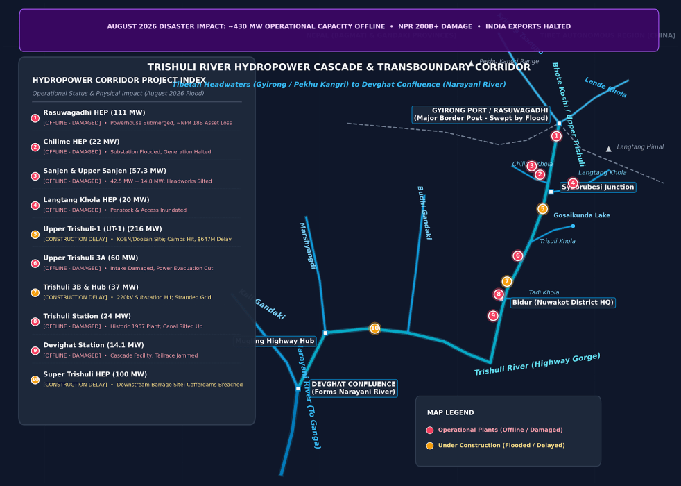
(Feature Image: Map of Hydropower Projects and condition in Trishuli- Bhote Koshi Basin Map by SANDRP made with Google LLM)
Even as Nepal, Tibet, India and other countries whose citizens are in missing list following the Aug 26 2026 Rasuwa flood disaster for Nepal, and even as the full dimensions of the disaster are still unfolding, a Bloomberg journalist asked SANDRP a pertinent question. Seeing the major role played by operating and under construction hydropower projects in the disaster and the missing list of hundreds of people from such projects, he noted that deaths at disaster hit hydropower projects in Himalayas is a recurring story. During and after every such disaster, there is talk of learning lessons such projects, but there is little change in decision making process. His question was, is there a limit to human folly, beyond which we will see some genuine change?
It’s a tough question. Unfortunately, as of now no limit to human folly is in sight. If we see what has been happening during and post disasters since at least the Kedarnath disaster in June 2013 to the most recent Rasuwa flood disaster, we see little impact of lessons from any of the disasters on the decision-making process of hydropower and such major infrastructure projects in the Himalayas.
If we are really interested in learning lessons from the disasters, the first step we need to do is to set up an independent panel of experts that will try to understand what exactly happened in the disaster, which institutions, individuals, various infrastructure played what role, who needs to be held accountable for major mistakes during the disaster, and what we can learn lessons for future. By not having any such assessment for any of the disasters, we have shut the door on learning any lessons from the disasters. The first thing we need to do is to open that door.
NEPAL DISASTER
Himalayan Disaster: August 2026 Bhote Koshi Deluge On the Himalayan disaster of Aug 26, 2026, this SANDRP report tries to put together the available information in a comprehensive way. It also highlights how ADB and other multilateral institutions are pushing large hydro and related infrastructure in this fragile Disaster-Prone Himalayan region without even adequate assessments and calling it climate resilient project. This very region faced similar GLOF related disaster just a year back on July 8, 2025, but there is no evidence of any lessons learnt. Will we learn any this time?
Nepal Disaster & Hydropower: How Global Banks Downplayed the Risks they Knew This report from SANDRP shows the role of international financial bodies in pushing huge investments in highly risky hydropower projects in the fragile, Himalayan, disaster prone trans-boundary Trishuli-Bhote Koshi basin. They were fully aware of the disaster prone area and still took no steps to address the risks, take preventive measures or avoid and discourage these particularly in monsoon months.
The international financial bodies that have invested in hydropower projects here include Asian Development Bank, World Bank’s International Financial Corporation, Asian Infrastructure Investment Bank, Chinese Exim Bank, and several climate funds and institutes including those from Canada, Netherlands, UK, South Korea and OPEC fund. Will this be a watershed movement in history of hydropower projects in South Asia?
SANDRP researchers Parineeta Dandekar and Himanshu Thakkar argue that this tragedy was not entirely unforeseeable, pointing out that “Multilateral Development Banks including the ADB and World Bank Group’s IFC, that financed and championed the Upper Trishuli-1 hydropower project and conducted a Cumulative Impact Assessment of Trishuli Basin were acutely aware of the extreme danger to which they were exposing thousands of laborers, officials, residents, rivers, infrastructure and landscape.”
The authors note that the lenders’ “own reports repeatedly highlighted it. But they did not take any preventive steps, did not demand stringent checks and balances, nor were they prepared for a calamity they knew could occur,” adding that capital continued to flow under the dubious premise that “Funding was sought and provided in the garb of ‘Climate and Disaster Resilience’.”
Why Earlier Warnings Were Ignored Exactly one year ago, in July 2025, a similar disaster struck this very Bhote Koshi-Trishuli Valley in Nepal’s Rasuwa District, which caused massive damage to more than 10 hydropower projects. In August 2026, a terrifying catastrophe has struck the exact same spot once again.
The question is clear—when scientists and experts have been issuing constant warnings, why weren’t early warning systems and real-time data sharing implemented? When will the blind race to build dams indiscriminately on sensitive Himalayan rivers come to a halt? Hear the sharp and candid words of river and dam expert Himanshu Thakkar (SANDRP) on how administrative negligence invited this devastation all over again.
Flood damage to Nepal’s hydropower sector could run into billions The scale of the destruction has also raised urgent questions over how damaged projects will be rebuilt and who will bear the cost. Rajan Dhakal, spokesperson for the Nepal Electricity Authority (NEA), said on Aug. 28 that the authority’s preliminary assessment pointed to losses worth hundreds of billions of rupees. His estimate is substantially higher than that of the Independent Power Producers’ Association, Nepal (IPPAN), whose senior officials have put average losses in the sector at around Rs25 billion to Rs30 billion.
Uttam Bhlon Lama, senior vice-president of IPPAN, said older hydropower projects with ground-level powerhouses suffered extensive or complete damage. “Newer projects with underground powerhouses and desanders have suffered comparatively less damage,” Lama said. “Overall, we estimate losses at around 25 to 30 percent of the total project cost, although a complete assessment is still pending.”
At least 13 hydropower projects, both operational and under construction, have been damaged in Rasuwa and Nuwakot districts. Affected operational projects include the 20MW Langtang Khola project, which was in the testing phase, the 5MW Mailung Khola, 14.8MW Mailung Khola, a 25MW solar project operated by the NEA and its subsidiaries, the 14MW Devighat, 24MW Trishuli, 60MW Upper Trishuli A, 22MW Chilime and the 111MW Rasuwagadhi Hydropower Project.
Projects under construction that have been affected include the 37MW Upper Trishuli 3B, jointly owned by the NEA and Nepal Telecom, the privately developed 120MW Rasuwagadhi Bhotekoshi, the 6.42MW Upper Mailung A, the 216MW Upper Trishuli 1 and the 15.6MW Middle Trishuli Ganga project.
Insurance could play a crucial role in determining how quickly the projects are rebuilt. While private hydropower projects are generally insured, government-owned infrastructure may not have comprehensive insurance coverage, according to industry experts. Raju Raman Paudel, former executive director of the Nepal Insurance Authority, said insured projects should be able to claim compensation after losses are assessed.
“Once the damage is evaluated, insurance companies will make the payments,” he said. “But there are concerns that not all NEA projects are insured. That could create difficulties.” Despite growing climate risks, many government-owned structures in Nepal remain uninsured, he said.
573 workers trapped or missing at 11 Nepal hydropower sites At least 573 workers at hydropower project sites and tunnels across Nepal’s Rasuwa and Nuwakot districts — two of the worst-hit areas in Wednesday’s flash flood — are trapped or out of contact, days after a wall of ice, rock and water tore down the Lhende-Bhote Koshi-Trishuli river system. Nepal government data seen by HT put the number of workers missing across at least 11 project sites at 934, late on Aug. 28. Of these, 361 have since been rescued or made it out on their own.
Most of the trapped are concentrated at four projects. Upper Trishuli 1 (216MW) has reported at least 322 people missing. Upper Trishuli 3B has 122 missing, Upper Trishuli 3A has 43, and the Rasuwagadhi Hydropower Project (111MW) has 44, according to the data.
Ajay Choudhury, a quality-control engineer at Upper Trishuli 1, was among those who got out. “At 8.59am the wave of flood overtook our project site. It is an under-construction site with at least three tunnels. As soon as we saw the huge wave of water coming towards the site, we ran. It must have taken us around 40 seconds to reach the hills nearby after coming out of the site. Scores of workers like us fled the dam construction site. In my estimate there are nearly 150-200 workers who could not escape in time. The tunnel entrance closed, and the walls crashed. People there are from Nepal, India, China and Germany.”
Ashok Kumar Mandal, assistant manager (HR) at Upper Trishuli 1, said the muck blocking the tunnels was 10-12 feet high. He and Choudhury are among 120 workers who escaped and walked for two days to reach Nuwakot before being brought to Kathmandu by bus. “Before the flood destroyed the under-construction dam and blocked all tunnels, the lights went out. When everyone started shouting and I too came out on the road, within a minute the water had touched my ankle. We saw around 35-40 workers working on the other side of the Trishuli river, being swept away by the wave. I remember seeing my watch at 9.02am from the hills. The water had risen to almost 50 metres as it covered the site completely. In another location, the muck of debris completely blocked the three tunnels, trapping our friends inside. Our friends are buried in debris inside the tunnel and the walls of the dam that crumbled.”
Among the 43 missing persons from Upper Trishuli 3B HEP are 22 project employees and security personnel, seven family members of employees, 11 employees of the consulting company, and three intern students from Kathmandu University.
According to figures reported by the Nepal Electricity Authority and the Independent Power Producers’ Association of Nepal, at least 897 people associated with hydropower projects are unaccounted for. Five days after the disaster, their whereabouts remain unknown.
Jiblal Adhikari, who normally works at the Kulekhani hydropower project, had travelled to Trishuli 3A to inspect machinery during its annual overhaul and maintenance. The 60 MW project, which began commercial generation in 2019, was undergoing scheduled maintenance when the disaster struck. Between 30 and 40 people, including experienced technicians and engineers from the Nepal Electricity Authority and specialist teams hired from other projects, were working inside the underground powerhouse.
The delayed rescue operation has increasingly frustrated the families. The project has a 4.1-kilometre headrace tunnel and an underground powerhouse built deep inside a mountain. The rescue operation is now focused primarily on reaching the powerhouse and its network of tunnels. Rescuers have been attempting to reach the facility through the cable route, excavating in the hope of creating an access point.
The Independent Power Producers’ Association of Nepal says 897 people associated with 11 hydropower projects, including projects under construction, remain out of contact. The highest number of missing people has been recorded at Upper Trishuli-1, with 576 people missing from the 216 MW project.
Authorities have yet to determine how many of them are trapped inside tunnels and how many may have been swept away by floods or buried by landslides. Families, hydropower developers and the Nepal Electricity Authority have all expressed concern over delays in locating the missing workers.
The Ministry of Energy, Water Resources and Irrigation says 361 people have been rescued from various hydropower projects. The state-owned power utility said 265 of its workers remain out of contact at four projects: Chilime, Rasuwagadhi, Trishuli 3A and Trishuli 3B. The authority estimates that between eight people are missing at Chilime, more than 93 at Rasuwagadhi, 42 at the Trishuli 3A powerhouse, and 122 at Trishuli 3B.
Nepal Electricity Authority reports 14 hydropower projects damaged – nine operating plants plus five under construction. Those plants had workers and those constructing the new plants right in the path of the flood. As of this writing, more than 900 hydropower workers are missing. The damaged operational plants accounted for about 8% of Nepal’s total generating capacity.
Military officials estimate that at least 35 people may be trapped inside the Upper Trishuli 3A HEP tunnel. The figure was provided following a technical assessment, although Nepal Police has put the number of people believed trapped at around 200.
The flood has left 60 people associated with the 20 MW Langtang Khola Hydropower Project out of contact, according to project promoter Bijay Mohan Bhattarai. Twenty-five engineers, drivers and kitchen staff and 35 workers who were inside a tunnel have been out of contact since Wednesday morning, Bhattarai said. “We have not been able to contact them so far,” Bhattarai said on Wednesday afternoon. The hydropower project had been completed and was scheduled to undergo testing in two days, Bhattarai said.
The sudden flood in Rasuwa has damaged 6 major hydropower and transmission facilities, along with other electricity distribution infrastructure, disrupting power supply in the affected areas, the Nepal Electricity Authority (NEA) said. The damaged facilities include Rasuwagadhi, Chilime, Trishuli 3A, Trishuli 3B Hub 220 kV Substation, Trishuli Hydropower Station and Devighat Hydropower Station. The Authority said various distribution structures in the area have also sustained damage and efforts are underway to restore electricity supply as soon as possible. It urged consumers and other concerned parties to remain patient until power services are restored.
Efforts to hunt for survivors at the nine hydropower projects picked up as weather improved slightly. At Upper Trishuli-1, around 300 workers were believed to have been trapped inside the tunnel, of whom 254 had been rescued, while search operations continued for the remaining workers. At Upper Trishuli-3B, 91 of the 122 workers earlier reported missing had been rescued and 31 remained unaccounted for, showing how the rescue effort had expanded far beyond the 100-odd workers initially feared trapped at a handful of sites.
While the Independent Power Producers’ Association Nepal said 537 workers and staff were unaccounted for across nine projects, Nepal’s disaster management authority, NDRRMA, stated that 933 workers from hydropower projects were untraced.
Nepali Army engineers intensified efforts on Aug. 30 to reach people believed trapped inside the Upper Trishuli-3A project tunnel in flood-hit Nuwakot, using heavy equipment and blasting to widen an opening into the buried structure. The team reached the main section of the tunnel, known as the “crown head” and created a six-square-feet opening. Rescuers descended through the opening using ropes and called out to those inside but received no response, it said.
The energy stakes are transborder Second, the flood’s damage to over 15 hydro projects of varying capacities along the Trishuli, and the downstream exposure it triggered, could cause huge national-to-transborder environmental damage. Cascading effects within Nepal, China and India, and further downstream in Bangladesh, have hit the national and public psyche hard, and could disrupt cross-border energy trading and regional power pools, causing acute energy insecurity.
India’s Central Water and Power Commission took the initiative in 1953 to build the first hydel project on the Trishuli. An agreement was signed in 1958, and this 21 MW run-of-the-river project was commissioned in the sleepy mountain village of Tuphe, 6.4 km upstream from Trishuli Bazar, in June 1972 at a cost of Rs 13.55 crore. It long supplied power to Kathmandu. The project now remains largely decimated.
Similar examples exist in India. In October 2023, massive calving from the South Lhonak glacier’s snout triggered a Glacial Lake Outburst Flood (GLOF) in North Sikkim; within hours, the Teesta rose 15-20 metres. The flash flood killed people and animals, and swept away villages, houses, farmland, industrial projects, social infrastructure, tourism and health facilities, defence personnel and ammunition storage, roads, highways, and 33 bridges. The Chungthang dam’s 1,200-MW hydro project was destroyed, and the Teesta was scoured out entirely.
Downstream townships in Sikkim, West Bengal and Bangladesh were buried in slush and debris. Damage was estimated at over Rs 25,000 crore — nearly 60% of Sikkim’s 2022-23 GDP. The loss of 1,800 MW of generation alone cost over Rs 19,000 crore. Though the state’s Chief Minister led the disaster response with National and State Disaster Management teams, the devastation exposed several critical gaps in climate impact management. (Mahendra Lama, ICIMOD)
Rasuwa was among the worst-hit areas after floodwaters surged downstream from the Nepal-Tibet border, destroying roads, bridges and hydropower infrastructure and damaging settlements including Timure and Syabrubesi. Rasuwagadhi suffered a similar disaster last year. On July 8, 2025, a flash flood in the Lhende River swept away the Miteri Bridge at Kerung. China took nearly six months to construct a temporary bridge. Nepal’s customs point at Rasuwagadhi lies about 24 km south of Kerung.
Notably, a total of 30 hydropower projects in Eastern Nepal sustained a damage of Rs 8.5 billion due to floods in June 2023. According to the Independent Power Producers’ Association, Nepal (IPPAN), the floods of June 16 and June 17 in Taplejung, Panchthar, Sankhuwasabha and Bhojpur districts damaged the 30 hydropower projects of 463 MW in total capacity. Of these, 13 operating projects with 132 MW faced a loss of around Rs 6 billion.
Among suffered projects, the 22.1 MW Lower Hewa Khola Hydropower Project had the biggest loss of Rs 1 billion. The 25 MW Kabeli B-1 faced a loss of Rs 500 million. The 4.7 MW Upper Piluwa-2 Hydropower Project had damage in its physical structures including headwork, pipe alignment and power house. It is estimated that it will take over two years to repair the damaged structures of the Upper Piluwa-2 project. The damage costs an estimated Rs 900 million to the project.
Similarly, 17 under construction hydropower projects with capacity totaling 327 MW witnessed losses of over Rs 2 billion due to floods. The Super Hewa Khola Hydropower Project had the biggest loss of Rs 800 million. Of 18 workers who were swept away by the flood at the project, dead bodies of only four have been found.
This Feb. 2021 paper aims to make the connection between the status of hydropower projects in Nepal and the state of glaciers in the Himalayas, and suggests that advanced studies on glacial lakes and GLOFs are needed to ensure the long-term sustainability of hydropower projects under changing climate. This paper aims to make the connection between the status of hydropower projects in Nepal and the state of glaciers in the Himalayas, and suggests that advanced studies on glacial lakes and GLOFs are needed to ensure the long-term sustainability of hydropower projects under changing climate.
Himalayas are unpredictable Alongside the hundreds of hydropower workers who remain missing in Nepal, the country saw more than 430 megawatts of power –– enough to power hundreds of thousands of homes –– knocked offline after 12 dams were hit by the surge of floodwaters. There was also damage to other under-construction projects, estimated to account for another 470 megawatts of capacity, according to Nepal’s Ministry for Energy, Water Resources and Irrigation.
Initial estimates suggest the flood was caused by an avalanche near the border rather than deep inside China. The avalanche created a temporary dam/lake that burst all at once, releasing a sudden surge of water. Because heavy rock debris fell, it continues to form temporary blockages. The debris did not clear all at once, so secondary flooding remains a risk, though we project future surges will be smaller in scale.
Our primary challenge is that our initial hydrological station was swept away on the first day. Efforts to set up another station are ongoing. The Department of Hydrology and Meteorology (DHM) requires mutual consent from both countries to establish a new station. I discussed this with representatives from the Chinese Embassy, and we agreed on continuous information sharing. Cross-border information sharing is vital; without it, we risk facing even greater disasters. With higher-than-average temperatures forecasted alongside El Niño impacts, the coming days pose further challenges across Asia.
A 4.4 magnitude earthquake was felt, which may have weakened the permafrost structure. Rising temperatures had already compromised the permafrost integrity, and even a mild earthquake was enough to cause a collapse and block the river. Our studies indicate that the sudden breach of this dammed river created this terrible catastrophe. Moving forward, organising early warning systems is key, but managing the immediate disaster remains our priority. (Excerpts from Dharmaraj Upreti, Chief Executive, NDRRMA, interview)
Nepal’s high-tech disaster response meets low-tech reality Though the government has attempted to project a modern, ‘smart’ response through digital maps and online dashboards, critics argue that these efforts fail to translate into tangible assistance on the ground. Upstream engineering and missing warnings may have magnified the natural disaster. (Brahma Chellaney)
At the May 27 meeting in Nepal’s capital, 10 officials from Nepal and about a dozen from China, including the Tibet region where the disaster struck, discussed strengthening cooperation to monitor and respond to floods, weather and glacier-related hazards, according to an agenda prepared by the Nepali side and seen by Reuters.
Rescue efforts have entered their fifth day, with Nepalese authorities now putting the death toll at 675. According to Nepal’s disaster response agency, more than 7,500 people have been rescued, nearly 2,500 are missing, and 219 people have been injured in the disaster. The tourism board earlier shared an update that 250 foreign nationals had been rescued, though 320 were still unaccounted for.
Given the extraordinary stakes, China should immediately invite an independent panel of international seismologists, geologists, and dam-safety experts to inspect the site, review the project’s geological assumptions, and assess whether the recommended design modifications are sufficient. China should also institutionalize year-round, real-time hydrological data-sharing and emergency notification mechanisms with India and Bangladesh, and commit to ongoing transboundary consultation on major design changes.
Nepal floods are a warning to dams Across the whole Hindu Kush Himalaya, there are 550 hydropower projects underway, planned, or under construction in China, India, Pakistan, Nepal and Bhutan combined, tapping into an estimated 500 GW of potential energy, according to the International Centre for Integrated Mountain Development’s new Hindu Kush Himalaya Assessment report.
While China does not necessarily lead the region in sheer number of hydropower projects, its buildout in Tibet and southwestern China remains the fastest-growing and largest by scale in Asia. The Nepal disaster exposed a fact that is easy to forget when looking at hydropower statistics from a distance: in the Himalayas, the infrastructure built to harness water is often located directly in the path of water’s most violent movements.
Their recent research analyzed 493 such floods from the earliest available records through 2024. It found that these events have become roughly five times more frequent since 1950, rising from an average of about seven per decade to 34. Researchers map the most dangerous lakes and call on China and Nepal to work together to reduce the threat of catastrophic flooding
Trans-boundary cooperation for the borderless Himalayas Seven high-impact Nepal-like, multi-hazard and cascading disasters have occurred in India since 2000. These include glacial collapse, avalanches, landslides, glacial lake outburst floods (GLOFs), landslide lake outburst floods (LLOFs) and/or extreme precipitation as seen in Sutlej-Kinnaur (2000), Yigong-Siyang (2000), Parechu (2005), Kedarnath (2013), Chamoli (2021), South Lhonak (2023) and Dharali (2025). While not a particular classification in literature or policy, they could be referred to as ‘Glacio-fluvial flash floods’ (GF3) in this article.
Himalayas are a unified geography and the risk ignores political borders. Glaciers, slopes, rivers and rainfall systems transcend geometrically-drawn political borders. In the case of Nepal, India shares at least six major river systems. A 24/7 operational link between India’s Central Water Commission control rooms and Nepal’s institutions would be a simple first step. This would allow engineers on shift to exchange rainfall, river stage, barrage releases, lake data, and warnings without formal diplomatic delays. (Safi Ahsan Rizvi)
New Era of Transboundary Climate Defence The speeds recorded on the Tibet-Nepal flood show we cannot afford to wait. Bureaucracy moves in meetings. A loaded alpine channel moves in minutes. The mountains are not sending a metaphor. It is a process, a slope collapses, water ponds, the dam breaks, and a surge races downstream. If governments treat that as a rare disaster instead of a planning rule for a warming Himalaya, the next flood will come unannounced. The practical response is to monitor the high Himalayan valleys together, keep major buildings and people out of the flood path, and give downstream communities the hours of warning that these events still sometimes allow. (Vimal Khawas)
Building regional resilience and sustainable watershed governance This event represents a classic cascading disaster, where an initial physical trigger high in the cryosphere initiates a chain of secondary environmental impacts. To protect shared river basins and human settlements from escalating mountain hazards, South Asian nations must adopt comprehensive long-term resilience strategies: (Aarti Kelkar, IWP)
The mountains don’t care about borders The way forward is not to wait for the next tragedy and then improve the response. It is to build shared knowledge, shared warning systems, shared standards, and—wherever possible—shared responsibility before the disaster occurs. The Himalayas are politically divided but geographically inseparable. Their rivers flow across borders. Their glaciers feed several nations. Their hazards travel faster than any administrative decision. It is time to stop managing the Himalayas one country at a time. The mountains are one system. Our understanding—and our strategy—must become one system too. (Dr. Jayant Kumar)
Preventing a repeat of this scale of disaster will require stronger transboundary data-sharing, strictly enforced riparian buffer zones, comprehensive cumulative Environmental Impact Assessments for river-basin projects, and satellite-integrated early-warning networks built specifically for dynamic, high-altitude Himalayan conditions. Madhab Pant, Member of the Nepali Communist Party
The red flags in dam-building in the Himalayas The Himalayan topography includes lakes formed by melting glaciers, fast-flowing rivers and steep slopes. The Nepal floods highlight major vulnerabilities, but there are ways to reduce the fallout of such events.
The flash flood disaster in Nepal could serve as a reality check for governments that are driving a boom in dams, tunnels, highways, railways, and bridges across the Himalayas, warns C. P. Rajendran, geo-scientist and adjunct professor at the National Institute of Advanced Studies, Bengaluru. Despite mounting and compelling evidence, major hydropower projects continue to be pursued across the mountain zone, creating mounting risks to life and property. But these are being cynically ignored writes Shyam Saran.
HYDRO POWER PROJECTS
Sikkim Body Urges PM to Scrap Hydro Projects The Sikkim Bhutia Lepcha Apex Committee (SIBLAC) appealed to Prime Minister Narendra Modi to freeze all new hydropower initiatives in the state and commission an independent, time-probe investigation into projects already operating there.
Tseten Taski Bhutia, SIBLAC’s convenor and also chief advisor to the Bharatiya Janata Party’s Sikkim unit underlined that the floods in Nepal suggest “a fresh assessment of development activities” is required. “The disaster in Nepal highlights the vulnerability of the Himalayan region, requiring a fresh assessment of development activities,” he said, adding that the Union government needed to rethink its plans for further hydroelectric development on Sikkim’s rivers.
Bhutia also pressed for a thorough, independent review covering the environmental, geological, seismic, social, and national security dimensions of every hydropower project in Sikkim, both existing and proposed, and asked that the government release a white paper detailing the outcomes of this assessment.
Warning of dam building over Siang river New Delhi is pushing the Siang multipurpose dam in Arunachal for power and to hedge Chinese upstream control, while locals and even CM Pema Khandu warn of a dried-up river, displacement of ~1.5 lakh people, and submergence of 27 Adi villages. Surveys and outreach are alleged to proceed without free, prior, informed consent—CRPF deployment, cash-for-consent claims, action against activists (e.g., Ebo Mili)—turning a development project into a state–citizen clash. Himalayan geology plus rapid warming raise dam-break risk: major quakes, documented glacial collapses in Tibet and Uttarakhand, and Nepal’s August 2026 ice-collapse flood show how ice, debris, and sudden water surges can overwhelm valleys—making a large Siang structure a high-stakes bet.
High risk glacier lake in India under scanner The National Disaster Management Authority (NDMA) has identified 195 vulnerable glacial lakes across six Himalayan States and Union Territories. Of these, 67 have been classified as Category A, or “very high risk.” The identified lakes include 48 in Himachal Pradesh, 41 in Sikkim, 34 in Ladakh, 32 in Arunachal Pradesh, 27 in Jammu and Kashmir, and 13 in Uttarakhand.
Separately, the Central Water Commission (CWC), in its June 2026 monitoring report, flagged 147 glacial lakes that recorded an increase in water spread during the month and called for intensified monitoring of these lakes. Together, the two assessments highlight the growing GLOF risk in the Indian Himalayas and the need for continuous monitoring and early-warning systems for vulnerable glacial lakes.
Himachal glacial lakes surge 5X over 3 decades, threaten dams: Study The number of glacial lakes in Himachal Pradesh has surged over fivefold while their total surface area has more than doubled since 1990, raising severe risks of Glacial Lake Outburst Floods (GLOF) coinciding with extreme rainfall, according to a joint study by IIT Ropar and University of Technology, Sydney.
Researchers found that glacial lakes in the state grew from 107 in 1990 to 669 in 2024 (a 525% increase), expanding their combined area by 102% from 5.54 sq km to 11.20 sq km. Very small lakes (0.01 sq km or less) showed the highest rise, jumping from 9 to 487.
Out of 669 lakes, 88 of the 94 measuring at least 0.02 sq km are susceptible to GLOF triggers, primarily due to unstable natural dams (73 lakes), earthquake risks (58), ice cores (52), and rockfalls (44). Nine lakes were categorised as “very high hazard,” 18 as “high hazard,” and 26 as “medium hazard”.
The researchers studied two high-risk glacial lakes, one each in Beas basin and Satluj basin to find out what could happen when a lake bursts during different-intensity rainfall, including an extreme scenario.
In Beas basin, the researchers studied Himsu Lake, which has an area of just 0.046 sq km and is fed by a 1.19-sq-km glacier and lies about 30 km from Hurla village, and in Satluj basin an unnamed lake with an area of 0.363 sq km and fed by a 4.91-sq-km glacier. The modelling estimated that if the natural dams of the two lakes failed, the peak outburst discharge could reach 1,385 cubic metres per second from the Beas lake and 3,507 cubic metres per second from the Satluj lake, potentially causing severe flooding downstream.
The study‘s flood modelling shows that in Beas basin, 94 buildings are within the inundation area under the worst-case scenario. These include the Uhl-III hydropower station and parts of Pandoh dam infrastructure. In Satluj basin, 588 buildings are vulnerable, including Koldam and its powerhouse and the Rampur hydropower project. Researchers urged state authorities to integrate GLOF hazards into dam-safety frameworks, calling for early-warning sensors to be installed at least 25 km upstream of Pandoh Dam and 100 km upstream of Bhakra Dam.
Himachal identifies 67 vulnerable glacial lakes Himachal Pradesh has identified 67 vulnerable glacial lakes, including several in remote, high-altitude areas, and is working to establish early warning systems for four of the most vulnerable lakes in Kinnaur and Lahaul-Spiti, Special Secretary, Disaster Management, Pushpinder Rana, said on Aug. 29.
Rana said recent incidents in the Himalayan region had highlighted the difficulty of predicting such events solely on the basis of rainfall forecasts. He said the state was therefore seeking technological solutions that could allow vulnerable lakes to be monitored continuously, particularly those situated in inaccessible terrain. “Until we find an innovative way to move forward on this, we will not be able to take effective steps regarding them,” Rana said.
Rana said Himachal Pradesh had submitted a proposal to the National Disaster Management Authority (NDMA) to establish early warning systems for vulnerable glacial lakes. He said work had been taken up on four lakes in Kinnaur and Lahaul-Spiti under the National Landslide Mitigation Program, with a focus on strengthening monitoring and early warning capabilities. The lakes include Parchu Lake and vulnerable locations in the Sangla-Kinnaur region, besides sites in Lahaul-Spiti.
The proposed systems are intended to detect potentially dangerous changes in lake conditions and communicate warnings to authorities and downstream populations. However, Rana said installation of such systems at high-altitude locations remained a major technological challenge. “The early warning system is a technical challenge. The problem is that these locations are in very remote areas where there is no network connectivity. Where will the sensors be installed, how will they be installed and how will the data be transferred? These are the challenges,” he said.
The state is working with the Centre for Development of Advanced Computing (C-DAC) to develop technological solutions to address these challenges. Rana said the state would begin installing an early warning system at Dipang Ghat once it receives final approval from the NDMA. Alongside early warning systems, the government is undertaking High Flood Level (HFL) marking in downstream areas that could potentially be affected by a sudden release of water.
“The High Flood Level marking in the downstream areas that could be affected is also being taken up at Dipang Ghat. The process is underway,” Rana said. Rana said regular monitoring and community awareness would form an important part of the preparedness strategy around vulnerable lakes. “The idea is that we will move forward towards an early warning system. The High Flood Level marking and regular monitoring will also be deployed at such locations,” he said.
Devastating Flood of 2000 On the night of July 31 and August 1, 2000, a sudden flash flood struck the Sutlej basin, triggered by the bursting of a glacial lake in Tibet and heavy rainfall. The Sutlej River rose nearly 60 feet above its normal level. The disaster washed away around 200 km of National Highway-22 (Hindustan-Tibet Road). At least 20 major bridges and 22 suspension bridges were swept away. The tragedy claimed 185 lives and caused economic losses of around ₹1,466 crore to Himachal Pradesh.
2005 Parachu Lake Outburst: On June 26, 2005, the natural dam of Parachu Glacier Lake in Chinese-occupied Tibet suddenly breached. As the lake was connected to the Sutlej River, millions of cusecs of water and huge quantities of debris rushed downstream into Kinnaur and Shimla districts of Himachal Pradesh. The outburst completely destroyed a 10-km stretch of NH-22 between Wangtu and Samdo. The force of the flood also destroyed 10 concrete bridges and 11 ropeways within a short period. However, lessons from the 2000 disaster had prompted the administration to issue an early warning, which helped significantly reduce the loss of life.
Uttarakhand’s 13 ‘high-risk’ glacial lakes back under scanner According to an assessment by the National Disaster Management Authority’s committee on Disaster Risk Reduction (NDMA-CoDRR), Pithoragarh accounts for six of the 13 potentially dangerous lakes, followed by Chamoli with four and one each in Bageshwar, Tehri Garhwal and Uttarkashi.
Of these, five lakes — Vasudhara Tal and an unnamed lake in Chamoli’s Joshimath block, along with Syantyankti, Mabang and Pyungru lakes in Pithoragarh’s Dharchula block — fall in the highest ‘Class A’ risk category, the most severe on NDMA’s four-tier hazard scale.
The lakes themselves are relatively small, with surface areas ranging from about 0.02 to 0.5 sq-km. But their risk assessment is based not merely on their size. Their location in remote and unstable Himalayan terrain, the condition of moraine dams holding back water, and the potential impact on settlements and infrastructure downstream make them a serious concern.
While the Uttarakhand lakes have been identified specifically for their GLOF potential, the broader concern is the increasing instability of the upper Himalayas, where glaciers, ice masses, moraine dams and steep mountain slopes can interact to trigger sudden cascading disasters, he added.
Understand emerging GLOF risks in the W Himalayas Kashmiri geoscientist Irfan Rashid is using satellite imagery of Nepal’s recent catastrophic floods to decode how massive glacier-ice collapses trigger deadly downstream events. By analysing Landsat, Planet and Sentinel data, he links this disaster to broader Himalayan risks, arguing that science-based, pre-emptive planning is vital as glacial lakes expand and climate-driven hazards intensify across Kashmir and Ladakh.
Hydro push raises fears in Kashmir Seven dam projects ongoing as locals face repeated cloudbursts, floods and landslides.
Nepal Flood: Lesson for Ladakh This regarding the growing threat posed by the avalanches and debris flow in Ladakh Himalaya particularly in The Zanskar valley. We have identified certain hanging glaciers that may pose serious threat to the downstream settlement in the Suru valley. (Navin Juyal)
Why Hanging Glaciers Are Becoming Time Bombs In this episode of Eco N Energy Talk, journalist Hridayesh Joshi speaks with renowned geologist Dr. Navin Juyal (formerly with the Physical Research Laboratory, Ahmedabad), who has studied Himalayan geology for over 40 years.
DAM SAFETY
Operation of Kaleshwaram Telangana decision, CWC & NDSA inform HC Central Water Commission (CWC) and National Dam Safety Authority (NDSA) have informed Telangana high court that decisions on operating Kaleshwaram lift irrigation scheme’s barrages rest with State Dam Safety Organisation (SDSO) and state govt’s project authority, and not with them. The agencies made the submissions in response to a writ petition filed by advocate Srirambhatla Sarath Kumar, who sought a direction for a comprehensive technical inspection of Medigadda, Annaram and Sundilla barrages, along with Kannepally and Sundilla pump houses and other connected project components, and a report on whether any part of the project could be safely used on a restricted basis.
In affidavits filed as per the court’s directions, the agencies denied allegations made by the petitioner that they had failed to discharge their statutory duties, resulting in hardship to farmers in obtaining water from Kaleshwaram project and its components, and urged high court not to pass any orders against them, while also seeking to dismiss the petition. NDSA further submitted that while Kaleshwaram Project is an important irrigation project for the state, the petitioner’s concerns regarding agricultural hardship were matters of policy falling within the domain of state govt.
Dam Safety Experts to Inspect Somasila Reservoir A committee of dam safety experts has arrived in Nellore district to assess the structural condition of Somasila reservoir. The committee, comprising Chairman Gopal Reddy and experts Venkateswarlu and Srikanth, will inspect the Somasila Reservoir on August 29 and 30. It will conduct a detailed assessment of the dam’s safety and structural condition over the two days. After completing the inspection, it will submit a report to the Central and state governments. The expert committee will subsequently inspect the Kandaleru Reservoir on August 31 and September 1.
Cyber attack suspected on dam safety infrastructure According to the complaint, information received from the Chief Information Security Officer indicated that certain IP addresses associated with the SPMU-DRIP and Water Resources Development Organisation under the Dam Safety Organisation were found communicating with a suspected malicious IP address. The suspicious network activity has raised concerns over a possible attempt to gain unauthorised access to government computer systems and confidential information.
The organisation is responsible for monitoring large dams, overseeing dam safety compliance and implementing the World Bank-assisted DRIP through the SPMU. The police have initiated a probe to identify the person or group behind the suspicious activity and determine the purpose and extent of the attempted communication. Investigators are expected to examine network logs, IP details and other digital evidence to ascertain whether any systems were compromised or confidential information was accessed. The police are working to trace the source of the suspected malicious IP address and identify those involved.
DAMS
Bihar’s unheard voices in Farakka debate What is needed is an independent, multidisciplinary assessment of Farakka’s long-term impact. Five decades of data on discharge, sediment, erosion, agriculture, fisheries, dolphins, groundwater and navigation should be placed in the public domain. The barrage’s operation, possibilities of redesign and alternative arrangements should be examined by independent experts. Farmers, fisherfolk and riverbank communities must have a meaningful place in decision-making.
Knowledge of a river does not reside only in laboratories. It resides in the farmer’s field, the fisherman’s boat, villages displaced by erosion and the declining number of fish in the river. The real reckoning over Farakka is not simply about how much water it has delivered to whom. It is about what it has meant for the river’s flow, sediment, farms, fish, dolphins and river-dependent communities. That reckoning must be based neither on sentiment nor political convenience, but on data and the testimony of those who live with the river.
Bihar needs water. Bangladesh needs water. West Bengal needs water. But the Ganga needs water too. The first principle of the next generation of water policy must be that an adequate share of the river’s flow remains protected for its ecological survival. The survival of the Ganga is inseparable from the survival of the people, farms, fishermen, villages and civilisation that have grown around it. The next chapter of Farakka should not be merely about dividing water. It should be about saving the river. (Kumar Krishnan)
Decisions of MoEF’s Expert Appraisal Committee meeting for River Valley Projects held on July 30 2026 1. 240 MW (1 x 120 + 2 x 60 MW) Tilari Pumped Storage Project (PSP) at Kodali Village, Chandgad Taluka, District Kolhapur Mah for TOR: Approved
2. Gandikota Pumped Storage Project (1800 MW) by ADANi RENEWABLE ENERGY FIFTY ONE Ltd at Y.S.R.,ANDHRA PRADESH for TOR: Approved
3. Nar Par Girna River Link Project by GIRNA RIVER VALLEY PROJECT DIVISION at NASHIK, MAHARASHTRA for TOR: Approved
4. Kalu Patti PSP (1000 MW) by RENEW HYDRO POWER PRIVATE Ltd at MIRZAPUR,UTTAR PRADESH for TOR: Approved
5. PEN Off-Stream Closed Loop Pumped Storage Project by TORRENT ENERGY STORAGE SOLUTIONS Pvt Ltd at RAIGAD,MAHARASHTRA for TOR: Approved
6. Bilaspur Pumped Storage Project (1000 MW) by JINDAL GREEN PSP 1 Pvt Ltd at BILASP UR,CHHATTISGARH: Amendment in TOR: Approved
7. Basania multi-purpose project by MOOL MARAVI at MANDLA,MADHYA PRADESH: Amendment in TOR: Approved
Agenda of MoEF’s Expert Appraisal Committee meeting on River Valley Projects to be held on Aug 31 2026 1. Shyampur Barrage Major Micro Irrigation Project, Madhya Pradesh – Terms of Reference
2. PSP-05, Pumped Storage Project (1300 MW) in West Karbi Anglong Dist, Assam- Terms of Reference
3. Yaganti Pumped Storage Project, (1500 MW) Andhra Pradesh -Terms of Reference
4. Luhri Hydro-Electric Project – I, (210 MW) for increase in Muck Dumping Site in Dist Shimla, Himachal Pradesh – Amendment in Environmental Clearance
INTERLINKING OF RIVERS
Women-led pond restorations challenge the Ken-Betwa Link Project Jal Sahelis reviving local water management are challenging the Ken-Betwa Link Project’s controversial vision of development and water security in Bundelkhand
United Rivers of India River interlinking project promises multiple benefits: improved irrigation, drinking water supplies, hydropower generation and better flood and drought management. But the challenges are equally formidable. River systems are ecologically interconnected, and diverting water can disrupt ecosystems, forests and fisheries. Large projects may also lead to displacement of communities. By Eklavya Prasad
INTERSTATE WATER DISPUTES
CWC to hold Telangana Mah Meeting on Tummidihatti barrage A crucial meeting on the proposed Tummidihatti barrage across the Pranahita will be held in New Delhi on September 1 to discuss the technical and inter-State issues surrounding the project. The meeting, convened by the Central Water Commission (CWC), will be chaired by its chairman and senior officials of the water resources departments of Telangana and Maharashtra are expected to participate.
Chief Minister of Telangana Mr. A Revanth Reddy had written to the Maharashtra Chief Minister on May 26, seeking a meeting between the two States to arrive at a mutually acceptable solution. He had also taken up the issue with the Prime Minister, following which the Prime Minister’s Office referred the matter to the Union Ministry of Jal Shakti. Subsequently, on August 5, Mr. Reddy wrote to Union Jal Shakti Minister C.R. Patil, seeking the Centre’s intervention to resolve the inter-State issues and facilitate the project.
A key point in the discussions is Telangana’s proposal to raise the agreed height of the barrage from 148 metres to 152 metres. The State has been explaining to the Centre that drawing the required quantum of water through gravity at 148 metres would not be feasible and that using high-capacity pumps would substantially increase power consumption and the recurring cost of the project.
AP, Telangana in Tit-for-tat Water Releases From N’sagar On Aug. 28, following AP stepping up its release from 2,000 cusecs of water that began this past Aug. 26, from NS Right Canal, which is under its control – to 6,553 cusecs, Telangana increased its releases from the NS Left Canal to 6,650 cusecs from 2,000 cusecs. Sources said there is now a competitive position that the two states have adopted on water releases from Nagarjunasagar, with neither side willing to back down in this contest. Both Telangana and AP are claiming that the releases are to meet drinking water needs of their people.
On Aug. 28, the total water stored in Nagarjunasagar was 181.929 tmc ft against the total storage of 312.050 tmc ft. Meanwhile, AP has demanded that the Union Jal Shakti Ministry stop Telangana from generating electricity at Srisailam, accusing Hyderabad of using around 40,000 cusecs of water from the Srisailam reservoir.
TN alleges Karnataka flouting CWMA directions Tamil Nadu has filed a fresh plea in the Supreme Court, seeking directions for Karnataka to release the remaining 17.604 TMC of Cauvery water based on the pro-rata formula as on August 27, 2026. Tamil Nadu claimed even after CWMA’s direction on August 25, 2026 for Karnataka to ensure 9,000 cusecs, Karnataka reduced the release from August 26, 2026 onwards.
On August 24, the Supreme Court asked the Tamil Nadu govt to approach the Cauvery Water Management Authority with its grievances in respect of release of river water by Karnataka. The court also noted as per a chart furnished by Karnataka, Tamil Nadu has already got excess water. The court fixed the matter for consideration on Monday, August 31, 2026.
RIVERS
Why Are Rivers So Mathematical? A simple scaling law brings order to the chaos of flowing water, rock, and sediment. New findings have extended the law even further.
SC Bans construction within 100m of Jojari edge & polluting units within 500m buffer zone of river The Supreme Court has banned construction within 100 meters of river edges and hazardous industrial activity within 500 meters of flood lines across the Jojari, Bandi, and Luni river basins in Rajasthan. The Court also clarified the authority of the High-Level Ecosystem Oversight Committee, assigned an environmental project to NLU, and scheduled the next hearing for September 22, 2026. Previously, the Court directed the State of Rajasthan to constitute, within seven days, an Integrated Coordination Group headed by the Chief Secretary and to set up an independent River Commission/River Rejuvenation Authority to streamline the restoration of the Jojari-Bandi-Luni river ecosystem.
Jodhpur’s Vivek Vihar police have arrested four entrepreneurs associated with JPNT in connection with pollution of the Jojari River. The accused were produced before a court. The Supreme Court is hearing a case concerning increasing pollution in the Jojari and other rivers and had directed the formation of an SIT. The SIT is taking action against those accused of polluting the river. In the same case, a complaint was registered on May 29 against 18 former office-bearers of JPNT. Earlier, on August 2, police had arrested five entrepreneurs and produced them before the court. They were subsequently granted bail.
Five people arrested for allegedly discharging toxic and contaminated industrial wastewater into Jodhpur’s Jojari River through an illegal pipeline were produced before a court on Aug. 03. The accused include Common Effluent Treatment Plant (CETP) Managing Director (MD) Jasraj Bothra, Executive Director Nilesh Sancheti, Treasurer Sang Singh Parihar, Trustee Suresh Khemani and Supervisor Gopal.
However, serious questions were raised about the police’s conduct at the court premises. While police generally release photographs of accused even in minor cases and bring them in police vehicles, they appeared unusually accommodating towards the five accused in this case. Instead of a government vehicle, the police brought them to court in a private vehicle and discreetly escorted them inside, reportedly to keep them away from the media cameras. Following the hearing, the court granted the accused bail.
The arrests were made on Aug. 02 following a Supreme Court reprimand over the Jojari River pollution case. Advocate Naman Mohnot, representing the accused, said the court was informed that the police had issued notices to the accused under Section 35(3). According to him, all five had been cooperating with the investigation but were suddenly arrested on August 2.
When the court questioned the grounds for arrest, the police reportedly said they suspected that the accused were involved in the offence. However, according to the defence, the police could not present concrete evidence before the court. The court subsequently released them on bail. Earlier, contractor Praveen Sharma, the first person arrested in the case, had also been granted bail.
An FIR was registered on May 29 at Vivek Vihar and Boranada police stations in connection with pollution of the Jojari River. Police have also issued notices to 14 other prominent entrepreneurs, including Ashok Sancheti, Jayantilal Jain, Jugnu Khan and Narendra Chhajed, in connection with the case.
5 Ganga states generate 32% more sewage than can be treated: RTI Five states along Ganga — Uttarakhand, Uttar Pradesh, Bihar, Jharkhand and West Bengal — generate a total sewage volume of 11,785.5 MLD, nearly 32% higher than their combined processing capacity of 8,026.7 MLD, according to data provided by Central Pollution Control Board (CPCB).The information shared in response to an RTI application filed by Noida-based activist Amit Gupta on July 21, showed that UP has the highest sewage generation at 5,500 MLD, followed by West Bengal (4,158 MLD), Bihar (1,100 MLD), Uttarakhand (554.5 MLD) and Jharkhand (473 MLD). “The 3,758.8-MLD sewage treatment capacity gap raises questions about the adequacy of sewage management and water-quality monitoring of the Ganga,” Gupta said.
UP also has the highest number of installed STPs at 158, followed by Uttarakhand (70), West Bengal (59), Jharkhand (37) and Bihar (19). However, the treatment capacity in each state remains lower than its reported sewage generation, indicating a shortfall in the treatment capacity.
“The gap remains lowest for UP at 12.1% with an STP capacity of 4836.1 MLD followed by Uttarakhand at 22.3% with a capacity of 430.9 MLD. Jharkhand has the highest shortfall at 67.4%, with a capacity of only 154 MLD. Bihar has a gap of 52.3% with a capacity of 525 MLD while West Bengal has a gap of 50% with 2080.7 MLD capacity. Bihar, Jharkhand and West Bengal alone account for nearly 79% of the total sewage-treatment capacity gap,” said Gupta.
NGT asks NMCG to trace origin of Budhi Ganga river in UP The NGT has directed the NMCG to submit a report identifying the origin of the Budhi Ganga river and its entire course until it merges with the Ganga river or any of its tributaries. The green body, while hearing a matter related to encroachment of the Budhi Ganga in Uttar Pradesh, had earlier directed the authorities to demarcate the river’s floodplain.
In an order dated August 3, a bench comprising NGT Chairperson Justice Prakash Shrivastava and expert member Afroz Ahmad noted that the state’s Irrigation and Water Resources Department had filed a report, saying physical demarcation of the Budhi Ganga floodplain and installation of boundary pillars were being carried out based on a report by the National Institute of Hydrology (NIH), Roorkee, in accordance with the Ganga Rejuvenation Order, 2016.
“Complete boundary pillar installation across all four reaches (of the river’s floodplain zone) is on track and proposed to be fully concluded by August 30, 2026,” the report said. The tribunal directed the state authorities to file a further progress report at least one week before the next hearing, confirming completion of the floodplain demarcation.
It noted the submissions of the petitioner that state authorities had provided an incorrect origin point of the Budhi Ganga river, and that he had an “authentic” 200-year-old map showing the river’s origin. The petitioner, during earlier proceedings, had pointed out that the river originates from Devel village in Muzaffarnagar and flows to Garhmukteshwar in Hapur district. The tribunal allowed him to submit the map and other relevant material to the NMCG within a week. “Let this affidavit be filed at least one week before the next date of hearing (on October 16),” the tribunal said.
यमुना: दिल्ली में बाढ़ का बढ़ता खतरा और नदी बाढ़ क्षेत्र प्रबंधन इसमें कोई संदेह नहीं है कि दिल्ली में यमुना के बाढ़ क्षेत्र (खादर) में बढ़ते अतिक्रमण ने प्राकृतिक बाढ़ को आपदा में बदलने का खतरा पैदा कर दिया है। खादर क्षेत्र का सीमांगन नहीं होने के कारण ओ-ज़ोन (यमुना खादर) का सही तरह से क्रियान्वयन नहीं हो रहा है। लेकिन वर्तमान बहस समस्या के केवल एक हिस्से तक सीमित है, जबकि इसके मूल कारणों पर पर्याप्त ध्यान नहीं दिया जा रहा। सबसे पहले यह समझना जरूरी है कि यमुना के खादर पर किस प्रकार के अतिक्रमण हुए हैं और इसकी सुरक्षा के लिए कौन-सा कानूनी एवं संस्थागत ढांचा उपलब्ध है।
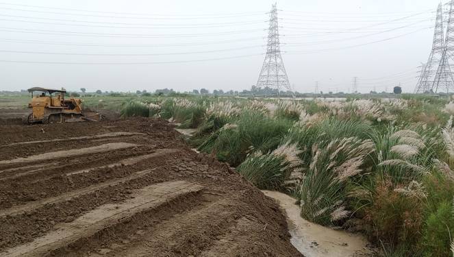
NGT orders DDA and Delhi flood department to end Yamuna floodplain deadlock According to the 16 July hearing at NGT, DDA received a map of the Delhi floodplains in March this year. It was prepared by Geo Spatial Delhi Limited (GSDL) and contained detailed elevation measurements and pointed to the area that is likely to be inundated during floods, with a 1% annual probability. DDA then began working on the physical demarcation of the plains using bollards, or thick metal posts. DDA had then set a deadline of 31 July for the completion of the process.
The Irrigation and Flood Control department, however, sent a revised map of the floodplains to DDA in June. “…The DDA has informed that … out of 277 bollards, 206 bollards were fixed, but because of the receipt of the communication from the Irrigation and Flood Control Department of GNCTD, the DDA has not proceeded,” read the NGT document.
Since DDA had completed half the work based on the initial map, they told NGT that they stopped the demarcation work and awaited further instructions on whether they should act on the revised map. DDA is now awaiting communication from the I&FC department. After ordering the Delhi Environment Secretary to clear the confusion and hold a joint meeting of the two departments within a week, NGT scheduled the next hearing on the case for Sept. 18. It asked for progress reports from both departments a week before the next hearing.
Delhi HC calls for immediate measures to address Yamuna pollution In a matter concerning waterlogging, untreated sewage, inadequate drainage infrastructure and pollution of the Yamuna, a Division Bench comprising Prathiba M. Singh and Manmeet Pritam Singh Arora, JJ., directed multiple authorities to take coordinated and time-bound measures to address deficiencies in drainage, sewage treatment and the redevelopment of non-conforming industrial areas.
The Court expressed serious concern regarding the condition of the open Abul Fazal Drain, which runs alongside a road used by vehicles and pedestrians without adequate protection. Pursuant to its earlier order dated 28 March 2026, the Court had directed the MCD to construct a separator wall between the drain and the road and to install reflectors and lights to make the drain visible to commuters.
The Uttar Pradesh Irrigation Department informed the Court that sanction had been sought from the NMCG and that the Department intended to commence the work by 15 September 2026. The Court directed the NMCG to consider the application and communicate its decision at the earliest.
Th HC noted that 28 existing STPs, having a combined capacity of 735 MGD, were operational and meeting the NGT-prescribed 10/10 parameters. A further 9 STPs, with a combined capacity of 78.86 MGD, were under upgradation and were presently operating at the 30/50 standard. Their upgradation to the 10/10 standard was expected to be completed between December 2027 and May 2028.
Redevelopment of non-conforming industrial areas The Court considered the redevelopment of 25 non-conforming industrial areas in Delhi. Plans prepared by various agencies had been submitted to DSIIDC, forwarded to the MCD and thereafter sent to the DDA for consideration of necessary relaxations under the Master Plan. The Court noted that the absence of a response from the DDA had resulted in a stalemate.
The Court directed the Additional Commissioner (Planning), DDA, to hold a meeting with all authorities concerned on 31 August 2026 and establish clear timelines for approval of the plans and consideration of necessary relaxations.
The Court directed the DDA, Ministry of Industries, GNCTD, MCD and DSIIDC to consider the relevant documents and demarcate the entire Samaypur Badli area so that a fresh redevelopment plan could be prepared. A meeting was directed to be held on 2 September 2026 at 11.30 a.m., under the Chairmanship of the Secretary, Ministry of Industries, GNCTD. Thereafter, Square Design, the agency concerned with preparation of the plans, was directed to commence preparation of a fresh redevelopment plan within 3 months.
The Court directed the authorities concerned to file updated status reports and comply with the timelines stipulated in the order. The matter has been listed for further hearing on 25 September 2026 at 4.00 p.m.
The High Court has directed the NMCG to review the DJB’s proposal to set up 13 new decentralised STPs to prevent untreated sewage from flowing into the Yamuna. The court’s August 24 direction came after local commissioners appointed by the court to monitor the condition of the Yamuna highlighted that only a portion of Delhi’s sewage is currently being treated, while untreated sewage continues to enter the river.
IIT to conduct study for construction of Yamuna flood protection wall Irrigation and Flood Control Minister Parvesh Sahib Singh has said that Indian Institute of Technology (IIT)-Delhi will be roped in to carry out a study for the construction of a new flood protection wall along a 4-km stretch of the Yamuna. Works on building the flood protection wall along the Yamuna to protect flood-prone areas will be taken up next year after a detailed study.
A 4.72-km wall will be built from Majnu Ka Tila to the Old Railway Bridge, with a target to complete the project before the next monsoon season. CM Rekha Gupta has said the decision, formally cleared as part of the budget, is rooted in the city’s struggle with floods. The wall is expected to provide a strong layer of protection to vulnerable localities such as Civil Lines, Kashmere Gate, Yamuna Bazaar and Majnu Ka Tila, areas that have been hit by rising water levels.
Two new bridges planned over Yamuna in Delhi Public Works Department (PWD) Minister Parvesh Sahib Singh on June 18 said the first package of the elevated Ring Road has been approved by the government in a recent meeting. Currently there are around 25 road and rail bridges over the Yamuna connecting the capital to East Delhi and NCR cities like Noida and Ghaziabad.
“The DPR (detailed project report) for the first phase under which Azadpur to Ashram areas will be covered has been approved. Two bridges will cross Yamuna at different locations providing signal-free roads for all users,” the minister said. Spanning 55 km, the project aims to enhance connectivity, decongest major intersections and promote sustainable urban transport through elevated corridors over the existing ring road, he further said.
As per the plan, the Azadpur Flyover-Hanuman Temple ISBT (9.5 km), Chandgi Ram Akhara-Majnu Ka Tilla (2.5 km) and Hanuman Temple ISBT-DND Flyover (11.5 km) corridors will be taken up on priority, the officials said. After completion, the elevated road will join the Azadpur flyover near Mukarba Chowk and the DND road.
Sabarmati vision for a rejuvenated Yamuna, Delhi Delhi must also reconnect with its river. Here again, the Sabarmati provides inspiration, but Delhi cannot simply copy Ahmedabad. The Yamuna is a living floodplain ecosystem, with wetlands, biodiversity and seasonal flows that must be protected. Its riverfront must therefore be nature-led and flood-resilient, not simply a concrete waterfront. Green spaces, walking and cycling corridors, sports facilities and restored ecological areas can bring citizens closer to the river while respecting its natural character. (Parvesh Sahib Singh)
DJB clears ₹4.5K-cr for Yamuna rejuvenation project The DJB, as part of its Yamuna rejuvenation program, has approved projects worth nearly ₹4,500 crore, comprising approvals for setting up 15 new decentralised STPs, expanding sewer networks to 3.3 million people, and upgrading STPs, sludge management and in-situ treatment of drains, water minister Parvesh Verma said.
The agency also approved an e-KYC project to trace 3 million illegal water connections, which is causing revenue loss, the minister said. “With these approvals, DJB will now have 28 decentralised STPs under implementation, including 13 DSTPs approved earlier and 15 newly awarded projects, marking one of the most significant expansions of Delhi’s sewage treatment infrastructure in recent years,” the minister said. Verma said that all 15 newly awarded DSTPs have been given a 21-month completion timeline.
“With the completion of all 28 DSTPs, Delhi will increase its treatment capacity by 227 mgd, taking the city’s total sewage treatment capacity to 1,041mgd,” the minister said, citing current sewage generation of around 1000mgd. The approvals for increasing sewer coverage involves extending coverage by 989 kilometres across 244 colonies and 57 villages, at a cost of nearly ₹1,600 crore, Verma said.
The DJB’s approval with regards to sludge management will entail setting up of facilities at 10 STPs, located at Coronation Pillar, Keshopur, Rithala, Narela and Rohini. Among other decisions, the board has also approved the in-situ treatment of the Delhi Gate drain at a cost of ₹65 crore, officials said.
The government has also decided to introduce performance-based monitoring for STPs, as per which, payments to plant operators will increasingly be linked to the quality of treated water, ensuring continuous compliance with environmental standards and improving operational efficiency, minister Verma said.
MPD 2047 seeks 1,000 ha along drains to process silt The Delhi Master Plan 2047, which was formally notified last week, has identified a requirement for around 1,000 hectares of land at different locations along the city’s drains in order to help facilitate the processing of desilted earth. According to the plan document, the Irrigation and Flood Control Department has proposed that the DDA provide land parcels of around one hectare at every 10 km interval along the drains.
This requirement for more land has been flagged as part of the plan’s assessment of land needed for the projects of the Irrigation and Flood Control Department. Difficulties in disposing of desilted earth by the department were mentioned in the document, while noting that Municipal Corporation of Delhi was reluctant to take the material.
Dye hard: Illegal F’bad units that keep returning Some stories leave a lasting impression of how slow, outdated and exhaustive our urban governance systems are in tackling the rapidly growing environmental needs of metropolitan cities like Gurugram and Faridabad.
RIVERS BIODIVERSITY
Assam’s Kaziranga ESZ proposal sparks debate Until now, the UNESCO World Heritage Site has not notified an ESZ boundary, so the default 10 km buffer continues to apply. Kaziranga shelters over 2,610 greater one-horned rhinoceroses—nearly 70% of the species’ global population—within an ecosystem of wetlands, grasslands, and semi-evergreen forests shaped. Protesters called for a comprehensive environmental impact assessment before any new ESZ perimeter is implemented and said surrounding communities should be treated as stakeholders in decisions affecting the park. Wildlife experts and conservation groups have warned that a smaller buffer zone could increase pressure on the park’s ecosystem and heighten the risk of human-wildlife conflict, particularly during flood season when animals move beyond the park’s boundaries. The matter remains unresolved, with the state government yet to formally notify the revised ESZ limit.
Gangetic Dolphin Allegedly Hunted in Kosi River A Gangetic dolphin was allegedly caught and killed by fishermen near Darhar village in Bihar’s Saharsa district. The fishermen reportedly took the dolphin home and planned to extract its oil. A video of the incident went viral, prompting the Forest Department to register a case and launch searches for the accused, who are reportedly absconding. The Forest Department has increased patrolling along the Kosi River to prevent further hunting.
FISH, FISHERIES, FISHERFOLKS
Fish workers plan protest to demand land rights, reservation Fish workers who are part of the All India Fish Workers Federation will protest near Jantar Mantar in New Delhi on Monday (August 31, 2026), urging the Union government to address their livelihood issues and provide them with health and accident insurance cover. They will also submit a memorandum to Union Fisheries Minister Rajiv Ranjan Singh, with a charter of demands, including control over multinational companies engaged in fishing.
The Union government must withdraw the “blue economy policy” as it subjugates the sea and the coast to multinational companies, the federation’s leaders, R. Prasad, and Lok Sabha MP V. Selvaraj, said in a statement. They urged the Union government to provide land and houses to all fishing families.
Indigenous fishing practices of the Monsang community in Manipur A first-of-its-kind study documents the indigenous fishing practices of Manipur’s Monsang community, revealing how traditional ecological knowledge supports livelihoods, sustainable fishing and the conservation of hill stream ecosystems.
New genus of earthworm eel from Indo-Gangetic Plain, Bihar Abstract: -Gangaichthys indonepalicus gen. et sp. nov., is described from the Indo-Gangetic Plain, Bihar, India. This is the first stygobitic chaudhuriid and first subterranean fish from the alluvial aquifers of the Gangetic Basin and Indo-Gangetic Plain, with all three specimens collected from borewells. As the first subterranean member of the family Chaudhuriidae it is readily diagnosed from other genera and species of the family by a unique set of morphological characters linked to its stygobitic habit such as reduced eyes, the complete absence of body pigmentation, and apparent absence of ribs. In addition to its stygobitic characters, Gangaichthys is distinguished from all known chaudhuriid genera by the following osteological characters: neural spines laterally narrow and tapering to a point posteriorly or dorso-posteriorly, no spinelike projection on neural arch in front of neural spine; preorbital extension of ectopterygoid does not reach beyond coronoid process of dentary; metapterygoid elongate. Gangaichthys indonepalicus gen. et sp. nov. may further be distinguished from all known chaudhuriid genera and species by the presence of 64 vertebrae (28 abdominal, 36 caudal), and in having a single pectoral fin-ray, six caudal fin-rays, 37 dorsal, and 35 anal fin-rays. Molecular data place Gangaichthys indonepalicus gen. et sp. nov. within Chaudhuriidae, and it is > 20% divergent from two genera of the family for which there is comparative mitochondrial CO1 sequence data.
New Fish Species Discovered in Bihar’s Groundwater Scientists have discovered a new fish species from a borewell near the India-Nepal border in Bihar. The discovery began with a video posted on TikTok in 2024. About four centimetres long, the transparent, colourless fish has eyes covered by skin and appears to lack ribs. The species has been named Gangaichthys indonepalicus. It is the first known subterranean fish found in groundwater aquifers of the Ganga Basin and the Indo-Gangetic Plain, and the first member of the family Chaudhuriidae known to be fully adapted to underground aquatic habitats.
All three known specimens were found in borewells. Genetic and morphological studies confirmed that the fish is distinct enough to be classified as a new genus and new species. The discovery highlights the possibility of a rich and largely unexplored world of life within underground aquifers, underscoring the need to better understand and protect these ecosystems.
A fish with no scientific name came out of a hand pump in a village in Bihar, northern India, in January 2025. It measured 40.6 mm from snout to tail base, had no body pigment at all, and had eyes reduced to skin-covered spots. The animal now has a formal name, Gangaichthys indonepalicus, and its describers place it in a new species and a new genus. Their paper appeared on 11 August in the journal ZooKeys, and the route by which they found it began on a phone.
Finding an actual specimen was considerably harder than identifying the fish in the video. Researchers had to locate suitable handpumps and borewells, obtain permission from their owners and then manually extract large quantities of groundwater while searching for the animal. At the borewell that produced the type specimens, the first fish emerged after approximately 2,000 litres of water had been pumped out, but it was damaged during the process and died immediately. A second specimen was recovered from the same borewell after an additional 500 litres had been extracted. That intact specimen was subsequently designated as the species’ holotype, the individual specimen used as the formal reference for describing a new species. The effort illustrates one of the major difficulties of studying subterranean ecosystems: even when researchers know an organism exists, reaching the underground habitat where it lives can be extremely challenging.
“Gangaichthys means fish of the Ganga,” author Ishan Agarwal from the Thackeray Wildlife Foundation said. “The Ganga or Ganges is one of the most important rivers in India, both as a source of fresh water, food and livelihood for millions of people; besides having an important role in the Hindu religion. This is the first stygobitic fish from the Indo-Gangetic plains and from the Gangetic basin,” Agarwal said. The authors wrote, “Gangaichthys indonepalicus gen. et sp. nov., is described from the Indo-Gangetic Plain, Bihar, India.
Microplastics found in Yamuna fish A study by researchers associated with the University of Delhi found microplastics in all 220 fish samples collected from different parts of the Yamuna in Delhi and Haryana. The 12 fish species examined contained a total of 1,678 plastic particles, averaging about 7.6 particles per fish. The most serious finding was from Delhi, where fish from Sur Ghat and Sonia Vihar had a higher microplastic burden than those from Yamunanagar and Karnal in Haryana.
Tilapia from Sonia Vihar contained an average of 21.8 particles per fish. Most microplastics were found in the digestive system, but particles were also detected in the gills and muscles. This is particularly concerning because fish muscle is consumed by humans. About 77.8% of the microplastics found were fine plastic fibres, which can enter rivers through washing of synthetic clothes, sewage and industrial waste. The findings show that cleaning the Yamuna cannot be limited to removing visible waste; it must also address the invisible plastic pollution entering the river.
WETLANDS, LAKES, WATER BODIES
Maharashtra completes documentation of over 23,000 wetlands National Centre for Sustainable Coastal Management (NCSCM) has completed the documentation and Ground-truthing of Maharashtra’s 23,415 wetlands, paving the way to formally notify and bring the water bodies under legal protection under the Wetlands (Conservation and Management) Rules. According to the Maharashtra wetlands dashboard maintained by the NCSCM data, Chattrapati Sambhaji Nagar and Nagpur division has the highest wetlands in Maharashtra, with 5,196 and 5,086 wetlands respectively.
RAMSAR WETLANDS
Perungulam tank set to move closer to Ramsar recognition The Thoothukudi district administration and Tamil Nadu’s Forest Department have begun efforts to secure Ramsar recognition for Perungulam tank, a biodiversity-rich wetland that provides a vital habitat for numerous resident and migratory bird species. The department is also considering obtaining a “Blue-Green Centre” tag for the tank to promote awareness about its ecological importance. The proposal will be prepared after incorporating the requirements of the Water Resources Department. It will then be scrutinised by the district wetland committee before being forwarded for further consideration.
Spread across 860 acres in Perungulam town panchayat, the tank is fed by the Thamirabarani River. Besides meeting irrigation requirements, the wetland supports a rich diversity of fish and birds. It attracts avian visitors throughout the year, particularly during the summer season. A study conducted at the Perungulam wetland between July 2023 and June 2024 recorded 147 bird species belonging to 22 orders and 60 families. Of these, 100 were resident species, accounting for a substantial proportion of the recorded bird population.
WATER OPTIONS
Rejuvenating commons for livelihood Commons are shared lands such as forests, pastures, water bodies and mangroves, which cover 205 million acres, or one-fourth of India, and form the lifeline for over 350 million people, including marginalized groups like Scheduled Castes, Scheduled Tribes and women. Communities across India have traditionally protected, restored and managed these commons through customary self-governance practices. Pressure over resources, caste and class hierarchies and environmental degradation has curtailed communities’ access to commons, leading to over-exploitation of commons and exposing them to climate vulnerabilities and rural distress.
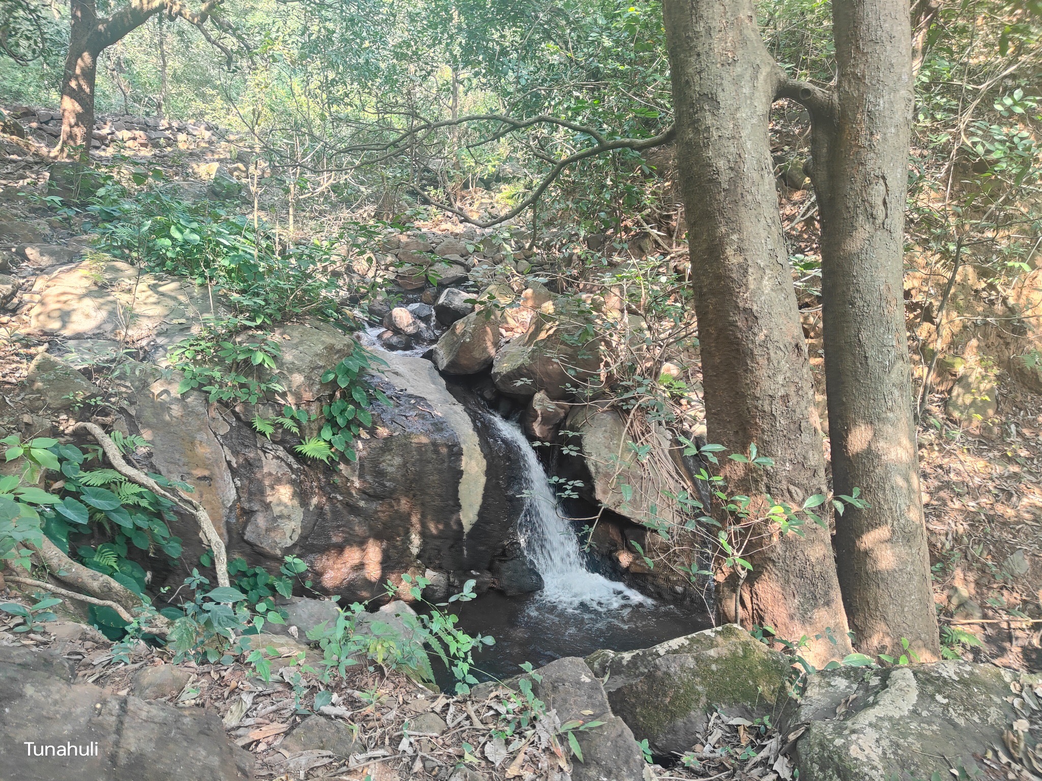
Despite these challenges, communities across India are showcasing that reclaiming, restoring and managing commons through customary self-governance practices plays a crucial role in their ecological, social and economic upliftment. This story from Ara and Keram is one such example of a community that has fought its way back from near-penury to thrive by determinedly caring for its commons. It shows how a strong gram sabha can both help a community bring its commons back from the brink and in doing so, also rebuild their own economies.
Haryana has declared Luhari Baoli a protected monument The Haryana government has declared the historic Luhari Baoli, a 14th-15th century stepwell in Luhari village near Pataudi, as a protected monument and archaeological site. Amit Kumar Agrawal, Commissioner and Secretary of the Heritage and Tourism Department, has issued a notification to this effect on August 14 under Section 4 (3) of the Haryana Ancient and Historical Monuments and Archaeological Sites and Remains Act, 1964.
Also known as Mughlaai Baoli, the stepwell is located in Luhari village in Jhajjar district. This historical structure is notable for its three-storey design, showcasing architectural elements characteristic of the Tughlaq dynasty. The baoli features six niches on either side, complemented by two stair bays on all levels, facilitating access to the well’s depths. The entrance to the well is adorned with a large pointed arch, emphasising the architectural style of the period. The well is octagonal and has a depth of approximately 40 feet.
GROUNDWATER
100% tap coverage masked by groundwater concerns in Haryana While all 30.4 lakh rural households in Haryana have functional tap connections, water source quality varies significantly. Testing data from Karnal revealed that canal-fed water recorded safe TDS levels between 142–158 mg/litre, whereas groundwater samples showed 406–427 mg/litre—approaching the Bureau of Indian Standards’ desirable limit of 500 mg/litre.
Central Ground Water Board monitoring highlighted more severe chemical hazards, detecting excess arsenic in 51 habitations and excessive fluoride across 136 locations in Haryana. Prolonged exposure to excess fluoride causes dental and skeletal fluorosis, while chronic arsenic exposure triggers cardiovascular and skin disorders.
Karnataka turns to new methods to recharge groundwater Minor Irrigation Minister Ajay Singh on Aug. 23 said that the government wants to shift its focus to recharge ground water. “In the next one month, a dash board will be created to now the level ground water in all 224 Assembly constituencies and also measures to be taken to enhance their water level,” he informed.
In the current year, 2026-27, the Minor Irrigation Department has been granted Rs 3,333 crore and throughout the state, a mega plan is in place to fill up 925 lakes out of 3,810 lakes throughout the state, that come under the department. The government in 2024-25 and 2025-26, as many as 9,829 borewells under the SC/ST Plan and 6,165 borewells were sunk under the TSP plan. Apart from this 687 barrages and check dams have been built to irrigate 40,316 ha, the minister added.
During 2025–26, the Kalyana Karnataka Region Development Board (KKRDB) and the Minor Irrigation Department each allocated Rs 100 crore for the construction of a series of check dams on the Shirapur model and for lake development works. A total of projects were taken up under the initiative, of which Rs 10.65 crore has been spent so far.
Similarly, during 2026–27, measures have been initiated to enhance groundwater levels in the remaining 25 Assembly constituencies of the region. The KKRDB, Minor Irrigation Department and Rural Development Department have each allocated Rs 75 crore, taking the total proposed expenditure to Rs 225 crore. The works are currently in the tendering process, he explained.
Groundwater depletion contributes to an increase in global carbon emissions Abstract: -Carbon emissions from groundwater depletion (GWD) can be involved in the global carbon cycle; however, it is poorly understood that how much contribution they have. We here generate two maps on global GWD using measurements from >171,000 monitoring wells and on global groundwater bicarbonate (HCO₃⁻) concentrations using the meta data from 28,902 measurements. We then evaluate the global GWD-induced carbon emissions and show that 1) the total emissions from GWD can be a type of significant source (52 ± 18 MMT CO₂ yr⁻¹) within the global carbon cycle, which have exceeded the net emissions of grasslands (~35 MMT CO₂ yr⁻¹), one of the world’s main carbon sources; 2) the total GWD is approximately 550 ± 73 km³/year in recent 20 years, which is generally consistent with previous studies; 3) China (6.7 ± 1.6 MMT CO₂ yr⁻¹), Brazil (6.6 ± 2.5MMT CO₂ yr⁻¹), and India (5.8 ± 1.5 MMT CO₂ yr⁻¹) are the top three contributors of GWD-induced carbon emissions.
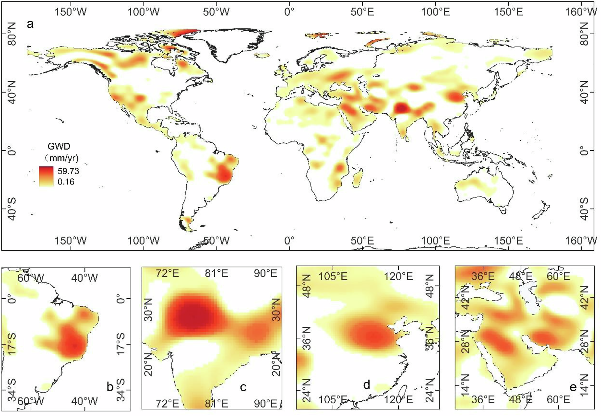
URBAN LAKES, WETLANDS
Parandur’s wetlands: Industrial proposal raises ecological questions again The Tamil Nadu government may have scrapped the proposed greenfield airport project at Parandur, ending years of protests by farmers and environmental groups. But with Industries Minister S Keerthana indicating in the Assembly that land already acquired for the Rs 27,000-crore project could be repurposed for industries, a fresh question has emerged: what will happen to Parandur’s wetlands, waterbodies and interconnected drainage systems?
For opponents of the airport, the concern was never limited to the construction of an airport. The proposed site forms part of a larger landscape of agricultural fields, wetlands, irrigation tanks, seasonal floodplains and drainage channels. They now fear that replacing the airport with industries, warehouses or other infrastructure could alter the landscape without addressing the ecological concerns that led to the opposition to the airport project in the first place.
A hydrological assessment by the Uvakai Research Foundation had found that the proposed airport site was linked to the Cooum and Adyar river basins and played an important role in flood moderation, groundwater recharge and downstream flow regulation. The assessment had warned that the project’s pre-feasibility study did not adequately quantify runoff, assess the cumulative impact on the river basins or examine downstream flood risks, including those to Chennai.
The findings assume fresh relevance now that the airport project has been shelved and the government is considering alternative uses for the acquired land. E Vidhubala, director of the Uvakai Research Foundation, meanwhile, questioned why the state government was yet to release the report of the state-appointed expert committee headed by retired IAS officer S Machendranathan.
UPPCB tells Noida to act on ‘waste dumping’ near wetlands The Uttar Pradesh Pollution Control Board (UPPCB) has directed the Noida authority to act on representations alleging the dumping of municipal solid waste and construction debris in and around in-situ wetlands in sectors 137 and 49. In a letter dated August 18 and addressed to the chief executive officer of the Noida authority, the UPPCB’s regional office in Noida asked the authority to direct the concerned officer to take steps to ensure compliance. The direction follows the NGT’s July 24 order, which recorded an applicant’s submission that “the said representations have not been considered till now.”
NGT was told that representations regarding the alleged dumping had been pending without action since 2025. One representation was submitted on July 30, 2025, while another was submitted on July 10, 2026. In the letter, UPPCB formally communicated the tribunal’s direction to the Noida authority, effectively placing the responsibility for examining the complaints before the civic agency.
The August 18 letter is the latest administrative step in the matter.The representations relate specifically to the alleged disposal of municipal waste and construction debris around the wetlands. The tribunal has not recorded a finding establishing that the alleged dumping took place. Its July order dealt with the representations submitted by the applicant and directed the authorities to take appropriate action on them. The matter is part of a larger environmental case concerning pollution in Noida, including issues relating to the irrigation canal in and around sector 137. The NGT has listed the matter for October 7, when the progress in the proceedings can be placed before the tribunal.
Evaluating the Effectiveness of Inlet-focused Interventions on the Water Quality and Ecosystem Services of Urban Lakes in the Tropics This study compares two restoration interventions aimed at addressing the quality and quantity of inflows of untreated wastewater: diversion channels and sewage treatment and compares these with no intervention measures. The study examines how choice of intervention impacts water quality and the delivery of ecosystem services across eight urban lakes in Bengaluru. The results indicate that, while diversion channels can significantly improve water quality in the target lake, they also present trade-offs that may affect other ecosystem services such as commercial fisheries, groundwater recharge and flood regulation, as well as pushing the wastewater problem downstream. Interventions need to be aligned with the intended uses and management priorities across the city scale. Effective wastewater treatment is clearly the ideal solution for cities, but when wastewater infrastructure is lacking, diversion channels provide some localized benefits. Even with sewage treatment, our study shows that a mix of other local interventions, including constructed wetlands, may be necessary, particularly in tropical monsoon climates, to achieve water quality to sustain biodiversity, fisheries and other provisioning, regulatory and cultural services.
New study reveals what happens to the lakes after sewage diversion A new study of eight Bengaluru lakes, published in Frontiers in Water on July 30, 2026, found that diversion channels can significantly improve the water quality of lakes by preventing untreated sewage from entering them. However, diverting sewage does not eliminate the pollution—it can simply shift it downstream through the city’s interconnected drainage network.
The study found that lakes receiving treated wastewater along with some untreated inflows, including Sarrakki, Hulimavu and Jakkur, had better water quality than lakes without interventions, although they remained in the “Slightly Polluted” category. Diversion-channel lakes also had lower water levels during the dry season, which may provide more storage for monsoon runoff but could affect activities such as fishing.
The key message is that lake restoration cannot focus only on making an individual lake cleaner. Diversion channels can address an immediate problem, but their wider impact depends on what happens to the diverted wastewater, the catchment and downstream water bodies. Effective wastewater treatment, along with measures such as constructed wetlands where appropriate, is therefore needed for long-term improvement.
Overall, the study argues for a catchment-wide approach to lake restoration, considering water quality, flood storage, groundwater recharge, biodiversity and other ecosystem services together. A cleaner lake is not necessarily evidence of a cleaner urban water system if the pollution has simply been moved elsewhere.
Environmentalists seek protection for Nerul’s 12-hectare DPS Lake This Raksha Bandhan, environmentalists, including NGO NatConnect Foundation, have written to Maharashtra Chief Minister Devendra Fadnavis seeking protection for Nerul’s 12-hectare DPS (Delhi Public School) Lake – named after the adjacent campus. Nature lovers want the government to protect the wetland from neglect and encroachment and ensure its revival before flamingos and over 120 bird species lose another refuge.
Metro pillars planned at Basai pond’s edge raise ecological concerns Three piers of Gurgaon metro corridor are planned along the edge of Basai pond, with 20.9 square metres of land required for their construction, according to a response by GMRL to an RTI application. The proposal has raised concerns over safeguards for a traditional waterbody already facing multiple ecological pressures.
The RTI, filed by Aseem Takyar and answered by GMRL public relations officer Mukesh Rawat on Aug 19, sought details of ponds, johads, lakes, wetlands, drains and natural streams within 500 metres of the proposed alignment, stations and depot. In its response, GMRL said the three piers would be constructed at the pond’s edge and that “only the edge of the Basai pond will be affected.” It classified the impact as temporary, adding that no waterbody would be permanently affected by construction of the corridor.
GMRL said said the metro project does not fall under Environmental Impact Assessment Notification, 2006, and therefore does not require statutory environmental clearance, though a detailed ESIA had nevertheless been carried out in line with practices generally followed for metro projects.
Environmentalists disputed GMRL’s framing of the impact as temporary. The RTI response identifies the affected location in Basai village but does not separately demarcate the recorded pond area from the land proposed for the three piers. The proposed construction comes as Basai pond already faces sewage inflows, solid waste, livestock pressure and invasive vegetation.
Restoring lakes by going beyond quick fixes Mohan Chandra Pargaien argues that restoring these vital systems demands more than quick fixes like desilting or fencing. We need long-term, ecology-first strategies that address encroachment, pollution, and governance gaps, and treat lakes as living infrastructure rather than empty plots for development.
URBAN WATER
Residents oppose Mamallan reservoir More than 50 organisations, including residents’ welfare associations (RWAs) from the Old Mahabalipuram Road (OMR) area, and over 1,100 citizens have petitioned CM C Joseph Vijay seeking the scrapping of the proposed Mamallan Reservoir project. Residents have also raised concerns that the project could alter the drainage patterns of the Pallikaranai and Kovalam marshland catchments, which eventually drain into the sea through the Kovalam estuary.
According to them, areas including Sholinganallur, Perumbakkam, Navalur, Siruseri and Thazhambur, which are drained by the Pallikaranai catchment, could face greater flood risks during intense rainfall. Instead, the residents have urged the government to protect existing water bodies, prevent encroachments and promote rainwater harvesting. They have also sought a transparent water allocation policy and drinking water projects based on scientific assessments that do not compromise wetlands or natural drainage channels.
A reservoir inside a functioning floodplain The government’s environmental study describes the area between OMR and ECR as a natural flood bowl receiving flows from a network of upstream tanks before water passes through the Buckingham Canal/backwater system and eventually reaches the Bay of Bengal through coastal outlets.
The report attributes existing flooding partly to raised embankments and insufficient waterways and proposes the reservoir, peripheral drainage and improved outlets as a solution. Residents argue the opposite: that modifying this floodplain and its drainage pathways could increase flood levels in settlements along OMR and neighbouring catchments. There is therefore a testable engineering disagreement.
The project has moved beyond the proposal stage Tamil Nadu announced the reservoir in the 2025-26 Budget as a new surface-water source for Chennai’s expanding metropolitan region. The Budget described a project across 4,375 acres of government land between OMR and ECR, with approximately 1.6 TMC of storage, annual harvesting capacity of 2.25 TMC and a planned 170 MLD contribution to drinking-water supply.
On January 19, construction was formally flagged off at Nemmeli. Contemporary reporting put the implementation estimate at ₹342.60 crore. That matters because repeatedly calling Mamallan merely a “proposed” reservoir obscures the accountability stage. The project must now be judged through construction sequencing, approvals, environmental conditions, contract delivery and eventual service outcomes.
How water stressed are Indian cities? This year, residents in several Indian cities -from Mumbai to Bengaluru – have experienced a shortage in water supply. India’s big cities are expanding in terms of size and population. This has also meant a strain on existing resources such as land and water. We have already seen cities such as Bengaluru attempting to implement restrictions on use of potable water for non-potable purposes. But do our cities need more than that to ensure water security for the future? How water stressed are Indian cities?
Why More Water Won’t Fix Water Scarcity How does saving water create a financial crisis for the utilities that supply it? And why do cities continue building water systems based on laws, infrastructure, and climate assumptions that are no longer relevant? In this episode of The Water Data Podcast, Newsha Ajami joins host Veena Srinivasan to unpack the hidden risks inside modern water systems- from outdated water rights and groundwater overuse to drought, demand management, decentralised reuse, and climate resilience.
INDUSTRIAL WATER MANAGEMENT
Foreign funding cools for Data Centres amid protests Over the last couple of months, the investment frequency for data centres and digital infrastructure has fallen from 2-3 deals a month until June to one investment a month. The size of foreign funding also declined from a range of $600-900 million a month in the first half of 2026 to around $100 million, according to Tracxn data. The last investment was $130 million on July 15, while August recorded no foreign funding.
The slowdown coincides with India’s second data centre protest in Balkum, Thane, Maharashtra, where residents voiced concerns about water and electricity shortages and noise pollution. On the country’s east coast, similar concerns have been raised by Visakhapatnam residents, who argue that local authorities failed to complete the necessary compliance measures before allocating the land. Both communities have called for greater transparency in regulatory and compliance procedures before project execution, especially as current project documents highlight discrepancies between the documented sourcing and level of water usage and the information quoted publicly.
Sources aware of the matter told businessline that the local dissent has sparked discussions among authorities on whether to relocate these projects, leading to significant compliance hurdles. “There is a lot of exuberance and euphoria around data centres among investors, but obtaining the required environmental clearances remains an overhang on execution. The local protests are further delaying project execution, creating short-term challenges,” said Kranthi Bathini, Director, Equity Strategy at Wealth Mills Securities.
Why citizens opposing AI Data Centres? The high computational power, advanced networking, and vast storage systems in AI data centres require massive amounts of electrical power and advanced cooling systems to avoid outages, downtime and overload. Goldman Sachs anticipates that AI will drive a 165 per cent increase in data centre electricity demand by 2030. And McKinsey’s analysis suggests that the annual global demand for data centre capacity might reach 171 to 219 gigawatts (GW). The current demand is 60 GW.

To meet these intense energy consumption and cooling requirements, some AI data centres employ a high-density setup. For example, liquid cooling often uses water rather than air cooling to transfer and dissipate heat. It offers greater efficiency in handling high-density heat and improved power usage effectiveness (PUE) — a metric used to measure data centre energy efficiency. Another cooling method, hot and/or cold aisle containment, organises server racks to optimise airflow and minimise the mixing of hot and cold air”.
DROUGHT
Karnataka govt to launch cloud seeding On Aug. 25, newly appointed irrigation minister N Cheluvarayaswamy announced that cloud seeding will begin in September and continue for close to 60 days across all four revenue divisions. The total cost of the cloud seeding is expected to be approximately Rs 27 crore, with the government likely to skip the tendering process and secure a 4G exemption under the Karnataka Transparency in Public Procurement (KTPP) Act.
The state has witnessed a 31 per cent deficit in rainfall, with as many as 175 of the 240 taluks suffering due to lack of monsoon. The minister said the decision has been taken to “effectively tackle the prevailing rainfall deficit and pre-empt the possible water scarcity across the state.” He announced that the government will immediately form monitoring, technical and field operations committees to begin the process for cloud seeding.
Stating that the current rainfall deficiency in Karnataka was among the four worst recorded since 1976, Deputy CM G. Parameshwara on Aug. 24 indicated that the State was laying the groundwork to declare 102 taluks drought-hit at the next meeting of the State Cabinet.
Rain deficit hits 175 Karnataka taluks Of the 240 taluks in Karnataka, 175 are facing a rainfall deficit, while 14 are facing a severe rainfall deficit, Deputy Chief Minister (DCM) G Parameshwara told the Legislative Assembly on Aug. 24. Tabling the state government’s statement on the drought situation, Parameshwara, who is also the Revenue Minister, said the state has received 454 mm of rainfall against the expected 654 mm between June 1 and August 24, resulting in a 31% deficit. North Interior Karnataka has recorded a 31% rainfall deficit, South Interior Karnataka 41%, Malnad 35% and the coastal region 24%, Parameshwara said.
MONSOON 2026
June July 2026: District wise rainfall in India’s SW Monsoon In July 2026, India received 290.3 mm rainfall, 3.5% above the normal July rainfall of 280.5 mm as per India Meteorological department. While June 2026 had huge deficit of almost 40% from normal rainfall, July 2026 has actually been 3.5% above normal rain, in spite of 2026 being a super El Nino year. This is partly explained by IMD due to the positive Indian Ocean dipole partly neutralising the effect of El Nino.
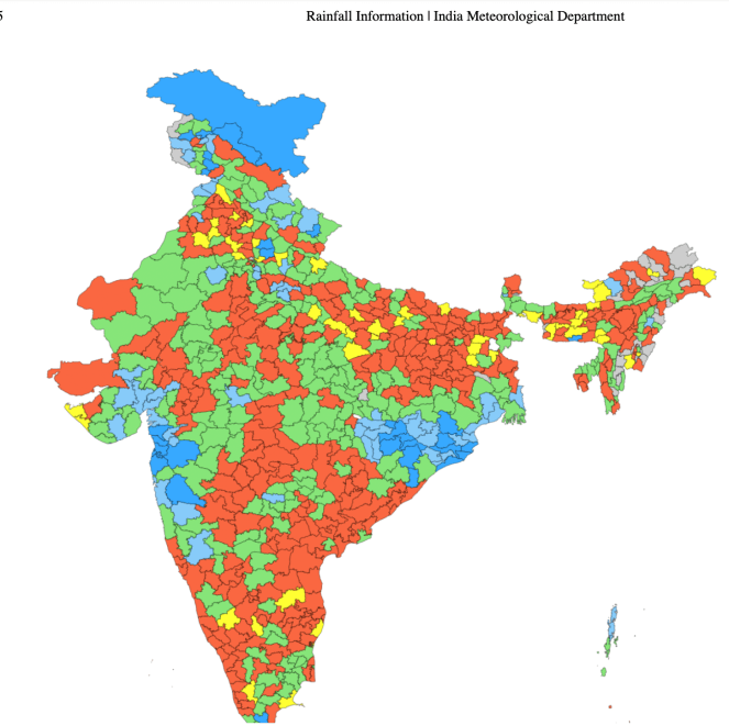
August rainfall fails to reduce India’s monsoon deficit While the country’s cumulative rainfall deficit (since June 1) was 13% as of July 31, it touched nearly 14% a month later due to a huge shortfall in Bihar, Andhra Pradesh, Punjab and some northeastern states. Though many parts of the country defied El Nino-linked predictions and got normal rainfall, 12 states have reported a rain deficit of more than 20% since June 1, with Bihar, Andhra Pradesh and three northeastern states – Meghalaya, Manipur and Arunachal Pradesh – reporting a huge deficit of more than 40% in cumulative (June 1-Aug 29) rainfall. Peninsular India has, so far, reported a deficit of more than 23% in cumulative rainfall, leaving Andhra Pradesh, Karnataka and Kerala largely dry for most of the southwest (summer) monsoon season.
India faces weakest monsoon in nearly two decades as El Nino strengthens India is on course for its weakest monsoon in nearly two decades, with rainfall likely to end the season around 15% below the long-term average, the lowest since 2009, two senior weather department sources said. India has received 13% less rainfall than average since the monsoon season began on June 1. Rainfall was 35.4% below average in June before a 1% surplus in July offered a brief reprieve. The monsoon weakened again in August, with rainfall so far running 15% below average.
El Niño puts Earth in ‘uncharted territory.’ Scientists warn that the 2026 El Niño, potentially the strongest on record, is occurring alongside unprecedented global warming, creating uncharted conditions that could amplify typical weather impacts and produce unexpected outcomes worldwide. A series of strong El Niño climatic patterns in recent decades, such as the “Godzilla” event currently brewing that is set to warp weather around the world, have been supercharged by the broader overheating of the planet caused by the burning of fossil fuels, a major new study has found.
FLOOD 2026
HC accepts petition that North Assam Floods Man Made disaster The Guwahati high court on Aug 26 admitted a public interest litigation filed by former Congress MLA Debabrata Saikia, alleging that the devastating July floods in upper Assam were a “man made disaster”, caused by illegal riverbed mining, official negligence and uncoordinated dam releases.
A division bench headed by chief justice Ashutosh Kumar heard Saikia’s counsel and directed all respondents to file their replies by Nov 3. The floods in Sivasagar, Charaideo, Jorhat and Golaghat has claimed more than 90 lives, having displaced lakhs of people while destroying livelihoods of thousands of families, the petition said. Saikia said he had warned the govt and authorities since 2018 about the dangers of unscientific sand and stone mining in the Dikhow riverbed, particularly along the Assam-Nagaland border.
The former Congress MLA said he had filed two PILs in 2018 and 2019, prompting the high court to issue clear directions in 2019 and again in 2022 to stop illegal mining and to constitute a task force battalion. “The govt simply ignored those orders. Even the official report of the water resources department, dated Jan 12, 2022, clearly predicted that continued illegal excavation would change the river’s course and cause devastation, which has now come true in the most tragic manner,” Saikia said.
“The govt has protected the mining mafia instead of protecting the people. Night time mining continued with impunity. I submitted repeated representations to the deputy commissioner, the superintendent of police, the chief secretary and even to the Chief Justice, but no action was taken,” he alleged. Saikia also blamed illegal open-cast coal mining in Nagaland’s Mon, Mokokchung and Wokha districts and sudden, uncoordinated water releases from the Doyang hydro electric project for aggravating the floods. He said years of illegal mining had destroyed natural sand and gravel bars that once moderated floodwaters.
The PIL seeks a permanent ban on illegal riverbed mining in the Dikhow and its tributaries, implementation of the high court’s 2019 and 2022 orders, and a high-powered monitoring committee headed by a retired judge. It also seeks a scientific assessment of the role of mining and dam releases, full restorative compensation for victims, FIRs against those responsible and a real-time protocol for upstream dam releases.
Why are Assam’s floods now so destructive? Assam’s July floods were explained as a consequence of heavy rainfall. That is true, but incomplete. Historian Arupjyoti Saikia joins us to uncover the much longer history behind the catastrophe: the earthquakes that transformed the Brahmaputra, the failed embankment experiment, changing sediment, dams and extraction in the highlands, erased wetlands, and a political economy built around flood control and relief. We discuss why a single river basin is governed in fragments; whether climate change is becoming an alibi for destructive decisions and what farmers, graziers and fisherwomen understand about the river that technocratic planning does not.
Experts seek answers beyond rain, flag changing Dikhow basin The devastating floods that swept through Upper Assam in July were caused by a combination of factors rather than heavy rainfall alone, experts said at a brainstorming session at Dibrugarh University on Aug. 28. They pointed to extreme rainfall in the upstream hills, changes in the Dikhow river basin, river morphology, sedimentation, mining, deforestation, altered drainage and gaps in disaster preparedness.
The discussion was organised by the Centre for Atmospheric Studies, Dibrugarh University, under the theme “Need of an integrated understanding through trans-disciplinary approach for effective risk reduction and adaptation”. It examined how an extreme rainfall event developed into a disaster of such magnitude and what measures could reduce the risk of similar events in the future.
Stone quarries put Assam semiconductor plant at risk Green activists and local organisations have petitioned the government on flash floods and air pollution caused by the quarries and crushers within 5 km of the Tata chip plant, which needs to be insulated from microscopic dust, according to the Indian Semiconductor Mission.
Extreme rainfall is redrawing North-East India’s geography From Tripura’s flooded villages to landslide-prone hills in Meghalaya and Mizoram, changing rainfall patterns and ecological decline are redrawing flood risk across North-east India, testing assumptions of safety. (Thomas Malsom)
Ganga erosion threatens Malda school The Ganga’s consistent erosion in recent days across the Ratua-I and Manikchak blocks of Malda district has plunged thousands of residents into uncertainty. A 58-year-old government-run primary school in Ratua-I is now on the verge of being swallowed by the Ganga. The river has already devoured large stretches of Bhutni in Manikchak and Paschim Ratanpur in Ratua-I over the past 24 hours. The Paschim Ratanpur Primary School, established in 1968, has 320 students and six teachers.
Residents living near the school have also started dismantling their homes to move elsewhere. Just five years ago, the river flowed kilometres away from the school. However, continuous erosion over the past two years led to this crisis, said sources. The erosion has intensified so sharply that residents are dismantling their houses and moving bricks, rods and belongings to safer locations in a desperate attempt to salvage whatever they can. Over the past three days, erosion by the Ganga has intensified in Ratua-I. Residents claimed that over 100 houses had been swallowed by the river at Srikantatola, Jittutola and Muniramtola.
As every year, the Ganga and Kosi rivers are once again causing rapid erosion in Bihar. In Tinegharia village of Kursela block in Katihar district, erosion has put the very existence of the village at risk. However, villagers are unhappy with the measures being taken to protect the village.
Yamuna Fail to hit warning mark The river, which typically swells during the four-month monsoon cycle, was flowing at 202.52 metres at the Old Railway Bridge (ORB) at 9pm on Thursday, according to official data. T The Yamuna was at 204.08 metres on August 8, just below the warning level. Data from previous years showed that the river had failed to reach 204.5 metres only twice in the past decade. The warning level is 204.50 metres and the danger level is 205.33 metres. Bhim Singh Rawat, coordinator of the South Asia Network on Dams, Rivers and People (SANDRP), said the river had experienced an unusually dry monsoon so far.
“There is not a single instance when the river has reached 204.5m level. Coupled with erratic rainfall in the upper catchment area, it is also linked to the distribution of water being carried out the Hathnikund barrage with most of the river water being diverted to Eastern and Western Jamuna canals rather than the river stream,” he said. Rawat said the monsoon was the only period when the river received enough water for pollutants to be flushed downstream. “Depriving river of the monsoonal flow is also bad for its ecology in long run,” he said. Experts said the annual swelling of the Yamuna was important for maintaining its ecological health, supporting aquatic life and recharging underground aquifers beneath the floodplains.
DAM FLOOD 2026
After Record Floods, Fresh Alert In Madhya Pradesh Town The devastation caused by the first surge has been extensive. Torrential rain in the catchment areas of eastern Madhya Pradesh sent the Mandakini surging through Chitrakoot over the weekend. Officials said water levels exceeded those recorded during the devastating 2003 floods, inundating large parts of the pilgrimage town on both sides of the Madhya Pradesh-Uttar Pradesh border. Nearly 1,000 people were rescued during the initial emergency, including hundreds from the Madhya Pradesh side.
As floodswaters rose rapidly around Ramghat, many people were stranded on rooftops and terraces. Two Indian Air Force helicopters, along with State Disaster Response Force (SDRF) teams and other rescue personnel, were deployed for evacuation operations. An IAF helicopter from Prayagraj airlifted several people trapped on the terrace of a partially submerged building near the swollen river.
A large section of the nearly 300-metre bridge linking the Ramghat-Nayagaon stretch with the Hanuman Dhara side was washed away or badly damaged, disrupting connectivity between the Madhya Pradesh and Uttar Pradesh sides of Chitrakoot. The floods have also taken a severe toll on the town’s religious and historic landmarks. Tulsi Ghat suffered extensive damage, while more than 400 shops were inundated.
While authorities on the Madhya Pradesh side reported no deaths during the initial rescue operation, local reports from Uttar Pradesh said at least two people were killed and another person remained missing.
The impact of the floods extends well beyond the pilgrimage town. Several villages in Chitrakoot, Koter and Rampur Baghelan tehsils of Satna district have been affected by swollen rivers and persistent rainfall. The Mandakini and Semrawal rivers have damaged houses, roads and standing crops, while losses of livestock and poultry have also been reported.
The district administration has ordered all schools in Satna to remain closed on August 31 and September 1 for students from nursery to Class 12 due to heavy rainfall, swollen rivers and disrupted road connectivity.
The threat remains across eastern Madhya Pradesh, where a heavy rain alert has been issued for 11 districts, including Rewa, Mauganj, Maihar, Sidhi, Umaria, Shahdol, Dindori, Anuppur, Mandla, Seoni and Balaghat. The weather department has warned of very heavy rainfall in parts of the state over the next three days.
In Shahdol district, rising inflows into the Bansagar Dam forced authorities to open six gates on Sunday. Around 2,454 cumecs of water was being released into the Son River, prompting authorities to place 24 downstream villages in Sidhi district on alert. The sharp rise in inflows has added concerns as heavy rain continues across the dam’s catchment area.
Singrauli has also been battered by intense rain. A bridge in the district has been badly damaged by floodwaters, disrupting movement along the Singrauli-Sidhi road corridor. Flooding and heavy rain have also affected parts of Mandla, Panna, Tikamgarh and the wider Vindhya-Bundelkhand belt.
In Madhya Pradesh’s Chitrakoot district, the Mandakini River is in spate. Continuous heavy rainfall in Satna and Chitrakoot has disrupted normal life, with flood-like conditions reported in several areas. Near Manikpur, the Doda Dam breached after overflowing, causing waterlogging in surrounding areas.
HFL BREACH
After ten days, River Tons at Rewa site has again breached 265.45 meter HFL dated 02.08.2021 is just short of 0.08 meter to touch 266.16 meter HFL set on 20.08.2026 at the site.
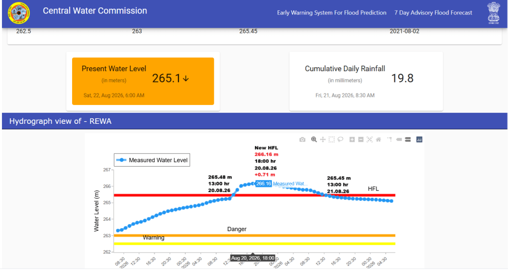
River Paisuni at Sardhua site in Chitrakoot district, UP has crossed its HFL 91.42 meter dated 28.08.2022 and has set 91.5 meter HFL at 15:00 hour on 30.08.2026. However, the river has already set 93 meter HFL at the site on 03.08.2025 which the CWC has not updated.
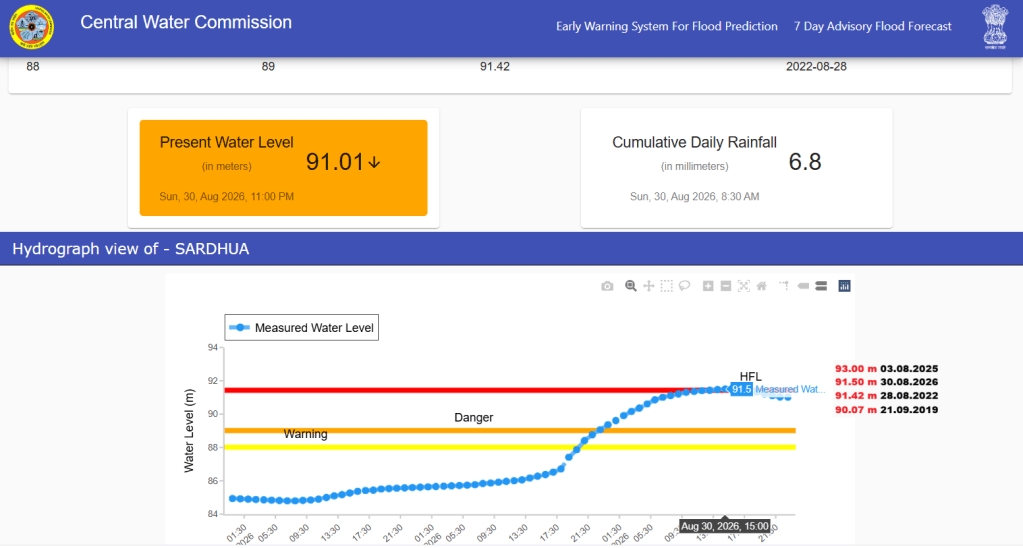
River Mohan at Sohar site in Singrauli, MP has crossed its HFL 256.39 meter dated 30.09.2019 at 17:00 hour on 30.08.2026 and continues to flow in extreme flood condition.
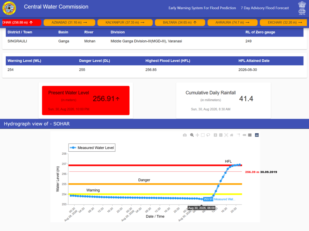
River Paisuni at Chitrakoot site in Satna District, MP has crossed its HFL 142.65 meter (undated) at 10:00 hour on 29.08.2026 and has set new HFL 145.6 meter at 13:00 hour on 29.08.2026. The new HFL is 2.95 meter higher than old HFL. The flood level in the river increased by 7.5 meter in about 06 hours from 138.1 meter at 07:00 hour on 29.08.2026 to 145.6 meter at 13:00 hour on 29.08.2026.
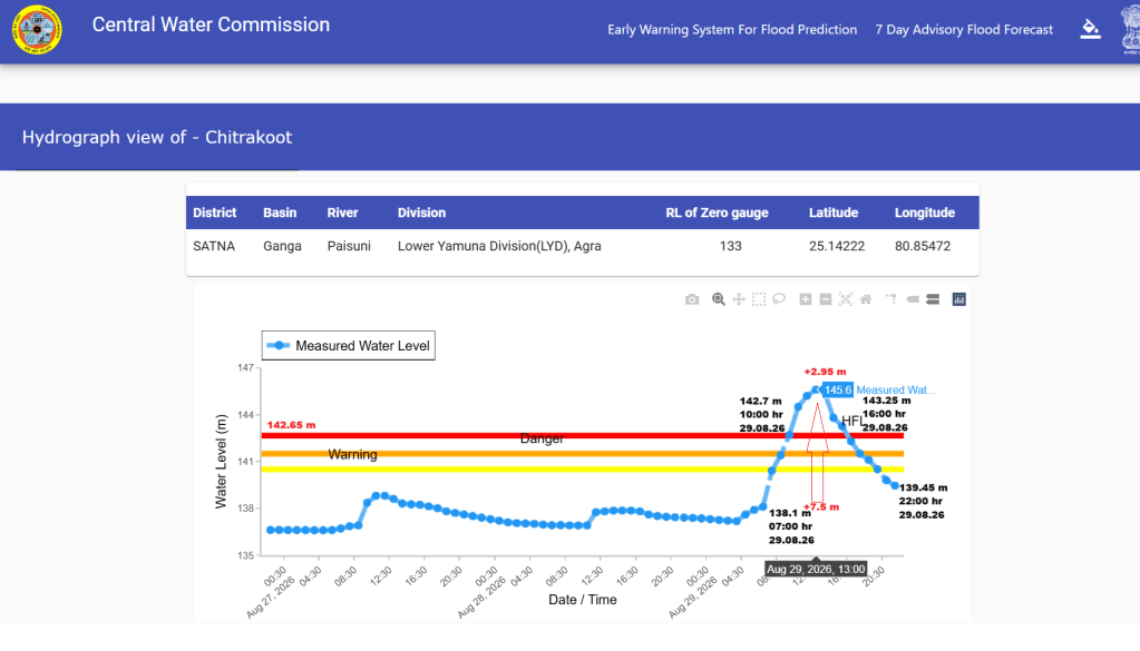
River Jirgo at Ahraura site in Mirzapur district Uttar Pradesh has crossed its HFL 76.8 meter dated 21.08.2020 at 15:00 hour on 26.08.2026. However, the river has already set higher HFL 77.51 meter at the site on 24.08.2025 which the CWC has not updated.
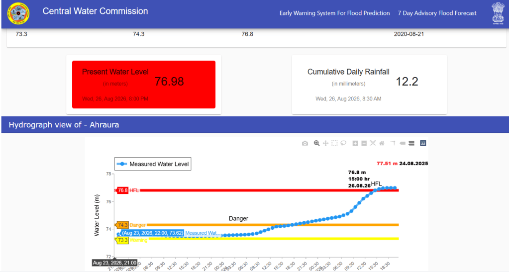
URBAN FLOODS
Gurgaon’s annual infrastructure betrayal Gurgaon’s Aug. 24 monsoon disruption exposes a recurring infrastructure failure, with 75mm of rain flooding major roads, stranding schoolchildren and commuters, and causing missed trains. Hundreds of crores spent on drainage and desilting, along with pending road repairs and major civic body vacancies, show a city repeatedly treating symptoms, not building long-term resilience.
A recent assessment noted that the administration has spent close to Rs 503 crore over the last nine years, up to 2025, on improving the city’s drainage infrastructure. But an hour of heavy rain was enough to bring large parts of the Millennium City to a standstill again. So it’s no longer just a question of money being spent — it’s a question of whether public spending is addressing the underlying engineering problem, or merely funding another round of emergency pumping, desilting, patching and road repairs.
Gurugram is drowning in its own choices Until its citizens hold themselves accountable—as much as they hold the government to account—the monsoon will keep washing away the illusion of progress by Ritu Rao
In search of India’s Abercrombies Ankur Bisen questions why architects remain largely absent from the urgent challenges facing Indian cities—from flooding and pollution to unplanned growth. As the profession faces shrinking institutions and a shortage of town planners, he calls for architects to step beyond individual projects and take a more active role in shaping the cities we live in.
CLOUD BURSTS
SANDRP Documents Alarming Frequency of Uttarakhand Cloudbursts SANDRP report documents a worrying increase in the frequency of cloudburst incidents across Uttarakhand, continuing a trend observed over recent years. The report notes that many cloudbursts occur in remote Himalayan regions, where inadequate rainfall monitoring makes accurate documentation and scientific analysis difficult.
ENERGY OPTIONS
Indian analyst warns against reactor expansion Shankar Sharma, a Power & Climate Policy Analyst based in Sagara, Karnataka, with over 38 years of experience in the power sector across India and Australia, draws a direct line from Europe’s crisis to India’s precarious position. “If such an alarming scenario of cooling water supply to nuclear reactors can occur in the relatively cooler climate of Europe, the probabilities of such a scenario in India can be projected as credible; in the context that the heatwave days and spread in the country are increasing with the passage of each year”, says Sharma.
India is already one of the top seven most water-stressed countries in the world, according to global assessments. The country’s rivers, reservoirs, and groundwater aquifers are under severe pressure from agriculture, industry, and a growing population. Adding numerous nuclear reactors — each requiring enormous volumes of cooling water — into this equation, Sharma argues, is a recipe for compounding disaster.
The timing is particularly critical. India is simultaneously planning a massive expansion of data centres, which are notoriously water-intensive for cooling, further straining an already depleted water resource base. “Hence, extreme due diligence must precede any potential decision to set up additional nuclear reactors in the country, which is already one of top 7 most water stressed countries with the plans to set up numerous data centres too”, he adds.
Hisar power plant needs 8 years to clear 33 LMT fly ash, NGT told The Rajiv Gandhi Thermal Power Plant (RGTPP) at Khedar in Hisar requires nearly eight years to clear 33 lakh metric tonnes (LMT) of fly ash currently stored at the plant for utilisation, according to a timeline submitted by the plant before the NGT. In an additional reply filed with the NGT, accessed by HT, the plant, which currently has around 45 LMT of ash stored in its operational ash dykes, has said that 12 LMT must be retained for the safety of the dyke structures, leaving 33 LMT for lifting or utilisation. Under the proposed schedule, RGTPP plans to utilise 3 LMT during 2027-28 and 5 LMT annually for the next six years, taking the targeted utilisation of the 33 LMT to March 31, 2034.
The plant, however, made it clear that the timeline is dependent on market conditions, demand for fly ash, infrastructure projects and applicable statutory guidelines. The submission was made in response to an application filed before the principal bench of the NGT. The plant said the additional reply was filed in view of the tribunal’s May 14, 2026, proceedings to place on record the tentative timelines for utilisation or disposal of available fly ash and details of pollution-control measures at its fly ash silo system.
The plant management maintained that the ash presently stored in its two dykes does not fall under the category of “legacy ash” because both dykes are operational and continue to receive ash generated by the plant. It said the current action plan, therefore, concerns gradual utilisation of the stored ash while simultaneously ensuring utilisation of freshly generated ash.
In its report to the NGT, the plant referred to the Union ministry of environment, forest and climate change notification of December 31, 2021, which mandated 100% utilisation of fly ash by thermal power plants. It also cited the December 30, 2022, amendment defining ash stored in ash ponds or dykes other than operational ash ponds or dykes designated for temporary storage as legacy ash.
ENVIRONMENT GOVERNANCE
A weak legal foundation Ex post facto clearance remains an Achilles heel in India’s environmental law enforcement, and a new Supreme Court judgement is unlikely to deter future violator. (Ritwick Dutta)
SOUTH ASIA
The Challenges of Transboundary Teesta Management The Teesta is no longer just a river shared by India and Bangladesh; it is becoming a fault line shaped by dams, diversions, politics and a changing climate. With water reaching downstream communities in shrinking quantities and China entering the conversation, the question is no longer whether the river needs a deal, but how long both sides can afford to wait.
As climate pressures mount and political windows open and close, comprehensive Teesta agreement whether framed as a treaty, integrated master plan or joint management framework is need of the hour. Failure to act on time risks converting a shared river into a permanent fault line undermining the very human and environmental security the basin has historically provided. The principles of mutual respect highlighted by Bangladesh’s water minister point the way: true friendship requires recognising that upstream interests and downstream needs are inextricably linked. (Vimal Khawas)
The Teesta will outlive the maps She will outlive the barrages and the embankments, treaties and billion-dollar dredging projects. Empires decay. Pragmatism survives. The river’s memory is deeper than our politics. She remembers the path to the sea. Our task, in this era of climate collapse, is not to conquer her or carve her up. It is to enter into a relationship of intelligent, humble reciprocity. A multilateral commission, founded on real-time data, equitable energy swaps and a legal mandate that recognises the river as a stakeholder, is the highest and most pragmatic expression of that relationship.
It is not merely a diplomatic solution to a water conflict. It is a civilisational pact between two nations — and between humanity and the living world — that the thirst of one will not be quenched by the desiccation of another. The time for bold action was yesterday. We are already late. But as the sun sets over the sandbed where the water should be, we can still hear her whisper: the ghost of a current, the memory of a goddess named for thirst. She is waiting for us to remember that we are not her masters, but her children. (Zakir Kibria)
IWT India Holds Firm as Pakistan Pleads Over Indus Waters Treaty Driven by growing domestic vulnerabilities and diplomatic isolation, Pakistan has turned to the international community following India’s decisive suspension of the 1960 Indus Waters Treaty (IWT). Addressing a virtual seminar organised by the Pakistani Embassy in the United States, Pakistan Foreign Minister Ishaq Dar raised concerns over India placing the treaty in abeyance, describing water security as central to his country’s national stability while warning of broader regional consequences.
CHINA
1975 Banqiao dam disaster The Aug. 08, 1975 disaster has acquired fresh relevance after the latest flash flood along Nepal’s Bhote Koshi-Trishuli river system, close to the Tibet border. The Banqiao Dam was built during the nascent years of Communist China and Mao Zedong’s early years in power, and it was later reinforced with Soviet assistance. It was a showpiece of the Communist Party’s campaign to tame China’s mighty rivers. It was a campaign that accelerated during the Great Leap Forward. But as Banqiao broke, a wall of water up to 10 kms wide raced across the valleys and plains of Henan province, catching downstream villages in their sleep. By morning, the major dams of Banqiao and Shimantan, and dozens of smaller dams had failed, unleashing China’s deadliest dam disaster, which is ranked as the world’s third-deadliest flood in recorded history.
Typhoon Nina, which had formed in the eastern Pacific Ocean, brought extreme rain to the region, but poor dam design, official inaction and failed warnings made the disaster far worse. China’s state-controlled media barely reported the dam collapse. The scale of the tragedy emerged about 20 years later, while some official records reportedly remained secret for nearly 30 years.
The flood directly killed around 26,000 people, according to a 2017 study by researchers from Princeton and Tsinghua universities. The study estimated that famine and disease subsequently caused approximately one lakh additional deaths. A much higher estimate of about 2.3 lakh deaths was produced by eight senior Chinese experts, cited by Human Rights Watch in 1995. The exact toll, however, remains contested. Around 10 million people were affected or left without adequate shelter, while entire villages and towns, roads, railway lines and vast stretches of farmland disappeared underwater.
In one of the deadliest natural disasters in modern Chinese history, an earthquake on the Tibetan Plateau’s eastern rim in 2008 killed nearly 90,000 people, mainly in Sichuan province. While scientists continue debating the precise relationship, influential research concluded that the immense weight of water stored in the reservoir of the new Zipingpu Dam may have increased pressure along an underlying fault, potentially advancing the earthquake by decades or even centuries.
Instead of facing up to that scientific possibility, China has embarked on a vastly larger dam project in an even more fragile geological setting. But the Himalayan fault system does not respect national borders; nor would the consequences of a major dam failure. The powerful 2025 Myanmar earthquake demonstrated how interconnected this seismic zone is, with tremors traveling far enough to trigger the collapse of a high-rise building in Bangkok, some 1,000 kilometers away. (Brahma Chellaney)
THE REST OF THE WORLD
After GERD, can Egypt shape Ethiopia’s next Nile dams? Egypt’s response to Ethiopia’s new Nile dam plans is centred on diplomacy, international pressure and cooperation with Sudan, rather than trying to stop construction outright. However, the experience of the Grand Ethiopian Renaissance Dam (GERD) has exposed the limits of Cairo’s influence. The revival of three proposed Blue Nile hydropower projects – Karadobi, Mandaya and Beko Abo – will test whether Egypt can turn more than a decade of opposition into practical leverage over how Ethiopia develops the river.
Elwha River dam removal took decades before work began in 2011 The patience embedded in the 1992 law eventually paid off. By 2014, both dams had been fully removed, and the Elwha River began carrying sediment and nutrients down to the Strait of Juan de Fuca for the first time in a century. Salmon returned to stretches of river they had not reached since before the dams were built, fulfilling the ambition set out, as per the Act, at the very start: the full restoration of “the Elwha River ecosystem and native anadromous fisheries.” Twenty-four years after Congress put pen to paper, the Elwha once again flowed unbroken from the peaks of the Olympic Mountains to the sea.
Otter spotted for first time in 100 years in New York City’s Bronx River The image, captured in June by the camera of RJ Hawkins, a scientist affiliated with the Wildlife Conservation Society’s Bronx zoo, is the first documented sighting of a river otter in the river since the early 1900s, according to the society. This decimated local wildlife, but concerted conservation efforts and laws such as the Clean Water Act have in recent years helped restore the Bronx River’s fortunes, to the point that species such as oysters have returned.
In 2007, beavers returned to the river for the first time in more than 200 years, the zoo said, and the appearance of a river otter suggests the waterway, which is New York City’s only freshwater river, is continuing to recover from decades of pollution. While the sighting of a single otter doesn’t confirm a larger resident population, it is encouraging as river otters require clean water and abundant fish. Peter J McKosky celebrates the return of the river otter after a century to New York, but notes that hundreds are violently killed in traps every year elsewhere in the state.
SANDRP
Also see: DRP 24 Aug 2026 & DRP 17 Aug. 2026
Follow us on: www.facebook.com/sandrp.in; https://twitter.com/Indian_Rivers


