
(Feature Image: Map showing the temporal changes in the Yamuna river courses for years 1990, 2007, 2014 and maximum possible/ visible extents of the associated floodplains for years 1807, 1952, 1980, 1990, 2007 and 2014; digitized from the toposheets compiled from Survey of India, IRS 1C LISS III imageries and Google Earth images. Credit: Constriction of the Yamuna River Floodplains within Delhi Region since 19th Century: A Serious Concern)
Three recent studies have once again highlighted both the severe degradation of the Yamuna and the critical role of its floodplain in Delhi. Their findings make it clear that cleaning sewage alone will not revive the river. Protecting natural flows, restoring floodplain connectivity and conserving wetlands are equally important for reducing flood risk, recharging groundwater and sustaining the river’s ecology. Undoubtedly, the Yamuna floodplain has already suffered extensive encroachment, fragmentation and ecological damage due to weak governance.
Against this backdrop, the Delhi Development Authority’s (DDA) proposal to divide Zone O into Zone O-1 and Zone O-2 is deeply concerning. The proposal, reportedly sent to the Ministry of Housing and Urban Affairs (MoHUA) as part of the Delhi Master Plan 2047, is intended to facilitate the regularization of unauthorized colonies in the Yamuna floodplain.
MoHUA should not approve this proposal as it would legitimize encroachments in one of Delhi’s most ecologically sensitive areas. It would further dilute the already weakened Zone O provisions and set a dangerous precedent for floodplain governance across the country. Instead of weakening existing safeguards, the priority should be scientific floodplain mapping, and physical demarcation. The episode also reinforces the urgent need for an independent expert authority dedicated to protecting the Yamuna floodplain in the national capital.
Ironically, the DDA’s move comes just days after the National Mission for Clean Ganga (NMCG) on Aug. 7 has amended the Ganga protection framework by introducing active, regulatory and warning floodplain zones. While the amendment classifies floodplains into different categories, it does not clearly define the development restrictions applicable to the newly created regulatory and warning zones. This creates fresh ambiguity instead of strengthening floodplain protection.
The continued dilution of floodplain safeguards by institutions responsible for protecting rivers is deeply troubling. India still lacks a dedicated national law to define, map, demarcate and protect river floodplains. The proposed River Regulation Zone (RRZ) framework, first drafted in 2011, remains unnotified. Without a strong legal framework, scientific floodplain mapping, physical demarcation and accountable governance, India’s rivers and floodplains will remain vulnerable to piecemeal development and irreversible ecological degradation.
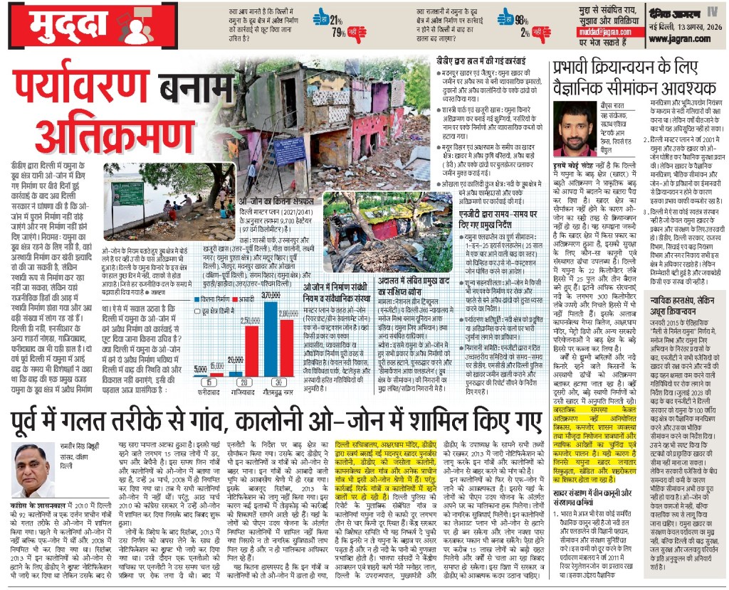
O-zone split with recreational activities to be allowed along floodplains The O Zone of Yamuna floodplain has now been divided into two parts under the Master Plan for Delhi-2047, with a lower degree of protection proposed for a “buffer area” farther from the river. While no construction or development will be permitted in O-1 – which falls within the defined 1-in-25-year floodplain – O-2, the area outside this zone, will allow specified recreational activities, including parks and green spaces, subject to regulations.
The change marks a departure from the approach outlined in the draft Master Plan for Delhi-2041 and previous master plans, which sought to protect the Yamuna floodplain as a whole and allowed only restricted development in areas under environmental protection. The draft MPD-2041 had also envisaged a 300-metre-wide green buffer, wherever feasible, along the entire edge of the river.
The draft plan had specifically stated that “no permanent construction shall be permitted in the floodplain” and proposed public access through 75-100 metre-wide greenways along embankments, with cycling and walking trails and spaces for passive recreation. The new plan, officials explained, creates a distinction between the “core floodplain” and the “outer buffer”. While O-1 continues to receive the highest level of protection, O-2 is no longer subject to the same blanket restriction and can accommodate regulated recreational uses.
This means areas that were earlier part of the larger protected O-Zone will now have a separate development regime. Although the proposed uses are recreational and regulated, environmental planners and residents have previously raised concerns over the impact that increasing activity and infrastructure in the floodplain could have on its ecological and flood-management functions.
Bhim Singh Rawat of the SANDRP said the Delhi Development Authority (DDA), which was made the custodian of the Yamuna floodplain, was instead working towards weakening the laws meant to protect it. “On the one hand, DDA has been stalling scientific demarcation of floodplain in ongoing NGT cases for several years and now it is changing the very definition. The one-in-100-year flood should be the baseline, not 25-year flooding period. The last two flooding episodes have shown that even with smaller water discharges, the carrying capacity of the river in Delhi has been severely compromised,” he said.
The plan will now be sent to the MoHUA for final approval and subsequent notification. The decision was taken at a DDA meeting chaired by lieutenant governor Taranjit Singh Sandhu and attended by vice-chairman N Saravana Kumar and other members of the authority. DDA has not revealed details of the Master Plan yet and it is unclear how the O zone will be demarcated. O-Zone, a 9,934-hectare ecologically sensitive floodplain where permanent urban, residential and commercial constructions are largely restricted or prohibited, will be divided into two parts: Zone I, covering the riverbed and measuring 6,295 ha, and Zone II, comprising the outer sections of the floodplain. A 52-km cycle track and recreational spaces are planned in Zone II.
Yamuna lost 68% width, 89% flow in 225 years These findings of a study titled Two Centuries of Hydrogeomorphic Changes: Width–Discharge Dynamics of the Urbanised Yamuna River in Delhi by scientists from Delhi University’s Department of Geography and the Indian Institute of Science Education and Research (IISER), Bhopal, who pieced together the Yamuna river’s transformation using a map dating back to 1799, historical records and satellite imagery spanning over 2 centuries.
The construction of barrages at Tajewala, Okhla, Wazirabad and ITO diverted substantial volumes of water before it entered Delhi, reduced the river’s natural flow. As the city’s population expanded from about two lakh in the early 19th century to nearly 2.15 crore today, demand for land & water intensified. Floodplains were cut off by embankments and development projects, with around 45 sq kms of these natural buffers disappearing between 1912 and 2024.
“The river’s ecological features have thinned alongside it. Sandy mid-channel islands that once covered nearly 20 sq km in 1985 have shrunk to just 4 sq km by 2020, signalling the loss of habitats that helped maintain the river’s ecological balance,” the report says.
The report concludes that restoring the Yamuna will require looking beyond pollution control. Protecting natural river flows, reconnecting floodplains and preserving ecological processes, it argues, are essential if Delhi is to reduce future flood risks and prevent further degradation of its lifeline.
The study warns that continued encroachment and degradation of the floodplain threaten the Yamuna’s ecological health and resilience. The researchers recommend protecting and restoring floodplains, restricting further development in the river corridor, improving environmental flows and integrating river-sensitive planning into Delhi’s urban development strategy. Experts say that the loss of floodplains threatens groundwater recharge, biodiversity and the river’s ecological health, while calling for stronger legal protection.
Delhi pushed Yamuna to the brink Another recent study published in Environmental and Sustainability Indicators offers one of the most detailed assessments to date of how land use and land cover changes are reshaping the Upper Yamuna Basin and undermining river health in Delhi. The study by Neenu and Mitthan Lal Kansal, titled, ‘Multi-level intensity analysis of LULC change in the Upper Yamuna Basin and its impact on river health in the Delhi region’, examines two decades of landscape change between 2004 and 2024 and reveals how urban growth is steadily eroding the ecological foundations that sustain the river.
Water bodies in the basin shrank from 1.36 % of the total area in 2004 to just 0.62 % by 2024. In Delhi, they declined from 1.88 percent to 1.60 percent over the same period. Using Cellular Automata-Artificial Neural Network (CA-ANN) modelling, the researchers forecast that water bodies in the basin could decline by more than 40 percent between 2024 and 2034 alone.
The Upper Yamuna Basin is now approaching a tipping point where urban growth, hydrological stress, ecological decline and climatic vulnerability are reinforcing one another. Unless land-use transitions are brought under ecological regulation, future river restoration investments may continue treating symptoms while the underlying drivers worsen unchecked. The Yamuna’s future will ultimately depend not only on cleaning drains or building treatment plants but also on whether India is willing to redesign urban growth around ecological limits rather than against them.
Floodplains act as Delhi’s natural filter The study explains that Delhi’s alluvial floodplains, formed over thousands of years by the shifting Yamuna, create a freshwater aquifer that naturally filters and improves river water before it enters the city’s water supply. Researchers emphasised that while this riverbank filtration is an inexpensive and sustainable natural pre-treatment system, it cannot substitute for proper sewage treatment. They warned that encroachment and degradation of the Yamuna floodplains could damage this vital ecosystem service, stressing that protecting the floodplains and improving wastewater treatment are both essential for Delhi’s long-term water security.
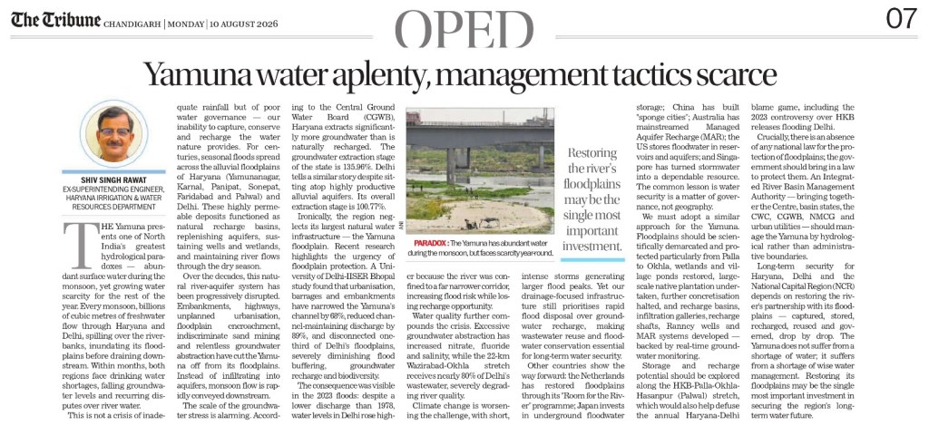
Treat the Yamuna as a Living River This editorial argues that the Yamuna’s worsening condition reflects decades of fragmented governance, excessive sewage discharge, floodplain encroachment and inadequate environmental flows. It concludes that the Yamuna’s revival demands long-term, science-based river basin management, transparent governance, and sustained political commitment, rather than piecemeal clean-up projects focused only on pollution control. Restoring floodplains may be the single most important investment. (Shiv Singh Rawat)
Centre redefines Ganga floodplain, drops ‘construction-free zone’ provision The changes were notified by the Jal Shakti Ministry on Aug. 7 and published in the Gazette on Aug. 10 through the River Ganga (Rejuvenation, Protection and Management) Authorities (Second Amendment) Order, 2026.
Under the amended framework, an “active floodplain” is now defined as an area of the Ganga or its tributaries that is inundated during a flood corresponding to a one-in-five-year return period.
The broader definition of “flood plain” now includes three categories. These are the active floodplain, a regulatory zone covering areas inundated between one-in-five-year and one-in-25-year floods and a warning zone covering areas inundated between one-in-25-year and one-in-100-year floods.
The amendment also retains within the floodplain areas on either side of the Ganga and its tributaries that are inundated during floods corresponding to their greatest flow or a flood with a frequency of once in 100 years.
The earlier 2016 order had defined the floodplain as areas on either side of the river and its tributaries that come under water during floods corresponding to their greatest flow or a flood with a frequency of once in 100 years. The latest notification also changes the language governing the maintenance of the river’s banks and floodplains.
Instead of referring to a “construction free zone”, it states that the banks of the Ganga and its tributaries and their floodplains shall be maintained to reduce pollution sources and pressures and preserve their natural groundwater recharge functions through necessary measures.
The 2016 order had prohibited the construction of permanent or temporary structures for residential, commercial, industrial or other purposes in the Ganga, its banks, its tributaries and the active floodplain, subject to specified exceptions and permissions. The 2026 amendment does not alter that construction provision.
However, with the active floodplain now specifically linked to a one-in-five-year flood, it establishes the regulatory and warning zones as additional categories within the broader floodplain. The notification does not separately specify whether construction will be permitted or prohibited in these newly defined regulatory and warning zones.
DAMS & HEPs IN YAMUNA BASIN
NBWL clears PSP in MP hampering Tiger Corridor The Despite “taking note” of the reservations expressed by a Madhya Pradesh Forest Department officer and acknowledging its location in an area used by tigers and other wildlife, the Standing Committee of the National Board for Wildlife (SC-NBWL) recently recommended clearance for the 1800 MW Panari pumped storage hydropower project in the Panna-Ranipur tiger corridor.
The project requires 411.48 ha forest land in key tiger corridor and the satellite core areas of Panna Tiger Reserve. The corridor in question connects forests around the Panna reserve across Satna and Panna districts to the Ranipur Tiger Reserve in Chitrakoot, UP. Prior to the project’s clearance in the SC-NBWL’s July 9, 2026, meeting, the panel had ordered a site inspection in January to ascertain its impact. The corridor connects forests around the Panna reserve across Satna and Panna districts to the Ranipur Tiger Reserve in Chitrakoot, UP.
2 Landslides at Lakhwar Dam in 3 Days The under-construction Lakhwar dam site on the Yamuna river in Dehradun district of Uttarakhand witnessed two landslide incidents within three days in July 2026. Although there was no loss of life, both incidents damaged construction machinery, exposed the risks faced by workers, and revived concerns about slope stability, construction practices and the suitability of building such a large dam in the fragile Himalayan region.
INTERLINKING OF YAMUNA RIVERS
Ken-Betwa Link: Is there really surplus water to transfer? In this episode, Himanshu Thakkar of SANDRP breaks down the various ways in which the Ken-Betwa river link project doesn’t make sense and the underhanded reasons that it does.
Himanshu Thakkar has stated plainly that “there is no surplus water in the Ken Basin.” He has also pointed to a claim with real bearing on how the project should be understood: that the project’s own Detailed Project Report reportedly admits its primary objective is not to serve drought-hit Bundelkhand villages but to transfer water to the upper Betwa basin districts of Raisen and Vidisha, which lie outside the Bundelkhand region entirely. This represents a significant gap between the project’s public justification and its documented purpose.
He further stated that neither the Environmental Impact Assessment (EIA) nor other available studies provide a clear analysis of how the project will affect downstream villages, water availability, agriculture, and river ecology. He argues that the project has also been accused of violating several important environmental and forest clearance conditions.
Thakkar also criticised the project for relying on outdated hydrological estimates (2003–04) & the absence of any recent scientific assessment of water availability in the Ken basin. He said internal government correspondence itself reflects uncertainty over the annual yield at the proposed Daudhan Dam, while the Central Empowered Committee (CEC) had earlier questioned the assumption that the Ken River has “surplus” water.
He advocates alternative approaches instead of the project. He believes that reviving Bundelkhand’s traditional water harvesting structures, promoting rainwater harvesting, groundwater recharge, and watershed development could provide a far more sustainable and cost-effective solution to the region’s water scarcity.
Protest ends but questions remain There is another fundamental contradiction. The project is presented as a solution to water scarcity, yet it involves the destruction of around three million trees. If the projected benefits of the Ken-Betwa Link Project prove uncertain, an obvious question arises: could its estimated budget of ₹45,000 crore produce better results if invested differently? (Bharat Dogra)
Activist Amit Bhatnagar suspended his fast on July 23, 2026 after the government’s assurance to include the people left out of the rehabilitation process. On July 19 the police dispersed a peaceful protest while the protest leader Amit Bhatnagar, who has been on an indefinite fast close to two weeks, was moved to a hospital.
July 19 marked the 17th day of the ‘Chita Andolan’ and the 14th day of Amit Bhatnagar’s hunger strike. Villagers had on July 3 launched a “Phansi Satyagraha” to draw attention to their concerns over displacement, inadequate rehabilitation and compensation. They say the project, promoted as a solution to water scarcity and irrigation needs in Bundelkhand, has instead brought uncertainty and fear for families living in the submergence area.
Bhatnagar claimed the agitation was disrupted as he was about to expose corruption in the Ken-Betwa link project. Bhatnagar had been arrested in May by the Panna police and later secured bail. From rehabilitation and compensation to environmental concerns, here’s what is driving the protests against the Ken-Betwa river-linking project.
Ministry of Tribal Affairs about Ken Betwa Project The PIB Press Release on the statement of Union Minister of State for Tribal Affairs Shri Durgadas Uikey in Rajya Sabha on Aug 5, 2026 provides no updated status, numbers or their settlement of Forest Rights.
Allegations of gram sabha violations & corruption Leader of the Opposition in the Madhya Pradesh State Assembly alleged gram sabha violations and corruption worth crores in the distribution of compensation and in awarding contracts to companies. He demanded independent investigation.
According to villagers, compensation amounting to around ₹11 crore was sanctioned for houses in Kharihani village. However, available documents indicate that around ₹8 crore was paid to individuals who had no connection to the village or had already left it between 1980 and 1990 and several people genuinely affected were yet to receive compensation.
YAMUNA RIVERS
Noida Plans ₹29,315 Cr Hindon RFD based on Gomti RFD The Noida Authority has revived plans to develop a 25-km Hindon Riverfront on the lines of the Gomti Riverfront in Lucknow at an estimated cost of ₹29,315 crore. The project aims to transform the Hindon riverbanks with a six-lane road, green spaces, walking tracks, seating areas, children’s recreation facilities, and tourism infrastructure, with completion targeted by 2031.
The project will be implemented in three phases, with nearly 50% of the work planned during the first phase. A major challenge is the rehabilitation of around 10,000 families living along the riverbanks, estimated to cost ₹4,000 crore. The proposal also includes ₹15,000 crore for land acquisition, while the six-lane riverfront road alone is expected to cost ₹2,425 crore.
An earlier attempt to implement the project in 2012–13 failed despite land acquisition. Officials say illegal colonies have since come up on parts of the proposed land, making recovery and rehabilitation more difficult. The proposal has now been sent to the Uttar Pradesh Government for final approval. The Noida Authority will execute the project after obtaining the required No Objection Certificate (NOC) from the Irrigation Department, with the state government taking the final decision on implementation.
Gomti RFD: Hidden environmental price The report argues that the Gomti Riverfront Development Project in Lucknow has transformed the river into an engineered urban corridor at a significant ecological cost. Approved in March 2015 at an estimated cost of ₹656.58 crore, the project involved channelising an 8.1-km stretch of the river, constructing concrete embankments on both sides, narrowing the floodplain from about 450 metres to 240 metres, and reclaiming nearly 200 hectares of floodplain land for urban use. While the project aimed to beautify the riverfront, improve flood management, create recreational spaces and clean the river, the article argues that many of these objectives have not been achieved.
Youth cleans up Banas river The Banas River sustains ecosystems and communities across a large stretch of Rajasthan, yet pollution had reached even its upper reaches near the river’s source. Disturbed by the growing neglect, a group of young volunteers came together to remove over 100 sacks of waste from the river and its banks, inspiring wider community participation. Their initiative, supported by local organizations, has expanded into campaigns for waste reduction and tree planting. (by Bharat Dogra)
YAMUNA FLOWS
Govt plans two initiatives to enhance e-flows The two plans include to curb water loss by remodelling of part of Munak canal system and to reserve at least 30% of inflow water after the construction of three upcoming dams are under consideration. The proposals put forward by Haryana govt were presented in the Yamuna rejuvenation review meeting held by the union home secretary last week.
The 102-km Munak canal, constructed between 2003 and 2012, carries nearly 37% of Delhi’s raw water from Haryana daily, through the Carrier Lined Channel (CLC) and Delhi Sub-Branch (DSB), to the Haiderpur water treatment plant. To reduce water losses in the Munak canal system, the first plan proposes laying down 25km of fresh pipelines from the Khubru to Kakroi head of the canal system at an estimated cost of ₹750 crore.
This should be followed by the rehabilitation of 41.6km of the DSB. The canal currently sees more than 30% water transmission loss and, after the remodelling, could see losses go down below 5%, said officials. “Haryana has proposed that the entire cost of remodeling the system should be borne by Delhi and the Union government. Haryana will ensure that 330 cusecs of water reaches Haiderpur. The water saved in transmission loss should be diverted to the river as part of the e-flow,” said one of the officials.
River without Flows Even During Monsoon It is well known that excessive diversion of Yamuna waters at the Hathnikund Barrage (HKB) in Yamuna Nagar, Haryana over the past two-and-a-half decades has turned the perennial river into a seasonal stream in its upper reaches during the lean season. However, an analysis of the Central Water Commission’s (CWC) hourly discharge figures and hydrographs since July 1, 2026 reveals that the river is now being deprived of its essential flows even during the monsoon.
Higher monsoon inflows fail to boost Yamuna’s flow Monsoon rains increased water inflows at Hathnikund Barrage over the past fortnight. However, most additional water was diverted into canals, leaving river flows unchanged. SANDRP expresses concern that this practice hinders the river’s natural ability to dilute pollutants. Environmental flows recommended by NIH for the Yamuna remain unnotified. Restoring adequate environmental flows upstream is critical for the Yamuna’s long-term revival.
YAMUNA RIVER FRONT
SC stops Vrindavan RFD The Supreme Court on 21 July 2026 ordered a status quo on all construction activities along the Yamuna river in Vrindavan, expressing concern that ongoing works could reduce the river’s channel width and affect its ecological flow. A Division Bench of Justice J.B. Pardiwala and Justice K.V. Viswanathan termed the situation “very serious” and emphasized the need to protect the natural flow of the Yamuna.
The order was passed while hearing Ashok Kumar Sinha v. Union of India & Ors. (Civil Appeal No. 3367/2020), after two interlocutory applications highlighted construction activities near the Yamuna that could lead to river channel shrinkage. The Court directed that a detailed report on the issues raised must be submitted before the next hearing on 23 Sep 2026. The order prevents any further construction in the affected area until further directions.
NGT examined Vrindavan RFD Violations The NGT on 10 June 2026 took cognizance of allegations that the ongoing Yamuna riverfront development project at Keshi Ghat, Vrindavan was being carried out beyond the environmental permissions granted by authorities. The petition alleged that construction by the Uttar Pradesh Irrigation and Water Resources Department exceeded the approved scope, with works reportedly extending into the Yamuna river channel. The applicant argued that permissions from the NMCG and Taj Trapezium Zone (TTZ) Authority were limited to restoration and beautification of the existing ghat and did not allow additional construction inside the river area.
YAMUNA POLLUTION
Sludge may be behind ammonia spikes: CPCB Accumulated sludge in the Yamuna bed at Wazirabad may be contributing to ammonia spikes that have caused recent disruptions in Delhi’s water supply, preliminary findings of a Central Pollution Control Board (CPCB) study based on samples collected from the pondage area have shown, government officials said. The study was undertaken at the behest of the Upper Yamuna River Board (UYRB), which is examining the causes of recurring ammonia spikes and their impact on Delhi’s water supply.
The findings also come as the DJB prepares to dredge and revive the Wazirabad pondage area up to Ram Ghat. The project, approved last month, will involve removing around 387,000 cubic metres of silt, with work expected to begin after mid-Sept, once the monsoon ends.
But dredging the pondage area may not provide a lasting solution. A one-time de-sludging exercise could be followed by fresh accumulation as nitrogen-rich water continues to flow into the river through drains, a DJB official said. “The long-term situation will improve only when nitrogen levels in the water coming through drains are brought within acceptable limits. The CPCB will study the issue thoroughly and suggest solutions,” the official said.
Garbage dumped at 33 Yamuna bank Sites A CPCB report submitted to the NGT on July 22, 2026, revealed that solid waste was found at 33 of 52 monitored locations along the Yamuna River, Sahibi River (Najafgarh Drain), Shahdara Drain, and their tributary drains between May 2025 and April 2026. The monitoring, carried out jointly by CPCB, the Delhi Pollution Control Committee (DPCC), and the Delhi Jal Board (DJB), highlights continued illegal dumping despite ongoing Yamuna clean-up efforts.
Following the findings, CPCB and DPCC directed multiple civic agencies to remove waste, prevent further dumping, and submit action-taken reports. The matter came under NGT scrutiny after a media report alleged that waste from the Okhla landfill was being dumped along the Yamuna floodplain. The CPCB also reported that, despite extensive biomining, 109.37 lakh metric tonnes of legacy waste remained at Delhi’s Bhalswa, Ghazipur, and Okhla landfill sites as of May 31, 2026.
Yamuna pollution markers remain high The pollution parameters of the Yamuna have either remained constant or seen a marginal dip in July compared to the previous month, according to the latest assessment.
Delhi’s Yamuna biologically dead A comparison of DPCC water quality reports from May 2025 and May 2026, shows that while pollution indicators have improved marginally at a few locations, the river remains biologically dead across much of Delhi.
The deterioration comes weeks after CM launched the ‘Clean Delhi with CM’ campaign at Chilla village, calling the Yamuna a river revered by millions and promising its scientific and sustainable rejuvenation. The government has announced plans to modernise STPs, expand sewer networks and tap drains carrying untreated wastewater into the river in a phased manner. Yet the latest DPCC data suggests these measures have not yet translated into meaningful improvements in water quality.
Residents flag illegal sewage dumping into stormwater drain Residents of New Palam Vihar have alleged that private septic tankers are illegally dumping untreated sewage into a stormwater drain along the Dwarka Expressway every day after creating an unauthorised access point by damaging a section of the drain near the Sector 110 entry. According to residents, dozens of tankers arrive throughout the day and empty untreated sewage directly into the drain instead of transporting it to authorised STPs, allegedly to avoid paying treatment charges. Residents have demanded that the vehicles be seized, operators booked, and environmental compensation imposed on those found responsible.
NGT pulls up Haryana On 17 July 2026, the NGT sharply criticised the Haryana govt over the accumulation of nearly 30 lakh metric tonnes of legacy waste and the continued discharge of untreated sewage across the state. The NGT warned that continued non-compliance posed serious risks to public health, groundwater, rivers and the environment, and stressed the need for strict accountability and effective implementation of waste management measures.
Only 3 of 132 illegal bleach units paid EC in 9 years A list of bleach houses and bleaching units in Panipat – against which the state pollution board took closure action between 2016 and 2025 – has highlighted the gap between enforcement and recovery of damages. During these nine years, Haryana State Pollution Control Board ordered the closure of 132 bleach houses and bleaching units, but environmental compensation (EC) has been recovered in only three cases so far, as per an RTI reply. The RTI show that the process of finalising & recovering compensation remains incomplete in a large number of cases, with the board attributing the delay in the 32 NGT-linked cases to pending observations from higher authority.
Illegal jeans factory sealed thrice, still operational in Gurgaon Trilok Dyeing in Rahaka was sealed three times, but was still found operational, a complaint has claimed. According to the complaint – filed by Delhi-based environmental activist Varun Gulati with HSPCB – environmental compensation of Rs 1.6 crore had been imposed on the unit by the board on one occasion. The matter has reached the vigilance wing of HSPCB, with its chief vigilance officer (CVO) seeking an action-taken report from the board’s member secretary.
Haryana unveils revival plan with 18 new STPs Reviewing the Yamuna Action Plan roadmap on July 30, Chief Secretary Anurag Rastogi directed all departments to expedite projects for sewage treatment, industrial pollution control, solid waste management and restoration of water bodies in the Yamuna basin. The state is upgrading six existing STPs (284 MLD) and developing 18 new STPs with a combined capacity of 621 MLD at an estimated cost of ₹932.18 crore across Gurugram, Faridabad, Sonipat, Panipat and Bahadurgarh.
To improve industrial effluent management, 12 new CETPs with a total capacity of 187.25 MLD have been proposed to serve 6,417 industries in the Yamuna catchment. The plan also includes Integrated Solid Waste Management clusters across all 33 urban local bodies, establishment of six biogas plants for dairy waste processing, and rejuvenation of 61 ponds and water bodies, of which 11 have already been restored. Officials also noted that Haryana currently operates 86 STPs, 17 CETPs, along with biomedical, hazardous and e-waste treatment facilities.
Utilisation of pollution control board funds The NGT, on Feb 23, 2026, said the matter is an indication of a larger problem across the country wherein attempts were being made to divert funds for development works which have to be taken up by other statutory bodies. The NGT directed the SPCB / PCC of the states and Union Territories to file their responses on the matter. When the matter was taken up on August 3, 2026, the court was informed that some PCBs / PCCs had filed their responses.
The counsel appearing for the PCBs of Tamil Nadu, Meghalaya, Uttar Pradesh, Kerala, and the PCCs of the Union Territory of Daman Diu and Ladakh sought more time to file an additional reply. CPCB sought time to file its response. National Mission for Clean Ganga was also asked to submit its reply. Counsel for the HSPCB sought permission to utilize the EC fund to set up Micro STPs in the catchment area of the Yamuna river.
SC Eases Industrial Approvals in Taj Trapezium Zone On July 23, 2026, the Supreme Court allowed the Taj Trapezium Zone (TTZ) Authority to process over 410 pending applications for the establishment, expansion or relocation of mostly small and medium industries. Applications can be approved without court permission only if the TTZ Authority, the Central Empowered Committee (CEC) and the NEERI unanimously classify them as non-polluting. All decisions must be made public on the CEC website for objections and remain subject to judicial review if required.
The relaxation will continue until a cumulative impact assessment, vision document and final list of non-polluting industries are completed. The Court also referred two applications seeking permission to fell 5,812 trees for NH-21 improvements in Bharatpur and 188 trees for a road project in Uttar Pradesh within the TTZ to the CEC for expert examination.
YAMUNA FISH, FISHERFOLKS
Microplastics in Yamuna fish pose health risks Microplastics accumulating in freshwater fish from the Yamuna could pose long-term health risks ranging from neuro-inflammation and cognitive impairment to cellular damage, doctors said, after a recent study reported widespread contamination in fish from the river.
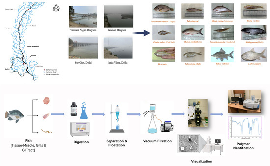
The researchers analysed 220 fish representing 12 freshwater species collected from four locations across Haryana and Delhi, and found 1,678 microplastic particles. They reported significantly higher microplastic accumulation in fish collected from the Delhi stretch of the Yamuna than at upstream locations, describing the work as a first-of-its-kind scientific investigation that provides baseline data on microplastic pollution, ecological risks and potential food safety concerns in Indian freshwater ecosystems.
Mass Fish Death Reported in Yamuna at Gausganj On July 22, thousands of dead fish were found floating along a 5-km stretch of the Yamuna River from Nayapurwa to Manki Ghat in Gausganj, Kanpur Dehat, Uttar Pradesh, alarming local residents. According to the Fisheries Department, the fish kill may have been caused by polluted or chemical-laden water flowing from upstream, which likely increased the biochemical oxygen demand (BOD) and reduced dissolved oxygen levels in the river.
Officials from the Fisheries Department and the Pollution Control Board collected water samples and launched an investigation. They noted that there are no nearby industrial units, indicating that polluted runoff, silt, and waste carried from upstream areas may be responsible. The exact cause will be determined after laboratory analysis.
The large-scale fish mortality during the breeding season has raised concerns about the survival of fish species. The Fisheries Department has begun an investigation to determine the exact cause of the deaths. To protect fish populations during their breeding season, fishing and riverbed mining are completely prohibited from June 1 to August 31 every year.
Regional Pollution Control Officer Manoj Chaurasia said that during the monsoon, silt and various types of waste are washed into the river, adversely affecting aquatic life. He noted that there are no industrial units near the site where the fish died, suggesting that polluted water may have flowed in from upstream areas. He added that low water levels and stagnant conditions along the riverbanks may have increased the concentration and impact of harmful substances, leading to the mass fish deaths.
MINING IN YAMUNA RIVERS
Illegal mining in Baghpat The NGT, on July 14, 2026 expressed dissatisfaction with the report filed by the Director, Geology and Mining Directorate, Uttar Pradesh, concerning illegal mining in Baghpat district. The court pointed out that the report was not filed by way of affidavit and was not signed by the Director, Geology and Mining, Uttar Pradesh or any other duly authorized officer. The report also fails to provide complete information regarding the implementation of the court’s directions and action taken concerning incidents of illegal mining particularly in district Baghpat and the measures taken by the District Task Force Baghpat regarding these incidents.
The court directed the Director, Geology and Mining Directorate, to file a compliance report. Uttar Pradesh Pollution Control Board (UPPCB) filed a compliance affidavit on April 10, 2026 mentioning that Smart Mart Stores had deposited an EC amount of Rs 4,63,563 on November 20, 2025 and that this amount will be utilized for plantation along a 5 km stretch of the bandh between Mavikalan and village Alipur.
ARVALI PROTECTION
Tribals challenges mining to protect river, hills The report documents the resistance of the Meena Adivasi community in Deepawas village, Neem Ka Thana (Sikar district), Rajasthan, against a proposed iron ore mining project, arguing that it threatens their forests, water sources, agricultural land and the fragile Aravalli hills. Villagers have adopted the slogan “For our river, for our hills”, describing the struggle as one to protect their environment and livelihoods rather than merely oppose mining.
The mining lease, covering about 180 hectares, includes nearly 149 hectares of forest land. Residents allege that mining would destroy hill slopes, reduce groundwater recharge, pollute local streams and affect the seasonal river on which nearby villages depend. The community also fears the loss of biodiversity and grazing land that supports their agriculture and livestock.
Expand Aravali definition, hear local voices The views were expressed during consultations with the panel in the city, which is examining issues relating to the definition, delineation and protection of Aravali hills and ranges. The consultations have brought out competing demands over the future of Aravalis, with environmentalists and local residents seeking greater participation in the consultation process.
A key concern raised during the consultation was the limited participation of rural communities. Several residents from Mangar, Anangpur and Damdama suggested that the panel should visit affected areas and interact with local experts and stakeholders to understand ground-level conditions. Others agreed that the consultation needed to be more inclusive & structured.
Meanwhile, Aravali Bachao Citizens Movement has proposed the creation of an ‘Aravali Biosphere Reserve’ spread across approximately 1,43,577 sq km across multiple states, arguing that protection should take a landscape-level approach covering the hills, valleys, rivers, streams, aquifers, biodiversity and human health. In its submission to HPC, the group opposed a narrow legislative or judicial definition of Aravalis and said tribal and biodiversity protection should not take a back seat in the name of “sustainable mining”.
SC panel to start survey for Aravalis definition Supreme Court-appointed high-powered committee (HPC), tasked with examining the definition and conservation of the Aravalis, will begin its six-day field survey on Aug. 6 with visits to key ecological sites in Delhi-NCR before travelling across Rajasthan. The committee will return to Delhi on Aug 11. A stakeholder consultation with Haryana representatives is scheduled in Delhi from 4-6pm the same day.
The field inspections are a key part of SC’s exercise to develop a scientific and legally tenable framework for identifying and conserving the Aravali hills. During the visit, the committee will assess ecological, geological, hydrological, biodiversity, mining, land-use and socio-economic characteristics of the landscape. It is to submit its report to the apex court by Aug 31.
SC Panel Invites Public Suggestions for Aravali Protection A Supreme Court-appointed high-powered committee has invited public suggestions, representations and documentary evidence on the protection of the Aravali hills, with its report due to the Supreme Court by 31 August 2026. The Union Environment Ministry has asked stakeholders from Haryana, Rajasthan, Delhi, Gujarat and other Aravali states to submit inputs within 21 days through email or a dedicated portal.
NGT Rebukes MoEF&CC over Raisina Aravalis Case The NGT has reprimanded the MoEF for failing to appear in proceedings concerning environmental violations in the ecologically sensitive Raisina Aravalis despite being served notice. The Tribunal directed the Ministry to appear at the next hearing or appoint legal representation and file its response to an intervention application within two weeks.
A forest department survey has identified at least 500 illegal farmhouses in Gurugram’s Aravali region, while environmentalists have criticised delays in enforcement, noting that construction has continued despite repeated tribunal directives. Next hearing on 1 Sept 2026.
Fresh construction come up again in protected Aravalis Fresh construction activity appears to be continuing inside Ansal Aravali Retreat in Raisina’s protected Aravalis. A field visit on Aug 5 found more than two dozen active construction sites in the area despite ongoing proceedings before NGT and its earlier directions to restore the ecologically sensitive landscape. The area falls under the ‘gair mumkin pahar’ or uncultivable hill category and is notified under Section 4 of Punjab Land Preservation Act (PLPA), which prohibits tree felling. It is also protected under the Union environment ministry’s Aravali Notification, under which construction of buildings, roads, electrification works and felling of trees are not permitted without approval.
NGT shuts stone mine over illegal access road in Aravali The NGT has ordered the closure of a stone mining operation in Haryana’s Mahendergarh district after finding that the leaseholder accessed the mine through an unauthorised road passing through Aravali Plantation without mandatory forest clearance. The tribunal also held that the company violated multiple conditions of its environmental clearance (EC).
Stop road construction in Mangar Bani: NGT to forest chief The paving of an internal road in Mangar Bani has now reached NGT. The tribunal has directed Haryana’s principal chief conservator of forests (PCCF) to ensure that no illegal construction takes place in the ecologically sensitive area. NGT has also asked the PCCF to file a comprehensive report at least a week before the next hearing. The matter has been listed for Oct 16. Last month, the forest department had stopped the work after paver blocks were laid at the site.
Action sought over illegal forest land diversion at Surajkund On 17 July 2026, MoEF appointed committee recommended disciplinary action against several forest and revenue officials for the unauthorised diversion of forest land in the Surajkund area of Faridabad. The panel found that officials had allowed or failed to prevent the use of protected forest land for non-forest purposes without obtaining the mandatory approvals under the Forest (Conservation) Act, indicating serious administrative lapses.
YAMUNA WETLANDS
10 km radius buffer for mining extends to all wetland reserves: SC The Supreme Court orally clarified on Aug 4, 2026 that a direction banning mining activities within a 10 km radius of the Asan wetland conservation reserve, a Ramsar site in Uttarakhand, would apply to other wetland conservation reserves across the country for the sake of parity. “Wherever it is a community or a wetland conservation reserve, Asan [directions] will be applied. Wetlands are in a different category…” Justice Joymalya Bagchi, part of the Bench headed by Chief Justice of India Surya Kant, observed. The court was hearing an application filed by Himachal Pradesh arguing that the 10 km radius restriction imposed in Uttarakhand should not apply to it.
On February 14, 2024, the apex court passed an interim order that “no mining activities would be carried out within 10 km radius of the Asan wetland conservation reserve without the project proponent obtaining permission from the Standing Committee of the National Board of Wildlife and/or MoEF&CC. “The additional reason that weighs with us in issuing this direction is due to the importance given to the wetland, which was declared to be Ramsar site under the Ramsar Convention”, said SC.
The high court of Uttrakhand in its order of July 2, 2015 held that mining around Asan wetland conservation reserve will be permitted only if the mining activity is located beyond 10 kilometres from the wetland site. This order of the HC was initially challenged by the Uttarakhand government, but the state withdrew the appeal to file a review against the HC order. The HC dismissed the review plea against which the state did not file an appeal making it final and binding against the state.
Considering these facts, the top court in its February 2024 order said, “By way of interim order we direct that no mining activities would be carried out within 10 kms. radius of the Asan Wetland Conservation Reserve without the project proponent obtaining permission from the Standing Committee of the National Board of Wildlife and/or MoEFCC.” Later in October 2024, the court clarified that its order shall not be seen as laying down universal guidelines for all conservation reserves and community reserves.
NGT orders Bhoj Wetland encroachments removed by Aug 31 The NGT on July 29 has issued stringent directions to protect the ecologically sensitive Bhoj Wetland and remove encroachments within the 50-metre Full Tank Level (FTL) zone, reaffirming that environmental conservation must take precedence over unauthorised development.
Hearing four connected petitions related to Bhoj Wetland, Kaliyasot Dam, Kerwa Dam and the Bhopal Lake system, the Tribunal directed the district administration to intensify action against illegal constructions and ensure strict compliance with wetland conservation norms.
The Tribunal was also urged to ensure scientific demarcation of the boundaries of Bhoj Lake, Kaliyasot Dam and Kerwa Dam, regulate the use of chemical fertilisers and pesticides in surrounding agricultural areas to prevent water pollution, and protect the proposed 150-hectare botanical garden.
According to the administration’s survey, a total of 117 encroachments were identified within the 50- metre FTL zone, comprising 68 encroachments on govt land and 49 encroachments on private land. It was further submitted that 45 encroachments have already been removed, consisting of 23 encroachments on govt land and 22 on private land and 72 encroachments are yet to be removed, comprising 45 encroachments on govt land and 27 on private land.
Environmental activist Subhash C Pandey, appearing in person in one of the two petitions before NGT, said that the previous order has not been strictly complied with. He raised the issue of identification and demarcation of Kaliasot dam and Kerwa dam and the Upper lake. He also raised the issue of prevention of use of chemicals in farming surrounding the wetland area causing chemical contamination into the water adversely affecting the aquatic life and further causing an adverse effect on the human as the water is being supplied to the citizens of Bhopal.
Hartshwardhan Tiwari, counsel for another petitioner Rashid Noor Khan submitted that encroachments around the Upper Lake have only increased in spite of the actions taken by the district administration and BMC.
Over Half of Noida’s Water Bodies Beyond Recovery, NGT Told A report submitted to the NGT has revealed that more than half of the water bodies in Gautam Buddha Nagar district are beyond recovery due to extensive encroachments, urbanisation and irreversible ecological degradation. According to the district administration, only a limited number of ponds and wetlands can still be restored, while many have been completely built over or lost their hydrological character. The case is part of the tribunal’s ongoing monitoring of wetland and water body conservation in the district.
Status of waterbodies in GB Nagar The NGT directed the district magistrate of Gautam Budh Nagar, Uttar Pradesh July 14, 2026 to file a fresh report stating the status of waterbodies in the district. The report should contain information on waterbodies in tabulated form with specific reference to the three authorities, the area of each pond / waterbody and the area encroached upon and the encroachers. The counsel for the District Magistrate, Gautam Budh Nagar submits that the report would be filed within eight weeks.
The invisible threat of nutrient pollution Recent water quality investigations clearly demonstrate that Hauz Khas Lake is experiencing continuous nutrient enrichment resulting from anthropogenic activities. (Prabhat Kumar Tanwar, Sarita Bansal, N Raghuram)
YAMUNA WATER RESOURCES MANAGEMENT
Raj, MP sign JJM2.0 reform MoUs The agreements commit the states to implement 11 structural reforms aimed at improving governance, service delivery, water quality monitoring, source sustainability, digital data management, community participation, financial sustainability, and capacity building in rural drinking water systems. The reforms also mandate a Gram Panchayat-led, community-centred model for operation and maintenance of rural water supply schemes, along with adoption of digital decision-support systems and annual public water campaigns.
Centre releases ₹486 cr for Rajasthan’s JJM On 17 July 2026, the Centre approved the release of ₹486.04 crore to Rajasthan under Jal Jeevan Mission (JJM) 2.0, restoring the state’s access to central funding after it addressed concerns over the implementation of the scheme. The sanctioned amount includes ₹277.91 crore for the general category, ₹160.65 crore for Scheduled Caste (SC) areas, and ₹47.48 crore for Scheduled Tribe (ST) areas.
YAMUNA URBAN WATER
NGT Directs DJB to Act Against Paharganj Hotels The NGT on July 17, 2026, expressed concern over the slow progress by the DJB in regulating groundwater extraction by hotels and guest houses in Delhi’s Paharganj area. The tribunal noted that only 162 out of 555 establishments had installed piezometers or digital water meters in the past three months, while 393 establishments continued extracting groundwater without measurement systems.
DJB informed the tribunal that notices had been issued to remaining establishments on July 7, 2026, directing them to install digital meters or piezometers within seven days, failing which legal action would be initiated. The tribunal had earlier, on April 1, 2026, ordered installation of monitoring devices to assess groundwater extraction and enable regulation and recovery of charges. DJB has been asked to submit a compliance report.
Delhi may link borewell permits to RWH On 18 July 2026, the Delhi government announced that it is examining a proposal to make rainwater harvesting mandatory for all new borewell permissions to address the city’s rapidly declining groundwater levels.
₹2,574 cr ‘Wazirabad Water Supply Improvement Project Delhi Water Minister Parvesh Sahib Singh on Aug 10 said that in-principle approval has been given by the Screening Committee of the Department of Economic Affairs (DEA) for the “long-awaited” ₹2,574 crore Asian Development Bank-assisted ‘Wazirabad Water Supply Improvement Project’. Under the project, old, damaged and undersized pipelines will be replaced, while new transmission and distribution lines will be laid wherever required. Existing networks will be interconnected to improve pressure, distribution and reliability
Gurugram’s forgotten neighbourhoods Scarcity and private tankers are routine at the end of Gurugram’s water network. Residents say that dwindling groundwater and tubewells are being used to make up for shortages.
HC orders fresh GW testing near Union Carbide site On July 24, 2026, the Madhya Pradesh High Court directed the Madhya Pradesh Pollution Control Board (MPPCB) to assess the current status of groundwater contamination in 42 colonies surrounding the abandoned Union Carbide plant in Bhopal. The order came while hearing a PIL filed by NGOs representing Bhopal gas tragedy survivors.
MONSOON IN YAMUNA BASIN
Delhi crosses August rainfall average in first 8 days The national capital has crossed its average monthly rainfall for August in just the first eight days of the month, with the Safdarjung Observatory recording 230.1 mm of rain so far. Delhi on Aug. 08 recorded its wettest August day in two years.
Gurgaon gets surplus rains in 12 days Till July 31, cumulative rainfall was only 193mm — 13% below normal. Around 42% of the season’s rainfall so far has come in just 12 days of Aug, effectively wiping out the entire deficit recorded during June and July.
Monsoon revives dry Aravali slopes Water is now flowing through the valleys, spilling over rocky outcrops and turning seasonal streams into temporary waterfalls, from Ghamroj, Gairatpur Bas, Khod Basai and Kotla to stretches of the range near Faridabad. In the space of a few heavy showers, waterfalls have appeared on slopes that were bone dry a fortnight ago. Check dams built by the forest department are full to the brim and spilling over, and rocky depressions are now quiet pools ringed by startlingly green vegetation.
FLOOD IN YAMUNA BASIN
Yamuna rises after season’s highest Hathnikund release According to CWC, the Yamuna began rising on Aug. 05, with the water level at the Old Railway Bridge increasing by 1.12m — from 202.38m at 1am to 203.50m at 8pm. According to the CWC forecast issued on Wednesday morning, the water level is likely to rise by around 1.5m over the next two days. Bhim Singh Rawat, SANDRP, said, “Data from upstream shows the water level has stabilised near Baghpat while it is still rising near Palla. The river is likely to rise further over the next 24 hours and may breach the warning level for the first time this season”.
Flooding in Delhi during monsoon De-silting of 77 drains of the Irrigation and Flood Control Department (I&FC) Delhi has been carried out before the monsoon season 2026 and 3.105 million tonnes silt has been desilted from all the 77 drains. De-silting of all other drains falling under the jurisdiction of the Municipal Corporation of Delhi (MCD) and the Public Works Department (PWD) shall be carried out by them. This was stated in the report filed by the I&FC and taken up by the NGT, August 3, 2026.
The court was informed that for assessing long-term measures, the Central Water and Power Research Station (CWPRS), Pune, has been assigned the work of scientific assessment of River Yamuna by application of hybrid model. Further measures would be taken after receiving the CWPRS report. CWPRS encountered technical limitations while preparing the 1:100-year floodplain map with 1-metre contour lines, as the data provided by the Survey of India was found to be inadequate for the required analysis.
To address the gap, as decided during the oversight committee meeting wherein the progress of the study is being monitored, on November 14, 2025, IFCD will procure the data from Airbus. In this regard, work has already been awarded to Micronet Spacetech LLP and data is shared with CWPRS Pune, the court was informed.
Monsoon misery drowns areas of Noida, Gurugram In Noida, there were reports of waterlogging on several arterial roads, service lanes and underpasses, slowing traffic during peak hours. Commuters reported long delays as vehicles crawled through flooded stretches.
Gurgaon Civil Hospital floods every monsoon Even after a Rs 1.2-crore renovation last year, officials say the flooding persists because of an ageing building and an external sewer network that backflows during heavy rain. The hospital’s basement was inundated again on Aug. 6, with stagnant water spread across the floor and housekeeping equipment placed nearby as staff tried to keep the area functional.
As a longer-term fix, the hospital has commissioned a survey for a STP within the campus. The survey, expected within 10 to 15 days, will determine the treatment capacity needed before the project is designed. Gupta acknowledged, however, that an STP alone may not resolve the flooding if the external sewer network keeps overflowing during heavy rainfall. The problem is compounded by the building itself. Handed over by HSVP in 2012, it has structural defects that let rainwater seep through walls and tile joints as flagged by PWD.
Heavy rain leaves Noida airport waterlogged A spell of heavy rain led to temporary waterlogging near the terminal and parking area of Noida International Airport in Jewar on Aug. 11, with videos triggering a wave of online mockery over the newly launched airport’s drainage setup. The incident comes less than five months after PM Narendra Modi inaugurated Phase I of Noida International Airport on Mar 28, 2026.
DISASTERS IN YAMUNA BASIN
Recurring Landslides Disrupt Yamunotri Highway With the onset of the monsoon, even light rainfall has begun triggering frequent landslides near Syana Chatti and Hanuman Chatti on the Yamunotri National Highway.
Heavy rains disrupts Yamunotri NH Rain since Aug. 05 night triggered landslides, rockfalls, and debris at several locations, forcing the closure of the Yamunotri Highway and leaving hundreds of pilgrims and local residents stranded. Meanwhile, the Yamuna River remains in spate near Syanachatti, worsening the situation for local residents. For more than a week, floodwaters have inundated the ground floors of several hotels and buildings, and rising river levels continue to cause hardship in the area.
Landslide on Yamunotri NH As per Aug. 01 report, a major landslide occurred on the Yamunotri NH near Syana Chatti in the Barkot area after a hillside suddenly collapsed. Large boulders and huge quantities of debris rushed downslope, reaching the residential area of Syana Chatti and triggering panic among residents and pilgrims. People rushed out of their homes and hotels to safer locations after hearing the loud noise of the landslide and seeing debris approaching.
Landslides block Yamunotri NH Intermittent heavy rainfall in the Yamunotri Valley has triggered multiple landslides along the Yamunotri Highway, bringing traffic to a complete halt since early July 31 after debris and large boulders blocked the road.
Debris threatens bridge at Syana Chatti Heavy flows of debris and large boulders surged through the Kupra Khad at Syana Chatti on the Yamunotri Highway on July 29, triggering panic among local residents. Continuous rainfall caused the stream to carry a large volume of mud, rocks, and debris downstream, posing a serious threat to the under-construction Bailey bridge at the site. As per July 12 report, landslides severely damaged the Yamunotri Highway near Syanachatti, washing away nearly 100 metres of the road and it remained closed even two days after the incident.
Yamunotri NH blocked by landslide As per May 27, 2026 report, the Yamunotri NH-507 in Uttarkashi district has been blocked near Sarigad due to a landslide. Debris continues to fall at the site, making the area unsafe.
Worker dies in rockfall in Silkyara tunnel A worker died in a rockfall inside the under-construction 4.5-km Silkyara-Barkot tunnel in Uttarakhand.
RELEVANT REPORTS
Riparian Forest 22 degrees Celsius cooler than the RFD! Tara Tanmayi writes about an interesting Citizens Science Initiative in Pune to understand a relatively unknown impact of river front development project in Pune.
Walking rivers initiative By encouraging communities to view rivers as living ecosystems rather than merely water sources, the initiative seeks to strengthen public participation in conserving and restoring India’s freshwater commons.
NGT questions floodplain demarcation in Varanasi On July 22, 2026, the NGT directed the NMCG to clarify the basis for using 1-in-5-year and 1-in-25-year flood return periods to demarcate the Ganga floodplain in Varanasi, observing that this appears inconsistent with the River Ganga (Rejuvenation, Protection and Management) Authorities Order, 2016, which defines the floodplain based on the 1-in-100-year highest flood level.
SC gives Bihar 6 weeks to clear Ganga encroachments The Supreme Court has directed the Bihar government to remove all unauthorized structures and encroachments along the stretch between Nauzar Ghat and Nurpur Ghat in Patna within six weeks. The bench said the matter required immediate attention after being informed that no effective steps had been taken despite earlier directions.
The court sought a compliance report “by a competent authority by the next date of hearing” and warned that “any laxity in this regard will be viewed strictly”.
Namami Gange: Billions spent, yet Ganga remains polluted Experts argue that the focus has been on infrastructure creation rather than ensuring effective operation, monitoring, ecological restoration and enforcement.
NMCG framework for small rivers conservation The Small rivers need distinct conservation strategy, says NMCG draft framework.
Energy-positive wastewater management in urbanizing tropical cities The study devotes considerable attention to impacts on the Ganges River, particularly during low-flow summer periods when pollutant concentrations become most severe.
SANDRP
Also see: Yamuna Manthan July 2026 & June 2026
Follow us on: www.facebook.com/sandrp.in; https://twitter.com/Indian_Rivers


