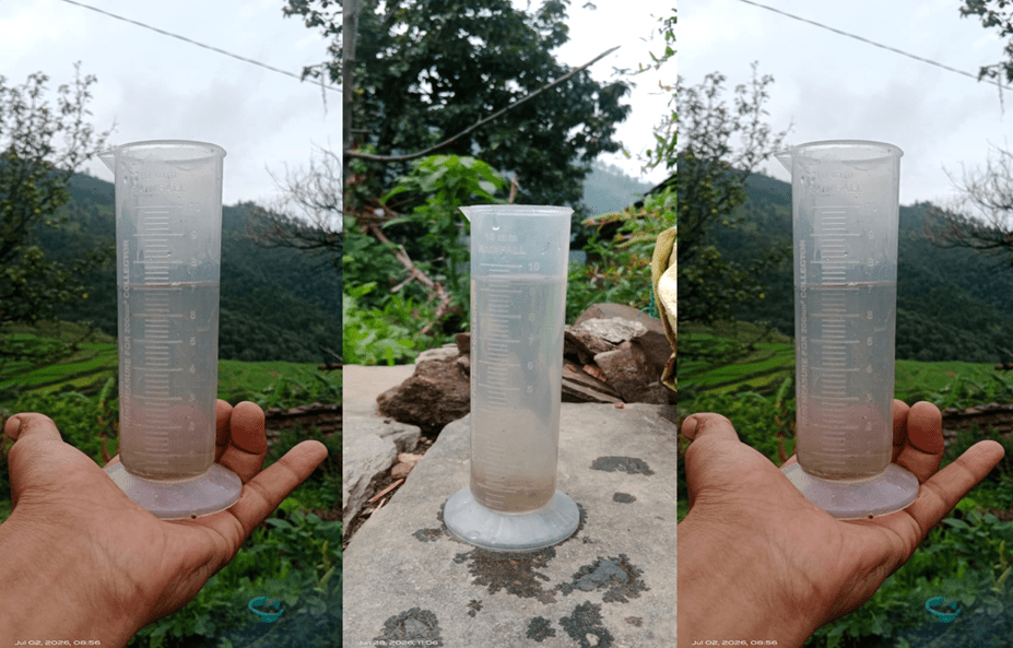
(Feature Image: A manual rain guage in Syunsal village of Pauri district, Uttarakhand. Bhim Singh Rawat/SANDRP)
Two reports from Karnataka this week highlight that over half of the 6605 rain gauges in Karnataka are non-functional. Earlier we saw that IMD does not even report rainfall for at least 11 districts in Arunachal Pradesh alone, possibly since it does not have adequate number of rain gauges in those newly formed districts of Arunachal Pradesh. IMD’s Annual Report for 2025 says P 59): “IMD operates 1,008 Automatic Weather Stations (AWS), 1,382 Automatic Rain Gauge (ARG) stations, 200 Agro-AWS, 5 Automatic Snow Gauge (ASG) stations”. That comes to 2395 locations where rain or snow is measured by IMD, going by the Annual Report. IMD apparently uses rainfall data from other agencies, but their number is not given in the report. IMD also has a large number of manual rain gauges, but the IMD Annual Report does not provide those numbers.
The IMD annual report also says (P 94): “The density of observations systems such as automatic weather stations and rain gauges over hilly terrain regions are sparse. The Panel recommends installation of observational instruments on the hilly terrains for the proper monitoring of rainfall activity over hilly terrains which could trigger landslides.” This is supplemented by, the report says (p 101): “Indian Precipitation Ensemble Dataset (IPED) is India’s first observation-based ensemble rainfall dataset at a resolution of about 10 kilometres compared to existing 25 km resolution.” 10 km resolution data means one observation in about 100 sq km area, 25 km resolution data means one observation in about 625 sq km area. There is of course the additional issue of quality of rainfall data.
A major problem with sparse density of rain gauges is that IMD is almost never in a position to declare any cloude burst incidents (like the ones described below from the news this week) since IMD does not have rain gauging facilities at most such locations of cloude burst, an essentially localised phenomena.
It’s clear from all this that the rainfall monitoring in India is far from adequate. Accurate and timely monitoring and dissemination of rainfall is crucial from so many aspects, including disaster preparedness, flood forecasting, reservoir operation, crop planning, among many others. Rainfall is an amazing blessing and the least we can do is to monitor it well and provide that information promptly to all the people across the country promptly.
Non Functioning Rain Gauge stations in Karnataka affecting farmers In Sirsi taluk of Uttar Kannada district in Karnataka, at least 16 of the 32 rain gauges are not functioning since about two years. This stops and delays their insurance claims from the insurance companies. Over 100 rain gauges are not functioning in the Uttar Kannada district and over 2000 across the state. The KSNDMC has completed the Tender process for Sirsi Raingauges repair, but the concerned private company that got the work says it will take time as they are repairing RG across the state. This reflects very poorly that RG stations remain non-functional for so long and it takes so long to repair them even after the onset of monsoon.
Another report says the collection of rainfall data in the state has been hampered for at least the last three years, as more than 50% of the 6,605 rain gauge stations are non-functional due to various reasons, including damage and poor maintenance. Field inspections revealed that the authority was not receiving rainfall data from around 1,444 stations, as the machines were either covered or relocated.
KSNDMC Director M S Divakara said that around 1,959 stations were left out of annual maintenance as they had remained inactive for the last three years. No department had taken responsibility for their maintenance at the district level. “To address this, an Additional Deputy Commissioner has now been appointed as the nodal officer for rain gauge stations in each district. The damaged devices are being replaced in phases and all stations will be made operational within a month,” he said.
As of now, in Uttar Kannada district, 111 stations are functioning, and 169 are not working. In Dakshina Kannada district, of the 274 stations, 166 are not working. Of the 242 stations in Chikkamagaluru district, 136 are not functioning. In Kalaburgi district, 164 stations are working, and 117 are not working.
CLOUD BURSTS
Monsoon fury batters Arunachal, 12 districts affected As per June 29 report a cloudburst triggered flash floods in Ledum and Korang villages in Ruksin subdivision, damaging 11 houses, submerging three others and causing the collapse of the Rema Bridge, besides damaging the Bokrang Bridge, officials said. Rescue teams comprising the SDRF, district administration and local volunteers rescued 40 people from flood-hit areas and shifted affected families to safer locations.
Floodwaters also inundated at least 10 houses in Ledum after the river changed its course due to continuous rainfall. One house was almost completely submerged, two cattle were swept away, while a community toilet and a rice mill were on the verge of submergence. Three shops were also damaged.
In Lower Siang district, a massive landslide at Siji blocked the flow of the Siji River near the Likabali checkpost between Siji and Magi, causing water to accumulate upstream. A biker had a miraculous escape after being swept down a slope along with his motorcycle when a landslide struck the area, officials said. Authorities warned of possible danger to downstream areas and deployed police personnel to alert riverside residents to move to safer locations. Officials later said the river resumed its normal flow on June 29 morning after the ponded water receded.
Leparada district also witnessed widespread damage as flash floods, overflowing rivers and landslides affected several areas. Chisi and Padi villages in Dari circle were among the worst hit, with floodwaters carrying boulders, logs and debris onto roads, severely disrupting traffic.
Meanwhile, search operations entered the sixth day on July 29 for two persons still missing in the flash flood that struck Keyi Panyor district on June 24. The death toll rose to three after the body of Saurabh Kumar Kharwar was recovered near Hawa Camp in adjoining Papum Pare district on June 28. Earlier, the bodies of a 35-year-old woman and another woman were recovered on June 24 and June 27, respectively.
Five people had gone missing after the flash flood devastated the NEEPCO Colony in Poosa, damaging houses, roads and triggering landslides. Preliminary estimates indicate that around 30 houses were completely damaged or washed away in the colony, while another 10 houses were destroyed and 14 partially damaged in the Possa and Pitapool areas. Altogether, 128 households have been affected, with 60 displaced people currently staying at a relief camp on the NEEPCO campus.
Cloudburst buries vehicles, blocks highway in Kinnaur On 3 July 2026, a cloudburst struck Choling village in Kalpa subdivision, Kinnaur district. The report does not specify the exact time of the incident. The cloudburst triggered a flash flood carrying mud, rocks and debris that buried two vehicles, blocked the Hindustan–Tibet National Highway (NH-5), and disrupted traffic for several hours. The flood also damaged agricultural land and local infrastructure, while restoration teams were deployed to clear debris and reopen the highway. No casualties were reported.
Cloudburst blocks highway in Lahaul-Spiti On the afternoon of 1 July 2026, a cloudburst struck near Jispa village in Lahaul subdivision, Lahaul-Spiti district. The intense downpour triggered a flash flood that completely blocked the Manali–Leh Highway, bringing traffic to a standstill and stranding vehicles on the route. As a precaution, the Lahaul-Spiti Police, in coordination with police from Ladakh and Zanskar, halted all onward traffic until the road could be cleared. Authorities advised tourists and local residents to avoid travelling towards Jispa while restoration work was planned after conditions became safe. The report noted that this was the second flash flood in two consecutive days, reportedly linked to glacial snowmelt.
Cloudbursts cause widespread disruption On 1–2 July 2026, heavy monsoon rains and three cloudbursts caused widespread disruption across Lahaul-Spiti and Chamba districts of Himachal Pradesh. Two cloudbursts occurred on the night of 1 July in Jispa and Padak village in Pattan Valley (Lahaul-Spiti district). The cloudburst at Jispa triggered a flash flood in a local stream, depositing debris on the Manali–Leh National Highway and forcing its closure, while landslides also blocked the Tandi–Sansari road.
The second cloudburst in Padak village caused flash floods that damaged standing crops and disrupted the Rewaling link road. A third cloudburst struck Kiri Panchayat near Saho in Chamba district, damaging apple orchards, washing away nearly 500 metres of the Kiri–Banjal road near Jungli Nallah, and sweeping away three pedestrian bridges near Kainchi Mor. Elsewhere, a woman was killed in Mandi district after being struck by rocks during heavy rain. Rivers and seasonal streams remained in spate, and the IMD issued an Orange Alert for continued heavy rainfall across several districts.
Heavy rainfall and a cloudburst devastated nearly 5 bighas of standing crops belonging to farmers in Padhak village of Ranika Panchayat. The cloudburst also triggered a flash flood in the Rawaling Nallah, disrupting vehicular movement and blocking traffic.
Flash flood hits Bhava valley in Kinnaur On 2 July 2026, during the first spell of the southwest monsoon, heavy rainfall triggered a flash flood in the Bhava Valley of Nichar subdivision, Kinnaur district, Himachal Pradesh. The flood affected Surcho, Rispa and Lippa villages, where the swollen Bhava Khad washed away a wooden bridge connecting Surcho and Rispa, damaged roads and disrupted drinking water supply schemes. Authorities stated that no casualties were reported, and restoration work was initiated to reconnect the affected villages and repair damaged infrastructure. Cloudburst hits Kinnaur’s Bhava valley A cloudburst struck Surcho in Himachal Pradesh’s Kinnaur district, causing a local stream to swell and damaging several agricultural fields in Bhava Valley. Local panchayat officials have begun assessing the extent of crop losses. No casualties have been reported, and authorities are monitoring the situation.
Cloudburst Sweeps Away Footbridge in Kinnaur On the morning of 2 July 2026, a cloudburst struck Surcho village in Shango Panchayat, Bhava Valley, Nichar subdivision of Kinnaur district. The cloudburst triggered a flash flood in the Shango Khad, washing away a pedestrian bridge and severing road connectivity to Dutrang and Kangarang villages. Floodwaters also inundated agricultural fields, damaging standing crops. Elsewhere in the state, heavy rain caused widespread disruption, including the death of an HRTC bus conductor after a rockfall in Dhondal Nallah, Mayar Valley (Lahaul district), while roads, power transformers and water supply schemes were affected across Himachal Pradesh.
Cloudburst damages roads, crops in Pangi On 2 July 2026, a cloudburst near Ghisl Dhar in Pangi Valley, Chamba district, Himachal Pradesh, triggered flash floods that washed away a long stretch of the Sach–Gharat–Sechu Nala road and three culverts, disrupting connectivity to villages including Sechu, Shun, Chasak, Hilutwan, Hilor, and Sahali. After nearly 11 hours of restoration work, the PWD temporarily reopened the road for traffic. The department estimated infrastructure losses at around ₹50 lakh, while pea crops in Ghisl and Kuthal villages suffered extensive damage. Following the incident, the Pangi Residential Commissioner visited the affected area and directed officials to conduct a detailed assessment of the damage.
Cloudburst triggers flash flood in Kinnaur At around 3:00 a.m. on 24 June 2026, a cloudburst struck the Kacharang area in Patwar Halqa Natpa, Nichar block (subdivision) of Kinnaur district. The cloudburst triggered a flash flood in the Kacharang Khad (stream) near Bhawanagar, washing away sections of local roads and a bridge, disrupting internal connectivity, and damaging drinking water supply infrastructure. Large quantities of debris buried agricultural fields and apple orchards, causing significant losses to farmers. Despite extensive damage to infrastructure and horticulture, no casualties or damage to residential houses were reported, as the floodwaters remained largely confined to the stream channel. District authorities initiated damage assessment and restoration of roads and water supply.
12 cloudbursts hit J&K and Ladakh in 12 hours Within 12 hours on 2 July 2026, the onset of the southwest monsoon triggered 12 cloudbursts across J&K and Ladakh. The report does not specify the exact time of each incident. The cloudbursts affected Kalalgisar village in Bhalessa (Doda district), Tulail Valley in Gurez (Bandipora district), Gudi Draman–Larnoo and Aishmuqam (Anantnag district), Hamam in Rafiabad (Baramulla district), Sinthan Top on the Kishtwar–Anantnag National Highway, parts of Rajouri and Poonch, and areas along the Zanskar–Manali road in Ladakh.
The resulting flash floods, landslides and mudslides damaged homes, roads, bridges and other public infrastructure, inundated villages, washed away stretches of the Bandipora–Gurez road, blocked the Thathri–Kilothran road, disrupted connectivity to remote areas, and forced the closure of the Kishtwar–Anantnag National Highway and the Zanskar–Manali road. The Kishanganga River rose sharply, prompting road closures and restoration work. Authorities reported no deaths from the cloudburst incidents, although lightning during the same weather spell killed over 100 sheep near Sinthan Top.
6 cloudbursts trigger floods across J&K On 2 July 2026, with the onset of the southwest monsoon, six cloudbursts were reported across Doda, Kishtwar and Bandipora districts of Jammu & Kashmir. The report does not specify the exact time of the incidents. The cloudbursts struck Kalalgisar and Seru in Bhalessa (Doda district), Gahan (Sarthal) and Machipal (Kishtwar district), Bandekhra Nallah in Thathri (Doda district), and Zadigay Nallah in Tulail Valley, Gurez (Bandipora district). The intense rainfall triggered flash floods, swollen rivers and streams, landslides, and widespread road blockages, cutting off connectivity to several villages.
Floodwaters damaged roads, bridges, agricultural land and local infrastructure, while the Kishtwar–Jammu Highway and several interior roads were temporarily blocked. Authorities launched rescue and restoration operations, shifted vulnerable residents to safer locations, and issued warnings against travel in affected areas. No major casualties were reported in the initial assessment.
Twin cloudbursts cut off villages in Doda On 1 July 2026, following heavy rainfall, two cloudbursts struck the Kalalgisar and Seru areas of Bhalessa in Doda district, Jammu & Kashmir. The reports do not specify the exact time of the incidents. The cloudbursts triggered flash floods that brought large volumes of mud, rocks and debris onto roads, blocking several interior link roads and cutting off connectivity to multiple villages in the Bhalessa region. Authorities advised residents to avoid unnecessary travel due to the continued risk of landslides and further road blockages, while restoration work was initiated after weather conditions improved. No casualties were reported.
Cloudburst Triggers Flash Flood in Bhalessa Following overnight heavy rainfall on 1 July 2026, a cloudburst struck the Kaljugasar area of Bhalessa in Doda district triggering a flash flood in Seru Nallah. Although the exact time was not specified, the incident occurred during the night and early morning hours. The flash flood and mudslides damaged a bridge, a road, and agricultural land with standing crops, while debris blocked road connectivity across the area. Restoration work began after the weather improved, and authorities advised residents to avoid travel in vulnerable areas. No casualties or major property damage were reported.
The same spell of heavy rain also caused temporary traffic disruption in Gandoh, landslides on the Chenani–Latti–Dudu road, suspension of the Machail Mata Yatra, and flash flooding in Guridraman village, Larnoo (Anantnag district), where local residents safely rescued schoolchildren trapped by rising waters.
Monsoon triggers cloudbursts across J&K On 1 July 2026, with the onset of the southwest monsoon over Jammu & Kashmir, multiple cloudbursts and flash floods were reported across the Union Territory. The report does not specify the exact time of the cloudbursts. A cloudburst occurred over Zadigay Nallah near Zadigay village in Tulail Valley, Gurez (Bandipora district), sending a torrent of water downstream that damaged the Kilshay–Zadigay road, disrupted connectivity, and caused a sharp rise in the Kishanganga Nallah. In the Bhalessa region of Doda district, two cloudbursts struck Kalalgisar village following heavy rainfall, prompting monitoring by authorities, though no loss of life was reported. The same spell also triggered a flash flood in Guridraman village, Larnoo (Anantnag district) after heavy afternoon rain, where villagers safely evacuated schoolchildren before rescue teams arrived. The Meteorological Department warned that continued heavy rainfall could trigger further localized flash floods, landslides and cloudbursts in vulnerable parts of the Jammu division, Pir Panjal Range, Chenab Valley and South Kashmir.
Cloudburst triggers flash flood in Gurez’s Tulail valley On 2 July 2026, a cloudburst struck the Koragabal area of Tulail Valley in the Gurez region of Bandipora district, Jammu & Kashmir. The report does not specify the exact time of the incident. The intense localized rainfall triggered a flash flood that severely damaged stretches of the Tulail–Gurez road, disrupted road connectivity, and caused a sharp rise in the Kishanganga Nallah, raising concerns for downstream villages. Residents moved to safer locations as floodwaters overflowed riverbanks and swept debris downstream. Rescue and relief teams were deployed to assess the damage, clear debris, and inspect the affected road, while authorities advised people in low-lying and riverbank areas to avoid travel and move to higher ground. No fatalities had been confirmed at the time of reporting, though officials were verifying reports of missing persons.
3 cloudbursts cause flash floods, landslides in J&K As per June 02, 2026 report, three cloudbursts struck parts of Kishtwar and Doda districts, triggering flash floods and landslides. Two cloudbursts in the Gahan area of Sarthal and Machipal in Kishtwar caused landslides that blocked stretches of the Kishtwar–Jammu Highway, disrupting traffic and prompting emergency response. The third cloudburst at Bandekhra Nalla in Thathri town, Doda district, sent floodwaters and debris into the local market, trapping several vehicles in mud and briefly endangering schoolchildren and commuters, who were rescued by local residents. Disaster management, police and revenue teams were deployed to clear debris, restore connectivity and assess the affected areas. No casualties or significant property damage were reported in the initial assessment.
HYDRO POWER PROJECTS
CEA issues norms to reduce cost overruns in hydropower projects The Central Electricity Authority (CEA) has issued new guidelines for tendering and construction of hydro power projects to minimise geological uncertainties, reduce time and cost overruns, cut contractual disputes, and boost investor confidence. It recommends the use of advanced technologies, calls for increased transparency in tender documents, continuous geological monitoring during construction, stronger safety measures for workers and a higher budget for advanced geological investigations.
Concerns over SUMP remains Protest groups, including the Siang Indigenous Farmers’ Forum (SIFF) and Adi Bane Kebang (ABK), demand transparent consultation, legally binding rehabilitation guarantees, and protection of their cultural and ecological heritage before the project proceeds. The article argues that without rebuilding trust through meaningful dialogue and credible resettlement commitments, India’s largest proposed dam is unlikely to move forward despite its strategic importance.
Greens oppose Jawadhu Hills PSP On June 30 environmental organisation Poovulagin Nanbargal strongly opposed the proposed 1,800 MW Alleri Pumped Storage Hydroelectric Project by Adani Hydro Energy Fourteen Ltd. in the Jawadhu Hills of Vellore district, Tamil Nadu. The group said the project would require 337.45 hectares of land, including 228.35 hectares of the Arasampattu Reserve Forest, threatening ecologically sensitive forests, wildlife habitats, and an important corridor connecting the Jawadhu Hills and Amirthi forests. It warned that the project could impact species such as the Malabar Grey Hornbill, Indian Pangolin, Slender Loris, Leopard, Gaur, Sloth Bear, and the endemic Jawadhu leaf-litter skink.
The organisation also raised concerns over plans to draw water from the Palar River through an 18-km pipeline, which it said could affect agriculture and groundwater in nearby villages. Questioning the project’s economics, it argued that the estimated generation cost of ₹9.10 per unit is significantly higher than solar and wind power, and urged the Tamil Nadu government to cancel its agreement with the Adani Group and reject forest clearance for the project.
Forest Dept clarifies on Alleri PSP proposal The Vellore District Forest Officer (DFO) on June 30 clarified that the Forest Department has only sought approval to conduct a survey to assess the feasibility of the proposed Alleri Pumped Storage Hydroelectric Project in the Jawadhu Hills, and not for the project’s construction. The clarification came amid concerns raised by environmental groups over the project’s potential impact on reserve forests and wildlife habitats. The DFO emphasized that any future project implementation would require separate statutory approvals, including forest and environmental clearances, after detailed assessments. The proposed project by Adani Hydro Energy Fourteen Ltd. is planned near Alleri village in Anaicut taluk, Vellore district, and has drawn attention due to its location within ecologically sensitive reserve forest areas.
Andhra Pradesh approves 2,250 Mw Gandikota-2 PSP The state govt on May 20, 2026 approved the 2,250 Mw Gandikota-2 PSP to be developed by Adani Hydro Energy Eleven Ltd in YSR Kadapa district. Cleared by the State Investment Promotion Board (SIPB) under the Andhra Pradesh Integrated Clean Energy Policy 2024, the project will be developed at the Lord Balaji Donthi Kona PSP Park and is expected to be completed within 72 months. The government has allocated 29.20 million cubic metres (MCM) of water for the project’s initial filling and 2.20 MCM annually to compensate for evaporation losses from the Gandikota Reservoir.
DAMS
22 years on, Indira Sagar dam affected awaits justice Twenty-two years after the Indira Sagar Dam submerged the historic town of Harsud in Madhya Pradesh on 30 June 2004, the ruins of homes, roads, temples, and markets continue to reappear whenever reservoir levels recede. The project displaced residents of Harsud and around 245 villages, but many families say rehabilitation remains incomplete. Although 2,367 residential and 535 commercial plots were allotted in New Harsud (Chhanera), thousands of displaced families still lack legal ownership despite paying for the plots.
The absence of land titles has affected access to bank loans, property transactions, and livelihoods. Residents also say the govt’s promise to develop a modern township with employment opportunities has not been fulfilled, leading to youth migration. They are demanding legal ownership of rehabilitation plots, completion of pending rehabilitation measures, employment generation, and preservation of Harsud’s cultural heritage. Authorities say the process of granting ownership rights is underway, with surveys completed in five of the town’s 17 sectors.
Displaced, Denied, and Defiant: The Human Story Behind the Renuka Dam It is the deep-seated fear that brought the Renuka Dam Displaced Struggle Committee to a press conference in Nahan recently. But they were not there to chant slogans against development. Their grievance runs far deeper. As they stood before the microphones, their words cut through the silence—their fight, they insisted, is against the suffocating veil of opacity, the blatant disregard for environmental laws, and the casual dismissal of their basic human rights.
As the press conference drew to a close, the committee issued a resolute warning. They vowed that Renuka will not be allowed to become yet another grim footnote in history—another Bhakra, another Pong—where the displaced are left waiting for a justice that never comes. “If this government continues to trample environmental laws and ignore our rights,” Thakur declared, his voice now firm with defiance, “then this struggle will no longer be just about money. It will transform into a vast, unstoppable movement—a fight to redefine what development truly means. We will settle for nothing less than justice, transparency, and a genuine seat at the table where our future is being decided.”
Karnataka SBWL clears Mekedatu DPR studies The Standing Committee of the Karnataka State Board for Wildlife (SBWL) on July 01 approved geo-technical and borehole surveys required for preparing the Detailed Project Report (DPR) of the proposed Mekedatu Balancing Reservoir and Drinking Water Project inside the Cauvery Wildlife Sanctuary. The surveys are intended to assess soil and rock conditions at the project site before finalising the DPR.
Chief Minister D. K. Shivakumar directed officials to expedite the process of obtaining statutory clearances, including approval from the National Board for Wildlife and the Union govt. The proposed ₹9,000-cr project aims to supply 4.75 TMC of drinking water to Bengaluru and generate 400 Mw of hydropower, but continues to face opposition from Tamil Nadu and environmental groups over its potential ecological impacts on the sanctuary and the Cauvery River basin.
Locals protest Sundernagar reservoir desilting On 4 July 2026, residents of Sundernagar, Mandi district, Himachal Pradesh, protested the ongoing desilting of the Sundernagar balancing reservoir under the 990 MW Beas–Sutlej Link (BSL) Project of the Bhakra Beas Management Board (BBMB). They alleged that silt dredged from the reservoir, which receives water diverted from the Beas River to the Sutlej River, is being dumped in the Suketi Khad forest area, damaging fertile farmland in the Balh Valley, aquatic life, forests, and local drinking water schemes. Locals also claimed that dumping silt in the forest violates environmental regulations and demanded action against BBMB. The BBMB, however, said desilting began on 30 June 2026 and is being carried out by three dredgers in accordance with the approved Environmental Management Plan.
INTERLINKING OF RIVERS
Ken-Betwa river link project: construction continues without forest dept clearance The An examination of government documents has revealed that several mandatory conditions for forest clearance have not been met. Among these, the most crucial condition, the rehabilitation of affected families, is still incomplete. According to rules, if the necessary conditions are not met, the project needs to obtain forest clearance again. District administration data indicates that the complete rehabilitation of affected families has not yet occurred.
Furthermore, important recommendations from the Central Empowered Committee (CEC) and the National Tiger Conservation Authority (NTCA) have also not been fully complied with. Under these circumstances, questions are being raised about the validity of this project, worth approximately 45,000 crore rupees. To understand the legal and technical disputes of the project, Bhaskar examined government documents and spoke with experts. Attempts were made to get a statement from Forest Department officials on this matter, but they did not provide any response.
Stage-1 forest clearance was received in May 2017, and Stage-2 approval in October 2023. In both phases, several essential conditions related to environmental protection, wildlife safety, and rehabilitation of affected people were laid down, many of which were similar. An examination of government documents has revealed that these mandatory conditions have not been fully complied with.
The second common condition of the Ken-Betwa Link Project’s forest clearance was that no power plant or power house of any kind would be built within the main forest area. Condition-13 of Stage-1 Forest Clearance (May 2017) clearly prohibited the construction of a power plant within the forest. The same provision was reiterated as Condition-11 in Stage-2 Forest Clearance (October 2023).
Despite the ban, proposal for a 78 MW power plant According to documents, despite clear restrictions, the Ken-Betwa Link Project Authority (KBLPA) is moving forward with a proposal to establish a 78 MW capacity power plant within the Panna Tiger Reserve. According to environmentalist Himanshu Thakkar, the project’s official map still includes the power plant proposal. In the review meeting on July 19, 2024, the possibility of constructing a power house within the forest was discussed, contrary to the conditions of forest clearance, and it was decided to conduct a separate study for this.
Under condition-23 of Stage-1 Forest Clearance, the state government was required to strictly ensure compliance with the recommendations of the National Tiger Conservation Authority (NTCA), the National Board for Wildlife (NBWL), the recommendations of the Central Empowered Committee (CEC), and the directions and approvals of the Supreme Court. Available documents and the current status of the project indicate that several important recommendations of CEC and NTCA have not been fully complied with. This raises serious questions about the project’s statutory compliance and adherence to the conditions of forest clearance.
Condition-43 of Stage-2 Forest Clearance stipulates that if all stipulated conditions are not complied with within one year of receiving approval, the approvals will be considered terminated. Existing documents and the project’s status indicate that several essential conditions could not be met within the stipulated timeframe.
According to environmentalist Himanshu Thakkar, the Ken river’s water further merges into the Yamuna, so a scientific assessment of the river’s natural flow and the minimum water requirement of the downstream area should have been done. He says that such an assessment is not publicly available. According to him, many mandatory conditions for Stage-1 and Stage-2 forest clearance in the project were not fully complied with.
Pyre Protest Against Ken-Betwa Project Resumes As per July 04 report, people affected by the Ken-Betwa Link Project and other irrigation projects in Madhya Pradesh’s Chhatarpur and Panna districts have resumed their ‘Chita Andolan’ (pyre protest) after alleging that the administration failed to honour assurances made when the agitation was suspended in April. Led largely by tribal women, protesters are demanding fair rehabilitation, adequate compensation and relief before displacement. They accused the authorities of demolishing homes during the monsoon, filing false cases, carrying out forced evictions, and creating fear through police action. Activists also alleged that nearly 50,000 people face displacement and warned that the project would destroy millions of trees, harm the Panna Tiger Reserve, and damage the Ken River ecosystem. Protesters vowed to continue the agitation until their demands for justice are met.
INTERSTATE WATER DISPUTES
Rajasthan, Haryana sign ₹34,102-cr Yamuna water project The Rajasthan and Haryana govts signed a Memorandum of Agreement (MoA) on June 29 to implement the long-pending ₹34,102-crore Yamuna Water Project, operationalising the 1994 Upper Yamuna River Board Agreement after a delay of nearly 32 years. The project will transport Rajasthan’s allocated 577 million cubic metres (MCM) of Yamuna water from the Hathnikund Barrage through a 295.5-km underground pipeline via the Western Yamuna Canal system during the monsoon (July–October). It aims to provide long-term drinking water security to the water-scarce districts of Churu, Sikar and Jhunjhunu in Rajasthan, while also benefiting Bhiwani, Dadri and Hisar in Haryana. The agreement was signed in the presence of Union Home Minister Amit Shah and Union Jal Shakti Minister C.R. Paatil, who described it as a major step towards resolving a decades-old interstate water-sharing issue.
Sharing Waters: The Tungabhadra Model The editorial argues that the Tungabhadra Dam offers a successful model of cooperative federalism in managing interstate river waters. While the dam has largely avoided major water disputes due to an established sharing formula and the role of the Tungabhadra Board, challenges remain, including reduced reservoir capacity due to siltation, ageing infrastructure highlighted by the 2024 crest gate failure and disagreements over Karnataka’s Upper Bhadra Lift Irrigation Project.
The editorial calls for greater investment in dam safety, desilting, and scientific basin management, urging the Centre and states to adopt the Tungabhadra model of dialogue and cooperation for resolving interstate water issues rather than relying on prolonged legal disputes.
Tungabhadra Dam Interstate Water Cooperation The article highlights the Tungabhadra Dam as a symbol of renewed interstate cooperation following the inauguration of 33 newly replaced crest gates on 25 June 2026 by the Chief Ministers of Karnataka, Andhra Pradesh and Telangana, along with the Union Jal Shakti Minister. The replacement was undertaken after one of the dam’s crest gates was washed away during the August 2024 floods, raising concerns about dam safety and water security.
URBAN RIVERS
Tawi RFD sparks Flood Risk Debate June 30 report examined the growing debate over the Tawi Riverfront Development Project in Jammu, following the inauguration of the first phase of its artificial lake in January 2026. While Jammu Smart City Limited and the National Institute of Hydrology (NIH) maintain that the project enhances flood protection through scientific channelization, improves public spaces, and promotes tourism, environmentalists and riverside residents argue that narrowing the river, constructing barrages, and creating an artificial lake have altered the river’s natural flow and could increase flood risks. Concerns intensified after the August 2025 floods, which caused widespread damage along the riverbanks, with affected residents alleging that the project obstructed floodwaters.
Illegal dumping chokes Mula river banks in Pune This June 30 report highlights that large-scale illegal dumping of construction debris and municipal waste along the Mula River near Blue Ridge Township in Hinjawadi, Pune, has raised serious environmental concerns. Residents of nearly 5,000 flats said that since April 2026, trucks have been dumping rubble, cement waste, and domestic garbage on private land within 50 metres of the river, despite environmental regulations. Citizens alleged that complaints to multiple authorities have yielded little action, with agencies passing responsibility among themselves. Residents warned that the waste could pollute the river, damage riparian habitats, and worsen flooding during the monsoon, calling for immediate removal of the debris and strict enforcement against illegal dumping.
Musi RFD project gets cabinet nod Despite opposition from different quarters, the State cabinet has approved the proposals to float tenders for the Musi Rejuvenation project’s first phase covering 21 km with a cost of Rs. 7,345 crore. In the first phase, works would be executed from Himayath Sagar to River Esa and Osman Sagar to River Musa confluence point to Bapu Ghat. To execute works and monitor them, creation of 147 posts has been approved by the cabinet and if required, more staff would be deployed on deputation.
RIVERS
The Kho River in Pauri Garhwal, Uttarakhand The Kho or Khoh River is a major tributary of the the Ramganga, originating in Uttarakhand. Official records cite its source in the forests of Langur Patti, but in reality, the river’s journey begins from Dogadda, a historical town in Pauri Garhwal district, Uttarakhand. It is here, after the confluence of the Langurgad and Silgad, both perennial, that the newly formed river takes the name Kho. Dogadda, the birthplace of the legendary Dr. Shiv Prashad Dabral, who wrote numerous volumes on the history of Uttarakhand, is located at an altitude of over 3,000 feet and is actually enclosed by the Langurgad and Silgad rivers, as well as surrounded by the Shivalik hills. Today, large resorts have taken over the riverbanks. Water is blocked at multiple points to create recreational pools for tourists. People drive their Thars and other SUVs straight into the riverbeds. The river’s entire character has changed. Uncontrolled mining has inflicted further damage.
Langurgad is so named because it actually originates from the forests in the Langur Patti, or Languri, or Langurgarhi region and its adjoining forests. It ends its journey after traversing nearly 20 kilometers to the scenic town of Dogadda, where it meets the other river emerging from the Sila village forests near Lansdowne. The new river emerging from this confluence is known as the Kho or Khoh.
The newly formed Kho River flows towards Kotdwar, a town at a distance of about 10 kilometers. The stretch between Dogadda and Kotdwar is particularly scenic: the river winds through massive rocks and boulders. Because the riverbed is not easily accessible, the water remains remarkably clean. Dogadda’s famous Durga temple provides a beautiful view of the river carving its way through huge rocks. This section also serves as a vital watering point for wild elephants. Herds are frequently spotted here, as the area forms an important part of Rajaji National Park.
By the time the Kho reaches Siddhbali temple in Kotdwar, its condition deteriorates. The river splits into several channels — some naturally, others turned into small bathing pools by visitors. Tourists throng the area. Beyond Kotdwar, the river reaches Saneh Park and Saneh Road, marking the beginning of its journey through the plains. By now, it has been joined by a couple of local streams and appears fuller. Saneh Road, located on the Najibabad-Kotdwar railway line, lies in a forested zone frequented by wild animals and remains remarkably scenic.
In its final stretch, the Kho River crosses several small towns in Bijnor district of Uttar Pradesh. After traveling approximately 112 kilometers, it merges with the Ramganga River at Latifpur Bila (or Latifpur Ba) village in Dhampur tehsil. Honestly speaking, at the confluence, the Kho often appears larger than the Ramganga. This is because a massive dam at Kalagarh upstream drastically reduces the Ramganga’s flow, with water released only through barrages at a few points. Interestingly, a barrage has also been constructed on the Kho River at Sherkot, about 25 km before the confluence. From here, an 82-km-long feeder canal supplies water to the Ganga.
Tragically, the very river that gives life to the Ganga and Ramganga — and supports countless farmers — is under severe threat at its source. Both the Uttarakhand and Uttar Pradesh governments must act urgently, working with local communities, municipalities, and panchayats. Immediate steps are needed to: Ban all mining on the Kho River, Stop the unnatural blocking of water in the river and its tributaries, Take legal action against illegal resorts and hotels along its banks. (By Vidya Bhushan Rawat)
Under-Construction Ganga bridge collapses in Bhagalpur A large portion of the under-construction Sultanganj–Aguwani bridge over the Ganga in Bhagalpur district, Bihar, collapsed into the river on May 04, 2026 marking the second major structural failure of the project after an earlier collapse in April 2022. The bridge, being constructed at an estimated cost of over ₹1,700 crore, was intended to connect Bhagalpur and Khagaria districts. Preliminary assessments and expert opinions pointed to possible design flaws, construction deficiencies and structural weaknesses, while the powerful flow and complex sediment dynamics of the Ganga were also considered contributing factors. The repeated collapse raised serious concerns over construction quality, project oversight, and accountability in the execution of large infrastructure projects.
Delhi govt plans two new bridges on Yamuna The Delhi govt on June 19 has approved the first phase of a ₹12,000-crore Elevated Ring Road Corridor, which includes the construction of two new bridges over the Yamuna River to improve east-west connectivity and reduce traffic congestion. The approved phase will extend from Metcalfe House in Civil Lines to the DND Flyway near Ashram, forming part of a planned 55-km elevated ring road.
Govt to launch Yamuna cruise after monsoon Delhi Tourism Minister Kapil Mishra on July 03 announced that an international-standard cruise service on the Yamuna will be launched after the monsoon season as part of the Delhi government’s efforts to promote tourism.
HSPCB recovers only 12.58% of environmental penalties This June 28 report mentions Haryana State Pollution Control Board (HSPCB) has recovered only ₹6.95 crore (12.58%) of the ₹55.28 crore in environmental compensation imposed on 89 industries, builders, government departments and other establishments in Panipat for violating environmental norms. Major defaulters include National Fertilisers Ltd., Ansal Builders, TDI Infra, Panipat Thermal Power Station (PTPS), and the Public Health Department, with ₹48.31 crore still outstanding. The data, obtained through an RTI by environmentalist Varun Gulati, revealed that 26 establishments have not paid any part of the penalties. Gulati urged the HSPCB to strengthen recovery efforts and utilise the funds for restoring the environment and improving water, land and air quality.
HSPCB cracks down on defaulters The HSPCB has decided to tighten enforcement against industries, commercial establishments and government institutions that have failed to pay environmental compensation (EC) imposed for violating pollution norms. Under the new directive, defaulting units will be denied renewal of their Consent to Operate (CTO) and Consent to Establish (CTE) until all outstanding dues are cleared. The decision aims to expedite recovery of pending compensation and strengthen compliance with environmental regulations. Officials noted that unpaid EC dues are pending from private industries as well as government-run facilities, including STPs and CETPs. Regional offices have been directed to intensify recovery efforts.
RIVERS BIODIVERSITY
Sikkim: Eurasian Lynx captured on cam for 1st time The reported Eurasian lynx camera-trap record from the Tso Lhamo Plateau was outside the Khangchendzonga National Park, but it is also situated in the upper Teesta catchment. Thus, while the lynx report did not mention a river basin, geographically the location falls within the upper Teesta River basin, the same broader basin that encompasses Khangchendzonga National Park.
SAND MINING
Impact of Sand Mining, Transportation on River Infrastructures across India This overview tracks the incidents of damage and threats to bridges and other river infrastructure across India between March 2023 and June 2026. The compilation shows that at least six bridge collapse incidents were reported where riverbed sand mining, sand transportation or excessive riverbed disturbance either directly contributed to the collapse or emerged as a significant risk factor alongside floods, poor construction and overloading.
Mining in Ken fuels migration from riverbank village Bharat Dogra highlights how intensive sand mining along the Ken River in Bodepurva village, Banda district, Uttar Pradesh, has devastated the livelihoods of the Kevat community, triggering large-scale migration. Villagers allege that excessive sand extraction over the past five years has destroyed fertile floodplain farmland by leaving mining debris across areas once used for vegetable cultivation. As agriculture collapsed, many families were forced to migrate in search of work. The report also raises concerns over broader ecological impacts, including altered river flow, reduced water availability, degradation of aquatic habitats, and increased flood and erosion risks, arguing that the short-term gains from sand mining have come at the expense of sustainable livelihoods and river health.
Illegal miners abandon 80 trucks in Punjab As per July 06 report, during a visit by Gurdaspur MP Sukhjinder Singh Randhawa to the Ghanian-Bet area in Batala subdivision, individuals allegedly involved in illegal sand mining in the Ravi river mistook his convoy for a police raid and fled the site as per July 06 report. In their haste, they abandoned around 80 trucks loaded with illegally mined material. Randhawa alleged that illegal mining was being carried out openly despite repeated complaints and called for strict action against those responsible as well as officials accused of failing to curb the activity. The incident has renewed concerns over the scale of illegal mining in the region.
Karnataka: 7 killed in boulder collapse at stone quarry Seven workers were killed and at least five others injured after a massive 40-foot boulder collapsed at a stone quarry in Madapatna village on the outskirts of Bengaluru on July 02. The incident occurred while an excavator was carrying out quarrying operations, causing the boulder to dislodge and crash onto workers below, trapping several under the debris. Most of the deceased were migrant labourers from Bihar. Preliminary investigations indicate that the boulder may have been pushed loose by an excavator rather than falling naturally, prompting a detailed probe into possible violations of quarrying and worker safety norms.
WETLANDS, LAKES, WATER BODIES
Protests against wetland reclamation for KV campus On 2 July 2026, opposition councillors and environmental activists staged a protest in Thrikkakara, Ernakulam district, Kerala, against the reclamation of wetlands for the proposed Kendriya Vidyalaya (KV) campus. Protesters alleged that filling ecologically sensitive wetlands for the school project would increase flood risks, damage local biodiversity, and violate wetland protection norms. They urged the authorities to identify an alternative site for the campus instead of reclaiming wetlands, arguing that preserving these natural ecosystems is essential for flood mitigation and ecological balance.
WATER OPTIONS
Wastewater from Bengaluru’s apartments could solve the water crisis The researchers estimate that between 25% and 60% of all wastewater generated in Bengaluru (between 473 and 1187 million litres per day, or MLD) could be safely reused for non-potable purposes like toilet flushing, landscaping, and construction. However, despite having the world’s highest concentration of decentralised sewage treatment plants (over 3,000 predominantly in residential complexes), only about 47 MLD of treated wastewater from these local sources is currently being reused.
The researchers also found that many government rules were implemented in a top-down manner without stakeholder input and were scientifically or logistically unrealistic. Treated wastewater also struggles to compete economically because piped city water is heavily subsidised, and groundwater is often extracted unsustainably for virtually no cost.
The research finds that national and Karnataka state policies, supported by judicial interventions and civil society advocacy, have driven the shift towards wastewater reuse by strengthening regulations on wastewater treatment, discharge, and monitoring. However, despite this progressive policy framework, the expansion of DWTRS is constrained by fragmented governance, inadequate monitoring, and the absence of comprehensive water reuse standards. The study concludes that Bengaluru can realise the full potential of wastewater reuse only through an integrated, multi-level governance framework that strengthens regulation across the entire wastewater reuse value chain, thereby improving urban water security and providing a model for other rapidly urbanising cities.
Borjuli wild rice site gets Biodiversity heritage status On 3 July 2026, the National Biodiversity Authority (NBA) notified the Borjuli wild rice conservation site in Sonitpur district, Assam, as a Biodiversity Heritage Site (BHS), marking a significant milestone in conserving India’s wild rice genetic resources. The site was identified under a project funded by the National Rainfed Area Authority (NRAA) and implemented since 2022 by the ICAR–National Bureau of Plant Genetic Resources (ICAR-NBPGR) in collaboration with the Assam State Biodiversity Board. The recognition aims to protect Oryza rufipogon, the wild ancestor of cultivated rice, which is valued for its disease, pest, and climate resilience traits that are vital for future crop improvement and food security.
Japanese Bio-Lace Pilot cuts water pollution by 90% On 3 July 2026, the Hyderabad Metropolitan Water Supply and Sewerage Board (HMWS&SB) announced that India’s first pilot project using Japan’s Bio-Lace technology had reduced BOD by 90% and total suspended solids (TSS) by 85% in polluted nala water at a 1 MLD sewage treatment plant in Fatehnagar, Hyderabad. The technology, developed by TBR Co. Ltd., Japan, has been used to restore over 400 rivers and waterways in Japan and is being evaluated for deployment in flowing nalas and streams, including those draining into the Musi River. Officials said the system requires 70–85% less land, consumes over 50% less power, uses natural microorganisms instead of chemicals, and generates less sludge than conventional sewage treatment plants. Wider adoption will be considered after evaluation by the Telangana Pollution Control Board.
GROUNDWATER
Groundwater levels decline in 17 Telangana districts On 2 July 2026, the Telangana Ground Water Department reported that groundwater levels had declined in 17 districts compared with the same period the previous year, despite pre-monsoon showers. The sharpest declines were recorded in districts such as Sangareddy, Medak, Vikarabad, Mahabubnagar and Narayanpet, mainly due to below-normal rainfall, intensive groundwater extraction for irrigation and drinking water, and rising water demand. While a few districts registered marginal improvements owing to local rainfall and recharge measures, officials warned that continued over-extraction could further deplete aquifers if the southwest monsoon remains weak.
WRD plans Turn System for Athikadavu–Avinashi Scheme On 4 July 2026, the Tamil Nadu Water Resources Department (WRD) said it is considering introducing a “turn system” to regulate water distribution under the Athikadavu–Avinashi Groundwater Recharge Scheme. The proposal aims to calibrate pipeline pressure and ensure more equitable filling of 1,045 water bodies across Coimbatore, Tiruppur and Erode districts by supplying water to different regions in phases rather than simultaneously. Officials said the move is intended to address uneven water flow, reduce pressure-related issues in the pipeline network, and improve the scheme’s efficiency in recharging groundwater and supporting irrigation and drinking water needs.
URBAN LAKES, WETLANDS
TNPCB contradicts Metro Water on Puzhal lake pollution On 30 June 2026, the Tamil Nadu Pollution Control Board (TNPCB) informed the NGT that Puzhal (Red Hills) Lake, a major drinking water source for Chennai, is being polluted by sewage, contradicting claims by the Chennai Metropolitan Water Supply and Sewerage Board (Metro Water) that no sewage enters the reservoir. Based on water samples collected in February 2026, TNPCB detected faecal coliform, indicating organic and faecal contamination. It reported that untreated sewage from residential areas including Venkateshwara Nagar, Pudur, Bhanu Nagar, Kallikuppam, and Sakthi Nagar was entering the lake through stormwater drains and directed Metro Water to ensure all households in the affected areas are connected to the underground sewerage network.
Study finds alarming faecal pollution in Kochi waterbodies A study by the Future Kerala Mission of JAIN (Deemed-to-be University), Kochi, reported alarming levels of faecal contamination in six major waterbodies across Kochi. Water samples collected during May and June 2026 tested positive for E. coli at all locations, while Streptococci bacteria were detected at the Thuthiyoor Vettuveli Ferry site. The assessment also found excessive turbidity, dissolved solids, and chloride levels at several locations, rendering the water unsuitable for recreational and domestic use. Researchers attributed the deterioration to untreated wastewater discharge and urban runoff, and called for a city-wide, science-based strategy to improve water quality and restore Kochi’s urban water ecosystems.
URBAN WATER
Pune plans artificial rain to ease water crisis On 30 June 2026, the Pune Municipal Corporation (PMC) announced plans to explore an artificial rain (cloud seeding) experiment over the catchment areas of dams supplying the city, following a severe rainfall deficit and worsening water scarcity. The proposal, discussed at an all-party meeting chaired by Mayor Manjusha Nagpure, is estimated to cost ₹6 crore and is proposed to be funded through CSR funds. PMC has directed officials to prepare a feasibility report covering the technology, institutions capable of carrying out cloud seeding, likely success rates, costs, and experiences from similar projects elsewhere. The move comes after the city imposed alternate-day water supply as delayed monsoon rains have sharply reduced reservoir inflows, prompting authorities to explore emergency measures to augment water storage.
Dry spell revives Mumbai’s water crisis fears This June 23 report mentions Mumbai’s prolonged dry spell and delayed monsoon have revived memories of the city’s severe water crises in 1966 and 2009. The 1966 drought forced the then Bombay Municipal Corporation to implement an unprecedented 50% cut in water supply, while a delayed monsoon in 2009 also led to acute water shortages. Officials say the arrival of sustained rainfall in the coming weeks will be crucial to replenishing reservoirs and avoiding a repeat of past crises.
Hyderabad to deploy AI robots for underground pipeline inspection On 3 July 2026, the HMWSSB announced that it will deploy AI-powered robotic inspection systems across all 12 zones of the city after a successful pilot project. Equipped with high-resolution cameras, advanced sensors and AI-based defect detection, the robots will inspect underground water pipelines ranging from 100 mm to 250 mm in diameter to identify leaks, contamination, blockages, cracks, damaged joints, illegal water connections and other structural defects without extensive excavation. Larger pipelines will be inspected using additional robotic equipment.
Bengaluru sewage blamed for Kelavarapalli dam foaming The Krishnagiri District Collector on July 04 said that untreated and partially treated sewage from Bengaluru is responsible for persistent foaming at the Kelavarapalli Dam in Hosur, Tamil Nadu, as the Thenpennai (South Pennar) River flows into the reservoir from Karnataka. Citing a Karnataka government study, the collector noted that Bengaluru generates about 1,329 MLD of sewage, while its treatment plants can handle only 830 MLD.
Water quality monitoring by the TNPCB found high levels of ammonia, nitrogen, phosphates, faecal matter and coliform bacteria in the dam between April 2025 and March 2026, along with increased growth of water hyacinth. The NGT has already taken up the issue, and the Tamil Nadu govt has urged Karnataka and the CPCB to implement a permanent solution.
WATER SECTOR
Business sees Rs 20 lakh cr opportunity in Water Sector India’s water sector could offer a Rs 20 lakh crore investment opportunity over the next decade, according to a report by PL Capital. The report identified sewage treatment as the largest opportunity area. PL Capital said the biggest investment opportunities lie in water treatment, wastewater recycling, sewage infrastructure, storage and distribution systems, water purification, desalination and reuse facilities.
JJM/ RURAL WATER SUPPLY
Thirsty Tribal village next to dam supplying water to Mumbai Perched beside a vast reservoir that supplies water to Mumbai, 350 residents of Maharashtra’s Dapurmal village (in Shahpur) spent years struggling for a single pot of drinking water. Until a journalist’s camera captured the crisis and nudged the state into action. Dapurmal, a small adivasi hamlet located on a hilltop in Maharashtra’s Nashik district, exists almost in isolation. From above, it appears to be surrounded by the Upper Vaitarna Dam – one of Maharashtra’s major reservoirs. It reminds us that water scarcity is not always about the absence of water – it is often about the absence of access.
For much of the year, the community depends on a small rainwater harvesting well. But when it dries up during summer, women and children walk four kilometres downhill to fetch water from the reservoir below. The route is unforgiving – rocky terrain, steep and slippery slopes, dry forests and very few trees to rest under. In peak summer, temperatures rise above 40 degrees Celsius, making an already tough journey even more punishing.
Recently, the Maharashtra State Commission for Protection of Child Rights took suo motu cognisance and issued notices to multiple district and state authorities. A hearing has been scheduled, and officials have been asked to submit reports outlining long-term solutions.
Tamil Nadu women’s daily struggle for drinking water In the photo essay “The Only Source,” published on 4 July 2026, photojournalist Akshara Sanal documents the daily struggle of women in the fishing village of R. Pudupattinam in Tamil Nadu’s Pudukottai district, where nearly 2,000 families depend entirely on an oothu – a natural coastal groundwater spring – for drinking water. With saline groundwater and a dysfunctional piped water supply, women and girls walk nearly 2 km each day, crossing a damaged bridge to reach the spring, where they dig shallow pits in the sand and wait 10–30 minutes for freshwater to seep through before carrying up to 36 litres back home.
It attributes the crisis to decades of inadequate water infrastructure, neglect of the damaged bridge, failure of the Tamil Nadu government’s Combined Water Supply Scheme, and the absence of a reliable piped drinking water system. While the oothu continues to sustain the community, the story underscores the urgent need for functional rural water infrastructure and equitable access to safe drinking water.
INDUSTRIAL WATER SUPPLY
India’s fuel story comes at the cost of water and food security This (20% ethanol blending with petrol) achievement is accompanied by certain implications, particularly concerning grain. The same agricultural cycle that now contributes to nearly one-fifth of India’s petrol supply has also experienced significant volatility in food prices, with an 11.5 per cent inflation spike followed by deflation within 28 months. With the potential return of El Niño in 2026, it is pertinent to consider whether India’s progress in energy security has inadvertently compromised its food security, especially at a time when such security is crucial.

Maize and rice aren’t just food crops any longer; they are also inputs into two distinct downstream markets: food consumption and fuel production. The demand for ethanol manifests in the grain market not as a direct demand for ethanol, but as a demand for maize, indistinguishable from the demand originating from flour mills or poultry farms. These two markets are interconnected through a common input, such that a disruption in one, such as a blending mandate requiring additional feedstock, can inadvertently constrain supply in the other market.
The data indicate a real-time tightening of this wiring. In the Ethanol Supply Year (ESY) 2022-23, maize constituted merely 6.2 per cent of ethanol feedstock. By the complete ESY 2024-25, maize alone had increased to nearly 50 per cent, while the total grain-based feedstock, comprising maize and rice, accounted for 69 per cent of the supply, up from 59 per cent the previous year. Nearly seven out of every 10 litres of ethanol blended into India’s petrol last year originated from crops that also supply the country’s kitchens and its poultry feed. This development is a natural and almost inevitable outcome of rapidly scaling blending: sugarcane molasses alone could not have supported a programme expanding at this pace, necessitating the use of grain to bridge the gap.
DROUGHT 2026
Centre reviews monsoon deficit, drought preparedness On 3 July 2026, Union Home Minister Amit Shah and Union Agriculture Minister Shivraj Singh Chouhan reviewed the impact of below-normal monsoon rainfall and the potential drought situation in parts of India due to El Niño. The Centre directed the Ministry of Jal Shakti to closely monitor all reservoirs, water bodies, and groundwater, while advising states to promote low-water-consuming crops such as millets, pulses, and fodder.
The Ministry of Power was asked to ensure uninterrupted electricity supply, and officials confirmed that stocks of essential food grains, including rice and wheat, remain adequate with stable prices. The Home Minister also ordered the deployment of an Inter-Ministerial Central Team (IMCT) to Assam and Arunachal Pradesh to assess damage caused by recent heavy rainfall, flash floods, and landslides.
MONSOON 2026

Pre Monsoon 2026: District Wise Rainfall in India In the three month pre monsoon season (March 1 to May 31, 2026) India received 131.3 mm (185.8 mm in Pre-Monsoon 2025, 125.9 mm in Pre-Monsoon 2024, 146.6 mm in Pre Monsoon 2023) rainfall, 0.54% above (42% above normal in Pre-Monsoon 2025, 4% below normal in Pre-Monsoon 2024 and 12% above in Pre Monsoon 2023) the normal rainfall of 130.6 mm as per the India Meteorological Department (IMD). In 2020[ii], 2021 and 2022[iv] India received 158.5 mm, 155.2 mm and 130.6 or 20% above normal, 18% above normal and 1% below rainfall respectively. So, India has received above normal rainfall in 5 of the last 7 years in Pre-Monsoon season since 2020.
IMD forecasts below-normal rainfall for July The India Meteorological Department (IMD) has forecast below-normal rainfall across most parts of India during July 2026, despite expecting a significant improvement in rainfall during the first 7–10 days of the month as the southwest monsoon advances. The country ended June with a 40% rainfall deficit, making it one of the driest starts to the monsoon season in recent years. IMD expects the early July rains to reduce this deficit and support kharif crop sowing, particularly in rain-fed agricultural regions.
However, overall July rainfall is projected to remain below 94% of the Long Period Average (LPA), while above-normal temperatures are also likely across much of the country. The outlook has raised concerns over agriculture, water resources, and reservoir levels, although some regions, including parts of central India, the Northeast, and the eastern peninsula, are expected to receive normal to above-normal rainfall.
June 2026 set to be India’s third driest in a century India is set to record its third driest June in the last 100 years, with a 42% rainfall deficit and only 92.2 mm of rain received against the normal 157.7 mm by 29 June. Even with rainfall on the last day of the month, total June rainfall is expected to be around 100 mm, exceeded only by the drought years of 2009 (87.5 mm) and 2014 (92.1 mm). Central India has recorded the highest rainfall deficit (54%), followed by east and northeast India (41%), northwest (30%), and south India (28%). The monsoon, which reached Kerala on 4 June, has remained sluggish, with nationwide daily rainfall exceeding normal on only one day during the month.
According to the latest IMD data, India’s cumulative rainfall deficit has narrowed sharply to 28% between June 4 and July 5, compared to a deficit of nearly 45% just a week earlier. The country has received 140.9 mm of rainfall against the normal 196.5 mm during the period, reflecting the rapid revival of monsoon activity after one of the driest starts to June in over a century.
Haryana records 44% rainfall deficit in June Haryana recorded a 44% rainfall deficit in June 2026, with Gurgaon receiving 37% less rainfall than normal, reflecting a delayed and weak southwest monsoon across the state. According to the India Meteorological Department (IMD), only nine of Haryana’s 22 districts received normal rainfall during the month, while the remaining districts experienced deficient or scanty rainfall. The prolonged dry spell has raised concerns over agriculture, groundwater recharge, and water availability, although IMD has forecast an active monsoon phase with widespread rainfall over Haryana in the first week of July, which could help reduce the deficit.
El Niño is forecast to intensify, increasing likelihood of extreme weather – El Niño conditions have developed in the tropical Pacific and are forecast to strengthen rapidly over the coming months, increasing the likelihood of heatwaves, droughts, heavy rainfall and other extreme weather events in many parts of the world, according to the World Meteorological Organization (WMO). A potential super El Nino is rapidly taking shape, with the tropical Pacific warming well beyond El Nino thresholds and atmospheric conditions reinforcing the event, says the Southern Hemisphere Monitoring Report of the Bureau of Meteorology Australia (BoM). Meteorologists say it may become one of the most powerful El Niño events since 1950, triggering fears of major worldwide weather and climate disruptions.
FLOOD 2026
Rain deficit Assam, Arunachal face devastating floods Despite recording below-normal rainfall during June 1–23, Assam and Arunachal Pradesh experienced severe flooding after a short spell of extreme rainfall in the eastern sub-Himalayan region. The report explains that intense rain over steep, short river catchments rapidly swelled smaller rivers and streams, triggering flash floods even though seasonal rainfall remained deficient. For instance, Pasighat recorded 222.8 mm of rainfall in 24 hours (June 28–29), causing rivers such as Sibo Korong, Poglek, Sille, Dura, Yembung, Leku, Kemi, Oyan, and Simen to overflow.
The floods washed away the Kemi–Puroni Jelom iron bridge, damaged the Simen railway bridge, inundated villages, destroyed paddy fields and livestock, and disrupted connectivity. Experts attribute the disaster to orographic rainfall, steep and fragile Himalayan catchments, sediment-laden rivers, and occasional landslide-induced river blockages, rather than seasonal rainfall totals. The report also notes renewed concerns over the vulnerability of the region to large hydropower projects amid increasingly extreme rainfall events.
Arunachal flood toll rises to 4, over 90,000 affected The flood situation worsened in Arunachal Pradesh, as one more person died, taking the toll to four, while 21 others were injured in the state, where 90,499 people were affected in almost all 28 districts, the authorities said on June 30. Two persons also remained missing as heavy rain, causing flash floods and landslides, battered the state over the past seven days, damaging houses, roads, bridges and public infrastructure, a report of the State Emergency Operation Centre (SEOC) said.
On June 29, the deluge affected at least 12 districts. According to the SEOC report, around 90,499 people in 251 villages in 202 circles of the state have been affected since 24 June. Upper Siang district reported the highest number of affected people at 47,357, followed by Siang (23,715), Kra Daadi (8,171) and East Kameng (5,895).
According to a delayed report, one person died in a landslide at Sarti village in Anjaw district on 28 June. The three other deaths occurred in the flash flood that struck Possa in Keyi Panyor district on 24 June. The report said that 21 people were injured in the Keyi Panyor disaster, while two women are still missing.
The SEOC report said that as many as 342 kutcha houses, 82 pucca houses and 37 huts have been damaged across the state. It also recorded the deaths of 130 poultry birds, 613 small animals and six large animals.
The monsoon fury has also caused extensive damage to infrastructure, with 80 roads, 12 bridges, 18 culverts, 147 water supply schemes, 21 power lines, 60 electric poles, seven flood protection walls, four hydropower projects, four government buildings and two hospitals affected. The report added that 1,010 hectares of forest area and 312.2 hectares of agricultural and horticultural land have been affected by the rain-related disasters.
Flash floods, landslides wreak havoc in L/Siang Flash floods and landslides affected more than 3,100 people across 14 villages in Lower Siang district, officials said on June 30. District Information and Public Relations Officer (DIPRO) Augusti Jamoh said the disaster has extensively damaged wet rice cultivation fields, private properties and public infrastructure across the Nari-Koyu assembly constituency.
Road connectivity has been completely snapped in several villages, including Tabiripo Saku, Loglu, Rotte, Rame and Koyu village, leaving nearly 500 households isolated. However, no loss of life or injuries has been reported so far, he said.
Several vehicles were swept away in the deluge, while a large number of livestock, including pigs and poultry, were also lost, he said. The disaster forced villagers to flee their homes and take shelter in nearby paddy huts, where many remained stranded. During the chaos, two houses were destroyed in a fire that broke out while the occupants were away, Koyu said.
He said the village’s hanging bridge was washed away and approach roads and culverts extensively damaged, leaving Rotte completely cut off. The village’s water supply system was destroyed, while electricity poles and power lines were swept away. A comprehensive assessment of the damage is also being carried out to facilitate compensation and rehabilitation for the affected families, officials said.
Simen river railway bridge collapsed On 29 June 2026, rail services to Murkongselek, Assam’s easternmost railway station and a key gateway to Arunachal Pradesh, were suspended indefinitely after a section of the Simen River railway bridge in Dhemaji district collapsed due to severe riverbank erosion caused by heavy rainfall and flooding. Train operations on the Silapathar–Murkongselek section have been halted until further notice, with all trains terminating at Silapathar. Northeast Frontier Railway (NFR) officials said the bridge, originally built in 1965, became unstable after erosion undermined one of its piers. A team of expert engineers from Lucknow has been deputed to redesign and rebuild the bridge with a longer span to withstand the Simen River’s shifting course, and restoration is expected to take several weeks.
Floods wash away 300- metre bridge in Dhemaji A 300-metre-long iron bridge over the Kemi River, connecting Kemi and Oyan in Assam’s Dhemaji district, was washed away by powerful floodwaters, completely severing road connectivity between the Kemi–Purana Jelom area and Jonai Sadar. The bridge served as a vital transport link for thousands of residents, and its collapse has disrupted daily movement and access to essential services, including emergency response. The incident underscores the severe impact of ongoing monsoon floods in Dhemaji, one of the worst-affected districts in Assam.
HFL 2026
After 21 years, Amba river which is part of west flowing rivers from Tapi to Tadri basin at Nagothane site in Raigad district has breached it Highest Flood Level (HFL) 13.75 meter dated 25.07.2005 at 13:00 hour on 06.07.2026. Present flood level is 13.95 meter at 14:00 hour on 06.07.2026 with stable trend.

HIMALAYAN DISASTERS
Sequence of events that led to the South Lhonak lake outburst flood in Sikkim On October 4, 2023, a proglacial lake named the South Lhonak lake was the source of a catastrophic Glacier Lake Outburst Flood (GLOF) in the Teesta river basin area, resulting in 24 fatalities and leaving over 70 persons missing. The GLOF also destroyed 13 bridges and a major hydropower plant in the Chungthang region. Over 60,000 individuals in four districts of Sikkim were impacted by this GLOF event. This study examines the factors that led to the GLOF event.
Our study shows that the cause of this GLOF was initiated by a landslide, that dumped a substantial amount (~ 38.31 million m3) of debris into the South Lhonak Lake. Furthermore, the glacier that was connected to the lake, lost a big chunk of ice mass (~ 7 million m3) due to calving. The combination of these two processes led to the collapse of the left lateral moraine that consequently generated flood waves which breached the terminal moraine dam of the lake. We recommend monitoring land subsidence and calving events for large proglacial lakes to prevent the disastrous consequences of such GLOFs in the future.
Flash flood near Jispa disrupts highway traffic On 1 July 2026, a flash flood triggered by a cloudburst near Jispa in Lahaul–Spiti district, Himachal Pradesh, completely blocked the Leh–Manali Highway, bringing traffic to a standstill. Acting on the directions of Superintendent of Police Shivani Mehla, Lahaul–Spiti Police, in coordination with the Ladakh and Zanskar Police, suspended all vehicle movement towards the affected stretch and advised tourists and commuters to stay at safe locations until the road is cleared. Officials said this was the second flash flood in two consecutive days, attributing the event to glacial snowmelt despite no rainfall in the area. Road clearance operations are underway, and authorities are continuously monitoring the situation before restoring normal traffic.
ENVIRONMENT GOVERNANCE
Hasdeo coal block gets EC As per July 03 report, the MoEFCC had granted environmental clearance for the Kente Extension integrated coal block in the Hasdeo-Arand forests of Surguja district, Chhattisgarh. The clearance, issued on 24 June 2026, follows the in-principle forest clearance granted on 9 June for the integrated open-cast mine and washery project. The 1,760-hectare coal block, allotted to Rajasthan Rajya Vidyut Utpadan Ltd (RRVUNL) with the Adani Group as the mine developer and operator, is expected to produce 9 million tonnes of coal annually for power plants in Rajasthan.
The approval has drawn criticism because it is the third major coal mining project cleared in the ecologically sensitive Hasdeo-Arand forests, despite a 2021 Wildlife Institute of India biodiversity assessment recommending against new mining in the area due to likely impacts on forests, wildlife, and the Hasdeo River catchment. The project involves diversion of 1,742.6 hectares of forest land and the phased felling of about 4.48 lakh trees, while local tribal communities and environmental groups continue to oppose the project over concerns of deforestation, biodiversity loss, and impacts on livelihoods.
PCB clears Byrnihat Ethanol plant of pollution charges The Meghalaya State Pollution Control Board (MSPCB) has ruled out allegations that an ethanol and distillery unit operated by Umiam Distillation Pvt. Ltd. in Byrnihat is responsible for local pollution. The inspection was initiated after social media posts alleged that emissions from the plant were contributing to environmental degradation in the industrial town, which was ranked the world’s most polluted metropolitan area in the 2024 IQAir report. The MSPCB stated that its inspection found no violation of prescribed emission standards and clarified that the visible emissions were water vapour from the grain-drying process, not smoke. The Board added that the plant complies with environmental norms and is equipped with pollution-control systems, including electrostatic precipitators and a zero-liquid-discharge system. However, the MSPCB said it would continue regular monitoring of industries in Byrnihat and maintain enforcement against any units found violating pollution norms.
Pollution Crisis in Byrnihat A documentary examines the severe air pollution crisis in Byrnihat, on the Assam–Meghalaya border, often described as one of the world’s most polluted towns. Through interviews with local residents, the report alleges that emissions from nearly 80 industries, including an ethanol plant, have led to widespread health problems such as asthma, respiratory illnesses, skin diseases, and cancer, while also contaminating crops and the local environment.
Activists seek suspension of NMDC mine over EC violations Environmental activists have urged authorities to halt operations at the National Mineral Development Corporation (NMDC)’s iron ore mine in Ballari district, Karnataka, alleging that the project has violated more than 28 conditions attached to its Environmental Clearance (EC). They claim the mine has failed to comply with several statutory requirements, including safeguards related to forest conservation, biodiversity protection, water management, pollution control, and environmental monitoring.
Activists argue that these violations have led to ecological degradation, including deforestation, habitat fragmentation, and adverse impacts on local wildlife and water resources. They have submitted evidence to regulatory authorities, demanding an independent investigation and suspension of mining activities until compliance is ensured. The report adds that authorities are being urged to revoke or review the mine’s environmental clearance if the alleged violations are confirmed.
IBM flags NMDC mine for environmental Violations As per June 04 report the Indian Bureau of Mines (IBM) has urged the Ministry of Mines to take action against NMDC Ltd. over alleged violations at its Kumaraswamy Iron Ore Mine in Ballari district, Karnataka. Following inspections, IBM identified multiple instances of non-compliance with mining regulations and environmental conditions, including mining outside approved limits, improper waste dump management, and inadequate environmental safeguards. The watchdog submitted its findings to the Centre, recommending corrective measures and action against the state-owned miner. The report adds to increasing regulatory scrutiny of NMDC’s operations, with environmental groups also raising concerns over compliance with statutory conditions.
Villagers allege pollution by Hindustan Zinc A June 28 ground report from Chittorgarh, Rajasthan, highlights villagers’ allegations that pollution from Hindustan Zinc’s operations has contaminated water, caused livestock deaths, and adversely affected public health and the local environment. Residents have demanded an investigation into the recent animal deaths and stronger action on pollution control. The report notes that these allegations have not been officially confirmed, and the matter is awaiting investigation by the concerned authorities.
Ramgarh resident alleges severe industrial water pollution A resident of Ramgarh, Jharkhand, highlights severe water pollution allegedly caused by the nearby Rungta Plant, showing thick toxic sludge in a local water body as evidence of industrial contamination. He claims the polluted water is being used by local communities for daily needs and warns that prolonged exposure could lead to serious illnesses such as tuberculosis and cancer. He further alleges that the pollution is destroying crops, vegetation, and freshwater resources, posing a grave threat to public health and the livelihoods of future generations. These are allegations by the resident and have not been independently verified.
Villagers allege environmental crisis around NALCO operations A ground report investigates allegations of a growing environmental and public health crisis in villages surrounding NALCO’s bauxite processing operations in Odisha. Residents claim that industrial waste, referred to locally as “Red Poison” (red mud, a byproduct of alumina refining), is contaminating the environment, degrading agricultural land, and polluting local water sources. Villagers also report increasing health problems, which they believe are linked to prolonged exposure to the waste, while alleging that their concerns have received inadequate attention from authorities. The report highlights the conflict between industrial development and environmental justice, documenting the community’s demand for greater transparency, accountability, and measures to protect livelihoods, public health, and the local ecosystem.
Section of Aravali hillock flattened in Mangar A section of an Aravali hillock covering about one acre has been flattened in Mangar, an ecologically sensitive area in Haryana known for the Mangar Bani sacred grove and its rich biodiversity. The incident has raised concerns over possible illegal excavation or land alteration in the protected Aravali landscape. Following complaints and media reports, district authorities have launched an investigation to determine whether environmental and mining regulations were violated and to identify those responsible. Officials from the revenue, forest and mining departments have been directed to inspect the site and submit a report. The episode has renewed concerns over continuing degradation of the Aravali hills despite legal protections and court directives aimed at conserving the fragile ecosystem.
THE REST OF THE WORLD
Indo-Bangladesh Water issue amidst growing presence of China and Pakistan in Bangladesh India has signalled that it wants the best of ties with its neighbour, with a highly-placed political appointee being ambassador. While that is commendable at a time of serious difficulties, it is far from enough. At times, it does seem that Delhi’s right hand has no control over its left. Meanwhile, there is an even more serious issue: that of reduced water flow in the Ganges, driven by climate pressures. Upstream water diversions and other factors have led to increased salinity, degrading the potential of river-based fisheries. It might be time to take Bangladesh experts on board to study the Ganges and its myriad issues and strike a partnership to get the best deal for the mighty river and its subsystems, for everyone’s sake.
At the same time, offer a generous package for the Teesta project. It’s never too late. Especially when Delhi does have a reputation of giving generously – even if at snail’s pace – rather than demanding a pound of flesh in debt later. Dhaka is well aware of Chinese practices, and it is wary of extending Pakistani influence, especially when Islamabad has nothing to give. A little Indian generosity, well in time, could go a long way. In fact, there really is no choice at all. Even a watered down ‘Monroe doctrine’ of its own will require some really heavy lifting, and a lot of grace and generosity. That’s what is in terribly short supply in a world at war. It just might do the trick. (By Tara Kartha)
Nepal has to constrain hydro generation due to transmission and export constrains As water levels in rivers and streams rise with the onset of monsoon, Nepal’s hydropower generation has once again exceeded domestic demand, and the Nepal Electricity Authority (NEA) has instructed developers to reduce output. Hydropower developer Sujan Poudel said the instructions began arriving in late May and have continued into early monsoon weeks, with no fixed schedule.
“Nepal’s peak demand is around 2,200 MW,” IPPAN president Mohan Dangi said. “Even after exporting roughly 1,200 MW to India and Bangladesh, total demand reaches about 3,400 MW. But installed capacity has already reached around 4,300 MW.” He said this creates a situation where nearly 900 MW of electricity may not be absorbed at certain times, particularly during high-flow monsoon periods.
SANDRP
Also see: DRP 29 June 2026 & DRP 22 June 2026
Follow us on: www.facebook.com/sandrp.in; https://twitter.com/Indian_Rivers


