In the just concluded month June 2022, the first month of India’s South West 2022 monsoon, India received 152.3 mm rainfall, 8% below the normal June rainfall of 165.3 mm as per India Meteorological department. In June 2021, the rainfall was 182.9 mm[i], about 11% above normal and in June 2020, the rainfall was 196.9 mm, or about 18% above normal and in June 2019 it was 33% below normal.
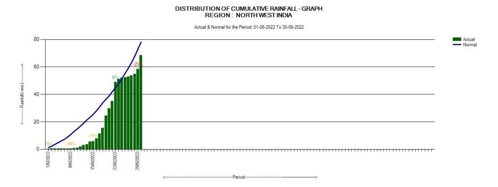
However, the rainfall has been far from normal this month. Till June 14, the rainfall at national level was below normal on every single day, highest deficit being 68% on June 8. In fact the cumulative monsoon deficit kept going up till June 11, when it was 43%. Between June 15 and June 21, it poured so fiercely that the cumulative monthly deficit became zero by June 21. Daily rainfall was again in deficit from June 23 to June 29, turning in positive zone only on last day of the month, when the day rainfall was second highest of the month at 10.2 mm, the highest being 10.8 mm on June 19.
AN EXCELLENT report by ROXY KOLL of IITM (Pune) explained the South West Monsoon in India so far, showing foot print of Climate Change and its connections with wider climate and implications. Very clear headed and also suggesting what is required: We need to urgently disaster-proof every district and village of South Asia and make it climate resilient. We need to prepare our houses and farms for both droughts and floods. We need policies that help redesign our cities and prepare our rural areas for intensifying cyclones, floods and heatwaves. Unfortunately, IMD is unable to provide ACTIONABLE forecasts of rainfall, as clear as explained by IITM scientist.

The spatial distribution was equally abnormal with north east India and parts of east India (mainly West Bengal and only on last Bihar and East UP) having high, almost unprecedented rainfall in the period during June 15 and June 21, leading to unprecedented floods in parts of North East India. This spatial distribution is also apparent from the maps below. Assam Chief Minister described the floods in Silchar as man-made disaster, which needs investigation, but that statement is equally true about floods in many other areas in North East India.
EDIT in Deccan Herald on June 25, 2022 rightly mentions the role of these factors contributing to flood disaster in Assam: destruction of wetlands, destruction of drainage system, indiscriminate urbanisation, deforestation, mining, dysfunctional embankments, climate change and lack of multidisciplinary approach to flood management.
THE HINDUSTAN TIMES Editorial on June 23, 2022 rightly highlights that the indiscriminate infrastructure development, deforestation and such actions are also responsible for the current NE floods in addition to climate change impacting rainfall pattern.
As the Times of India wrote in its editorial on June 30, 2021, India really needs to prioritise the harvesting of rain where it falls, when it falls, make every drop count. We are unfortunately, still busy destroying the prime forests and wetlands for projects of questionable merits like the Ken Betwa River Link Project. It was also good to see an EDITORIAL on monsoon progress in THE TIMES OF INDIA on June 20, 2022.
Region wise rainfall IMD divides the country into four regions: North West India, East & North East India, Central India, South Peninsula. The bar charts from daily rainfall in these regions and also for Pan India rainfall as provided by IMD for June 2022 are given below.


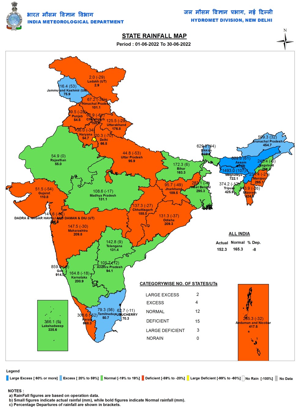
State wise Rainfall As we can see from the IMD map above, out of 37 States and Union Territories (UTs), two (Assam and Meghalaya, the reason for the unprecedented floods in NE India, the rainfall here has broken a number of records) had large Excess (Actual rainfall more than 60% above normal), Four (Arunachal Pradesh, Sikkim, Tamil Nadu and Jammu & Kashmir) had Excess (Actual rainfall 20-59% above normal), 12 had normal (Actual rainfall 19% below normal to above normal), 15 had deficit (Actual rainfall 20-59% below normal rainfall) and Three (Delhi, Chandigarh, Diu-Daman-Dadar-Nagarhaveli) had Large Deficit (Actual rainfall over 60% below normal) in rainfall in June 2021. Meghalaya had the highest rainfall of 1493 mm, Ladakh had the lowest rainfall at 2 mm.
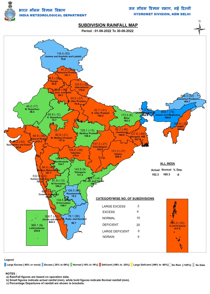
Sub Division wise rainfall IMD divides India into 36 meteorological divisions (the logic of many of them is far from clear). As we can see from the map above, two sub divisions (Assam-Meghalaya, Sikkim and Sub Himalayan W Bengal) had Large Excess rainfall, Four (Tamilnadu-Puducherry, Jammu-Kashmir-Ladakh, Rayalseema and Arunachal Pradesh) had Excess rainfall, 10 had Normal rainfall and 20 had deficit rainfall. Assam-Meghalaya had the highest rainfall at 858.1 mm and East Uttar Pradesh had the lowest at 33.5 mm rainfall in June 2022.

River Basin wise Rainfall As we can see from the above map, IMD also reports river basin wise rainfall, but as we have been noting in the past, this reporting remains rather callous and inadequate, unfortunately. This is clear from the map, where was can see that IMD reports NO RAIN in whole of the month June 2022 in all these river basins: Upper Godavari, Imphal and others, Middle Yamuna, Lower Bhima, Upper Krishna and Vaippar-Pamba. THIS IS AN IMPOSSIBILITY, looking at the district wise rainfall in the maps below, among others. Clearest evidence of IMD’s devil cares attitude in reporting river basin wise rainfall. In addition, IMD reports NO DATA for Upper Indus and Jhelum river basins.
DISTRICT WISE STATE WISE RAINFALL
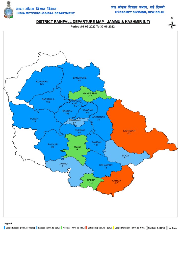
NORTH INDIA: Jammu & Kashmiar
Ladakh

Himachal Pradesh

Uttarakhand

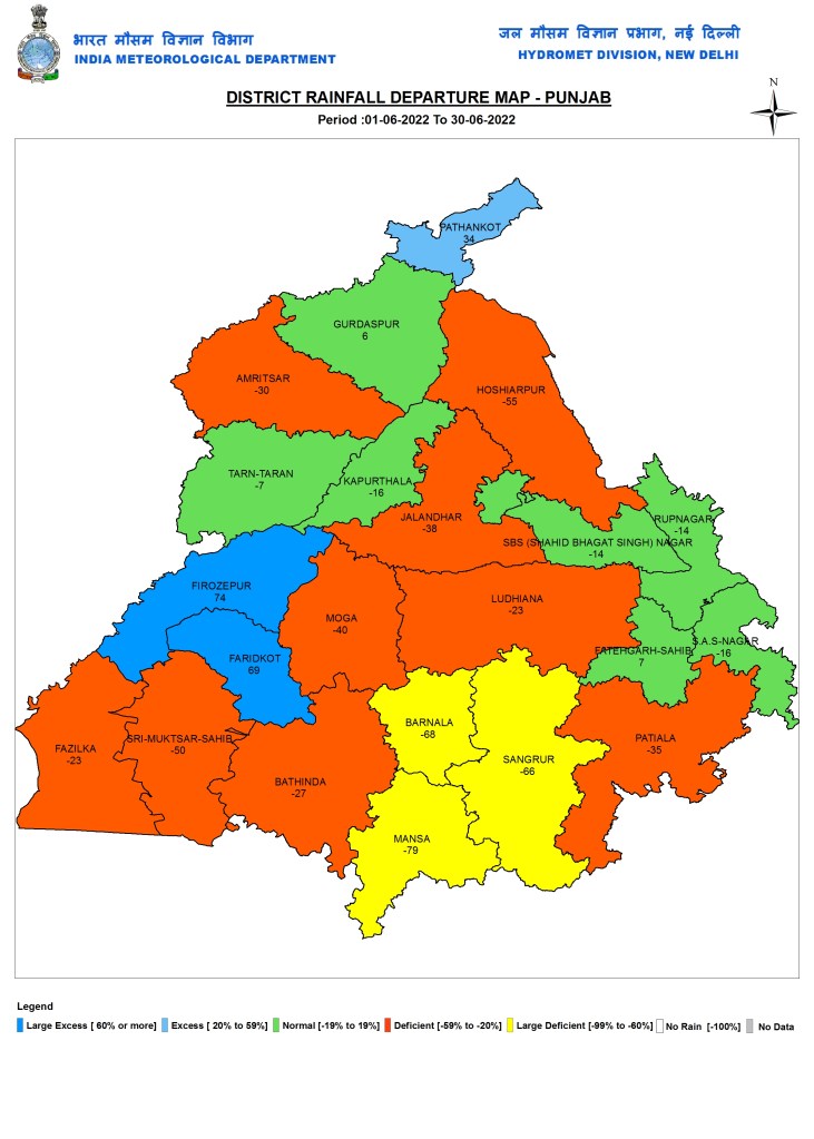
Punjab
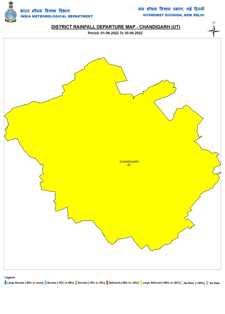
Chandigarh
Haryana

Delhi

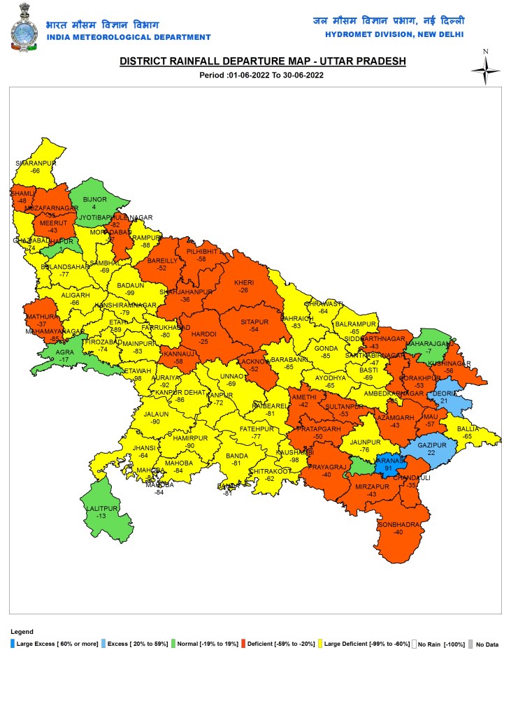
EAST INDIA: Uttar Pradesh
Bihar

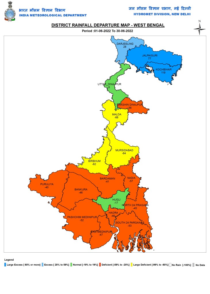
W Bengal
Jharkhand

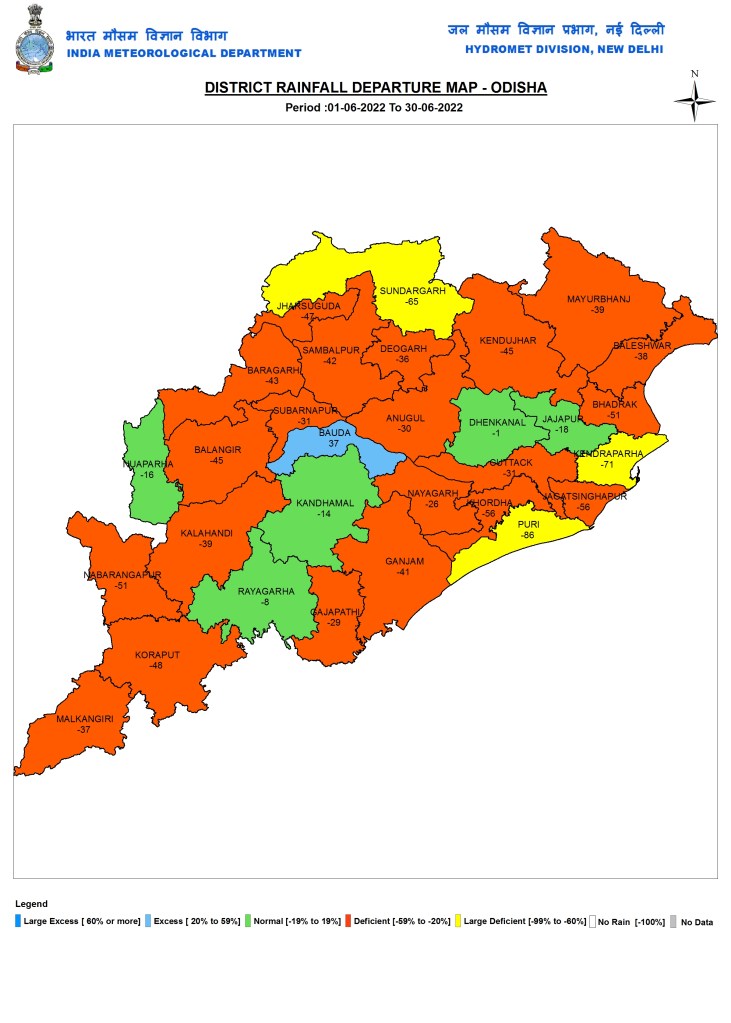
Odisha
Chhattisgarh

NORTH EAST INDIA: Sikkim

Assam

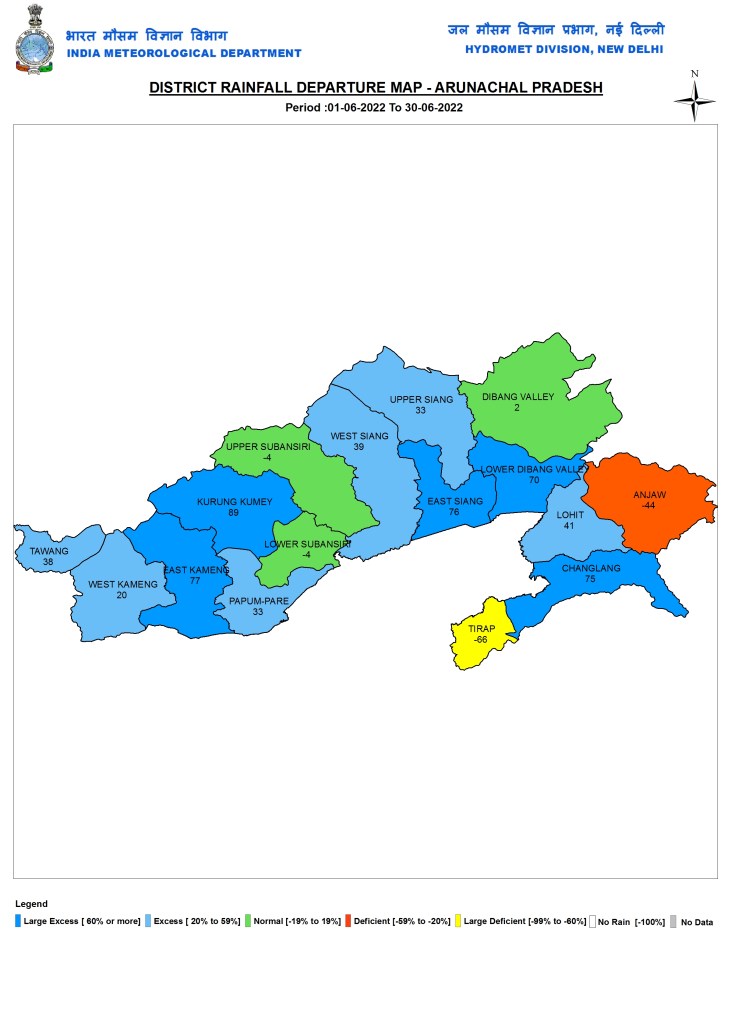
Arunachal Pradesh
Meghalaya

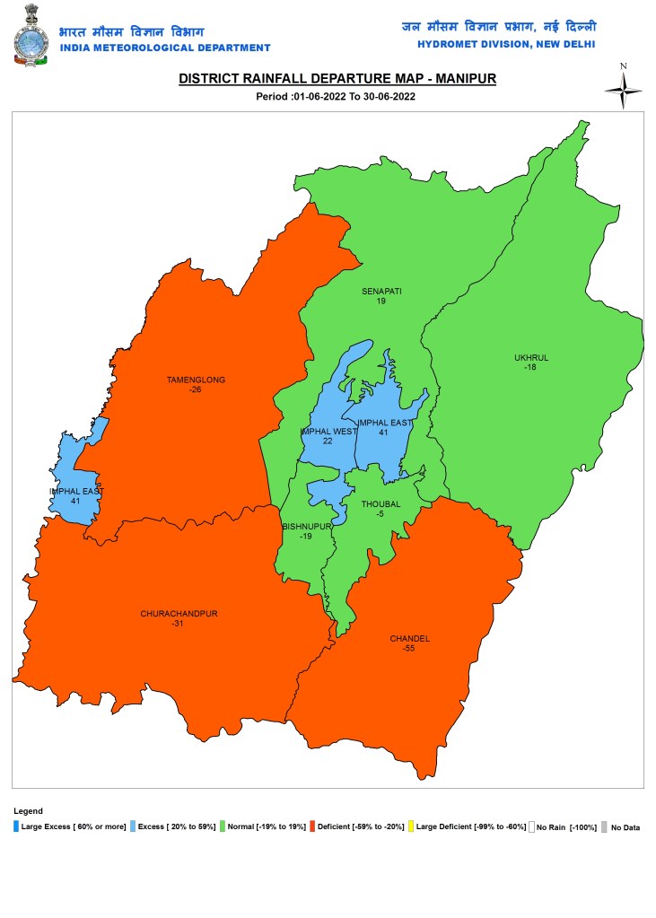
Manipur
Mizoram

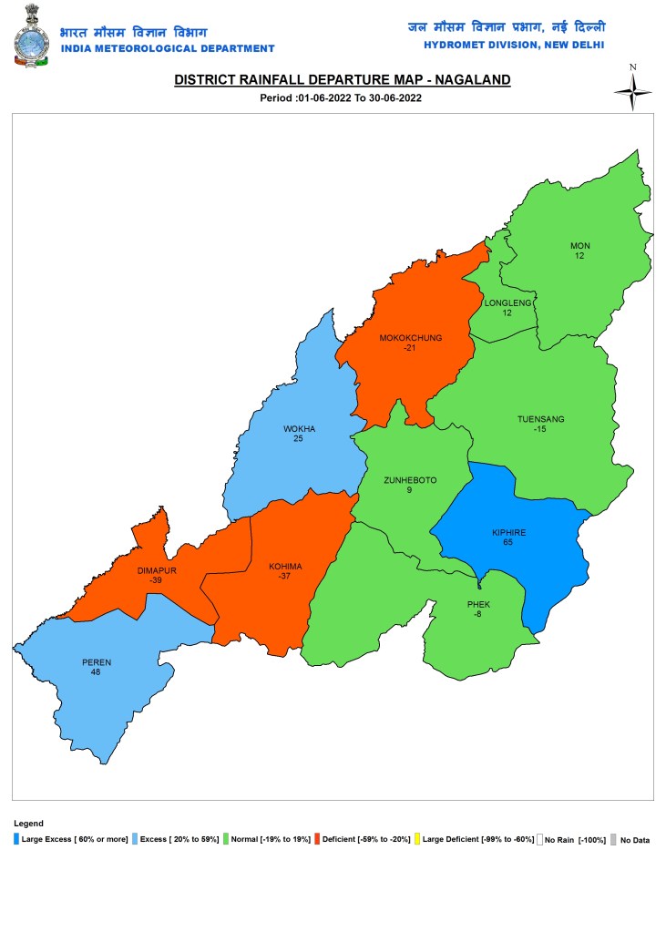
Nagaland
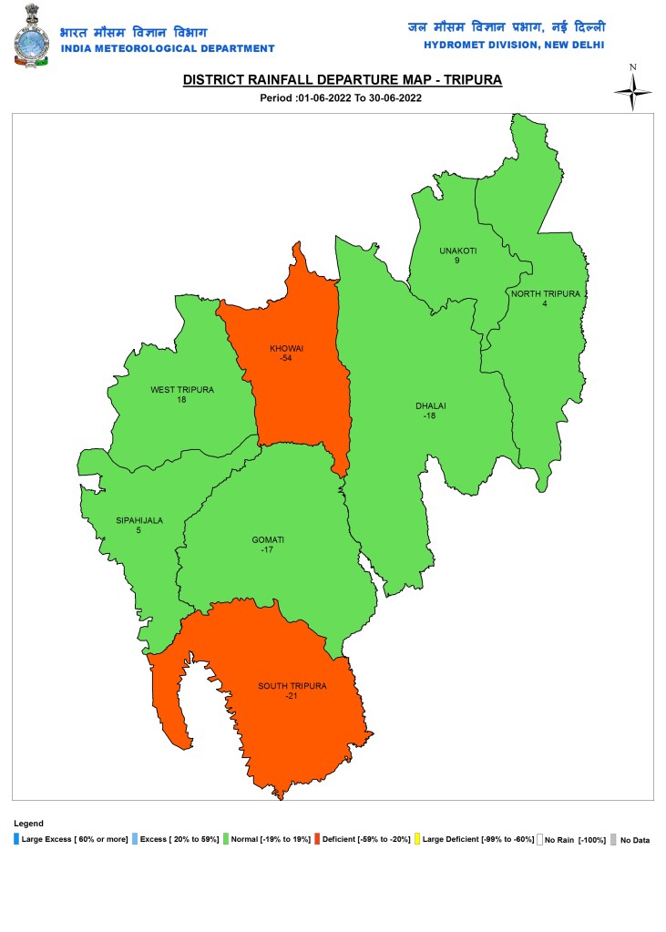
Tripura
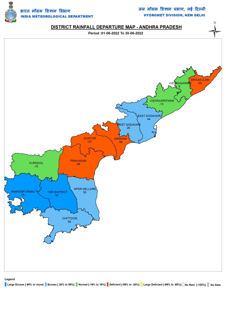
SOUTH INDIA: Andhra Pradesh
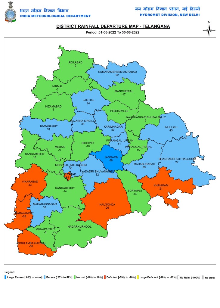
Telangana
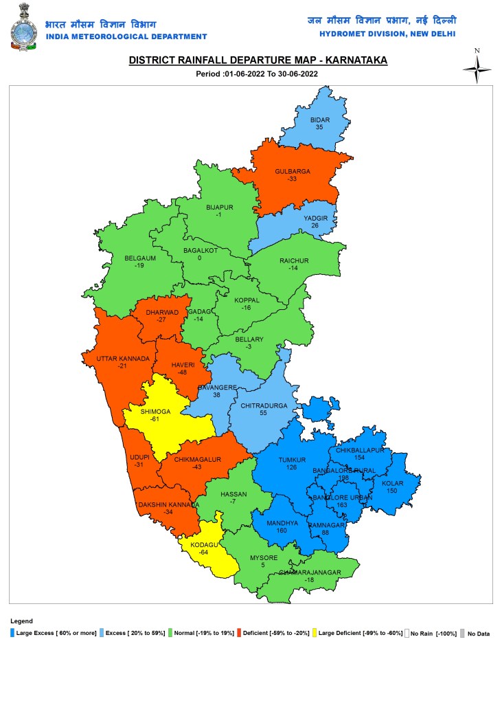
Karnataka
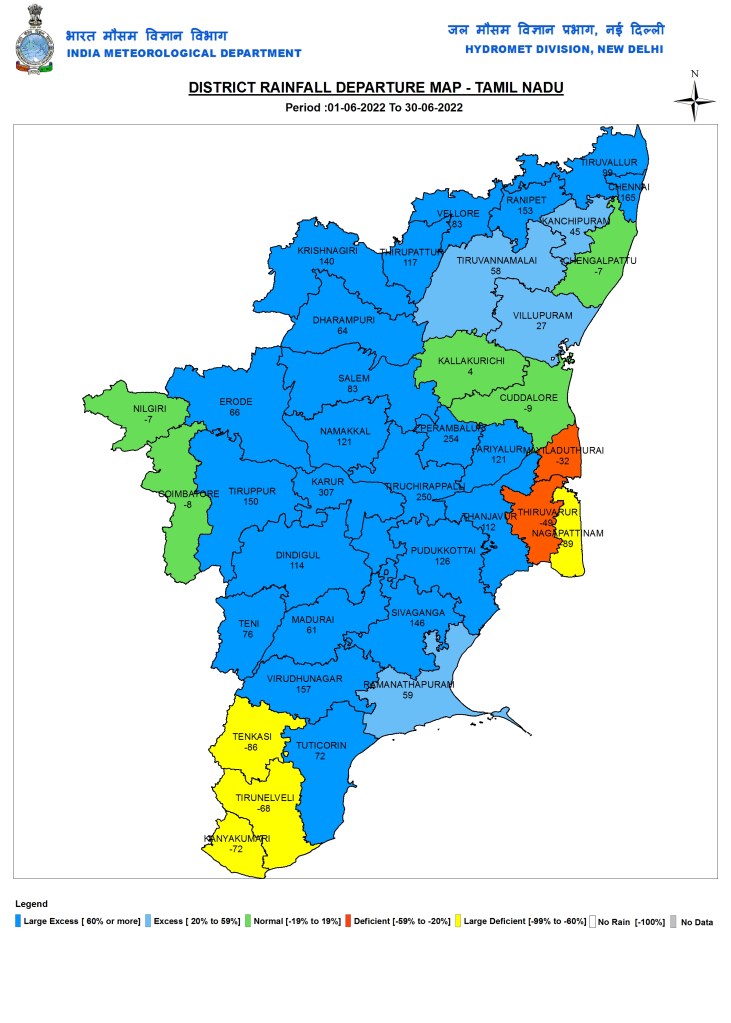
Tamil Nadu
Kerala

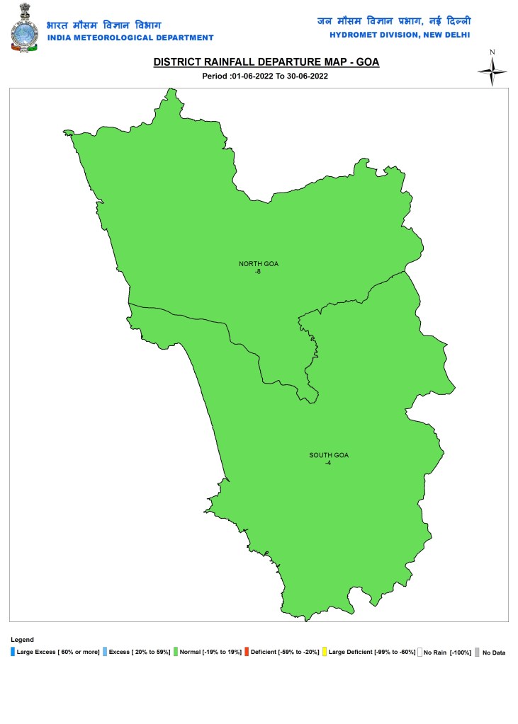
WEST INDIA: Goa
Maharashtra

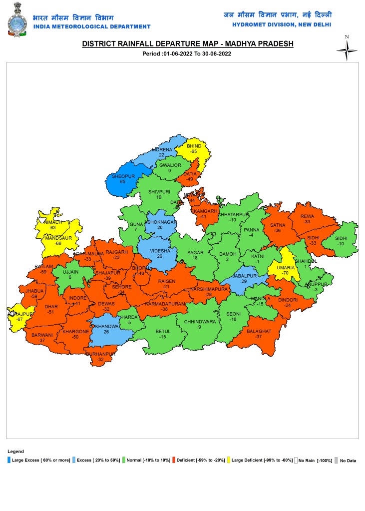
Madhya Pradesh
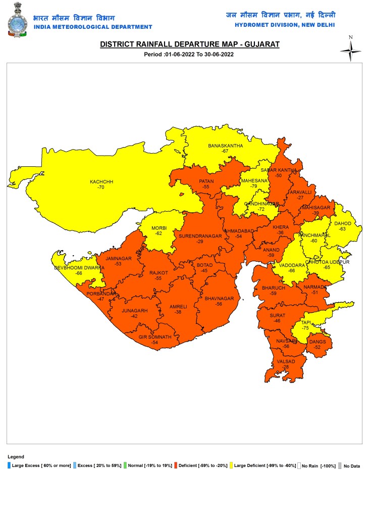
Gujarat
Rajasthan

SANDRP (ht.sandrp@gmail.com)
[i] https://sandrp.in/2021/06/30/june-2021-district-wise-rainfall-in-in-indias-sw-monsoon/
