CWC - Central Water Commission

2022: Overview of CWC’s Flood Monitoring Sites in North East India

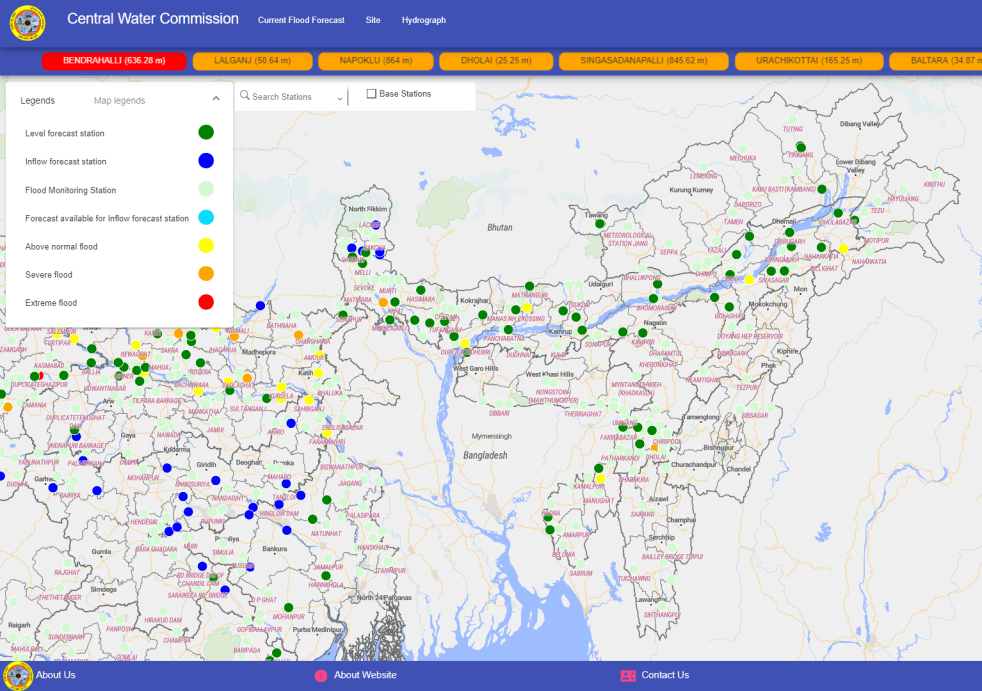
During monsoon CWC (Central Water Commission) monitors water level at several hundred sites in the county and publishes this information on its Flood Forecast website[I]. The website has three ways to get this information: Data Flow Map, List Based Exploration, and Hydrograph view. The Hydrograph view provides information for past 72 hours, supposed to be updated every hour. This is in addition to the list of current forecasts listed on the website.

Since 2018, SANDRP has been analyzing CWC’s flood forecast website in zone wise manner. After examining status of flood forecast and monitoring sites in North Indian[II] states, this overview is for North East India region covering Arunachal Pradesh, Assam, Meghalaya, Manipur, Nagaland, Tripura, Mizoram and Sikkim states. This also includes part of North West Bengal that is in Brahmaputra basin. Our 2018 and 2019 analysis on the North East region can be seen here[III] and here[IV].  .

Continue reading 2022: Overview of CWC’s Flood Monitoring Sites in North East India
CWC - Central Water Commission · Dams

2022: CWC Flood Monitoring Sites in North India

(Feature image: Bar Chart showing number of Level Forecast/Monitoring, Inflow Forecast sites in North Indian States & UTs)

Continuing analysis of Central Water Commission’s flood forecast website, SANDRP presents the details of flood monitoring sites in North Indian states comprising Union Territories of Jammu & Kashmir, Ladakh, Chandigarh, Delhi and states of Himachal Pradesh, Uttarakhand, Punjab, Haryana and Uttar Pradesh. Before this, we have prepared similar critical reports and highlighted problematic issues in flood monitoring sites in North India in 2018, 2019 and 2020.   

Continue reading 2022: CWC Flood Monitoring Sites in North India
Dams · Floods

Overview of CWC Flood Forecasting Sites 2018: WEST INDIA

Central Water Commission is the only agency doing flood forecasting in India. As per CWC’s Flood Forecasting website[i] the Data Flow Map has information about 226 Flood Forecast Sites in the country comprising of 166 Level Forecast Sites and 60 Inflow Forecast Sites. It also monitors 700 other sites, information is made available through List Based Exploration and Hydrograph View, but no flood forecasting is done for these sites.

In order to better understand the CWC’s flood monitoring and forecasting work, in this article, we have given an overview of CWC’s flood forecasting and monitoring sites in West India. It includes state wise list of CWC’s Level Forecasting, Inflow Forecasting and level monitoring sites in 5 States in West India. Similar report has been published for North India[ii] and North East India[iii] and East India[iv] and South India[v]. This is the last part in the series.  Continue reading “Overview of CWC Flood Forecasting Sites 2018: WEST INDIA”