Arunachal Pradesh · brahmaputra · Cumulative Impact Assessment · Ministry of Environment and Forests · Siang

Cumulative Impact Assessment Study of Siang Basin in Arunachal Pradesh: Serious shortcomings; pro large hydro bias

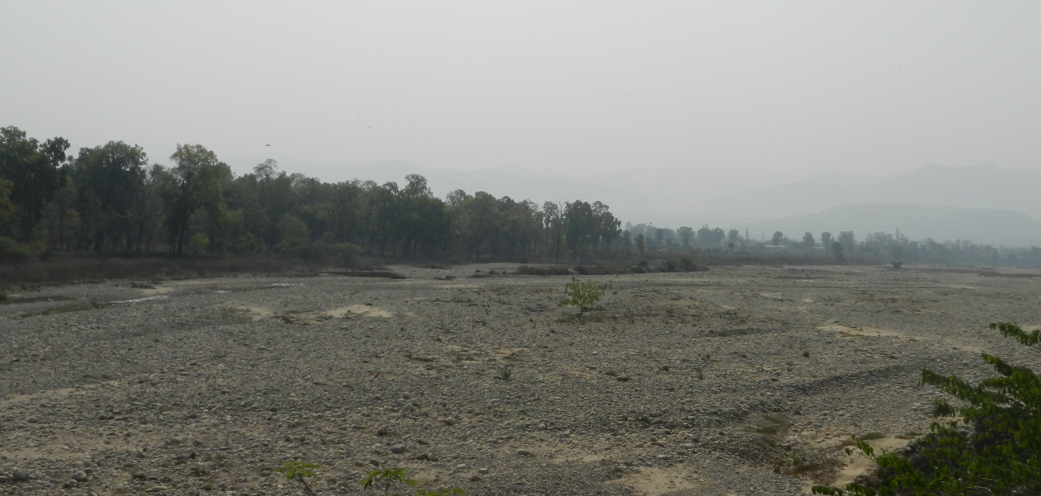
Most of the major rivers in the North East India are largely free-flowing till date, which is a rarity in India and the world. Their basins are home to unbelievable ecological and cultural diversity. Main rivers in Arunachal Pradesh which form the mighty Brahmaputra are the Siang (the Yarlung Tsang Po), Dibang and Lohit, which meet at the trijunction to form Brahmaputra.

Massive hydropower projects are planned on these rivers in cascade. They will have irreversible destructive impacts on the society, forests, rivers, biodiversity, ecosystems, cultural identity and downstream Assam.

Hydropower Flood in Arunachal Pradesh Map: Neeraj Vagholikar, Sanctuary Asia
Hydropower Flood in Arunachal Pradesh
Map: Neeraj Vagholikar, Sanctuary Asia

Siang River alone has 44 dams planned along its entire length.

Yes, 44 dams. You have read it correctly. At least 44 dams in one sub basin of Brahmaputra River Basin. This is what was meant by MOU virus as Jairam Ramesh described it.

Siang River Basin The Siang river originates in the Chemayungdung mountain ranges which nearly sixty miles south-east of Mansarovar lake in the Mount Kailash range in Southern Tibet at an elevation of 5300 m. A spring called Tamchok Khambab spills from the glaciers which later gather breath and volume to become the Tsangpo, the highest river in world.  Tsangpo river flows 1625 km in Tibet parallel to the main range of Himalayas before entering India through Arunachal Pradesh.

Before entering India, the river passes Pi (Pe) in Tibet and suddenly turns to the north and northeast and cuts a course through a succession of great narrow gorges between the mountain Gyala Peri and Namjabarwa (Namcha Barwa) in a series of rapids and cascades. The river then turns south and southwest and flows through a deep gorge across the eastern extremity of the Himalayas with canyon walls that extends upward for 16,500 feet (5,000 meters) and more on each side.

The river enters Arunachal Pradesh near Gelling from where it is known as Siang. The total length of Siang River is 294 km till its point of confluence with Dibang and Lohit River. After entering India the river traverses approximately 197.0 km to join the Siyom river. From there the length of the river till Assam border is 86.3 km. Flowing further 10.6 km in Assam the river joins the confluence of Lohit and Dibang. From this point forward it flows as Brahmaputra river in Assam and traverses a distance of about 195 km up to the confluence of Subansiri river on its right bank. Further downstream it is joined by Kameng at Jamugurihat near Tezpur, after another 123 km.  From  here  it  travels  for  another  134  km  up  to Guwahati.
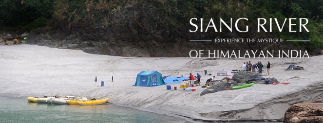
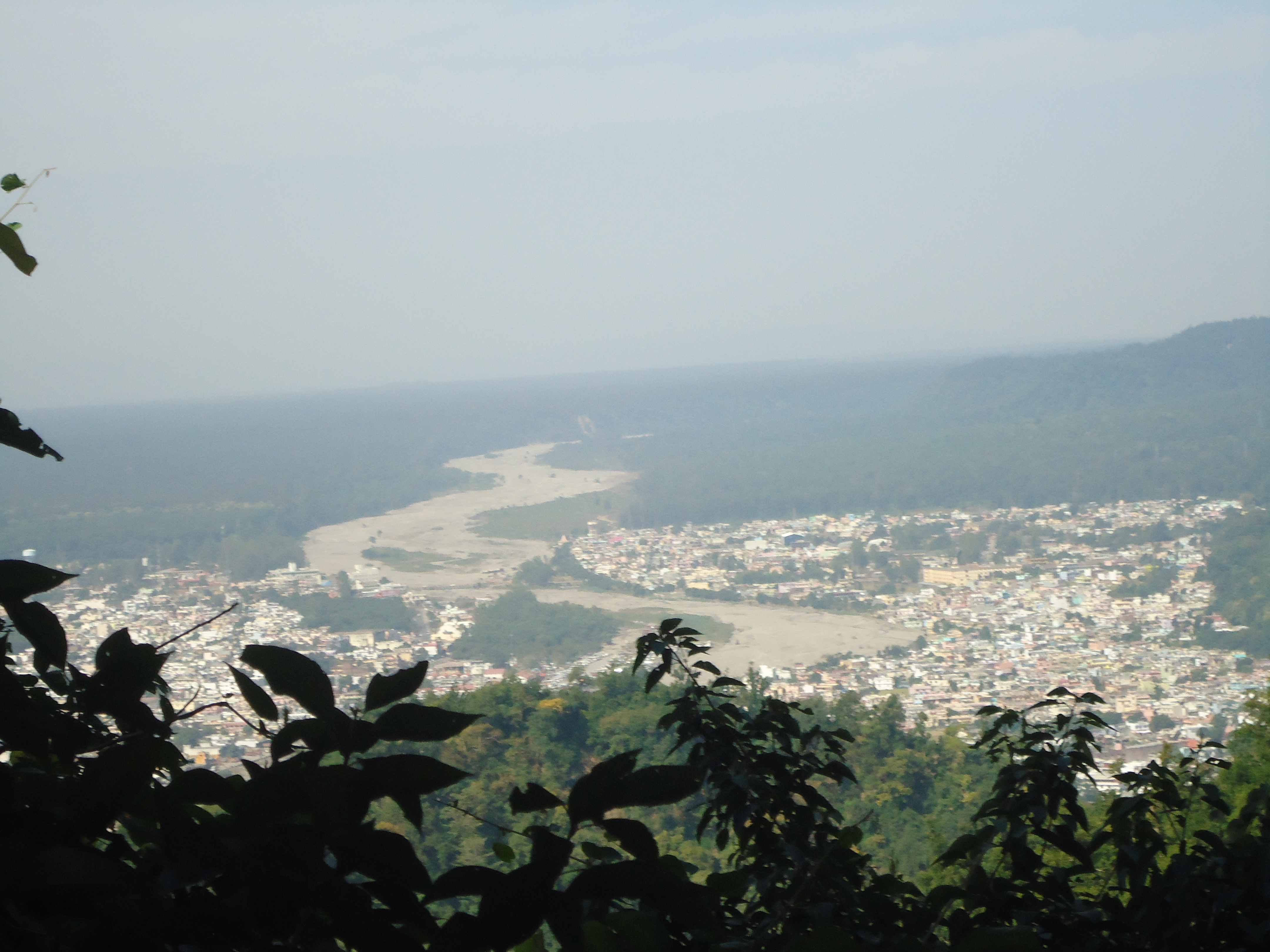
River Siang Photo from: Global Descents

The elevation of Siang river catchment area ranges from 90 m to around 5800 m. The total catchment area of Siang river from its origin to its confluence with Lohit and Dibang rivers is 251,521 sq km. Out of this 236555.7 sq km area lies in Tibet. The total catchment area of Siang river in India upto its confluence with Lohit and Dibang rivers is 14965.30 sq km.    

A question arises here, what will be the condition of the 294 km long Siang river if the proposed 44 dams are being built on the river. The Siang river basin study has the answer for this which is actually alarming “Only 85.5 km (29%) of free flowing water regime of Siang river will be left out of its total course in India i.e.  294 km of lotic ecosystem will be converted into 208.5 km of lentic ecosystem altering the entire Siang river aquatic system which will adversely impact the aquatic biodiversity and seriously affecting fish populations and their migration behaviour.”(page 11.23)

Three dams on the main Siang will convert the free flowing river into a three-stepped reservoir, without ANY flowing length of the river! These dams alone will affect more than 18,000 hectares of forests! If all the dams are built, water level fluctuations in the downstream D’Ering Sanctuary will be more than 23 feet every single day in the winter and other non monsoon seasons!

82.26% of the Siang basin is under forest cover (more than 15,000 sq kms), it is rich in orchids (more than 100 species!), holds 16 species of rhododendrons, 14 species of Bamboos and 14 species of canes and overall 27 RET species and 46 endemic plant species. 25 (18%) mammalian species found are Schedule I of WPA (Wildlife Protection Act), while 26 are under Schedule II! There are 447 species of birds, of which 31 are Schedule I species. The single basin consists of 5 Important Bird Areas !!(IBAs)

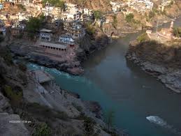
Formation of River Siyom, which will have multiple dams in a cascade Photo from: Team BHP

This information has been collated by the CIA (Cumulative Impact Assessment)/ CCS (Carrying Capacity Study) of the Siang Basin, which was an attempt to look at the scale and cumulative impacts of projects in Siang holistically.

Has the CIA commissioned by Central water Commission and done by RS Envirolink Technologies done an objective, scientific, independent assessment?

SANDRP sent comments about this 2-volume study  with over 1500 pages to the Expert Appraisal Committee, Ministry of Environment and Forests which will be considering this basin study in its upcoming meeting on Feb 20-21, 2014. Submission below highlights that the study has very serious short comings and bias. The recommendation of dropping 15 (mostly small ones, all below 90 MW installed capacity) HEPs and re-configuring some others is welcome, but far from sufficient. The study itself is disappointing:

Projects planned in the Siang Basin Phot from CIA/ CCS of Siang Basin


Time Line of Siang Basin Study

Feb 2010 Ministry of Water Resources constituted an Inter-Ministerial Group on the directions of Prime Minister’s Office with a view to evolve a suitable framework to guide and accelerate the development of hydropower in the North East and also to assess the impact of the massive hydropower development in Arunachal Pradesh on downstream areas in Assam
Nov 2010 EAC discussed TOR for the Siang Basin CIA
Dec 23, 2010 MoEF issues TORs for the Siang Basin CIA
April 2011 EAC discusses sampling locations for the CIA on request of CWC
Dec 2011 Work of CIA for Siang awarded to RSET Pvt Ltd
May 2012 RSET says draft interim report discussed by TAC, but there is no meeting of TAC in May 2012, minutes of March and July TAC meetings (the ones before and after May 2012) on CWC website also do not mention any such discussion.
Nov 2012 EAC discusses Draft Interim report
Aug 2013 Draft Final report submitted to CWC
Sept 2013 RSET says Draft final report discussed by TAC, but the minutes of the Sept 2013 meeting of the TAC obtained under RTI donot contain any reference to the Siang basin study
DEC 2013 Draft Final Report submitted to MoEF
Feb 17, 2014 Critique of the Draft Final report submitted by SANDRP to EAC
Feb 20, 2014 MoEF’s EAC to  discuss the Draft Final report

To,

Chairperson and Members,

Expert appraisal Committee

Ministry of Environment and Forests

Delhi

Subject: Serious inadequacies of Cumulative Impact Assessment (CIA) and Carrying Capacity Study (CCS) of Siang Sub-basin including Downstream Impacts

Respected Chairperson and Members,

We see from the agenda uploaded on the MoEF Website that Final Report of the Siang CIA/CCS Study commissioned by CWC and conducted by RS Envirolink Technologies Pvt Ltd will be discussed in the 72nd EAC Meeting to be held on 20-21 February 2014.

SANDRP has been analysing basin studies in the Western Himalayas and Brahmaputra Basin for some time now. Looking at the aggressive cascade hydropower development and its far reaching cumulative impacts, CIA/ CCS and Basin Studies should form the backbone of informed decision making by MoEF. Unfortunately, most studies being considered by the EAC are of a sub-standard quality and are shying away from addressing the cumulative impacts [1]. EAC itself is delinking appraisal of individual projects from basin studies, rendering the crucial process meaningless which is in violation of EIA notification of Sept 2006, wherein Form 1 Section 9 actually asks for cumulative impact assessment. Some of the recent orders of National Green Tribunal also make it CIA mandatory, thus making such delinking legally untenable.

Looking at the scale of ecological and social impacts of these projects and the significance of MoEF’s and EAC’s role, we urge the EAC to consider CIA/ CCS/ Basin Studies more seriously.

Main issues with Siang Basin Study include: (These are elaborated with reasons below)

1. No mention of social and cultural impacts!

2. Downstream impacts on Assam not studied in detail

3. Cumulative Disaster vulnerability, impact of projects on such vulnerabilities, Dam Safety Assessment, risk assessment not done

4. “Cumulative” Impacts not assessed on several aspects

5. Non-compliance with critical recommendations by the EAC:

a. Study is not compatible with similar studies done worldwide

b. No suggestions about ramping to reduce downstream impacts

c. No recommendation on free flowing length between two projects

d. No mention of cumulative impact on sediment regime

e. No mention of impact of road construction

f. BBM for eflows not used, despite agreeing to use it before EAC

g. Impact of Sand mining, boulder mining not conducted

h. Impact of specific projects not clearly studied

6. Eflows, one of the most significant issues, handled erroneously: NO ACTUAL ASSESSMENT OF E-FLOWS REQUIREMENTS AS REQUIRED BY TORs

7. No mention of Climate Change, reservoir emissions vis-à-vis cumulative impacts of such massive scale, how the projects would affect the adaptation capacity of the communities and region in the context of climate change

8. No stand taken on three mega projects on Siang Main Stem and other big hydro projects

9. No conclusion about how much length of the river is to be compromised

10. Number of sampling locations: TOR not followed

11. Source of information not given

12. Inconsistency, contradictions in listing of flora-fauna

13. Unsubstantiated advocacy: going beyond the TOR & mandate

14. Other inadequacies of CIA

15. Study should not be finalised without credible Public consultation across the basin.

Division of the Siang Basin into sub basins Phot from : CIA/ CCS Report of the Siang Basin

DETAILED CRITIQUE

1. No mention of social and cultural impacts! In the entire basin study, there is no mention of social and cultural impacts by these 44 projects which will together submerge more than 21,000 hectares of forests and affect the entire Siang Basin adversely. Needless to say, local communities depend heavily on the basin resources like fish, medicinal and food plants, timber varieties for their livelihoods. For example, more than 2000 hectares of multi-cropped, irrigated rice fields will be submerged by Lower Siang Project alone.

Adi Community that will be affected by the dams on Siang Photo with thanks from : Kaushik Shil

The CIA/CCS study needs to be re-conducted, in which social and cultural cumulative impacts are assessed with participation of local communities and downstream communities from Arunachal Pradesh and Assam. It may be remembered that Public Hearing of Lower Siang (in the latest instance, slated to be held on 31st January 2014) had to be cancelled due to a number of procedural issues, and also opposition from local residents [2]. It is incomprehensible how the CIA Study has no assessment of impacts on communities!

2. Downstream impacts on Assam not studied in detail The study assesses impacts specifically on Dibrugarh, Bokaghat (Kaziranga) and Guwahati. However, there are several villages, settlements, tea estates, agriculture, forests etc., on the Right Bank of Siang in Assam after Pasighat. This includes a major part of Dhemaji District of Assam. Impact on this region needs to be assessed. There has been opposition to Siang Dams from places like Jonai from Dhemaji, which have been ignored.[3] 
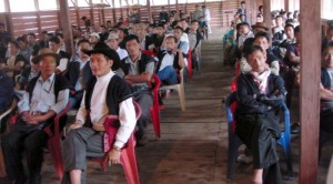
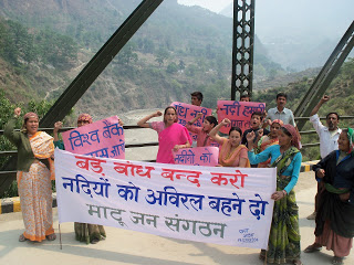
Meeting protesting against Public Hearing of 2700 MW Lower Siang HEP Photo: Echo of Arunachal

According to the model used, the chainage for assessing impacts at D’Ering Sanctuary is between 20-33 kms from Lower Siang Dam. The next chainage is at 102 kms at Dibrugarh. Impacts on the stretch between D’Ering and Dibrugarh, for nearly 70 kilometres are simply not assessed! What can be reason behind this?

Level fluctuations at D’Ering Sanctuary, with Lower Siang, Middle Siyom and Upper Siang Projects is to the tune of 7.2 meters (23.66 feet!!) in lean season. This highlights the need to study impacts on the intermediate zone in Assam between Dering Sanctuary and Dibrugarh. The Study should not be accepted without these assessments.

3. Cumulative Disaster vulnerability, impact of projects on such vulnerabilities, Dam Safety Assessment, risk assessment not done

Upper Siang Stage I, Stage II and Lower Siang are huge projects with direct impact on downstream state. Even as issues of dam safety and risk assessment have gained high significance in Assam as can be seen in Lower Subansiri protests, the basin study/CIA does not include a word on dam safety, cumulative risk assessment, risk of landslips and landslides, seismic zones of projects, past earthquakes in the region, possible mitigation measures, disaster management, etc. There is no assessment of baseline situation about disaster vulnerability of the region and how the projects will change that. By its nature, a CIA/CCS/ basin study is best placed to assess these impacts.

Lanslides are a common feature of this region. Pic shows Yinkiong in Siang II Sub basin where several projects are planned. Photo: Team BHP

These points have been raised by KMSS, Assam and others. The Uttarakhand disaster of June 2013 underlines this and even the Supreme Court of India has asked for an assessment of how hydropower projects contributed to disaster in Uttarakhand. Looking at Uttarakhand Disaster as well as protests from downstream Assam where dam safety is a major issue, dam safety needs to be addressed in the CIA/ CCS. In the absence of all this, projects will not be allowed by communities, as can be seen with Lower Subansiri and Lower Siang.

4. Cumulative impacts not assessed on several aspects The study has a sketchy section (Chapter 11) on Cumulative impact assessment.

The minutes of 62nd EAC meeting noted, “The main objective of the study is to bring out the impact of dams being planned on the main Siang River and its seven tributaries on terrestrial and aquatic ecology, plant and animal biodiversity, including wild life, hydrology of the basin, etc.” (Emphasis is as in original.) However, the study has not placed emphasis on assessing these impacts.

Yar Gyap Chu: a River and basin which holds high religious significance for the Buddhists Photo: Kaushik Shil

Moreover, the study does not attempt to assess cumulative impacts of all the projects due to:

  • Blasting and Tunnelling: This is not mentioned even once in the entire study! When the disastrous impacts of blasting, tunnelling and related activities are fresh in our minds w.r.t Uttrakhand and Himachal Disasters, it is incomprehensible to see that this section is not mentioned at all in the basin study!
  • Community resources: No mention on loss of agricultural lands, homesteads, displacement, loss of forest rights, etc.
  • Infrastructure development: No mention of the impact of workers colonies, buildings on the society, landscape and cultural aspects, etc.
  • Greenhouse gas Emissions: Considering submergence of more than 20,000 hectares of dense to very dense forests and building of a large number of reservoirs in tropical climate, cumulative impacts on green house gas emissions should have been assessed.
  • Biodiversity, RET Species, Deforestation: While the report deals with these issues very sketchily, there is no statement as to what will be the cumulative impact of 44 projects on the above issues.

5. Non-compliance with critical recommendations by the EAC Interim basin study was discussed in the 62nd EAC meeting in November 2012. The EAC had given some important recommendations at that stage to be included in the study. However, most of the recommendations have not been complied with, these include:

  • Study is not compatible with similar studies done worldwide: EAC had specifically recommended compatibility with global studies. However, Siang CIA is not compatible with any global Basin and Cumulative impact Assessment Study. A Cumulative Impact Assessment is a multi-stake – holder process that assesses the cumulative and indirect impacts as well as impact interactions of the proposed dam or set of dams, as well as existing and planned projects from other sectors, on ecosystems, communities, and identified Valuable Ecosystem Components (VECs) within a specific spatial and temporal boundary. [4]
  • No suggestions about ramping to reduce downstream impact: EAC had specifically asked for ramping study with reference to downstream impacts. However, ramping studies are not done at all, although downstream impacts of the projects in isolation as well as together are huge. 
  • No recommendation on free flowing length between two projects Although Upper Siang I, Upper Siang II and Lower Siang have no free flowing stretch between each other, the study refrains doing any assessments or from making any recommendations in this regard, contrary to EAC’s recommendation. 
  • No mention of cumulative impact on sediment regime 44 projects with several mega reservoirs will have a profound impact on the sediment regime of the rivers as well as downstream impacts thereof. EAC had specifically asked to include sediment balance and impact, which is not discussed in the report. 

The minutes of 62nd meeting of EAC says: “The Consultants were also asked to study and recommend on silt management considering “no dam” and “with dam” scenario as silt substantially impact the ecology and cause sedimentation particularly when its velocity is affected d/s due to construction of dam.” No such study has been conducted. In fact globally, sediment balance on cascade projects is a crucial element of study, which is completely left out in the present study. 

  • No mention of impact of road construction Roads and related activities like deforestation, slope destabilisation, blasting, mining, muck dumping, all the cumulative impacts of peaking operation (needs to be done comprehensively, including the limitations that such operation of upstream projects will impose on downstream projects), etc have a critical impact on fragile geology. Role of roads for hydel projects was significant in Uttarakhand Tragedy in June 2013. EAC had specifically asked for “Impacts due to construction of approach roads”. This point is not touched upon in the report. 
  • BBM for eflows not useddespite agreeing to use it in front of EAC Although the consultant agreed in the 62nd meeting that BBM will be used to assess eflows regime,[5] at the insistence of the EAC, in reality BBM has not been used in the study. The reasons given [6] that BBM is a “prescriptive approach”, “it takes too much time” and “only stakeholder in the basin is river and fish” is wrong, shocking and unacceptable.

The study forgets about the people, biodiversity and other stakeholders. Requirements of BBM were known at the time consultant agreed to use this methodology before the EAC. Is fluvial geomorphology, cultural practices, hydrological requirements and sediment balance not important blocks of BBM study? 

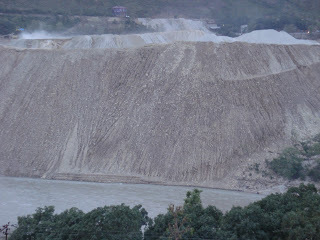
  • Impact of Sand mining, boulder mining not conducted EAC had specifically asked for this study. This is critical as mining of sand and boulders from river bed has severe impact on riverine ecology, bed stability, erosion, flow velocity, etc. However, the study has not even mentioned this issue. 
Yargyap Chu or teh Medicinal RIver Photo: Team BHP
Yargyap Chu or the Medicinal RIver Photo: Team BHP
  • Cumulative Impacts of projects on biodiversity in sub-basins not clearly studied While the study has done impressive job in inventorysing ecological attributes of 11 sub basins, it has fallen woefully short in clearly communicating the individual and cumulative impacts of projects on Valued Ecosystem Components (VECs). This reduces practical application of the report. EAC had brought this up during the 62nd meeting. 
  • Length of rivers to be assessed for downstream studies As per the minutes of the 43rd meeting of EAC held in Nov 2010 the report was to recommend: “What may be criteria for downstream impact study in terms of length of the river downstream to the tail water discharge point and what may be the parameters of such a study”.

The same EAC meeting recommended: “If the states do not change their policy of allotting elevation-wise river reaches for hydropower development, what criteria the EAC may adopt in restricting the river reach for hydropower development. Alternatively, what should be the clear river length of uninterrupted flow between the reservoir tip at FRL of a downstream project and the tail water discharge point of the immediate upstream project.”

“For peaking stations, what extent of diurnal flow variation may be considered safe for the aquatic life. There are examples where the release is drastically reduced during the long time for reservoir filling and huge discharge flows through the river during the few hours of peak power generation. This is detrimental to the aquatic environment of the downstream stretch of the river.”

“For muck disposal, what may be minimum distance that must be maintained between the outer boundary of the muck disposal sites and the river bank.”

6. Eflows, one of the most significant issues handled erroneously: NO ASSESSMENT OF E-FLOWS REQUIREMENTS The CIA has not done assessment of e-flows requirements at various locations keeping in mind the upstream projects. The very crude assumption it has made is by dividing the entire basin in Mahseer and Trout Zone and assuming certain water depths for these fish in lean, monsoon and non-lean, non-monsoon months. Several fisheries scientists do not support this classification or accept these two species alone as representing the ecosystem. The study assumes 50 cms water depth for Mahseer and 40 cms depth for Trout in lean season.[7] Then flows for maintaining that particular depth are calculated and recommended. Added criteria is that depth should not be less that 50% pre-project river depth. 

Luxuriant Biodiversity of the Siang basin Photo: Team BHP

Here it is worth quoting the minutes of 62nd meeting of EAC:

“The EAC asked the Consultants to take comprehensive view of the environmental flow assessment and make final recommendations for each stretch. Committee asked to study international literature available on the subject and use the best suitable methodology for this exercise suiting to Indian conditions. The Consultants said that most appropriate method such as Building Block Methodology would be used by them. Detailed habitat simulation modelling for the entire year needs to be considered so that flow release requirement can be established not only for lean season but also for monsoon season and other months… The Consultants while submitted that public hearing as such is not a part of the study as per ToR, informed that BBM entails expert and stakeholder‟s consultations and would be followed.”

This has clearly not been done.

This approach is incorrect on various counts:

  • The habitat requirements of Mahseer and Snow Trout are higher than the assumed 0.5 m and 0.4 m. This has been confirmed by several fisheries scientists. The WII study on Upper Ganga Projects recommends a minimum of water depth of 1 meter for adult Mahseer (Tor species) (Table 7.6, Page 148) and at least more than 50 cms for Trouts (Schizothorax sps) (Table 7.8, Page 150). Incidentally these tables from WII Cumulative Impact Assessment have been used in the report without stating the source or credit. SANDRP has interacted with several fisheries experts who claim that 0.5 meters is a completely inadequate depth for adult Mahseer.
  • This faulty assumption has led to low eflows recommendations of 15% of average flows in non-lean non-monsoon months for Heo and Tato I Projects, this is lower even that EACs norms. This assessment and recommendations are clearly unacceptable.
  • The criteria of 50% water depth wrt pre-project depth is arbitrary and without any scientific justification. For Himalayan rivers with a stable hydrograph like Siang, 50% depth reduction is very high. As can be seen from Eflows chapter, after 50% depth reduction, most river stretches have less than 100 cms depth, which is just about the minimum depth required for an adult Mahseer or a spawning snow trout. However, Mahseer and trouts are abundant in these rivers. This just indicates the problems behind 50% water depth criteria. This should not be accepted.
  • The entire eflows discourse is not based on assessment of environment flows for various objectives and ignores most critical requirements.
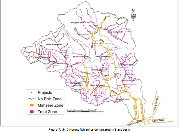
    Division of the Basin into Trout and Mahseer Zones Photo: From CIA/ CCS Report of Siang Basin
    Division of the Basin into Trout and Mahseer Zones Photo: From CIA/ CCS Report of Siang Basin

7. No mention of Climate change In the entire study, there is no mention of climate change, how changing climate would affect the rivers and projects and how project construction would add to climate change impacts and how they will reduce the adaptation capacity of the people and environment to cope with the changing climate. Deforestation to the scale of 21000 hectares of thick forests and complete loss of a biodiversity rich free flowing river has strong impacts in the context of climate change and these need to be assessed.

8. No stand taken on three mega projects on Siang Main Stem and other big hydro projects Three mega projects on Siang Main stem, namely the 6000 MW Upper Siang I, 3750 MW Upper Siang Stage II and 2700 MW Lower Siang will have a huge destructive impact on the entire ecology and society of the region. These three projects together will submerge 18,100 hectares of dense forest area and will convert entire river length between these projects: 208.5 kilometers, into unbroken sequence of reservoir-dam-reservoir-dam-reservoir-dam, with no flowing river between two consecutive projects. The study has not even attempted assessment of length of flowing river required between the projects and eflows allocation for this stretch.

L Section of the Siang River with 3 mega projects which do not leave any flowing river between them. Photo from: CIA/ CCS Report of the Siang Basin


Oppsition to Public Hearing of 2700 MW Lower Siang Project Photo: Echo of Arunachal

These projects in a cascade, destroying a complete flowing river are against the principle of sustainable development and even EAC’s minimalist norm of 1 km of flowing river between projects. A CIA/ CCS study should have raised this issue strongly as these projects are undoing most of the other recommendations. However, the study refuses to take an independent stand against these projects and fails its mandate of being an independent study. 
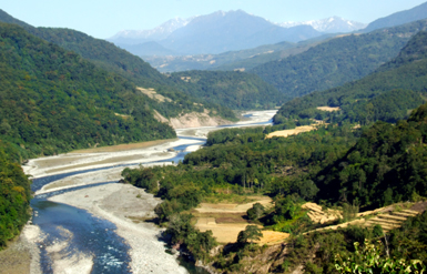
Yamne Basin, claimed to host highest biodiversity in Siang is planned to have 4 projects back to back! Photo: Abor Country Travels

Similarly the study does not take stand on other big hydropower projects proposed in the basin. Most of the projects it has recommended to be dropped are relatively smaller projects, none are big ones. This shows bias of the consultants. The report is also not in consistent in its recommendations. 

Positive suggestions: The study recommends dropping 15 projects and keeping some tributaries free from any hydel development. It also calls for including small hydel projects under the ambit of EIA. These suggestions are important and should be accepted. EAC should immediately ask MoEF to recommend changes in the EIA notifications to include all hydro projects above 1 MW. 

The study has also asked for change in parameters of Tato II, Hirong, Naying and Siang Middle HEPs so that at least 1 km of river is left flowing between them. This is welcome and EAC should accordingly ask for changes in these projects. But the report has not done any study in this regard. 

9. No conclusion about how much length of the river is to be compromised One of the TORs of the study include, as per the minutes of the 43rd meeting of EAC held in Nov 2010: “Considering the total length of the main river in the basin and the HEPs already existing and planned for future development, how many more HEPs may be allowed to come up. In other words, how much of the total length of the river that may be tunneled inclusive of the tunnelling requirement of all the projects that have been planned for development so that the integrity of the river is not grossly undermined.” (Emphasis added.) The report does not do an assessment on this. The B K Chaturvedi committee had recommended that not more than 50% of the river can be compromised. However, this report was to study this aspect, but has neither studied this, nor done analysis or reached any conclusion. 

10. Number of sampling locations The minutes of 49th meeting of EAC held in April 2011 concluded that the number of sampling locations will be decided based on this criteria: 3 sites for project with over 1000 MW installed capacity, 2 sites for projects with 500-1000 MW installed capacity and one site for projects below 500 MW installed capacity. In addition 2-3 locations will be selected in the downstream areas. 

Menchuka_Team BHP

If we go by this criteria, and considering 44 planned projects listed in the CIA, there should have been 15 locations for 5 projects with capacity 1000 MW or above, 4 for two projects with 500-1000 MW capacity and 37 for projects below 500 MW capacity, in addition to the locations in downstream areas. The CIA has not followed these directions from EAC, else sampling locations would have been about 60 and not 49 as included in the report. 

11. Source of information not given Several annexures in Vol II (this too should have been put up on EAC website, but has not been, we got it from other sources), including Annex I says that it is prepared from “PREPARED FROM SECONDARY DATA & FIELD SURVEYS”, but which information has been obtained from field surveys and which information is obtained from which secondary source is not given. In absence of this it is difficult to verify the claims. 

12. Inconsistency, contradictions in listing of flora-fauna

– In volume II, Annex I titled “LIST OF PLANT SPECIES REPORTED FROM SIANG BASIN”, which is supposed to include data from secondary sources and field surveys lists 1249 angiosperms and 11 gymnosperms. However, the pteridophytes listed in Annex II titled “LIST OF PLANT SPECIES RECORDED FROM DIFFERENT SUB BASINS OF SIANG DURING FIELD SAMPLING” do not find mention in Annex I or Annex III a/b/c.

Out of 11 Gymnosperms listed in Annex I, only two figure in Annex II, rest do not get listed in any of the sub basins.

– The species Dicliptera bupleuroides and Phlogacanthus thyrsiflorus listed in Annex 1 Angiosperms do not get listed in any of the sub basins.

Section 4.1.4 says Paphiopedilum fairrieanum is an endangered and Cymbidium eburneum is an endemic and vulnerable orchid species in Siang basin, however, these species do not get listed in any sub-basins in Annexure II or in any season in Annexure III. Same is the case with endemic orchid species of Siang basin, namely Calanthe densifloraDendrobium cathcartiiD hookerianumGaleola falconeriLiparis plantaginea and Paphiopedilum fairrieanum.

– Similarly among the Rhododendron species, threatened species like Rhododendron boothii, threatened species like Rhododendron falconeri, newly discovered and critically endangered species like Rhododendron mechukae (even though it was found in Yargyap Chhu sub basin), Rare species like Rhododendron arizelumRhododendron dalhousieaevar. rhabdotum,Rhododendron kenderickii, and R edgeworthii are not found in Annex II or III.

Rhododendron Species of Siang Basin Photo: Abor Country Travels

Endemic cane species Calamus leptospadix also do not figure in Annex II or III.

– The CIA says, “The Siang basin as discussed above is also very rich in floristic resources and there are still number of areas in the basin which are either under-explored or yet to be explored”, however, a CIA is supposed to make recommendation how to ensure that such areas are explored before any more projects are taken up, but this report makes no recommendation in this regard.

– The CIA says that 17 Near Threatened (regional level) medicinal plants, 46 endemic species and additional 55 endemic species are reported in Siang basin, but CIA neither gives list of them, nor locations, how these will be affected by hydropower projects or recommendations to conserve them.

– The scope of study given in Annex 1, Vol. I says: “Preparation of comprehensive checklist of flora (Angiosperms, Gymnosperms, Lichens, Pteridophytes, Bryophytes, Fungi, Algae etc.) with Botanical and local name.” However, we do not find the local names listed.

The situation with respect to fauna species is no different, with similar inconsistencies, lack of specific sub-basin wise situations and recommendations to conserve them. This is true in case of mammals, birds, butterflies, amphibians, reptiles, inspects as also aquatic biodiversity. While the report makes some impressive general statements, but is found to be lacking in specifics mentioned above.

This sample list of inconsistencies and gaps shows that there are serious problems in these lists and the consultant should be asked to remove all these inadequacies. There is also need to get these lists peer reviewed by credible independent experts like those from WII.

13. Unsubstantiated advocacy: going beyond the TOR & mandate The CIA says in last para in section 12.3 titled “Downstream Impacts”, “Keeping the substantial storage requirement in Siang, storage projects in Siang needs to be re-configured, which may lead to merging of Siang Upper Stage I and II into single project to create storage.” There are several other such sentences in this section and elsewhere. This is uncritical acceptance of CWC assertions and is an advocacy for more storage projects in the name of flood moderation. This is clearly uncalled for in a CIA report and such uncritical acceptance of CWC assertions is also not what is expected from a CIA. In any case, this is also beyond the mandate of the CIA.

14. Other inadequacies of CIA

– The CIA does not contain the TOR, the scope of the study given Annex 1 of Vol I is not the TOR.

– 49th EAC meeting had asked for inclusion of Assam Experts in the study, but the study does not mention this.

– The 43rd EAC meeting held in Nov 2010 had asked for inclusion of assessment of the impacts of the projects on wetlands, floodplains, river morphology, sediment transport/ erosion/ deposits, impact on human activities and livelihoods and recommend necessary measures in these regard. The report mentions all these aspects, but fails to assess these impacts and make necessary recommendations.

– The Preface of the CIA claims that the TAC reviewed the draft interim report in May 2012 and draft final report in Sept 2013. We have checked the minutes of the TAC meetings and find that in May 2012 there was no TAC meeting. The 114th TAC meeting happened in March 2012 and 115th TAC meeting happened in July 2012, neither of the minutes include any mention of Siang basin study.

– The Sept 2013 meeting also did not include this report in its agenda. The report seems to be making false claims in this regard, they should be asked to provide minutes of the TAC meeting where this was discussed and what were the outcomes.

15. Study should not be finalised without credible Public consultation across the basin A comprehensive Siang Basin Study will give a cumulative picture of impacts on basin and on basin residents, including downstream population in Assam. The study is supposed to include important findings, which are separate from individual EIA reports. Even MoEF’s Strategic 12th Five Year Plan notes: 

Paddy feilds in Siang Basin. Agriculture finds no place in the CIA Photo: Kaushik Shil

“Of late, the limitations of project-level EIA are being realized internationally. Project EIAs react to development proposals rather than anticipate them, so they cannot steer development towards environmentally “robust” areas or away from environmentally sensitive sites. Project EIAs do not adequately consider the cumulative impacts caused by several projects or even by one project’s subcomponents or ancillary developments. The new trend is to address environmental issues earlier in planning and policy making processes. This could be done through cumulative impact assessment.” 

However, such a study cannot be complete without consultations held across the basin in a credible way with full information to the communities in the language and manner they can understand. The study should not be accepted without a credible process of Public hearing [8].

CONCLUSION We would like to urge the EAC NOT TO CONSIDER INDIVIDUAL PROJECTS UNLESS THE CIA/CCS Study is APPROVED through a participatory process. In Siang basin, the EAC has already granted EC to 2 projects, Scoping clearance to 16 projects (of which PH has been held for 8 projects) and nine projects will not need EC as they are below 25 MW. This renders the whole exercise of CIA/CCS meaningless!

We urge the EAC to consider all projects from Siang Basin only after CIA-CCS is finalised and keep the scoping and environmental clearances of projects in abeyance till then. 

Prayer Flags in Siang basin Photo: Team BHP

Looking forward to you point-wise response,

Yours Sincerely,

Parineeta Dandekar, Himanshu Thakkar SANDRP

(with inputs from Parag Jyoti Saikia)

END NOTES:
[1] SANDRPs assessment of Lohit Basin Study, Bichom Basin Study, Subansiri Basin Study and Upper Ganga Cumulative Impact Assessment.
[2] – This news was covered widely in the media – Arunachal Pradesh Groups Ask MoEF to Cancel Illegal Public Hearing of Lower Siang 2,700 mw Lower Siang Hydro Electric project runs into rough weather ,  GreenTalk: Activists to protest public hearing for dam on Arunachal’s Lower Siang river,  Protests against Siang dam,  Anti-dam stir hits Arunachal too, AASU,  TMPK oppose move on Lower Siang project,  Public hearing for Lower Siang project opposed,  Several organisations demand scrapping of Lower Siang project.
[3] Jonai meet opposes Arunachal dams
[4] Some such relevant benchmark norms include:
The World Commission on Dams Report, Nov 2000
International Rivers, Dam Standards: A Rights Based Approach, January 2014
The European Commission’s Guidelines for the Assessment of Indirect and Cumulative Impacts as well as Impact Interactions (1999)
The U.S. NEPA Analysis Guidance Manual (2007)
The Canadian Environmental Assessment Agency’s Cumulative Effects Assessment Practitioners Guide (1999)
– International Finance Corp’s (The World Bank Group) “Good Practice Note on Cumulative Impact Assessment and Management”, Jan 2013
– The World Bank’s “Sample Guidelines: Cumulative Environmental Impact Assessment for Hydropower Projects in Turkey”, Dec 2012
[5] “It was informed that BBM would be applied in addition to other applicable methodologies for working out EFR. The Consultants while submitted that public hearing as such is not a part of the study as per ToR, informed that BBM entails expert and stakeholder’s consultations and would be followed.” 62nd EAC Meeting, November 2012
[6] Section 9.9 of the CIA CCs Report
[7]“ To assess the minimum environment flow requirement in lean season a criteria has been defined that projects in the Mahseer zone needs to provide a minimum 0.5 m average depth in the initial reach studied, and for projects in the trout zone this depth is considered as 0.4m.” (Section 9.6.1 Environmental Flows Assessment in Lean Season)
[8] Himachal Pradesh Government had conducted such a Public Hearing on Satluj Basin Study recently
 

Post Script:

A good report on the Siang Basin CIA: Damn that river Author: Karthik Teegalapalli Posted on: 13 Oct, 2014: http://www.downtoearth.org.in/content/damn-river

Bhutan · Hydropower

Fish Ladder at Kurichhu Hydropower Project, Bhutan: Some thoughts

By Malika Virdi and Emmanuel Theophilus, Himal Prakriti

 While hydro-power is projected as clean energy, there is sufficient evidence to the contrary, on various counts. One of the major concerns about hydropower projects, is that the dams, whether they be impoundment dams or diversion dams (the latter going under the misleading euphemism nowadays of run-of-the-river structures), critically fragment a river. Regulation and release of water at extreme lows (often nil) and sudden releases apart, dams are an impassable barrier for migratory fish, progressively depleting populations past critical thresholds, eventually leaving rivers bereft of life. Dead rivers affect not only the freshwater aquatic realm, but also all terrestrial life dependent on rivers, including large human populations. The impacts are known to cascade down the entire river continuum down to the oceans. Not only does such river regulation have serious political implications in terms of equity and justice between proximate and faraway users, but far-reaching cultural repercussions as well.

Kurichhu HEP Photo: Druk Green

In the on-going discourse on the large-scale build-up of hydro-power projects in the Himalaya, which will soon be the most densely dammed region on earth, one encounters proposed part-solutions, often billed as mitigation measures. Ofcourse, every attempt at addressing the serious problems created by hydropower projects is desirable and welcome. However, which of these actually mitigate or provide solutions to the problems created by hydro-power projects, and which of them only serve to provide camouflage from public gaze, or a cover of legitimacy for mandatory approvals, does require to be looked at more closely.

We have been hearing for long about fish passes of various designs constructed on hydro-power dams in the US and in Europe, to allow the passage of many species of migratory fish, to travel to their breeding grounds in distant mountain rivers. None of the numerous hydro-power projects under construction in Uttarakhand have incorporated any provision for the passage of seasonal migratory fish, and this is puzzling. How are hydro-power projects cleared on environmental grounds and approved despite their disastrous impact on fish movement and subsequently on fish populations?

One instance of a proposed mitigation measure is what was proposed by WAPCOS for NTPC’s Rupsiabagar-Khasiabara HEP in the Gori river basin where we live. While the project has recently been denied Forest Clearance for diversion of forest land for the specific dam-site, it had earlier managed to secure overall Environmental Clearance on the basis of proposed mitigation measures, and is being cited here as a case in point. Addressing the problem of creating a barrier for movement of migratory fish, WAPCOS proposed an entire fish breeding-and-stocking programme. The proposal was for setting up facilities for producing seed of snow trout (Schizothorax richardsonii) at a cost of Rs. 16.05 million, for periodically stocking 3 cm long fingerlings with 100 fingerlings per km of river, for 10 km upstream and downstream of the dam structure, for 5 years. Serious money that could even sound like a serious effort. Only, anyone living close to the river knows that the proposed dam-site itself, let alone 10 km above it, is entirely uninhabited by any fish whatsoever. This was clearly a ‘mitigation measure’ proposed only to obtain environmental clearance. It is another matter that even WAPCOS’s species fish-list for the river was just a wish-list.

In the context of addressing the problem of fish-passage, we were informed of a fish-ladder constructed by the NHPC for the Kurichhu HEP in Mongar in Bhutan, so we undertook to visit and see the fish ladder design, and to speak to the hydro-power company to understand how effective it was. The Kurichhu is a medium sized Himalayan river in Eastern Bhutan, forming the upper main-stem of the Manas river which originates in Tibet. Access to it by road is long and circuitous, and after a year of trying to get away for long enough to visit, we finally reached there on the cloudy afternoon of 11th January 2014. Prior permission had been sought for the visit through contacts in India, and we were received and shown around with rare grace and courtesy by officials of DrukGreen, the company running the hydro-power project after handover to it by the NHPC of India. The sight of the ladder was thrilling, and we were even permitted take photos of the fish ladder.

Fish Ladder at Kurichhu HEP Photo : Authors


January is not the season for either upstream or downstream movement of fish in that zone, so we could not see fish movement in the ladder for ourselves. However, we gathered the following:

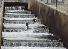
The dam is a 55 m high (from the foundation) concrete gravity dam located at an altitude of about 530 meters asl and is 285 meters across the beautiful, dark, blue-green Kurichhu river at Gyalpozhing. At full reservoir level 15.70 million m³ of water is impounded behind the dam. At the time of our visit, one of the four turbines was operational and there was a small release of water downstream of the dam. The fish ladder was in flow, releasing just 0.8 cumecs of water. The project authorities said that during such low-flows, this is the only flow from the dam, since there is no minimum flow required to be maintained by law in Bhutan. The ladder is a pool-and-weir type, with submerged orifices and centrally located notches.  A pool and weir design is one of the oldest styles of fish ladders. It uses a series of small dams and pools of regular length to create a long, sloping channel for fish to travel around the obstruction, in this case the dam. The channel acts as a fixed  lock to gradually step down the water level; and to head upstream, fish must either negotiate a slot, or jump over from box to box in the ladder.

The Kurichhu fish pass has a total of 98 baffles, each 1.5 m wide and 1.5 m deep, arranged at a distance of about 2.9 m. The total depth of each pool is 2 m. There are two exits (water entrances) to the fish pass, the lower exit placed 5 m lower than the other, to provide for flow at different draw-down levels. The vertical height between the water level of the ‘stilling basin’ (interesting name for a reservoir holding 15.7 million m³ of water) and the water entrance for fish from below the dam is 32 meters. To achieve this height, the fish-pass channel has to traverse a total distance of 320 m, leading to a slope of 1:10, and resulting in a drop in height per pool of 0.3-0.4 m. Quite impressive, except that the slot in the centre of each baffle does not exceed 25 cm in width. Clearly, no way for big fish, and Mahseer (Tor), the fish with the longest migration distance in this river, also happens to be the largest carp in the world.

We asked the project manager whether they know the fish ladder to be effective. He said that on a few occasions during the fish migration season, they had stopped the flow of water in the ladder and found some small fish in some of the drained pools. They did not know which species they were. We enquired whether there had been any systematic study of the efficacy of the fish ladder, in terms of comparing, with a baseline since commissioning the dam in 2002. Whether there was a change in species composition, or a significant change in upstream fish populations during this time? He replied that they had not.

Mahseer in Bhutan's Rivers. Photo with thanks from: http://yesheydorji.blogspot.in/
Mahseer in Bhutan’s Rivers. Photo with thanks from: http://yesheydorji.blogspot.in/

Discussion: It is understandable that project authorities in Bhutan were not familiar with names of fish species or other particularities, because people in Bhutan in general do not catch or eat fish. This could stem from Buddhist tradition, but also from funereal custom, where one of the traditional options is that the body of deceased adults is dismembered and consigned to the river for fish to consume.

On enquiring about any documentation with regard to the fish ladder design, they kindly shared a document titled ‘Feasibility Studies for fisheries development in Kurichhu reservoir, Bhutan’ prepared for NHPC, Faridabad, by CIFRI, Calcutta. While CIFRI has been hired by NHPC ostensibly for extending their expertise on fish, they could have spared us their use of tired narratives of ‘development’. It is clearly beyond their area of expertise. Prefacing their feasibility study on fish passes with statements such as “advancement of human civilization and distortion of natural habitat go hand in hand,” and “requirement of electricity is synonymous with the development of civilization”, and more, just exposes their fait accompli. We photographed relevant pages onsite, and along with discussions, have gathered the following:

Since every fish passage requires to be designed to cater to the specific behavioural propensities and physical capabilities of a particular set of fish species inhabiting the river in question, certain stretches of the river were sampled by CIFRI. The fish they caught can be grouped into three broad groups:

  • Snow trout, mahseers and minor carps: Schizothorax richardsonii. S. Progastus, Barbodes hexagonolepis, Labeo dolycheilus.
  • Loaches: Garra lyssorhinchus, G. gotyla,
  • Catfish: Glyptothorax coheni, G. brevipinnis, Pseudocheneis sulcatus.

CIFRI did not catch Tor during sampling, but during dam building many fish were caught by workers and staff from India, one 15 kg and another 20 kg fish near Kurizhampa bridge. Fish of this size cannot be Barbodes or Chocolate Mahseer, and seem to be Mahseer of the Tor genus (species tor or putitora).

The three functional categories of fish migration in general are: Reproductive (spawning) migration, feeding (trophic) migration and refuge migration. For this, hill-stream fish are known to migrate between three major habitats: A wintering habitat, a feeding habitat and their spawning habitat.

Dams and other diversions for river regulation are seen to impact fish in five major ways:

  • Obstruction in the ascent of fish in their migration for spawning.
  • Reservoirs can inundate spawning habitat, silting up gravels,
  • Changes in river water quality due to inter-basin transfers and stratification of water.
  • Natural flows downstream are radically altered. This includes abruptness of changes in flow, in volume, velocity and seasonality.
  • Prevention of young migratory fish and refuge migrants from descending to lower reaches.

In addition, adverse repercussions result from indirect effects such as the disruption of the food-webs downstream, stranding of fish during rapid flow fluctuations, and siltation in the reservoir above the dam. The chemical, trophic and thermal properties of a river are greatly  altered. Additionally, changes in slope, riverbed profile, structure of the bottom surface, submergence of gravel zones, and changes in the thermal and trophic regimes, affect the habitability of certain stretches of the river.

Designs of fish passages are many, and can be broadly categorized as follows:

  • Fish ladders. Pool and weir, baffle fishways, rock-ramp fishways, vertical slot.
  • Fish lift locks
  • Fish elevators
  • Fish trapping and hauling.
PoolWeir-Bonneville_Ladder
Pool and Weir Type Fish Ladder, Bonneville Dam, United States Photo: Wikipedia
Special Fish Ladder for Salmon in Sweden. Photo: Wikipedia

The basic information you need for designing a fish pass, is details about the species particularities such as normal cruising speed and burst speed of target species. Some important criteria are:

  • Provision of comfortable passage for all migratory species, including the poorer swimmers, over the entire length of the fish pass. To achieve this, provision for refuge against fast currents at regular intervals should be made.
  • Year-round functionality, under different flow regimes, temperatures and oxygen levels, notably to enable fish displaced by floods to return to their initial habitat.
  • Sufficient space or carrying capacity allowing massive upstream ascents during reproductive or trophic migration.
  • Positioning the entry of the fish pass so that it is readily identifiable and accessible to the migrants.
  • Attraction of fish to the fish pass entrance in the downstream (water exit) in case of upstream migration and deterring them from dead-ends and dangerous places.
  • Positioning of upstream outlet (fish exit) of fish passes far enough from spillways and turbines to minimize the risk of being swept downstream or being damaged.

Clearly, creating an artificial fish passage is complex and would not work if the multiple aspects are not considered and provided for. Ease of physical passage is just one important aspect. Migration is specifically timed to match various conditions, and even a delay in migration can nullify the purpose. For example, upwelling and excessive turbulence in the areas near the fish entrance are undesirable, as they can confuse migrating fish from finding the entrance. For this, the gates of the dam are required to be manipulated so that the heaviest spill is at the bank opposite the fish-way, with the result that the velocity barrier forms a diagonal lead, a traffic signal of sorts, across the river to the fish entrance. Apart from a sufficient ‘attraction flow’ at the entrance of a fish pass, projects elsewhere have experimented with directing fish traffic with the help of guiding screens, and the use of overblown ‘traffic signals’ such as acoustic arrays, strobe and mercury lights, and even electric fields.

At a fish passage such as the array at Kurichhu, it is critical that at the entrance of the fish-way, the gate is to be manipulated to ensure possible passage of fish. Depth and velocity to suit particular species need to be maintained. CIFRI recommended a ‘compromised’ depth of 25 cm to be sufficient to allow fish passage. In addition the gates should be regulated to ensure that all the baffles are submerged, allowing the fish to swim over them upstream comfortably. This was not the case, when we visited, the flow level did not allow for the baffles to be submerged, as visible in the photograph as well.

Even with a depth of 25 cm in the fish exit, the variable head-height as per the draw-down of the reservoir can create a higher velocity than desired. While CIFRI warns that this poses apprehensions regarding hindrance to fish migration, they dismiss these apprehensions summarily thereafter, stating that this high velocity is observed only for a short distance, which fish would be able to negotiate using burst speed (high speed, short duration). CIFRI mentions that it is only when the speed at the water entrance or any other point exceeds burst speed, (5-6 m per second) that fish would be unable to cross this speed barrier.

While variables such as water temperature and fish length are determinants of swimming speed of fish, CIFRI has assumed that Schizothorax  and Barbodes can swim at 3-5 and 2-4 m per second respectively. They have taken the flow speed of water with head height, and fitted it to the equation for determining the velocity through the orifices in or over the baffles, and they are estimated to be ranging from 2.69 to 2.80 m per second, which they say, ‘permits the fish to cruise through the fish-way comfortably.’

There are some doubts here. Even a short distance of one baffle, or at just the entrance is critical, because if that is unpassable, the entire fish-way is unsuccessful. Further, CIFRI has arrived at burst-speed of fish for this river not by actual studies on specific species, but by inference from studies on fish in other countries. What strikes as doubtful about this basis, is their assumption that all other things being equal, a fish of any species is capable of equal burst speed, provided it is of the same length. This does not match anything one sees as evidence in the occupation of different fish species in different river stretches, nor in their striking speed while feeding competitively.

In order to test whether the fish ladder was ‘working’, CIFRI officials operated the fish pass in March (the beginning of the migration season) for 3 days and then closed the sluice gates to check. They found Schizothorax richardsonii, Garra gotyla and G. lissorhinchus in the top-most pool. They did it again in June and found 8 species in the uppermost pool. While it is clear from this that some fish are making it up the channel right upto the top pool, they have no way of knowing for sure whether they were getting through the 25 cm gap at different draw-down levels.

The critical question here is not just whether some fish are making it up the channel, but which species, how many, and are breeding populations making it up on time? A relevant study cited on the April 2013 issue of the Yale Environment 360, titled ‘Fish and hydropower on the U.S. Atlantic coast: failed fisheries policies from half-way technologies’ by J.Jed Brown and 6 other co-authors (Conservation Letters, Vol 6. Issue 4, p 280-286, July/Aug 2013) is instructive. The discussion by co-author John Waldman is titled ‘Blocked Migration: Fish Ladders on US dams are not effective’, citing this study goes on to say that fishways on rivers in the U.S. Northeast are failing, with less than 3 percent of one key species making it upriver to their spawning grounds.

 Waldman says that “in most major rivers in the U.S., maintaining some semblance of the integrity of migratory fish runs past hydropower dams is dependent upon the fish using ladders and elevators”. They undertook a study of the success – or, rather, failure – of Atlantic salmon, American shad, river herring, and other species in migrating from the sea to their spawning grounds past a gauntlet of dams on three rivers in the northeastern U.S. – the Susquehanna, Connecticut, and Merrimack. Waldman says “what we found was grimmer than we expected. For one species, American shad, less than 3 percent of the fish made it past all the dams in these rivers to their historical spawning reaches.  The sobering aspect of these contemporary studies is that they are based on the insubstantial number of fish today as compared to earlier massive migrations of these species, which numbered in the many millions. For the international community, the record of fish passage on rivers in the northeastern U.S. is a cautionary tale”.

He goes on to say that “hydropower has often been billed as a clean source of renewable energy, and generating electricity without polluting the air or producing greenhouse gases is commendable. But ‘clean’ is in the eye of the beholder, and any claims to being sustainable ignore its multifarious aquatic effects, including blocking fish passage, fragmenting habitat, and undermining a river’s fundamental ecological services.”

What Brown and co-authors found was bleak. One metric used was the percentage of fish passing the first dam that also passed just the second dam. For shad, the numbers were 16 percent on the Merrimack, 4 percent on the Connecticut, and 32 percent on the Susquehanna. But on these rivers, Waldman says, the second dam is only the beginning of the journey, and these rivers have multiple dams blocking access to historical spawning reaches. It’s important to put these results in perspective because they are merely relative to the present paltry numbers of fish that even attempt to migrate up these rivers.

The study says that there are three absolute numbers that matter. One is how many ran annually before the dam was created, the second is the numbers targeted for restoration in fish passage programs, and the third are the numbers that actually show up each year. On all the rivers examined by the study, restoration goals were in the hundreds of thousands of fish – at least one, if not two, orders of magnitude less than historic, pristine runs. Yet run sizes obtained across three decades ranged annually from a high of about 10 percent to, more commonly, 2 percent or less of the stated goals.

There are two significant aspects worth taking note of here. First, the three absolute numbers that matter, as mentioned in the paragraph above. The construction of a fish ladder must come with quantified stated goals, in terms of the number of fish that are required to pass as minimum, to achieve the desired stability of fish populations. This requires an estimate of populations prior to building the dam, and an estimate of the number that migrate unimpeded, as well as specific population dynamics. Fish migrations in large rivers can be in the millions, as already cited here from Brown and Waldman’s study. Here at the Kurichhu, or any other fish-pass in India, population and migration estimates, let alone quantified goals are a far cry.

Secondly, the study clearly illustrates that every subsequent dam upstream has a cumulative  impact on the numbers of fish succeeding upstream, diminishing in orders of magnitude. This brings to the fore the critical importance of considering cumulative impact of multiple projects, despite ‘mitigation measures’, along an entire stream-length, before any clearance is given piece-meal.

While on the design for fish-passes on specific hydro-projects, there are many aspects other than physical passability provided by a fish-pass, that determine its success or failure. Changed flow, turbulence, and volumes can be disorienting for fish leading to serial delays, making it unlikely that the many fish make it to the spawning reaches at the optimal time in the river’s seasonal ecological cycle. The numbers of adults successfully returning downstream past the dams also sacrifice their future spawning potential. The flow out of an operating fish-ladder is often very small compared to the water going into the intake to the turbines, and fish will often choose the larger flow during descent, to their peril. At Kurichhu for example, the flow down the fish ladder is just 0.80 m³ a second, which is a fraction of the flows for the 4.75 m diameter intake of any one of the four 15 MW turbines.

There is also the larger question of flows in a river being regulated by series of dams, and sometimes being too low to provide the necessary cues for hormonal change and migration, puts paid to fish even reaching fish-ladders in the first place.

The study by Brown and colleagues in the US says that despite vast spending on modern technologies, contemporary shad migrations on these rivers are at least three to four orders of magnitude below the original unfettered run sizes, with similar results for salmon and river herring. While dams alone don’t explain these results; overfishing, habitat destruction, and alien species contribute – but there is widespread consensus among fish biologists that dams (such fish-passes notwithstanding) are a primary cause. Surely, a cautionary tale for India.

And here is another cautionary tale for India, where unlike Bhutan, fish are eaten, readily. Thirty-three years ago, standing on the Sutlej Barrage at Ropar in Punjab, I witnessed a strange sight. At the base of the barrage, there was some urgent movement in the cold blue waters of the Sutlej in early spring. Mahseer fish were attempting to migrate up and beyond the 10 meter high barrage. There, right along the buttress of the sloping spillway, one could see a living pyramid of thousands of fish upon fish, slithering up the side of the uni-dimensional triangle against the spillway, barely submerged in the leaking flow from one of the gates, and wriggling on top of and past each other, in a futile effort to make it over the barrage. While this may just have been a collective shoal strategy to get past smaller rapids, it was a death-trap for fish there, against a steep and high barrage. Some other men had already seen this, and I could see them wade up to the desperate and tenuous pyramid in knee deep water below the barrage, and carrying away fish in sack-loads.

Hydro-power projects in India may undertake to construct fish-ladders projected as mitigations measures to obtain environmental clearance, but that does not prevent the staff and others from making the best of the concentration of fish at the base of the fish-ladders and even at un-passable barrages and predating on them. The CIFRI study for the Kurichhu mentions that Indian workers hired by NHPC regularly fished at points of concentration during migration season, nullifying the purpose of the fish-pass. Clearly, the dam authorities will also need to be charged with the responsibility for protection of fish-passes, and other points of concentration even on dams without fish passes.

These are some of the aspects that require to be further investigated about fish-passes in our Indian context, and to be put on the table for discussion and closer scrutiny when mitigation measures are proposed by hydro-power projects.

Editor’s Note from SANDRP:

When the rivers in Himalayas are facing huge impacts of cascade hydropower projects, it is important to look at the role played by organisations like CIFRI ( Central Inland Fisheries Research Institute) which is supposed to be Asia’s “premier facility in the feild of inland fisheries research” CIFRI was hired as a consultant for recommending eflows for Teesta IV HEP in Sikkim and 780 MW Nyamjangchu HEP in Tawang, Arunachal Pradesh. In the case of Nyamjangchu, CIFRI recommended a flow of 3.5 cumces from the proposed barrage point, which is 14% lower than the lowest flows recorded (extrapolated) for that site. It is highly improbable that even CIFRI’s target species of snow trout will be able to sustain these drastic flow reductions. CIFRI has not raised a voice when multiple dams are being planned without fish ladders or realistic mitigation measures across the country when protecting riverine fish and fisheries is a part of its mandate.

In a strange contradiction, although India’s NHPC has built Kurichhu HEP and CIFRI has designed the fish ladder for a dam that is 55 mts high, the EAC of the MoEF in India unilaterally thinks that fish ladders do not work for dams, even as high as 42 meters, This EAC also includes representative from CIFRI.

Before concluding that fish ladders will or will not work in India, we need extensive studies on this subject for different rivers and projects. Unfortunately, none are being undertaken, in line with our overall apathy towards riverine fish diversity and fisheries. Good, scientific  studies will help in designing ladders which can be useful for species specifically found in Indian rivers, or will conclude that ladders will not work in specific cases, in which case, the irreversible impact of the project will have to be looked at in a perspective beyond ‘mitigation measures’.


Dams · Hydropower · Ministry of Environment and Forests · Sikkim

Hydro Power Projects Violating SC order in the Greenest State of India

Gangtok, 9 October 2013: Deemed as the greenest state in India, the government of Sikkim has drawn flak of the national board of wildlife (NBWL) for blatant violation of the environmental norms and the standing order of the Supreme Court in implementation of several hydro power projects under different stages of construction.

The background: In its 28th meeting held on 20th March 2013, the proposal for 520 MW Teesta Stage-IV Hydroelectric Power Project, on River Teesta in North Sikkim to be developed by NHPC Ltd, was placed before the SC-NBWL (Standing Committee-National Board of Wild Life) for consideration. The Member Secretary had informed the SC-NBWL that the project location falls 4 km away from the Fambonglho Wildlife Sanctuary and was recommended by the State Board for Wildlife.

photo 1
Photo from SC-NBWL committee report has this caption: Construction of the Teesta III project at Chungthang on the edge of Khangchendzonga National Park proceeding without SC-NBWL clearances. Note the extensive forest cover and large landslides at the site

Following discussions, the SC-NBWL decided that a team comprising Dr M.K.Ranjitsinh, Kishor Rithe, Dr A.J.T Johnsingh and Dr M.D. Madhusudan would carry out site inspection and submit a report to the committee for its consideration. Following this decision, the above committee visited the project site and nearby areas from 15th to 21st May 2013. The committee met the representatives from the Sikkim Government’s Forest, Environment and Wildlife Management Department (FEWMD), the user agency, NHPC Ltd, and people from local citizens’ groups. The report of the committee dated Aug 2013 is now available online (http://envfor.nic.in/division/wl-orders).

The report raises serious concerns about a number of hydropower projects in Sikkim under construction without wildlife clearance in contravention to the Supreme Court order[1] (in the Goa foundation case).  The Chamling government in Sikkim has allowed blatant violation of the Supreme Court order, a situation compared by the report with what had happened in Goa with respect to mines which were operating without wildlife clearance in violation of SC orders (the subject of the Shah Commission report). The Union Ministry of Environment and Forests is equally responsible for allowing continuing construction of these projects without legally mandatory clearances. The decision based on this report in the NBWL Standing Committee is still pending.

map 1
Map with locations of projects and protected areas from the SC-NBWL committee report

Both before and during site inspection, multiple stakeholders brought to the notice of the NBWL team that there were other proposed and ongoing hydel projects in the Teesta Basin located within the eco-sensitive zone (as defined by the Supreme Court in the Goa Foundation case), of the Khangchendzonga NP and Fambonglho WLS, which had not obtained the Supreme Court mandated clearance from the Standing Committee of the National Board for Wildlife.

Besides this,  the team in their journeys saw  two projects under active construction—the Dik Chu[2] and the Teesta III[3]—that were clearly within the Supreme Court mandated eco-sensitive area. For Dik Chu HEP, the report says, “However, the accompanying FEWMD officials informed us that these mandatory wildlife clearances from the SC-NBWL had, apparently, not been obtained.” For Teesta III HEP, FEWMD officials were not aware of the SC-NBWL clearance, and the committee noted, we “must therefore conclude, on the basis of information available with us, that such a clearance was not obtained… we are deeply concerned about the advisability of this project.”

Deeply concerned about the likelihood of various hydel projects coming up in violation of the Supreme Court’s order in the Goa Foundation case, the team has  requested the MoEF to write to the government of Sikkim, seeking a comprehensive list of completed, ongoing and proposed hydroelectric projects within the Supreme Court mandated 10-kilometre zone of the Khangchendzonga National Park (KNP) and Fambonglho Wildlife Sanctuary (FWLS). For each project,  details sought included:  (a) location (latitude-longitude) and distance from KNP and FWLS; (b) current status of the project; and (c) if and when they had obtained the required Environment, Forest and Wildlife Clearances. Even after waiting for 10 weeks, the NBWL team did not receive either an acknowledgment, or a response from the Pawan Chamling government to their query.

The committee, left with no option was compelled to use publicly available information on Environmental Clearances (EC) (http://environmentclearance.nic.in), submissions and information provided by other stakeholders, and to examine minutes from the SC-NBWL’s meetings, to ascertain if there was merit to the allegations made about the violations of the Supreme Court’s order of 12/2006.

Key recommendations Based on examination of available information on legal compliances required for the projects in the Teesta basin, the committee concluded that, with the notable exception of the Teesta IV project (which has currently approached the SC-NBWL for clearance), none of the other projects appear to have sought/obtained this compulsory SC-NBWL clearance, as mandated by the Supreme Court. While the SC-NBWL is fully aware that there are many more proposed/ongoing hydroelectric projects situated within the Supreme Court mandated 10-km eco-sensitive zone of wildlife sanctuaries and national parks in Sikkim, it has not been able to ascertain whether Supreme Court stipulations in their regard are being followed, or being violated, and if latter be the case, the MoEF should take due cognizance of the same urgently.

“We are of the unanimous considered opinion that it is absolutely essential to assess the overall impact of these projects, both from the recent past and those in the pipeline, rather than deal with them in a piecemeal fashion. Hence, we urge the Standing Committee not to consider the Teesta IV project’s request for clearance separately, but treat it as part of a larger set of hydroelectric projects in the Teesta Basin, with vast ecological, social and legal portents”, the committee has recommended.

It further recommend that the Standing Committee direct the MoEF to write to the Government of Sikkim asking them to immediately investigate and submit a detailed report listing hydroelectric projects in Sikkim that are being constructed prima facie in violation of Supreme Court’s order. Based on the list provided by the government of Sikkim, if it is indeed ascertained that the projects are proceeding in violation of the said Supreme Court ruling, it further adds that the MoEF initiate action by asking the State Government to suspend ongoing work on those projects immediately and to direct user agencies to formally seek clearance for these projects from the SC-NBWL. It adds that the MoEF and the Government of Sikkim thoroughly investigate the circumstances under which the seemingly widespread bypassing of Supreme Court orders in the construction of dams within the 10-km ecosensitive zone of Sikkim has taken place, fix responsibility for the transgressions and violations, and punish the guilty.

About Teesta IV proposal from NHPC, for which the committee visited Sikkim, the report recommends, “Finally, in the light of the devastating June 2013 Uttarakhand floods, we are deeply concerned about the wisdom of such large-scale manipulations of mountain river systems that are being implemented, against all reasonable scientific advice (and thedisregard of the CISHME’s recommendation against the construction of Teesta III, is a case in point)… Hence, we urge the Standing Committee not to consider the Teesta IV project’s request for clearance separately, but treat it as part of a larger set of hydroelectric projects in the TeestaBasin, with vast ecological, social and legal portents.”

The report also recommends  that projects already in the pipeline and that may be proposed in future in Sikkim, be placed before the Standing Committee, “chaired by a very senior official of the MoEF, Besides senior officials of the MoEF and the Sikkim Government, this committee must include legal experts as well as experts in hydrology/ geology/ seismology/ social science/ botany/ riverine ecology/wildlife ecology, from reputed research institutions and some representatives of local communities” whenever they fall within the purview of the Supreme Court-mandated 10 km eco-sensitive area around PAs. The committee report adds that much of the summary and recommendations section of Justice Shah’s report (pp. 189-200) is extremely relevant to the case of the hydroelectric dams in Sikkim, and that any committee constituted to examine hydroelectric dams in the eco-sensitive areas of Sikkim, pay close attention to this report.

No ecological flows from NHPC’s Teesta V What the report says about this subject makes disturbing reading: ”On 16th May 2013, driving upstream of the Teesta V powerhouse, we noted extremely low flow in the river, which was particularly so in the stretch of the river directly downstream of the Teesta V dam (Figure 1), where the river was diverted through a tunnel. Such low flows, where River Teesta has been diverted through tunnels, are a cause for serious concern in the context of maintaining the ecological function of a river. We enquired from NHPC officials about how details of ecological flows were determined, and learnt that ecological flow was not a parameter that was optimised in the planning process. We were told that downstream flows were effectively a consequence of maximising hydropower potential of various river basins as determined jointly by the Central Electricity Authority and the Central Water Commission. These values, in turn, were used as the basis for soliciting proposals for hydroelectric power projects. In other words, we learnt to our great dismay that absolutely no ecological consideration whatsoever was used in the process of determining the hydropower potential of river basins.”

Violations galore, government unresponsive In a submission made by Tseten Lepcha in his capacity as the then Honorary Wildlife Warden of North Sikkim to Jayanthi Natarajan in 8th October 2011, Lepcha had contended that how the 1750 MW Demwe Lower by the Athena group is being considered by the SC-NBWL for wildlife clearance, when a project by the same promoters (1200 MW Teesta III) is under construction in violation of Supreme Court orders (without wildlife clearance). The current NBWL report confirms that the 1200 MW Teesta III is under construction illegally, violating SC orders. In an earlier submission he had made to the SC-NBWL on April 19, 2011 he mentioned violation of the WLPA (killing of a Serow – Schedule I species) in the 1200 MW Teesta III project being developed by the Athena group. The developer of the project, Teesta Urja Ltd (a special purpose vehicle of M/S Athena Pvt. Ltd.), through its sub-contractor, SEW Infrastructure Ltd, was involved in the death of a Serow (Capricornis sumanntraensis), a Schedule I animal, at the project site on June 4, 2008.

photo 2
Photo from SC-NBWL com report with this caption: The Teesta V dam showing the virtual absence of flow in the river downstream of the dam, which can have devastating consequences for river-dwelling and river-dependent species

Several attempts by this correspondent, to contact the PCCF –cum-Secretary of the FEWM department of Sikkim Mr. Arvind Kumar on his cell phone, and his official e-mail address to get the Sikkim government’s official version on the controversy, remained unanswered.

How IPPs are cheating by flouting norms Sikkim Bhutia Lepcha Apex Committee (SIBLAC) convenor Tseten Tashi Bhutia, while speaking to this correspondent expressed immense joy at the NBWL report. “We have been protesting cultural and religious genocide being committed by the Sikkim government in the name of developing hydro power, apart from severely degrading the environment, this is a moral boost. I hope GOI takes strong action”, he said. Bhutia added that there are violations of the Places of Worship (special provisions) Act 1991, extended to Sikkim, and the gazette notifications of the Chamling government, in allowing the Tashiding project on holy river Rathong Chu.

SIBLAC along with another apolitical group Save Sikkim on September 28th, 2013 filed FIRs against an IPP, Shiga Energy Pvt ltd, developer of the 97 MW Tashiding hydro power project for alleged cheating, distortion of facts and violation of environmental norms and the SC order. This is in addition to an ongoing PIL at the Sikkim High Court.

The facts revealed by Tseten Tashi Bhutia in his FIR are startling and shocking. As per the requirement of the Environment Ministry (MoEF, Government of India), the executing agency i.e. Shiga Energy Private Limited, is required to submit a Six-monthly compliance report[4] on the status of the 97 MW Tashiding HEP to the stipulated environmental conditions in a prescribed format .However, while going through the latest Six monthly report dated 22.11.2012[5] submitted by the executing agency to the concerned authority i.e. North Eastern Region Office, Ministry of Environment & Forest, Government of India , it is found that as against the IX necessary conditions required in the prescribed format, the executing agency have intentionally deleted Stipulation No. VIII, jumping to the next condition.

The Monitoring report of MEF regional office (signed by DR S C KATIYAR, SCIENTIST ‘D’) dated Oct 2012[6] says about Stipulation VIII: “the proposed site is about 5 Km away from the buffer zone of the Khangchendzonga Biosphere Reserve as per Supreme Court order clearance from NBWL may be obtained (if required).”  Status of Compliance: “Not complied with” and further writes; “the project also falls within 10 Kms from the Fambomgla Wildlife Sanctuary, as such; NBWL clearance needs to be obtained.”

Thus the agency has not complied to nor has obtained NBWL clearance yet as evident from the Monitoring Report on the Implementation Status of Conditions of Environmental Clearance dated Oct 4th, 2012. In other words, the executing agency has simply and swiftly been misleading and cheating the authorities till date by submitting wrong report to Ministry of Environment and Forest, Govt. of India. More surprising is to witness the lack of action by the MoEF on these manipulations and lack of action even after the Monitoring Report clearly reports non compliance.

Rathongchu is a sacred river according to the Denjong Neyig and Nesol texts having its source at various secret and sacred lakes at Khangchendzonga, Sikkim’s supreme guardian deity and runs independently till it meets River Rangit at the lower reaches; This sacred Rathongchu is the source to the annual Tashiding Bumchu ceremony which is held in the first lunar month, corresponding to the months of February and March. In fact, this Bumchu (Sacred Water) ceremony has been continuing for centuries and attracts thousands of devotees and pilgrimages from far across including Bhutan, Nepal, and entire Himalayas.

Ironically, a one-man Professor P S Ramakrishnan committee, of the JNU School of Environmental Sciences, submitted a report titled Ecology and Traditional Wisdom,  on October 9th 1995, to the government of Sikkim where he categorically stated, “on social, cultural, and religious considerations, apart from the rich bio-diversity and fragile ecology of the Yuksom valley region, I strongly recommend that no hydro power or other projects should be allowed on River Rathongchu, deemed extremely sacred by Buddhists”. Under the circumstances, how was the Tashiding HEP allotted to the Shiga Energy Ltd by the Sikkim Government and cleared by the MoEF is moot question.

Some of the other proposed projects that are mentioned in the SC-NBWL committee that are also coming up requiring the SC-NBWL clearance include the 300 MW Panan HEP, the Ting Ting HEP, besides the ones mentioned above, see the accompanying map from the SC-NBWL report. Other hydropower projects of Sikkim that are being considered by the MoEF for clearances and that are also close to the protected areas include: 63 MW Rolep HEP on Rangpo river in E Sikkim (5-6 km from Pangolakha and Kyongnosla WLS), 126 MW Ralong HEP (4.05 km from Kangchendzonga Biosphere Reserve and 1.8 km from Maenam Wildlife Sanctuary), 96 MW Chakung Chu HEP inn North Sikkim district (1.8 km from Kangchendzonga Biosphere Reserve). Other such possible projects include: 71 MW Sada Mangder, 60 MW Rangit III, among others.

Let us hope now following the SC-NBWL report, the MoEF will promptly order stoppage of illegally ongoing construction of the guilty HEPs, not waiting for the SC-NBWL committee to meet, since the new Standing Committee of the NBWL remains to be constituted after the term of the earlier committee ended. The evidence provided by the SC-NBWL committee is sufficient to take prompt action. The fact that the MoEF has not take action yet, weeks after submission of the SC-NBWL report speaks volumes about the possible collusion of the MoEF in this murky affair.

Soumik  Dutta (duttauni@gmail.com, with inputs from SANDRP)

END NOTES:


[1] WP 406/2004, Goa Foundation vs. Union of India, Order dated 04/12/2006: “The MoEF would also refer to the Standing Committee of the National Board for Wildlife, under Sections 5 (b) and 5 (c) (ii) of the Wild

Life (Protection) Act, the cases where environment clearance has already been granted where activities are within 10 km. zone

[2] Strangely, the Environment clearance letter for the project does not even mention the need for SC-NBWL clearance, see: http://environmentclearance.nic.in/Auth/openletter.aspx?EC=5766

[3] The Six monthly compliance report for Teesta III dated June 2013 also is quite on the issue of compliance with SC-NBWL clearance, see: http://environmentclearance.nic.in/writereaddata/Compliance/57_Teesta%20HEP-III%20_june2013.pdf, the condition for this was mentioned in the MoEF letter dated 30-04-2010 with additional condition: “Considering the proximity of Khangchendzonga National Park from the project site, clearance from the Standing Committee of theNational Board for Wildlife (NBWL) should be obtained”.

[4] For latest version of the compliance report, see: http://environmentclearance.nic.in/writereaddata/Compliance/34_Tashiding%20Six%20Monthly%20Compliance%20Report_May%202013.pdf. In this report, the column before the condition VIII says: NA (not available).

Hydropower · Hydropower Performance · Indus

HydroPower Performance in Indus Basin

Indus river rises in the southwestern Tibet Autonomous Region of China. Originating in the Tibetan plateau of western China in the vicinity of Lake Mansarovar in Tibet Autonomous Region, the river runs a course through the Ladakh district of Jammu and Kashmir and then enters Pakistan via the Northern Areas (Gilgit-Baltistan), flowing through the North in a southerly direction along the entire length of Pakistan, to merge into the Arabian Sea near the port city of Karachi in Sindh.

The Sub-basin wise generation data of large hydro with installed capacity of the basin in the latest year 2012-13.

Projects

Inst Capacity  (MW)

Generation (MU)

MU/MW

Sutlej

4534.3

18979

4.19

Beas

2267

9125

4.03

Ravi

2059

7383

3.59

Chenab

1530

8159

5.33

Jhelum

690

3828

5.55

Total

11080.3

47474

4.28

indus

  • The above graph shows the trend line of power generation of Big Hydropower projects for last 28 years in the basin, the trend-line shows diminishing generation from existing hydro power projects of Indus River Basin.
  • It shows that the per MW generation in 2012-13 (4.28) has dropped by a huge 17.69% from the highest per MW generation (5.2) achieved in the year 1988-89.
  • All generation figures have been taken from official data of Central Electricity Authority (CEA).

List of other projects (up to 25 MW) under operation (for which latest generation figures not available):

SN Project

Ins Cap (MW)

State

In main basin


1 Iqbal

3.75

Jammu & Kashmir
2 Hunder

0.40

Jammu & Kashmir
3 Sumoor

0.10

Jammu & Kashmir
4 Igo-Mercellong

3

Jammu & Kashmir
5 Haftal

1

Jammu & Kashmir
6 Marpachoo

0.75

Jammu & Kashmir
7 Bazgo

0.30

Jammu & Kashmir
8 Stakna

4

Jammu & Kashmir
Total

13.30

In Sub Basins
1 Sutlej

31.55

Himachal Pradesh
2 Beas

61.8

Himachal Pradesh
3 Ravi

110.6

HP, J&K and Punjab
4 Chenab

33.8

Jammu & Kashmir
5 Jhelum

51.6

Jammu & Kashmir
 

Grand Total

302.65


Source: http://www.hpseb.com/hydro_potential.htm

http://jkspdc.nic.in/exist.htm

List of proposed and under construction projects in the basin:

  Project

Ins Cap (MW)

State

Status

In Main Basin


1 Rongdo

9

Proposed IPP Project
2 Bairaas

9

Proposed IPP Project
3 Tamasha

9

Proposed IPP Project
Total

27

In Sub Basins
1 Sutlej

6055

Himachal Pradesh
2 Beas

3270.1

Himachal Pradesh
3 Ravi

1292

HP, J&K
4 Chenab

8225

HP, J&K
5 Jhelum

864.55

Jammu & Kashmir
Grand Total

19733.65

Source: http://jkspdc.nic.in/up.htm

http://www.hpseb.com/hydro_potential.htm

http://envfor.nic.in

Map of Hydroelectric Projects in Indus River Basin available at:

https://sandrp.in/basin_maps/Hydropower_Projects_in_Indus_Basin.pdf

South Asia Network on Dams, Rivers & People (www.sandrp.in)                                           July 2013

ht.sandrp@gmail.com

Chenab · Hydropower

Hydropower Generation Performance in Chenab River Basin

The Chenab River Basin is the major part of IndusRiver Basin. This river is formed by the Chandra and Bhaga, which rises in Lahul. It flows through Himachal Pradesh and Kashmir and is known as Chandra-Bhaga or Chenab. It then Traverses 330 km to Akhnur where it enters Pakistan. It flows 644 km more to Panjnad, joins the Sutlej after receiving the eaters from Jhelum at Trimmu and the Ravi lower down, its catchment area up to the Indo-akistan border is 26,155 sq km.

 The project wise generation data of large hydro with installed capacity of the basin in the latest year 2012-13.

Chenab

  • The above graph shows the trend line of power generation of Big Hydropower projects for last 25 years in the basin. the trend-line shows diminishing generation from existing hydro power projects of Chenab River Basin.
  • It shows that the per MW generation in 2012-13 (5.33) has dropped by a huge 23.09% from the highest per MW generation (6.93) achieved in the year 1990-91.
  • All generation figures have been taken from official data of Central Electricity Authority (CEA).
SN Projects

State

Inst Capacity  (MW)

Generation (MU)

MU/MW

1 Baglihar

Jammu & Kashmir

450

2839

6.31

2 Dulhasti

Jammu & Kashmir

390

2043

5.24

3 Salal

Jammu & Kashmir

690

3277

4.75

  Total


1530

8159

5.33

 List of other projects (up to 25 MW) under operation (for which latest generation figures not available):

SN Project

Ins Cap (MW)

State

1 Chenani-I

23.30

Jammu & Kashmir

2 Chennai-II

2

Jammu & Kashmir

3 Chenani-III

7.5

Jammu & Kashmir

4 Bhaderwah

1

Jammu & Kashmir

  Total

33.8

List of proposed and under construction projects in the basin:

  Project

Ins Cap (MW)

State

Status

  Bhaderwah Unit-III

0.5

Jammu & Kashmir Under Construction
  Pakul Dul

1000

Jammu & Kashmir Under Construction
  Baglihar-II

450

Jammu & Kashmir Under Construction
  Bardang

126

Himachal Pradesh Proposed
  Chattru

108

Himachal Pradesh Proposed
  Miyar

90

Himachal Pradesh Proposed
  Tinget

81

Himachal Pradesh Proposed
  Teling

69

Himachal Pradesh Proposed
  Tandi

104

Himachal Pradesh Proposed
  Rashil

102

Himachal Pradesh Proposed
  Gondhala

144

Himachal Pradesh Proposed
  Khoksar

90

Himachal Pradesh Proposed
  Patam

60

Himachal Pradesh Proposed
  Seli

454

Himachal Pradesh Proposed
  Dugar

236

Himachal Pradesh Proposed
  Gyspa

170

Himachal Pradesh Proposed
  Sach-Khas

149

Himachal Pradesh Proposed
  Reoli/Dugli

268

Himachal Pradesh Proposed
  Ratle

850

Jammu & Kashmir Proposed
  Bursar

1020

Jammu & Kashmir Proposed
  Kwar

520

Jammu & Kashmir Proposed
  Sawalkote I&II

1200

Jammu & Kashmir Proposed
  Lower Kalnai

50

Jammu & Kashmir Proposed
  Kirthai-I

240

Jammu & Kashmir Proposed
  Kiru

600

Jammu & Kashmir Proposed
  Ranjala Dunadi

15

Jammu & Kashmir IPP Projects
  Hanswar Paddar

6

Jammu & Kashmir IPP Projects
  Gulabgarh

6.5

Jammu & Kashmir IPP Projects
  Chenani IV

7

Jammu & Kashmir IPP Projects
  Chingus-I

3

Jammu & Kashmir IPP Projects
  Chingus-II

3

Jammu & Kashmir IPP Projects
  Upper Ans

3

Jammu & Kashmir IPP Projects
  Total

8225

EAC: Expert Appraisal Committee of MoEF; FAC: Forest Advisory Committee of MoEF

Source: http://www.hpseb.com/hydro_potential.htm; http://envfor.nic.in

http://jkspdc.nic.in/exist.htm

Map of Hydroelectric Projects in Chenab River Basin available at:

https://sandrp.in/basin_maps/Hydro_%20Electric_Projects_in_Chenab_River_Basin.pdf

South Asia Network on Dams, Rivers & People (www.sandrp.in)                                           June 2013

ht.sandrp@gmail.com

Cumulative Impact Assessment · Dams · Hydropower · Ministry of Environment and Forests

Upper Ganga Report with Pro Hydro Bias does not do justice to its terms or to Ganga, people or environment

Summary A month after its submission to the Union Ministry of Environment and Forests, the Inter Ministerial Group on Upper Ganga basin Hydropower projects and Ganga river in general is yet to be put in public domain. A detailed perusal of the report shows that the report is hugely biased in favour of large hydropower projects, and has not done justice to the task given to it or to the Ganga river, people or environment. Out of the three non government members (out of total 15 members) on the Group, Dr Veer Bhadra Mishra expired during the working of the group. Rajendra Singh has given a dissent note, not agreeing with the report in its totality. The “alternative view” note from Sunita Narain, the third non-government member, is not much of an alternative and is not in the interest of the river, people or the environment. However, the fact that none of the non-government members have endorsed the report speaks volumes about the credibility of the report.

utc20b-A4

The recommendations of the IMG report are an exercise largely in supporting the interests of hydropower lobby in the name of balancing the power & development needs of the region and local people. The IMG has actually attempted to make 69 large hydropower projects in the Upper Ganga basin a fait accomplice when only 17 of them are under operation and 14 are under construction. In many cases IMG has reached unscientific and unfounded conclusions. Some of the recommendations are also contradictory in some fundamental nature. In many cases IMG has made statements, and implied recommendations that are bad in law. In general, the report shows that IMG has poor understanding of the science of the rivers. Even where the IMG has sought to make some seemingly environment friendly recommendations, it is generally not serious about these recommendations.

A broad conclusion is inescapable that the IMG report (except the dissent note by Shri Rajendra Singh) is largely an exercise in deception, with a pro-hydropower bias. While this note points out key negative aspects of the IMG report, the IMG report is not without some positive aspects. The report gives a list of positive aspects of the IMG report on which there is a lot of scope for positive action, which the MoEF should initiate, while rejecting the report.

FULL TEXT

1. The Inter Ministerial Group (constituted by the Union Ministry of Environment and Forests through an order issued on June 15, 2012) report has been submitted around April 22, 2013, but it is still not in public domain a month later. The report should have been promptly put in public domain as in the case of the HLWG report on WGEEP panel recommendation on the Western Ghats, which was made public the day after the submission of the report to MoEF. These comments[1] are based on the hard copy of the final report made available by a colleague[2].

2. The IMG final report has been endorsed by all members, except the dissent note by Rajendra Singh attached at Annexure X and a note on “alternate approach” from Sunita Narain, attached at Annexure XI. Shri Veer Bhadra Mishra, who was the third non-government member, expired during the period of functioning of the IMG group. The committee constitution was heavily loaded in favour of the government officers (ten of the fifteen members were government officials), so its independence was already in doubt. With none of the non-government members endorsing the report, the report has little credibility. This review tries to look at the report with an open mind.

3. While SANDRP as a group is critical of large, destructive and non participatory hydropower projects, it does not mean the group is against all hydropower projects. For example, if the projects were to be set up through a participatory and informed, decentralized, bottom up decision making process or if projects were to follow the recommendations of World Commission on Dams, such projects would certainly have greater public acceptance. That is not the case for any of the projects today.

4. The main TOR given to the IMG was to decide the quantum of environment flows for the upper Ganga basin rivers, keeping in mind the IIT (Indian Institute of Technology Roorkee, the report was basically from some individual of Alternate Hydro Electric Centre of IIT-R) and WII (Wildlife Institute of India) reports on cumulative impact assessment of the projects in these river basins. However, IIT (Roorkee) report has been found to be so flawed and compromised (for details see: http://www.sandrp.in/hydropower/Pathetic_Cumulative_Impact_Assessment_of_Ganga_Hydro_projects.pdf) that it should have been rejected by the MoEF and the NGRBA. Even the MoEF’s Expert Appraisal Committee on River Valley Projects has been critical of the IIT-R report. However, since a member of the IIT-R was present on the IMG, it may not have been possible for the IMG to take an objective view of the merits of IIT-R report. It is however, welcome that IMG has relied on WII rather than IIT-R report while accepting recommendations on e-flows. WII report was better in some respects, though still suffering from some basic infirmities. Moreover, to set up an IMG to decide on the course of action considering these two reports (and any other relevant reports) was compromised at the outset and was an invitation for further dilution of the environment norms, considering the track record of the most of the members of IMG.

ChillaChannel

Ganga river flowing through a channel, diverted for the 144 MW Chilla hydropower project

5. The recommendations of the IMG report are an exercise largely in supporting the interests of hydropower lobby in the name of balancing the power & development needs of the region and local people. The IMG has actually attempted to make 69 large hydropower projects in the Upper Ganga basin a fait accomplice when only 17 of them are under operation and 14 are under construction. In many cases IMG has reached unscientific and unfounded conclusions. Some of the recommendations are also contradictory in some fundamental nature. In many cases IMG has made statements, and implied recommendations that are bad in law. In general, the report shows that IMG has poor understanding of the science of the rivers. Even

where the IMG has sought to make some seemingly environment friendly recommendations, it is generally not serious about these recommendations. All of these points are further elaborated in this note.

6. Cancelled projects  & those on Bhagirathi Eco Sensitive Zone shown as under development Shockingly, even the projects like the Loharinag Pala, Pala Maneri and Bhairon Ghati that have been officially dropped are shown as under development by the IMG, see Annex VID! In fact in Table 12 and 13 IMG even calculates the reduction in power generation and increase in tariff at Loharinag Pala (among others) if the IMG recommended e-flows are implemented! The 140 MW Karmoli HEP on Bhagirathi, on a stretch that the MoEF has been declared as Eco Sensitive Zone, and on which the GOI has said no large hydro will be taken up, the IMG has actually suggested that the project can be taken up! The 50 MW Jadhganga project, very close to the Gangotri, is shown to be project under development by the IMG! These examples show how the IMG has played a role of supporter of the hydropower lobby.

7. Wrong classification of projects as under construction and under clearance projects IMG has divided the 69 hydropower projects in Upper Ganga basin (leaving our the Kotli Bhel 2, since it is on Ganga river and not on Bhagirathi or Alaknanda) in four categorie

s: Operating projects, under construction projects, under clearance projects and under development projects. It is here that IMG has done its biggest manipulation by classifying a number of projects as under construction when they are not and cannot be under construction. IMG classification of projects under clearances is equally problematic. IMG and even the “alternative View” by Sunita Narian says all these projects in first three categories can go ahead without any change, except the e-flows recommendations. This manipulation shows the stark pro hydro-bias of the IMG.

DryGangaChilla

Dry Ganga river after the river is diverted for Chilla HEP. Photos by SANDRP

8. Manipulations about percentage length of river that the projects can destroy On the one hand, the IMG has recommended that “projects may be implemented so that not more then 60% of the length (of the river) may be affected.” There is no mention how they have arrived at this magic figure of 60%, what is the basis or science behind that magic figure. At the same time the IMG has said that if all the 69 projects were to be implemented than 81% of Bhagirathi and 65% of Alaknanda will be affected. Firstly these numbers are not correct if we taken into account the full length of the reservoirs and the bypassed river lengths by the hydro projects, in many cases the length of the submerged reservoir behind the dam has not been counted. Here we need to add the fact that the reservoir of the 70th Project on its list, the Kotlibhel 2 project will submerge parts of both Bhagirathi and Alaknanda rivers, which has also not been counted by the IMG. WII had to recommend 24 projects to be dropped, and even after that, WII assessed that 62.7% of the rivers would still be affected. However, the IMG has made no recommendation as to which of the projects need to be dropped (except vague review of the projects in Annex VI-D) to achieve that magic figure of 60%. This again shows how non serious IMG is, making this recommendation meaningless.


9. IMG double talk on distance criteria The IMG has said that “There is a clear need to ensure that adequate river length is available to meet the societal needs and River gets adequate time during its flow to regenerate itself” (emphasis added). This sounds good. But IMG has shown no will or interest in ensuring that this happens. In fact IMG exposes its understanding on this matter when it says, “the distance between two hydro projects should generally be such as to ensure that over-crowding is avoided”. What is over-crowding, how do you define it? This is a funny word IMG has used, not even bothering to define it. However, when it comes to implementation, dumping all these requirements, IMG has justified smaller distance (read zero distance) between projects where gradient is high. Now let us understand this: where gradient is high, if the distance left between the projects is less, will the time the river flows between projects be smaller or greater than if the gradient is low? Clearly, if gradient is high, for the same distance, the river will have less time to travel then if the gradient were low. It is in fact the time of free flow that is a crucial driving parameter for river to regenerate itself. So if the river were to have the same amount of time to flow between two points, with higher gradient, river will require more distance, not less. This again exposes the poor understanding of IMG members about science of the rivers.

The IMG even goes on to say that “distance will have to be smaller in view of technical requirement of the hydro power. This could result in continuity in some cases.” Firstly it is clear here again that IMG is basically catering to the hydropower lobby, it is completely non serious about the environmental issues. That is why after all those great sentences, it goes on to say that it is the technical requirement of the hydropower project that will be the decider! If technical requirements means no distance between two projects, then river can disappear, environmental issues do not matter! In case of many projects where the distance of free flowing river between projects is very little or nil and where the construction has not started or has not progressed much, there is today scope for change. For example in case of Vishnudgad Pipalkoti HEP on Alaknanda: the Full Reservoir Level of the VPHEP is same as the Tail Water Level of the upstream Tapovan Vishnugad HEP. This means that there is zero length of free flowing river between the projects. VPHEP does not have all the clearances and its construction has not started. Even for the upstream Tapovan Vishnugad HEP, the construction has not gone far enough and there is scope for change in both projects to ensure that there is sufficient length of free flowing river between the projects. IMG should have recommended change in parameters in this and other such cases, but it has done no such thing, it has shown no interest in any such matter! Even the “alternative approach” note in Annexure XI has not bothered to recommend such changes even while recommending 3-5 km free flowing river between two projects.

The IMG makes another unscientific statement in this context when it says, “With the recommendation of IMG for environment flow which will be available and which would have traveled throughout the diverted stretch, any significant gaps and large distance may not be required.” This is an unscientific, unfounded statement. Firstly where is the evidence that the environment flows that IMG has suggested would take care of the need for river to flow on stretches between the projects? Secondly, the need for river to flow between the projects to rejuvenate itself will also depend on the length of the rivers submerged by the reservoirs, and also depend on the biodiversity, the social, cultural and religious needs in addition to the ecological needs. By making such ad hoc unfounded statements devoid of scientific merit, the IMG has exposed itself.

While the IMG talks about the rich diversity of fish species and other aquatic diversity of the river, it has no qualms in saying that e-flows alone will address all the problems caused by bumper to bumper projects. As many including Government of India’s CIFRI (Central Inland Fisheries Research Institute) have concluded, Dams have been the primary reason for the collapse of aquatic diversity in India, not only because of the hydrological modifications and lack of e-flows, but also because of the obstruction to migration they cause, destruction of habitat during construction, muck disposal, trapping of sediments, destruction of terrestrial (especially riparian) habitats. But these concerns are not even considered by the IMG while saying that recommended e-flows will be able to solve all problems caused by bumper to bumper projects.

Dry Bhagirathi downstream Maneri bhali HEP Photo: Peoples science Institute

10. WII recommendation of dropping 24 HEPs rejected by IMG without any reason The IMG notes that WII has recommended that 24 hydropower projects of 2608 MW installed capacity should be dropped in view of the high aquatic and terrestrial biodiversity. However, IMG decides to dump this WII recommendation without assigning any reasons. This again shows the strong pro hydro bias of the IMG. WII report says that even after dropping these 24 projects, at least 62% of the river will be destroyed.

It is shocking that projects like Kotlibhel 1B and Alaknanda HEP, which have been rejected by WII and Forest Advisory Committee, is considered as “under development” by IMG, when they should have been rejected. While the IMG Report talks of unique biodiversity of the Ganga Basin, Valley of Flowers and Nanda Devi National Parks, it still supports projects which will be affecting these National Parks like the 300 MW Alakananda GMR HEP, which was also rejected by the WII and FAC (twice).

As a matter of fact, of the 24 projects that WII report recommended to be dropped, the IMG has shown 8 as under construction and 4 as “projects with EC/FC clearances”. This is sheer manipulation, in an attempt to make them a fait accomplice. Strangely, the “alternative approach” note in Annexure XI does not say anything about this manipulations and in fact says the projects in Annexure VI-B and VI-C can go ahead!

11. Non serious recommendation about keeping six tributaries in pristine state IMG (Para 3.70) “recommends that six rivers, including Nayar, Bal Ganga, Rishi Ganga, Assi Ganga, Dhauli Ganga (upper reaches), Birahi Ganga and Bhyunder Ganga should be kept in pristine form and developments along with measures for environment up gradation should be taken up. No new power projects should be taken up in these River Basins.” This sounds good, but turns out to be like a joke, since firstly, IMG recommends construction of projects on these rivers that yet to be constructed! If these rivers are to be kept in pristine state then IMG should have asked for immediate stoppage of under construction projects and also time bound decommissioning of the operating projects on each of these rivers. In stead, the IMG report shows that projects are under construction on rivers like Assi Ganga (stage I and stage II projects each of 4.5 MW), Birahi Ganga (24 MW stage I project), Bal Ganga (7 MW stage II project listed in Annex VI B of IMG report, in addition to the 1 MW Balganga and 5 MW Balganga I project are also under construction as per IIT Roorkee report) and Bhyunder Ganga (24.3 MW stage II project) and IMG has (implicitly) recommended that these projects be allowed to continue, on rivers that IMG says it wants to remain pristine! Moreover, Rishi Ganga (13.2 MW project) and Birahi Ganga (7.2 MW) have operating projects on these rivers to be kept pristine! In addition, on Assi Ganga the 9 MW stage III project, is considered by the IMG as ready for development since it has some of the clearances.

Rishiganga HEP Photo: Ashish Kothari, Courtesy The Hindu

The IMG has noted that 70 MW Rishi Ganga Stage-1 and 35 MW Stage II Project are under development on Rishi Ganga (IIT-R report mentioned another project on Rishi Ganga, namely the 60 MW Deodi project, it is called Dewali project by WII report; WII report also mentions 1.25 MW Badrinath II existing project on Rishi Ganga) and 24 MW Birahi Ganga-II project is under development. But the IMG does not recommend dropping of these projects.

So at least five of the six rivers that the IMG claims it wants to stay in pristine state are no longer pristine! They have multiple projects, most of them under construction or yet to be developed and the IMG has not said that any or all of these projects should be stopped, cancelled and those under operation be decommissioned in time bound manner. Even on Nayar, the sixth small tributary that IMG said should be kept in pristine condition has a 1.5 MW Dunao project under development by UJVNL, as per the UJVNL website. It’s clear how non serious IMG is about its own recommendation. IMG has included Dhauli Ganga (upper reaches) in this recommendation, but has not even bothered to define which stretch of the Dhauli Ganga this applies to, again showing the non-seriousness of IMG.

In para 4.22 IMG says, “Specifically, it is proposed that (a) Nayar River and the Ganges stretch between Devprayag and Rishikesh and (b)… may be declared as Fish Conservation Reserve as these two stretches are comparatively less disturbed and have critically important habitats for long-term survival of Himalayan fishes basin.” If IMG were serious about this, they would have also said that Kotli Bhel II project should be cancelled since it is to come in this very stretch.

IMG’s claim that not having any more projects on these six streams will mean loss of generating capacity 400 MW is also not backed by any sort of information or list of projects to be dropped, it seems IMG is in the habit of making such claims and does not feel the need to back them.

12. IMG on environmental impacts of Hydropower projects One of the key TORs given to IMG was “to make a review of the environmental impacts of projects that are proposed on Bhagirathi, Alaknanda and other tributaries of river Ganga and recommend necessary remedial action.” What has the IMG done about this TOR? IMG wrongly claims (Para 4.18), “The environment impact of proposed 69 hydropower projects has been considered by IMG.” It has done absolutely no justice to this very crucial TOR. First thing IMG has done in this regard is to dump the WII recommendation to cancel 24 hydropower projects, without giving any justifiable reasons. The IMG has produced a set of guidelines for the hydropower projects, which have almost nothing new, they are certainly not comprehensive or legally binding. They miss the most important issues of inadequate environment impact assessment, inadequate public consultation process, inadequate appraisal, lack of accountable governance and compliance.

What is required is certainly not new set of guidelines. MoEF already has a long list of environment and forest clearance conditions, environment management plans and manuals. But there is no interest, will or willingness to achieve compliance in MoEF. IMG is obviously aware of this state of affairs. Yet they have happily prepared a new set of five page guidelines just to show they have done something about this TOR. The “alternative approach” in Annex XI also has nothing to offer on this score.

Muck Disposal directly into the Alaknanda river by Srinagar Project Photo: Matu janSangathan

13. Unwarranted conclusion about BBM methodology The IMG has said, “Considering environment, societal, religious needs of the community and also taking into account the status of river Ganga as national river, the IMG recommends adoption of Building Block Methodology (BBM) for assessing the e-flow requirement”. This is good and needs immediate and credible implementation.

However, IMG says this will be applicable only “in situation where the required conditions are satisfied and resources, time and data are available.” The only basis for this conclusion by IMG is the fact that WWF took three years to do a study of environment flow requirements of three sites along Ganga involving large number of experts. This is clearly an unwarranted conclusion since WWF was only doing it first time and has much less resources at its disposal than the government have. By arriving at this unjustified conclusion that has no basis, the IMG implies is that BBM methodology is required and is justified, but Indian rivers including the Ganga won’t get it since IMG (wrongly) thinks that “required conditions” are not satisfied. This is clearly wrong and unwarranted conclusion. The BBM can and must be applied in all cases immediately, including for all existing and under construction projects and cumulative impact assessments.

Also, while stating multiple times that BBM for three locations for Ganga took three years, the IMG does not go into the details of what caused this delay. One of the important reasons stated by WWF itself is that required data was not made available to them, which contributed to the delay. So it is the government itself that was part of the reason for the delay in WWF study, and now IMG uses that delay to suggest that BBM is not practicable for Ganga! If the Government has the will to implement a more holistic methodology like BBM, it can be done and IMG conclusion is unwarranted and wrong.

14. Unjustified pro hydro bias of the IMG The IMG has shown its pro hydro bias at several places. At one place it says that a balanced approach needs to be taken as “It is important to see that the flows do not result in exorbitant cost of power which the people of the region may not be able to afford. This would make these power projects uneconomic and un-implementable”. Firstly, as far as people in immediate neighbourhood of the projects are concerned, history of grid connected hydropower projects in India shows that local and particularly the affected people almost never get power benefits from projects but they surely suffer all the negative impacts. IMG is wrong as far as this section of the people is concerned.

Secondly as far as the people of Uttarakhand in general are concerned, where all the projects in Upper Ganga basin are situated, the state would get 12+1 % of free power. Since most of the projects are in central or private sectors, the rest of the electricity would mostly go outside the state. As far as this 13% free power is concerned, since it is supposed to be free, there will be no impact of e-flows on the tariff of such projects, except some marginal reduction in quantum of power.

Lastly, is it the bottom line of the IMG that projects must be economic and implemented at all costs, by hook or by crook, as is apparent from the above quoted sentence? How can that be the bottom line of IMG considering its TORs? Moreover, by making the projects economic and implementable by hook or by crook, the IMG seems to be saying that irrespective of the social, environmental, cultural, religious and even economic costs, the projects must go on. Thus what IMG is suggesting is that artificially low cost electricity must be produced for the cities and industries irrespective of any concerns of costs and impacts on people, environment, future generations and rivers including the national river! This is clearly a plea to export the water, livelihood and environment security of the people for the short term economic prosperity of far off city dwellers and industrialists. Is this acceptable?

15. What is environment flow? IMG should have provided a definition of what is meant by river and environment flow. Since it is linked with enabling the river to perform its various roles and services in the downstream area, it cannot be just limited to water flow downstream. The downstream river also needs silt and nutrition from the upstream and the biodiversity and geomorphology in the river crucially depends on such flows of nutrition and silt. However, IMG has said nothing on this count.

Dry River at Uttarkashi Photo: Open Magazine

16. Environment flows = aviraldhara? The IMG has said, “Environment flows in the river must lead to a continuous availability of water (aviraldhara) in the river for societal and religious needs.” This equation of aviral river with continuous flow of water is clearly flawed, since by that token even a pipeline has aviraldhara, but a pipeline is not the same as aviral River. For a river to be flowing aviral, continuous flow of water is a necessary but not a sufficient condition. A river means so much more.

17. No attempt at assessment of social, religious, cultural needs The IMG keeps talking about social, religious and cultural perspective and needs of the society from the river and so on. However, there has been no attempt to assess what exactly this means in terms of river flow, quality, content of flow across the time and space. More importantly, how is all this to be decided and who all are to be involved in the process. IMG just assumed that this has already been done by IITR and WII, which is flawed assumption, since WII or IIT-R has clearly not done any such assessment. So in stead of giving standard monthly flow release percentage across the rivers (releases to vary based on daily flow variations, this recommendation of daily changing flow is certainly an improvement from IMG), IMG should have asked for actual assessment of such needs across the rivers and IMG should also have given the process for arriving at such decisions. But while deciding social, religious or cultural needs, the IMG sees no role for the society, religious groups or cultural institutions.

In this context it may be added that the IMG has also not taken note of the legal stipulations like the order of the Allahabad High Court that says that no project can divert more than 50% of river flows existing at the point of diversion.

DevPrayag: Confluence of Alaknanda and bhagirathi Threatened by Kotli Bhel I A, IB and II Projects. Photo: Wikimedia

18. IMG recommendation during High Flow Season (May-Sept) The IMG has recommended 25% of daily uninterrupted (no clear definition is given how this will be arrived at) flow, with the stipulation that the total inflow in the river would not be less than 30% of the season flows. This is same as 30% of mean seasonal releases recommended by WII (para 8.3 of WII report, para 4.11 of IMG report) and also used by even Expert Appraisal Committee on River Valley Projects currently. The recommendation of releases based on daily flow is an improvement compared to the earlier situation, but its implementation is in serious doubt considering the weak compliance requirements from IMG.

It should be added here that IMG has not mentioned how the environment flow will be released. Just dropping it from the top of the dam won’t help, the flow must be allowed to flow downstream in an environmentally sound manner that is as close as possible to the flow of the river and helpful for the biodiversity in the river to link up from downstream to upstream and vice versa. Moreover, while deciding flows, IMG has largely followed the recommendations of the WII. However, WII conclusion of classifying Upper Ganga basin under EMC class C itself is flawed. IMG should have corrected this flaw, before concluding on environment flows.

19. IMG recommendation during Lean Flow season (Dec-March) The IMG has recommended (Para 3.48) release of 30% of daily uninterrupted river flows, this will go up to 50% where the average monthly river flows during lean season (Dec-March) is less than 10% of average monthly river inflows of the high flow season (May-Sept) and to 40% (however, Para 3.51 does not mention this 40% norm) where this ratio is 10-15%. While this is an improvement in the current regime, this remains weak considering that IMG has not done project wise calculations where 30, 40 and 50% stipulation is applicable, which it could have easily done at least for the existing and genuinely under construction projects.

20. IMG recommends lower flow for India’s national river compared to what India promises Pakistan in Jhelum basin The IMG has recommended 30-50% winter flows for all projects as described above. This in case of a river everyone recognizes as the heart and soul of India, a river that has such an important social, religious, spiritual significance and it has been declared as the national river. Let us compare this with what e-flows Indian government has promised to Pakistan downstream of the Kishanganga Project in Jhelum river basin in Kashmir. In a case before the Permanent (International) Court of Arbitration (PCA), Indian government has assured that India will release more than 100% of the observed minimum flow from the dam all round the year, and now in fact the government is considering even higher than 100% of the observed minimum flow all round the year. The PCA is yet to decide if what India has proposed will be sufficient or more water flow is required. So, as against the assurance of more than 100% of minimum flow at all times on another river, for the river flowing into another country; for the national river Ganga, for India’s own people and environment, all that the IMG recommends is 30-50%. On most winter days, KishengangaRiver downstream of the hydropower project, flowing into Pakistan, thus will have higher proportion of its daily flows than what Bhagirathi or Alaknanda will have.

Dry Ganga at Haridwar in August 2012 Photo: SANDRP

21. Monitoring and compliance of Environment Flows The IMG has said that effective implementation is cardinal part of its recommendations. This is good intention. However, by asking the power developer to be responsible for the implementation, the IMG has made the recommendations ineffective. IMG has chosen to ignore the fact that there is clear conflict of interest for the power developer in assuring e-flows, since the e-flows would reduce the power generation and profits of the developer. Its faith in IT based monitoring is also completely untested and there is no evidence to show that such monitoring will be free of manipulation. Secondly, to ask the MoEF to do annual review, that too only for first five years ignores the track record of MoEF in such matters where MoEF has shown no will, capacity or interest in achieving post-clearance compliance of the environment laws of the country. Thirdly, to require this only for projects above 25 MW shows the lack of understanding of IMG as to how important the smaller streams are for the water, ecology and livelihood security of the community in hills. Its recommendation of monitoring by an independent group is welcome, but lacks credibility in the absence of sufficient involvement of local community groups in such a mechanism.

22. Baseless assumption of low water requirement for fish in the Himalayan region The IMG has assumed that in the Himalayan region, the water requirement for fish in the river is less and hence the rivers here will not require as much water as the rivers do in the plains. This is completely unscientific, flawed and baseless assumption. The amount of e-flows needed has to be assessed not only based on the requirement of fish (IMG has not done even that assessment), but entire aquatic and connected terrestrial biodiversity across the seasons, in addition to the water needs of a river for providing the social and environmental services.

23. Suggestions that are bad in Law The IMG report shows several projects as “Under Construction” (Annex VI B) category, when they do not even have statutory clearances and hence cannot even legally start the work. This is a ploy to make these projects a fait accomplice when these projects are perfectly amenable to review and rejection since the project work has not started. In fact to categorise such projects without having all the statutory clearances (e.g. Vishnugad Pipalkoti does not have forest clearance) as under construction project is plain illegal.

24. Wrong representations The IMG has shown several projects in Annex VI C, as “Hydropower projects with EC/FC Clearances and others”, basically a ploy to push the projects that do not even have all the statutory clearances. None of these projects have all the statutory clearances and are certainly not in position to start construction and hence these projects are the ones where dropping of the projects or modifications in dam location, dam height, FRL, HRT length, e-flows, capacities etc are still possible. But IMG did not do it for any of the projects. As mentioned above, four of these projects have been recommended by WII to be dropped, and IMG should have recommended dropping these or should have categorized them as ‘to be reviewed’.

25. No mention of impact of peaking operation of hydropower projects The IMG has missed many crucial environmental impacts. One crucial one that it has missed is the issue of peaking operation of hydropower projects on the downstream people, environment, flood plains, geo morphology, biodiversity and other aspects of the river. This is very important since one of the Unique Selling Proposition (USP) of hydropower projects is supposed to be that they can provide peaking power. However, peaking operation means sudden changes of huge magnitude of flows in downstream river, having far reaching impacts including those on safety of people, flood plain cultivation, impacts on cattle and property, impact on ecology, amongst many others. The IMG has completely missed this, which is very strange since this is a huge issue being taken up by people and campaigns in the North East against large hydropower projects there.

26. IMG cannot see through poor work of IIT-R It is well known that IIT-R report on Ganga basin study is of poor quality. In the IMG report there is an attempt to respond to only a couple of the criticism of IIT-R report, but IMG could not even see through the wrong facts presented by IIT-R report. For example, IMG report says, “The requirement of flushing during monsoon is not required in both rivers as all hydro projects except Tehri reservoir are run of river types where silt is not stored.” This is completely wrong. All the projects, even if run of the river, have storage behind the dam where the coarser silt will settle down and will need to be flushed out periodically. The dams are being provided with bottom sluices to facilitate this. A quick perusal of the EIA reports of some of the hydropower projects in the region shows that Vishnugad Pipalkoti, Srinagar, Kotli Bhel 1-A, Kotli Bheal 1-B, to name only a few all have proposed to provide bottom sluices for periodic release of silt accumulated behind the dam. Thus the contention that most projects do not need flushing is wrong. In any case, for all projects, the de-silting chambers would be releasing silt laden water and there is no attempt to assess the cumulative impacts of such actions. IMG’s attempt to provide scope for some defense for the IIT-R has clearly back fired on IMG! Moreover, even in case of Tehri, the biggest project in the region under review, IMG report has nothing at all, about it social, environmental impacts and performance, about its power generation, irrigation, water supply, flood control performance or even its silt management performance.

The contention that all projects except Tehri are ROR is entirely wrong and misleading. Even as per the WII report, out of the 69 projects, a whopping 13 projects are storage projects. This includes the biggest and most problematic projects like Srinagar, KotliBhel IB, KotlibhelIA, Koteshwar, Vishnugad Pipalkoti, Devsari, etc.

27. IMG on Srinagar HEP and Dharidevi Temple The IMG was also asked to “review the impacts of the Alaknanda (GVK) Hydro Power Project on flow of the River and the issues related to the temple relocation.” The IMG gave an interim report on this issue, which was so disappointing that Rajendra Singh and Late Shri Veer Bhadra Mishra both members of the IMG, gave a dissenting note, Rajendra Singh also suggested shelving the project. The IMG rejected the suggestion of its own members without giving any justifiable reasons.

DhariDevi Temple threatened by submergence

28. Time bound action plan for E-flows from existing projects The IMG says that the existing projects should also follow the suggested e-flows and this should be achieved in three years (Para 3.52). However, IMG should have been more clear about the role of different agencies (MoEF, state government, developers, state electricity regulatory commissions and power purchases) and what is the legal backing such a step will have.

29. Lack of understanding of conflicting projects and public protests The IMG report, Annex VI B shows 12.5 MW Jhalakoti (wrongly) as under construction project. In fact the Jhalakoti project has been recommended by WII to be dropped. The IMG seems to have no clue that Jhalakoti project is being strongly opposed by the local communities and no work has started on the project. The under construction status given by IMG for this project is clearly wrong. If the Jhalakoti HEP comes up then the existing 40 KW Agunda micro HEP will no longer be able to function. Many of the other projects including the Devsari and Vishnugad Pipalkoti HEP are also facing strong opposition, but the IMG has not taken note of these or any of the social impacts of the projects in the Upper Ganga basin.

Peoples protests against Large dams on Ganga. Photo: Matu Jansangathan

30. IMG on TOR on pollution abatement in Ganga It is good to see that IMG has suggested that “all users must be forced to plan for water needs based on what the river can spare, not what they can snatch.” However this should not mean an advocacy for more big dams and storages on the rivers. This seems to be the case when we read the IMG recommendation that says, “The government then has a choice to build storages to collect monsoon water for dilution within its territory or to ‘release’ water to rivers and make other choices for use in agriculture, drinking or industry”. Storages can come in many forms and sizes and IMG should be careful not to recommend more big storages on the rivers. The suggestion that “there will be a clear conditionality in Central government funding, which is matched to the quantum of ecological flow released by the state in the river” is welcome. Linking of JNNURM-II and National Mission for Clean Ganga to the above norm, incentivisation of use of innovative bioremediation and in-situ drain treatment are also welcome. However, IMG has shown no interest in understanding or tackling the real problem in river pollution: Lack of participatory, democratic governance in urban water and pollution control regime.

IMG has recommended in Para 6.7(i), “Ecological flow will be mandatory in all stretches of the river.” This is welcome. IMG goes on to suggest some norm for the urbanized stretches of rivers, but no norms are suggested for the non urbanized stretches of river in the lower river basin.

31. Report does not reflect the discussions in IMG? The dissent note by Shri Rajendra Singh, a member of IMG says that on several aspects, IMG report does not reflect what transpired in the IMG meetings. This is a very serious charge that puts a big question mark on the IMG report and its recommendations, particularly since Rajendra Singh is the lone independent voice in the IMG after the sad demise of Shri Veer Bhadra Mishra[3].

32. Incomplete project list The IMG does not seem to have full information about the existing, under construction and planned hydropower projects in the Upper Ganga basin in Uttarakhand. Some of the projects not listed in the IMG report include:

A. Operating projects under 1 MW: According to the website of UJVNL (Uttarakhand Jal Vidhyut Nigam), the state has 12 such projects with total capacity of 5.45 MW, see for details: http://www.uttarakhandjalvidyut.com/cms_ujvnl/under_operation1.php. Most of these projects are in Upper Ganga basin, though it is not clear how many.

B. UJVNL has larger list of schemes under development by UJVNL including in the Upper Ganga basin, not all of them are included in the IMG list, see: http://uttarakhandjalvidyut.com/bd2.pdf.

C. Private sector has been given license for a large number of hydropower projects, not all the projects of Upper Ganga basin here are on IMG list, see for full list of projects being developed by IPPs in Uttarakhand: http://uttarakhandjalvidyut.com/Hydro%20Projects%20Being%20Developed%20by%20IPPs.pdf.

D. There is another “full list” of hydropower under development in Uttarakhand including sub-MW size projects, see: http://uttarakhandjalvidyut.com/bd5.pdf. Some of the projects here in Upper Ganga basin do not figure on IMG list.

One would expect better information base of the IMG than what they have shown.

33. No specific recommendation to save the prayags There are five holy prayags (confluence of rivers) along Alaknanda river in Uttarkhand, including Deoprayag, Vishnuprayag, Karnaprayag, Rudraprayag and Nandprayag.

Vishnuprayag has already been destroyed by the 400 MW existing Vinshnuprayag HEP of Jaiprakash Associates, rest would be destroyed by the projects listed by IMG. The IMG keeps talking about cultural importance of the rivers, but has not said a word about how it plans to save these culturally important confluences and how it plans to rejuvenate the Vishnuprayag already destroyed.

34. “Alternative View” in Annexure 21: How much of an alternative is it? In Annexure XI of IMG report, a note authored by one of the IMG members, Sunita Narian of Centre for Science is given, it is titled: “TOR (ii): Alternative View: Environment flow”. The Annexure opens with the line “The recommendations of this IMG report are not acceptable.” It is not clear if this sentence applies to all the recommendations of the IMG or about environment flows mentioned in the title or it applies to TOR (ii) that applies to all environmental aspects, not just environmental flows. The Annexure also deals with some issues besides environment flows, so one assumes this “alternative view” is about environmental aspects of hydropower projects.

The Annexure XI seems to give an impression that, principles of distance between dams, ecological flow and limit on % of river than can be “affected” will lead to “sound hydropower development, balanced for energy and environment”.

One of the three principles listed in the note says: “Distance between projects: 3-5 km”. The note does not say how this distance has been arrived at or how this distance is to be measured, the least the note should have mentioned was that this is not distance between projects but distances of flowing river between the Tailwater level of upstream and full reservoir level of downstream project.  No elaboration is given about this criterion at all. Most importantly, there is not even any attempt to apply this criterion to the projects that IMG is supposed to look into. On the contrary, the note says that “The projects under construction can be built” (point 7(ii)) and “projects with EC and FC clearances can be taken up for construction” (point 7(v)). So in fact there is absolutely no application of the criterion to the projects on hand. The conclusion that this is half baked and non serious criterion is inescapable.

Another of the three principles listed in Annexure XI is: “Maximum intervention allowed in river length: 50-60 per cent”. Again there is no elaboration as to how these figures are arrived at, why there is a range, what is meant by “intervention”, which lengths it will apply and so on. Again, the note does not bother to apply this criterion to the rivers under review and actually says in point 7(ii) and 7(v) described above, that projects in Annexure VI (B) and VI(C) can go ahead without even checking if in that case this criterion will be violated or not. Again the conclusion that this is also a half baked and non serious criterion is inescapable.

The whole of the Annexure XI is basically devoted to application of the third principle: “Ecological flow regime: 30/50 per cent (high and lean period)”. About this, the annexure says: “The engineering design of the uninterrupted flow would take into account the need for sediment and fish transfer”, not clear how this will be achieved. The Annexure does not suggest any new measure of achieving compliance with its recommendations. The note mentions “design changes incorporated to maximize energy generation during high discharge season” but does not elaborate what these would mean.

Annexure XI says that IIT-R tried to suggest that e-flows must be low and in this effort did “big and large manipulation of data”. This is good. However, it would have been better if the full data and notes from IIT-R were annexed here to illustrate how the manipulation was done.

Bullet point 3 in Annexure XI reads, “It is important to consider that water of a river is similar to the coal or gas as raw materials used in thermal plants”. This statement needed to be qualified that the impact of taking out coal or gas from its source is not comparable to taking out water from the river, the latter’s impact is much more severe, since river is not equal to just water flowing in it.

Since Annexure XI does not raise objection to any other conclusions and recommendations of the IMG except the three principles mentioned above, it would not be incorrect to assume that author agrees to the rest of the IMG report. This, when taken together with the fact that at least two of the three principles in the alternative view note have not been applied to the projects under review, leads to the conclusion that there is not much of an alternative in “alternative view”  note and this won’t help the cause of the river, people, environment or even sustainable and sound development.

35. Conclusion A broad conclusion is inescapable that the IMG report (except the dissent note by Shri Rajendra Singh) is largely an exercise in deception, with a pro-hydropower bias. While this note points out key negative aspects of the IMG report, the IMG report is not without some positive aspects. One of the positive aspect of this report is that possibly for the first time heads of central organizations like CWC and CEA have sat with some non government members to discuss some important subjects that have remained contentious for these official agencies.

However, as noted above, on most positive aspects, while IMG has been less than sincere, there is a huge potential to take the environment flow movement forward.

The MoEF and NGBRA should, considering all the above points, take some positive aspects forward. Some of the positive retrievable aspects of the IMG report include the following, on each of which there is a lot of scope for serious action:

  • Ensuring at least 50% E-flows in non monsoon months in all rivers.
  • Keeping some rivers in pristine form, stopping all ongoing and planned projects on suggested rivers and time bound decommissioning of existing projects on such rivers that are to be in pristine form. This should be immediately implemented on the rivers recommended by IMG and also in other selected rivers in all river basins.
  • Rejecting planned and under construction projects which have high impact on terrestrial and aquatic biodiversity, as per score developed by WII Report as well as projects which irreversibly impact spiritual and religious places like rivers, prayags, places of worship and ghats.
  • Give deadline of one year and maximum of two years for all the existing dams, diversions and hydropower projects across the Ganga basin (& other rivers) to achieve the suggested e-flows with clear inbuilt mechanisms for monitoring and compliance with participation of river basin communities, as a first step.
  • Accepting BBM as the standard methodology for E-flows assessment, e-flows to mimic the river flows and involving communities as an important stakeholder in this methodology.
  • Ensuring Aviraldhara.
  • Ensuring rivers have adequate free flow time between projects to regenerate itself. Mandating at least 5 km free flowing river between any two projects as an immediate measure pending site specific studies and reviewing all under construction, under clearance and under development projects in the basin keeping this in mind.
  • Releases based on daily flows rather than monthly or seasonal averages in all rivers. Define uninterrupted flows to arrive at uninterrupted daily flows.
  • Monitoring of e-flows and other environmental compliance by independent group involving at least 50% of the monitoring group from local communities.
  • Assuring that e-flows through well designed fish passages (taking consideration of Guideline 7, Annex IX).
  • The IMG has recommended that a technical group may be made to study alternatives including the alternative suggested by Prof Bharat Jhunjhunwala that only partial dams across rivers may be allowed. This should happen expeditiously. The proposed projects should be stopped till this is done.

Himanshu Thakkar (ht.sandrp@gmail.com)

South Asia Network on Dams, Rivers & People (http://sandrp.in

Endorsed by:
EAS Sarma, Former Union Power Minister, Visakhapattanam, eassarma@gmail.com

Vimal Bhai, Matu Jansangathan, Uttarakhand, bhaivimal@gmail.com

Malika Virdi, Himal Prakriti, Uttarakhand, malika.virdi@gmail.com

E Theophilus, Himal Prakriti, Uttarakhand, etheophilus@gmail.com

Ramnarayan K,  Save the Rivers Campaign Uttarakhand, ramnarayan.k@gmail.com

Dr Latha Anantha, River Research Centre, Kerala, rrckerala@gmail.com

Parineeta Dandekar, SANDRP, Pune, parineeta.dandekar@gmail.com

Samir Mehta, International Rivers, Mumbai, samir@internationalrivers.org

Tarini Manchanda, Independent film maker, Delhi,  mtarini@gmail.com


Current state of our National River at Haridwar  Photo: SANDRP
Current state of our National River at Haridwar Photo: SANDRP

[1] The author is thankful to Parineeta Dandekar, Shripad Dharmadhikary and Samir Mehta among others for providing comments on earlier drafts.

[2] Prof Bharat Jhunjhunwala provided the copy.

[3] One of the members of the IMG started discussing the report in public domain through her writings even before the report was in public domain, see: http://www.downtoearth.org.in/content/training-engineers-not-ganga and http://www.downtoearth.org.in/content/ganga-saga-part-ii-redesign-dams-not-rivers. This can create misleading impression about the report, when the readers do not have benefit of cross checking what the report is actually saying. The articles in any case are full of serious errors, for example it said: “Most of the proposed projects are run-of-the-river schemes, which are seemingly benevolent as compared to large dams”, not understanding that EACH of the so called run of the river schemes ALSO involves a dam, most of them are large dams as per international definition. It incorrectly said, “Run-of-the-river projects, which used flowing water as the raw material for energy”, in reality NONE of the so-called ROR projects generate power from flow of the water in the river, they all dam and divert the water away from the river to produce power. It also tried to dilute the impact of the projects on rivers (akin to killing of rivers) by saying projects “affect” rivers. It misleadingly wrote, “The hydropower engineers argued for 10 per cent e-flow” without mentioning that the EAC of MoEF is prescribing 20-30% of mean season flows. The article claimed that figures of water flow and tariffs were modified by IIT-Roorkee, but in the entire IMG report, (except the Annexure XI written by author of the articles), there is no mention of any of these. The article talks about engineers’ claims that “this source provides power during peak demand hours”, but as we noted above the IMG has not even looked at the impact of peaking generation. There is not even an attempt to understand how much of the current generation from hydropower projects is happening during peaking hours, or what is the generation performance of hydropower projects, issues that SANDRP has been raising for many years.

Forest Advisory Committee · Ministry of Environment and Forests · Western Ghats

How much does the Kasturirangan Committee understand about Water Issues in Western Ghats?

The Ministry of Environment and Forests constituted the Western Ghats Experts Ecology Panel (WGEEP) in March 2010 under the Chairmanship of Prof. Madhav Gadgil. The Panel submitted its report on 31st August 2011. Here on, the report was kept under wraps by the MoEF and only after strict orders from the CIC and High Court was it released to the public in May 2012.

On Aug 17, 2012, MoEF set up the High Level Working Group (HLWG) under the Chairmanship of Dr. K. Kasturirangan to study recommendations of this Report. Members of this Committee include Sunita Narain, Prof. C.R. Babu, J.M. Mauskar, Prof. Kanchan Chopra, Shri Darshan Shankar etc. The HLWG was to look into the recommendations of the WGEEP report and the comments from the various stakeholders. The very constitution of the HLWG raised suspicions that this has been formed to dilute the recommendations of the WGEEP. The functioning of the HLWG left a lot to be desired, it refused to give time to listen to the affected people at many places. On April 17, 2013, after a number of extensions, the HLWG submitted its report. 

It seems the HLWG Report (HLWGR) has worked hard to hugely dilute the WGEEP reccomendations. In many cases, HLWG report has made the recommendations of the WGEEP report ineffective. No wonder, Prof. Madhav Gadgil himself has said: “ The initial impression (about HLWG Report) is that there are differences of approach in protecting the ecology of the region. The WGEEP report talks about the facts and we have pointed out that misgovernance is a major issue affecting the ecology of the Western Ghats. This was totally neglected in the new report, which calls for more role for bureaucracy. Providing more power and money to bureaucracy is like giving it to ‘Dusshasana’, and it is a wrong approach” . (http://newindianexpress.com/states/kerala/Kasturirangan-Committee%E2%80%99s-report-favours-bureaucracy-says-Gadgil/2013/04/20/article1553460.ece)


Dilution of WGEEPs strong recommendations is highlighted in the case of 200 MW Gundia Hydel Project in Karnataka and 163 MW Athirappilly Hydel Project in Kerala. While WGEEP Report has categorically rejected these projects based on their severe impacts on ecology and communities, the HLWG has refrained from doing so. The HLWG Report has gone ahead to recommend a few largely irrelevant, measures, while actually giving OK to these projects. Whatever suggestions of review HLWGR has given, the governments would be happy to do the necessary paper work and show that they have done that. The authors of the HLWG report seemed happy to toe the lines that government wants, rather than do justice to the mandate given to them. This was unexpected as both the projects not only have severe impact on ecology, but are also facing stiff and sustained local opposition. The HLWG Report does not seem to give any value or try to understand the reasons behind these local protests.

HLWGR has certified that Athirappilly Project is required for Kerala for peaking power. This is very strange certificate. Do we have an assessment of how much of the power generation from Kerala Hydro projects (incidentally Kerala has one of the highest proportion of installed power capacity under hydro projects, compared to any other state) today is providing peaking power? None. Do we have any credible attempt at ensuring more optimum peaking power generation from existing hydro projects in Kerala? None. Do we have any credible attempt at demand side management in Kerala to manage the peak load requirements? None. Have the KSEB and Kerala government implemented the orders of the Kerala High Court while HC rejected the environmental clearance to the Athirappilly project? No. Then on what basis has the HLWGR certified that “the project’s importance for meeting the peaking power requirements of the State cannot be disputed”?

The other recommendations of the HLWGR about hydropower development in Western Ghats are also problematic. It recommends environmental flows as 30% of lean season flow for hydropower dams, rather than asking for assessment of environment and social requirements of flow in the rivers. These studies cannot be done at a later stage as indicated by the HLWG. It makes no recommendations for flows in other seasons, including monsoon. The HLWG recommends that distance between 2 hydel projects should be minimum 3 kms, again without any basis. It should have asked for site specific studies rather than making such one-size-fits-all kind of recommendation, indicating lack of understanding of environmental issues. It should have at least mentioned ‘distance of free flowing river between two projects should be three kilometre”. Even in case of ROR projects, the submergence itself stretches for kilometres. Cascade hydel dam development which is devastating the Himalayas has not started in Western Ghats. Giving a recommendation like this is in fact inviting more cascades in Western Ghats, that too in the ESA.

The HLWGR has allowed what is it calls Green Growth in the Western Ghats area. But there is no credible process suggested as to who will decide this and how? How will such a process be achieved? Where is the road map to achieve it? The government itself calls all hydropower projects as green growth projects. It is shocking to read that HLWGR also describes all hydropower projects as clean and renewable, exposing their lack of understanding of the hydropower projects and their impacts. The HLWGR seems not bothered by the adverse impacts of such projects on the Western Ghats environment, this is clear in its recommendation agreeing to green growth projects without any credible process.

The HLWG has also not rejected Inter basin transfers from Western Ghats. In doing so, they have quoted justification that “Maharashtra that Rain Shadow Regions” need drinking water. Ironically, all the inter basin transfers happening in Maharashtra (Koyana and six Tata Dams) actually involve transfers FROM the rain shadow region TO water-rich Konkan region for power generation. But the HLWG Report says nothing about this Ulti Ganga. They should have actually recommended stoppage of these diversions if they had the interest of drought prone areas of Maharashtra in mind.

The HLWG Report is also entirely silent on the need to amend the EIA Notification 2006 to include Drinking Water and Industrial Water Supply Dams and Mini Hydel Projects below 25 MW and irrigation projects with command less than 10000 ha under the purview of this Notification. This has been one of the most serious challenges faced by Rivers in Western Ghats right now and the HLWG does not comment on this. It has not commented on dams like Kalu, Shai, Balganga, Lendhi, Gargai, Pinjal, Khargihill which will have a huge impact on Western Ghats ecology and communities. The extent of this damage is evident in the fact that in a recent Forest Clearance granted to Kalu Dam, the Forest Advisory Committee has asked the proponent to follow the recommendations of the Kasturirangan Committee Report. If only the report had made strong and proactive recommendations there was a chance of saving 1000 hectares of forests of Western Ghats

The HLWGR has not commented on fisheries at all.

While a more detailed critical look at the HLWGR will take time, this compilation puts before the readers exact passages from HLWG (see Section A below) and WGEEP (see Section B that comes after Section A) Reports for ready reference. It shows how much understanding of water issues the members of HLWG have or do not have.

– SANDRP

EXCERPTS FROM HLWG AND WGEEP REPORT ON WESTERN GHATS

A. High Level Working Group (HLWG) Report on Western Ghats (Kasturirangan Committee Report)

(HLWG Report Volume I, pp. XII-XXIII)

Out of the estimated 164,280 km2 of the Western-Ghats area, the natural landscape constitutes only 41 per cent. The area identified as ecologically sensitive is about 37 per cent i.e., about 90 % of the natural landscape.

1. Hydropower

Hydropower projects may be allowed in the ESA but subject to following conditions:

(a) Uninterrupted ecological flow at least 30 per cent level of the rivers flow in lean season till a comprehensive study establishes individual baselines.

(b) After a cumulative study which assesses the impact of each project on the flow pattern of the rivers and forest and biodiversity loss.

(c) Ensuring that the minimum distance between projects is maintained at 3 km and that not more than 50 per cent of the river basin is affected at any time.

The villages falling under ESA will be involved in decision making on the future projects. All projects will require prior-informed consent and no objection from the Gram Sabha of the village. The provision for prior informed consent under the Forest Rights Act will also be strictly enforced.

The strategy evolved for the continuation of the Western Ghats Development Programme, in the 12th Plan centres around, besides watershed based development, fragility of the habitat, and development needs of the people i.e. a Watershed + approach – an approach which emphasizes conservation, minimal ecological disturbance, involvement of locals along with sustainable model of economic development and livelihood generation with enhanced allocation.

2. Power/Energy, including hydropower and wind-

(HLWG Report, Volume I, pp. 106-108)

Hydroelectric projects, proposed and planned in the forested regions of the Western Ghats have often come in for opposition. It is clear that as much as the country needs hydroelectric power, which is renewable and clean, but it also needs to balance this requirement with the loss of biodiversity in forests and the need for ecological flow in rivers. Both are essential components and policy must determine that these elements are safeguarded. It is also clear that rivers in India play more than just basic ecological functions. These are lifelines for local livelihood, nutrition and water security. The desire to use the river for generating electricity cannot be at the cost of the value of the river. It is this balance that needs to be maintained. In fact, the potential of hydroelectric power has remained the sole driver for management of the river, particularly in its upper reaches. In the lower reaches, the use of the river for large-scale water diversion projects for irrigation and industrial uses becomes the criterion for development. But these single focus objectives must be enlarged so that the competing – and often the primary needs – can be taken into account at the time of planning and management.

It is also clear that rivers do not know boundaries. Therefore, the conditions for hydropower will be stipulated for the entire Western Ghats and not just for ESA. HLWG recommends that future hydroelectric projects in the ESA and the entire Western Ghats must only be considered on the basis of the following policies:

a. Hydropower development must be based on the acceptance of uninterrupted ecological flow at 30 per cent level of the rivers flow in lean seasons till a comprehensive study establishes individual baselines. The 30 per cent ecological flow is mandated in Western Ghats keeping in mind the shorter length of rivers in this region. The compliance with this condition will require rigorous and seasonal data collection in upper reaches of rivers to prepare a hydrological mapping of the basin. It is also clear that this hydrological assessment is critical given the changes in rainfall patterns because of climate change.

b. Hydropower projects must be considered only after a cumulative impact assessment on the flow pattern of the rivers and forest and biodiversity loss. Currently, individual projects are planned and executed without consideration of these impacts. The Environment Assessment Committees will only consider proposals for individual projects after cumulative impacts have been studied.

c. Current and future hydropower development in the Western Ghats must be based on clear rules that stipulate distance between projects and that do not allow for over-exploitation of the basin. The minimum distance between projects must be maintained at 3 km in most cases (shorter distance requirement because of the short length of the rivers in Western Ghats as compared to other regions) and not more than 50 per cent of the river basin should be affected at any time. This will require reworking the current projects to provide for optimized energy generation but it is necessary given the need to balance development with ecology.

d. Better and more balanced planning for hydropower will lead correct tariff of energy, taking into account the cost of raw material of water. Energy costs, world over, take into account the cost of raw material. It is imperative that the current subsidies and distortions in raw material supply for energy are minimized. It is in this context that water, as the raw material for generation of hydropower, must be factored in the project design. The ecological, social and cultural health of the river is a price that cannot be discounted at the time of planning for the feasibility of power.

e. There is a need to redesign and reevaluate small hydropower projects – below 25 mw as these often have limited impact on energy generation and can lead to huge impacts on ecology. The rationale for small projects must be considered within a policy framework, which provides for mini-grids and local energy distribution.

HLWG about Inter-basin transfers-

(HLWG Volume-I. pp- 100-103)

WGEEP recommendations for sector level planning and their implications

The WGEEP has recommended guidelines for sector-wise activities, which would be permitted in categorized ecologically sensitive area of the region. In this way, regions with the highest ecological sensitivity would have restricted developmental activities – from a total ban on mining to large hydroelectric projects or inter-basin transfer of water and even plantations. The listing is comprehensive and provides an important direction to what will constitute environmentally sound development in this ecologically rich region. The question is how such a development plan will be implemented. Furthermore, it is also important that environmentally sound development should be incentivized and not only practiced through fiat. It is also clear that this recommendation of the WGEEP has evoked the strongest criticism from many quarters. There is apprehension that this ‘blanket prescription’ could be detrimental to economy and livelihoods.

It is also a fact that permit-based regulations are often open for misinterpretation and misuse. A similar issue was raised with the High Level Group on its visit to Maharashtra, when officials explained that there was concern that the WGEEP, if implemented could lead to complete halt of all economic activity. “It would condemn people to live in stone-age”. According to them, the guidelines would not allow for any infrastructure development, from renewable energy to inter-basin transfer of water. This would be a problem, they explained, as many regions of the Western Ghats lie in the rain shadow area and need water to be diverted for irrigation and drinking. Clearly, their concern was the impact of the sweeping nature of the recommendations on the region’s economy. It is not possible to design an effective framework for sustainable development based on such an approach. It is clear that large -scale water diversion projects, which have impacts on the environment and forests, should not be allowed. However, this recommendation should not imply that all water diversion would be stopped even without any study or scrutiny about the individual project or cumulative impact of the projects.

HLWG recommendations for two hydel projects that were categorically rejected by the WGEEP Report

  • 163 MW Athirappilly HEP, Kerala:

HLWG is of the view that while the importance of the proposed Athirappilly hydropower project for meeting the peaking power requirements of the State cannot be disputed, there is still uncertainty about ecological flow available in the riverine stretch, which has a dam at a short distance upstream of the proposed project.

It recommends that given the increased variability due to unpredictable monsoon, the project must be revaluated in terms of the generation of energy and whether the plant load factor expected in the project makes it viable against the loss of local populations of some species. Based on this revaluation and collection of data on ecological flow, the Government of Kerala, could take forward the proposal, if it so desires with the Ministry of Environment and Forests.

The HLWG along with the officials of Kerala State Electricity Board and Kerala Forest Department visited the Athirappilly Hydropower Project, after hearing the presentations made by Kerala State Electricity Board (KSEB) and also a local NGO (River Research Centre, Trissur). The team visited the dam site, the settlement of Kadar tribes impacted by the dam, rapids and waterfalls and irrigation dam site. During presentation, the KSEB explained the upstream run of the river hydropower projects – the Sholayar project on the Sholayar river which is tributary of Chalakudy river, the tail water of which is discharged into downstream that flows into Poringalkuthu project which is on the main river itself, the tail water of which is discharged into downstream of Chalakudy river and is used for the proposed Athirappilly project which is about 40 km away from the backwaters of Cochin. All these projects are run of the river projects and there are no dry stretches of the rivers. If these streams/rivers are not dammed, the excess monsoon run off cannot be stored and enters into sea within 48 hours. The average annual inflow, based on 32 years data at Athirappilly, is 1169.Mm3. This is confirmed from the flow data of Chalakudy river at Arangals collected by Central Water Commission. The tail water from Athirappilly will be released into Chalakudy via its tributary at Kannankuzhithodu.

The fluctuations in the water flow in different months and the plant load factor were also explained. The issues relating to Kadar tribal families living close to the submergible portion of the dam were explained to HLWG and it was informed that a package has been worked out for their welfare without rehabilitation as the areas inhabited by them does not come under submergible zone. The NGOs, who met with HLWG, brought to its attention that project would have irreversible impact on the rich biodiversity value of the forest; particularly, along stretch of 7.89 km between dam site and the point where the tail race water joins Chalakudy river. They said that the habitat of the Kadar tribal population would be adversely hit and that people had not yet given their consent. In addition, they said that this project, being built in an area of biodiversity value, would have minimal benefits. The technical feasibility of the project was doubtful with meager amount of power obtained at high cost. In addition, plantation owners and farmer representatives located below the proposed project said it would have adverse impacts on downstream irrigation and drinking water.

The HLWG examined the status of forests, including the riparian forests and submergible slope forest, a small swampy area and the plantations. It is clear that as in all hydropower projects, there is a need to balance the need for energy, particularly peaking power, water supply and irrigation with the loss of biodiversity, forest habitat, displacement of tribal communities and the need for ecological flow in the river.

HLGW, after detailed deliberations on each of the critical issues, is of the view that while the project’s importance for meeting the peaking power requirements of the State cannot be disputed, there is still uncertainty about ecological flow available in the riverine stretch, which has a dam at a short distance upstream of the proposed project. Given the increased variability, in flow from catchments due to unpredictable monsoon rains, the project may be revaluated in terms of the generation of energy and if the plant load factor expected in the project makes it viable against the loss of local populations of some species. Based on this revaluation and collection of data on ecological flow, the Government of Kerala, could take forward the proposal if it so desires with the Ministry of Environment and Forests.

  • 200 MW Gundia HEP, Karnataka:

As the proposed Gundya hydropower project is located in the ESA, it must be proceeded upon with extreme caution. HLWG recommends that the Government of Karnataka should reassess the ecological flow in the downstream areas, based on a thorough evaluation of hydrological regimes in the area. The project should not be given the go-ahead, till such a review and reassessment is made. The Government’s review must also assess local damage to all forests, which will emanate from the construction work and if at all, this can be mitigated. The HWLG has not proposed a complete ban on the construction of hydropower projects in the ESA, but its recommended conditions that balance the needs of energy with environment, must be followed.

Background: The Karnataka Power Corporation Limited (KPCL) has proposed a hydroelectric project in the Gundya River basin in the Hassan and Dakshina Kannada district in two phases: Phase I of 1x 200 MW and Phase II of 1x 200 MW. The project is on Gundya river – a tributary of west flowing river of Netravathi; phase I involves pooling of waters by linking Yettinahole, Kerihole, Hongadhalla and Bettakumari and water from these streams will be intercepted by small weirs and will be drawn through a tunnel running from Yettinahole leading to Bettakumari reservoir. From the foreshore of this reservoir, 7.8 km long head trace tunnel takes water to a surge tank and from there to an underground powerhouse. The Phase II will have two tunnels – one tunnel will take water from Kadumanehalla and surrounding areas by 13 km long unlined tunnel and discharge into tunnel that takes water from Yettinahole weir, and another tunnel of 15 km long will take water from Lingath hole and Kumaradhara to Bettakumari reservoir. The submergible area will be 184.64 ha. An additional 560 ha will be needed for infrastructure. KPCL is not going ahead with the Hongadhalla dam because of the extensive submergible area of 523.80 ha. The project has got necessary clearances from different regulatory agencies; EAC of MoEF has asked KPCL to conduct also public hearing in Dakshna Kannada District, as project area falls in both the districts. The public hearing was conducted at Siribagiln village of Puttur taluka on 25.03.2009. Meanwhile the Malenadu Janapara Horata Samithi made a representation before the subcommittee of EAC during its visit to the site on 5.12.2009. The EAC has recommended clearance but the MoEF has not issued the environmental clearance.

The land required for the project includes forest area of 113 ha, revenue land of 263.63 ha, which also includes forests (though mostly degraded); and 71.5 ha of private land making it a total of 448.13 ha. The site has unique forest types with high biodiversity values (endemic, rare, threatened and new species) and also the cardamom and coffee plantations with scattered forest patches, which will be impacted adversely by land use changes and changes in hydrological regimes in the river basin due to project.

The major impacts of the project would be: (i) submergence of patches of riparian forest, (ii) land degradation/fragmentation of forest patches for tunneling and road construction; (iii) the drying up of down streams of three Yellinahole (with 60.50 km2 catchment area), Kerihole (27.00 km2 catchment area), Hongadahalla (8.50 km2 catchment area) and Bettakumari (35.00 km2 catchment area) before they join Gundya river, although each of them has small catchments, and a stretch of 34 km of Gundya river; and (iv) the apprehension of shortage of water at Subramanya Swami temple.

HWLG notes that the Gundya hydel project is run of the river project, which must ensure ecological flow in the affected stretch of the river. Furthermore, while the area of the submergible portion of forest is small, the construction of the project and tunneling in the region will have adverse impacts on both government forests and green areas on private land. As the Gundya hydropower projects is located in the ESA, HLWG recommends that it must be proceeded upon with extreme caution. It would recommend that the Government of Karnataka should reassess the ecological flow in the downstream areas, based on a thorough evaluation of hydrological regimes in the area. The project should not be given the go-ahead, till such a review and reassessment is made. The Government’s review must also assess damage to all forests, which will emanate from the construction work and if at all, this can be mitigated. The HWLG has not proposed a complete ban on the construction of hydropower in the ESA, but its recommended conditions that balance the needs of energy with environment must be followed.

B. WESTERN GHATS EXPERT ECOLOGY PANEL (WGEEP) REPORT

Athirappilly and Gundia Hydel projects

WGEEP Categorically rejects both the projects for their impact on communities and ecosystems.

Sectoral Recommendations relating to Water

Recommendations for ESZ I, II, III-

Decentralized water resources management plans at Local Self Government level Protect high altitude valley swamps and water bodies. Catchment area treatment plans of hydroelectric and major irrigation projects should be taken up to improve their life span. Improve river flows and water quality by scientific riparian management programmes involving community participation Water conservation measures should be adopted through suitable technology up gradation and public awareness programmes inter-basin diversions of rivers in the Western Ghats should not be allowed

Hydropower projects

For ESZ I-

  • Allow run of the river schemes with maximum height of 3 m permissible which would serve local energy needs of tribal/ local communities / plantation colonies subject to consent of gram sabha and all clearances from WGEA, SEA and DECs.
  • No forest clearance or stream diversion for new projects
  • Run of the river schemes not allowed in first order or second order streams
  • Promote small scale, micro and pico hydropower systems, that are people owned & managed and are off grid
  • New small hydropower projects (10 MW and below) are permissible

For ESZ II-

  • Small bandharas permissible for local and tribal community use / local self- government use
  • No new dams above 15 m or new thermal plants permissible
  • New hydro projects between 10- 25 MW (up to 10 m ht) permissible
  • All project categories subject to very strict clearance and compliance conditions through SEA and DECs of WGEA
  • Have run off the river hydropower projects but after cumulative impact study of the river basin is done

For ESZ III-

  • Large Power plants are allowed subject to strict environmental regulations including 1. Cumulative impact assessment studies 2. Carrying capacity studies 3. Minimum forest clearance (norms to be set by WGEA) 4. Based on assessment of flows required for downstream needs including the ecological needs of the river.
  • For already existing dams reservoir operations to be rescheduled for allowing more water downstream

Common recommendations for all the three zones-

  • No diversion of streams/ rivers allowed for any power projects and if already existing, to be stopped immediately.
  • Catchment area treatment in a phased manner following watershed principles;
  • Continuous non-compliance of clearance conditions for three years would entail decommissioning of existing projects
  • Dams and thermal projects that have crossed their viable life span (for dams the threshold is 30–50 years) to be decommissioned in phased manner
  • All project categories to be jointly operated by LSGs and Power Boards with strict monitoring for compliance under DECs

Fisheries

Recommendations for ESZ I, II, III-

  • Strictly control use of dynamite and other explosives to kill fish; provide fish ladders at all reservoirs Introduce incentive payments as ‚conservation service charges‛ for maintenance of indigenous fish species in tanks under control of Biodiversity Management Committees or Fishermen’s co-operatives; monitor and control trade in aquarium fishes with the help of Biodiversity Management Committees

Water use-

(WGEEP Report Volume II, pp. 32-37)

Water resources management in the Western Ghats region is inextricably linked to improving the flows in the rivers and the health of the catchments. Western Ghats is the origin of many of the important Peninsular Rivers like Cauvery, Krishna and Godavari that drain the Deccan Plateau and flow eastwards. The hundreds of shorter perennial monsoon fed west flowing rivers like Sharavati, Netravathi, Periyar, and the Bharathapuzha travel through steeper and more undulating topography before emptying into the Arabian Sea. A rough estimate reveals that 245 million people in the five Western Ghats states directly depend on these rivers for their diverse water needs. Geographically, the Western Ghats is the catchment for river systems that drain almost 40 % of the land area in India. The basin area of west flowing shorter rivers is mostly located on the steep western slopes. Except for a few coastal streams 1/3 rd of the basin area of most of the river basins is located within the Western Ghats. This too makes them fragile and calls for their proper care and management. Once these streams leave the Western Ghats proper, they are drained and enriched by the once fertile steep river valleys, midlands and flood plains. The coastal and backwater fisheries is sustained by the rich nutrients and sediments brought down by the flowing rivers. The musings by fisher folk in coastal Kerala: ‘The Sea begins in the mountains and ‘fertility of the coast and the plains depends on the wealth from the rivers’ holds significance in this context. Open dug wells and springs are the other important water resources being extensively used for irrigation and drinking water purposes in the Western Ghats region. In several places, water–‐ harvesting structures dependent on rainwater are also used. In the Sigur plateau, numerous drinking water schemes dependent on the Moyar River are being operated for the tribal and dalit populations. Bore wells have made their entry in the recent past due to intensive irrigation patterns and lowering of water tables. As for Kerala, the groundwater potential is low when compared to other states and shallow dug wells are the most common source of freshwater. However, over the years the groundwater table is lowering at an alarming rate indicative of poor recharging capacity. On the other hand, water needs for drinking water, energy, irrigation and industrial purposes are growing in the Western Ghats States. More and more water is being diverted even from irrigation dams to meet the thirst of the expanding urban spaces and for industries. We have examples of Siruvani, Kabini, Peechi and Malampuzha reservoirs across the Western Ghats where irrigation water is being diverted for drinking and for the industrial needs of cities in the midlands like Coimbatore, Bangalore and Mysore, Thrissur and Palakkad respectively. New dams are being planned and some of them are in different phases of construction in the Maharashtra Western Ghats to meet the expanding needs of Mumbai and its suburbs. Pinjal, Shai, Gargai, Kalu and Vaitarani dams are recent cases. Water abstraction through check dams across hill streams is being practiced for decades by tea and coffee plantations in upstream catchments of rivers to meet their drinking and irrigation needs. This has resulted in cutting off the stream flows at their origin itself. Indiscriminate and unplanned tourism is another reason for increasing water abstraction and diversion. The tourism industry in Ooty depends on the reservoirs constructed across the tributaries of the Cauvery in the high mountains since the times of the British. Studies reveal that east–‐ flowing Rivers like Krishna, Cauvery are struggling to reach the seas due to over abstraction of both surface and groundwater. Basins are closing and its impact is felt even on delta fishing, farming livelihoods and ecology. During the 2001-2004 drought years, the discharge from the Krishna to the ocean was almost nil! As for the west-flowing rivers, saline ingress is advancing even into the midlands due to reduced downstream flows. Crop losses and saline water intrusion into drinking water has been reported in Kerala during severe summer owing to salinity intrusion. In Goa, mining has affected groundwater and surface flows and drainage patterns of rivers impacting downstream needs and water quality. Tailings from mines are polluting streams and rivers. The Kudremukh mining issue is a classic case of mining- related pollution. This mountain range has a long history of human interventions and each of these have directly or indirectly impacted upon the water resources availability and recharge in the region. Some of the important interventions and issues that have had lasting impacts on water resources and its management in the Western Ghats are briefly discussed below.

Issues of Concern

Forest destruction in the river catchments

Western Ghats has a long history of deforestation. Deforestation of upper catchments of rivers for timber, river valley projects and plantations has drastically reduced the capacity of the hill streams that feed into the rivers to hold and recharge water. Drying up of streams immediately after the monsoons and desiccation related to deforestation is clearly evident. This in turn has contributed to reduced summer flows.

River management in the Western Ghats

Most of the rivers in the Western Ghats are either dammed or diverted, some of them at several sites for power generation in the upper reaches and irrigation in the lower reaches. For instance, the east–‐‑flowing tributaries of Cauvery (Bhavani, Moyar, Kabani) and Krishna (Bhima, Tunga, Bhadra) are already dammed. The west–‐‑flowing shorter rivers (Sharavathi, Periyar) have been dammed at several places. We also have complete diversion of river flows at Mullaperiyar and Parambikulam dams involving Kerala and Tamil Nadu. West-flowing rivers have been virtually made into east–‐‑flowing Rivers by violating all natural laws. Dams are without dispute the most direct modifiers of river flows. They can heavily modify the magnitude (amount) of water flowing downstream, change the timing, frequency and duration of high and low flows and alter the natural rates at which rivers rise and fall during runoff events. Severe daily flow fluctuation between peak and off peak times below dams is commonplace in west–‐‑flowing dammed rivers. This has impacted drinking water schemes, major and minor irrigation projects operating in downstream areas apart from cutting off flood plains and impacting aquatic ecology and riparian systems. However very few studies are available that correlate the reservoir operations with the different types of downstream impacts and put measures in place for mitigation. In the case of inter-basin water, no water flows or even

The Mullaperiyar dam is a classic case where the main tributary of Periyar has been completed diverted to the Vaigai basin in the east. Idukki dam does not even have a spillway for allowing monsoon spills into the river. In Maharashtra, the tail race discharges of Koyna Powerhouse I, II and III are released into the west–‐‑flowing Vashishthi River and lead to heavy floods in Chiplun. Continuous stretches of rivers have dried up irreparably below diversions affecting river ecology, surface flows and even ground water seepage. Many of the reservoirs especially in the steep valleys are silting up prematurely due to the massive encroachment and deforestation of catchments consequent to dam construction. Idukki dam is a classic case wherein the entire catchment was encroached along with dam construction. The operations of hydroelectric stations (reservoir operations) are in tune with the power needs rather than the downstream water needs. Hence daily flow fluctuations created by peak and off peak operations of reservoirs in dammed rivers have led to upstream- downstream conflicts in many river basins. Similarly diversion of flows into another river basin after power generation is creating problems of daily flood in the recipient basin and drought in diverted basins. These are turning into management issues which need to be addressed at a basin level. However, there is a lack of systematic river basin level data on ecological changes due to hydrological alterations created by dams.

Incorrect land use patterns

Mining for mineral ores, granite and lateritic mining has affected water availability and recharge especially in the lower altitude regions and midlands. In Goa alone, the government itself has acknowledged that over half of the 300 odd mining leases are located close to water bodies. Data tabled in the Goa Assembly revealed that several of the 182 mining leases exist within one kilometer of a major irrigation project, the Selaulim dam, which provides drinking water to six lakh people in south Goa, virtually half the population of Goa (Ref: Deccan Herald Article).

In South Karnataka and North Kerala, surangams, a traditional irrigation system in lateritic hills is losing out to lateritic mining. Many of the rivers in this region originate from these lateritic hills and many of the Western Ghats Rivers like Chandragiri, Valapattanam, and Netravathi benefit from the water recharged by lateritic hills in their flow downstream.

Agricultural practices including cropping patterns have a role to play in water resource management in the Western Ghats. Planting steep slopes with soil–‐‑eroding monocu;ture crops like rubber and banana, and heavy tillage, has led to increased surface runoff along with loss of precious top soil. This has contributed to low seepage and infiltration into deeper soil depths. The deforestation for tea, coffee and cardamom plantations located at higher altitudes has contributed to drying up of hill streams.

 Reclamation of high altitude valley swamps is contributing to water scarcity in the upper catchments. Many of the rivers originate from these swamps and are source of perennial flow. In the Nilgiris, most of the fertile water rich swamps have been converted for intensive pesticide-based farming, greenhouse farms, housing, etc.

Sand mining

Most of the rivers in Western Ghats are facing the consequences of indiscriminate sand mining. The lowering of water tables and deterioration of water quality are the immediate impacts. River beds in some stretches are lower than the sea level accelerating saline ingress. Drinking water scarcity is on the rise in river bank panchayats in spite of being close to the river. Plan funds are spent for providing drinking water even to panchayats on river banks. Sand mining has also impacted breeding and feeding grounds of fish and other aquatic species

Measures for Mitigation/Improvement

Time for river basin-­level planning and decentralised management of water resources in the Western Ghats As cited above, the impacts of incorrect land use and interventions are already evident. Reduced summer flows, flow fluctuations, lowering of water tables and degrading water quality are all direct impacts of the presently followed project–‐‑oriented, demand-supply based and ad hoc approach to water resource planning and management. The time is ripe for a paradigm shift in approach to river basin–‐‑level management of water resources where water is considered an integral part of the ecosystem. Some important measures that can be adopted in this regard are briefly detailed.

1. Local self–‑ government level decentralized water management plans to be developed at least for the next 20 years: Water resource management plans with suitable watershed measures, afforestation, eco–‐‑restoration of catchments, rainwater recharging and harvesting, storm water drainage, water auditing, recycling and reuse etc. should be built into the plans. These water management plans should integrate into basin level management plans. The objective is to reduce the dependence on rivers and external sources and to improve recharge.

2. Reschedule reservoir operations in dammed rivers and regulate flows in rivers to improve downstream flows and also to act as a conflict resolution strategy. These should be implemented with an effective public monitoring system in place.

3. Revive traditional water harvesting systems like recharge wells, surangams, etc.

4. Protect high altitude valley swamps that are the origins of rivers from further reclamation and real estate or agricultural development and declare them as ‘hotspots for community conservation’

5. Participatory sand auditing and strict regulations to be put in place.

6. Declare “sand holidays’ based on assessments and sand audits for mined river stretches. Items 5 and 6 would work to improve the water retention capacity in the river.

7. Rehabilitation of mined areas to be taken up by the companies / agencies with special focus on reviving the water resources like rivers, wells, tanks, etc. that have been destroyed by the mines.

8. Planters, local self–‐‑governments and Forest Departments in high altitude areas should come together for eco–‑restoration of the forest fragments between the tea and coffee estates and revive hill streams.

9. Take up catchment area treatment plans of hydro and major irrigation projects to improve their life span.

10. Riparian management can be taken up with community participation and involvement to improve river flows and water quality.

11. Water conservation measures should be adopted through suitable technology upgradation and public awareness programs.

12. Reconnect children and youth to rivers and water resources through basin level education programs.

Actionable points for the WGEA-

The (proposed) Western Ghats Ecology Authority (WGEA) can take a strong recommendatory and advisory role in this regard. Some of the important recommendations for WGEA are:

1. Declare origins of rivers as Ecologically Sensitive Localities (ESLs) (the catchment area)

2. Many projects in the Western Ghats are on–‐‑going or completed with violations in environmental clearance and forest clearance or even no clearances at all, as in the case of the Kalu and Shai dams in Maharashtra. The WGEA should act as an additional layer for screening projects approved by the Expert Appraisal Committees (EACs), subject them to additional scrutiny in terms of the geographical context, ecological sensitivity, status of river basin and need for environmental flows taking into consideration all season flows instead of ad hoc allocations.

3. Till the WGEA comes into operation, issue a moratorium on all on–‐‑going projects like dams and mines that can impact upon water resources in a substantial way. The WGEA should subject the projects to scrutiny for mandatory clearances and compliances, and augment the level of public consultation before deciding on whether to allow them to progress or not.

4. No more inter–‐‑basin diversions of rivers shall be allowed in the Western Ghats.

5. Take up sample river basins in each state and recommend to the State Governments to carry out:

  • Environment flow assessments involving social movements for river protection, research institutions, NGOs along with communities to put in place indicators for environmental flow assessment
  • Assessment of downstream impacts of dams on river ecology, flood plains, fishing habitats, livelihoods, etc.
  • Salinity intrusion mapping so as to suggest improved flows in future
  • Improve reservoir operations management in dammed rivers to improve meeting of water needs of downstream populations. Put proper monitoring of reservoir operations in place involving downstream local self–‐‑governments and departments.
  • Update and upgrade hydrological databases in rivers and consolidate the ecological database and information at river basin level
  • Based on the consolidation of databases, declare high conservation value stretches of rivers as ESAs and keep them free them from further development.

6. Recommend to State Governments to take up decentralized bottom􀈮up river basin planning with restoration built into the plans.

7. River Basin Planning should be supported by suitable legal institutions that are capable of integrating different departments which are presently dealing with or impacting on the rivers in a compartmentalized manner. Put in place river basin organizations adapted to state administrative context.

8. All new projects in the Western Ghats (dams, mines, tourism, housing, etc. that impact upon water resources) should be subject to cumulative impact assessment and should not exceed the carrying capacity.

9. Stronger and stricter laws for regulation of sand mining to be developed

10. Recommend the decommissioning of dams that have outlived their utility, are underperforming, and have silted up beyond acceptable standards, etc.

 Fisheries

 (WGEEP, Volume II, pp. 48-49)

Depletion of the fishery resources is a serious issue in the Western Ghats region. Compared to marine fish resources / biodiversity, the freshwater fish diversity is on the decline due to various reasons. Traditionally the conservation and management of fishery resources were vested with local communities, but this has now been altered. Several innovative measures are required to revive this highly valued resource and to use it in a sustainable manner on account of its relevance in livelihood improvement and food security. There is a need to readdress these issues with the fisheries department and other impacting sectors to reorient conservation measures in a participatory mode. Furthermore, local fish consumption has been a traditional source of protein for local people from time immemorial.

Issues of Concern

  • Habitat loss, including loss of mangroves
  • Pollution due to pesticides, industrial effluents/other sources
  • Waste dumping in rivers
  • Improper river maintenance and management
  • Unscientific methods of collection (use of poisons, electro–‐‑fishing, dynamiting etc.)
  • Impoundments in rivers, check dams
  • Introduction of exotic fishes
  • Destruction/loss of breeding grounds
  • Fish diseases
  • Overexploitation
  • Unauthorised ornamental fish trade
  • Sand mining
  • Excessive tourism activities in freshwater lakes
  • Decline of indigenous species due to introduction of exotic and alien fishes species

Measures for Mitigation/Improvement-

  • Regular monitoring of fish wealth to assess the health/ diversity of the fish population.
  • Banning the use of plastics which settle at the bottom of water bodies and lakes and affect breeding of some species.
  • Management measures aimed at conserving freshwater fish biodiversity to be incorporated into the fishery policy.
  • The database on population size and geographical distribution of endangered and endemic species should be strengthened by undertaking extensive micro–‐‑geographical surveys. Information on area of distribution and micro–‐‑geographical characteristics of the habitats of these ecologically sensitive fishes will be inputs for establishment of aquatic reserves for the conservation of these species.
  • Information regarding migration, breeding behavior and spawning grounds of threatened fishes should be generated through extensive surveys and analysis. Such a database is essential for both ex situ and in situ conservation of the species.
  • Techniques should be developed for the captive breeding and brood stock development of fishes of potential economic importance.
  • Brood stock maintenance centers and hatcheries should be established exclusively for indigenous, endangered and critically endangered fishes for their in situ conservation and aqua ranching as a substitute for their natural recruitment.
  • Investigation on the invasive nature of exotic species in the natural habitats should be carried out. The functioning of the committee constituted under the Government of India to quarantine and control introduction of exotic species should be made more effective and foolproof.
  • Strict vigilance and monitoring, including enforcement of laws, to be ensured to reduce the loss of the natural breeding grounds of the fishes arising from reclamation of paddy and wetlands.
  • Strengthen awareness programs to ensure the sustainability and survival of fish resources.
  • Regulation on fishing, during breeding seasons in freshwater environs to restore natural/ wild stock
  • Establishment of fish sanctuaries
  • Sand mining and other activities which destroy the habitat of many endemic fishes to be restricted.
  • Live–‐‑fencing using native plant species instead of stone walls to be encouraged for protecting river banks.
  • River Management Funds to be utilised for activities related to river health programs and not for construction or other developmental activities.
  • Regulation of ornamental fish collection from the wild.

Compiled by Damodar Pujari, SANDRP (damodar.sandrp@gmail.com)

Ministry of Water Resources

India Water Week 2013: Another evidence of MoWR working like a big dam lobby?

India Water Week 2013

Another evidence of MoWR working like a big dam lobby?

It is well known that India’s water resources ministry in India and its offices like the CWC and NWDA work more like a big dam lobbies, now increasingly working for the private sector business organisations, rather than the communities that they are supposed to serve. If an additional proof was needed, it has become available in the form, content, inclusion and exclusion of the concerned groups in its India Water Week being organised at Vigyan Bhawan in Delhi during April 8-12, 2013.

Ministry of Water Resources, Govt of India, along with organisations likes Central Water Commission, Central Ground Water Board, National Water Development Agency, some related ministries of Govt of India are collectively organising India Water Week during April 8-12. Sponsors of the week long show include some state dam and irrigation organisations to private sector business organisations like L&T and Jain Irrigation and also hydro power company from neighbouring country like the Punatsanchu Hydropower Authority of Bhutan. The theme of this year’s event is: “Efficient Water Management: Challenges and Opportunities”.

The official website (http://www.indiawaterweek.in/) says about the event, “Ministry of Water Resources, Government of India have established a key annual policy and technology showcase event… The event is targeted at International and National audience comprising of policy planners and technologists involved with water resources management in all key sectors of economy”.

Further elaborate statement (http://www.indiawaterweek.in/html/aboutus.html) says something different, “the Ministry of Water Resources, Government of India have made a comprehensive plan for creating a unique platform for deliberating the issues involving all stakeholders including decision makers, politicians, researchers and entrepreneurs of water resources not only from Indian arena but also from International avenues”. So all stakeholders involved in India water sector are supposed to be participating in this. However, we see no sign of any scope for the most important stakeholders: farmers, women, tribals, fisherfolk or even critical voices from civil society. The organiser claims to have made efforts “for effective civil society involvement too in the consultative processes of India Water Week 2013”. We have not noticed any, but that must be our fault.

The registration fee: Who can afford? The fee is nominal: only Rs 8000/- per participant. Needless to add, the stakeholders have to make their own travelling and staying arrangements, not included in this registration fees. 99% of Indians cannot afford such fees, but we guess its not for them. The trouble, however, is that this is happening at public expense by the government of India agencies, in the name of people of India, most of whom cannot even participate it it.

The programme page of the official site (http://www.indiawaterweek.in/html/programme.html) opens with a telling statement: “Keeping in view the priorities of the Government of India towards making optimal usage of all the available water resources”. So, very interestingly, whatever the organisers are doing, is not only on behalf of water resources ministry and its subordinate offices, but the entire Government of India.

Commodification of Water That the event organisers equate water resources with water is apparent when they say: “the water resources are a single entity, which are shared by all the above sectors out of a common pool of utilizable water”. They simple do not seem to understand that water is an ecological good, embedded in the ecological entities and when water is taken out, it has consequences.

Enlightening definition of wide consultations What the Ministry understands by wide consultations is abundantly clarified by them. The Programme page says: “The theme for the event has been decided after wide consultations amongst the national and international level stakeholders and workers in the field. You can view the deliberations here.” When you click to view the deliberations, it takes you to: http://www.indiawaterweek.in/pdf/programme1.pdf. This page contains minutes of the meeting held on April 30, 2012, chaired by the Central Water Commission Chairman. It actually includes the list of 15 participants, and no prize of guessing that all, each one of them happen to be government officers! It is thus quite enlightening to know what is the meaning of wide consultations. Obviously those mortals who are not government officials have no place in the consultations.

National Water Policy It is learnt from the statements of the Union Water Resources Minister Harish Rawat that he will launch the new National Water Policy from the inaugural function on April 8, 2013. Here it should be noted that people of India have yet to see the final version of the new NWP, but those who pay the registration fees, will be first to see it! More importantly, it may be recalled that majority of the states that participated in the National Water Resources Council meeting held on Dec 29, 2012 opposed the policy. If one were to go by the latest draft available on MWR website (see: http://mowr.gov.in/writereaddata/linkimages/DraftNWP2012_English9353289094.pdf), the new policy is likely to advocate treated water as an “economic good”, encourage private sector to be service provider in public private participation mode and largely support business as usual practices rather than learn any lessons from past experiences. For more detailed comments on the new NWP draft, see: https://sandrp.in/wtrsect/Letter_to_NWRC_on_New_National_Water_Policy_Dec2012.pdf.

Buyer Seller meet for Dam Rehabilitation and Improvement Project There is an interesting session in the event with above sub title. DRIP is a World Bank funded programme managed by CWC for rehabilitation of some 243 dams that are more than 50 years old. The official programme website says, the objective of the event is to facilitate state dam agencies to get “exposure to state of the art technologies and solutions”. Its bit of a mystery what is going to be bought and sold, since even contours of the DRP programme are not in public domain. We hope, it is not about buying and selling of the old dams, as seems to be the case from the title of the session.

Hydropower A quick look at the detailed programme (see: http://www.indiawaterweek.in/html/event_plan.html) shows that the event will have four sessions on hydropower: 1. Water Availability and issues in development of hydro / thermal power 2. Hydro Power Green Power 3. Hydro Power Generation – Impact on Environment 4. Accelerated Development of Hydropower. The formulation, description and available names of moderators of these sessions clearly show how the MWR is acting like a big dam lobby.

For example, the page on first session (see: http://www.indiawaterweek.in/pdf/IWW-2013-IB2_30.pdf) does not talk about water availability issues at all, but about the huge untapped hydropower potential, like any lobbyist would do. The moderator is Mr A B Pandya, who is known to be proponent of big dams.

For the second session on Hydro Power Green Power (see: http://www.indiawaterweek.in/pdf/IWW-2013-IB2_49.pdf) the very title says that it is going to play the usual pro hydro jingle. Not surprisingly, the moderator is Mr Dasho Chhewang Rinzin from Bhutan’s Druk Green Power Corporation Limited. The session description includes, “Environmental Impacts of Hydro Projects need to assessed in proper keeping in view all aspects”. While former environment minister Jairam Ramesh, Assam Power Minister and many others are on record to have said that almost all EIAs in India are mostly dis-honest, cut and past jobs, to expect Managing Director of Bhutan corporation to moderate such a session is clearly inappropriate decision. It is open secret that Bhutan, in spite of its slogan of Gross Happiness Index, gives scant regard for social or environment issues of hydropower projects. Only where you can do that, can you get away with calling Hydro Power as Green Power.

For the Third Session on Accelerated Development of Hydro Power, (see: http://www.indiawaterweek.in/pdf/IWW-2013-IB2_42.pdf), the session is, to be moderated by the Chairman of Central Electricity Authority, which has been sanctioning every hydropower project that comes its way, without even fulfilling its  duty under Section 8(2) of India Electricity Act 2003, which asks CEA to evaluate the impact of the projects on basin wide context.

For the fourth session on Impact of Hydro Power on Environment (see: http://www.indiawaterweek.in/pdf/IWW-2013-IB2_15.pdf), the description actually talks only about positive impacts of hydropower on environment! Even about negative impacts, it says, “These impacts, however, may not necessarily be characterised as negative impacts”. The description actually shows how ostrich like the organisers are: “there is no universally accepted methodology for monitoring the downstream, reservoir or upstream ecological responses of the river systems”. They would not even like to acknowledge the existence of the report of the World Commission on Dams.

Session on Environment Flows It is indeed welcome to see the session titled: “Case for setting aside gains for environment flow”, though the title should be talking about gains from and not for environment flows. More worryingly, the organisers could not find anyone more credible than former Power Sector Shri Anil Razdan to moderate this session. Mr Razdan clearly has no environmental credentials and is rather known for his advocacy for more hydropower projects. This shows how insincere the organisers are on such vital issues.

There is only one more session on “Water Management and Sustainable Ecosystem” where there is likely to be some discussion on Ecosystem (see: http://www.indiawaterweek.in/pdf/IWW-2013-IB2_28.pdf). The session is to be moderated by Ms Sui Coates, Chief, WSH UNICEF. Good to see some representative of fairer gender at last. We hope UNICEF will in future speak up when dams destroy rivers, forests, biodiversity and livelihoods in future, which they have not done in the past, even though they are active in India.

In Conclusion: No-Water-weeks in India’s Drought Prone areas Even as the mandarins of water resource establishment host this multi crore  water week, very large parts of India, including parts of Maharashtra, Gujarat, Karnataka, Tamil Nadu and Kerala are facing drought and crores are people are suffering no-water-week, week after week. The organisers of India Water Week have clearly scant regard for these crores of unfortunate people. They may in fact join in chorus with Maharashtra Deputy Chief Minister Ajit Pawar (see: http://www.ndtv.com/article/india/ajit-pawar-apologises-for-shocking-remark-if-no-water-in-dam-do-we-urinate-in-it-351163) in mocking at these people. It would however be useful to remind them that Maharashtra is the state of India that has the highest number of big dams, more than a third of India’s big dams are in that state, and yet that state is claimed to be suffering drought worse than the 1972 drought, when the rainfall is much higher than the 1972 drought in most drought affected districts (for details see: https://sandrp.wordpress.com/2013/03/30/how-is-2012-13-maharashtra-drought-worse-than-the-one-in-1972/) and when the states has built close to thousand big dams in these 40 years. Big dams are not going to be solutions of India’s Water Future, they are actually going to create more problems and we need to find real solutions, beginning with some honest review of past experiences, which is what such event should start from. But the organisers of India Water Week seem in no mood for any such exercise.

Himanshu Thakkar (ht.sandrp@gmail.com)

South Asia Network on Dams, Rivers & People (www.sandrp.in)

Manoj Mishra (yamunajiye@gmail.com)

Yamuna Jiye Abhiyaan, Delhi (http://www.peaceinst.org/)


Dr Latha Anantha (rrckerala@gmail.com)

River Research Centre, Thrissur, Kerala


Parineeta Dandekar (parineeta.dandekar@gmail.com)

SANDRP, Pune


Shripad Dharmadhikary (manthan.shripad@gmail.com)

Manthan Adhyayan Kendra, Pune

Dams

Fish Ladders: Do they Work?

During the last few months several contradictory facts have been surfacing about fish ladders. Fish Ladders are small elevated steps or passes made in dams, with water releases to enable fish to migrate in the upstream (or downstream) of the dam.

Image

This upstream migration is a part of the reproductive cycle of many fish, like Hilsa and Mahseer in India.

Image

A study in the United States, a country with comprehensive attention to impacts of dams on fish, has concluded that actual numbers of fish who make it to their spawning grounds above dams with fish passages is a small fraction of targeted goals of these facilitie.  For example, for American shad (Incidentally, Hilsa is also a type of Shad) – an important species for commercial and recreational fisheries that sustained generations on the East coast of the US – on average about only 3% percent of the fish that pass the first fishway make it past the last dam with a fishway in these rivers. Another example is that species such as Atlantic sturgeon cannot pass fish ladders—so for certain species, fishways do not work at all. Thus, in these systems, effective up and down stream passage is not being provided for anadromous fish. The result is that these species are getting listed as endangered or threatened one by one. The study actually concludes that looking at the dismal success rate of fish ladders and hatchery based recovery programs, “Ecologically and economically significant species restoration is not possible without dam removals”. (International Rivers)

Image

A spectacular film “End of the River” chronicles the impact of small hydropower dams on fish in Europe. The film says that water released from the fish ladders is not enough for the fish species to survive in the downstream. https://sandrp.wordpress.com/2013/03/16/the-end-of-the-river/)

At the same time, ecologically designed fish ladders do help the fish get across the impediment of dams in some cases. For example, a weir on River Elbe in Germany counted its Millionth migrating fish in January 2013, 3 years after it was built.(http://www.dw.de/german-fish-ladder-celebrates-millionth-user/a-16509927)

Image

Lesson for India seems to be that, in keeping with our livelihood dependency on riverine fish and their ecological value:

  • Dams should not be built in ecologically important regions with documented fish diversity like in Western Ghats, Eastern Himalayas, near river confluences and near estuaries.
  • Existing dams, where feasible, should have  fish ladders and passages designed for Indian species, these should be monitored by independent committees with local participationImage
  • all small hydel projects should have functioning fish ladders and most importantly,
  • ALL dams should release e-flows which exceed the flows needed for fish survival and migration. E-flows should be released through fish passages and not turbines. They should keep in mind the need for longitudinal and lateral connectivities.
  • No in stream sand mining should be allowed. No diversion of water for sand mining should be allowed. Sand mining should only be done manually, use of machine should not be allowed.

Unfortunately, even India’s premier research institutes like CIFRI are recommending eflows which are insufficient for species like trouts to survive. Its not a coincidence that these recommendations are very convenient for the private dam developers who are funding these studies.

SANDRP (ht.sandrp@gmail.com)

POST SCRIPT: Some related articles on SANDRP blog:
1. https://sandrp.in/2016/11/24/narora-barrage-fish-ladder-ganga-and-memories/
2. https://sandrp.in/2016/08/12/sushri-umaji-hilsa-fisherfolk-and-ganga-deserve-more-than-a-fish-ladder-by-cifri/
3. https://sandrp.in/2014/02/02/fish-ladder-at-kurichhu-hydropower-project-bhutan-some-thoughts/
4. https://sandrp.in/2014/12/17/larji-dam-fishladder-an-unlovely-trinket-a-deceptive-ornament/

Hydropower

Hydropower at the Cost of Drinking Water?

Even as the state faces one of the most severe droughts in recent history, the irrigation department continues to divert water from the water-deficient Krishna valley to the water-surplus region of Konkan. Around 50 thousand million cubic feet of water (TMC) is annually diverted for three private hydro electricity plants in the Bhima sub-basin, which ultimately flows into the Konkan region.

Image

While engineers of the water resources department claim that the diversion is necessary for production of hydro electricity, water experts say drinking water should be given more importance in a drought year.

Located in the upper Krishna Basin, Koyna Dam has the largest live water reservoir (2,836 TMC) in Maharashtra. The dam also houses five powerhouses with a total capacity of 1,956 MW. Of this, 1,920 MW installed capacity takes out water from the Krishna basin that flows into the water-surplus region and only the smallest 36 MW powerhouse at the dam toe allows the water to flow into the Krishna basin in Maharashtra. Krishna basin also houses some of the worst drought-hit areas of the state, such as the taluka of Maan and districts of Sangli and Solapur.

The diversions are taking place from the dams of Shirawantha, Walwhan, Lonavala, Kundli, Thokewadi and Bhira for the three privately operated hydro-electric projects. The total power generation capacity of these three plants is around 300 MW. However, the water so used in generation of hydro-electricity flows to the westward flowing rivers, which drain ultimately in Konkan.

As per the latest available storage position of the reservoirs, Koyna dam has a live storage of 68.78 TMC, while the dams catering to the private hydro-electric stations have a live storage of around 18.75 TMC of water.

This stock, say experts, can cater to the drinking water and domestic requirements of 7 crore people for an entire year.

Water expert and South Asia Network on Dams, Rivers and People (SANDRP) founder says post the usage in the privately owned dams, the water flows into the rivers of Vashisthi, Kundalika, Patalganga and Savitri, which flow via Konkan and drain into the Arabian Sea. “The rivers pass through chemical hubs and thus get polluted and become unsuitable for human consumption,” he says.

Making a strong case for stopping this diversion, Thakkar says the water, if not diverted, would be sufficient to meet the water needs of Sangli and Satara immediately. “In neighbouring Karnataka, the government has stopped five hydro power generation stations, to preserve the water for drinking purposes for Bangalore city. In Maharashtra, we need to initiate a dialogue and take a decision to stop the diversion in the worst drought year for the state,” he adds.

Engineers associated with the project, however, point out that the proposal, though feasible, can’t be executed for technical and other reasons. To start with, they say, since the canal distribution system to carry water downstream is not ready, and due to the gradient difference, lifting water would be difficult.

D N Modak, chief engineer of the Koyna project, says it is the power generated from these projects that is required for the state. “There is sufficient water available in the Koyna dam,” he claims.