The Brahmaputra is believed to have two mythological fathers – Lord Brahma and sage Shantanu. In the 16th-century text Yogini Tantra, dedicated to the worship of goddesses like Kali and Kamakhya, the river is linked to an ancient ablution ritual with the following invocation:
O Son of Brahma! O Son of Shantanu! O Lohit! O Son of Lohit!
I bow before you, wash away my sins of the last three births.
Category: brahmaputra
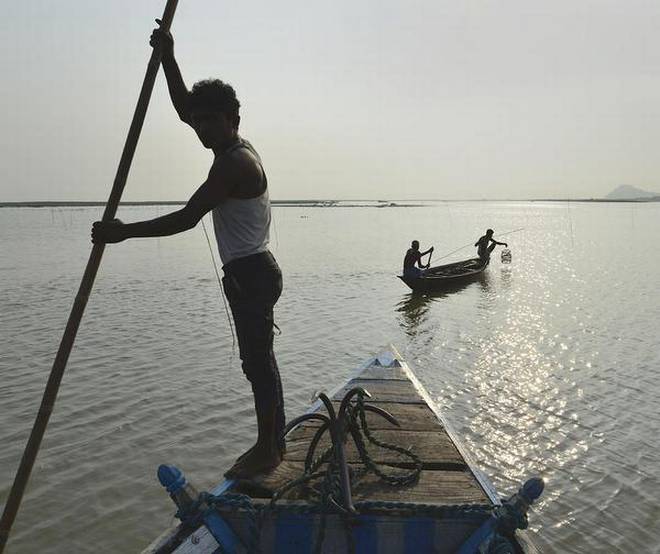
From River to Cup: History of Assam’s Tea Plantations and the role of Brahmaputra
Guest article by Anantaa Ghosh
[Feature image above: A NASA Earth Observatory image by Lauren Dauphin]
Author’s note: In this article, I have taken grammatical liberties by omitting the use of ‘the’ before a river’s name and ‘it’ when referring to them. I firmly believe that reimagining and re-understanding rivers necessitate a profound change that extends to our lexicon as well. Consequently, I am deliberately employing the pronoun ‘they’ to refer to Brahmaputra and all the rivers mentioned herein, rather than ‘it’ which may reduce the river to an object. I also refrain from using ‘he’ or ‘she’ (as per Indian mythology) as these pronouns tend to impose a mythological identity as the sole identity of a river,, negating the multifaceted nature and diverse forms of identity that a river has.
Continue reading “From River to Cup: History of Assam’s Tea Plantations and the role of Brahmaputra”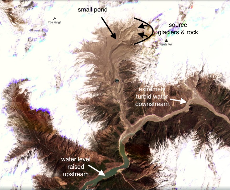
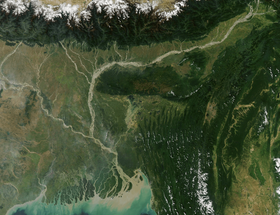
Massive Landslide on Yarlung Tsangpo on March 22, 2021
Dave Petley has on March 29, 2021[i] reported that a massive landslide has occurred along Yarlung Tsangpo river in Tibet, just upstream of Great Bend. (coordinates: 29.815, 94.932, the centre of the landslide source.)
Continue reading “Massive Landslide on Yarlung Tsangpo on March 22, 2021”
Why is India not demanding TEIA for the Great Bend Hydro proposal of China?
While one can never be too sure what is the exact meaning of Chinese whispers, a thoughtful response has to take into account the available facts and the context. This report tries to take stock of available facts and context of this latest episode that started at the end of November 2020 and is still going on: China’s proposed massive hydropower project on the Great Bend of Yarlung Tsangpo River just before the river enters India as Siang, a tributary of Brahmaputra river. It also reviews the key media reports published on this issue.
Continue reading “Why is India not demanding TEIA for the Great Bend Hydro proposal of China?”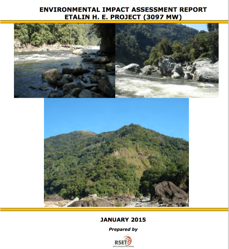
Open letter to MoEF & River Valley EAC: Review Recommendation to grant EC to Etalin HEP
The MoEF’s Expert Appraisal Committee (EAC) on River Valley Projects in its meeting in January 2017 recommended Environmental Clearance (EC) to the controversial 3097 MW Etalin Hydropower project in Dibang River Valley in Arunachal Pradesh. However, since the stage I forest clearance to Etalin HEP has not yet been accorded, the EC letter has not yet been issued. Hence there is an opportunity to stop EC to the project till the EAC reviews its decision.
It may be noted that Forest Advisory Committee (FAC) in its meeting on April 23, 2020, has decided in the context of Etalin Project: “As this is a large sized project in the Himalayas, inputs of IA (Impact Assessment) Division of the Ministry on whether environmental impacts of the proposed project and mitigating measures have been considered, will be obtained.” This provides an opportunity for the MoEF to direct the IA Division and EAC to review its decision to recommend EC to the Etalin Project.
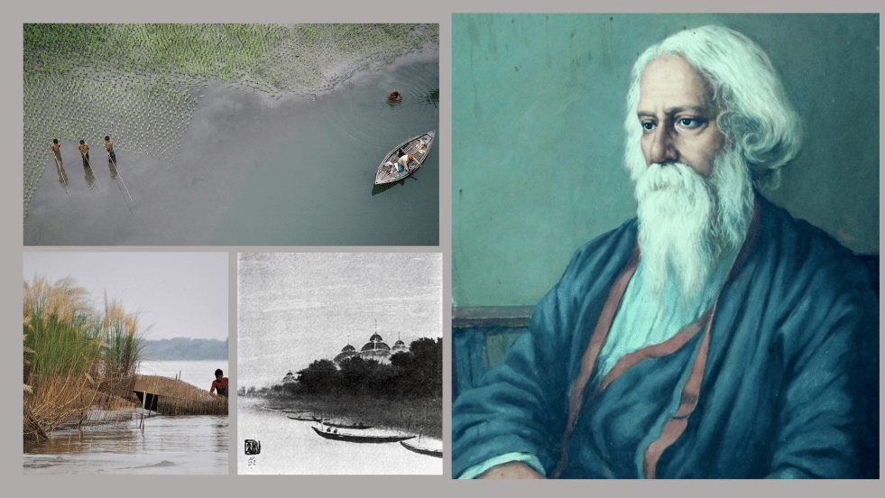
He Spoke the Language of the Rivers: Rabindranath Tagore
Part 1
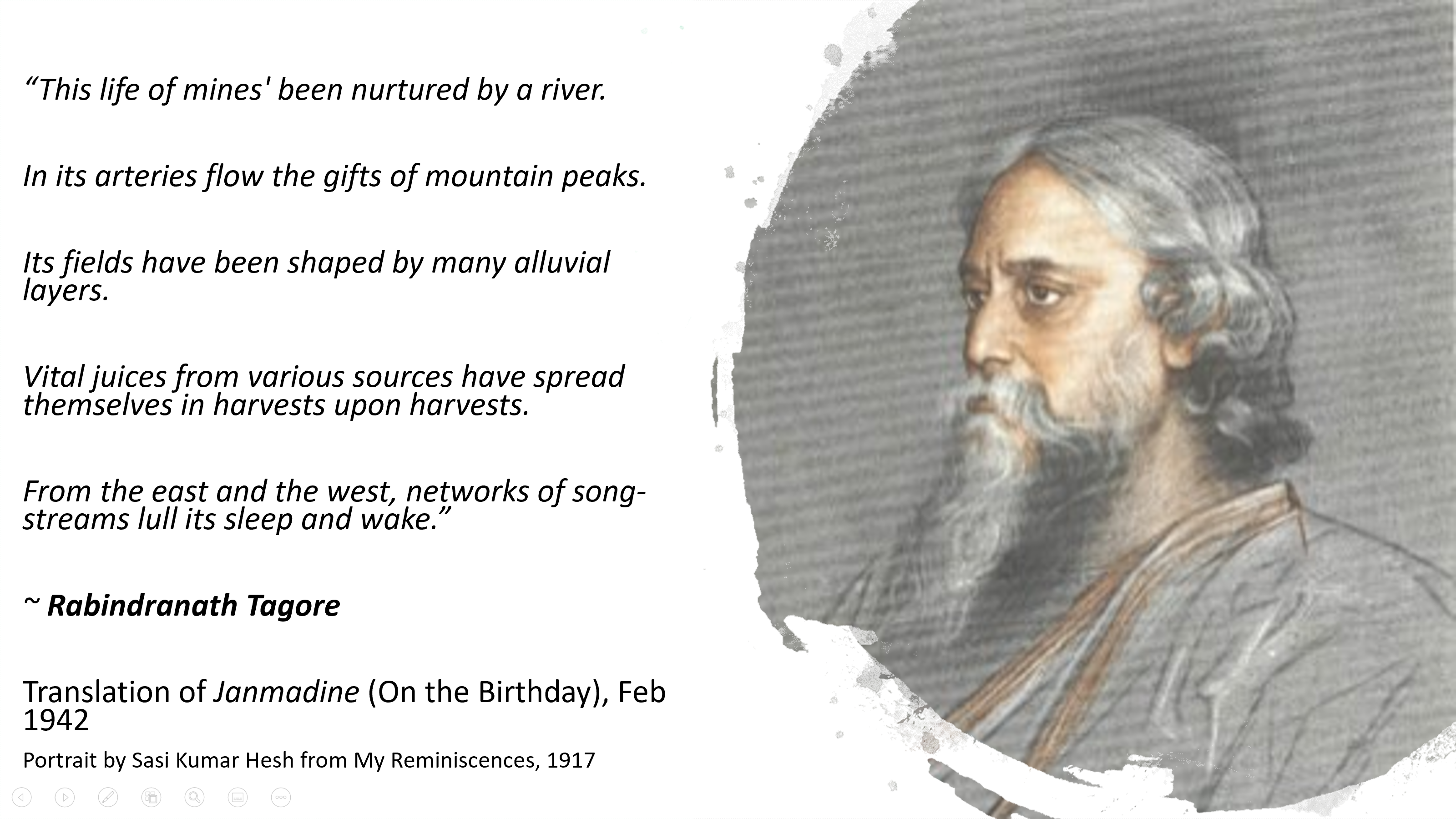
This was one of the last poems written by Gurudev Rabindranath Tagore. Bard of Bengal, Kabiguru, Bishwakabi: world knows him by many names. He reveled in life with the curiosity and wonderment of a child. In the Preface of Gitanjali (1912), Collection of poems which made him the first non-European to receive the Nobel in Literature, W. B. Yeats says, “Pearl fishers dive for pearls, merchants sail in their ships, while children gather pebbles and scatter them again. They seek not for hidden treasures, they know not how to cast nets.” This was for Tagore as much as the children. Poet, musician, novelist, painter, educator, freedom fighter, rationalist, modernist: the world was his canvas. Continue reading “He Spoke the Language of the Rivers: Rabindranath Tagore”
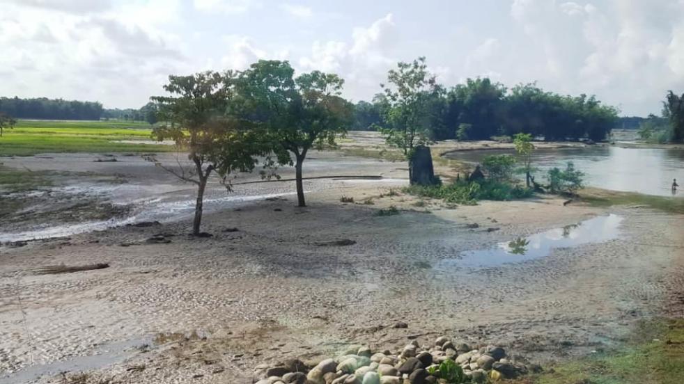
The floods of Jiadhal River in Assam
Guest blog by Sazzad Hussain
Late Kartik Pegu, grandfather of Bipin Pegu of Jiadhal Chariali village under Dhemaji Revenue Circle of Dhemaji district in northeast Assam prepared his own burial site during early 1970s on the bank of Jiadhal River. The site, a paddy field, has been owned by the Patir family of the village near the railway bridge over the river. Kartik Pegu was buried there when he died in 1976 and a tombstone was built in his memory. After that in 1985 Bilapson Pegu, Bipin’s father, too was buried on the same site and another tombstone was placed in his memory close to that of Kartik Pegu. Now Bipin Pegu (47), a college graduate and a local peasant with three children wishes him to be buried on the same plot of land when he dies. But on the evening of 16 September, 2019, his wishes for final rest close to his near and dear ones were shattered when Jiadhal River suddenly surged with overflowing water submerging the tombstones of Bipin’s immediate ancestors. He has never seen them being under water so far. Continue reading “The floods of Jiadhal River in Assam”
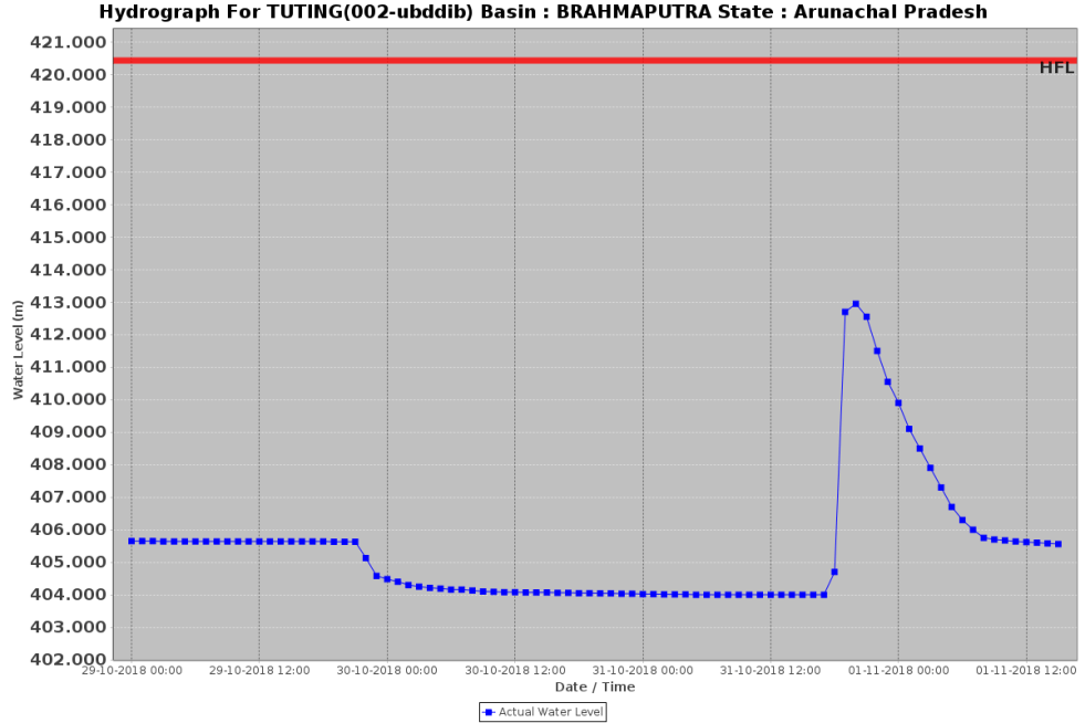
Another Landslide Dam on Yarlung Tsangpo raises more questions
On Oct 29, 2018, another landslide dam blocked the path of Yarlung Tsangpo Dam, reportedly at the same location as the Oct 17,2018 landslide dam[i]. It breached on Oct 31, without any reported major calamity, but these repeated occurrences, twice in two weeks and third time in ten months (if we include Dec 2017[ii] landslides) raises a lot of questions. The silence of government of India institutions about the possible causes or other analysis, including by Central Water Commission, Union Ministry of Water Resources, National Disaster Management Authority or even National Remote Sensing Agency has, as expected, raised questions and speculations in Arunachal Pradesh. Continue reading “Another Landslide Dam on Yarlung Tsangpo raises more questions”
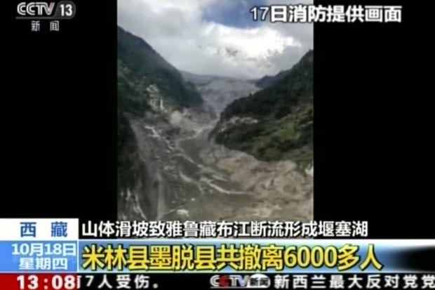
Landslide DAM on Tsangpo creates flood disaster risk for Siang
A massive dam, created by landslide in early hours (around 5 am) of Oct 17,2018 has blocked the main stream of Yarlung Tsangpo in Tibet. The reservoir behind the dam already has humungous 360 Million Cubic Meters (MCM) of water by 7 am on Oct 18, 2018 and as per latest reports (subsequently saw the CWC tweet put out at 955 pm on Oct 18, saying that storage had reached 484 MCM by 8 pm on Oct 18), the reservoir is still growing in size. The exact location of the landslide dam is uncertain. According to one source, the latitude longitude could be 94.93754° E, 29.74957° N, but this may not be accurate the likely location may be a few kilometers downstream from here. The Chinese media[i] has reported that the landslide dam is located at near Gyalha village in Milin or Manling county. According to some experts who visited the site, the dam could breach very soon, possibly on Oct 19, bringing massive floods along Siang river in Arunachal Pradesh. Continue reading “Landslide DAM on Tsangpo creates flood disaster risk for Siang”
Role of Doyang Dam in bringing unprecedented floods in Golaghat
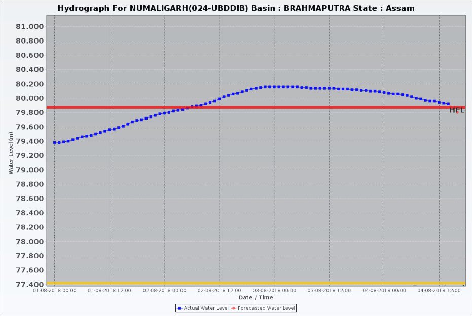
When Dhansiri river broke the highest flood level mark at Numaligarh site in early hours of Aug 2, 2018 in Golaghat district in Assam, it was not only completely out of the blue, the whole episode was unprecedented.
The earlier Highest Flood Level of Dhansiri River at Numaligarh was 79.87 m. The new HFL, it seems, was 80.18 m, full 31 cm above the previous HFL. This is rather rare, normally the new HFL would be a few cm higher, not almost one third of a meter. Secondly, the water level remained above 79.87 cm, the old HFL, for over 60 hours. This is also unusual, normally the water level rarely remains above HFL for more than a day or so. Thirdly, the earlier HFL was achieved on Sept 24, 1985, so this sudden episode of flood was breaking 33 year old record. Continue reading “Role of Doyang Dam in bringing unprecedented floods in Golaghat”
