Bhagirath Prayas Samman · Chenab · Dams · Himachal Pradesh · Hydropower · Sutlej

Bhagirath Prayas Samman: Himdhara Collective: Relentless Questioning and Doing

When I talk with Manshi, a friend and co-traveler from Himdhara Collective about Bhagirathh Prayas Samman that the collective received during the India Rivers Week 2016, she is modest, even slightly hesitant. She simply says, “We love the mountains, we want to protect them and help mountain communities fight the unequal battle against unplanned hydropower. That is one motivation of our work. But the other is recognition of the fact that we are privileged… privileged to be able to speak English, to work on a computer, to understand the bureaucratic procedures that alienate a tribal or forest dweller from her land. That understanding also drives us.”

Citation of Bhagirath Prayas Samman given to Himdhara Collective states: Himdhara’s strength is its engagement with communities, movements and organisations. It has created an effective discourse around issues of resource distribution and their ownership and the resultant impacts on ecological spaces of mountain communities, especially vulnerable groups like indigenous people, dalits and women. It is an honor to recognize and celebrate Himdhara Environment Research and Action Collective’s extraordinary Bhagirath efforts in maintaining the integrity of rivers in Himachal Pradesh.”

In their own words, “Himdhara is an autnomous and informal non registered environment research and action collective, extending solidarity and support, in research and action, to people and organisations asserting their rights over their natural resources and agitating against corporatisation of these resources for destructive development in the state.”

IMG_9726
Face of Hydropower in Kinnaur Photo: Himdhara

A collective of young, passionate and questioning minds, Himdhara has been working with communities in far flung areas of Himachal Pradesh include Lahaul and Spiti and Kinnaur in their fight against the onslaught of ill-planned and bumper to bumper hydropower projects in Himachal, amongst other issues. Continue reading “Bhagirath Prayas Samman: Himdhara Collective: Relentless Questioning and Doing”

Beas · Hydropower Performance · Sutlej

Insider view: BBMB is inefficient, slow, heavy, bureaucratic; Does not work to preserve its massive resources

Bhakra Beas Management Board (BBMB, http://bbmb.gov.in/english/index.asp) is the manager of India’s celebrated icons: Temples of Modern India as our first Prime Minister called it. In a rare occasion, when we get a candid account of insider’s view of this organisation, it is worth taking note of it.

bhakra1

 Bhakhra Dam: Photo from BBMB 

BBMB, created on Oct 1, 1967, has current annual budget of massive Rs 1000 crores and manages the Bhakra Nangal Project, the Beas Project I (Pandoh dam, the Beas Sutlej Link and the Dehar Power House) and the Beas Project II (Beas Dam and Pong power houses). With close to 3000 MW of installed capacity it generates about 12.5 billion units of power annually.

Mr Satish Loomba, who served as Financial Advisor to BBMB between 1996 and 2001 has just provided an interesting view about the functioning of BBMB in his article Need to corporatise BBMB in The Tribune of January 23, 2014: http://www.tribuneindia.com/2014/20140123/edit.htm#6. While the author, as the title suggests, is advocating a corporate restructuring of BBMB, what he has said in the process provides a valuable insights from an insider. Here are some snippets:

Þ    “This organisation, which has become heavy, slow and bureaucratic…”

Þ    “However, despite a façade of running smoothly, the BBMB, from the organizational standpoint, suffers from several infirmities, limitations and internal contradictions.”

Þ    “At the core of the inadequacies in the BBMB are the… systems which do not promote efficiency, cost control and long term health of its vast assets… It has no concern with the value of its output…”

Þ    “… capital of the BBMB is not being preserved in accordance with accepted principles…” In fact in recent years, the illegal dumping of humungous quantities of muck (even a 100 MW project creates several million meter cube of muck) by the numerous major, medium and small hydropower projects in upstream Sutlej (see: https://sandrp.in/basin_maps/Hydro_Electric_Projects_on_Sutlej_River_in%20HP.pdf) and Beas (see: https://sandrp.in/basin_maps/Hydropower_Projects_in_Beas_Basin.pdf) basins is  leading to accelerated silting up of the Bhakra, Pong and Pandoh reservoirs, but no one, not even BBMB has shown the slightest concern.

Þ    “For the ageing irrigation wing assets, which are colossal and could be in sudden need of massive recapitalization…”

Þ    “… there is no account which summarises its results for a specific time period…”

This is a very serious indictment, not only of BBMB but also the way the “icons” of India are being managed by an organisation controlled by the Union Ministry of Power. Are these remediable infirmities or are these the implications of the kind and size of structures that BBMB manages? The author of the above article does not even pose this question, but is a very relevant one.

Declining Hydropower generation As per our analysis of hydropower generation from the three BBMB projects in Himachal Pradesh, namely Bhakra (1325 MW), Dehar (990 MW) and Pong (396 MW), with total installed capacity of 2711 MW, the generation per MW installed capacity has shown hugely declining trend with trend line declining by 18-20% in less than three decades. We also have graphs of individual BBMB hydropower projects that show similar trend line. This is a massive decline and in any responsible governance, questions would be asked as to why this is happening, but here, there are no questions.

bhakra2

Unravelling Bhakra In a comprehensive critique Unravelling Bhakra, (see: http://www.manthan-india.org/spip.php?rubrique1, available in both English and Hindi), author Shripad Dharmadhikary has shown that it is a myth to assume that Bhakra dams were the only or major reasons behind India’s food security, green revolution or irrigation in North West India. He has shown with facts and figures that are yet to be proven wrong that the contribution of Bhakra dams was limited.

unravellingBhakara

Displaced people still awaiting justice Over five decades after commissioning of the Bhakra project, the people displaced by this most celebrated of Indian dams are still awaiting justice, as is clear from this latest news report (http://www.tribuneindia.com/2014/20140120/haryana.htm#10) in January 2014. This has been highlighted by many in the past including Govt of India’s Water Resources Minister in his autobiography, by SANDRP in 2002, by Shripad Dharmadhikary in above  mentioned book and continuous media coverage. This also shows the callous attitude of BBMB and concerned state and central governments.

Ad hoc, callous reservoir operation It is no secret that even this irrigation system is in bad and declining health. This is due to many reasons, including due to lack of maintenance and participatory governance. Several times it has been pointed out how unaccountable and inefficient has been the operation of the Bhakra reservoirs. Two recent occasions when SANDRP pointed this out include the following:

Þ       July 2012: Precarious situation of Bhakra dams: BBMB says emergency measures are imminent: Callous, ad-hoc reservoir operation again? Could this situation have been avoided? https://sandrp.in/dams/PR_Why_precarious_water_situation_at_Bhakra_dams_was_avoidable_July_2012.pdf

Þ    Sept 2010: Bhakra reservoir is being operated in casual, adhoc manner? Need for clearly defined norms of accountability in reservoir operations https://sandrp.in/dams/Bhakra_and_Need_for_accountability_in_Reservoir_Operations_Sept_19_2010.pdf

Þ    With general elections approaching in coming April May 2014, we have to wait and see if the Bhakra reservoirs will again be operated in an ad hoc manner like it happened before previous two national elections.

We hope right lessons will be learnt from this insider’s view of the alarmingly inadequate functioning of the BBMB and efforts will be made to make its functioning more participatory, transparent and accountable.

Himanshu Thakkar (ht.sandrp@gmail.com)

brahmaputra · Dams · Sutlej

Media Hype Vs Reality: India-China Water Information Sharing MoU of Oct 2013

It was pretty surprising to see the front page headline in The Times of India on Oct 24, 2013[i], claiming that an India China “MoU on Dams Among Nine Deals Signed”. The Hindu headline[ii] (p 12) claimed, “China will be more transparent on trans-border river projects”. Indian Express story[iii] (on page 1-2) claimed, “The recognition of lower riparian rights is a unique gesture, because China has refused to put this down on paper with any other neighbouring country”. It should be added that the news stories on this subject in the Economic Times and the Hindustan Times took the MoU in more matter of fact way.

Proposed Chinese Dams on Yarlung Zangbo Source: SANDRP
Proposed Chinese Dams on Yarlung Zangbo
Source: SANDRP

Additional information for second half of May However, the actual language of the Memorandum of Understanding on “strengthening cooperation on trans-border rivers” available on website of Press Information Bureau[v] and Ministry of External affairs[vi] gives a very different picture. There is no mention of dams, river projects or lower riparian or rights there. One additional feature of the agreement is that the current hydrological data (Water Level, Discharge and Rainfall) in respect of three stations, namely, Nugesha, Yangcun and Nuxia located on river Yaluzangbu/Brahmaputra from 1st June to 15th October every year[vii] will now be extended to May 15th to Oct 15th with effect from 2014. While this is certainly a step forward since the monsoon in North East India sets in May and also in view of the accelerated melting of glaciers in changing climate, it should not lead to the kind of hype some of the newspapers created around the river information MoU. Moreover, it should be remembered that India pays for the information that it gets from China and what Indian government does with that information is not even known since it is not even available in public domain. How this information is thus used is a big state secret!

Three stations on Yarlung Zangbo - Nugesha, Yangcun and Nuxia (the green spots in the map represent these station)[iv]
Three stations on Yarlung Zangbo – Nugesha, Yangcun and Nuxia
(the green spots in the map represent these station)[iv]

Over-Optimistic reading of the MoU? The specific feature of the new MoU about which media seemed excited read as follows: “The two sides agreed to further strengthen cooperation on trans-border rivers, cooperate through the existing Expert Level Mechanism (for detailed chronology of ELM formation, meetings and earlier MoUs on Sutlej and Brahmaputra, see annexure below) on provision of flood-season hydrological data and emergency management, and exchange views on other issues of mutual interest.” The key words of this fifth the last clause of the MoU were seen as “exchange views on other issues of mutual interest”, providing India an opportunity to raise concerns about the Chinese hydropower projects and dams on shared rivers. However, the clause only talks about exchange of views and there is no compulsion for China to share its views, leave aside share information about the Chinese projects in advance or otherwise. On the face of it, the hype from this clause misplaced.

Tsada station on river Satluj (Shown as A in the Google Map)

This was read with first clause: “The two sides recognized that trans-border rivers and related natural resources and the environment are assets of immense value to the socio-economic development of all riparian countries.” Here “riparian countries” clearly includes lower riparian. But to suggest that this clause on its own or read with clause 5 mentioned above provides hope that China will include the concerns of the lower riparian in Chinese projects on shared rivers seems slightly stretched. The clause only recognises the asset value of rivers and related natural resources and environment for all basin countries and it is doubtful if it can be used to interpret that Chinese will or should take care of the concerns of lower riparian.

Thus the rather optimistic interpretation does not seem to emanate from the actual wording of the MoU, but the rather over optimistic interpretation by the Indian interlocutors, possibly including the Indian ambassador to China, who has been quoted on this aspect.

Real Achievement: GOI recognises value of Rivers! What is most interesting though is that Indian government has actually signed a Memorandum that recognises that “rivers and related natural resources and the environment are assets of immense value to the socio-economic development”. This is absolutely amazing and joyful development for rivers. Since there is nothing in the laws, policies, programs, projects and practices of Indian government that says that rivers are of any value. Now that Indian government has actually signed an MoU agreeing to such a value, there is sudden hope for rivers, it seems. Only lurking doubt, though is the word “trans-border” before rivers! We hope the Government of India applies this clause to all rivers, not just trans-border rivers, though we know from past that this hope is one a rather thin ice!!

SANDRP

Annexure:

1. Formation and Meetings of Expert Level Mechanism (ELM) on Trans-border Rivers

20-23 Nov, 2006 During the visit of the President of People’s Republic of China to India in November 20-23, 2006, it was agreed to set up an Expert-Level Mechanism to discuss interaction and cooperation on provision of flood season hydrological data, emergency management and other issues of trans-border rivers between the two countries. Accordingly, the two sides set up the Joint Expert Level Mechanism(ELM) on Trans-border Rivers. The Expert Group from Indian side is led by Joint Secretary level officers.  Seven meetings of ELM have been held so far.
19-21 Sept, 2007 In the 1st meeting of ELM the issues related to bilateral cooperation for exchange of hydrological information were discussed.
10-12 April, 2008 In the 2nd meeting of ELM work regulations of the ELM were agreed upon and signed. It was agreed that the ELM shall meet once every year, alternatively in India and China.
21–25 April, 2009 The 3rd meeting was focused on helping in understanding of each other’s position for smooth transmission of flood season hydrological data.
26-29 April, 2010 In the 4th meeting the implementation plan on provision of hydrological information on Yaluzangbu/Brahmaputra River in flood season was signed.
19-22 April, 2011 In the 5th meeting the Implementation Plan in respect to the MoU on Sutlej was signed.
17-20 July, 2012 The 6th meeting of ELM was held at New Delhi where both the countries reached at several important understandings and a significant one of those understandings is – “The two sides recognized that trans-border rivers and related natural resources and the environment are assets of immense value to the socio-economic development of all riparian countries.”
14-18 May, 2013 In the 7th meeting held at Beijing, China where in the draft MoU and Implementation Plan on Brahmaputra river was finalized.

 2. MoUs on Hydrological Data Sharing on River Brahmaputra / Yaluzangbu

2002 Government of India and China signed a MoU for provision of hydrological information on Yaluzangbu/Brahmaputra River in flood season by China to India. In accordance with the provisions contained in the MoU, the Chinese side provided hydrological information (Water Level, Discharge and Rainfall) in respect of three stations, namely, Nugesha, Yangcun and Nuxia located on river Yaluzangbu/Brahmaputra (see the map above) from 1st June to 15th October every year, which was utilized in the formulation of flood forecasts by the Central Water Commission. This MoU expired in 2007.
2008 On 5th June, India signed a new MoU with China on provision of hydrological information of the Brahmaputra /Yaluzangbu river in flood season by China to India with a validity of five years. This was done during the visit of the External Affairs Minister of India to Beijing from June 4-7. Under this China had provided the hydrological data of the three stations for the monsoon season from 2010 onward.
2013 During the visit of Chinese Premier Li Kegiang to India the MoU of 2008 has been extended till 5th June 2018.

 3. MoUs on Hydrological Data Sharing on River Satluj / Langquin Zangbu

2005 A MoU was signed during the visit of the Chinese Premier to India in April for supply of hydrological information in respect of River Satluj (Langquin Zangbu) in flood season. Chinese side provided hydrological information in respect of their Tsada station on river Satluj (Langquin Zangbu in Chinese, see the map above).
Aug 2010 In order to supply flood season hydrological information on River Sutlej a new MoU was agreed in August 2010
Dec 2010 On 16 Dec 2010, during the visit of Prime Minister of China to India a new MoU was signed to provide hydrological information of Sutlej/Langquin Zangbo River in flood season by China to India with a validity of five years.
April 2011 During the 5th  ELM meeting held in April, 2011 an MoU on Sutlej containing the Implementation Plan with technical details of provision of hydrological information, data transmission method and cost settlement etc. was signed in Beijing. The hydrological information during the flood season has been received in terms of the signed implementation plan.

Annexure compiled by Parag Jyoti Saikia

Post Script: Further reading: http://www.thethirdpole.net/2015/11/06/tibet-dams-hold-back-silt-not-water

END NOTES:

Hydropower Performance · Sutlej

Hydropower Generation Performance in Sutlej River Basin

The Sutlej River Basin is the major part of Indus River Basin. It is the easternmost tributary of the Indus River. It rises near the Darma Pass near Mansarovar Lake, enters the Zarkar range and flows through Tibet before entering India. It cuts through the Great Himalayan range and the outer Himalayas and enters the plains at Roper. It receives the Beas River at Harike at Punjab and forms the boundary between India and Pakistan for nearly 120 km. It finally enters Pakistan near Sulemanki.

The project wise generation data of large hydro (above 25 MW) with installed capacity of the basin in the latest year 2012-13 is follows.

SN Projects

State

Inst Capacity  (MW)

Generation (MU)

MU/MW

1 Sanjay Bhabha

Himachal Pradesh

120

365

3.04

2 Baspa-II

Himachal Pradesh

300

1240

4.13

3 Nathpa Jhakri

Himachal Pradesh

1500

6778

4.52

4 Bhakra

Himachal Pradesh

1325

4707

3.55

5 Ganguwal

Punjab

77.65

593

7.64

6 Kotla

Punjab

77.65

600

7.73

7 AP Sahib

Punjab

134

639

4.77

8 Karchham Wangtoo*

Himachal Pradesh

1000

4057

4.6

  Total

4534.3

18979

4.19

* The Generation figure of Karchham Wangtoo is available for one year only as it commissioned in the year 2011.

 Sutlej_Performance

  • The above graph shows the trend line of power generation of large Hydropower projects for last 28 years in the Sutlej basin. The trend-line shows diminishing generation from existing hydro power projects of Sutlej River Basin.
  • It shows that the per MW generation in 2012-13 (4.19) has dropped by a huge 31.09% from the highest per MW generation (6.08) achieved in the year 1998-99.
  • All generation figures have been taken from official data of Central Electricity Authority (CEA).
KarchamWangtoo HEP
1000 MW KarchamWangtoo HEP
Muck dumped from Karcham Wangtoo project into the Sutlej photo from :http://adrianomarzi.photoshelter.com/


List of other projects (up to 25 MW) under operation (for which latest generation figures not available):

SN Project

Ins Cap (MW)

State

1 Rukti

1.50

Himachal Pradesh
2 Chaba

1.75

Himachal Pradesh
3 Rongtong

2.00

Himachal Pradesh
4 Nogli

2.50

Himachal Pradesh
5 Titang

0.90

Himachal Pradesh
6 Lingti

0.40

Himachal Pradesh
11 Ghanvi

22.50

Himachal Pradesh
 

Total

31.55


Source: http://www.hpseb.com/hydro_potential.htm

List of proposed and under construction projects in the basin:

  Project

Ins Cap (MW)

State

Status

1 Kol Dam

800

Himachal Pradesh Under Construction
2 Rampur

412

Himachal Pradesh Under Construction
3 Kashang-I

165

Himachal Pradesh Under Construction
4 Kasang-IV

48

Himachal Pradesh Under Construction
5 Shorang

100

Himachal Pradesh Under Construction
6 Raura

8

Himachal Pradesh Under Construction
7 Ghanvi-II

10

Himachal Pradesh Under Construction
8 Bhaba Aug.PH

4.5

Himachal Pradesh Under Construction
9 Chango-Yangthang HEP

180

Himachal Pradesh EAC TOR Approved
10 Lara Sumta

104

Himachal Pradesh EAC TOR Approved
11 Luhri HEP

775

Himachal Pradesh EAC & FAC  Recommended
12 Shongtong-Karcham HEP

402

Himachal Pradesh EAC& FAC Recommended, (Under stay order of HC)
13 Sumta Kathang

130

Himachal Pradesh EAC TOR Approved
14 Tidong -I

100

Himachal Pradesh EAC Recommended
15 Tidong -II

60

Himachal Pradesh EAC Under consideration
16 Yangthang – Khab HEP

261

Himachal Pradesh EAC TOR Approved
17 Kashang -Stage II & III HEP

130

Himachal Pradesh FAC Recommended
18 Jangi Thopan

480

Himachal Pradesh Proposed
19 Khab-I

450

Himachal Pradesh Proposed
20 Khab-II

186

Himachal Pradesh Proposed
21 Kuling Lara

40

Himachal Pradesh Proposed
22 Kut

24

Himachal Pradesh Proposed
23 Mane Nadang

70

Himachal Pradesh Proposed
24 Poo Spiloo

300

Himachal Pradesh Proposed
25 Ropa

60

Himachal Pradesh Proposed
26 Thopan Powari

480

Himachal Pradesh Proposed
27 Bahairari

5.5

Himachal Pradesh Proposed
28 Lara

60

Himachal Pradesh Proposed
29 Baspa

210

Himachal Pradesh Proposed
  Total

6055

EAC: Expert Appraisal Committee of MoEF; FAC: Forest Advisory Committee of MoEF

Source: http://www.hpseb.com/hydro_potential.htm; http://envfor.nic.in

Underground Tunnel at Nathpa Jhakri Project
1500 MW Nathpa Jhakri Project


 Map of Hydroelectric Projects in Sutlej River Basin available at:

https://sandrp.in/basin_maps/Hydropower_Projects_in_%20Sutlej_River_Basin.pdf

South Asia Network on Dams, Rivers & People (www.sandrp.in)                                           July 2013

ht.sandrp@gmail.com

Expert Appraisal Committee · Ministry of Environment and Forests · Sutlej

MoEF’s Exp App Com damns the Sutlej

ImageImage
It is well-known that India’s environment governance is very weak. The work of the Expert Appraisal Committees (EAC) in the clearance process is shoddy, unscientific and largely catering to vested interests. But with the recent recommendation of an environment clearance for the 775 MW Luhri hydropower project on the Sutlej river in Himachal Pradesh, the Union Ministry of Environment and Forests’ (MoEF) EAC on River Valley and Hydropower Projects seems to have touched a new low.

First, the Sutlej was known to be an already over developed basin when the Luhri project came up for first stage clearance before the EAC in April 2007. The EAC should have refused to consider the project without an independent credible cumulative basin level study looking into its carrying capacity with respect to various aspects. The fact that the EAC did not even discuss this then, even though the issue was brought before it, showed the EAC members’ complete lack of understanding of the importance of the basin level cumulative impact assessment study.

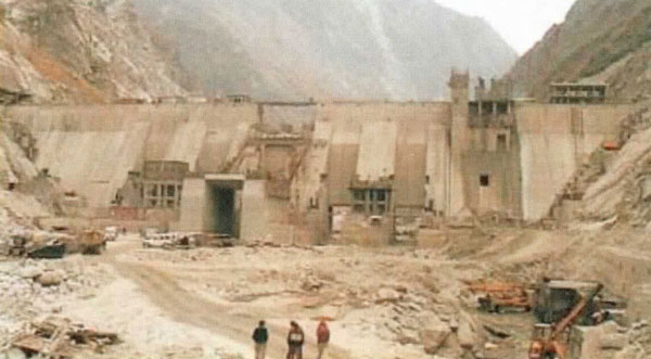
The minutes of the EAC meeting in April 2007, where the Terms of Reference (TOR) of the EIA came up for approval for the Luhri project, say that the project is going to have a 45 m high dam affecting a maximum of 45 project affected families and 13 villages. Now from the EIA it is clear that the dam height is not 45 m but 86 m, that the project will affect not 45 but 2,337 landowners and 9,674 persons and impact not 13 but over 100 villages. Any competent body would have questioned the very serious nature of changes in basic project parameters, but competence is clearly not the correct description of the EAC. The EAC did not even ask the project promoter for an explanation, leave aside penalise them for their misrepresentations.

Even legally, the TOR clearance is supposed to be valid only for two years. When the project came up for final environmental clearance before the EAC towards the end of March 2012, it was almost five years since the TOR was cleared. The TOR clearance was no longer valid but the EAC was completely blind to the illegalities.

The legally mandatory public hearings for the project were held in May and August 2011, but the EIA, made available a month before the public hearing as required under the EIA notification, did not have basic information about the names and impacts on the 78 villages along the path of the tunnel of the projects. The local groups had written to the ministry, the Pollution Control Board that is supposed to conduct the hearings and the EAC about these and other issues. But the EAC did not even take note of such serious legal lapses. On this count of violations alone, in the public hearing process, the EAC should have refused to consider the project. But the EAC did not even discuss this issue!

In repeated representations to the EAC, the Sutlej Bachao Sangharsh Samiti and Himdhara have been bringing to the EAC’s notice that there has been no compliance with the Forest Rights Act (FRA) for the forest land required for the project and that the local administration has been indulging in manipulations and pressure tactics to get the mandatory gram sabha resolutions for the FRA compliance.

In fact, these groups have been sending representations to the EAC on all these issues since October 2011. Already, five representations have been sent, but the EAC has never even acknowledged, leave aside discussed any of these representations in its meetings.

The EAC should have invited the people who sent such representations, heard them and allowed them to be present when the project was discussed in the EAC. The EAC did none of these things clearly showing their bias for the projects and not for the environment and people which are the basic mandates of the EAC. This behaviour of the EAC is also in violation of the Delhi High Court order in the Utkarsh Mandal case where the High Court has expressly asked the EAC to show that it has applied its mind to each representation it receives and the decision it takes in that regard.

The EIA itself has such serious inadequacies that even the EAC notes in the minutes of the March 2012 meeting that “the EIA/EMP report is inadequate,” and the consultant has presented “poor quality of material.” The EAC minutes record many of the serious deficiencies of the EIA in its March 2012 meeting. The EIA was so inadequate, so full of contradictions and misrepresentations that the EAC should have rejected it and asked for a fresh EIA while recommending blacklisting of the consultant. None of these issues were resolved in the November 2012 meeting when EAC next discussed the project. By then the EAC had also received representations from affected people, and the issues raised, which too remained unresolved. And yet, the EAC decided to quietly recommend environment clearance to the project without referring to its own observations or those of the representations. The most charitable explanation is that the EAC is inconsistent, incompetent and arbitrary. Reality is rarely that charitable.

The response of the developer and consultant to the issues raised by the EAC in the March 2012 meeting was supposed to be made available at least 10 days before the next EAC meeting in November 2012 when it met to consider the project, as per the orders of the Central Information Commission (CIC) in Febuary 2012 and the CIC notice to the MoEF following SANDRP’s appeal in May 2012. Violating the CIC orders, the responses were not in the public domain.

Even more shockingly, the project violated the EAC’s own norms, but amazingly, the EAC did not even discuss it. Let us see how. The Full Reservoir Level of the Luhri dam is 862.9 m and the tail water level of the immediate upstream Rampur project is also 862.9 m, which means there is zero distance of flowing river between the two projects. This is in complete violation of the recommendations of the Avay Shukla (former additional Chief Secretary of Himachal Pradesh) Committee appointed by the Himachal Pradesh High Court and the reported recommendation of the BK Chaturvedi Committee appointed by the National Ganga River Basin Authority, headed by the Prime Minister. Both the committees’ recommendations are for a minimum of five km distance of flowing river between any two projects. Even the EAC has been following the recommendation of at least a one km distance between the two projects. But the EAC did not even discuss this issue.

Even more disturbingly, the full reservoir level of the downstream Kol dam is 642 m, whereas the invert level of the Tail Race Channel of Luhri dam is one metre below this that is 641 m, which means again there is zero length of flowing river between the two projects. The EAC again violated the recommendations of the Avay Shukla Committee and its own norms. Why did the EAC not even discuss this issue? Why did the SJVN and the EIA consultants, who were familiar with the EAC norm did not raise these issues for both the upstream and downstream situation? Why did the MoEF officials who are part of the EAC and knew the importance of these issues did not raise them either? This collective silence, indicating collective collusion, raises too many questions for anyone’s comfort.

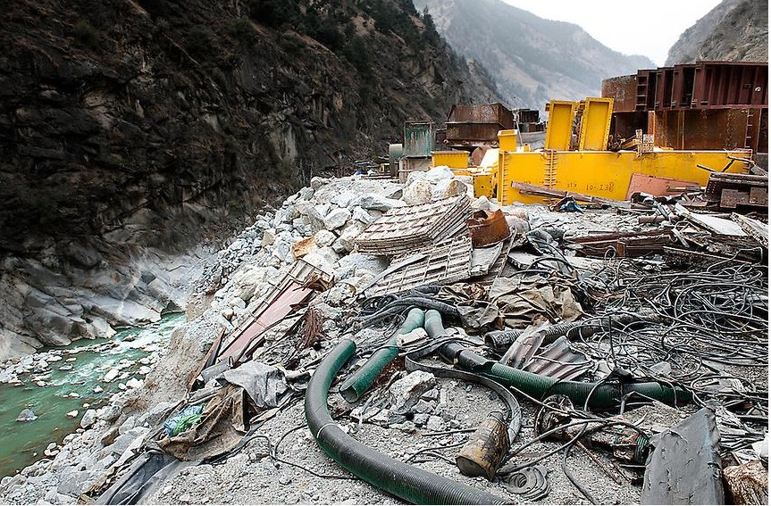
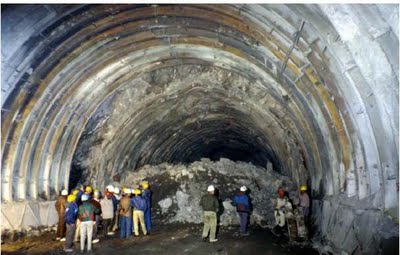
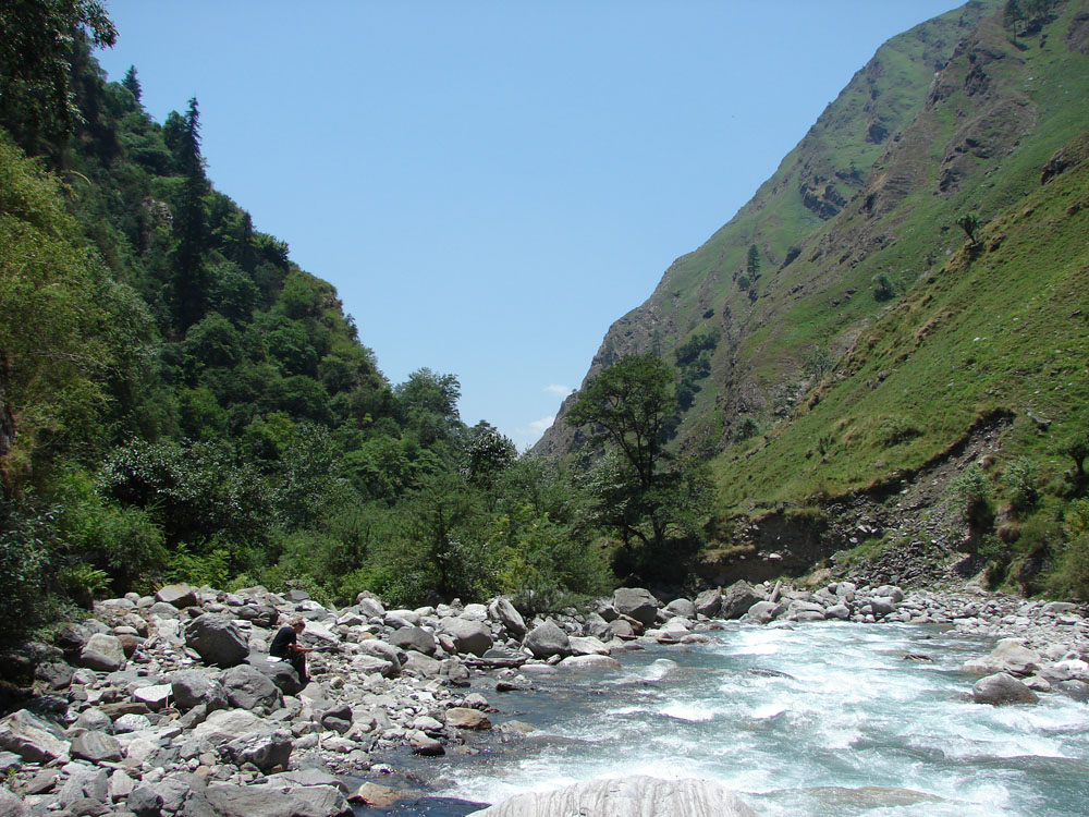
It should be noted that the Luhri project has a head race tunnel length of 38.14 km, which is the longest in the world. As the EAC itself noted, the tunnel will bypass over 50 km length of the river, in addition to the 6.8 km long reservoir. So the project will destroy close to a length of 60 km of the mighty, already over-dammed Sutlej river. To see the callous treatment the EAC has given to such an unprecedentedly impactful project is most reprehensible.

It’s clear that the whole episode of the EAC recommending environment clearance to the Luhri HEP is shameful. As if to keep that appalling decision away from the public gaze, the publication of the November 2012 meeting of the EAC was delayed beyond the next meeting, unlike the usual practice. The only possible option left for the EAC to clear the air and its own name from this disgraceful situation is an urgent, transparent review of this decision it has taken. Let us hope the EAC will use that opportunity soon.
Himanshu Thakkar (ht.sandrp@gmail.com)
http://civilsocietyonline.com/pages/Details.aspx?263
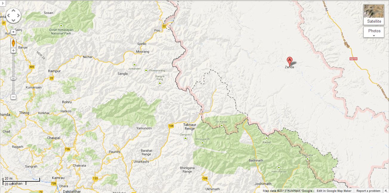