“Ye paani samne aa gaya. Gate khul nahi rahe to grenade dalo, blast kardo. Ye pura beh jaayega.”
“The water is right in front of us. If the gates are not opening, blast them with a grenade. Everything will be washed off.”
– Ex-Minister Lal Singh Chaudhary (Basholi, J&K) at Madhopur Barrage, on the eve of Madhopur gate collapse.[1]
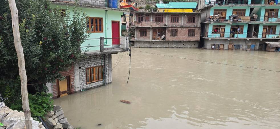
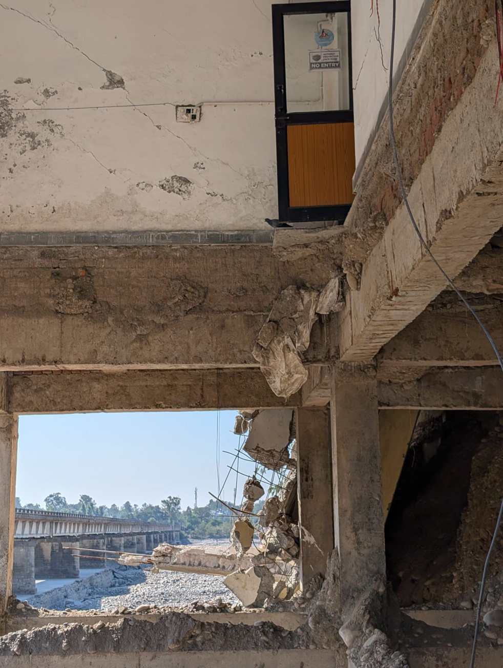
On the 27th of August, after facing several days of floods from a swollen, angry Ravi River, three gates of Madhopur Barrage at Pathankot crashed into the brown, swirling waters. Around this time, a team of engineers and helpers were on the barrage, making dangerous but futile attempts at opening the jammed gates. Three people fell in the flood, two were rescued but one body was later recovered underwater, from the wrecked gates they were trying to open. Earlier that morning, 22 CRPF jawans were airlifted from a building next to the barrage, moments before it collapsed into the raging river. The flood unleashed a wave of destruction in the downstream.
Continue reading “One More Monsoon: Governance, Accountability and the Collapse of Madhopur Barrage”