The one day Ganga Manthan[1] organized by the National Mission for Clean Ganga on July 7, 2014 was described by Union Minister[2] Sushri Uma Bharti & Union Minister[3] Shri Nitin Gadkari as “Historical”. The Union Environment Minister, who has one of the most crucial role in achieving a rejuvenated Ganga, was supposed to be there, but could not come at any stage.
I attended the full day meeting with a lingering question: Will this help the river? Even some of the ardent skeptics said that Uma ji has emotional, spiritual and religious attachment with the cause of Ganga.
At the conclave attended by close to a thousand people, the story of how Ms. Bharti came back to the BJP party about a year back to work for the cause of Ganga, and how she was promised a year back that if their party came to power, Ganga will get a separate ministry and she its charge was narrated repeatedly by both Ms Bharti and Mr Gadkari at least twice. It was also stated that the government has the commitment, the will & all the money to make the Ganga clean (Nirmal) and perennial (aviral). There were also repeated statements by both ministers about the officials being so committed to the cause of Ganga. These, in essence, were the basic positive assets of this government to achieve Ganga Rejuvenation.
While it was good to see large gathering involving various sections of the society, including many independent non government voices, missing were some key stakeholders: Ganga basin state governments, farmers groups, Ministry of Urban Development, fisher-folk groups, boats-people representatives. Another key constituency missing was Ministry of Agriculture, since agriculture is major user of water & irrigation and responsible for water diversion and at the same time major non point source polluter through use of chemicals and fertilizers.
Rejuvenation does not mean just nirmal and aviral But if the task is Rejuvenation of River Ganga, are these assets sufficient? What exactly does Rejuvenation of River Ganga mean? There were no answers to this question at the meeting. The government did not even seem bothered about these questions. Are Nirmal and Aviral Ganga sufficient objectives to achieve Rejuvenation of Ganga? The answer is clearly no, for, even a pipleline or canal carrying perennial flow of water can claim that distinction. A rejuvenated river will need much more than that, but the government has nothing else to offer for a rejuvenated river.
Even for Aviral Ganga, the government had absolutely nothing to offer. In the information package shared with the participants, the only thing relevant to Aviral Ganga was the extended summary of draft “Ganga River Basin Management Plan” being prepared by consortium of seven IITs in collaboration with some 11 other organisations. This is led by Dr Vinod Tare of IIT Kanpur. While standing with Dr Tare and Rajendra Singh of Tarun Bharat Sangh at the lunch, I said, the problem with Ganga is not of technology[4], but of governance. Despite being a proud IITian myself, I have no hesitation in saying that IITs do not have expertise in governance issues, so how can the IIT Consortium help in fix a governance problem? Having read the full Draft Plan of the IIT consortium, it only further strengthens the view that it was wrong decision of Jairam Ramesh to give this task to IIT Consortium.
Agenda for further destruction As a matter of fact, while this government has yet to take a step that will truly help rejuvenation of Ganga, they have declared their agenda that will possibly further destroy the river. This was clear on June 6, 2014, within ten days of new government taking over when a PIB press release[5] announced, “Shri Gadkari said it is proposed to conduct dredging to provide a width of 45 meters and for a three (3) meters draft (depth) to enable transport of passengers and goods between Varanasi and Hoogly on river Ganga in the first stage of its development and eleven terminals are proposed to be constructed along the banks. He said barrages are proposed to be constructed at every 100 Kms.” This was a shocking and arrogant announcement. There is nothing in public domain about this Rs 6000 crores plan, no details as to what exactly is planned, where the barrages are planned, why are they needed, what are their environmental impacts, what are the social impacts, what are the riverine impacts, what is the cost and benefits, who will pay the costs and who will reap the benefits, where is public consultation….there is absolutely nothing in public domain and here is a nine day old government declaring such massive plan! By July 7, 2014, the PIB Press Release declared that the depth will now by 5 meters and not three announced earlier. The PIB PR now said, “He (Mr Gadkari) said barrages are proposed to be constructed at every 100 Kms on the river. Shri Gadkari said his Ministry has sent a proposal in this regard to World Bank for the development of Allahabad- Haldia corridor.”
The minister possibly does not know that there is just one barrage on the Allahabad-Haldia 1500 km long stretch, namely the Farakka barrage and Bangladesh had threatened India to take the matter about building this barrage to the UN! Moreover, that barrage, everyone accepts, has not even achieved the basic objective it was supposed to achieve, namely navigability of Kolkata port, but has had many other severe impacts.
At Ganga Manthan, Mr Gadkari dropped a bombshell[6] when he said this plan is already in advanced stage of appraisal with the World Bank! He said the government hopes to get Rs 4000 crores from the World Bank!! The World Bank has zero track record in achieving any clean river anywhere in the world, after spending billions of dollars every year. In India itself it stands guilty of destroying many rivers. A more inauspicious start to the Ganga Manthan possibly could not have been possible. At the Ganga Manthan itself, there was opposition to this plan, as The Hindu[7] has reported.But Ms Uma Bharti finds nothing amiss about this as was clear by her answers at the press conference. But what about at least some semblance of participatory democracy?
Business as usual at NMCG and NGBRA will not help In reality, this is not all. While this Manthan for Ganga Rejuvenation is happening, the NMCG and NGBRA[8] (National Ganga River Basin Authority) go on with their work in business as usual fashion. So in Varanasi, the Uttar Pradesh Jal Nigam is going about its task of floating and examining the bids for five-part sewer laying and Sewage Treatment Plants with the help of JICA money. In Kanpur, the effort to divert several streams to Pandu is going on. In Allahabad, “the draft final ESAMP sewerage works for sewerage districts” A & C could be found on the NGBRA website. In Patna, the World Bank is funding the sewerage projects of Pahari in Patna & river front development and the draft social and environmental impact assessments could be found on NGBRA website. All of this (except the Varanasi packages, which are funded by Japanese aid agency) is going on under USD 1 Billion World Bank Funded NBGRA project.
So the business as usual that is going on for 40 years is now going to help rejuvenate Ganga!
The NMCG announced that the Manthan, a “National Dialogue on Ganga”, was supposed “to facilitate interaction with various stakeholders”, “to discuss the issues & solutions to the task of Ganga Rejuvenation”, “to prepare road map for preparation of a comprehensive plan”. The website said the Ganga is “holiest of Rivers”, “purifier of mortal beings” & “living godess”, but now “seriously polluted” and in “extreme environmental stress”.
Where is the dialogue? However, the way the meeting was organized, there was essentially no dialogue. After the inaugural plenary session, the participants were divided among four groups: 1. spiritual leaders, 2. environmentalists, NGOs, water conservationists, 3. scientists, academicians and technocrats, and administrators; 4. public representatives.
I went to the second group and there, when someone pointedly asked, if there is any representative of the government present, there was no response! In fact it was positively shocking that the first panel member that spoke in this group was Dr Arun Kumar of AHEC (Alternate Hydro Energy Centre) whose work on Ganga basin cumulative impact assessment is so discredited that even the official agencies like the Expert Appraisal Committee of MoEF, the Inter-ministerial Group on Ganga, the Expert Body appointed by the Supreme Court after the June 2013 flood disaster and the Supreme Court itself has criticized it or found it unreliable. NMCG has discredited itself by appointing such a person to give an overview of achievement of Ganga Action Plans.
Ms Bharti apologized in the beginning for hurriedly-called meeting. But the least she could have ensured was a credible process that will ensure that the officials have to show application of mind to the various suggestions received and conduct of the meeting in credible and confidence inspiring way. But the meeting did not inspire confidence that there will be any credible process that will ensure that there is application of mind to the various inputs given. Many of the participants did not have any opportunity to speak.
Recommendations for the government on Ganga
1. Make an honest effort to learn from the past. Why have the efforts of last 40 years since the passage of Water Pollution Act 1974 not helped Ganga? Similarly why did the GAP I, NRCP, GAP II, NGBRA not helped make the Ganga clean (nirmal) or perennial (aviral)?
2. Understand & recognise that Ganga is a river and what are the essential characteristics of a Ganga that it needs to rejuvenate it as a river. At Ganga Manthan, in post lunch session in the room where the fourth group for public representatives was sitting, I was sitting next to an official of Ministry of Water Resources and I casually asked him does the ministry of water resources understand what is a river? He first said yes, but when I said you are only dealing with water and nowhere in your work have we seen any value for rivers, he said ok, but we can do it in collaboration with MoEF. The trouble is, even MoEF does not understand rivers. [It was also strange to see in this session Mr Madhav Chitale (former Water Resources Secretary) describing Tennessee Valley Authority of 1933 as an effort to clean the river! Such misrepresentation going unchallenged was shocking.] It should be remembered that it is this ministry of water resources through which Sushri Uma Bharti has to achieve a rejuvenated Ganga!
3. Ganga is not 2525 km long river: We kept hearing this sentence that Ganga is 2525 km length of river and Mr Bhurelal in fact said we need to limit ourselves to discussing how to make this stretch clean. The trouble is, if the tributaries are not healthy rivers, how can the main stem of Ganga be rejuvenated? As Manoj Misra of Yamuna Jiye Abhiyaan said, Ganga is not 2525 km, but much more than 25000 km including all the tributaries, as Yamuna is not 1400 km long but 13470 km long including all the tributaries.
4. Ganga in Mountains: Learn the lessons from Uttarakhand disaster, that affected the headwaters of the Ganga river. The Expert body constituted by the MoEF under Dr Ravi Chopra has a lot to say there. Revisit all the existing, under construction and planned projects in the whole basin.
5. Farakka barrage: It is well known that the barrage did not serve the basic purpose it was created for, namely making the Kolkata port navigable. But it has created such havoc in upstream and downstream for millions of people that some of the Bihar MPs of previous Lok Sabhas talked about decommissioning of the barrage in the debate on Ganga. But this government wants to make many more barrages! First do a post facto assessment of the Farakka barrage and its current costs, benefits and risks.
6. Formulate an Urban Water Policy: The footprint of the urban areas on the rivers is increasing in multiple ways, but we have no urban water policy. Some key elements that such a policy will include: Reducing transmission & Distribution losses, water audit from RWA upwards, Rainwater harvesting, decentralised and eco-friendly ways of sewage treatment and recycle, groundwater recharge and bottom up management, demand side management, protection of local water bodies, protection of riverbeds, floodplains and forest areas & democratisation of the Urban water utilities. As the working report for the 12th Five Year Plan on Urban water said, no Urban areas should be allowed to have external water till they exhaust their local potential, including recycling of the treated sewage and other demand side and supply side options. The footprint of the urban areas will increase exponentially if we do not urgently on this front.
7. Agriculture is the biggest user of water and our government encourages use of chemicals and pesticides in agriculture. Most of these chemicals end up in water bodies including rivers. If we do not want our rivers to be dumping grounds for these chemicals, the government should encourage organic farming. Similarly, in stead of encouraging water intensive cropping patterns and methods, government needs to encourage low water use crops and methods like System of Rice Intensification (SRI). SRI is applicable for many crops and can reduce water need by upto 50% and yet increase yields and incomes of farmers. But the government has shown no interest in encouraging SRI. Such methods can free up a lot of water for the river. Similarly, under the influence of powerful sugar lobby, we are producing more sugarcane and sugar than we need and than we are exporting the same at subsidized rates! So essentially we are exporting water at huge subsidized rates, that too from Ganga, but we have no water for the river!
8. Irrigation is the biggest user of water. At Bhimgoda, Bijnor and Narora barrages, we are diverting almost all the water in the river for irrigation. But we have no water for the river. If we change our water resources development and agriculture policies, it is possible to restrict these diversions to 50% and release the rest for the river. We need to review all this.
9. The IIT consortium report is seriously flawed and is not likely to help the river.
10. We need to define the path of the riverbed or right of way for the river, based on its need to carry 100 year flood and silt. In absence of such a defined space for the river, there are a lot of encroachments. There is also no river regulation law to regulate this riverways land. This is urgently required.
11. Our Pollution Control Boards and related mechanism is not known to have achieved a single clean river or nala in 40 years of their existence, anywhere in the country. This is because of the completely non transparent, unaccountable, non participatory and exclusive bodies, where people whose lives are affected by the pollution have no role. A complete revamp of this is required to make its management inclusive from block level upwards, and answerable to the local people through clearly defined management system.
12. One of the major reason for the failure of the GAP, NRCP and NGBRA is that their functioning is top down, with absolutely no clearly defined norms for transparency, accountability, participation and inclusive management. Unless we completely change this, no amount of money, no amount of technology, no amount of infrastructure or institutions is going to help the Ganga. We need management system for every STP, every freshwater plant, every city and town, every 3-5 km of the river, every tributary and so on. At least 50% members of the management committees for each of them should be from outside the government, including community members. The people whose lives and livelihoods depend on river including fisherfolk, boatspeople, river bed cultivators, local sand miners, communities depending on river for different water needs have to be represented in such management system. That will also create an ownership in river rejuvenation effort. This is also applicable to urban areas and all the tributaries.
13. This is also true for our environmental governance of dams, hydropower projects, flood control projects, water supply projects, and so on. Today there is no credible environmental management at planning, appraisal, construction, operation or decommissioning stage.
14. River of course needs water. Urgently. Chart out a road map to achieve 50% of freshwater releases from all dams and barrages in two years. Also no sewage water or effluents entering the river in two years.
In the concluding plenary, after listening to the reports from four groups (there were a lot of positive and useful suggestions there), Ms Uma Bharti and Mr Gadkari said that they won’t make any announcement today but they will ensure that the good suggestions that have come will be given to the decision-makers who will create a road map. This is very vague and unconvincing process with no credible transparency. The least the ministers could have assured is a confidence-inspiring process that would transparently ensure that the decision makers have applied their minds to the suggestions. But even that was not promised.
Despite this seemingly gloomy outcome, considering that the NMCG has invited[9] suggestions even after the meeting, I am going to send this blog link to them and wait for their response! Ganga definitely needs a lot of sewa from all of us if the river is to have any better future.
[2] Union Minister of Water Resources, River Development and Ganga Rejuvenation
[3] Union Minister of Road Transport & Highways, Shipping, Rural Development, Panchayati Raj, Drinking Water & Sanitation
[4] It’s worth noting here that Mr Gadkari seems to have abiding faith in technology, he said that this is an age of technology and there are technological solutions for all problems! This possibly shows where we are heading!
[5] Title: “Development of River Ganga for Tourism, Transport and to make it Environment Friendly”
RAMPANT ENVIRONMENTAL VIOLATIONS OF MAHARASHTRA WATER RESOURCE DEPARTMENT: STATE FOREST AND ENVIRONMENT DEPT AND CENTRAL MOEF NEED TO TAKE URGENT ACTION
A shocking expose by the CAG Report on Management of Irrigation Projects in Maharashtra, 2014, highlights the repeated and rampant Environmental Violations in Maharashtra which have led to huge impacts, environmental issues, stoppage of work, wastage of funds and violations of multiple laws.
CAG states that as many as 249 projects in Vidarbha Irrigation Development Corporation (VIDC) alone started work without receiving the legally required Environmental Clearance (EC) from the Central Ministry of Environment and Forests or the State Environment Department. There are large number of projects also from Konkan IDC, Tapi IDC, Godavari Marathawada IDC and Maharashtra Krishna Valley Dev Corporation. In test cases, an expenditure of Rs 376.96 crore was incurred up to March 2013 without obtaining EC by VIDC alone. In addition, work was started in 89 projects and Rs. 7,129.76 crore were spent without Forest Clearance, in violations of Forest Conservation Act by all IDCs. Issues due to this led to an additional expense of nearly Rs. 2000 Crores. Some of the important CAG findings:
There was no mechanism in the WRD to monitor compliance of environmental clearance conditions. However, the responsibility of monitoring compliance also falls with the State and Central Environment Departments and Ministries and the Pollution Control Board. They too have violated the laws by not taking any action against the WRD and are to blame for the terrible state of affairs. Following indicates that some of these agencies refused to take action even when SANDRP and other organisations pointed out the violations in the past.
Some examples of projects without Environmental clearance are: Surya, Virdi, Nardawe, Kondane: Konkan IDC, Janai Shirsai LIS and Chaskaman extension by MKVDC (Maharashtra Krishna Valley Development Corporation), Katepurna barrage, Lower Dnyanganga, Januna, Pangrabandhi, Warajahangir, Sukli and Lower Wardha Major Project by VIDC, Kurha Vadoa project by Tapi IDC and Vishnupuri Project Phase II by Godavari Marathawada IDC which includes 13 barrages on the Godavari.
After the CAG report, the Environment Department, GOM has issued notices to 38 projects without EC. Director, Environment Department told SANDRP that Forest Department may issue a separate notice to projects violating the FC Act.
Violations of Forest Conservation Act (1980). Some of the important CAG findings:
188 projects valuing Rs 46,652.44 crore under the jurisdiction of five IDCs remained incomplete (June 2013) because of pending forest clearances by GoI and GoM. 18 projects were not granted forest clearance due to violation of Forest Act.
139 projects from above mentioned 188 projects needed 19,489 hectares of forest land.
An expenditure of Rs 7,129.76 crore was incurred on 89 projects out of these pending clearances under the Forest Act in violation of Forest Conservation Act (1980). For 61 projects and 7636 ha land, no NPV (Net Present Value, required to be deposited for use of forest land) was deposited.
In 19 out of 89 projects, commencement of work without forest clearances necessitated changes, stoppage of work etc. resulting in blocking of funds to the extent of Rs 1,944.92 crore.
While the CAG report has done a comprehensive assessment of the violations of Environmental Act, Chitale Committee Report, also brought out around the same time misses many of these projects and violations. However, the Chitale Report also recommends strict action to be taken against Executive Engineers for starting working without clearances.
SANDRP had tried to bring several such violations from bigger projects to the notice of both Govt of Maharashtra and Ministry of Environment and Forests, Government of India consistently. However, most shockingly, no action was taken about these violating projects by these bodies. Letter about irregularities in Nardawe Medium Irrigation Project to Mr. A. Rajeev, Principal Secretary Environment Department, GOM in July 2013, as also to the MoEF, has been unanswered till date.
Additional HUGE projects which have commenced without EC include the Krishna Marathwada Lift Irrigation Scheme in Solapur, Lower Tapi Project in Dhule, and as many as 9 lift irrigation schemes based on Ujani.
SANDRP had sent relevant information on the above projects in form of submissions to MoEF time to time, but NO ACTION WAS TAKEN BY THE MINISTRY.
The State Wildlife Board, Maharashtra, under the Chairpersonship of the Chief Minister has cleared violating projects in its last meeting which were under construction and had already violated the Supreme Court Orders as well as the Environment Protection Act 1986. These projects include Nardawe Medium Irrigation Project and Alewadi and Ar Kacheri Nallah Projects in Buldana. Here too, SANDRP had pointed out the violations to the SWB, but it chose to take no action.
Additional Environmental and Forest violations are documented by SANDRP in projects including: Balganga, Kalu, Shai, Talamba and Sarambale Dams of KIDC, Upper Godavari Interbasin Transfer and Manjarpada Phase I project and Components of Gosi Khurd in GMIDC.
Lift Irrigation Schemes like Shirapur LIS, Sangola LIS, Barshi LIS, Bhima Seena Link Canal, Dahigain LIS and Seena Madha LIS based on Ujani. All information about these has been given by SANDRP in January 2013 to the Expert Appraisal Committee of the MoEF which grants Environmental Clearance to these projects. But no action has been taken by MoEF.
This points to the inescapable conclusion that the state forest and environment department and ministry as well as the MoEF, Delhi, are equally responsible for consciously turning a blind eye towards violations by WRD, Maharahstra.
Any action taken by these agencies following the CAG report is only to save face and is too little too late, as environment and forests are already impacted and huge amounts of public funds are already spent or locked in these projects without even basic impact assessments or appraisals. This shows that the government, politicians and bureaucrats have no respect for environment and forest clearances, appraisals, impact assessments & affected community’s opinion through public consultations. Strict action should be taken against all those ministers, officials, engineers & contractors, who are responsible for sanctioning and starting such work. Action also needs to be taken against agencies which have looked the other way and have failed to take necessary action, along with WRD Maharashtra for violating laws of the land and affecting forests, environment, people, society and economy of the state.
While the responsibility of ruling coalition of Congress and NCP is greater, the opposition alliance of BJP and Shiv Sena is also equally to blame for not raising these important issues which are crucial for the people of Maharashtra.
Why this hurry to submerge tribals and farmers under
Narmada waters?
In a shocking decision[1] on June 12, 2014, the Narmada Control Authority (NCA), headed by the secretary, Union Ministry of Water Resources (MWR), & which includes secretary of Ministry of Environment and Forests (MEF) and senior officials of four states of Gujarat, Maharashtra, Madhya Pradesh & Rajasthan, have sanctioned, in what The Hindu called “emergency meeting” (http://www.thehindu.com/news/national/narmada-dam-to-be-higher-by-17-m/article6108571.ece) installation of 17 m high gates on the Sardar Sarovar Dam on Narmada River in Gujarat, taking the effective current height of the dam from 121.92 m to 138.68 m. This has been done after the Rehabilitation sub group (RSG) of the Narmada Control Authority, chaired by secretary, Union Ministry of Social Justice and Empowerment (MSJE) has also cleared this decision. This decision implies submergence of thousands of ha of land and displacement of lakhs of tribals and farmers in three states of Gujarat, Madhya Pradesh and Maharashtra, when their rehabilitation, as legally required, has not been done.
Strangely, the government that talks about transparency, had nothing to report on its website (either PIB website or MWR website till 12 noon on June 6, 2014) about this decision, who will be affected, reason for such emergency decision or basis for the decision.
More importantly, Gujarat & Rajasthan can get their share of water from Narmada river without this height increase and are not able to use even 20% of the water already available to them at the current height. This is clearly unnecessary, unjust and unwarranted decision that is not likely to have even legal sanction. Only additional benefit that increase in height can provide is additional water storage, which will imply about 10-20% additional power generation, in which Gujarat’s share is only 16%: 57% share goes to MP and 27% share goes to Maharashtra.
There is some misinformation that this height increase is required to take the water to Kutch, Saurashtra and North Gujarat. This is completely wrong. The Full Supply Level of Narmada Main Canal is 110 m and once water enters this level in the dam, water can be taken to the canals. Once water enters the main canal, it can be taken to the Kutch, Saurashtra and N Gujarat. Based on information we have obtained from SSNNL under RTI, we have seen that Gujarat can get its full share of 9 Million Acre Feet of water at current height and no height increase is necessary. Had Gujarat built the necessary canal distribution system with branch canals, distributary canals, minors, sub minors and field canals to fields in Kutch, Saurashtra and N Gujarat, it could have taken Narmada water to these regions even eight years ago. To suggest that height increase will achieve this is clearly spreading misinformation. Similarly, as far as providing drinking water to the drought prone areas is concerned, height increase is not required to complete that.
Gujarat, in the meantime have increased the share of drinking water (1 MAF) and industrial Water (0.22 MAF) from 0.87 MAF for these combined sectors, at the cost of irrigation, without any participatory or transparent process. (see new share in this report in The Hindu on June 12, 2014: http://www.thehindu.com/todays-paper/tp-national/a-long-wait-ends-for-gujarat/article6109547.ece).
It is shocking that all the officials of the central and state governments and all the concerned ministers (including Water Resources Minister Ms Uma Bharti, Environment Minister Mr Prakash Javdekar, Social Justice Minister Mr Thaawar Chand Gehlot, Maharashtra Chief Minister Prithviraj Chavan in addition to Gujarat and MP Chief Ministers) have towed the line dictated by Prime Minister Mr Modi and Gujarat Government in this regard, within two weeks of new government taking over. No additional rehabilitation could have been accomplished in these two weeks, which seems to indicate that a political decision has been taken, without considering the ground realities, merits or justification of the decision or necessity of the decision. This does not bode good for the functioning of the new government.
It should be noted here that the installation of gates will take three years, and in any case, for closing the gates, the project will need clearance from Environment Sub Group, RSG and NCA again. Secondly, the gates have been lying in the yard of Sardar Sarovar Narmada Nigam Limited (SSNNL) for many years and a question mark was raised about the safety of the gates in a recent meeting of the Sardar Sarovar Construction Advisory Committee. Now, as The Times of India reported on June 13, 2014 (http://timesofindia.indiatimes.com/city/ahmedabad/Use-of-30-year-old-gates-worries-experts/articleshow/36453333.cms), even former Gujarat Government officials are raising the issue of old technology of 30 year old gates when new technology gates would be also be safer. In view of all this, it may have been better, as Narmada Bachao Andolan has suggested, for the government to first take proper stock of the situation rather than rush into this “emergency” decision on the eve of the monsoon, when no work is in any case possible in monsoon.
It is also shocking that even before the RSG and NCA were to take the decision; Gujarat Government was already busy preparing for celebratory meeting at the Dam site. This shows that the functioning of the statutory bodies has been taken for granted and their decision was pre-determined, as directed by higher authorities.
Gujarat can get its water share without increase in height The new government wants to take the SSP Dam from its current height of 121.92 m to its final design height of 138.68 m. Firstly, there are serious doubts if this height increase is required since it can be shown that Gujarat and Rajasthan can get their share of water from Narmada without this increase in height. Secondly, Gujarat is not even in a position to use more than 20% of the water it already gets from the river at current height of the dam for the purposes for which the project was designed: providing water for the drought affected regions in Kutch, Saurashtra & North Gujarat. On the other hand, urban centres, industrials areas, SEZs, cosmetic river beautification schemes have appropriated a large chunk of SSP waters without legal, democratic sanction or justification. Gujarat really does not have a case for increasing the height of SSP Dam.
Moreover, this will also entail such massive additional submergence, displacement and disruption of lives of tribals and farmers that it is sure to create huge opposition. Narmada Bachao Andolan estimates that an additional 2.5 lakh people will face unjust submergence in three states of Gujarat, Madhya Pradesh and Maharashtra. The just rehabilitation of already affected people is far from complete, in fact, most of the affected population has not been given minimum 2 ha of land required under the Narmada Tribunal award and subsequent accepted policies.
Mr Modi during his tenure of 13 years as Chief Minister of Gujarat failed to complete the canal network of SSP in the drought prone areas in whose name the project has always been justified. It needs to be noted that the agitation against SSP did not stop Gujarat government from going ahead with construction of canal network. It was not for lack of finances that SSP could not complete the canal network. SSP has been getting largest quantum of money from the Government of India’s Accelerated Irrigation Benefits Programme ever since the AIBP scheme started in 1996. This support to SSP from AIBP was clearly wrong since SSP was never the last mile project for which AIBP was meant, but the big dam lobby in Union Water Resources ministry and Gujarat government were hand in glove in this misallocation of AIBP money for SSP. In fact, Mr Modi arm-twisted the Planning Commission in 2011-12 to sanction the escalated costs for SSP even when the issues raised by Planning Commission officers remained unanswered.
It is the ineptitude of Gujarat Government under Mr Modi that is on show as to why it could not complete the canal network on drought prone areas in Gujarat. Mr Modi would do well to remember the reasons for that failure before he considers the mega projects agenda as Prime Minister.
Moreover, on SSP, the issues of completing repairs of the damages the Sardar Sarovar dam structure suffered four years ago & related issue of safety of the dam are yet to be resolved[2] and Gujarat has embarked on building another Garudeshwar Dam in immediate downstream without any impact assessments, participatory democratic process or required sanctions[3]. The legality of the Garudeshwar Dam work stands challenged in the National Green Tribunal by the affected tribals.
Conclusion This unnecessary, unwarranted and unjust decision is not going to go down well with any right thinking person. The new government at the center is clearly treading a path that is bound to raise huge uproar and make the common person on street question: for whom and for what purpose is this government working. It would be in best interest of everyone if the government was so confident, to get this debated in the Parliament.
“The actual construction costs of large dams are too high to yield a positive return” this was the unequivocal conclusion of a recent study done by a group of experts from Oxford University on dams around the world[1]. Similar conclusions can be reached from a recent analysis done by SANDRP on five large irrigation dam projects from northeastern region of India, where project costs have increased as high as 35 times from its original costs and projects are under construction for 35 years but yet not completed. The Oxford study which has assessed 245 large dams built between 1934 and 2007 in 65 different countries in five continents, including 97 hydropower projects, 59 irrigation projects and 89 multipurpose projects with hydropower component, had identified enormous cost and time overrun as a major problem with large dam projects.
SANDRP had recently done an analysis (https://sandrp.wordpress.com/2014/03/19/lack-of-transparency-and-accountability-remains-the-norm-of-functioning-for-mowrs-advisory-committee/) of the decisions of the Advisory Committee in the Union Ministry of Water Resources for consideration of techno-economic viability of Irrigation, Flood Control and Multi Purpose Project Proposals (TAC in short) for North East India. This analysis covered decisions taken by TAC from 95th meeting of January 2009 to 122nd meeting of December 2013. Within these five years, TAC has given clearance to 38 projects in North East India out of which major number of the projects i.e. 26 are flood and erosion control projects. Rest of the 12 projects includes 6 irrigation projects, 3 barrage projects and 3 multipurpose projects. All these 12 projects involve irrigation as a major component.
Among the 12 projects, five projects draw specially attention because of the humongous cost escalation and time overrun in the construction of these projects. But this focus on five projects out of twelve should not be taken as an ‘All is well’ certificate for the remaining seven projects. There are significant issues with those projects as well but from the perspective of time and cost overrun, these five projects present a very critical picture.[2] Besides, all the five projects discussed here are under construction projects. TAC had paid little attention to these critical issues and therefore very little information is available in the TAC meeting minutes regarding the five projects discussed here. In this analysis, along with details cost and time escalation other important issues related with the projects have been brought together. Three out of these five projects are located in Manipur where as two are located in Assam.
Starting with the three projects from Manipur, the table below summarizes the cost incurred in these three projects. All these projects are age old projects and how much benefits will be acquired from them once there construction is complete, still remains uncertain.
Name of the Project
Year of Starting
Original cost
Considered in 2009
Considered in 2012
Khuga Multipurpose Project (Major- Revised)
1980
15
381.28
433.91
Dolaithabi Barrage Project (Medium – Revised)
1992
18.86
251.52
360.05
Thoubal Multipurpose Project (Revised)
1980
47.25
982
1387.85
Total (all costs in Rs Crores)
81.11
1614.8
2181.81
Khuga multipurpose project was first considered in the year 1980 when the cost of the project was Rs 15 crores. 1. The Khuga multipurpose project is located near Malta village in Churachandpur district of Manipur, at least 10 km from the district headquarter. The project was to irrigate 15,000 ha of land, provide 10 million galons for drinking water and have installed capacity of 7.5 MW hydropower. The Khuga (considered in the 110th and 115th meeting of TAC) project witnessed cost escalations of 25.42 & 28.92 times respectively from its original cost.
Map of Khuga multipurpose project; Source: India WRIS Wiki
In the 115th meeting of TAC held in July 2012, the completion deadline of Khuga multipurpose project was stated as March 2013 which implies that it would take 33 years only to complete the project. The minutes of the 115th meeting stated “The project authorities indicated that the increase in cost was due to frequent blockades and law and order problem in the project area, as a result Project authority were unable to obtain construction materials like cement, steel etc, in time, which in turn slowed down the progress of the project significantly. Regarding revised target date of completion, the Project authorities informed that land acquisition had been completed and the project would be completed by March 2013.”
We came across some of very crucial issues about these projects discussed in detail in the Manipur based website Manipur online, Hueiyen Lanpao[3]. These issues were very much related with the viability of the Khuga project but none of these issues found any mention in the TAC meeting discussions. The project proponent seemed to have completely ignored these issues, some of these are given below.
The Khuga project is reported to be inaugurated by Congress chairperson Sonia Gandhi in November 2010.
This project was visualized to solve the irrigation, drinking water and electricity problem of Churachandpur district in particular and Manipur in general since agriculture is the main livelihood option of the region.
But, in terms irrigation it seemed unrealistic to many since Churachandpur is a hill district where jhum cultivation is practiced. In fact an inspection of the main right canal of the Khuga multi-purpose project showed the very sorry state of the canal.[4] The inspection led by an ex-Minister N Mangi came to the conclusion that the canal had never provided any irrigation to nearby paddy fields.
An audit report of Khuga multipurpose project of March 1999 on the performance review of the dam had stated “Since 1984, the IFCD, Manipur, carried out construction work on 25.37 km of canal over an area of 40.27 hectares of forest land in Dampi reserve forest without obtaining the required clearance for diversion of forest land. Barring the unaccounted environmental destruction (that still continues) the overall concept of the multipurpose Khuga Dam project in itself was unpractical and paradoxical.”[5]
Regarding drinking water, people in the area when faced with drinking water scarcity, were not sure whether the water reserved in Khuga dam would qualify as good enough for drinking. People of several villages living in the vicinity of the dam had reported that stagnant water actually smells.[6]
The electricity generation component had been scrapped totally even after the power house was reported to be completed by almost 80%. It was said that there were flaws in the design of the Khuga multipurpose project right from the beginning and the electricity generation was not a viable option. It was learnt that the power component was planned and designed without studying its operational feasibility and the power component can be operated for only about 3 or 4 months in a year when there is excess water.
There was also a report that a Joint Action Committee on Khuga Dam visited the national capital and submitted a petition to Deputy Chairman of Planning Commission demanding an expert team to investigate the execution of the project.[7] The Joint Action Committee also demanded that the 1.5 MW electricity for the people of Churachandpur district and compensation and rehabilitation money to the affected the villages should be cleared. None of the above, even the petition submitted to the planning commission was not mentioned in the minutes of the TAC meeting.
Dolaithabi Barrage Project was first approved by the Planning Commission of India in 1992 with a cost of Rs 18.86 crores to be constructed in Imphal East district of Manipur.[8] 22 years have passed since then, but the project is yet to be completed. The cost of the project has increased 19 times from its original cost when it was considered in the 115th TAC meeting held on 24th July 2012. In that meeting price escalation, change in design on the basis of model studies, detail examination of the project proposal by the CWC field unit had been cited as the reasons for increase in costs of the project. But there was no question on why the design of the project had to be changed 20 years after the project had started. TAC meeting minutes did not mention any completion year for the project, but state Chief Minister Okram Ibobi Singh in an inspection tour to the project site in October 2012, had announced that this project would be over by March 2014.[9] This clearly sounds unrealistic.
Location map of Dolaithabi and Thoubal project. Source: India WRIS Wiki
Thoubal multipurpose project was first considered by Planning Commission in the year 1980 and the original cost of the project was Rs 47.25 crores. The project is still far from completion and witnessed huge cost escalations. From 2009 to 2013, the Thoubal multipurpose project was considered in two meetings. In the 101st TAC meeting, when this project was considered the cost escalation was already 20.78 times the original cost. As per minutes of the 115th TAC meeting, the cost by then was 29.37 times higher from the original cost. The Thoubal project was also considered in 123rd meeting held on January 30th, 2014 where the projected cost was Rs 1694.27 crores. This is a 35.86 times increase in costs from its original cost. It is interesting to see that in the minutes of the 115th meeting the reasons provided to justify the delay in the construction of Thoubal Multipurpose project are exactly same as those given for Khuga multipurpose project.
Dhansiri irrigation project in Darang district of Assam is another glaring example of mind blowing time and cost overrun. This project was discussed in the 119th meeting on 29th August 2013 for consideration of cost of Rs 567.05 crores. This project started in 1975 and the original cost of the project was Rs 15.83 crores as per the information available in Assam State Irrigation Department website.[10] The same website states that project is supposed to be completed in 2010, 35 years from the time it started. But in the 119th TAC meeting March 2015 was stated as the new completion target. This implies that the cost of the project has increased by 35.82 times over a period of 40 years but even after that the advisory committee accepts proposal without much scrutiny or enquiry. There was no detailed assessment of the reasons for time and cost overruns (there is no question of delay due to clearances or agitations here) or on whether this project which will take 40 years just to complete will be viable or not.
Dhansiri irrigation project command area: Source: India WRIS Wiki
The project proponent stated that due land acquisition and law and order problem the project has not been completed and the TAC seemed to be contended with this. But the minutes of the 119th meeting also showed that major components of the project were in advanced stages of construction with 93% of barrage work, 99% of the canal works and about 83% of works in the distribution system completed. There was no detailed assessment of any of these aspects.
Champamati irrigation project in Chirang district of Bodoland Territorial Area District (BTAD), Assam presents a very unique case. This project started in 1980 with an original cost of 15.32 crores. It was discussed in 103rd meeting of TAC held on 11th March 2010 with a revised cost of 309.22 crores which is clearly a 20 times increase from the original cost. This was 30 years after the project had started and referring to the observation of the Chairman, TAC minutes stated “both physical and financial progress of the work was rather going on a slow pace. He enquired to know whether there was any land acquisition problem persisting or not.”
Map of Champamati irrigation project command area. Source: India WRIS Wiki
Replying to this, the project authorities had stated that “the delay was mainly due to lack of fund and land acquisition problem. However, the main canals had been completed by about 80% while distribution system completed upto 30% which is likely to be completed in another two years.” But in the list of major/medium schemes in the website of Irrigation department, Govt. of Assam the proposed year of completion of this project has been mentioned as 2009.
But in midst of these tall claims of project completion, what is the present status of this irrigation project cannot be confirmed. There is little information available on this project in the internet and from those it can be clearly said that the project was not completed till the mid of 2013. In a news report titled “Centre worried over Cost overruns in old irrigation projects in NE” published in The Sentinal on 26th August 2013 the delay in construction of Champamati irrigation project was also highlighted. On other hand an earlier report “Irrigation scheme damned by delays” published in the Telegraph on 21st August 2006, had indicated that this project had substantial amount of construction left to be done “Till now, only the sluice gate (headwork) of the Champamati irrigation project has been completed, sources said. Of the 37 regulators, only eight are complete, of the 120 canal falls only 20 are complete, while 72 cross-drainage systems have been completed out of a total of 270. Of the 197 bridges, just 50 are finished. The earthwork of the main canal and the branch canal are also incomplete, with only 97.67 km out of 145.95 km finished.”
How much benefit these projects will do to the people of India’s Northeast is the question which may appears in the minds of many after going through this analysis. After such humongous in costs and time overrun, the benefits expected to be derived from these projects, would hardly justify the costs incurred. Similar concerns were raised by the representative of the Planning Commission regarding Dhansiri Irrigation project “the benefit cost ratio of the project was 1.2 and any further escalation in cost would result in the project becoming techno-economic unviable.”
Whether these projects can actually deliver what had been promised remains uncertain at best. From the history of Khuga project, it is very clear that the promises are never fulfilled and the benefits never reached the people. In fact the Khuga project is also an example of how the expected benefits of the project never become a reality even after completion of construction. The benefits from irrigation largely remained on paper.
This is the case with the several other irrigation projects in northeast. The case of Loktak Lift Irrigation project in Manipur can be cited here about which the minutes of the 122nd TAC meeting (20th December 2013) stated “Loktak lift irrigation project was commissioned in 1986 with an original command area of 24000 ha and 40000 ha as annual irrigation. Due to scarcity of funds from State Government the normal repair and maintenance could not be taken up and as of now the annual irrigation has reduced to 1800 ha.” This is possibly indicative of how much irrigation benefits have actually been accrued from irrigation projects.
Functioning of TAC Barring the cost and time overrun of these projects, the functioning of TAC also needs to be looked into. The Advisory Committee of MoWR very much works like a rubber stamping committee, clearing everything that comes to it. A reading of the minutes of its meetings reveals that there are hardly any critical questions asked on merits of the projects and for the massive delay and cost escalations that most of the considered projects suffer from. Nor is there any discussion about the performance of the projects. Considering the importance of TAC in India, we believe the committee needs to be more serious in performing its duties. It needs to question the merits and need of a project before clearing and need to do performance evaluation. It should no way become a clearing house for projects. Effective steps need to be taken to ensure that the functioning of this committee becomes more transparent, participatory and accountable. SANDRP has written letters to the concerned authorities in this regard, but we are yet to see an effective change.
Parag Jyoti Saikia (with inputs from Himanshu Thakkar) (meandering1800@gmail.com)
This is analysis of the decisions of the Advisory Committee in the Union Ministry of Water Resources for consideration of techno-economic viability of Irrigation, Flood Control and Multi Purpose Project Proposals (TAC in short) for North East India[1] from 95th meeting of January 2009 to 122nd meeting held in December 2013. In our last analysis of TAC minutes we have covered the decision taken for NE states from July 2011 to December 2013 which is available at – https://sandrp.wordpress.com/2014/03/19/lack-of-transparency-and-accountability-remains-the-norm-of-functioning-for-mowrs-advisory-committee/. In this analysis, we have covered the same for an extended period. In these five years TAC has accepted project proposals worth of 5515.46 crores. In calculating the total cost of the projects considered we have considered only the projects whose proposals were given clearance by TAC. In these five years, some of the projects also made two appearances with revised costs. In such cases the higher revised cost has been taken into consideration, e.g. Khuga Multipurpose Project and Dolaithabi Barrage Project, both located in Manipur were accepted by the committee in its 100th meeting (held on 9th October 2009) with revised cost of Rs 381.28 crore and 251.52 crore respectively. In the 115th meeting (held on 24th July 2012) of the TAC, these two projects were considered again where the cost for Khuga Project was Rs. 433.91 cr and for Dolaithabi Project it was Rs. 360.05 Cr. The same is the case for the Thoubal Multipurpose Project which appeared in 101st and 115th meeting of the TAC.
Within these five years, TAC has given financial clearance to 26 flood and erosion control projects and majority of these projects are from Assam. The committee gave the clearance to 6 irrigation projects, 3 barrage projects and 3 multipurpose projects.[2] The committee also gave clearance to a strom water drainage improvement project below Greenfield Airport at Pakyong in Sikkim within this period.
In this period, largest no of considered (25) and approved (20) projects were from Assam. Assam also has the maximum cost of projects among all states (Rs. 2631.99 Cr). Highest number of projects were considered (16) and approved (14) in the year 2009, with total cost of Rs 2321 Crores, which too was highest among all the years.
As found in our previous analysis, in the last five year from 2009 to 2013 TAC has not rejected a single project. Five projects had been deferred but were approved in the subsequent meetings within the same period. In the 108th meeting (held on 4th January 2011), the TAC did not discuss two projects on the Brahmaputra river stating “It was observed that the flood control and anti erosion scheme of Brahmaputra Board are implemented through Central Fund, which do not require investment clearance from the Planning Commission. Therefore, these schemes need not be put up to the Advisory Committee. However, the technical aspect of such project may be looked into by Central Water Commission as per past practice.” But both these projects were reconsidered in the 110th meeting of TAC (held on 20th July 2011) and were cleared by the committee.
So this seems like a rubber stamping committee, clearing everything that comes to it. Reading of the minutes of the meetings also reveals that there are hardly any critical questions asked on merits of the questions for the massive delay and cost escalations that most of the projects suffer. Nor is there an discussion about the performance of the projects.
As we noted earlier, this committee functions in most non transparent, non participatory and unaccountable way. Neither the minutes nor the agenda notes of the meetings are in public domain. Following our letters along with TAC analysis in April 2011, addressed to Planning Commission, Union Ministry of Water Resources, Central Water Commission and members of the National Advisory Council, for the first time, TAC minutes were put up on CWC website (see: http://www.cwc.gov.in/main/webpages/TAC%20minutes.html). However, the last uploaded minutes were for the 115th meeting held in July 2012, after which minutes have stopped being uploaded. Secondly, some of the links are not working and all the files are unnecessarily large PDF files since only scanned pages of the minutes are put up, in place of the PDFs of normal word files, which would be of much smaller size. The TAC also has no independent, non government members, all the members are government officials. As we wrote to MoWR and Planning Commission in April 2011 and again in March 2014, there is urgent need for TAC to have such members so that they provide objective perspective about the projects that come up before TAC.
The importance of functioning of this committee cannot be over emphasised. As we wrote in our letter to MoWR and Planning Commission, TAC “considers dozens of such projects with huge economic, social, environmental and other implications for the country in every one of its meetings. All of these projects are supposed to be public purpose projects, and are taken up using public resources. The Planning Commission accords investment clearance to the projects only after the TAC clearance. This Committee’s decisions are perhaps the ones which impact on India as a whole the most – as they relate to land and water – which are the basic life sustaining and livelihood providing resources for the people.”
It is high time that first effective steps are taken to ensure that the functioning of this committee becomes more transparent, participatory and accountable.
State-wise list of projects cleared by TAC
State
No of Projects Considered
No of projects approved
Total cost of the projects
Arunachal Pradesh
4
4
106.6
Assam
25
20
2631.99
Manipur
10
10
2268.99
Meghalaya
1
1
5.63
Sikkim
1
1
48.55
Tripura
6
6
453.7
Note: No projects from Mizoram and Nagaland have come to TAC in this 5 years period.
Year-wise List of Projects Cleared by TAC
Year
No of Projects Considered
No of projects approved
Total cost of the projects
2009
16
14
2321
2010
5
5
663.67
2011
12
9
497.33
2012
5
5
2208.81
2013
9
9
1439.45
Meeting-wise List Projects Cleared by TAC January 2009 to December 2013
Sl. No
Meeting no
Date of meeting
No of projects considered
No projects approved
No of projects deferred
No of projects rejected
Total cost of the accepted projects, Rs Crore
95th
20.01.2009
4
3
1
0
196.07
96th
16.02.2009
2
2
0
0
168.14
100th
09.10.2009
6
5
1
0
264.73
101st
30.11.2009
4
4
0
0
77.26
102nd
28.01.2010
1
1
0
0
59.91
103rd
11.03.2010
1
1
0
0
302.22
106th
16.09.2010
3
3
0
0
301.54
108th
04.01.2011
2
0
2
0
0
109th
04.03.2011
3
3
0
0
70.13
110th
20.07.2011
5
4
1
0
211.56
111th
17.08.2011
1
1
0
0
167.09
112th
14.09.2011
1
1
0
0
48.55
115th
24.07.2012
5
5
0
0
2208.81
117th
21.03.2013
1
1
0
0
155.87
118th
30.07.2013
2
2
0
0
467.38
119th
29.08.2013
2
2
0
0
601.67
120th
13.09.2013
1
1
0
0
42.96
121st
08.10.2013
2
2
0
0
146.01
122nd
20.12.2013
1
1
0
0
25.56
Total
47
42
5
0
5515.46
95th meeting (20.01.2009): Accepted TOTAL – Rs 196.07 crores (revised costs have been taken into consideration)
SN
Project
Dist/ State
Appr. year
River/ Basin
Original (revised) Cost-CrRs
Decision
1
Protection of Sialmari Area
Morigaon/ AS
2002
B’putra
14.29 (25.73)
Accepted
2
Protection of Bhojaikhati, Doligaon and Ulubari
AS
2002
B’putra
14.52 (27.92)
Accepted
3
Protection of Majuli Island Ph II-III
AS
New
B’putra
116.02
Deferred the proposal with suggestion to prepare the cost at current prices.
4
Raising & strengthening Dyke from from Sissikalghar to Tekeliphuta including closing of breach by retirement and anti erosion measures
AS
New
B’putra
142.42
Accepted
96th meeting (16.02.2009): Accepted Total – Rs 168.14 crores
SN
Project
Dist/ State
Appr. year
River/ Basin
Original (revised) Cost-CrRs
Decision
1
Flood protection of Majuli Island Ph-II & III
AS
New
B’putra
115.03
Accepted
2
Restoration of Dibang & Lohit rivers to their original courses at Dholla Hattiguli
AS
New
B’putra
23.32(53.11)
Accepted partially & suggested that proposal of coffer dam, pilot channel, etc. may be put up to the Standing Committee for expert opinion
100th meeting (09.10.2009): Accepted: TOTAL – Rs 897.53 crores
SN
Project
Dist/ State
Appr. year
River/ Basin
L of Dam
Original (revised) Cost-CrRs
Benefit Irri CCA
Annual Irrigation
Decision
1
Borolia Irrigation Project
AS
1980
Brahmaputra
92 m
6.775 (135.93)
9717
15,000 Ha
Deferred due to non-submission of State Finance Concurrence
2
Khuga Multipurpose (Major- Revised)
Manipur
1980
Khuga/ Imphal
230 m
15 (381.28)
9575
14,755 Ha
Accepted
3
Dolaithabi Barrage Project (Med Revised)
Manipur
1992
Iril/ Manipur
79 m
18.86 (251.52)
5,500
7,545 Ha
4
Gumti Irrigation Project (Revised)
Tripura
1979
Gumti
96 m
5.88 (83.01)
4,486
9,800 ha
Accepted
5
Khowai Irrigation Project (Revised)
Tripura
1980
Khowai
96 m
7.10 (83.01)
4,515
9,320 Ha
Accepted
6
Manu Irrigation Project
Tripura
1981
Manu
82 m
8.18 (98.71)
4,198
7,600 Ha
Accepted
101st meeting (30.11.2009): Accepted TOTAL – Rs 1059.26 crores
SN
Project
State
Appr. year
River/ Basin
L of Dam
Original (revised) Cost-CrRs
Benefit Irri CCA/ flood prot.
Annual Irrigation
Decision
1
Raising & strengthening to Puthimari embankment
Assam
New
B’putra
NA
30.23
15000 Ha
NA
Accepted
2
Anti Erosion measures to protect left B’putra Dyke
Assam
New
B’putra
NA
27.97
5000 Ha
NA
Accepted
3
Protection of Gakhirkhitee and its adjoining areas
Assam
New
B’putra
NA
19.06
20,000 Ha
NA
Accepted
4
Thoubal Multipurpose Project (revised)
Manipur
1980
Thoubal/ Imphal
1074 m
47.25 (982)
21,862 ha
33,449 Ha
Accepted
102nd meeting (28.01.2010): Accepted TOTAL – Rs 59.91 crores
SN
Project
Dist/ State
Appr. year
River/ Basin
Original Cost-CrRs
Benefit-flood protsn
Decision
1
Emergent measures for protection of Rohmoria in Dibrugarh Dist
Assam
New
Brahmaputra
59.91
18,000 Ha
Accepted
103rd meeting (11.03.2010): Accepted: TOTAL Cost of approved projects: Rs 302.22 crores
Project
Dist/ State
Appr. year
River/ Basin
L of Dam
Original (revised) Cost-CrRs
CCA (Ha)
Annual Irrigation (Ha)
Decision
Champamati Irrigation Project
Chirag/AS
1980
Champamati/B’putra
258.5 m
15.32 (309.22)
17,414
24,994
Accepted
106th meeting (16.09.2010): Accepted TOTAL – Rs 301.54 crores
SN
Project
Dist/ State
Appr. year
River/ Basin
Original (revised) Cost-CrRs
Decision
1
Raising & strengthening of tributary dyke on both banks of Kopili River
Assam
New
Kopilli/ B’putra
110.72
Accepted
2
Assam Integrated Flood River Bank Erosion Risk Management Project
Dibrugarh/ Assam
New
Brahmaputra
61.33
Accepted
3
Assam Integrated Flood River Bank Erosion Risk Management Project
Palasbari/ Assam
New
Brahmaputra
129.49
Accepted
108th meeting (04.01.2011): Accepted TOTAL- Rs 0
SN
Project
Dist/ State
Appr. year
River/ Basin
Original (revised) Cost-CrRs
Decision
1
Restoration of Dibang & Lohit rivers to their original courses at Dholla Hattiguli
AS
New
Brahmaputra
23.32(53.11)
The technical aspect pf this type of project may be looked in to by CWC as per past Practices.
2
Protection of Majuli Island from flood & erosion, Ph II-III
AS
New
Brahmaputra
116.02
The technical aspect pf this type of project may be looked in to by CWC as per past Practices.
109th meeting (04.03.2011): Accepted TOTAL – Rs 70.13crores
SN
Project
Dist/ State
Appr. year
River/ Basin
Original (revised) Cost-CrRs
Decision
1
Anti Erosion & Flood Protection work in Dikrong Basin
Arunachal Pradesh
New
Dikrong
23.68
Accepted
2
Anti Erosion & Flood Protection work in Bhareli sub Basin
Arunachal Pradesh
New
Bhareli
16.81
Accepted
3
Anti Erosion & Flood Protection work in Siyom Basin
Anti erosion work along river Gumti from Dlak Samatal Para to Durgapur under Amarpur, Udaipur & Sonamura subdivision
S & West Tripura
Gumti
54.99
2209
Accepted
Anti erosion work along river Khowaii from Netajinagar to Banglahour under Telimura subdivision and from south L. N. Pur to Paharmura bridge under Khowai subvision
[1]While this article only contains the details of the North East India Projects considered in TAC for the five years, we hope to soon provide details of the projects considered by TAC from all over India.
[2] Sicne Khuga Multipurpose, Thoubal Multipurpose and Dolaithabi barrage project, all from Manipur appears twice in this period, they have calculated only for once here.
The Advisory Committee in the Union Ministry of Water Resources (MoWR) for consideration of techno-economic viability of Irrigation, Flood Control and Multi Purpose Project Proposals (TAC in short) is a very important committee. It accords the financial clearance for any irrigation, flood control and multipurpose project. TAC is supposed to discuss the techno-economic viability of projects as per the resolution published in the Union of India Gazette Notification No. 12/5/86-P-II dated Nov 27, 1987. This committee came into being replacing a similar committee that existed earlier in the planning commission. Even now, the guidelines for functioning of the committee are issued by the Planning Commission.
The Gazette notification cited above also said, “The committee may also invite representatives of any other Government organizations, scientific body of experts in the relevant fields to participate in its deliberations.” This seems like a window to appoint credible, independent, non-government persons in the committee, but this window does not seem to have been used. Among the functions of the committee listed in this notification include, “The functions of the Committee will be to examine projects proposed by State Governments, Central Government or other organizations and satisfy itself that the schemes have been prepared after adequate investigations” and “the need of environment conservation and proper rehabilitation of project-affected persons have been taken into account.” However, our perusal of the functioning of the TAC shows that TAC has failed to fulfill both these mandates.
As noted in the Guidelines for Submission, Appraisal and Clearance of Irrigation and Multipurpose Projects, 2010 available on the CWC website (see: http://www.cwc.nic.in/main/webpages/publications.html), “The project proposal, thereafter, is put up to the Advisory Committee for clearance, which is, by and large, like single window clearance.” The importance of such a single window clearance becomes all the more important. The guidelines further note, “On the basis of examination conducted by the Advisory Committee, decision on techno-economic viability of the projects is taken in the meeting of this Committee. The projects found acceptable by the Advisory Committee shall be recommended for investment clearance by the Planning Commission and inclusion in the Five Year Plan/Annual Plan.” This shows how important is the role of the TAC in judging techno-economic viability of projects and also from the point of view of prudent planning.
No Transparency, independent participation or accountability of TAC Considering the above, there is strong case for clearly defined norms for transparency, participation and accountability in (1) functioning of TAC; (2) The screening process of the projects at initial stages that also happen under these guidelines in the Central Water Commission, based on which approval for DPR preparation is given.
In view of the significance of TAC, this is SANDRP’s third analysis of the decisions taken in TAC meetings. The present analysis covers decisions taken for North East India from 110th to 122ndTAC meeting. In the two previous analysis done by SANDRP, TAC meeting decisions taken from 95th meeting to 109th meeting has been covered. Here it is important to note that lack of transparency has been observed right from the agenda and minutes of the TAC meetings. The agenda and minutes of the TAC meetings should be uploaded on CWC website but CWC website has minutes only till the 115th meeting held on 24th July 2012 and the website has been last updated on 31/08/2012.
In this analysis we have covered 13 TAC meetings held from July 2011 to December 2013. In these 13 meeting, 21 projects from 6 northeastern states have been considered. But out of the 13 meetings held, projects from northeast were considered only in 10 meetings. TAC has accepted the proposals for projects with a total cost of rupees 4075.46 crore. Majority of the projects were given clearance at the first time of consideration. Thus, on an average TAC had cleared projects worth of 407.55 crores from the North East in each of these 10 meetings. Number of the projects considered by TAC in each meeting along with their total cost is given below. A state-wise and a project-wise list is also provided.
Total Cost of Projects Cleared by TAC July 2012 to December 2013
Sl No
Meeting no
Date of meeting
No of projects considered from NE
No projects approved
No of projects deferred
No of projects rejected
Total cost of the accepted projects, Rs Crore
1
110th
20-07-11
5
4
1
0
211.56
2
111th
17-08-11
1
1
0
0
167.09
3
112th
14-09-11
1
1
0
0
48.55
4
115th
24-07-12
5
5
0
0
2208.81
5
117th
21-03-13
1
1
0
0
155.87
6
118th
30-07-13
2
2
0
0
467.38
7
119th
29-08-13
2
2
0
0
601.67
8
120th
13-09-13
1
1
0
0
42.96
9
121st
08-10-13
2
2
0
0
146.01
10
122nd
20-12-13
1
1
0
0
25.56
Total
20
4075.46
State-wise list of projects cleared by TAC
Sl. No
State
No of projects approved
Total cost of the approved projects, Rs Crore
1
Arunachal
1
36.47
2
Assam
7
1526.85
3
Manipur
7
2268.99
4
Meghalaya
1
5.63
5
Sikkim
1
48.55
6
Tripura
3
188.97
Note: No projects from Mizoram and Nagaland have come to TAC in this 30 month period.
Some observations regarding TAC meetings
1. Zero Rejections The TAC did not reject a single project. There was only one project which was deferred in the 110th meeting but it was approved in the next meeting. Rest of the new projects were were approved in the very first meeting of their consideration.
2. Lack of information The TAC minutes provide little information about projects. Specially in case of newer projects, detailed discussions should have happened. The minutes of TAC meetings do not give much of an idea about size, location, benefits of a particular project. In the project- wise list provided towards the end of this analysis, we have provided limited information available in the minutes. Some of the noteworthy missing information is listed below:
– In the 115th meeting, 5 projects from Manipur were considered. Out of these five projects, 2 were multipurpose projects and 3 were barrage projects. Surprisingly, there was no information about where these projects are located, on which river, what the size of these projects. None of the minutes mentioned about whom these projects will actually benefit. Only two projects mentioned about increase in annually irrigated land but no more detail was provided.
– In the 118th meeting, construction of embankments on both banks of river Ranganadi for flood management and river training was considered. But the cost of the project was on the higher side compared to the embankment construction work to be done on the river Dikrong, considered in the same meeting. This cost escalation may be due to the difference in the length of the projects. But this cannot be confirmed since minutes do not mention the length of the proposed embankments.
India’s First Geo-tube embankment in Matmora in Dhakuakhana sub-division of Lakhimpur district in Assam. Photo: Parag Jyoti Saikia
But the increased costs may also be due to the use of Geo bag technology for construction of Ranganadi embankments. Use of Geo-bag technology is a costly affair but nothing has been mentioned about the use of this technology in the minutes of 118th meeting. This is stated in the annexure (Annex VI as mentioned in the document) of the meeting. Interestingly this annexure too has been mentioned only as a corrigendum.
3. No Detailed Discussion on Projects Considered This was very evident in the two previous analysis done by SANDRP and situation remains the same this time as well. In case of all the projects, including the ones considered for the first time, there was no detailed information or any detailed discussion. There is no discussion on technical viability of the project. Reading through the minutes gives an impression that approval for any project considered by TAC is fait accompli.There is no discussion about whether the project is a desirable project, if there are other options available, if this is the best option and so on. Under the mandate given to it, TAC is supposed to discuss all these issues. TAC accepted projects proposals with huge cost and time overruns but little enquiry has been made why such escalation happened.
Dhansiri irrigation project This is a glaring example of cost escalation. The project was discussed in the 119th meeting on 29.08.2013 for consideration of cost of Rs 567.05 crores. But, it was surprising to find that original cost of the project in 1975 was Rs 15.83 crores as according to the information available in Assam State Irrigation Department website.[1] The same website states that project started in 1975 and supposed to be completed 35 years later in 2010. In the TAC meeting a new time schedule of March 2015 was stated. The cost of the project has increased by 35.82 times over a period of 40 years but the advisory committee accepts proposal without much scrutiny or enquiry.There was no detailed assessment of the reasons for time and cost over runs (there is no question of delay due to clearances or agitations here) or whether this project which will take 40 years just to complete will be viable or not. On the contrary, the planning commission representatives said, “the benefit cost ratio of the project was 1.2 and any further escalation in cost would result in the project becoming techno-economic unviable.”
The TAC should have done a detailed assessment why the project took so long time to complete. But it seemed to be contended with the rational that the project authorities provided which was that due land acquisition and law and order problem the project has not been completed. But in the meantime minutes of the meeting also showed that that major components of the project are in advanced stages of construction with 93% of barrage work, 99% of the canal works and about 83% of works in the distribution system were reported to have been completed. There has been no detailed assessment in to any of these aspects.
Imphal Barrage project In this project, the cost of the project mentioned in the minutes of the 115th meeting contradicted with the cost provided in the annexure. The cost of Extension, Renovation and Modernization (ERM) of the Imphal barrage project as mentioned in the minutes is Rs 16.80 crores. But a letter from the Under Secretary, Govt. of Manipur to the Chief Engineer of Irrigation and Flood Control Department, Manipur dated 21.07.2012 stated the cost of the project as 23.41 crores. This reflects the lack of serious discussion over projects in TAC. It is also surprising that TAC, being the committee which gives the techno economic clearance to projects, does not have clarity about even the cost of the project.
4. No Discussion over Social, Environmental and Other impacts of the Projects The projects cleared by TAC have serious social, environmental and other impacts but the committee never discussed these impacts. TAC does not at all take into account the impacts a project would have on the environment.
In the 118th meeting (30.07.2013), while considering the proposal for flood management of Dikrong along with river training works on both banks, the minutes stated “Effectiveness of existing embankments of river Dikrong has been deteriorating due to lack of repair, siltation of river bed and consequential change in river behaviour, change in flow pattern due to release of Ranga Nadi hydel project etc.” But this is one of the rare instances when TAC mentioned about the environmental impacts on embankments. But rather than asking for more details on these impacts or to see whether embankment would really be a viable option or not, the TAC accepted the proposal. On the other hand nowhere the committee discussed what impacts an embankment has on river bed, siltation or downstream stretches of a river.
Dikrong Power Station at Hoz where water from Ranganadi HEP is released in Dikrong/Pare. Photo: Parag Jyoti SaikiaRiver Dikrong at Dikronghat in Lakhimpur district of Assam where it erodes rapidly. The impacts of change is water flow is clearly visible. Due to release of water in upstream water at night covers the lower portion of the bank. This photo was taken around 8am in the morning when the water receded. The lower bank portion was wet in the morning. According to the local the water further recedes by the evening and again increases at night. Photo: Parag Jyoti Saikia
It is also important to note here TAC also does not take into consideration impacts of the hydropower projects on the embankments in the downstream of the river. In the above mentioned case, the increased costs of Dikrong embankment should have been charged on the Ranga Nadi HEP, but there is no discussion on this. The Pare hydropower project (110 MW) in Papumpare district of Arunachal Pradesh is currently under construction on Dikong / PareRiver. Moreover there are at least 10 hydropower projects at various stages in the combined Ranganadi-Dikrong basin in Arunachal Pradesh, including one operating, three TOR approvals given and five additional MoA signed (in addition to a proposed project). There is no provision to assess the impacts of these projects on the embankments downstream of DikrongRiver in Assam. In fact there is no provision for any impact assessment study for embankments even though studies show the disastrous impacts of embankments on environment, floods and on the lives of the people living close to the river.
5. Clearing Same Embankment Projects over Years In terms of embankments, it is observed that the TAC had cleared same projects over the years. Not emphasizing on the environmental impacts of embankment projects is one of the major reasons for this. In the 117th TAC meeting held on 21.03.2013 the proposal for “Protection of Brahmaputra dyke from Sissikalghar to Tekeliphuta at different reaches from Lotasur to Tekeliphuta from the erosion of river Brahmaputra Assam” was considered. The estimated cost of the project was Rs 155.87 crore. But on the same embankment, a project titled “Raising and Strengthening to Brahmaputra dyke from Sissikalghar to Tekeliphuta including closing of breach by retirement and anti-erosion measures (to protect Majuli and Dhakukhana areas against flood devastation by the Brahmaputra, Lakhimpur district, Assam) was accepted in the 95th TAC meeting held on 20.01.2009. The estimated cost of the earlier project was 142.42 crore.
A Hoarding on the way to Geo-tube embankment in Matmora, describing the project. Photo: Parag Jyoti Saikia
The minutes of the 117th meeting, about the previous scheme said that it “was taken up primarily for closure of breach in the then existing embankment including raising of embankment around the breach area only.” But the minutes of the 95th TAC meeting had said something totally different about the project. The minutes stated that project proposal envisaged – (i) Raising and strengthening of embankment for a length of 13.9 km, (ii) Construction of retirement bund with geo-textile tubes of length 5000 m. This shows how the discussion on the Brahmaputra dyke Sissikalghar to Tekeliphuta is 117th meeting is completely misleading. TAC does on even take into account its previous meeting discussions before clearing a project. This possibly gives a hint of a scam.
The Brahmaputra dyke from Sissikalghar to Tekeliphuta has a long history of facing severe erosions. The first geo-tube embankment was constructed on this dyke in Dec 2010. Crores have been spent for the protection of this embankment. But even after that the Dhakukhana sub-division always remained in the headlines during the flood season in Assam. There is need for area specific detailed study assessing the impact on and of the embankment, but little has been done in this regard. Besides, the Bogibeel Bridge, the fourth one on the BrahmaputraRiver, is coming up in the upstream of this embankment. Construction of this bridge would make this dyke even more prone to erosion since the length of this bridge will be 4.94 km, shrinking the wide river to great extent. In a personal visit to the area, one of the government officials informed that as a result of this “funneling action”, the force of water will increase and it will directly hit the embankment leading to more erosion. But TAC has never dealt with these issues in its meetings but cleared all the proposals that it considered. Short History Brahmaputra Dyke from Sissikalghae to Tekeliphuta[2]
6. There is no independent, critical voice in the meetings. The agenda, proceedings, or decisions of the meetings are not even in public domain.
7. There is no mechanism to hold the TAC accountable for any wrong decisions taken.
8. The TAC is clearly not fulfilling the mandate given to it in the guidelines for TAC meetings. The guidelines themselves need revision from several points.
9. There is no attempt to assess the justifiability of the kinds of projects that are being accepted and if they are indeed delivering the promised benefits.
Anti erosion work along river Gumti from Dlak Samatal Para to Durgapur under Amarpur, Udaipur & Sonamura subdivision
S & West Tripura
Gumti
54.99
2209
Accepted
2
Anti erosion work along river Khowaii from Netajinagar to Banglahour under Telimura subdivision and from south L. N. Pur to Paharmura bridge under Khowai subvision
On the eve of International Day of Action for Rivers (14th March), more than 1500 people gathered on the Ganeshpal Island in the Shalmala River. The mood was upbeat and there was spring in each step, young and old. The crowd was made up of a remarkable majority of women, all of them with flowers in their hair. There were barefooted farmers, planters with gardens along the river, priests in dhotis clutching files full of river protection stories, swamis who were to deliver a tough message, researchers working on rivers, tribal groups who venerated the Shalmala and after 5 pm, even school children who splashed around in the river! The densely forested river banks were decorated with garlands of flowers and mango leaves and there was a local band drumming rhythmic beats.
“Let our Shalmala Flow. International Day of Action for Rivers” Photo: All photos by Parineeta, SANDRPPeople gathering for the rally Photo: All photos by Parineeta Dandekar, SANDRP
The gathering was here to celebrate the lovely Shalmala River, a life giving resource to these villages. On one of the boulders inside the river was a painted notice: “If anyone tries to destroy our environment and rivers, we will NOT allow it”
Sign on a river boulder
They were unaware that this remarkable local phenomenon was resonating with a similar global endeavor. That the International day of Action for Rivers celebrates just this spirit: of protecting, celebrating and fighting for our rivers. Residents along Shalmala have been taking action for their river for more than 10 years now.
Shalmala River, as the name suggests, evokes lyrical beauty and magic. This small river is a tributary of the West Flowing River Bedthi of the Western Ghats, in Uttar Kannada District of Karnataka.
Bedthi herself is a special river. In the 1980’s when the Karnataka Power Corporation Limited announced its proposal for damming this river for a hydroelectric project, the resultant protest movement brought together myriad groups from Uttar Kannada led by Panduranga Hegde, Ananth Hegde, researches , economists, scholars and activists like Sundarlal Bahuguna, Vandana Shiva from across India. Like the Narmada and Silent Valley struggles, Bedthi struggle helped lay the foundation stones of an informed discourse surrounding dams and rivers. While it talked the language of a local peasant who did not want his land to be submerged and his river to go dry, it also talked the language of a scholar working on cost benefit analysis and ecological goods and services. The movement is an inspiration to many because the Bedthi still flows freely and the dam is all but scrapped, bowing to the opposition.
Ananth Hegde Ashisar addressing the Shalmala RallyPriests earnestly discussing river protection strategies
Shalmala, a smaller tributary of Bedthi is no less special. For one, it is one of the very few protected rivers in India. Following untiring research and advocacy by Bhalchandra Hegde and local communities and with support of Forest Department Officials and erstwhile Chairperson of Western Ghats Task Force Ananth Hegde Ashisara, Shalmala the river has been protected through constitution of Shalmala River Riparian Conservation Reserve in June 2012. With Shalmala River Riparian Ecosystem Conservation Reserve, Uttar Kannada now has 4 CRs under its belt: all of them protecting important rivers in the region, without affecting local traditional use. These include Aghanashini-Lion Tailed Macaque Conservation Reserve, Bedthi Conservation Reserve and Hornbill Conservation Reserve along the Kali River. Several researchers like Dr. TV Ramchandra from IISC, Dr. Praveen Bhargava, Politicians, Swamijis of local Matths, and importantly the local population have supported this cause.
Women of all ages took active part in the rally and the discussions
Conservation Reserve is a new concept in the rigid framework of Protected Areas under the Wildlife (Protection) Amendment Act of 2002. The novel part of these reserves is that they seek to protect habitats that are under private ownership also, through active stakeholder participation. They are typically buffer zones or connectors and migration corridors between established national parks, wildlife sanctuaries and reserved protected forests in India. They are designated as conservation reserves if they are uninhabited and completely owned by the government but used for subsistence by communities, and community reserves if part of the lands are privately owned. Administration of such reserves would be through joint participation of forest officials and local bodies like gram sabhas and gram panchayats.
Shalmala Conservation Reserve was declared in June 2012 through a gazette notification. It encompasses more than 15.9 kms of the Shalmala River, with 100 mts riparian buffer on each bank. The reserve starts at Sahasralinga and culminates at Ganeshpal, the island where the rally took place. Just downstream Ganeshpal, the river takes a plunge down a steep gorge to form the Ganesh falls. From here, the boundaries of the Bedthi Conservation Reserve begin.
One of the important arguments in the proposal for conservation reserve is the unique cultural value of Shalmala River. At Sahasralinga, one is awestruck to see hundreds of Shivlingas carved on the bedrock of the river. The river itself is a temple, with carvings of Shivalingas, Nandi (Basaveshwara), Garuda, deeps and inscriptions. There is a huge pilgrimage here on the occasion of Shivratri.
Shalmala Riverbed with Shivlingas and Carvings at Sahasralinga
Hydel Project in the Conservation Reserve
Even as the conservation reserve was declared in June 2012, Karnataka Renewable Energy Development Limited (KREDL) has allotted a 24 MW Hydel project right inside the conservation Reserve across the Shalmala! This 24 MW Ganeshpal hydel project by KARE Power envisages a trench weir as well a dam to store and divert water away from the river. The proposed location of the weir is just upstream of Ganeshpal isalnd. The project envisages a 4.4 kms long Head race tunnel to divert water from river to the powerhouse. The powerhouse is planned to be at the foot of the waterfall.
Through this tunnel diversion which will need blasting in the river bed and riparian zone, nearly 5 kms of the rivers well as the Ganesh Falls will be rendered dry. As a trench weir is proposed, there is no possibility of releasing eflows.
Bhalchandra Hegde and Ananth Hegde Ashisar, instrumental behind protecting Shalmala
The Ganeshpal Island, where the rally took place will be exposed, without a river caressing it and Ganesh Falls will dry up. The project also envisages a 15 kms long transmission line to the power station and most of this area is under forest. In addition, the DPR of the project plans for construction of roads to the weir, powerhouse and tunnels as well as workers colonies and rest house with recreational facilities. If materialised, this small hydel project which does not legally require an Environment Impact Assessment or Public Hearing, will destroy the Shalmala Conservation Reserve.
The local people are opposing this project with all their might. One of the resolutions of the rally was an appeal to the government to install solar power projects in Uttar Kannada in non-forest regions, which will be heartily supported by locals, but to leave their river alone. It is understandable. The economic, social and cultural ethos of the region is very strongly linked to flowing rivers. People worship rivers, they fish from them, use water for drinking water needs, diver streams for irrigation g their lands and look upon the rivers in awe in the monsoons.
People heading back home after the rallyEnjoying Shalmala
The protest rally was organised and addressed by Sri. Ananth Hegde Ashisara, past Chairperson of the Western Ghats Task Force and past member of the State Wildlife Board, noted economist B. Kumarswamy, Dr. Subhashchandra from IISC, Bangalore, Adv. Shankar Bhat from Bangalore, Parineeta Dandekar from SANDRP and Shri. Karunakar Gogate from Hosamat, Dakshin Kannada. Shri. Gogate shared now Kukke hydel project planned in his region has not disclosed even its submergence details after 3 years of being told to do so by the government. Incidentally, Kare Power Projects which is proposing Ganeshpal Hydel, is constructing the Thangarabalu Hydel Project across Krishna in Gulbarga and here too, the company has not shared submergence details for a dam as high as 22 meters!
The meeting was presided over of Swamiji of a Svarnavalli Matth. He is locally known as the Green Swamy. Rather than going into religious sermons, Swamiji told the people: “Along with Shanti Mantra, now is the time for Kranti mantra. Do not let project developers who have no link with your river, come here and destroy it. We have a duty towards our river and we will fulfil it.”
More than 1500 people stood and vowed to protect Shalmala river and their entwined lives in days and years to come.
After the rally, school children splashed about in the river, researchers went for bird watching along the riparian stretch, farmers returned to their gardens to water their crops and the elderly sat down on the river sands for a gossip.
The Shalmala flowed by serenely. May this flow continue…
Most of the major rivers in the North East India are largely free-flowing till date, which is a rarity in India and the world. Their basins are home to unbelievable ecological and cultural diversity. Main rivers in Arunachal Pradesh which form the mighty Brahmaputra are the Siang (the Yarlung Tsang Po), Dibang and Lohit, which meet at the trijunction to form Brahmaputra.
Massive hydropower projects are planned on these rivers in cascade. They will have irreversible destructive impacts on the society, forests, rivers, biodiversity, ecosystems, cultural identity and downstream Assam.
Hydropower Flood in Arunachal Pradesh Map: Neeraj Vagholikar, Sanctuary Asia
Siang River alone has 44 dams planned along its entire length.
Yes, 44 dams. You have read it correctly. At least 44 dams in one sub basin of Brahmaputra River Basin. This is what was meant by MOU virus as Jairam Ramesh described it.
Siang River Basin The Siang river originates in the Chemayungdung mountain ranges which nearly sixty miles south-east of Mansarovar lake in the Mount Kailash range in Southern Tibet at an elevation of 5300 m. A spring called Tamchok Khambab spills from the glaciers which later gather breath and volume to become the Tsangpo, the highest river in world. Tsangpo river flows 1625 km in Tibet parallel to the main range of Himalayas before entering India through Arunachal Pradesh.
Before entering India, the river passes Pi (Pe) in Tibet and suddenly turns to the north and northeast and cuts a course through a succession of great narrow gorges between the mountain Gyala Peri and Namjabarwa (Namcha Barwa) in a series of rapids and cascades. The river then turns south and southwest and flows through a deep gorge across the eastern extremity of the Himalayas with canyon walls that extends upward for 16,500 feet (5,000 meters) and more on each side.
The river enters Arunachal Pradesh near Gelling from where it is known as Siang. The total length of Siang River is 294 km till its point of confluence with Dibang and Lohit River. After entering India the river traverses approximately 197.0 km to join the Siyom river. From there the length of the river till Assam border is 86.3 km. Flowing further 10.6 km in Assam the river joins the confluence of Lohit and Dibang. From this point forward it flows as Brahmaputra river in Assam and traverses a distance of about 195 km up to the confluence of Subansiri river on its right bank. Further downstream it is joined by Kameng at Jamugurihat near Tezpur, after another 123 km. From here it travels for another 134 km up to Guwahati.
River Siang Photo from: Global Descents
The elevation of Siang river catchment area ranges from 90 m to around 5800 m. The total catchment area of Siang river from its origin to its confluence with Lohit and Dibang rivers is 251,521 sq km. Out of this 236555.7 sq km area lies in Tibet. The total catchment area of Siang river in India upto its confluence with Lohit and Dibang rivers is 14965.30 sq km.
A question arises here, what will be the condition of the 294 km long Siang river if the proposed 44 dams are being built on the river. The Siang river basin study has the answer for this which is actually alarming “Only 85.5 km (29%) of free flowing water regime of Siang river will be left out of its total course in India i.e. 294 km of lotic ecosystem will be converted into 208.5 km of lentic ecosystem altering the entire Siang river aquatic system which will adversely impact the aquatic biodiversity and seriously affecting fish populations and their migration behaviour.”(page 11.23)
Three dams on the main Siang will convert the free flowing river into a three-stepped reservoir, without ANY flowing length of the river! These dams alone will affect more than 18,000 hectares of forests! If all the dams are built, water level fluctuations in the downstream D’Ering Sanctuary will be more than 23 feet every single day in the winter and other non monsoon seasons!
82.26% of the Siang basin is under forest cover (more than 15,000 sq kms), it is rich in orchids (more than 100 species!), holds 16 species of rhododendrons, 14 species of Bamboos and 14 species of canes and overall 27 RET species and 46 endemic plant species. 25 (18%) mammalian species found are Schedule I of WPA (Wildlife Protection Act), while 26 are under Schedule II! There are 447 species of birds, of which 31 are Schedule I species. The single basin consists of 5 Important Bird Areas !!(IBAs)
Formation of River Siyom, which will have multiple dams in a cascade Photo from: Team BHP
This information has been collated by the CIA (Cumulative Impact Assessment)/ CCS (Carrying Capacity Study) of the Siang Basin, which was an attempt to look at the scale and cumulative impacts of projects in Siang holistically.
Has the CIA commissioned by Central water Commission and done by RS Envirolink Technologies done an objective, scientific, independent assessment?
SANDRP sent comments about this 2-volume study with over 1500 pages to the Expert Appraisal Committee, Ministry of Environment and Forests which will be considering this basin study in its upcoming meeting on Feb 20-21, 2014. Submission below highlights that the study has very serious short comings and bias. The recommendation of dropping 15 (mostly small ones, all below 90 MW installed capacity) HEPs and re-configuring some others is welcome, but far from sufficient. The study itself is disappointing:
Projects planned in the Siang Basin Phot from CIA/ CCS of Siang Basin
Time Line of Siang Basin Study
Feb 2010
Ministry of Water Resources constituted an Inter-Ministerial Group on the directions of Prime Minister’s Office with a view to evolve a suitable framework to guide and accelerate the development of hydropower in the North East and also to assess the impact of the massive hydropower development in Arunachal Pradesh on downstream areas in Assam
Nov 2010
EAC discussed TOR for the Siang Basin CIA
Dec 23, 2010
MoEF issues TORs for the Siang Basin CIA
April 2011
EAC discusses sampling locations for the CIA on request of CWC
Dec 2011
Work of CIA for Siang awarded to RSET Pvt Ltd
May 2012
RSET says draft interim report discussed by TAC, but there is no meeting of TAC in May 2012, minutes of March and July TAC meetings (the ones before and after May 2012) on CWC website also do not mention any such discussion.
Nov 2012
EAC discusses Draft Interim report
Aug 2013
Draft Final report submitted to CWC
Sept 2013
RSET says Draft final report discussed by TAC, but the minutes of the Sept 2013 meeting of the TAC obtained under RTI donot contain any reference to the Siang basin study
DEC 2013
Draft Final Report submitted to MoEF
Feb 17, 2014
Critique of the Draft Final report submitted by SANDRP to EAC
Feb 20, 2014
MoEF’s EAC to discuss the Draft Final report
To,
Chairperson and Members,
Expert appraisal Committee
Ministry of Environment and Forests
Delhi
Subject: Serious inadequacies of Cumulative Impact Assessment (CIA) and Carrying Capacity Study (CCS) of Siang Sub-basin including Downstream Impacts
Respected Chairperson and Members,
We see from the agenda uploaded on the MoEF Website that Final Report of the Siang CIA/CCS Study commissioned by CWC and conducted by RS Envirolink Technologies Pvt Ltd will be discussed in the 72nd EAC Meeting to be held on 20-21 February 2014.
SANDRP has been analysing basin studies in the Western Himalayas and Brahmaputra Basin for some time now. Looking at the aggressive cascade hydropower development and its far reaching cumulative impacts, CIA/ CCS and Basin Studies should form the backbone of informed decision making by MoEF. Unfortunately, most studies being considered by the EAC are of a sub-standard quality and are shying away from addressing the cumulative impacts [1]. EAC itself is delinking appraisal of individual projects from basin studies, rendering the crucial process meaningless which is in violation of EIA notification of Sept 2006, wherein Form 1 Section 9 actually asks for cumulative impact assessment. Some of the recent orders of National Green Tribunal also make it CIA mandatory, thus making such delinking legally untenable.
Looking at the scale of ecological and social impacts of these projects and the significance of MoEF’s and EAC’s role, we urge the EAC to consider CIA/ CCS/ Basin Studies more seriously.
Main issues with Siang Basin Study include: (These are elaborated with reasons below)
1.No mention of social and cultural impacts!
2.Downstream impacts on Assam not studied in detail
3.Cumulative Disaster vulnerability, impact of projects on such vulnerabilities, Dam Safety Assessment, risk assessment not done
4.“Cumulative” Impacts not assessed on several aspects
5.Non-compliance with critical recommendations by the EAC:
a.Study is not compatible with similar studies done worldwide
b.No suggestions about ramping to reduce downstream impacts
c.No recommendation on free flowing length between two projects
d.No mention of cumulative impact on sediment regime
e.No mention of impact of road construction
f.BBM for eflows not used, despite agreeing to use it before EAC
g.Impact of Sand mining, boulder mining not conducted
h.Impact of specific projects not clearly studied
6.Eflows, one of the most significant issues, handled erroneously: NO ACTUAL ASSESSMENT OF E-FLOWS REQUIREMENTS AS REQUIRED BY TORs
7.No mention of Climate Change, reservoir emissions vis-à-vis cumulative impacts of such massive scale, how the projects would affect the adaptation capacity of the communities and region in the context of climate change
8.No stand taken on three mega projects on Siang Main Stem and other big hydro projects
9. No conclusion about how much length of the river is to be compromised
10. Number of sampling locations: TOR not followed
11. Source of information not given
12. Inconsistency, contradictions in listing of flora-fauna
13.Unsubstantiated advocacy: going beyond the TOR & mandate
14. Other inadequacies of CIA
15.Study should not be finalised without credible Public consultation across the basin.
Division of the Siang Basin into sub basins Phot from : CIA/ CCS Report of the Siang Basin
DETAILED CRITIQUE
1. No mention of social and cultural impacts! In the entire basin study, there is no mention of social and cultural impacts by these 44 projects which will together submerge more than 21,000 hectares of forests and affect the entire Siang Basin adversely. Needless to say, local communities depend heavily on the basin resources like fish, medicinal and food plants, timber varieties for their livelihoods. For example, more than 2000 hectares of multi-cropped, irrigated rice fields will be submerged by Lower Siang Project alone.
Adi Community that will be affected by the dams on Siang Photo with thanks from : Kaushik Shil
The CIA/CCS study needs to be re-conducted, in which social and cultural cumulative impacts are assessed with participation of local communities and downstream communities from Arunachal Pradesh and Assam. It may be remembered that Public Hearing of Lower Siang (in the latest instance, slated to be held on 31st January 2014) had to be cancelled due to a number of procedural issues, and also opposition from local residents [2]. It is incomprehensible how the CIA Study has no assessment of impacts on communities!
2. Downstream impacts on Assam not studied in detail The study assesses impacts specifically on Dibrugarh, Bokaghat (Kaziranga) and Guwahati. However, there are several villages, settlements, tea estates, agriculture, forests etc., on the Right Bank of Siang in Assam after Pasighat. This includes a major part of Dhemaji District of Assam. Impact on this region needs to be assessed. There has been opposition to Siang Dams from places like Jonai from Dhemaji, which have been ignored.[3]
Meeting protesting against Public Hearing of 2700 MW Lower Siang HEP Photo: Echo of Arunachal
According to the model used, the chainage for assessing impacts at D’Ering Sanctuary is between 20-33 kms from Lower Siang Dam. The next chainage is at 102 kms at Dibrugarh. Impacts on the stretch between D’Ering and Dibrugarh, for nearly 70 kilometres are simply not assessed! What can be reason behind this?
Level fluctuations at D’Ering Sanctuary, with Lower Siang, Middle Siyom and Upper Siang Projects is to the tune of 7.2 meters (23.66 feet!!) in lean season. This highlights the need to study impacts on the intermediate zone in Assam between Dering Sanctuary and Dibrugarh. The Study should not be accepted without these assessments.
3.Cumulative Disaster vulnerability, impact of projects on such vulnerabilities, Dam Safety Assessment, risk assessment not done
Upper Siang Stage I, Stage II and Lower Siang are huge projects with direct impact on downstream state. Even as issues of dam safety and risk assessment have gained high significance in Assam as can be seen in Lower Subansiri protests, the basin study/CIA does not include a word on dam safety, cumulative risk assessment, risk of landslips and landslides, seismic zones of projects, past earthquakes in the region, possible mitigation measures, disaster management, etc. There is no assessment of baseline situation about disaster vulnerability of the region and how the projects will change that. By its nature, a CIA/CCS/ basin study is best placed to assess these impacts.
Lanslides are a common feature of this region. Pic shows Yinkiong in Siang II Sub basin where several projects are planned. Photo: Team BHP
These points have been raised by KMSS, Assam and others. The Uttarakhand disaster of June 2013 underlines this and even the Supreme Court of India has asked for an assessment of how hydropower projects contributed to disaster in Uttarakhand. Looking at Uttarakhand Disaster as well as protests from downstream Assam where dam safety is a major issue, dam safety needs to be addressed in the CIA/ CCS. In the absence of all this, projects will not be allowed by communities, as can be seen with Lower Subansiri and Lower Siang.
4.Cumulative impacts not assessed on several aspects The study has a sketchy section (Chapter 11) on Cumulative impact assessment.
The minutes of 62nd EAC meeting noted, “The main objective of the study is to bring out the impact of dams being planned on the main Siang River and its seven tributaries on terrestrial and aquatic ecology, plant and animal biodiversity, including wild life, hydrology of the basin, etc.” (Emphasis is as in original.) However, the study has not placed emphasis on assessing these impacts.
Yar Gyap Chu: a River and basin which holds high religious significance for the Buddhists Photo: Kaushik Shil
Moreover, the study does not attempt to assess cumulative impacts of all the projects due to:
Blasting and Tunnelling: This is not mentioned even once in the entire study! When the disastrous impacts of blasting, tunnelling and related activities are fresh in our minds w.r.t Uttrakhand and Himachal Disasters, it is incomprehensible to see that this section is not mentioned at all in the basin study!
Community resources: No mention on loss of agricultural lands, homesteads, displacement, loss of forest rights, etc.
Infrastructure development: No mention of the impact of workers colonies, buildings on the society, landscape and cultural aspects, etc.
Greenhouse gas Emissions: Considering submergence of more than 20,000 hectares of dense to very dense forests and building of a large number of reservoirs in tropical climate, cumulative impacts on green house gas emissions should have been assessed.
Biodiversity, RET Species, Deforestation: While the report deals with these issues very sketchily, there is no statement as to what will be the cumulative impact of 44 projects on the above issues.
5.Non-compliance with critical recommendations by the EAC Interim basin study was discussed in the 62nd EAC meeting in November 2012. The EAC had given some important recommendations at that stage to be included in the study. However, most of the recommendations have not been complied with, these include:
Study is not compatible with similar studies done worldwide: EAC had specifically recommended compatibility with global studies. However, Siang CIA is not compatible with any global Basin and Cumulative impact Assessment Study. A Cumulative Impact Assessment is a multi-stake – holder process that assesses the cumulative and indirect impacts as well as impact interactions of the proposed dam or set of dams, as well as existing and planned projects from other sectors, on ecosystems, communities, and identified Valuable Ecosystem Components (VECs) within a specific spatial and temporal boundary. [4]
No suggestions about ramping to reduce downstream impact: EAC had specifically asked for ramping study with reference to downstream impacts. However, ramping studies are not done at all, although downstream impacts of the projects in isolation as well as together are huge.
No recommendation on free flowing length between two projects Although Upper Siang I, Upper Siang II and Lower Siang have no free flowing stretch between each other, the study refrains doing any assessments or from making any recommendations in this regard, contrary to EAC’s recommendation.
No mention of cumulative impact on sediment regime 44 projects with several mega reservoirs will have a profound impact on the sediment regime of the rivers as well as downstream impacts thereof. EAC had specifically asked to include sediment balance and impact, which is not discussed in the report.
The minutes of 62nd meeting of EAC says: “The Consultants were also asked to study and recommend on silt management considering “no dam” and “with dam” scenario as silt substantially impact the ecology and cause sedimentation particularly when its velocity is affected d/s due to construction of dam.” No such study has been conducted. In fact globally, sediment balance on cascade projects is a crucial element of study, which is completely left out in the present study.
No mention of impact of road construction Roads and related activities like deforestation, slope destabilisation, blasting, mining, muck dumping, all the cumulative impacts of peaking operation (needs to be done comprehensively, including the limitations that such operation of upstream projects will impose on downstream projects), etc have a critical impact on fragile geology. Role of roads for hydel projects was significant in Uttarakhand Tragedy in June 2013. EAC had specifically asked for “Impacts due to construction of approach roads”. This point is not touched upon in the report.
BBM for eflows not used, despite agreeing to use it in front of EAC Although the consultant agreed in the 62nd meeting that BBM will be used to assess eflows regime,[5] at the insistence of the EAC, in reality BBM has not been used in the study. The reasons given [6] that BBM is a “prescriptive approach”, “it takes too much time” and “only stakeholder in the basin is river and fish” is wrong, shocking and unacceptable.
The study forgets about the people, biodiversity and other stakeholders. Requirements of BBM were known at the time consultant agreed to use this methodology before the EAC. Is fluvial geomorphology, cultural practices, hydrological requirements and sediment balance not important blocks of BBM study?
Impact of Sand mining, boulder mining not conducted EAC had specifically asked for this study. This is critical as mining of sand and boulders from river bed has severe impact on riverine ecology, bed stability, erosion, flow velocity, etc. However, the study has not even mentioned this issue.
Yargyap Chu or the Medicinal RIver Photo: Team BHP
Cumulative Impacts of projects on biodiversity in sub-basins not clearly studied While the study has done impressive job in inventorysing ecological attributes of 11 sub basins, it has fallen woefully short in clearly communicating the individual and cumulative impacts of projects on Valued Ecosystem Components (VECs). This reduces practical application of the report. EAC had brought this up during the 62nd meeting.
Length of rivers to be assessed for downstream studies As per the minutes of the 43rd meeting of EAC held in Nov 2010 the report was to recommend: “What may be criteria for downstream impact study in terms of length of the river downstream to the tail water discharge point and what may be the parameters of such a study”.
The same EAC meeting recommended: “If the states do not change their policy of allotting elevation-wise river reaches for hydropower development, what criteria the EAC may adopt in restricting the river reach for hydropower development. Alternatively, what should be the clear river length of uninterrupted flow between the reservoir tip at FRL of a downstream project and the tail water discharge point of the immediate upstream project.”
“For peaking stations, what extent of diurnal flow variation may be considered safe for the aquatic life. There are examples where the release is drastically reduced during the long time for reservoir filling and huge discharge flows through the river during the few hours of peak power generation. This is detrimental to the aquatic environment of the downstream stretch of the river.”
“For muck disposal, what may be minimum distance that must be maintained between the outer boundary of the muck disposal sites and the river bank.”
6. Eflows, one of the most significant issues handlederroneously: NO ASSESSMENT OF E-FLOWS REQUIREMENTS The CIA has not done assessment of e-flows requirements at various locations keeping in mind the upstream projects. The very crude assumption it has made is by dividing the entire basin in Mahseer and Trout Zone and assuming certain water depths for these fish in lean, monsoon and non-lean, non-monsoon months. Several fisheries scientists do not support this classification or accept these two species alone as representing the ecosystem. The study assumes 50 cms water depth for Mahseer and 40 cms depth for Trout in lean season.[7] Then flows for maintaining that particular depth are calculated and recommended. Added criteria is that depth should not be less that 50% pre-project river depth.
Luxuriant Biodiversity of the Siang basin Photo: Team BHP
Here it is worth quoting the minutes of 62nd meeting of EAC:
“The EAC asked the Consultants to take comprehensive view of the environmental flow assessment and make final recommendations for each stretch. Committee asked to study international literature available on the subject and use the best suitable methodology for this exercise suiting to Indian conditions. The Consultants said that most appropriate method such as Building Block Methodology would be used by them. Detailed habitat simulation modelling for the entire year needs to be considered so that flow release requirement can be established not only for lean season but also for monsoon season and other months… The Consultants while submitted that public hearing as such is not a part of the study as per ToR, informed that BBM entails expert and stakeholder‟s consultations and would be followed.”
This has clearly not been done.
This approach is incorrect on various counts:
The habitat requirements of Mahseer and Snow Trout are higher than the assumed 0.5 m and 0.4 m. This has been confirmed by several fisheries scientists. The WII study on Upper Ganga Projects recommends a minimum of water depth of 1 meter for adult Mahseer (Tor species) (Table 7.6, Page 148) and at least more than 50 cms for Trouts (Schizothorax sps) (Table 7.8, Page 150). Incidentally these tables from WII Cumulative Impact Assessment have been used in the report without stating the source or credit. SANDRP has interacted with several fisheries experts who claim that 0.5 meters is a completely inadequate depth for adult Mahseer.
This faulty assumption has led to low eflows recommendations of 15% of average flows in non-lean non-monsoon months for Heo and Tato I Projects, this is lower even that EACs norms. This assessment and recommendations are clearly unacceptable.
The criteria of 50% water depth wrt pre-project depth is arbitrary and without any scientific justification. For Himalayan rivers with a stable hydrograph like Siang, 50% depth reduction is very high. As can be seen from Eflows chapter, after 50% depth reduction, most river stretches have less than 100 cms depth, which is just about the minimum depth required for an adult Mahseer or a spawning snow trout. However, Mahseer and trouts are abundant in these rivers. This just indicates the problems behind 50% water depth criteria. This should not be accepted.
The entire eflows discourse is not based on assessment of environment flows for various objectives and ignores most critical requirements.
Division of the Basin into Trout and Mahseer Zones Photo: From CIA/ CCS Report of Siang Basin
7. No mention of Climate change In the entire study, there is no mention of climate change, how changing climate would affect the rivers and projects and how project construction would add to climate change impacts and how they will reduce the adaptation capacity of the people and environment to cope with the changing climate. Deforestation to the scale of 21000 hectares of thick forests and complete loss of a biodiversity rich free flowing river has strong impacts in the context of climate change and these need to be assessed.
8. No stand taken on three mega projects on Siang Main Stem and other big hydro projects Three mega projects on Siang Main stem, namely the 6000 MW Upper Siang I, 3750 MW Upper Siang Stage II and 2700 MW Lower Siang will have a huge destructive impact on the entire ecology and society of the region. These three projects together will submerge 18,100 hectares of dense forest area and will convert entire river length between these projects: 208.5 kilometers, into unbroken sequence of reservoir-dam-reservoir-dam-reservoir-dam, with no flowing river between two consecutive projects. The study has not even attempted assessment of length of flowing river required between the projects and eflows allocation for this stretch.
L Section of the Siang River with 3 mega projects which do not leave any flowing river between them. Photo from: CIA/ CCS Report of the Siang Basin
Oppsition to Public Hearing of 2700 MW Lower Siang Project Photo: Echo of Arunachal
These projects in a cascade, destroying a complete flowing river are against the principle of sustainable development and even EAC’s minimalist norm of 1 km of flowing river between projects. A CIA/ CCS study should have raised this issue strongly as these projects are undoing most of the other recommendations. However, the study refuses to take an independent stand against these projects and fails its mandate of being an independent study.
Yamne Basin, claimed to host highest biodiversity in Siang is planned to have 4 projects back to back! Photo: Abor Country Travels
Similarly the study does not take stand on other big hydropower projects proposed in the basin. Most of the projects it has recommended to be dropped are relatively smaller projects, none are big ones. This shows bias of the consultants. The report is also not in consistent in its recommendations.
Positive suggestions: The study recommends dropping 15 projects and keeping some tributaries free from any hydel development. It also calls for including small hydel projects under the ambit of EIA. These suggestions are important and should be accepted. EAC should immediately ask MoEF to recommend changes in the EIA notifications to include all hydro projects above 1 MW.
The study has also asked for change in parameters of Tato II, Hirong, Naying and Siang Middle HEPs so that at least 1 km of river is left flowing between them. This is welcome and EAC should accordingly ask for changes in these projects. But the report has not done any study in this regard.
9. No conclusion about how much length of the river is to be compromised One of the TORs of the study include, as per the minutes of the 43rd meeting of EAC held in Nov 2010: “Considering the total length of the main river in the basin and the HEPs already existing and planned for future development, how many more HEPs may be allowed to come up. In other words, how much of the total length of the river that may be tunneled inclusive of the tunnelling requirement of all the projects that have been planned for development so that the integrity of the river is not grossly undermined.” (Emphasis added.) The report does not do an assessment on this. The B K Chaturvedi committee had recommended that not more than 50% of the river can be compromised. However, this report was to study this aspect, but has neither studied this, nor done analysis or reached any conclusion.
10. Number of sampling locations The minutes of 49th meeting of EAC held in April 2011 concluded that the number of sampling locations will be decided based on this criteria: 3 sites for project with over 1000 MW installed capacity, 2 sites for projects with 500-1000 MW installed capacity and one site for projects below 500 MW installed capacity. In addition 2-3 locations will be selected in the downstream areas.
If we go by this criteria, and considering 44 planned projects listed in the CIA, there should have been 15 locations for 5 projects with capacity 1000 MW or above, 4 for two projects with 500-1000 MW capacity and 37 for projects below 500 MW capacity, in addition to the locations in downstream areas. The CIA has not followed these directions from EAC, else sampling locations would have been about 60 and not 49 as included in the report.
11. Source of information not given Several annexures in Vol II (this too should have been put up on EAC website, but has not been, we got it from other sources), including Annex I says that it is prepared from “PREPARED FROM SECONDARY DATA & FIELD SURVEYS”, but which information has been obtained from field surveys and which information is obtained from which secondary source is not given. In absence of this it is difficult to verify the claims.
12. Inconsistency, contradictions in listing of flora-fauna
– In volume II, Annex I titled “LIST OF PLANT SPECIES REPORTED FROM SIANG BASIN”, which is supposed to include data from secondary sources and field surveys lists 1249 angiosperms and 11 gymnosperms. However, the pteridophytes listed in Annex II titled “LIST OF PLANT SPECIES RECORDED FROM DIFFERENT SUB BASINS OF SIANG DURING FIELD SAMPLING” do not find mention in Annex I or Annex III a/b/c.
– Out of 11 Gymnosperms listed in Annex I, only two figure in Annex II, rest do not get listed in any of the sub basins.
– The species Dicliptera bupleuroides and Phlogacanthus thyrsiflorus listed in Annex 1 Angiosperms do not get listed in any of the sub basins.
– Section 4.1.4 says Paphiopedilum fairrieanum is an endangered and Cymbidium eburneum is an endemic and vulnerable orchid species in Siang basin, however, these species do not get listed in any sub-basins in Annexure II or in any season in Annexure III. Same is the case with endemic orchid species of Siang basin, namely Calanthe densiflora, Dendrobium cathcartii, D hookerianum, Galeola falconeri, Liparis plantaginea and Paphiopedilum fairrieanum.
– Similarly among the Rhododendron species, threatened species like Rhododendron boothii, threatened species like Rhododendron falconeri, newly discovered and critically endangered species like Rhododendron mechukae (even though it was found in Yargyap Chhu sub basin), Rare species like Rhododendron arizelum, Rhododendron dalhousieaevar. rhabdotum,Rhododendron kenderickii, and R edgeworthii are not found in Annex II or III.
Rhododendron Species of Siang Basin Photo: Abor Country Travels
– Endemic cane species Calamus leptospadix also do not figure in Annex II or III.
– The CIA says, “The Siang basin as discussed above is also very rich in floristic resources and there are still number of areas in the basin which are either under-explored or yet to be explored”, however, a CIA is supposed to make recommendation how to ensure that such areas are explored before any more projects are taken up, but this report makes no recommendation in this regard.
– The CIA says that 17 Near Threatened (regional level) medicinal plants, 46 endemic species and additional 55 endemic species are reported in Siang basin, but CIA neither gives list of them, nor locations, how these will be affected by hydropower projects or recommendations to conserve them.
– The scope of study given in Annex 1, Vol. I says: “Preparation of comprehensive checklist of flora (Angiosperms, Gymnosperms, Lichens, Pteridophytes, Bryophytes, Fungi, Algae etc.) with Botanical and local name.” However, we do not find the local names listed.
The situation with respect to fauna species is no different, with similar inconsistencies, lack of specific sub-basin wise situations and recommendations to conserve them. This is true in case of mammals, birds, butterflies, amphibians, reptiles, inspects as also aquatic biodiversity. While the report makes some impressive general statements, but is found to be lacking in specifics mentioned above.
This sample list of inconsistencies and gaps shows that there are serious problems in these lists and the consultant should be asked to remove all these inadequacies. There is also need to get these lists peer reviewed by credible independent experts like those from WII.
13. Unsubstantiated advocacy: going beyond the TOR & mandate The CIA says in last para in section 12.3 titled “Downstream Impacts”, “Keeping the substantial storage requirement in Siang, storage projects in Siang needs to be re-configured, which may lead to merging of Siang Upper Stage I and II into single project to create storage.” There are several other such sentences in this section and elsewhere. This is uncritical acceptance of CWC assertions and is an advocacy for more storage projects in the name of flood moderation. This is clearly uncalled for in a CIA report and such uncritical acceptance of CWC assertions is also not what is expected from a CIA. In any case, this is also beyond the mandate of the CIA.
14. Other inadequacies of CIA
– The CIA does not contain the TOR, the scope of the study given Annex 1 of Vol I is not the TOR.
– 49th EAC meeting had asked for inclusion of Assam Experts in the study, but the study does not mention this.
– The 43rd EAC meeting held in Nov 2010 had asked for inclusion of assessment of the impacts of the projects on wetlands, floodplains, river morphology, sediment transport/ erosion/ deposits, impact on human activities and livelihoods and recommend necessary measures in these regard. The report mentions all these aspects, but fails to assess these impacts and make necessary recommendations.
– The Preface of the CIA claims that the TAC reviewed the draft interim report in May 2012 and draft final report in Sept 2013. We have checked the minutes of the TAC meetings and find that in May 2012 there was no TAC meeting. The 114th TAC meeting happened in March 2012 and 115th TAC meeting happened in July 2012, neither of the minutes include any mention of Siang basin study.
– The Sept 2013 meeting also did not include this report in its agenda. The report seems to be making false claims in this regard, they should be asked to provide minutes of the TAC meeting where this was discussed and what were the outcomes.
15. Study should not be finalised without credible Public consultation across the basin A comprehensive Siang Basin Study will give a cumulative picture of impacts on basin and on basin residents, including downstream population in Assam. The study is supposed to include important findings, which are separate from individual EIA reports. Even MoEF’s Strategic 12th Five Year Plan notes:
Paddy feilds in Siang Basin. Agriculture finds no place in the CIA Photo: Kaushik Shil
“Of late, the limitations of project-level EIA are being realized internationally. Project EIAs react to development proposals rather than anticipate them, so they cannot steer development towards environmentally “robust” areas or away from environmentally sensitive sites. Project EIAs do not adequately consider the cumulative impacts caused by several projects or even by one project’s subcomponents or ancillary developments. The new trend is to address environmental issues earlier in planning and policy making processes. This could be done through cumulative impact assessment.”
However, such a study cannot be complete without consultations held across the basin in a credible way with full information to the communities in the language and manner they can understand. The study should not be accepted without a credible process of Public hearing [8].
CONCLUSION We would like to urge the EAC NOT TO CONSIDER INDIVIDUAL PROJECTS UNLESS THE CIA/CCS Study is APPROVED through a participatory process. In Siang basin, the EAC has already granted EC to 2 projects, Scoping clearance to 16 projects (of which PH has been held for 8 projects) and nine projects will not need EC as they are below 25 MW. This renders the whole exercise of CIA/CCS meaningless!
We urge the EAC to consider all projects from Siang Basin only after CIA-CCS is finalised and keep the scoping and environmental clearances of projects in abeyance till then.
A good report on the Siang Basin CIA: Damn that river Author: Karthik TeegalapalliPosted on: 13 Oct, 2014: http://www.downtoearth.org.in/content/damn-river
Subject: Issues about the laying of Yettinahole Diversion Project’s foundation Stone
Respected Dr. Moily,
We learnt about your announcement and support for laying the foundation stone of the controversial Yettinahole Diversion Project on January 31, 2014 in your parliamentary constituency of Chikkaballapur, from several media reports[i]. The project has not conducted any impact assessment study and does not have any statutory clearance from your ministry. This is in complete violation of several norms and laws and is shocking, to say the least.
Dr. Moily, our assessments based on local interactions, site visits, study of the Project report (the DPR for the project is still not ready) indicate that the project involves eightdams inside the Western Ghats, deforestation of more than 100 ha of forests inside the Western Ghats eco-sensitive region, water diversion without any ecological studies, 370 MW of power for pumping, a canal of 250 kms length, 1200 ha submergence near Devaranyadurga including submergence of 2 villages and 600 ha forest land. [ii]
The foundation stone laying ceremony is supposed to take place on the 31st January 2014 at Muddenahalli, Chikkaballapur, which also happens to be your current constituency. It is clear why you chose Chikkaballapur to lay the foundation stone, and not Sakaleshpur, from where the water will be diverted, or Dakshin Kannada, which will face most of the impacts of the project. In Sakaleshpur and entire Dakshin Kannada, (which was your constituency in the past) there is a huge and mounting opposition to Yettinahole Diversion and also to your decision.
Just in the last two weeks, there have been attempts to a stop train in protest, numerous dharnas, hunger strikes, letters in opposition and a Satyagraha in Netravathi River to oppose this project.[iii]
Rail Roko protest against Yettinahole Diversion Photo: Daiji World
Despite this growing discontent, you, as an MP from Chikkaballapur and the Union Environment Minister, or the Karnataka Government did not feel the need to initiate a dialogue with the people of this region. Has the government learnt no lessons from Delhi as to what happens when local voices are ignored and unheeded?
Protest in Hassan (in addition to Dakshin Kannada) against Yettinahole Diversion. Photo: The Hindu
Why has the Karnataka Government or the Union Ministry of Environment and Forests, which you now head, not thought it necessary to assess and address the serious ecological impacts of this project? Why have you supported the fraudulent tactics of this project to escape environmental clearance? Our letter to the Ministry in his regard dated 10 Sept 2013, which was endorsed by several experts remains unanswered till date[iv].
As the Minister of Environment and Forests, it is your duty to see that projects with significant impacts on ecology and dependent communities are assessed. Why are you escaping that duty?
Why is the Karnataka Government and the MoEF, under you leadership, hiding behind weak technical clauses of the EIA Notification 2006 to claim that the project does not qualify for Environment appraisal?
In fact the EIA Notification 2006 requires that there is thorough appraisal of the project. We have sent you a letter in this regard again on the 28th of January 2014, with scanned pages from the project report proving this.
How can you support foundation stone laying ceremony when RTI reveals that Forest Department has not even assessed the forest area affected by this project?
How can a Minister of Environment and Forests of India indulge in an illegal act of formal initiation of a project that does not have environmental or forest clearances?
The project will come to the Ministry of Environment and Forests, headed by you, for Forest Clearances. But you have supported the foundation stone for this project already, giving a signal that forest clearance is a foregone conclusion.
If this is not conflict of interest, what is?
And all this for 2.8 TMC drinking water for Kolar and Chikkaballpur Districts. Has the government conducted any studies to prove that project with Rs 100 Billion cost and severe environmental impacts is the least-cost option to get drinking water for Kolar and Chikkaballapur in whose name the project is being pushed?
Dr. Moily, as the Union Environment Minister, it is you duty to address these questions before you support the foundation stone laying of Yettinahole Diversion Project.
Not doing so is in violation of environmental norms and legal stipulations.
We are looking forward to getting a point-wise response from you.
Sincerely,
Parineeta Dandekar, Himanshu Thakkar, SANDRP, Pune and Delhi
Dr. T. V. Ramchandra, Energy and Wetlands Group, Centre for Ecological Sciences, Indian Institute of Science, Bangalore, Karnataka
Do you know how much Aam people depends on Environment?
Do you understand what is conflict of interest?
Do you at all get the message from Aam people?
Please immediately remove Moily from MoEF if you do!
Dear Dr Manmohan Singh, Mrs Sonia Gandhi and Mr Rahul Gandhi,
On December 21, 2013, Congress Vice President Rahul Gandhi said at a FICCI meeting (see the video of this clip uploaded by Indian National Congress: http://www.youtube.com/watch?v=URnr8OKTygg), “Many of you expressed your frustrations with environmental clearances that they are delaying projects unduly. There is excessive administrative and judicial discretion. The loopholes are so big that you can drive a truck through some of them. Environmental and social damage must be avoided, but decisions must also be transparent, timely and fair.”
Mr Rahul Gandhi, you are right. The loopholes are so big in our environmental regulations that one can drive a truck through some of them. However, this is a grand understatement. The loopholes in our environmental regulations are in fact so big that even whole dams, mines, mountains and rivers can be driven through them. You are right that decisions must be transparent, timely and fair. Have you had a look at the official website of environmental clearances (http://environmentclearance.nic.in/) or forest clearances (http://forestsclearance.nic.in/) or CDM clearances (http://www.cdmindia.gov.in/), all under Union Ministry of Environment and Forests (http://envfor.nic.in/)? Please do go through the website and let us know if you manage to get the copy of the latest (timely) clearances (transparency) or understand how the decisions have been arrived at (fair decisions). Your statements, that too at the meeting of industrialists’ vested interest lobby like FICCI, only shows, sir, that you have been so poorly informed about the functioning of MoEF, to put it most charitably.
On the same day of Mr Gandhi’s statement, the Union Minister of State of Environment and Forests (Independent Charge) Mrs Jayanthi Natarajan resigned and the Prime Minister Dr Manmohan Singh handed over the charge of the Environment and Forests portfolio to Union Petroleum Minister Veerappa Moily. From day one in office at Paryavarahan Bhawan, Mr Veerappa Moily has earnestly started to dismantle whatever little and poor environmental regulation exists in this country. This is disastrous for the people and future of India and also for the future of UPA.
The Prime Minister Dr Manmohan Singh said at his press conference on Jan 3, 2014 (http://www.ndtv.com/video/player/news/pm-rules-out-third-term-says-he-will-hand-over-baton/303780?pfrom=home-topstories), “There were bottlenecks in terms of timely clearances of the projects from the point of view of environmental-forests clearances.” Mr Prime Minister, this only shows how ill-informed you are (again to put it most charitably) or you choose to be. To give you just one instance, the Expert Appraisal Committee appointed by your government on River Valley and Hydropower projects have not rejected environment clearance a single project in last seven years (for details see: https://sandrp.in/env_governance/TOR_and_EC_Clearance_status_all_India_Overview_Feb2013.pdf). Even when all of the members of the standing committee of the National Board for Wildlife unanimously rejected Wildlife Clearance to Lower Demwe Dam in Arunachal Pradesh for its disastrous impacts on communities and ecosystems in downstream Assam, Jayanti Natarajan, as the chairperson of the Committee, sanctioned it. On Forest clearance also the story is almost same. Here in rare event when the statutory Forest Advisory Committee (twice) rejected forest clearance for the 300 MW Alaknanda Badrinath Hydropower project, your minister Mrs Natarajan overturned the FAC decision and gave clearance (it should be clear that we are not writing this in defense of Mrs Natarajan’s tenure at MoEF). In another instance, when FAC said no to Kalu Dam near Mumbai in April 2012, a more pliable FAC was put in place and your party Chief Minister from Maharashtra wrote to FAC to clear it and lo and behold, in April 2013 it was cleared! Mr Prime Minister sir, you yourself have gone ahead and laid foundation stone for the 3000 MW Dibang Hydropower Project in Arunachal Pradesh on January 31, 2008, when the project did not have statutory environment and forest clearances, the project still does not have them, because the basic studies have still not been done. All this only shows how off the mark your statements are.
As we wrote in our blog (https://sandrp.wordpress.com/2013/12/21/veerappa-moily-as-environment-minister-has-the-upa-leadership-learnt-no-lessons-from-aap-experience/) on December 21, 2013, the appointment of Mr Veerappa Moily is most shocking and bizarre, showing that UPA leadership do not seem to appreciate or understand the extent to which poor people of this country depend on environmental resources including forests, rivers, hills and biodiversity. You all also do not seem to understand the issue of conflict of interest: How can Petroleum minister be given the charge of environment and forests?
Mr Gandhi, while we agree that the decisions need to be transparent and fair, but they also need to be democratic, well-informed and professional, and that means much better Environmental Impact Assessments, people with understanding of environment at the helm of Appraisal Committees and of course, informed participation and consent of the impacted people in the impact assessment and in decision making too, as also credible compliance mechanism in place. That is one of the key messages that we can get from recent events in India, but it seems to be falling on deaf years.
Among other things, this whole episode highlights poor is the understanding of UPA leadership to the signals that Aam people of this country have been sending. You are ignoring these signals at your own peril.
The least we expect you to do is to remove Mr Veerappa Moily from the post of Minister of Environment and Forests and replace him with a credible person immediately. There is of course a lot more you can do if you are really interested in the well being and future of Aam people and environment of this country.
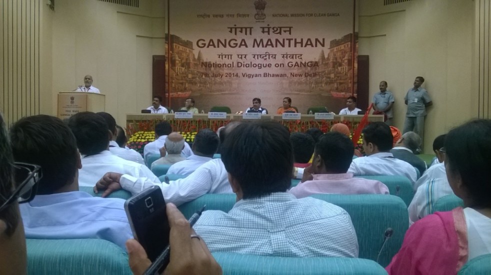


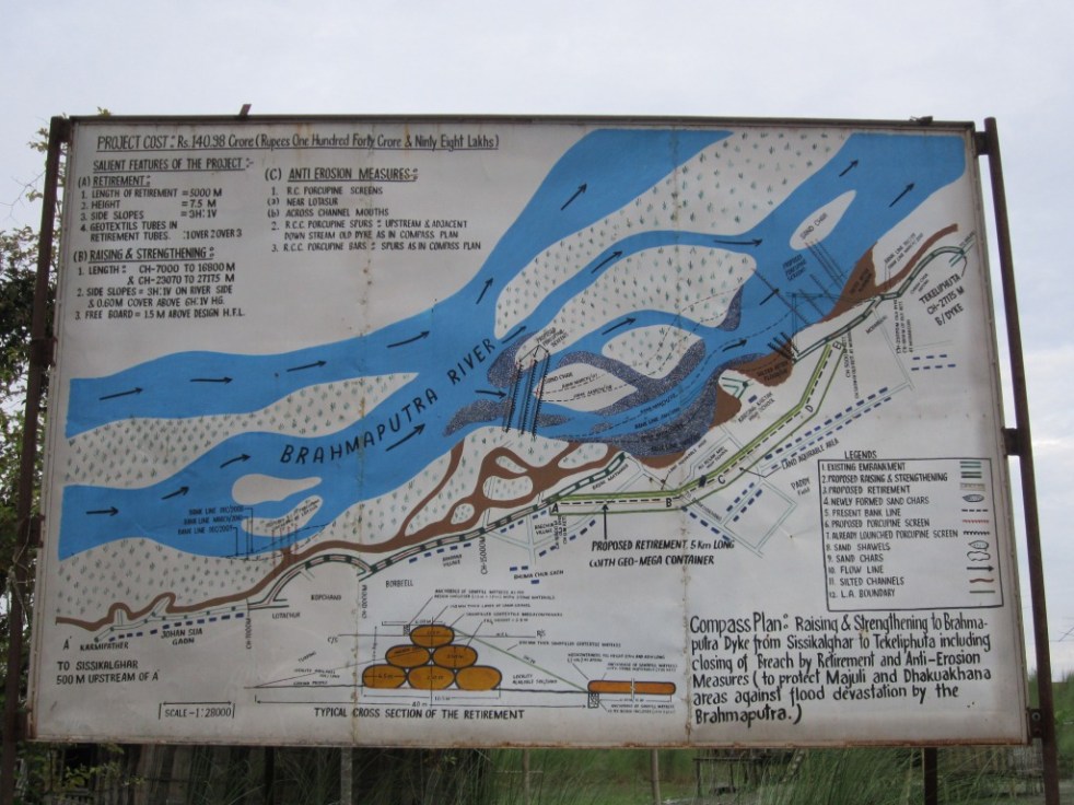

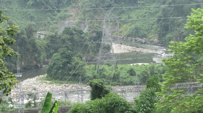
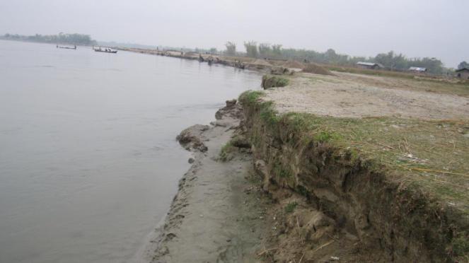

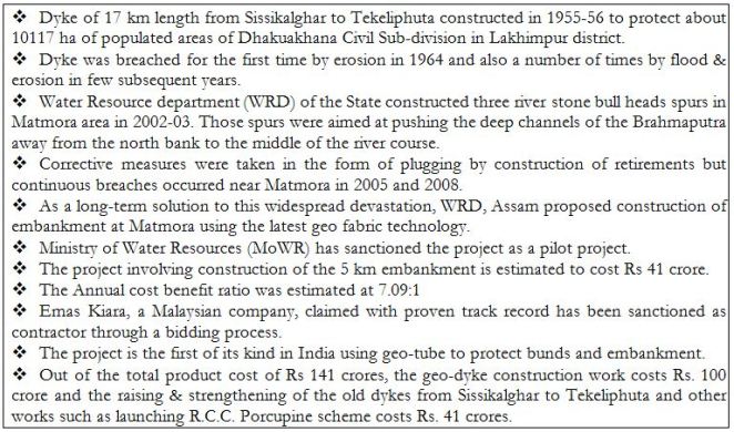


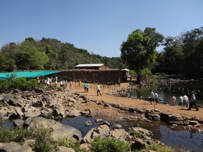


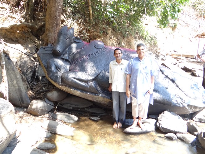


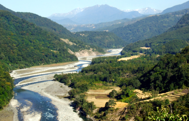


 administrative and judicial discretion. The loopholes are so big that you can drive a truck through some of them. Environmental and social damage must be avoided, but decisions must also be transparent, timely and fair.”
 Here in rare event when the statutory Forest Advisory Committee (twice) rejected forest clearance for the 300 MW Alaknanda Badrinath Hydropower project, your minister Mrs Natarajan overturned the FAC decision and gave clearance (it should be clear that we are not writing this in defense of Mrs Natarajan’s tenure at MoEF). In another instance, when FAC said no to Kalu Dam near Mumbai in April 2012, a more pliable FAC was put in place and your party Chief Minister from Maharashtra wrote to FAC to clear it and lo and behold, in April 2013 it was cleared! Mr Prime Minister sir, you yourself have gone ahead and laid foundation stone for the 3000 MW Dibang Hydropower Project in Arunachal Pradesh on January 31, 2008, when the project did not have statutory environment and forest clearances, the project still does not have them, because the basic studies have still not been done. All this only shows how off the mark your statements are.