In a bizarre turn of events, as Jayanthi Natarajan resigned as Union Minister of State of Environment and Forests (Independent charge), she has been reportedly replaced by Veerappa Moily[i]. He holds Union Oil and Petroleum Ministry currently and will hold Ministry of Environment and Forests Ministry as an additional charge. Firstly there is issue of conflict of interest there, since projects from Oil and Petroleum ministry also come for environment clearances.
This choice of Veerappa Moily as the new Minister of Environment and Forests is shocking, ironical and unacceptable for many reasons. It seems the leadership of Congress and United Progressive Alliance (UPA) has learnt no lessons from its Delhi election debacle. Mr. Moily’s appointment as Petroleum Minister in place of Jaipal Reddy was widely criticized as a sop to a specific private sector oil company[ii]. While we do not want to compare Mr. Reddy as Petroleum minister with Ms. Natarajan as Environment minister, Mr. Moily’s appointment as Environment Minister seems to cater to similar lobby for hydropower projects and dams.
Let us look at just a few instances to substantiate this.
Veerappa Moily laid the foundation stone of 85 MW Mawphu Stage II Hydel Project in Meghalaya in September 2012.[iii]The project is to be developed by NEEPCO (North Eastern Electric Power Corporation Limited). Shockingly Veerappa Moily laid this foundation stone even when the project did not have any of the statutory clearances from the Environment Ministry! This only indicates his callousness towards issues related to people and environment. The project has applied for 1st stage (Terms of Reference) Clearance only in January 2013 and that too has not been issued so far.
“Moily’s love for Hydels” Even as Hydel Power remains one of the most complex, controversial and problematic sectors with huge impacts on environment, people, downstream impacts, disaster implications, Veerappa Moily has been openly supporting Hydel power projects. He has been reported to have sent a note to the Prime Minister, pushing hydel power and Hydel Power Projects. This has been referred by the media as “Moily’s love for Hydels”.[iv]
Mr. Moily has urged the Arunachal Pradesh Chief Minister to “Fast Track” Hydel Projects, and specifically seems to favour NEEPCO and NHPC. NHPC already holds several hydel projects in Arunachal Pradesh including the 2000 MW Lower Subansiri Project which is witnessing possibly the strongest protest in the country from downstream Assam. [v]
In 2011, Veerappa Moily actually wrote to MoEF against expanding boundaries of Pushpagiri Wildlife Sanctuary in Dakshin Kannada.[vi] He wrote that people from affected regions will lose homes and livelihoods. But the region under expansion includes parts of reserved forests. Environmental groups stressed that the pressure against expansion is not coming from people but from the powerful hydel and timber lobby which is causing serious environmental and social impacts in the region.[vii]
Support for controversial Yettinhole Project Mr Moily is staunchly supporting the very controversial Netravathi Diversion project (which is now labelled as Yettinahole Diversion Project, only to mislead people) for his constituency of Chikkaballapur.[viii] He is even asking people of Dakshin Kannada not to oppose the project (he has lost elections from that area more than once). This project has fraudulently tried to escape environmental clearance from the Union Ministry of Environment and Forests. It entails 8 dams inside Western Ghats forest regions, affecting protected areas , a dam at Devaranyadurga which will submerge 1200 hectares of land including nearly 700 hecatres of forests and many villages. The proposal will cost minimum Rs. 100 Billion and is economically as well as technically unviable.[ix]
There is little doubt that Mr. Moily is an incorrect, inappropriate and unacceptable choice for the post of Union Minister of Environment and Forests. The UPA government is only committing blunders after blunders in the face of elections. We urge the UPA leadership to immediately change this decision. It would be in their own interest to do that.
PS: This Indian Express story seems to corroborate that the change is not for what is stated, but in favour of the Business and against the interests of the Environment and People. UPA will pay dearly for this: http://www.indianexpress.com/…/pm-wakes-up…/1210241/0
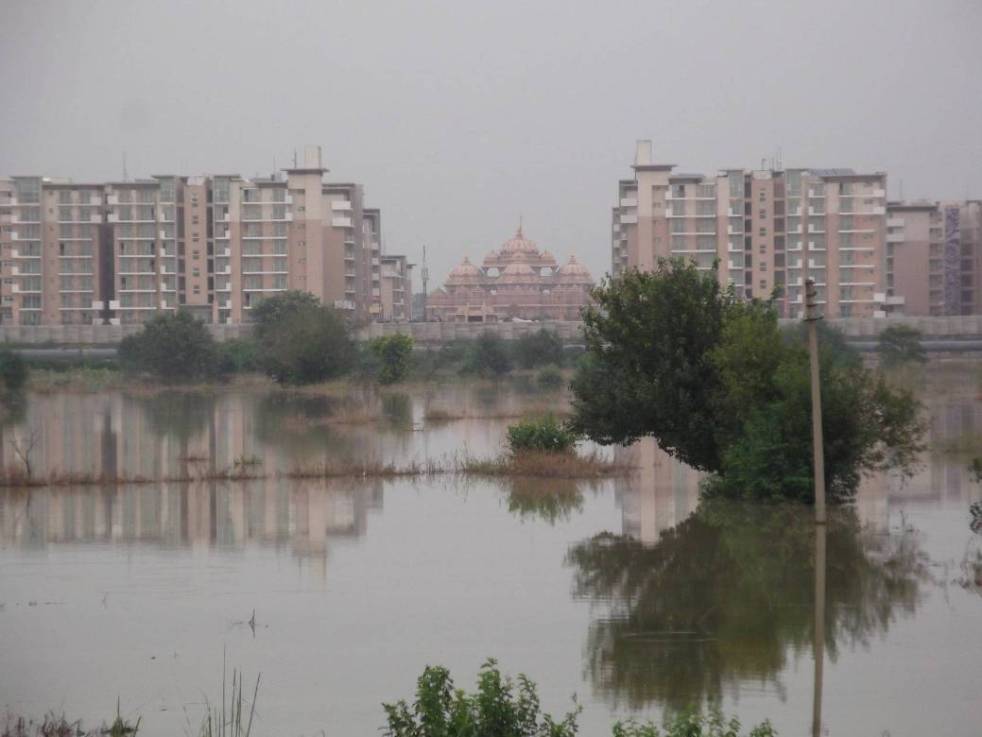
Deteriorating health over the decades of river Yamuna in Delhi is a perfect example of an abject governance failure. All grandiose plans to restore the river to its past glory have been in vain. Yamuna Action Plans (YAP) implemented since 1993 with a consolidated spent of around Rs 1500 crores have succeeded (sic) in only taking the river closer to its demise in the city-state.
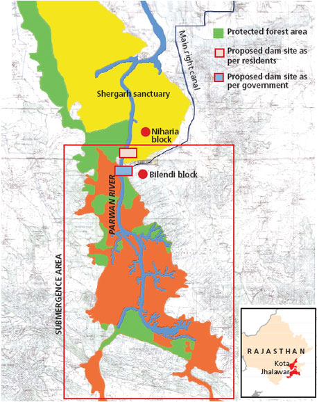
It seems Rajasthan state is ignored and is silent as Madhya Pradesh is going ahead with massive water resources development projects in interstate ChambalRiver basin. Some of these projects were even part of the interstate projects discussed for several years between the two states and now Madhya Pradesh is going ahead with them unilaterally. Mohanpura and Kundaliya projects were also part of the ParbatiKalisindh ChambalRiver link, one of the priority links of Union Government, but now MP is going ahead with them without any consultation with Rajathan or Government. In response to SANDRP questions, Madhya Pradesh responded, as recorded in the minutes of 68th meeting of EAC held in Sept 2013, “It was clarified that the NWDA scheme has not been accepted by the M.P. Government and is not likely to be implemented in the near future. The M. P. Government wants immediate implementation of Mohanpura Project”.
Lift irrigation project in NCS. Source: SANDRP partners
Not only that, the MP has ten times increased the size of the projects, which will have huge, unassessed downstream impacts on people, river and environment. The interstate National Chambal Sanctuary (NCS) will also be seriously adversely affected, but the downstream Rajasthan seems neither consulted nor concerned.
Gharial resting on a sand bank with Indian Cormorants and Lesser Whistling-ducks in NCS Source: SANDRP partners
Below we have given some information about some of the projects that have come up for clearance before the Union Ministry of Environment and Forests’ Expert Appraisal Committee on River Valley Projects (the meeting number and date of meetings are given) over the last couple of years. All of these projects are in Chambal basin in Madhya Pradesh and are being taken up without consent of or consultation with state or people of Rajasthan.
Mohanpura Major Irrigation Project
Dist/ State
Rajgarh / Madhya Pradesh
River/ Basin
Newaj
Proposal
TOR
Developer
Water Resource Department, Bhopal, Govt of Madhya Pradesh
Height of Dam (m)
47.90
Drinking water supply
20 MCM
Industrial Water Supply
60 MCM
CCA (Ha)
65,000
Submergence area (Ha)
7051
Area required (Ha)
NA
Villages affected
36 (1800 families) (10,240 persons)
ForestLand
NO
Decision
52nd Meeting (16-17.09.2011)
Decided that some additional information may be submitted
53rd Meeting (11-12.11.2011)
No effective discussion on the parameters of the project could be made and it was decided that the project shall be discussed again along with the information submitted by the M.P. Govt.
54th Meeting (26-27.12.2011)
Recommended scoping clearance and TORs with the same comments and observations made for Kundaliya Project.
This Mohanpura project (for more information on this, see: https://sandrp.wordpress.com/2013/11/15/mohanpura-dam-in-madhya-pradesh/) have been under discussed in the EAC now for full environment clearance and does not include any reference to Rajasthan, interstate aspects, downstream impacts, or impact on Chambal River of National Chambal Sanctuary. Some details in this respect are given below.
Much bigger Mohanpura Reservoir proposed compared to the PKC proposal It is clear from the perusal of the Feasibility Report of the PKC link given on the NWDA website that the project now proposed by the Govt of Madhya Pradesh is much bigger and an unviable scheme. The Gross and live storage of the NWDA scheme is 140 MCM and 52.5 MCM, where as the proposal now has gross storage of 616.27 MCM and live storage of 539.42 MCM, which means the live storage proposed now is more than ten times the live storage proposed in NWDA scheme. In fact the NWDA scheme had the proposal to transfer 464 MCM from the Patanpur Dam to the Mohanpura dam and yet, under the Mohanpura live storage capacity proposed under NWDA scheme was much smaller.
Location map of the Mohanpura Project (Source: Project EIA)
Interstate aspects ignored The project is coming up on an interstate river basin and will have clear implications for the downstream state of Rajasthan, but there is no mention of this in the EIA. Several meetings have also happened between Madhya Pradesh and Rajasthan about the PKC link mentioned above. The Government of India has prioritized this link, but by taking up this project unilaterally without consent of Rajasthan or Centre (Ministry of Water Resources) the Madhya Pradesh government is violating the interstate and federal norms. The EIA does not even mention any of these issues.
Kundaliya Major Irrigation Project
Dist/ State
Rajgarh and Shajapur Districts/ Madhya Pradesh
River/ Basin
Kalisindh
Proposal
TOR
Developer
Water Resource Department, Bhopal, Govt of Madhya Pradesh
Height of Dam (m)
44.50
Drinking water supply
18 MCM
Industrial Water Supply
84MCM
Diversion
1037 cumecs of LakhundarRiver to river Kalisindh
Live storage capacity
495.20 MCM
CCA (Ha)
58040
Catchment Area (sq km)
4900
Submergence area (Ha)
7476
Villages affected
56 (8630 persons)
Forest land
680 ha
Decision
52nd Meeting (16-17.09.2011)
Desired some more info.
53rd Meeting (11-12.11.2011)
It was decided that the project shall be discussed again along with the information submitted by the M.P. Govt. The Committee felt that considerable area of forest land is to be submerged in the project (680 ha). The forest maps provided as a part of additional information lack clarity.
54th Meeting (26-27.12.2011)
Recommended scoping clearance and TORs with some suggestions/comments.
Kalisindh Major irrigation project
Dist/ State
Sajapur/ Madhya Pradesh
River/ Basin
Kalisindh
Proposal
TOR
Developer
Water Resources Department, Govt of Madhya Pradesh
CCA
49023
Submergence area (Ha)
4239
Area Req (Ha)
4919
Village affected
15 (2384 PAFs)
Decision
61st Meeting (12-13.10.2012)
Sought some additional information.
62nd Meeting (23-24.11.2012)
Recommended clearance for pre-construction activities and TOR with some additional TORs.
It is high time Rajasthan government and people wake up to this reality of upstream developments and write to Madhya Pradesh, Union Ministry of Environment and Forests and also Union Water Resources Ministry against these developments.
The Mohanpura Project The proposed Mohanpura dam is to be constructed by the Madhya Pradesh Water Resources Deparment near the village Banskhedi of District Rajgarh, Madhya Pradesh on river Newaj in ChambalRiver Basin. The earthen dam project envisages irrigation of 97,750 ha, including the irrigable area of 62250 ha in Rabi and 35500 ha in Kharif in Rajgarh and Khilchipur Tehsils of Rajgarh district. The Environmental Impact Assessment (EIA) dated May 2013 has been done by WAPCOS, an agency under Union Water Resources Ministry.
Site of the proposed Mohanpura Dam (Source: EIA)
The EIA and the EAC We have provided below some critical comments on the EIA, these are only indicative in nature and not comprehensive. These comments were sent to the Ministry of Environment and Forests’ Expert Appraisal Committee (EAC) on River Valley Projects for its meeting in June 2013 and further comments for Sept 2013 and Nov 2013 EAC meetings. We were glad that EAC asked the project proponent to reply to our submission in detail. But we did not get any reply directly either from the project proponent or MoEF. We several times checked the relevant section of MoEF website before the Nov 11-12, 2013 EAC meeting and did not find any additional submission from the project proponent or EIA consultant except the EIA and earlier submissions. We also wrote to the EAC and MoEF officials about this absence of any response from the proponent or the EIA consultant and they did not respond to our emails.
However, while looking for something else, on Nov 13, 2013, on clicking the EIA (which we assumed was the old EIA), what we got was the Oct 2013 response from the project proponent that supposedly included the response from WAPCOS to our submission. This seems like an attempt on the part of MoEF officials to camouflage/ hide the reply so that the reply is put up, but we do no get a chance to review and respond to it. This is clearly wrong and we have written on Nov 13, 2013 to that effect to the MoEF director Mr B B Barman who is also member secretary of the EAC.
Location map of the Mohanpura Project (Source: EIA)
In any case, the WAPCOS reply of Oct 2013 does not really provide adequate response to any of the points we raised as we have discussed in the following sections. If the EAC had applied its mind, EAC too would have come to the same conclusion. However, if EAC decides to recommend clearance to the project based on this reply by WAPCOS, it will not only show lack of application of mind and bias on the part of the EAC, the project clearance would also be open to legal challenge.
In what follows we have provided main critiques of the EIA and the project.
EIA does not mention that the project is part of Inter-Linking of Rivers The Mohanpura dam is part of the Government of India’s Interlinking of Rivers scheme, specifically part of the Parbati-Kalisindh-Chambal (PKC) scheme, see for example the mention of Mohanpura dam on Newaj river in salient features of the PKC scheme at: http://nwda.gov.in/writereaddata/linkimages/7740745524.PDF, the full feasibility report of the PKC scheme can be seen at: http://nwda.gov.in/index4.asp?ssslid=36&subsubsublinkid=24&langid=1. This hiding of this crucial information by the Project Proponent is tantamount to misleading the EAC and MoEF and should invite action under EIA notification. The claim by WAPCOS (through their response in Oct 2013) that this was mentioned in DPR is clearly not tenable since this should have been mentioned in the EIA.
Much bigger Mohanpura Reservoir proposed compared to the PKC proposal It is clear from the perusal of the Feasibility of the PKC link given on the NWDA link that the project now proposed by the Govt of Madhya Pradesh is much bigger and actually an unviable scheme. The Gross and live storage of the NWDA scheme is 140 MCM and 52.5 MCM, where as the proposal now before the EAC has gross storage of 616.27 MCM and live storage of 539.42 MCM (page 1-328 mentions Live storage as 616 MCM, showing another instance of shoddy work of WAPCOS), which means the live storage proposed now is more than ten times the live storage proposed in NWDA scheme. It may be noted that there is less than 4% difference in catchment area of the two schemes, the NWDA site was slightly upstream with the catchment area of 3594 sq km, compared to catchment area of now proposed scheme being 3726 sq km, the difference between the two is only 132 sq km.
This does not warrant or justify more than ten time higher live storage. In fact the NWDA scheme had the proposal to transfer 464 MCM from the Patanpur Dam to the Mohanpura dam and yet, under the Mohanpura live storage capacity proposed under NWDA scheme was much smaller. It is clear that the proposal before NWDA is completely unviable proposal and should be rejected.
No justification for increasing the live storage capacity OVER TEN TIMES This is a very serious issue and unless this is satisfactorily resolved, EAC should not consider the proposal.
Here it should be point out that the following discussion in the 67th EAC meeting regarding the SANDRP letter is misleading: “The developers were asked to clarify doubts raised in the above letters relating to the project features that contradict with the assumptions made in the NWDA study of Parbati – Kalisindh – Chambal Scheme, a major issue is that the NWDA scheme envisaged a gross and live storage provision of 140 and 52.5 MCM respectively against the present proposal 616.27 and 539.42 MCM respectively because the NWDA proposed transferring 464 MCM from Patanpur dam to Mohanpura Reservoir to reduce the large submergence of Mohanpura Reservoir. The developers clarified that the NWDA scheme has not been accepted by the M.P. Government and is not likely to be implemented in the near future. The M. P. Government wants immediate implementation of Mohanpura Project for poverty alleviation of the backward Rajgarh District.”
The issue is not only about how NWDA plans differed from the current proposal in terms of transferring 464 MCM water to Mohanpura dam from Patanpur dam and transferring 403 MCM from Mohanpura dam to Kundaliya dam. Net effect of these two transfers is addition of less than about 61 MCM water to Mohanpura dam in NWDA proposal from outside the Newaj basin. In spite of this addition, the storage capacity of the Mohanpura dam in NWDA proposal is HUGELY LOWER than in the current GOMP proposal. There is clearly no justification for such huge storage capacity from any angle. Even the water use plan has exaggerated figures and does not change even with changed cropping pattern. The issue is the viability, desirability, need and optimality of the ten times larger reservoir than was NWDA proposed earlier.
Unfounded assumption about water availability The project assumes huge yield of 745.2 MCM, much higher than that assessed by the Chambal Master Plan, without assigning any reason. This seems to be a ploy to push for unjustifiably huge reservoir. This is clearly wrong and the proposal should be rejected. The reply by WAPCOS that “The calculated yield of dam is approved by Bureau of Design of Hydel & Irrigation Project (BODHI), M.P.” is not convincing since BODHI is government of Madhya Pradesh organisation and in any case, their approval letter and methodology details have not been attached. In any case, Newaj being in interstate Chambal river basin, it will need vetting by the interstate Chambal River Board or credible independent body.
Inadequate assessment of upstream water requirement The EIA does not do proper or adequate assessment of current and future water requirements of upstream areas and allocates almost all available water in the catchment to the project in a bid to justify unjustifiable project. The figures given in table 10.9 are not even substantiated with any basis and hence are far from adequate in the context. The PP has also not responded to the EAC query about the upstream water demand.
Unjustifiable submergence The proposal entails submergence of 7051 Ha, almost three times the submergence as per NWDA scheme of 2510 ha. The project proponent has hugely underestimated the number of affected families to 1800 against private land acquisition of 5163 ha. They have amazingly, allotted just 132 ha of land for R&R, when land for land provisions under the MP R&R policy will require much more than 5000 ha just for R&R. The social impact assessment has not been done at all. In fact the phrase Social Impact Assessment or Social Impact does not figure in the entire EIA, when the National Green Tribunal has been laying such a stress on SIA.
The whole social impact assessment of the proposal now submitted is shoddy. It is clear the huge displacement is unjustified, and the project proponent has no interest in even doing any just rehabilitation. The PP has not explained the justification for three times increasing the submergence area compared to the NWDA proposal.
Interstate aspects ignored The project is coming up on an interstate river basin and will have clear implications for the downstream state of Rajasthan, but there is no mention of this in the EIA. Several meetings have also happened between Madhya Pradesh and Rajasthan about the PKC link mentioned above. The Government of India has prioritized this link, but by taking up this project unilaterally without consent of Rajasthan or Centre (Ministry of Water Resources) the Madhya Pradesh government is violating the interstate and federal norms. The EIA does not even mention any of these issues.
Underestimation of Land required for Canal The project has command area of 97750 ha and claims that it will require just 152 ha of land for canals (table 2.6 of EIA), which is clearly a huge under estimate and is not based on any real assessment. The project will require several times more land for the canals and will have related social and environmental impacts which have not even been assessed. The response from WAPCOS that this is because most of the water conveyance system is underground is far from adequate since an assessment of land requirement should still have been done and a lot of land would still be required at the end of water conveyance system.
No Command Area Development Plan The EIA report (May 2013) mentions CAD in two sections: Section 2.8 and 10.9. However, perusal of both sections show that neither have full description of Command Area Development Plan or adverse Impacts of the project in the Command Area including drainage, health, biodiversity and other issues.
Shocking statements in Command Area Development Plan The CAD now annexed in the Additional information (dated Aug 2013) makes some shocking statements. e.g. It says: “GCA of the project is 928680 ha…” with an extra “0”. This seems to suggest that the EIA consultant is callous.
The CAD further says: “Maximum height of the spillway above the ground will be 47.90 m (measured from river bed level to top of the spillway bridge). Maximum height of spillway from expected foundation level will be 47.90 m.” So the height of the spillway above the riverbed and above the foundation is same! This means that there is no foundation of the dam below the riverbed level! This again shows the callousness and lack of understanding of basic concepts by WAPCOS.
Section 2.9 of CAD says: “The groundwater development is of the order of 6.9% to 8.7% in the command area blocks.” In reality, as the table 2-3 just below this statement shows, the groundwater draft is 69 to 89%.
Section 3.1 of CAD says: “…the catchment area intercepted upto Mohanpura dam site is 3825 sq.km.” The last sentence in the same para says: “The catchment area intercepted at the dam site is 3726 sq.km.” Such figures for the catchment area upto Mohanpura dam keeps appearing in the documents.
The CAD should start with clear statement of HOW MUCH OF THE PROPOSED COMMAND AREA IS ALREADY IRRIGATED. This is not even mentioned.
No Downstream Impact Assessment The EIA report has not done any downstream impact assessment, including the impact on biodiversity, livelihoods, draw down agriculture, water security, groundwater recharge, geo-morphological impacts, among others. The response of WAPCOS in Oct 2013 that Newaj is a monsoon fed river and hence there are no downstream impacts is completely inadequate and shows the lack of understanding of functions of the river on the part of WAPCOS.
Impact of project on National Chambal Sanctuary It may be noted that the project is to be constructed on Newaj river, a tributary of the Chambal river. The project will have significant impact of water, silt and nutrient flow pattern into the ChambalRiver, the approximate 600 km of which has been declared as National Chambal Sanctuary between 1979-1983 across three states of Madhya Pradesh, Rajasthan and Uttar Pradesh. However, the EIA does not even mention that the National Chambal Sanctuary exists down stream of the proposed project and will be impacted by the project. According to section 29 of the Wildlife Protection Act of 1972, any project that affects flow of water into or out of the protected area should be assessed for its impact on such sanctuary and necessary clearances be taken from the designated authorities including Chief Wildlife Wardens and National Wild Life Board. However, WAPCOS does not even seem aware of the existence of the sanctuary.
Another point to note is that the entire water availability in the NCS is dependent on the KaliSindh and Parbati since there is no discharge below the Kota Barrage. The response from WAPCOS (Oct 2013) that the Mohanpura catchment is about 200 km from the river and that it is just 2.5% of the Chambal catchment and hence will not have any impact is clearly untenable. Firstly, the EIA does not even mention the existence of National Chambal Sanctuary. Secondly, it is not the distance of % catchment, but the impact of the abstraction that is important and the EIA has clearly not done that.
Impact of mining of materials for the project not mentioned The EIA has some assessment of material required to be mined for the project at Table 2.7, but where will these materials come from and what will be the impacts of this is not even mentioned.
No proper Options Assessment The EIA does not do proper options assessment to arrive at the conclusion that the proposed project is the most optimum proposal. It may be noted that the area has rainfall of 972 mm (see Chapter 2 in Command Area Dev Plan in Additional Information dated Aug 2013) and there are a lot of options for local water systems. As is clear from the public hearing report, several farmers suggested that in stead of one big dam a series of smaller dams should be built and that farmers will have to commit suicide if the dam is built. The response in the EIA is most callous that this is not technically feasible is not even backed by any evidence, which again shows the shoddy nature of the EIA.
The response of WAPCOS (Oct 2013) that the project is justified for fluoride affected area is completely misleading since if that was the concern than much smaller dam and large number of rain water harvesting structures would better serve the purpose. This again shows that WAPCOS has not done any options assessment.
Public hearing in the office of the DM? Chapter 17 of the EIA says, “Public Hearing for Mohanpura Multipurpose Major Project was conducted by Madhya Pradesh State Pollution Control Board (MPPCB) on 11th March 2013 in the premises of the office of the District Magistrate, Rajgarh”. This is most shocking state of affairs. The Public hearing as per the EIA notification is supposed to be conducted at the project site and cannot be conducted in the office of the District Magistrate. The MoEF should have applied its mind on just this aspect and rejected the proposal and asked them to get the public hearing done in legal way. The public hearing report is also incomplete with several sentences not being complete. This again shows lack of application of mind on the part of the MoEF and WAPCOS. The response from WAPCOS in Oct 2013 that the DM office is just 9 km from the dam site and is convenient to all concerned is clearly wrong, the public hearing should have been conducted in the affected area and public hearing report should be full and cannot be accepted with half sentences. This public hearing will also not pass the legal scrutiny.
CUMULATIVE IMPACT ASSESSMENT FOR CHAMBAL BASIN A very large number of dams and other water use projects have been constructed, are under construction and under sanction in the ChambalRiver Basin. It is high time that a Cumulative Impact Assessment (CIA) and carrying capacity study for the ChambalBasin be done before any more projects are considered in the basin. This is also required as per the MoEF Office Memorandum (J-11013/1/2013-IA-1 dated May 28, 2013) that required states to initiate CIA in all basins within three months, that is by Aug 28, 2013.
Unacceptable EIA The whole EIA is done in most shoddy way and should be rejected for this reason and EAC should make recommendation for black listing of WAPCOS as EIA agency. Just to illustrate, the EIA says MDDL stands for Maximum Draw Down level (page 1-14), has not even mentioned the project impact on the National Chambal Sanctuary (one of the only two river sanctuaries of India also proposed as Ramsar site), for hugely inadequate R&R land and canal land requirements, for not doing impact of mining of materials for the project, for not assessing the hydrological viability of the project, for making unfounded assumptions, among other reasons mentioned above.
Issue of Conflict of Interest for WAPCOS It may be noted that WAPCOS is a Ministry of Water Resources organization, and has been in the business of doing pre-feasibility, feasibility reports and Detailed Project Reports, which are necessary for the justification of the projects. This is part of the business of the organization. Such an organization has clear conflict of interest in doing an honest EIA since an honest EIA can lead to a possible answer that the project is not viable. Hence EAC should recommend that the WAPCOS should be debarred from doing any EIAs or CIAs (Cumulative Impact Assessments).
Other Issues Besides the above, a large number of issues raised by EAC in 67th meeting remain unresolved.
Þ For example, the area to be inundated by dam break needs to be listed and shown on map, which has not been done.
Þ EAC had asked: “Details of drainage network planning be included in the report.” In response, PP has attached Annex III which is just a map!
Þ EAC had asked: “75%flow series gives a total yield of catchment as 25.77 cumec-10 days in 75% dependable year. Whereas in table-5.2 the 75% dependable yield is given as 749.71 Mcm. The same needs to be corrected. Corresponding corrections at relevant sections in Volume-II, EMP report also be done”. This has not been done except an amended table
Þ Annex XIV in Additional Info on “INCOME – EXPENDITURE DETAILS OF PAFs” leaves a lot to be desired. Here, what does the figures represent in Table 1 is also not clear.
Þ Annex XV in Additional Info volume is basically a reproduction of 10.11.6 from the EIA. Incidentally, it ends by saying: “Project planner need to understand the negative impacts with sensitivity, and formulate mitigation measures appropriately; such mitigations measures that would be acceptable to the concerned population groups and that are sustainable.” The proposed project or the R&R plan are neither acceptable to the concerned population groups, nor sustainable, in any case, there is no process to achieve this.
Þ EAC had asked for more no of villages in the sample compared to 9, but the EIA consultant has refused to do this (Annex XVI and XVII in additional Info) without any convincing reason.
CONCLUSION In view of the above, we urge EAC to:
1. Reject the proposal for environmental clearance. It will be most shocking if the project gets cleared with this kind of EIA.
2. Reject the EIA, as explained above this is most shoddy EIA.
3. Reject the Public hearing; as explained above, the public hearing has not been conducted as legally required. The public hearing also need to be conducted again since the EIA is found to be so seriously inadequate and needs to be redone. In any case, with so many additions and changes to the EIA, the public hearing clearly needs to be redone.
4. Suggest black listing of WAPCOS as EIA and CIA agency. It is high time for EAC to send a signal that such shoddy EIA would not be accepted and is in violation of law.
Submission showing how the WAPCOS EIA of Mohanpura Project is Inadequate and Plagiarised
Sep 23, 2013
To,
Chairman and members,
Expert Appraisal Committee on RiverValley Projects,
Ministry of Environment and Forests,
New Delhi Subject: Serious concerns on the Mohanpura Irrigation Project on agenda for the 68th meeting of EAC of RVP
Dear Chairman and Members of the EAC-RVP,
With reference to the Mohanpura Irrigation Project on agenda for the 68th meeting of the Expert Appraisal Committee on River Valley Projects, and WAPCOS response to EAC comments (August 2013), I believe that the concerns raised by the New Delhi based SANDRP has not been addressed. The Project Proponent has also not responded satisfactorily to the queries raised by the EAC, and I outline a few of their (WAPCOS) responses below –
EAC Comment No. 16: The source of data for faunal population is to be provided. The source of secondary information may be provided if used.
EAC Comment No. 17: The avifaunal list is good but requires a lot of typographical corrections. Also some of the species such as Golden Plover and Redshank have been shown as resident although they are migratory.
EAC Comment No. 18: The list of reptiles appears deficient for this hot and dry area of central India. This needs to be updated. The information provided by WAPCOS under-represents the faunal richness of the region and is an attempt to deceive the Expert Appraisal Committee on River Valley Projects. The sources used in the EIA are old and I would like to draw you attention to more recent work from the region (attached below).
Nair, T. & Krishna, Y. C. (2013). Vertebrate fauna of the ChambalRiver Basin, with emphasis on the National Chambal Sanctuary. Journal of Threatened Taxa, 5(2): 3620–3641; doi:10.11609/JoTT.o3238.3620-41
EAC Comment No. 19: The methodology for faunal surveys has not been provided properly. The faunal part in section 4.2.2 is too brief and fails to provide any idea about the primary effort. The source of secondary information may be provided if used. The methodology outlined in Annexure-XII by WAPCOS has simply been copied from other survey reports / studies without actually conducting them. This amounts to professional dishonesty and fraud, and is another attempt to deceive the EAC-RVP.
Eg: “Direct Count: Both terrestrial and arboreal (small and large) mammals were counted during monitoring of line transect (Burnham et al. 1980) that were walked in the early and late hours of the day, and during the night using spotlight or headlights (Duckworth 1992).” is plagiarised fromhttp://fes.org.in/studies/sitamata-report-final-july.pdf?file=ZG93bmxvYWQvd3AxOS5wZGY=
“Indirect Count: Presence and relative abundance of most of the small and large mammals was evaluated using methods that rely on indirect evidence such as animal burrows/holes, dung, pellets, scats, feeding signs, tracks, nests, digging and antler thrashing.” is also plagiarised fromhttp://fes.org.in/studies/sitamata-report-final-july.pdf?file=ZG93bmxvYWQvd3AxOS5wZGY=
“Line Transect useful in determining variation in herpetofaunal populations across continuously changing environmental gradients (Jaeger, 1994). Thus, systematic searches can be used to provide data for distribution, inventory, relative abundance, density estimates, population trends, site occupancy and territory mapping.” is plagiarised fromhttp://www.outdooralabama.com/research-mgmt/State%20Wildlife%20Grants/AL_AM_Final_Report.pdf
EAC Comment No. 20: The presence/absence of Blackbuck, a Schedule-I species, may be commented upon since it is expected in the area. WAPCOS response that ‘Blackbuck is not reported in the area’ is again not true. Please refer to the press report and scientific study which show the presence of black buck from the area. Press report: http://articles.timesofindia.indiatimes.com/2013-01-05/flora-fauna/36162066_1_blackbuck-population-stray-dogs-habitat Scientific publication: Karanth, K. K., Nichols, J. D., Hines, J. E., Karanth, K. U. and Christensen, N. L. (2009), Patterns and determinants of mammal species occurrence in India. Journal of Applied Ecology, 46: 1189–1200. doi: 10.1111/j.1365-2664.2009.01710.x I believe that such a manner of plagiarism and false claims of having used scientific methods during the Environmental Impact Assessment is reason enough to reject the project and to blacklist WAPCOS. Further, the Government must initiate civil and criminal proceedings against WAPCOS for fraud, suppressing facts and providing misleading information on an issue that has serious and negative ecological and social consequences.
It is becoming increasingly evident that ‘rivers’ do not figure anywhere in the entire e flows discourse and assessments going on at Government level in India. We have so many different types of e-flows assessments being tried out.
Multiple agencies, but where are the flows? At least 69 hydro power projects are in various stages of development in Alaknanda – Bhagirathi sub basins of the Ganga (as per IMG records). Four different e-flow regimes based on different approaches have been put forward by the four different agencies. While AHEC (Alternate Hydro Electricity Centre) has used Mean Annual Flows (MAF), WII (Wildlife Institute of India) has resorted to Mean Seasonal Runoff (MSR) for different seasons based on the needs of the fishes. CWC (Central Water Commission) has resorted to ad-hoc e flows of 20 % of daily flows. IMG (Inter-Ministerial Group) has come out with its own recommendation of percentage of daily inflows for different seasons going upto 50 % for winter season from December – March where winter flows are very low.
The beautiful Nyamjangchu River, Tawang, Arunachal Pradesh, now threatened by the 780 MW Nyamjangchu Hydel Project and very low eflows recommendation Photo courtesy: Tenzing Rab Monpa
While admitting that Building Block Methodology (BBM) is the most comprehensive holistic methodology, IMG report claims (without basis) that since it is time consuming and since it has not been tried out in any large river basin, interim e-flows recommendations be done so that hydro power development is not held up for want of environmental decisions. Mind you, this is the case with all the rivers where hydro power projects are being planned. While many of the project developers and EIA agencies claim that they follow BBM methodology, it is evident that none of these fulfill the requirements of a comprehensive BBM methodology. So who cares about the rivers here?
NIH workshop on Oct 2-3, 2013 without MoEF! The National Workshop on Environmental flows organized by the National Institute of Hydrology (NIH), Roorkee along with UK based Centre for Ecology and Hydrology (CEH) during 2-3 Oct 2013 only reinforced my conviction that what is going on in the name of e flows assessment is indeed not for any goodwill for the rivers. The workshop was conspicuous by the absence of MoEF officials whose main mandate is protecting river ecosystems and life in rivers. Were they not invited or did they decide not to participate? It was mostly dominated by technical persons and organisations who believe that rivers are for the exploitation by humans alone mostly through mega projects. The workshop agenda was set on the oft repeated dictum that e flows should be integrated into water resources development, without any will for such integration.
E-flows are for rivers In India e flows is just a formality to fulfill the requirements of the environmental clearance process. Ironically, resource persons from countries outside India with ample experience on e flows assessment pointed out that the intention was to find ways to ‘limit’ or mitigate the impacts of development. If the agenda had been set with the intention that e flows should be part of river conservation and not just to fulfill the development agenda then we would have some hope for rivers.
Developers don’t want any e-flows Project developers are clearly unhappy with even the meager allocation in the name of e flows. The dam builders like the NHPC, Uttaranchal Jal Vidyut Nigam Ltd. and Tehri Hydro Power Corporation claimed that they are actually releasing more water than they are ‘asked to’! This is indeed ridiculous. Even what they are ‘asked to’ release does not amount to e-flows and is not based on any comprehensive assessment or community validation! And there is clear evidence that they are not releasing even that (e.g. NHPC’s Teesta V or Tehri). Then where does the question of reducing e-flows allocation below dams arise? They even went to the extent of recommending that in those rivers where tributaries join the dry stretch below the dam, can’t e flows allocation be reduced and can’t the tributary contribution added as e flows? Can’t e flow releases be used for power generation by installing dam toe power houses? For them e flows is mere ‘cumecs’ (Cubic meters per second) of water to be released and nor do they understand that each tributary and the main stem of the river have their own ecological niches & functions; and social and cultural dependencies which are linked to the flows in each of these.
Dhauliganga before the June 2013 disaster, with zero water flow downstream from the dam, killing a perennial river. Source: Emmanuel Theophilus
The presentations made by NIH Roorkee, CIFRI (Central Inland Fisheries Research Institute), GBPIHED (GP Pant Institute of Himalayan Environment and Development) and AHEC for proposed hydro power projects in the Himalayas and the North East India revealed that none of the studies had carried out consultations with river dependent communities and did not follow the BBM principles either.
CIFRI-NIH’s flawed assessment of Teesta IV HEP e-flows Teesta IV HEP proposed in Sikkim is presently under the scanner since many groups have raised the genuine concern with the MoEF (Ministry of Environment and Forests), EAC (Expert Appraisal Committee), FAC (Forest Advisory Committee) and the NBWL (National Board of Wild Life) that if implemented it would mean the death of the last free flowing stretch of the main Teesta river. The ToR (Terms of Reference) of the study commissioned by MoEF says, “An estimation to be made for environmental flows downstream forsustenance of aquatic environment and for downstream uses, considering details of streams joining the river below the proposed dam site with their approximate distance from the dam site, their nature (whether perennial or seasonal) etc. A detailed environmental flows study shall be carried out through the premier institutions such as Central Inland Fisheries Research Institute (CIFRI), Barrackpore and National Institute of Hydrology (NIH), Roorkee for biological and hydrological components”.
The consultants took just 7.5 km length of the river from dam axis to the existing downstream project Teesta V which is immediately downstream. The study carried out in 2009- 2010 period has prescribed a minimum discharge of 10 cumecs (Cubic Meters per second) from the dam during the lean period and 40 cumecs for wet season for aquatic life is also prescribed. The ToR has two objectives namely e flows for the sustenance of aquatic environment and for downstream uses, but the sampling parameters in the presentation does not reflect the fulfillment of these objectives.
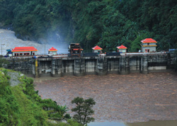
Teesta V HEP Photo: Tehelka
Since the Teesta V is already commissioned, the impact below the dammed and flow regulated stretch of Teesta V on the aquatic environment and downstream uses would have given useful comparisons. The study seems to have ignored the e flows for downstream uses of communities even in the 7.5 km stretch. The study though claimed to have used the BBM methodology, it is doubtful if all the relevant building blocks have been considered. The study carried out in 2009-10 does not seem to be uploaded in public domain to date.
E-flows for all projects do not make sense? Most shockingly, the chief consultant for the Ganga River Basin Management Plan now being formulated by a consortium of IITs (Indian Institutes of Technology) Dr Vinod Tare was of the opinion that all projects to release e flows does not make sense. He said it is important to seek balance and generate power as well. Now this is problematic. Let us face it that in Indian conditions we are working on e-flows under data and information deficient conditions. We are still far away from understanding a river system in its complexity along with its basin characters, eco- hydrological interactions and land use changes.
Lack of Eco-hydrological understanding Even NIH engineers and other experts agreed during discussions that we lack reliable hydrological data and have absolutely very little ecological data base on our rivers to arrive at proper recommendations for e-flows. MoEF and NGRBA (National Ganga River Basin Authority) has meanwhile accepted BBM methodology (as in the NGRBA Report; Code – 022_GBP_IIT_EFL_SOA_01_Ver 1_Dec 2011) as the most robust assessment approach to e-flows and they also say it needs to be worked upon.
The report says, ‘The BBM methodology is found to be robust with high confidence level. However, specific flow recommendations are difficult to justify at this stage, and will have to be worked out afresh. The major uncertainties centered on the hydrological and hydraulic models due to lack of availability of reliable data’. In BBM all blocks are equally important as they interact with each other. Against such a scenario, Dr Tare needs to think twice before making such statements! They can be used by dam developers to lobby for reduced or even no flows.
What about e-flows from existing dams? Another missing element from e-flows at the NIH workshop that is bothersome was the lack of interest by the experts and the various authorized institutions in allocating e flows below already dammed rivers. They say it will be a tough job and would not be possible politically. However, ultimately e-flows is a social and political choice with trade offs and negotiations inbuilt into it. Does that imply that we can leave heavily dam ravaged rivers like the Mahanadi, Krishna, Cauvery, Narmada, Tapi, Sabarmati, Godavari, Teesta, Sutlej, Ravi, Beas, Chenab, Periyar and the like to die without allowing them at least their long overdue minimum flows leave alone e flows ? It is high time the Government took interest and started engagement and studies in arriving at and allocating e flows below dammed rivers.
The same Baspa, bone dry, about 5 kms downstream Baspa Dam. Photo: SANDRP Partners
Future challenges After two days of debate and disagreements, I came out of the workshop with the following thoughts at the top of my mind.
Several institutions in this country with expertise in ecology and hydrology and with necessary infrastructure who could have made efforts to put in place comprehensive e-flows assessment process are working for dam developers and serving as experts in EIA studies giving green signals to ill conceived hydro electric projects and dams based on inadequate e-flows recommendations. The level of dilution of science and ethics this can lead to is mind-boggling and with disastrous consequences for our rivers. For example e-flows and minimum environmental flows are being used as synonyms by many institutions including CWC. An interesting and dangerous recommendation from CWC at the workshop is; ‘If feasible, a separate storage of water in the upper reaches of a river basin maybe created for environmental needs which will help in augmenting flows during lean season and satisfy the e-flows demands particularly for Himalayan rivers’. So in future all river basins with dam cascades could be recommended with e-flows reservoirs!
What about compliance, MoEF? While e-flows have become mandatory for hydro power projects in this country, it is surprising and shocking that MoEF is yet to ensure compliance and to take up comprehensive and fundamental assessment of e-flows in sample river basins on its own which is its primary mandate. It is high time MoEF develops a ToR for e-flows from its conception to implementation to monitoring. E-flows assessment presently being carried out lacks proper objectives and mostly excludes communities from its purview or assessment. There is vagueness about what constitutes downstream in e-flows assessment. Even for the e flows assessment carried out in River Ganga for the NGRBA has there been any effort to implement the same? Has the MoEF ever tried to seek inputs on e flows from outside the government organisations or from the several groups working tirelessly for conservation of rivers?
Will NIH exercise have credibility? NIH in collaboration with many institutions proposes to take up sample river basins in India and put in place eco hydrological models for e flows. The absence of MoEF and members of the Expert Appraisal Committee on River Valley Projects at this workshop organized by a MoWR institution speaks for itself how e-flows will be realized if the mandatory ministry does not take a pro active role.
Some of the gaps and challenges in e flows assessment in Indian context include: lack of reliable data, lack of understanding of eco- hydrological linkages, river aquifer interactions, pollution related aspects (how to quantify and relate to flow releases), e-flow releases for flood plains, lack of resource allocation, lack of valuation of ecosystem services and societal – cultural value of rivers, multiple institutions working against each other’s interests (MoWR vs MoEF), Peaking induced flashiness, scientific and acceptable ways to compute e-flows and lastly but most importantly, effective implementation and monitoring.
Experts from other countries pointed out that rather than numbers it is better to have distribution ranges for e flows under Indian conditions with complex dependencies. They also made an important comment that uncertainty and risk factors never get integrated into our e-flows estimations. In India land use changes are also not accounted in e flows calculations.
47 experts and organisations from across the country have written to the Ministry of Environment and Forests, including the Minister Ms. Jayathi Natarajan to include hydel projects between 1-25 MW under the purview of EIA Notification 2006. A similar letter has been sent to the Ministry of New and Renewable Energy and Minister Dr. Farooq Abdulla, to address the impacts of these projects which are governed by the MNRE.
Those who have written include eminent personalities like Former Water Resources Secretary: Dr. Ramaswamy Iyer, Former Ambassador of India: Ms. Madhu Bhaduri, Former Secretary of Power and Principle Advisor to Planning Commission: Dr. EAS Sarma, Former member of MoEF’s Forest Advisory Committee: Dr. Ullas Karanth, Head of IISC’s Centre for Ecological Sciences: Dr. TV Ramachandran, Head of People’s Science Institute: Dr. Ravi Chopra, experts from energy field, as well as activists, fisheries experts, scientists and importantly, representatives from affected communities
Letter sent to MoEF is below:
1. Smt. Jayanthi Natarajan,
Union Minister of State (IC) of Environment and Forests,
Union Ministry of Environment and Forests, New Delhi, vrg.iyer@nic.in
3. Mr. Maninder Singh
Joint Secretary,
Ministry of Environment and Forests, New Delhi, jsicmoef@nic.in
4. Mr. Ajay Tyagi
Joint Secretary,
Union Ministry of Environment and Forests, New Delhi a.tyagi@nic.in
5. Mr. B. B. Barman
Director (IA) River Valley Projects,
Union Ministry of Environment and Forests, New Delhi, bidhu-mef@nic.in
Please include Small Hydel Projects (1-25 MW) under the purview of EIA Notification 2006, considering their serious impacts on ecosystems and communities.
Respected Madam Minister and office bearers of the MoEF,
We want to record our concern about serious impacts of small hydro projects on communities and ecosystems. Several groups from us have written to you in the past to urgently amend the EIA Notification 2006 and to include Small Hydel Projects in its ambit. Looking at the serious impacts of these projects, MoEF could have suo motto taken this initiative. But that has not happened, despite several amendments in the EIA Notification down the years.
SHPs can have and are having severe impacts on communities and ecosystems. This is significant as SHPs are exempt from environmental impact assessment, public hearing, and environmental management plan as EIA Notification 2006 restrict itself to projects above 25 MW. The local communities are specifically affected as they do not have a platform to voice their concerns.
To highlight some of the impacts of SHPs:
Þ 70 SHPs in Karnataka under scanner following HC orders Karnataka High Court upheld Elephant Task Force’s recommendation about impacts of SHPs on Elephant habitats and directed Karnataka Government to review clearances of all such projects affecting elephant habitats[1], bringing at least 70 SHPs under scanner, 40 in Hassan district, the rest in Mandya, Chamarajanagar and Uttara Kannada districts.
Gangani Small Hydro project in Uttarakhand across Yamuna which resulted in loss of lives and property during Uttarakhand floods. Photo: Yamuna Jiye Abhiyan
Þ Karnataka HC no to SHPs in W Ghats In Feb 2013, the Karnataka High Court banned SHPs in Western Ghats[2], following a petition filed by Western Ghats Forum.
Þ Uttarakhand Uttarakhand had earlier cancelled as many as 56 SHPs due to irregularities.
Þ Western Ghats reports Considering the impacts of small hydro projects, the Madhav Gadgil Panel on Western Ghats recommended that in Ecologically sensitive zone 1, only projects below 10 MW with max height of 3 m and not involving forest land be taken up. In ESZ 2, projects upto 25 MW can be taken up only if dam height is below 15 m. This shows the nuanced approach that is required for small hydro projects. The panel also recommended that WGEA should include small hydro projects under EIA notification. Even the Kasturirangan committee has recommended that hydropower projects, including SHPs be allowed only on condition that 30% eflows are released, less than 50% of the river length is destroyed and there is 3 km free flowing river between projects. It has also recommended that hydropower projects, including small hydro projects should required environment clearance in the Ecologically Sensitive Area.
Pristine Forests set for submergence under the 24 MW Kukke Mini hydel Plant in Dakshin Kannada, Karnataka. Photo: SANDRP
Þ Bhagirathi ESA In the notified Bhagirathi ESA in Uttarakhand, the MoEF itself has implied that Hydro projects only of below 2 MW installed capacity can be taken up.
Þ BWSSB asks for stoppage of SHPs In March 2013, Bangalore Water Supply and Sanitation Board (BWSSB) asked the Karnataka Power Corporation Limited (KPCL) to stop power generation from four mini hydel projects on Cauvery River as it was affecting drinking water supply to Bangalore.[3]
Most Small Hydro projects (1-25 MW) are grid connected, and local communities do not get electricity from the projects in their backyards, across their rivers which have significant impacts on local water availability, habitats and submergence.
Some examples in this regard are given here:
Þ In Himachal, communities have protested strongly against 4.5 MW Hul project affecting drinking water security and irrigation of 6 villages, as well as ancient oak forests.
Protesst against 4.5 MW Hul project in Himachal/ Photo: Saal Ghati Bachao Samiti
Þ Projects like 24.75 Kukke I in Dakshin Kannada can submerge a massive 388 hectares, including extremely bio-diverse forests, plantations and houses. This is being strongly opposed by local communities.
Þ Greenko’s Perla and Shemburi Projects, Basavanna and Mauneshwara SHPs in Karnataka are examples where two 24.75 MW SHPs are fraudulently shown as separate projects, but are single projects with a common dam. In the latter case, villagers assumed that the power canal is actually an irrigation canal for their fields. They only realised that they were alienated from their river after they were banished from approaching the canals.
Blatant violations in 24.75 MW Perla MHP and 24.75 MW Shemburi MHP across Netravathi. The common, huge barrage can be seen for two supposed seperate projects. Photo SANDRP
Þ Maruthi Gen projects, also in Karnataka, were not only clubbed together, but also hid their significant impact on forest land.
Þ Submergence data of SHPs is routinely hidden & affected communities are kept in dark till water actually floods their lands. 24.75 MW Thangarabalu SHP on Krishna in Karnataka entails a dam of more than 22 meters in height, but has not divulged any data of submergence to villagers or Forest Department.
Þ 3 MW Beedalli MHP in Karnataka is on the boundary of the Pushpagiri Sanctuary and will severely affect wildlife, but does not envisage eflows release, fish passage or environmental mitigation measures
Þ 15 MW Barapole MHP in Kerala is affecting reserve forests in Karnataka. An earlier such project which was affecting Brahmagiri Sanctuary was opposed and cancelled due to pressure from conservation groups in Karnataka.
Þ String of more than 98 mini hydel projects in various stages of operation, commissioning, construction and planning on the Cauvery in Karnataka has affected elephant corridors and movement.
Þ Many mini hydel projects along the Cauvery in Karnataka are adjoining the Cauvery Wildlife Sanctuary, violating the 10 km buffer zone, while also encroaching on forest land.
The lovely bharachukki falls on Cuavery, also shackeled by many mini hydel projects. Photo: SANDRP
Þ In Himachal Pradesh, several hydel projects have been built on streams that are on ‘negative list for hydel projects’. Fisheries department wanted in-situ conservation of fish in these streams.
Þ The 15 MW Om Power project near Palampur in Himachal Pradesh has caused extensive loss of forest cover and has disrupted irrigation and drinking water supply to downstream areas due to indiscriminate muck dumping.
Þ The 1.5 MW Pakhnoj Nala Power project would impact the flourishing apple economy of 19 villages in Kullu District of Himachal Pradesh by disrupting irrigation supplies. The local people have been strongly opposing the project and the matter is pending in the court.
MoEF and NCDMA: National CDM Authority is under the MoEF and has been giving Host Country Approvals to CDM applications of several small hydel projects. Many of us have been writing to NCDMA and MoEF, providing clear evidence of the sham in CDM applications of projects and their validation reports. But the MoEF has never taken a notice of this. In fact, the MoEF certifies that these projects have positive impact on sustainable development without checking the ground situation, when the impacts of some of these projects on sustainable development are negative.
World over, it is being recognised that impact of small hydel projects is in fact comparable with large hydro projects and hence has to be assessed and mitigated.[4] Countries like Vietnam have cancelled 338 small hydel projects as their assessment indicated that environmental and social impacts of these projects is not commensurate with their benefits.[5]
We would be willing to present the problems from the ground to the MoEF. A holistic and truly sustainable approach can help boost renewable energy development in our country.
We are sure MoEF is committed to protecting environmental impacts, irrespective of the installed capacities of projects and will amend the EIA Notification to this effect urgently. Till such a credible regulatory system is in place, we request the MoEF to stop providing Host Country Approvals to Small Hydel Projects.
Some links and additional information related small hydro projects and their impacts can be found at:
Dr. Ullas Karanth, Former member, Forest Advisory Committee, MoEF, Director for Science-AsiaWildlife Conservation Society and Director, Centre for Wildlife Studies, ukaranth@gmail.com
Dr. Ravi Chopra, Director, People’s Science Institute, Dehra Doon, Uttarakhand, psiddoon@gmail.com
Dr. T.V. Ramachandra, Head, Energy & Wetlands Research Group, Centre for Ecological Sciences, Indian Institute of Sciences, Bangalore
Dr. Bijukumar, Associate Professor and Head, Dept. of Aquatic Biology & Fisheries University of Kerala, Thiruvananthapuram 695 581, Kerala, abiju@rediffmail.com/ bijupuzhayoram@gmail.com
Gangtok, 9 October 2013: Deemed as the greenest state in India, the government of Sikkim has drawn flak of the national board of wildlife (NBWL) for blatant violation of the environmental norms and the standing order of the Supreme Court in implementation of several hydro power projects under different stages of construction.
The background: In its 28th meeting held on 20th March 2013, the proposal for 520 MW Teesta Stage-IV Hydroelectric Power Project, on River Teesta in North Sikkim to be developed by NHPC Ltd, was placed before the SC-NBWL (Standing Committee-National Board of Wild Life) for consideration. The Member Secretary had informed the SC-NBWL that the project location falls 4 km away from the Fambonglho Wildlife Sanctuary and was recommended by the State Board for Wildlife.
Photo from SC-NBWL committee report has this caption: Construction of the Teesta III project at Chungthang on the edge of Khangchendzonga National Park proceeding without SC-NBWL clearances. Note the extensive forest cover and large landslides at the site
Following discussions, the SC-NBWL decided that a team comprising Dr M.K.Ranjitsinh, Kishor Rithe, Dr A.J.T Johnsingh and Dr M.D. Madhusudan would carry out site inspection and submit a report to the committee for its consideration. Following this decision, the above committee visited the project site and nearby areas from 15th to 21st May 2013. The committee met the representatives from the Sikkim Government’s Forest, Environment and Wildlife Management Department (FEWMD), the user agency, NHPC Ltd, and people from local citizens’ groups. The report of the committee dated Aug 2013 is now available online (http://envfor.nic.in/division/wl-orders).
The report raises serious concerns about a number of hydropower projects in Sikkim under construction without wildlife clearance in contravention to the Supreme Court order[1] (in the Goa foundation case). The Chamling government in Sikkim has allowed blatant violation of the Supreme Court order, a situation compared by the report with what had happened in Goa with respect to mines which were operating without wildlife clearance in violation of SC orders (the subject of the Shah Commission report). The Union Ministry of Environment and Forests is equally responsible for allowing continuing construction of these projects without legally mandatory clearances. The decision based on this report in the NBWL Standing Committee is still pending.
Map with locations of projects and protected areas from the SC-NBWL committee report
Both before and during site inspection, multiple stakeholders brought to the notice of the NBWL team that there were other proposed and ongoing hydel projects in the Teesta Basin located within the eco-sensitive zone (as defined by the Supreme Court in the Goa Foundation case), of the Khangchendzonga NP and Fambonglho WLS, which had not obtained the Supreme Court mandated clearance from the Standing Committee of the National Board for Wildlife.
Besides this, the team in their journeys saw two projects under active construction—the Dik Chu[2] and the Teesta III[3]—that were clearly within the Supreme Court mandated eco-sensitive area. For Dik Chu HEP, the report says, “However, the accompanying FEWMD officials informed us that these mandatory wildlife clearances from the SC-NBWL had, apparently, not been obtained.” For Teesta III HEP, FEWMD officials were not aware of the SC-NBWL clearance, and the committee noted, we “must therefore conclude, on the basis of information available with us, that such a clearance was not obtained… we are deeply concerned about the advisability of this project.”
Deeply concerned about the likelihood of various hydel projects coming up in violation of the Supreme Court’s order in the Goa Foundation case, the team has requested the MoEF to write to the government of Sikkim, seeking a comprehensive list of completed, ongoing and proposed hydroelectric projects within the Supreme Court mandated 10-kilometre zone of the Khangchendzonga National Park (KNP) and Fambonglho Wildlife Sanctuary (FWLS). For each project, details sought included: (a) location (latitude-longitude) and distance from KNP and FWLS; (b) current status of the project; and (c) if and when they had obtained the required Environment, Forest and Wildlife Clearances. Even after waiting for 10 weeks, the NBWL team did not receive either an acknowledgment, or a response from the Pawan Chamling government to their query.
The committee, left with no option was compelled to use publicly available information on Environmental Clearances (EC) (http://environmentclearance.nic.in), submissions and information provided by other stakeholders, and to examine minutes from the SC-NBWL’s meetings, to ascertain if there was merit to the allegations made about the violations of the Supreme Court’s order of 12/2006.
Key recommendations Based on examination of available information on legal compliances required for the projects in the Teesta basin, the committee concluded that, with the notable exception of the Teesta IV project (which has currently approached the SC-NBWL for clearance), none of the other projects appear to have sought/obtained this compulsory SC-NBWL clearance, as mandated by the Supreme Court. While the SC-NBWL is fully aware that there are many more proposed/ongoing hydroelectric projects situated within the Supreme Court mandated 10-km eco-sensitive zone of wildlife sanctuaries and national parks in Sikkim, it has not been able to ascertain whether Supreme Court stipulations in their regard are being followed, or being violated, and if latter be the case, the MoEF should take due cognizance of the same urgently.
“We are of the unanimous considered opinion that it is absolutely essential to assess the overall impact of these projects, both from the recent past and those in the pipeline, rather than deal with them in a piecemeal fashion. Hence, we urge the Standing Committee not to consider the Teesta IV project’s request for clearance separately, but treat it as part of a larger set of hydroelectric projects in the Teesta Basin, with vast ecological, social and legal portents”, the committee has recommended.
It further recommend that the Standing Committee direct the MoEF to write to the Government of Sikkim asking them to immediately investigate and submit a detailed report listing hydroelectric projects in Sikkim that are being constructed prima facie in violation of Supreme Court’s order. Based on the list provided by the government of Sikkim, if it is indeed ascertained that the projects are proceeding in violation of the said Supreme Court ruling, it further adds that the MoEF initiate action by asking the State Government to suspend ongoing work on those projects immediately and to direct user agencies to formally seek clearance for these projects from the SC-NBWL. It adds that the MoEF and the Government of Sikkim thoroughly investigate the circumstances under which the seemingly widespread bypassing of Supreme Court orders in the construction of dams within the 10-km ecosensitive zone of Sikkim has taken place, fix responsibility for the transgressions and violations, and punish the guilty.
About Teesta IV proposal from NHPC, for which the committee visited Sikkim, the report recommends, “Finally, in the light of the devastating June 2013 Uttarakhand floods, we are deeply concerned about the wisdom of such large-scale manipulations of mountain river systems that are being implemented, against all reasonable scientific advice (and thedisregard of the CISHME’s recommendation against the construction of Teesta III, is a case in point)… Hence, we urge the Standing Committee not to consider the Teesta IV project’s request for clearance separately, but treat it as part of a larger set of hydroelectric projects in the TeestaBasin, with vast ecological, social and legal portents.”
The report also recommends that projects already in the pipeline and that may be proposed in future in Sikkim, be placed before the Standing Committee, “chaired by a very senior official of the MoEF, Besides senior officials of the MoEF and the Sikkim Government, this committee must include legal experts as well as experts in hydrology/ geology/ seismology/ social science/ botany/ riverine ecology/wildlife ecology, from reputed research institutions and some representatives of local communities” whenever they fall within the purview of the Supreme Court-mandated 10 km eco-sensitive area around PAs. The committee report adds that much of the summary and recommendations section of Justice Shah’s report (pp. 189-200) is extremely relevant to the case of the hydroelectric dams in Sikkim, and that any committee constituted to examine hydroelectric dams in the eco-sensitive areas of Sikkim, pay close attention to this report.
No ecological flows from NHPC’s Teesta V What the report says about this subject makes disturbing reading: ”On 16th May 2013, driving upstream of the Teesta V powerhouse, we noted extremely low flow in the river, which was particularly so in the stretch of the river directly downstream of the Teesta V dam (Figure 1), where the river was diverted through a tunnel. Such low flows, where River Teesta has been diverted through tunnels, are a cause for serious concern in the context of maintaining the ecological function of a river. We enquired from NHPC officials about how details of ecological flows were determined, and learnt that ecological flow was not a parameter that was optimised in the planning process. We were told that downstream flows were effectively a consequence of maximising hydropower potential of various river basins as determined jointly by the Central Electricity Authority and the Central Water Commission. These values, in turn, were used as the basis for soliciting proposals for hydroelectric power projects. In other words, we learnt to our great dismay that absolutely no ecological consideration whatsoever was used in the process of determining the hydropower potential of river basins.”
Violations galore, government unresponsive In a submission made by Tseten Lepcha in his capacity as the then Honorary Wildlife Warden of North Sikkim to Jayanthi Natarajan in 8th October 2011, Lepcha had contended that how the 1750 MW Demwe Lower by the Athena group is being considered by the SC-NBWL for wildlife clearance, when a project by the same promoters (1200 MW Teesta III) is under construction in violation of Supreme Court orders (without wildlife clearance). The current NBWL report confirms that the 1200 MW Teesta III is under construction illegally, violating SC orders. In an earlier submission he had made to the SC-NBWL on April 19, 2011 he mentioned violation of the WLPA (killing of a Serow – Schedule I species) in the 1200 MW Teesta III project being developed by the Athena group. The developer of the project, Teesta Urja Ltd (a special purpose vehicle of M/S Athena Pvt. Ltd.), through its sub-contractor, SEW Infrastructure Ltd, was involved in the death of a Serow (Capricornis sumanntraensis), a Schedule I animal, at the project site on June 4, 2008.
Photo from SC-NBWL com report with this caption: The Teesta V dam showing the virtual absence of flow in the river downstream of the dam, which can have devastating consequences for river-dwelling and river-dependent species
Several attempts by this correspondent, to contact the PCCF –cum-Secretary of the FEWM department of Sikkim Mr. Arvind Kumar on his cell phone, and his official e-mail address to get the Sikkim government’s official version on the controversy, remained unanswered.
How IPPs are cheating by flouting norms Sikkim Bhutia Lepcha Apex Committee (SIBLAC) convenor Tseten Tashi Bhutia, while speaking to this correspondent expressed immense joy at the NBWL report. “We have been protesting cultural and religious genocide being committed by the Sikkim government in the name of developing hydro power, apart from severely degrading the environment, this is a moral boost. I hope GOI takes strong action”, he said. Bhutia added that there are violations of the Places of Worship (special provisions) Act 1991, extended to Sikkim, and the gazette notifications of the Chamling government, in allowing the Tashiding project on holy river Rathong Chu.
SIBLAC along with another apolitical group Save Sikkim on September 28th, 2013 filed FIRs against an IPP, Shiga Energy Pvt ltd, developer of the 97 MW Tashiding hydro power project for alleged cheating, distortion of facts and violation of environmental norms and the SC order. This is in addition to an ongoing PIL at the Sikkim High Court.
The facts revealed by Tseten Tashi Bhutia in his FIR are startling and shocking. As per the requirement of the Environment Ministry (MoEF, Government of India), the executing agency i.e. Shiga Energy Private Limited, is required to submit a Six-monthly compliance report[4] on the status of the 97 MW Tashiding HEP to the stipulated environmental conditions in a prescribed format .However, while going through the latest Six monthly report dated 22.11.2012[5] submitted by the executing agency to the concerned authority i.e. North Eastern Region Office, Ministry of Environment & Forest, Government of India , it is found that as against the IX necessary conditions required in the prescribed format, the executing agency have intentionally deleted Stipulation No. VIII, jumping to the next condition.
The Monitoring report of MEF regional office (signed by DR S C KATIYAR, SCIENTIST ‘D’) dated Oct 2012[6] says about Stipulation VIII: “the proposed site is about 5 Km away from the buffer zone of the Khangchendzonga Biosphere Reserve as per Supreme Court order clearance from NBWL may be obtained (if required).” Status of Compliance: “Not complied with” and further writes; “the project also falls within 10 Kms from the Fambomgla Wildlife Sanctuary, as such; NBWL clearance needs to be obtained.”
Thus the agency has not complied to nor has obtained NBWL clearance yet as evident from the Monitoring Report on the Implementation Status of Conditions of Environmental Clearance dated Oct 4th, 2012. In other words, the executing agency has simply and swiftly been misleading and cheating the authorities till date by submitting wrong report to Ministry of Environment and Forest, Govt. of India. More surprising is to witness the lack of action by the MoEF on these manipulations and lack of action even after the Monitoring Report clearly reports non compliance.
Rathongchu is a sacred river according to the Denjong Neyig and Nesol texts having its source at various secret and sacred lakes at Khangchendzonga, Sikkim’s supreme guardian deity and runs independently till it meets River Rangit at the lower reaches; This sacred Rathongchu is the source to the annual Tashiding Bumchu ceremony which is held in the first lunar month, corresponding to the months of February and March. In fact, this Bumchu (Sacred Water) ceremony has been continuing for centuries and attracts thousands of devotees and pilgrimages from far across including Bhutan, Nepal, and entire Himalayas.
Ironically, a one-man Professor P S Ramakrishnan committee, of the JNU School of Environmental Sciences, submitted a report titled Ecology and Traditional Wisdom, on October 9th 1995, to the government of Sikkim where he categorically stated, “on social, cultural, and religious considerations, apart from the rich bio-diversity and fragile ecology of the Yuksom valley region, I strongly recommend that no hydro power or other projects should be allowed on River Rathongchu, deemed extremely sacred by Buddhists”. Under the circumstances, how was the Tashiding HEP allotted to the Shiga Energy Ltd by the Sikkim Government and cleared by the MoEF is moot question.
Some of the other proposed projects that are mentioned in the SC-NBWL committee that are also coming up requiring the SC-NBWL clearance include the 300 MW Panan HEP, the Ting Ting HEP, besides the ones mentioned above, see the accompanying map from the SC-NBWL report. Other hydropower projects of Sikkim that are being considered by the MoEF for clearances and that are also close to the protected areas include: 63 MW Rolep HEP on Rangpo river in E Sikkim (5-6 km from Pangolakha and Kyongnosla WLS), 126 MW Ralong HEP (4.05 km from Kangchendzonga Biosphere Reserve and 1.8 km from Maenam Wildlife Sanctuary), 96 MW Chakung Chu HEP inn North Sikkim district (1.8 km from Kangchendzonga Biosphere Reserve). Other such possible projects include: 71 MW Sada Mangder, 60 MW Rangit III, among others.
Let us hope now following the SC-NBWL report, the MoEF will promptly order stoppage of illegally ongoing construction of the guilty HEPs, not waiting for the SC-NBWL committee to meet, since the new Standing Committee of the NBWL remains to be constituted after the term of the earlier committee ended. The evidence provided by the SC-NBWL committee is sufficient to take prompt action. The fact that the MoEF has not take action yet, weeks after submission of the SC-NBWL report speaks volumes about the possible collusion of the MoEF in this murky affair.
[1] WP 406/2004, Goa Foundation vs. Union of India, Order dated 04/12/2006: “The MoEF would also refer to the Standing Committee of the National Board for Wildlife, under Sections 5 (b) and 5 (c) (ii) of the Wild
Life (Protection) Act, the cases where environment clearance has already been granted where activities are within 10 km. zone”
[3] The Six monthly compliance report for Teesta III dated June 2013 also is quite on the issue of compliance with SC-NBWL clearance, see: http://environmentclearance.nic.in/writereaddata/Compliance/57_Teesta%20HEP-III%20_june2013.pdf, the condition for this was mentioned in the MoEF letter dated 30-04-2010 with additional condition: “Considering the proximity of Khangchendzonga National Park from the project site, clearance from the Standing Committee of theNational Board for Wildlife (NBWL) should be obtained”.
Bangladesh has come up a new flood forecasting and warning system with several amazingly useful features of forecasting floods available on their website from June 2013. Flood forecasting is a vital non-structural measure to mitigate flood losses which can be very useful for a deltaic nation like Bangladesh which face brunt of floods annually. The Flood Forecasting and Warning Centre (FFWC) is under the aegis Bangladesh Water Development Board and is supported by UNDP through the Comprehensive Disaster Management Programme (Phase II) and Ministry of Disaster Management and Relief. The website can be accessed at http://www.ffwc.gov.bd/index.php.
While the features have become available on website since June 2013, many of them have been otherwise available since 2011. In fact, Interactive Voice Response [Calling from mobile (phone no- 10941), flood and weather messages can be heard in Bangla (charge applicable)] facility is available since 2011.
The Deltaic Bangladesh Geographically, Bangladesh is country located in one of the biggest active deltas in the world with an area of about 1,47,570 sq km. The climate of the country is subtropical-monsoon climate where annual average precipitation is 2300 mm which varies from1200 mm in the north-west to over 5000 mm in the north-east. Bangladesh, as stated in its Annual Flood Report of 2012, has a total of 230 rivers out of which 57 are Transboundary Rivers. 54 of these transboundary river flows from India to Bangladesh which includes the Ganges and the Brahmaputra. Bangladesh consists of flood plains of the Ganges, the Brahmaputra and the Meghna rivers and their numerous tributaries and distributaries. The FFWC carries out monitoring of 86 representative water level stations and 56 rainfall stations across Bangladesh.
The FFWC Website The homepage of the FFWC website presents a map of the whole country and its rivers, marked with flood forecasting sites in Bangladesh which is really useful for a number of reasons:
(i) For a first time visitor it gives a good idea of the rivers in Bangladesh and their flood forecasting sites.
(ii) When the cursor stops at a particular forecasting site, a pop up site appears with location details, water level, highest water level and danger level at that particular site.
(iii) with locations of forecasting sites on the same river clearly marked, one can get an overview of the situation across the river basin.
(iv) colour code of the symbol at each FF location gives an idea if the water level is above/ below warning or danger level or High Flood level.
The homepage of FFWC offers an option to view the whole website in Bangla. This is very welcome and useful since this important information can be accessed and used by people in local language.
The home page also provides information on the sites where water level is currently on the rise or above the danger mark. Below the line of tabs of the website, name of the sites where water level is on the rise keeps on scrolling. Clicking in any of the sites in the scroll, leads to a pop-up where the rise in water level is presented in graph for the previous one week. The rise in water level for each day is also showed according to time which appears when the cursor is kept on any of the dots of the graph. This pop up can also be saved either as a photo, as a pdf or as a SVG vector image.
The FFWC website provides rainfall data and water level data of every designated site in the four river basins of Bangladesh under the ‘data’ tab: Bramaputra (13 sites), Ganga (17 sites), Meghna (15 sites) and South East Hills (10 sites). The rainfall data table gives rainfall of the day, along with previous two days rainfall, normal monthly rainfall and cumulative rainfall for the month. But here FFWC can add the total rainfall data for the whole season which will make it more useful.
The water level data table provides water level of the day, previous day water level and projection of water level for the next three days along with name of the river and location name for 38 sites in Brhamaputra basin, 27 sites in Ganga basin, 26 sites in Meghna basin and 7 sites in South East Hill Basin.
The FFWC website under the ‘Forecasting and Warning’ tab provides very substantial information regarding floods under following heads: ‘Flood Summary’, ‘Flood Bulletin’, ‘3-day Deterministic Flood Forecast’, ‘5-day Deterministic (experimental) Flood Forecast’, ‘Medium Range (1-10 Days)Forecast’ ‘Structure Based Forecast’ (available for a few structures like embankments or bridges on experimental basis) and ‘Special Outlook’ (only in Bangla language).
Under the ‘Map’ tab, the website has ‘Rainfall Distribution Map’ and ‘Inundation Map’. The rainfall distribution map[i] provides at a glace picture of rainfall over the last 24 hours. The latter provide the options to view inundation maps[ii] for the given day and forecasts for next two days, both for Dhaka and for Bangladesh as a whole.
The ‘Reports’ tab holds annual reports on floods in Bangladesh for last five years. In the ‘Hydrograph’ tab, the website first provides of forecast of water level for each site through a graph. Under ‘Forecast’ the website provides observed water level at each selected site for the day, previous six days (with all the observations available on the graph) and forecast for the next three days. This is provided for 89 sites which include 8 sites from South East Hills basin, 26 sites in Meghna basin, 21 sites in Ganga basin and 34 sites in Brahmaputra basin. Division wise break up is: Borisal-1; Chittagong-11; Dhaka-30; Khulna-6; Rajshahi-14; Rangpur-12; Sylhet-15. It also provides monsoon hydrograph for 104 sites, where the water level throughout the monsoon is given, some of the graphs seems to show flat levels, though, raising questions if these are providing correct information.
Here for some sites several selected years’ monsoon season data is also represented through graph for some of the sites but it becomes bit confusing since no rational for choosing a particular year is provided. Providing the basis for choosing a particular year monsoon will clarify the picture. In both ‘forecast’ and ‘monsoon’ options the sites are presented not only river basin wise but also on the basis of regions making it more easy to use. Hydrograph also includes ‘Real Time Data’ of three sites. The real time data of these three sites presents the water level from one day to last 60 days through graph.
GoI-CWC’s Flood Forecasting website If we compare this with the flood forecasting website of Government of India’s Central Water Commission (http://www.india-water.com/ffs/index.htm), the CWC site home page has two options ‘list based’ and ‘map based’ but the latter surprisingly never worked for this whole monsoons season, it has never worked, it seems. Clicking on the map based option leads to page which asks for plug in download. There is also an option for map browser installation but that never worked.
The ‘list based option’ has the flood forecasting sites under three options – state, basin and region-wise. But there is no page where all the flood forecasting sites can be found at one place. CWC flood forecasting site provides forecasts available at a given point of time, only for one day and which is removed as soon as the time of forecasting gets over. The forecasting in table format is made only for those sites where the water level has crossed the warning level. The CWC flood forecasting website does not provide three day, or five day or ten day forecasts. This is in contrast with the flood forecasting done by Bangladesh because the website provided water level data for each site in the country in one place and it is fast, more responsive and user friendly. Besides, on CWC site there is no option of keeping a record of previous forecasts. All the forecasting data available in the CWC website is available in English and not even in Hindi.
In case of CWC, there were also instances when water level even after crossing the danger level did not appear in the flood forecasting table. This has been observed for example in case of the Sahibganj site on the GangaRiver. Sahibganj did not appear in the flood forecasting table even for once even though the site was witnessing low to moderate floods as shown in the list base option of the same website.
There are also several other issues with the CWC flood forecasting website e.g. wrong flood forecasting, no forecasting of the floods during the Uttarakhand disaster and inadequate flood forecasting sites which had been pointed out to CWC by SANDRP[iii].
CWC need to do serious homework to improve its performance in flood forecasting for and in doing so it can take some good lessons from Bangladesh.
Extending the forecasts to GBM basin There is a huge scope for Transboundary cooperation in extending the flood forecasting across the countries sharing Ganga-Brahmaputra-Meghna basins, including Bangladesh, India, Bhutan, Nepal and China. In fact Md Amirul Hossain, Executive Engineer at FFWC wrote to SANDRP in response to a question, “The FFWC of Bangladesh has been receiving little (rather very little) upstream data/ information on water level or flood situation. This little data helped us very much for generating everyday flood forecasting. If we would be in a position to share hydro-met data of the upstream, most of within India, few in Nepal & Bhutan, then the Flood Forecasting and Warning Lead time could further be increased/ extended. FFWC-Bngladesh likes to share the information, skill and experience and would be happy to participate in an effort to develop “BASIN FLOOD FORECASTING AND WARNING” for Brahmaputra-Ganges and Meghna basin (GBM-Basin).” It is heartening to see this offer from FFWC, Bangladesh. We hope steps will be taken to realize this potential and more and transparent sharing of flood forecasting information across the countries will be a reality soon.
Reports[1] indicate that Congress leader Rahul Gandhi is to lay foundation stone for the controversial Parwan Irrigation Project in Jhalawar district in Rajasthan (see the map above, taken from Down to Earth), before speaking at public meeting in Baran district on Tuesday, Sept 17, 2013. Detailed analysis of official documents and other reliable accounts indicate that this unnecessary dam is seemingly being pushed to supply water to some of the proposed thermal power projects in Baran and Jhalawar districts.
The project will require 12248 ha of land including submergence of massive 9810 ha of land as per conservative government estimates, displacing about 100 000 people[2] from at least 67 villages of Baran and Jhalawar districts in Hadauti region of Rajasthan. It will require at least 1835 ha of forest land, and will affect at least 2 lakh trees only on this forest land, lakhs of trees on non forest land will also stand destroyed. Most of the 1.31 lakh Ha of land in Baran, Jhalawar and Kota districts that is supposedly to get irrigation is already irrigated. These districts have average rainfall of 842 mm (Baran[3]), 923.5 mm (Jhalawar[4]) and 804 mm (Kota[5]), which is high by Rajasthan standards. If there is adequate harvesting of this rainwater, groundwater levels would certainly rise and remain sustainable with appropriate cropping pattern. This has happened in neighbouring Alwar and Jaipur districts.
This Rs 2000 crore dam with huge impacts is certainly not required for this purpose.
From all accounts, in reality the dam seems to be pushed for thermal power projects like the 1320 MW Kawai coal based thermal power project of Adani[6], 1320 MW coal based Chhabra[7] thermal power project of Rajasthan Rajya Vidyut Utpadan Nigam Ltd and the 330 MW gas based thermal power project of RRVUN at the same location. Very strangely, these projects applied for environmental clearance based on water supply from Parwan dam, even when Parwan dam does not have all the required statutory clearances, and when work its yet to start. The MoEF should have refused to sanction these thermal power projects before Parwan dam was in place.
This action of the MoEF speaks volumes about poor environmental governance due to which the TPS were cleared based on water from a project that is yet to see even foundation stone or all necessary clearances! The allocation for thermal power projects has increased[8] from earlier 40 Million Cubic meters (MCM) to 79 MCM to 87.8 MCM and this is likely to increase further considering these allocations did not take into account the transmission and evaporation losses.
Manipulated clearance process In fact the Parwan dam still does not have all the necessary statutory clearances. A quick look at the way Parwan got various clearances:
Þ Environmental Impact Assessment From the minutes of the 40th and 45th meetings of the Expert Appraisal Committee on River Valley Committee held in August and December 2010 it is clear that the EIA of the project did not have: Full social impact assessment, Full R&R Plan with Categories of Project affected persons and land for each category, Proper Dam break analysis, proper command area development plan with cropping pattern or necessary irrigation intensity (Only 14% kharif irrigation intensity provided as noted by EAC) and drainage plan, muck disposal plan. The basic facts in the EIA were wrong and the EAC should have rejected the EIA.
Þ Contradictions in EIA The EIA is full of contradictory information. For example it says the forest land coming under submergence is 1608.59 ha when the FAC form A[9] says that submerging forest land is 1731.48 ha. This is a very big difference by any standards.
Þ R & R Plan Firstly, there is such huge difference in the figures of displaced and affected people in various documents; it is clear there has been no credible social impact assessment. For example, EAC notes that 2722 houses to be submerged, 3002 (2142 in FAC factsheet in 0413) families to be affected, of which 461 tribal families. No R&R for non tribal families, which is completely unjust. Even for the tribal families there is no adequate provision of agricultural land. FAC sub committee accepts: “Most of these families do not belong to the notified Scheduled Tribes and also do not have any documentary evidence to prove that they are in possession of the forest land for a continuous period of minimum 75 years.” So most of the people will not even be eligible for resettlement or rehabilitation.
Þ How many people are affected? About 1401 families with population of 8650 persons will be displaced fully while 741 families with 4172 persons will be displaced partially. The ST population comprises 340 families with population of 1524 persons fully displaced and 121 families population 882 persons are partially displaced. However, independent sources are saying that the project will affect more than a lakh of people. This is a huge difference. Track record of past projects shows that official figures are always gross under estimates.
Þ EAC recommendation However, even when the responses to EAC’s fundamental concerns were not available, EAC recommended clearance to the project in December 2010. This showed how the EAC basically works as a rubber stamp.
Þ Environment clearance After EAC’s recommendation, the MEF is supposed to issue Environmental clearance. However, a visit to MEF website[10] on September 16, 2013 shows no information about clearance to the project. We learn from other sources that the MEF issued clearance to the project in 2011, but since it is not put up on the MEF website as required under EIA notification and NGT orders, the project will remain open to legal challenge with 30/90 days of MEF putting up the clearance letter on MEF website.
Þ Wildlife clearance The Standing Committee of the National Board of Wildlife in its 22nd meeting[11] held on April 25, 2011 considered the project. This was the infamous meeting[12] chaired by the then Union Minister of state (Independent Charge) of Environment and Forests Jairam Ramesh pushed 59 projects in two hours (average two minutes per project). He reportedly[13] said later that this was done under pressure, but the damage was done.
Þ Dr M.K. Ranjitsinh[14] and Dr Divyabhanusinh Chavda[15] submitted dissent notes, but the minister had predetermined objective and did not listen to any argument. The NBWL decided to clear the project even without knowing if the Shergarh wildflife sanctuary will be affected, how much water the downstream river will need, what will be the impact of the project on Jawahar Sagar Sanctuary, Rana Pratap Sagar Sanctuary or Chambal River Sanctuary or the project even had done basic options assessment or impact assessment.
Þ Location with respect to Shergarh WLS One of the key issues about this project is the location of the project with respect to Shergarh Wild Life Sanctuary. As noted by the FAC sub committee, the Parwan Doob Kshetra Hitkari and Jangal Bachao Samiti has been saying that the dam site is right inside the Sanctuary. However, if the project were to affect the WLS, it would require a Supreme Court clearance. To avoid this, manipulations have been going on.
The Site Inspection Report[16] of Forest Advisory Committee noted this issue and conducted a joint inspection in June 2012. The SIR said after this exercise that the proposed dam is 150 m in the upstream of the boundary of the WLS. However, the Parwan Doob Kshetra Hitkari and Jangal Bachao Samiti have contested this conclusion and said there was manipulation in this exercise.
But the EIA of the project, as noted by the 40th and 45th EAC meeting said that the project is five km away from the Shergarh WLS (this itself shows how poor is the EIA and how poor is the appraisal by EAC. Shockingly, even the Environment Clearance letter of 2011 also reportedly says that the project is 5 km away from the WLS, another reason why the EC will remain open to legal challenge.) In June 2013 there was another attempt at resolving this dispute, but again due to heavy rains could not be resolved. Funnily, the NBWL, which should be most concerned about this issue, has shown no concern. Until this issue is satisfactorily resolved, the project cannot go ahead, it will remain open to legal challenge.
Þ Recommendation of 25 cusecs release The NBWL condition that 25 cusecs (cubic feet per second) water should be released for the environment is not based on any assessment of water requirement for the river and biodiversity in the downstream, since such an assessment has never been done. It seems like another manipulation, based on the fact that Shergarh weir, 10 km downstream from the dam site, has storage capacity of 16 MCM, which is equal to release of 25 cusecs water!
Þ Gram Sabha resolutions The FAC factsheet[17] agrees that there are contradictory gram sabha resolutions, one set against the project and another submitted by the project authorities in favour of the project. The resolutions submitted by the opposing committee, which is without vested interests, is likely to be correct. There should be an inquiry about the correctness of the gramsabha resolutions by an independent body.
Þ Forest Advisory Committee The FAC considered the project in its meetings in Sept 2012 and April 2013 and recommended clearance in April 2013 meeting when all the fundamental issues remained unresolved.
Þ FAC sub-committee A sub committee of FAC visited the project in March 2013. Their report accepts a number of serious anomalies. For example, it says: “FAC sub committee report says: “It (is) a fact that a major part of the command area of the project is presently irrigated by using tube wells… Though there is no mention in the EIA report and other documents, about 79 MCM water from the dam is proposed to be utilized for 1,200 MW and 2,520 MW thermal power plants being constructed at Kawai and Chhabra respectively, in Baran district… It has been accepted by the project proponent that approach road to the historic Kakoni temple will be submerged. Submergence of the approach road will hinder free movement of devotees to the said temple, which may result in public resentment.”
Þ Forest Clearance After the FAC recommended forest clearance for the project in April 2013 in questionable circumstances, the MEF is supposed to issue in principle forest clearance and than after fulfillment of conditions in the in-principle clearance, it can issue final clearance. A perusal of the MoEF FC website[18] on Sept 16, 2013 shows that the site does not display any of the clearance letters. Our letter to the concerned MoEF officers on Sept 15, 2013 remains unanswered. We came to know through independent sources that in principle forest clearance has been issued in middle of August 2013, final forest clearance will take a long time.
Þ Compensatory Afforestation Plan Full plan and maps of CAP have not been submitted, says FAC factsheet. It is not even known if the land for CA is free of encroachment, the DFO says it will be ensured when the possession taken, as reported in Factsheet in April 2013. CA land is in 32 villages in at least 32 pieces, the DFO has not even visited all the lands to ascertain if it is suitable for CA and yet DFO has given certificate that it is suitable for CA. This seems like typical case where CA has no chance of success as noted by CAG audit report on CA in Sept 2013. It is completely illegal of CCF, PCCF, state forest department, FAC or MoEF to consider the project without full CAP with all the required details verified on ground.
Þ CWC clearance The Central Water Commission’s Technical Advisory Committee is supposed to clear all major irrigation projects. This TAC appraisal is supposed to happen only after all the final clearances are given as TAC recommendation is the basis for Planning Commission’s investment clearance. Since the Parwan project does not have the final forest clearance, it cannot be considered by the TAC of CWC. However, we learn that on Friday, Sept 13, 2013, TAC met and cleared the project.
Þ Planning Commission Investment clearance Project cannot have the Planning Commission Investment Clearance since it does not have all other clearances in place. Without this clearance no funds can be allocated for the project from state or central plans.
Þ Big irrigation projects not delivering As even Planning Commission and CAG has noted and as SANDRP has been showing through analysis for so many years, since 1992-93, net irrigated area by Major and Medium Irrigation Projects at National level has not seen any increase. There is little sense in spending massive amounts on such projects without understanding this reality. We hope Planning Commission, CWC, Rajasthan government and people concerned with this issue will take heed of this. Unless of course, if the intention is to create reliable reservoirs of water for thermal power projects, as seems to be case here, while pushing projects in the name of irrigation for Rajasthan farmers.
What all this means is that Rs 2332.52 crore project with Rajasthan’s fourth largest reservoir (after Bisalpur, Rana Pratap Sagar and Mahi Bajaj Sagar) is being planned without a proper appraisal or legally supportable clearances. Bull dozing ahead with such a project which has huge social, environmental and economic costs is not only bound to keep it open to agitations, legal challenges and delays, but is also not likely to have justification in public eye. It can even be politically counter productive. Nehruvian era of trying to win elections through such so called temples of modern era is gone, and our politicians need to learn this fast.
It is hoped that better sense prevails and Mr Rahul Gandhi will ask the project to go through due process rather than laying foundation stone of this controversial project that has more questions than answers.
[12]http://articles.timesofindia.indiatimes.com/2011-09-30/india/30229554_1_clearance-process-nature-conservation-foundation-nbwl: ““The NBWL members note that in their last meeting during Jairam Ramesh’s tenure as environment minister they were forced to clear most of the 59 proposals to start projects in protected areas – wildlife sanctuaries and national parks – in only two hours… Yet another fact of the same meeting was that 39 clearance proposals were received only two days prior to the meeting leaving very little time, and no working day, for the members to even glance through the proposals.” The NBWL members who have signed the letter include Biswajit Mohanty from the Wildlife Society of Orissa, Asad Rahmani of the Bombay Natural History Society, T R Shankar Raman of the Nature Conservation Foundation, Bivabh Talukdar of Aranyaak, M K Ranjit Sinh, Divyabhanusinh Chavda, Brijendra Singh, Valmik Thapar, Prerna Bindra, Bittu Sehgal, Mitali Kakkar and Uma Ramakrishnan.”
[14] “The Parvan major irrigation project, Rajasthan, which will submerge 81.67 sq.km. of the Shergarh Wildlife Sanctuary and what is more, will result in the destruction of approximately 186443 trees, in a tree deficit State like Rajasthan. Furthermore, even though 25cusecs of water is proposed to be continuously released into the Chambal from the proposed dam, this project will result in a major diversion of water from the Chambal, which has already been identified as deficient in water flow to support the last viable populations of the endangered Gharial and the Dolphin, in the April 2011 report prepared by the Wildlife Institute of India at the instance of the MoEF. The report specifically recommends that no further diversion of water from the Chambal should take place if the future survival of the endangered aquatic species mentioned above, is to be secured. There is also no EIA of the project, with regard to the impact upon the aquatic life and ecology of the downstream Jawahar Sagar Sanctuary, Rana Pratap Sagar Sanctuary and the National Chambal Sanctuary”.
[15] “With regard to Parvan major irrigation project in Rajasthan, please record that I had pointed out at the meeting that nearly 2 lac trees need to be inundated/chopped for the purpose. Though I did not mention it then, I feel very strongly that proper EIA of the project must be done.”
Yettinahole Diversion Project is being planned in the Western Ghats and Eastern Plains of Karnataka, by the Karnataka Neeravari Nigam Limited (KNNL) purportedly as a drinking water supply scheme to supply 24 TMC water to Kolar and Chikkaballapur Districts. The scheme involves 8 dams in Western Ghat forests, 250 kms long canals, 80 and 50 kms long raising mains, a reservoir that will submerge 1200 hectares of land and 2 villages. A closer look at the Project Report of the scheme indicates that of the 24 TMC to be diverted, assured drinking water to Kolar and Chikkabalapur is just 2.81 TMC! Rest is planned to be allocated for uses like river and tank rejuvenation, irrigation, industries, urban supply etc.
Gundia River, formed of headwaters of Yettinahole, Kerihole, Hongadhalla and Kadumanehole which will be diverted for the Yettinahole Diversion Project Photo: SANDRP
The Project has escaped appraisal by the Expert Appraisal Committee of the MoEF, claiming that it is a drinking water scheme ( as per the EIA Notification 2006, Drinking Water Supply Schemes are exempt from Appraisal and Environmental Clearance process.)
But analysis of the Project report indicates a different picture.
More than 14 individuals, mainly from Karnataka have written to the Union Environment Minister, Secretary, MoEF and Director, Impact Assessment, River Valley Projects Division to appraise the Yettinahole Diversion Scheme entirely. Signatories include Dr. Ullas Karanth, former non-official member of the Forest Advisory Committee, MoEF, Praveen Bhargava from Wildlife First, Dr. T.V. Ramchandra from Indian Institute of Sciences, noted rainwater harvesting expert Vishwanath Srikataiah, Niren Jain of Kudremukh Wildlife Foundation, amongst others. While the signatories support long term and sustainable solutions to legitimate drinking water demands of drought affected regions in Karnataka, as the letter clarifies, Yettinahole Diversion Project does not seem to be an answer to that.
To,
Smt. Jayanthi Natarajan,
Union Minister of State (IC) of Environment and Forests,
Union Ministry of Environment and Forests, New Delhi, vrg.iyer@nic.in
Maninder Singh
Joint Secretary,
Union Ministry of Environment and Forests, New Delhi, jsicmoef@nic.in
Mr. B. B. Barman
Director (IA) River Valley Projects,
Union Ministry of Environment and Forests, New Delhi, bbbdx.dy@gmail.com
Subject: Appeal for fresh Appraisal of the Yettinahole Diversion Project in Karnataka and withdrawal of the Letter/NOC which has been issued by the MoEF on the basis on inaccurate/insufficient information.
Respected Madame and Sirs,
In the 63rd meeting of the EAC for River Valley and Hydropower projects, the committee considered Yettinahole Diversion Project by Karnataka Neeravari Nigam Limited, Government of Karnataka (Agenda Item: 2.11 (b) “Clarification on Drinking Water Supply Scheme to Tumkur, Bangalore (Rural), Kolar & Chikaballapur Districts by M/s. Karnataka Neeravari Nigam Ltd, Government of Karnataka for applicability of EIA Notification, 2006.)
The EAC concluded (emphasis added): “In view of the above, the EAC expressed its inability to consider the project for the purpose of TOR/EIA/EMP etc as this does not fall within the preview and mandate of the EAC although, there appear to be some environmental and R&R issues involved which may be appropriately addressed. Outcome of the WGEEP report may also have to be factored. The drinking water schemes, in fact, do not attract the provisions of EIA Notification, 2006 and its subsequent amendment, 2009… The project neither proposes any hydro-electric power generation component nor comprises of any irrigation component and thus has no command area.”
The EAC also recommended: “The Ministry of Environment & Forests may write to Karnataka Neeravari Nigam Ltd (KNNL), Government of Karnataka that the instant project does not attract the provisions of EIA Notification, 2006 and its subsequent amendment, 2009.” We understand the MoEF sent a letter to KNNL on these lines.
This recommendation of the EAC and MoEF decision are both incorrect. Looking at the facts mentioned below, the scheme is Category A project and needs to be appraised by the EAC not only because it falls under the purview of the EIA Notification 2006, but also due to serious ecological and social impacts. This letter is based on a site visit to the region, discussions with local communities, perusal of the Project Report of the scheme as well as the minutes of 63rd EAC Meeting.
EAC considered the project only on the basis of the proponent’s statements, without studying the Project Report.
An analysis of the Project Report (Version June 2012, prior to EAC Meeting) it is clear that:
1. Irrigation Component: The project aims to supply water to 337 minor irrigation tanks and Zilla Parishad Tanks in Kolar and Chikkaballapur. The command areas of these 337 minor irrigation tanks, as mentioned in the Project Report (Voulme I, Annex 3) come to 29,182 hectares. This is higher than command area of 10,000 hectares; hence this is a Category A project which comes under the purview of EIA Notification 2006 and will have to be considered for Environmental Clearance by Expert Appraisal Committee of the MoEF.
2. Hydropower Generation: The Project Report claims that it can generate 125-150 MW of power through gravity canals. Location details are also made available in the Project erport (Page 59, Volume I). As this is higher than 25 MW, the project comes under the purview of EIA Notification 2006 and will have to be considered for Environmental Clearance by the Expert Appraisal Committee of the MoEF.
Thus, the Project comes under the purview of EIA Notification 2006 and should be considered by the EAC, urgently taking back any letter sent to Karnataka Government to the effect that the project does not require an EC as per EIA notification 2006.
In addition to technicalities about qualifying under the EIA Notification 2006, the project has severe socio ecological impact, which cannot be sidelined by the EAC and the MoEF.
Majority of the project falls in Ecologically Sensitive Zone I as per the WGEEP, where any large infrastructure project is banned. In addition, WGEEP bans any inter-basin transfer of water. MoEF has as yet not decided on WGEEP recommendations. In the absence of this, the MoEF cannot provide any letter to the state about not requiring an Environmental Clearance. MoEF will need to consider the WGEEP Report while making its recommendations, as also directed by NGT, which MoEF has not done.
The project plans to divert 24.01 TMC water from 4 streams in Western Ghats, without making any study of eflows for the downstream Eco Sensitive Zone.
The project does not divulge forest land required. Only by estimating heads under ‘cutting thick forests’ in its estimates, it will require 107.27 hectares land with thick forest cover only for laying raising mains. The Hon’ble Supreme Court has formulated Guidelines in the Lafarge Judgment which mandate that projects that require both forest and environment clearance must first secure forest clearance. This has not been complied with.
Gravity Canal from Harvanahalli (Sakaleshpur) to Tumkur will require a minmum of 400 hectares land
Reservoir at Devarnyadurga will require 1200 hectares of land, including 50% forest land and will submerge at least 2 villages.
Though the project claims to be a scheme for drinking water of Kolar and Chikkaballapur Districts, actual dedicated drinking water allocation of these districts is only 2.81 TMC of the 24.01 TMC diverted which works out to less than 10%. Rest will go for irrigation, river rejuvenation, urban areas, industrial areas, etc. Signatories support long term and sustainable solutions to drinking water crisis. While provision of drinking water to the said districts is a legitimate necessity that we do not object to, what we are questioning is the justification of this ill conceived project whose cost-benefit analysis is extremely skewed and the ecological and social impacts are horrendous.
Alternative and feasible proposals that will provide the 2.81 TMC feet of water for the said districts have, in our considered view, not been explored. Furthermore, the feasibility of large-scale land acquisition required for the project must be considered in the context of the amendments to the Land Acquisition Bill that has just been passed by Parliament.
Considering all these serious issues, the EAC’s appraisal of this project has been incorrect technically as well as wrong on facts and law.
We urgently request the MoEF to:
1. Withdraw any letter/NOC etc., that it may have sent to Karnataka Government in this regard as the current decision of the EAC and MoEF may not stand the test of legal scrutiny and may lead to some wholly un-necessary litigation.
2. Direct the State of Karnataka to present a detailed project report that includes the plans for phase II and III that are sure to follow.
3. Ensure that the EAC considers the DPR and appraises project for Environmental Clearance in its entirety.
Looking forward to your response and appropriate action to points raised above.
Parineeta Dandekar (parineeta.dandekar@gmail.com,09860030742), andHimanshu Thakkar (ht.sandrp@gmail.com, 09968242798) South Asia Network on Dams, Rivers and People, Delhi and Pune