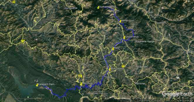
Ramganga (West) River originates from the western part of Dudhatoli reserve forest lying between Thailisain block in Pouri and Gairsain tehsil in Chamoli districts of Uttrakhand state. It is an important tributary of National River Gaga. The total length of the river is about 596 km. For first 200 km the river flows in Uttarakhand state and the remaining length falls in the state of Uttar Pradesh. Before it descends into plains, it is impounded by Kalagarh dam inside Jim Corbett National park.
Google Interactive map of Ramganga (West) River prepared by author.
The WRIS (Water Resources Information System) report of Ganga Basin says about the river:
The Ramganga river is the first major tributary to join the Ganga at its left bank. It rises in the lower Himalayas at an altitude of about 3110 m above the mean sea level near the village of Lohba in the Garhwal district of Uttarakhand. The total length of the river from the source to its outfall into the Ganga is 596 km and the entire length lies in the Uttarakhand and Uttar Pradesh. A number of tributaries join the river mostly from the left. The river enters the plains at Kalagarh near the border of the Garhwal district, where the famous Ramganga dam has been constructed. Beyond Kalagarh, the river flows in a southeasterly direction and finally joins the Ganga on its left bank near Kannauj in the Fategarh district. The most important tributaries are the Khoh, the Gangan, the Aril, the Kosi and the Deoha (Gorra) rivers.., the Gagas, the Haldgadi Rao.. The geographical extent of the Ramganga sub-basin lies between 78° 14′ to 80° 8′ east longitudes and 27° 7′ to 30° 6′ north latitudes.. The catchment area of the sub-basin is about 30,839 Sq.km.
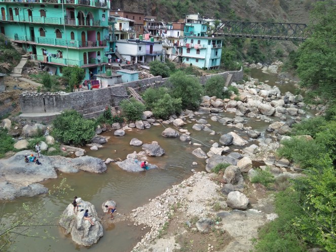
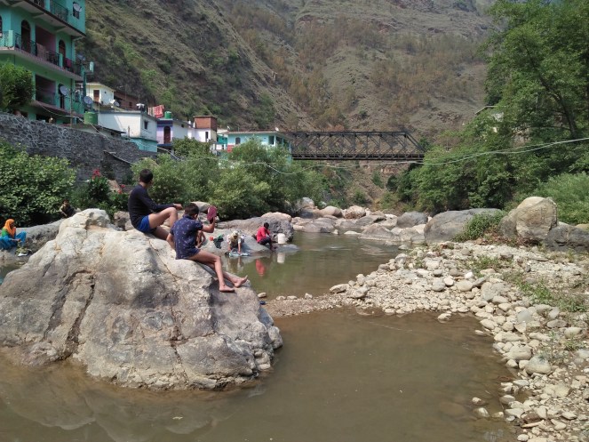
Gairsain, Mehalchouri, Choukhatiya, Bhikiyasain are growing towns on the banks of river in Uttrakhand state. Area around Gairsain is proposed for developing new capital of the hilly state. In Uttar Pradesh, the river flows through Bijnor, Moradabad, Bareilly, Badaun, Shahjahanpur and Hardoi cities before merging into Ganga.
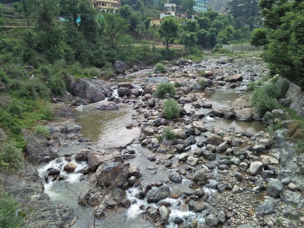
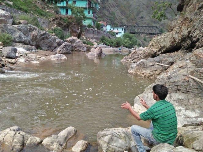
All along its length, the river meets drinking water supply of large number of human habitations and meets irrigational demands of vast farming areas. Being non-glacial river, it has rich aquatic diversity and known for providing habitats for Mahseer fish. But gradually, the emerging towns along the river are dumping huge amount of solids waste in the river particularly in hilly areas. This pictorials report based on brief visit to the river on May 21, 2019 at Mehalchouri and Choukhatiya towns presents a sad state of affairs. All the images in the report are take by author on May 21, 2019.

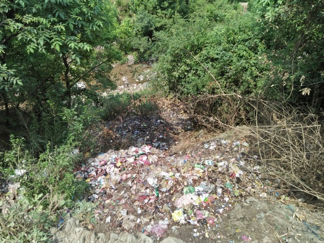


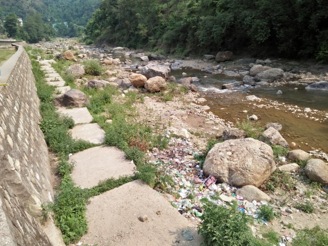


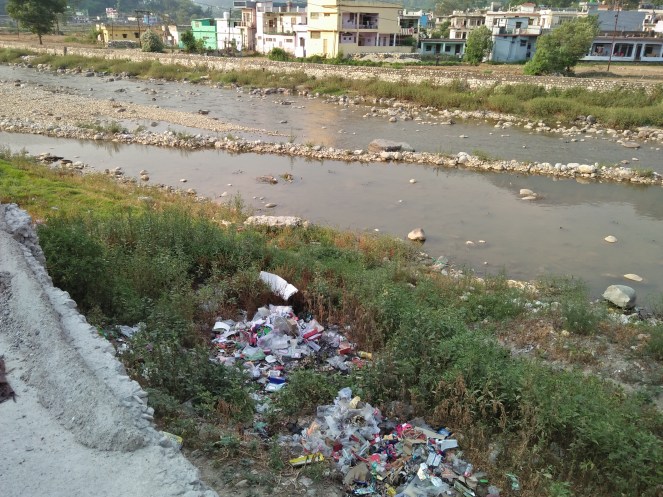


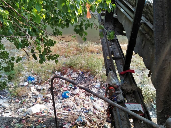
It is sad that dumping of solid waste by the rivers, that too of Ganga basin has become a norm in mountain areas. The respective Panchayats, Traders’ bodies, district administration, government bodies like Jal Nigam and Tourism are completely inactive and in slumber on such key issues.
Same situation prevails along East Nayaar river, in Pouri Garhwal of which SANDRP has written earlier. In addition to this solid waste the bio medical waste is dumped into rivers in similar manner at many locations. Similarly, increasing liquid waste particularly from market places also finding its way into the rivers. Steadily the use of chemicals in farming is also growing in adjoining areas leading to chemical pollution in the Ramganga West and Nayaar East rivers.
Ramganga and Nayaar are non-glacial river systems. They are rich in aquatic biodiversity and feeds the national river Ganga, also known to be spiritually, culturally important. The dumping of solid waste in these river ultimately reaches Ganga river. But we do not see action from any of the concerned, either from the governments or from media or from civil society or from judiciary or from the religious-cultural organisations. Needless to mention, if steps are not taken at the soonest to address these issues, there is little hope for the Ganga.
The newly appointed Union Water Resources or Jal Shakti minister Shri Gajendra Singh Shekhawat has said now the govt is focus on Ganga tributaries. Will the ministry look into the state of Ramganga west?
Composed by Bhim Singh Rawat (bhim.sandrp@gmail.com)
Also see, East Nayaar River: The Scenic Stream of Ganga in Trouble
