Dams · Sand Mining

Andhra Pradesh Riverbed Mining 2020: Quicksand of mismanagement

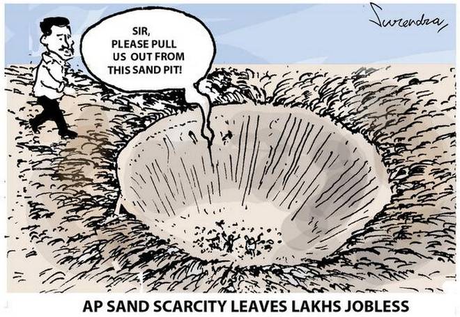
In 2019 overview, we saw the state of Andhra Pradesh experiencing all the key problems associated with sand mining; growing demand and prices, inadequate supply, illegal excavation affecting rivers and villagers and inactive govt bodies. Reports revealed Krishna and Vamasdhara rivers facing large scale mechanized mining while indiscriminate mining in Nagavali river affecting drinking water schemes in Regidi mandal. Srikakulam district and beaches particularly suffered.

There were reports showing political parties involved or facilitating illegal mining. Like other states, the Andhra govt was seen rallying on technological solutions to manage the mining. https://sandrp.in/2019/02/26/sand-mining-2018-telangana-and-andhra-pradesh/

The following overview since then show a whole range of developments. Unsustainable excavation of riverbed minerals & mismanagement show no end.

Continue reading “Andhra Pradesh Riverbed Mining 2020: Quicksand of mismanagement”

Sand Mining

Illegal Sand Mining Violence 2018: at least 28 People died across India

Across the country, many government officials were killed while taking action against illegal sand extraction in 2018. So were the lethal attacks on reporters and citizens for exposing illegalities and objecting to illegal mining activities. Many innocent people lost lives in accidents related to illegal sand mining related incidents which could have been avoided. This compilation of sand mining related incidents also highlights how illegal sand mining was damaging the infrastructure providing essential services.

NORTH INDIA

Uttrakhand A 115 years old British era bridge on Tons river in Birpur, Dehradun collapsed on Dec. 28 reportedly due to overloaded sand trucks. Two people were killed[1] in the accident. The single lane bridge was damaged during 2013 floods and opened for public after repair. 

Continue reading “Illegal Sand Mining Violence 2018: at least 28 People died across India”

Dams · Floods

Overview of CWC Flood Forecasting Sites 2018: SOUTH INDIA

Central Water Commission is the only agency doing flood forecasting in India. As per CWC’s Flood Forecasting website[i] the Data Flow Map has information about 226 Flood Forecast Sites in the country comprising of 166 Level Forecast Sites and 60 Inflow Forecast Sites. It also monitors 700 Flood sites, information made available through List Based Exploration and Hydrograph View, but no flood forecasting is done for these sites.

In order to better understand the CWC’s flood monitoring and forecasting work, in this article, we have given an overview of CWC’s flood forecasting and monitoring sites in South India. It includes state wise list of CWC’s Level Forecast, Inflow Forecast and level monitoring sites in South India. Similar report has been published for North India[ii] and North East India[iii] and East India[iv]. 

Tamil Nadu There are 3 Level Forecasting, 48 Level Monitoring and 14 Inflow Forecasting sites in Tamil Nadu State. Out of total 65 sites, 19 Level Monitoring and 2 Inflow Forecasting sites are inactive. MWL information is given only for 1 Inflow Forecasting site out of 14. IRRUKKANKUDI, Sathanur and Gomukhi sites are repeated with incomplete information. Out of 48, HFL figure and date is not provided for 25 Level Monitoring sites.

Continue reading “Overview of CWC Flood Forecasting Sites 2018: SOUTH INDIA”

Dams

Odisha Rivers Profile

About Odisha

Odisha is located on the eastern coast of India, between 17o31‟ and 22o 31‟ N latitude and 81o 31‟ and 87 o 31‟ E longitude. It covers 155,707 km2 , which represents about 4.74% of the area of India. The climate of state is tropical with 1450mm average rainfall.

The 2011 Census established the State‟s population at 41.9 million, 16% of which lived in urban centres. The average population density is 270 persons per km2, compared to 382 for India.  Odisha is a land of possibilities. The State is endowed with bountiful of resources, people, land, water, forest, minerals and other minor resources. The State is divided into 30 districts, of which Mayurbhanj is the largest (1042km2) and Jagatsinghpur the smallest (197km2). The districts are subdivided into 314 CD Blocks. There are 58 sub-divisions and 171 tahasils. According to 2001 census there are 51,349 villages and 6234 Gram Panchayats.(ORISSA STATE WATER PLAN, 2004). 

Continue reading “Odisha Rivers Profile”