Guest Blog by: Sumit Mahar (sumitmahar.12@gmail.com), Him Dhara Environment Research and Action Collective, Himachal Pradesh [1]
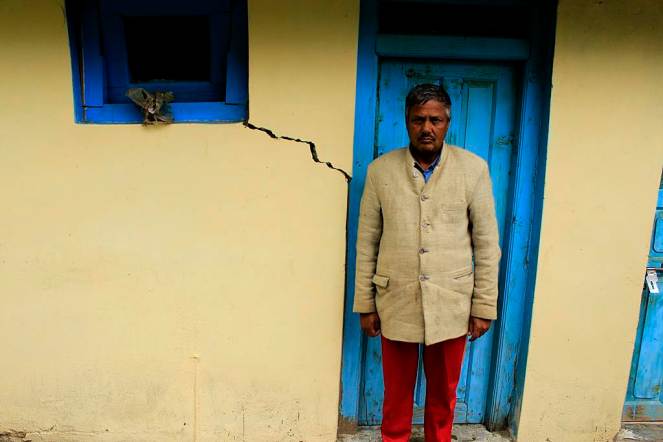
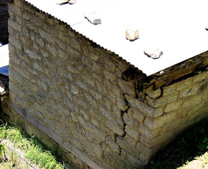
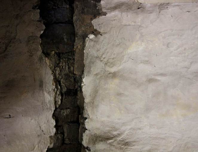
Tunneling for hydropower project using the blasting technique can have massive impacts. It has a series of direct and indirect impacts which have already been documented. Among the most serious impacts is drying up of the natural drinking water springs and the reduction in sub-soil moisture. This directly impacts the drinking water availability for the local villagers as well as agriculture and horticultural productivity, which is critically dependent upon the presence of sub-soil moisture. Blasting for tunnels and other underground components of hydroelectricity projects creates vibrations that have resulted in cracks in houses situated near these components.
Importance of impacts of tunneling and blasting becomes very important since all run of the river (ROR) projects involve tunneling and blasting. Proponents claim that ROR hydropower projects are environment friendly, but most people do not know that the tunneling and blasting adds an additional dimension to the impacts due to ROR hydropower projects and these can be very serious. Most environmental and social impact assessments or cumulative impact assessments do not even assess these impacts. Many times the proponent get away claiming that the impacts are not due to the projects, when in reality all evidence shows that these are very much caused by the tunneling and blasting being done as part of the construction of these projects.
This photo essay documents the impacts of tunneling and blasting for hydropower projects mainly in Kinnaur (part 1 of photo essay does the same for projects in Chamba district) of Himachal Pradesh. In Kinnaur the photo essay includes such impacts of 1000 MW Karcham Wangtoo and 1500 MW Nathpa Jakhri hydropower projects.[2] It is noteworthy that impacts are not only limited to large hydropower projects, but also to what is defined as small hydropower projects (projects below 25 MW installed capacity). This should also help puncture the misconceived notion that small hydropower projects are environmental benign and they do not need environmental and social impact assessment, public consultations, appraisal, monitoring or compliance.
These photo essays are indicative of the kind of impacts tunneling and blasting can have in the process of building hydropower projects in the Himalayas. What they indicate is relevant not only for Himachal Pradesh, but entire Himalayas and all projects that involve such tunneling and blasting. We hope these photo essays open the eyes of state governments, Union Ministry of Environment, Forests & Climate Change, Union Ministry of Power, Union Ministry of Water Resources, Central Electricity Authority, state environment departments, hydropower developers, EIA consultants, chairman and members of Expert Appraisal Committee on River Valley Projects, media, judiciary, civil society and all others concerned.
Karcham Wangtoo Hydro Power Project, Kinnaur
Project
Jaypee Karcham Wangtoo HEP
Capacity (MW)
1000
Basin
Satluj
District
Kinnaur
Villages
Choling, Yulla, Urni, Runnag, Meeru, Chugaun
Pictures taken on
25 May to 2 June 2014
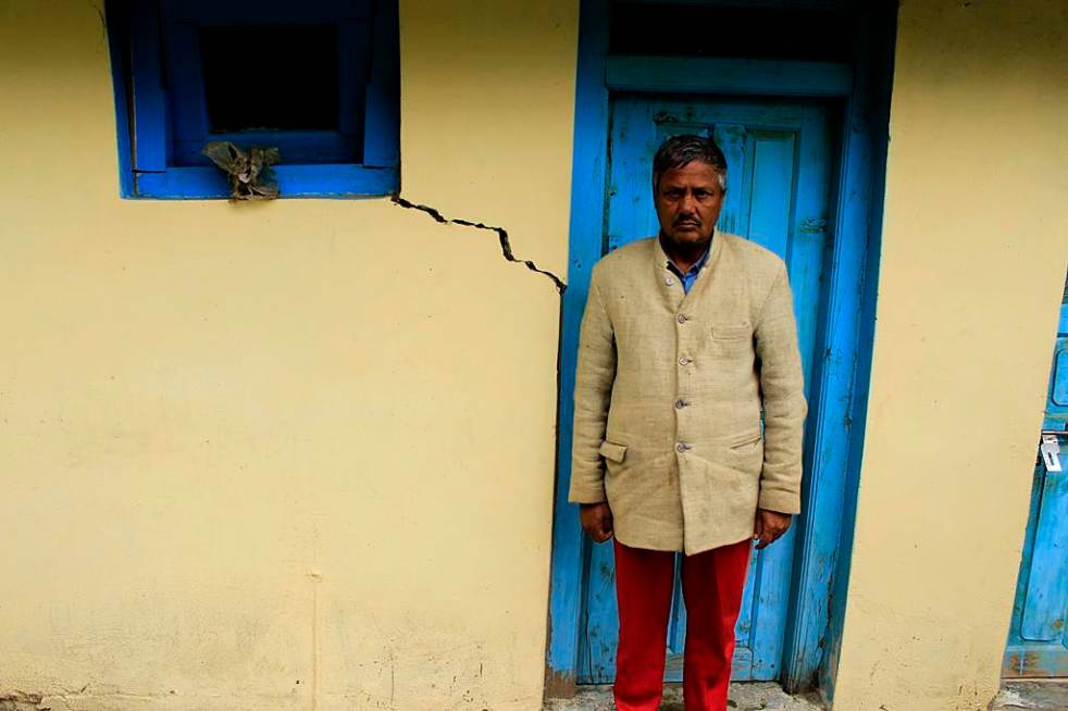
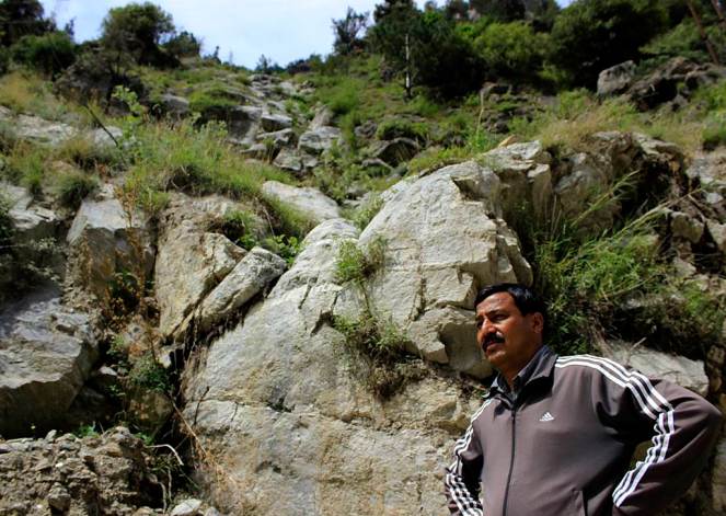
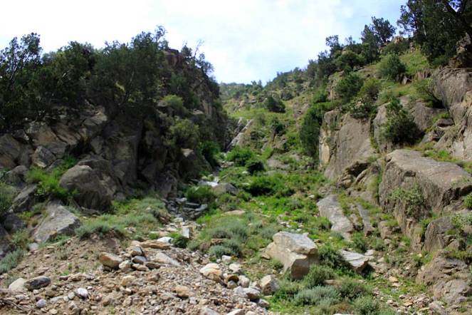
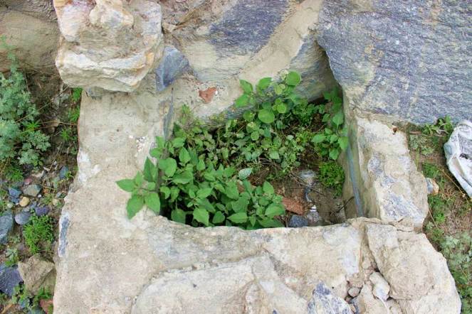
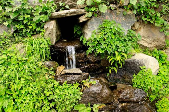
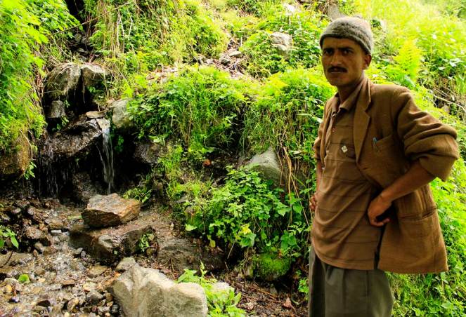
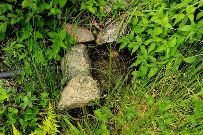
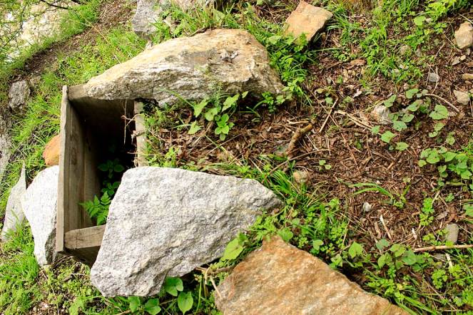
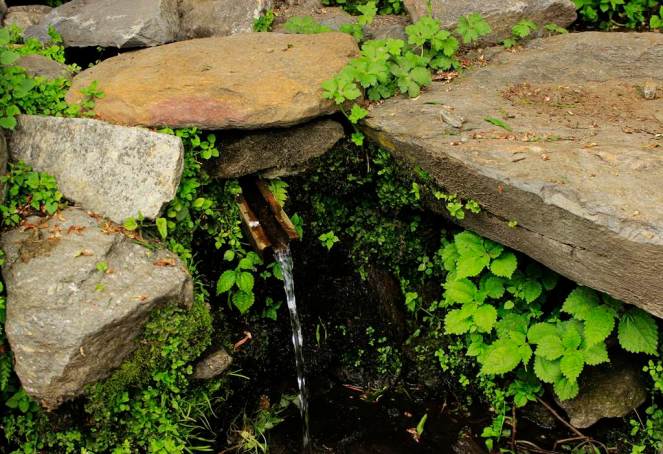
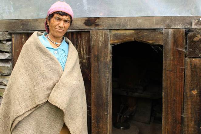
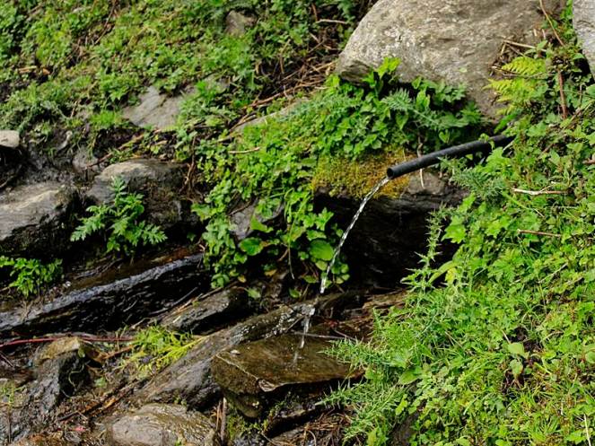
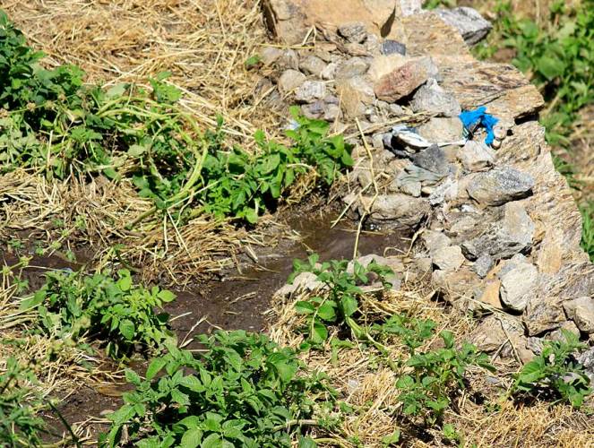
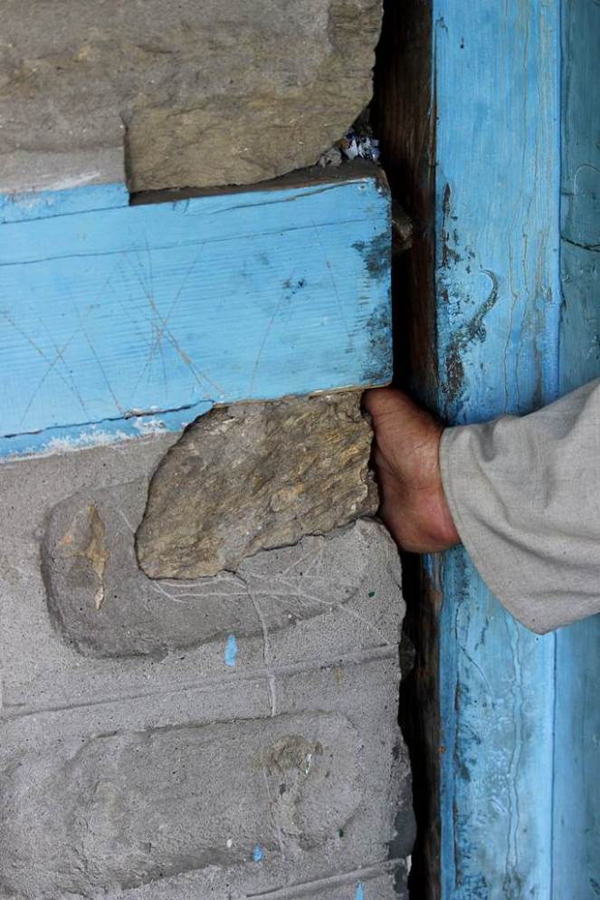
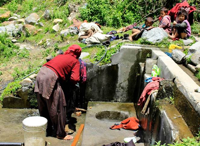
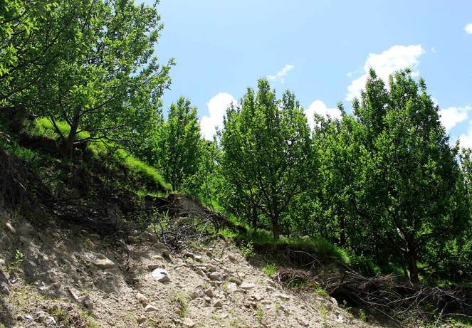
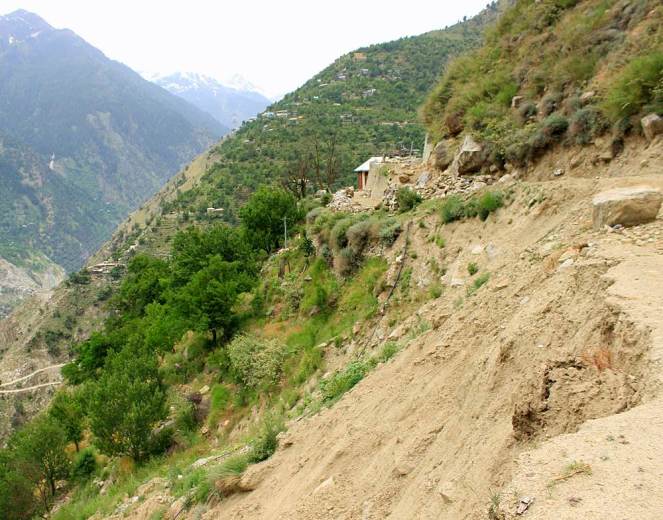
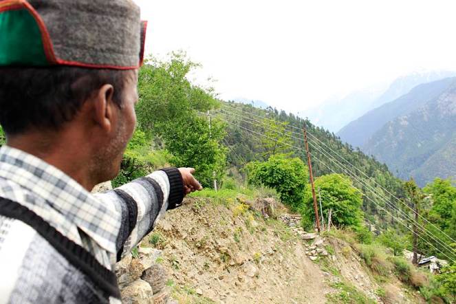
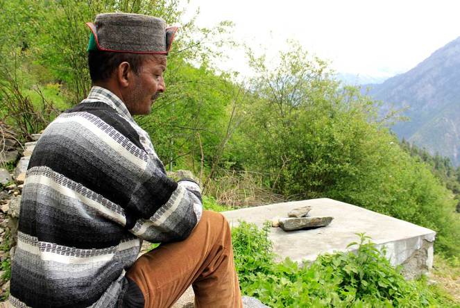
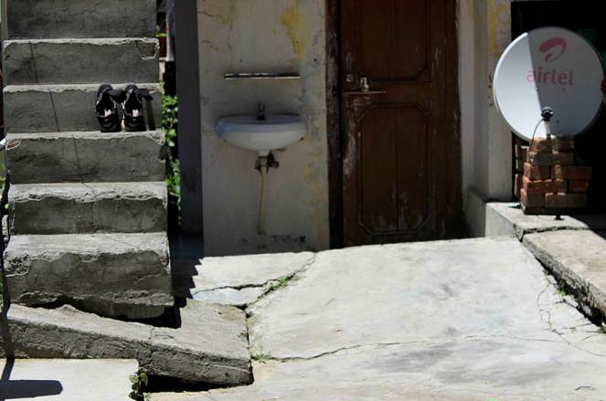
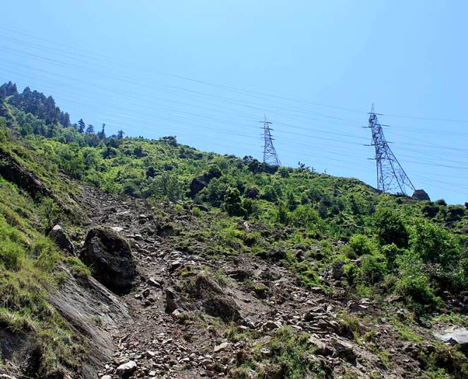
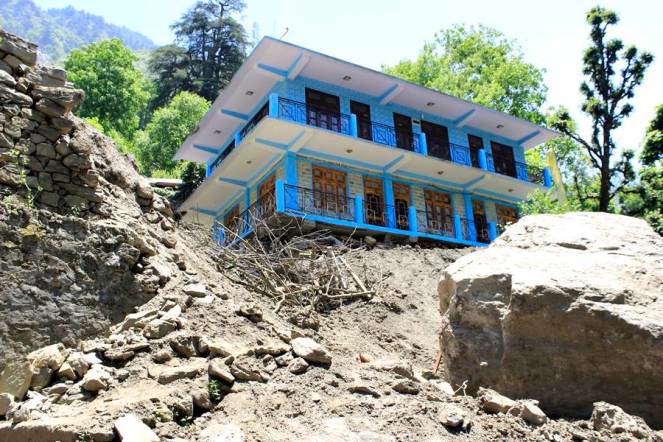
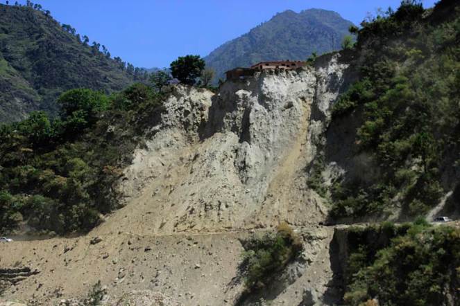
Murim-I, is a local stream that dried up due to the 17 km long 1000MW Karcham Wangtoo project’s tunnel in Kinnaur district. The stream is surrounded by grazing landsMurim-II next to Murim I shared a common source which led to drying up of both streamsNang Choling water source or chashma near the highway. The water was used for drinking not just by the people in Choling but also by passers by. This source has totally dried up now due to the Karcham Wangtoo tunnel constructionPeokeh-I is a water source in the Yulla village. The discharge of this source has reduced by 50% since the construction of the tunnel for Karcham Wangtoo HEPYet another source of water – Peokeh-II, Yulla village whose discharge has reduced by 30 to 40%Jyoti Prakash’s house in Yulla village suffered from cracks because of the tunnel construction of Karcham Wangtoo HEPJagat Singh’s fields had this water source and used this for drinking and irrigation. Due to the reduction in the discharge after tunnel construction there is just enough water to use for drinkingKakhiyo water source was used for drinking by 10 families in Yulla and the source is now totally dryLang Chuldhing water source in Yulla the discharge has reduced due to the tunnel. 4 -5 families in the vicitnity depend on this sourceRam Devi’s gharat in Yulla has been rendered useless along with another 4 above her’s. All due to the drying up of a water source – Yang baroYang Baro water source was feeding the watermills as well as irrigation channels. Now there is hardly any water for theseRamanand Negi showed this water source in Urni village which emerged suddenly in 2005. This has come out in a location where there is a landslide getting activeThis is the Urni steep slope where the landslide is activeRamanand’s House in Urni village which has developed cracks and crevices due to the blasting and construction of tunnel for Karcham Wangtoo ProjectRunnag Chashma is used by the Runnag village for washing and drinking. The water discharge has reduced substantiallyMunni Lal’s apple orchard which was impacted by a landslide last year when the June 2013 monsoon rains occurredLandslide just above the tunnel of Karcham Wangtoo project at Rangle. This was also activated lst year during the monsoonsRyabi Khaldam (Disturbed Source), the water source has relocated naturally after the construction of the tunnel beganLand slide at Meeru village activated last year and the main path of the village disturbedButhkas, IPH Source fully dried now as a result of tunnel. Almost the entire Meeru panchayat was dependent on this water for drinkingJagdish Chand Negi’s house in Chugaun was impacted because of the construction of Karcham Wangtoo TunnelCow shed developed cracks in Chugaun affected by Karcham Wangtoo Project’s tunnel construction
Nathpa Jhakari Hydro Power Project
Project
Nathpa Jhakari HEP
Capacity (MW)
1500
Basin
Satluj
District
Kinnaur
Villages
Nigulseri & Jhakari
Pictures taken on
29/05/2014 & 03/06/2014
On 25th May 2014 this landslide occurred in Nigulseri village. Locals claim that the tunnel of 1500 MW Nathpa Jhakri Project had already disturbed the area which was further disturbed because of the transmission tower construction for Baspa II and Karchham Wangtoo HEPsGeeta Ram’s house affected by the landslide at NigulseriShamsher Singh’s house cracks at Nigulseri in May 2014. A total of 13 houses have suffered such damagesThis landslide has occurred near powerhouse of the Nathpa Jhakri project in Jhakri
For Part 1 of the photo essay related to tunneling impacts of hydropower projects in Chamba district, see: https://sandrp.wordpress.com/2014/10/01/photo-essay-on-the-impacts-of-blasting-and-tunneling-for-hydropower-projects-in-chamba-district-in-himachal-pradesh-1/
Some highlights from SANDRP’s latest Publication on Riverine Fisheries of the Ganga
The government is discussing Ganga not only as ‘Ganga Mata’, but also as a ‘navigational corridor’ with plans to build barrages after every 100 kilometers with funding from World Bank. At her origin, hundreds of hydropower dams are changing the ecological character of the Ganga. However, as a rich ecosystem, the Ganga also supports about 10-13 million riverine fisherfolk and about 300 freshwater fish species! Riverine fisheries have been a blind spot in Independent India, despite the fact that they provide nutritional and livelihood security to millions of people.In the post independence water management discourse, river has been equated to water and water to irrigation, water supply, and hydro power. The profound impacts of irrigation, water supply and hydropower dams on sectors like riverine fisheries have been entirely ignored.
Nachiket Kelkar looks at the status of riverine fisheries and fisher communities in the Gangetic Basin of India and highlights the devastating impacts of dams, barrages and water abstractions on this. Nachiket’s study on Gangetic Fisheries is based on long term engagement with fisher communities in the basin as well as robust scientific studies.
SANDRP has published this work in the form of a Primer which will soon be available online. What follows are some glimpses from the Primer. Please write to us if you are interested in receiving a full soft copy of the Primer.
Riverine fisheries of the Gangetic basin support one of the largest fishing populations of the world. However, its fish resources are rapidly declining due to large dams, barrages and hydropower projects, severely altered river flows, fragmentation of hydrological connectivity between rivers and wetlands, alarming levels of pollution, riverfront encroachment, rampant sand mining and unregulated overexploitation of fish resources.
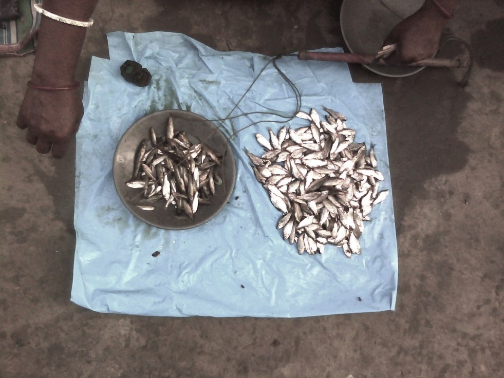
Across its range, the fisheries show indications of economic unviability and ecological collapse, with violent social conflicts as an outcome of the contest over scarce and declining resources as well as politics and access. A major factor behind the serious fisheries-related problems is severe alteration of river flow volume and seasonal dynamics by large dams, barrages and hydropower projects. The state of river fisheries directly indicates the declining biophysical, ecological and social integrity of the river basin. The existing in-river fisheries contribute merely about 10% of the overall inland fish production. Even this production is highly unsustainable today and has all the indicators of serious levels of overfishing. For instance, river fisheries in Bihar now even glean small-sized fish fry for markets in northern West Bengal (Siliguri) and Assam, where eating small fish is a delicacy (F.pers.comm).
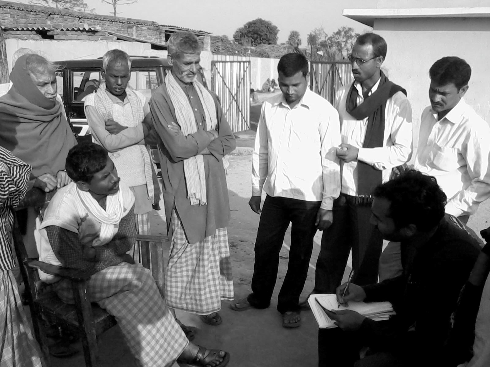
To understand the situation in Gangetic Basin clearly, a detailed, large-scale interview survey was conducted by the author in 2012 across 372 fishers in 59 fisher groups spread over 17 rivers in 5 north Indian states. The survey objective was to document perceptions of traditional fishing communities about issues and problems in fishing in the Gangetic basin. Of the respondents, c. 90% singled out “large dams and poor river flows” as the main causes for a near-total decline in fisheries and fish resources over the past 4 decades. About 90% people mentioned low water availability and stoppage of fish migratory routes by large dams as the main cause for fish declines. Almost 45% (from eastern and northern UP, and Bihar) singled out the Farakka barrage as the main problem.
The Canvas of Gangetic River Fisheries
The Ganga River, from her headwaters to the delta, along with hundreds of her tributaries drains an area of approx. 0.9_1 million km2 across northern and eastern India, flowing through 10 states in India and also in Nepal and Bangladesh. These rivers form one of the largest alluvial mega-fan regions of the world, and deliver huge quantities of sediment from the Himalayas to the northern Indian plains and to the Bay of Bengal in the Indian Ocean. The Gangetic floodplains shape not only landforms but also complex human cultures that attempt to stabilize themselves and adapt to the constantly changing riverine forces. Biodiversity, hydrology, geomorphology and social dynamics influence each other through constant interaction and multiple feedback mechanisms.
The major rivers of the Gangetic Basin (Based on ‘hydro1k-rivers-Asia.dbf’).
The dynamic balance of these factors triggers opportunities for spawning, reproduction, population dynamics and viability, migration and movement of freshwater species, including fishes, river dolphins, otters, crocodilians, turtles, invertebrates as well as terrestrial biodiversity.
In floodplain rivers, as floodwaters recede post-monsoon, fishers record the highest catches in October and November, as large post-breeding and migrating adult fishes (e.g. major carps, clupeids, mullet) become catchable. Winters, from December to early February, generally record low catches because many fish show slowed behavior and limited movement. But in spring fisheries of minor carps and catfishes record high production. With water levels reducing, fishes become more concentrated in specific river habitats like deep pools, where they are easy to fish. Summer fish catch biomass is also reasonably good due to the overall low water availability.
In the Gangetic basin, fisheries are practiced in a range of diverse freshwater habitats including natural and man-made, lentic (stagnant water) and lotic (flowing water) ecosystems. Natural freshwater areas include large floodplain rivers, non-perennial rivers, perennial and seasonal streams, cold-water rivers and streams, glacial lakes, estuaries, tidal rivers, floodplain wetlands, oxbow lakes, grassland swamps and marshes. Manmade habitats include dug or built-up wetlands, ponds, man-made reservoirs, dam reservoirs and canals. To the fisher, flow velocity, depth profile, substrate type, vegetation structure, current patterns and habitat stability are key indicators for fishing effort allocation and logistical decisions.
Fish Diversity in the Gangetic Basin
The overall species pool of the Gangetic fish assemblage is estimated at around 300 species (53+ families, 150+ genera; 250 species). The floodplain fisheries are dominated by major and minor carps (Cyprinidae), catfishes (Siluriformes: 6-7 families), Clupeidae, Notopteridae and a mix of many other families. Major carps and the Clupeid fish, Hilsa (Tenualosa ilisha) and some large catfishes form the most valued catches across most parts of the Gangetic floodplains.
Major carps, the most preferred freshwater food fishes, include species like Catla, Rohu, Mrigal, Mahseer etc. exhibit potamodromous (along freshwater upstream-downstream gradients) migration. Though these fishes have suffered serious declines due to overfishing, pollution and dams, they have been mass-produced through artificial rearing in pond aquaculture. Farmed large carps form the major proportion of fish eaten anywhere in India today. In wild fisheries, catfishes come lower in the preference order, but with the decline of carps, medium and small catfishes have become the main fishing targets. Further, as most catfishes are sedentary and do not show long-distance movements, the fisheries have completely switched from carp- to catfish-targeting fisheries. Other deep-bodied, highly sought after fishes include the Chitala and Notopterus, or the featherfishes, and mullet.
Various fish species in Ganga Basin. Refer to the Primer for more information.
The estuarine fishery in the Hooghly and Sunderbans tidal rivers in West Bengal is dominated by shellfish (prawns, mud crabs and shrimp), Clupeidae and Engraulidae, Sciaenidae, catfishes of the Ariidae and a far more diverse set of families compared to truly inland fisheries. Other important components of the commercial fisheries include 5-6 species of shellfishes (mainly prawn and shrimp).
Coldwater fisheries specialize on large-bodied, rapids-loving potamodromous migrant fishes such as Mahseer and Snow Trout. These fishes are of high commercial importance and are in high demand by professional sport fishers and anglers, apart from being highly prized as food locally. Mahseer in particular, have recently led to the opening of new markets of luxury wildlife tourism that is based on angling and recreation in the Western Himalaya.
Dam reservoir fisheries are almost entirely based on managed stocking and breeding of commercial fishes in hatcheries, of major carps Catla, Rohu and Mrigal, catfishes like Pangasiodon, and minor catfishes. The state of river fisheries in the Gangetic basin has been affected over the last few decades by several threats described in the next section.
Dams and Riverine Fisheries in India Fisheries across India have been severely affected by dams, flow regulation and associated human impacts, which have substantially altered ecological requirements of fisheries and biodiversity together. If one clinically investigated the fisheries’ decline, they would find it to coincide with the period of maximum dam building (1970s-80s) in India. Most commercially valuable fish species, especially major carps and Hilsa, have shown population-level collapse and even commercial extinction over large inland waters. Reduction in harvested fish size-class distributions, a classical indicator of overexploitation by fisheries, points to poor fish recruitment and adult survival, which may be further brought down by flow regulation by dams. Dams have acted as the major factor of disruption by blocking migratory routes of upriver or estuarine spawning fishes such as Hilsa and Anguilla eels. Dams have also caused loss of genetic connectivity between fish populations, most notably seen in major carp stocks. Erratic water releases, nutrient and sediment trapping behind dams and barrages, failure of breeding in carp and catfish species due to siltation, erosion, poor water availability, modified thermal regimes required for breeding (increase in temperatures due to low river depth/flow), and exceptional levels of hazardous pollution (again, magnified due to the poor flows reducing dilution capacity of river water), are other fallouts that adversely affect fisheries. The fact that there is just not enough water in the river must form the bottom line of any causal investigation of riverine fisheries. Lack of appropriate policy measures and pollution receive dominant mention as threats to fisheries by government research agencies, but they are mere outcomes of much larger shifted baselines because of dams. Dams, barrages and hydropower projects through flow regulation have increased uncertainty about fishing and driven fishing to desperate levels: fishers often resort to destructive practices, or even worse, exit the fishery altogether. Such exit does not solve the problem of existing fisher folk: water is critical to sustaining not just fisheries but the river and the people dependent on it. Detailed understanding of the lives of fishing communities of the Ganges is therefore critical.
Ganga made completely dry at Haridwar by the Bhimgouda barrage Photo: SANDRP.
Fisher communities in Ganga: Around 10-13 million people in the Gangetic floodplains are estimated to be dependent on fish resources for their livelihoods, directly or indirectly. However, accurate estimates of active traditional and non-traditional fisher populations are still wanting. It is important for any discussion on fishing communities to clearly separate traditional fishing communities from ‘non-traditional fishers’, who may be practically from any other local community and with the possession of other livelihood options, but also opportunistic fishing, due to unrestricted access to imported nets and gear available in markets to anyone. Traditional fishing communities were always the craftsmen of their own nets and gear, and also possess remarkable ecological knowledge about rivers, fish and biodiversity, their breeding biology, ecology, seasonality, and distribution. Of course, with the degradation of fisheries throughout the Gangetic plains, the traditional knowledge and practices of fishing are eroding fast. Hence such knowledge needs to be documented well, especially from old fishers with whom it still persists, to identify historical baselines of river fisheries with a different, past ecological reference (pers.obs.; F.pers.comm).
Traditional fishing communities today form a highly marginalized, politically unorganized and socio-economically impoverished people. Caste discriminations and political history form the chief reasons for their poverty and subjugation over centuries of fishworking. But the present condition of rivers does not seem to offer hope to any improvement in their economic position unless and until there is collective voicing of their concerns, especially against large-scale water engineering projects that threaten their livelihoods.
Author in discussions with fishers
Their livelihoods, one may argue, confined them to the river’s water,albeit the fact that they never owned the waters legally. However, they always have stated cultural claims of temporally confined territory, following their foraging preferences and site usage. But depending on the nature of the river’s hydrological dynamics, there may be variable maintenance of fixed ‘territories’ by fishers adopting a roving mode of fishing, and neither legal nor cultural claims can be reconciled to a level that the conflicting parties can reach mutually. With regards to their economic viability and status, a large proportion of the traditional fishworkers fall Below the Poverty Line (BPL), and are recorded as Economically Backward Castes, and also have been assigned the status of Scheduled Castes. Annual incomes from fishing alone, according to the few estimates available, range from INR 25,000/- to INR 50,000/- (pers.obs., F.pers.comm.).
Large dams, flow regulation and Gangetic basin fisheries : The singular key problem of fisheries today is that it lacks water in the dry-season, because of flow regulation by dams, barrages and hydropower projects. More water flow releases are needed for the protection of riverine fisheries in the Gangetic basin. Widespread river habitat degradation, industrial, agricultural and domestic pollution, altered flows and modification of sediment and nutrient fluxes by dam projects, and resource overexploitation (by fisheries, agriculture or industry) have had major consequences for the unique biodiversity and fisheries of floodplain rivers across Asia. Obstruction and fragmentation of river flow, habitat destruction, accelerated erosion and siltation, long-distance water diversions (involving huge amount of transmission losses and waste) and poor flow releases are the major direct threats of dam-canal systems in the Gangetic plains.
Flow volume problems: Lower-than-minimum flows have been consistently recorded across the Ganga, Yamuna, Chambal, Kosi, Sone, Ken, Betwa, Ghaghra and Gandak rivers. Along with these large rivers, almost all others (Rapti, Baghmati, Mahananda, Teesta, Kamla, Burhi Gandak, Punpun, Gomti and others) have been highly regulated64,69. The reduction of freshwater discharge reaching the Sunderbans because of the Farakka barrage has led to high degree saline ingress throughout the estuary, causing die-offs of considerably large tracts of mangroves and aquatic vegetation, as well as severe losses to the upstream fishery. Downstream, fishing practices suited to brackish and fresh waters now have to adapt to saline intrusion into the estuary’s waters. Globally, fragmentation and flow regulation have caused the most severe impacts through drastic alterations to riverine biota and ecology. Low flows and fragmented connectivity of river channels lead inevitably to fish population declines and breeding failure. Over time, dams have probably led to genetic isolation of fish populations as well as river dolphin / crocodile populations, destruction of fish breeding habitats and spawning triggers and loss of valuable wild fish germplasm. These losses are so large in their ecological value and opportunity costs that they cannot be recovered with artificial fish culture techniques or hatcheries.
Aggravation of pollution effects: The Ganges basin is one of the most polluted large river basins in Asia, especially with regards to domestic sewage and agricultural runoff. Poor flows reduce the dilution and self-purification capacity of river water to reduce concentration of pollutants and local impacts on fishes. . Agricultural fertilizers (organophosphates, organochlorines, nitrates etc.), heavy metal pollution from industrial effluents, thermal power plants, oil refineries, distilleries and tanneries, and nitrogen-rich sewage, waste-water and non-biodegradable substances such as plastics, mercury, radioactive compounds and hospital wastes can cause fish kills or even worse, lead to high levels of toxicity in tissues. Pollution problems are especially acute in highly regulated river reaches, especially around Delhi (Yamuna River), and the Gomti at Lucknow, Yamuna until Panchnada in UP and Ganga River at Kanpur, Allahabad, Varanasi, Patna, Barauni, Bhagalpur and Farakka.
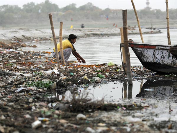
Polluted Ganga at Allahabad Photo: National Geographic
Siltation in dam reservoirs and barrage gates: Excessive siltation in the Ghaghra barrage has led to, as per local fishers, breeding failure in Labeo angra (Ghewri), a preferred spring-fisheries target in the region. The fishers claimed that over the past 5 years they have not captured a single fish with eggs inside it, and also added that catches have plummeted heavily (F.pers.comm). Siltation of gravel/sediment in reservoir or storage zones is a problem of huge magnitude for fisheries, especially through breeding failure. Accumulated silt in reservoirs is estimated to be so high (in tens of meters height) that it cannot even be easily flushed out, and leads to nearly 60-90% reductions in sediment fluxes of rivers in monsoon and non-monsooon seasons. Siltation adds to obstruction of flow release through barrage gates. In the Farakka barrage, sediment load accumulation is leading to breakage of gates every year, adding to maintenance costs.
Habitat destruction and alteration of erosion-deposition dynamics: Soil erosion by erratic and sudden releases before floods can potentially lead to alteration and destruction of fish breeding habitats and stock depression. Changes in depth and flow velocity lead to fish not being able to receive natural physiological cues for movement and spawning that are otherwise provided by variability in discharge. Flow alteration also alters hydrological connectivity and sediment transport with wetlands and confluence channels during flooding. As a result these productive breeding habitats often become unavailable for catfishes and carps. These factors together become a problem for pre-settlement fish juveniles and recruits, which move into the main channels.
Threats to cold-water and foothills fisheries from Hydropower Dams: Overall, despite their projected low impact situation, hydropower projects can have serious large-scale effects on mountain streams as well as rivers downstream. Globally, despite mitigation measures in hydropower constructions, fish migration and development have largely been deemed as failures. In India, hydropower projects, especially run-of-river projects in higher altitudes, often have disastrous effects on natural thermal regimes, cause sediment blockages and perturb natural flow variability at diurnal timescales through releases varying across several orders of magnitude. These changes severely affect not just breeding and migration in higher-altitude cold-water fisheries of snow trout and Mahseer in Himachal, Sikkim and Uttarakhand, but also downstream fisheries of catfish and carps in the foothills and plains due to altered flows. Their cumulative downstream impact can also potentially risk fisheries-based uses of river water without being exposed to the risk of sudden flow releases every day.
Globally, through extreme perturbation of natural flow dynamics, dams have homogenized and altered many crucial river-floodplain processes, and have had disastrous impacts on biodiversity and fisheries. There is an urgent need to ensure ecologically necessary, adequate and natural flow regimes in all rivers of the Gangetic basin. The current water scarcity is so severe that projects such as river interlinking, apart from their ridiculous proposed costs, are simply impossible to conceive of, water itself being the limitation. There is no doubt that further water developments will prove disastrous for a whole section of people and their livelihoods, and must be scrapped. Rivers that need urgent attention in this respect are the Chambal, Yamuna, Ken, Betwa, Alaknanda, Bhagirathi, Mandakini, Sone, Damodar, the Ganges at Farakka and Allahabad, Sharada, Ghaghra and all other rivers especially in Uttar Pradesh, Uttarakhand, Madhya Pradesh and Bihar0. Run-of-river hydropower projects, flow diversions and links, pumped irrigation, embankments, agricultural intensification, groundwater depletion and sand mining are highly destructive threats that will affect not just fisheries but the whole social fabric of river users in the near future.
Despite the demonstrated folly of not allowing rivers to flow from headwaters to estuaries and deltas, engineers, technocrats and politicians talk of “rivers flowing wastefully into the sea”. This statement would imply that the thousands of species and millions of fisher livelihoods that need flowing water in rivers are of no value to the state policy on water resource development. Such statements are ignoring important societal needs and hence are evidently irresponsible.
No post dam-construction compensation schemes exist for fishers, who may lose their entire livelihood because of flow-regulation and loss of hydrological connectivity due to dams. Downstream fisher populations must be ideally compensated for the lost fishing catch and livelihood opportunity, but in general there has been scant attention towards the communities’ livelihoods (F.pers.comm). Downstream water allocations through on-ground consultations with fisher communities are urgently needed (F.pers.comm). In India, water resources development is so strongly irrigation-focused (and now strongly focused on industry and hydropower), that, in comparison, riverine fisheries are not even acknowledged as legitimate and in need of conservation and livelihood protection. These biases mean that only pond aquaculture receives any attention. If river conservation and development groups can actively work with fishing communities in order to develop an informed and aware constituency or interest group, fishers will gain political voice in making negotiations about water availability in river basins.
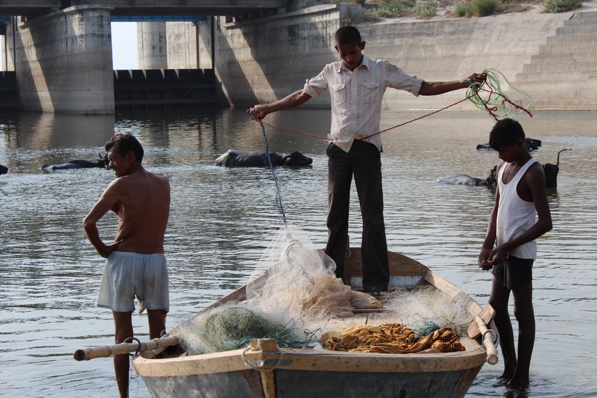
Fisherfolk of Ganga Photo: Gangapedia
Fisheries incur ‘colossal losses’ every season due to irregularities in dam operations, and always fall severely short of demand. But now, through the boom of artificially managed pond aquaculture and wetland fishing especially in Andhra Pradesh and West Bengal, the nature of supply itself has radically changedThis boom has contributed to India becoming one of the largest producers of inland freshwater fish in the world. But such ranking hides a lot of miserable facts about river degradation. Although net production shows increases, the collapse of river fisheries that still support millions of poor people who don’t get access to aquaculture, get totally ignored under such swamping. This is why farmed fish in fish hatcheries can barely replace riverine fisheries despite the fact that they have cornered the attention of fisheries development.
The failure of river fisheries has led to large-scale outmigration for labour from the Indo-Gangetic plains (F.pers.comm.). This might be a significant contributor to the magnitude of labour-related migrations from the Gangetic plains, which has been a rising exodus. Today, fisher folk from Uttar Pradesh, Bihar and Bengal provide a large proportion (20-40%) of construction and manual labor force across India (F.pers.comm). Others who stay behind have to take to menial jobs such as rickshaw-pullers or servants (F.pers.comm; pers.obs). Some are forced to take to crime to be able to feed themselves and their families. These factors can weaken the social resilience of production systems and create poverty, disparity and community breakdown. It has been argued that ethnic conflicts between local Indian populations and illegally immigrated Bangladeshi refugees are linked to poor water releases from the Farakka barrage in West Bengal, to downstream floodplain reaches in Bangladesh.
Mitigation measures like Fish ladders and hatcheries
There is little existing research on the construction design, functioning and efficiency of fish ladders in tropical and subtropical large floodplain rivers. Across the tropics, monitoring studies on fish ladders do not show positive results. A handful of barrages in India have constructed fish ladders, but owing to numerous problems they have been largely a failure. These problems are all related to the extremely low discharge rates from the dams – as there is simply not enough water volume allocated for migrating fishes, which therefore cannot access the ladders and fish lifts. Other problems are linked to siltation in reservoirs and turbulence of flows near the fish passages. For instance, the Farakka fish lifts do not seem to have been of any help due to the extremely low outflow of the Ganga River from it, and the commercial extinction of the Hilsa fisheries both upstream and downstream is clear with an estimated 99.9% decline. Fish passes constructed at barrages on the Yamuna River (Hathnikund barrage) and the Ganga barrage at Haridwar have been monitored by CIFRI and the results suggest that they have had very low success for migration of cold-water species like the Golden Mahseer Tor putitora. Similar structures on the Beas River and Mahanadi River (Salandi dam, Orissa) have found to be ineffective in buffering the adverse impacts on fisheries production in these rivers. India has dominantly followed reservoir hatcheries development, and therefore consideration for effective fish ladders has always been low priority. However, as we have seen, hatcheries themselves bring about several problems for native fish populations – and are not an ecologically viable solution, despite being economically profitable to certain interests. Given the poor success of existing fish passages, it is important to consider modern designs in existing and proposed dams that are suited to the ecology of our own fishes. A whole body of interdisciplinary research – spanning engineering and ecology, is needed to address the significant gaps in our understanding of making fish passages work. We need to monitor existing examples well to assess reasons for their failure. Again, just the act of allowing higher dry-season flows and timely adequate releases in the river could be a far more effective strategy for fisheries improvement than other intensive technology-driven practices to enhance fisheries production (F.pers.comm)
River restoration and alternative livelihoods: Given the current state of riverine fisheries, there is an urgent need to consider possibilities for large-scale ecological restoration of rivers by modifying dam operations and improving ecological flows. Alongside restoration, it is crucial to consider alternative livelihoods to fishers, which regard their traditional knowledge and provide them with clearly defined user rights and responsibilities over management of wild-caught or cultured fish resources. Ecological restoration of all major and minor rivers in India needs to be undertaken urgently, to ensure ecologically adequate, naturally timed flow releases, consistent dry-season flow regimes, hydro-geomorphological habitat maintenance, flood maintenance and reduction in pollution. Dam re-operations to ensure adequate flows and variability in river discharge remain a neglected aspect of river management in most regions today. Flow restoration can lead to improved health, numbers and availability of native commercial carps and preponderance of larger fish sizes through improved juvenile recruitment, along with other advantages to surface hydrology and local groundwater availability. Large-scale scientific research and monitoring programs must be instituted to study the response of inland wild-capture fisheries and take further steps to mitigate local threats. Restoration also needs to involve stringent restrictions on release of untreated domestic and industrial effluent, especially in urban belts such as Kanpur, the National Capital Region of Delhi, Allahabad-Varanasi, Mathura-Agra, Lucknow in Uttar Pradesh; Patna, Barauni in Bihar and the Durgapur and Kolkata regions in West Bengal. Strict restrictions are needed on sand-mining, riverfront encroachment and embankment construction, especially in the Chambal, Ghaghra, Gandak, Baghmati, Rapti and Kosi Rivers. In this regard, more judicial interventions, such as seen recently in the case of sand-mining closures from river beds based on a review by the National Green Tribunal, are critical in reducing wanton and unregulated destruction of riverfronts, when implemented effectively. In terms of reducing the most direct impacts, there is a need to regulate fishing pressure and completely curb destructive fishing practices like dynamiting, use of mosquito-nets, beach seines, and gillnets below allowable mesh-sizes, poisoning, use of long-lines etc. Traditional fishers must be involved directly in monitoring and banning the use of destructive practices by the government monitoring agencies.
Finally, the quest for sustaining fisheries in the Ganga River basin in the long-term will require rethinking of current dominant paradigms to move towards ecological restoration of rivers, their biodiversity, as well as socially just, rights-based and equitable socio-political restoration of traditional fisher communities and fisheries management systems.
-Nachiket Kelkar
Ashoka Trust for Research in Ecology and the Environment, Srirampura Royal Enclave, Jakkur, Bangalore 560064, India. (The views expressed are of the author and do not belong to the institution where the author currently works)
Twelve-point recommendation from traditional fisher communities for sustaining riverine fisheries and livelihoods in the Gangetic basin.
Rank
Need
Recommendations
1
Water
Provide enough water, adequate natural flows in all rivers. Allow fish movements upriver, currently blocked by large dams and barrages. STOP new dams and mindless, high-cost, destructive and unsustainable engineering projects such as river interlinking.
2
Ban on destructive fishing practices
Curb destructive practices of fishing, especially mosquito-netting, poisoning, dynamite-fishing, trawling and beach-seine netting everywhere.
3
Poverty alleviation and social security
Fishers are in need of government dole or loans, technical know-how, permits and I-cards, housing, education and displacement packages. It is alleged that these benefits are hardly reaching them, although the allocations of funds reach farmers easily. Fishers need government security from criminals / mafia / anti-social elements / pirates that harass them and grab fish catch.
5
Define fisher rights and responsibilities
Clearly define fishing use and access rights across all riverscapes, provide clear guidelines on multi-objective management of fisheries amidst other economic activities
6
Reduce pollution and mass fish-kills
Urgent need to reduce the presently excessive river pollution, especially industrial but also domestic wastes.
7
Alternative livelihoods
River fisheries are currently in a state of ecosystem-level decline or collapse. Trash fishes have become the most common catch, replacing many commercially viable carps and catfishes. People require alternative livelihoods in situ, to check problems related to migration and exodus to work as construction laborers or rickshaw-pullers. Community-based, cooperative pond carp-culture fisheries seem highly promising. Other alternative livelihoods include working with river management authorities, conservation agencies, ecotourism, agriculture etc.
8
Fishery co-operatives
Focus on community-based management of river fisheries and help it develop in an ecologically friendly and sustainable manner. Replace the systems of private contracts and free-for-all fishing by power-equitable, social dignified resource-sharing arrangements
9
Ensure compliance of fishers towards biodiversity conservation and monitoring
Needs to be ensured through continued monitoring of fishing activity and behavior, including by-catch or hunting of species. This will help safeguard endangered wild species such as gharial, turtles, river dolphins, birds etc. This can also help the spread of exotic food fishes that are rapidly invading our rivers (the worst examples are Tilapia species, Chinese and Common Carps, and more recently, Red-bellied Piranha.
10
Use of Food Security Act, Rural Labor Programs
Can facilitate daily incomes by which fisheries losses could be offset; while also providing a solid community-level incentive to regulate and monitor fishing.
11
Restoration of native riverine fish communities
Very important given the huge decline in native carp species of high commercial value. Fisheries need to protected not only by revival of stocks, facilitating better fish recruitment, but also by protecting fish breeding habitats from
12
Adaptive management of water tenure in fishing areas
Owing to natural uncertainty linked to flow regimes and channel course changes, new flexible systems of tenure in fisheries are required. Such systems would fit in well with providing a clear definition to fishing rights in any riverine stretch.
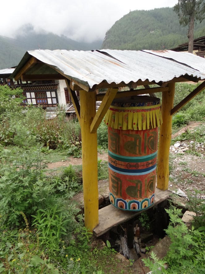
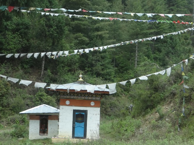
Countries like Bhutan, Nepal, parts of Tibet and parts of India like Sikkim have some lovely Buddhist traditions linked to the nature. On the edges of forests, overlooking valleys and atop majestic mountains flutter tiny colorful prayer flags.Inside Dzongs, fixed prayer wheels spin by the tug of a pious hand. While spinning and fluttering, the prayers are supposed to be disseminated in the universe, reaching every sentinel being.
But there is a third kind of fascinating prayer wheel. It worships not only the creator, but also flowing water. Today, as naturally flowing waters become rarer, it is strangely reassuring to see these wheels spinning away, as the stream pushes the small wooden turbines round and round. These wheels are more fascinating for their symbolic significance: In these regions where water wheels worship the flow, the same flow is being harnessed for generating money and power: Hydropower. In Bhutan, the 10,000 MW + hydropower initiative supported by India and financial institutions like ADB & other foreign players will dam almost all of the big river systems in the country.
In fact, institutions like ADB are so over-enthusiastic in pushing hydropower in Bhutan ( ADB is ‘administering‘ Hydropower grants to Bhutan from countries like Norway and Japan) that they see Bhutan’s strong environmental conservation practices as ‘hurdles’ in this development. ADB says: “Bhutan’s strong environmental conservation policies have affected the pace of implementing power projects because of the time required to complete procedures such as environmental impact assessments, public consultations, forestry clearances, and road planning.”
What follows is a short photo feature on Water Wheels in Bhutan as well as the hydropower development in the Punatsangchu Basin, through the 1200 MW Punatsangchu I HEP. Just a few kilometers downstream is the proposed intake and dam of Punatsangchu II which is also underway.
Bhutan is the only country in the world which measures its development not only in terms of GDP, but through Gross National Happiness (GNH), which is an aggregate of a number of things, including environmental conservation and preservation of culture.
Let us hope that this dense hydropower development does not affect the Bhutanese tenets of happiness…
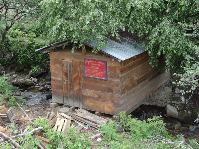
Majestic three- tiered prayer wheels in Paro, on way to Tiger’s Nest Monastery Photo: SANDRPA tiny water wheel in agricultural fields of Paro Photo: SANDRPOne more water wheel on way to Taktsang Monastery Photo: SANDRPA water prayer wheel in a village near Paro Photo: SANDRPA water wheel on a flowing stream in a dense forest, on way to Phobjikha Valley Photo: SANDRPThe wooden wheel blades Photo: SANDRPA roadside Prayer wheel with steel blades Photo: SANDRPA roadside water wheel on way to Thimpu Photo: SANDRPOn way to Thimpu Photo: SANDRPOn way to Taktsang Monastery Photo: SANDRPCascade of three water wheels in Phobjikha Valley Photo: SANDRPDifferent ways of using the flow: A storehouse for Apples and other seasonal fruits, built on the top of a stream, which acts like a natural AC Photo: SANDRPFresh fruits, preserved in a storehouse on the stream! Photo: SANDRP
HYDROPOWER IN BHUTAN
At the same time, huge, unprecedented hydropower developing is also challenging the tiny nation. Much of it is pushed by India.
Planned, underconstruction and commissioned hydropower projects may cover all the river systems in Bhutan. Photo: Down to Earth from CEA
In 2006, India and Bhutan signed an agreement to “facilitate and promote development and construction of hydropower projects and associated transmission systems as well as trade in electricity, through both public and private sector engagements”. Under this agreement, India has agreed to minimum imports of 5,000 MW of hydropower capacity by 2020. The agreement will be valid for a period of 60 years and can be extended. In addition to this agreement, a protocol between India and Bhutan was signed in 2009 through which India will develop 10,000 MWs of hydropower in Bhutan for export of surplus power to India by 2020. This has been going on through a mix of soft loans and grants. This also means services for Indian engineering and design consultants like WAPCOS and Indian developers & contractors like L and T, NHPC, Gammon India, JP Associates, BHEL, SJVN, THDC, Tatas, HCC, Jindal, etc.[1] Indian companies like NHPC, WAPCOS are also involved in Detailed Project Reports, while other Indian companies are bagging the construction and equipment contracts.[2]
Already, three hydro projects funded and built by India are operating in Bhutan which include 336 MW Chukha, 60 MW Kurichu and 1020 MW Tala HEP. Under-construction projects funded mainly by India include 1200 MW Punatsangchhu HE Project Stage-I, 1020 MW Punatsangchu Stage II and 720 MW Mangdechu HEP. News reports indicate that Bhutan and Indian government have together identified 10 HEPs with a total capacity of 11,576 MW by 2020 for development. In addition the country has about 16 operating HEPs[3].
Punatsangchu I Project, 130 mts high dam, envisages submergence of 673 acres of Reserve forest land, 78 acres of private land (involving 116 land owners) and 6 acres of Institutional Land (2 institutions) till the end of April 2013 for the project construction. Punatsangchu II project with 80 mts high dam, involves 479 acres of reserve forest land, 14 acres of private land (involving 17 land owners) and 5 acres of Institutional Land (3 institutions) till the end of April 2013 for the project construction.
In 2014, India and Bhutan also signed an agreement for 2120 MW hydropower capacity through four projects which include 600 MW Kholongchu project, 180 MW Bunakha project (with 230 MW downstream benefits from Tala, Chukha and Wangchu HEPs), 570 MW Wangchu project, and 770 MW Chamkarchu-I project.[4]
Following are some pictures from Punatsangchu I Site.
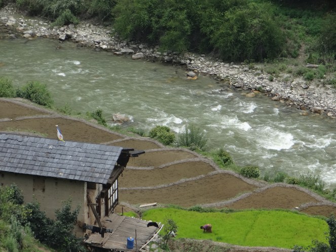
Riparian farming on a tributary of Punatsangchu Photo: SANDRP
Coffer dam and diversion of PSHP I Project Photo: SANDRPDam Axis of PSHP I Photo: SANDRP
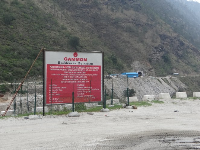
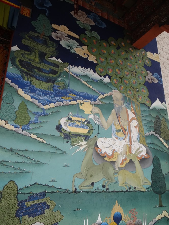
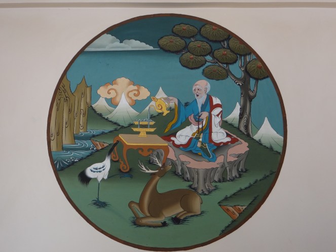
Diverted River, dry and without flows Photo: SANDRPHuge muck disposal next to the river bank near the intake chambers Photo: SANDRPL and T India is the contractor for construction of Diversion Tunnel, Dam, intake and Desilting Chambers Dam Wall Photo: SANDRPGammon India is contractor for 7.48 kms Head Race Tunnel. Bharat Heavy Electricals and HCC are also contractors in PSHP I Photo: SANDRPStretch of Punatsangchu River that will be diverted through the tunnel when the dam is commissioned Photo: SANDRPBaso Chhu River, entirely dried as it is diverted for the 66 MW BasoChhu Power Project of Druk Green Photo: SANDRPThe Six symbols of Longevity celebrated in Bhutan ( also Tibet). Photo: At Punakha Monastery, SANDRP
In almost all Dzongs, as well as hotels and homes rests a picture of Six Symbols of Longevity ( see picture above), all of them are interlinked, hold symbolic significance and are supposed to be auspicious.
They include Man, Animals, Birds ( The Black Necked Cranes, incidentally threatened by an Indian Dam: 780 MW Nyamjangchu, close to Bhutanese border), Mountains, Trees and Rivers!
[5] Samir Mehta’s blog on Hydropower Challenges in Bhutan: http://www.internationalrivers.org/blogs/257/bhutan-s-picture-of-gross-national-happiness-blurs
[7] Sector Study of Bhutan’s Hydropower by World Bank: http://documents.worldbank.org/curated/en/2007/12/9425448/bhutan-hydropower-sector-study-opportunities-strategic-options
[8] ADB pushing for Hydropower in Bhutan, also for storage projects, which have huge impacts! http://www.adb.org/features/bhutan-s-hydropower-sector-12-things-know?ref=countries/bhutan/features
That sounds like a rather innocent question and I was asked to write an article, addressing it. But before we go into that, let us try and understand a few things. Firstly, what is a River? Let us first try and understand that.
There is no single definition of this complex entity. For every definition, there is something more a river does.
Take the example of the one of the most complex rivers of all, the Ganga that we think we know. Before being a religious entity cultural icon, etc Ganga is, first & foremost, a River. A perennially flowing river like Ganga flows all the time. But that flow is not constant. It changes from day to night, from one day to another, from one season to another, one year to another, from one place to another.
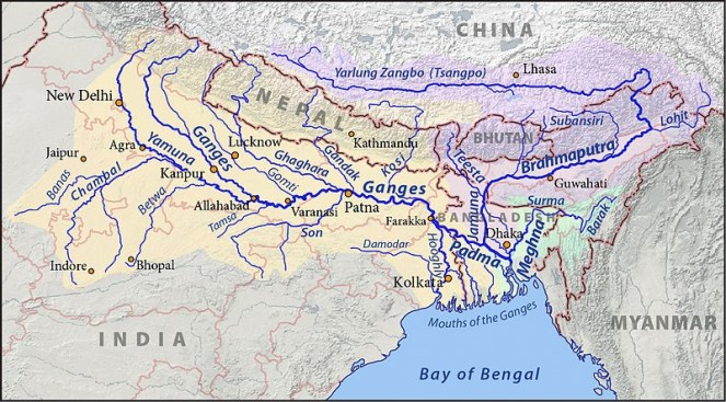
And then, the Ganga that we know is not only a single river but a collection of rivers. So Yamuna, Bhagirathi, Alaknanda, Mandakini, Dhauliganga, Pinder, Ramganga, Kali, Tons, Gomti, Ghaghra, Sone, Gandak, Budhi Gandak, Kosi & Mahananda are some of the major tributaries that directly meet Ganga. Each of them is a river in its own right.
The Ganga Brahmaputra Basin Photo from: Wikimedia Commons
Take Yamuna for example. Some of its major direct tributaries include: Tons, Giri, Som, Sahibi, Hindon, Chambal, Sind, Betwa & Ken, each of them are again significantly big rivers.
Take Chambal, some of the major direct tributaries of Chambal include: Parbati, Kali Sindh (Lakhundar, Ahu, Parwan are some of the tributaries of Kali Sindh, Newaj is one of the tributaries of Parwan, Dudhi is one of the tributaries of Newaj), Banas, Ider, Retam, Sau, Kshipra, Chhoti Kali Sindh, Cham, Siwana, Kural: each of which is a river by its own right.
Take Parbati: some of the major tributaries of Parbati include: Papnaus Ajnal, Sewan Paru, Utawali, Paraparwa, Mawal, Tem, Bhader, Gochi, Gaumukh, Sunk, Negri, Chopan, Uproni, Duhral, Andheri, Beram, Kosam, Ahelil and Sukni. These are all rivers too!
We can go on like this much longer. But such is a vast network of rivers that we call Ganga.
Secondly what flows in a river is not just water, though most governments, official agencies & engineers see the rivers as channels of water. Flowing water is surely a major visible defining component of a river. But even a canal or a pipeline can claim that. But unlike a canal or pipeline, a river carries dissolved matter, suspended matter, bed load, microorganisms, many levels of aquatic flora and fauna.
Thirdly, a river is a connected entity. It is connected with upstream and downstream river, biodiversity & landmass, the terrestrial land & life, underground geology and groundwater aquifers and is also connected with the floodplain. Perennial rivers like Ganga meet the sea forming a delta and this connection is vital for the river and as well as the sea. The connections are so strong that a river provides a report card about what is happening upstream and downstream, if read carefully.
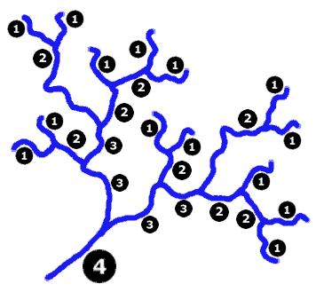
From: The River continuum Concept. Species in India will be different, but this represents how biological entitites in a river are linked to each other through a number of processes including nutrient spiralling Oxbowriver.com
This is admittedly a partial description of a river, limited by the constraints of an article or blog. This is also a bit simplistic description of how humans deal with rivers, since there are exceptions. But this provides a broad direction of our journey with the rivers.
from : lakeconesteenaturepark.com
Apart from its many functions like ecological, hydrological, geomorphological ones, a river is also connected with the human society along the banks. The connection with human societies has been as long as the humans have existed. This connection is not really necessary for the river to survive, but we cannot say the same about human survival. Humans cannot survive without the rivers, though is doubtful if the human society understands or even acknowledges that reality.
More importantly, till about a century ago, our interaction with the rivers did not endanger the existence of the rivers themselves. But what we have been doing in last century has created existential threat for rivers. This threat comes in the form of big dams, diversions, chemical pollution from agriculture and industries, large dose of sewage pollution at major urban centers, encroachment on floodplains, deforestation, unsustainable groundwater use, riverfront developments, embankments, and climate change.
What humans have done to the rivers in last century can possibly be described as Terraforming (one of the grandest concepts in science fiction in which “advanced” societies reshape entire planets to suit their needs). Or what some geologists describe as Anthropocene, meaning a new geological age of humans to suggest that humans are now a planet transforming force.
It seems humans have stopped valuing the rivers as they exist in nature and decided that they can stop, bend, tunnel, channelise, divert, encroach, pollute the rivers. So when we build a dam, we do not put any value to the destruction of river & destruction of the services provided by a river that entails in the process of building the dam.
But let us get back to Rivers & what dams do to them. A river, by definition, must flow freely. A dam stops the free flow of river, and impacts the river in the most fundamental ways. In India when we construct a dam (e.g. Tehri), a hydropower project (e.g. 400 MW Vishnuprayag project on Alaknanda in Chamoli district in Uttarakhand) or diversion (Lower Ganga – Bhim Goda at Haridwar, Middle Ganga – Bijnor and Upper Ganga-Narora barrages), we do not have to leave any water for the downstream stretch of river. So complete drying up of the rivers for most of the dry months by these structures is the first direct impact of these structures on the river. To put it mildly, that action practically kills the river. Upstream of the dam too, the river gets killed, for immediate upstream there is stagnant water and further upstream, the river has lost its connections with the downstream river!
Dry Baspa River downstream Baspa II Dam, Himachal Pradesh Photo: SANDRP Partners
This is because these structures not only stop the flow of water to the downstream areas, they also stop flow of everything else that was flowing in the river: the silt, the nutrients, the sand, the organisms, the flora, fauna, and severe every one of the connections of rivers we described earlier
And imagine when a river has to face such death every few kilometers in its journey!
Density of dams in the Upper Ganga Basin Map by SANDRP
That is not all. As the river continues its journey, if the tributaries are flowing reasonably freely, there is some chance for the river to recover some of its defining characteristics. But we have dammed most major tributaries too.
To top it, we also have other elements that help kill the river, like pollution, encroachment, abstraction, etc, as described earlier.
And remember just about a century back Ganga and other rivers were not in such a bad shape. This is an achievement of less than 100 years.
Chandra Basin in Himachal Pradesh depicted by Nicholas Roerich in 1932. The same Chenab Basin now witnesses one of the highest dam densities in Himalayas. From: WikiArt
Some people will read in this a plea to go back by those 100 years. That is not possible, and we all know that. But there are other ways to deal with the rivers. Human society can take what is needed for the society, without destroying the river.
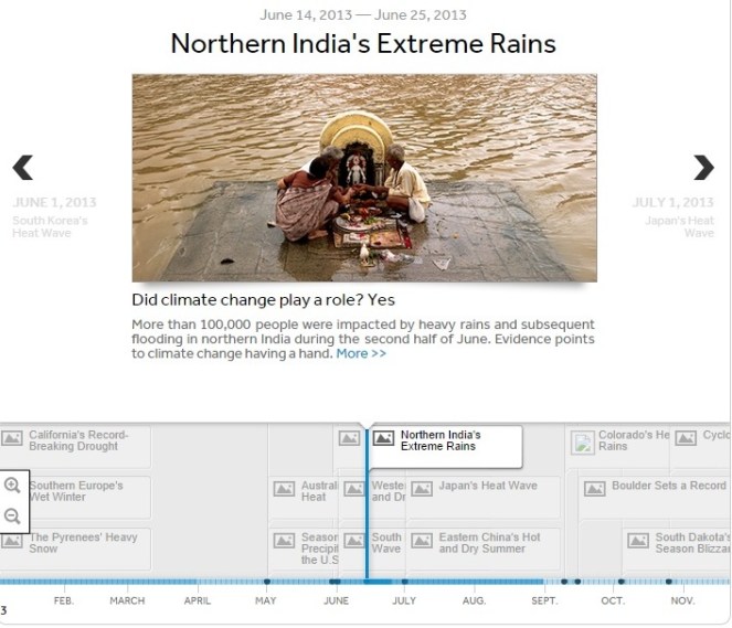
June 16, 2014 This is a sad day, reminding us of the Uttarakhand disaster that began on this day a year ago. The disaster was triggered by unseasonal and heavy rainfall in which indicates a clear footprint of climate change. At the same time, the role played by massive infrastructure interventions, including an onslaught of hydropower projects and dams in Uttarakhand’s fragile ecosystem, in magnifying the proportions of this disaster manifold is also undeniable[1]. It is a sign of callousness of our system that till date we do not have a comprehensive report about this disaster that throws light on what all actually happened, which institutes played what role, which institutes failed or succeeded in their assigned role, what were the rehabilitation and resettlement provisions, processes, plans and policies, and what lessons we can learn from this experience.
The lessons from this experience hold significance for the entire Himalayan region.
Uttarakhand and the union government declined to even investigate the role of hydropower projects in the disaster. It was left to the Supreme Court of India, through its order of Aug 13, 2013, to ask the government to set up a committee to assess the role of existing and under construction hydropower projects in the disaster.[2] The apex court also asked governments to stop clearances to all such projects in the state in the meantime. The reluctant Union Ministry of Environment and Forests (MEF) took two more months to set up the committee which was headed by Dr Ravi Chopra.[3]The committee submitted the report in mid April, 2014, but two months later the MEF is yet to put up the report in public domain. Or make it available to the people of Uttarakhand in their language or invite their views. SANDRP had written in detail about the recommendations of the EB, the committee certainly said that the hydropower projects played a significant role in the disaster[4]. Eminent geologist Prof K S Valdiya has also written in Current Science in May 2014 (Vol. 106, p 1-13) that most projects are being built in landslide prone, seismically active area and should not be built there.
It was again left to the Supreme Court on May 7, 2014 to order stoppage of work on the 24 hydropower projects. The Expert Body recommended cancellation for 23 of these projects and change of parameters for one project. There is immense hope in further proceedings in the apex court in coming months, since the results will provide a guide for the whole Himalayan region in Uttarakhand, in other states in India and even for the Himalayan region beyond the border.
At the same time, it is unfortunate to see that the MEF, the Union government and Uttarakhand government seem to have learnt no lessons from the disaster. These bodies have been trying all sorts of manipulations to push massive projects like Lakhwar and Vyasi in Yamuna basin even without Environment Impact Assessment, Cumulative Impact Assessment or public consultations.
Now a new government has taken over at the centre. It is possible sign of things to come that India’s new Prime Minister Shri Narendra Modi has chosen this anniversary day to lay foundation stone for a huge hydropower project in the Himalayan region, read his own statement dated June 14, 2014[1], about his impending trip to Bhutan on June 15-16, 2014: “During the visit, we will lay the Foundation Stone of the 600 MW Kholongchu Hydropower Project[5].” This possibly indicates the thinking of new government on this issue.
The memory and lessons of this unprecedented disaster seem to be fading already. While going through the articles on this disaster in a number of newspapers like Indian Express, Hindu, Tribune, Business Standard, among others, I could find just one article in Business Standard[2] that mentioned the role of hydropower projects in Uttarakhand disaster.
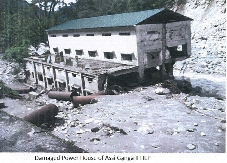
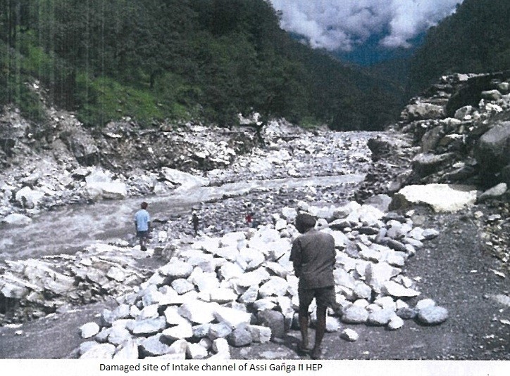
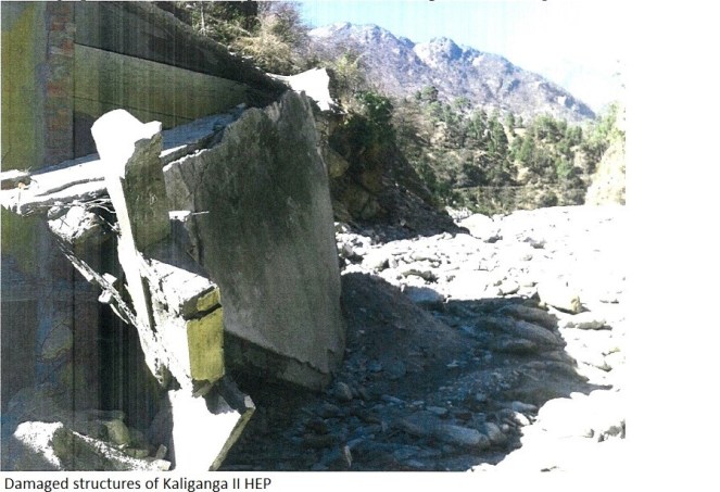
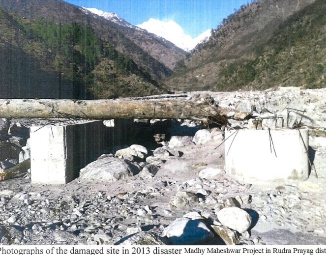
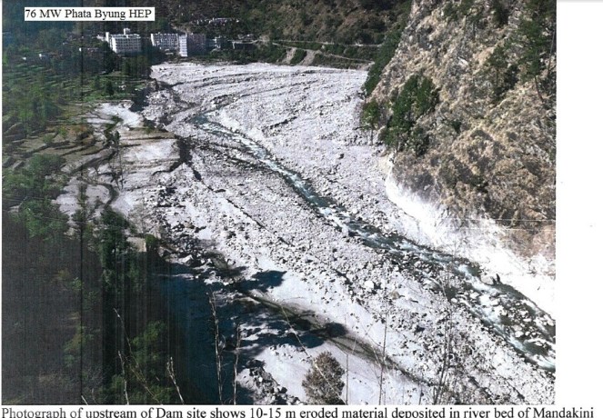
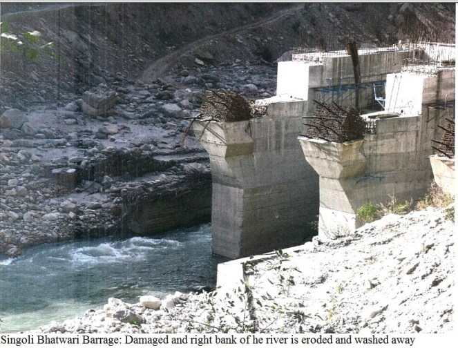
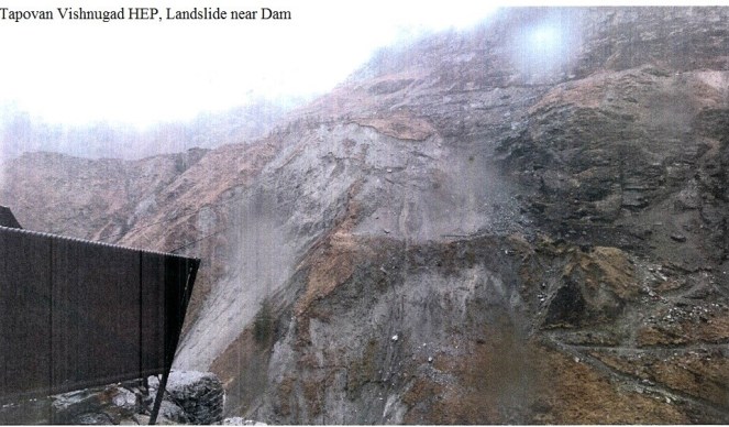
It is very important, in this context to remember the issue. We are here presenting here some photos of the damaged hydropower projects of Uttarakhand in that context. The photos are mostly taken from official sources, namely 582 page annexures to the Ravi Chopra Committee report. Most of the photos have not been in public domain to the best of our information.
Assi Ganga I (4.5 MW in Uttarkashi district): Letter from Regional office of MoEF to Uttarakhand Forest secretary dated 30 March, 2014 says:“The project was heavily damaged in 2013 devastation.” It also says that the project is in Ganga Eco Sensitive Zone and in the zone only projects below 2 MW capacity and serving the needs for the local population are allowed. Hence it says, “…the project should not start without obtaining fresh forest clearance and permission from the Central Govt.”
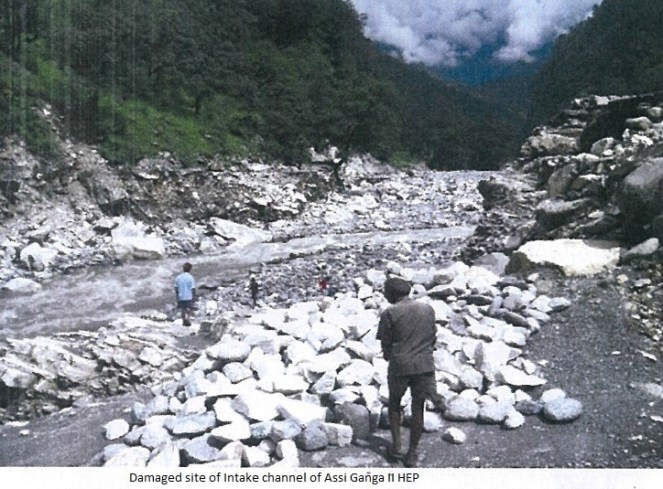
Assi Ganga II (4.5 MW in Uttarkashi district): Similar letter from Regional office of MoEF says: “The project was heavily damaged in 2013 devastation.” Following photos from the monitoring report of the project speak about the damage this project suffered:
Kaldigarh HEP (9 MW in Uttarkashi district) The project heavily damaged in 2012 floods and it being in Eco Sensistive zone, the report says the project should not be allowed to restart without permission from central govt.
Kotli Bhel 1A HEP (195 MW on Bhagirathi river in Uttarkashi district) The project has not given the final forest clearance. The stage I forest clearance was given on 13.10.2011 and environment clearance on 09.05.2007. The Ravi Chopra Committee report has asked for changes in the project parameters and Supreme Court order of May 7, 2014 has asked for stoppage of work on 24 HEPs, this project is on that list of 24 projects. The regional office report says that work on the project has been started on non forest land, which should now come to stop.
Kaliganga II HEP (6 MW, Rudraprayag district, Mandakini Basin) The Project got forest clearance on March 6, 2007. But project is yet to provide non forest land as required under act. The project is also within 2 km of Kedarnath Wildlife Sanctuary, but has not got clearance either from state wildlife Board or National Wildlife Board. The project construction thus is clearly illegal. Project has now suffered damages in June 2013 disaster, as can be seen from the photos below.
Madhya Maheshwar HEP (10 MW, Rudra Prayag district):
Phata Byung HEP (76 MW, Mandakini river, Rudra Prayag district):
Singoli Bhatwari HEP (99 MW, Mandakini river, Rudra Prayag district):
Bhyunder Ganga HEP (15 MW, Alaknanda river, Chamoli Disrict):
What happened in Uttarakhand a year ago in June 2014 was possibly a warning.
These photos are a reminder that even the hydropower projects are not safe and they will invite not only destruction for themselves, but also for the surrounding areas. Lest we forget the warning.
This post is the second of a two part summary of the results of a study on the socio-ecological impacts of privatized, small, run-of-the-river hydropower projects in Himachal Pradesh.[1] The study is based on field research conducted in 2012 on all 49 completed small hydropower projects in the state.[1] Part one, posted here on 8 June, reviews the implementation of the Himachal Pradesh power policy governing privatized small hydropower development and examines the local social and environmental effects of commissioned small (defined as 5 MW or less) hydropower projects. This part will address two of the claimed local benefits of small hydropower development, namely monetary contributions by the project developer to local community development projects through the Local Area Development Authority (LADA) and local employment generation. After a brief discussion of the relationship between small hydropower projects and carbon credits through the Clean Development Mechanism, the article reviews two promising institutional models for small hydropower development and concludes with a set of recommendations.
Local Area Development Authority– Implementation and Accountability Challenges
The 2006 Hydropower Policy includes provisions for tangible local benefits, in part to foster local support for power projects. One primary mechanism is the requirement that project developers deposit one percent of the project cost into an account with the district commissioner. These funds, known as Local Area Development Funds, are to be allocated by the Local Area Development Authority (LADA) to support local development activities, particularly related to infrastructure and services.[2]
In our survey of the 49 commissioned small hydropower projects we found that the LADA program was not working as well as intended. Inconsistent record keeping by district authorities, the lack of clearly defined project affected areas, and uneven levels of awareness among local pradhans about the program have enabled some project developers in Himachal to avoid fulfilling their obligations to local communities. The district revenue department office in Kangra was the only district office that maintained a comprehensive record of LADA obligations and tracked how much the project developer had paid and how much was still owed. Without such a record, officials in the remaining six districts found it extremely difficult to hold the project developer accountable for their LADA payment obligations. For example, in District Chamba, ten small hydropower projects together owe Rs 247 lakhs. However, as of the summer of 2012 they had paid only Rs 70 lakhs and the developers of three projects had contributed nothing at all. District administrators seem to have little authority or recourse, beyond personal persuasion, to compel the project developer to make the required contributions.
There are also challenges with defining the Project Affected Area (PAA) and Project Affected Zone (PAZ), which is important because 70% of the LADA funds are earmarked for projects in the PAA and 30% for projects in the PAZ. Very few small hydropower projects have defined PAAs and none had defined a PAZ. The lack of clearly defined affected areas raises questions about whether or not the authorized development projects actually reach those households and hamlets most affected by the hydropower project.
A related concern is the unevenness of awareness about the LADA program among village pradhans. Several village pradhans, especially in the remote areas of the state, had never heard of the LADA program, even though one or more small hydropower projects were located within their panchayat boundaries. Where the program was functional, there are sometimes disputes between the LADA committee and the district commissioner concerning which projects to fund and whether to prioritize projects oriented towards strengthening local employment generation or hard infrastructure development.
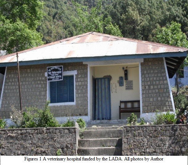
We did encounter one example of a panchayat in which the LADA program was working as intended. The pradhan of the panchayat, located in District Kangra, was a retired military officer. Well aware of the LADA obligations of the small hydropower project developers in his panchayat, he maintained close communication with the district commissioner’s office in order to ensure that the required deposits were made. The pradhan also pressured the LADA committee to identify potential projects in a timely fashion and he followed up with the district commissioner to ensure that the expenditure of the requisite funds was authorized. As a result, in this panchayat LADA funds had been used to construct a cricket playing field, veterinary dispensary, and a handsome hall for village meetings and social functions (figures 1 and 2). Furthermore, in part due to the effective implementation of the LADA program and the fact that the small hydropower project did not annex cultivated areas, local opposition to the projects was virtually nonexistent. This example suggests that the LADA can offer tangible local benefits if accurate records are kept, if the project developers are compelled to contribute the requisite amounts, if village pradhans know about the program and their entitlements under it, and if the district administration supports program implementation.
Employment Generation –Unrealized Potential for Secure Jobs
In addition to requiring project developers to contribute to the Local Area Development Authority, the 2006 Hydropower Policy seeks to generate local benefits by stipulating that 70% of the project’s workers be from Himachal Pradesh. Because the lack of local employment opportunities is one of the primary drivers of migration from hill areas, the provision of permanent jobs through small hydropower projects could be a significant benefit. In addition to a steady income, permanent regular employees participate in government-approved pension plans, receive compensation for work-related accidents and injuries, and are protected from arbitrary dismissal. The project developer is also required to register all workers with the Labour Department and the local police station on a monthly basis.
While the 49 commissioned small hydropower projects in the state generate significant employment, more than half of project developers evade complying with labor law. All told, the 49 projects employ a total of 951 people, 603 of whom come from the panchayat(s) in which the project is located. On average, a 5 MW project employs approximately 20 people. While the total employment these projects generate is substantial, only 22 project developers have registered their employees with the state Labour Department as regular employees. These workers do receive the protections and benefits of the state’s labor laws, and some of them (in three projects) are also provided subsidized lodging and meals. However, the workers in the remaining 27 small hydropower projects, while doing the same work as regular employees in other projects, are hired on a daily wage basis and are thus excluded from the benefits and security of regular employment. A further disjuncture arises from the fact that only 11 project developers have established provident fund contributions for their employees, the remaining 38 have not. For the majority of workers in small hydropower projects, one of the most important potential local benefits – secure employment – has not been realized.
Given the significant risk of injury or death in this sector, it is of particular concern that unregistered workers are less likely than registered workers to receive compensation should an accident occur. While we did not develop comprehensive information about accidents and injuries, we did confirm worker deaths, the great majority of which occurred during the project construction phase due to tunnel collapses, falling rock, landslides, and tractor accidents. A total of 40 people died in accidents related to the construction of the commissioned small hydropower projects in the state, 18 were Himachali and 22 were from neighboring states or from Nepal. Only three of the families of the forty workers who died in fatal accidents received some form of compensation. The lack of proper registration and the general absence of compensation suggests the extent to which project developers and their contractors treat workers as a disposable labor force.
The common practice of contracting out project construction work to subcontractors who hire large numbers of employees challenges the ability of unions to advocate for project workers.[3] Questions arise concerning who is ultimately responsible for following the relevant labor laws and protections – the project developer or the developer’s subcontractors (figure 3)? Project developers can evade accountability through the use of subcontractors or by creating subsidiary companies. For example, in District Kangra in May, 2010 the local construction worker union notified a small hydropower project developer of its intent to strike due to violations of labor laws and working conditions. In a letter the developer responded that the strike was “totally illegal and off the mark” as the developer was not the owner of the plant but was “merely the contractor.” Furthermore the developer noted that the project was “generating power in the interest of the public of Himachal Pradesh,” and was “a property of the State and a national asset,” and thus the calling of the strike was “illegal from all perspectives.” While it is true that the developer to whom the labor union had sent the notice of intent to strike is not the company listed as the owner of the project in the state of Himachal Pradesh’s records, it is also true that the listed company is actually a subsidiary of the developer, whose address is the same as the developer and whose website leads directly to that of the developer. Furthermore, the power project is showcased on the developer’s website as one of four small hydropower projects they have constructed and are currently operating in District Kangra. The developer’s attempt to evade accountability for labor law violations by creating a fictitious subsidiary demonstrates the challenges unions face when they seek redress for labor law violations and demand worker rights
Payments to Developers for Renewable Energy Production
Part One of this article discussed the economics of small hydropower development. Clearly, the primary source of income developers receive is the guaranteed purchase price that the Himachal Pradesh State Electricity Board provides. A second, and much smaller, source of revenue for some projects derives from the sale of carbon credits through the Clean Development Mechanism of the Kyoto Protocol, administered under the United Nations Framework Convention on Climate Change (UNFCCC). The Clean Development Mechanism allows countries in the global south to sell carbon credits in the form of Certified Emission Reductions (CERs) to countries in the global north that need to purchase such reductions in order to meet emissions reduction limits that the Kyoto Protocol has imposed. Projects in the global south may be eligible for registration under the Clean Development Mechanism if it can be demonstrated that their implementation will prevent carbon (measured in metric tons of carbon dioxide equivalents) from entering the atmosphere. The resulting emission reductions can then be sold by the project developer to a carbon generating entity in the global north that needs to purchase such carbon credits. In the context of small scale hydropower projects, developers argue that if they did not produce electricity using hydropower, the equivalent amount of electricity would be generated primarily through the burning of fossil fuels. Thus, by producing electricity through hydropower, they are “preventing” a measureable amount of carbon from going into the atmosphere. If their projects are registered under the Clean Development Mechanisms, then project developers may sell credits to entities in the global north.
Of the 49 commissioned small hydropower projects, approximately 27 are registered under the Clean Development Mechanism.[4] According to documents relating to these 27 projects on the UNFCCC Clean Development Mechanism website, these hydropower projects are credited with generating 447651 metric tons of carbon dioxide emissions reduction equivalents per year. Project developers may sell these emissions reductions equivalents (carbon credits) to entities in the global north. There are at least three points worth noting about these carbon credits. Firstly, the value of carbon credits has dropped precipitously in the last few years, from a high of approximately rupees 760 in 2008 to its current price of less than rupees 50 per metric ton of carbon equivalent (redd-monitor.org 2013).[5] The essential collapse of the international carbon credit market has been attributed to an oversupply of credits and weak demand (Singh 2014). Secondly, there are serious concerns about the ethics of generating marketable carbon equivalents from projects that severely disrupt the livelihoods of communities as described in part one of this post. Thirdly, there are questions about the integrity of the calculations and procedures employed to calculate the carbon equivalents of such projects and to justify project inclusion in the UNFCCC registry. One of these questions centers on the requirement of additionality. Additionality, as the Kyoto Protocol specifies, is the principle that projects are eligible for international support through the Clean Development Mechanism only if they would be uneconomical without such support. Thus, a small hydropower project that is economically viable without the revenue from selling carbon credits is in principal barred from participating in the carbon credit program. On the other hand, private sector loan officers will not approve financing for projects that are not economically viable. At least some project developers resolve this contradiction by developing two sets of project documents. As one project manager told me, “we prepare two DPRs (Detailed Project Reports), one for CDM and one for the banks.”
In light of the poor remuneration developers receive from the sale of carbon equivalents, at least some project developers expressed the desire to participate in the Government of India’s Renewable Energy Certificate (REC) program, which has its roots in the 2003 Electricity Bill and is part of the country’s renewable energy policy (Carbon Credit Capital 2011). By becoming designated as “eligible entities” within the REC program, developers would receive one renewable energy certificate for every megawatt hour (MWh) that they sell to the state electricity grid. Purchasing electricity produced by an eligible entity enables state utilities to meet their Renewable Purchase Obligation, which is the proportion of electricity they purchase that must come from renewable sources. Eligible entities may trade renewable energy certificates on one of India’s two electricity exchanges. As of 2012, no small hydropower developer had become an eligible entity within the REC program. Several developers were interested in joining this program, however the fact that they already have power purchase agreements to sell electricity to the HP State Electricity Board renders them ineligible for the REC program.
Two Alternative Institutional Models for Future Small Hydropower Development
The track record of the 49 commissioned small hydropower projects in Himachal Pradesh is cause for concern. Patterns of disruption to farmer-managed irrigation systems as well as water mills (gharats), environmental and infrastructural damage from landslides in some regions (especially Chamba District), negative effects on fisheries and the livelihoods that fish farming and sport and subsistence fishing activities support, systemic problems with the Local Area Development Authority, significant uncompensated worker deaths during project construction and on-going concerns regarding labor relations, all comprise the local track record of small hydropower development in the state. Leaving aside the broader question of whether or not small hydropower projects should be developed, it is clear that if they are going to be developed, then an alternative institutional framework is called for.
Two institutional models for small hydropower development exist that have the potential to realize more sustainable, effective and equitable hydropower outcomes. These models are represented by the Sai Engineering Foundation (figure 4) and the Churah Cooperative Floriculture Society (figure 5). Inspired by the teachings of the religious leader Bhagwan Sri Sathya Sai Baba and the religious ideals of Gandhian social service, Sai Engineering Foundation is a registered charitable foundation that promotes social welfare. They have been involved with hydropower development since the first India Hilly Hydel demonstration projects in the 1990s. They both own and manage their own projects and provide consulting services for other private power developers. They invest the revenue from hydropower production in social service and welfare programs in Himachal Pradesh. These activities include medical and blood donation camps, financial assistance to low income students, community-based welfare programs, working with government programs to deliver services to low income communities, and promoting cooperative societies in the field of power generation, construction, and floriculture (Sai Engineering Foundation 2011). Because of the social service ideology that informs this organization, when the Sai Foundation develops small hydropower projects, it does so in a manner that prevents or mitigates the negative impacts on local livelihood strategies and is responsive to local concerns and issues.
The second alternative institutional arrangement is the Churah cooperative society. Although the 2006 Hydropower Policy specifically addresses the need to prioritize working with cooperative societies, and despite repeated calls by community members for more support for local cooperative society involvement in hydropower development, our research revealed only one community-based cooperative society working on small hydropower development. Since 1996 the Churah Valley Fruits, Vegetables, and Flowers Growers Marketing and Development Cooperative Society (Churah Floriculture Cooperative Society) has worked to promote the economic development of low income families in the Churah Valley, a remote area in Chamba District, not far from the border with Jammu and Kashmir. The cooperative’s initial and on-going work involves developing floriculture using greenhouses, and marketing cut flowers to cities in north India, as well as off-season vegetable production in neighboring Pangi Valley. Interestingly, they are also working to develop a small hydropower project under the framework of the 2006 Hydropower Policy. Four hundred Below Poverty Line (BPL) households, all members of the cooperative society, are involved in this effort. In order to qualify for the necessary loans, each household is putting up their house and land as collateral. The cooperative society is currently securing the necessary funding and moving ahead with efforts to secure the required No Objection Certificates. The revenue from the small hydropower project, once it is commissioned, will be shared among the participating families.
Both the Sai Engineering Foundation and the Churah Floriculture Cooperative Society represent viable alternatives to the current approach, which emphasizes corporate ownership of small hydropower facilities. Both of these organizations are accountable to local concerns and interests and prioritize local social and environmental sustainability. However, both the Sai Engineering Foundation and the Churah Floriculture Society face an uphill battle to get their projects approved and the requisite NOCs obtained. Both organizations have fewer financial resources to offer in exchange for obtaining NOCs than do private companies; they are thus at a disadvantage when competing with private corporations for bureaucrats’ attention and willingness to provide NOCs.
Concluding Recommendations
Insights from this study provide the basis for proposing concrete steps that together could help small run-of-the-river hydropower projects realize their purported, but not realized, benefits. Three broad categories of recommendations exist. Firstly, the process through which potential hydropower sites are identified must include key elements of the agrarian landscape as well as the cumulative effects of multiple projects along a common stream reach; furthermore, when negative social and environmental effects are anticipated, they should be adequately mitigated. Settlements, networks of kuhl irrigation systems, strings of gharats along streamcourses, irrigated and unirrigated cultivated areas, and proximity to adjacent projects, in addition to hydrological information, should be incorporated into the site evaluation and identification process. Using this information to avoid siting projects in densely managed landscapes, or too close to each other, would help eliminate many of the negative project impacts on local livelihoods and communities. In cases where projects do negatively affect local livelihoods, e.g. when a project renders gharats defunct, disrupts a community-managed irrigation system, or disturbs grazing or cultivated areas, then adequate compensation should be provided through a government-facilitated process. Similarly, negative environmental effects should be mitigated, for example by requiring manual cleaning of desilting tanks, installation of fish-friendly diversion weirs, adequate water (quality and quantity) to support ecosystem needs, and effective muck management approaches.
Secondly, policy implementation and enforcement need to be strengthened. While the 2006 HP Power Policy and state labour laws contain important safeguards for local communities and workers, implementation and enforcement need strengthening. For example, district authorities need to be required and empowered to collect the mandatory developer contributions to the Local Area Development Authority. LADA funds should be allocated in a manner that maximizes local benefits for project-affected households and communities. Similarly, labour laws requiring that workers doing regular work should be hired on a permanent, not a daily wage, basis should be enforced, and workers should receive the perquisites concomitant with regular employment, including compensation in the event of injury or death. Projects that disrupt local livelihoods and generate unmitigated negative environmental effects should not qualify for carbon credits under the Clean Development Mechanism. Greater policy and bureaucratic support also needs to be directed towards supporting alternative institutional models for small hydropower development, such as cooperative societies and social service foundations
Thirdly, governance measures that strengthen small hydropower projects’ accountability should be developed. The record of negative social and environmental effects and the extent of local opposition, attests to the unsustainable nature of the current approach to small hydropower development. Identifying and implementing governance measures to minimize these negative socio-ecological effects will likely provide a more informed and democratic basis for decision-making. Measures such as requiring Environmental Impact Assessments, along with the requisite public hearings, as well as obtaining environmental clearance from the state, would go a long way to improving the sustainability of small hydropower in Himachal Pradesh. If developers, after completing such assessments and hearings, and receiving clearance, were able to more easily obtain the necessary No Objection Certificates, then project delays would also be reduced.
Clearly, alternatives do exist for advancing institutional approaches to small hydropower development that are accountable to local communities and environmental concerns. Whether or not the state of Himachal Pradesh (and other states since this is likely to be equally applicable to other states where such projects are taken up) chooses to embrace these approaches remains to be seen. If the next 450 planned or under-construction small hydropower projects in the state generate a track record similar to the first fifty, then regional society and environment will be much the poorer for it. However, if civil society mobilizations and resistance are sustained, and governance measures strengthened, then power developers will be held more accountable for the local impacts of their activities. If the state government chooses to offer more support and capacity building resources for entities like cooperative societies and Sai Engineering Foundation, or at least removes some of the barriers they currently face, then these alternate institutional approaches to power development may proliferate. And if in response to electoral pressures within the state, Himachal Pradesh decides to put more teeth into its currently progressive, but not enforced, power policy, then perhaps the future will be brighter than the recent past.
1] This study is based on six months of mixed methods, qualitative and quantitative field research that I and two research assistants. After an initial exploration of the relevance of this topic in 2009, field research commenced in January, 2012. We began by meeting key state level bureaucrats in Shimla and collecting secondary documents concerning all of the 49 commissioned small hydropower projects from the Himurja (Himachal Pradesh Energy Development Agency) office in Shimla. We then turned to the district and project level research. In each district where commissioned small hydropower projects were located, we interviewed district officials and collected secondary information concerning the projects. We met with district commissioners, sub-division magistrates, tehsildars, and other concerned district officers. We informed officials of our research, garnered key insights about small hydropower development from them, and collected relevant information and project related records and documents. We then focused our research efforts on each commissioned small hydropower project. At each project location, we interviewed project representatives (generally the project manager and occasionally the project owner) and the panchayat pradhans of affected panchayats. We conducted structured and semi-structured survey interviews with project-affected households and other key informants. We checked all the information we obtained using between-subject, cross-method, and cross-researcher triangulation (Newing 2011). We ground truthed what we learned through meetings, surveys and interviews by walking transects from the diversion weir down to the tail race of every commissioned project. We also photocopied key documents such as petitions, correspondence, court documents, and judicial papers. Near the completion of the fieldwork, I met the same state level officers and bureaucrats with whom I had met at the beginning of the fieldwork in order to share preliminary research findings and conclusions.
[2] The Local Area Development Authority is a committee, comprised of the sub-district magistrate, other subdivisional officers, affected area panchayat pradhans, and a representative of the project developer. The committee identifies and prioritizes potential projects, and then submits the prioritized list of projects to the district commissioner, who is to then approve and authorize the necessary expenditure. Examples of projects include a veterinary dispensary, ayurvedic dispensary, cremation ground, village meeting hall, furniture for meeting hall, irrigation system (kuhl) repair, culverts and road repair, footbridges and playing field for youth.
[3] The labor-intensive project construction process lasts at least two years and often significantly longer. To accomplish specific tasks, subcontractors hire large numbers of workers. The majority of these workers live in temporary tin shed housing located along the banks of the stream or river from which the project diverts water. These “labor camps” often house one hundred or more workers. The fuelwood consumption for cooking and heating (notwithstanding attempts to provide LPG cylinders) associated with these camps poses a significant environmental concern, as does the fact that most of these labor camps do not have adequate provision for wastewater and sewage. Consequently the adjacent stream, which is invariably used downstream for washing, irrigation and other purposes, and stream bank, are severely contaminated. While this research focused on already constructed projects, local residents nevertheless often complained about the negative environmental, health, and social impacts of these labor camps.
[4] This is based on a comprehensive review of the Project Cycle Search webpages of the Clean Development Mechanism segment of the UNFCCC website, accessed on 9 June 2014.
It is close to a year after the worst ever Himalayan flood disaster that Uttarakhand or possibly the entire Indian Himalayas experienced in June 2013[1]. While there is no doubt that the trigger for this disaster was the untimely and unseasonal rain, the way in which this rain translated into a massive disaster had a lot to do with how we have been treating the Himalayas in recent years and today. It’s a pity that we still do not have a comprehensive report of this biggest tragedy to tell us what happened during this period, who played what role and what lessons we can learn from this experience.
Floods in Uttarakhand Courtesy: Times of India
One of the relatively positive steps in the aftermath of the disaster came from the Supreme Court of India, when on Aug 13, 2013, a bench of the apex court directed Union Ministry of Environment and Forests (MoEF)[2] to set up a committee to investigate into the role of under-construction and completed hydropower projects. One would have expected our regulatory system to automatically initiate such investigations, which alas is not the case. Knowing this, some us wrote to MoEF on July 20, 2013[3], to exactly do such an investigation, but again MoEF played deaf and blind to such letters.
5 MW Motigad Project in Pithorgarh District destroyed by the floods. Photo: Emmanuel Theophilus, Himal Prakriti
The committee report, signed by 11 members[5], makes it clear that construction and operation of hydropower projects played a significant role in the disaster. The committee has made detailed recommendations, which includes recommendation to drop at least 23 hydropower projects, to change parameters of some others. The committee also recommended how the post disaster rehabilitation should happen, today we have no policy or regulation about it. While the Supreme Court of India is looking into the recommendations of the committee, the MoEF, instead of setting up a credible body to ensure timely and proper implementation of recommendations of the committee has asked the Court to appoint another committee on the flimsy ground that CWC-CEA have submitted a separate report advocating more hydropower projects! The functioning of the MoEF continues to strengthen the impression that it is working like a lobby for projects rather than an independent environmental regulator. We hope the apex court see through this.
Boulders devouring the Vishnuprayag Project. 26th June 2013 Photo: Matu jan Sangathan
Let us turn our attention to hydropower projects in Himalayas[6]. Indian Himalayas (Himachal Pradesh, Uttarakhand[7], Jammu & Kashmir, Sikkim, Arunachal Pradesh and rest of North East) already has operating large hydropower capacity of 17561 MW. This capacity has leaped by 68% in last decade, the growth rate of National Hydro capacity was much lower at 40%. If you look at Central Electricity Authority’s (CEA is Government of India’s premier technical organisation in power sector) list of under construction hydropower projects in India, you will find that 90% of projects and 95% of under construction capacity is from the Himalayan region. Already 14210 MW hydropower capacity is under construction. In fact CEA has now planned to add unbelievable 65000 MW capacity in 10 years (2017 to 2027) between 13th and 14th Five Year Plans.
Meanwhile, the Expert Appraisal Committee of Union Ministry of Environment and Forests on River Valley Projects has been clearing projects at a break-neck speed with almost zero rejection rate. Between April 2007 and Dec 2013[8], this committee recommended final environment clearance to 18030.5 MW capacity, most of which has not entered the implementation stage. Moreover, this committee has recommended 1st stage Environment clearance (what is technically called Terms of Reference Clearance) for a capacity of unimaginable 57702 MW in the same period. This is indicative of the onslaught of hydropower projects which we are likely to see in the coming years. Here again an overwhelming majority of these cleared projects are in Himalayan region.
Agitation Against Lower Subansiri Dam in Assam Source: SANDRP
What does all this mean for the Himalayas, the people, the rivers, the forests, the biodiversity rich area? We have not even fully studied the biodiversity of the area. The Himalayas is also very landslide prone, flood prone, geologically fragile and seismically active area. It is also the water tower of much of India (& Asia). We could be putting that water security also at risk, increasing the flood risks for the plains. The Uttarakhand disaster and changing climate have added new unknowns to this equation.
We all know how poor are our project-specific and river basin-wise cumulative social and environmental impact assessments. We know how compromised and flawed our appraisals and regulations are. We know how non-existent is our compliance system. The increasing judicial interventions are indicators of these failures. But court orders cannot replace institutions or make our governance more democratic or accountable. The polity needs to fundamentally change, and we are still far away from that change.
Peoples protests against Large dams on Ganga. Photo: Matu Jansangathan
The government that is likely to take over post 2014 parliamentary elections has an opportunity to start afresh, but available indicators do not provide such hope. While UPA’s failure is visible in what happened before, during and after the Uttarakhand disaster, the main political opposition that is predicted to take over has not shown any different approach. In fact NDA’s prime ministerial candidate has said that North East India is the heaven for hydropower development. He seems to have no idea about the brewing anger over such projects in Assam and other North Eastern states. That anger is manifest most clearly in the fact that India’s largest capacity under-construction hydropower project, namely the 2000 MW Lower Subansiri HEP has remained stalled for the last 29 months after spending over Rs 5000 crores. The NDA’s PM candidate also has Inter Linking of Rivers (ILR) on agenda. Perhaps we have forgotten as to why the NDA lost the 2004 Parliamentary elections. The arrogant and mindless pursuit of projects like ILR and launching of 50 000 MW hydropower campaign by the then NDA government had played a role in sowing the seeds of people’s anger with that government.
In this context we also need to understand what benefits these hydropower projects are actually providing, as against what the promises and propaganda are telling us. In fact our analysis shows that the benefits are far below the claims and impacts and costs are far higher than the projections. The disaster shows that hydropower projects are also at huge risk in these regions. Due to the June 2013 flood disaster large no of hydropower projects were damaged and generation from the large hydro projects alone dropped by 3730 million units. In monetary terms this would mean just the generation loss at Rs 1119 crores assuming conservative tariff of Rs 3 per unit. The loss in subsequent year and from small hydro would be additional.
It is nobody’s case that no hydropower projects be built in Himalayas or that no roads, townships, tourism and other infrastructure be built in the Himalayan states. But we need to study the impact of these massive interventions (along with all other available options in a participatory way) in what is already a hugely vulnerable area, made worse by what we have done so far in these regions and what climate change is threatening to unleash. In such a situation, such onslaught of hydropower projects on Himalayas is likely to be an invitation to even greater disasters across the Himalayas. Himalayas cannot sustain this onslaught.
It is in this context, that the ongoing Supreme Court case on Uttarakhand provides a glimmer of hope. It is not just hydropower projects or other infrastructure projects in Uttarakhand, or for that matter in other Himalayan states that will need to take guidance from the outcome of this case, but it could provide guidance for all kinds of interventions all across Indian Himalayas. Our Himalayan neighbors can also learn from this process. Let us end on that hopeful note here!
At least 49 large[1] hydropower projects are under construction in India today, with a cumulative capacity of 15006 MW[2]. As per the latest bulletin from Central Electricity Authority[3], “Status of Hydro Electric Projects under Execution for 12th Plan & beyond (Excluding projects above[4] 25 MW)” dated March 31, 2014, 35 of these projects (9934 MW) are expected to be commissioned in 12th Five Year Plan[5] and remaining 14 with installed capacity of 5072 MW would provide benefit beyond 12th Plan.
Considering that 1534 MW capacity has already been added in first two years of ongoing 12th Five Year Plan (during 2012-13 and 2013-14), CEA projections means that India hopes to add massive 11468 MW capacity during the current five year plan. This will be higher than capacity added in any other five year plan and 254% of the capacity addition during the last, 11th Five Year Plan (2007-12) when India added 4514 MW. The graph below shows how steeply our hydropower installed capacity is going up over the last 25 years.
Rapidly Increasing installed capacity of Large Hydropower Projects in India
The proponent of even more accelerated hydro capacity addition misleadingly talk about the need for having 40% of installed grid capacity as hydro.
In line with this, the CEA came out with plans to add 65000 MW in 13th Five Year Plan (2017-2022: 30 000 MW) and 14th Five Year Plan (2022-2027: 35 000 MW). (see http://www.energylineindia.com/ of May 6, 2014)
There is no science behind this advocacy. It is basically a suggestion possibly based on the general assumption that peaking demand is 40% higher than base-load demand. Hence if we have 40% installed capacity from hydro in the grid, this can take care of total demand optimally. However, this is based on assumption that hydro capacity is indeed used for peaking. This assumption is completely wrong in India, with no agency monitoring or even reporting how much of the hydro generation currently provide peaking power. Without such optimum use of current hydro capacity, where is the case for 60:40 grid capacity ratio for hydro? It goes without saying that when hydro projects are used for peaking power, there are additional social and environmental impacts in the downstream and upstream. These need to assessed and those who suffer are compensated.
On similar lines, one can answer the advocacy for claim that hydro is clean, green, renewable and cheap source of power or that run of the river or small hydropower projects are more environmentally benign. However, this blog is not attempting to answer all such fallacies here, it needs a separate blog.
While this is happening, the Expert Appraisal Committee of Union Ministry of Environment and Forests on River Valley Projects has been clearing projects at break a neck speed with almost zero rejection rate. Between April 2007 and Dec 2013, this committee recommended environment clearance to 18030.5 MW capacity, most of which has not entered the implementation stage. Moreover, this committee has recommended 1st Environment clearance (what is technically called Terms of Reference Clearance) for a capacity of unimaginable 57702 MW in the same period. This is indicative of the onslaught of hydropower projects which we are likely to see in the coming years.
Figure 1 TORs (First Stage EC) and EC recommended by EAC between April 2007 – December 2013
Table: Sector-wise & plan-wise number of & capacity of under construction HEPs
Sector
During 12th FYP
After 12th Plan
Total
No of Projects
Installed capacity, MW
No of Projects
Installed capacity, MW
No of Projects
Installed capacity, MW
Central
11[6]
5312
3
2615
14
7927
State
12
1506
3
736
15
2242
Pvt
12
3116
8
1721
20
4837
Total
35
9934
14
5072
49
15006
Among the three sectors, the largest number of under construction projects (20) are from private sector. However, among all sectors of under construction projects, central sector projects have the highest installed capacity (7927 or 53% of under construction capacity of 15006 MW).
Figure 2 Sectorwise ownership of under-construction HEPs in Numbers
Vulnerable Himalayas are the target In the second table the state-wise and sector-wise break of numbers and capacity of under construction HEPs has been given. Himachal Pradesh has the highest number and highest installed capacity projects among all states. That state also has the highest installed capacity (8139 MW or over a fifth of operating HEP capacity at national level) of large operating hydropower projects. Sikkim, however, has the highest number and capacity of private sector hydropower projects under construction. In fact, half of the total national-level private sector projects which are under construction are in that tiny state. Their installed capacity is more than half the installed capacity of all the private sector hydropower projects under construction at national level. Ironically, the state also has the highest biodiversity in the country.
Figure 3 Installed Capacity of under construction HEPs, sector-wise ownership, in MW
Himachal Pradesh and Uttarakhand also have 5 and 3 private sector HEPs under construction respectively. The 5 Himalayan states of Jammu & Kashmir (J&K), Himachal Pradesh, Uttarakhand, Sikkim and Arunachal Pradesh between them have 38 of the 49 under construction hydropower projects with total capacity of 13550 MW or over 90% of under construction capacity. In addition, the projects of Mizoram, Meghalaya, W Bengal (Teesta L Dam IV) and Punjab (Shahpur Kandi on Ravi River) are also in Himalayan zone.
Table: State-wise & sector-wise number and capacity of under-construction HEPs
State
Central Sector
State Sector
Private Sector
Total
No of projects
Installed Capacity, MW
No of projects
Installed Capacity, MW
No of projects
Installed Capacity, MW
No of projects
Installed Capacity, MW
J&K
1
330
1
450
1
850
3
1630
Himachal P
4
2532
6
956
5
460
15
3948
Uttarakhand
4
2135
–
–
3
505
7
2640
Sikkim
–
–
–
–
10
2622
10
2622
Arunachal P
3
2710
–
–
–
–
3
2710
Mizoram
1
60
–
–
–
–
1
60
Meghalaya
–
–
1
40
–
–
1
40
W Bengal
1
160
–
–
–
–
1
160
Punjab
–
–
1
206
–
–
1
206
Madhya Pr
–
–
–
–
1
400
1
400
Maharashtra
–
–
1
80
–
–
1
80
Andhra Pr
–
–
3
410
–
–
3
410
Kerala
–
–
2
100
–
–
2
100
Total
14
7927
15
2242
20
4837
49
15006
Figure 4 State-wise and sector-wise number of HEPs under constructionFigure 5 State-wise installed capacity of under construciotn HEPs
Diminishing Returns This blind rush for hydropower projects (which have serious and irreversible impacts on social and ecological systems) is difficult to understand and justify considering their poor generation performance, rising costs and availability of better options. To illustrate, in the graph below we can see how power generation per unit (MW) installed capacity has been steadily reducing over the last two decades. From 1993-94 to the latest year of 2013-14, there has been a huge drop of 16.5%.
Diminishing power generation from India’s Hydropower Projects over the last two decades
Yawning gap between promised and actual generation of Hydro Projects Another way to look at performance of hydropower projects would be to compare the projected (as promised in Techno Economic Clearance) and actual generation (both at 90% dependability) of electricity by HEPs. This assessment shows that about 89% of India’s operating hydropower projects are generating at below the promised levels. Shockingly, half of under performing projects are generating at below 50% of promised generation levels.
How much Peaking Power are we generating? A third way to assess the hydropower generation is in terms of peaking power, a USP[7] of hydropower projects. However, no figures are available as to how much of the generation from hydropower projects are happening during peaking hours. No agency in India is even monitoring this or reporting this: including CEA, Central or State Electricity Regulatory Authority, National, Regional or State Load Dispatch Centers, Union or state Power Ministries or individual operators. In short, there is no case for justifying more hydro in the name of providing peaking power if we are neither monitoring nor optimizing hydropower generation during peaking hours. One expected CEA to do this job, but it seems they are busy lobbying for hydropower projects rather than functioning as India’s premier Technical Power sector agency.
Invitation to disaster? The consequences of such massive capacity addition are and will continue to be disastrous for the rivers, forests, biodiversity and people. The Uttarakhand disaster of June 2013 has shown the vulnerability of hydropower projects in Himalayas, as well as their impacts. The disaster and independent reports[8] also show how the construction and operation of these projects have contributed to compounding the proportion of the disaster. Climate Change is accentuating this situation and will continue to do so with increasing intensity as per the IPCC reports.
Role of HEPs in Uttarakhand disaster: CEA and CWC in denial mode This analysis of under construction hydropower projects as reported in the latest CEA bulletin shows that Himalayas is the target for overwhelming majority of hydropower projects being taken up India (& neighbouring countries like Bhutan, Nepal, Pakistan and Tibet). The Uttarakhand disaster showed how hydropower projects are increasing the existing vulnerabilities and disaster potential of the Himalayan region in times of natural calamities. An independent committee appointed by MoEF following Supreme Court orders of Aug 13, 2013 pointed out the role of hydropower projects in Uttarakhad disaster of June 2013.
It should be highlighted here that multiple hydropower projects should invite cumulative impact assessment. As Supreme Court order of Aug 13, 2013 highlighted, such cumulative impact assessment need to be done in a credible way and not the way AHEC of IITR did for the Bhagirathi-Alaknanda basin.
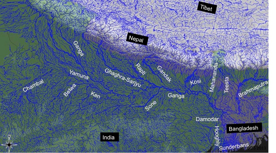
Strangely, instead of accepting this reality and taking this into account in decision making processes, Central Water Commission and Central Electricity Authority are in a denial mode! They collectively submitted a completely unscientific and unfounded report to Union Environment & Forests Ministry, advocating for hydropower projects rather than assessing their role in disaster, which was the mandate given by Supreme Court of India to MoEF. The CEA is clearly jeopardizing whatever credibility it has in joining hands with CWC. It would be better for both the agencies to accept and wake up to these realities.
Else, such onslaught of hydropower projects on Himalayas is likely to be an invitation to further disasters all across the Himalayas. All our decision makers and all others concerned need to take note of this urgently.
[4] In reality, this should be “below”, we have italicized the word since the error is in the original.
[5] Ending on March 31, 2017
[6] CEA projects that out of 2000 MW installed capacity of Lower Subansiri HEP in Arunachal Pradesh, 1000 MW will be commissioned in 12th Plan and the rest of 1000 MW thereafter.
In late April and early May 2012, what was usually a roaring Seti river in Northwestern Nepal had slowed to a trickle. The milky-white turbid water had turned blue and clear. And then suddenly on May 5, 2012, the flooded river laden with slurry of sediment, rock, and water surged through the Seti valley in the Kaski district, obliterating dozens of homes and sweeping 72 people to their deaths. The floods waters were upto 30 m high at places. It reminded of the sequence of events leading to Tsunami. Questions swirled about where the water had come from and how it arrived with so little warning and that too in a non-monsoon season.
NASA Earth Observatory (acquired October 7, 2013)
The abstract of the paper by Shreekamal Dwivedi and Yojana Neupane of Department of Water Induced Disaster Prevention of Government of Nepal (presented in a conference in Nov 2012 and published in Nepal Geological Society (2013, Vol. 46)) provided some details of what happened in the floods: “Comparative Analysis of the Landsat ETM satellite images of 20th April, 2012 and 6th May, 2012 revealed that the area of about 32000 square meter of the southern ridge 1.5 kilometer away from the Annapurna IV peak failed in the north western direction. The impact of descending mass of the failed mountain from 6850 meters to 4500 meters almost vertically pulverized the ice, sediment and rock. The impact even triggered seismicity at 9:09.56 AM. local time which was recorded all over the 21 stations of National Seismological Centre. The closest seismic station at Dansing which is 32 km. south west from the area recorded the high signals for 70 minutes which corresponds to the duration of the debris flow. (The seismicity was equivalent to magnitude 3.8-4 in Richter Scale.) Lab analysis of the flood water sample revealed the density of the flow as 1.88 gm/cc. Analysis of the satellite based hourly rainfall GSMaP NRT from the period form 20th April -6th May 2012 revealed that there were just 4 occurrences of rainfall which amounted less than 1 mm/hour in the source area of the avalanche. The rainfall > 6mm/hour which occurred in the Kharapani area on 4 May was localized rainfall which did not extend to the avalanche area. Lack of systematic disaster preparedness caused huge loss of life and property even though the early warning message was received from the Ultralight pilot who was flying close to the area. The avalanche triggered high intensity floods which have similar characteristics to glacier lake outburst floods (GLOFs) have emerged as a new hazard in the Himalaya.”
Now, twenty months after the disaster, experts like Dr Jeffrey Kargel, hydrologist at University of Arizona, are in a position to throw more light what happened. Dr. Kargel has concluded that it was not just one event but a series of event that combined to produce the devastation.
NASA Earth Observatory site describes the affected landscape as: “The landscape in this part of Nepal is shaped by a cycle of landslides and subsequent erosion. As the tectonic collision of India with Asia pushes the Himalaya upward, ice, water, and gravity, assisted by sporadic earthquakes, combine to grind the mountains down. The channel of the SetiRiver itself is cut into the remnants of a much larger debris flow, perhaps 1,000 times as big. 60 to 100 meters (200–330 feet) thick, the landslide deposits are composed of the same limestone as the peaks to the north. Likewise, the May 2012 flow left behind jagged fragments of limestone, carried from the crest of the Himalaya to the foothills in a single event.”
‘Seti’ in local languages means white, and Seti is the ‘White River’, its water is glacial white, turbid and laden with sediment.
The high intensity floods in May 2012 came in waves, and the first wave alone had around a quarter of a million cubic meters of water in just a few minutes. There were about 27 waves in all over the next hours, according to eyewitnesses, so several million cubic meters of water flowed overall. As Dwivedi et al note, “The huge mass of debris along with ice chunks rushed down the river as a debris flow for 20 kilometres downstream at Kharapani in just 28 minutes (almost 12 meters/second). The flood arrived at Kharapani, where most of casualties occurred, at 9:38 AM and reached the dam of the Seti irrigation system at 10:35 AM… The high-water level at the dam weir at Pokhara was 2.15 meters. The discharge estimation based on the water mark revealed the peak as 935 m3/s (B. Poudel, personal communication). The eye-witnesses in Kharapani area reported huge ice blocks floating in the flood. They felt vibrating ground and heard very loud sound similar to flying of several helicopter together. The smell of the flood water was muddy… Kharapani was a popular spot for picnic and natural hot spring bath… Most of the causalities occurred in this area as the warning message from the Pokhara Airport tower could not reach this area”.
It is heart warming to see that many lives were saved, as Dwivedi et all write, “Capt. Alexander Maximov, the pilot of ultra-light plane of Avia Club Nepal in the morning of May 5 was in a regular sightseeing flight close to the Mountain Machhapuchhre. He noticed a huge dark cloud in the high-mountain depression (Fig. 9) and immediately turned back. He sent a message to the tower of Pokhara Airport. His quick understanding of the unusual event and timely response has saved hundreds of lives during the Seti flood of 5th May 2012. He informed the tower at 9:16 AM and the message was broadcasted through FM radio; police forces evacuated hundreds of people living and working in the bank of the Seti River. Some eye- witnesses in the field said that information about the flood was also received in Kharapani bazar by mobile calls from the people who saw the flooding in the upstream area. This message has helped many people to run to safety. However there was no organized approach of the warning dissemination in the ground.”
Video shot by Capt. Maximov from his aircraft, as the event was was happening:
NASA Earth Observatory image (acquired Dec 22 2013)
However, the series of event started weeks before the flood with a series of rockfalls that sent debris tumbling into the SetiRiver, backing water up in the extremely deep and narrow gorge. The last of these landslides occurred just a week or so before the flood. The situation grew dire on May 5, 2012, when an unusually powerful ice avalanche and rockfall tumbled down a vertical cliff on a ridge just south of Annapurna IV Mountain peak. The total drop from the Annapurna IV ridgeline to the bed of the Seti below Pokhara is about 6,100 meters (20,000 feet) spread over a distance of only 40 kilometers. The distance between the landslide dam and sight of worst floods was about 29 km.
Prof Jeffrey Kargel, writes (http://earthobservatory.nasa.gov/blogs/fromthefield/2014/01/24/setiriverclues/), “A flash flood—what geologists call a hyper concentrated slurry because it was thick with suspended silt—had torn through some villages along the Seti River, in north-central Nepal, just north of the country’s second largest city, Pokhara. It was immediately recognized as a very deadly event, but the death toll—and a tally of those who remain missing but were clearly also killed—was not known exactly for several months. 72 souls lost. Though not large on the scale of global disasters, this event was terrifying for the fact that it seemed to come from nowhere—literally from beneath a blue sky.”
AFTER IMAGE: shows the area on May 6, 2012, roughly 25 hours after the landslide
BEFORE IMAGE: the same area on April 20. The diagonal lines are gaps in the data, due to a partial failure of the satellite.
One scenario (see: http://earthobservatory.nasa.gov/IOTD/view.php?id=78070&eocn=image&eoci=related_image) estimates that roughly 22 million cubic meters of rock broke off the slope of Annapurna IV. Colin Stark at Lamont-Doherty Earth Observatory at ColumbiaUniversity said: “There’s a drop of about 2,000 meters into the canyon, so we’re talking an enormous gain in momentum. Then I think the debris ran down the canyon at speeds upwards of 30 meters per second—a guess but what we see for the landslide itself.” Stark estimated that events unfolded in a matter of minutes with no time for a temporary dam to form.
This flood appeared to behave like a glacier lake outburst flood, and the news media can be pardoned for having assumed that it was. Prof Kargel adds: “Seeing that the disaster occurred at the foot of the AnnapurnaRange, within the Greater Himalaya, probably every expert’s first thought was “glacial lake outburst flood” (GLOF), because these were common in Nepal’s Himalaya, and the news accounts of the disaster event resembled accounts of GLOFs”. However, available satellite images showed there were no such lakes. “It was, however, clearly a disaster that had its source in a high Himalayan amphitheatre-like bowl, a glacially-carved structure called the Sabche Cirque. This structure was rimmed by some of Nepal’s most famous, picturesque mountain peaks, including the storied, holy Machapuchare ( “fishtail” peak) & Annapurna IV, a 24,688 ft” mountain.
Annotated photo from Dr. Kargel
Thanks to video from winged camera of a 2 seater plane incidentally flying over the area at the time of the event, the disaster’s trigger was sourced on a ridgeline near Annapurna IV. Apparently part of this ridge—probably initially the glacier ice— collapsed, dropping ice and rock over 3000 m almost vertically onto unconsolidated rock debris (glacial moraines and ancient glacial lake silts and gravels) resting unstably in the deep bowl of the Sabche Cirque. Some of that loose debris was also swept up by the avalanche, and the mass flowed and dropped through an additional 1,500 m into the SetiRiver gorge. Indeed, the conversion of gravitational potential energy to heat could have melted roughly a tenth of the falling snow and ice by the time it reached the SetiRiver.
A view of the gorges and also the distant peaks of the Sabche Cirque and the ancient glacial deposits in between. The avalanche entered the gorge from the upper right corner of the scene. (Photo: Dr. Kargel)
One source seemed to be definitely involved, and that was a rockslide-dammed reservoir in the gorge. This was definitely not a GLOF, but was caused by a rockslide into the SetiRiver gorge, formation of an impoundment reservoir over a several week period due to damming of spring snow and ice melt, and then the final triggering event of the mighty rock and ice avalanche off Annapurna IV.
The source area for the avalanche of May 5, 2012. Annapurna IV is just off image to the upper left. (Photo: Dr. Kargel)
Warning: More such events could occur As Dwivedi et al have noted, “The southern slopes of Annapurna range have been experiencing avalanche-triggered high intensity floods also in the past. On August 15, 2003, the Madi River had experienced an unprecedented flash flood which destroyed the recently built rural road and triggered many landslides along its course and killed 5 people”.
“There are good reasons to be concerned,” Jeffrey says, “Something like this will happen again. It’s inevitable.” The Seti River Gorge is unusually prone to dangerous blockages because of how narrow and deep it is. And the same processes that triggered the spring 2012 rockfalls and avalanche are still at work. “The only question is whether future events will be as destructive or whether people in the SetiRiverValley will have absorbed the lessons of 2012 and found ways to move their homes out of the flood plain.” India should not forget that we are downstream country in Seti basin and what happens there will flow down here too.
In an earlier excellent paper on this event, Jorg Hanisch et al recommends that this event requires deep investigations and “Marsyangdi Khola, Madi Khola, Modi Khola and Kali Gandaki, all with apparent origin in the high-mountain environment of Annapurna Range (Hormann 1974; Yamanaka and Iwata 1982) should be included in the investigations… A new catastrophe of similar size would have an apocalyptic impact: about half a million people live in the valley today. A detailed investigation of the circumstances of the disaster on May 5th, especially the possible influence of global warming on the trigger of the disaster, and a reliable forecast of a potential recurrence of similar events or of even much greater scope, are urgently required. For this, the thorough understanding of the conditions, triggers and mechanisms of the huge flows in the past to compare it with the recent flood is indispensable as well.”
The proposal for a 140 MW Tanahu Seti storage project downstream of this flood event & supported by the Asian Development Bank, Japan International Cooperation Agency, European Investment Bank and Abu Dhabi Fund is questionable, says Ratan Bhandari of Nepal. Considering that the Seti River Basin is prone to such events in future, the proposal seems disastrous.
More significantly, this whole episode raises the question as to how much do we really know about the Himalayas. Uttarakhand disaster of June 2013 was a wake up call to understand the Himalayan ecosystem and its implications for future well being of the people and environment of India. However, in stead of learning any lessons, our governments in Uttarakhand (as also in Himachal Pradesh, Kashmir and North East) and at the Centre, with environmentally-challenged Mr Veerappa Moily as the environment minister, are playing into the hands of short sighted vested interests. This is also apparent in the recent decision to sanction the massive Lakhwar dam on YamunaRiver in Uttarakhand without so much as an Environmental Impact Assessment!
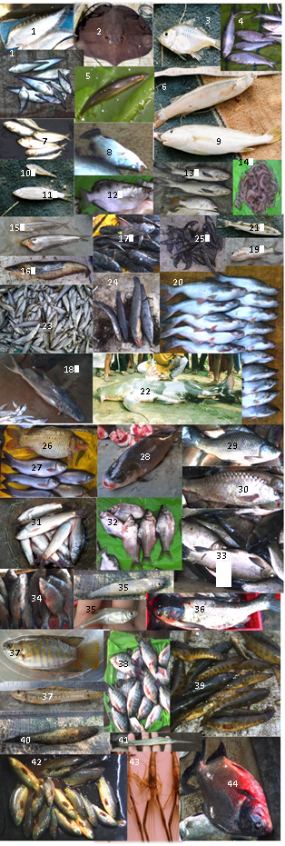
We still do not have full explanation for the Uttarakhand disaster of June 2013. This explanation of the Seti River Disaster in the same Himalayas, which happened just a year before the Uttarakhand disaster highlights the urgent need for more serious studies and applying precautionary principle while dealing with the Himalayas, its rivers and flood plains.
2. http://earthobservatory.nasa.gov/blogs/fromthefield/2014/01/24/setiriverclues/ This entry was posted on Friday, January 24th, 2014 at 10:34 am. See the absolutely amazing photos on the site that gives an insight into the situation in the head reaches of Seti River… possibly indicates how little we know about the catchments of our Himalayan Rivers.
7. “Cause and mechanism of the Seti River flood, 5th May 2012, western Nepal” by Shreekamal Dwivedi and Yojana Neupane, Department of Water Induced Disaster Prevention, Pulchwok, Lalitpur, Nepal (shreekamal @gmail.com), published in Journal of Nepal Geological Society, 2013, Vol. 46, pp. 11-18
8. Famous movie clip of the area, http://www.youtube.com/watch?v=Uk82ggshSKs&feature=related you can see landslide in the clip at 56-57 seconds of the movie. At this time the avalanche had not occurred yet. After taking one round the aircraft pilot has noticed the dark grey brown cloud formed by the avalanche (see the movie at 2 minute 7 seconds). This is thanks to Shreekamal Dwivedi
9. “The Pokhara May 5th fl ood disaster: A last warning sign sent by nature?” by Jörg Hanisch, Achyuata Koirala and Netra P. Bhandary, Journal of Nepal Geological Society, 2013, Vol. 46, pp. 1-10