Cumulative Impact Assessment · Dams · Hydropower · Ministry of Environment and Forests

Upper Ganga Report with Pro Hydro Bias does not do justice to its terms or to Ganga, people or environment

Summary A month after its submission to the Union Ministry of Environment and Forests, the Inter Ministerial Group on Upper Ganga basin Hydropower projects and Ganga river in general is yet to be put in public domain. A detailed perusal of the report shows that the report is hugely biased in favour of large hydropower projects, and has not done justice to the task given to it or to the Ganga river, people or environment. Out of the three non government members (out of total 15 members) on the Group, Dr Veer Bhadra Mishra expired during the working of the group. Rajendra Singh has given a dissent note, not agreeing with the report in its totality. The “alternative view” note from Sunita Narain, the third non-government member, is not much of an alternative and is not in the interest of the river, people or the environment. However, the fact that none of the non-government members have endorsed the report speaks volumes about the credibility of the report.

utc20b-A4

The recommendations of the IMG report are an exercise largely in supporting the interests of hydropower lobby in the name of balancing the power & development needs of the region and local people. The IMG has actually attempted to make 69 large hydropower projects in the Upper Ganga basin a fait accomplice when only 17 of them are under operation and 14 are under construction. In many cases IMG has reached unscientific and unfounded conclusions. Some of the recommendations are also contradictory in some fundamental nature. In many cases IMG has made statements, and implied recommendations that are bad in law. In general, the report shows that IMG has poor understanding of the science of the rivers. Even where the IMG has sought to make some seemingly environment friendly recommendations, it is generally not serious about these recommendations.

A broad conclusion is inescapable that the IMG report (except the dissent note by Shri Rajendra Singh) is largely an exercise in deception, with a pro-hydropower bias. While this note points out key negative aspects of the IMG report, the IMG report is not without some positive aspects. The report gives a list of positive aspects of the IMG report on which there is a lot of scope for positive action, which the MoEF should initiate, while rejecting the report.

FULL TEXT

1. The Inter Ministerial Group (constituted by the Union Ministry of Environment and Forests through an order issued on June 15, 2012) report has been submitted around April 22, 2013, but it is still not in public domain a month later. The report should have been promptly put in public domain as in the case of the HLWG report on WGEEP panel recommendation on the Western Ghats, which was made public the day after the submission of the report to MoEF. These comments[1] are based on the hard copy of the final report made available by a colleague[2].

2. The IMG final report has been endorsed by all members, except the dissent note by Rajendra Singh attached at Annexure X and a note on “alternate approach” from Sunita Narain, attached at Annexure XI. Shri Veer Bhadra Mishra, who was the third non-government member, expired during the period of functioning of the IMG group. The committee constitution was heavily loaded in favour of the government officers (ten of the fifteen members were government officials), so its independence was already in doubt. With none of the non-government members endorsing the report, the report has little credibility. This review tries to look at the report with an open mind.

3. While SANDRP as a group is critical of large, destructive and non participatory hydropower projects, it does not mean the group is against all hydropower projects. For example, if the projects were to be set up through a participatory and informed, decentralized, bottom up decision making process or if projects were to follow the recommendations of World Commission on Dams, such projects would certainly have greater public acceptance. That is not the case for any of the projects today.

4. The main TOR given to the IMG was to decide the quantum of environment flows for the upper Ganga basin rivers, keeping in mind the IIT (Indian Institute of Technology Roorkee, the report was basically from some individual of Alternate Hydro Electric Centre of IIT-R) and WII (Wildlife Institute of India) reports on cumulative impact assessment of the projects in these river basins. However, IIT (Roorkee) report has been found to be so flawed and compromised (for details see: http://www.sandrp.in/hydropower/Pathetic_Cumulative_Impact_Assessment_of_Ganga_Hydro_projects.pdf) that it should have been rejected by the MoEF and the NGRBA. Even the MoEF’s Expert Appraisal Committee on River Valley Projects has been critical of the IIT-R report. However, since a member of the IIT-R was present on the IMG, it may not have been possible for the IMG to take an objective view of the merits of IIT-R report. It is however, welcome that IMG has relied on WII rather than IIT-R report while accepting recommendations on e-flows. WII report was better in some respects, though still suffering from some basic infirmities. Moreover, to set up an IMG to decide on the course of action considering these two reports (and any other relevant reports) was compromised at the outset and was an invitation for further dilution of the environment norms, considering the track record of the most of the members of IMG.

ChillaChannel

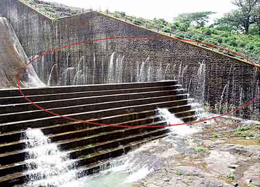
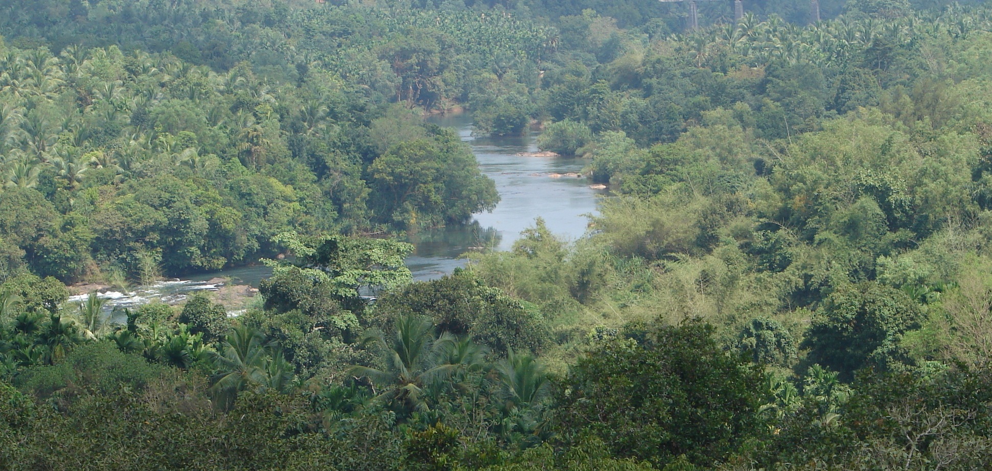
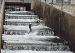
Ganga river flowing through a channel, diverted for the 144 MW Chilla hydropower project

5. The recommendations of the IMG report are an exercise largely in supporting the interests of hydropower lobby in the name of balancing the power & development needs of the region and local people. The IMG has actually attempted to make 69 large hydropower projects in the Upper Ganga basin a fait accomplice when only 17 of them are under operation and 14 are under construction. In many cases IMG has reached unscientific and unfounded conclusions. Some of the recommendations are also contradictory in some fundamental nature. In many cases IMG has made statements, and implied recommendations that are bad in law. In general, the report shows that IMG has poor understanding of the science of the rivers. Even

where the IMG has sought to make some seemingly environment friendly recommendations, it is generally not serious about these recommendations. All of these points are further elaborated in this note.

6. Cancelled projects  & those on Bhagirathi Eco Sensitive Zone shown as under development Shockingly, even the projects like the Loharinag Pala, Pala Maneri and Bhairon Ghati that have been officially dropped are shown as under development by the IMG, see Annex VID! In fact in Table 12 and 13 IMG even calculates the reduction in power generation and increase in tariff at Loharinag Pala (among others) if the IMG recommended e-flows are implemented! The 140 MW Karmoli HEP on Bhagirathi, on a stretch that the MoEF has been declared as Eco Sensitive Zone, and on which the GOI has said no large hydro will be taken up, the IMG has actually suggested that the project can be taken up! The 50 MW Jadhganga project, very close to the Gangotri, is shown to be project under development by the IMG! These examples show how the IMG has played a role of supporter of the hydropower lobby.

7. Wrong classification of projects as under construction and under clearance projects IMG has divided the 69 hydropower projects in Upper Ganga basin (leaving our the Kotli Bhel 2, since it is on Ganga river and not on Bhagirathi or Alaknanda) in four categorie

s: Operating projects, under construction projects, under clearance projects and under development projects. It is here that IMG has done its biggest manipulation by classifying a number of projects as under construction when they are not and cannot be under construction. IMG classification of projects under clearances is equally problematic. IMG and even the “alternative View” by Sunita Narian says all these projects in first three categories can go ahead without any change, except the e-flows recommendations. This manipulation shows the stark pro hydro-bias of the IMG.

DryGangaChilla

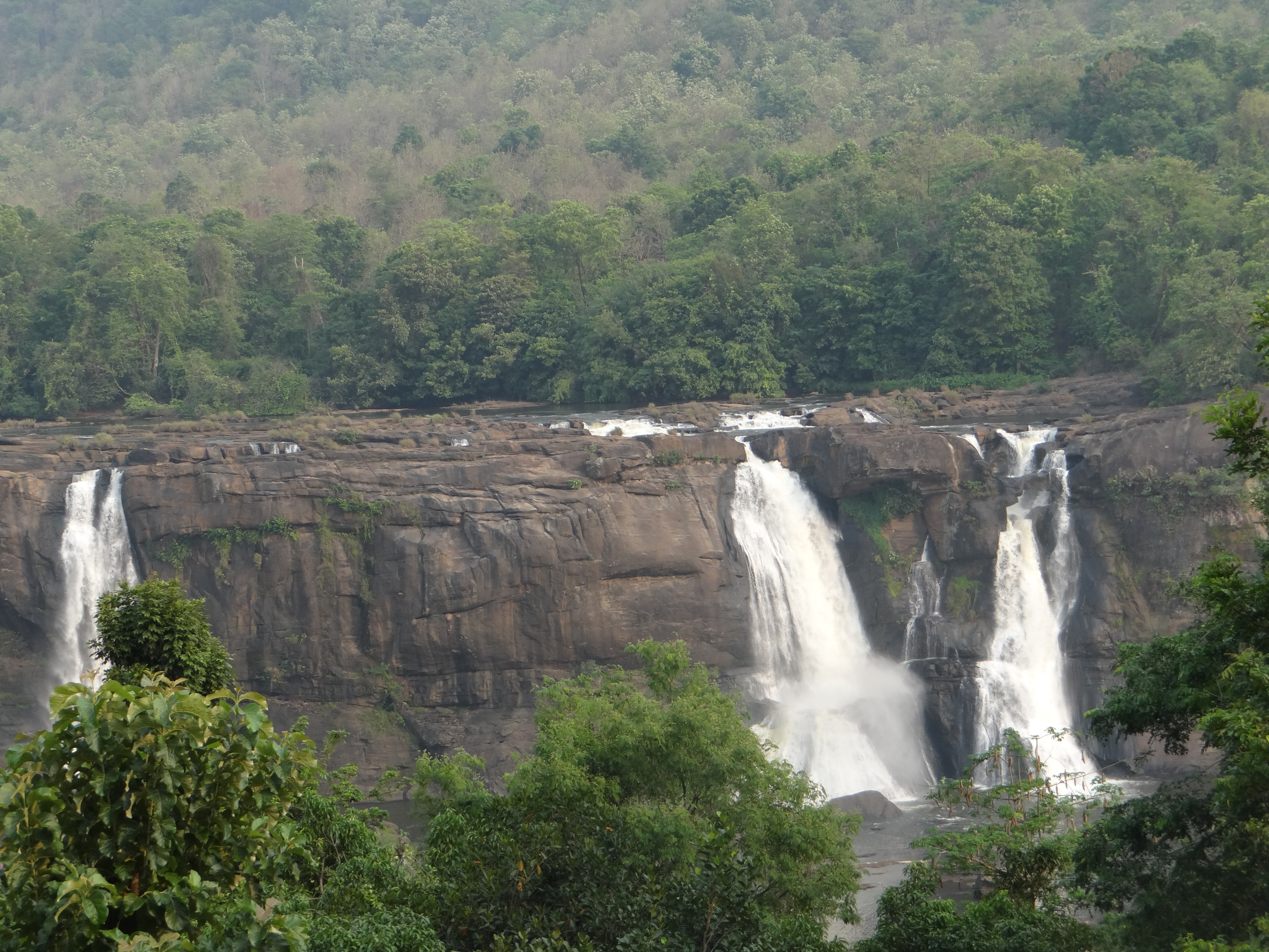
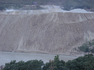
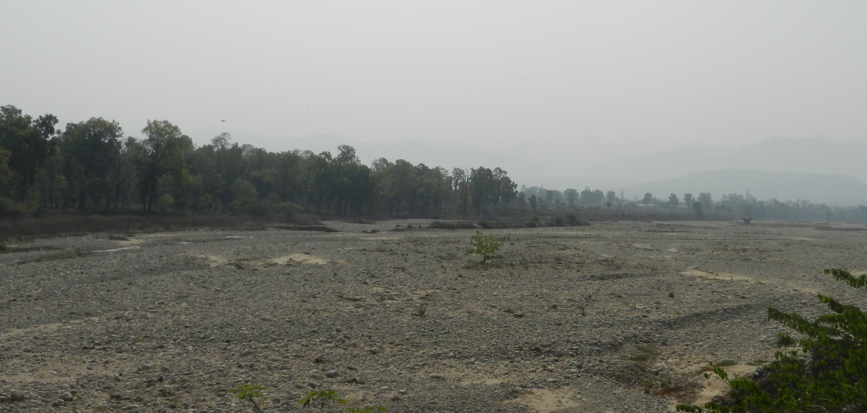
Dry Ganga river after the river is diverted for Chilla HEP. Photos by SANDRP

8. Manipulations about percentage length of river that the projects can destroy On the one hand, the IMG has recommended that “projects may be implemented so that not more then 60% of the length (of the river) may be affected.” There is no mention how they have arrived at this magic figure of 60%, what is the basis or science behind that magic figure. At the same time the IMG has said that if all the 69 projects were to be implemented than 81% of Bhagirathi and 65% of Alaknanda will be affected. Firstly these numbers are not correct if we taken into account the full length of the reservoirs and the bypassed river lengths by the hydro projects, in many cases the length of the submerged reservoir behind the dam has not been counted. Here we need to add the fact that the reservoir of the 70th Project on its list, the Kotlibhel 2 project will submerge parts of both Bhagirathi and Alaknanda rivers, which has also not been counted by the IMG. WII had to recommend 24 projects to be dropped, and even after that, WII assessed that 62.7% of the rivers would still be affected. However, the IMG has made no recommendation as to which of the projects need to be dropped (except vague review of the projects in Annex VI-D) to achieve that magic figure of 60%. This again shows how non serious IMG is, making this recommendation meaningless.


9. IMG double talk on distance criteria The IMG has said that “There is a clear need to ensure that adequate river length is available to meet the societal needs and River gets adequate time during its flow to regenerate itself” (emphasis added). This sounds good. But IMG has shown no will or interest in ensuring that this happens. In fact IMG exposes its understanding on this matter when it says, “the distance between two hydro projects should generally be such as to ensure that over-crowding is avoided”. What is over-crowding, how do you define it? This is a funny word IMG has used, not even bothering to define it. However, when it comes to implementation, dumping all these requirements, IMG has justified smaller distance (read zero distance) between projects where gradient is high. Now let us understand this: where gradient is high, if the distance left between the projects is less, will the time the river flows between projects be smaller or greater than if the gradient is low? Clearly, if gradient is high, for the same distance, the river will have less time to travel then if the gradient were low. It is in fact the time of free flow that is a crucial driving parameter for river to regenerate itself. So if the river were to have the same amount of time to flow between two points, with higher gradient, river will require more distance, not less. This again exposes the poor understanding of IMG members about science of the rivers.

The IMG even goes on to say that “distance will have to be smaller in view of technical requirement of the hydro power. This could result in continuity in some cases.” Firstly it is clear here again that IMG is basically catering to the hydropower lobby, it is completely non serious about the environmental issues. That is why after all those great sentences, it goes on to say that it is the technical requirement of the hydropower project that will be the decider! If technical requirements means no distance between two projects, then river can disappear, environmental issues do not matter! In case of many projects where the distance of free flowing river between projects is very little or nil and where the construction has not started or has not progressed much, there is today scope for change. For example in case of Vishnudgad Pipalkoti HEP on Alaknanda: the Full Reservoir Level of the VPHEP is same as the Tail Water Level of the upstream Tapovan Vishnugad HEP. This means that there is zero length of free flowing river between the projects. VPHEP does not have all the clearances and its construction has not started. Even for the upstream Tapovan Vishnugad HEP, the construction has not gone far enough and there is scope for change in both projects to ensure that there is sufficient length of free flowing river between the projects. IMG should have recommended change in parameters in this and other such cases, but it has done no such thing, it has shown no interest in any such matter! Even the “alternative approach” note in Annexure XI has not bothered to recommend such changes even while recommending 3-5 km free flowing river between two projects.

The IMG makes another unscientific statement in this context when it says, “With the recommendation of IMG for environment flow which will be available and which would have traveled throughout the diverted stretch, any significant gaps and large distance may not be required.” This is an unscientific, unfounded statement. Firstly where is the evidence that the environment flows that IMG has suggested would take care of the need for river to flow on stretches between the projects? Secondly, the need for river to flow between the projects to rejuvenate itself will also depend on the length of the rivers submerged by the reservoirs, and also depend on the biodiversity, the social, cultural and religious needs in addition to the ecological needs. By making such ad hoc unfounded statements devoid of scientific merit, the IMG has exposed itself.

While the IMG talks about the rich diversity of fish species and other aquatic diversity of the river, it has no qualms in saying that e-flows alone will address all the problems caused by bumper to bumper projects. As many including Government of India’s CIFRI (Central Inland Fisheries Research Institute) have concluded, Dams have been the primary reason for the collapse of aquatic diversity in India, not only because of the hydrological modifications and lack of e-flows, but also because of the obstruction to migration they cause, destruction of habitat during construction, muck disposal, trapping of sediments, destruction of terrestrial (especially riparian) habitats. But these concerns are not even considered by the IMG while saying that recommended e-flows will be able to solve all problems caused by bumper to bumper projects.

Dry Bhagirathi downstream Maneri bhali HEP Photo: Peoples science Institute

10. WII recommendation of dropping 24 HEPs rejected by IMG without any reason The IMG notes that WII has recommended that 24 hydropower projects of 2608 MW installed capacity should be dropped in view of the high aquatic and terrestrial biodiversity. However, IMG decides to dump this WII recommendation without assigning any reasons. This again shows the strong pro hydro bias of the IMG. WII report says that even after dropping these 24 projects, at least 62% of the river will be destroyed.

It is shocking that projects like Kotlibhel 1B and Alaknanda HEP, which have been rejected by WII and Forest Advisory Committee, is considered as “under development” by IMG, when they should have been rejected. While the IMG Report talks of unique biodiversity of the Ganga Basin, Valley of Flowers and Nanda Devi National Parks, it still supports projects which will be affecting these National Parks like the 300 MW Alakananda GMR HEP, which was also rejected by the WII and FAC (twice).

As a matter of fact, of the 24 projects that WII report recommended to be dropped, the IMG has shown 8 as under construction and 4 as “projects with EC/FC clearances”. This is sheer manipulation, in an attempt to make them a fait accomplice. Strangely, the “alternative approach” note in Annexure XI does not say anything about this manipulations and in fact says the projects in Annexure VI-B and VI-C can go ahead!

11. Non serious recommendation about keeping six tributaries in pristine state IMG (Para 3.70) “recommends that six rivers, including Nayar, Bal Ganga, Rishi Ganga, Assi Ganga, Dhauli Ganga (upper reaches), Birahi Ganga and Bhyunder Ganga should be kept in pristine form and developments along with measures for environment up gradation should be taken up. No new power projects should be taken up in these River Basins.” This sounds good, but turns out to be like a joke, since firstly, IMG recommends construction of projects on these rivers that yet to be constructed! If these rivers are to be kept in pristine state then IMG should have asked for immediate stoppage of under construction projects and also time bound decommissioning of the operating projects on each of these rivers. In stead, the IMG report shows that projects are under construction on rivers like Assi Ganga (stage I and stage II projects each of 4.5 MW), Birahi Ganga (24 MW stage I project), Bal Ganga (7 MW stage II project listed in Annex VI B of IMG report, in addition to the 1 MW Balganga and 5 MW Balganga I project are also under construction as per IIT Roorkee report) and Bhyunder Ganga (24.3 MW stage II project) and IMG has (implicitly) recommended that these projects be allowed to continue, on rivers that IMG says it wants to remain pristine! Moreover, Rishi Ganga (13.2 MW project) and Birahi Ganga (7.2 MW) have operating projects on these rivers to be kept pristine! In addition, on Assi Ganga the 9 MW stage III project, is considered by the IMG as ready for development since it has some of the clearances.

Rishiganga HEP Photo: Ashish Kothari, Courtesy The Hindu

The IMG has noted that 70 MW Rishi Ganga Stage-1 and 35 MW Stage II Project are under development on Rishi Ganga (IIT-R report mentioned another project on Rishi Ganga, namely the 60 MW Deodi project, it is called Dewali project by WII report; WII report also mentions 1.25 MW Badrinath II existing project on Rishi Ganga) and 24 MW Birahi Ganga-II project is under development. But the IMG does not recommend dropping of these projects.

So at least five of the six rivers that the IMG claims it wants to stay in pristine state are no longer pristine! They have multiple projects, most of them under construction or yet to be developed and the IMG has not said that any or all of these projects should be stopped, cancelled and those under operation be decommissioned in time bound manner. Even on Nayar, the sixth small tributary that IMG said should be kept in pristine condition has a 1.5 MW Dunao project under development by UJVNL, as per the UJVNL website. It’s clear how non serious IMG is about its own recommendation. IMG has included Dhauli Ganga (upper reaches) in this recommendation, but has not even bothered to define which stretch of the Dhauli Ganga this applies to, again showing the non-seriousness of IMG.

In para 4.22 IMG says, “Specifically, it is proposed that (a) Nayar River and the Ganges stretch between Devprayag and Rishikesh and (b)… may be declared as Fish Conservation Reserve as these two stretches are comparatively less disturbed and have critically important habitats for long-term survival of Himalayan fishes basin.” If IMG were serious about this, they would have also said that Kotli Bhel II project should be cancelled since it is to come in this very stretch.

IMG’s claim that not having any more projects on these six streams will mean loss of generating capacity 400 MW is also not backed by any sort of information or list of projects to be dropped, it seems IMG is in the habit of making such claims and does not feel the need to back them.

12. IMG on environmental impacts of Hydropower projects One of the key TORs given to IMG was “to make a review of the environmental impacts of projects that are proposed on Bhagirathi, Alaknanda and other tributaries of river Ganga and recommend necessary remedial action.” What has the IMG done about this TOR? IMG wrongly claims (Para 4.18), “The environment impact of proposed 69 hydropower projects has been considered by IMG.” It has done absolutely no justice to this very crucial TOR. First thing IMG has done in this regard is to dump the WII recommendation to cancel 24 hydropower projects, without giving any justifiable reasons. The IMG has produced a set of guidelines for the hydropower projects, which have almost nothing new, they are certainly not comprehensive or legally binding. They miss the most important issues of inadequate environment impact assessment, inadequate public consultation process, inadequate appraisal, lack of accountable governance and compliance.

What is required is certainly not new set of guidelines. MoEF already has a long list of environment and forest clearance conditions, environment management plans and manuals. But there is no interest, will or willingness to achieve compliance in MoEF. IMG is obviously aware of this state of affairs. Yet they have happily prepared a new set of five page guidelines just to show they have done something about this TOR. The “alternative approach” in Annex XI also has nothing to offer on this score.

Muck Disposal directly into the Alaknanda river by Srinagar Project Photo: Matu janSangathan

13. Unwarranted conclusion about BBM methodology The IMG has said, “Considering environment, societal, religious needs of the community and also taking into account the status of river Ganga as national river, the IMG recommends adoption of Building Block Methodology (BBM) for assessing the e-flow requirement”. This is good and needs immediate and credible implementation.

However, IMG says this will be applicable only “in situation where the required conditions are satisfied and resources, time and data are available.” The only basis for this conclusion by IMG is the fact that WWF took three years to do a study of environment flow requirements of three sites along Ganga involving large number of experts. This is clearly an unwarranted conclusion since WWF was only doing it first time and has much less resources at its disposal than the government have. By arriving at this unjustified conclusion that has no basis, the IMG implies is that BBM methodology is required and is justified, but Indian rivers including the Ganga won’t get it since IMG (wrongly) thinks that “required conditions” are not satisfied. This is clearly wrong and unwarranted conclusion. The BBM can and must be applied in all cases immediately, including for all existing and under construction projects and cumulative impact assessments.

Also, while stating multiple times that BBM for three locations for Ganga took three years, the IMG does not go into the details of what caused this delay. One of the important reasons stated by WWF itself is that required data was not made available to them, which contributed to the delay. So it is the government itself that was part of the reason for the delay in WWF study, and now IMG uses that delay to suggest that BBM is not practicable for Ganga! If the Government has the will to implement a more holistic methodology like BBM, it can be done and IMG conclusion is unwarranted and wrong.

14. Unjustified pro hydro bias of the IMG The IMG has shown its pro hydro bias at several places. At one place it says that a balanced approach needs to be taken as “It is important to see that the flows do not result in exorbitant cost of power which the people of the region may not be able to afford. This would make these power projects uneconomic and un-implementable”. Firstly, as far as people in immediate neighbourhood of the projects are concerned, history of grid connected hydropower projects in India shows that local and particularly the affected people almost never get power benefits from projects but they surely suffer all the negative impacts. IMG is wrong as far as this section of the people is concerned.

Secondly as far as the people of Uttarakhand in general are concerned, where all the projects in Upper Ganga basin are situated, the state would get 12+1 % of free power. Since most of the projects are in central or private sectors, the rest of the electricity would mostly go outside the state. As far as this 13% free power is concerned, since it is supposed to be free, there will be no impact of e-flows on the tariff of such projects, except some marginal reduction in quantum of power.

Lastly, is it the bottom line of the IMG that projects must be economic and implemented at all costs, by hook or by crook, as is apparent from the above quoted sentence? How can that be the bottom line of IMG considering its TORs? Moreover, by making the projects economic and implementable by hook or by crook, the IMG seems to be saying that irrespective of the social, environmental, cultural, religious and even economic costs, the projects must go on. Thus what IMG is suggesting is that artificially low cost electricity must be produced for the cities and industries irrespective of any concerns of costs and impacts on people, environment, future generations and rivers including the national river! This is clearly a plea to export the water, livelihood and environment security of the people for the short term economic prosperity of far off city dwellers and industrialists. Is this acceptable?

15. What is environment flow? IMG should have provided a definition of what is meant by river and environment flow. Since it is linked with enabling the river to perform its various roles and services in the downstream area, it cannot be just limited to water flow downstream. The downstream river also needs silt and nutrition from the upstream and the biodiversity and geomorphology in the river crucially depends on such flows of nutrition and silt. However, IMG has said nothing on this count.

Dry River at Uttarkashi Photo: Open Magazine

16. Environment flows = aviraldhara? The IMG has said, “Environment flows in the river must lead to a continuous availability of water (aviraldhara) in the river for societal and religious needs.” This equation of aviral river with continuous flow of water is clearly flawed, since by that token even a pipeline has aviraldhara, but a pipeline is not the same as aviral River. For a river to be flowing aviral, continuous flow of water is a necessary but not a sufficient condition. A river means so much more.

17. No attempt at assessment of social, religious, cultural needs The IMG keeps talking about social, religious and cultural perspective and needs of the society from the river and so on. However, there has been no attempt to assess what exactly this means in terms of river flow, quality, content of flow across the time and space. More importantly, how is all this to be decided and who all are to be involved in the process. IMG just assumed that this has already been done by IITR and WII, which is flawed assumption, since WII or IIT-R has clearly not done any such assessment. So in stead of giving standard monthly flow release percentage across the rivers (releases to vary based on daily flow variations, this recommendation of daily changing flow is certainly an improvement from IMG), IMG should have asked for actual assessment of such needs across the rivers and IMG should also have given the process for arriving at such decisions. But while deciding social, religious or cultural needs, the IMG sees no role for the society, religious groups or cultural institutions.

In this context it may be added that the IMG has also not taken note of the legal stipulations like the order of the Allahabad High Court that says that no project can divert more than 50% of river flows existing at the point of diversion.

DevPrayag: Confluence of Alaknanda and bhagirathi Threatened by Kotli Bhel I A, IB and II Projects. Photo: Wikimedia

18. IMG recommendation during High Flow Season (May-Sept) The IMG has recommended 25% of daily uninterrupted (no clear definition is given how this will be arrived at) flow, with the stipulation that the total inflow in the river would not be less than 30% of the season flows. This is same as 30% of mean seasonal releases recommended by WII (para 8.3 of WII report, para 4.11 of IMG report) and also used by even Expert Appraisal Committee on River Valley Projects currently. The recommendation of releases based on daily flow is an improvement compared to the earlier situation, but its implementation is in serious doubt considering the weak compliance requirements from IMG.

It should be added here that IMG has not mentioned how the environment flow will be released. Just dropping it from the top of the dam won’t help, the flow must be allowed to flow downstream in an environmentally sound manner that is as close as possible to the flow of the river and helpful for the biodiversity in the river to link up from downstream to upstream and vice versa. Moreover, while deciding flows, IMG has largely followed the recommendations of the WII. However, WII conclusion of classifying Upper Ganga basin under EMC class C itself is flawed. IMG should have corrected this flaw, before concluding on environment flows.

19. IMG recommendation during Lean Flow season (Dec-March) The IMG has recommended (Para 3.48) release of 30% of daily uninterrupted river flows, this will go up to 50% where the average monthly river flows during lean season (Dec-March) is less than 10% of average monthly river inflows of the high flow season (May-Sept) and to 40% (however, Para 3.51 does not mention this 40% norm) where this ratio is 10-15%. While this is an improvement in the current regime, this remains weak considering that IMG has not done project wise calculations where 30, 40 and 50% stipulation is applicable, which it could have easily done at least for the existing and genuinely under construction projects.

20. IMG recommends lower flow for India’s national river compared to what India promises Pakistan in Jhelum basin The IMG has recommended 30-50% winter flows for all projects as described above. This in case of a river everyone recognizes as the heart and soul of India, a river that has such an important social, religious, spiritual significance and it has been declared as the national river. Let us compare this with what e-flows Indian government has promised to Pakistan downstream of the Kishanganga Project in Jhelum river basin in Kashmir. In a case before the Permanent (International) Court of Arbitration (PCA), Indian government has assured that India will release more than 100% of the observed minimum flow from the dam all round the year, and now in fact the government is considering even higher than 100% of the observed minimum flow all round the year. The PCA is yet to decide if what India has proposed will be sufficient or more water flow is required. So, as against the assurance of more than 100% of minimum flow at all times on another river, for the river flowing into another country; for the national river Ganga, for India’s own people and environment, all that the IMG recommends is 30-50%. On most winter days, KishengangaRiver downstream of the hydropower project, flowing into Pakistan, thus will have higher proportion of its daily flows than what Bhagirathi or Alaknanda will have.

Dry Ganga at Haridwar in August 2012 Photo: SANDRP

21. Monitoring and compliance of Environment Flows The IMG has said that effective implementation is cardinal part of its recommendations. This is good intention. However, by asking the power developer to be responsible for the implementation, the IMG has made the recommendations ineffective. IMG has chosen to ignore the fact that there is clear conflict of interest for the power developer in assuring e-flows, since the e-flows would reduce the power generation and profits of the developer. Its faith in IT based monitoring is also completely untested and there is no evidence to show that such monitoring will be free of manipulation. Secondly, to ask the MoEF to do annual review, that too only for first five years ignores the track record of MoEF in such matters where MoEF has shown no will, capacity or interest in achieving post-clearance compliance of the environment laws of the country. Thirdly, to require this only for projects above 25 MW shows the lack of understanding of IMG as to how important the smaller streams are for the water, ecology and livelihood security of the community in hills. Its recommendation of monitoring by an independent group is welcome, but lacks credibility in the absence of sufficient involvement of local community groups in such a mechanism.

22. Baseless assumption of low water requirement for fish in the Himalayan region The IMG has assumed that in the Himalayan region, the water requirement for fish in the river is less and hence the rivers here will not require as much water as the rivers do in the plains. This is completely unscientific, flawed and baseless assumption. The amount of e-flows needed has to be assessed not only based on the requirement of fish (IMG has not done even that assessment), but entire aquatic and connected terrestrial biodiversity across the seasons, in addition to the water needs of a river for providing the social and environmental services.

23. Suggestions that are bad in Law The IMG report shows several projects as “Under Construction” (Annex VI B) category, when they do not even have statutory clearances and hence cannot even legally start the work. This is a ploy to make these projects a fait accomplice when these projects are perfectly amenable to review and rejection since the project work has not started. In fact to categorise such projects without having all the statutory clearances (e.g. Vishnugad Pipalkoti does not have forest clearance) as under construction project is plain illegal.

24. Wrong representations The IMG has shown several projects in Annex VI C, as “Hydropower projects with EC/FC Clearances and others”, basically a ploy to push the projects that do not even have all the statutory clearances. None of these projects have all the statutory clearances and are certainly not in position to start construction and hence these projects are the ones where dropping of the projects or modifications in dam location, dam height, FRL, HRT length, e-flows, capacities etc are still possible. But IMG did not do it for any of the projects. As mentioned above, four of these projects have been recommended by WII to be dropped, and IMG should have recommended dropping these or should have categorized them as ‘to be reviewed’.

25. No mention of impact of peaking operation of hydropower projects The IMG has missed many crucial environmental impacts. One crucial one that it has missed is the issue of peaking operation of hydropower projects on the downstream people, environment, flood plains, geo morphology, biodiversity and other aspects of the river. This is very important since one of the Unique Selling Proposition (USP) of hydropower projects is supposed to be that they can provide peaking power. However, peaking operation means sudden changes of huge magnitude of flows in downstream river, having far reaching impacts including those on safety of people, flood plain cultivation, impacts on cattle and property, impact on ecology, amongst many others. The IMG has completely missed this, which is very strange since this is a huge issue being taken up by people and campaigns in the North East against large hydropower projects there.

26. IMG cannot see through poor work of IIT-R It is well known that IIT-R report on Ganga basin study is of poor quality. In the IMG report there is an attempt to respond to only a couple of the criticism of IIT-R report, but IMG could not even see through the wrong facts presented by IIT-R report. For example, IMG report says, “The requirement of flushing during monsoon is not required in both rivers as all hydro projects except Tehri reservoir are run of river types where silt is not stored.” This is completely wrong. All the projects, even if run of the river, have storage behind the dam where the coarser silt will settle down and will need to be flushed out periodically. The dams are being provided with bottom sluices to facilitate this. A quick perusal of the EIA reports of some of the hydropower projects in the region shows that Vishnugad Pipalkoti, Srinagar, Kotli Bhel 1-A, Kotli Bheal 1-B, to name only a few all have proposed to provide bottom sluices for periodic release of silt accumulated behind the dam. Thus the contention that most projects do not need flushing is wrong. In any case, for all projects, the de-silting chambers would be releasing silt laden water and there is no attempt to assess the cumulative impacts of such actions. IMG’s attempt to provide scope for some defense for the IIT-R has clearly back fired on IMG! Moreover, even in case of Tehri, the biggest project in the region under review, IMG report has nothing at all, about it social, environmental impacts and performance, about its power generation, irrigation, water supply, flood control performance or even its silt management performance.

The contention that all projects except Tehri are ROR is entirely wrong and misleading. Even as per the WII report, out of the 69 projects, a whopping 13 projects are storage projects. This includes the biggest and most problematic projects like Srinagar, KotliBhel IB, KotlibhelIA, Koteshwar, Vishnugad Pipalkoti, Devsari, etc.

27. IMG on Srinagar HEP and Dharidevi Temple The IMG was also asked to “review the impacts of the Alaknanda (GVK) Hydro Power Project on flow of the River and the issues related to the temple relocation.” The IMG gave an interim report on this issue, which was so disappointing that Rajendra Singh and Late Shri Veer Bhadra Mishra both members of the IMG, gave a dissenting note, Rajendra Singh also suggested shelving the project. The IMG rejected the suggestion of its own members without giving any justifiable reasons.

DhariDevi Temple threatened by submergence

28. Time bound action plan for E-flows from existing projects The IMG says that the existing projects should also follow the suggested e-flows and this should be achieved in three years (Para 3.52). However, IMG should have been more clear about the role of different agencies (MoEF, state government, developers, state electricity regulatory commissions and power purchases) and what is the legal backing such a step will have.

29. Lack of understanding of conflicting projects and public protests The IMG report, Annex VI B shows 12.5 MW Jhalakoti (wrongly) as under construction project. In fact the Jhalakoti project has been recommended by WII to be dropped. The IMG seems to have no clue that Jhalakoti project is being strongly opposed by the local communities and no work has started on the project. The under construction status given by IMG for this project is clearly wrong. If the Jhalakoti HEP comes up then the existing 40 KW Agunda micro HEP will no longer be able to function. Many of the other projects including the Devsari and Vishnugad Pipalkoti HEP are also facing strong opposition, but the IMG has not taken note of these or any of the social impacts of the projects in the Upper Ganga basin.

Peoples protests against Large dams on Ganga. Photo: Matu Jansangathan

30. IMG on TOR on pollution abatement in Ganga It is good to see that IMG has suggested that “all users must be forced to plan for water needs based on what the river can spare, not what they can snatch.” However this should not mean an advocacy for more big dams and storages on the rivers. This seems to be the case when we read the IMG recommendation that says, “The government then has a choice to build storages to collect monsoon water for dilution within its territory or to ‘release’ water to rivers and make other choices for use in agriculture, drinking or industry”. Storages can come in many forms and sizes and IMG should be careful not to recommend more big storages on the rivers. The suggestion that “there will be a clear conditionality in Central government funding, which is matched to the quantum of ecological flow released by the state in the river” is welcome. Linking of JNNURM-II and National Mission for Clean Ganga to the above norm, incentivisation of use of innovative bioremediation and in-situ drain treatment are also welcome. However, IMG has shown no interest in understanding or tackling the real problem in river pollution: Lack of participatory, democratic governance in urban water and pollution control regime.

IMG has recommended in Para 6.7(i), “Ecological flow will be mandatory in all stretches of the river.” This is welcome. IMG goes on to suggest some norm for the urbanized stretches of rivers, but no norms are suggested for the non urbanized stretches of river in the lower river basin.

31. Report does not reflect the discussions in IMG? The dissent note by Shri Rajendra Singh, a member of IMG says that on several aspects, IMG report does not reflect what transpired in the IMG meetings. This is a very serious charge that puts a big question mark on the IMG report and its recommendations, particularly since Rajendra Singh is the lone independent voice in the IMG after the sad demise of Shri Veer Bhadra Mishra[3].

32. Incomplete project list The IMG does not seem to have full information about the existing, under construction and planned hydropower projects in the Upper Ganga basin in Uttarakhand. Some of the projects not listed in the IMG report include:

A. Operating projects under 1 MW: According to the website of UJVNL (Uttarakhand Jal Vidhyut Nigam), the state has 12 such projects with total capacity of 5.45 MW, see for details: http://www.uttarakhandjalvidyut.com/cms_ujvnl/under_operation1.php. Most of these projects are in Upper Ganga basin, though it is not clear how many.

B. UJVNL has larger list of schemes under development by UJVNL including in the Upper Ganga basin, not all of them are included in the IMG list, see: http://uttarakhandjalvidyut.com/bd2.pdf.

C. Private sector has been given license for a large number of hydropower projects, not all the projects of Upper Ganga basin here are on IMG list, see for full list of projects being developed by IPPs in Uttarakhand: http://uttarakhandjalvidyut.com/Hydro%20Projects%20Being%20Developed%20by%20IPPs.pdf.

D. There is another “full list” of hydropower under development in Uttarakhand including sub-MW size projects, see: http://uttarakhandjalvidyut.com/bd5.pdf. Some of the projects here in Upper Ganga basin do not figure on IMG list.

One would expect better information base of the IMG than what they have shown.

33. No specific recommendation to save the prayags There are five holy prayags (confluence of rivers) along Alaknanda river in Uttarkhand, including Deoprayag, Vishnuprayag, Karnaprayag, Rudraprayag and Nandprayag.

Vishnuprayag has already been destroyed by the 400 MW existing Vinshnuprayag HEP of Jaiprakash Associates, rest would be destroyed by the projects listed by IMG. The IMG keeps talking about cultural importance of the rivers, but has not said a word about how it plans to save these culturally important confluences and how it plans to rejuvenate the Vishnuprayag already destroyed.

34. “Alternative View” in Annexure 21: How much of an alternative is it? In Annexure XI of IMG report, a note authored by one of the IMG members, Sunita Narian of Centre for Science is given, it is titled: “TOR (ii): Alternative View: Environment flow”. The Annexure opens with the line “The recommendations of this IMG report are not acceptable.” It is not clear if this sentence applies to all the recommendations of the IMG or about environment flows mentioned in the title or it applies to TOR (ii) that applies to all environmental aspects, not just environmental flows. The Annexure also deals with some issues besides environment flows, so one assumes this “alternative view” is about environmental aspects of hydropower projects.

The Annexure XI seems to give an impression that, principles of distance between dams, ecological flow and limit on % of river than can be “affected” will lead to “sound hydropower development, balanced for energy and environment”.

One of the three principles listed in the note says: “Distance between projects: 3-5 km”. The note does not say how this distance has been arrived at or how this distance is to be measured, the least the note should have mentioned was that this is not distance between projects but distances of flowing river between the Tailwater level of upstream and full reservoir level of downstream project.  No elaboration is given about this criterion at all. Most importantly, there is not even any attempt to apply this criterion to the projects that IMG is supposed to look into. On the contrary, the note says that “The projects under construction can be built” (point 7(ii)) and “projects with EC and FC clearances can be taken up for construction” (point 7(v)). So in fact there is absolutely no application of the criterion to the projects on hand. The conclusion that this is half baked and non serious criterion is inescapable.

Another of the three principles listed in Annexure XI is: “Maximum intervention allowed in river length: 50-60 per cent”. Again there is no elaboration as to how these figures are arrived at, why there is a range, what is meant by “intervention”, which lengths it will apply and so on. Again, the note does not bother to apply this criterion to the rivers under review and actually says in point 7(ii) and 7(v) described above, that projects in Annexure VI (B) and VI(C) can go ahead without even checking if in that case this criterion will be violated or not. Again the conclusion that this is also a half baked and non serious criterion is inescapable.

The whole of the Annexure XI is basically devoted to application of the third principle: “Ecological flow regime: 30/50 per cent (high and lean period)”. About this, the annexure says: “The engineering design of the uninterrupted flow would take into account the need for sediment and fish transfer”, not clear how this will be achieved. The Annexure does not suggest any new measure of achieving compliance with its recommendations. The note mentions “design changes incorporated to maximize energy generation during high discharge season” but does not elaborate what these would mean.

Annexure XI says that IIT-R tried to suggest that e-flows must be low and in this effort did “big and large manipulation of data”. This is good. However, it would have been better if the full data and notes from IIT-R were annexed here to illustrate how the manipulation was done.

Bullet point 3 in Annexure XI reads, “It is important to consider that water of a river is similar to the coal or gas as raw materials used in thermal plants”. This statement needed to be qualified that the impact of taking out coal or gas from its source is not comparable to taking out water from the river, the latter’s impact is much more severe, since river is not equal to just water flowing in it.

Since Annexure XI does not raise objection to any other conclusions and recommendations of the IMG except the three principles mentioned above, it would not be incorrect to assume that author agrees to the rest of the IMG report. This, when taken together with the fact that at least two of the three principles in the alternative view note have not been applied to the projects under review, leads to the conclusion that there is not much of an alternative in “alternative view”  note and this won’t help the cause of the river, people, environment or even sustainable and sound development.

35. Conclusion A broad conclusion is inescapable that the IMG report (except the dissent note by Shri Rajendra Singh) is largely an exercise in deception, with a pro-hydropower bias. While this note points out key negative aspects of the IMG report, the IMG report is not without some positive aspects. One of the positive aspect of this report is that possibly for the first time heads of central organizations like CWC and CEA have sat with some non government members to discuss some important subjects that have remained contentious for these official agencies.

However, as noted above, on most positive aspects, while IMG has been less than sincere, there is a huge potential to take the environment flow movement forward.

The MoEF and NGBRA should, considering all the above points, take some positive aspects forward. Some of the positive retrievable aspects of the IMG report include the following, on each of which there is a lot of scope for serious action:

  • Ensuring at least 50% E-flows in non monsoon months in all rivers.
  • Keeping some rivers in pristine form, stopping all ongoing and planned projects on suggested rivers and time bound decommissioning of existing projects on such rivers that are to be in pristine form. This should be immediately implemented on the rivers recommended by IMG and also in other selected rivers in all river basins.
  • Rejecting planned and under construction projects which have high impact on terrestrial and aquatic biodiversity, as per score developed by WII Report as well as projects which irreversibly impact spiritual and religious places like rivers, prayags, places of worship and ghats.
  • Give deadline of one year and maximum of two years for all the existing dams, diversions and hydropower projects across the Ganga basin (& other rivers) to achieve the suggested e-flows with clear inbuilt mechanisms for monitoring and compliance with participation of river basin communities, as a first step.
  • Accepting BBM as the standard methodology for E-flows assessment, e-flows to mimic the river flows and involving communities as an important stakeholder in this methodology.
  • Ensuring Aviraldhara.
  • Ensuring rivers have adequate free flow time between projects to regenerate itself. Mandating at least 5 km free flowing river between any two projects as an immediate measure pending site specific studies and reviewing all under construction, under clearance and under development projects in the basin keeping this in mind.
  • Releases based on daily flows rather than monthly or seasonal averages in all rivers. Define uninterrupted flows to arrive at uninterrupted daily flows.
  • Monitoring of e-flows and other environmental compliance by independent group involving at least 50% of the monitoring group from local communities.
  • Assuring that e-flows through well designed fish passages (taking consideration of Guideline 7, Annex IX).
  • The IMG has recommended that a technical group may be made to study alternatives including the alternative suggested by Prof Bharat Jhunjhunwala that only partial dams across rivers may be allowed. This should happen expeditiously. The proposed projects should be stopped till this is done.

Himanshu Thakkar (ht.sandrp@gmail.com)

South Asia Network on Dams, Rivers & People (http://sandrp.in

Endorsed by:
EAS Sarma, Former Union Power Minister, Visakhapattanam, eassarma@gmail.com

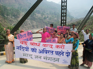
Vimal Bhai, Matu Jansangathan, Uttarakhand, bhaivimal@gmail.com

Malika Virdi, Himal Prakriti, Uttarakhand, malika.virdi@gmail.com

E Theophilus, Himal Prakriti, Uttarakhand, etheophilus@gmail.com

Ramnarayan K,  Save the Rivers Campaign Uttarakhand, ramnarayan.k@gmail.com

Dr Latha Anantha, River Research Centre, Kerala, rrckerala@gmail.com

Parineeta Dandekar, SANDRP, Pune, parineeta.dandekar@gmail.com

Samir Mehta, International Rivers, Mumbai, samir@internationalrivers.org

Tarini Manchanda, Independent film maker, Delhi,  mtarini@gmail.com


Current state of our National River at Haridwar  Photo: SANDRP
Current state of our National River at Haridwar Photo: SANDRP

[1] The author is thankful to Parineeta Dandekar, Shripad Dharmadhikary and Samir Mehta among others for providing comments on earlier drafts.

[2] Prof Bharat Jhunjhunwala provided the copy.

[3] One of the members of the IMG started discussing the report in public domain through her writings even before the report was in public domain, see: http://www.downtoearth.org.in/content/training-engineers-not-ganga and http://www.downtoearth.org.in/content/ganga-saga-part-ii-redesign-dams-not-rivers. This can create misleading impression about the report, when the readers do not have benefit of cross checking what the report is actually saying. The articles in any case are full of serious errors, for example it said: “Most of the proposed projects are run-of-the-river schemes, which are seemingly benevolent as compared to large dams”, not understanding that EACH of the so called run of the river schemes ALSO involves a dam, most of them are large dams as per international definition. It incorrectly said, “Run-of-the-river projects, which used flowing water as the raw material for energy”, in reality NONE of the so-called ROR projects generate power from flow of the water in the river, they all dam and divert the water away from the river to produce power. It also tried to dilute the impact of the projects on rivers (akin to killing of rivers) by saying projects “affect” rivers. It misleadingly wrote, “The hydropower engineers argued for 10 per cent e-flow” without mentioning that the EAC of MoEF is prescribing 20-30% of mean season flows. The article claimed that figures of water flow and tariffs were modified by IIT-Roorkee, but in the entire IMG report, (except the Annexure XI written by author of the articles), there is no mention of any of these. The article talks about engineers’ claims that “this source provides power during peak demand hours”, but as we noted above the IMG has not even looked at the impact of peaking generation. There is not even an attempt to understand how much of the current generation from hydropower projects is happening during peaking hours, or what is the generation performance of hydropower projects, issues that SANDRP has been raising for many years.

Cumulative Impact Assessment · Dams · Environment Impact Assessment · Hydropower · Ministry of Environment and Forests · Western Ghats

Comments on HLWG Report submitted to Ministry of Environment and Forests

This post is based on a submission made by SANDRP and our colleagues on the HLWG Report on Western Ghats. 20th May 2013 is the last date to submit comments on this. Comments need to be sent to: amit.love@nic.in. We request groups and individuals to make as many submissions as possible.

Comments on HLWG Report with a focus on Water issues

Date: May 20, 2013

To,


Mrs. Jayanthi Natarajan

Union Minister of State (IC)

Ministry of Environment and Forests

Government of India

Email: mosefgoi@nic.in, jayanthi.n@sansad.nic.in


Dr. V Rajagopalan

Secretary

Ministry of Environment and Forests

Government of India

Email: envisect@nic.in


Dr. Amit Love,

Deputy Director,

Ministry of Environment and Forests

Email: amit.love@nic.in


Dear Mrs. Jayanthi Natarajan and Dr. Rajagopalan,


SUB: Comments on the High Level Working Group Report with respect to water sector

This is in response to announcement posted on MoEF website about submitting comments on the HLWG report under the Chairpersonship of Dr. Kasturirangan. These comments mainly deal with water in Western Ghats: One of the most critical issues for Western Ghats States.

A lady collecting drinking water from a sacred grove in Western Ghats Photo: SANDRP

Unfortunately, we have to note that recommendations of the HLWG Committee in response to WGEEP Report as well as some of HLWGs omissions and commissions are detrimental to the well-being of rivers, wetlands and dependent communities in the Western Ghats and hence, for related sectors like ecology, water supply, irrigation, hydropower, etc. This is elucidated in the following points:

  1. HLWG does not comment on any other issue related to water except hydropower:

While the Gujarat, Maharashtra, Goa, Karnataka, Kerala and Tamilnadu are facing multiple issues with respect to rivers, drinking water, irrigation, loss of biodiversity and livelihoods, dam-induced displacement, etc., the only issue HLWG report has commented upon is Hydropower. The WGEEP report has dealt with a number of issues related to the water sector from democratic community driven bottom up governance, watershed development, opposition to large dams in ESZ I and II, drinking water, fisheries, etc. However, the HLWG does not comment on any of these recommendations of the WGEEP, nor does it offer its own position on these. This is a serious lacuna in the HLWG Report.

In the absence of such recommendations, we request that MoEF adheres to WGEEP recommendations.

Fishing in Vashishthi Estuary, Western Ghats. Photo: SANDRP
  1. HLWGs recommendations about Hydropower are ad hoc, unscientific and misleading
  1. HLWG claims that all Hydropower is “renewable and clean.”

This is a completely incorrect statement and it’s surprising to see that it comes from HLWG. The world over, the myth of Hydropower as clean source of energy has been busted.[1],[2] Hydropower projects have huge impacts on environment, ecology, forests, rivers, biodiversity and livelihood security of the people. Studies have proved that methane emissions from reservoirs formed by hydropower dams in tropical countries can have significant global warming potential, methane being about 21 times more potent global warming gas than CO2. Dams emit methane at every draw down.[3] With tropical forests in the Western Ghats (WG) under submergence and otherwise destruction by such projects, this threat is even more serious. Already WG has some of the biggest hydropower plants in the country including the Koyna, Bhandardara, Ghatghat HEPs and three Tata HEPs in Maharashtra, Linganmakki, Gerisouppa, Bhadra, Tungabhadra, Upper Tunga, Talakalale, Kabini, Harangi, Chakra, Supa, Varahi, HEPs in Karnataka, Idukki, ldamalayar, Lower Periyar, Poringalkuttu, Sholayar HEPs in Kerala and Bhavani HEPs in Tamil Nadu. All these projects have not only contributed to greenhouse gas emissions, but have also adversely affected communities, forests, rivers and ecosystems in Western Ghats. There are numerous pending cases of rehabilitation from these dams (for example Koyna in Maharashtra) till date involving tens of thousands of people and communities in many areas are still suffering from erratic water releases from these projects (downstream communities near Jog Falls d/s Linganmakki).

Hydropower dams in WG are in many cases transferring water across the basin for power generation, making it unavailable of the original basin and its inhabitants (For example:  Interbasin transfers from Koyna and Tata Hydropower dams in Maharashtra). Every hydropower project has finite life. Thus, for the basin dwellers and everyone else, Hydropower not much renewable either.

 HLWG is not justified in giving a ‘clean and renewable’ certificate to hydropower.

Jog Falls on Sharavathy: Dried and diverted by the Linganmakki HEP in Karnataka Western Ghats. Photo: SANDRP


  1. HLWG allows Hydropower projects in ESAs while not looking at performance of existing projects

While the WGEEP did not allow large dams and hydropower projects in ESZ I and II, HLWG has allowed hydropower projects in its demarcated ESAs. This is unacceptable. Western Ghats are already ravaged by dams and at least the areas of high biodiversity value should now be protected from the same onslaught. But the HLWG has rejected WGEEP recommendations about this. While doing so, they have not looked at the performance of the existing HEPs in WG. SANDRP has been studying performance of HEPS in India for some time now based on generation data from Central Electricity Authority. The performance of existing hydropower plants in WG is dismal as can be seen below:

  • In Koyna Basin, the per MW generation in 2010-11 has dropped by a huge 56.79% from the highest per MW generation achieved in the year 1994-95.[4]
  • In Kali Nadi projects, the per MW generation has dropped by 46.65% from the highest per MW generation achieved in 1994-95[5]
  • In Sharavathi Basin projects, per MW generation in 2010-11 has dropped by 37.60% from the highest per MW generation achieved in the year 1994-95[6]
  • Same situation is true for most other hydropower projects.
  • Most of these projects are performing far below the level at which the projects were given techno-economic clearances.
  • There is no assessment as to how much of the generation from such hydropower projects is during peaking hours. Nor is there any attempt at optimising the peaking power from these projects.

It is clear that there is huge scope to make the existing projects more efficient, rather than destroying ESAs in WG with more projects.

We request that in line with WGEEP report, large dams should not be permitted in ESAs of Western Ghats.

  1. Recommendation about mitigating impacts of Hydropower are extremely weak
  • The HLWG has recommended 30 % of lean season flow as the minimum flow throughout the year as a conditionality for allowing hydro power projects in the ESA. This is contradictory to the recommendation for ecological flows by the HLWG.  Ecological flows means trying to mimic the natural flow regime in the river as far as possible and that would include arriving at different seasonal flows based on studies and consultation with the river communities and other stakeholders, using the Building Block Methodology which even the Inter Ministerial Group on Ganga Basin has said is the most appropriate for India. Moreover, the IMG has recommended 50% releases in lean season flows, applicable for all existing projects. MoEF should accept these norms immediately for all existing projects.

The MoEF should be recommending ecological flows / environmental flows as in the WGEEP report and not minimum environmental flows and this should be determined through holistic methodologies like Building Block Methodology and local participation.

  • The HLWG recommendation of 3 km minimum distance between dams is totally ad hoc, arbitrary and hence unacceptable. Firstly, the HLWG should have mentioned min 3 km of flowing river between projects. The minimum distance is river specific and would depend upon a basin level study of the river including the altitudinal profile of the river, the riparian forest status, the aquatic habitats and biodiversity, the present dependability and many such criteria. More significantly, the cascade hydropower dam menace which is destroying rives in Himalayas need not be replicated in western ghats. We would like to reiterate that no large dams should be allowed in the ESA of WG.

The MoEF should recommend for arriving at river specific studies while accepting 5 km of free flowing river between projects as minimum distance of free flowing river between projects. The best case is not to allow any further large dams in Western Ghats.


No flows in Sharavathy downstream Linganmakki  Dam and Jog Falls. Photo: SANDRP
No flows in Sharavathy downstream Linganmakki Dam and Jog Falls. Photo: SANDRP


  1. The HLWG does not stress the need for Environmental Clearance for Mini hydel Projects

Hydro projects less than 25 MW are currently exempt from Environmental Clearance due to a dangerous omission in the EIA Notification 2006. WG is currently facing a severe threat due to a flood of these unplanned cascades of Mini Hydel Projects. Ecosystems and communities in rivers like Netravathi, Kumaradhara, Krishna and Cauvery are facing impacts of these projects, many of which are fraudulent.[7] Netravathi has more than 44 mini hydel projects planned and under operation. Kerala has plans to set up  around 100 mini Hydel projects on its rivers. The threat of these projects on river systems in Western Ghats is so high that in March 2013, the Karnataka High Court, has banned any new mini hydel projects in Karnataka Western Ghats[8].

WGEEP had recommended no mini hydel projects in ESZ I and II. HLWG has not done this. While the HLWG makes a rather vague statementThere is a need to redesign and reevaluate small hydropower projects – below 25 mw as these often have limited impact on energy generation and can lead to huge impacts on ecology’, it has not recommended that these projects should need an EIA and EC process, like it has said for Wind Energy. This is a very serious omission. SANDRP and many organizations have written about this to the MoEF several times.

The MoEF should amend the EIA Notification 2006 and include all hydel projects above 1 MW in its purview.


Pristine Forests set for submergence under the 24 MW Kukke Mini hydel Plant in Dakshin Kannada, Karnataka. Photo: SANDRP
  1. The HLWG does not stress the need of Environmental Clearance (EC) for Drinking Water and Industrial supply dams

HLWG has not looked at water as a sector, but has only confined itself to hydropower. This has resulted in several loopholes. Many dams are being constructed in Western Ghats for Drinking Water and Industrial water supply. These are also exempt from EC process as per the EIA Notification 2006. Dams like Kalu, Shai, Balganga, Khargihill, Pinjal, Gargai are set to submerge more than 6000 hectares of forest in ESAs and Protected Areas in Northern Western Ghats in Maharashtra.

WGEEP Report had recommended no large dams in ESZ I and II, but the HLWG does not talk about these dams at all. Their impacts on WG forests and communities are entirely ignored. This is another serious lapse of the HLWG report.

The MOEF should amend the EIA Notification 2006 to include all large dams, irrespective of the purpose, including drinking and industrial water supply dams in its purview. No large dams should be planned in ESA of Western Ghats.


Ravines of Vaitarna already submerged by the Middle Vaitarna Dam near Mumbai Photo: SANDRP
  1. HLWG does not recommend eflows from existing projects

Several hundreds of Irrigation, water supply, hydropower dams have transformed the nature of rivers and dependent communities in Western Ghats. While the WGEEP Report mentioned maintaining eflows from existing projects, the HLWG does not make any recommendation for eflows from existing projects.

Hydropower projects in Karnataka like Kali, Linganmakki have affected communities and ecosystems in the region, have driven some species to extinction. There is an urgent need to restore eflows in all WG rivers.

The MoEF should recommend that eflows should be assessed with holistic and participatory methodology like BBM and recommend e-flows for all dammed rivers in Western Ghats with time limit of one year.

  1. HLWG does not apply its mind to dam decommissioning

The HLWG has chosen to ignore the recommendations on dam decommissioning. While the states have rejected the recommendation the MoP (Ministry of Power) and Central Electricity Authority has noted that dam decommissioning in a phased manner is worth considering.

There are several irrigation and hydropower dams in the Western Ghats which are severely underperforming or incomplete after two decades, or more than 100 years old, and/or unsafe. For example, several experts have opined than large irrigation projects in Konkan region of Maharashtra are severely underutilized. Tillari Interstate Project between Maharshatra and Goa which has come up affecting a wildlife corridor and which has still not rehabilitated its affected population, has a created irrigation potential of 7,295 hectares in Maharashtra of which farmers are utilizing just 162 hectares, according to the Govt Of Maharashtra’s 2012 White Paper on Irrigation Projects in Maharashtra. This underlines the redundancy of large irrigation projects in the WG.

The HLWG had an opportunity to relook at such projects, which it has not done. The HLWG could have noted that the state governments and the MoEF and MoP should start the process of evolving parameters / criteria towards the process of dam decommissioning.

The MoEF may please recommend the same.

Leaking Khadkhad dam Mahrashtra Western Ghats Photo: Pune Mirror


  1. HLWG does not recommend free flowing rivers for WG

Rivers in Western Ghats are repositories of biological, ecological and cultural diversity. Rivers in WG harbor high endemism and diversity in freshwater fish. They also house several Sacred groves at river origins, river fish sanctuaries, etc., protecting rivers and fish. The freshwater biodiversity remains the most fragmented among all biodiversity and HLWG has taken no note of this state and further risks that freshwater biodiversity faces. The WGEEP had wisely followed a graded approach in tune with the ecological connectivity of river ecosystems. ln the HLWG approach, stretches of rivers would flow out of the natural landscape into the cultural landscape which is open to indiscriminate development and the chance for their restoration or protection would be completely lost out. A river cannot be protected in pieces like this.

Looking at the pressures from dams and water abstractions, there in an urgent need to conserve ecologically, culturally and socially important rivers in their free-flowing condition. This approach is well accepted globally and several countries have created specific legislations for protecting free flowing rivers[9]. It seems that the IMG Committee on Upper Ganga, in which Ms. Sunita Narain (Member of Kasturirangan Committee), was also a member has recommended that some six tributaries of Upper Ganga basin should be kept in pristine state. While rejecting WGEEPs recommendation about dam decommissioning or dam free rivers in the ESZs, HLWG has not recommended keeping even a single river in Western Ghats in its free flowing condition.

MoEF should identify ecologically, culturally and socially important rivers, based on community and ecological knowledge and conserve Heritage Rivers of Western Ghats in their free flowing condition for the current and future generations.


Seetha Nadi, free flowing river in Karnataka Western Ghats. Photo: SANDRP
  1. HLWG allows Inter basin transfers in Western Ghats, without any justification or studies

The HLWG has agreed to inter basin transfers toeing the claims of some of the states. There are ample instances of failed interstate – inter basin transfers in the Western Ghats rivers which have turned into permanent scenes of conflicts like the famous Mullaperiyar,  Parambikulam Aliyar, Siruvani interstate inter basin transfers between Kerala and Tamil Nadu. The HLWG while acknowledging the need for ‘ecological flows assessment’ in rivers has failed to note that in all these inter basin transfers, the river / tributary has been completely diverted and has lost its ‘ecological flows’. The HLWG could have recommended a cumulative impact assessment of the existing inter basin transfers which would reveal the ground reality.

HLWG seems to have accepted the contention of states like Maharashtra: “This (stopping IBT) would be a problem, they explained, as many regions of the Western Ghats lie in the rain shadow area and need water to be diverted for irrigation and drinking.”

Reality is that, ALL the interbasin transfers happening in Maharashtra currently (through Koyna and Tata Hydro power projects, an amount more than 4 Billion Cubic Meters Annually) are transferring water FROM the rain shadow area of Krishna and Bhima basins TO water surplus regions in Konkan. If HLWG was concerned about water supply for rain shadow regions, it would have at least recommended that this transfer from deficit area to high rainfall area be immediately reviewed and reversed in a time bound manner. It has chosen not to, showing its complete ignorance of ground reality or its completely pro government and pro vested interests bias.

The MoEF should retain the recommendation for no more inter basin transfers as in the WGEEP report and ask for immediate review of transfer of water from deficit basins to high rainfall areas. 


  1. HLWG allows hydro projects in first and second order streams

The HLWG has not said no to hydro power projects in first and second order streams in ESA. Meanwhile the MoP, CEA and WAPCOS all agree that hydro power projects should not be permitted in these highly ecologically sensitive areas which are the ‘origin’ of Western Ghats Rivers.

The MoEF should retain the recommendation for no run of the river schemes in first and second order streams as in the WGEEP report.

  1. HLWG offers no comments of on several water sector recommendations of WGEEP which have been supported by State Governments

Kerala and Maharashtra have accepted many of the recommendations of the WGEEP in water sector (page 14 section 2.3 – point 9) like catchment area treatment plan, protection of high altitude valley swamps, water conservation measures, rehabilitation of mined areas, improved river flows etc. It is surprising to note that the HLWG is silent on these very important measures and has not even endorsed these acceptable recommendations which can significantly contribute towards improving water availability in the Western Ghats.

The MoEF should follow these recommendations of the WGEEP.

  1. HLWG takes an extremely biased stand about Athirappilly and Gundia Hydropower projects, rejected by the WGEEP

The WGEEP had categorically stated that the Athirappilly and Gundia Hydropower project should not come up in Western Ghats, looking at their huge impacts on biodiversity, several studies by local organisations and local opposition. However, ignoring all these, the HLWG has taken a very pro project stand on these projects, stating that they can be considered with some vaguely due process, which the state government would be happy to show they have followed it on paper. This is entirely unacceptable.

The MoEF should not allow Athirappilly and Gundia HEPs looking their impact on ecology and communities and in face of the strong local opposition that they are facing.

DSC02831
Athirappilly Waterfalls on the Chalakudy River Photo; SANDRP

The WGEEP process and report initiated a robust discussion about the paradigm of development and conservation in Western Ghats. Water and Rivers is a cross cutting issue connecting ecosystems and communities, rural areas and urban centers, providing goods and services and supporting freshwater biodiversity, which is most threatened currently.

A proactive position on conserving rivers in Western Ghats will go a long way in protecting and conserving myriad livelihoods and ecosystems that thus depend of them.

We hope the MoEF considers the recommendations made above about the WGEEP and HLWG Reports and helps conserving rivers of the Western Ghats for people and ecosystems urgently. The HLWG Report cannot be accepted the way it stands presently. As a step in this direction, we also suggest that WGEEP should get a formal chance to respond to the points raised about it in the HLWG.

Thanking You,


Yours Sincerely,

Himanshu Thakkar, Parineeta Dandekar, South Asia Network on Dams, Rivers and People, New Delhi and Pune (ht.sandrp@gmail.com , parineeta.dandekar@gmail.com)

Dr. Latha Anantha, River Research Centre, Thrissur, Kerala (rrckerala@gmail.com)

Shripad Dharmadhikary, Manthan Adhyayan Kendra, Pune, Maharashtra (manthan.shripad@gmail.com)

Dr. T.V. Ramchandra, Energy & Wetlands Research Group, Centre for Ecological Sciences, IISc, Bangalore (cestvr@ces.iisc.ernet.in)

Janak Daftari, jalbirdari, Mumbai, Maharashtra (daffy@jalsangrah.org)

Sujit Patwardhan, Parisar, Pune, Maharashtra (patwardhan.sujit@gmail.com)

Dr. Nilesh Heda, Samvardhan, Vidarbha, Maharashtra (nilheda@gmail.com)

Nisarg Prakash, Nature Conservation Foundation and Nityata Foundation, Bangalore, Karnataka (nisargprakash@gmail.com)

Mrinalinee Vanarase, Iora Consultants, Pune, Maharashtra (ioraespune@gmail.com)

Shankar Pujari, President, Nivara Bandhkam Kamgar Sangh, Sangli, Maharashtra (shankarpujari16@gmail.com)

Damodar Pujari, SANDRP, Pune, Maharashtra (damodar.sandrp@gmail.com)

Saili Palande-Datar, Kalpavriksha, Pune, Maharashtra

Following Members from Energy and Wetlands Research Group, Centre for ecological Science, Indian Institute of Sciences: 

  • Dr. M.D. Subash Chandran
  • Dr. Prakash Mesta
  • Dr. Uttam Kumar
  • G R Rao
  • Mahima Bhat
  • Vishnu Mukri
  • Sreekanth Naik
  • Balachandran C
  • Boominathan M
  • Bharath H Aithal
  • Bharath Settur
  • Vinay S
  • Ganesh Hegde
  • Anindita Dasgupta
  • Arun D T
  • Vishnu Bajpai
  • Gouri Kulkarni
  • Sudarshan Bhat
  • Durga Madhab Mahapatra
  • Ashwath Naik
  • Sowmya Rao
  • Shwetmala


Dams · Western Ghats

Prof. Madhav Gadgil writes to Dr. Kasturirangan

Open Letter sent by Prof. Madhav Gadgil to Dr. Kasturirangan on the High Level Working Group Report on WGEEP and Western Ghats. 

MadhavGadgil

17 May 2013
Dear Dr. Kasturirangan,

JBS Haldane, the celebrated 19h century scientist and humanist who quit England protesting its imperialistic invasion of Suez to become an Indian citizen has said: Reality is not only stranger than we suppose, but stranger than we CAN suppose! I could never have imagined that you would be party to a report such as that of the High Level Working Group on Western Ghats, but, then, reality is indeed stranger than we can suppose!

In our report to the Ministry of Environment & Forests, based on our extensive discussions and field visits, we had advocated agraded approach with a major role for grass-roots level inputs for safeguarding the ecologically sensitive Western Ghats. You have rejected this framework and in its place, you advocate a partitioning amongst roughly one-third of what you term natural landscapes, to be safeguarded by guns and guards, and two-third of so-called cultural landscapes, to be thrown open to development, such as what has spawned the 35,000 crore rupees illegal mining scam of Goa. This amounts to attempts to maintain oases of diversity in a desert of ecological devastation. Ecology teaches us that such fragmentation would lead, sooner, rather than later, to the desert overwhelming the oases. It is vital to think of maintenance of habitat continuity, and of an ecologically and socially friendly matrix to ensure long term conservation of biodiversity rich areas, and this is what we had proposed.

Moreover, freshwater biodiversity is far more threatened than forest biodiversity and lies largely in what you term cultural landscapes.  Freshwater biodiversity is also vital to livelihoods and nutrition of large sections of our people. That is why we had provided a detailed case study of Lote Chemical Industry complex in Ratnagiri district of Maharashtra, where pollution exceeding all legal limits has devastated fisheries so that 20,000 people have been rendered jobless, while only 11,000 have obtained industrial employment. Yet the Government wants to set up further polluting industries in the same area, and has therefore deliberately suppressed its own Zonal Atlas for Siting of Industries.

Your report shockingly dismisses our constitutionally guaranteed democratic devolution of decision making powers, remarking that local communities can have no role in economic decisions. Not surprisingly, your report completely glosses over the fact reported by us that while the Government takes absolutely no action against illegal pollution of Lote, it had invoked police powers to suppress perfectly legitimate and peaceful protests against pollution on as many as 180 out of 600 days in 2007-09.

India’s cultural landscape harbours many valuable elements of biodiversity. Fully 75% of the population of Lion-tailed Macaque, a monkey species confined to the Western Ghats, thrives in the cultural landscape of tea gardens. I live in the city of Pune and scattered in my locality are a large number of Banyan, Peepal and Gular trees; trees that belong to genus Ficus, celebrated in modern ecology as a keystone resource that sustains a wide variety of other species. Through the night I hear peacocks calling, and when I get up and go to the terrace I see them dancing. It is our people, rooted in India’s strong cultural traditions of respect for nature, who have venerated and protected the sacred groves, the Ficus trees, the monkeys and the peafowl.

Apparently all this is to be snuffed out. It reminds me of Francis Buchanan, an avowed agent of British imperialism, who wrote in 1801 that India’s sacred groves were merely a contrivance to prevent the East India Company from claiming its rightful property.

It would appear that we are now more British than the British and are asserting that a nature friendly approach in the cultural landscape is merely a contrivance to prevent the rich and powerful of the country and of the globalized world from taking over all lands and waters to exploit and pollute as they wish while pursuing lawless, jobless economic growth. It is astonishing that your report strongly endorses such an approach. Reality is indeed stranger than we can suppose!

With warm personal regards,

I remain,

Yours sincerely,

Madhav

Dams · Environment Impact Assessment · Hydropower · International Water Issues

Damocracy: “The world is killing its rivers!!”

http://damocracy.org/?portfolio=damocracy-the-movie

A fantastic documentary shattering the myths of Large Dams as sources of clean energy, Damocracy takes a documentary to the next level. It talks about two dams, separated by thousands of kilometers, united by people’s struggle against destructive and illegal large dams. It traces the story of the Bel Monte Dam on Xingu River in the Amazon Basin of Brazil and the Ilisu Dam on the Tigris River in Turkey.amazon

It takes us through a maze of lies, government repression, plight of communities, strengths and struggles of local communities against these projects which have gone on for decades. While Bel Monte Dam threatens over indigenous tribes and native fish in Brazil, Ilusu Dam, under construction even without an EIA will submerge 300 archeological sites including eth entire city of Hasankeyf.

Dr. Philip Fearnside talks about the popular jingle of Hydropower being ‘clean, green source of energy’. He says “People have heard this myth so many times, that they believe it, because they’ve never heard anything else.” He talks about the impact of Methane on global warming, which is many times more than carbon di oxide.

Damocracy_6-1024x576

The film ends with a diverse group of dam activists from all corners of the world actually dismantling a wall built across the Xingu… working together in the scorching Amazon sun to undo work of machines for months. In the end, the XIngu flows again..though symbolic, it a powerful message.

In the words of one of the elated activists seeing the river flow finally “If a small united group could do this, imagine what a united world can do against monster dams.”

An inspiring fim in many ways. A must watch for sure.

more on the campaign: http://damocracy.org/

Dams

Why Solapur, Sugarcane and Sustainability do not rhyme?

As I build this dam

I bury my life.

The dawn breaks

There is no flour in the grinding stone.

I collect yesterday’s husk for today’s meal

____

The dam is ready

It feeds their sugarcane fields

Making their crop lush and juicy

But I walk miles through forests

In search of a drop of drinking water

I water the vegetation with drops of my sweat

As dry leaves drop and fill my parched yard

Daya Pawar[1] (Original marathi song Bai me dharan bandhte, majha maran kandte)[2]

The 2012-13 sugarcane crushing season (which goes on for 160 days [3] from roughly 15th October) has recently concluded. It may be instructive to look at the figures of the sugarcane crushed by sugar factories in Solapur, one of the worst drought-hit districts in the state. Presently, Solapur has more than 200 cattle camps, one of the highest in the state, and more than 141 villages which are entirely dependent on tankers for drinking water.

Solapur and Sugarcane: Solapur has the highest number of sugar factories in Maharashtra. During 2012-13 (latest crushing figures as on 11th April 2013), 126.25 Lakh tonnes cane was crushed in Solapur district alone in its 28 sugar factories[4]. The district accounts for the maximum 18.25% of the cane crushed in the state during 2012-13.  In 2012-13, a year that was called as a ‘drought year, worse than 1972 drought’, Solapur added 4 new sugar factories to its empire.

River basins of Solapur Normal monsoon (June-Oct) rainfall in Solapur district is 560 mm, in 2012 monsoon the rainfall was 412 mm[5]. Solapur belongs to five different sub basins as described by the Maharashtra Water and Irrigation Commission (MWIC) Report (June 1999). Among these five sub basins, the MWIC report describes 4 sub basins Bhima downstream Ujani (18B), Seena (19A) and Bori Benetura (19B) as highly deficient considering the water availability from all natural sources. Please see Annex1 Table 1 for details. 86.6% of Solapur district, barring parts of Karmala and Malshiras talukas, fall in this highly deficient river basins. The Commission says: “It is desirable to impose a total ban on water intensive crops like sugarcane in these deficit sub basins”. In these sub basins, “less water intensive crops only” and “less water intensive economic activities only” should be permitted, says the commission (p 138, Vol. III). Please see Annex 1 Table 2 for sub basin wise area of Solapur District.

Map-of-Maharashtra-Solapur

It means that sugarcane crop and sugar factories in all talukas of Solapur district, possibly except those in Karmala and Malshiras are unviable, in violation of the MWIC report and against prudent water management. There is some addition to the water available in these basins (18B, 19A and 19B) following implementation of Ujani dam and inter-basin transfers. However, that still does not justify any crops like sugarcane or setting up of sugar factories. MWIC clears states that additional water should be spread across the talukas to benefit maximum farmers. Sugarcane cultivation clearly will not help that cause.

Rise of sugarcane cultivation in Solapur “Sugarcane is a crop which exhausts the soil and, therefore, it is not grown in the same field from year to year but is rotated in alternate years with food-crops.” 

-District Gazetteer of Sholapur, 1977[6]

How rapidly the area under sugarcane in Solapur district has gone up can be seen from the graph (figures from official sources like http://mahaagri.gov.in and Sugar Commissionarate in Pune, 1961-62 and 1971-72 figures is from the Solapur district gazetteer and for 1992-93 from MWIC report). It is clear from the graph that the sugarcane area approximately doubled in Solapur during seventies and again during the eighties. Between 2005-06 and 2011-12, it seems to have gone up by over 160%, this is the highest growth phase for sugarcane cultivation in Solapur. That growth phase is likely to continue if we go by the number of new sugar factories that are planned to be set up in Solapur.

solapur_Sugar_Graph

DSC02239

The area under sugarcane in Solapur at its high in recent years was 1.79 lakh ha in 2011-12, which is 19.46 % of net sown area of 9.2 lakh ha in the district (see table 3 in Annex). Of the net irrigated area of 2.52 ha in Solapur, sugarcane takes away 71.03%, way above the prudent 5% prescribed in Maharashtra. It is clear that sugarcane has been taking away disproportionate share of water of the district, at the cost of the rest of the farmers.

Water Consumption of Sugarcane and Sugar factories Considering productivity of 81 tonnes of sugarcane per hectare[7], the cane crushed during 2012-13 occupied 155 864 hectares in Solapur. Considering that ratoon type of sugarcane requires 168.75 lakh litres water per hectare at farm[8], which is the lowest water requirement among all types, (40% of sugarcane in Maharashtra is under ratoon type cultivation), amount of water required for cultivating sugarcane on 155 864 hectares of area in Solapur works out to be 2630 Million Cubic Meters. This is 1.73 times the live storage capacity of Ujani Dam (Live Storage: 1517 MCM), the largest reservoir in Bhima basin and third largest reservoir of Maharashtra. Assuming a rather high irrigation efficiency of 60% (considering that most of the water comes from surface water sources) water required from source would be 4383 MCM[9]

For crushing 126.25 lakh tonnes of cane, the sugar factories used a minimum of 18.93 Million Cubic Meters of water between October 2012 and March 2013, when drought was already severe. The live water storage of Ujani reservoir, at its highest was in October 2012 at 14% and it rapidly receded to zero in January and sub-zero levels from January to March[10] (as on 21st April, 2013, it is -32.91%).This is a very conservative estimate as per guidelines of Central Pollution Control Board (CPCB), considering 1500 litres water required to crush and process one tonne of cane[11].

DSC02370

According to MWIC report, even with maximum possible augmentation (from all planned schemes, many of which are not even implemented or sanctioned), Solapur district’s total share of water is 4188 MCM. But the current level of sugarcane cultivation in Solapur already seems to be using more water than the ultimate planned water allocation for Solapur.

New Sugar factories planned in Solapur! To add to this, at least 19 new sugar factories (see details in Table 4) are planned in Solapur[12]. Many of these are private sugar factories and are owned by politicians. Sakhar Diary 2013 gives the locations and capacities of these factories. Some of these factories have also received distance certificates[13] from the Sugar Commissioner’s office, Maharashtra indicating that they are at an advanced clearance stage at the state level. Together, these new factories will add crushing capacity of 85.52 Lakh tonnes of sugarcane. Madha, part of the constituency of Union Agriculture minister Sharad Pawar, is in the forefront of getting new sugar factories. It has 3 existing factories and has 5 new ones planned, 2 by politicians.

To grow this 85.52 L T sugarcane, an additional 105 580 hectares will have to be brought under sugarcane cultivation. Additional 1782 MCM of water will be required at farm to cultivate this sugarcane. Assuming even a high irrigation efficiency of 60%, this would mean requirement of 2970 MCM water at source. In addition, the Sugar factories will require 12.83 MCM of water for crushing this cane.

The new planned sugar factories will bring total area under sugarcane in Solapur to 2.685 lakh ha and the annual water consumption by sugarcane and sugar mills over 7400 MCM. This is way above the full planned allocation of water for Solapur as per the MWIC report. MWIC assessment is exhaustive including all possible planned water schemes, so there is no possibility for Solapur to get water over and above the ultimate planned schemes in Solapur. This means that by going for these new sugar factories, Solapur would possibly taking water of other regions or accelerating towards rapid exhaustion of its available groundwater.

Sugarfactory

Even as farmers from Mohol region sat on dharna in Mumbai, urging Maharashtra government to release water for Ujani dam, the same Mohol block in Solapur district has 3 existing sugar factories. These factories crushed 13.56 lakh tonnes of sugarcane this year till March 2013[14], using 20,340 Lakh Litres of water from 15 October 2012, when the drought was already severe till March 13, when farmers from Mohol were protesting in Mumbai for drinking water. So even when farmers were protesting for drinking water, all the factories continued crushing in Mohol and the district administration, sugar Commissionerate as well as the state administration did not do anything to curb fresh sugarcane cultivation.

In addition, Mohol also has one more sugar factory planned[15] by a politician, with a capacity of crushing 6,40,000 tonnes of sugarcane, which will additionally require 133 MCM water at farm and 222 MCM water at source to cultivate this sugarcane and 9,600 lakh litres of water to crush this sugarcane.

Other drought affected districts Similar situation prevails in Osmanabad, Beed, Jalna, Parbhani in Marathwada which are reeling under severe drought and where drinking water itself has becomes scarce. Osmanabad crushed 26.35 LT of sugarcane through its 9 sugar factories[16]. Significantly, here the district Collector had written a letter in November 2012 to the Sugar Commissionerate to suspend cane crushing in Osmanabad in face of drought[17]. Nothing was done about that recommendation. To top this, 10 more factories are planned in Osmanabad. In the case of Beed, in addition to the existing 8 factories, 14 are in pipeline, Ahmednagar has 20 with 8 in pipeline, Latur has 12 existing and 5 in pipeline and Satara has 11 existing and 14 in pipeline.[18] Looking at the impact of existing sugar cultivation and factories on the water supplies in drought affected regions, the impact of these additional factories is difficult to imagine. The impact of water use and pollution caused by sugar factories and distilleries manufacturing alcohol will be additional.

Absence of credible sanctioning process for new capacities How did these factories get permissions from the Sugar Commissionerate which is the nodal sanctioning authority for sugar factories in Maharashtra? What role did the district administration play? What role do the Agriculture Department as well as the Water Resources Department play in this sanctioning process? What role do the farmers and people have in this sanctioning process? Who decides these are sustainable, just decisions? These are not just rhetorical questions. If prudent answers to these questions not found, Maharashtra water crisis may only get worse in days to come.

Enslaved to sugarcane With a growth cycle of 11-17 months, sugarcane cultivation locks up the farmers, the state and the system in a vicious cycle of irrigation at any cost. On an average, sugarcane requires irrigation twice a month. Once planted, the farmers have no choice but to look for all options to irrigate it. And the sugar mills have no options but to crush the sugarcane and the downstream water consumption lock in only grows. Since the whole product cycle is so long, once the crop is in place, everyone tries to get the necessary water to run the system, irrespective of drought, water scarcity, irrespective of impact on other sections of society or on long term sustainability. The whole state machinery is a slave to the survival of the sugar manufacturing process, it seems. Even the Comptroller and Auditor General, in its report for five years ending in 2007 have reported how the Sugar Commissionarate sanctioned capacities without considering water availability.

In this situation, it is very important to have credible checks before allowing more sugar factories or expansion of existing sugar factories. However, the basic checks and balances to ensure only sustainable sugarcane crushing capacity is installed seems to have completely failed in Maharashtra. There is no acknowledgement of this reality. In absence of prudent decision making process, the repercussions are bound to be painful and far reaching, the poor and likely to be the worst sufferers.

How much do the small farmers and poor benefit from sugar boom in Solapur? It is true that large number of small farmers and agricultural labourers, including dalits and other backward classes are also benefiting from sugar boom in drought affected districts of Maharashtra. However, a number of researchers have pointed out[19] that benefits to these sections are far less as compared to other sections. Secondly, the adverse impact of allocating most of available water to sugarcane on rest of the sections is disproportionately felt. For example, farmers near Bhima river in Helli village just as Bhima leaves Maharashtra say that most of the times, there is no water in the river and their weir never gets filled due to abstraction in the upstream. What about these small holding farmers? Today there does not seem to be even an acknowledgement of the collateral damage this sugar boom in Solapur and other drought affected districts is causing. As Osmanabad collector said, currently in villages with sugarcane, there is no drinking water. And as Daya Pawar’s poem given above narrates, it is the women of the poor sections that are facing the worst adverse impacts. Moreover, no one is asking how sustainable are these benefits and what will happen when even the sugar mills bust, as they are bound to?

Women trying to collect water from the dry Seena in Madha where 5 sugar factories will come up. March 2013. Photo: SANDRP

When Sweet Lime plantations over thousands of hectares died in Marathwada in the absence of water this year and when hapless farmers set their own horticultural plantations on fire as they could not bear to witness the wilting and dying trees they planted, sugarcane still continued to get water. So while there is a lobby to protect the sugarcane farmers, no such luck for other farmers.

Burnt Sweet Lime plantations in Osmanabad. Courtesy: Times of India

Once farmers have cultivated sugarcane, the sugar industries hide behind the farmers saying what will happen to the farmers if factories do not process this cane. While the risk of cultivating sugarcane and fighting for its water falls on the farmers, sugar industries are insulated from any risk, in the name of farmers and can continue crushing, using thousands of lakhs of litres of water and polluting even more water.

Is drip irrigation the ultimate solution? In the entire discourse on the costs and efficiency of sugarcane in Maharashtra, the water angle, which is of a paramount importance as demonstrated this year, is the most neglected. Institutes like Vasantdada Sugar Institute (VSI) (For every quintal of sugar generated by Sugar Factories, Rs 1 goes to VSI) and the Sugar Commissionerate seem strategically silent on this. When we contacted the drip irrigation cell in Vasantdada Sugar Institute to inquire about the area of sugarcane under drip irrigation, we were told by the person in-charge that Drip Irrigation Cell itself does not have these figures. This indicates either that this data is not available or they are not ready to share available information

Maharashtra Chief Minister and Commission on Agriculture Costs and Prices, Ministry of Agriculture have said this year that there is need to make drip irrigation mandatory for sugarcane cultivation in Maharashtra. This looks more like a band aid solution, which will continue the status quo of massive sugarcane cultivation in drought prone areas without asking if this is sustainable. In absence of such questions, drip irrigation could become a reason to continue to expand unsustainable sugar mills and sugarcane cultivation in drought prone areas, effectively using more water.

While claiming that Maharashtra has the highest efficiency of sugarcane in the country, it is forgotten that if crop duration and water consumption factors are added in the equation, Uttar Pradesh is more efficient than Maharashtra by a whopping 175%.[20] Maharashtra consumes on an average 1000 litres more water than UP to produce 1 kilogram of sugar.

In the end, while the High Court decision on releasing water for Ujani from upstream dams is welcome in one sense, the water releases from upstream dams is likely to be used up for the same unsustainable sugarcane cultivation in Solapur and along the way in Pune region. There is an urgent need to look at the bigger picture as to how in the water situation worsened so much in Solapur that the region producing most sugarcane does not have drinking water. Drought is a common phenomenon in this region for centuries, as described by the Solapur district Gazetteer. Solapur experiences drought once in every five years. In the context of climate change, rainfall will become more unreliable and drought more frequent. But if corrective steps are not taken about the unsustainable sugar boom in Solapur, we may be inviting worst disasters in future. These include encouraging sustainable cropping pattern including oilseeds, cereals and millets.

It is high time there is a public debate about why Sustainable Sugar won’t rhyme with Solapur other drought prone districts in Maharashtra.  There is an urgent need to stop setting new sugar factories in these regions, review the existing ones through credible independent process and ensure that lessons learned during the 2012-13 drought are not forgotten soon.

 -Parineeta Dandekar (parineeta.dandekar@gmail.com), Himanshu Thakkar  (ht.sandrp@gmail.com), with  inputs from Damodar  Pujari (damodar.sandrp@gmail.com)


South Asia Network on Dams, Rivers & People (https://sandrp.in/news)

_________

Annex 1


Table 1: Taluka wise Rainfall in Solapur district in 2012 monsoon (June-Oct)

Source: http://www.mahaagri.gov.in/rainfall/index.asp


Taluka Name

Normal Rain (mm)

Actual Rain (mm)

% To Normal

N. Solapur

617.3

465.4

75

S. Solapur

617.3

465.4

75

Barshi

596.5

551.8

93

Akkalkot

676.3

556.3

82

Mohal

573.9

316.4

55

Madha

534.4

435.5

81

Karmala

544

272.6

50

Pandharpur

573.7

360.4

63

Sangola

462.4

393.6

85

Malshiras

441.3

308.3

70

Mangalwedha

519.8

402.9

78

Solapur

559.7

412

74


Table 2 Sub basin wise area of Solapur district

(Area in sq km)

Note: Information from Maharashtra Water and Irrigation Commission, numbers in first column as per the same report; taluka wise area figures following http://solapur.nic.in


Sub basin No Sub Basin Name Talukas of Solapuar in the sub basin (area of the taluka in sub-basin) Area of Solapur in the sub-basin Solapur area in the sub basin as % of sub basin area
17 Bhima upto Ujani Karmala (930)

930

6.32%

18A Remaining BhimaNEERA Malshiras (1065)

1065

15.2%

18 B D/s of Ujani including Man Malshiras (457) + Sangola (1550) + Pandharpur (1304) + Madha (813) + Mohol (565) + S Solapur (146) + Mangalwedha (1141)

5976

57.3%

19 A Sina Madha (732) + Mohol (843) + S Solapur (718) + Akkalkot (80) + N Solapur (736) + Barshi (1483) + Karmala (680)

5272

41.37%

19 B Bori-Benetura Akkalkot (1310) + S Solapur (331)

1641

43.9%

TOTAL

14884


Table 3: Profile of Solapur district[21]

Area in ‘000 ha

Solapur

Geographical area

1487.8

Sown area

919.7

Net Irrigated area

251.5

Canal irrigated area

31.4

GW irrigated

193.5

Sugarcane area 2007-08

154.5

2010-11

163.1


Table 4: Taluka wise crushing capacities of existing and proposed sugar factories in Solapur

(crushing capacity in T/day)

Taluka

Existing sugar factories

Planned sugar factories

Number of Factories[22] Crushing Capacity Number of Factories[23] Crushing Capacity
Madha

3

11000

5

15000

Mohol

3

7500

1

2500

Karmala

3

6250

2

5000

Malshiras

5

19500

Akkalkot

2

6000

2

5000

Barshi

2

5000

1

2500

Mangalvedha

1

2500

3

9950

Pandharpur

4

12500

Sangola

1

2500

1

2500

North Solapur

3

10000

1

2500

South Solapur

1

2500

3

8500

TOTAL

28

85250

19

53450


Note: For some of the proposed factories where we could not get figures of crushing capacity, we have assumed it to be 2500 T/d, the normal minimum capacity. Source: Sugar Commissionarate, Pune


[1] From Staying Alive: Women, Ecology and Development, Zed books, Vandana Shiva, 1988

[3] Vasant Dada Sugar Institute Magazine DnyanYaag 2012

[4] Sugar Commissionarate Maharashtra: Crushing Figures as on 11th April 2013

[5] Please see Annex 1 Table 1 for Taluka-wise rainfall in the district during June-Oct 2012 monsoon

[7] Commission for Agriculture Costs and Prices, Ministry of Agriculture, Price Policy for Sugarcane, the 2013-14 Sugar Season Report: puts Maharashtra average productivity at 80 tonnes per hectare, Vasant Dada Sugar institute Report Dnyan Yag 2012 puts it 83 tonnes per hectare. We have assumed 81 tonnes/ hectare.

[8] Commission for Agriculture Costs and Prices, Ministry of Agriculture, Price Policy for Sugarcane, the 2013-14 Sugar Season Report: Chapter 5

[9] CACP chairman Prof Gulati clarified to us through email on April 21, 2013, the water requirement per Tonne sugarcane produced, as given in the CACP report is calculated at farm and the irrigation efficiency would depend on the source.

[10] www.mahawrd.org: dam storages

[12] Sakhar Diary 2013, a leading reference book for sugarcane cultivators and factories in Maharashtra.

[13] Certifying that the new factory locations are 25 km or more from the nearest existing sugar factories, as per the Dec 2012 notification from Govt of India.

[14] Sugar Commissionerate, April 2013

[15] Sakhar Diary 2013

[16] Sugar Commissionerate 11 April 2013

[18] Sakhar Diary 2013

[19] See for example Vandana Shiva reference above or http://www.academia.edu/172012/Growth_and_Poverty_In_Maharashtra

[20] CACP, Ministry of Agriculture Report, Chapter 5

[22] Source: Sugar Commisionerate Maharashtra, 2012-13 Crushing figures

[23] Source: Sakhar Diary 2013

Dams

How Efficient is Maharashtra’s Sugarcane Crop?

That question may sound slightly irreverent and irrelevant.

Maharashtra is the highest sugar producing state of India. Its sugarcane yield in 2011-12 was 80.1 t/ha, compared to the yield of 59.6 t/ha for the second highest sugar producing state Uttar Pradesh and national average of 70.3 t/ha. The average sugar recovery rate of the four sugarcane cultivation methods in Maharashtra was 11.32% in 2011-12, the recovery rate of Adsali sugarcane was even higher at 12.3%. The Maharashtra average was way above that of UP at 9.16% and all India rate of 10.2%. In fact the land productivity adjusted for recovery rate is even higher for Maharashtra at 98.8 t/ha (161.14 t/ha for Adsali) compared to 61.04 t/ha for UP. The yield per month when adjusted for recovery rate is 7.56 t/ha/month compared to 6.33 t/ha/month for UP.

DSC02055

 So with the highest production, high yield and high recovery rate, there should be no question of efficiency of Maharashtra sugarcane crop.

Indeed.

Methods of Sugarcane cultivation in Maharashtra Let us understand the basic parameters of how sugarcane crop is grown in Maharashtra, see the table 1 below.

 Table 1. Basic parameters of sugarcane crop in Maharashtra in 2011-12

Table_SugarcaneEfficiency

Source: Price Policy for Sugarcane: the 2013-14 Sugar season, Commission for Agricultural Costs and Prices, Ministry of Agriculture, Government of India, Aug 2012, Table 5.1

 Of the four sugarcane cultivation methods prevalent in Maharashtra, Ratoon is most popular with 40% cane area under it, possibly since it has shortest duration at 11 months, fitting almost perfectly with the annual Oct to March cane crushing season. Same can be said about Suru method, having duration of 12 months and coverage of 20%, both methods requiring 22.5 irrigations, each of 7.5 cm depth. Adsali method has the highest yield and recovery rate, but only 10% of the sugarcane area is under this method, possibly since it has the longest duration at 17 months. It is most water intensive, requiring 32.5 irrigations. Pre-seasonal method, as the name suggests, is planted about 2.5 months before the season, and stands between Ratoon and Adsali in terms of duration, yield and recovery rate.

DSC02339

 Water Productivity The latest report from CACP from which the above figures are taken, however states that land productivity alone does not give correct picture, “…as land and water are increasingly becoming scarce in India with high opportunity costs. Therefore, the real resource cost of growing sugarcane in different regions cannot be correctly compared unless land productivity is normalised for the time duration of crop, its water intake, and its recovery rate.” To make such a comparison, CACP made a table, a part of which is given above in Table 1.

 However, CACP has gone a step further than the figures in Table 1 (though there is an error in CACP calculations here, we have pointed this out to CACP). CACP has calculated water productivity of different sugarcane methods in Maharashtra and compared them with the water productivity in UP. The average water productivity of sugarcane in Maharashtra comes to 0.403 T/ha/month/’000 m3 water, compared to 1.11 for UP. This means that while UP seemed inefficient in sugarcane productivity in everyway, Maharashtra is inefficient by 175.43% when productivity per unit of water consumption is considered.

Dry Seena in Madha Block Solapur

 How is this possible? The reason why sugarcane productivity of UP in terms of water is higher is simple: UP sugarcane crop is of shorter 9-10 months duration and requires only 7-8 irrigations, approximately less than once a month. As against this, Maharashtra sugarcane crop requires irrigation every 15 days and that too for longer duration. To put it another way, while on average Maharashtra needs 25 irrigations for sugarcane crop, UP needs 7.6.

Water required per kg of sugar The CACP report further calculates that in Maharashtra every kilogram of sugar needs 2068 litres of water, where as in UP the requirement is almost half, at 1044 litres. This is indeed a telling figure. Add to it, as CACP report puts it, “real cost of water in Maharashtra is at least 2 to 3 times higher than that in UP”.

In response to a specific question, CACP chairman Dr Ashok Gulati wrote to me that this water calculation does not include the water used by sugar mills. If water used by sugar mills and water used in further downstream processing is included, the water consumption in sugar production is will go up substantially.

This analysis is very relevant for a state like Maharashtra that has much lower rainfall and per capita water availability compared to northern states like UP and Bihar. It is even more relevant when 79.5% of Maharashtra’s sugarcane is grown in drought prone districts as we showed in another blog.

How sugar mills lock up Maharashtra’s water future Considering water becomes even more important, looking at the kind of impact sugarcane cultivation is having in Maharashtra this drought season. Here it may be recalled that sugarcane is a long duration trans-season crop that has implications for water consumption beyond the point where decision for planting is taken. So even if the rainfall is normal or above when the crop is planted, the same crop will continue to have high water demand in the following year when it may be drought year. This creates really serious implications for water availability in the drought year particularly in drought prone, low rainfall areas. The impact on water available becomes even more serious in a state like Maharashtra where sugar mills are set up irrespective of water availability, violating the norms of distances, where sugar factories operate at way beyond their sanctioned capacity, where they violate the norms of no more than 5% of cultivable land under sugarcane, they dump untreated effluents into water bodies, thus polluting the water in such water bodies and so on. The lock in becomes even more stronger with the setting up of sugar mills, since their owners would like to get maximum cane every year, irrespective of water availability situation.

Sugarcane going to factories in drought affected Nagar District in March 2013

 The CACP report says Maharashtra is further worse off in terms of cost of providing water for sugarcane, “If this costing is included in calculating water productivity, the difference in sugarcane yields will be so high that, Uttar Pradesh and presumably Bihar, would turn out to be the most efficient producers of sugar per unit cost of water, adjusted for time duration and recovery.” CACP goes on to say that Maharashtra sugarcane grown on 3% of the total cropped area of the state, takes away 60% of irrigation water in the state, “leading to massive inequity in the use of water within the state”. These figures might be slightly outdated considering the expansion of sugar factories and sugarcane cultivation in recent years.

Band aid solutions won’t help One recommendation CACP report makes for Maharashtra is that much of sugarcane in the state must be brought under drip. Even the Chief Minister of State and the Union Agricultural Minister has made same recommendation. We are not sure if this is really a solution since this is unlikely to curb the unsustainable levels of sugarcane in drought prone districts of Maharashtra, considering the politics involved in the issue with large number of politicians owning sugar factories.

As per the Maharashtra Economic Survey figures for last two years, Maharashtra has provided subsidy for drip irrigation in 5.68 lakh ha and for sprinkler irrigation in 2.33 lakh ha between 2005-06 and 2011-12, thus providing subsidy for covering 8.01 lakh ha for these two techniques in these seven years. However, we see no impact of so much area under the drip and sprinkler irrigation on water situation in the state, nor do we see much of sugarcane under drip. State institute like the VSI does not even know how much sugarcane is under drip even though it has a section just for drip irrigation. More investment in drip for sugarcane is likely to give reasons for expansion of sugarcane empire in drought prone districts, in addition to opening the doors for more corruption.

 Another method called Sustainable Sugarcane Initiative can help the farmers to produce at least 20 per cent more sugarcane, and that too with 30 per cent of reduced water consumption and 20 per cent less chemical inputs. CACP report, though is silent on this.

DSC02239

Options like drip irrigation and sustainable sugarcane initiative should be explored for sugarcane cultivation in relatively water rich areas. However, in immediate future, Maharashtra needs to cancel all new licenses for sugar mills and put a halt to new mills and expansion of existing sugar mills in drought prone districts. For existing sugar factories, it needs to decide the level of sustainable sugarcane cultivation in each drought prone district through a transparent, independent process. Immediately in this drought year, no more water should be allowed to be used for sugarcane cultivation in drought prone districts.

Maharashtra faces a very challenging water future even if all these steps are implemented. Its water future is very bleak if no serious move is made in this direction.

Himanshu Thakkar (ht.sandrp@gmail.com)

South Asia Network on Dams, Rivers & People (www.sandrp.in)

References:

1. Price Policy for Sugarcane: the 2013-14 Sugar season, Commission for Agricultural Costs and Prices, Ministry of Agriculture, Government of India, Aug 2012 http://cacp.dacnet.nic.in/RPP/Sugarcane-2013-14.pdf

2. How is 2012-13 Maharashtra Drought worse than the one in 1972?, March 2013, SANDRP, https://sandrp.wordpress.com/2013/03/30/how-is-2012-13-maharashtra-drought-worse-than-the-one-in-1972/

3. Economic Survey for Maharashtra for 2011-12 and 2012-13

4. Sugarcane leaves farmers crushed, Business Line, April 15, 2013
http://www.thehindubusinessline.com/opinion/sugarcane-leaves-farmers-crushed/article4620505.ece

Dams

HC asks Maharashtra Govt to release water for Ujani: But will it help the drought affected?

Through its order on April 9, 2013 the Mumbai High Court has asked Maharashtra Govt to release water from upstream dams to  Ujani dam for mitigating drought in Solapur. The decision is welcome if the water released from upstream dam were to be used for the drought affected in Solapur. A division bench of Chief Justice Mohit Shah and Justice M S Sanklecha directed the government to release as much water as possible within 24 hours. The High Court’s order came in response to a PIL filed by a Solapur-based activist, Shankarrao Sathe. The PIL says that the Ujani dam gets water from the Bhima River which starts from Karjat in the Western Ghats. Between the source of the river and the dam, there are 20-22 dams.

Image

Highly-placed sources informed that soon after the High Court order, a high-level meeting was held in Mumbai to discuss the issue of release of water for Solapur as per the court orders.  Senior officials from Sinchan Bhavan in Pune attended the meeting which explored the options best suited for release of water to Ujani dam. The sources informed that it is likely that 2.5 TMC (70.8 MCM) water would be released from Bhama Askhed dam while half a TMC (14.16 MCM) water would be released from Andra dam, the WRIS map above shows the location of both these reservoirs. The water release would start from April 10, 2013, an official said. Bhama Askhed dam has design live storage capacity of 208.11 MCM and as per the latest (April 8, 2013) information, the dam had 124 MCM. Andra Valley dam has live storage capacity of 82.75 MCM. Both are irrigation and hydropower projects.

However, the moot question is, how much water would actually reach Ujani dam and how of that, how much water will really reach the drought affected people. Under the current circumstances, it is seriously doubtful if any significant proportion of the water released from upstream dams would reach the drought prone people, unless specific steps are taken to ensure the water is not diverted for non drought relief purposes.

Image

In that context, it needs to be noted that the water released from Bhama Asakhed and Andra Valley dams will have to travel about 250 km before it would reach the Ujani Dam. A very large portion of the water would be lost in evaporation and seepage and some also would be taken out by the enroute farmers as happened in the past with other water releases in Maharashtra earlier this year.

Moreover, Bhama Asakhed dam has irrigation potential of 29,465 Ha, but as per Irrigation Dept white paper, had irrigated area of just 434 ha by June 2012. The dam has 124 MCM storage now because it has not developed its irrigation potential over a decade since the dam has been completed. Why has that irrigation potential not realised? Pune has been eyeing water from Bhama Askhed for augmenting its water supply for a long time now, a demand backed by the same politicians who made mocked drought affected farmers.Similar questions also arise for Andra Valley dam.

Secondly, as per Solapur CADA website, the water level in Ujani dam as on April 9, 2013 is 16.74 TMC (474.3 MCM) below the live storage level. So even if the 3 TMC proposed to be released were to reach Ujani, the water level would still remain far below dead storage level.

Unfortunately, the Maharashtra Water Resources Department has never been able to control unauthorised use, let alone promote equitable usage of water from canals, dams and rivers. In our earlier blog, we showed how, even when it was clear that Maharashtra was going to face serious drought in 2012-13, no attempt was made to curb sugarcane farming, running of sugar mills or wine distilleries even when district officials have asked for such steps. This is also highlighted in the current drought, water conflicts in Manmad, in Nandur Madhyameshwar, in Mula Dam for Jayakwadi could not be resolved by the Water Resources Department.

With this background, though it is indeed a welcome decision that HC has ordered water release for Ujani from Pune Dams, it will be doubtful how much of that water will reach the purpose and area that it is meant for. The fact that all dams in a basin should have uniform water by the end of October is enshrined in the MWRRA Act 2005. It says:

Section 11: Power, functions and duties of the Authority states:

  • to determine the priority of equitable distribution of water available at the water resource project, sub-basin and river basin levels during periods of scarcity;

Section 12: General Policies of the Authority states:

in order to share the distress in the river basin of sub-basin equitably, the water stored in the reservoirs in the basin or sub-basin, as the case may be, shall be controlled by the end of October every year in such way that, the percentage of utilizable water, including kharif use, shall, for all reservoirs approximately be the same”. 

However, the establishment has made a mockery of this law by actually claiming that[1] MWRRA does not effectively exist as it does not have a Chairperson or expert members!

How can we then depend on the same WRD to ensure that water reaches Solapur and affected regions? When we know that the Khadakwasala RBC and LBC as well as Ujani RBC and LBC canal systems are leaking and in a state of dispair? That there are hundreds of unathorised lifts and siphons all along the way from Pune to Solapur?

Mismanagement and misuse of Ujani water has reached its new heights during this drought, when, the dam water was supplied water exclusively to sugarcane lobby and factories.

Under the circumstances, firstly, the High Court and the Govt of Maharashtra, in stead should consider the option of stopping the west ward diversion of water from the six Tata dams, as that would provide much more substantial water for the downstream Bhima basin.

Secondly, the High Court should also direct Maharashtra govt to formulate a policy for reservoir operations so that through out the filling period, there is sufficient water releases from all dams so that at the end of the monsoon, dams in any basin or sub basin have equitable water storage. This will ensure that High Court orders does not remain a fire fighting step, but has longer term implications.

The High Court would also need to ask the State govt as to what steps it has taken to ensure that the water released for Ujani actually goes to the deserving drought prone area and also what steps have been taken to stop the unjustifiable, unviable and unsustainable water use activities like westward diversions, sugarcane cultivation and sugar mill operations in drought period are stopped. Without all these steps, the welcome decision of High Court may not really serve the purpose it is supposed to serve.


Parineeta Dandekar(parineeta.dandekar@gmail.com), Himanshu Thakkar (ht.sandrp@gmail.com)

South Asia Network on Dams, Rivers & People (www.sandrp.in)


[1] Agrowon Newspaper, 29th March 2013


Dams

Bhima Water Crisis: Genesis and Way forward

Introduction Two weeks back I visited these farmers protesting at Azad Maidan and requesting for water to be released to canals (Right and Left Bank Canals of Ujani dam) for the Solapur district for their drinking water needs. They (there were women too)  represent Solapur Jilha Janahit Shetakari Sangathana (SJJSS). The man with prominent injury in the center is their leader Mr. Prabhakar (bhaiya) Deshmukh, who was publicly mocked at by no other than Maharashtra Dy. CM, Ajit Pawar on April 7, 2013 in absolute tasteless language. There can be different views over effectiveness of releasing the water from canals for drinking water needs in Solapur villages. Nonetheless, the public sentiments cannot be ridiculed by any one, leave aside the Dy. CM. Particularly when the Maharashtra government has some real options to solve the problems raised by Prabhakar Deshkukh.

Image

Solapur farmers on satyagarha in Mumbai for drinking water for two months Photo- SANDRP

Analysis Ujani dam, the biggest dam on Bhima River (Bhima river meets Krishna river in downstream Karnataka near Raichur), which supplies water to Solapur district, does not have any water left in its live storage – in fact, the attached graph shows that the level has gone in negative, which means the water level has gone below its live water storage capacity- in such case, judicious water consumption should have been the norm. It should have been adopted once it was confirmed by Aug 2012 that the area will be facing drought this year. Strict ban on sugar cane crushing, sugar cane plantation, effective water recycling, stopping westward water diversions from Bhima river, etc. are some of these options, none of which the administrators have perused with any seriousness.

Bhima before it reaches Solapur It is important to study the upstream situation of Mula, Mutha, Pavana and Bhima rivers before it flows down to Ujani dam. This first leads us to west-ward transfers of water from drought affected Bhima river basin to high rainfall (3000 mm or more annually) Konkan region for power generation. The attached maps depict this westward diversion projects. For hydro power generation, Tata Power transfers the water from these rivers across the Western Ghats through underground water tunnels, to the western side i.e. Konkan region which actually receives surplus rainfall. Such projects are highlighted in the Maps obtained from Water Resources Information System (WRIS). The six water reservoirs (Mulshi, Thokewadi, Shirawatha, Walwan, Lonavvala and Kundali), parts of the three Tata hydropower projects (150 MW Bhira, 72 MW Bivpuri and 72 MW Khopoli) could be seen on the eastern side of the dotted line which is Western Ghats ridge line.

Image

Figure 1– Bhira Power Project

Considering the fact that the downstream basin is reeling under severe drought, one must critically evaluate the question whether millions of cubic meters of water should be allowed to flow west into Konkan region.

Image

Figure 2- Khopoli Power Project        

Image

Figure 3-Bhipuri Power Project

Water supply in Pune district Pune is intersected by rivers Mula, Mutha, and Pawana which are tributaries of Bhima. In Pune and Pimpri Chinchwad region, there are 5 major dams which control the river flow downstream viz. Temghar, Panshet, Varasgaon, Khadakvasala and Pawana. There is Ujani dam in Solapur on Bhima River itself. It is indeed a cause of concern that the live storage in Ujani dam has reached in its negative capacity (-30%) when, upstream all these dams are showing quite healthy trend of water storage of their capacity. The following graph is compiled using the most recent available figures from Water Resources Department and Command Development Authority (CADA), Solapur.

Image

It is clear that while Solapur is reeling under sever water crises, Pune and Pimpri Chinchwad metropolitan area have adequate water supply. This situation raises question on the equity of our water sharing practices; not just on inter-state but even also on inter-district ones! In fact a case has been filed in which Maharashtra Water Resources Regulatory Authority is a respondent, asking for water release from upstream dams  in Pune for Ujani Dam.  In Pune district, apart from annual draft of underground 1015 MCM out of available 1442 MCM water[1], a study[2] on Urban water distribution states that, PMC is supplying so much water today that it would be sufficient to sustain Pune’s projected population of 2050[3]. There is unevenness in the water distribution with lack of well-designed inter-city water supply coordination. The demand for water has reached 1,164 MLD for Pune city. Water for the city predominantly comes from Khadakvasala dam. On the other hand, large part of the over 1.7 million rural population in Pune district are supplied the drinking water from tankers in March 2013[4]. The government officials claim that the district has enough water storage in the four dams to supply 1.5 TMC water every month till mid-July[5].

Water pollution in Pune district Pune’s record of sewage treatment has been one of the most dismal ones in India, pronmpting even the erstwhile Env. Minister Jairam Ramesh to write a strong letter condemning the Municipal Corporation. Pune Municipal Corporation admits that there is still a gap of over 250 MLD of sewage which is left untreated out of total 700 MLD generated[6]. In case of Pimpri-Chinchwad Municipal Corporation, the administration claims that there is about 50 MLD of sewage still being discharged into river untreated[7]. Experts believe that these figures are entirely misleading. Pune and Pimpri Chinchwad effectively do not treat even 25% of their sewage. Though Pune is required to do so, it does not return a single drop of recycled water into Khadakwasla Left Bank or Right Bank Canals for downstream usage. Pollution Control Board had filed a case against Pune Municipal Corporation in this regard, without any positive outcomes. Out of 30 stations across Maharashtra assessed by the Maharashtra Pollution Control Board for exceptionally poor Water Quality Indices, a whopping 18 stations lie in Pune.  The picture becomes even grimmer considering the fact that there are 25% of the population who are not connected by established sewage carrying mechanisms[8]. DO of Mula Mutha is routinely near zero is Pune and BOD and COD are extremely high. Even after building more than 6 sewage treatment plants, the condition has not improved.

Sugar mills and sugarcane cultivation Sugar factories also consume huge quantity of water and deliver surplus pollutants in the river. CPCB newsletter Parivesh confirms that sugar factories consume around 1,500- 2,000 liter of water and produce about 1,000 liters of sewage for every ton of sugarcane that they crush[9]. As on 28th February 2013, there are 27 operational cooperative sugar factories in Pune and Solapur combined[10] with total crushing capacity of 83750 tons/day. In addition, in the same region, according to government records, there are 19 private sugar factories[11]. It is not clear whether any of these  follow the rule of not establishing a sugar mill in 15 km circumference from any other sugar mill. The staggering figure of daily crushing capacity of 173250 tons/day imparted by 55 sugar cane factories in Pune division (not to be confused with district), leaves us wondering how much of water pollution they would have been caused[12].  In fact people from Daund and Indapur have been protesting about pollution from Pune for the past few years. Moreover there is the issue of massive water consumption by the sugarcane farms that cater to these sugar mills. Even as some of us travelled in these districts in this drought year, we could see sugarcane fields on both sides of the road as we travel from Pune to Solapur, as far as the eye could see. The plantation of sugarcane even after the declaration of drought continued and there was no attempt to curb that by anyone. Nor was there any attempt to stop the functioning of the water mills even in drought. There is of course the larger question of appropriateness of sugarcane cultivation and allowing sugar mills in this drought prone area. We learn that the administration has already sanctioned 31 more sugar factories in Solapur district.

 Conclusion There is a huge disparity between water availability  in Pune and Solapur districts.

  1. There is no effective machinery to ensure judicious inter-district water sharing.
  2. In the wake of severe drought also, we continue to divert our water to water surplus basins from water deficit Bhima basin
  3. Whatever water is left in the basin, Pune district degrades it, leaving the people downstream in Solapur demanding clean water in addition to their demand for supply of water in the first place[13].
  4. The addiction to sugarcane cultivation and sugar mills is very high even in the drought hit areas. In fact at least the crushing in Pune and Solapur districts should have been stopped right in October when it became clear that the state is going to face drought.

These conclusions also tell us that Dy. CM has a lot of options to work on instead of what he suggested in Indapur on 7th April 2013. The demand for water by Prabhakar Deshmukh and his organization cannot be brushed aside and certainly not in the fashion that Mr. Ajit Pawar did. In stead, he could have immediately directed stopping of westward diversion of water from the six Tata dams so that the water instead flows to the Ujani dam, which can than be used for providing water to the drought hit villages.

Damodar Pujari (damodar.sandrp@gmail.com)

South Asia Network on Dams, Rivers & People (www.sandrp.in)


[2] From Centre for Science and Environment

Dams

How is 2012-13 Maharashtra Drought worse than the one in 1972?

Maharashtra is facing one of the worst droughts this year. Union Agriculture Minister Sharad Pawar as well as Chief Minister Prithviraj Chavan have said that this year’s drought is worse drought than the one in 1972, which was termed as a ‘famine’. Maharashtra has the highest number of large dams in the country and is now claimed to be suffering the worst drought in four decades or more.

(For more detailed analysis, with tables, please see:

Click to access Maharashtra_Drought_2012_13_worse_than_1972_March2013.pdf

https://sandrp.in/otherissues/PR_How_is_Mah_Drought_2012_13_worse_than_1972_March_30_2013.pdf)

 DSC02370

Sugarcane going to sugar factories against teh backdrop of a dry Ujani Canal in Solapur                              Photo: SANDRP

However, an analysis of the rainfall figures and the monthly rainfall pattern in 1972 and 2012 with respect to the normal rainfall pattern in seventeen drought affected districts shows a different picture. From a Meteorological and agricultural point of view, this year’s drought cannot be called worse than that in 1972. It is possible that hydrologically, this year’s drought may prove to be worse than 1972 for some districts. The blame for this lies entirely on wrong decisions about building unviable and undesirable large dams, wrong cropping patterns, diversion of water for non priority uses, neglect of local water systems and unaccountable water management by the Maharashtra government, MWRRA (Maharashtra Water Resources Regulatory Authority, set up in 2005 under a World Bank funded programme) as well as the Union Government.

Let us look at the figures of the rainfall of 1972 and 2012. Table 1 shows monthly normal and actual rainfall for 1972 and 2012 for the months of June to October and their total for the seventeen districts[1] mentioned as drought affected. When the monthly rainfall of 1972 and 2012 shows more than 50% deficit[2] from normal, it is marked in red background for 1972 and in red numbers for 2012.

It is clear from the Table 1 that in June 2012, eight districts had monthly rainfall less than half the normal. In July 2012, no district showed a deficit rainfall more than 50%. In August 2012, the deficit was more than 50% in case of three districts: Aurangabad, Jalna and Osmanabad (these three districts also experienced over 50% deficit in June). This was the case for only Jalna in Sept 2012 and for Dhule and Jalgaon in Oct 2012. It seems from this comparison that Aurangabad, Jalna and Osmanabad were some of the worst drought affected districts this year, which is indeed the case.

In comparison, the number of districts that faced more than 50% deficit in monthly rainfall in 1972 were: 3 in June, 9 in July, 9 in August, 6 in September and all 17 in October 1972. This comparison between 1972 and 2012 for the number of districts facing over 50% deficit in monsoon months clearly tells us that the 1972 rainfall was much lower than the 2012 rainfall for every month with the sole exception of June.

Sugarcane

Sugarcane in various stages of growth in Solapur, in March 2013                                              Photo: SANDRP

Table 2 gives the total rainfall of these five months (June-Oct) in a normal year, in 1972 and in 2012 for these districts. This table also gives the 2012 rainfall as % of the normal rainfall and as % of 1972 rainfall in separate columns. It is clear from this comparison that only in case of two districts (Sangli and Dhule) is the 2012 rainfall substantially lower  than 1972. In two other districts (Jalna and Satara) the rainfall in 2012 is lower than that in 1972, but difference is less than 7% in both cases. In remaining thirteen districts, the monsoon rainfall in 2012 was more than that in 1972.

While comparing the 1972 and 2012-13 droughts, it must be kept in mind that rainfall in 1971, the year before the 1972 drought was also low. In comparison, rainfall in Maharashtra was above average in 2011 & most of the dams were full. Maharashtra Economic Survey for 2011-12 notes, “Total rainfall in the State during 2011 was 102.3 per cent of the normal rainfall.” The state agriculture commissioner had stated in 2011: “The good distribution of rain has resulted in good quality of crops. The above average rainfall has filled up nearly all dams, which will help replenish the soil in the run-up to the rabi season.”[3]

Table 1 Normal, 1972 and 2012 Rainfall (in mm) in Drought Affected Districts

District

Year

June

July

August

September

October

TOTAL

Ahmednagar

Normal

101.4

102.5

84.3

148.1

61

497.3

1972

80.36

80.29

60.2

97.87

1.2

319.92

2012

39.6

86.8

63.8

93.6

99.5

383.3

Pune

Normal

139.9

286.6

181.4

144.9

77.3

830.1

1972

132.41

338.48

68.74

120.42

1.08

661.13

2012

55.8

161.2

205.6

116.8

137.2

676.6

Solapur

Normal

102

101.1

104.3

181.4

70.9

559.7

1972

49.35

64.28

20.03

91.4

25.99

251.06

2012

56.1

93.6

53.2

103.8

105.3

412

Satara

Normal

149.3

339.9

204.5

140.5

87.9

922.1

1972

241.54

535.62

73.65

127.79

1.75

980.35

2012

114.2

270.1

278.2

123.9

131.4

917.8

Sangli

Normal

92.9

132.1

96.7

133.6

96.3

551.6

1972

151.5

337.19

54.05

107.24

15.17

665.16

2012

48

78.7

58.8

68

154.4

407.9

Aurangabad

Normal

131.4

168.1

166.7

157.3

51.8

675.3

1972

92.07

46.64

64.63

85.64

0.85

289.84

2012

49.1

118

67.6

84.7

49.4

368.8

Jalna

Normal

138.9

171.8

166.7

156.7

54

688.1

1972

105.46

54.83

73.32

102.16

0.61

336.39

2012

43.4

95.2

62.7

78.4

44.3

324

Beed

Normal

128

161

138.8

177.6

63.1

668.5

1972

78.35

36.69

48.09

105.09

2.84

271.06

2012

54.9

108.6

82.7

107.3

81.4

434.9

Latur

Normal

145.6

192.7

181.8

205.2

63.3

788.6

1972

64.32

46.54

84.57

123.98

6.48

325.88

2012

115.6

183.4

160.8

163.9

136.3

760

Osmanabad

Normal

163.3

141.6

221.9

148.6

66.3

741.7

1972

59.03

32.23

33.48

115.17

17.54

257.44

2012

45.8

142.1

46.2

106.8

49.7

390.6

Nanded

Normal

164.8

273.9

246.9

197.2

60.9

943.7

1972

128.16

74.17

115.95

60.02

3.99

382.28

2012

108.4

219.3

154.9

125.5

52.6

660.7

Akola

Normal

135.2

231.3

182.8

148

37.6

734.9

1972

119.26

130.75

244.64

72.22

0.58

567.45

2012

151.4

292.9

148.8

198.7

36.3

828.1

Nashik

Normal

154.4

378.1

282

198.5

60.9

1073.9

1972

101.476

252.837

207.496

78.948

2.37

643.127

2012

83.2

262

280.1

162.4

75.7

863.4

Dhule

Normal

116.6

168.7

131.8

113.3

36

566.4

1972

87.68

159.823

240.364

48.517

1.578

537.962

2012

32.5

171

112

79.6

10.6

405.7

Jalgaon

Normal

130

206.8

187.8

139.2

39.1

702.9

1972

88.734

80.941

149.924

59.197

0.836

379.632

2012

19.6

181

102.5

86.2

15.3

404.6

Parbhani

Normal

126.6

210.8

203.5

180.7

55

776.6

1972

98.107

61.838

97.434

84.497

0.783

342.659

2012

99.5

192.4

107.4

159.3

78.5

637.1

Buldhana

Source: 1972 Rainfall Data: http://indiawaterportal.org/met_data/

Normal and 2012 Rainfall Data: http://www.mahaagri.gov.in/rainfall/index.asp

In addition, Maharashtra has by far the largest number of Big Dam in India. In 1972, some of the big irrigation projects in the worst drought affected districts. In 40 years since 1972, Maharashtra has built a very large number of big dams, ostensibly to help these drought prone areas. For example, Aurangabad has Jayakwadi project (completed in 1976), Beed has Mazalagaon Project (Jayakwadi Stage II), Jalna has Upper Dudhna and Lower Dudhna projects. Osmanabad depends partly on Ujani Dam, partly on schemes in Krishna basin, Solapur completely depends on Ujani. Live storage of most of the dams in drought affected districts is either 0 or near zero today. All these projects and increased groundwater use facilities in 2012 should actually be able to reduce the impact of rainfall deficit in 2012, which is lower than the deficit of 1972. But the situation is actually the worse in 2012 compared to 1972, claims the Chief Minister and the Union Agriculture Minister. So what are the reasons for this? For one, area under sugarcane in Maharashtra was 167 000 ha in 1970-71, going up to 1022 000 ha in 2011-12 (Maharashtra Economic Survey 2012-13).

districtwiseSugarcane

Chart showing district-wise Normal, 1972 and 2012 rainfall for the 16 drought affected districts of Maharashtra

Table1

As can be seen from the profiles of some of the districts given in Table 3 and accompanying chart, Solapur, Pune, Ahmednagar, Sangli, Satara, Osmanabad, Beed, Latur, Nashik, Jalna, Parbhani and Aurangabad, all drought prone and drought affected districts are major sugar producing centres of the State. They collectively produce 79.5% of sugar produced in Maharashtra. According to Maharashtra Economic Survey for 2012-13, “As on 31st December, 2012, out of the total sugar production in the country, the share of State was 35.3 per cent”. So more the drought prone districts of Maharashtra produce more than a quarter of India’s sugar!

Table 2 Total Rainfall in drought affected districts in 1972 as against 2012 (in mm)

  Districts

Normal

1972

2012

2012 as % of Normal

2012 as % of 1972

1 Ahmednagar

497.1

319.9

383.3

77.1

119.8

2 Pune

830.1

661.1

676.6

81.5

102.3

3 Solapur

559.7

251.1

412.0

73.6

164.1

4 Satara

922.1

980.4

917.8

99.5

93.6

5 Sangli

551.6

665.2

407.9

73.9

61.6

6 Aurangabad

675.3

289.8

368.8

54.6

127.2

7 Jalna

688.1

336.4

324.0

47.1

96.3

8 Beed

668.5

271.1

434.9

65.1

160.4

9 Latur

788.6

325.9

760.0

96.4

233.2

10 Osmanabad

741.7

257.4

390.6

52.7

151.7

11 Nanded

943.7

382.3

660.7

70.0

172.8

12 Akola

734.9

567.5

828.1

112.7

145.9

13 Nashik

1073.9

643.1

863.4

80.4

134.3

 14 Dhule

566.4

538.0

405.7

71.6

75.4

15 Jalgaon

702.9

379.6

404.6

57.6

106.6

16 Parbhani

776.6

342.6

637.1

82.0

186.0

17 Buldhana

713.0

453.2

612.2

85.9

135.1

As one travelled during March 2013 in some of the drought affected districts like Pune, Solapur, Ahmednagar and Nashik one saw unending fields of sugarcane,  and some of Banana and Grapes on both sides of the road. Many of these fields were planted after August 2012 when it was known that Maharashtra would be facing a drought this year. There was no attempt by anyone in the Maharashtra govt or administration to curb either planting of sugarcane and other water intensive crops or to curb any of the water intensive activities like running of sugar and wine factories in the drought affected districts. The builders continued to advertise sale of houses attached with swimming pools in drought affected areas. Maharashtra continues to divert millions of cubic meters of water everyday, out of the Krishna and Bheema basin, to the Konkan area with average rainfall of over 3000 mm. The manager of Solapur Hotel said that there is no water scarcity. Groundwater levels are down, but there seemed little sign of drought in most of these areas. The poor and the cattle are facing the water shortage. However, it seems those who had the money and power continued to get as much water as they needed, for whatever purpose they want it for. An NDTV programme on March 29, 2013 accused NCP leaders of stealing water in times of drought[4].

Dry Seena

Table 3: Profiles of some of the drought affected districts

Area in ‘000 ha Ahmednagar Aurangabad Beed Jalna Osmanabad Sangli Solapur Pune
Geographical area

1702

1007.7

1068.6

772.6

748.5

861

1487.8

1562

Sown area

1146.3

654

876

529

519.3

557.1

919.7

945

Net Irrigated area

330

163.3

137.7

116.5

106.66

174

251.5

287

Canal irrigated area

84

31.05

108.92

22.17

18.72

45

31.4

121.5

GW irrigated

246

130.31

Nil

91.28

102.74

38.5

193.5

92.3

Sugarcane area 2007-08

133.3

34.3

74

25.1

53.8

64.7

154.5

104.2

2010-11

126

23.3

58.8

19.3

43.2

76.3

163.1

111.5

Amazingly, the Maharashtra Economic Survey for 2012-13, published after March 19, 2013[5] does not mention that the state is suffering from drought, leave aside giving details of the drought prone areas. Interestingly, it says that during 2012 monsoon, Maharashtra suffered rainfall deficit of 9.7% and that 10 districts and 136 talukas had deficit over 25%. And Yet the survey reported that water availability situation was alarming in Aurangabad, Jalna, Beed, Osmanabad, Nanded, Ahmednagar, Nashik, Jalgaon Pune, Satara, Sangli, Solapur and Buldhana (13 districts). These districts, the survey said, suffered “very severe water scarcity”. It said 1779 villages were supplied water through tankers as on March 4, 2013, topping the list was Aurangabad division with 771 villages. 4709 wadis were also supplied water through tankers, topping the list here was Pune division with 3197 wadis.

MWRRA and the state machinery have entirely failed in managing water levels at Jayakwadi & Ujni dams and releases from the upstream dam releases. There has been no serious attempt at controlling area under sugarcane and sugarcane crushing in the drought areas or controlling unauthorised sugarcane cultivation around Ujani backwaters, or unauthorised lifts from upstream of many dams like Nandur Madhyameshwar and through canal systems Majalgaon Project or lifting of water from the river beds for sugarcane or curbing other non essential water intensive activities. In fact all efforts have been towards increasing the area under sugarcane and other water intensive activities in the drought prone areas. In affidavit in the High Court, Maharashtra government said on March 28, 2013 that MWRRA effectively does not exist!

40 years after Maharashtra’s worst drought of 1972, the state seem to be in worse situation this year, despite spending lakhs of crores on irrigation projects and despite putting in place numerous institutions and authorities to manage water. While 1972 drought could be called a natural calamity, 2012-13 drought is a disaster of water management accompanied by corruption, extremely water intensive cropping pattern unsuitable for the drought prone areas, pushed by the government and the politicians, top heavy institutions without local participation or transparency, absence of responsive disaster management system and absence of a long term view to manage drought.

Parineeta Dandekar (parineeta.dandekar@gmail.com) and Himanshu Thakkar (ht.sandrp@gmail.com)

South Asia Network on Dams, Rivers & People (www.sandrp.in)


[1] Ahmednagar, Pune, Solapur, Sangli, Satara, Aurangabad, Beed, Jalna, Latur, Osmanabad,Nanded, Akola, Parbhani, Buldhana, Nashik, Dhule and Jalgaon

[2] It may be noted here that India Meteorological office calls rainfall deficient when deficit is 20-60% and scanty when deficit is more than 60%. We have used the figure for 50% just for comparison here.

Dams

Fish Ladders: Do they Work?

During the last few months several contradictory facts have been surfacing about fish ladders. Fish Ladders are small elevated steps or passes made in dams, with water releases to enable fish to migrate in the upstream (or downstream) of the dam.

Image

This upstream migration is a part of the reproductive cycle of many fish, like Hilsa and Mahseer in India.

Image

A study in the United States, a country with comprehensive attention to impacts of dams on fish, has concluded that actual numbers of fish who make it to their spawning grounds above dams with fish passages is a small fraction of targeted goals of these facilitie.  For example, for American shad (Incidentally, Hilsa is also a type of Shad) – an important species for commercial and recreational fisheries that sustained generations on the East coast of the US – on average about only 3% percent of the fish that pass the first fishway make it past the last dam with a fishway in these rivers. Another example is that species such as Atlantic sturgeon cannot pass fish ladders—so for certain species, fishways do not work at all. Thus, in these systems, effective up and down stream passage is not being provided for anadromous fish. The result is that these species are getting listed as endangered or threatened one by one. The study actually concludes that looking at the dismal success rate of fish ladders and hatchery based recovery programs, “Ecologically and economically significant species restoration is not possible without dam removals”. (International Rivers)

Image

A spectacular film “End of the River” chronicles the impact of small hydropower dams on fish in Europe. The film says that water released from the fish ladders is not enough for the fish species to survive in the downstream. https://sandrp.wordpress.com/2013/03/16/the-end-of-the-river/)

At the same time, ecologically designed fish ladders do help the fish get across the impediment of dams in some cases. For example, a weir on River Elbe in Germany counted its Millionth migrating fish in January 2013, 3 years after it was built.(http://www.dw.de/german-fish-ladder-celebrates-millionth-user/a-16509927)

Image

Lesson for India seems to be that, in keeping with our livelihood dependency on riverine fish and their ecological value:

  • Dams should not be built in ecologically important regions with documented fish diversity like in Western Ghats, Eastern Himalayas, near river confluences and near estuaries.
  • Existing dams, where feasible, should have  fish ladders and passages designed for Indian species, these should be monitored by independent committees with local participationImage
  • all small hydel projects should have functioning fish ladders and most importantly,
  • ALL dams should release e-flows which exceed the flows needed for fish survival and migration. E-flows should be released through fish passages and not turbines. They should keep in mind the need for longitudinal and lateral connectivities.
  • No in stream sand mining should be allowed. No diversion of water for sand mining should be allowed. Sand mining should only be done manually, use of machine should not be allowed.

Unfortunately, even India’s premier research institutes like CIFRI are recommending eflows which are insufficient for species like trouts to survive. Its not a coincidence that these recommendations are very convenient for the private dam developers who are funding these studies.

SANDRP (ht.sandrp@gmail.com)

POST SCRIPT: Some related articles on SANDRP blog:
1. https://sandrp.in/2016/11/24/narora-barrage-fish-ladder-ganga-and-memories/
2. https://sandrp.in/2016/08/12/sushri-umaji-hilsa-fisherfolk-and-ganga-deserve-more-than-a-fish-ladder-by-cifri/
3. https://sandrp.in/2014/02/02/fish-ladder-at-kurichhu-hydropower-project-bhutan-some-thoughts/
4. https://sandrp.in/2014/12/17/larji-dam-fishladder-an-unlovely-trinket-a-deceptive-ornament/