As on March 2012, Rs 80,000 crores spent on the projects under Jalyagnam, which was launched in the year 2004 by the then CM Rajshekhar Reddy, involving 86 projects involving cost of over Rs 1.86 lakh crore.
Almost all test checked projects were taken up and contract awarded without obtaining necessary clearances such as investment clearance (24 projects) from Planning Commission, forest clearance (21 projects) and environment clearance (18 projects) from Ministry of Environment and Forests; in principle clearance (16 projects) from CWC and R&R clearance (14 projects) from Ministry of Tribal Affairs.
Out of 74 irrigation projects, 31 were Lift Irrigation Schemes. The power required for these schemes amounted to nearly 54.43 percent of total Installed Capacity of the state and around 30.93 percent of total consumption of the state.
Audit scrutiny revealed that state government was yet to approve the draft plan for R&R of over 50 percent of displaced from 546 villages. Out of 281 villages for which the draft R & R plan is yet to be submitted, 206 villages pertain the controversial Polavaram project.
CAG noted that while the state government show an extra ordinary commitment in expediting the task of awarding the contract for Spillway (in March 2005) and ECRF dam work (in August 2006) for Polavaram project, it had not even initiated the socio-economic survey of the submergence zone and not yet identified the PAFs.
Some of the contractors garnered most of the work packages, largely through cross-formation of Joint Ventures amongst themselves. CAG found several flaws in tendering process such as, awarding contract on single tender basis, keeping qualification criteria fixed for empanelment of contractors at less stringent levels etc.
Jalyagnam, the most ambitious irrigation scheme of Andhra Pradesh has come under severe indictment in a recent performance audit carried out by CAG of India. The report got tabled in Andhra Pradesh assembly on June 21st, the last day of the budget session. The program comprised 86 projects (44 major, 30 medium, 4 flood banks and 8 modernisation works) and was estimated to cost Rs 1.86 lakh crore. While 12 under implementation projects (with an approved cost of Rs 2139 crore) were brought under Jalyagnam with an express aim of expediting their completion, the rest of the projects got sanctioned between 2004-’05 and 2008-’09. The programme aimed at extending irrigation in an ayacut of 97.40 lakh acres and stabilise another 22.53 lakh acres of existing ayacut in parched and drought prone areas of Telangana and Rayalseema. It also promised to provide drinking water to 1/4th of the state’s population and generate 2700 MW of power.
CAG audits for Andhra Pradesh have been reviewing irrigation projects in Andhra Pradesh every year. During the period 2004-2010, it had examined 18 irrigation projects. Almost all of those projects formed a part of Jalyagnam and those audit findings are under discussion by Public Accounts Committee. Those earlier audit reports have raised mainly two concerns: i) the need for building safeguards in the EPC (i.e. Engineering, Procurement and Construction) mode of contracts with regard to variation in scope, specifications, design etc. and ii) the impact of non-acquisition of land and non-obtaining statutory clearances from CWC, MoEF and MoTA before awarding the contracts.
CAG carried out performance audit of 26 out of 74 major and medium irrigation projects, involving a capital outlay of Rs 1.43 lakh crore, taken up under Jalyagnam during June – December 2011 with a focus on irrigation benefits. As on March 2012, Rs 61,498 crore were spent on these projects. Some of these 26 projects had also come audit scrutiny earlier as individual projects or as part of performance audit of AIBP and Godawari Water Utilisation Authority. Those audit findings haven’t been repeated in the present report.
Audit scrutiny of project related documents around feasibility issues revealed that many projects were taken up without adequate planning on ensuring the availability of water and power (in the case of Lift Irrigation Shcmes), and inadequate delineation of the targeted ayacut in some cases. It was especially so, in respect of projects on river Krishna and Pennar, where the water required for successful implementation of the projects is far above the quantity available in these two river basins. The state government was conscious of this aspect and hence made a claim that it proposed to utilise the surplus/ flood flow in the two river basins. CAG audit observation noted that there was evidence in the records made available to audit that the flood data of these rivers were analysed to assess the average number of days that flood flows are available annually. There was also no uniformity in the number of flood days adopted for the designing of the projects that were supposed to use flood flows of Krishna.
National Park Area W Godavari District Photo: Anil Kumar
Where is water for the projects? CAG cites an opinion expressed by an expert committee constituted by the state government in July 1997, to examine the feasibility of implementing Galeru Nagari project. This expert committee had stated at that point almost 15 years ago that the number of flood days in Krishna was only 30 per annum that too with only 40 percent dependability. Examined alongside this observation, some of the projects taken up on river Krishna are not viable and this is corroborated by the fact that CWC has returned the project proposals of Galeru Nagari, Veligonda and Srisailam Left Bank Canal projects to state government, stating that the state government had failed to establish clear and firm availability of water on a long term basis for these projects. CAG audit scrutiny also underlined a Planning Commission stipulation that all projects that have inter-state ramifications should be cleared by CWC, but state government had not obtained for these projects as of September 2012. CAG also noticed that there was no evidence in the records produced for audit to show that the proposals in respect of Gandikota-CBR lift scheme and CBR Lingala canal were sent to the CWC at any stage for approval.
Contracts before statutory clearances Not only was it an issue of an abysmally poor planning of Jalyagnam projects, audit scrutiny revealed that four projects were taken up without even feasibility studies and another 11 projects were taken up without preparation of Detailed Project Reports. CAG’s audit scrutiny also revealed that almost all test checked projects were taken up and contracts awarded without obtaining necessary clearances such as investment clearance (24 projects) from Planning Commission, forest clearance (21 projects) and environment clearance (18 projects) from MoEF, in-principle clearance (16 projects) from CWC and R&R clearance (14 projects) from MoTA. The much touted Jalyagnam had clearly bulldozed its way through the environmental regulation regime. It would be informative to find out if Planning Commission, CWC, MoEF and MoTA ever tried to engage the Andhra Pradesh state government to abide by the laws of the land. If this is not an example of brazen disregard for laws unleashed by development intoxication, where else shall we look?
As per annexure 3.1 in the audit report even as of July 2012 the following projects had not received Forest Clearances even as contracts for works on the same were awarded for quite some time now: Uttar Andhra, Galeru Nagari, Somasila Swarnmukhi Link Canal, Somasila Project, Rajiv Dummugudem, Pranahita Chevella, Dummugudem NS Tail pond, Telugu Ganga, Handri Neeva, Veligonda, Komaram Bheem, Kanthanapally, Devadula and Yellampally.
The same annexure states that following projects had not received Environment Clearance as of July 2012: Venkatnagaram, Uttar Andhra, SomasilaSwarnamukhiLinkCanal, Gandhikota – CBR Lift, CBRLingalaCanal, Pranhita Chevella, Dummuguddem NS Tail pond and Kanthanpally.
55% of AP power for Lift Irrigation Schemes? Out of 74 irrigation projects, 31 are Lift Irrigation Schemes. The power required for these projects, taken up over the river Krishna and Godavari, works out to be nearly 54.43 percent of total installed capacity of the state, and around 30.39 percent of the total consumption of the state! Andhra being a power deficit state, providing the requisite power to operate these schemes would pose a big challenge for the state government and expose the wisdom of mad push for the Jalyagnam.
The Engineering Procurement and Construction (EPC) mode of contracting, currently the system followed by many governments for time bound execution of the project and minimising the risks to state, as adopted by state government did not ensure commensurate benefits to the State. Audit scrutiny noticed that several contracts were awarded on a single tender basis, and sufficient time was not given to ensure fair competition. Technical sanctions were obtained after the receipt and opening of bids in several cases. Audit also found cases where finalisations of Iinternational Bench Mark values were delayed and post tender changes to INMs were allowed.
MEIL Company got as many as 28 packages worth Rs 36,916 crore by entering into joint ventures with 23 companies. SEW construction company also garnered 51 packages worth Rs 25,369 crore by entering into JV with 20 different companies. Maytas, which was in the hands of Ramalinga Raju’s son Teja Raju during 2004-10, had successfully grabbed 28 packages worth Rs 23,186 crore by entering into joint venture with 17 companies. CAG also pointed that MEIL, AAG, BHEL and ABB companies were not in the original empanelled list but have teamed up with several empanelled firms to obtain contracts under open category.
No concern for Rehabilitation A program that was taken up and marketed all around in a mission mode to fast track the irrigation projects proceeded at snail pace when it came to ensuring resettlement and rehabilitation of affected people. Audit scrutiny revealed that state government was yet to approve the draft plan for R&R of over 50 percent of displaced from 546 villages. Out of 281 villages for which the draft R & R plan is yet to be submitted, 206 villages pertain the controversial Polavaram project. The Commissioner, R&R stated in a reply dated July 2012 that the government had prioritised 191 villages in different irrigation projects as of March 2012, and all the activities in this regard will have to be completed within the next two to three years. CAG was not quite convinced with this explanation and noted that “the reply confirms that Government is unable to complete even the planning process, despite expiry of the original agreement periods, for a majority of the projects”.
Photo: Tony Stewart
Further, provision of houses for the populated slated to be affected by the projects was abysmally slow, with just about 13 percent progress in constructing houses for these families. In respect of nine projects, namely Pulichintala, Veligonda, Bheema, Nettempadu, Tarakaram Tirth Sagar, Neelwai, Kalwakurthy, Handri Neeva and Devdula; as against 23166 houses contemplated, not a single house was completed as of March 2012! Further, in two projects, namely Polavaram and Yelampally involving five districts, the progress in completion of houses was only marginal.
Photo: Tony Stewart
Polavaram CAG indicted the controversial Polavaram project, which involved submergence of 277 villages, affecting 42,712 Project Affected Families with 131045 persons in 3 districts in Andhra Pradesh, apart from affecting 2335 PAFs with 11766 persons from 4 villages in Chhatisgarh and 1002 PAFs with 6316 persons from 8 villages in Odisha for visible delay in R & R activity. CAG noted that while the state government show an extra ordinary commitment in expediting the task of awarding the contract for Spillway (in March 2005) and ECRF dam work (in August 2006), it had not even initiated the socio economic survey of the submergence zone and had not yet identified the PAFs. Audit scrutiny also found out that the first phase of R & R activity, which was due for completion by June 2008, was not completed even as of March 2012. Even those 9 villages that are situated in close vicinity of the dam have not been shifted as noted by the audit. The state government has resettled only 277 families with 1136 persons so far despite incurring expenditure worth Rs 108 crore on R & R. Thus the progress on R & R front in Polavaram was a mere 5 percent during the last seven years. Isn’t it time for social scientists and researchers who have worked on the issue of displacement and rehabilitation to ask why is it that in projects after projects we witness that rehabilitation work is almost never carried out pari passu with civil construction work, let alone it being completed prior to embarking on the stages of construction!
Papi Hills National Park. Photo: Anil Kumar
However, when it came to acquire land for the projects the state government appeared to be trying to put up a brave performance! CAG audit revealed that out of 9.19 lakh acres of land required for projects, state government had acquired 5.97 lakh acres (i.e. almost 65 percent).
Common Command Area
CAG also noted that delays completion of projects, along with changes to the specification and scope of work pursuant to detailed study and investigation and designs, pushed up the costs by Rs 52,116 crores compared to the origination sanction.
This performance audit points at how Jalyagnam that was used by the successive regimes in Andhra Pradesh to build a grandiose image rang hollow on the issue of due diligence in planning, showing due regards to the environmental regulations and dealing with the displaced people sensitively. It drives home the message that citizens must probe into the lofty claims churn out by propaganda machinery of the state. Will citizens start asking some tough questions on what plagues irrigation sector in India?
Bigger than Maharashtra Irrigatoin scam? From the figures available so far, it seems to be larger than the irrigation scam of Maharashtra. Will the media take this up with equal zeal as they took up the case of Maharashtra irrigation scam and do persistent investigations into specific projects, specific irregularities, specific contracts, specific contractors, specific links of contractors with politicians, specific failure of regulatory agencies?
Himanshu Upadhyaya (He is a research scholar at Centre for Studies in Science Policies, JNU, New Delhi)
The Brahmaputra River, geologically is the youngest among the major rivers in the world yet it is known as a moving ocean. The river Brahmaputra travels 2880 km from its origin in the young Himalayan range through the Tibet and India and finally merges with the sea in Bangladesh by opening its streams like the roots of a large Banyan tree. While traversing through India the river is astonishingly wide at some areas. In Upper Assam near Dibrugarh the river is 16 km wide where as in lower Assam at Pandu, near Guwahati the river is 1.2 km wide but in the immediate downstream it is nearly 18 km wide. Brahmaputra which is mainly a glacier fed river has also the distinction of being the river with highest sediment yield 852.4 t/km2/y in the world and second highest water yield at delta, next only to Amazon.[1]
Origin and Path
The BrahmaputraRiver originates in the Chemayungdung mountain ranges which nearly sixty miles south-east of Mansarovar lake in the MountKailash range in Southern Tibet at an elevation of 5300 m.A spring called Tamchok Khambab spills from the glaciers which later gather breath and volume to become the Tsangpo, the highest river in world.
Out of its total length of 2,880 km the Brahmaputra covers a major part of its journey in Tibet as Tsangpo. Tsangpo or the BrahmaputraRiver flows 1625 km in Tibet parallel to the main range of Himalayas before entering India through Arunachal Pradesh.
Apart from the name Tsangpo, the Brahmaputra is also known by its Chinese name, Yarlung Zangbo in Tibet. There are several tributaries of Tsangpo in Tibet. According to Encyclopedia Britannica, Raka Zangbo (Raka Tsangpo), Lhasa (Kyi) and Nyang Qu (Gyamda) are prominent north bank tributaries where as Nyang Qu (Nyang Chu) is a tributary on the south bank. The Raka Zangbo (Raka Tsangpo) joins Tsangpo in the west of Xigazê (Shigatse) and Nyang Qu (Gyamda) River joins the river from the north at Zela (Tsela Dzong). The Lhasa (Kyi) river flows past the Tibetan capital of Lhasa and joins the Tsangpo at Qüxü. The right bank tributary Nyang Qu (Nyang Chu) meets the Tsangpo at Xigazê.
Before entering India, the river passes Pi (Pe) in Tibet and suddenly turns to the north and northeast and cuts a course through a succession of great narrow gorges between the mountain Gyala Peri and Namjabarwa (Namcha Barwa) in a series of rapids and cascades.
The river then turns south and southwest and flows through a deep gorge across the eastern extremity of the Himalayas with canyon walls that extends upward for 16,500 feet (5,000 meters) and more on each side. This is the celebrated great bend where China has plans to build the world’s biggest hydropower project of 40 000 MW capacity and also divert water from here to the North China, though China is currently denying any such plans.
The river enters Arunachal Pradesh near Gelling where it is known as the Siang or Dihang. The total length of Siang River is 294.5 km till its point of confluence with Dibang and Lohit River. The elevation of Siang river catchment area ranges from 90 m to around 5800 m. In India the total catchment of Siang river up to its confluence with Dibang is 14965.30 sq km.[2]
The SiangRiver meets two other major tributaries of Brahmaputra, Dibang and Lohit in the west of Sadiya, at a place named Kobo. From this confluence point, the river is known as the Brahmaputra till it enters Bangladesh. In India the journey of the river Brahmaputra is 918 km long.
A recent study has shown that Kobo used to be confluence point in 1915. By 1975 the confluence shifted to a place called Laikaghat which is 16 km downstream of the earlier point of confluence. In 2005 through satellite images it was observed that the confluence point has shifted “19 km farther downstream”.[3]
The river crosses Assam below Dhubri and enters Bangladesh where the river is known as Jamuna and it flows for 337 km. Regarding Brahmaputra’s role in Bangladesh a study writes “The Jamuna is the local name given to the river for its entire length in Bangladesh to the Ganges junction.
The Brahmaputra-Jamuna has one principal tributary input, the TeestaRiver in the north-west, and two major offtakes on the left bank that are the Old Brahmaputra and the Dhaleswari. The Brahmaputra/Jamuna River contributes ~51% of the water discharge and 38% of the sediment yield to the Padma (Schumm and Winkley, 1994), with the sediment yield being estimated at 590 MT/ yr and the sand fraction contributing 34% of this total (Sarker, 1996).”[4] The Jamuna joins the Ganges at Goalundo Ghat and from here the combined flows of these two mighty rivers are known as Padma which joins Meghna in the downstream. The united stream thereafter known as the Meghna and with this name the river Brahmaputra ends its journey, entering the Bay of Bengal.
Bhutan forms an integral part of the Brahmaputra river basin even though it does not come in the path of the river. In our subsequent blogs we will bring a detail account of Bhutan’s role in Brahmaputra river basin.
The Brahmaputra River Basin
The Brahmaputra river is an international river and its river basin is spread over four countries Bhutan, Tibet , India and Bangladesh with a total basin area of 5,80,000 sq. km. Out of this total catchment area 50.5% lies in Tibet, 33.6% in India, 8.1% in Bangladesh and 7.8% in Bhutan. For geologist and environmentalist the Brahmaputra is a very unique river because “drains such diverse environments as the cold dry plateau of Tibet, the rain-drenched Himalayan slopes, the landlocked alluvial plains of Assam and the vast deltaic lowlands of Bangladesh.”[5]
In India the total basin area of BrahmaputraRiver is 197 316 sq. km. which 5.9% of the total geographic area of the country. In India the river is spread over states of Arunachal Pradesh, Assam, West Bengal, Meghalaya, Nagaland and Sikkim.
In India state-wise the drainage area of the BrahmaputraRiver is as follows:
State
Drainage area (sq. km)
% of state area in Brahmaputra basin
Arunachal Pradesh
83 740
100%
Assam
71 216
90.79%
West Bengal
12 585
14.18%
Meghalaya
11 780
52.52%
Nagaland
10 895
65.71%
Sikkim
7 100
100%
Total
197 316
—
Source: ‘Intregrated Water Resource Development: A Plan for Action’, MoWR, Govt. of India, September, 1999
The Arunachal Pradesh and Nagaland portion of the Brahmaputra river basin is mainly covered by mountain ranges and narrow valleys. Meghalaya part of the basin is majorly covered by hills where as Assam and West Bengal are mostly plain areas.
Politically in India the basin is spread over 22 parliamentary constituencies (2009) comprising 12 in Assam, 4 in West Bengal, 2 in Arunachal Pradesh, 2 in Meghalaya, 1 in Sikkim and 1 in Nagaland.
Projected Water Use for Diverse Purposes in the Brahmaputra Basin
Catchment Area
197 316 km2
Population (1991 census)
29.1 million
Surface-Water Potential (Av Annual)
629 km3/year
Utilisable Surface Water
24 km3/year
Total Replenishable Ground Water (Av. Annual)
26.55 km3/year
Natural Groundwater Recharge from Rainfall
25.72 km3/year
Estimated Utilisable Flow excluding Ground Water
21 km3/year
Source: ‘Integrated Water Resource Development: A Plan for Action’, MoWR, Govt. of India, September, 1999
Tributaries of Brahmaputra
Sub-basin map of Siang River Source: Environment Assessment Report Siang Basin In Arunachal Pradesh, Interim Report June 2012
Studies have stated that the Brahmaputra river in its entire course receive water from a large number of tributaries. A study called “Study of Brahmaputra River Erosion and Its Control” done by IIT Roorkee[6] stated “the Brahmaputra receives as many as 22 major tributaries in Tibet, 33 in India and three in Bangladesh.” However this study did not mention anything about the river in Arunachal. We have already mentioned about the few of the tributaries Tibet. In Arunachal the major tributaries of Siang River are Ringong Asi, Yang Sang Chhu, Sigong/ Sirapateng, Niyikgong, Angong, Simang, Yamne, Siyom, Yargyap, Hirit Korong.[7]
In the course of journey through Assam from east to west, some of the important tributaries of the BrahmaputraRiver which join the river on the north bank are Lohit, Dibang, Subansiri, Jiabharali, Barnadi, Puthimari, Pagladia, Beki, Manas, Ai, Gabhoru, Chompawati, Sankosh, Raidhak, Torsa, Teesta etc. Burhidihing, Desang, Dikhow, Jamji, Bhogdoi, Kakdonga, Dhansiri, Kopili, Kolong, Sonai, Digaru, Bharalu, Krishnai, Dudhnoi are the major tributaries on the left bank. The actual number of rivers and rivulets which joins the mighty river is much larger than this list. In subsequent blogs we will try to go into details of some of the tributaries of the river Brahmaputra.
Hydrology of Brahmaputra
For the river Brahmaputra the average annual flow (water discharge) throughout Assam vary from 8500 to 17000 cubic meters per second. At Pandu Ghat near SaraighatBridge the average annual floods recorded was 16,000 cubic meters per second. During floods water discharge reaches its peak and the yearly average peak flow recorded was approximately 51,000 cubic meters per second.[8] At its mouth in Bangladesh, the average annual discharge of the river is 19,830 cubic meters per second. This is the fourth highest average annual discharge in the world. For the river Brahmaputra the highest daily discharge was recorded in August 1962 at Pandu which was 72,726 cubic meters per second. The lowest daily discharge at the same place was 1757 cubic meters per second in February 1968.[9]
Satellite image of the river Brahmaputra (2008) just downstream of Guwahati city indicating intense braiding Source: ‘Riverbank erosion: a perspective” presentation by Dr. Bipul Talukdar, Assam Engineering College
Though the Brahmaputra has been described as a braided river, recent studies have shown that the river does not fit into the conventional definition of braided river. A recent study states “In the study reach of the upper Assam area, the Brahmaputra appears to be a multichannel and multi-pattern river that has a tendency to very frequently generate ananabranching[10] (Latrubesse, 2008) pattern in decadal scale.” [11]
The Brahmaputra has been widening its (riverbed) size continuously from the last century. Reports from Water Resource Department showed that in Assam the river Brahmaputra was spread over for 4000 sq km in 1920 but in 2008 this has increased to 6000 sq km.[12]
The Brahmaputra along with several of its major tributaries like Subansiri, Jia Bharali, Manas had very high water yields[13] which are higher than most of the major rivers in the world. The reason behind such high water yield for Dr. D.C. Goswami, one of the renowned environmental scientist from Assam is “High monsoon rainfall in the upper catchments and their steep gradients are considered to be the major factors responsible for the high rates of unit discharge which in turn help generate the high sediment yield from the basin and contribute significantly towards causing drainage congestion in the valley.”[14]
Seismicity and Brahmaputra Basin
The Brahmaputra river basin and its adjoining hill ranges are seismically very unstable because it is located in the Eurasian (Chinese) and Indian tectonic plates. The most severe earthquakes with Richter magnitude 8.7 was recorded twice in the valley, in 1897 and 1950. The latter one particularly had severe impacts on the river Brahmaputra. As a result of this earthquake river bed was raised at least by three meters at Dibrugarh which had increased the flood and erosion intensity of the river. In the opinion of geomorphologists “the region’s active seismicity has a significant impact on the hydro-geomorphic regime of the Brahmaputra system of rivers, causing landslides that result in the natural damming of rivers, flash floods due to the bursting of landslide-induced temporary dams, raising of riverbeds by siltation, fissuring and sand venting, elevation of existing river and lake bottoms and margins, creation of new water bodies and waterfalls due to faulting.”[15]
Climate Regime
The Brahmaputra in its path from snow covered mountains of Himalaya to the deltaic flood plains of Bangladesh covers different climatic regimes. The mean annual rainfall in the Brahmaputra basin excluding the Tibetan portion is 2300 mm. The distribution of rainfall is different at different parts of the basin. In the southern slopes of Himalaya the rainfall is over 6000 mm but in parts of Nagaland this is 1200 mm. The monsoon rainfall (June to September) contribute 60-70% to the annual rainfall of the basin.[16]
In this basin, areas which are above or equal to the elevation of 1500 m experience snowfall. In the Indian part of Brahmaputra basin there are 610 glaciers which covers an area of 928.91 sq km and the volume of these glaciers are 49.57 cubic km. Out of these 449 glaciers are in Teesta basin and 161 glaciers are in Arunachal.[17] In the Brahmaputra basin, Himalayan snow and glacial melt waters play a very significant role in water availability and climate change will have severe impacts on this. Climate change will also impact the rainfall and snowfall pattern in the Brahmaputra basin. This issue needs more serious attention and we will come up with more detailed blogs on this.
Bio-Diversity in the Brahmaputra Basin
The Lohit flooplains, immediately dowsntream of Lower Demwe HEP, constitute an Important Bird Area as per international criteria and is also a potential Ramsar site Photo: Neeraj Vagholikar
The Brahmaputra river basin hosts very rich and unique bio-diversity. The whole of northeastern region is a globally recognized bio-diversity hot spot. In the Indian territory the total forest cover of the Brahmaputra basin is 1,14,894 sq. km. which is 54% of the total basin area. In the distribution of forest cover among 6 states in Brahmaputra basin, Arunachal Pradesh tops the list with 82.8% forest cover but it is sad that the highest number of hydro-electric dams are planned in this state inviting disastrous impacts for the biodiversity, forests, people and environment. The tally of rest of the five states is as follows – Nagaland (68.9%), Meghalaya (63.5%), Sikkim (38.1%), West Bengal (21.4 %) and Assam (20.6 %).
Besides, the aquatic bio-diversity of the Brahmaputra and its tributaries is also very rich. Here we should also take the case of ‘beel’ or wetlands in the Brahmaputra flood plains which according to experts work as ”ecotonal zones” and ”play an important role in the dynamics of the Brahmaputra ecosystem, as these are natural feeding and breeding grounds for a number of fish species and other aquatic fauna.”[18]
Flood and Erosion
Brahmaputra river basin is known to be very prone to flood and erosion and these two hazards have led to many problems in the basin. In India, out of the eight northeastern states, Assam faces the most severe brunt of flood and erosion. Both flood erosion has been severely affecting the economy as well political, social and cultural milieu of Assam.
Experts opine that natural as well anthropogenic factors lead to devastating floods in northeastern region. “The unique geo-environmental setting of the region vis-à-vis the eastern Himalayas, the highly potent monsoon regime, weak geological formation, active seismicity, accelerated erosion, rapid channel aggradations, massive deforestation, intense land use pressure and high population growth especially in the floodplain belt, and ad hoc type temporary flood control measures are some of the dominant factors that cause and/or intensify floods in the Brahmaputra and the Barak basins (Goswami, 1998).”[19] The Brahmaputra river basin is also prone to flash floods and some of the worst flash floods have occurred in the valley in the new millennium.
Along with floods, erosion is also threatening the lives of the people in the state of Assam as it leads to permanent loss of land. Here we can take the case of the river island Majuli, which had been one of the worst sufferers of the erosion done by Brahmaputra. In 1853 the total area of Majuli was 1129 sq km but it has now reduced to 3.55 sq km.[20]
In Bangladesh the Brahmaputra river which known as Jamuna is also infamous for severe floods and erosion. The river carries huge water and sediment discharge in this deltaic region. Because of its geographical setting, Bangladesh is very much dependent on its river for fertile fields and diverse flora and aqua culture but rivers also brings several hazards in the form of floods and erosion. Bangladesh has witnessed severe annual floods but the floods in 1987, 1988, 1998 and 2004 were the most severe ones in recent decades. But studies have shown that, “The people of Bangladesh have adapted their lifestyle for centuries to live with river flooding – frequently moving their temporary bank-side homes, planting on newly emergent river bars, and sometimes raising their homesteads above water level in flood periods (Paul, 1997). However, a growing population, coupled with the expansion of infrastructure and economic development, has resulted in an increase in the intensity of flood damage (FPCO, 1995; Paul, 1997; CPD, 2004). The lives of many millions of Bangladeshi citizens is thus reliant on these rivers, with up to 600,000 people living on the riverine islands and bars alone (Sarker et al., 2003).”[21]
In order to protect people from the fury of floods and erosion the main measure taken in India as well in Bangladesh is the construction of embankments. In Assam the total length of embankment is 4,473.83 km constructed on a total of 130 small and big rivers. But recent reports say that out this, 3376 km embankments are in a vulnerable condition and need immediate strengthening and repair.[22] As a deltaic region Bangladesh too has put its thrust on increasing length of embankments. In 1989 Bangladesh launched an elaborate flood control programme through construction of embankments which was named as ‘Flood Action Plan’. But this plan was vehemently criticized both at national and international level.
In order to control the floods in Brahmaputra valley one of the proposed solution is construction of multi-purpose dams. In fact flood control was one of the pretexts for hydro-development in the northeastern region. But the idea that multipurpose dams can lead to flood control along with hydro-power generation is actually contradictory and unviable as seen from experience of such projects. Studies done on some of the biggest multi-purpose river valley projects of independent India, e.g. ‘Unravelling Bhakra’ by Shripad Dharmadhikary, ‘Drown and Dammed’ done on Hirakud by Prof Rohan D’Souza, “One Valley and a Thousand: Dams, Nationalism, and Development, Studies in Social Ecology & Environmental History” on Damodar Valley dams by Daniel Klingensmith have shown how unviable this proposition is. A number of these dams have actually created avoidable flood disasters in the downstream areas due to wrong operation of the dams[23]. In case of the mightly Brahmaputra river, this is likely to prove even greater disastrous considering its characteristics described above.
Today Brahmaputra valley is witnessing severe opposition against hydro-power dams. The struggle against the Lower Subansiri hydro-electric project can be regarded as milestone. In the Brahmaputra valley the hydropower projects have been opposed also because of the impacts which it will going to have in the downstream as well as on the biodiversity, seismicity, society and culture of one of the most ecological sensitive areas. .
Institutional Mechanism over Brahmaputra in India
The Brahmaputra Board is the foremost body on Brahmaputra established by Government of India under an Act of Parliament i.e. The Brahmaputra Board Act, 1980 (46 of 1980) under the Ministry of Irrigation which now renamed as Ministry of Water Resources. The main task entrusted on Brahmaputra Board is ‘planning and integrated implementation of measures for the control of floods and bank erosion in the BrahmaputraValley and for matters connected therewith.’BothBrahmaputra and Barak valleys are under the jurisdiction of Brahmaputra Board. Even though this independent board was established to better manage the flood and erosion problem of the two river basins, but its activities have come under severe public criticism. Besides Brahmaputra Board, the State Water Resource Department and Central Water Commission also looks after water issues in the river basin. Recently international funding agency Asian Development Bank (ADB) has come to be associated with flood and erosion control in the Assam but from the experiences of Bangladesh, the advent such agencies must be dealt with precaution.
Brahmaputra Valley as the Point of Confluence for People and Cultures
The Brahmaputra is a dynamic river whose dynamism is not only limited to its physical characters or features of the river, but immersed in social, political, economic and cultural aspects. The Brahmaputra valley has been the space of assimilation for people from different races and the one can find large variety of languages and dialects being spoken in this valley. The northeastern region falls under the Brahmaputra and Barak River basin[24] which is home for more than 166 separate tribes, 160 scheduled tribes and over 400 other tribal and sub-tribal communities and groups, speaking a wide range of languages (Climate Change in India: A 4×4 Assessment, 2010). The northeastern region can also be considered as an ‘ethnological transition zone’ between India and the neighbouring countries of Bhutan, Tibet, Burma and Bangladesh. In this region one can find 220 languages belonging to three language families – Indo-Aryan, Sino-Tibetan and Austric.[25]
Relevance of Brahmaputra for Assam
For Assam, the state located at the center of the northeastern region, the river Brahmaputra paves its way through this state like the lifeline of the state. The river ‘Brahmaputra’ literally means ‘Son of Brahma’. It is also one of the few rivers in India which is regarded as a ‘male’ river. There are several myths and legends about the Brahmaputra’s origin and we will bring those together in our coming blogs.
Bogibeel, the fourth bridge on Brahmaputra is under construction between Dhemaji and Dibrugarh district. Photo – Parag Jyoti Saikia
In Assam Brahmaputra River is also known by several other names i.e. ‘Luit’, ‘Siri Luit’, ‘Bor Luit’ ‘Bor Noi’. For the people of Assam, the Brahmaputra is a symbol of great pride due to its ‘moving ocean’ size but this also ignites fear when it rises to its strength during floods. People of Assam have faced difficult times when the river has come to its full strength. Famous singer Jayanta Hazarika wrote, when he formed ‘Xur bahini’ to gather relief for flood victims “Luitor Bolia baan, toloi koloi nu dhapoli meliso, hir hir sowode kal roop dhori loi kaak nu bare bare khediso (Oh the maddening floods of Luit, where are you heading this time. Whom are you chasing again with frightening sound of your waves)”.
But this river is also the source of strength for the people of Assam. Time and again, they have expressed their unity as ‘Luitporia’ or ‘people from the banks of Luit’. The famous cultural icon of Assam, Jyoti Prasad Agarwala wrote in 1942 during Indian Freedom movement “Luitor parore ami deka lora, moriboloi bhoi nai (we are the youth from the banks of Luit and we don’t have any fear of death)”. For another legendary cultural icon, Dr. Bhupen Hazarika who is known as the bard of Brahmaputra, the river’s power of destruction was the source which will awaken the people. In his famous song “Bistirno parore” he asked the river – “Sahasro barishar, unmadonar, avigyotare, pangu manobok sawal songrami aru agrogami kori nutula kiyo (with your maddening experience of thousand monsoons, why don’t you arouse the disabled human beings for struggle and progress)”.
This blog is a small step to document the various aspects of the river Brahmaputra. It is the need of the hour since a flood of dams are proposed to submerge the Brahmaputra valley. Chinese plans of dam construction is not very much in the public domain but the impacts of dam construction of in the upstream Tibet will have severe impacts on the Brahmaputra river. Besides, the bogey of Chinese threat to divert the waters of Siang is used by the Indian government to push for rapid dam construction sidelining all the social, environmental, safety, sustainability, climate change concerns and impacts on the river ecosystem. The government very shamelessly has also put aside all the democratic processes to push for rapid dam construction. Though there is no proposal for a dam on the Brahmaputra in Assam, there are proposals to dam its major upstream tributaries. This upsurge of dams, if they do get constructed will have huge impacts on the Brahmaputra River which are yet not known due to lack of credible projects specific or cumulative impacts assessment studies. These studies should include issues like the river ecosystem, river bio-diversity, forests and wildlife, climate change, floods and erosion and economic and socio-cultural impacts. However, we are hopeful that the ongoing struggles against such unjustifiable projects will succeed and all these projects won’t come up. Through a series of blogs we will also try to bring together all these different streams of concerns.
Himanshu Thakkar, Parag Jyoti Saikia
South Asia Network on Dams, Rivers & People (www.sandrp.in) Email: ht.sandrp@gmail.com, meandering1800@gmail.com
[1] Lahiri, S.K., Sinha, R., Tectonic controls on the morphodynamics of the Brahmaputra River system in the upper As-sam valley, India, Geomorphology (2012)
[2]EnvironmentAssessmentReport SiangBasin In Arunachal Pradesh, Interim Report June 2012, Prepared for Central Water Commission(CWC
[3] Lahiri, S.K., Sinha, R., Tectonic controls on the morphodynamics of the Brahmaputra River system in the upper As-sam valley, India, Geomorphology (2012)
[10] An anabranch is a section of a river or stream that diverts from the main channel or stem of the watercourse and rejoins the main stem downstream.
[11] Lahiri, S.K., Sinha, R., Tectonic controls on the morphodynamics of the Brahmaputra River system in the upper As-sam valley, India, Geomorphology (2012)
Through this series, will be trying to publish issues related to dams in the World Heritage site of Western Ghats. The dilemma of Conservation Vs Development of this ‘most populated biodiversity hotspot in the world’ has been highlighted with the WGEEP and HLWG Report. Through this series, we will try to look at the way in which rivers, forests and communities in the Ghats are being affected by dam construction and to what extent do these dams contribute to development of teh region whihc suffers the impacts.
1. Nardawe Dam, Sindhudurga District, Northern Western Ghats, Maharashtra
Introduction
Nardawe dam is being built on GadRiver in Kanakavali taluka of Sindhudurg district by Konkan Irrigation Development Corporation (KIDC), under the Water Resources Department, Maharashtra. Gad is a small west flowing river originating from the Western Ghats, meeting the Arabian Sea. According to the White Paper on Irrigation Projects in Maharashtra brought out by the Water Resource Department (WRD) in December 2012, Administrative approval for Nardawe Dam was granted in 1989 for Rs. 32 Crores. Due to a number of delays, the project could not be started for more than a decade. By the third administrative approval in 2007, the sanctioned cost shot up to ₹ 446 Crores.
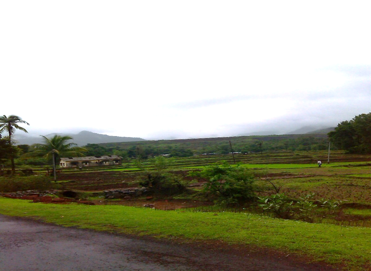
Rice sowing at Nardawe Photo: Damodar Pujari
A brief reading of the White Paper and actual situation in Maharashtra indicates that this is a typical tale of most dams, where cost and time estimates have been escalated multiple times.
By June 2012, the KIDC has spent ₹ 311 Crores on this project. Costs have escalated despite the fact that canals in the original proposal have been cancelled and converted into 16 ‘Kolhapur Type’ gated weirs (KT Weirs).Its Command area (after the dam completion) is supposed to be 12, 530 ha, through 16 KT weirs.It will store 123.74 Million Cubic Meters (MCM)water .Total submergence of Nardawe Dam is625 hawhich will affect3849 people from 967 families.1 village is completely affected (Jambhalgaon) and 4 (Naradawe, Yavateshwar, Bhairavgaon, Durganagar) villages are partially affected. 34.13 ha of identified forests will have to be diverted for the project
Actualwork on the project started in 2001.
According to white paper, 61% work on the dam is complete, which includes the earthen dam wall and 10 KT weirs.
This project finds itself mired in violations of several kinds That it is coming from KIDC comes as no surprise. This section of the WRD Maharashtra has been a regular in violating several norms while pushing its projects. KIDC was also found to have indulged in corruption in the case of Konadhane Dam in Raigad, has started work on Dams like Kalu and Balganga without Forest Clearances or rehabilitation plans.
Illegal Work without Environment Clearance The project has a command area more than 10,000 hectares and hence, requires an Environmental clearance according to the EIA Notification of 1994 which was in effect when the construction work for the dam started. Legally, work cannot start on the dam without an Environmental Clearance. In Nardawe, work has been 61% complete even without an Environment Impact Assessment or Public Hearing.
Work at Nardawe Dam. Photo; Damodar Pujari
Executive Engineer of the Project, Mr Godse, while speaking to SANDRP on the 7th July 2013 accepted that the project has just applied for Terms of Reference (TORs) with the Ministry of Environment and Forests (MoEF) and had started work without an Environment Impact Assessment, Public Hearing or Environmental clearance.
Forest Clearance The project affects 34 ha of identified forest land (वन संज्ञा क्षेत्र) and hence requires Forest clearance from Divisional Forest Office, Bhopal. It does not have final forest clearance. Violating the Forest Conservation Act 1980, work on the project went on, even in Forest area.
Work at Nardawe Dam Photo: Damodar Pujari
The Executive Engineer, while speaking to SANDRP stated that a number of queries have been raised by the Forest Office, Bhopal, one of which is that the project is in vicinity of Radhanagari Wildlife Sanctuary and may need clearance from National Board for Wildlife too.
Forest Rights Act: Individual and community Rights of people dependent on Forest areas are not yet settled. This is serious as these are private forest lands and there is a strong dependence of people on these forests.
High Level Working Group (HLWG) and Western Ghats Expert ecology Panel (WGEEP) Reports All of the affected villages fall under Ecological Sensitive Areas as per the HLWG report and entire Kanakavali Taluka was considered as Ecologically Sensitive Zone (ESZ) – I by WGEEP. WGEEP Report has recommended that no large dams should be built in ESZ 1. According to HLWG Report, peoples’ consultation and resolution are a must prior to starting work in Ecologically Sensitive Areas.
These committees were formed after work on the Nardawe Dam started. However, these reports highlight the high ecological richness of the area. If KIDC had conducted a credible Environment Impact Assessment, as it is legally bound to conduct, these issues could be highlighted before starting work. Current ecological and related social loss could have been avoided.
Officials agree to violations, say that it is more of a norm When SANDRP talked with the Executive Engineer of the project, Mr. Godse on 7th July 2013, he agreed that work on the project is in advanced stage without an Environmental Clearance or Forest clearance in place. As a justification, he said that many projects in Maharashtra indulge in these violations! He said that the project has just applied for TORs for Environmental Clearance with the Ministry of Environment and Forests’. However, the project is yet to come up before the Expert Appraisal Committee of MoEF on River Valley Projects.
Dubious role of EIA Agencies While the Executive Engineer himself agrees that the project has progressed without an Environmental and Forest Clearance in place, The EIA agency for this project, namely Science and Technology Park, Pune[i] did not bat an eyelid while agreeing to do an EIA for this project. They did not point it out to KIDC that applying for an Environmental Clearance when the work is supposedly 61% complete is illegal, neither did they refuse to be a party of such a violation. When SANDRP talked with official from Science and Technology Park involved in this work, he admitted that have visited the region and know that work is at advanced stage. He also agreed that this is a violation and there is little meaning in doing an EIA in such a case. This same agency has worked on EIA Reports of other dams in Konkan region as well.
KT Weirs instead of Canals Letter written by Upper Secretary, Irrigation Department dated 23rd November 1994, claims that the proposal of building RBC (85 km) and LBC (45 km) can generate less irrigated area compared to their length and hence appear to be inefficient in terms of cost as well as irrigation potential. The letter further asks the executive engineer to change the cropping pattern to arecanut and floricultural crops in the command area which require less water which could be supplied from gated barrages through lift irrigation. With this letter as support, canals have been cancelled and KT weirs are being installed, at an increased cost.
Abandoned site office of the Nardawe Dam at Nardawe Photo: Damodar Pujari
Issues of rehabilitation and resettlement When a survey was conducted in 1997, it concluded that 967 families were affected by Nardawe Dam. Sixteen years after the survey, villagers say that the number of affected families has grown to 1245. This means that more than 6000 people may be affected by this project. The villages where resettlement will take place are nothing but sections of hill slopes, as I saw for myself.
Figure 5. Santosh Sawant. One of the affected people and non-governmental member on rehabilitation committee at district administration level
Currently, No resettlement has taken place and villagers are not moving out of their homes.
In a bid to force the affected families out from their homes, administration has stopped construction and repairing of basic civic facilities in the affected villages since 2001.No new water connections, repairing of roads and even ZP schools has taken place in the affected villages in order to push the residents accepting lands in resettlement villages.
Response of the administration has been to assert that local opposition has been the main reason behind the delay in the project. Actually, work on the project has been going on irrespective of local protests, morchas or sit-ins, in complete disregard of the local demands and concerns.
In Conclusion According to villagers, KT weirs built downstream the dam are largely unused because of the cropping pattern, which depends mainly on monsoon and availability of groundwater. Before the KT weirs too, the river was used for some seasonal irrigation.
Time and again it has been proved that major and medium irrigation projects are not a solution for Konkan’s agriculture. According to the White Paper, while the ‘Created’ Irrigation potential of a large dam ‘Tillari’ in Sindhudurga is 7,295 hectares, the actual irrigation potential utilized is just 162 ha!
According to Economic Survey Report of Sindhudurg District in 2012 (Please see table below), large and medium projects have performed dismally. Of the total command area of 49878 hectares, the area actually irrigated by major projects is a mere 158 hectares that is 0.31% and for medium projects with command area of 40821 hectares, area irrigated is an unbelievable 82 ha that is 0.2%!
As against this, minor projects seem to have done better with 4619 hectares irrigated in command of 12851 hectares (around 36%).
Performance of water resources projects in Sindhudurg
No
Taluk
Small
Medium
Large
Command area
Actual irrigated area
Command area
Actual irrigated area
Command area
Actual irrigated area
1
Devgad
1205
533
0
0
0
0
2
Vaibhavwadi
770
114
9027
0
0
0
3
Kankavali
2697
453
20652
82
0
0
4
Malvan
2650
1201
0
0
0
0
5
Vengurla
942
313
0
0
0
0
6
Kudal
3298
1218
0
0
26285
0
7
Sawantwadi
904
598
11142
0
0
0
8
Dodamarg
385
189
0
0
23654
158
Total
12851
4619
40821
82
49939
158
Source- District Economic Survey of Sindhudurg, 2012
The region receives more than 2500 mm of rainfall and decentralized rainwater harvesting, watershed management, revival and renovation of traditional irrigation systems like temple tanks and paats can be cost effective, ecologically sustainable, equitable and efficient solution for this region. The entire Sindhudurg district has several small, decentralized traditional irrigation systems like paats. There exist intricate conflict resolution and water sharing arrangements at the community level about using these paats. Sindhudurg is also rich in irrigation through Temple tanks. TempleTanks in Dhamapur and Nerur stand testimony to the fact that even today, these systems are being utilized.
So then, why are projects like Nardawe, which are costly, unviable, ecologically destructive and stemming unrest in the region being pushed and promoted?
The primary motive behind these irrigation project does not seem to be irrigation or public welfare, for which number of benign options are available. These projects are an easy source profits for contractors, engineers and politicians. Issues like sustainability, efficiency and equity do not seem to matter for the KIDC or Water Resources Department in Maharashtra.
Nardawe Dam is just one example of the large dam centric water management prevalent in Maharashtra. The Irrigation scam which is still unfolding, has demonstrated how hollow this dependence on large infrastructure projects is. If we weigh the meager benefits of these projects against the ecological, social and economic losses to the local communities, environment and public exchequer, it becomes clear that specifically in Konkan region, large dams like Nardawe have no case.
Damodar Pujari, SANDRP
[i] According to its website (http://www.scitechpark.org.in/): “The Science and TechnologyPark is an institute set up jointly by Department of Science and Technology, Ministry of Science and Technology, Govt. of India and University of Pune in the year 1988.”
As Uttarakhand faced unprecedented flood disaster and as the issue of contribution of hydropower projects in this disaster was debated, questions for which there have been no clear answers were, how many hydropower projects are there in various river basins of Uttarakhand? How many of them are operating hydropower projects, how many are under construction and how many more are planned? How many projects are large (over 25 MW installed capacity), small (1-25 MW) and mini-micro (less than 1 MW installed capacity) in various basins at various stages?
This document tries to give a picture of the status of various hydropower projects in various sub basins in Uttarakhand, giving a break up of projects at various stages, As per available information in July 2013.
River Basins in Uttarakhand Entire Uttarakhand is part of the larger Ganga basin. The Ganga River is a trans-boundary river, shared between India and Bangladesh. The 2,525 kms long river rises in the western Himalayas in the Indian state of Uttarakhand, and flows south and east through the Gangetic Plain of North India into Bangladesh, where it empties into the Bay of Bengal. The Ganga begins at the confluence of the Bhagirathi and Alaknanda rivers and forms what we have called Ganga sub basin till it exits Uttarakhand. Besides Bhagirathi, Alaknanda and Ganga sub basin, other river basins of Uttarakhand include: Yamuna, Ramganga (Western Ramganga is taken as Ramganga basin in this document, eastern Ramganga is considered part of Sharda basin) and Sharda. Sharda sub basin includes eastern Ramganga, Goriganga, Dhauliganga, Kaliganga and part of Mahakali basin.
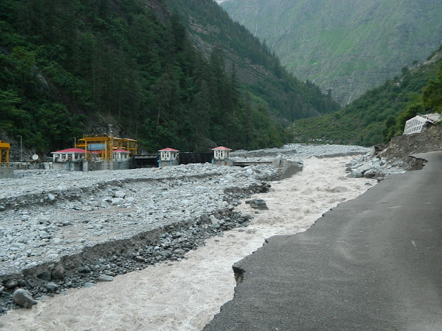
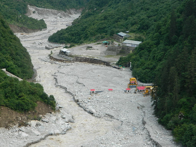
Destroyed 400 MW Vishnuprayag HEP on Alaknanda. Photo: Matu Jan Sangathan
Existing hydropower projects in Uttarakhand In the table below we have given the sub basin-wise list of existing hydropower projects in Uttarakhand along with their capacities. The list has been prepared based on various sources including Central Electricity Authority, Uttarakhand Jal Vidhyut Nigam (UJVNL), Uttarakhand Renewable Energy Development Authority (UREDA) and Report of Inter Ministerial Group on Ganga basin.
Existing Hydropower projects in Uttarakhand
Projects
Installed Capacity (MW)
Projects in Alaknanda River Basin
1. Vishnu Prayag (P)
400
2. Tilwara
0.2
3. Soneprayag
0.5
4. Urgam
3
5. Badrinath II
1.25
6. Rajwakti (P)
3.6
7. Tapowan
1
8. Jummagad
1.2
9. Birahi Ganga (P)
7.2
10. Deval (P Chamoli Hydro P Ltd on Pinder)
5
11. Rishiganga (P)
13.5
12. Vanala (P Hima Urja P Ltd Banala stream)
15
13. Kaliganga I (ADB)
4
Alaknanda Total
455.45
Projects in Bhagirathi River Basin
14. Maneri Bhali-1 (Tiloth)
90
15. Maneri Bahli-2
304
16. Tehri St-I
1000
17. Koteshwar
400
18. Harsil
0.2
19. Pilangad
2.25
20. Agunda Thati (P Gunsola hydro Balganga river)
3
21. Bhilangana (P – Swasti)
22.5
22. Bhilangana III (P – Polyplex)
24
23. Hanuman Ganga (P – Regency Aqua)
4.95
Bhagirathi Total
1850.9
Projects in Ganga River sub basin downstream of confluence of Bhagirathi and Alaknanda
24. Chilla
144
25. Pathri
20.4
26. Mohamadpur
9.3
Ganga sub basin Total
173.7
Projects in Ramganga basin
27. Ramganga
198
28. Surag
7
29. Loharkhet (P Parvatiya Power P Ltd Bageshwar)
4.8
30. Kotabagh
0.2
31. Sapteshwar
0.3
32. Gauri
0.2
Ramganga Total
210.5
Projects in Sharda River Basin
33. Dhauliganga
280
34. Tanakpur
94.2
35. Khatima
41.4
36. Chirkilla
1.5
37. Taleshwar
0.6
38. Suringad
0.8
39. Relagad
3
40. Garaon
0.3
41 Charandev
0.4
42. Barar
0.75
43. Kulagad
1.2
44. Kanchauti
2
Sharda Total
426.15
Projects in Yamuna River Basin
45. Chibro
240
46. Dhakrani
33.75
47. Dhalipur
51
48. Kulhal
30
49. Khodri
120
50. Galogi
3
51. Tharali
0.4
Yamuna Total
478.15
Grand Total
3594.85
Note: (P) in the bracket suggests the project is in private sector, throughout this document. The eastern Ramganga river, which is part of Sharda basin, is included in Sharda basin. Where-ever Ramganga river is mentioned in this document, it refers to Western Ramganga, which is a tributary of Ganga.
Alaknanda flowing beyond the destroyed 400 MW Vishnuprayag Project Photo: Matu Jan Sangathan
In the next table we have given available list of existing mini and micro hydropower projects in Uttarakhand, based on UREDA information.
List of projects up to 1 MW under operation:
SN
Project
Ins Cap (MW)
Dist
Basin
1
Milkhet
0.1
Chamoli
Alaknanda
2
Bamiyal
*
Chamoli
Alaknanda
3
Bursol
0.2
Chamoli
Alaknanda
4
Choting
0.1
Chamoli
Alaknanda
5
Ghagaria
0.1
Chamoli
Alaknanda
6
Ghagaria Extension
*
Chamoli
Alaknanda
7
Ghes
0.1
Chamoli
Alaknanda
8
Gulari
0.2
Chamoli
Alaknanda
9
Niti
0.025
Chamoli
Alaknanda
10
Sarma
0.1
Chamoli
Alaknanda Nandakini/ Maini Gad
11
Wan
0.05
Chamoli
Alaknanda
12
Bank
0.10
Chamoli
Alaknanda Pinder
13
Gamsali Bampa
0.05
Chamoli
Alaknanda Dhauliganga/Ganesh Ganga
14
Kedarnath II
0.2
Rudraprayag
Alaknanda
15
Badiyakot
0.1
Bageshwar
Alaknanda
16
Kunwari
0.05
Bageshwar
Alaknanda
17
Borbalada
0.025
Bageshwar
Alaknanda Pindar/ Chhiyaldi Gad
18
Dokti
0.02
Bageshwar
Alaknanda
19
Dior IInd Phase
*
Pauri
Alaknanda/ Ganga
20
Chandrabhaga Gad
*
Tehri
Bhagirathi
21
Jakhana
0.1
Tehri
Bhagirathi Bhilangana/Balganga
22
Gangotri-I
0.1
UttarKashi
Bhagirathi Kedar Ganga
23
Kanwashram
0.1
Pauri
Ganga
24
Bilkot
0.05
Pauri
Ramganga
25
Dior Ist Phase
0.1
Pauri
Ramganga
26
Gogina II
0.05
Bageshwar
Ramganga
27
Sattshwar
0.05
Bageshwar
Ramganga
28
Toli
*
Bageshwar
Ramganga
29
Ramgarh
0.1
Nainital
Ramganga
30
Lathi
0.1
Bageshwar
E Ramganga/Sharda
31
Liti
0.05
Bageshwar
E Ramganga/Sharda
32
Liti-II
0.05
Bageshwar
E Ramganga/Sharda
33
Ratmoli
0.05
Bageshwar
E Ramganga/Sharda
34
Baghar
0.05
Bageshwar
E Ramganga/Sharda
35
Baicham
0.1
Bageshwar
E Ramganga/Sharda
36
Jugthana
0.1
Bageshwar
E Ramganga/Sharda
37
Kanol gad
0.1
Bageshwar
E Ramganga/Sharda
38
Karmi
0.05
Bageshwar
E Ramganga/Sharda
39
Karmi -III
0.05
Bageshwar
E Ramganga/Sharda
40
Karmi-II
0.05
Bageshwar
E Ramganga/Sharda
41
Bhikuriya Gad
0.5
Pithoragarh
Sharda
42
Kanchauti
*
Pithoragarh
Sharda
43
Lamabager
0.20
Bageshwar
Sharda Saryu
44
Lamchula
0.05
Bageshwar
Sharda Saryu
45
Tarula
0.10
Almora
Sharda Saryu/Jataya Ganga
46
Taluka
0.025
Uttarkashi
Yamuna Tons/ Gattu Gad
47
Bhadri Gad
0.02
Tehri
Yamuna
From http://ahec.org.in/, capacity of some of the projects is as per the UJVNL website. The capacity comes to 3.815 MW for the 41 projects for which capacity is available, for six mini-micro HEPs in Uttarakhand listed above, this information is not available..
5 MW Motigad Project in Pithorgarh District destroyed by the floods. Photo: Emmanuel Theophilus, Himal Prakriti
Based on above two tables, in the following table we have provided an overview of operating hydropower projects and their capacity, with basin wise and size wise break up.
Uttarakhand has total of 98 existing hydropower projects, with total installed capacity of close to 3600 MW. At least eleven of these projects are in private sector with total capacity of over 503 MW. An additional about 1800 MW capacity is in central sector. It means that majority of the power generation capacity in the state is not owned by the state and there is no guarantee how much of that power would be available to the state.
Basin wise number of operating hydro projects in Uttarakhand
Basin
Large Hydro projects (above 25 MW)
Small Hydro projects (1-25 MW)
Mini-micro Hydro projects (below 1 MW)
Total Hydro projects
No of projects
Capacity, MW
No of Projects
Capacity, MW
No of Projects
Capacity, MW
No of Projects
Capacity, MW
Alaknanda
1
400
10
54.75
21
2.22
32
456.97
Bhagirathi
4
1794
5
56.7
4
0.4
13
1851.1
Ganga Sub basin
1
144
2
29.7
1
0.1
4
173.8
Ramganga
1
198
2
11.8
9
1.05
12
210.85
Sharda
3
415.6
4
7.7
21
4.45
28
427.75
Yamuna
5
474.75
1
3
3
0.445
9
478.195
TOTAL
15
3426.35
24
163.65
59
8.665
98
3598.665
Here we should note that as per the Union Ministry of New and Renewable Energy sources, in Uttarakhand, by March 2013, 98 small hydro schemes has been installed with total capacity of 170.82 MW. If we add the small and mini-micro projects in above table, we have 83 operating schemes with installed capacity of 172.315 MW. This mis-match is not possible to resolve since MNRE does not provide full list of operating SHPs in Uttarakhand.
Under Construction Hydropower projects in Uttarakhand In the table below we have given available list of under construction hydropower projects in Uttarakhand. Actual list of under construction projects is likely to be larger than this, since clear and uptodate information is not available on official website. Please note that this does not include the list of mini and micro hydropower projects that are under construction. Even in case of small hydro projects (1-25 MW capacity), the list is not complete. According to this list, 41 projects with 2378.115 MW capacity are under construction in Uttarakhand. 6 of them are large hydropower projects and rest 35 are small or mini-micro hydro projects. Of the 6 large hydropower projects, three are in private sector and three are in central sector, none in state sector.
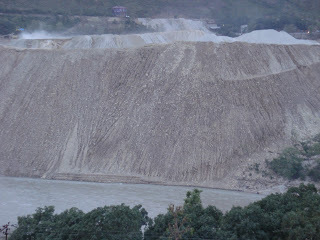
Mountains of Muck generated by under construction 330 MW Shrinagar Hydel Project
List of under construction projects:
SN
Project
Ins Cap (MW)
Dist
Sub-Basin
1
Srinagar
330
Pauri
Alaknanda
2
Phata- Byung
76
Rudraprayag
Alaknanda
3
Singoli-Bhatwari
99
Rudraprayag
Alaknanda
4
Lata Tapovan
171
Chamoli
Alaknanda
5
Tapovan Vishnugad
520
Chamoli
Alaknanda
6
Madhmaheshwar (ADB)
10
Rudrprayag
Alaknanda
7
Kaliganga-II (ADB)
6
Rudrprayag
Alaknanda
8
Bgyunderganga (P)
24.3
Chamoli
Alaknanda
9
Birahi Ganga-I (P)
24
Chamoli
Alaknanda
10
Devali (P)
13
Chamoli
Alaknanda
11
Kail ganga
5
Chamoli Pinder
Alaknanda
12
Khiraoganga (P)
4
Uttarkashi
Alaknanda
13
Sobla I
8
Pithoragarh
Alaknanda
14
Hafla
0.2
Chamoli
Alaknanda Hafla Gad
15
Nigol Gad
0.1
Chamoli
Alaknanda Nigal Gad
16
Wachham
0.50
Bageshwar
Alaknanda Pindar/SunderDhunga Gad
17
Tehri stage-II
1000
Tehri
Bhagirathi
18
Asiganga-I
4.5
Uttarkashi
Bhagirathi
19
Asiganga-II
4.5
Uttarkashi
Bhagirathi
20
Suwarigad
2
Uttarkashi
Bhagirathi
21
Limchagad
3.5
Uttarkashi
Bhagirathi
22
Kaldigad (ADB)
9
Uttarkashi
Bhagirathi
23
Balganga-II
7
Tehri Garhwal
Bhagirathi
24
Jalandhari Gad (P)
24
Uttarkashi
Bhagirathi
25
Kakora Gad (P)
12.5
Uttarkashi
Bhagirathi
26
Kot-Buda Kedar (P)
6
Tehri
Bhagirathi
27
Siyangad (P)
11.5
Uttarkashi
Bhagirathi
28
KotiJhala
0.2
Tehri
Bhagirathi Bal Ganga
29
Pinsward
0.05
Tehri
Bhagirathi Bal Ganga
30
Dunao
1.5
Pauri
Ganga sub basin
31
Gaudi Chida
0.25
Pauri
Ganga sub basin E Nayar
32
Rotan
0.05
Pithoragarh
Sharda E Ramganga/Rotan
33
Duktu
0.025
Pithoragarh
Sharda Kali/ Nati Yanki
34
Nagling
0.05
Pithoragarh
Sharda Kali/ Nagling Yanki
35
Sela
0.05
Pithoragarh
Sharda Dhauli Ganga/ Seal Gad
36
Kutty
0.05
Pithoragarh
Sharda Kali
37
Napalchu
0.05
Pithoragarh
Sharda Kali/ Piear Yanki
38
Bundi
0.05
Pithoragarh
Sharda Kali/ Pulung Gad
39
Rongkong
0.05
Pithoragarh
Sharda Kali/ Dangiang Yanki
40
Chiludgad
0.10
Uttarakashi
Yamuna Supin/Chilude Gad
41
Khapu Gad
0.04
Uttarakashi
Yamuna Supin/Khapu Gad
Total Under Construction 2378.115 MW
Note: Projects like Loharinag Pala, Pala Maneri, Bhairoghati and other projects along Bhagirathi upstream of Uttarkashi along the Eco Sensitive zone have been dropped from this list. Rest of the list is from the IMG report or from UJVNL website. P in the bracket indicates the project is in the private sector. ADB in the bracket indicates that the project is funded by the Asian Development Bank.
Proposed hydropower projects in Uttarakhand In following tables we have provided available list of proposed hydropower projects in the Alaknanda, Bhagirathi, Yamuna, Sharda and Ramganga basins in Uttarakhand. The list is likely to be longer than the list in these tables since full and upto-date information is not available. Also there are different agencies involved in proposing, sanctioning and executing these projects and there is no single agency which can provide comprehensive picture of what is happening in the basin. However, even this available list is frightening.
List of proposed projects in Alaknanda Basin
SN
Project
Ins Cap (MW)
Dist
Sub-Basin
Status
1
Vishnugad Pipalkoti (WB)
444
Chamoli
Alaknanda
Construction to be started
2
Kotli Bhel (IB)
320
Pauri
Alaknanda
EAC ok/FAC u/consideration
3
Alaknanda (P Badrinath)
300
Chamoli
Alaknanda
EC & FC ok IA not signed
4
Devsari Dam
252
Chamoli
Alaknanda
EC & FC ok CEA concrnce?
5
Kotli Bhel II
530
Pauri
Ganga sub basin
EAC ok/FAC u/consideration
6
Bowla Nandprayag
300
Chamoli
Alaknanda
EAC TOR Approved
7
Tamak Lata
280
Chamoli
Alaknanda
EC ok, DPR under revision
8
Nand Prayag
100
Alaknanda
DPR returned
9
Jelam Tamak
108
Chamoli
Alaknanda
EAC ok in June 2013
10
Maleri Jelam
55
Chamoli
Alaknanda
PFR prepared
11
Rishiganga I
70
Chamoli
Alaknanda
PFR prepared
12
Rishiganga II
35
Chamoli
Alaknanda
PFR prepared
13
Gohana Tal
60
Chamoli
Alaknanda
PFR prepared
14
Rambara
24
Rudraprayag
Alaknanda
IMG report
15
Birahi Ganga-II (P)
24
Chamoli
Alaknanda
DPR under revision
16
Melkhet (P)
56
Chamoli
Alaknanda Pinder
Proposed
17
Urgam-II
3.8
Chamoli
Alaknanda
Under S&I
18
Bhyunder Ganga
243
Chamoli
Alaknanda
FC under consideration
19
Nand Pyayag Langasu
141
Chamoli
Alaknanda
EAC TOR Approved
20
Rambara
76
Rudraprayag
Alaknanda
EAC TOR u/consideration
21
Bagoli
90
Chamoli
Alaknanda
Proposed
22
Bangri
44
Chamoli
Alaknanda
Pinder
23
Madhya Maheshwar
350
Chamoli
Alaknanda
Proposed
24
Ming Nalgaon
114
Chamoli
Alaknanda
Pinder
25
Padli
66
Chamoli
Alaknanda
Proposed
26
Thapli
44
Chamoli
Alaknanda
Proposed
27
Utyasu-I
70
Chamoli
Alaknanda
Proposed
28
Utyasu-II
205
Chamoli
Alaknanda
Proposed
29
Utyasu-III
195
Chamoli
Alaknanda
Proposed
30
Utyasu-IV
125
Chamoli
Alaknanda
Proposed
31
Utyasu-V
80
Chamoli
Alaknanda
Proposed
32
Utyasu-VI
70
Chamoli
Alaknanda
Proposed
33
Rampur Tilwari
25
Rudraprayag
Alaknanda
Proposed
34
Chunni semi
24
Rudraprayag
Alaknanda
Proposed Mandakini
35
Kosa
24
Chamoli
Alaknanda
Dhauliganga
36
Vijay nagar- Rampur
20
Rudraprayag
Alaknanda
Proposed
37
Nandakini-III
19.5
Chamoli
Alaknanda
Proposed
38
Nayar
17
Pauri
Ganga sub basin
Nayar
39
Alaknanda I
15
Chamoli
Alaknanda
Proposed
40
Buara
14
Bageshwar
Alaknanda
Pindar
41
Duna Giri
10
Chamoli
Alaknanda
Dhauliganga
42
Alaknanda II
10
Chamoli
Alaknanda
Proposed
43
Balkhila-II
10
Chamoli
Alaknanda
Proposed
44
Mandani Ganga
10
Rudraprayag
Alaknanda
Mandakini Mandani ganga
45
Rishiganga
8.25
Chamoli
Alaknanda
Proposed
46
Subhain
8
Chamoli
Alaknanda
Dhauliganga
47
Son
7
Rudraprayag
Alaknanda
Mandakini son gad
48
Kalp ganga
6.25
Chamoli
Alaknanda
Proposed kalpganga
49
Lustar
6
Rudraprayag
Alaknanda
Mandakini Lustar
50
Madhya maheshwar -II
6
Rudraprayag
Alaknanda
Mandakini madmaheshwar
51
Hom 6
6
Chamoli
Alaknanda
Dhauliganga
52
Amrit ganga
6
Chamoli
Alaknanda
Amrit ganga balsuti gadera
53
Gaddi
5.25
Chamoli
Alaknanda
dhauliganga Gaddi Gadera
54
Deval
5
Chamoli
Alaknanda
Proposed
55
Ghrit Ganga
5
Chamoli
Alaknanda
Proposed
56
Jumma
5
Chamoli
Alaknanda
Proposed
57
Ringi
5.5
Chamoli
Alaknanda
Dhauliganga
58
Tamak
5
Chamoli
Alaknanda
Proposed
59
Balkhila-I
5.5
Chamoli
Alaknanda
Proposed Balkhila
60
Basti -I
4
Rudraprayag
Alaknanda
Proposed
61
Basti -II
4
Rudraprayag
Alaknanda
Proposed
62
Laxmanganga
4
Chamoli
Alaknanda
Proposed
63
Nil ganga
3
Chamoli
Alaknanda
Proposed
64
Santodhar – I
2
Pauri
Ganga sub basin
W Nayar
65
Santodhar – II
2
Pauri
Ganga sub basin
W Nayar
66
Birahiganga
4.8
Chamoli
Alaknanda
Proposed
67
Byaligaon
2.25
Pauri
Ganga sub basin
E Nayar
68
Ghirit Ganga
1.3
Chamoli
Alaknanda
Proposed
69
Jummagad
1.2
Chamoli
Alaknanda
Proposed
70
Kailganga
3
Chamoli
Alaknanda
Proposed
71
Kakra
1
Rudraprayag
Alaknanda
Proposed
72
Kali Ganga
3
Chamoli
Alaknanda
Proposed
73
Garud Ganga
0.6
Chamoli
Alaknanda
Proposed
74
Gansali Bampa
0.05
Chamoli
Alaknanda
Dhauliganga/Ganesh Ganga
Alaknanda Total
5199.25
List of proposed projects in Bhagirathi Basin
SN
Project
Ins Cap (MW)
Dist
Sub-Basin
Status
1
Kotli Bhel (IA)
195
Pauri
Bhagirathi
EC/FAC stage 1
2
Jhalakoti (P)
12.5
Uttarkashi
Bhagirathi
Proposed dharamganga
3
Bhilangana II A
24
Uttarkashi
Bhagirathi
Proposed
4
Karmali
140
Uttarkashi
Bhagirathi
IMG, on Eco-sensitive zone?
5
Jadhganga
50
Uttarkashi
Bhagirathi
IMG: PFR prepared
6
Bhilangana IIB
24
Tehri
Bhagirathi
Under S&I
7
Bhilangana IIC
24
Tehri
Bhagirathi
Under S&I
8
Pilangad-II
4
Uttarkashi
Bhagirathi
Proposed
9
Bhela Tipri
100
Uttarakashi
Bhagirathi
Proposed
10
Nelong
190
Uttarakashi
Bhagirathi
Proposed
11
Asiganga-III
9
Uttarkashi
Bhagirathi
Proposed
12
Gangani (P)
8
Uttarkashi
Bhagirathi
Proposed
13
Balganga-I
5
Tehri Garhwal
Bhagirathi
Proposed
14
Khirao ganga
4
Uttarkashi
Bhagirathi
Proposed
15
Lagrasu (P)
3
Tehri Garhwal
Bhagirathi
Proposed
16
Songad
3
Uttarkashi
Bhagirathi
Proposed
17
Jalandhari Gad
3
Uttarakashi
Bhagirathi
Proposed
18
Jalkurgad I
2
Tehri Garhwal
Bhagirathi
Proposed jalkur gad
19
Rataldhara
0.4
Tehri Garhwal
Bhagirathi
Proposed Jalkur Gad
20
Lamb Gaon
0.4
Tehri Garhwal
Bhagirathi
Proposed Jalkur gad
21
Dhatirmouli
0.4
Tehri Garhwal
Bhagirathi
Proposed Jalkurgad
22
Gangi-Richa
0.2
Tehri Tehri
Bhagirathi
Bhilangana/ Re Gad
Bhagirathi Total
801.9
List of proposed projects in W Ramganga Basin
Golden Mahseer in Ramganga
SN
Project
Ins Cap (MW)
Dist
Sub-Basin
Status
1
Babas Dam
88
Almora
Ramganga
Proposed
2
Khati
63
Bagehwar
Ramganga
Proposed
3
Lumi
54
Bagehwar
Ramganga
Proposed
4
Kuwargarh
45
Bagehwar
Ramganga
Proposed
5
Bawas Gaon
34
Nainital
Ramganga
Proposed
6
Jamrani Dam
30
Ramganga
Proposed
7
Khutani
18
Bageshwar
Ramganga
Proposed
8
Sarju Stage-II (P)
15
Bageshwar
Ramganga
Proposed
9
Sarju Stage-III (P)
10.5
Bageshwar
Ramganga
Proposed
10
Sheraghat
10
Almora
Ramganga
Kho
11
Baura
14
Bageshwar
Ramganga
Proposed
12
Sarju Stage-I (P)
7.5
Bageshwar
Ramganga
Proposed
13
Balighat
5.5
Bageshwar
Ramganga
Proposed
14
MehalChaura-I
4
Pithoragarh
Ramganga
Proposed
15
MehalChaura-II
3
Pithoragarh
Ramganga
Proposed
16
Agarchatti
2
Pithoragarh
Ramganga
Proposed
17
Kho I
2
Pauri
Ramganga
Kho
18
Kho II
2
Pauri
Ramganga
Proposed
19
Harsila
0.7
Bageshwar
Ramganga
Proposed harsila gad
20
Kalsa
0.3
Nainital
Ramganga
Proposed
Ramganga Total
408.5
List of proposed projects in Sharda Basin
SN
Project
Ins Cap (MW)
Dist
Sub-Basin
Status
1
Mapang Bogudhiyar (P)
200
Pithoragarh
Sharda
EAC TOR Approved
2
Bogudhiyar Sarkaribhyol (P)
170
Pithoragarh
Sharda
EAC TOR Approved
3
Sarkaribhyol Rupsiabagar
210
Pithoragarh
Sharda
EAC TOR Approved
4
Rupsiabagar Khasiabara
260
Pithoragarh
Sharda
EAC Ok / FAC Rejected
5
Bokang Baling
330
Pithoragarh
Sharda
Proposed THDC
6
Chungar Chal
240
Pithoragarh
Sharda
Proposed NHPC
7
East Ram Ganga Dam
30
Pithoragarh
Sharda
Proposed
8
Khartoli Lumti Talli
55
Pithoragarh
Sharda
Proposed
9
Budhi
192
Pithoragarh
Sharda
Mahakali
10
Garba Tawaghat
610
Pithoragarh
Sharda-Mahakali
Proposed NHPC
11
Garbyang
131
Pithoragarh
Sharda
Mahakali
12
Lakhanpur
160
Pithoragarh
Sharda
Proposed
13
Malipa
138
Pithoragarh
Sharda
Mahakali
14
Pancheshwar
6000
Pithoragarh
Sharda
Indo Nepal Project
15
Purnagiri Dam
1000
Champawat
Sharda
Indo Nepal Project
16
Tawaghat – Tapovan
105
Pithoragarh
Sharda
Mahakali
17
Taopvan Kalika
160
Pithoragarh
Sharda
Mahakali
18
Tapovan Chunar
485
Pithoragarh
Sharda
Proposed
19
Sela Urthing
230
Pithoragarh
Sharda
Proposed
20
Urthing Sobla (P)
340
Pithoragarh
Sharda
Proposed
21
Sobla Jhimjingao
145
Pithoragarh
Sharda
Proposed
22
Kalika – Baluwakot
120
Pithoragarh
Sharda
Mahakali
23
Kalika Dantu
230
Pithoragarh
Sharda
Proposed
24
Dhauliganga Intermediate
200
Pithoragarh
Sharda
Proposed NHPC
25
Gauriganga III A & B
140
Pithoragarh
Sharda
Proposed NHPC
26
Madkini (P)
39
Pithoragarh
Sharda
Proposed
27
Burthing – Purdam
5
Pithoragarh
Sharda
Proposed Jakula
28
Jimbagad
7.7
Pithoragarh
Sharda
Proposed
29
Suringad-II
5
Pithoragarh
Sharda
Proposed
30
Tanga (P)
5
Pithoraharh
Sharda
Proposed
31
Tankul
12
Pithoragarh
Sharda
Proposed
32
Motighat (P)
5
Pithoraharh
Sharda
Proposed
33
Painagad
9
Pithoragarh
Sharda
Proposed
34
PhuliBagar- Kwiti
4
Pithoragarh
Sharda
Proposed Jakula
35
Kumeria- Garjia (Bawas)
12.5
Nainital
Sharda
Kosi
36
Balgad
8
Pithoragarh
Sharda
E Ramganga
37
Kuti SHP
6
Pithoragarh
Sharda
Maha Kali/ Kuti yangti
38
Palang SHP
6.5
Pithoragarh
Sharda
Maha Kali/ Plang gad
39
Najyang SHP
5.5
Pithoragarh
Sharda
Maha Kali/ Najyang gad
40
Simkhola SHP
8.75
Pithoragarh
Sharda
Maha Kali/ Simkhola gad
41
Birthi
1
Pithoragarh
Sharda
Balchinn
42
Baram
1
Pithoragarh
Sharda
Dhauli Ganga/ Baram Gad
43
Unchiya
0.05
Pithoragarh
Sharda
Dhauli Ganga/ Khari Gad
44
Murtoli
0.02
Pithoragarh
Sharda
Goriganga/ Martoligad
45
Burphu
0.03
Pithoragarh
Sharda
Goriganga/ Martoligad
46
Ralam
0.03
Pithoragarh
Sharda
Goriganga/ Ralangad
47
Ram Gad-II
0.1
Nainital
Sharda
Kosi/ Ramgad
48
Watcm
0.1
Pithoragarh
Sharda
Ramgad E/ Watchraila
Total Sharda Basin
12022.28
List of proposed projects in Yamuna Basin
SN
Project
Ins Cap (MW)
Dist
Sub-Basin
Status
1
Lakhwar
300
Dehradun
Yamuna
EAC TOR Approved
2
Vyasi
120
Dehradun
Yamuna
EAC Recommended
3
Arakot Tuni
81
Uttarkashi
Yamuna
EAC TOR Approved
4
Tuni Plasu
66
Dehradun
Yamuna
EAC TOR Approved
5
Mori-Hanol (P)
63
Uttarkashi
Yamuna
EAC TOR Approved
6
Naitwar Mori (Dewari Mori)
60
Uttarkashi
Yamuna
EAC Recommended
7
Hanol Tuni (P)
60
Uttarkashi
Yamuna
EAC Recommended
8
Jakhol Sankri
45
Uttarkashi
Yamuna
EAC TOR Approved
9
Kishau
600
Dehradun
Yamuna
Proposed
10
Chammi Naingaon
540
Uttarakashi
Yamuna
Proposed
11
Chatra Dam
300
Uttarakashi
Yamuna
Proposed
12
Taluka Sankri
140
Uttarkashi
Yamuna
Proposed
13
Taluka Dam
112
Uttarakashi
Yamuna
Proposed
14
Sankri Mori
78
Uttarakashi
Yamuna
Proposed
15
Barkot Kuwa
42
Uttarakashi
Yamuna
Proposed
16
Hanuman Chatti Sianachatti
33
Uttarakashi
Yamuna
Proposed
17
Barnigad Naingaon
30
Uttarakashi
Yamuna
Proposed
18
Rupin Stage V (P)
24
Uttarkashi
Yamuna
Proposed
19
Damta – Naingaon
20
Uttarkashi
Yamuna
Proposed
20
Tons
14.4
Uttarkashi
Yamuna
Proposed
21
Supin
11.2
Uttarkashi
Yamuna
Proposed
22
Rupin Stage IV (P)
10
Uttarkashi
Yamuna
Proposed
23
Rupin Stage III (P)
8
Uttarkashi
Yamuna
Proposed
24
Barnigad
6.5
Uttarakashi
Bhagirathi
Proposed
25
Pabar
5.2
Dehradun
Yamuna
Proposed
26
Badyar (P)
3
Uttarkashi
Yamuna
Proposed
27
Lagrasu
3
Tehri
Yamuna
Proposed
28
Rayat (P)
3
Tehri
Yamuna
Proposed
29
Ringali
1
Tehri Garhwal
Yamuna
Proposed Aglar Ringaligad
30
Purkul
1
Dehradun
Yamuna
Tons
31
Paligad
0.3
Uttarkashi
Yamuna
Proposed Paligad
32
Rikhani Gad
0.05
Uttarkashi
Yamuna
Rikhanigad
33
Bijapur
0.2
Dehradun
Yamuna
Tons
Yamuna Total
2780.85 MW
Grand Total
21212.78 MW
Note: EAC: Expert Appraisal Committee of MoEF; FAC: Forest Advisory Committee of MoEF; EC: Environment Clearance: FC: Forest Clearance; TOR: Terms of Reference (of EIA); for Alaknanda, the first 17 projects are listed as given in IMG report and for Bhagirathi first 8 projects are as listed in IMG report. However, many of these projects have been recommended to be dropped by the WII (Wildlife Institute of India) report. Also, IMG and other have said that no further projects should be taken up in Bhagirathi and Alaknanda basins. The projects listed above in the Bhagirathi basin beyond serial number 8 and those in Alaknanda basin beyond 17 would, in any case, not be taken up.
In the table below we have provided and overview of proposed hydropower projects in Uttarakhand based on the information from above five tables.
Overview of Proposed Hydropower Projects in Uttarakhand
Basin
Large Hydro projects (above 25 MW)
Small Hydro projects (1-25 MW)
Mini-micro Hydro projects (below 1 MW)
Total Hydro projects
No of projects
Capacity, MW
No of Projects
Capacity, MW
No of Projects
Capacity, MW
No of Projects
Capacity, MW
Alaknanda
29
4823
43
375.6
2
0.65
74
5199.25
Bhagirathi
5
675
13
125.5
4
1.4
22
801.9
Ramganga
6
314
12
93.5
2
1
20
408.5
Sharda
26
11920
16
101.95
6
0.33
48
12022.28
Yamuna
17
2670
13
110.3
3
0.55
33
2780.85
TOTAL
83
20402
97
806.85
17
3.93
197
21212.78
Overview of hydropower projects in Uttarakhand In the table below we have put together the number and capacities of existing, under construction and proposed hydropower projects in various basins of Uttarakhand. Uttarakhand government has plans to have total of 337 hydropower projects with total capacity of 27191.89 MW. Largest number (124) of such projects are in Alaknanda basin, the largest capacity is proposed to be in Sharda basin at 12450.905 MW.
In the table below we have given basin wise figures of total large, small and mini-micro hydropower proejcts (including existing, under construction and proposed) projects in Uttarakhand. According to Union Ministry of New and Renewable energy, total potential of small hydro in Uttarakhand is 1707.87 MW from 448 small hydro projects. If we take that into account the figures in the following tabes would change (go up) accordingly.
Basin wise total capacities for large, small and mini HEPs in Uttarakhand
Basin
Large Hydro projects (above 25 MW)
Small Hydro projects (1-25 MW)
Mini-micro hydro projects (<1 MW)
Total Hydro projects
No of projects
Capacity, MW
No of Projects
Capacity, MW
No of Projects
Capacity, MW
No of Projects
Capacity, MW
Alaknanda
35
6419
61
524.65
26
3.67
122
6947.32
Bhagirathi
10
3469
28
266.7
10
2.05
48
3737.75
Ganga Sub basin
1
144
3
31.2
2
0.35
6
175.55
Ramganga
7
512
14
105.3
11
2.05
32
619.35
Sharda
29
12335.6
20
109.65
35
5.155
84
12450.405
Yamuna
22
3144.75
14
113.3
8
1.135
44
3259.185
TOTAL
104
26024.35
140
1150.8
92
14.41
336
27189.56
In the table below we have given basin wise figures of existing, under construction and proposed hydropower projects of all sizes in Uttarakhand.
Overview of all Hydropower projects in Uttarakhand
Basin
Existing Hydro projects
Under construction projects
Proposed hydropower projects
Total Hydro projects
No of projects
Capacity, MW
No of Projects
Capacity, MW
No of Projects
Capacity, MW
No of Projects
Capacity, MW
Alaknanda
32
456.97
16
1291.1
74
5199.25
122
6947.32
Bhagirathi
13
1851.5
13
1084.75
22
801.9
48
3737.75
Ganga Sub basin
4
173.8
2
1.75
–
–
6
175.55
Ramganga
12
210.8
–
–
20
408.5
32
619.35
Sharda
28
427.75
8
0.375
48
12022.28
84
12450.405
Yamuna
9
478.195
2
0.14
33
2780.85
44
3259.185
TOTAL
98
3598.665
41
2378.115
197
21212.78
336
27189.56
Basin Maps Maps of Hydroelectric Projects in various sub basins of Uttarakhand are available at the following links. Please note that the maps are based on information available when the maps were created in 2011:
How do the hydropower projects increase the scale of disaster?
This is a question that a lot of journalists and TV anchors have been asking me since the Uttarakhand disaster. Here is a quick response:
Þ Almost all hydropower projects of Uttarakhand involve deforestation. Deforestation directly increases the potential of erosion, landslides and floods since water now just runs off to the rivers. Moreover the compensatory afforestation and catchment area treatment, even when done, usually involves planting of commercially important variety of trees like pine and teak and not broad leaf tress like oaks which not only adds humus in the soil, but also allows rich under growth. Pine does not allow this to happen. This change in character of forests is something Gandhiji’s disciple Mira Behen has been warning since independence, but there is little impact of this on the forest department.
Þ In fact largest proportion of deforestation in Uttarakhand has happened basically for hydropower projects.
Þ All run of the river projects involve building of a dam, diversion structure, desilting mechanism, tunnels which could have length of 5 to 30 km and width sufficient to carry three trains side by side, as also roads, townships, mining, among other components. All of these components increase the disaster potential of the area in one or the other way. Cumulative impacts of all the components of any one project and all projects together in a given basin is likely to be larger than the addition of the impacts of individual projects in many cases.
Þ Massive blasting of massive proportions is involved in construction of all these components, which adds to landslide risks. In fact Uttarakhand’s Disaster Mitigation and Management Centre in their report of Oct 2012 after the Okhimath disaster of Sept 2012 recommended that no blasting should be allowed for any development activity anywhere in Uttarakhand, but Uttarakhand government did nothing about this recommendation.
Þ The massive tunneling by itself weakens the young and fragile Himalayan mountains, increasing the disaster potential.
Þ Each of the hydropower project generates immense amount of muck in tunneling, blasting and other activities. A large hydropower project could typically generate millions of cubic meters of muck. The large projects are supposed to have muck disposal plan, with land acquired for muck disposal, transportation of muck to the designated sites above the High Flood levels, creation of safety walls and stabilization process. But all this involves costs. The project developers and their contractors find it easier to dump this muck straight into the nearby rivers. In the current floods, this illegally dumped muck created massive disaster in downstream areas in case of 330 MW Srinagar HEP, the 76 MW Phata Byung HEP and the 99 MW Singoli Bhatwari HEP. When the flooded rivers carry this muck, boulders and other debris, has much greater erosion capacity and also leaves behind massive heaps of this muck in the flooded area. In Srinagar town about 100 houses are buried in 10-30 feet depth of muck. Such debris laden rivers also create massive landslides along the banks.
Muck Disposal directly into the Alaknanda river by Srinagar Project Photo: Matu janSangathan
Þ Wrong operation of hydropower projects can also create greater disasters in the downstream areas. For example the operators of 400 MW Vishnuprayag HEP on Alaknanda river did not open the gates when the river was flooded on June 16-17, possibly to maximize power generation. However, this lead to accumulation of massive quantities of boulders (for photos of dam filled with such boulders see: http://matuganga.blogspot.in/) behind the dam, so much so that that there was no space for water to flow. The river then bypassed the dam and started flowing by the side of the dam, creating a new path for its flow. This created a sudden flashflood in the downstream area, creating a new disaster there.
Boulders devouring the Vishnuprayag Project. 26th June 2013 Photo: Matu jan Sangathan
Þ The incomplete, broken and ill designed protection wall of the Maneri Bhali projects in Uttarkashi lead to erosion and landslides in the downstream areas.
DAMAGED HYDRO PROJECTSA large number of hydropower projects are likely to have suffered damage due to the flood disaster in Uttarakhand. Some of the projects that have suffered damage include:
According to the update from http://www.energylineindia.com/on June 27, 2013, the 520 MW under construction Tapovan Vishnugad HEP has suffered damaged by rains on June 16, 2013: “While construction of diversion tunnel was completed in April this year, the same was washed away due to heavy rains on June 16. Diversion dyke has washed away and damages have been observed in chormi adit approach road. In August last year, the flash floods had caused serious damages in the coffer dam of the project.”
76 MW Phata Byung HEP of Lanco in Mandakini Valley in Uttarakhand
99 MW Singoli Bhatwari HEP of L&T in Mandakini Valley in Uttarakhand NDTV India reported that the water level of the river has gone up due to the silt dumped by dams. This is likely to be due to the Phata Byung and Singholi Bhatwari HEPs.
Assiganga projects on Assiganga river in Bhagirathi basin in Uttarakhand
5 MW Motighat I HEP in Goriganga basin in Pithoragarh (Himalprakriti report)
280 Dhauliganga Project of NHPC in Pithoragarh district of Uttarakhand (reports said the power house was submerged, but is now working, part of the township was submerged.)
The Himalaya Hydro (HH) Tanga Phase I for 5 MW, located along the Paina gad in Goriganga basin, is badly damaged. The dam has got smashed by a deluge of huge boulders. One sluice gate is torn through. The metal filter-gates are all choked with boulder debris, and the remnant concrete and gate pulleys of the dam are now stranded mid-river, with both banks eroded and the river now running along the true-left bank. (Himalprakriti report)
The UREDA 500 KW Motigad microhydel on Moti gadh (a tributary of Paina gadh) at Bindi (Dani Bagad) is also badly damaged. The water has broken through the wall, cut under the foundation, inundated the turbines with water and debris, and smashed the housing for the electrical distribution system. (Himalprakriti report)
The 5.5′ diameter head race waterpipes taking water to the HH Phase II, located on the Gori opposite Seraghat, has also been damaged. The generator and housing for the HH Ph II has collapsed into the river. All this damage is said to have happened on the evening of 17th June. People working as non-skilled labour have been sent home for a few months, but welding work on the new pipes feeding the powerhouse is still underway! (Himalprakriti report)
Down to Earth (http://www.downtoearth.org.in/content/hydropower-projects-suffer-severe-damage) has given some details of damage to some of the hydropower projects, quoting UJVNL sources. It says: 19 small hydropower projects have been completely destroyed, while others have been damaged by the raging waters (see table below)
Project
Location
Capacity
Estimated Loss
Dhauli Ganga
Pithoragarh
280 MW
Rs 30 crore (project completely submerged)
Kaliganga I
Rudraprayag
4 MW
Rs 18-19 crore (power house and 4 houses washed away)
Kaliganga II
Rudraprayag
6 MW
Rs 16 crore (power house and 4 houses washed away)
In addition, a large number of projects had to stop generation temporarily due to high silt content, including Maneri Bhali I and II, Tanakpur, Dhauli Ganga, Kali Ganga I, some of the Yamuna basin projects among others.
Conclusion This article was intended to give an overview of hydropower projects in Uttarakhand. However, we should add that there are many glaring issues related to these hydropower projects, some of the key issues include:
Most of these projects are out of the environmental governance. Projects below 25 MW do not require EIA, Social Impact Assessment, public consultation, environmental clearance, environmental management plan or monitoring. This is clearly wrong as all projects have environmental impacts, and they are particularly serious in Himalayan region with multiple vulnerabilities. We have for years demanding that all projects above 1 MW should need environment clearance, EIA and so on.
Even for projects above 25 MW we do not have any credible environmental or social impact assessment. Former Environment Minister Jairam Ramesh is on record having accepted that most EIAs are dishonest cut and paste jobs. We do not have any credible process in place to ensure that EIAs are proper and those that are not are rejected and consultants are black listed. Jairam Ramesh did put in place a process of registration of EIA consultants under the Quality Council of India, but that is completely non transparent, unaccountable and ineffective process. It is amazing that reputed NGOs like the Centre for Science and Environment are on board of this process, but they have completely failed to achieve any change and have chosen to remain quiet.
The Environment clearances of the River Valley Projects (which includes hydro projects and dams) is considered by the Expert Appraisal Committee on River Valley Projects appointed by Union Ministry of Environment and Forests. However, the ministry chooses members of the EAC such that they rarely object to any project. As per SANDRP analysis in six years ending in Dec 2012, the EAC had not said NO to any project for environment clearance. Its appraisal of projects, EIAs, public consultation process and its own minutes were found to be inconsistent, unscientific and loaded in favour of the project developers.
Our environment compliance system is non-existing. The projects are supposed to implement the environment management plan pari passu with the project work, they are supposed to follow the conditions of environment clearance, follow the environmental norms, but who is there to ensure this actually happens? The Union Ministry of Environment and Forests which is supposed to ensure this compliance has no capacity the officials tell us. The officials do not have time to even check if six monthly compliance reports are being submitted or make any surprise visits. However they do not even seem to have will, since we have seen no change in this situation for decades. Nor do they seem to have willingness, since even when NGOs present photographic and video and other evidence of violations they refuse to take action.
One way to achieve compliance is to have a project monitoring committee for each project where over 50% of the members are from local communities and other independent persons and such committees ok must be required each stage for the project to go ahead. We have been suggesting this for long, but the MoEF has shown no willingness to follow this.
More pertinently, none of the assessment reports look at the impact on the disaster potential of the area. Each of these projects have significant impact on the disaster potential of the area, particularly in the context of a vulnerable state like Uttarakhand. This should be a must for all such projects.
Similarly the projects must also be assessed in the context of climate change, again in vulnerable area like the Himalayas. How the project will impact the local climate, how it will have impact on adoption capacity of the local communities and also how the project itself will be impacted in changing climate. This again we have been writing to the MoEF numerous times, but without any success so far.
Most significantly, the only impact assessments that we have is for specific projects of over 25 MW capacity. However, we have no credible cumulative impact assessment for any of the river basins of Uttarakhand, which also takes into account carrying capacity of the river basins and all the interventions that are happening in the basins. As our critique of so called cumulative impact assessment of Bhagirathi-Alaknanda basins done by AHEC of IIT Roorkee shows (see: http://www.sandrp.in/hydropower/Pathetic_Cumulative_Impact_Assessment_of_Ganga_Hydro_projects.pdf), it was not much of a cumulative impact assessment. WII (Wildlife Institute of India, Dehradun) report was somewhat better within the mandate given to it (assessment of hydro projects on aquatic and terrestrial biodiversity), but the most important recommendation of the WII report that at least 24 projects should be dropped has not been accepted by the MoEF, so what is the use of the cumulative impact assessment in such a situation?
Unless we address all of the above issues in a credible way, there is little wisdom in going ahead with more hydropower projects in Uttarakhand.They will invite greater disasters. Uttarakhand has many other options for development.
Firstly people of Uttarakhand should get first right over all the power that is getting generated within Uttarakhand.
Secondly, this is not a plea for no projects, but to address the crucial issues without addressing which we are in no situation to even know the impacts or address the issues.
Thirdly, Uttarakhand needs to take up power generation options that do not accentuate the disaster potential of the area. Such options include micro hydro, hydro kinetics, and solar and biomass based power in addition to better utilization of existing infrastructure.
Going ahead with more hydropower projects in current situation would be invitation to greater disasters. In fact, the Uttarakhand government should not allow even the damaged and under construction hydropower projects until al the conditions mentioned above are satisfied.
Some of the hydropower projects that have surely seem to have added to the disaster proportions of current Uttarakhand flood disaster include the 400 MW Vishnuprayag HEP, the 280 MW Dhauliganga HEP, the 330 MW Shrinagar HEP, the 304 and 90 MW Maneribhali II and I HEPs, the 99 MW Singoli Bhatwari HEP and the 76 MW Phata Byung HEP, the last two on Mandakini river.
In response to my question on a programme on Headlinestoday channel anchored by Rahul Kanwal on July 8, 2013 (in presence of panel that also included Dr Vandana Shiva and Vimlendu Jha), the Uttarakhand Chief Minister Shri Vijay Bahuguna agreed that he will institute an enquiry into the damage due to these hydropower projects and hold them accountable for such damage.
Let us see how soon and how independent and credible enquiry he institutes.
– Himanshu Thakkar
South Asia Network on Dams, Rivers & People (www.sandrp.in) July 2013
Submission to the Forest Advisory Committee, Ministry of Environment and Forests urging them not to grant Forest Clearance to Kikvi Drinking water supply Dam coming up in Trimbakeshwar, Nashik, in the absence of relevant studies and justifications. The project will submerge nearly 1000 heactres of agricultural and forest land in Western Ghats, and there is no justification provided that Nashik needs a new source. The city already takes water from 4 dams, is building a fifth weir and is allegedly supplying more drinking water to help India Bulls Thermal Power Project.
To,
Chairperson and members,
Forest Advisory Committee
Ministry of Environment and Forests
Delhi
Subject: Concerns about Kikvi Drinking Water Supply Project, Brahmanwade, Nashik
Respected Chairperson and Members,
We see from the agenda uploaded on MoEF Website that the FAC will be considering proposal of Kikvi Drinking Water Supply Dam in BrahmanwadeVillage in Nashik, Maharashtra diverting 172.46 hectares of Forest in its upcoming meeting on 11th and 12th July 2013. The entire submergence of the project is a massive 933.98 hectares in the Northern Western Ghats. Partners from SANDRP visited the site on the 7th July 2013, studied the ecology and talked with the local farmers to be affected by the project. Based on the visit and analysis of Site Inspection report (SIR), FormIA and Factsheet uploaded on MoEF Website, we would like to highlight some strong concerns about this proposal:
No evidence that Nashik needs a new source of drinking water: The Site Inspection Report of the Additional Principal Chief Secretary of Forest Department in June 2013 simply says “The project should be encouraged as it is a drinking water project”.
This is a strange statement coming from Forest Department, entrusted with protecting the dwindling forests of the country. There has been no supporting evidence provided by the Additional PCCF, Western Zone that Nashik actually needs this project for its drinking water supply needs.
In fact, there is no information provided in the Site Inspection Report, FormIA or the Fact sheet justifying the need for this project.
There is no estimation of Nashik’s current water demand, existing drinking water sources, future water demand, options assessment, demand management explored, etc.
In the absence of any such studies, how can Forest Department simply “encourage” a project to divert 172.47 hectares of forest (it will also submerge 776.52 hectares of agricultural land) only because it is a drinking water supply project? This is unacceptable and FAC should ask all the concerned officials to apply their mind before accepting to such proposals, including looking at the justifiability of the proposal and assessment that given project is the best option. This is important for all projects, but particularly so for a project that does even have environmental and social impact assessment.
2. Nashik has a number of existing drinking water supply projects There are already three dams in the upstream of Nashik city on the river Godavari and its tributaries. Nashik Municipal Corporation has a reservation for drinking water in each of these dams. These include the Gangapur Dam, Kashyapi Dam and Gautami Dam. Kashyapi and Gautami Dams were built to supplement Gangapur Dams water storage because it was silting up[1]. Kikvi project is also being pushed stating the same reason that Gangapur dam is silting up.
In addition, Nashik Municipal Corporation has a reservation of 350 million cubic feet on the Darna Dam, 28 kms downstream Nashik.
Nashik Municipal Corporation (NMC) is also building one more weir on DarnaRiver with a capacity of 144 million cubic feet. [2] There is no study to show that Nashik has been using all these available resources efficiently and that it is taking necessary steps to reduce the siltation of the Gangapur dam effectively and also considering the desilting of the reservoir.
It is clear that NMC already has many sources to supply drinking water. With efficient water supply, demand management, effective use of rainwater harvesting and gray water recycling (which have been compulsory since 2009, but which are yet not implemented effectively) the water demand of NMC may come down. These options should be explored first rather than a new dam project that is ecological, economically and socially costly. Forest Clearance to such projects should not be given in the absence of supportive studies.
3. The City Development Plan prepared by Nashik Municipal Corporation (NMC) under the JNNURM does not consider a new drinking water source in its Phase I work till 2016. Why then is there a hurry to divert forests and submerge agricultural lands? (http://nashikcorporation.gov.in/pagedetail.aspx?id=22&mid=69). Even for the phase beyond 2016, unless there is credible study that shows that Nashik is using its current resources efficiently and has exhausted all available options, there should not be any consideration for the current project.
4. No exploration of desilting Gangapur Dam While the Form IA and Factsheet claim that the project is needed as capacity of Gangapur Dam is decreasing due to siltation, it logically follows that the first attempt should be to arrest siltation and desilting of the reservoir. Gangapur Dam also provides irrigation water. Hence, desilting should be explored seriously. During the current 2012-13 drought, Government had undertaken desilting of some reservoirs in Maharashtra. In fact, the Chief Minister himself said that a capacity of 8 TMC has been added in Pune division due to desilting projects.[3] Thus, desilting should be carried out even before discussing new costly sources.
5. Wrong representation in Form IA FormIA states that there is no dependence on forests of the communities and the project does not involve any rehabilitation. This is incorrect.
The entire project involves submergence of 933.98 hectares of land, with 761.52 hectares of agricultural land. This also includes farm shelters and temporary houses of farmers. Farmers and tribals in this region depend heavily on the forests for a number of produce. Hence, the claim in FormIA that there is no dependence on forests is incorrect and should not be accepted.
In fact, there is a strong opposition to the project by villagers of nine villages which are losing agricultural lands to this project.
6. Fact sheet claims lands under submergence and not irrigated: As our partners witnesses this is a misleading statement. Large proportion of land under submergence is irrigated by groundwater through private shallow wells sunk by farmers. This irrigated area will also be submerged, along with the wells.
7. Over developed region The SIR, Form I and Fact sheet mention that there is no alternative alignment of Kikvi project possible due to existing projects in the upstream and downstream. This gives an idea of the overdeveloped region in terms of projects. One more project in this area will add to the cumulative impacts of the existing projects on ecology as well as sociology, but there is no cumulative impact assessment available.
8. Violation of Forest Rights Act: While it is clearly stated by the State Government in the Fact Sheet that: “10. The project authority has partially fulfilled the compliance under the Schedule Tribes and Other Traditional Forest Dwellers (Recognition of Right) Act, 2006. The compliance is not in proper format.” (emphasis added), it is surprising to see that the Form IA mentions that the project authority has fulfilled the compliance under Forest Rights Act 2006!
Thus, Forest Clearance should not be recommended unless the status of FRA compliance is known clearly.
9. Restoration of Forests needed, not further diversion The SIR by the Additional PCCF, Western Zone, notes that submergence of 1960 trees “ will have no ill effect on the area, in fact it will have positive impact due to water body”. This is a shocking statement to be coming from the Forest Department. How can loss of 1960 trees have no ill effect? As for the positive impact due to water bodies, this is a baseless claim for a region that has many water bodies and receives 2600-3000 mm rainfall annually.
The further justification given to divert forests is that the forest is pruned and lopped with low density. When partners of SANDRP visited the site on the 7th of July 2013, they found that the region is poorly managed by the Forest Department, with no security. This has encouraged encroachment and lopping. Instead of addressing these problems and restoring the forests under their control, Forest Department is using this as a justification to further divert forests. This argument is not acceptable.
10. No Environment Impact Assessment, Public Hearing or Environmental Clearance process: Due to an unsound and arbitrary exclusion in the EIA Notification 2006, drinking water supply projects are excluded from the ambit of EIA, Public hearing, Environmental Clearance and hence, Environment Management Plan and environment monitoring. The current project will submerge a total of 933.98 hectares of land without these checks and balances and hence, the FAC needs to consider this project very seriously. Not only will this affect the forest, it will also affect the agrarian economy of the region. FAC should first demand a project specific EIA, SIA and also cumulative impact assessment before even considering this project.
11. No mention of environmental flows: The proposed project will be entirely diverting the water of River Kikvi for drinking water use through Gangapur Dam in Nashik. Such a complete diversion of river has a profound ecological and social impact on the downstream. The issue is serious here as this region forms part of the Western Ghats. Hence, there has to be a study of the environmental flows that should be released from the project in the downstream for social and ecological needs.
As the project will not be applying for an Environmental Clearance, FAC needs to pay serious attention to these aspects.
We hope that the Forest Advisory Committee considers this project seriously and not simply as a drinking water supply project. Nashik Municipal Corporation has been reported to be supplying more drinking water to Nashik city than its need. This is allegedly to benefit the India Bulls Thermal Power plant which is based on the treated sewage water from Nashik Municipal Corporation.[4]
In this scenario, FAC should not recommend a forest clearance to this project, with no justification. The points becoming more pertinent considering that this is a project which has a potential to drown nearly 1000 hectares land in the Northern Western Ghats without any project specific EIA, SIA or cumulative impact assessment without any options assessment or study to show that Nashik is using its current resources efficiently.
Looking forward to a point-wise response to the issues raised above.
Thanking You,
Yours sincerely,
Parineeta Dandekar, SANDRP, Pune
Jui Pethe, Independent Botanist and Agriculturist, Trimbak, Nashik
Amit Tillu , Independent Wildlife Researcher and Agriculturist, Trimbak, Nashik
Pradeep Purandare, Retd. Associate Professor, Water and Land Management Institute, Aurangabad writes about the basic problems and limitations of the Special Investigation Team, under the Chairpersonship of Dr. Madhav Chitale, constituted by the Govenrment of Maharashtra to investigate the unprecedented Irrigation Scam in Maharashtra
Maharashtra’s infamous irrigation scam highlighted the agonizing state of Maharashtra’s water sector exposing the establishment, the government, the engineers and the numerous “Vikas-purush” who pulled irrigation projects (and not water!) for their constituencies. Drought that followed the scam highlighted the far reaching impacts of playing irresponsibly with water and rivers. Even the fraudulent White Paper on Irrigation Projects could not quell the huge discontent generated by the scam. Very reluctantly, state government constituted “Special Investigation Team” (SIT) on 31st December 2012, on the last day of such a commitment. The team was supposed to submit its report to the government within 6 months, i.e. till 30th June 2013. The committee has not submitted its report yet. Instead, it has asked for an extension of 6 months to the government which has been granted with alacrity. Thus, the Chitale committee has now become a “twelve monthly” committee, like the sugarcane which completes its cycle in 12 months! But looking at the constitution and the real motive behind forming this committee, it will not be surprising if this committee follows the eighteen month cycle like sugarcane in the state! In fact, looking at the remuneration and allowances given to the committee, it will not be a surprise if it even becomes perennial!
According to a leading Marathi Daily dealing with issues related to agriculture, (11th May2013), Dr. Chitale receives a remuneration of Rs. 1.50 Lakhs per month as the chair of the committee, while other members receive Rs. 1.25 lakh per month, with travel and related allowances being paid separately. Considering these details, I remember a washing powder ad, “Daag acche hai!!” In this context, it will be important to know exactly when officials like Dr. Chitale and Mr. Ranade retired, how many committees they worked on and how much of remuneration did they earn meanwhile. This information must also be made public.
Significantly, it cannot be forgotten that “Sinchan Sahayog,” [SS] an organization closely related with Chitale has been receiving tremendous government patronage since its conception. There has been a separate government resolution issued to facilitate government officers attending events organized by SS. Its office is in government premises at Aurangabad. All correspondences for SS take place through Godavari Khore’s e-mail id. Many government officers are office holders and/ or active members in SS. The questions like- whether government facilities are being used for programs organized by SS, whether the officers guilty of corruption/ scams are/ were part of SS, and whether SS receives government grants – are unanswered despite me raising them in a reputed newspaper (27th March 2013).
As an illustrious Engineer, Dr. Chitale is not known to have taken any position against corruption/ scandals and misuse of post/ power. In fact, other officers of Water Resource Department – like Shri. Mendhegiri, Shri.Kulkarni, Shri.Vandere, Shri.Upase etc. – who do not get attention like Chitale but are equally capable, have already highlighted engineering defects, gross corruption and serious issues about several projects through their reports. Keeping this in the context, what more can the SIT achieve? The only implicit mandate of the team seems to be to buy time and eventually justify the white paper. Dr. Chitale’s response, “Investigating any allegations does not fall under the mandate of the SIT” in response to a demand by opposition leader, Mr. Tawde, speaks volumes about the committee.
Immense corruption, intentional irregularities, and misuse of power have been the hallmarks of the irrigation scam. Most allegations are quite serious and do not only limit themselves to engineering related issues. Transparency, public participation and accountability are totally missing in Maharashtra’s water resource development and management policies. Inclusiveness and participation have been consciously sidelined. There has been too much of engineering arrogance in such policies. Adjustments and impractical conditions accepted by so called vanguards of economic development – just to push the project forward- are now back-firing. Adamant “supply side management” rationale of increasing water availability at any cost as well as criminal and blatant neglect towards “demand side management” involving equitable, efficient water distribution underline our pathetic water management. We are experiencing the cumulative impacts of this approach. Overemphasis on supply side management has been one of the main drivers of the irrigation scam and Dr. Chitale has been a staunch supporter of such supply side management. Keeping this in mind, what investigation would he indulge in?
Despite knowing very well that Maharashtra WRD does not measure either the exact volume of water used or the actual area irrigated, Dr. Chitale believes that the same department has been successful in publishing – with fraudulent figures of- water audit, benchmarking and status of irrigation report. While speaking to a newspaper on 6th July 2012 Dr. Chitale said, “WRD’s records of the area irrigated are based on water-bills and hence, compared to Revenue, and Agriculture department, Water Resource Department’s data are more reliable”. It would be appropriate that I objected the same statement on 7th July 2012.
“To verify the created irrigation potential & actual area irrigated and water used for non-irrigation purposes; to study the details of area irrigated (such as area irrigated on wells, farm ponds & that irrigated by Water Conservation Department & WRD) and to find out reasons behind less area irrigated” constitutes the very first point of Chitale committee’s mandate. The committee is yet to submit even its interim report. It will, therefore, be interesting to see which statistics in this regard have been used & reported by Chitale Committe to Kelkar Committee.[1] Dr. Chitale is member of Kelkar Committee too. If the data furnished by WRD has been simply passed on to Committees without unbiased and fair checking, then it is a serious matter & may adversely affect the reports of both the committees. This point needs to be clarified by all concerned.
Water audit for 2009-10 was published in 2011. I raised some critical objections to the report and the figures published under it. The WRD did not clarify these points. However, there has been no water audit, benchmarking and irrigation status reports published since then!
Maharashtra Water Resource Development Centre (MWRDC) is said to be helping SIT in daily technical matters. MWRDC had been publishing water audit and benchmarking reports for many years without measuring water used and actual irrigated area. Many experts say privately that the MWRDC did not cooperate with Kulkarni Committee which was constituted to investigate barrages on GodavariRiver. Kulkarni Committee reportedly has mentioned this fact in its report.
Above details are part of the current reality of water management in Maharashtra. However, complications in the situation are because of another reason too. Dr. Chitale has been a proponent of a certain school of thought and he has seldom concealed his political inclination. His opinions and actions bear a special strategic meaning. In fact, he appears to behave as if he is on a mission of his parent organization. Against this backdrop, his constant tie-up with ruling class for shaping its water policies while keeping close links with opposition party warrant a detailed political analysis. What is he suggesting? What are his two recent comments pointing at?
7th Annual Marathwada Janata Vikas Parishad was organized on 21st April 2013 at Aurangabad. As an inaugural speaker, Dr. Chitale said,“Our decisions are going wrong because our water discourse is clouded by the dark shadow of agriculture”
Dr. Chitale specially guided industrialists during water management conference organized by Confederation of Indian Industries on 27th June 2013, again in Aurangabad. He said, “Considering the economic growth due to agriculture (4%), industry (8%) & service sector (15%) parallel weightage to all sectors is required.” (Times of India, Aurangabad, 28 June 2013)
Treating water as an economic commodity and referring to agriculture as a ‘dark shadow’ bears disastrous implications for farmers in the state. It underlines the hidden mandate that the Chitale committee is following. Keeping irrigation projects incomplete and transferring water from agriculture to industries seems to be a strategy. It is important to keep a keen watch on the SIT under Dr. Chitale’s chairpersonship (and even Kelkar committee for that matter), its credibility has many question marks already. The issues range beyond corruption.
[Edited Marathi version of this article is published in Divya Marathi (all editions) on 6th July 2013.
Translated by Damodar Pujari, SANDRP, with the permission and approval from the author.)
[1] Kelkar Committee, Headed by former finance secretary Vijay Kelkar, was appointed in May 2011 by Government of Maharashtra to analyse regional development imbalance, especially for regions like Vidarbha, Marathwada and Konkan which are lagging behind in terms of irrigation facilities, road network and spread of education and health infrastructure as compared to regions of Maharashtra.
The Sutlej River Basin is the major part of Indus River Basin. It is the easternmost tributary of the Indus River. It rises near the Darma Pass near Mansarovar Lake, enters the Zarkar range and flows through Tibet before entering India. It cuts through the Great Himalayan range and the outer Himalayas and enters the plains at Roper. It receives the Beas River at Harike at Punjab and forms the boundary between India and Pakistan for nearly 120 km. It finally enters Pakistan near Sulemanki.
The project wise generation data of large hydro (above 25 MW) with installed capacity of the basin in the latest year 2012-13 is follows.
SN
Projects
State
Inst Capacity (MW)
Generation (MU)
MU/MW
1
Sanjay Bhabha
Himachal Pradesh
120
365
3.04
2
Baspa-II
Himachal Pradesh
300
1240
4.13
3
Nathpa Jhakri
Himachal Pradesh
1500
6778
4.52
4
Bhakra
Himachal Pradesh
1325
4707
3.55
5
Ganguwal
Punjab
77.65
593
7.64
6
Kotla
Punjab
77.65
600
7.73
7
AP Sahib
Punjab
134
639
4.77
8
Karchham Wangtoo*
Himachal Pradesh
1000
4057
4.6
Total
—
4534.3
18979
4.19
* The Generation figure of Karchham Wangtoo is available for one year only as it commissioned in the year 2011.
The above graph shows the trend line of power generation of large Hydropower projects for last 28 years in the Sutlej basin. The trend-line shows diminishing generation from existing hydro power projects of Sutlej River Basin.
It shows that the per MW generation in 2012-13 (4.19) has dropped by a huge 31.09% from the highest per MW generation (6.08) achieved in the year 1998-99.
All generation figures have been taken from official data of Central Electricity Authority (CEA).
Indus river rises in the southwestern Tibet Autonomous Region of China. Originating in the Tibetan plateau of western China in the vicinity of Lake Mansarovar in Tibet Autonomous Region, the river runs a course through the Ladakh district of Jammu and Kashmir and then enters Pakistan via the Northern Areas (Gilgit-Baltistan), flowing through the North in a southerly direction along the entire length of Pakistan, to merge into the Arabian Sea near the port city of Karachi in Sindh.
The Sub-basin wise generation data of large hydro with installed capacity of the basin in the latest year 2012-13.
Projects
Inst Capacity (MW)
Generation (MU)
MU/MW
Sutlej
4534.3
18979
4.19
Beas
2267
9125
4.03
Ravi
2059
7383
3.59
Chenab
1530
8159
5.33
Jhelum
690
3828
5.55
Total
11080.3
47474
4.28
The above graph shows the trend line of power generation of Big Hydropower projects for last 28 years in the basin, the trend-line shows diminishing generation from existing hydro power projects of Indus River Basin.
It shows that the per MW generation in 2012-13 (4.28) has dropped by a huge 17.69% from the highest per MW generation (5.2) achieved in the year 1988-89.
All generation figures have been taken from official data of Central Electricity Authority (CEA).
List of other projects (up to 25 MW) under operation (for which latest generation figures not available):
Maharashtra’s Chief Minister Prithviraj Chavan was the Chief Guest for one day symposium regarding water management in Maharashtra organised by the Gokhale Institute of Politics and Economics in Pune on the 2nd of July 2013.
In his address, the CM raised a number of important topics about water management in Maharashtra. Some of his thoughts were encouraging. He talked about the problems and expense of large irrigation projects, their underperformance and underlined the need for decentralised water management systems. He mentioned that the 2000 crores spent on tankers and animal shelters during 2013 drought was an avoidable expense, if we had developed decentralised water sources. He highlighted the problems of water regulatory authorities like MWRRA. He also mentioned that improper dam operation is a reason behind many disasters like the floods in Surat in 2006 due to Ukai Dam, Sangli floods due to mismanagement of Almatti Dam and stressed that Maharashtra should be concerned about this.
Significantly, he mentioned that while we are assessing the economic costs and efficiency of large dams, we are not looking at their social and ecological and that such assessments should take place. He also said that there should be an in-depth study on the ecological costs of these projects. This is a very welcome statement.
In reality, there has been a huge gap on what he said and what is happening on the ground.
The most blatant example of this is the Kalu Dam where work has stopped currently due to a stay order by the Hon. Bombay High Court. This dam is coming up in the Murbad block of Thane District and falls entirely in the tribal sub plan area and ecologically sensitive region of the Western Ghats. It is set to submerge 1000 hectares of Western Ghats forests and will affect more than 18000 primarily tribal population. The dam, being built by the Konkan Irrigation Development Corporation (KIDC,) has not done any Social Impact Assessment as per the National Rehabilitation Policy. Nor has it undertaken an Environmental Impact Assessment or Cumulative Impacts Assessment of its impact on the Forests. The individual and community Forest Rights have not been settled, in violation of the Forest Rights Act, 2006. Despite all this, the construction started illegally, without a Forest Clearance and is halted only because of a petition filed in the High Court by Shramik Mukti Sangathana.
Illegal Work on Kalu Dam Site by FA Constructions Photo: SANDRP, May 2011
The Forest Clearance of this dam was rightfully rejected in 2012 by the Forest Advisory Committee (FAC) of the Ministry of Environment and Forests (MoEF). But exactly a year later the Forest Advisory Committee went back on its decision and gave Forest Clearance to this project unjustifiably.
One of the important reasons as, stated by the FAC in in its minutes is that
“(The FAC) also noted that Hon’ble Chief Minister of Maharshtra has specifically requested for a review of the decision of the Forest Advisory Committee” (FAC Minutes 3-4th April 2013)
How is it that the CM actually pushed for a Forest Clearance which would destroy over one lakh trees in Western Ghats, without any studies or options assessment?
When we asked this to the CM after this meeting, he replied that there is no law which says that EIA study for a drinking water supply dam is needed. While this is true and attributed to the erroneous omission in the EIA notification 2006, there is no law which says that such studies should not be conducted! Especially for a dam which is going to submerge 1000 hectares of forests and affect 18000 tribals! A Chief Minister with vision would in fact ask for such studies suo motto.
Dams around Mumbai which are mainly for drinking and industrial water supply can together submerge more than 6000 hectares of Forest. Even the State Forest Department under the Chief Minister himself has said that EIA of Kalu Dam is necessary. Chief Conservator of Forests, Central Circle has said that Cumulative impact Assessment of Dams coming up around Mumbai is necessary.
In this scenario, rather than urgently demanding for such a study the CM has in fact pressurised the FAC into giving a Forest Clearance to Kalu Project, WITHOUT any assessments.
Forests in Tansa Wildlife Sanctuary. 750 hectares of these primer forests will be submerged for the Gargai Dam. Photo: SANDRP
During his speech, the CM said how important afforestation is. He said that he has asked all departments to undertake afforestation. “The issue is so important that even tanker water should be given for afforestation”. When afforestation is so important, why are we submerging last remaining forests of Western Ghats without any studies?
Misrepresentation of Western Ghats Expert Ecology Panel (WGEEP) Report: The CM also said that WGEEP Report has banned all development from Gujarat to Kerala and that the on-going laterite stone mining in Sindhudurga-Ratnagiri districts is a result of WGEEP which will hamper development in these places. It has laid a blanket ban on development.
CM seems to be entirely misinformed on this count. Firstly the laterite stone mining ban has nothing to do with WGEEP Report, but is in place due to a Supreme Court Order. This point has been reiterated several times and it is surprising to see the CM still claiming this. Secondly the WGEEP has not banned developmental activities, but has said that local communities should be in the driving seat while taking decisions affecting their regions. This is also upheld by several laws including the Forest Rights Act. So CMs statement about the WGEEP is clearly ill informed.
It was great to see the CM mention Climate Change, its impacts, need for advanced weather monitoring, etc. It was also good to hear from him about ecological importance for rivers and their flow. It will be good if environmental flows are released from dams of Maharashtra, as also upheld by the Krishna Water Disputes Tribunal. This is currently not happening.
The CM seems to have progressive opinions about water and natural resource management. Hence, we are sure that the CM will demand for an Environment Impact Assessment, Social Impact Assessment and Cumulative Impact Assessment of dams coming up around Mumbai, especially Kalu Dam and will take a critical look at dams coming up across Western Ghats in Konkan being undertaken by KIDC, breaking laws like Forest Conservation Act, Forest Rights Act, Environment Protection Act, National Rehabilitation Policy with impunity. In fact he should see that KIDC and contractors which started work illegally are brought to the books.
We hope that the CM walks his talk about decentralised water management and valuing ecology.
The season of flood havoc has just started in Assam. The Assam State Disaster Management Authority in its daily report published on 28th June 2013, stated that in the last 24 hours 55 villages in Dhemaji, Lakhimpur and Tinsukia district have been affected by flood. All three of these districts are located in upper Assam and three of them shares borders with Arunachal Pradesh. Dhemaji till now is the worst affected among these three. In this district, 13 villages in Dhemaji revenue circle, 28 villages in Sissiborgaon revenue circle and 7 villages in Gogamukh revenue circle has been affected. In Lakhimpur 1 village in Subansiri revenue circle and 6 villages of Doomdooma revenue circle in Tinisukia district has been affected by floods. The report also said that the cumulative number of villages affected till 28th was 70 in four districts which include Golaghat, Kamrup, Jorhat and Karimganj. Continue reading “CWC Flood Forecast 2013 for Assam: Issues Started Arriving before Floods”→