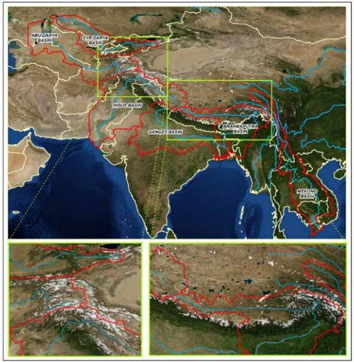
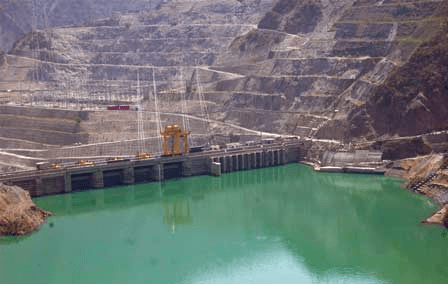
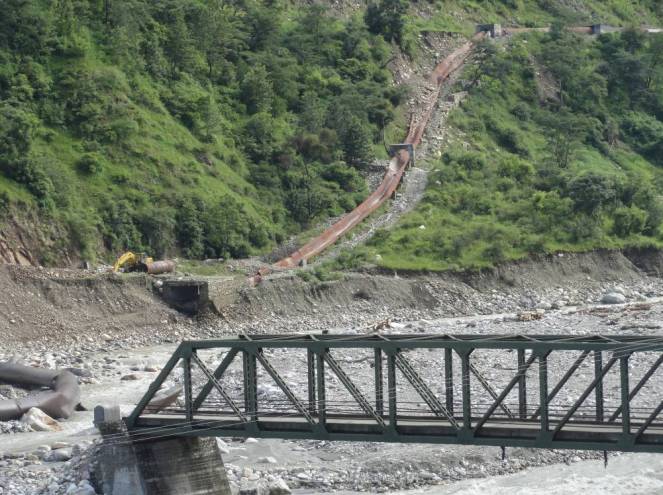
Indus river rises in the southwestern Tibet Autonomous Region of China. Originating in the Tibetan plateau of western China in the vicinity of Lake Mansarovar in Tibet Autonomous Region, the river runs a course through the Ladakh district of Jammu and Kashmir and then enters Pakistan via the Northern Areas (Gilgit-Baltistan), flowing through the North in a southerly direction along the entire length of Pakistan, to merge into the Arabian Sea near the port city of Karachi in Sindh.
The Sub-basin wise generation data of large hydro with installed capacity of the basin in the latest year 2012-13.
Projects
Inst Capacity (MW)
Generation (MU)
MU/MW
Sutlej
4534.3
18979
4.19
Beas
2267
9125
4.03
Ravi
2059
7383
3.59
Chenab
1530
8159
5.33
Jhelum
690
3828
5.55
Total
11080.3
47474
4.28
The above graph shows the trend line of power generation of Big Hydropower projects for last 28 years in the basin, the trend-line shows diminishing generation from existing hydro power projects of Indus River Basin.
It shows that the per MW generation in 2012-13 (4.28) has dropped by a huge 17.69% from the highest per MW generation (5.2) achieved in the year 1988-89.
All generation figures have been taken from official data of Central Electricity Authority (CEA).
List of other projects (up to 25 MW) under operation (for which latest generation figures not available):
Maharashtra’s Chief Minister Prithviraj Chavan was the Chief Guest for one day symposium regarding water management in Maharashtra organised by the Gokhale Institute of Politics and Economics in Pune on the 2nd of July 2013.
In his address, the CM raised a number of important topics about water management in Maharashtra. Some of his thoughts were encouraging. He talked about the problems and expense of large irrigation projects, their underperformance and underlined the need for decentralised water management systems. He mentioned that the 2000 crores spent on tankers and animal shelters during 2013 drought was an avoidable expense, if we had developed decentralised water sources. He highlighted the problems of water regulatory authorities like MWRRA. He also mentioned that improper dam operation is a reason behind many disasters like the floods in Surat in 2006 due to Ukai Dam, Sangli floods due to mismanagement of Almatti Dam and stressed that Maharashtra should be concerned about this.
Significantly, he mentioned that while we are assessing the economic costs and efficiency of large dams, we are not looking at their social and ecological and that such assessments should take place. He also said that there should be an in-depth study on the ecological costs of these projects. This is a very welcome statement.
In reality, there has been a huge gap on what he said and what is happening on the ground.
The most blatant example of this is the Kalu Dam where work has stopped currently due to a stay order by the Hon. Bombay High Court. This dam is coming up in the Murbad block of Thane District and falls entirely in the tribal sub plan area and ecologically sensitive region of the Western Ghats. It is set to submerge 1000 hectares of Western Ghats forests and will affect more than 18000 primarily tribal population. The dam, being built by the Konkan Irrigation Development Corporation (KIDC,) has not done any Social Impact Assessment as per the National Rehabilitation Policy. Nor has it undertaken an Environmental Impact Assessment or Cumulative Impacts Assessment of its impact on the Forests. The individual and community Forest Rights have not been settled, in violation of the Forest Rights Act, 2006. Despite all this, the construction started illegally, without a Forest Clearance and is halted only because of a petition filed in the High Court by Shramik Mukti Sangathana.
Illegal Work on Kalu Dam Site by FA Constructions Photo: SANDRP, May 2011
The Forest Clearance of this dam was rightfully rejected in 2012 by the Forest Advisory Committee (FAC) of the Ministry of Environment and Forests (MoEF). But exactly a year later the Forest Advisory Committee went back on its decision and gave Forest Clearance to this project unjustifiably.
One of the important reasons as, stated by the FAC in in its minutes is that
“(The FAC) also noted that Hon’ble Chief Minister of Maharshtra has specifically requested for a review of the decision of the Forest Advisory Committee” (FAC Minutes 3-4th April 2013)
How is it that the CM actually pushed for a Forest Clearance which would destroy over one lakh trees in Western Ghats, without any studies or options assessment?
When we asked this to the CM after this meeting, he replied that there is no law which says that EIA study for a drinking water supply dam is needed. While this is true and attributed to the erroneous omission in the EIA notification 2006, there is no law which says that such studies should not be conducted! Especially for a dam which is going to submerge 1000 hectares of forests and affect 18000 tribals! A Chief Minister with vision would in fact ask for such studies suo motto.
Dams around Mumbai which are mainly for drinking and industrial water supply can together submerge more than 6000 hectares of Forest. Even the State Forest Department under the Chief Minister himself has said that EIA of Kalu Dam is necessary. Chief Conservator of Forests, Central Circle has said that Cumulative impact Assessment of Dams coming up around Mumbai is necessary.
In this scenario, rather than urgently demanding for such a study the CM has in fact pressurised the FAC into giving a Forest Clearance to Kalu Project, WITHOUT any assessments.
Forests in Tansa Wildlife Sanctuary. 750 hectares of these primer forests will be submerged for the Gargai Dam. Photo: SANDRP
During his speech, the CM said how important afforestation is. He said that he has asked all departments to undertake afforestation. “The issue is so important that even tanker water should be given for afforestation”. When afforestation is so important, why are we submerging last remaining forests of Western Ghats without any studies?
Misrepresentation of Western Ghats Expert Ecology Panel (WGEEP) Report: The CM also said that WGEEP Report has banned all development from Gujarat to Kerala and that the on-going laterite stone mining in Sindhudurga-Ratnagiri districts is a result of WGEEP which will hamper development in these places. It has laid a blanket ban on development.
CM seems to be entirely misinformed on this count. Firstly the laterite stone mining ban has nothing to do with WGEEP Report, but is in place due to a Supreme Court Order. This point has been reiterated several times and it is surprising to see the CM still claiming this. Secondly the WGEEP has not banned developmental activities, but has said that local communities should be in the driving seat while taking decisions affecting their regions. This is also upheld by several laws including the Forest Rights Act. So CMs statement about the WGEEP is clearly ill informed.
It was great to see the CM mention Climate Change, its impacts, need for advanced weather monitoring, etc. It was also good to hear from him about ecological importance for rivers and their flow. It will be good if environmental flows are released from dams of Maharashtra, as also upheld by the Krishna Water Disputes Tribunal. This is currently not happening.
The CM seems to have progressive opinions about water and natural resource management. Hence, we are sure that the CM will demand for an Environment Impact Assessment, Social Impact Assessment and Cumulative Impact Assessment of dams coming up around Mumbai, especially Kalu Dam and will take a critical look at dams coming up across Western Ghats in Konkan being undertaken by KIDC, breaking laws like Forest Conservation Act, Forest Rights Act, Environment Protection Act, National Rehabilitation Policy with impunity. In fact he should see that KIDC and contractors which started work illegally are brought to the books.
We hope that the CM walks his talk about decentralised water management and valuing ecology.
The season of flood havoc has just started in Assam. The Assam State Disaster Management Authority in its daily report published on 28th June 2013, stated that in the last 24 hours 55 villages in Dhemaji, Lakhimpur and Tinsukia district have been affected by flood. All three of these districts are located in upper Assam and three of them shares borders with Arunachal Pradesh. Dhemaji till now is the worst affected among these three. In this district, 13 villages in Dhemaji revenue circle, 28 villages in Sissiborgaon revenue circle and 7 villages in Gogamukh revenue circle has been affected. In Lakhimpur 1 village in Subansiri revenue circle and 6 villages of Doomdooma revenue circle in Tinisukia district has been affected by floods. The report also said that the cumulative number of villages affected till 28th was 70 in four districts which include Golaghat, Kamrup, Jorhat and Karimganj. Continue reading “CWC Flood Forecast 2013 for Assam: Issues Started Arriving before Floods”→
On the 25th June 2013, when unprecedented floods were ravaging Uttarakhand, Prime Minister of India Dr. Manmohan Singh laid the foundation stone of 850 MW Ratle Hydroelectric Project, being developed by a private company GVK, on the Chenab River in Jammu and Kashmir. The PM hailed this project as a harbinger of prosperity to J and K and did not forget to state that the project has acquired all the requisite clearances.(http://inbministry.blogspot.in/2013/06/pms-address-at-laying-of-foundation.html). While he mentioned the upcoming elections, he did not mention a single word about the Uttarakhand tragedy.
PM laying the foundation stone of Ratle Project Courtesy: Indian Express
He forgot to mention that while there are over 60 projects under planning, construction and commissioning in Chenab Basin of Himachal Pradesh and Jammu and Kashmir, no Cumulative Impact Assessment that has been carried out to study the cumulative impacts of these bumper to bumper projects on the ecology, geology, disaster impacts, climate change impacts and communities of the Chenab. No carrying capacity study has been done in the basin to ascertain if the area can take all these projects in a sustainable and safe way. CHENAB BASIN LIKELY TO HAVE THE HIGHEST CONCENTRATION OF HYDROPOWER PROJECTS AMONG ALL BASINS IN INDIA.
In addition, the MoEF website till date (1st July 2013, after PM laid the foundation stone of Ratle Project) does not show the Form I, Form I A or the Environmental Impact Assessment Report of Ratle Project on its website, clearly violating Central Information Commission (CIC) orders. This issue has been pointed out by civil society including SANDRP multiple times and it is shocking that MoEF is not following CIC orders even for a project which is high profile enough for the PM to lay its foundation stone.
The PM, incidentally laid foundation stone for the 3000 MW Dibang project in Arunachal Pradesh on January 31, 2008, the project still has not got even statutory clearances over five years later. Let us see if Ratle makes better progress than that.
Considering these issues and also the devastation in the wake of Uttarakhand Floods, one would expect that the upcoming hydro projects in the fragile Himalayas will have a thorough assessment of their risks due to climate change, flash floods, landslides. However, the TOR of 850 MW Ratle Project given by MoEF does even mention the term Climate change! Going for the project without such an assessment may be invitation for a disaster.
These and other such issues have been raised by civil society organizations including SANDRP when MoEF was busy clearing hydropower projects on the Chenab Basin.
SANDRPs submissions to the EAC on Ratle: SANDRP had raised many issues after Ratle was granted Environmental Clearance by the Expert Appraisal Committee of the MoEF in its 59th meeting in July 2012.
Submission sent by SANDRP before the 60th EAC meeting in September 2012:
“RATLE HEP: the EAC has recommended EC to this 850 MW project, the largest such projects so far in J&K and in Chenab basin. However, Chenab basin is home to a very large number of large hydropower projects, including Salal, Baglihar-1, Dul Hasti (all operating) and also Baglihar 2 (under construction), Sawalkote, Bursar (plannned) among many others. However, there has been no cumulative impact assessment including basin wide and carrying capacity aspects. Taking up further projects without such a study is not prudent.
More importantly, in the context of this project, there seems to be some major discrepancies and EAC do not seem to have applied its mind. For example, the minutes say (page 14) that FRL of Ratle is 1029 m and TWL of upstream Dulhasti is at 1031.5, just 2.5 m above the FRL of Ratle. And yet the minutes claim that this project is 14 km downstream of Dul Hasti power house! How is this possible that the elevation of the TWL of the upstream project is just 2.5 m above and yet the distance is 14 km? This seems unlikely considering the topography of the region. The minutes do not say what is the length of the river where the tail race water of upsteram project enters the river and the tip of the FRL of downstream project.
VIOLATION OF CIC ORDERS The EIA and other related documents of the Ratle (or any other projects discussed in EAC) are not available on the MEF website, as required under the CIC orders, and till the implementation of the CIC order is achieved, consideration of projects will be violating the basic transparency norms.
We find that for Ratle, the minutes says that min env flow of 33.43 cumecs will be achieved through the operation of a 30 MW unit, it is not clear what norms will be followed for other seasons, including monsoon. The EAC do not seem to have applied its mind on this.
In view of all these reasons, we request the EAC to review its decision regarding the Ratle project.
Himanshu Thakkar
SANDRP”
We did not receive any response on this from the EAC members or other officers of MoEF. The EAC did not even acknowledge the letter, nor did they bother to explain the serious discrepancies pointed out in the letter.
Bumper to Bumper Dams in Chenab: As Chenab descends from Himachal and enters Jammu and Kashmir, it is dammed by several large hydro projects either operational, under construction or planned. Table below lists hydropower projects close to 9,000 MW in the Chenab basin in Jammu and Kashmir. This is not the full list. According to the Central Electricity Authority, projects totaling 4,200 MW are planned in the Twelfth Five-Year Plan, while additional projects for 2,075 MW have been identified.
Partial list of large hydropower projects on the Chenab in Jammu and Kashmir:
Sr No
Project
Capacity (MW)
River
1
Kirthai I
250
Chenab
2
Kirthai II
990
Chenab
3
Bursar
1,200/1,500
Marusudar
4
Pakal Dul
1,000
Marusudar
5
Dul Hasti (operating)
390
Chenab
6
Ratle (GVK)
850
Chenab
7
Baglihar I (operating)
450
Chenab
8
Baglihar II
450
Chenab
9
Sawalkote
1,200
Chenab
10
Salal (operating)
690
Chenab
11
Chainani I, II, III
33
Tributary
12
Kiru
600
Chenab
13
Kwar
520
Chenab
Total
8,623/8,923 MW
Some projects are under consideration for forest and environmental clearance, like the 1,200 MW Bursar project in Kishtwar district which requires 1,665 hectares of land, including 1,077 hectares of forest. It will affect more than 500 families in over 14 villages (option 2 requires 4,593 hectares of land!). And the 1,200 MW Sawalkote dam which will require 1,099 hectares of land, including 600 hectares of forest. Some of these dams will submerge parts of the Kishtwar High Altitude National Park. Here again, like it is being done in Chenab Basin in Himachal Pradesh, projects are being planned bumper-to-bumper; no environmental mitigation measures like fish passes or ladders are included and the social impacts appear huge, adding to the overall cumulative impact.
Despite all of this, no cumulative impact assessment study is being recommended or undertaken for the Chenab basin in Jammu and Kashmir.
Overdeveloped Chenab Basin in Himachal Pradesh: As many as 49 Hydroelectricity projects are planned or under construction in Chenab in Himachal Pradesh (HP). According to CM of HP Premkumar Dhumal, more than 28 of these projects are at an advanced stage of obtaining clearances (http://thehimachalnews.com/himachal-asks-for-environment-waivers-on-chenab-river-projects/ ). HP government is actually suggesting that the condition of cumulative impact assessments for projects on the Chenab put forward by the MoEF should be lifted as “it is unilateral and contrary to the state’s interests”! It would appear as though the chief minister believed that the interests of the state lay only in the execution of hydropower projects, nothing else. Services obtained from a river such as water availability, groundwater recharge, fishing, irrigation through smaller streams, climate regulation, tourism and protection of lands, forests, mountains and biodiversity are not in the interests of the state and are worthless!
Partial list of large hydro projects planned/under implementation in the Chenab basin, Himachal Pradesh:
Sr No
HEP
Cap in MW
District
Tributary
Length of HRT
Distance from U/s project
Distance from D/s project
Developer
1
Gyspa
300
Lahaul and Spiti
Bhaga
14.96 km
Himachal Pradesh Power Corporation Limited
2
Chattru
120
Lahaul and Spiti
Chandra
10.48
Not applicable
DCM Sriram
3
Shangling
44
Lahaul and Spiti
Chandra
Reliance Power
4
Miyar
120
Lahaul and Spiti
Chandrabhaga
Moser Baer
5
Tandi
104
Lahaul and Spiti
7.4
ABG Shipyard
6
Rashil
130
ABG Shipyard
7
Seli
400
Lahaul and Spiti
Zero
Moser Baer
8
Reoli Dugli
420
Lahaul and Spiti
11 km
Zero
Moser Baer
9
Teling
94
Reliance Power
10
Bardang
126
Lahaul and Spiti
ABG Shipyard
11
Patam
60
Lahaul and Spiti
9.75 +
12
Tinget
81
13
Purthi
300
Lahaul and Spiti
Reliance Power
14
Sach Khas
260
Chamba
Chenab
3.5 km
9 km
15
Dugar
380
Chamba
Chenab
8.5 km
9 km
3 km
Tata Power S N Group, Norway
16
Gondhala
144
Lahaul and Spiti
Chenab
17
Khoksar
90
Lahaul and Spiti
Chenab
Total
3,173
Protests against Hydel Projects on Chenab in Himachal Courtesy: Himdhara
Cumulative impact Assessment of Chenab Basin Projects in Himachal: The MoEF sanctioned TORs for cumulative impact assessments of the Chenab in February 2012. Surprisingly, this critical task has been entrusted to the Directorate of Energy, Government of Himachal Pradesh. Can there be any agency with greater conflict of interest than the Directorate of Energy for this study? Can we expect this department to conduct the study in an unbiased manner? Even as the directorate put out a request for proposals for contractors to carry out the study, it did not mention that the consultant had to be an independent agency with a credible track record, as specifically instructed by the EAC.
The MoEF seems to have meekly accepted the Himachal Pradesh chief minister’s demand for delinking environmental clearances from cumulative impact assessment studies, without any questions asked. Delinking EC from Cumulative impact Assessment defeats the entire purpose of having a CIA done. J and K Government is not even considering a Cumulative Impact Assessment as the MoEF has not asked for it so far.
It is time India took the issue of the impacts of cascading mega projects seriously. These rivers are not merely power-producing channels, they have been providing and continue to provide services to millions of local communities and our ecology. Governments and their agencies cannot simply push ahead with their big dam agenda at the cost of the environment and communities, in the absence of unbiased scientific studies and democratic decision making process. Doing that would be invitation to disaster.
Moreover, we need a cumulative impact assessment for the whole Chenab basin, including Himachal Pradesh and J&K, which is not even being considered by anyone, including the Prime Minister, MoEF, or state governments.
Poor track record of GVK group Here it should be added that Ratle project is being developed by GVK group, who has poor track record in development of hydropower projects. The only hydropower project of the group that has gone to advanced stage is the 330 MW Srinagar hydropower project on Alaknanda river in Uttarakhand and that project has been mired in serious controversies. A case has been going on in the Supreme Court, Union Ministry of Environment and forests has given stay work order, the project has no environmental impact assessment, and now during the current flood, the project is found to be responsible for the destruction of the downstream Srinagar town, and project itself has suffered extensive damage. People of J&K need to be aware of this track record so that they know what to expect from them. It is indeed shocking that the Prime Minister chose to lay foundation stone for this GVK project in the face of the role that the project of this company has played in Uttarakhand.
Neglect by PM’s Advisory Council on Climate Change It may be added here that Prime Minister is the head of the India’s climate change related work along with his advisory council on climate change. One of the highlights of the Uttarakhand disaster is that the PM and his advisory council have neglected the issues related to climate change in Uttarakhand. Now they are again repeating that blunder in J&K.
It is indeed unfortunate to see that the Prime Minister laid the foundation stone of the huge Ratle Project even as all the above mentioned issues are unresolved and are being swept under the carpet. What makes it more poignant is that he should do it when floods are still ravaging Uttarakhand and when many experts and organisations are linking these floods with the cumulative impacts of damming, blasting, tunneling, mining, muck dumping, deforestation, no attention to climate change impacts, disaster impacts , environmental compliance and sheer playing with the rivers associated with hydel projects in Uttarakhand.
This act has the potential of sending a very wrong signal to communities of Himalayas: That Indian Government will go ahead with its hydel development plan at any cost: even without assessing impacts of these projects on communities and ecology, without fulfilling norms of transparent governance. At a time when the nation is trying to cope with the Uttarakhand disaster, this is indeed a very wrong signal to send.
We have recently sent a letter to the PM, Ms. Snia Gandahi, Planning COmmission Members, etc.
July 4, 2013
To,
1. The Prime Minister of India,
Government of India,
New Delhi
2. Union Minister of State of Environment and Forests (IC),
Paryavaran Bhawan,
New Delhi
3. Mihir Shah,
Member (Water),
Planning Commission, Government of India,
and member NAC,
New Delhi
4. Chairperson,
National Advisory Council,
New Delhi
Respected Sirs and Madams,
The Prime Minister of India and UPA Chair-person graced the occasion of laying the foundation stone for the 850 MW Ratle Hydropower project in Jammu and Kashmir on June 25, 2013. We were very happy to see that Mrs Sonia Gandhi raised the issues of environmental impacts and sustainability on this occasion.
In this context we would like to bring to your attention that a very large number of hydropower projects are at various stages of planning, clearance, construction and operation in the Chenab basin. These include at least 13 hydropower projects of J&K alone, with total capacity of over 8600 MW. A very large number of smaller hydropower projects (each of them also have adverse impacts on local environment and communities) are additional. In addition, in the upstream Chenab basin in Himachal Pradesh, at least 17 large hydropower projects of total capacity of 3200 MW are in advance stage, whereas the state has plans for 49 projects in Chenab basin. Here again there are other smaller projects. It means even now there are over 30 large hydropower projects (for a full list of such projects, see: https://sandrp.wordpress.com/2013/07/01/pm-kick-starts-850-mw-ratle-project-in-jk-without-full-impact-assessment-invitation-to-another-disaster-in-chenab-basin/) with total capacity 11 800 MW (this is not the full list or total capacity) and much larger number of smaller hydropower projects are planned to come up in this basin. It seems Chenab basin is going to be home to one of the largest number of hydropower projects in the country if all these projects are to come up.
However, there is no cumulative impact assessment of all these projects and other developmental interventions that are going on in the basin. Nor is there any carrying capacity study. As you know credibility of our environmental and social impact assessments is also very poor. Such indiscriminate planning and construction of so many projects without such basic assessments in place is clearly an invitation to disaster. This is particularly so in the context of Climate Change, which is having one of the greatest impacts in the Himalayan Region. Scientists have been warning us that Chenab basin has seen a very high rate of melting of glaciers and threat of Glacier Lake Outburst floods.
The absolute minimum we can do is to do the cumulative impact assessment and carrying capacity by a credible agency (not by Directorate of Energy, Govt of Himachal Pradesh, since this agency is more interested in pushing more and more hydro projects, or such other agencies involving conflict of Interest) and stopping clearance and work on all new projects (including Ratle) till such an assessment is available. It is not prudent to delink the new projects from such an assessment as the MoEF is currently doing. This is the most important lesson we can learn from the Uttarakhand disaster and the lessons from that disaster are relevant for all Himalayan areas including the entire Chenab basin. The MoEF should also not be considering cumulative impact assessment and carrying capacity study in Himachal Pradesh and J&K separately, but consider for Chenab basin as a whole.
Here we would also like to highlight that the GVK Hydro, which is the developer of Ratle project, has been held guilty of a lot of serious problems in implementation of the 330 MW Srinagar hydropower project in Uttarakhand (the only large hydro that this company has ever developed. Over a hundred houses have been damaged in Srinagar town, many of them submerged in over 10 ft of muck illegally dumped by the project in the river and sudden release of water in early hours of June 17 by the project. In fact your government should investigate such project induced damages in Uttarakhand disaster and fix responsibility on those guilty and make them pay for such damages. Your gracing the foundation stone laying ceremonies for projects of such companies do not send right signal.
We request you to kindly take the steps suggested above on urgent basis. We will look forward to your early response on this.
Forum for Policy Dialogue on Water Conflicts in India (Forum hereafter) has published its latest compendium titled ‘Water Conflicts in Northeast India – A Compendium of Case Studies.’ Forum since its inception has been working towards documenting water related conflict in the country. Forum has already earlier published a book titled ‘Water Conflicts in India: Million Revolts in the Making’ where they published 63 case studies of conflicts related to water from all over India.
In the NE compendium, Forum has put together water related conflict case studies from the northeastern region of India. This is the first document from northeast where issues related to water sectors has been put into the framework of conflict and analyzed. Northeast is already witnessing a lot of hue cry regarding water issues. These issues include annual flood havoc in the Assam valley, the unprecedented rise in hydropower construction in Arunachal Pradesh, the threat of water diversion by China in the upstream of Brahmaputra, shortage drinking water in towns and hill areas etc. The northeastern region is surrounded by international boundaries and linked to mainland India though a 27 km wide Siliguri corridor. The Brahmaputra and BarakRivers, two of the major rivers in the region along with many of their tributaries are international rivers. Therefore water related conflicts in the region carry a lot of geo-political importance. However, from the side of government of India the thrust today is for hydropower development and bargain for water sharing with China.
Cover of the Compendium
Different Cases with Inherent Conflicts:
This compendium has 18 case studies which covers several important issues related with water in the region. This compendium also has 3 chapters along with the note from the editors which brings to fore the rationale for this compendium. Out of the 18 case studies nine case studies deal with hydropower development. Rest of the nine case studies brings to light other burning issues related with water in the region.
The introductory chapter is an article titled ‘Damming of rivers and Anthropological Research: An Introductory Note’ written by Dr. A.C. Bhagbati, a renowned social anthropologist from northeast. Dr. Bhagbati wrote this article in 1983 but there are several issues which are still relevant. The time when he wrote this, the feasibility report for Ranganadi Hydroelectric project was prepared and lower Subansiri project was still in papers. During that time possibly he was the only one who expressed concerns for the social-ecological consequences of dam construction in the region. He said that no anthropological research was incorporated in development planning of the country at that time and impacts of dam on local inhabitants receives attention as a mere technical question in the survey report prepared for the dams. The situation has not changed much even though 30 years have passed.
Natural Resources and Impact on Water:
There are two case studies, which analyse the process of natural resource extraction in the region and how it is affecting the water resources in the area. The first case study “Seismic Survey for OIL in the Brahmaputra River Basin: Scientific Understanding and People’s Perceptions” deals with how lack of transparency of concerned authorities regarding the technologies used for seismic surveys as well as oil exploration and their likely negative impacts coupled with uneven sharing of costs and benefits have resulted in differing perceptions and contestations in Assam.
The other case study named “The Barak River: Conflict around the impending Oil Extraction in Manipur” talks about the impending oil extraction in Manipur and how it can worsen the conflicts in the region around the Barak river from its source in Manipur through Assam and up to Bangladesh. The case study also brought the issue of water contamination through oil extraction.
Drinking Water Safety and Security:
The next set of two case studies ‘Water Quality in Assam: Challenges, Discontent and Conflict’ and ‘Conflicts over Drinking Water in Tripura’ brings to fore the problems of drinking water safety and security in the region. Even though the first case study is not focused on a specific area, it discusses the overall situation of water quality and the problems of water contamination due to arsenic, fluoride & other heavy metals along with bacteriological contamination. The second case study discusses how drinking water shortage becoming acute in the state of Tripura and how it is impacting the people living in urban areas as well in the refugee camps.
Embankment and Erosion – Failure of structural measures:
The case study ‘Jiadhal River Catchment: Conflicts over Embankments’ by Partha J Das discusses issue of frequent changing of river course Jiadhal river and how it is failing all the structural measures taken in the state. This case study also presents the dynamic and unpredictable nature of the rivers in the region and how human interventions in the river, e.g. embankments can do no good to ‘protect’ the people from the fury of the river.
The case study by Sidharth Kumar Lahiri ‘Riverbank Erosion in Rohmoria: Impact, Conflict and Peoples’ Struggle’ is focused on the worst erosion affected area of Assam, Rohmoria (in Dibrugarh district in upper Assam) which has witnessed the loss of 30 revenue villages, 5 huge tea gardens and 1 state government run sericulture firm along with 7 schools, police station and post office buildings. The rapidity of erosion in the region was such that no structural measures did any good to stop this. This case study also shows the nature of resource orientated state as government started giving attention to this area only after the oil-blockade, started in 1999. In both these cases there were open confrontation of people and government forces as the people staged protests, dharnas and road-blocks demanding solutions.
Transboundary River issues:
The two case studies ‘The Kurichu Project in Bhutan: Transboundary Hydropower Projects and Downstream Impacts’ and ‘Uncharted Waters: Navigating the Downstream Debate on China’s Water Policy’ details about the transboundary nature of rivers in the northeast and how this is adding to the complexities of water conflicts in the region. The first case study talks about the catastrophic flash floods which occurred on 10 July 2004 due to the bursting of the Tsatichu landslide dammed lake in Bhutan. This had led too flash floods in the Manas and Beki rivers and submerged parts of the Barpeta and Nalbari districts in downstream Assam.
The latter case study by Nimmi Kurien, discusses the Chinese plans of hydropower development and water diversion and its role in the water dynamics of northeast. This case study analyses the China’s water resources choices in its overall water policy directions, the possible conditions under which the China is planning to exercise these choices, the ripple effects they are likely to have across the borders and some key concerns that have flown downstream. This case study indicates that hydro-power projects in China has given an impetus to Indian government to build mega dams in the sub-basins of the Siang, Lohit and Subansiri rivers to establish first-user rights over the water. In doing so, India has kind of sidelined all the environment and ecological concerns.
Case studies on Hydro Power Projects:
The next set of nine case studies is focused on issues related with hydropower dams in the northeast. These nine case studies are from Manipur, Sikkim, Arunachal Pradesh and Assam. This region has been identified as the future powerhouse of the country and as a result the region is witnessing rapid increase in the proposals for construction of hydropower dams in the region. In fact MoUs for 157 dams in a single state of Arunachal Pradesh has been signed, damming almost all the free flowing rivers in the state. Due to the staggering number of MoU former Union Minister of Environment and Forests Jairam Ramesh had once opined that the state was infected by ‘MoU Virus’.
It can be observed that though these case studies are located in different states, they bring together similar issues or instances which in a way lead to the larger critique of the hydropower development regime in the region.
Impacts of Tipaimukh Dam in Manipur:
The case study by R. K. Ranjan Singh titled “Tipaimukh High Dam on the BarakRiver” states that construction of the Tipaimukh dam will lead to permanent displacement and loss of livelihoods of indigenous communities, mostly belonging to the Zeliangrong and Hmar people. This dam was originally planned for flood control but later on a hydropower element was added to it. The constriction of the dam has been questioned due to several critical grounds which include geological and seismic factors, environmental impacts, downstream impacts which extends up to Bangladesh, conservation of socio-cultural heritage, impacts on health and hydro dynamics of the dam itself. The case study states that a total of 25,822 hectares of forest area in Manipur will be affected by this which will lead to felling of 7.8 million trees. If this happens this will invite serious climate change impacts.
Impacts of Hydropower projects in Sikkim:
Dams underconstruction and planning in Teesta Basin, Sikkim. Map by SANDRP
The three case studies on hydropower development in Sikkim presents situation where the indigenous people of the state have been shown a false dream of development through hydropower generation. The three case studies brings an in depth analysis of the fall out of hydro-development on the rivers and environment as well as how it is impacting the lager political arena in this small Himalayan state.
In the case study ‘Hydropower Projects on the Teesta River: Movements against Mega Dams in Sikkim’ the author Tseten Lepcha discusses the detrimental impacts of many hydropower projects on the ecosystem, livelihoods, religion, cultural identity, political rights of the people and demographic changes due to influx of outsiders for dam construction. The story of the valiant struggle of the project affected people under the banner of Affected Citizens of Teesta (ACT)’s can also be found here.
The case study by Ghanashyam Sharma and Trilochan Pandey titled ‘Water Resource Based Developments in Sikkim: Exploration of Conflicts in the East and West Districts’ describes how the government’s strategy of increasing state’s revenue through the hydropower route has been putting a huge stress on the local environment, the people and the culture.
The case study ‘Hydropower in Sikkim: Coercion and Emergent Socio-environment Justice’ by Amelie Huber and Deepa Joshi, brings to light that the new hydropower development discourse is couched in ostensible win-win scenarios: securing energy for the rapidly developing national economy, accelerating development hitherto ‘backward’ but hydro-potent areas; and generating ‘clean’ energy and thus taking the discourse away from the earlier dam related critique.
Four Case studies on Hydropower Development in Arunachal Pradesh:
There are four case studies on the hydropower development in Arunachal Pradesh and these case studies show the extent of damage which the construction of dams will do to the environment, society, culture and economy of the state. The greed of the state government for hydro-dollar is actually eroding societal values and rich bio-diversity of the state.
Hydropower Dams in various stages in Arunchal Pradesh. Photo Courtesy: International Rivers
The case study by Raju Mimi, titled ‘The Dibang Multipurpose Project: Resistance of the Idu Mishmi’ is focused on the Dibang Multipurpose project in the Dibang basin in Arunachal Pradesh and discusses two main issues of conflict. Firstly, the underlying justification of the project on grounds of economic viability as the displacement is considered to be negligible. Secondly the fear of Idu Mishmi’s of demographic imbalance in the Dibang valley due to huge influx of outside labourers for dam construction. The case study highlighted that total population of Idu Mishmi’s is only about 11,000 whereas the planned 17 projects in the Dibang basin will bring about 100,000 outsiders.
In this compendium there are two case studies on the Demwe Lower Hydro-Electric Project which is the lower most project of the 11 projects in the Lohit river basin and will be constructed near Parshuram Kund, culturally significant site. The LohitRiver enters the plains leaving the hills just after this site.
The first case study by Girin Chetia titled ‘Damming the Lohit: Claims and Counter Claims’ brings to light that even though there are 11 hydropower projects proposed in the Lohit river basin but no cumulative impact assessment study has been conducted for the river basin. Besides, the Demwe Lower project is situated in the border of Arunachal Pradesh and Assam but no downstream impact assessment have been taken up to assess the impacts on densely populated plains in Assam.
The second case by Neeraj Vagholikar ‘Demwe Lower Hydroelectric Project in LohitRiver Basin: Green Clearances Bypass Ecological and Socio-Cultural Concerns’ analyses this project from the perspective of environmental governance. The author shows that this proposed project violates various environmental and wildlife related laws in the country. The Expert Appraisal Committee (EAC) had prescribed a cumulative impact assessment of multiple projects in the Lohit river basin; it delinked the environment clearance of the Demwe Lower and Demwe Upper from the results of the Lohit river basin study. There was also no public hearing held for this project in downstream Assam.
The case study by Azing Pertin titled ‘The Lower Siang Hydropower Project: A Peaceful Valley Erupts’ is focused on the proposed 2700 MW Lower Siang HEP one of the series of projects proposed in the Siang Basin. The project faced vehement opposition, led by Adi Student Union(AdiSU), Siang People’s Forum and Forum for Siang Dialogue on the grounds of social and ecological destruction – submergence of large tracts of forests and agricultural landscapes, destruction for rivers, massive socio-cultural and demographic changes, very little opportunity of sustainable livelihoods, increased seismicity in the region, and other major downstream impacts.
Dam induced Flood in Assam:
The case study titled ‘The Kopili Hydro-Electric Project: Downstream People Rise in Struggle’ is the only case study of a dam located in Assam. This case study presents how the excess water released from the Kopili Hydro Electric Project, led to floods in the downstream on 21 and 22 July, 2004. Due to this flood nearly one lakh people had to flee from their homes and the economic loss was immense. The calculations presented for a single farmer in the case study shows the extent of damage. This case study is very significant in order to present the situation of people leaving in the downstream of a dam.
The last case study ‘State Water Policy of Assam 2007: Conflict over Commercialising Water’ by Chandan Kumar Sharma shows that the draft State Water Policy 2007 bears clear signal for commodification of water and provides for river linking and construction of big dams. The author argues that this draft of state water policy was made by the state government under the pressure of the union government to fall in line with the National Water Policy where not much civil society participation was allowed. But civil society’s vehement objection and pressure on draft had resulted in making the community as the primary repository of rights to water, says the paper. While this may be true, this is difficult to ascertain since the state government has not finalised the water policy and final water policy is not available in public domain.
The compendium has two concluding chapters. The article ‘Water Conflicts in Northeast India: The Need for a Multi-track Mechanism’ by N.G. Mahanta is focused on the approach to be adopted in order to engage with water conflicts in the northeastern region. The author opines that large dams can further intensify the conflicts over water in the region.
The article by Sanjib Baruah titled ‘Whose River is it, Anyway? The Political Economy of Hydropower in the Eastern Himalayas’ was first published in Economic and Political Weekly and it is reproduced here. Though article focuses particularly on the Lower Subansiri project, but it also discusses most of the issues which have been addressed by various case studies in the compendium. In the article the author highlights that the government of India is aiming to take the ‘great leap forward in hydropower generation’ in the coming years and this will be done majorly on the basis of the hydropower projects in northeast. According to a vision document of Central Electricity Authority, by 2025-2026, India aims to add 400 hydropower dams with a total capacity of 107,000 MW. Out of this, according to CEA estimates Northeast India could generate as much as 58,971 MW of hydropower. Arunachal Pradesh alone has the potential of producing about 50,328 megawatts of hydropower – the highest in the country. A report published in Down to Earth in September 2011 stated that government of Arunachal has signed memoranda of understanding for 148 hydropower projects. An estimate done by Human Rights Law Network shows that, in a ten-year period, Arunachal Pradesh proposes to add hydropower capacity which “is only a little less than the total hydropower capacity added in the whole country in the 60 years of Independence.” In his article Baruah concludes that with so many dams in the upstream people of northeast, specially Assam have to live with the risk of sudden floods and at the mercy of the dam authorities.
Critical Issues:
The issues mentioned in this compendium bear great significance for the economy, polity and society of the northeastern region. This compendium was an opportunity to bring together water related issues of the region under one umbrella and the Forum has been successful in doing so. However there are a few critical issues which we would like to point out.
In the concluding chapter by Sanjib Baruah and as well as in the editorial it was highlighted that there is a fundamental difference “between the hydropower projects of postmillennial India and the multipurpose river valley projects of an earlier period in India’s postcolonial history. In the mid-20th century large multi-purpose river valley projects were taken up, to develop river basin region. They were driven by the spirit of decolonization itself…. by contrast, what is bring designed and built these days are almost all single-purpose hydropower dams with power to be produced and sold for profit by private as well as public sector companies.” It is clearly a wrong proposition that in mid 20th century large multi-purpose RVPs were the best options before the society than or were taken up in any participatory democratic way. History shows that the dams have actually created more flood disasters where there need not have been any. There are many other serious issues of performance of large dams in post Independent India.
In the concluding chapter by Sanjib Baruah, I also find it difficult to agree with the opinions made citing John Briscoe. The author said quoting him ‘In the Brahmputra Basin, there are large benefits from multi-purpose storage projects that are being forgone because power companies are licensed to develop “power only” projects, which are typically run-of-the river projects with few flood control or navigation benefits’. The idea that multi-purpose projects can be an optimum option for northeast is very problematic. Some of the issues with such projects can be found in the case study by Raju Mimi in the same compendium. In the conclusion part again quoting Briscoe (in fact quoting Briscoe, a senior officer of the World Bank who served for long in India and Brazil in early years of current millennium is seriously problematic since he stands discredited for his rabidly pro large dam views and who campaigned to ensure that the World Commission on Dams report was not adopted by the World Bank) Baruah writes, “unfortunately, despite there being a history of successful multipurpose projects in India, the Government of India now does not have an enabling framework which facilitates the same socially-optimal outcomes.” Here again we fail to find where is the successful history of multipurpose projects in India. There are detailed critiques available of some of Independent India’s biggest multi-purpose river valley projects, including those for Bhakra(“Unravelling Bhakra” by Shripad Dharmadhikary), Hirakud (by Prof Rohan D’Souza and others), Damodar Valley Projects (“One Valley and a Thousand: Dams, Nationalism, and Development, Studies in Social Ecology & Environmental History” by Daniel Klingensmith among others). SANDRP has been monitoring dam related concerns for more than a decade now and we find it hard to agree with this statement. For more details of SANDRP’s work one can look at the our website https://sandrp.in/ and our blog https://sandrp.wordpress.com/.
Though the case studies of the compendium have brought out several important concerns, some of the case studies need more detailed analysis.
The case study on seismic survey for oil exploration in the Brahmaputra brings to light a new dimension of water issues but could not justice to it. The case study said more about oil then water or river. There are several boxes which talks about the impacts of the seismic survey in a haphazard manner but those cannot be substantiated as an analysis of water conflict.
The case study on conflicts over drinking water in Tripura should include data of drinking water availability in the state. The author can dwell upon on each issue with more detailed emphasis or can take up one area out of the areas mentioned in the case study. The case study can also be substantiated through an analysis of policies on drinking water and sanitation in Tripura.
The case study on Kurichu dam project in Bhutan views the issue of trans-boundary conflicts between the two countries from a narrow perspective. The case study should have covered several more aspects of the Trans-boundary water issue. Specifically the case study does not give any detail of how much damage actually happened on the ground. The larger political and economic rationale for hydro-development in the small Himalayan state could have given better idea of the conflict.
Besides, this case study should have also included the element of flash floods which could help in broadening the scope of the case study. In fact flash flood is one of the important water related issues in northeast. There was a severe flash flood in GaiRiver in Dhemaji district in upper Assam on 15 August, 2011. This was due to breaching of the earthen dam[1] in the upstream of the river. This flash flood had submerged 17 villages and diverted its path making its way through the villages. In fact the cover page of this compendium (photo by the author of this review) depicts the guide bundh of the Gai river railways bridge which was washed away by the same flash flood.
The case study on floods in KopiliRiver could have elaborated more on the aspect how dams were constructed with false promises to people. As the whole region is speculating about the impacts of hydropower development in Arunachal Pradesh, this case study actually brings to light the after effects of dam construction. However this case study too could have elaborated its scope by bringing a comparison with the Ranganadi river floods which submerged the Lakhimpur town and other areas on 28th June 2008. This flood too was the result of water release from the upstream Ranganadi hydroelectric project.
The compendium overlooks some major issues related to floods which severely affect Assam every year. As the compendium wishes to cover water related issues in the region there should been a case study or a chapter dedicated to the overall situation of floods.
The compendium should have include issues related to climate change and impact on water in northeast, the trans-boundary issues with Bangladesh where India will be upstream state and hydropower dams which government of India wants to build in Mizoram. Though the impacts on Bangladesh was mentioned in some of the case studies, keeping the magnitude of the issue there should have been either a separate chapters on this. Analysis of water issues in northeast India from the perspective of gender is also missing in the compendium.
The compendium can also include a case study on the Pagladia dam project which was proposed in 1960s but faced strong opposition from the people. This project was seen as a multi-purpose project but even then people opposed it as they were aware of the inherent nature of the river. The name ‘Pagladia River’ means ‘mad river’ because it changes its course widely, drastically and suddenly.[2] This can also be taken as an example of how multipurpose river valley projects cannot be the answer to floods. According to the government records the project was supposed to be completed by 2008 but many say this project is out of the government’s priority list for now.
This compendium was released on 21st June, 2013 in a public function organized in Guwahati[3] and it was announced that this compendium will soon be out in the form of a book which will be useful. As first of its kind of initiative for northeast this compendium is very welcoming and we hope that the book will be able to bring the issues raised in the compendium in a more comprehensive and updated manner.
Parag Jyoti Saikia
South Asia Network on Dams, Rivers & People (www.sandrp.in)
Email: meandering1800@gmail.com
[1] According to local people living in the villages of the Gai river basin, the high amount of sand in river bed had formed an artificial lake in the upstream which got breached on the day the flash floods occurred.
[2] Bharali Gita, “Pagladia Dam Project in Assam: A Case Study”, Conference on Redressing Inequalities of Displacement by Development: Dams and Mines. Ranchi: Council for Social Development, November 6-8, 2004.
Select Independent persons with clean track report in transparent way:
Do not select any of the current EAC members
Over 50 individuals and organisations from 15 states all over India have written a letter to the minister and secretary in Union Ministry of Environment and forests about their concerns when the MoEF selects members of the Expert Appraisal Committee for River Valley Projects. The signatories include eminent persons like Prashant Bhushan, Akhil Gogoi, Ramaswamy Iyer, EAS Sarma, Vandana Shiva, Prof M K Prasad and Bittu Sehgal. At least eight organisations/ persons from the disaster affected states of Uttarakhand and Himachal Pradesh have endorsed the letter. The letter makes specific suggestions for the criteria of selection and has requested that none of the members of the outgoing EAC be selected, considering the track record of the outgoing EAC. The letter is self explanatory.
It is this EAC that considers all the dams and hydropower projects for environment clearance at initial (Terms of Reference of Environment Impact Assessment) and final (Environment Clearance) stage as also the adequacy of the EIAs, public consultation process and cumulative impact assessments. Selection of right kind of persons for chair and members of this committee is very important as past members and their conduct left a lot to be desired. Right selection of members of EAC can also go a long way in avoiding increased impact of the disasters like the one Uttarakhand is currently experiencing.
June 29, 2013
To
1. Union Minister of State (IC) of Environment and Forests
Paryavaran Bhawan, CGO Complex,
Lodhi Road, New Delhi11003
2. Secretary,
Union Ministry of Environment and Forests
Paryavaran Bhawan, CGO Complex,
Lodhi Road, New Delhi11003
Respected Minister and Secretary,
Sub: Reconstitution of Expert Appraisal Committee on River Valley Projects
We understand that the term of the current Expert Appraisal Committee on River Valley Projects has come to an end and the ministry is in the process of reconstituting the EAC. In this context, we would like to suggest that the ministry must follow some basic criteria while selecting the chair and members for the new committee. Firstly, the ministry must ensure that all the members of the new committee have credible track record on environmental and related social issues related to the River Valley Projects. This cannot be said to be the case of some members of the outgoing committee. In addition to sociologists, ecologists, hydrologists, the committee needs to have representation from tribal groups, members with proven work on services of the river as against hydrology, experts in climatology and disaster management. Secondly, all the members of the new committee must have a track record of unimpeachable integrity and professional independence, of taking position independent of government and developers. Thirdly, there should be no issues of conflict of interest for any of the members or their affiliated organisations with respect to the projects and sector they are dealing with.
The members of the EAC should be accountable for their actions. There should be a code of conduct for EAC members, and they should give an undertaking to the MoEF that they will adhere to it. The Code should include items such as a requirement for the members to read the EIA Reports and send it written comments before each meeting on what they consider are the significant issues, declaring conflict of interests, not taking on consultancy, etc.
Secondly, the committee has been at best inconsistent in applying:
basic parameters of the adequacy of EIA,
the adequacy of EMP,
need for cumulative impact assessment and carrying capacity,
adequacy of public consultation processes,
track record of the developers & EIA consultants,
adequacy of considering climate change issues,
adequacy of consideration of impact of the project on the disaster vulnerability of the area &
Most importantly, adequate application of mind to all these issues.
The committee has been sanctioning projects that have been rejected by other government bodies, without providing any reasonable case for rejecting such recommendations. This has in fact resulted in many of the projects that the EAC has cleared, but have remained stranded because of legal, regulatory interventions and people’s opposition. One of the direct consequences of what the EAC has done can seen in the hugely increased proportions of disaster that Uttarakhand is now facing. It was shocking to see the committee recommending final environmental clearance for the 108 MW Jelam Tamak hydropower project in one of the worst hit Chamoli district in Alaknanda basin in Uttarakhand. This was in spite of at least two government appointed studies recommending that the project should not be cleared, including the Wildlife Institute of India and also the Inter Ministerial Group headed by B K Chaturvedi and SANDRP & Matu jan sangathan writing to the EAC about this and also raising various concerns about the project. Media articles have also said that the current EAC members should be sacked, see: http://www.hindustantimes.com/India-news/NorthIndiaRainFury2013/Can-we-now-please-sack-these-experts/Article1-1081246.aspx.
MEF should realise that it can discharge its Constitutional obligation under Article 48A to conserve the ecology and ensure the sustainability of development only if the processes under the Environment (Protection) Act, 1986 are fully complied with. In this, the selection of the Chairman and the members of the EACs assume central importance.
We urge you in fact to set in place a transparent process of selection of EAC chair and members.
We hope you will take this into consideration.
Thanking you,
Yours Sincerely,
Endorsed by:
Himanshu Thakkar & Parineeta Dandekar, South Asia Network on Dams, Rivers & People, 86-D, AD block, Shalimar Bagh, Delhi, https://sandrp.in/, ht.sandrp@gmail.com, 09968242798
The claim of THDC, CWC and Uttarakhand Chief Minister that in absence of Tehri dam, Rishikesh and Haridwar would have been washed away is completely baseless and unfounded, nothing but a hype. Facts show that if Tehri Dam id not exist, the water level in downstream towns may have risen on June 16-17, before the levels actually rose on June 18 (as per CWC, peak level in Rishikesh was 340.8 m and in Haridwar at 295.1 m, both on June 18), but are likely to be lower than the levels of June 18 since peak flow in Alaknanda (around 11000 cumecs) was lower than that in Bhagirathi (6900 cumecs). THDC and CWC should refrain from making such claims as they are more like adding salt to the wounds that the people of the state are now experiencing and where dams and hydro projects have played a big role.
From all accounts, it is clear that peak flood in Bhagirathi River on which Tehri dam is situated, occurred on June 16 and the peak flood in Alaknanda occurred on June 17 and not at the same time. So it is not rational to add the two peaks happening at different points of time to claim that Tehri saved downstream areas. If Tehri was not there, there could have been floods in downstream a day earlier, but that does not mean peak level would have been much higher than what was the case with Tehri Dam.
From the records available on the websites of Central Water Commission (http://cwc.gov.in/Reservoir_level.htm) and Central Electricity Authority (http://cea.nic.in/daily_hydro.html), it is clear that water level in Tehri reservoir rose from 749 m on June 15 to 776.8 m on June 18 (water levels for June 16 and 17 are not available for some strange reason), this translated to increase in water storage by 652 Million Cubic meters (MCM). THDC claims that they experienced peak inflow of 244 000 cusecs and moderated that to an outflow of 14000 cusecs. To achieve this moderation for a day would take storage capacity of around 563 MCM, so it is plausible that they achieved this moderation on June 16, when Bhagirathi was experiencing peak flow.
However, as we noted earlier, the peak flow in Alaknanda happened on June 17. THDC should make public hourly figures of flow in Bhagirathi and Alaknanda on June 15-19, outflow from Tehri on each of those hours, level of Ganga at Devprayag, Haridwar and Rishikesh, so that everyone can assess the reality of their claim. Such information should in fact be in public domain in routine way.
It cannot be forgotten that:
Areas downstream of Tehri dam faced avoidable and unprecedented flood disaster in September 2010 (for details see page 20 of Aug Sept 2010 issue of Dams, Rivers & People: https://sandrp.in/drp/DRP_Aug_Sept_2010.pdf). If the dam operation is not done properly, we may be in for a repeat later this season.
It should also be recalled that Tehri is a ticking time bomb in the context of large earthquake that is imminent in the state as seismologists are telling us.( including eminent seismologists like Dr. Vinod Gaur. For more details: Earthquakes and Large Dams in Himalayas)
Landslides and debris flowing into Tehri Reservoir. 2012. Matu Jan Sangathan
People affected by the Tehri dam have still not been rehabilitated, the dam has also not been delivering the peaking power it could, as noted by Central Electricity Regulatory Authority. The dam is also silting up much faster than envisaged, reducing its water holding and power generation capacity.
In fact, CWC has failed in its flood forecasting as we made it clear earlier. Both CWC and THDC need to put their house in order rather making unfounded claims.
Central Water Commission, India’s premier technical body under Union Ministry of Water Resources, has once again failed in the Uttarakhand flood disaster. Even as the Uttarakhand state faced the worst floods in its history, CWC, which has been given the task of forecasting floods across flood prone areas all over India, completely failed in making any forecasts that could have helped the people and administration in Uttarakhand.
First principle of disaster management is prior warning. With prior warning, significant proportion of possible damages and destruction can be avoided. In that respect, one expected that CWC would play a key role in forecasting the floods. SANDRP has been monitoring CWC flood forecasts throughout the monsoon for some years. During June 15-17, when Uttarakhand was receiving the most intense rains, CWC did not make any forecasts regarding Uttarakhand. As far as the most severely disaster affected areas of Ganga basin upstream of Devprayag are concerned (these include the worst affected Kedarnath and Mandakini valley, the Gangotri and Bhagirathi valley and Badrinath in Alaknanda valley), CWC has made no flood forecasts at all this year. Same is the case regarding other affected regions of Uttarakhand including Yamuna basin including Yamunotri and Pithoragarh including Goriganga basin. What is than the role of this premier technical body tasked with flood forecasting?
The only forecast that CWC made for Uttarakhand this June 2013 were for Rishikesh and Haridwar on June 18, 2013. Even in these instances, CWC’s callousness is reflected. For example, by the fact that normally when flood forecasts are made for any site in the first place, the forecasts would be low flood forecast (where water level is between warning and danger level for the site), and only in next stage, would medium flood forecast would be made (water level above danger level). However, in case of both Rishikesh and Haridwar, CWC straightaway made medium flood forecasts, clearly missing the low flood forecasts.
In fact looking at the CWC flood forecasting site (http://www.india-water.com/ffs/index.htm), we notice that in entire Uttarakhand state, CWC has only three flood forecasting sites: Srinagar, Rishikesh and Hridwar, which means CWC would not be doing any forecasts for the most vulnerable regions of Uttarakhand in any case! Even in case of Srinagar (which actually suffered the worst floods with hundreds of damaged houses), CWC site says the Highest flood level is 536.85 m, amazingly, below the warning level of 539 m! This means that CWC has never forecast flood at that site and even if water level goes above HFL, it won’t forecast any floods since level could still be well below the warning level? Can one imagine a more callous technical body?
The callous performance of CWC does not end there. During June 2-7 this year, CWC flood forecasting site as also the flood forecasting site of NDMA which also depends on CWC, stopped functioning. After numerous emails and phone calls from SANDRP, the website started functioning on June 7, 2013 and Shri V D Roy, Director (Flood Forecasting Management) of CWC wrote to us, “Due to technical reasons, the CWC FF site was not working since 2nd June. With consistent effort, the website was made functional w e f 7th June”.
Pointing out a major blunder of CWC, we had written to CWC on June 12, 2013, “CWC forecast site reported that water level of Brahmaputra river at Neamatighat site in Jorhat district in Assam had reached 94.21 m at 0900 hrs (on June 11, 2013), which was 6.84 m above the highest flood level of the site at 87.37 m. The FF site also forecast that the level will be 94.15 m at 0900 am on June 12, 2013, that is today. Both the recording and forecast were clearly wrong, rather way off the mark. The site or the area in question or upstream and down stream levels do not match with what the CWC site said y’day.” Needless to add there was no floods in Brahmaputra in spite of such forecast by India’s highest technical body! CWC is yet to respond to our emails on this issue.
It is strange that CWC, in stead of putting its house in order, is acting as a lobby for big dams by making baseless claims about Tehri dam having saved downstream area of floods, as reported by Indian Express[i] on June 25, 2013. This is like adding salt to the wounds of the people of Uttarakhand who are suffering from the ill effects of lopsided developments including dams and hydropower projects. It would be better if CWC tries to improve its flood forecasts rather than indulging in such lobbying efforts at such times of crisis.
CWC needs to seriously consider including key sites of Uttarakhand into its flood forecasting sites, even if the the duration available for such forecasting is smaller. In times of crisis even a few hours notice can save many lives and also help save other losses.
The India Climate Justice collective notes with deep anguish the devastating loss of life, livelihoods, and homes in Uttarakhand and beyond. The death toll is likely in the thousands, way beyond current official figures. We extend our deep condolences to the families and friends of those killed, and our support to those still fighting for survival, and to local populations whose livelihoods will take years to rebuild.
This tragedy was triggered by extreme unseasonal rains in North India, 2-3 weeks in advance of what is normal for this region. The Director of the Indian Meteorological Department (IMD), Dehradun, said that 340 mm fell in a single day at Doon, a record not seen for five decades. Such extreme and unseasonal rainfall seems to us to indicate a global warming induced climate change phenomenon. Warmer air due to global warming has the capacity to hold more moisture, leading to more intense bursts of rainfall in a particular region. The natural monsoon cycle in India has already been badly disrupted, and a new cycle of extreme rainfall events and prolonged droughts have been reported from all over the country in the recent past. Thus, contrary to statements by senior politicians, the Uttarakhand disaster is not natural: it is no less man-made than the other contributors to the tragedy. And if it is indeed induced by global warming, similar catastrophes could recur with increasing frequency and intensity anywhere in the country in the coming years.
In Uttarakhand, a chaotic process of ‘development’ that goes back many years exacerbated the effects of this extreme rain. Extensive deforestation of mountain tracts, by the state and more recently due to ‘development’ projects, led to soil erosion and water run-off, thus destabilizing mountain slopes and contributing to more intense and frequent landslides and floods. Unchecked hill tourism has resulted in the huge growth of vehicular traffic, spread of roads not suitable to this mountainous terrain, and the construction of poorly designed and unregulated hotels and structures, many near rivers. Sand mining along river banks has intensified water flows into rivers.
Most of all, the construction and planning of hundreds of small, medium and large dams across the Himalayan states from Himachal Pradesh and Uttarakhand in the northern Himalayas to Sikkim and Arunachal Pradesh in the east, have destabilized an already fragile ecosystem and threatened biodiversity. A staggering 680 dams are in various stages of planning, or construction in Uttarakhand alone! These dams have a direct connection with the extent of the damage that can be caused in such flooding events, in that the tunnelling and excavation in the so-called run-of-the-river projects cause huge and unregulated dumping of excavated debris into river basins, leading to increased siltation, and in turn aggravating the flood situation. The electrical power generated by these dams will be consumed by urban elites elsewhere. It is ironic that these dam projects, while adversely impacting people’s access to their river commons, claim to be climate change solutions in the guise of renewable and green energy, and have already made huge profits by fraudulently claiming CDM (clean development mechanism) status. In 2009, the CAG had warned the government of Uttarakhand that the “potential cumulative effect of multiple run-of-the-river projects can turn out to be environmentally damaging”. Like many other warnings by environmentalists and local community groups in the past, this was also ignored. And now we are facing one of the biggest disasters that the country has seen in decades.
The central government of India and various state governments, including the govt of Uttarakhand, have prepared action plans for combating climate change. Any such plan ought to include the establishment of a disaster-prediction and warning mechanism. The Uttarakhand government has taken no measures to prepare for this kind of eventuality, though it has paid lip service to climate action plans over the last three years. In the present case, the IMD issued inadequate warning, which was disregarded by the state government. An urgent prior warning could have ensured that pilgrims don’t move forward and retreat to relative safety, that locals reduce their exposure to risk to the extent possible. Thousands of pilgrims from different states, locals, workers in hotels and dharamshalas, and transport animals have been killed. Cars with people inside them were washed away. Those who have survived had to go without food for several days. Thousands are still stranded at different points, or in forests, and we are still counting the dead.
There has also been extensive devastation of local lives and the regional economy. Serious devastation has been reported from over 200 villages, so far. Innumerable locals, including agricultural workers, drowned in the raging waters or were submerged under mud and debris. Houses have collapsed or been washed away. Tourism and the local employment it generates have been hit indefinitely at the peak of the tourist season. Floods, landslides and debris have devastated agriculture along the rivers. Irrespective of whether these extreme rains are due to climate change or not, this is what a climate change world in the Himalayas looks like. This devastation is a glimpse into a climate uncertain future.
We see this tragedy as a result of cumulative and widespread injustice and wrongdoing: not only against the Himalayan environment, but also against mountain communities whose survival depends on that environment. This tragedy is also a crime, because our policy makers and administrators are also part of the larger climate injustice at a global scale that threatens, displaces and kills the marginal and the poor everywhere. On another plane, they simply let it happen. We believe that adaptation to disasters does not just mean desperate rescue work during and after the event, but also reducing vulnerability and risk before. Effective adaptation involves a series of measures that need to be adopted on a war footing. The sustainable development of a hill economy, and equity – not profit for a few – should be at its core.
India Climate Justice demands:
· That the governments at the central and state level retreat to a low carbon pathway of development that has equity, decent employment, and sustainability at its core.
· That the planning and construction of dams in the entire Indian Himalayas be reviewed, and all construction be halted until such a review is carried out.
· That the use of explosives in all such infrastructure development works is completely stopped.
· That, given the likelihood of extreme rainfall events and other climate extremes in the future, extensive and sub-regional warning systems are put in place urgently across all the Himalayan states, the coastal areas and beyond.
· That a proper assessment of the carrying capacity of specific ecosystems is carried out.
· That the stretch from Gaumukh to Uttarkashi be declared an eco-sensitive zone without further delay.
· That a river regulation zone be enforced such that no permanent structures are allowed to be constructed within 100 metres of any river.
· That the residents and their organizations are thoroughly consulted in a democratic plan on climate change, in the revival of the local hill economy, and the generation of decent employment.
· That local people are compensated for the loss of life and livelihood, and that urgent plans are put in place for the revival of local livelihoods and agriculture.
· That the central government learn from the Uttarakhand catastrophe to put in place prior adaptation measures not just for the mountainous regions but beyond, for coastal and the drought-prone interiors as well.
(INDIA CLIMATE JUSTICE)
Endorsing Organizations All India Forum of Forest Movements; Pairvi; Beyond Copenhagen; South Asia Network of Dams, Rivers and People; National Alliance of People’s Movements; Himalaya Niti Abhiyan; New Trade Union Initiative; All-India Union of Forest Working People; Chintan; Bharat Jan Vigyan Jatha; Toxics Watch Alliance; Nadi Ghati Morcha, Chhattisgarh; Rural Volunteers Centre, Assam; Vettiver Collective, Chennai; Himal Prakriti, Uttarakhand; Maati, Uttarakhand; Bharat Gyan Vigyan Samiti; River Basin Friends (NE); India Youth Climate Network; Intercultural Resources; Kabani, Kerala; Human Rights Forum, Andhra Pradesh; National Cyclists Union, India; Equations; Posco Pratirodh Solidarity, Delhi; Global Alliance for Incinerator Alternatives; Science for Society, Bihar; Nagarik Mancha; SADED; JJBA, Jharkhand; BIRSA; Jharkhand Mines Area Coordination Committee; Adivasi Mulvasi Astitva Raksha Manch; National Adivasi Alliance; Bank Information Centre; Focus on the Global South; Jatiyo Sramik Jote, Dhaka; Jharkhand Jungle Bachao Andolan; All India Students’ Association; All India Progressive Women Association; People’s Union for Democratic Rights
India Climate Justice is a collective comprising social movements, trade unions, other organizations and individuals. It was formed in 2009 to respond to the growing climate crisis, from a perspective of justice and equity.
The current disaster in Uttarakhand has exposed our unpreparedness in many spheres: be it disaster management, weather forecasting, early warning system, tourism management or transparent and participatory environmental governance of a fragile region.
However, we cannot ignore Climate Change and its associated challenges when dealing with these issues.
Himalayas are experiencing Climate Change at an unprecedented rate, this is increasing the incidents of flash floods, GLOFs, landslides and related disasters. India has a huge National Action Plan for Climate Change in place since 2009, under it is a special National Mission for ‘Sustaining Himalayan Ecology’, National Mission on Water, among six others. But what has happened down these years? Are we even considering climate change and its impacts while clearing hundreds of projects on hydel power, river bed mining , urban development, roads and related infrastructure in this region? We are not even assessing the impact of such projects on disaster potential in already vulnerable areas.
Uttarakhand disaster linked to Climate Change However, a number of officials have accepted the climate change link with the current disaster. Secretary of Government of India Ministry of Earth Sciences Shailesh Nayak has now said that the cloudburst that triggered flash floods in Uttarakhand read like a weather phenomenon brought about by warming. He also narrated how the high intensity rainfall is increasing while low and medium intensity events are decreasing. (See: http://timesofindia.indiatimes.com/india/Earth-sciences-secretary-blames-Uttarakhand-rains-on-climate-change/articleshow/20709643.cms)
However, it is an undisputed fact that climate change is impacting the Himalayas at much faster pace than what the global averages tells us. We take a look at our responses to adapt to and mitigate CC Challenges.
1. Unprecedented Climate Change in Himalayas
(This section is largely based on ICIMODs report:The changing Himalayas – Impact ofclimate change on water resources and livelihoods in the Greater Himalayas)
Warming in Himalayas is happening at an unprecedented rate, higher than the global average of 0.74 ˚C over the last 100 years (IPCC, 2007a; Du et al., 2004), at least 2-3 times higher than global averages. Progressively higher warming with higher altitude is a phenomenon prevalent over the whole greater Himalayan region (New et al., 2002).
1.1 Impact on Precipitation: In many areas, a greater proportion of total precipitation appears to be falling as rain than before. As a result, snowmelt begins earlier and winter is shorter; this affects river regimes, natural hazards, water supplies, and people’s livelihoods and infrastructure. The extent and health of high altitude wetlands, green water flows from terrestrial ecosystems, reservoirs, and water flow and sediment transport along rivers and in lakes are also affected.
Throughout the himalayas, there is increasing perception and documentation that precipitation is changing, becoming more erratic and intense. “Flooding may arise as a major development issue. It is projected that more variable, and increasingly direct, rainfall runoff will also lead to more downstream flooding.”(http://lib.icimod.org/record/27016/files/c_attachment_782_6044.pdf, Changing With The Seasons: How Himalayan communities cope with climate change, Chicu Lokgariwar, People’s Science Institute)
1.2 Retreating glaciers:As compared to global averages, Himalyan glaciers are receding at a rapid rate. Retreat in glaciers can destabilize surrounding slopes and may give rise to catastrophic landslides (Ballantyne and Benn, 1994; Dadson and Church, 2005), which can dam streams and sometimes lead to outbreak floods.
Excessive melt waters, often in combination with liquid precipitation, may trigger flash floods or debris flows.Available studies suggest changes in climatic patterns and an increase in extreme events. An increase in the frequency of high intensity rainfall often leading to flash floods and land slides has been reported (Chalise and Khanal, 2001; ICIMOD, 2007a).
Rapid retreat of Himalayan Glaciers as compared to global averages Courtesy: ICIMOD
1.3 Higher frequency of flash floods and GLOF events: In the eastern and central Himalayas, glacial melt associated with climate change, has led to the formation of glacial lakes behind terminal moraines. Many of these high-altitude lakes are potentially dangerous. The moraine dams are comparatively weak and can breach suddenly, leading to the discharge of huge volumes of water and debris. The resulting glacial lake outburst floods (GLOFs) can cause catastrophic flooding downstream.
There is an indication that the frequency of GLOF events has increased in recent decades. In the Hindukush Himalayan (HKH) region two hundred and four glacial lakes have been identified as potentially dangerous lakes, which can burst at any time (ICIMOD, 2007b)
Cumulative Frequency of Flash FLoods and GLOFs in Hindukush Himalayan region Courtesy: ICIMOD
2.1 National Mission for Sustaining the Himalayan Ecosystem under the NAPCC:
The ambitious National Action Plan for Climate Change has a separate National Mission for Sustaining the Himalayan Eco System (NMSHE) under the Ministry of Science of Technology, Government of India.
The NMSHE Mission document prepared in 2010 states:
“The mission would attempt to evolve management measures for sustaining and safeguarding the Himalayan glaciers and mountain ecosystem by:
• Enhancing monitoring of Himalayan ecosystem with a focus on recession of Himalayan glaciers and its impact on river system and other downstream socio-ecological processes.
• Establishing observational and monitoring network to assess ecosystem health including freshwater systems.
• Deploying technologies – for hazard mitigation & disaster management, development of ideal human habitats, and agriculture and forest sector innovations
2.1.1 Some Proposed Actions to address Objectives and Goals of the Mission:
Continuous Monitoring of the Eco-system and Data Generation
Enhanced implementation of guidelines for Priority Action in the National Mission on Sustaining the Himalayan Ecosystem
Sustainable Urbanization in Mountain Habitats:This includes:
Town Planning and Adoption and Enforcement of Architectural Norms:
Given the ecological fragility of mountainous areas, it was agreed that rather than permit the unplanned growth of new settlements, there should be consolidation of existing urban settlements, which are governed through land-use planning incorporated in a municipal master plan.
Further action points may include:
(a) Municipal bye-laws will be amended, wherever required, to prohibit construction activity in areas falling in hazard zones or across alignments of natural springs, water sources and watersheds near urban settlements. There will be strict enforcement of these bye-laws, including through imposition of heavy penalties and compulsory demolition of illegal structures.
(e) Construction activity will be prohibited in source-catchment areas of cities, including along mountain lakes and other water bodies. Their feeder channels will also be kept free of building activity.
In order to enable these decisions to be implemented urgently, it is necessary to draw up, as soon as possible, a comprehensive State-wide inventory of such water resources and their channels, which could then be declared fully protected zones.
Promotion of Sustainable Pilgrimage:
Measures for promoting the healthy and sustainable development of religious pilgrimage to the many sacred and holy sites scattered all over the Himalayas, are also necessary. Some of these actions are:
(a) A comprehensive inventory of key pilgrimage sites in each State would be drawn up, which would include analyses of the ecological capacity of each site, based on its location and fragility.
(b) In advance of the results of the above exercise, develop a plan to harmonise the inflow of pilgrims with the capacity of the local environment to cater to the needs of pilgrims. These include the source of several Himalayan rivers, sacred lakes and forest groves.
(c) The construction of roads should be prohibited beyond at least10 kilometres from protected pilgrim sites, thereby creating a much-needed ecological and spiritual buffer zone around these sites. These areas, like national parks and sanctuaries, will be maintained as special areas, where there would be minimal human interference, respecting the pristine nature of thesesites.
(d) Each designated pilgrimage site should have a declared buffer zone where development activity will be carefully regulated.
“Green Road Construction”The construction of roads must fully take into account the environmental fragility of the region. To this end, the concerned State Governments will consider promulgating, as soon as possible, the following guidelines for road construction in hill areas.
(a) Environmental Impact Assessment to be made mandatory for the construction of all state & national roads and expressways of more than 5 km length, including in the extension and widening of existing roads. This will not apply to inter-village roads.
(b) Road construction will provide for the treatment of hill slope instabilities resulting from road-cutting, cross drainage works and culverts, using bio-engineering and other appropriate technologies. Cost estimates for road construction in these areas will henceforth include estimates on this account.
(c) Plans for road construction must provide for disposal of debris from construction sites at suitable and identified locations, so as to avoid ecological damage and scarring of the landscape. Proposals for road construction must henceforth include cost estimates in this regard.
(e) All hill roads must provide adequate roadside drains and, wherever possible, be connected to the natural drainage system of the area.
(f) Alignment of proposed roads should avoid fault zones and historically landslide prone zones.Where this may not be possible, adequate measures will be taken to minimize associated risks, in consultation with experts.
Water security:
The importance of the Himalayas as a natural storehouse and source of water must be acknowledged fully. The region is already under water-stress, with the drying up or blockage of many water sources and natural springs. The following immediate actions, appear to be necessary:
The Himalayan eco system is vulnerable and susceptible to the impacts and consequences of a) changes on account of natural causes, b) climate change resulting from anthropogenic emissions and c) developmental paradigms of the modern society.
Recognizing the importance of scientific and technological inputs required for sustaining the fragile Himalayan Ecosystem, the Ministry of Science and Technology has been charged with the nodal responsibility of coordinating this mission.”
Unfortunately, we saw that NONE of the above is currently happening in the Uttarkhand Himalayas, or for that matter any of the Himalayan States. There are no clear action plans, timelines and budget breakups of this program available and at best, this seems like a vague wish list, rather than an urgent program.
2.2 Uttarakhand State Action Plan for Climate Change:
“Extreme precipitation events have geomorphological significance in the Himalayas where they may cause widespread landslides. Increase in rainfall is likely to causes fresh floods land slides and damages to the landmass. Winter precipitation has become extremely erratic and unpredictable. Increase in the flooding varying between 10 to over 30 percentof the existing magnitudes is expected in all the regions. This has a very severe implication for the existing infrastructure such as dams, bridges, roads, etc., for the areas and shall require appropriate adaptation measures to be taken up.
Strategies:
“The UAPCC recognises that scientific knowledge and evidence base on impacts of climate change to the water sector is limited. As such, a comprehensive water data base in public domain and assessment of the impact of climate change on water resource through the various agencies responsible for different aspects of water resources management in the State will be developed, and updated and analysed on an on-going basis.
Strategies towards this will include:
Review of network of hydrological observation stations
Review of the network of automatic weather stations and automated rain gauge stations
Collection of necessary additional hydro-meteorological and hydrological data for proper assessment of impact of climate change in Himalayan region including other improvements required in hydrometric networks to appropriately address the issues related to the climate change.
Such data will include:
o Hydrological and hydro-meteorological data in low rainfall areas
o Hydrological and hydro-meteorological data above permanent snowline, glaciated areas, seasonal snow areas in Himalayan region
· Improved network for collection of evaporation and rain gauge data using automated sensors
· Establishment/strengthening of ground water monitoring and geohydrologynetworks
· Collection of data about river morphology for monitoring erosion and carrying capacity, and
· Surface and ground water quality data collection, etc.
Other initiatives will include adoption/development of modern technology for measurement of flow in hilly areas, development of water resources information system, and reassessment of basin wise water situation, apart from projection of water resources availability as a result of impact of climate change which would inter-alia include the likely changes in the characteristics of water availability in time and space.
Other necessary studies to improve understanding of climate impacts to the sector will also be carried out from time to time, and robust data mechanisms will be established. Currently, Uttarakhand does not have a State Water Policy. As such, it will be a priority agenda for the State to develop an appropriate policy framework, with explicit cognisance of climate concerns.”
Unfortunately, here too we did not find evidence that ANY of the strategies were put in practice. As we have said earlier, we still do not have a picture of how much rainfall occurred where and when. Rudraprayag district seems to have a single raingauge station, and high density tourist spots like Kedarnath, which are already vulnerable do not even have a raingauge. There exists no early warning system and as clarified by CAG report on Disaster Management, 2013, the State Disaster Management Authority has not met even once since its constituion in 2007.
3. Hydropower and Climate Change: Time to bust the myths
Hydropower projects are being aggressively pushed for their supposedly benign role in global warming and climate change. However, world over, there is increasing consensus that Hydropower dams are not only extremely vulnerable to climate change but (http://ieeexplore.ieee.org/xpl/login.jsp?tp=&arnumber=1007423&url=http%3A%2F%2Fieeexplore.ieee.org%2Fiel5%2F2195%2F21734%2F01007423), but actually contribute to global warming and climate change, depending on their size and nature. They are being increasingly recognized as being ‘False Solutions to Climate change.’
Many hydropower projects being planned, under construction or commissioned in Uttarakhand ( and across Indian Himalayas) are storage dams with reservoirs. Even the so called ‘run of the river’ projects involve reservoirs and big dams. These reservoirs emit methane (21 times more potent than carbon dioxide) and carbon dioxide. It is now proved that methane is not only emitted from reservoirs, but that it is boosted at each dam turbines and draw-down (Ref: http://news.wsu.edu/pages/publications.asp?Action=Detail&PublicationID=32301)
4. Environmental Clearances to Hydropower Dams do not consider Climate Change impacts or mitigation methods:
Despite the burgeoning literature, debates around the world, several submissions from civil society including SANDRP, there is not even as assessment of the impacts of hydel projects on climate change, leave alone mitigation measures. The Expert Appraisal Committee on River valley and Hydropower Projects constituted by the MoEF which recommends Terms and Reference and further Environmental Clearances to these projects has not included the impacts of climate change or the mitigation measures against impacts while recommending TORs or granting Environmental Clearances. It also does not include assessment of impact of the projects on disaster potential of the region or adaptation capacity of the people. The EAC in fact has zero rejection rate even when we know we do not have credible EIA, SIA or CIA for any projects or basins.
Many of the Hydropower projects in the Himalayas, including Uttarakhand have applied for carbon credits under the UNFCCC’s Clean Development Mechanism. Under this, clean energy projects in developing countries get millions of rupees as incentives from developed world, which in turn get carbon offset credits, which are a license to pollute further. The entire system, put in place after the Kyoto Protocol is inherently flawed due to absence of due attention impact of projects on adaptation of local people, to local voices and due to market based approach. Many destructive hydropower projects in Uttarakhand are being certified as clean projects, making a mockery of climate change adaptation and sustainable development. Notable among-st these include the 99 MW Singoli Bhatwari HEP , 76 MW Phata Byung HEP, both on Mandakini river (epicenter of current disaster), 300 MW Alaknanda (GMR) hydropower project, 330 MW Alaknanda Srinagar Hydropower project, 414 MW Rampur project in Himachal Pradesh, where the World Bank played an active role in getting it registered for Carbon credits.
Carbon credits to large hydropower projects in fact accelerate climate change and its impact on ecosystems and communities and is unacceptable.
6. Dubious role of World Bank and Asian Development Bank
World Bank is being reported to have come up with a report which says that “An extremely wet monsoon that at present has a chance of occurring only once in 100 years is projected to occur every 10 years by the end of this century,” It also projected a rise in severe floods within the next 25 years.
The same organisation is pushing some of the biggest and most destructive hydropower projects in the Himalayan region like the 775 MW Luhri HEP, in addition to 2 large Hydel projects upstream on Luhri in the Sutlej Basin in Himachal Pradesh. Luhri HEP will have one of the longest tunnels in Asia and there is no impacts assessment of the impact of this blasting and tunnelling on the villages above, or geological stability.
World Bank is also pushing and financing the 440 MW Vishnugad Pipalkoti Hydropower in Uttarakhand. Incidentally, Pipalkoti region experienced some severe impacts of the current deluge and also suffered damages as per MATU report. The World Bank is supporting these projects even when there are no credible project specific ESIA or cumulative impact assessment studies or carrying capacity studies or studies on the impacts of these cascade projects on disaster risks or climate change.
Asian Development Bank is also supporting a number of hydropower projects n Uttarakhand (they are reported to have suffered damages) and in Himachal Pradesh on similar lines.
Cascade projects along the rivers, with no distance between two projects effectively means that the entire landscape surrounding the rivers is blasted, submerged and tunneled.
There is a huge gap between what World Bank’s says and what it does as far as hydropower and climate change is concerned.
In Conclusion:
Current Uttarakhand disaster has seen government officials to the World Bank suggesting that impacts of climate change are severe, but ironically, when asked specifically if they would link current disaster with climate change, they say that cannot be established and hide behind ‘scientific uncertainity’.
As has been seen world over, the poor and most vulnerable sections of the society and the ecology are worst impacted by climate change. It is high time that we adopt no regret strategies to cope with impacts of climate change, through mitigation and adaptation.
National Action Plan of Climate Change needs to be audited for its efficacy and work from organisations like CAG. MoEF urgently needs to include impacts of climate change while it is busy sanctioning all the projects that come to it. Organizations like World Bank need to walk their talk on climate change and stop financing destructive hydro projects in this fragile region, in absence of any studies on their impact on Climate Change and lives and livelihoods of millions dependent on natural systems.
Climate change is knocking at some of our doors, while it has already arrived through other doors. We can choose to close our eyes and ears and say “this is normal and expected in this region”. But if we do not respond to challenges posed by Climate Change urgently, it wont be just politely knocking, but causing extreme damage, as it is being witnessed.