Bridges are essential infrastructure for human and cargo mobility across a river. They have also allowed us stop over and gaze on the beauty of flowing water streams without any risk of getting drowned or getting ourselves drenched in water. More and more bridges are being built on rivers without understating their impacts. There is hardly any debate or discussion on governance and decision making process or minimum distances to be maintained between two bridges or limiting the number of bridges on given stretch, considering what the river can support. This report takes a look at the situation of bridges on river Yamuna and describes few examples how they have been impacting the river eco-system.
Bridges on River Yamuna
The main stem of River Yamuna flows through five states of Uttarakhand, Himachal Pradesh, Haryana, Delhi and Uttar Pradesh. The total length of river is 1376 km and it’s divided into five segments[i]. Through Google earth maps we could mark 131 bridges along the river which includes 6 barrages cum road bridges, 12 railway bridges and about 6 pontoon bridges. There are also half a dozen foot bridges in Himalayan segment which have not been counted in this exercise.
| Segment | Places | Km | No. of bridges | Average distance between the bridges |
| Himalayan | Origin to Tajewala Barrage | 172 | 20 | 8.60 km |
| Upper | Hathini Kund to Wazirabad Barrage | 224 | 11 | 20.00 km |
| Delhi | Wazirabad to Okhla Barrage | 22 | 25 | 0.88 km |
| Eutriphied | Okhla to Chambal Confluence | 490 | 44 | 11.36 km |
| Diluted | Chambal Con. to Ganga Confluence | 468 | 27 | 17.30 km |
| 1376 | 127 | 10.80 km |
Issues and concerns: Himalayan segment
| SN | Name | District/City | Type |
| 1 | Janki Chatti | Uttrakashi | Road |
| 2 | Janki Chatti | Uttrakashi | Road |
| 3 | Syana Chatti | Uttrakashi | Road |
| 4 | Rana Chatti | Uttrakashi | Road |
| 5 | Kuthnor | Uttrakashi | Road |
| 6 | Kishala | Uttrakashi | Road |
| 7 | Khanera | Uttrakashi | Road |
| 8 | Kharadi | Uttrakashi | Road |
| 9 | Rajgarhi | Uttrakashi | Road |
| 10 | Badkot | Uttrakashi | Road |
| 11 | Naugaon | Uttrakashi | Road |
| 12 | Naugaon 2 | Uttrakashi | Road |
| 13 | Burnigad | Dehradun | Road |
| 14 | Damta | Uttrakashi | Road |
| 15 | Nainbagh | Tehri | Road |
| 16 | Lakhwar | Dehradun | Road |
| 17 | Juddo | Dehradun | Road |
| 18 | Kalsi | Dehradun | Road |
| 19 | Katapathar | Dehradun | Barrage cum Bridge |
| 20 | Ponta Sahib | Sirmaur | Road |
This segment is prone to landslides, flash floods and earthquakes. Due to landslides at Kishala in Badkot, two additional bridges were built on Yamuna river in the past.

The story of Kharadi bridge connecting Badkot to Nagangaon is very disappointing. The bridge was damaged in June 2013 flood during Kedarnath disaster. Seven years later, it has not been fully restored impacting mobility of people and supply of essential materials.
The construction work of Lakhwar dam, Vikas Nagar has led to construction of two new bridges at Juddo and Nainbagh. This segment also has Dakpathar Barrage cum Road Bridge. In past an old bridge at Kalsi was washed away and a new bridge has been constructing replacing it.
Upper Segment
| SN | Name | District/City | Type |
| 1 | Hathini Kund | Yamuna Nagar | Barrage cum Bridge |
| 2 | Kalanaur | Yamuna Nagar | Railway |
| 3 | Kalanaur | Yamuna Nagar | Road Old |
| 4 | Kalanaur | Yamuna Nagar | Road New |
| 5 | Sandhala | Yamuna Nagar | Road Proposed |
| 6 | Gangoli | Karnal | Newly Built |
| 7 | Badoli | Karnal | Road |
| 8 | Sanoli | Panipat | Road |
| 9 | Bhalgarh | Sonipat | Road |
| 10 | Eastern Peripheral Way | Sonipat | Road |
| 11 | Eastern Peripheral Way | Sonipat | Road |
In this stretch the bridges including Hathini Kund Barrage cum Road bridge are connecting Haryana and Uttar Pradesh state. The new road bridge at Kalanaur has suffered damages during 2010 floods and was closed. At the time the earlier British era bridge left unused was opened for traffic movement. Presently one more road bridge has been built at the location which has not been counted in this exercise.
Similarly, the Lal Bahadur Sharhtri bridge connecting Panipat-Kairana and the Shahmal Tomar bridge (Bhalgarh) linking Sonipat and Baghpat has suffered damages during floods in last decade.
Recently two bridges have come up as part of Eastern Peripheral Way (EPW) close to Delhi Haryana border on the Yamuna river.
One new bridge Gangoli has been built at Karnal linking Saharanpur district. And another one is proposed at Sandhala at Yamuna Nagar. The Gangoli bridge is notable example of how the bridges are disconnecting the floodplain and affecting the flood water spread during monsoon.
The Gangoli bridge construction was started around 2012 and it has become operational in 2019. The floodplain spread is about 1.8 km but the elevated part of the bridge is hardly 600 meter. The bunds has been created right into the river and guide bunds have been built in the flood plain to protect the structure.

The Google earth image clearly shows that it has impacted active river channels on both banks. Actually it is an invitation to flood disaster in the area. In 2019 a part of bridge bund at Karnal side was washed away. However, the Irrigation Department Saharanpur has again earth filled the portion.
It is noteworthy here that this upper stretch of the Yamuna basin has been facing large scale mechanized and illegal mining of riverbed materials.
In the past, the menace has led to collapse of British era Tajewala barrage and constantly presenting threat to Hathinikund barrage, both in Yamuna Nagar.
Delhi stretch
| SN | Name | District/City | Types |
| 1 | Wazirabad | Delhi | Barrage cum Bridge |
| 2 | Signature Bridge | Delhi | Road |
| 3 | Signature Bridge | Delhi | Road |
| 4 | ISBT Kashmiri Gate | Delhi | Road |
| 5 | ISBT Kashmiri Gate | Delhi | Road |
| 6 | ISBT Metro | Delhi | Metro |
| 7 | Old Railway Bridge | Delhi | Railway |
| 8 | Railway Bridge | Delhi | Under Construction |
| 9 | Geeta Colony | Delhi | Road |
| 10 | Geeta Colony | Delhi | Road |
| 11 | ITO | Delhi | Barrage cum Bridge |
| 12 | ITO | Delhi | Road |
| 13 | Yamuna Bank | Delhi | Metro |
| 14 | Railway | Delhi | Railway |
| 15 | NH 24 | Delhi | Road |
| 16 | NH 24 | Delhi | Road |
| 17 | NH 24 | Delhi | Road |
| 18 | Mayur Vihar | Delhi | Metro |
| 19 | Barapula | Delhi | Under Construction |
| 20 | DND | Delhi | Road |
| 21 | DND | Delhi | Road |
| 22 | Okhala | Delhi | Barrage cum Bridge |
| 23 | Okhala | Delhi | Road |
| 24 | Okhala | Delhi | Metro |
| 25 | Okhala | Delhi | Road |
*The name of bridges repeated here are two lanes with separate structure on the river. The total length of river in Delhi is 48 km of which urban stretch heavily bridges is 22 km long. The remaining 26 km stretch lying between Palla the entry point of river in Delhi upto Wazirabad Barrage is covered under Upper segment. Interesting there is not a single bridge in that 26km stretch so far.
*Bridges connecting Central past of city to East Delhi, Noida, Gaziabad mentioned as NH 24 in the tabular format are three different bridges of which two double lane bridges have been built in last 7 years in addition of metro bridge leading to Mayur Vihar. The road is originally known as Gurjar Smart Mihir Bhoj Setu and road.
The situation regarding bridges on Yamuna river in Delhi is quite alarming as so far 25 road bridges including 3 barrages cum bridges, 4 metro bridges, two railway bridges have come up on the river. In addition, one railway and one road bridge as part of Old Railway Bridge and Barapula extension are under construction.
So in a stretch of 22 km which accounts for only 2 per cent of total Yamuna river length, there will soon be at least 27 bridges. Compare this with 33 bridges built and proposed in first two segments spanning 396 kms. Thus on an average, there is a bridge on Yamuna river in Delhi after every 800 metre.
Almost all the road bridges including the barrage roads have been extended into double lanes. The Signature bridge is most recent one. At NH 24 connecting Nizammudin to East Delhi, Noida and Ghaziabad, back to back four road and 1 metro bridges have been built in last one decade.
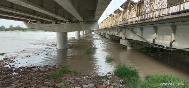
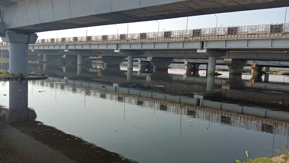
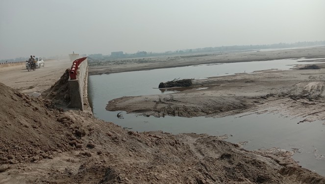
So many of these bridges have fragmented the floodplain and affected spread of flood water during monsoon. Moreover these bridges have been facilitating official, illegal encroachments of the riverbed. Creation of guide bunds to protect the bridge structures, grabbing of large floodplain area in lieu of space for maintenance facilities and dumping of construction material are other among major concerns resulting in negative impacts of bridges on river eco-system.
In true sense there bridges are horizontal bunds on floodplain, having elevated path only over active flow of the river while constraining the flood water spread and passage.
In addition to the cross sectional structures the floodplain has been confined between extension of ring roads from both side in the city. Additional around 3.5km long road has been created from Old Railway Bridge to ITO along western bank and about 4km of Pushta road has been extended into floodplain from eastern side channelizing the river.
Recently National Green Tribunal (NGT) has allowed construction[ii] of one more bridge downstream Wazirabad barrage which was proposed under phase IV for Maujpur-Majlis metro line.
Eutriphied Segment
| SN | Name | District/City | Types |
| 1 | Manjhawali | Faridabad | Under Construction |
| 2 | Eastern Peripheral Way | Faridabad | Road |
| 3 | Eastern Peripheral Way | Faridabad | Road |
| 4 | Chainsha | Faridabad | Pontoon |
| 5 | Mohna | Mohna | Road |
| 6 | Palwal | Palwal | Road |
| 7 | Shergarh | Mathura | Road |
| 8 | Vrindavan | Vrindavan | Wood Bridge |
| 9 | Vrindavan | Vrindavan | Road |
| 10 | Mathura | Mathura | Railway |
| 11 | Mathura | Mathura | Road Old |
| 12 | Mathura | Mathura | Road New |
| 13 | Gokul Barrage | Mathura | Barrage cum Bridge |
| 14 | Gokul | Mathura | Road |
| 15 | Mauni Baba | Mathura | Road |
| 16 | Jugsana | Mathura | Road |
| 17 | Nera Bangar | Agra | Road |
| 18 | Kailash Mandir | Agra | Road |
| 19 | Poiya | Agra | Pontoon |
| 20 | Jawahar | Agra | Road |
| 21 | Jawahar | Agra | Road |
| 22 | Ambedkar | Agra | Road |
| 23 | Strachey | Agra | Road |
| 24 | Railway | Agra | Rail Cum Road |
| 25 | Yamuna Express Way | Agra | Road |
| 26 | Yamuna Express Way | Agra | Road |
| 27 | Pontoon | Agra | Pontoon |
| 28 | Sikrara | Agra | Road |
| 29 | Indon | Agra | Road |
| 30 | Shankarpur | Agra | Road |
| 31 | Agra Lucknow Expressway | Agra | Road |
| 32 | Agra Lucknow Expressway | Agra | Road |
| 33 | Balai | Bateshwar | Road |
| 34 | Rapri | Agra | Road |
| 35 | Kachpura | Agra | Road |
| 36 | Bauth | Agra | Road |
| 37 | Kachoura | Agra | Road |
| 38 | Railway | Etawah | Railway |
| 39 | Udi | Etawah | Road |
| 40 | Etawah | Etawah | Road |
| 41 | Pontoon | Etawah | Pontoon |
| 42 | Navada | Etawah | Under Construction |
| 43 | Takrupur | Etawah | Road |
| 44 | Sikrodi | Etawah | Road |
*The name of bridges repeated here are two lanes with separate structure on the river.
In the 490 km long stretch between Okhala Barrage and Chambal river confluence, there are 44 bridges including 4 rail bridges and 1 barrage cum road bridge at Gokul in Mathura district in UP. This stretch also has 4 pontoon bridges which were first built during the British rule. Most of the bridges have been built in the last two decades. On an averagely there is a bridge after about every 12 km.
Out of these, 18 bridges are located in about 70 km stretch between Vrindavan to Agra and the 25 are lying on along 420 km river length upto confluence with Chambal river. The cities of Mathura (5) and Agra (9) have 14 numbers of bridges while they cover around 35 km river length. There is at least one railway and one road bridge under construction in Agra which have not been counted here as they were not visible on Google earth map.
Diluted Segment
| SN | Name | District/City | Types |
| 1 | Asewa | Etawah | Pontoon |
| 2 | Karandevi | Etawah | Road |
| 3 | Devkali | Auraiya | Road |
| 4 | Khojarampur | Jaluan | Under Construction |
| 5 | Kalpi | Kalpi | Road |
| 6 | Kalpi | Kalpi | Road |
| 7 | Kalpi | Kalpi | Railway |
| 8 | Kalpi | Kalpi | Railway Under Construction |
| 9 | Musanagar | Kalpi | Road |
| 10 | Hamirpur | Hamirpur | Road |
| 11 | Hamirpur | Hamirpur | Railway |
| 12 | Gangoli | Hamirpur | Pontoon |
| 13 | Gangoli | Hamirpur | Road |
| 14 | Manduli | Hamirpur | Road |
| 15 | Chilla | Banda | Road |
| 16 | Chilla | Banda | Road New |
| 17 | Bedaghat | Banda | Road |
| 18 | Augasi | Banda | Road |
| 19 | Ekdla | Fatehpur | Road Under Construction |
| 20 | Rajapur | Chitrakoot | Road |
| 21 | Mau | Mau | Road Under Construction |
| 22 | Pratapur | Mau | Road |
| 23 | DFC | Allahabad | Road |
| 24 | Naini | Allahabad | Railway |
| 25 | Naini | Allahabad | Railway |
| 26 | Naini | Allahabad | Road |
| 27 | Naini | Allahabad | Road |
*The name of bridges repeated here are two lanes with separate structure on the river.
In 468 km length of Yamuna river from its confluence with Chambal to Ganga, there are 28 bridges of which 6 are railway bridges and 2 are pontoon bridges. This also includes under construction road bridges at Mau, Ekdla and Railway Bridge at Kalpi. Chambal, Betwa, Ken and Sindh rivers are joining the Yamuna making it comparatively better navigable, hence use of small and passenger boats is still common. The stretch provides habitats to dolphins and constructional activities are impacting their habitats and movements.
Expert views
So more than 120 bridges have already been built along entire length of Yamuna, with more under construction, in pipeline. The situation in urban areas is quite worrying with Delhi being the worst example. However not many river experts in India are raising the issue of impacts of the bridges on the rivers.
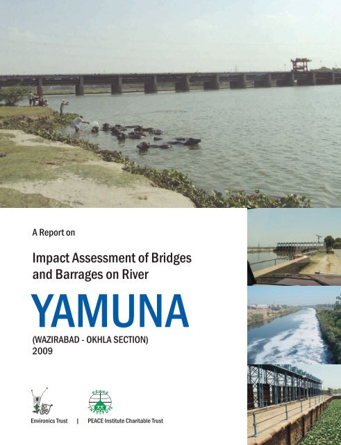
A 2009 study by Environics Trust titled Impact Assessment of Bridges and Barrages on River Yamuna in Delhi[iii] has found that the river has been segmented by several road and rail bridges. These structures, largely for economic considerations, have been built as embankments for all but the small segment of the flow-channel thus hindering the natural expanse of floodplains and increasing flood vulnerability.
It concluded that considering the typical nature of river Yamuna in NCT of Delhi, each structure coming over the River adds multiple impacts of different orders and recommended a careful examination and integration of process including Environment Impact Assessment (EIA) with a special focus on upstream and downstream structures already existing along with simultaneous hydraulic study and alternatives before taking any decisions on the clearance of a project. The study also objected to use of fly ash as a land fill for brides observing that it would have detrimental impact on the floodplain system.
Yamuna Jiye Abhiyan (YJA) working for floodplain protection and revival of river Yamuna terms the modern bridges as pseudo bridges not built embankment to embankment like the Old Railway Bridge with sufficient room and height for passage and spread of flood water. “To believe bridges on rivers are harmless structures is a false notion. In Delhi all the bridges except old railway bridge are pseudo bridges severely restricting the meandering of river”, says Manoj Misra, convener YJA.
He further says that the modern bridges are only considering the lean season flows and ignoring flood cycle thus disrupting flood water spread, damaging the floodplains and they are in true sense cross section embankments on the river.
Indeed the increasing number of bridges are impacting fluvial morphology by altering the sedimentation process and flood water spread.

As per Dr. Venkatesh Dutta, Gomti River Water-keeper too many bridges over a river alter the flow regime of the river. Over a long time, even the channel morphology and deposition dynamics get badly impacted. Form and functions of many rivers in the urban stretch have been damaged by road crossing and improperly designed bridges.
“If you construct over a dozen bridges over a small span of say 20 km, you essentially change the bankfull channel depth, cross-section area, flow velocity, pool-riffle sequence, sand bars and many other morphometric parameters. It can also leads to severe bed degradation and distorted bed gradient in the downstream resulting in loss of habitat. Ultimately, you make unsuitable environment for aquatic life”, says Dr. Venkatesh Dutta.
According to him the situation in India, especially in the urban stretch is really grim and bridges after bridges are being erected in a relatively short river span due to rising transport network and vehicular density.
Activist Vikrant Tongad who has raised objection against construction of Signature Bridge on River Yamuna without credible EIA in NGT says that the stand alone bridges are covered in draft EIA notification but there is lack of compliance of set conditions (please see NGT order here[iv]). “While NGT has admitted covering 20,000 sqkm construction area which has been increased to 1.50 lakh sqkm area by union environment ministry which has defeated the purpose”, adds Vikrant who heads Social Action for Forest and Environment (SAFE).
Conclusion Most of the bridges have been built at Ghats where in past, boats were commonly used to ferry people and materials across the river. They have been given name of ancient rulers or legendary leaders. There are only two road cum railway bridges on river Yamuna: one each in Delhi and Agra. From experience, it seems the British era bridges are studier and have well taken flood and floodplains into consideration.
Most of the conventional bridges have been jolted by floods in upper segment of Yamuna. Recently built and under construction bridges particularly road bridges are ignoring flood cycles and floodplain before starting construction.
To cut the construction cost, involved companies are keeping less portion on elevation and more on bunds. Such bridges necessitate additional construction of guide bunds which further eat into riverbed land. The number and size of pillars also have impact on spread and impact of floods.
More and more bridges are being built in urban areas on River Yamuna river without assessing possible impact on river, flood spread and floodplains. While bridges are essential for public mobility, there are no specific laws in India to assess, appraise and monitor for compliance of the proposals for bridges on river eco-system. There are apparently no norms for minimum distance between bridges, the size and height of pillars, flood path to be left for the river and number of bridges that could be allowed in a given stretch of a river.

Such bridges are fragmenting the floodplains, straight jacketing the river patch which has adverse impacts on river eco-system. Significant changes on flowing pattern, sediment deposition could be seen upstream and downstream of barrages cum bridges and where bridges have been built recently.
This is urgent and emerging issue, requiring immediate attention of all concerned. Hope everyone, including the government agencies would start taking concrete steps in undoing the impact of such bridges and refrain from constructing new bridges without complete, credible impact assessment before these bridges turn into a flood disaster or ruin the river and floodplain ecosystem forever. Clearly defined norms for bridge design and construction are also urgently required.
Happy Yamuna Jayanti 2020!
Bhim Singh Rawat (bhim.sandrp@gmail.com)
About Yamuna Jayanti:- The birthday of river Yamuna is celebrated every year on sixth day of summer Navratra. SANDRP has been publishing a blog highlighting the current situation of river. The Yamuna Nadi Mitra Mandli [YNMM (Friends of River Yamuna)] has contributed in previous efforts with current photos and videos. However this year on account of nationwide lockdown they were unable to send in pictures of bridges barrages from their areas.
The Yamuna Eco Scholar (YES) of Rainbow Children Academy, Vikas Nagar were specially preparing for the day and had already conducted painting, quiz activities on River Yamuna and had plans for cloth bags distribution and Yamuna walk to mark the occasion which are withheld given Covid-19 epidemic. Here is a video report on the planned activities of YES.
To see previous blogs on Yamuna Jayanti, kindly see-
Yamuna Jayanti 2016: An Unforgettable River Journey Through Pictures..
2018: Happy Birth Day, Yamuna! In pics from Friends of Yamuna
Yamuna Jayanti 2019: Will the agony of the River & People speak in Elections?
Disclaimer:- The counting of bridges is primarily based on Google earth maps hence there could be changes in the names and their numbers also could go and down by few counts. The names of bridges in tabular format repeated are two lanes with separate super structures and pillars hence counted separately.
End Notes:-
[i] http://cwc.gov.in/ybo/about_basin
[ii] http://www.indiaenvironmentportal.org.in/files/file/bridge-Yamuna-flood-plains-NGT-order.pdf
[iii] http://environicsindia.in/wp-content/uploads/2016/03/Impact-Assessment-of-Bridges-and-Barrages-on-River-Yamuna.pdf
[iv] http://www.indiaenvironmentportal.org.in/files/bridge%20across%20Yamuna%20NGT.pdf
