Dams

Election manifestos of BJP, Congress and AAP: Comparative reading on Environment and natural resource management

Now that the Bharatiya Janta Party (BJP) has made its manifesto for the 2014 Parliamentary elections in India public on April 7, 2014, we are in a position to make a comparative reading of manifestoes of three most prominent parties in fray at national level, namely the BJP, Congress and Aam Aadmi Party (AAP). While manifestos are largely ritualistic exercises, they are also the most important documents that declare the intentions of the political outfits, besides the other statements of the party leaders and track records of the parties and their leaders. These documents need to be read both in terms of the promises that they make as also the roadmaps that the parties provide to achieve the promises.

Overall impression In that respect, the overall impression that BJP manifesto (let us begin with a comment on BJP manifesto since all the opinion polls are giving the party an edge over others, though it is well known that opinion polls are largely doctored exercises that have proved wrong so many times) gives is one of an arrogance: both in terms of the content and the timing of the document. The BJP manifesto reads more like a laundry list of feel good factors, without any roadmap as to how the party hopes to achieve the listed objectives. The fact that the party came out with manifesto even as the voting in first phase of the elections was already underway, signals that it is not bothered to tell people why they should vote for them. There is little in the track record of the party in the states it is in power for over a decade, like Gujarat, Madhya Pradesh and Chhattisgarh, to show that it is serious on these issues in these states.

Congress manifesto, also of 52 pages like that of the BJP manifesto, provides much more details about the specific issues they list, but it is not written in particularly imaginative style, nor is it making any attempt at taking care of the negativity that has been generated around its performance over the last decade. In that sense, Congress’s manifesto makes for somewhat bureaucratic and boring reading. It also lacks in providing the big picture and a big vision.

The AAP manifesto at 28 pages is more interesting as it is not written as a marketing product pamphlet. It starts with the section on Jan Lokapal, their main plank and tries to answer why people should vote for AAP. The major highlight of the whole manifesto is that the party wants to give Gram Sabhas and mohalla sabhas a decisive say in all matters at their respective levels and in overall governance. This is a major departure from other two manifestos, besides their reliance on tackling corruption & Crony Capitalism with more seriousness and convincingly than other two parties. However, while it is more elaborate than the BJP and Cong manifestos in describing how the party seeks to change the governance in India, it seems less comprehensive. Another lacuna of the AAP manifesto’s PDF file is that it is not searchable, unlike the other two manifestos.

Having taken an overall view, let us look at some specific issues that we are concerned about.

Natural Resource Management The BJP manifesto seems to have poor understanding of the scope of ‘Natural Resources’. The manifesto lists only coal, minerals and spectrum among natural resources. The most important natural resources of land, forests, rivers, water sources and biodiversity are not even listed. It seems the party is only interested in directly marketable (as in equity market) commodities that their industry friends are interested in. Interestingly, the section starts with Gandhi’s famous quote on need vs greed, but there is no reflection of this principle in what is said here.

The Congress manifesto talks about “establishment   of a clearly defined policy for fair, transparent equitable and time bound development of natural resources. The Indian National Congress will immediately put in place a Special Purpose Vehicle for this.”  The fact that this comes in industries section does not sound very confidence inspiring.

The AAP has a section on natural resources that does include water and forests among natural resources along with major minerals and provides Gram Sabha pivotal role, without whose consent, decisions about exploitation of such major natural resources cannot be taken. The ownership of the minor natural resources remains with the gram sabhas in AAP scheme of things.

Environmental governance The BJP section on this issue has interesting heading: “Flora, Fauna and Environment – Safeguarding Our Tomorrow”. However, the section or the rest of the document does not tell us anything how they are going to improve environment governance in India or do they even see this need. On the contrary, by stating in Industry section that it intends to “Frame the environment laws in a manner that provides no scope for confusion and will lead to speedy clearance of proposals without delay” and talking about single window and speedy clearance elsewhere, it is clear what is their understanding is and where they intend to go. This can only be disastrous for India’s environment and environmental governance.

The Congress Manifesto claimed that it intends to set up National Environment Appraisal and Monitoring Authority. However, as Supreme Court judges promptly remarked, this is actually the order of the Supreme Court and Congress had no business of putting it on their manifesto. Moreover, Congress lacks credibility on this, since, when Jairam Ramesh, as environment minister proposed this, he was actually removed and his successor did nothing to implement this. Moreover, the environment ministry under UPA II actually filed an affidavit in the Supreme Court saying that it is not possible to set up such an authority with any teeth. The appointment of Union Oil Minister Veerappa Moily as Environment Minister, forgetting about conflict of interest and the actions that Moily as been taking subsequently including pushing the disastrous Yettinahole Diversion Project to benefit his parliamentary constituency in Karnataka takes away any credibility the party may have had. It is true that National Green Tribunal is the only major contribution of UPA on this issue, but that too is largely due to Mr Ramesh as his successor ministers tried their best to scuttle the functioning of NGT.

The AAP manifesto talks about reforming “Ministry of Environment and Forests and its agencies so that they can empower and facilitate Gram Sabhas to be effective custodians and managers of their local natural resources.” This is certainly welcome. However, there are insufficient details as to how this will be achieved. Their clubbing of Ecology and Economy in one section sounds promising at one level, again how this will be implemented without allowing ecology to be subservient to economic interests is not described.

Rivers It is well known that Inter Linking of Rivers (ILR) is high on agenda of BJP and Mr Modi. However, for some unclear reasons, they have played down ILR, saying, “Inter-linking of rivers based on feasibility.” Possibly they do not want to raise the hackles prematurely. However, the Narmada Kshipra link that was recently inaugurated and the track record of the BJP in Madhya Pradesh and elsewhere seems to suggest that BJP state governments are working at cross purposes with the national ILR plan.

The BJP manifesto says, “BJP commits to ensure the cleanliness, purity and uninterrupted flow of the Ganga on priority”, but this is not helpful, since no roadmap is given how this will be achieved. Moreover, this intentionally ignores the three biggest threats that the Ganga and other rivers face: The dams & hydropower projects, the urban & industrial pollution & encroachment. The BJP manifesto is silent on all these three threats to the river. Even on the issue of River Pollution, the only thing the party manifesto condescends to inform the readers is that “a massive ‘Clean Rivers Programme’ will be launched across the country driven by people’s participation.” No details again. Even on the issue of seemingly unsolvable urban water pollution, the only solution party can offer is more sewage treatment plants, choosing to ignore that the existing STPs are non functional most of the places. Interestingly, BJP manifesto has a section on North East India (unlike the other two manifestos) and mentions the flood problem of Assam and promises tackling the river, but without any details as to how.

It is worth noting in this context that when BJP’s PM candidate Mr Modi visited North East India in general and Arunachal Pradesh in particular he did not mention ILR or large hydropower projects in that region, knowing that local sentiments are totally against them. However, Mr Modi, while proposing his national energy plan in Madhya Pradesh in March 2014, said that North East India is heaven for hydropower projects! The manifesto again is expectedly silent on this issue!

The Congress manifesto says that “The National Ganga River Basin Authority has begun the ambitious task of cleaning the Ganga River. We  will use similar models of creating empowered, well-funded agencies to clean other major rivers in the country”. Now this sounds mindless and incredible! NGRBA, five years after it was notified, has been the most ineffective, non transparent institution that has achieved no change in the state of the river. How can such an institution be used as a model for other rivers? The authors of the Congress manifesto seem completely ill informed on this score.

The AAP manifesto seems to have nothing on Rivers: a major omission of the manifesto.

Water The BJP manifesto promises piped water supply to all households! Irrespective of if all households need it or not or is it feasible or appropriate or not. The BJP manifesto claims that there will be 50% gap between demand and supply of water in India by 2050. This is totally off the mark, according to Govt of India’s National Commission for Integrated Water Resources Development, country’s water requirement will match the available resources in 2050, even considering high growth trajectory, we are going far below that level currently. The BJP manifesto writers seem to have no clue about the realities, or they are just trying to push greater market for water companies. There is one promise in this regard that is welcome: “We will promote decentralized, demand-driven, community-managed water resource management, water supply and environmental sanitation.” However, how they will promote this is not given. Moreover, this promise remains unconvincing considering they also talk about river linking.

The Congress manifesto talks about adding 1 crore ha in gross irrigated area in 12th Plan, two years of which are already over! It clearly looks impossible, but more importantly, it does not say how they will achieve it. Both Congress and BJP manifestoes talk about water conserving irrigation techniques, which is actually seems to be scam ridden and affected by crony capitalism. Congress manifesto also talks about increasing irrigation efficiency and water use efficiency in general, but without any roadmap. More worryingly, the UPA government has pushed the proposal to allow Jain Irrigation (the biggest private supplied of drop and sprinkler systems) to set up the National Bureau of Water Efficiency! Crony capitalism?

The AAP manifesto talks about giving priority to watershed development to reduce pressure on big irrigation projects, but fails to take an informed and prudent stand on performance of big irrigation projects. This is certainly a major let down of AAP manifesto.

Urban Water Issues There is nothing noteworthy in BJP manifesto in this regard, even as it plans to prioritise Urban Development. It has no clue about how to tackle Urban Wastewater as it only talks about more STPs when existing STPs are not working, including in Modi’s Gujarat.

The Congress manifesto talks about continuing the problematic Jawaharlal Nehru Urban Renewal Mission under which over Rs 70000/- crores have been spent, mostly on Urban water issues, without any attempt at democratic governance, local water options, demand side  management or recycle and reuse of treated sewage. This is creating havoc on surrounding areas with displacement of tribals, destruction of forests and pushing unjustifiable dams. But it seems Congress is least bothered about it. The problem is so acute that some 18000 people in Thane to be displaced by Kalu dam meant for Mumbai have decided to boycott the polls, since the dam is being taken up without any clearances and when all the gram sabhas have passed resolutions against it. The writing is clearly on the walls for the Congress.

The only positive aspect in this regard in AAP manifesto is the proposed empowerment of Mohalla Sabhas. Let us hope they are able to show how this will work.

Climate Change It is interesting to see that Climate Change is an issue recognised by BJP and Congress manifestos, but what they say there is disappointing in both cases. BJP manifesto talks about launching a National Mission on Himalayan Ecosystem, but there is already one existing, which is supposed to be under implementation for some years, but no one seems to know what it is doing! BJP Manifesto also talks about program devised to arrest melting of Himalayan glaciers, sounds strange, since no such program is known.

The Congress manifesto promises of continued implementation of National Action Plan on Climate Change when the plan and its mission stand discredited, along with the Prime Minister’s Council on Climate Change. These are the things that make the Congress manifesto sound so bureaucratic.

AAP manifesto seems silent on climate change.

Renewable Energy It is welcome to note that BJP manifesto talks about promoting small hydro with local support and without displacement. However, it is not welcome that there is no mention of big hydro and big dams. Their promise to push infrastructure development in Arunachal Pradesh without any mention of participatory decision making with the local communities is likely to raise suspicion that this is for pushing big hydro there. The manifesto is also silent about promoting household level solar power projects.

The Congress manifesto is also silent on promoting household level solar power projects. It talks about giving new  thrust to  small hydro under new and renewable energy sources, but these projects need social and environmental impact assessment, the manifesto is silent on this.

The AAP manifesto is the only one that does talk about pushing decentralized renewable energy plants, which is welcome.

Tribal Development The scary part in BJP manifesto in this regard is that tribal development in India will be pushed on the lines of what has been achieved in Gujarat, Madhya Pradesh and Chhattisgarh! If this is the tribal development model for tribals in other areas, tribals all over India need to be very wary of this party.

The Congress manifesto says: “We will ensure the stringent implementation of PESA, 1996 and the Forest Rights Act, 2006 to ensure that Scheduled Tribes are empowered and brought into the mainstream.” Sounds good, but the trouble is what has Congress governments both at centre and states done? Nothing about PESA and very little to implement FRA in letter and spirit.

In that respect AAP manifesto does make such commitment and this is most welcome. This is possibly the only useful thing for tribals among all three manifestos, in addition to the fact that AAP provides separate section for Tribals, for Scheduled castes and also for Valmikis, unlike the BJP and Congress manifestos basically clubbing all under one head.

In conclusion It is apt that the last page of the BJP manifesto says “Time for Modi” and not for BJP! The Congress manifesto on last page shows Rahul Gandhi sitting with urban youth. This appeal will have limited catchment. The last page of AAP manifesto asks voters in Hindi to vote for the honest party.

Let us hope the voters everywhere will do that.

Himanshu Thakkar, ht.sandrp@gmail.com

BJPcongressaap

This blog also hosted at: http://www.write2kill.in/himanshu-thakkar/election-manifestos-of-bjp-congress-and-aap-comparative-reading-on-environment.html

and at: http://indiatogether.org/comparing-manifestos-of-national-parties-environment.

END NOTES:

1. BJP Manifesto: http://www.bjp.org/images/pdf_2014/full_manifesto_english_07.04.2014.pdf

2. Congress Manifesto: http://inc.in/media/pdf/English_Manifesto_for_Web.pdf

3. AAP manifesto: https://app.box.com/s/q9k6f7e21265olkpxrzq

4. Some articles on Congress, AAP manifestos: http://www.thethirdpole.net/new-indian-party-integrates-economy-and-ecology-in-manifesto/,

http://www.thethirdpole.net/indias-congress-party-releases-poll-manifesto-green-promises-remain-unfulfilled/,

http://www.thethirdpole.net/environmentalists-attack-catch-all-bjp-manifesto/,

http://www.thethirdpole.net/little-space-for-environment-in-indian-elections/

5. A related article: https://sandrp.wordpress.com/2014/04/04/why-is-media-missing-the-real-gujarat-story-gujarat-satya-samachar/

6. http://www.indiawaterportal.org/articles/elections-manifesto-2014-water-policy

7. http://www.theguardian.com/commentisfree/2014/mar/22/water-decide-indian-elections-aam-admi

8. Great to see hydropower projects become election issue in Sikkim: http://www.firstpost.com/politics/in-sikkim-environmental-issue-get-top-priority-1470713.html

9. http://prernabindra.com/2014/04/09/little-space-for-conservation-in-the-election-manifestos/

10. EPW editorial: “The absence of any engagement with climate change in the planet’s biggest elections is shocking” http://www.epw.in/system/files/pdf/2014_49/15/King_Canutes_Land.pdf

11. Quotes SANDRP http://www.thehindubusinessline.com/news/politics/green-agenda-gets-the-grand-shove/article5897143.ece?homepage=true

12. http://indiatogether.org/comparison-of-congress-bjp-aap-manifestos-government
Climate Change · Dams · Hydropower

Dams are not Climate Friendly: Readings from IPCC WG II Report

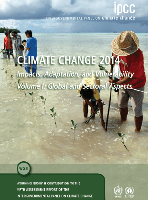
Inter-governmental Panel on Climate Change’s (IPCC) Fifth Assessment is falling into place. On the 31st March 2014, the report titled ‘Climate Change 2014: Impacts, Adaptation, and Vulnerability’, from Working Group II[1] was issued in Yokohoma, Japan. Working Group II assesses “the vulnerability of socio-economic and natural systems to climate change, negative and positive consequences of climate change, and options for adapting to it. It also takes into consideration the inter-relationship between vulnerability, adaptation and sustainable development.”[2]

This can be called as one of the more incisive Working Group Reports from IPCC. It states unequivocally that the effects of climate change are already occurring on all continents and across the oceans and world is ill-prepared for risks from a changing climate. According to Co-Chair of Working Group II, Chris Field, “The report concludes that people, societies, and ecosystems are vulnerable around the world, but with different vulnerability in different places. Climate change often interacts with other stresses to increase risk”.[3]

The report consists of two volumes. First volume contains a Summary for Policymakers, Technical Summary, and 20 chapters assessing risks by sector and opportunities for response. The sectors include freshwater resources, terrestrial and ocean ecosystems, coasts, food, urban and rural areas, energy and industry, human health and security, and livelihoods and poverty. A second volume of 10 chapters assesses risks and opportunities for response by region. These regions include Africa, Europe, Asia, Australasia, North America, Central and South America, Polar Regions, Small Islands, and the Ocean.

The summary for policymakers paints a sombre picture: “Climate change over the 21st century is projected to reduce renewable surface water and groundwater resources significantly in most dry subtropical regions, intensifying competition for water among sectors. In presently dry regions, drought frequency will likely increase by the end of the 21st century under RCP8.5. In contrast, water resources are projected to increase at high latitudes. Climate change is projected to reduce raw water quality and pose risks to drinking water quality even with conventional treatment, due to interacting factors: increased temperature; increased sediment, nutrient, and pollutant loadings from heavy rainfall; increased concentration of pollutants during droughts; and disruption of treatment facilities during floods. Adaptive water management techniques, including scenario planning, learning-based approaches, and flexible and low-regret solutions, can help create resilience to uncertain hydrological changes and impacts due to climate change.”

“Risks are unevenly distributed and are generally greater for disadvantaged people and communities in countries at all levels of development.”

Links with water

Being an integral and cross cutting issue, water features prominently in all of Chapters of the Working Group Report. Sections on Freshwater Resources, Costal systems and low lying areas, Food Security, Inland systems, etc. include important findings. It is significant to note that dams, hydropower projects, infrastructure measures like channelization, embankments, etc., are also mentioned in nearly all the chapters of the report. Couple of references indicate dams as a possible adaptation measure, but overwhelming references point to the contrary.

The collective picture that is arising through these reference is very important. A collation and analysis of all specific references to water infrastructure projects, read in tandem with the report indicates that: 

1. Dams and infrastructure projects contribute significantly to “non-climate impacts” which, after interacting with changing climate, exacerbate the overall impact on human societies and ecosystems

o   Sediment Trapping by reservoirs, exacerbates impact of  sea level rise

o   Hydropower affects local options

o   Climate  change and dams together affect a greater eco-region

o   Increased flow fluctuations by dams exacerbate through climate change

2. In case of Flood Protection, dams and embankments may do more harm than good. Ecological measures would fare better.

3. Dams and Hydropower projects affect biodiversity, which is critical in facing climate change challenges.

4. In the tropics, global warming potential of hydropower may exceed that of Thermal Power

5. Dams increase vulnerability of weaker sections to climate change

6. Existing Dams have to be managed sustainably, with ecological considerations

7. Hydropower itself is vulnerable to Climate Change

~~~

The references used in WG II report are peer reviewed research from several authors.The specific references given below will play an important role in debunking the simplistic myth that dams and hydropower projects are climate friendly and can be considered as de facto adaptation measures to cope with Climate Change.

Some Relevant Extracts from Working Group II Report:

  1. Dams and infrastructure projects contribute significantly to “non-climate impacts” which, after interacting with climate impacts, exacerbate the overall impact of climate change on human societies and ecosystems 
  • Sediment Trapping by reservoirs, exacerbates impact of  sea level rise

“Most large deltas in Asia are sinking (as a result of groundwater withdrawal, floodplain engineering, and trapping of sediments by dams) much faster than global sea-level is rising.” (Chapter 24: Asia)

“Human activities in drainage basins and coastal plains have impacted the coastal zone by changing the delivery of sediment to the coast. Sediment trapping behind dams, water diversion for irrigation, and sand and gravel mining in river channels all contribute to decrease sediment delivery, whereas soil erosion due to land-use changes help increase it. It is estimated that the global discharge of riverine sediment was 16-–19 Gt/ yr in the 1950s before widespread dam construction and it has decreased to 12–13 Gt/ yr. Out of 145 major rivers with mostly more than 25-year record, only 7 showed evidence of an increase in sediment flux while 68 showed significant downward trends. The number of dams has increased continuously and their distribution has expanded globally. As of early 2011, the world has an estimated 16.7 million reservoirs larger than 0.01 ha. Globally, 34 rivers with drainage basins of 19 million km2 in total show a 75% reduction in sediment discharge over the past 50 years. Reservoir trapping of sediments is estimated globally as 3.6 Gt/ yr to more than 5 Gt/ yr (Syvitski et al., 2005; Walling, 2012; Milliman and Farnsworth, 2011). Human pressure is the main driver of the observed declining trend in sediment delivery to the coastline.(Chapter 5 Coastal systems and Low Lying areas)

“Attributing shoreline changes to climate change is still difficult due to the multiple natural and anthropogenic drivers contributing to coastal erosion.” (Chapter 5 Coastal systems and low lying areas)

“The combined impact of sediment reduction, relative sea level rise, land-use changes in delta and river management on channels and banks has led to the widespread degradation of deltas. The changes of sediment delivery from rivers due to dams, irrigation and embankments/dykes creates an imbalance in sediment budget in the coastal zones. Degradation of beaches, mangroves, tidal flats, and subaqueous delta fronts along deltaic coasts has been reported in many deltas (e.g. Nile and Ebro, Sanchez-Arcilla et al., 1998; Po, Simeoni and Corbau, 2009; Krishna-Godavari, Nageswara Rao et al., 2010; Changjiang, Yang et al., 2011; Huanghe, Chu et al., 1996; very high confidence). Deltaic coasts naturally evolve by seaward migration of the shoreline, forming a delta plain. However, decreasing sediment discharge during the last 50 years has decreased the growth of deltaic land, even reversing it in some locations (e.g. Nile, Godavari, Huanghe). Artificial reinforcement of natural levees also has reduced the inter-distributory basin sedimentation in most deltas, resulting in wetland loss.” (Emphasis added.)

“The major impacts of sea level rise are changes in coastal wetlands, increased coastal flooding, increased coastal erosion, and saltwater intrusion into estuaries and deltas, which are exacerbated by increased human-induced drivers. Ground subsidence amplifies these hazards in farms and cities on deltaic plains through relative sea level rise. Relative sea level rise due to subsidence has induced wetland loss and shoreline retreat (e.g. the Mississippi delta, Morton et al., 2005; Chao Phraya delta, Saito et al., 2007; high confidence).” (Chapter 5 Coastal systems and low lying areas)

“There have been local variations in precipitation and runoff since 1950, but changes in sediment load are primarily attributed to over 50,000 dams and vegetation changes.”  (Chapter 18: Detection and attribution of observed impacts)

  • Hydropower affects local options

“Hydropower dams along the Mekong River and its tributaries will also have severe impacts on fish productivity and biodiversity, by blocking critical fish migration routes, altering the habitat of non-migratory fish species, and reducing nutrient flows downstream. Climate impacts, though less severe than the impact of dams, will exacerbate these changes.”(Chapter 24: Asia)

  • Climate  change and dams together affect a greater eco-region

“For one climate scenario, 15% of the global land area may be negatively affected, by the 2050s, by a decrease of fish species in the upstream basin of more than 10%, as compared to only 10% of the land area that has already suffered from such decreases due to water withdrawals and dams (Döll and Zhang, 2010). Climate change may exacerbate the negative impacts of dams for freshwater ecosystems.” (Chapter 3: Freshwater resources)

  1. Flood Protection: Dams and embankments may do more harm than good. Ecological measures fare better.
  • “On rivers and coasts, the use of hard defences (e.g. sea-walls, channelization, bunds, dams) to protect agriculture and human settlements from flooding may have negative consequences for both natural ecosystems and carbon sequestration by preventing natural adjustments to changing conditions. Conversely, setting aside landward buffer zones along coasts and rivers would be positive for both. The very high carbon sequestration potential of the organic-rich soils in mangroves and peat swamp forests provides opportunities for combining adaptation with mitigation through restoration of degraded areas.” (Chapter 3 Freshwater Resources)
  • “Ecosystem based adaptation (EBA) can be combined with, or even a substitute for, the use of engineered infrastructure or other technological approaches. Engineered defenses such as dams, sea walls and levees adversely affect biodiversity, potentially resulting in maladaptation due to damage to ecosystem regulating services. There is some evidence that the restoration and use of ecosystem services may reduce or delay the need for these engineering solutions. EBA offers lower risk of maladaptation than engineering solutions in that their application is more flexible and responsive to unanticipated environmental changes. Well-integrated EBA can be more cost effective and sustainable than non-integrated physical engineering approaches (Jones et al., 2012), and may contribute to achieving sustainable development goals (e.g., poverty reduction, sustainable environmental management, and even mitigation objectives), especially when they are integrated with sound ecosystem management approaches.” (Chapter 3 and Also Chapter 15 Adaptation Planning and Implementation)
  1. Dams and Hydropower projects affect biodiversity, which is critical in facing climate change challenges
  • “Freshwater ecosystems are considered to be among the most threatened on the planet. Fragmentation of rivers by dams and the alteration of natural flow regimes have led to major impacts on freshwater biota.” (Chapter 4: Terrestrial and Inland Water Systems)
  • “Damming of river systems for hydropower can cause fragmentation of the inland water habitat with implications for fish species.” (Chapter 4 Terrestrial and Inland Water Systems)
  •  “Freshwater ecosystems are also affected by water quality changes induced by climate change, and by human adaptations to climate-change induced increases of streamflow variability and flood risk, such as the construction of dykes and dams”. (Chapter 3: Freshwater resources)
  • “Hydropower generation leads to alteration of river flow regimes that negatively affect freshwater ecosystems, in particular biodiversity and abundance of riverine organisms, and to fragmentation of river channels by dams, with negative impacts on migratory species. (Chapter 3: Freshwater Resources)
  • “Hydropower operations often lead to discharge changes on hourly timescales that are detrimental to the downstream river ecosystem.”
  • “Climate change and habitat modification (e.g., dams and obstructions) impact fish species such as salmon and eels that pass through estuaries.” (Chapter 5 Coastal Systems and low lying areas)
  1. In Tropics, global warming potential of hydropower may exceed Thermal Power
  • “In tropical regions, the global warming potential of hydropower, due to methane emissions from man-made reservoirs, may exceed that of thermal power; based on observed emissions of a tropical reservoir, this might be the case where the ratio of hydropower generated to the surface area of the reservoir is less than 1 MW/km2”.
  • “Reservoirs can be a sink of CO2 but also a source of biogenic CO2 and CH4” (Chapter 4 Terrestrial and Inland Systems)
  1. Dams increase vulnerability of weaker sections to climate change
  • “A number of studies recognize that not every possible response to climate change is consistent with sustainable development, since some strategies and actions may have negative impacts on the well-being of others and of future generations .For example, in central Vietnam some responses to climate change impact, such as building dams to prevent flooding and saltwater intrusion and to generate power, threaten the livelihood of poor communities. First, the relocation of communities and the inundation of forestland to build dams limit households’ access to land and forest products. Second, a government focus on irrigated rice agriculture can reduce poor households’ ability to diversify their income portfolio, decreasing their long-term adaptive capacity. Indeed, the consequences of responses to climate change, whether related to mitigation or adaptation, can negatively influence future vulnerability, unless there is awareness of and response to these interactions. Here, the role of values in responding to climate change becomes important from a variety of perspectives, including intergenerational, particularly when those currently in positions of power and authority assume that their prioritized values will be shared by future generations. (Chapter 20: Climate-resilient pathways: adaptation, mitigation, and sustainable development)
  •  “Some documented impacts on dams, reservoirs and irrigation infrastructure are: reduction of sediment load due to reductions in flows (associated with lower precipitation), positively affecting infrastructure operation (Wang et al., 2007); impacts of climate variability and change on storage capacity that creates further vulnerability; and failures in the reliability of water allocation systems (based on water use rights) due to reductions of streamflows under future climate scenarios” (Chapter 9: Rural Areas)
  • “Infrastructure (e.g. roads, buildings, dams and irrigation systems) will be affected by extreme events associated with climate change. These climate impacts may contribute to migration away from rural areas, though rural migration already exists in many different forms for many non-climate-related reasons.” (Chapter 9 Rural Areas)
  • “Changes in water use, including increased water diversion and development to meet increasing water demand, and increased dam building will also have implications for inland fisheries and aquaculture, and therefore for the people dependent on them” .
  • “In the case of the Mekong River basin, a large proportion of the 60 million inhabitants are dependent in some way on fisheries and aquaculture which will be seriously impacted by human population growth, flood mitigation, increased offtake of water, changes in land use and overfishing, as well as by climate change. Ficke et al. (2007) reported that at that time there were 46 large dams planned or already under construction in the Yangtze River basin, the completion of which would have detrimental effects on those dependent on fish for subsistence and recreation.” (Chapter 7 Food security and food production systems)
  1. Existing Dams have to be managed sustainably, with ecological considerations:
  • “Suggested strategies for maximizing the adaptive capacity of ecosystems include reducing non-climate impacts, maximizing landscape connectivity, and protecting ‘refugia’ where climate change is expected to be less than the regional mean. Additional options for inland waters include operating dams to maintain environmental flows for biodiversity, protecting catchments, and preserving river floodplains.” (Chapter 24:Asia )
  1. Hydropower itself is vulnerable to Climate Change
  • “Climate change affects hydropower generation through changes in the mean annual stream-flow, shifts of seasonal flows and increases of stream-flow variability (including floods and droughts) as well as by increased evaporation from reservoirs and changes in sediment fluxes. Therefore, the impact of climate change on a specific hydropower plant will depend on the local change of these hydro-logical characteristics, as well as on the type of hydropower plant and on the (seasonal) energy demand, which will itself be affected by climate change”
  • “Projections of future hydropower generation are subject to the uncertainty of projected precipitation and stream-flow. In regions with high electricity demand for summertime cooling, this seasonal stream-flow shift is detrimental. In general, climate change requires adaptation of operating rules which may, however, be constrained by reservoir capacity. Storage capacity expansion would help increase hydropower generation but might not be cost-effective.”
  • “Observations and models suggest that global warming impacts on glacier and snow-fed streams and rivers will pass through two contrasting phases. In the first phase, when river discharge is increased due to intensified melting, the overall diversity and abundance of species may increase. However, changes in water temperature and stream-flow may have negative impacts on narrow range endemics. In the second phase, when snowfields melt early and glaciers have shrunken to the point that late-summer stream flow is reduced, broad negative impacts are foreseen, with species diversity rapidly declining once a critical threshold of roughly 50% glacial cover is crossed.” (Chapter 3 Freshwater Resources)

Let us hope that these collated finding will be helpful in addressing the myth that dams and hydropower projects are climate friendly and can even be looked at as adaptation measures. Let us also hope that the Working Group III Report, which will come out in less than a week’s time from now, will have lessons for hydropower development in line with the above statements in the WG II report.

Issues with WG III, Special Report on Renewable Energy

Findings of WG II contrast strikingly with Special Report on Renewable Energy Sources and Climate Change Mitigation (SRREN) [4]brought out by Working Group III in 2011.

SRREOne of the two lead coordinating authors of this report was Dr. Arun Kumar, from AHEC, IIT Roorkee. Notably, Dr. Kumar was also a part of the team which worked on Cumulative Impact Assessment of Hydropower projects in Upper Ganga basin of Uttarakhand[5]. The state suffered huge flood and precipitation damages in June 2013 (long after the report came out) and commissioned and under–construction hydropower projects had a large role to play in compounding the impacts of the disaster[6]. Ministry of Environment and Forests as well as the Supreme Court of India rejected this report. SANDRP had published a detailed critique of this CIA report at the outset.

Amazingly, the Hydropower Section of the above mentioned IPCC Special Report on Renewable Energy severely downplays and ignores the impacts of hydropower. For example, it does not allude to peoples protests to projects, impacts of projects by blasting and tunneling, downstream impacts, impacts of peaking, associated deforestation and related development, cumulative impacts of projects in a cascade, increasing climate vulnerability of the population, seismic impacts, increased disaster vulnerability of the region, etc.,. In fact, these impacts have been some of the most-discussed issues in hydropower discourse in many countries at the moment. The report makes strange statements like “trans-boundary hydropower establishes arena for international cooperation”, when we see across the world that hydropower projects on internationally shared rivers further conflicts and strife between nations. It also downplays methane emissions from hydropower.

In all, the section appears biased towards hydropower and does not do justice to IPCC’s rigorous and objective standards. The section should not have been accepted as it stands now.

Now, the Working Group III is yet to submit its Assessment Report to the IPCC. It will be discussed by the IPCC between 7-11 April 2014, in Berlin. We hope there is true depiction of hydropower in the Working Group III report, looking at the above mentioned impacts and also keeping in mind strong statements from Working Group II report made public on March 31, 2014.

Parineeta Dandekar, parineeta.dandekar@gmail.com

~~~


[1] The IPCC Working Group I (WG I) assesses the physical scientific aspects of the climate system and climate change. Working Group II (WG II) assesses the vulnerability of socio-economic and natural systems to climate change, negative and positive consequences of climate change, and options for adapting to it. It also takes into consideration the inter-relationship between vulnerability, adaptation and sustainable development. The assessed information is considered by sectors (water resources; ecosystems; food & forests; coastal systems; industry; human health) and regions (Africa; Asia; Australia & New Zealand; Europe; Latin America; North America; Polar Regions; Small Islands). The IPCC Working Group III (WG III) assesses options for mitigating climate change through limiting or preventing greenhouse gas emissions and enhancing activities that remove them from the atmosphere. (https://www.ipcc.ch/working_groups/working_groups.shtml)

[2] https://www.ipcc.ch/

[3] https://www.ipcc.ch/pdf/ar5/pr_wg2/140330_pr_wgII_spm_en.pdf

[4] http://www.ipcc-wg3.de/special-reports/srren/special-report-renewable-energy-sources

[5] http://www.sandrp.in/hydropower/Pathetic_Cumulative_Impact_Assessment_of_Ganga_Hydro_projects.pdf

[6] https://sandrp.wordpress.com/2013/06/21/uttarakhand-deluge-how-human-actions-and-neglect-converted-a-natural-phenomenon-into-a-massive-disaster/

https://sandrp.wordpress.com/2013/06/23/uttarakhand-floods-disaster-lessons-for-himalayan-states/

https://sandrp.wordpress.com/2013/06/25/uttarakhand-and-climate-change-how-long-can-we-ignore-this-in-himalayas/

https://sandrp.wordpress.com/2013/08/14/uttarakhand-flood-disaster-supreme-courts-directions-on-uttarakhand-hydropower-projects/

https://sandrp.wordpress.com/2013/09/27/uttarakhand-floods-of-june-2013-curtain-raiser-on-the-events-at-nhpcs-280-mw-dhauliganga-hep/


brahmaputra · Dams · Sutlej

Media Hype Vs Reality: India-China Water Information Sharing MoU of Oct 2013

It was pretty surprising to see the front page headline in The Times of India on Oct 24, 2013[i], claiming that an India China “MoU on Dams Among Nine Deals Signed”. The Hindu headline[ii] (p 12) claimed, “China will be more transparent on trans-border river projects”. Indian Express story[iii] (on page 1-2) claimed, “The recognition of lower riparian rights is a unique gesture, because China has refused to put this down on paper with any other neighbouring country”. It should be added that the news stories on this subject in the Economic Times and the Hindustan Times took the MoU in more matter of fact way.

Proposed Chinese Dams on Yarlung Zangbo Source: SANDRP
Proposed Chinese Dams on Yarlung Zangbo
Source: SANDRP

Additional information for second half of May However, the actual language of the Memorandum of Understanding on “strengthening cooperation on trans-border rivers” available on website of Press Information Bureau[v] and Ministry of External affairs[vi] gives a very different picture. There is no mention of dams, river projects or lower riparian or rights there. One additional feature of the agreement is that the current hydrological data (Water Level, Discharge and Rainfall) in respect of three stations, namely, Nugesha, Yangcun and Nuxia located on river Yaluzangbu/Brahmaputra from 1st June to 15th October every year[vii] will now be extended to May 15th to Oct 15th with effect from 2014. While this is certainly a step forward since the monsoon in North East India sets in May and also in view of the accelerated melting of glaciers in changing climate, it should not lead to the kind of hype some of the newspapers created around the river information MoU. Moreover, it should be remembered that India pays for the information that it gets from China and what Indian government does with that information is not even known since it is not even available in public domain. How this information is thus used is a big state secret!

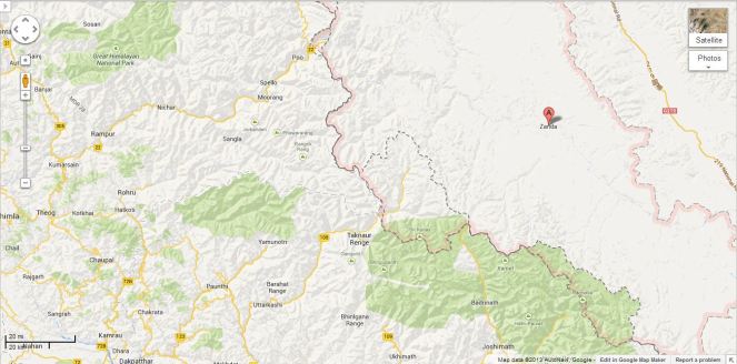
Three stations on Yarlung Zangbo - Nugesha, Yangcun and Nuxia (the green spots in the map represent these station)[iv]
Three stations on Yarlung Zangbo – Nugesha, Yangcun and Nuxia
(the green spots in the map represent these station)[iv]

Over-Optimistic reading of the MoU? The specific feature of the new MoU about which media seemed excited read as follows: “The two sides agreed to further strengthen cooperation on trans-border rivers, cooperate through the existing Expert Level Mechanism (for detailed chronology of ELM formation, meetings and earlier MoUs on Sutlej and Brahmaputra, see annexure below) on provision of flood-season hydrological data and emergency management, and exchange views on other issues of mutual interest.” The key words of this fifth the last clause of the MoU were seen as “exchange views on other issues of mutual interest”, providing India an opportunity to raise concerns about the Chinese hydropower projects and dams on shared rivers. However, the clause only talks about exchange of views and there is no compulsion for China to share its views, leave aside share information about the Chinese projects in advance or otherwise. On the face of it, the hype from this clause misplaced.

Tsada station on river Satluj (Shown as A in the Google Map)

This was read with first clause: “The two sides recognized that trans-border rivers and related natural resources and the environment are assets of immense value to the socio-economic development of all riparian countries.” Here “riparian countries” clearly includes lower riparian. But to suggest that this clause on its own or read with clause 5 mentioned above provides hope that China will include the concerns of the lower riparian in Chinese projects on shared rivers seems slightly stretched. The clause only recognises the asset value of rivers and related natural resources and environment for all basin countries and it is doubtful if it can be used to interpret that Chinese will or should take care of the concerns of lower riparian.

Thus the rather optimistic interpretation does not seem to emanate from the actual wording of the MoU, but the rather over optimistic interpretation by the Indian interlocutors, possibly including the Indian ambassador to China, who has been quoted on this aspect.

Real Achievement: GOI recognises value of Rivers! What is most interesting though is that Indian government has actually signed a Memorandum that recognises that “rivers and related natural resources and the environment are assets of immense value to the socio-economic development”. This is absolutely amazing and joyful development for rivers. Since there is nothing in the laws, policies, programs, projects and practices of Indian government that says that rivers are of any value. Now that Indian government has actually signed an MoU agreeing to such a value, there is sudden hope for rivers, it seems. Only lurking doubt, though is the word “trans-border” before rivers! We hope the Government of India applies this clause to all rivers, not just trans-border rivers, though we know from past that this hope is one a rather thin ice!!

SANDRP

Annexure:

1. Formation and Meetings of Expert Level Mechanism (ELM) on Trans-border Rivers

20-23 Nov, 2006 During the visit of the President of People’s Republic of China to India in November 20-23, 2006, it was agreed to set up an Expert-Level Mechanism to discuss interaction and cooperation on provision of flood season hydrological data, emergency management and other issues of trans-border rivers between the two countries. Accordingly, the two sides set up the Joint Expert Level Mechanism(ELM) on Trans-border Rivers. The Expert Group from Indian side is led by Joint Secretary level officers.  Seven meetings of ELM have been held so far.
19-21 Sept, 2007 In the 1st meeting of ELM the issues related to bilateral cooperation for exchange of hydrological information were discussed.
10-12 April, 2008 In the 2nd meeting of ELM work regulations of the ELM were agreed upon and signed. It was agreed that the ELM shall meet once every year, alternatively in India and China.
21–25 April, 2009 The 3rd meeting was focused on helping in understanding of each other’s position for smooth transmission of flood season hydrological data.
26-29 April, 2010 In the 4th meeting the implementation plan on provision of hydrological information on Yaluzangbu/Brahmaputra River in flood season was signed.
19-22 April, 2011 In the 5th meeting the Implementation Plan in respect to the MoU on Sutlej was signed.
17-20 July, 2012 The 6th meeting of ELM was held at New Delhi where both the countries reached at several important understandings and a significant one of those understandings is – “The two sides recognized that trans-border rivers and related natural resources and the environment are assets of immense value to the socio-economic development of all riparian countries.”
14-18 May, 2013 In the 7th meeting held at Beijing, China where in the draft MoU and Implementation Plan on Brahmaputra river was finalized.

 2. MoUs on Hydrological Data Sharing on River Brahmaputra / Yaluzangbu

2002 Government of India and China signed a MoU for provision of hydrological information on Yaluzangbu/Brahmaputra River in flood season by China to India. In accordance with the provisions contained in the MoU, the Chinese side provided hydrological information (Water Level, Discharge and Rainfall) in respect of three stations, namely, Nugesha, Yangcun and Nuxia located on river Yaluzangbu/Brahmaputra (see the map above) from 1st June to 15th October every year, which was utilized in the formulation of flood forecasts by the Central Water Commission. This MoU expired in 2007.
2008 On 5th June, India signed a new MoU with China on provision of hydrological information of the Brahmaputra /Yaluzangbu river in flood season by China to India with a validity of five years. This was done during the visit of the External Affairs Minister of India to Beijing from June 4-7. Under this China had provided the hydrological data of the three stations for the monsoon season from 2010 onward.
2013 During the visit of Chinese Premier Li Kegiang to India the MoU of 2008 has been extended till 5th June 2018.

 3. MoUs on Hydrological Data Sharing on River Satluj / Langquin Zangbu

2005 A MoU was signed during the visit of the Chinese Premier to India in April for supply of hydrological information in respect of River Satluj (Langquin Zangbu) in flood season. Chinese side provided hydrological information in respect of their Tsada station on river Satluj (Langquin Zangbu in Chinese, see the map above).
Aug 2010 In order to supply flood season hydrological information on River Sutlej a new MoU was agreed in August 2010
Dec 2010 On 16 Dec 2010, during the visit of Prime Minister of China to India a new MoU was signed to provide hydrological information of Sutlej/Langquin Zangbo River in flood season by China to India with a validity of five years.
April 2011 During the 5th  ELM meeting held in April, 2011 an MoU on Sutlej containing the Implementation Plan with technical details of provision of hydrological information, data transmission method and cost settlement etc. was signed in Beijing. The hydrological information during the flood season has been received in terms of the signed implementation plan.

Annexure compiled by Parag Jyoti Saikia

Post Script: Further reading: http://www.thethirdpole.net/2015/11/06/tibet-dams-hold-back-silt-not-water

END NOTES:

Bihar · CAG Report · Floods

CAG Review of Flood Control measures in Bihar: When will Auditors learn about ecology?

CAG Review of Flood Control measures in Bihar:

When will the auditors learn about Ecology?

Image

Recently tabled CAG (Comptroller and Auditor General of India) audit report on Bihar contains a performance review of implementation of flood control measures[i] in this most flood prone state. Most of the rivers in North Bihar originate in the Himalayan range in Nepal and cause floods in downstream Bihar with recurrent frequency. 73 percent of geographical area in Bihar is said to be under the threat of flood every year and 16.5 percent of total flood affected areas of India is located in this state.

On reading this performance review, one gets an idea of how CAG audit teams’ knowledge base on flood issue in Bihar relied heavily on Ganga Flood Control Commission (set up by Government of India in April 1972) recommendations, Bihar Flood Management Rules of 2003, Guide on Flood Management Programmes issued by Govt of India etc. However, the performance audit fails to draw upon the numerous writings by Dinesh Mishra of Barh Mukti Abhiyan (Freedom from Floods campaigns) and others. The performance audit also fails to draw upon the recommendations in the civil society fact finding mission following the massive floods due to Kosi embankment breach at Kusaha in Nepal[ii], Kosi Deluge: the Worst is Still to Come.

So when a performance audit report fails to draw upon the writings from ecologists and environmental historians, what recommendation flows from it? The same that would have flowed from the various official Ganga Flood Control Commission (GFCC) reports: build high dams in Nepal to trap the silt, at Barah Kshetra and on the tributaries of the river Kosi, a reservoir with adequate flood cushion at Noonthore on the Bagmati river, three dams over the river Gandak and a multipurpose reservoir at Chisapani on the river Kamla Balan. It is out of this blind faith in looking at high dams as providing flood control and flood cushion solution that CAG audit raised an audit observation that Bihar had failed to prepare even the Detailed Project Report on these proposed dams. The reply that state flood control department filed in November 2012 stated that a Joint Project Office was established at Biratnagar (Nepal) to study the feasibility of proposal of dam on Bagmati, Kamla Balan and Kosi rivers and the DPR of dam at Barah Kshetra was expected to be prepared by February 2013. The audit could have raised the question about the appropriateness of spending money on such futile exercise.

Misplaced faith in structural solutions Dinesh Mishra responds to this fallacy of the auditors stating, “The CAG report repeats what is told to it by the Govt. of Bihar (GoB) as the long term plan that was proposed for the first time in 1937 and nearly eight decades later the proposal is still under ‘active’ consideration of the two governments. Neither the GoB nor the CAG brings out this fact that there is massive resistance to any dam building in Nepal and more so if it is done by India. That is the reason why it has taken 16 years to work on the DPR so far without getting the same ready for any negotiation.” Dinesh Mishra adds, “There is no talking about seismicity, downstream impacts of large dams and strategic defence of the dam itself. We are not sure whether these structures would ever be built, but it is a carrot dangled before the flood victims of the state as if once the dam is built, all the flood problems of the state will be solved” (emphasis added).

No review of reasons for the Kosi disaster of 2008 Also missing from performance review are references to reasons for massive floods in the year 2008 following the breach in Kosi embankment at Kusaha and the pending recommendations by the still ongoing enquiry committee of Kosi High Level Commission. The audit fails to go indepth into how improper maintanance of the embankment lead to this flood disaster, who were responsible for improper maintanance and what system is needed to ensure such blunders are not repeated in future. The audit could have also gone into the role played by GFCC, Kosi High Level Committee and others in the Aug 2008 Kosi flood disaster. The audit continues to display an understanding that looks at more and more embankments straight jacketing the river, or unproved technological remedies such as Intra Linking of Rivers as potential solutions. Hence it raises questions on the non-completion of DPRs on Intra-linking of rivers and on completion of only 61.47 kms embankment against the target of 1535 kms as envisaged in the 11th Five Year plan.

Need to audit CWC’s flood forecasting performance The audit report does however mention those long term non-structural measures, such as flood plains zoning bill and establishment of flood forecasting units at field levels in upstream Nepal that were also recommended in 2004 by GFCC. The audit scrutiny showed that the state water resource dept had failed to enact flood plain zoning bill as well as in establishing flood forecasting units at field levels in all 16 test checked divisions out of 60 flood control divisions. The Audit should have also looked at the quality and use of flood forecasting by the state government and central agency like the Central Water Commisssion. CWC’s flood forecasting and its role in other aspects of flood management in Bihar also need a performance appraisal urgently. The Role played by Farakka Dam in creating backwater effect in Bihar, thus prolonging the flood duration in Bihar and also increasing the height of floods is another aspect that needs scrutiny.

Non implementation of Flood Plain Zoning Bill The flood plain zoning bill would have provided framework for regulation of development activities with the help of flood management maps. In November 2012, replying to this audit observation, department sought to justify its inaction by arguing that flood plain zoning is “impracticable and hindrance in the pace of development of state”. In the wake up of recent disaster in Uttarakhand, Bihar as well as other states would do well to give up on this misconceived tactic of shooting down any advocacy for environmental regulations by terming it as arresting ‘the pace of development’.

Bihar evaluating detention basin DPRs? The audit also pointed out that the suggestion of creating detention basins, i.e. adapting natural depressions/ swamps and lakes for flood moderation was not implemented by the dept as they had neither identified any sites nor released any funds to any divisions to undertake this work during 2007 to 2012. When this was pointed out by CAG auditors, the dept replied in August 2012 claiming that the DPRs of detention basins was under evaluation and final plans would be prepared by December 2012. However, till February 2013, no further progress on this was communicated by dept.

The audit also observed very serious deficiencies in financial management by the department. During the five year period 2007 to 2012, the dept had failed to utilise 11 to 44 percent of the available funds mainly due to delayed/ non-sanctioning of the schemes, delay in land acquisition, opposition by local people and non-passing of bills by the treasuries. Worse still, audit scrutiny showed that the dept had made 30 allotments amounting to Rs 47.47 crore to divisions on the last day of financial year.

Audit scrutiny of flood protection scheme revealed that the contract management of the dept was deficient as was evident from the cases of non-publicity of tender, allotment of works to ineligible contractor, loss to government owing to undue favour extended to a particular contractor and loss of Rs 103 crore due to non-availing of the benefit of competitive bidding in execution of Bagmati extension scheme. Audit also noticed other deficiencies such as non adherence to flood calendar in 44 percent of test-checked works, infructuous expenditure worth Rs 68.50 crore in four test-checked divisions and excess payment of Rs 6.25 crore in two test-checked divisions. Audit also pointed out that dept had incurred an unfruitful expense of Rs 20.21 crore due to abandoning, closure/ postponement of zamindari bandh in two test-checked divisions.

The office of CAG of India has indulged in lot of talk around the idea of environmental auditing. An International Centre for Environment Audit and Sustainable Development was inaugurated at Jaipur in May 2013 and the office of the CAG of India has held a few consultations on environment auditing in recent past. However, performance reviews such as this one clearly points out the need for CAG auditors to equip themselves better in the realm of understanding the ecological aspects around flood, flood plains and flood management; rather than simply drawing up from the reports in official domain such as Ganga Flood Control Commission etc. Will the newly appointed head of India’s Supreme Audit Institution devote his labour to this urgent tak?

Himanshu Upadhyaya

(Author is a research scholar at Centre for Studies in Science Policies, JNU, New Delhi.)

Dam Induced Flood Disaster

Is THDC preparing to repeat the disaster Tehri created in Sept 2010?

Why is Tehri filled up with half the monsoon still to come?

The Tehri dam reservoir on Bhagirathi river in Uttarkashi district in Uttarakhand is filled upto 818.4 m as on August 5, 2013, as per the latest available information on Northern Region Load dispatch Centre (http://nrldc.org/). With permitted full reservoir level of 820 m[1], the FRL is just 1.6 m above current level. At current rate, the water level in the Tehri dam may reach FRL in less than a week. The question is why is Tehri dam being filled up when almost half the monsoon is still to come? And when going by the trend so far, the monsoon is likely to continue to bring surplus rains? Now the Tehri dam is posing a huge, grave and real risk for the downstream areas in Uttarakhand and UP as the monsoon rains continue in all its fury.

In last 35 days since July 1 (level 780.05 m), the water level in the dam has gone up by 38.35 m. In last four days since Aug 1, the level has gone up by 7.85 m. On every single day since July 1, Tehri has been releasing less water than it has been receiving, which means the dam is hoarding water (a detailed list of reservoir level, inflow and usage at Tehri dam from July 1 to August 6 is given in the annexure below). On at least 22 days since July 1, the dam has used less than the optimum quantity of water it can use, that is 572 cubic meters/ sec. The Tehri dam generated 657.65 million units of power during July 2013, which is below the optimum it can generate (744 MU) and also less than what it generated for example in Aug 2011 and Sept 2010. As a direct consequence, while less power was generated, more water was accumulated behind the dam and now the dam is posing a risk to the downstream areas.

Safety issues at Koteshwar Dam: Vigilance enquiry on It may be recalled that in September 2010 similar mismanagement at the Tehri dam led to huge and avoidable floods (for details see page 20 of Aug Sept 2010 issue of Dams, Rivers & People: https://sandrp.in/drp/DRP_Aug_Sept_2010.pdf) in the downstream Uttarakhand and UP. Thus the highest ever flood level of 296.3 m at Haridwar was reached on Sept 19, 2010 (see http://www.india-water.com/ffs/static_info.asp?Id=24). In fact in Sept 2010, the downstream Koteshwar dam of THDC also suffered severe damages due to this mismanagement and now it is unable to take larger flows from upstream Tehri dam. The weak civil works of Koteshwar dam is also now facing vigilance enquiry as per the Aug 4, 2013 report from http://www.energylineindia.com/. The report said, “Vigilance department had expressed its concerns regarding the civil works and works relating to diversion plug, which are extremely susceptible to rains and are vulnerable to lead to major impact on the dam safety… The stalemate at THDC’s 400 MW Koteshwar Dam and Power House (KDPH) has seen work come to a halt in the event of non completion of emergency works for the project.”

97.5 m high Koteshwar Dam 20 km downstream of Tehri dam (photo: hydroworld.com)
97.5 m high Koteshwar Dam is located 20 km downstream of Tehri dam
(photo: hydroworld.com)


AIPEF misleading Power Ministry? It is reported[2] that All India Power Engineers Federation has written to the Union Power Ministry, expressing concern that spillage from Tehri dam will pose risk of flooding of the downstream Koteshwar project. This concern also seems to suggest that Koteshwar dam is not strong enough to take the higher water releases from Tehri that may be required. The Matu Jansangthan[3] has also raised concern about safety of the Koteshwar dam and its impacts. The request in the letter that THDC be allowed to increase the water storage to 830 m is anyway misleading since it is not in the hands of Power Ministry.

Uttarakhand waiting for new disaster? It seems from this situation that unless urgent steps are taken, Uttarakhand may be in for a new disaster pretty soon. It is strange that while this situation was developing over the last month a number of agencies that should have taken advance notice and action have been sitting quietly.

Þ    Central Water CommissionIndia’s highest technical body on water resources is supposed to provide rule curve for safe operation of all dams. It seems CWC has not issued any such safe rule curve for Tehri or the rule curve issued by it is unsafe like it is in many other dams.

Þ    Uttarakhand and Uttar Pradesh government In case of the flood disaster that will happen in the downstream area because of the wrong operation of the Tehri dam, it is the people, lands, property and environment of the Uttarakhand and Uttar Pradesh governments that will be affected. But Uttarakhand or the Uttar Pradesh seems to have taken no action. Uttar Pradesh government is also partner with THDC in the project.

Þ    National Disaster Management Authority NDMA should be concerned about this impending manmade disaster and should have taken action, but seems to have done nothing.

Þ    Union Ministry of Water Resources The Ministry is supposed to be concerned about the safety of all dams in India, but has clearly failed to do anything about Tehri or Koteshwar.

THDC, Uttarakhand Chief Minister, Central Water Commission among others have been making a lot of false claims about Tehri dam having saved Uttarakhand during the Uttarakhand flood disaster during June 15-17, 2013. Our analysis[4] showed that this is clearly false claim and also warned that Tehri could turn out to be a source of disaster in the remaining part of current monsoon. That situation now has clearly developed and requires urgent intervention. We hope all concerned authorities will urgently intervene and ensure that no such disaster happens.

Himanshu Thakkar (ht.sandrp@gmail.com)

South Asia Network on Dams, Rivers & People (https://sandrp.in/)


[1] In ongoing Supreme Court case, THDC does not have permission to take water level behind the dam above 820 m due to lack of progress in rehabilitation. On Aug 27, 2010, THDC was given a one time temporary permission to take water level to 830 m only as an “emergency measure”. Now THDC is seeking SC permission to take the water level to 835 m from the current permissible 820 m, but that is unlikely to be agreed by the Uttarakhand government considering the state of rehabilitation. The case is likely to come up before the Supreme Court in Sept 2013, as per Matu Jansangthan, which is fighting the case.

[4] https://sandrp.wordpress.com/2013/06/28/uttarakhand-floods-truth-about-thdc-and-central-water-commissions-claims-about-tehri/


Reservoir level, inflow and usage (outflow) at Tehri dam during July 1, 2013 to Aug 6, 2013 

Date Reservoir Level (meter) Inflow (cumecs) Usage (cumecs)
01-07-2013 780.05 603.78 462
02-07-2013 780.05 603.78 462
03-07-2013 781.1 554.73 540
04-07-2013 781.1 599.4 538
05-07-2013 781.6 545.81 536
06-07-2013 781.9 680.47 537
07-07-2013 781.9 680.47 537
08-07-2013 781.9 680.47 537
09-07-2013 781.9 680.47 537
10-07-2013 786.6 760.77 540
11-07-2013 787.1 785.2 645
12-07-2013 787.45 633.13 546
13-07-2013 788.45 804.66 546
14-07-2013 NA 749 549
15-07-2013 790.1 798.15 551
16-07-2013 790.1 798.15 551
17-07-2013 790.1 798.15 551
18-07-2013 793.8 910.51 546
19-07-2013 793.8 910.51 546
20-07-2013 796.35 855 475
21-07-2013 799.3 855 236
22-07-2013 800 810.53 459
23-07-2013 802.3 917 541
24-07-2013 802.3 917 541
25-07-2013 804.15 946.5 574
26-07-2013 808.5 1471.92 572
27-07-2013 809.7 972.44 564
28-07-2013 810.50 792.25 569
29-07-2013 810.50 792.25 569
30-07-2013 810.50 792.25 569
31-07-2013 810.50 792.25 569
01-08-2013 810.50 792.25 569
02-08-2013 810.55 730.41 572
03-08-2013 814.70 629.43 573
04-08-2013 816.15 617.8 572
05-08-2013 817.15 NA NA
06-08-2013 818.4 NA 566

Effective Full Reservoir Level of THDC – 820 meter, NA – Not Available. The dates mentioned here are reporting dates, the levels and flow figures are for the previous day.  Source: http://nrldc.org/

Ministry of Water Resources

MoWR’s Draft National Policy Guidelines for Water Sharing – Agenda to push Big projects and Inter Linking of Rivers?

Draft National Policy Guidelines for Water Sharing[1]: Comments[2]

 Copied below are the Comments sent by SANDRP to the Union Ministry of Water Resources in response to MWR’s invitation to send comments by July 31, 2013.

1. What is the value added by these Draft National Policy Guidelines on Water Sharing? What is the immediate reason for bring out these guidelines? The guidelines do not make this clear. This becomes particularly important as under constitution, water is a state subject and among states there is increasing suspicion that centre is trying to take over the rights of deciding about the water resources. If that is the case, as it seems (see comments below), than the guidelines also seem to violate the constitutional provisions.

2. The guidelines use the word “National Interest” at least four times, without explaining who will decide this and how. This is likely to raise suspicions among the states. This is particularly true with provisions like that in section 4.6 (c) saying, “The quantum of water exported from the surplus basin in overall national interest will not be counted as water available for sharing in that basin.” This seems to give unfettered rights to the centre to decide about inter basin transfer of water citing “national interest”.

3. If the Union Ministry of water resources is going to decide what is in National Interest than it is likely to invite risk of ridiculous and risky propositions. For example, the ministry some years ago came out with a scheme of National Projects, but most of the projects under this scheme did not have statutory clearances, or were unviable or were controversial and involved unresolved interstate issues. Thus use of such terms without clear definition and clear checks and balances is not likely to be acceptable.

4. It is pertinent to note that conflicts over river waters, whether inter-country or intra-country, invariably seem to arise only in the context of large projects. So long as the river is flowing freely without any such big projects, there is no cause for any conflict between the upper and lower riparians. As soon as any riparian State plans an intervention (dam or barrage or other diversion structure), anxiety in other riparians is triggered, and a potential for conflict arises. It would appear that large projects tend to become the foci of conflicts. This is essentially because (a) they tend to drastically alter geography and hydrological regimes, and (b) they involve issues of control, power and political relations, social justice and equity. The best course to avoid conflicts is to refrain from such interventions as far as possible, keep them minimal, give advance notice of an intended intervention to all the other riparians, provide full information, take the concerns and consent of the lower riparian into account, and refrain from causing ‘substantial harm’ or ‘significant injury’ to the lower riparian. This point has not been covered in the guidelines.

5. On similar lines, the guidelines basically take a macro view and do not seem to have a place for micro, local, bottom up process or democratic perspective.

6. The sharing should be only of what is available for sharing after the ecological functions of the river (in all its manifestation and catchments) are ensured. These would include the sustaining of wildlife, aquatic life and vegetation; the maintenance of the river regime and the capacity of the river to cope with pollution and regenerate itself; the maintenance of the micro climate; the support of the lives and livelihoods of people dependent on the river on both sides of the political or administrative border; the recharging of aquifers; the preservation of wetlands; the protection of the health of the estuary; and so on. This does not find mention in the guidelines.

7. Its very important to note here that groundwater is increasingly the main source of water for all sources and more and more areas. This is likely to remain the situation whether we like it or not. Under the circumstances, sustenance of rivers flowing all round the year with freshwater as one of the most important groundwater recharge mechanism is also important, both at intrastate as well as interstate level. This aspect should have found a key place in these guidelines.

8. An inter-State river is not a sequence of Statewise segments, it is one continuous flow, one integral whole as a hydrological/ecological system. Allocating so much of its waters to State A, so much to State B, etc, involves a segmentation – a chopping up – of the river. The ideal course would be a joint, agreed, integrated, holistic, harmonious use of its waters by all the basin States coming together. Any statement of sharing principles should begin with this recognition.

9. If a sharing becomes necessary, equitable sharing for beneficial uses must of course be the governing principle, and the Ministry’s draft says this in section 4.3.

The word ‘apportionment’ is best avoided because it suggests an imposition by a judicial or other agency. As mutual agreement is also possible, the word ‘sharing’ seems better. As contending States often argue on the basis of other principles such as ‘territorial sovereignty’ (the Harmon doctrine) or ‘prior use’ or ‘prescriptive rights’, the National Statement of Principles should not merely lay down the principle of equitable sharing but specifically rule out other principles such as those referred to above. Three, it is not enough to say ‘equitable sharing’; the words ‘for beneficial and justifiable uses’ must be added, because the sharing is not for non-use or waste.

The term ‘equitable sharing’ immediately leads to the question of what constitutes ‘equity’, and the draft has something to say about this. The Helsinki Rules enumerate a large number of criteria and leave the actual applicable criteria and the relative weights to be attached to each criterion to be determined in accordance with the circumstances of each case. These are missing here.

Thus, it is not clear how this equitable sharing will be applied and how it will get change with other principles like prior use, high economic value use, etc come in the picture. This principle has always been there, and in spite of such principles, in Maharashtra, a state with largest number of big dams, 70% of irrigation water gets used up by 2% land under sugarcane. Similarly while parts of Krishna basin is highly drought prone, over 3 billion cubic meters of water get transferred from that basin to the high rainfall area of Konkan while the downstream areas in the Krishna basin is severely drought prone. This is also applicable at interstate level as is clear from the reservoir filling methods applicable in all basins, where the upstream dams will release water only when they are full and till than downstream areas wont get any water, irrespective of if  the downstream areas are in the same state or another one. So in absence of clearly defined publicly accountable mechanism to implement this principle, it is of little value.

10. Incidentally, one of the criteria, namely the ‘contribution’ of each BasinState, is a bit dicey. Can that fact give unfettered rights over that water to that state?  If not what will limit those rights? This is because, the State that receives the precipitation also needs downstream state to provide drainage; it follows that by virtue of providing that crucial drainage the lower State also acquires a certain right over those waters. This factor is not mentioned here.

11. The upper riparian tends to assume a primacy of rights, and in any case has control over the waters, putting the lower riparian at a disadvantage. The upper riparian often talks in terms of ‘giving’ water to the lower riparian or ‘sparing’ water for the lower riparian. It is necessary for the Statement of Principles to make it clear that there is no hierarchy of rights; that all co-riparians have equal use-rights over the waters of the inter-State river; that the lower riparian has a right to the waters. If there is a hierarchy, than the hierarchy should be made clear and also how that hierarchy is going to be ensured in real situation.

12. One of the key issues that a statement of principles must deal with is the problem of sharing in a low-flow year. This is clearly recognised in the India-Bangladesh Ganges Water-Sharing Treaty 1996. However, the draft guidelines do not make this clear.

13. The upper riparian, in using the waters, must not cause ‘substantial harm’ (Helsinki language) or ‘significant injury’ (UN convention language) to the lower riparian. (The India-Bangladesh Ganges Treaty contains a ‘no harm to either party’ clause.) The draft guidelines must include this.

14. Under the law as it stands at present, the parties to an adjudication under the ISWD Act are the State Governments. A more inclusive approach seems desirable so as to allow water-users (agriculture, industry, citizens, etc), as well as those likely to be affected by the projects in dispute, to be heard in the adjudication process.

15. Data of all kinds needed for the purposes these guidelines (e.g. section 6.1.1) shall be freely shared by the States concerned and put in the public domain for the information of all without any restrictions on the grounds of confidentiality or secrecy.

16. Section 4.3 mentions that storage of rainwater shall not qualify as direct use of rainwater. However, there are many techniques that require local storage of rainwater and such local storage should not disqualify from being considered as direct user of rainwater. This may be modified to say that storage of water beyond a certain quantity at one place (say 1 million cubic meter) may not qualify as direct use of rainwater.

17. The guidelines are only pertaining to interstate water sharing. However, any such (non binding) guidelines should also include provisions for intra-state, inter-sectoral water sharing.

18.  Section 4.8 is problematic as it does not define what “existing use” is. Is the use of water by fish, plants and nature “existing use”?  Does it count? It seems the existing use is entirely anthropocentric, but in case of an ecologically embedded entity like water this may be seriously problematic. Secondly, it seems to recognise use only when done through projects approved through due process. But there is a lot of informal use of water (e.g. by tribals) that is beyond the project-generated use. Does it count? Thirdly it makes a strange distinction of preplanned use. Do we have well documented and well recognised pre plan uses of water? Fourthly, the use of phrase “Every effort shall be made to protect the existing utilization” creates serious doubts as it gives an escape route that nothing is sacrosanct.

19. Section 4.9.1 also raises serious suspicions since it says even where an existing interstate agreement has approval of all the basin states, it may still not be good enough before “national interests”. This is bound to raise suspicion of all the states.

20. Section 4.10.2 is also likely to raise suspicions as it reads: “In the process of water sharing/distribution, in consultation with the co-basin States, the Centre would take care of the water sharing/distributions required in the national interest… Any State affected adversely due to such sharing/distribution would be adequately compensated by alternative means.” This seems to give rights to centre that so far belongs to the state. As far as the interests of the ecology and environmental flows are concerned, centre has the powers under Environment Protection Act, 1986 and do not have to resort to such seemingly extra constitutional guidelines.

21. The presence of section 4.12 on interlinking further raises the suspicion that this whole effort is geared towards pushing such projects. This should have had no place in these guidelines.

22. In section 5.1b there should have been explicit mention of groundwater use and climate change implications on water use and availability.

23. In section 5.4b(i) it is not clear what is the basis for review after 40 years.

24. The whole guidelines have no place for people, and also has no value for transparency, accountability or participatory processes.

25. Conclusion This exercise may be redone with more open ended terms of reference and holistic way of considering water in nature and with greater faith in the people and democratic processes.

The Ministry should not rush through this. It should give more time for feedback, take up extensive consultation and make the draft available in regional languages.

Himanshu Thakkar[3] (ht.sandrp@gmail.com)


[2] I have used some of the comments on this document by Shri Ramaswamy Iyer.

[3] South Asia Network on Dams, Rivers & People, https://sandrp.in/

Western Ghats

Prof. Madhav Gadgil says Empower the panchayats to protect environment

“At the ground level people are really interested and they want to get involved and our report if nothing else, seem to have serve the purpose of triggering such kind of an interest” said Prof. Madhav Gadgil who delivered a lecture on “Democracy and ecology in contemporary India” at the Nehru Memorial Museum and Library (NMML) on 17th July 2013. His lecture was part of the public lecture series on ‘Science Society and Nature’ and the event was attended by more than 400 people, the second highest audience NMML has witnessed for public lecture as Director Mahesh Rangarajan revealed at the end of the lecture. The lecture was chaired by Jairam Ramesh, the former Minister of Environment and Forests and currently the minister for Rural Development and also in charge of Ministry of Drinking Water and Sanitation.

Prof. Gadgil in his lecture presented several case studies through which he showed how in the name of ‘development’ only lip service has been paid to the environmental norms and all democratic processes have been sidelined. Dr. Gadgil also shared his experiences of working for the Western Ghats Ecology Expert Panel (the report submitted by this panel can be accessed here – http://moef.nic.in/downloads/public-information/wg-23052012.pdf) which was formed by the Ministry of Environment and Forests (MoEF) to study the ecological and environmental concerns of the Western Ghats under his aegis.

Talking about iron mining in Goa, Prof Gadgil said the government of Goa even does not have any account of how much ore has been extracted by the mining contractors, leaving aside environmental concerns. Bringing the issue of unprecedented dam construction in Western Ghats, he gave the example of Athirappilly dam in ChalakudyRiver in Kerela which was the eight dam proposed in the river. There was a clear violation of Forest Rights Act, as construction of this dam would lead to displacement and subsequent extinction of the ‘primitive tribal’ community named Kadar. The government officials were claiming that if this dam was not constructed Kerela would starve for electricity. But a detailed presentation by RiverResearchCenter, Kerela covering technical, economic and social aspects of the proposed dam showed this dam was not viable as there would be not be sufficient water left in the river for this dam as the water would already be harnessed in the seven upstream dams. The government officials, who were claiming that Kerela would go power hungry, had no reply to this.

Presenting the case of Plachimada village in Perumatti Panchayat in Palakkad district of same state, he said that Coca Cola Company had not paid any compensation that it was supposed to pay to the farmers of Plachimada as ordered by the Supreme Court. Coca Cola was also supposed to pay a tax of Rs 60 cores to the government of Kerela but the government had surprisingly given tax exemption of Rs 6 crores to the company. In both these examples he showed how the acts of democratically elected government were actually against people and environment. But he hailed the Plachimada struggle against Coca Cola as a ray of hope since this was a struggle led by a Panchayat, a local level democratic institution which brought a multi-national company to its knees. He also pointed out how law and order mechanism of state had been used to suppress people’s protests against illegal pollution in Lotte, in Ratnagiri district of Maharashtra.

Throughout his lecture Dr. Gadgil strongly argued for decentralization of power in order to protect ecology and environment. He mentioned about the powers given in the hands of the local bodies through the 73rd and 74th amendment of the constitution of India. He said that there are several laws and policies e.g. Bio-logical Diversity Act (2002), National Gene Funds which talked about participation of citizens in the decision making but this was never implemented on the ground. He said that the Environmental Impact Assessment (EIA) documents and the whole environmental clearance process should be reconsidered and reviewed (a press release on the functioning of Expert Appraisal Committee which grants environment clearance termed the committee as Expert Approval Committee  – https://sandrp.wordpress.com/2013/02/05/analysis-of-moefs-eac-on-river-valley-projects-the-expert-approval-committee-has-zero-rejection-in-six-years/).

Taking the case of mining in Goa, he said that his team of the Ecology Expert Panel reviewed EIA documents of 75 mines and found that all the mines had made fraudulent statements about how the mines would impact the rivers and rivulets. There were EIA documents of these mines which even denied the existence of perennial streams in the hill plateau where these mines existed. In one case when he wrote to one of the mine managers about the existence of a famous stream near that mine, but the reply was that since there were no blue lines in the geological map of Goa, there are no streams.

He stressed on the need to engage local people in the decision making process and increase dissemination of information. He took the example of ‘Australian River Watch’ programme where the citizens are trained to monitor the health of a river just by looking at the bio-logical indicators. He opined that India should take lessons from this and should initiate such programmes. He said that in our democracy we have many possibilities of engaging in decision making. He ended his speech by saying that for India to progress, India should take bottom up approach and strengthen its democracy, rule of law, scientific temperament and traditional ecological knowledge.


Q&A session brought out more issues – The question-answer session which followed the lecture also brought several important issues in to the foray. Answering a question about how much scientific peoples’ knowledge is, he said that one must understand that peoples’ knowledge is historical and locality specific and traditional. So the people of a certain locality would know better about the ecology and environment of a specific place rather than experts or engineers. Here again he emphasized on the need to include of common people in the decision making process.    

Answering a question about the climate change impacts in the Western Ghats, he said that there are no immediately visible impacts of climate change in Western Ghats. But he said that Himalayan range already had visible impacts of climate change in the form of glacier melting and increased precipitation. But he warned that Western Ghats will surely have climate change impacts in the future.

When asked about his opinion on the future of Western Ghats if the diluted version of his report, i.e. Report of the High Level Working Group headed by Dr Kasturirangan (A blog that compares Kasturirangan and Gadgil Panel report can be found here – https://sandrp.wordpress.com/2013/04/24/how-much-does-the-kasturirangan-committee-understand-about-water-issues-in-western-ghats/) gets accepted by the government, Dr. Gadgil laughingly said that he knew that his report would not be accepted but he was sure that Kasturirangan’s report would also not  be implemented (A letter by Prof Gadgil on Kasturirangan committee can be found here: https://sandrp.wordpress.com/2013/05/18/prof-madhav-gadgil-writes-to-dr-kasturirangan/). But he expressed his surprise on the fact that after his report, people are really awakened and they are now paying attention to these issues. He is happy to see that at the people in the ground level are really interested to know about the environmental issues. He said that the report by his group, had served the purpose of triggering this interest if not anything else. He expressed his optimism about the report. (SANDRP comment on Kasturirangan Committee submitted to MoEF can be found at: https://sandrp.wordpress.com/2013/05/20/comments-on-hlwg-report-submitted-to-ministry-of-environment-and-forests/)

Talking about gender imbalance he narrated an experience of 1984 of a Zila Parishad in Uttar Kannada district in Karnataka. There he organized a meeting of all the Zila Parishad members to know their views on environmental issues in their zila (district). In that meeting it was mainly the women members who vociferously talked about the environmental concerns and they gave excellent feedback on the issue. He added that from his experience of working on such issues all these years, he has found that in the local elected bodies it is the women members who are more concerned with environmental issues.

Answering a question regarding dam construction in northeast he said that very less knowledge is available about the geology of young HimalayanMountain. Giving the example of the recent Uttarakhand disaster he said that one of renowned environmentalist from the state, Dr. K. S. Valdiya have been completely ignored and was never consulted for any of the developmental activity in the state even though he has written extensively about the geology of the hilly state. This is actually ignoring scientific knowledge about the area and he expressed his fear that similar things might be happening in the northeast as well.

Answering a question about recent flood devastation in Uttarakhand, he said that from Dr. K. S. Valdiya what he had come to know is that lawless and a mindless construction activity like dhabas and hotels, in the river bed of Mandakini in Uttarakhand is one of the major reasons for the increased amount of devastation in the recent flood. He said that traditionally the people of Uttarakhand used to construct houses far from the river in order to save themselves from the fury of floods. He was also informed that for hydroelectric dam the residences of project engineers and labour have been constructed at wrong places and in the recent floods these constructions must have been affected (a detailed report on Uttarakhand floods is available here – https://sandrp.wordpress.com/2013/06/21/uttarakhand-deluge-how-human-actions-and-neglect-converted-a-natural-phenomenon-into-a-massive-disaster/).

Answering a question about whether inter-linking of rivers in justified or not and if environmental movements have taken a view of ‘changelessness’, Professor Gadgil said he is not sure whether environmental movements are trying to suppress debate and pushing for only one kind of debate, which is undermining scientific spirit. Regarding inter-linking of rivers, he said that all the pros and cons should be thoroughly studied and then only the decision should be taken. However what he has been informed by Dr. K. S. Valdiya that those who are in favour of pushing through the projects are often suppressing all kinds of debates. Here he brought the issue of Athirappilly dam again and said that River Research Centre which had been long talking about the pros and cons of the project, their voices had been suppressed. He said that if environmentalists are trying to suppress the debate then that is clearly wrong but he has got no evidence of that. But he has seen evidences of things happening in the other way round where project proponents are suppressing questioning of project proposals.

On a question regarding faster growth versus sustainable growth, he said that if faster growth is genuinely leading to employment generation and improve quality of life, then following the path of faster growth is right.  But if this is not happening, he said there were many evidences that faster is obviously not better. He ended the question answer session by quoting a German proverb which said ‘if you are running in the wrong direction then it is better to run slowly than fast.’

Concluding Remarks by Former MoEF – Jairam Ramesh in his concluding remarks highlighted couple of points which Prof. Gadgil has raised. He said that the greatest contribution of the work done by Prof. Gadgil is that it had brought high levels of ecological sensitivity which is grounded in the primacy of local democratic institutions and anchored in  a belief on the scientific method. He said for the younger generation Prof. Gadgil is a role model. But he also points out that as a democracy India has to make a choice between growth and environmental concerns and he warned against the romanticization with environmental movements. He pointed out that India faces a unique challenge of adding 10 million jobs to its labour force every year. He opined that India cannot choose between faster or sustainable growth but India’s growth has to be faster and sustainable. The responsibility of the scholars, activists and government here, according to him is to find ways and means to reach this. The twin pillars to reach this have to be what Prof. Gadgil has mentioned in his talk – 1. Organized skepticism or the respect for the scientific methods and  2. Respect for full functioning of democratic institutions at all levels, from bottom to the top. Emphasizing on the need for laws to implement environment policies in a fast growing economy, he said that Indian Parliament has passed some of the most progressive laws in the world but it is in the implementation and enforcement of these laws where India has failed again and again.

Parag Jyoti Saikia (meandering1800@gmail.com)

Disasters

Central Water Commission’s Flood Forecasting – Pathetic performance in Uttarkhand disaster

Central Water Commission, India’s premier technical body under Union Ministry of Water Resources, has once again failed in the Uttarakhand flood disaster. Even as the Uttarakhand state faced the worst floods in its history, CWC, which has been given the task of forecasting floods across flood prone areas all over India, completely failed in making any forecasts that could have helped the people and administration in Uttarakhand.

First principle of disaster management is prior warning. With prior warning, significant proportion of possible damages and destruction can be avoided. In that respect, one expected that CWC would play a key role in forecasting the floods. SANDRP has been monitoring CWC flood forecasts throughout the monsoon for some years. During June 15-17, when Uttarakhand was receiving the most intense rains, CWC did not make any forecasts regarding Uttarakhand. As far as the most severely disaster affected areas of Ganga basin upstream of Devprayag are concerned (these include  the worst affected Kedarnath and Mandakini valley, the Gangotri and Bhagirathi valley and Badrinath in Alaknanda valley), CWC has made no flood forecasts at all this year. Same is the case regarding other affected regions of Uttarakhand including Yamuna basin including Yamunotri and Pithoragarh including Goriganga basin. What is than the role of this premier technical body tasked with flood forecasting?

The only forecast that CWC made for Uttarakhand this June 2013 were for Rishikesh and Haridwar on June 18, 2013. Even in these instances, CWC’s callousness is reflected. For example, by the fact that normally when flood forecasts are made for any site in the first place, the forecasts would be low flood forecast (where water level is between warning and danger level for the site), and only in next stage, would medium flood forecast would be made (water level above danger level). However, in case of both Rishikesh and Haridwar, CWC straightaway made medium flood forecasts, clearly missing the low flood forecasts.

In fact looking at the CWC flood forecasting site (http://www.india-water.com/ffs/index.htm), we notice that in entire Uttarakhand state, CWC has only three flood forecasting sites: Srinagar, Rishikesh and Hridwar, which means CWC would not be doing any forecasts for the most vulnerable regions of Uttarakhand in any case! Even in case of Srinagar (which actually suffered the worst floods with hundreds of damaged houses), CWC site says the Highest flood level is 536.85 m, amazingly, below the warning level of 539 m! This means that CWC has never forecast flood at that site and even if water level goes above HFL, it won’t forecast any floods since level could still be well below the warning level?  Can one imagine a more callous technical body?

The callous performance of CWC does not end there. During June 2-7 this year, CWC flood forecasting site as also the flood forecasting site of NDMA which also depends on CWC, stopped functioning. After numerous emails and phone calls from SANDRP, the website started functioning on June 7, 2013 and Shri V D Roy, Director (Flood Forecasting Management) of CWC wrote to us, “Due to technical reasons, the CWC FF site was not working since 2nd June. With consistent effort, the website was made functional w e f 7th June”.

Pointing out a major blunder of CWC, we had written to CWC on June 12, 2013, “CWC forecast site reported that water level of Brahmaputra river at Neamatighat site in Jorhat district in Assam had reached 94.21 m at 0900 hrs (on June 11, 2013), which was 6.84 m above the highest flood level of the site at 87.37 m. The FF site also forecast that the level will be 94.15 m at 0900 am on June 12, 2013, that is today. Both the recording and forecast were clearly wrong, rather way off the mark. The site or the area in question or upstream and down stream levels do not match with what the CWC site said y’day.” Needless to add there was no floods in Brahmaputra in spite of such forecast by India’s highest technical body! CWC is yet to respond to our emails on this issue.

It is strange that CWC, in stead of putting its house in order, is acting as a lobby for big dams by making baseless claims about Tehri dam having saved downstream area of floods, as reported by Indian Express[i] on June 25, 2013. This is like adding salt to the wounds of the people of Uttarakhand who are suffering from the ill effects of lopsided developments including dams and hydropower projects. It would be better if CWC tries to improve its flood forecasts rather than indulging in such lobbying efforts at such times of crisis.

CWC needs to seriously consider including key sites of Uttarakhand into its flood forecasting sites, even if the the duration available for such forecasting is smaller. In times of crisis even a few hours notice can save many lives and also help save other losses.

Himanshu Thakkar (ht.sandrp@gmail.com, 09968242798)

South Asia Network on Dams, Rivers & People  (https://sandrp.in/)

For SANDRP blogs on Uttarakhand flood disaster, see:

1. https://sandrp.wordpress.com/2013/06/21/uttarakhand-deluge-how-human-actions-and-neglect-converted-a-natural-phenomenon-into-a-massive-disaster/

2. https://sandrp.wordpress.com/2013/06/23/uttarakhand-floods-disaster-lessons-for-himalayan-states/

3. https://sandrp.wordpress.com/2013/06/25/uttarakhand-and-climate-change-how-long-can-we-ignore-this-in-himalayas/

A news report following this PR:

http://www.dnaindia.com/india/1853208/report-cwc-failed-to-forecast-alert-about-floods

Disasters

CLIMATE JUSTICE STATEMENT ON THE UTTARAKHAND CATASTROPHE

We cannot ignore the climate crisis anymore!

 25 June 2013

The India Climate Justice collective notes with deep anguish the devastating loss of life, livelihoods, and homes in Uttarakhand and beyond. The death toll is likely in the thousands, way beyond current official figures. We extend our deep condolences to the families and friends of those killed, and our support to those still fighting for survival, and to local populations whose livelihoods will take years to rebuild.

This tragedy was triggered by extreme unseasonal rains in North India, 2-3 weeks in advance of what is normal for this region. The Director of the Indian Meteorological Department (IMD), Dehradun, said that 340 mm fell in a single day at Doon, a record not seen for five decades. Such extreme and unseasonal rainfall seems to us to indicate a global warming induced climate change phenomenon. Warmer air due to global warming has the capacity to hold more moisture, leading to more intense bursts of rainfall in a particular region. The natural monsoon cycle in India has already been badly disrupted, and a new cycle of extreme rainfall events and prolonged droughts have been reported from all over the country in the recent past. Thus, contrary to statements by senior politicians, the Uttarakhand disaster is not natural: it is no less man-made than the other contributors to the tragedy. And if it is indeed induced by global warming, similar catastrophes could recur with increasing frequency and intensity anywhere in the country in the coming years.

In Uttarakhand, a chaotic process of ‘development’ that goes back many years exacerbated the effects of this extreme rain. Extensive deforestation of mountain tracts, by the state and more recently due to ‘development’ projects, led to soil erosion and water run-off, thus destabilizing mountain slopes and contributing to more intense and frequent landslides and floods. Unchecked hill tourism has resulted in the huge growth of vehicular traffic, spread of roads not suitable to this mountainous terrain, and the construction of poorly designed and unregulated hotels and structures, many near rivers. Sand mining along river banks has intensified water flows into rivers.

Most of all, the construction and planning of hundreds of small, medium and large dams across the Himalayan states from Himachal Pradesh and Uttarakhand in the northern Himalayas to Sikkim and Arunachal Pradesh in the east, have destabilized an already fragile ecosystem and threatened biodiversity. A staggering 680 dams are in various stages of planning, or construction in Uttarakhand alone! These dams have a direct connection with the extent of the damage that can be caused in such flooding events, in that the tunnelling and excavation in the so-called run-of-the-river projects cause huge and unregulated dumping of excavated debris into river basins, leading to increased siltation, and in turn aggravating the flood situation. The electrical power generated by these dams will be consumed by urban elites elsewhere. It is ironic that these dam projects, while adversely impacting people’s access to their river commons, claim to be climate change solutions in the guise of renewable and green energy, and have already made huge profits by fraudulently claiming CDM (clean development mechanism) status. In 2009, the CAG had warned the government of Uttarakhand that the “potential cumulative effect of multiple run-of-the-river projects can turn out to be environmentally damaging”. Like many other warnings by environmentalists and local community groups in the past, this was also ignored. And now we are facing one of the biggest disasters that the country has seen in decades.

The central government of India and various state governments, including the govt of Uttarakhand, have prepared action plans for combating climate change. Any such plan ought to include the establishment of a disaster-prediction and warning mechanism. The Uttarakhand government has taken no measures to prepare for this kind of eventuality, though it has paid lip service to climate action plans over the last three years.  In the present case, the IMD issued inadequate warning, which was disregarded by the state government. An urgent prior warning could have ensured that pilgrims don’t move forward and retreat to relative safety, that locals reduce their exposure to risk to the extent possible. Thousands of pilgrims from different states, locals, workers in hotels and dharamshalas, and transport animals have been killed. Cars with people inside them were washed away. Those who have survived had to go without food for several days. Thousands are still stranded at different points, or in forests, and we are still counting the dead.

There has also been extensive devastation of local lives and the regional economy. Serious devastation has been reported from over 200 villages, so far. Innumerable locals, including agricultural workers, drowned in the raging waters or were submerged under mud and debris. Houses have collapsed or been washed away. Tourism and the local employment it generates have been hit indefinitely at the peak of the tourist season. Floods, landslides and debris have devastated agriculture along the rivers. Irrespective of whether these extreme rains are due to climate change or not, this is what a climate change world in the Himalayas looks like. This devastation is a glimpse into a climate uncertain future.

We see this tragedy as a result of cumulative and widespread injustice and wrongdoing: not only against the Himalayan environment, but also against mountain communities whose survival depends on that environment. This tragedy is also a crime, because our policy makers and administrators are also part of the larger climate injustice at a global scale that threatens, displaces and kills the marginal and the poor everywhere. On another plane, they simply let it happen. We believe that adaptation to disasters does not just mean desperate rescue work during and after the event, but also reducing vulnerability and risk before. Effective adaptation involves a series of measures that need to be adopted on a war footing. The sustainable development of a hill economy, and equity – not profit for a few – should be at its core.

India Climate Justice demands:

·        That the governments at the central and state level retreat to a low carbon pathway of development that has equity, decent employment, and sustainability at its core.

·        That the planning and construction of dams in the entire Indian Himalayas be reviewed, and all construction be halted until such a review is carried out.

·        That the use of explosives in all such infrastructure development works is completely stopped.

·        That, given the likelihood of extreme rainfall events and other climate extremes in the future, extensive and sub-regional warning systems are put in place urgently across all the Himalayan states, the coastal areas and beyond.

·        That a proper assessment of the carrying capacity of specific ecosystems is carried out.

·        That the stretch from Gaumukh to Uttarkashi be declared an eco-sensitive zone without further delay.

·        That a river regulation zone be enforced such that no permanent structures are allowed to be constructed within 100 metres of any river.

·        That the residents and their organizations are thoroughly consulted in a democratic plan on climate change, in the revival of the local hill economy, and the generation of decent employment.

·        That local people are compensated for the loss of life and livelihood, and that urgent plans are put in place for the revival of local livelihoods and agriculture.

·        That the central government learn from the Uttarakhand catastrophe to put in place prior adaptation measures not just for the mountainous regions but beyond, for coastal and the drought-prone interiors as well.

(INDIA CLIMATE JUSTICE)

Endorsing Organizations All India Forum of Forest Movements; Pairvi; Beyond Copenhagen; South Asia Network of Dams, Rivers and People; National Alliance of People’s Movements; Himalaya Niti Abhiyan; New Trade Union Initiative; All-India Union of Forest Working People; Chintan; Bharat Jan Vigyan Jatha; Toxics Watch Alliance; Nadi Ghati Morcha, Chhattisgarh; Rural Volunteers Centre, Assam; Vettiver Collective, Chennai; Himal Prakriti, Uttarakhand; Maati, Uttarakhand; Bharat Gyan Vigyan Samiti; River Basin Friends (NE); India Youth Climate Network; Intercultural Resources; Kabani, Kerala; Human Rights Forum, Andhra Pradesh; National Cyclists Union, India; Equations; Posco Pratirodh Solidarity, Delhi; Global Alliance for Incinerator Alternatives; Science for Society, Bihar; Nagarik Mancha; SADED; JJBA, Jharkhand; BIRSA; Jharkhand Mines Area Coordination Committee; Adivasi Mulvasi Astitva Raksha Manch; National Adivasi Alliance; Bank Information Centre; Focus on the Global South; Jatiyo Sramik Jote, Dhaka; Jharkhand Jungle Bachao Andolan; All India Students’ Association; All India Progressive Women Association; People’s Union for Democratic Rights

Individuals Badri Raina, Kamal Mahendroo, Benny Kuruvilla, Subrat Sahu, Arun Bidani, Saurav Shome, Amitava Guha

India Climate Justice is a collective comprising social movements, trade unions, other organizations and individuals. It was formed in 2009 to respond to the growing climate crisis, from a perspective of justice and equity.

Emailindiaclimatejustice@gmail.com

Tel:  09434761915, 09717771255, 09910476553

Disasters

Uttarakhand Floods disaster: Lessons for Himalayan states

Many in the media and outside are calling the current Uttarakhand floods disaster of huge but as yet unknown proportions as Himalayan Tsunami somewhat erroneously. By that very name, we connect the combined fate of all Himalayan states and lessons that are inherent that other Himalayan states need to learn from this tragedy.

Similarities between Uttarakhand and Himalayan state like Arunachal Pradesh In fact one article[i] has already been written that draws some parallels, predicting what Uttarkhand experiences today[ii], Sikkim may tomorrow and Arunachal day after. The article did not realize that Himachal Pradesh and Jammu & Kashmir are ahead of North East in this queue. Indeed there are a lot of similarities between the situation in Uttarakhand and Arunachal Pradesh in particular and Himalayan states in general:

A view of the under-construction dam tunnels at the site of National Hydroelectric Power Corporation's 2000 megawatt Subansiri Lower hydroelectric project in Arunachal Pradesh state, India, Friday, Aug. 21, 2009. It is the biggest hydroelectric power project in India, located on a disputed border between Arunachal Pradesh state and Assam state. (AP Photo/Anupam Nath)
A view of the under-construction dam tunnels at the site of National Hydroelectric Power Corporation’s 2000 megawatt Subansiri Lower hydroelectric project in Arunachal Pradesh state, India, Friday, Aug. 21, 2009. It is the biggest hydroelectric power project in India, located on a disputed border between Arunachal Pradesh state and Assam state. (AP Photo/Anupam Nath)
  • Both Himalayan hill states are fragile, part of new mountain that is prone to high intensity rainfall events, including cloud bursts. In fact the average rainfall in Arunachal Pradesh is much higher than that in Uttarakhand.
  • Both states are also prone to flash floods and landslides.
  • Both states are home to very large number of rapidly flowing silt laden rivers that can turn into ravaging, eroding, force of destruction if not handled carefully. Again Arunachal Pradesh has much large number of major rivers than Uttarakhand. Arunachal rivers are also known to carry more silt than Uttarakhand rivers.
  • Both states are in seismically active area in zone IV and V, with tectonic activities that can lead to impact on land, rivers, increasing the disaster potential.
  • Both states have very high proportion of area under forests, which is necessary for the sustained existence of the local environment, people and biodiversity. Livelihood and water security of people in both states majorly depends on these natural resources.
  • Both states are prone to climate change impacts in major way, Himalayas have already seen increase in temperature that are 2-3 times higher than the average global temperature rise of 0.9° C. These climate change impacts include greater frequency of high intensity rainfall, including cloud bursts that can also increase the potential of landslides and flashfloods.
Broken flood protection walls, Karcham Wangtoo a few km downstream of dam_10.11.2010
Broken flood protection walls, Karcham Wangtoo Hydel Project, Himachal Pradesh a few km downstream of dam. Photo: SANDRP Partners

Lessons from Uttarakhand tragedy Some of the lessons that Uttarakhand and other Himalayan states can draw from the current tragedy include:

  • Ensure credible environmental and social impact assessment of all activities including all dams and all hydropower projects of above 1 MW capacity, such assessments should also include how the projects can increase the disaster potential of the area, how they will affect the adaptation capacity of the local people in the context of climate change, how the projects themselves would be affected in changing climate, among other aspects. Currently, we do not have credible environmental and social impact assessment for any project.
  • Ensure credible environmental compliance mechanism in place for each project in which local people have a key role. Today we have NO credible environmental compliance in place.
  • No projects should be cleared until and unless there is credible cumulative impact assessment for all projects in any river basin and sub basin, which includes carrying capacity study. None of this was done in Uttarakhand and none is in place in any river basin of Arunachal Pradesh.
  • An urgent review of under construction and under planning projects should be taken up, stop projects awaiting such a review. The review should include various environment and river governance policies. Moratorium on dams and hydropower projects til above conditions are satisfied. 
  • Certain rivers and certain high risk zones should be declared as no project areas in each basin.
  • In any case, there should be at least 5 km of free flowing rivers between any two projects. At least 50% of river flows in lean season and at least 30% of river flows in monsoon should be released on daily changing as environmental flows as recommended by IMG recently, pending project and river specific studies. This should be applicable for all projects, including existing and under construction projects.
  • Put in place system of early warning, forecasting and dissemination for all kinds of disasters, particularly those related to rainfall and landslides. It is technologically feasible to predict even cloud bursts at least 3 hours in advance, a Doppler radar system was sanctioned for Uttarakhand since 2008 that would have enabled that, but due to lack of coordination between NDMA, IMD and Uttarakhand government, this was not in place.
  • Put in place a clearly defined monitoring system in place that will give prompt report of actual rainfall events even as the event starts so that the downstream area people and administration can be alerted. This again was absent in Uttarakhand.
  • Protection and conservation of rivers, riverbeds and flood plains, including aquatic biodiversity.
  • Do not allow encroachment of riverbeds and floodplains.
  • Prepare clearly defined space for rivers, have river regulation zone in place and remove all illegal encroachments in river beds and flood plains in a time bound manner urgently through legislative, followed by executive action.
  • Do not allow unsustainable mining of riverbeds.
  • Do not allow blasting for any development activity (Uttarakhand Disaster Management & Mitigation Centre made this specific recommendation after the Rudraprayag disaster of Sept 2012 that lead to death of 69 people) as such blasting leads to increase in landslides.
  • Protection of catchments including forests, wetlands and local water bodies that can play the role of cushion during high rainfall events.
  • All states, including those in North East must have an active state disaster management authority in place that will have key role in all development decisions.

While rainfall and cloud bursts are natural phenomena, the disaster potential of such events directly depends on what we have done on ground over the years. Uttarakhand, by, allowing indiscriminate building of roads, buildings and hundreds of hydropower projects without doing basic assessments and participatory decision making processes, have allowed the disaster potential of current high intensity rainfall in the state increase manifold. While some in the media are calling this as Himalayan Tsunami, many people of Uttarakhand are seeing it as a trailer of such Tsunami, if Uttarakhand does not wake up, much bigger tragedy may await the state.

Himachal Pradesh, Sikkim and Jammu & Kashmir have gone rather too far down that road, but still can wake up and review its development plans and policies and possibly reduce the disaster potential in the respective states. Similarly Arunachal Pradesh has signed over 150 MOUs for big hydropower projects, each of them will entail big dam, long and huge tunnels, blasting, mining, roads, townships, influx of people, transmission lines and so on, without any credible assessment in place. These projects are being pushed under one pretext of another, including the China bogey.

Hydropower Dams in various stages in Arunchal Pradesh. Photo Courtesy: International Rivers

Other Himalayan states like HP, J&K, Sikkim, Meghalaya, Manipur and Mizoram are following the same footsteps. This is surely an invitation to major disaster that will engulf whole of Himalayan region. For Uttarakhand and all Himalayan states there is still time to learn all the lessons that the Uttarakhand experience offers. This is also applicable to neighboring Himalayan countries like Nepal, Bhutan, Pakistan and China (Tibet).

Teesta_Dam_1
Notice the extensive deforestation and unstability of land at an under construction Teesta Hydel Project in Sikkim

If these are not learnt, what could visit Himalayas could actually make the Uttarakhand disaster like a trailer.

Himanshu Thakkar (ht.sandrp@gmail.com)

Landslides in Sikkim in 2012, following earthquake in 2011. Locals blame these on extensive blasting, tunnelling and deforestation for Teesta Hydropower Projects. Photo: Live Mint
Tunnel for Teesta VI HEP in Sikkim, blasted in the mountains. Photo: Smair Mehta, International Rivers
Dams underconstruction and planning in Teesta Basin, Sikkim. Map by SANDRP
Tunnelling at the 330 MW KishenGanga HEP, Gurez, Jammu and Kashmir Photo: Panoramia.com