In the tragedy at a tiny village of Malin in Ambegaon, Maharashtra, as per reports till now, around 40 houses are under huge debris created by a landslide that occurred early in the morning on the 30th July 2014. The death toll till now is reported to be 44 with 150-300 missing as per different estimates. Unfortunately, the chances of survival of the missing are dim as per the Chief of Rescue operations.


Let us look at some key factors at play here:
VERY HEAVY RAINFALL: This region is nestled in the Northern Western Ghats which receives heavy rainfall in the monsoons. The region was receiving particularly very heavy rainfall in the week between 25th to 31st July. SANDRP had posted an alert on this on SANDRP Facebook page (https://www.facebook.com/sandrp.in) on the night of 29th July.
Cumulative rainfall in the week as recorded by NASA’s (The National Aeronautics and Space Administration of US) TRMM (Tropical Rainfall Measuring Mission, see: http://trmm.gsfc.nasa.gov/publications_dir/instant_2.html) was more than 600 mm, most of it between 29th-30th July. In fact on the 29th July, the region including Malin was shown purple in 24 hr rainfall map, which signifies the highest range of rainfall, exceeding 175 mm.
The region is still experiencing heavy to very heavy rainfall as we write this on Aug 1, 2014.


It was surprising to read report from Down to Earth about “mere 4 mm rainfall in 24 hours” before the landslide, which is clearly not the case.
With changing climate, frequency of such high intensity rainfall events is predicted to increase, making these areas even more vulnerable to disasters like landslides.
Landslide Warning
Following the very heavy rainfall in the regions around Northern Western Ghats, extending till Gujarat, NASA’s TRMM had also highlighted this region to be strongly landslide prone on the 30thof July.
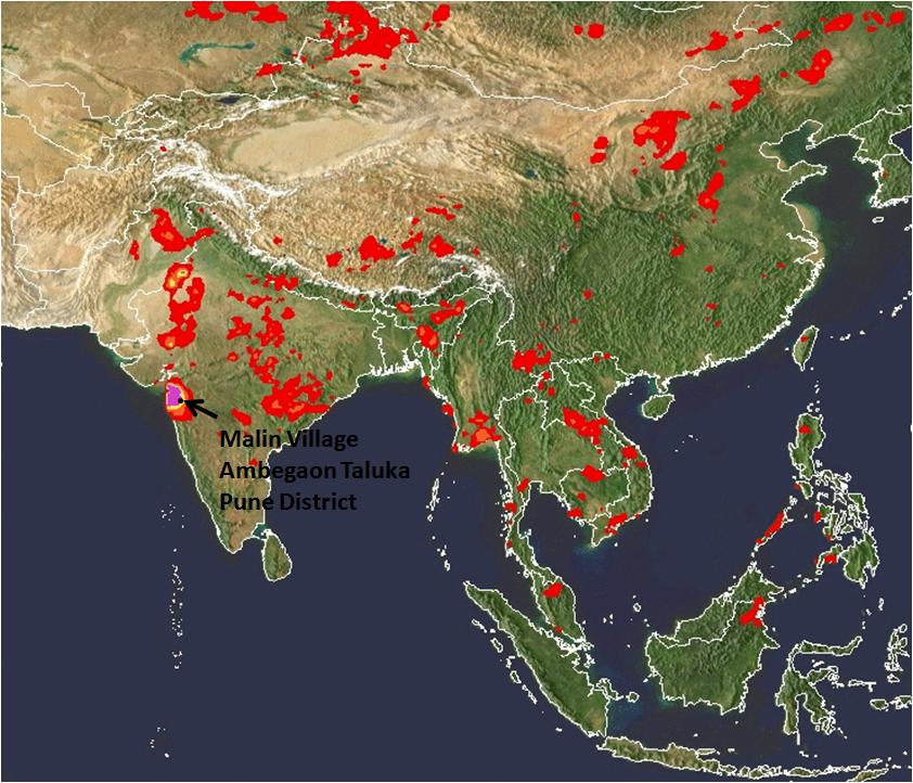
See NASA TRMM Landslide Prone Area Map on the 30th July 2014 below which highlights Bhimashankar and Malin region:

The dam connection:
The Malin village is approximately 1.5 kms from backwaters of the Dimbhe Dam, which is an irrigation project involving a big dam completed in 2000. On the 31st July, the dam held 44% of its live storage, that is about 156 MCM (Million Cubic Meters) of water. The link between water level fluctuations in dams and landslides in the rim of the reservoir and backwaters is well documented. Some geologists have also recorded increased landslides activity in areas surrounding Dimbhe Dam in the past. ( http://timesofindia.indiatimes.com/City/Mumbai/More-landslides-likely-in-5km-radius-of-Dimbhe-dam/articleshow/39314716.cms) Even if the dam was not overflowing when the tragedy occurred, it is well known that the dams can induce such landslides around the rim in view of standing water with fluctuating levels, change in drainage pattern and underground water flow pattern.

Key salient features of Dimbhe dam: Ht: 67.21 m; Lengh: 852 m; Live Storage Capacity: 354 MCM (www.mahawrd.org); Reservoir Area: 1754.7 ha.
The role played by the dam and its operations on the geology of the region and its possible connection with the landslide needs to be investigated in depth.
Landslides are not entirely new for the region
The region has seen some landslides in the past (e.g. in 2006-7) according to Saili Palande Datar, an ecologist and historian with Kalpavriksh. According to Anand Kapoor of NGO Shashwat active for decades in the region, a landslide had occurred earlier than that, where some cattle were buried and people had to be rescued. In a massive landslide on July 23, 1989, in village Bhaja in Mawal about 60 km from Pune, 39 people were killed.
In the Western Ghats of Pune as well as Maharashtra, a number of landslide-related tragedies have happened. According to a resident of village Tikona Peth in the catchment of Pavana Dam in Mawal tehsil of Pune, a landslide took place in in her village July, 1994 after heavy rains. There were no casualties, four houses were demolished by huge rocks. In August 2004, one person died due to landslide in Male, near Pune, in 2004 again, a worker died due to landslide in work related to a tunnel for a lift irrigation scheme, in June 2005, 4 workers died due to landslide at a tunnel of Ghatghar hydroelectric project.
Role of large scale land modifications in the region
Indeed according to a landslide map developed by Dr. David Petley, International Expert on Hazards and Risks in the Department of Geography at Durham University, the entire region of Western ghats has experienced landslides.
Dr. Petley has also written about the Malin Landslide here: http://blogs.agu.org/landslideblog/2014/07/31/malin-landslide-1/.
Dr. Petley told SANDRP, “Large scale land use modification and deforestation is the issue here”. He further said: “I would hypothesise here that the very heavy rainfall was the trigger, thick weathered soil, the shape of the slope and poor management of development and of water. A proper investigation should be able to ascertain whether this is right, but such large-scale modification of the landscape should be resisted.”

Landscape modifications around Bhimashankar
Bhimashankar region, the origin of river Bhima which is an important tributary of Krishna, is a high rainfall region with spectacular biodiversity. It is also home to Maharashtra’s state animal Malabar Giant Squirrel. The region is home to a vibrant tribal community which has seen several assaults on its way of life through the formation of the sanctuary, displacement caused by Dimbhe & other Dams, recent windmill projects, etc.,
In the recent years, some of the major landscape changes occurring in this region are through mechanised terracing of slopes for cultivation as well as developments related to windmill projects on mountain tops, which entail deforestation as well as road cutting on steep slopes. Although there are no windmill farms in Malin, such farms exist in the neighbouring Khed tehsil. Plans for such farms in Ambegaon are in the pipeline.
It needs to be understood that terracing for cultivation has been a traditional occupation of the tribals in this region, as in most of the Western Ghats. Not only is it an important livelihood support factor, but it has been limited by its scale, location and implementation due to its inherent manual nature. According to Anand Kapoor of Shashwat, tribals themselves do not prefer terraces made by JCBs and other machines as these are not entirely suitable for cultivation.
However, it is also a fact that now some government departments are using heavy machinery like JCBs in their bid to push terracing program. Unscientific mechanized terracing, which comes together with muck dumping, slope instability, affected drainage etc., can play a huge role in magnifying the impacts on a naturally vulnerable, high rainfall region.
In fact, a preliminary report by the Geological Survey of India (GSI) has singled out land flattening and terracing by heavy machinery as one of the primary causes for the tragedy. As per the preliminary report, a team of GSI experts noticed cracks where heavy soil erosion had occurred. The Deputy Director General of GSI has said that these cracks are a result of improper drainage system of rainwater. The flattening of land would have affected the water drainage resulting in the cracks. He says: “The slope of the hill was flattened almost halfway for agricultural purpose to such an extent that the hilltop had become unstable. The experts have also reported excessive deforestation disrupting the ecology of the hill. Added to this was the damage caused by use of heavy machinery over two years.” The Director General and Deputy Director General will be visiting the site on the 2nd and 3rd August for further analysis.
An independent credible review of the way the land levelling activities are going on under government policies and programs should be immediately instituted and till its report is available, use of heavy machines like JCB may be minimised.
Management of the region according to Western Ghats Expert Ecology Panel (WGEEP) Report and High Level Working Group Report (HLWG)
Both reports place Malin in Ecologically Sensitive Zone I and Ecologically Sensitive Area (ESA) respectively.
An ESZ I tag by the WGEEP report regulates a number of activities in the region, with participation of local communities. The report has specifically mentioned threat of landslides in this region.
While noting the impacts of windmills in the region surrounding Malin, WGEEP notes: “Apart from substantial forest destruction (including Forest Department estimates of about 28,000 trees being cut) via wide roads cutting huge swathes through Reserve Forest, the wind mill project has triggered large scale erosion and landslides through poor construction of roads with steep gradients, and all this rubble is ending up on fertile farmland and in reservoirs of tributaries of the Krishna.
The Forest Department is colluding with wind mill project operators in also illegally denying citizens access to these hills. Boards and check-posts have been put up by the company, falsely claiming to be authorized by the Forest Department. There are many traditional forest dwellers on these hills. Not only are their rights under the Forest Rights Act not being recognized, they are being illegally restrained in their movements on hills they have inhabited for centuries.”
If the WGEEP was accepted by the MoEF and state governments, this would have led to a more people-centred and ecologically-sound management of the Western Ghats region, but Maharashtra has been vehemently opposing WGEEP on the most unjustified grounds and the MoEF too has been busy downplaying the WGEEP.
While HLWG did include Malin village in its list of Ecologically sensitive Areas, however, this ESA tag did not mean much for the region it only regulates mining and red category industries. Most of the development activities that might threaten the region are not regulated by the HLWG. More importantly, HLWG has no role for the local communities in democratic decision making. There is also no mention of this region being landslide-prone in the HLWG, whereas the WGEEP specifically highlights this issue.
It is clear that HLWG is not much help for the region in avoiding tragedies like the Malin tragedy, but WGEEP report certainly would have helped.
Way forward
Northern Western Ghats which are characterized by heavy rainfall, rich biodiversity and predominant tribal population need more sensitive management approach than what it is subjected to right now. Although WGEEP had paved way for a more democratic, equitable and people-centred management of the region, the report was hidden, downplayed and finally rejected by the state as well as the central government. Episodes like Malin highlight the vulnerability and complex inter-linkages that affect the region which require a long term planning vision, integrating a number of components.
Despite this, several ill-conceived projects like townships, windmill farms, large dams and river linking projects like Damanganga-Pinjal and Paar Tapi Narmada are proposed in the region. Close to Bhimashankar region, Mumbai Metropolitan Regional Development Authority (MMRDA) as well as the Greater Mumbai Municipal Corporation are pushing more than 12 large dams. Some of these dams entail huge tunnels under the mountain ranges of Western Ghats. Despite the several risks and impacts, many of these massive dams may also escape scientific Impact Assessments or public hearings. These projects needs to be opposed and urgently dropped as there is little justification of the projects in view of huge number of options available in the cities for which these dams are proposed.
Similarly, Maharashtra Government has plans to build three huge hydropower dams in the Velhe and Mulshi region, which also falls in the Pune District. Velhe region has already seen slope instability and also falls in Seismic zone IV, making any such development highly risky there.
Let us hope that the heart-breaking tragedy at Malin is a wake-up call for all of us, paving way towards more sensitive,responsive, democratic and sustainable management of the Western Ghats. As a first step, the state and central government need to accept and implement the recommendations of the WGEEP immediately in Malin and for the entire Western Ghats.
-Parineeta Dandekar (parineeta.dandekar@gmail.com)

End Notes and Further Reading on Developmental Pressures on Western Ghats, specifically related to water:
1. “Damning the Western Ghats”, presentation by SANDRP: https://sandrp.in/rivers/Damming_the_Western_Ghats_Presentation_SWGM_December2012.pdf
2. Interbasin Transfers in Western Ghats of Maharashtra: https://sandrp.wordpress.com/2014/05/19/interbasin-diversion-dams-in-western-ghats-unknown-impacts-and-uncertain-benefits/
3. How much does the Kasturirangan Committee report understand about water issues in Western Ghats? https://sandrp.wordpress.com/2013/04/24/how-much-does-the-kasturirangan-committee-understand-about-water-issues-in-western-ghats/
4. Living Rivers and Dying Rivers of Western Ghats, by SANDRP http://www.indiawaterportal.org/articles/living-rivers-dying-rivers-rivers-western-ghats-india-lecture-parineeta-dandekar-and
5. Video on Living Rivers and Dying Rivers of Western Ghats, SANDRP https://www.youtube.com/watch?v=oDsNQejeNeU
6. SANDRP’s report on Dams in Western Ghats for Mumbai: https://sandrp.in/Dams_in_tribal_belt_of_Western_Ghats_for_the_Mumbai_Metropolitan_Region.pdf
7. Water Sector Options for India in a Changing Climate, SANDRP: https://sandrp.in/wtrsect/Water_Sector_Options_India_in_Changing_Climate_0312.pdf

The nature is taking its toil. We have plundered the forests, changed the landuse, changed the slopes for our comforts-such mishaps specially during the phase of climate change are bound to happen. Be it western Ghats or the Himalayas or the major rivers-each year the monsoon is fraught with mishaps now. Feel sad to read all this.
LikeLike
According to Shantabai Varve, resident of village Tikona Peth in the catchment of Pavana Dam in Mawal tehsil of Pune, a landslide took place in in her village July, 1994 after heavy rains. There were no casualties, four houses of village patil’s family were demolished by huge rocks. As a safety measure other houses were shifted to the current location- close to the motorable road. Land where new houses were built was allotted to them by erstwhile Bhor Sansthan. She thinks more info on this may be available at the Mawal tehsildar office. Forest Department may also have some info.
LikeLike
Thanks a lot Girija, this is very important information. I will also include this in the write up and will try and get more info on this. thanks again, parineeta
LikeLike
About Malin..pune..I was there since four daysa and also voisit all sites personaly chekibg alk points…there is flatning bu hecy machinaries asvits practicaky imposdible to move there..there are few rice fsrms at slopes..which are traditionaly mainatine..so conent in above article dosent shows fact as i personaky visited and seen the lication..the location is perticularly called as malib gawathan..malin village have 7 wadis away from that ..there fkatning us done..in padakali and is apart from that..so cause may be hevy rainfakk..and othet cause..
LikeLike
informative summary but I don’t agree with the connection Parineeta Dandekar has drawn between fluctuating water levels in the Dimbhe dam and the landslide. Malin village is some distance away from the dam for any such impact. Malin village is not situated at the rim of the dam as some other examples of dam related landslides that she referred to. It is a couple of kms away. it is not at all clear how fluctuating water levels could cause changes in drainage patterns and groundwater flow at such a distance through the basalt rock.
LikeLike
Thanks, Suvrat,
Along with distance, the gradient is also imp. If the gradient is flat, than the backwater impacts can extend more than two kilometers. This could be a factor and needs to be investigated.
LikeLike
where are you getting these numbers (2 kms). they may not apply to basalts. but the gradient is not flat. its a hilly terrain. how can water fluctuations in the dam cause changes in drainage patterns and groundwater flow (in low transmissivity basalts) across ridges and valleys? the simpler explanation is that modification of the slope made the soil mass unstable and then heavy rains saturated the soil and triggered a slide.
LikeLike
Thanks for your comments Suvrat.
The article is not establishing link between water level fluctuations in the dam, but highlighting the need for investigation.
It needs to be highlighted here that in this case the water level fluctuation in the dam, which is said to be an important factor in triggering landslides, has been huge. Live storage of Dimbhe Dam on 26th July was recorded to be 85 MCM and just in four days, this rose to 156 MCM (on 30th July) that is around 83.5% increase in live storage of a dam in 4 days. This deserves attention. In the past, we have not carried out any studies even when casualties occurred at dam sites.
Further studies may or may not establish the dam link, but it needs to be investigated.
Indeed several factors have been responsible for the tragedy, as is outlined.
thanks and regards,
parineeta
LikeLike
thanks for the clarification Parineeta-
regards
Suvrat
LikeLike
the technical paper compiled is well thought and it gave various issues related to landslide problems.let us join the hands together and do some thing visible on the ground.
LikeLike
Thanks Dr. Singh.
Given your expertise in Landslide Hazard Mitigation, we highly appreciate your comment.
We basically work on analysis of the water sector in India ( and hence also look at water-related hazards) and would be happy to be of help in this way.
Personally, we are involved in supporting the relief work going on at Malin.
Thanks and regards,
parineeta
LikeLike