Category: Dams

Another Hydro fraud: Two small projects on paper, one large project on site
24.75 MW Mouneswar + 24.75 MW Basavanna ‘Small’ Hydel Projects = One large HEP
According to the Ministry of New and Renewable Energy (MNRE), hydel projects between 2-25 MW are classified as Small Hydel Projects (SHPs). These projects are exempt from Environmental Clearance, impact assessment, public consultation or any monitoring from the Ministry of Environment and Forests (MoEF), receive subsidies from the MNRE and apply for Carbon Credits from United Nations Framework Convention on Climate Change (UNFCCC).
Though the concept of encouraging small hydel projects as sources of decentralized energy, also supplying off grid power seem welcome, the happenings on ground are vastly different. As these projects are excluded from environmental governance, there are several examples of fraudulent Small Hydro projects, which exploit the lax governance mechanism to hoodwink all concerned.[i]
One such recurring fraud is showing two separate projects on paper, in order to avoid environmental scrutiny and avail subsidies meant for SHPs, while building one single big dam on site, clubbing the two projects. Projects like Perla and Shemburi by Greenco in Mangalore or Maruthi Gen projects in Sakaleshpur (http://www.dnaindia.com/bangalore/report-maruti-power-gen-s-hydel-project-an-environmental-disaster-1617237), all in Karnataka Western Ghats, are two example of this fraud.
One more case has now come to light, this one from Gulberga district in north Karnataka when I visited the project area recently. Although called by two different names, 24.75 MW Mouneswar Small Hydel Project and 24.75 MW Basavanna Hydro Project are operating from a single dam/diversion weir across the KrishnaRiver, just downstream Narayanpur Dam. As such, the project should be considered as a single 49.50 MW hydel project and should undergo immediate environmental, social and legal scrutiny and further assessment. We tried to conatct the officials of the company several times for questions related to the projects, but we got no response.
The Projects:
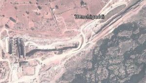
24.75 MW Mouneswar and 24.75 MW Basavanna SHEPs are built across river Krishna in Benchagaddi village of Shorpur taluk of Gulberga district in Karnataka.
The projects have also applied for Carbon credits under the United National Framework Convention on Climate Change (UNFCCC). Basavanna Hydro Project has been registered as a Clean Development Mechanasim (CDM) project with the UNFCCC on 28th December 2012 and its crediting period has been fixed as 1st March 2013 to 28th February 2023[ii]. 24.75 MW Mouneswar SHP has applied for registration[iii]. SANDRP has sent comments against registration of this project.[iv]
Shockingly, both projects have requested separate registrations, hiding the fact that both will be using the same dam, the same intake/power canal and the same tail race canal.
Project design documents (PDDs) submitted to United Nations Framework Convention on Climate Change Executive Board (UNFCCC – EB) mention the same coordinates as the project location:
Latitude- 16°19’52 “N
Longitude- 76°33’48” E
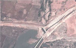
PDDs of both the projects do not even mention the other project, clearly misleading the UNFCCC. Not only do the PDDs show same coordinates, the lengths of the intake canals are exactly the same at 2771 meters, so are the RCC conduits and penstocks, because we are talking of the same project!
Carbon Credits are supposed to be provided to projects only when they prove beyond doubt that they will be economically unfeasible without such support. However, in this case the expenses of dam, power canal, and tail race tunnel is shared and hence the costs will be lowered, the Internal Rate of Return (IRR) of the projects will be higher than what is quoted in the PDDs and they will be profitable even without additional ‘pocketable’ finance from the UNFCCC in the name of Clean Development! (IRR claimed in the PDD is 9.14% for Mouneswar SHP and 11.38% for Basvanna SHP.)

Same Proponent, different names
Interestingly, project proponents of both the projects are shown to be different in respective PDDs. For Mouneswar Small Hydel Project it is Lakshmi Jalavidyut Limited and that for Basavanna Hydro Project it is Krishna Hydro Energy Limited. However, the registered office of both these firms is the same! This address also belongs to Penna Cements, Hyderabad, which is a player in Mini hydel projects in Karantaka. Penna Cements and its subsidiary Pioneer Genco already operate two SHPs, each of 24.75 MW capacity across Cauvery in Karnataka.
From the ground
When SANDRP visited the project sites, the officials were hostile to any entry in the premises or even near the site.

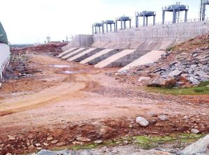
The dam/ diversion weir built by the projects is inside the KrishnaRiver bed and diverts the water through a power canal which runs approximately 3 kms downstream. The power canal takes most of the water from the river rendering the river dry in lean season.
Farmers told power canal as irrigation canal:
When I talked with the farmers in the downstream, they told me that they were under the impression that this canal is meant for irrigation, like Narayanpur Dam canals in the upstream (about 26 km). However, Benchagaddi village which is situated next to the tail race canal of the project not allowed to take even its drinking water from the canal.
There have been strong protests from the villages to this project as the diversion has dried the river bed and more than 300 irrigation pumps of villages like Bechagaddi, Hosur and Yedalabhavi used for irrigating paddy are now useless. Karanataka Bhagya Jal Nigam had also taken serious exception to the projects and had ordered a stop work notice.[v] (It subsequently issued an NOC, without providing any resolution to the issues raised by it earlier.)
The Benchagaddi village which is right next to the power canal experiences power cuts lasting 18-20 hours daily. Around 40 farmers from this village lost their lands for the canal. Rates of compensation given were Rs 25-85 thousand per acre.
Shockingly fraudulent Local Stakeholder Consultations!
The projects have claimed to have organised ‘Local Stakeholder Consultations’ about the CDM mechanism, which is mandatory when applying for CDM credits. PDD claims that Mouneswar project organised stakeholder consultations on 21st December 2011 and Basavanna project organized it on 26th September 2011.
Now see this, both PDDs mentions exactly the same people asking exactly the same questions with exactly the same answers being given!! It is absolutely clear that these meetings and these reports are fake. Amazingly, UNFCCC could not see through this clear fraud.
Local Development through Small Hydels?
As per the villagers, affected families were promised a job in the power plant although none of them received any jobs there. Even the JCB and truck operators are from other states. Security guards too aren’t from the same village.

Unaddressed impacts of Submergence:
In Geddamari village near the diversion weir, around 15-20 families lost their lands for construction of the dam. Bill collector (Talathi) of the village told SANDRP that around 50 acres of land was SUBMERGED due to dam (diversion weir) construction. He further added that farmers whose lands were submerged, have not received the compensation as yet. They have been talking with the company and have been verbally promised some compensation, though nothing on paper. Problems in this village too are like Benchagaddi village. Limited drinking water, disturbed power supply etc.
Applicable for Environmental Clearance:
As the projects use a single dam and are a single project of 49.50 MW and they qualify for a full environmental clearance process, including an EIA, public hearing, and Environmental appraisal by the state or central EAC and an Environmental Management Plan. However, the projects have illegally escaped all this.
Executive Engineer of Krishna Bhagya Jal Nigam (KBJN) – controlling state authority in case of Krishna River- confirmed, “Both the projects are operating using the same weir .The power houses of two projects are housed behind the same diversion weir. There are three 8.25 MW turbines for each of the projects situated downstream of the same diversion weir.”
According to the Executive Engineer, KBJN has granted NOCs to both the projects and that both of them being fully operational for last 6-8 months. When SANDRP visited the project site, the HEPs were found to be fully operational.
Conclusion:
24.75 MW Mouneswara and 24.75 Basvanna Projects are operating from the same diversion weir, use the same intake canal and same tail race. They are in fact one single project which has fraudulently shown itself as two separate projects. The proponent and the consultants have hidden this fact from the UNFCCC, the MoEF, the MNRE, KREDL, State Pollution Control Board and State Environmental Department. The Local Stakeholder Reports of the projects are a sham. Submergence impacts are still unaddressed.
These issues need to be addressed urgently by all concerned including the MoEF, the Karnataka Government, UNFCCC, MNRE and KREDL. Such frauds are giving a bad name to the all these institutes.
-Damodar Pujari (damodar.sandrp@gmail.com) with inputs from Parineeta Dandekar
Kasturirangan Report – a blueprint for political polarization in Kerala?
Guest Post by Dr. Latha Anantha, River Research Centre, Kerala
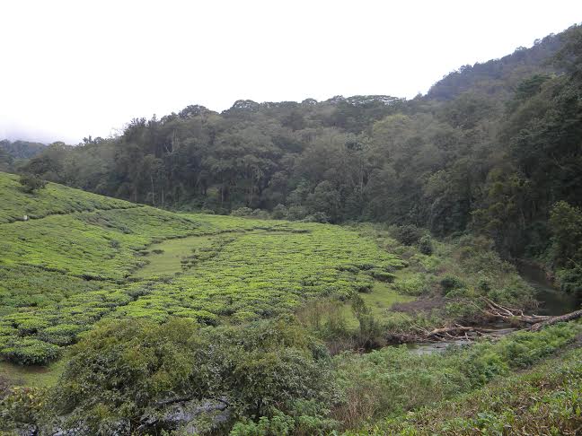
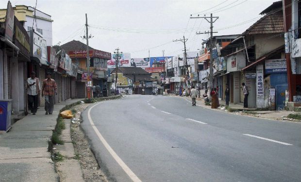
Possibly for the first time in the history of Kerala, a hartal led by the unlikely combination of a powerful section of the Church and the Left Democratic Front has rejected both the Western Ghats Panel Report (WGEEP) and the High Level Working Group Report (HLWG) claiming it as anti farmer. On November 18, 2013, the LDF and its supporters called for a state wide bandh which brought normal life to a standstill. Thousands of protestors took to streets, mainly from Idukki and Wayanad Districts. Events that are unfolding in Kerala hold significance for the entire country. Firstly it reveals the extent to which forces are trying to decide the fate of a common natural heritage like the Western Ghats through short sighted political means. Secondly it reveals the lack of democratic process by which the people of a region as diverse and ecologically significant as the Western Ghats are not taken into confidence by the Governments while introducing a new governance process. Thirdly the Western Ghats and the two reports on it has become the oven hot political weapon in an election year for Kerala.
Violent responses
The incidents of violence and destruction of public property started off with the issuance of directions by the MoEF on the 13th November 2013 under Section 5 of the Environmental Protection Act 1986. Kannur and Kozhikode districts witnessed widespread violence on the 15th November. Forest offices, government vehicles and public transport buses were set fire by the angry mob in several places in North Kerala[1]. The High Range Protection Council led by the Roman Catholic Church organised a 48-hour road blockade under the banner ‘occupy the streets’ at Kattapana the district headquarters in Idukki district on the 18th ad 19th of November. In fact the Wayanad MP Sri M. I Shanawas called on Mrs Sonia Gandhi in New Delhi along with Bishop Remigius Inchananiyel of Tharamassary Diocese, patron of the resistance group spearheading the campaign in north Kerala, to convey the anxieties of the people.[2] Not a day has passed since 14th November, 2013 when the discussions over the two reports have not taken over the prime time news hour in the television channels of Kerala. The debate continues.
Why the hue and cry?
The MoEF directions and the subsequent Office Memorandum (OM) dated 16th November both reiterate that the MoEF has accepted the High Level Working Group report on Western Ghats, headed by Dr. Kasturirangan ‘in principle’. It also explicitly means that the MoEF has rejected the Western Ghats Expert Ecology Panel Report under the chairpersonship of Prof. Madhav Gadgil, though the OM makes absolutely no mention of the WGEEP Report!

Atleast 123 villages in Kerala will fall within the ESA (natural landscape). The category of development activities banned in the ESAs are restricted to mining, quarrying and sand mining, thermal power plants, red category industries, building and construction projects of 20,000 sq.m and above.
The watered down HLWG report and the OM does not contain any clause which would force the farmers of Idukki and Wayanad districts out of their land as alleged by the agitators. Clearly farmers would not resort to hooliganism of the kind which was perpetuated in Kozhikode and Kannur. Presently, the sand mining and quarrying lobby hold the largest political clout in Kerala with many political leaders and legislators alleged to be having direct share and ownership over the large granite quarries operating in the heart of the Western Ghats districts. More and more farmers in the mountains are selling their land to quarry contractors. Now this is something which can become difficult if the restrictions are imposed. As somebody was remarking in a bus my friend was traveling in, ‘if mining stops, the JCBs will have to be sold at the price of scrap metal, that is the issue”!
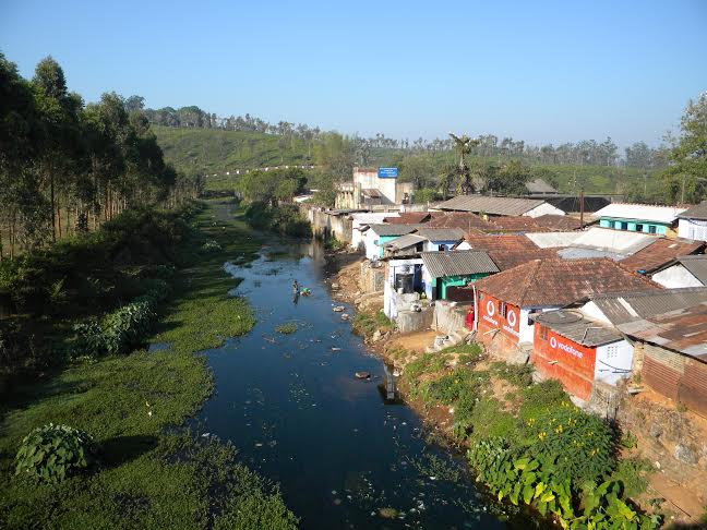
By this time a large section of population including the ruling party legislators in Kerala openly admit that the Kasturirangan panel report is a watered down version of the Gadgil panel report and is not going to bring in much changes in status quo conservation. Meanwhile, the clause (viii – d) on banning township and area development projects with an area of 50 ha and above and / or with a built up area of 1, 50 000 sq.m. shockingly reveals further dilution. The MoEF has gone against the ‘in principle’ acceptance by inserting this recommendation which was not included in both the reports! HLWG report has categorically stated that no more new townships and settlement areas will be allowed in the Western Ghats. This new insertion by the MoEF opens up the space for mining and quarrying in the name of township development within ESA areas diluting the concept and spirit of ESA. Meanwhile many ecologically sensitive areas have been left out of the HLWG report which will be opened up for mining and other development.
Baseless rumours are being spread over how the report will affect the high range population! Allegations are now reaching ridiculous levels include, ‘The hidden agenda is to convert all the ESAs into forest area in a stage by stage manner; tiger cubs are being introduced into the forest to evict the people; no more new houses will be allowed once the ESAs are declared; no more monoculture plantations in the Western Ghats; all houses in ESAs have to be painted green and lights have to be switched off by 8 pm; so on and so forth are the interpretations led by the church and the political fronts. The people living in the plains are being warned that they will have to bear the onslaught when lakhs of evicted farmers from the high ranges will settle in the plains! To top it all, the revenue department officials are warning people against land registration or land transfer citing that until further directions are given, no land transaction can be carried out in ESA villages!
There are misleading attempts to show that Ecologically Fragile Lands Act EFL Act (2005) and ESA are the same. The EFL Act is a state Act to provide for the vesting in the Government of ecologically fragile lands in the State of Kerala and for the management of such lands with a view to maintain ecological balance and conserving the bio-diversity. Ecologically fragile land denotes any forest land or any portion thereof held by any person and lying contiguous to or encircled by a reserved forest or a forest or any other forest land owned by the government and predominantly supporting natural vegetation. This Act allows the Government to vest such a land from the owner and make it part of the Reserve Forest. It also gives power to the government to evict any person occupying the notified land. The ESA meanwhile comes under the purview of the central Environment Protection Act 1986. It does not entail any eviction or vesting of land by the government or the Forest Department. There is no eviction of farmers entailed in either the WGEEP or the HLWG report. Any news about evictions is politically motivated and baseless.
The concerns and anxieties of the local communities who have made the mountains their home since three generations when a new regulation is being ushered in cannot be ruled out. The distressing state of the Western Ghats calls for stringent protection measures as well. ESA under the EPA (1986) is the best option available wherein conservation can be ensured without displacing people. Meanwhile the other states seem not too perturbed by the decision of the MoEF to accept the Kasturirangan Report. The high population density in Kerala Western Ghats plus the vested interests of the quarrying lobby and the church (which holds large tracts of land in the mountains) could be attributed as the reason for this uproar.
Reparative Measures
The Government of Kerala has meanwhile taken a guarded stance with respect to the Kasturirangan report instead of totally rejecting it. They have assured the people no decisions will be taken in haste. However, the GoK reacted late by stating that they will translate the notification when it is out and hold discussions in each of the ESA panchayaths. In response to the first OM issued on 19th October, 2013 (which was surprisingly cancelled by the MoEF and replaced by the OM on 16thNovember, 2013), the Kerala Government constituted a three member expert committee headed by the Kerala State Biodiversity Board (KSBB) Chairman to seek opinions from farmers’ organisations, environmentalists and people’s representatives from the regions that will be affected once the Kasturirangan report is implemented. The state also plans to circulate the HLWG report’s Malayalam version to all the 123 villages[3]. Round the clock help lines have been opened by the Kerala Forest Research Institute (KFRI) and KSBB to clarify the doubts of the public. Chief Minister Ommen Chandy has decided to convene an all party meeting to seek opinion from the various political units of the state. The Kerala Pradesh Congress Committee (KPCC) has also constituted a five member committee to seek opinions through district level hearings.
Lapses in democratic processes come with a cost. If the Government had taken the pains to interpret the WGEEP report way back in 2011 when it was published and undergo the above processes, so much politically created antagonism towards the WGEEP report, the destruction of public property and loss of 900 crores to the public exchequer by an uncalled for bandh could have been avoided[4]. The LDF too could have organized discussions and debates on the two reports instead of rejecting both the reports.
Consciousness for the Western Ghats is growing
What was the need to constitute the HLWG by the MoEF? New ideas and governance mechanism takes time to sink in the public mind and the development sectors that are used to work in silos. The MoEF bowed to the pressure from different lobbies and went ahead with the new panel without giving time to the state governments or the people to understand the WGEEP report. And not surprisingly the HLWG panel digressed from its ToR and came out with a status quo report. Hence the pro Athirappilly project lobby is happy with the HLWG report. While the WGEEP report had totally rejected the Athirappilly project, the HLWG has given space to the Government to revaluate the project and take it up with the MoEF if needed.
Is the Western Ghats Ecology Expert Report (WGEEP) sent for a burial? The MoEF seems to have done so. But many in Kerala where the maximum opposition to both the reports came in, think otherwise. The dots are growing into a network of like-minded groups and individuals who believe the Gadgil report should be accepted and not the HLWG. There is increasing realization that the WGEEP report has mooted a completely new system of governance based on ecological limits and carrying capacity of a region, democratic decentralization and a futuristic perspective of inter-generational equity. While recommending sanctions and regulations, the process is intrinsically democratic where discussions and decisions about the wise use of natural resources have to be made by the local communities. Not surprisingly even the media discussions start with the HLWG report and end up supporting the WGEEP report! There is still scope for the public to demand with the MoEF that the WGEEP report be implemented after correcting the grey areas. The rest of the Western Ghats states need to take cue from the happenings in Kerala and start a process of democratic discussion with the ESA village communities and different development sectors to avoid future problems that may crop up. The conflicts and riots have reinforced the conviction that it is time to start a peoples’ movement once again to save the Western Ghats!
Dr. Latha Anantha (latha.anantha9@gmail.com)
OTHER SANDRP BLOGS ON WESTERN GHAT REPORTS:
2. https://sandrp.wordpress.com/2013/05/18/prof-madhav-gadgil-writes-to-dr-kasturirangan/
[1] http://www.thehindu.com/news/national/central-direction-on-western-ghats-report-sparks-protest-in-kerala/article5354418.ece
[2] Read more at: http://indiatoday.intoday.in/story/western-ghats-kasturirangan-report-oommen-chandy-kerala-cm-protests-kozhikode/1/325158.html

Comments on Scoping Clearance Application of Panyor HEP on Ranganadi River in Arunachal Pradesh
The Arunachal Pradesh government has signed a MoU with Panyor Hydro Power Private Limited, a company based in Hyderabad to construct the Panyor hydro electric project. This will be the second hydroelectric project coming up on the Panyor River which is also known as Ranganadi in the downstream. This project with 80 (2x40MW) MW installed capacity is to be considered for ToR clearance in the 69th meeting of EAC to be held on 11-12 November, 2013.
Salient Features Panyor Hydropower project will be located a Lemma, a village five km upstream of the Yazali town in Lower Subansiri district. The proposed project is 12 km upstream of the Ranganadi dam Stage II with a surface power house on the left bank of the river and a 108 m high concrete gravity dam. This reservoir will cover 7.5 km of the river length. The catchment area of this dam is 1315.50 sq km. The tail race channel will be 300 m long. Total area required for the project is 390 ha. Out of this 42 ha is river area, 25 ha is reserve forest and 323 ha is private land. The total estimated cost of this project is Rs 820 crores which imply that per megawatt cost is Rs 10.25 crores.

Critical Issues It was surprising to see that even though the project has been on EAC agenda for ToR clearance MoEF website does not have the complete documents for this project. The PFR document of the project was not opening up in the website. Going through the Form I of the project we found several issues which need to be highlighted.
Downstream impacts In regard of the project on the Panyor river it is very important to remember that the catastrophic downstream impacts of hydropower dams in Arunachal, which has been a subject of much debate in Assam, with specific issues raised against the existing 405 MW HEP on Ranganadi. The release of water from the Ranganadi dam on June 14, 2008 had led to flash floods in a vast area and catastrophic devastation in the downstream. The Ranganadi dam is having severe downstream impacts not only in the Ranganadi valley, but also in the Dikrong valley since water from this dam is released in Dikrong or Pare River through an 8.5 km long diversion tunnel. Now construction of another dam on the same river which needs serious analysis since the Form I (p 45) states “Downstream impact on water, land, human environment due to drying up of the river at least 10 km downstream of the dam.”
The drying of the river for at least 10 km downstream of the proposed dam also need to seriously examined keeping in mind the reservoir spread of the Ranganadi stage I project.
Not a single village affected and no rehabilitation? Form I (p 33) states that not a single village would be affected and no rehabilitation needs to be done, which seems doubtful. The document at the beginning states that the project is located near Lemma village. It also suggests for socio-economic impacts where it mentioned about project affected families. These are serious contradictory issues within the same report and the developer should be asked to resolve this.
Environment Flow contradictory The Form I provides contradictory information regarding environment flow. On the last page, the document states “A scientific study shall be done to assess the downstream requirement of water to decide minimum assured release of water (Environmental Flows) for maintaining the aquatic ecology and water quality of river.” But on page 33 in the section 2.7 the document states that environment flow will be 3 cumecs.
Important aspects left out from scoping of EIA study In the scoping for EIA/EMP study there are several important aspect which the Form I has made no mention at all. These include:
1. Impacts of excavation and mining
2. Impact of the project on landslide and other disaster potential of the area and region.
3. Disaster management plan considering the previous flash flood event in June 2008.
4. Impacts of climate change and impacts of the project on local climate
5. Options assessment including potential of micro hydro (below 1 MW capacity) projects. The project will submerge a huge 312 ha of land. The PP (Project Proponent) should look into the options for run of river project rather than a dam with such huge submergence.
Wrong answers given in Form 1 In case of some of the information given in the Form 1, it seems wrong and the PP should be asked to correct it. For example (this is not exhaustive list):
1. In case of point 1.26 (p 11), in response to question “Long-term dismantling or decommissioning or restoration works?”, the Form says “No”. This is clearly wrong. After the useful life of the dam, it will need to be decommissioned and this has to be part of the EIA and TOR.
2. Similarly answer to question 1.27 (“Ongoing activity during decommissioning which could have an impact on the environment?”) is wrongly given as No.
3. In para 1.2 (p 6) there is no mention of land requirement for mining material for the project like sand, gravel, boulders, etc.
4. Para 2.2 (p 12) how much water will be used (KLD) or source is not given.
5. Para 2.3, in answer to minerals No is given, where as the project will require sand, clay, gravel, boulders, etc.
6. In response to Para 2.7, the impact of project on aquatic biodiversity, including fisheries should have been mentioned.
7. In response to Para 3.1 use of explosives is admitted. However, it should be told to PP to minimize the use of explosives considering the impact of them on increased landslides and other disasters.
8. In response to Para 3.3 the PP should have mentioned the impact of project on the people who also use the forests, rivers, get affected by other aspects including destruction of biodiversity including fisheries upstream and downstream.
9. In para 4.2 (p 16) and elsewhere, estimate of 1000 populations for “400 technical and labour staff” is clearly wrong. Also estimate of 200 labour vs 150 technical staff also do not seem correct.
10. Para 4.3 should also include the remains of explosives among hazardous waste.
11. Para 5.8 (p 19) answer (Q: Emissions from any other sources) No is clearly wrong, the reservoir covering 312 ha will certainly emit methane needs to be assessed.
12. In para 8.3 (p 22) and point 12 under environmental sensitivity (p 25-6) the vulnerability due to floods and landslides such others also need to be mentioned and response to them included.
13. The whole document keeps mentioning 25 ha forest land without inclusion of the community managed forest land in Arunachal Pradesh. This is clearly wrong information.
14. Under point 3 in on Environmental sensitivity (p 24) in response to “Areas used by protected, important or sensitive species of flora or fauna for breeding, nesting, foraging, resting, over wintering, migration”, it is not sufficient to investigate with forest dept, as the response says, since there are several aspects here (e.g. aquatic biodiversity) that are beyond the domain of forest department.
Cumulative Impact Assessment The information given in para 9.4 (p 24) is clearly wrong. There are at least eleven hydropower projects at various stages in the combined Ranganadi-Dikrong basin, including one operating, one under construction, three TOR approvals given and five additional MoA signed (in addition to the proposed project), see details below:
1. 405 MW Ranganadi HEP (Existing, transferring water from Ranganadi to Dikrong)
2. 110 MW Pare HEP (under construction)
3. 60 MW Par HEP on Dikrong (TOR approved by EAC on 8/9/2012)
4. 60 MW Dardu HEP on Dikrong (TOR approved by EAC on 8/9/2012)
5. 66 MW Turu HEP on Dikrong (TOR approved by EAC on 8/9/2012)
6. 25 MW Adum (Upper) Panyor HEP: Upfront premium and application fee of Rs 11.05 lakhs received by Arunachal Pradesh government from BSS Arunachal Energy Development Pvt. Ltd. (on 10/03/2010)[1]
7. 21 MW Panyor Lepa Middle HEP: Upfront premium nad processing fee of Rs 9.4 lakhs received by Arunachal Pradesh Government from JMD Power Solutions Pvt, New Delhi (on 27/08/2010)
8. 25 MW Papumpam HEP: allotted to: Meena Entrade and Engineering Pvt. Ltd. Naharlagun, AP. on 19/08/2008[2]
9. 15 MW Papum HEP: allotted to Patel Tours and Travels (Mumbai) on Dec 12, 2008
10. 12 MW Poma HEP: allotted to Patel Tours and Travels (Mumbai) on Dec 12, 2008
Hence a credible basin study is required BEFORE any more (including Panyor) projects are considered in Ranganadi-Dikrong basin.
Costly Project Per MW cost of this project will be Rs 10.25 crores according to current estimates. This will be costly affair considering that per MW cost of solar PV project would be lower than this.
Until the above issues are resolved, the project should not be considered for Scoping clearance.
Himanshu Thakkar (ht.sandrp@gmail.com) & Parag Jyoti Saikia (meandering1800@gmail.com)
——————————————————
Annexure: Panchayati Raj Institutions question the project
http://www.arunachaltimes.in/archives/ju09l%2012.html
July 12, 2009
PRIs question Govt on power project
ITANAGAR, July 11: Panchayat leaders of Pistana and Yachuli circles of Lower Subansiri district have voiced their protest against coming up of Panyor Hydro Electric Project, which they claimed was ‘kept secret’ from the public.
In a representation to the Chief Secretary yesterday, the PR leaders led by Zilla Parishad Chairperson Likha Tongum said that Panyor Hydro Electric Project came to light when M/S Raajratna Energy Holdings Private Ltd of Shimla, started surveying and investigation works in the area. They urged the Chief Secretary to cancel the MoA signed with the private company immediately in the interest of local sentiments.
To the surprise of the people of the area, MoA to this regard was already signed between the govt and the company on February 25 last for implementation of the 80 MW project on BOOT basis for which an amount of Rs 80 lakhs (at Rs 1 lakh per MW) as processing fees was already paid in the name of the Secretary Power, Govt of AP. The grass-root leaders alleged that the whole process was carried out secretly and kept under wraps.
They leaders further came down heavily on the agency for “totally undermining the project affected panchayats”.
If any agency wants to tap the natural resources available, they have to take the confidence of at least the local panchayat leaders, which is a normal procedure in a democratic setup, the leaders said.
“The local panchayats are the sole custodian and owner of natural resources in the region since time immemorial,” the leaders said and have decided to protest against the execution of the project.
Gujarat is taking up massive project in ecosensitive zone in the middle of the river without impact assessments or legally mandatory clearances
Letters have been sent by some eminent citizens and activists of Gujarat to the Union Ministry of Environment and Forests and Gujarat Environment Impact Assessment Authority that the massive Gujarat Project of setting up world’s tallest statue is being taken up by the Gujarat government without social or environmental impact assessment, without necessary public consultation process and without clearance under the Environment Protection Act 1986, Environment Impact Assessment of 2006 and also wildlife protection Act of 1972. The necessary permission from the Environment and Rehabilitation Subgroups of the Narmada Control Authority has also not been taken, nor have the party states been taken into account. The Tourism project involves massive constructions in the middle of the eco-sensitive river, just 3.2 km downstream from the Sardar Sarovar Dam and Shoolpaneshwar Sanctuary. Given below is the letter to sent to the Union Minister of State (Independent Charge) Mrs Jayanti Natarajan and secretary, Union Ministry of Environment and Forests. Similar letter has gone to Secretary, Union Ministry of Water Resources since he is the ex-officio chairman of the Narmada Control Authority. Another letter has gone to the Gujarat state EIA authority and concerned state government agencies.
Considering the importance of this issue, SANDRP is happy to share it on our blog, SANDRP Coordinator is also a signatory to the letter.
7 November 2013
To,
Dr V. Rajagopalan
The Secretary
Ministry of Environment & Forests
Government of India
Paryavaran Bhavan, CGO Complex, Lodhi Road,
New Delhi – 110 003.
Sub: To seek detailed environmental scrutiny of project called ‘Statue of Unity’ planned inside Narmada River, 3.2 Kms. downstream of Sardar Sarovar Dam and Shoolpaneshwar Sanctuary by a joint venture of Government of Gujarat and a trust – ‘Sardar Vallabhbhai Patel Rashtriya Ekta Trust’ (SVPRET) and to immediately stop all construction activity in the region.
Dear Sir,
We would like to bring to your attention that work on a project that proposes to build the world’s largest statue in the form of ‘Statue of Unity’ near Sardar Sarovar Dam in the river downstream from the dam, just 3.2 km from the Shoolpaneshwar Sanctuary, in eco-sensitive zone and involving massive infrastructure (see annexure) has started work without legally mandatory environment clearance, environment and social impact assessment or any public consultation process.
This is clearly illegal, in violation of the Environment Protection Act, 1986 and EIA notification of September 2006 and a number of NGT and Court orders about such massive kind of construction on the riverbed. On 31 October 2013, the foundation stone was laid for the project amidst huge fanfare and media attention. Tenders have also been floated. Even the work for the Garudeshwar weir, proposed about 12 km downstream of the Sardar Sarovar Dam, began without any social or environmental impact assessment, public consultation and environmental clearance from the Environmental Sub Group (ESG) of Narmada Control Authority’s (NCA).
The website http://www.statueofunity.in/ clearly state the purpose of tourism and involvement of the ‘Sardar Vallabhbhai Patel Rashtriya Ekta Trust’ (SVPRET) to build ‘Statue of Unity’, 3.2 km downstream of the Sardar Sarovar Dam inside the Narmada River on an islet called Sadhu bet.
The website (http://www.statueofunity.in/execution.html#sthash.N9z6EHIu.dpuf) says:
“A 13km. long water body (pond) will create an excellent tourist spot with available infrastructure on both the banks.
The Statue of Unity is planned to be erected in the river bed on downstream of the main dam in the Garudeshwar Weir pond. A permanent standing water pool in and around the Statue of Unity will be created by Garudeshwar Weir, which will enable boating activity around the statue.” (Emphasis added.)
The estimated cost of the project is more than Rs. 2,500/- corers (Rs 2063 crores is the cost of “DESIGN, ENGINEERING, PROCUREMENT CONSTRUCTION, OPERATION AND MAINTENANCE OF THE STATUE OF UNITY D/S of Sardar Sarovar Dam, Village Kevadia Ta. Nandod, District of Narmada Gujarat State, India” as per tender notice, see: http://www.statueofunity.in/tendernotice.html). The Government of Gujarat website (http://www.statueofunity.in/) clearly state that “A monument, that will not just be a mute memorial like the rest, but a fully functional, purpose-serving tribute that will boost tourism and facilitate development in the surrounding tribal areas” and will involve huge infrastructure as described in the Annexure downloaded from the official website.
The key issues that beg immediate scrutiny is as follows:
(1) The project clearly needs environment clearance under the EIA notification of September 2006, but has not applied for or obtained the clearance at any stage.
(2) The Shoolpaneshwar Sanctuary boundary is touching the Sardar Sarovar Reservoir (as a part of the Environmental Protection measures of the Sardar Sarovar Project, the earlier Dhumkal Sloth Bear Sanctuary was extended to meet the reservoir boundaries and is called Shoolpaneshwar Sanctuary.) Since the statute is only 3.2 kms from the Sardar Sarovar Dam, it is certainly near by Shoolpaneshwar Sanctuary.
(3) The Project involves construction in the river bed and proposed reservoir, close to sanctuary in eco-sensitive zone, and hence will have serious impacts on the ecology and environment. Hence, and EIA and EC is crucial.
(4) The project will affect the downstream river, its biodiversity, people and livelihoods and other related aspects.
(5) A comprehensive assessment of the environmental and social impacts of the ‘Statue of Unity’ and its contribution to the cumulative impact of all the projects and activities in the area has not been done.
(6) The project also needs public consultation, but none has happened so far.
(7) During the construction of the Sardar Sarovar dam due to hard rock digging, the seismic area already carries the burden of artificial activity in the bed rock and added load in what is deemed geologically fault line area. Public reports on geotechnical and geological studies on the proposed site have raised issues of structural stability as well as safety. This cannot be taken casually by authorities. The seismic hazard analysis claimed to have been done by the Gujarat Government’s in-house “Institute of Seismological Research” (http://www.statueofunity.in/execution.html#sthash.jEBrofSN.dpuf) or the Geological and Geotechnical investigation commissioned to another government institute WAPCOS cannot be considered credible unless peer reviewed and put in public domain.
In view of the above facts on record, we demand that:
- Direct the Government of Gujarat to submit application for environment clearance and till that is obtained, not to do any work related to the project.
- Direct the Government of Gujarat to immediately stop planned project called ‘Statue of Unity’ and direct them to stop all other activities related to the ‘Statue of Unity’.
- Declare the action – of the foundation stone installation on 31 October 2013 for the project called ‘Statue of Unity’ – of the Chief Minister of Gujarat State as illegal, in violation of the EIA notification of September 2006 and the Environment Protection Act, 1986.
We will look forward to your urgent action and also point wise response.
Yours Sincerely,
Rohit Prajapati
[Rohit Prajapati] (rohit.prajapati@gmail.com)
Girish Patel
[Girish Patel] (girishpatel512@gmail.com)
Himanshu Thakkar
[Himanshu Thakkar] (ht.sandrp@gmail.com)
Nandini Oza
[Nandini Oza] (nandinikoza@gmail.com)
Trupti Shah
[Trupti Shah] (trupti.vadodara@gmail.com)
Shripad Dharmadhikary
[Shripad Dharmadhikary] (manthan.shripad@gmail.com)
Lakhan Musafir
[Lakhan Musafir]
Chinu Srinivasan
[S. Srinivasan] (chinusrinivasan.x@gmail.com)
Persis Ginwalla
[Persis Ginwalla] (persis_ginwalla@yahoo.co.in)
Prasad Chacko
[Prasad Chacko] (prasad.chacko@gmail.com)
Rajni Dave
[Rajni Dave] (rajnidave@gmail.com)
Anand Mazgaonkar
[Anand Mazgaonkar] (anandpss@gmail.com)
Swati Desai
[Swati Desai] (swati43@gmail.com)
Krishnakant
[Krishnakant] (tokrishnakant@gmail.com)
Xavier Manjooran
[Xavier Manjooran] (rsss.narmada@gmail.com)
Ghanshyam Shah
[Ghanshyam Shah] (ghanshyam.shah2008@gmail.com)
Mahesh Pandya
[Mahesh Pandya] (paryavaranmitra@yahoo.com)
Saroop Dhruv
[Saroop Dhruv] (saroop_dhruv@yahoo.co.in)
Hiren Gandhi
[Hiren Gandhi] (darshan.org@gmail.com)
Ishwarbhai Prajapati
[Ishwarbhai Prajapati] (iaprajapati@yahoo.com)
Raju Deepti
[Raju Deepti] (jeevantirth@gmail.com)
Deepti Raju
[Deepti Raju] (jeevantirth@hotmail.com)
Amrish Brahmbhatt
[Amrish Brahmbhatt] (amrishdipti23@gmail.com)
Copy to:
The Chief Minister of Gujarat
Government of Gujarat
3rd Floor, Swarnim Sankul-1, New Sachivalaya, Gandhinagar-382 010.
The Chief Secretary, Government of Gujarat
1st Block, 3rd Floor, Sachivalaya, Gandhinagar.
The Principal Secretary, Forest & Environment Department
Government of Gujarat
14th Block, 8th Floor, Sachivalaya, Gandhinagar.
The Member Secretary
Sardar Vallabhbhai Patel Rashtriya Ekta Trust
1st Floor, Block No 12, New Sachivalaya Complex, Gandhinagar – 382 010
Annexure:
Features of the project as per the following links:
http://www.statueofunity.in/statue-of-unity-project-features.html#sthash.9PLgSpZw.dpuf
Stepping UP TO BUILD HIGH. Stepping ahead to THE FUTURE.
The Statue of Unity will be a naturalistic and historically accurate representation of Sardar wearing characteristic garments in a walking pose.
- The rich bronze cladding on the Statue gives it a marvelous look
- World’s fastest elevators to keep the visitor’s tour engaging
- The public three-level base of the Statue – exhibit floor, mezzanine and roof – contains the Memorial Garden and a large continuous exhibit hall that will be developed as a visitor attraction focusing on the contributions of Sardar Vallabhbhai Patel
- The observation deck at 500ft can accommodate 200 people at a time. The panoramic view from this level will enable visitors to see the beautiful Satpuda & Vindhyachal mountain ranges, the 256kms long Sardar Sarovar Reservoir and the 12kms long Garudeshwar Reservoir
- Access to the statue is via boat ride (3.5kms)
- An elaborate Gallery for a massive panoramic view of the World’s largest irrigation dam, the river and the hilly terrain, and an illustrious sight of Arabian Sea
- A state-of-the-art Underwater Aquarium
- A large modern canopied public plaza, overlooking the river and the Statue, will have scrumptious food stalls, ornate gift shops, retail kiosks and other visitor amenities
The project would include:
Museum & Audio Visual Gallery:
The Statue of Unity Project will also include a unique museum and audio-visual department depicting the life and times of Sardar Vallabhbai Patel.
A Laser, Light and Sound show:
A Laser, Light and Sound show on the efforts of Unification of India.
Research Centre:
A research centre dedicated to the research and development of subjects close to Sardar Vallabhbhai Patel’s heart like Good Governance and Agriculture Development. Here, subjects like Water Management and Tribal Development will also be studied and researched.
A Monumental Lift:
A heavy-load open lift with a panoramic view will be built alongside the Statue of Unity. Visitors will be able to rise up to the height of the structure’s head, walk into a viewing gallery and enjoy a panoramic view of the Sardar Sarovar Nigam project and the surrounding region from an astounding height of close to 400ft.
Hospitality & Entertainment:
Refreshment areas like restaurants and recreational spots to make the project area an attractive tourist spot, thus facilitating tourism and employment for the surrounding tribal region.
Ferry Services :
The statue and surrounding area will be accessed by special boats to avoid vehicular traffic and pollution
Sardar Patel brought the nation together and this tribute, the Statue of Unity, will bring the country national pride. Plans will be laid for convention and training centres, development and formulation of tourism plan and provision of technical and managerial assistance for bids to invite EPC contract.
http://www.statueofunity.in/project-objectives.html#sthash.zDluhmBy.dpuf
PROJECT OBJECTIVES INCLUDE:
- The project site will be connected with modern connectivity infrastructure such as expressways, improved rail system and helipads
- Through scientific area planning, clean industries will be located around the project site
- Research facilities in the area of biotechnology, clean energy and ethnic crafts will generate white collar jobs in this area
- Location and development of educational institutions in the areas of agriculture, animal husbandry, pisciculture will generate an educational and skill development complex to support economic activity in the region
- Development of tourism infrastructure to support MICE – Meetings, Incentives, Conferences and Exhibitions; which will generate huge livelihood opportunities for the local tribal population
For Further Details: http://www.statueofunity.in/projectteams.html
For Project Organisation: http://www.statueofunity.in/organization.html
MEDIA COVERAGE:
1. http://ibnlive.in.com/news/modis-pet-sardar-patel-statue-project-yet-to-get-green-panel-go-ahead/433235-3-238.html
4. http://www.downtoearth.org.in/content/sardar-patel-statue-project-has-no-green-clearance-activists
5. http://www.counterview.net/2013/11/prominent-citizens-of-gujarat-ask.html
8. http://www.frontline.in/cover-story/a-statue-and-its-cost/article5389185.ece#test

Small Hydro, MNRE and environmental impacts: Nero’s fiddle playing
Ministry of New and Renewable Energy (MNRE), Government of India recently published a report on ‘Developmental Impacts and Sustainable Governance Aspects of Renewable Energy Projects’. Around the same time, Karnataka High Court upheld Elephant Task Force’s recommendation about impacts of Small Hydro Projects (SHPs) on Elephant habitats and directed Karnataka Government to review clearances of all such projects affecting elephant habitats[i]. SHPs are hydel projects between 2 MW-25 MW installed capacity. Looking at the unaddressed impacts of SHPs, such a report by MNRE was sorely needed and was looked at as a welcome initiative.
Unfortunately, the MNRE Report has entirely excluded the small hydel sector from its assessment.

SHPs can have and are having severe impacts on communities and ecosystems. They fall under the MNRE and are exempt from environmental impact assessment, public hearing, and environmental management plan as EIA Notification 2006 restricts itself to projects above 25 MW. They get subsidies, tax rebates, tax holidays from the MNRE, apart from other benefits and preferential tariffs from states. Most of the SHP sector is crowded with private investors, wanting to make a quick buck from rivers, without any regulations. The rush is most prominent in Uttarakhand, Himachal Pradesh, Karnataka, Odisha and now Kerala, where cascades of such dams are coming across pristine rivers.
Despite MNRE’s supposed intention, most SHPs are not supplying electricity to any “remote and inaccessible areas”.[ii] Most projects are grid connected, so the local communities do not get electricity from the projects in their backyards, across their rivers which have significant impacts on local water availability, habitat loss, submergence and fraudulent practices.
Following a petition from Western Ghats Forum, Karnataka High Court has ordered a ban on SHPs in Western Ghats, Uttarakhand High Court had cancelled as many as 56 SHPs. In Himachal, communities fought a long and lonely struggle against the 4.5 MW Hul project affecting drinking water security and irrigation of 6 villages, as well as ancient oak forests. [iii]Projects like 24.75 Kukke I in Dakshin Kannada can submerge a massive 388 hectares, including extremely biodiverse forests, plantations and houses.[iv] Greenko’s Perla and Shemburi Projects[v], Basavanna and Mauneshwara SHPs in Karnataka are examples where two 24.75 MW SHPs are fraudulently shown as separate projects, but are single projects on the same river with a common dam. Maruthi Gen projects, also in Karnataka were not only clubbed together, but also hid their significant impact on forest land[vi] . Submergence data of SHPs is routinely hidden & affected communities are kept in dark till water actually floods their lands.
The issues are serious and have been raised by many. As the projects are outside the purview of EIA Notification, none of their impacts are studied; neither do the communities get a platform to record their protests. Hence, a study on the environmental impacts of renewable energy projects was needed to address these issues.
Considering these serious aspects, it is very surprising that MNRE Report on impacts of Renewable Energy projects has chosen not to look at this sector at all. The report does not assess impacts of any such projects, neither does it offer any recommendations for this sector under MNRE. It only makes a sketchy study of wind and solar energy projects. The report makes incorrect statements like: “All hydroelectric power projects have to get environmental clearances which under two categories: category B if capacity of projects is between 50 to 25 MW”, effectively refusing to acknowledge hundreds of SHPs, under the purview of MNRE not requiring any environmental regulation.It states incorrect facts like “There are institutions and processes governing every operational aspect of RE project development and local institutions, in the form of democratic bodies, to safeguard micro level ecological and social concerns.” This is patently untrue for SHPs, which are highly unregulated and non-participatory.
The TORs of the study stress assessment of impacts of solar and wind projects, but do not exclude hydel projects. While TORs should have stressed on impacts of SHPs, looking at the number of protests and inherent problems, that does not warrant report writers’ complete neglect of this sector. Executive Summary states that this study has been done in response to WGEEP and HLWG report recommendations. Despite the fact that WGEEP specifically banned SHPs in Ecologically Sensitive Zone I, this report has chosen to turn a Nelson’s eye to the sector.
Even with regards to solar and wind projects, the report seems inadequate. For primary data, the authors visited 6 wind energy farms and 1 solar energy site. At the solar energy site, interaction was exclusively with project management and engineers. Social and environmental impacts cannot be understood through interviews with project management alone. While the report documents the devastation around wind energy farms in Maharashtra, it is not reflected in conclusions and recommendations.
The report is entirely silent on Clean Development Mechanism applications of SHPs, which are routinely full of lies and incorrect information. CDM credits give project additional pocketable profits, while the affected communities get only unaddressed impacts. Considering the forest land submerged by Small hydel Projects, and their impacts on adaptation and mitigation potential of local communities, they are also problematic from perspective of climate change.
The report ends with unacceptable conclusions and recommendations, most surprising being: “The RE project development is regulated by environmental and social governance system. The current regulatory mechanism is strong… No new changes are required in the legal framework or the governance structure to mitigate environmental and social impacts.” It even pushes for a “fast channel for quick clearances”.
The report says that environmental impacts of RE projects “are not significant” and social impacts of are “not negative”. Report writers need to visit SHPs in Himachal, Uttarakhand and Karnataka where people have lost irrigation channels, water mills, plantations and even lives, when sudden water was released from projects like Perla-Shemburi in Bantwal[vii], Karnataka.
Sweeping conclusions and recommendations for the entire RE sector is highly problematic, especially when there are several examples of unaddressed impacts, which depend on specific site and project.
The report does include some welcome recommendations. These include: siting policy for projects including zonation and increased participation of local communities in planning and decision making about natural resources, affected by the projects. It recommends issuing clear guidelines such that community welfare is not compromised due to RE projects and about proponent’s responsibilities in the zone of influence of the RE project. The report recommends zonation of projects in go-green (no objection), go slow and no go areas for RE project development. These need to be implemented by the MNRE. If the report would have looked at the entire RE sector, it could have made some valuable observations and recommendations.
There is a very urgent need to bring projects between 1 – 25 MW under the purview of EIA Notification 2006. Several representations and evidences later, it is clear that MoEF does not have the will to do so. It was expected that MNRE will raise these issues, but if this report is an indication, MNRE too is not willing to accept the challenges of SHP development, or regulating the impacts.
Lower installed capacity does not always mean lower social or environmental impacts. Targeted efforts are needed to assess, address and mitigate impacts. For this, the first step will be to acknowledge impacts, not brush them under the carpet. World over, impacts of small hydro projects are being highlighted.
As India is looking at expanding its renewable energy sector, it needs to be truly sustainable and clean, not just an assumption. Hence, MNRE’s effort at addressing environmental and social impacts of renewable energy projects is a welcome move. But by refusing to acknowledge the impacts of Small Hydel Projects in its report, MNRE reminds one of Nero, playing his fiddle, when the forests around are being submerged or destroyed in the name of clean energy.
Parineeta Dandekar
[i] http://articles.timesofindia.indiatimes.com/2013-10-10/bangalore/42899588_1_mini-hydel-projects-karnataka-elephant-task-force-ketf
[v] https://sandrp.in/hydropower/PR_Halt_Mini_Hydel_Projects_in_Karnatka_pending_regulation_and_review_080812.pdf
[vi] http://www.downtoearth.org.in/content/karnataka-cancels-leases-two-mini-hydel-projects-western-ghats
[vii] http://www.daijiworld.com/news/news_disp.asp?n_id=124076, http://www.daijiworld.com/news/news_disp.asp?n_id=124443
Himdhara’s Report on Mini Hydel Projects in Uttarakhad: http://www.himdhara.org/2012/09/09/small-hydropower-big-impact-a-discussion-on-issues-facing-local-communities-in-himachal-pradesh/
Meeting on Mini hydel projects in Karnataka: https://sandrp.in/hydropower/PR_Halt_Mini_Hydel_Projects_in_Karnatka_pending_regulation_and_review_080812.pdf

Media Hype Vs Reality: India-China Water Information Sharing MoU of Oct 2013
It was pretty surprising to see the front page headline in The Times of India on Oct 24, 2013[i], claiming that an India China “MoU on Dams Among Nine Deals Signed”. The Hindu headline[ii] (p 12) claimed, “China will be more transparent on trans-border river projects”. Indian Express story[iii] (on page 1-2) claimed, “The recognition of lower riparian rights is a unique gesture, because China has refused to put this down on paper with any other neighbouring country”. It should be added that the news stories on this subject in the Economic Times and the Hindustan Times took the MoU in more matter of fact way.

Source: SANDRP
Additional information for second half of May However, the actual language of the Memorandum of Understanding on “strengthening cooperation on trans-border rivers” available on website of Press Information Bureau[v] and Ministry of External affairs[vi] gives a very different picture. There is no mention of dams, river projects or lower riparian or rights there. One additional feature of the agreement is that the current hydrological data (Water Level, Discharge and Rainfall) in respect of three stations, namely, Nugesha, Yangcun and Nuxia located on river Yaluzangbu/Brahmaputra from 1st June to 15th October every year[vii] will now be extended to May 15th to Oct 15th with effect from 2014. While this is certainly a step forward since the monsoon in North East India sets in May and also in view of the accelerated melting of glaciers in changing climate, it should not lead to the kind of hype some of the newspapers created around the river information MoU. Moreover, it should be remembered that India pays for the information that it gets from China and what Indian government does with that information is not even known since it is not even available in public domain. How this information is thus used is a big state secret!
![Three stations on Yarlung Zangbo - Nugesha, Yangcun and Nuxia (the green spots in the map represent these station)[iv]](https://sandrp.in/wp-content/uploads/2013/10/three-stations-on-on-yarlung-zangbo.jpg?w=663)
(the green spots in the map represent these station)[iv]
Over-Optimistic reading of the MoU? The specific feature of the new MoU about which media seemed excited read as follows: “The two sides agreed to further strengthen cooperation on trans-border rivers, cooperate through the existing Expert Level Mechanism (for detailed chronology of ELM formation, meetings and earlier MoUs on Sutlej and Brahmaputra, see annexure below) on provision of flood-season hydrological data and emergency management, and exchange views on other issues of mutual interest.” The key words of this fifth the last clause of the MoU were seen as “exchange views on other issues of mutual interest”, providing India an opportunity to raise concerns about the Chinese hydropower projects and dams on shared rivers. However, the clause only talks about exchange of views and there is no compulsion for China to share its views, leave aside share information about the Chinese projects in advance or otherwise. On the face of it, the hype from this clause misplaced.
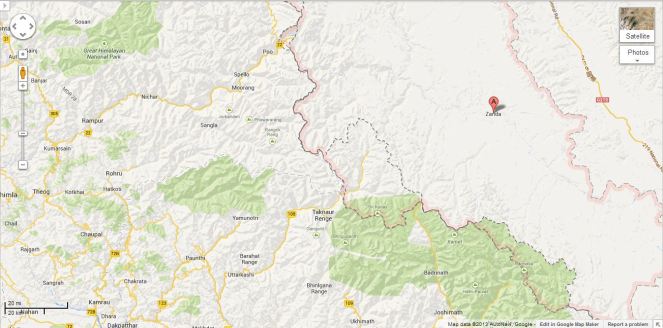
This was read with first clause: “The two sides recognized that trans-border rivers and related natural resources and the environment are assets of immense value to the socio-economic development of all riparian countries.” Here “riparian countries” clearly includes lower riparian. But to suggest that this clause on its own or read with clause 5 mentioned above provides hope that China will include the concerns of the lower riparian in Chinese projects on shared rivers seems slightly stretched. The clause only recognises the asset value of rivers and related natural resources and environment for all basin countries and it is doubtful if it can be used to interpret that Chinese will or should take care of the concerns of lower riparian.
Thus the rather optimistic interpretation does not seem to emanate from the actual wording of the MoU, but the rather over optimistic interpretation by the Indian interlocutors, possibly including the Indian ambassador to China, who has been quoted on this aspect.
Real Achievement: GOI recognises value of Rivers! What is most interesting though is that Indian government has actually signed a Memorandum that recognises that “rivers and related natural resources and the environment are assets of immense value to the socio-economic development”. This is absolutely amazing and joyful development for rivers. Since there is nothing in the laws, policies, programs, projects and practices of Indian government that says that rivers are of any value. Now that Indian government has actually signed an MoU agreeing to such a value, there is sudden hope for rivers, it seems. Only lurking doubt, though is the word “trans-border” before rivers! We hope the Government of India applies this clause to all rivers, not just trans-border rivers, though we know from past that this hope is one a rather thin ice!!
SANDRP
Annexure:
1. Formation and Meetings of Expert Level Mechanism (ELM) on Trans-border Rivers
| 20-23 Nov, 2006 | During the visit of the President of People’s Republic of China to India in November 20-23, 2006, it was agreed to set up an Expert-Level Mechanism to discuss interaction and cooperation on provision of flood season hydrological data, emergency management and other issues of trans-border rivers between the two countries. Accordingly, the two sides set up the Joint Expert Level Mechanism(ELM) on Trans-border Rivers. The Expert Group from Indian side is led by Joint Secretary level officers. Seven meetings of ELM have been held so far. |
| 19-21 Sept, 2007 | In the 1st meeting of ELM the issues related to bilateral cooperation for exchange of hydrological information were discussed. |
| 10-12 April, 2008 | In the 2nd meeting of ELM work regulations of the ELM were agreed upon and signed. It was agreed that the ELM shall meet once every year, alternatively in India and China. |
| 21–25 April, 2009 | The 3rd meeting was focused on helping in understanding of each other’s position for smooth transmission of flood season hydrological data. |
| 26-29 April, 2010 | In the 4th meeting the implementation plan on provision of hydrological information on Yaluzangbu/Brahmaputra River in flood season was signed. |
| 19-22 April, 2011 | In the 5th meeting the Implementation Plan in respect to the MoU on Sutlej was signed. |
| 17-20 July, 2012 | The 6th meeting of ELM was held at New Delhi where both the countries reached at several important understandings and a significant one of those understandings is – “The two sides recognized that trans-border rivers and related natural resources and the environment are assets of immense value to the socio-economic development of all riparian countries.” |
| 14-18 May, 2013 | In the 7th meeting held at Beijing, China where in the draft MoU and Implementation Plan on Brahmaputra river was finalized. |
2. MoUs on Hydrological Data Sharing on River Brahmaputra / Yaluzangbu
| 2002 | Government of India and China signed a MoU for provision of hydrological information on Yaluzangbu/Brahmaputra River in flood season by China to India. In accordance with the provisions contained in the MoU, the Chinese side provided hydrological information (Water Level, Discharge and Rainfall) in respect of three stations, namely, Nugesha, Yangcun and Nuxia located on river Yaluzangbu/Brahmaputra (see the map above) from 1st June to 15th October every year, which was utilized in the formulation of flood forecasts by the Central Water Commission. This MoU expired in 2007. |
| 2008 | On 5th June, India signed a new MoU with China on provision of hydrological information of the Brahmaputra /Yaluzangbu river in flood season by China to India with a validity of five years. This was done during the visit of the External Affairs Minister of India to Beijing from June 4-7. Under this China had provided the hydrological data of the three stations for the monsoon season from 2010 onward. |
| 2013 | During the visit of Chinese Premier Li Kegiang to India the MoU of 2008 has been extended till 5th June 2018. |
3. MoUs on Hydrological Data Sharing on River Satluj / Langquin Zangbu
| 2005 | A MoU was signed during the visit of the Chinese Premier to India in April for supply of hydrological information in respect of River Satluj (Langquin Zangbu) in flood season. Chinese side provided hydrological information in respect of their Tsada station on river Satluj (Langquin Zangbu in Chinese, see the map above). |
| Aug 2010 | In order to supply flood season hydrological information on River Sutlej a new MoU was agreed in August 2010 |
| Dec 2010 | On 16 Dec 2010, during the visit of Prime Minister of China to India a new MoU was signed to provide hydrological information of Sutlej/Langquin Zangbo River in flood season by China to India with a validity of five years. |
| April 2011 | During the 5th ELM meeting held in April, 2011 an MoU on Sutlej containing the Implementation Plan with technical details of provision of hydrological information, data transmission method and cost settlement etc. was signed in Beijing. The hydrological information during the flood season has been received in terms of the signed implementation plan. |
Annexure compiled by Parag Jyoti Saikia
Post Script: Further reading: http://www.thethirdpole.net/2015/11/06/tibet-dams-hold-back-silt-not-water
END NOTES:
[i] http://timesofindia.indiatimes.com/india/India-China-seal-border-pact-talk-Pak-based-terror/articleshow/24619614.cms
[ii] http://www.thehindu.com/todays-paper/tp-national/china-will-be-more-transparent-on-transborder-river-projects/article5266620.ece

Water Sector in Maharashtra: Infrastructure & Governance
Introduction
A typical irrigation project comprises of dam, reservoir, main canal, distributaries, minors, sub minors, field channels & farms. Components from reservoir to minors/sub minors are termed as Irrigation Main System [IMS]. The main purpose of IMS is to store & convey water to irrigation outlets. IMS, at present, is up-stream controlled, manually operated, mostly open channel system. Water Governance of projects critically depends upon IMS. Good governance of irrigation projects is practically impossible without compatible physical system & adequate legal support. This paper makes an attempt to highlight this basic fact with particular reference to M&MIP in Maharashtra.
Water Resources Development in Maharashtra Water sector in Maharashtra is passing through a difficult period. Following exposure of the irrigation scam in 2012, the Maharashtra Government had to publish white paper on irrigation. But that created more problems. Appointment of Special Investigation Team (SIT) further aggravated the controversy. Several public interest litigations have been filed. Investigation by CBI is being demanded. And opposition political parties have been keeping the issue alive in legislative council & assembly. The message is loud & clear. Water Governance is conspicuous by its absence.
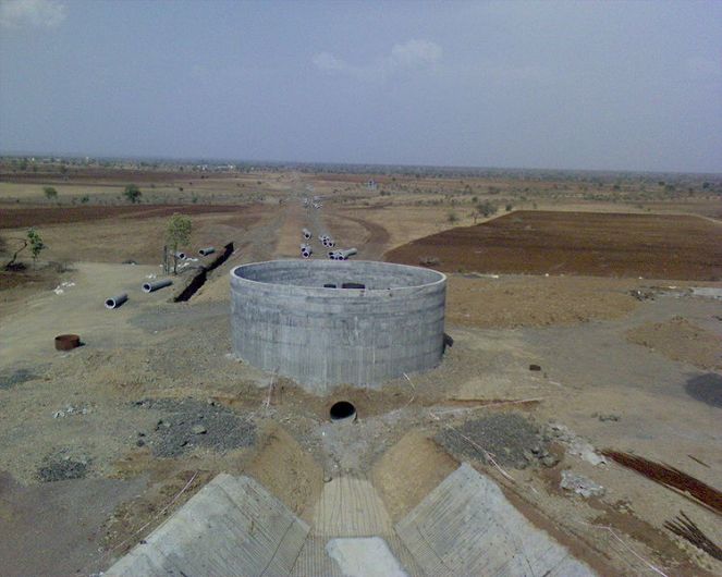
Issues that have become controversial are listed below & they do substantiate the absence of water governance.(1,4,6,7)
1) Validity of water availability certificates
2) Completion of irrigation projects in the truest sense of the term
3) Accurate, credible figures of Created Irrigation Potential (CIP)
4) Reduction in CIP
5) Truth about Actual Irrigated Area (AIA)
Present Scenario of Water Management in Maharashtra: The present scenario of water management in irrigation projects in the State is equally disturbing (2,3,4,5). Cropping pattern dominated by perennial & hot weather crops, inefficient water use, illegal lift irrigation schemes, diversion of water from irrigation to non-irrigation, absence of water – & crop area – measurement and non implementation of water laws are some of the important challenges before water governance.

Infrastructural Constraints Water governance demands compatible infrastructure. Infrastructure, in irrigation sector, includes reservoirs, canals & distribution network (DISNET), that is, mainly Irrigation Main System (IMS). Better the IMS better will be the water governance. IMS comprises of earthwork, structures & measuring devices. Earthwork & structures help store & convey water. Gated structures, in addition, facilitate control & regulation of water. Measuring devices, measure water & make possible other three most important & basic things of water governance, namely, monitoring, evaluation & water audit. Control, regulation & measurement together create “Water Control Situation” (WCS).WCS facilitates water level- & discharge- control which is the heart of canal operation. WCS, at least in Maharashtra, is largely conspicuous by its absence. That is a big infrastructural constraint from Water Governance point of view. Listed below are the highlights WCS in Maharashtra. The list is indicative & not exhaustive.
(1) IMS is an open channel system which, by its very nature, is difficult to control & regulate.
(2) IMS is an upstream controlled system. Such a system, by design, works as per the logic of supply side management & is operator – friendly. Here, the operator means officials of WRD. Participatory Irrigation Management is, not provided for in the design.
(3) IMS is basically designed for flow irrigation purposes. Lift irrigation & non-irrigation have not been considered in the original design. But IMS, in practice, is used for all purposes.
(4) Actual capacity of canals & DISNET is significantly less than design capacity; defective construction & lack of maintenance & repairs (M & R) being the main reasons.
(5) Actual conveyance losses of canals & DISNET are far more than generally expected. Overall Project Efficiency (ratio of water received at root zone & water released at canal head) is hardly 20-25% in most of the systems.(2,3)
(6) Less carrying capacity & more losses make mockery of irrigation schedules. Timely & predictable water supply remains on paper. Inordinate delays & grossly inadequate water supply inevitably lead to water conflicts.
(7) Gates of different type & size at strategic locations in canals & DISNET are of vital importance to control & regulate water supply. But most of the gates are either out of order or simply missing. Poor M & R, tampering & vandalism are common.
(8) Gates at present are cumbersome to operate. Their manual operation limits flexibility of canal operation. In absence of real time data, gate operation becomes ad-hoc. There is hardly any water level- & discharge-control.
(9) Measuring devices are generally not provided at the head of canals & DISNET. Wrong design, improper location, defective construction & poor M &R of measuring devices and moreover, no reliable staff to record measurements are some of the features of the volumetric supply. Both officers & influential irrigators simply don’t like the idea of water measurement for well known reasons.
Even if the WCS does not exist as described above, WRD used to religiously publish Water Audit, Benchmarking & Irrigation Status Reports regularly. The author of this paper sent some objections in 2011(5). WRD did not respond.

Story of crop area measurement is similar to that of water measurement. It is not being measured. On the background of Irrigation scam, white paper & SIT, though GOM published its Economic Survey, it does not give statistics of irrigation. That is just “Not Available-NA”!
In view of above, one is compelled to agree with following two well known comments which have serious implications for Water Governance
(i) There is no management in irrigation, its only administration.
(ii) Whatever irrigation takes place, it is not the result of any planning as such. Its irrigation by accident.
Water Laws Maharashtra has enacted several Irrigation Acts. But those are not being implemented. Maharashtra Water Resources Regulatory Authority (MWRRA), the first of its kind in India, has proved to be a failed institute. It has simply lost an opportunity to streamline water governance in the State in spite of having quasi-judicial powers. Lawlessness has become a hallmark of water sector in Maharashtra. Rule of Law is WANTED! (8)
Water Governance Constraints listed above lead to mismanagement in water sector which in turn gives rise to water conflicts. Absence of Rule of Law increases both number & severity of water conflicts. Given the situation, water governance then becomes virtually impossible. Good water governance is possible only if the infrastructure in water sector is improved & modernized and water laws are scrupulously implemented. Most importantly, when there is bottom up participatory process with key role for the local people. Implementation of water laws depends on political will & awareness amongst water users.
It’s time to switch over from “administration to management” in water sector & say good bye to “irrigation by accident”.
Till then good water governance may have to wait!
-Pradeep Purandare (Retd. Associate Professor, Water and Land Management Institute (WALMI), Aurangabad. E-mail: pradeeppurandare@gmail.com)
REFERENCES:
1) WRD,GoM(1999): “Report of Maharashtra Water & Irrigation Commission”
2) WRD,GoM(2011): “Report on Benchmarking of Irrigation Systems in Maharashtra State, 2009-10”, Mar 2011, www.mwrdc.org
3) WRD,GoM (2011): “Report on Water Auditing of Irrigation Systems in Maharashtra State, 2009-10”, Mar 2011, www.mwrdc.org
4) Purandare Pradeep (2012): “Canal irrigation in Maharashtra – Present Status”, Dams, Rivers & People, July – Aug 2012, https://sandrp.in/irrigation/Status_of_Canal_Irrigation_in_Maharashtra.PDF
5) Purandare Pradeep (2012): “Water Auditing of Irrigation Projects in Maharashtra: Myth & Reality”, Dams, Rivers & People, Sept-Oct, 2012 , https://sandrp.in/irrigation/Irrigation_Projects_Audit_Mah_Pradeep_Purandare_Nov2012.pdf
6) WRD,GoM,(2012):”White Paper on Irrigation in Maharashtra”, Vol-I, published on www.mahawrd.org on 29 Nov 2012,
7) Purandare Pradeep (2012): “Who is the Maharashtra Government Fooling?”, Dams, Rivers & People, Nov-Dec, 2012, www.sandrp.in
8) Purandare Pradeep (2013): “Wanted – Rule of Law”, www.downtoearth.org.in

When EIAs Don’t Know River Lengths! Review of EIA/EMP of Simang I & II HEP on Simang River in Arunachal Pradesh
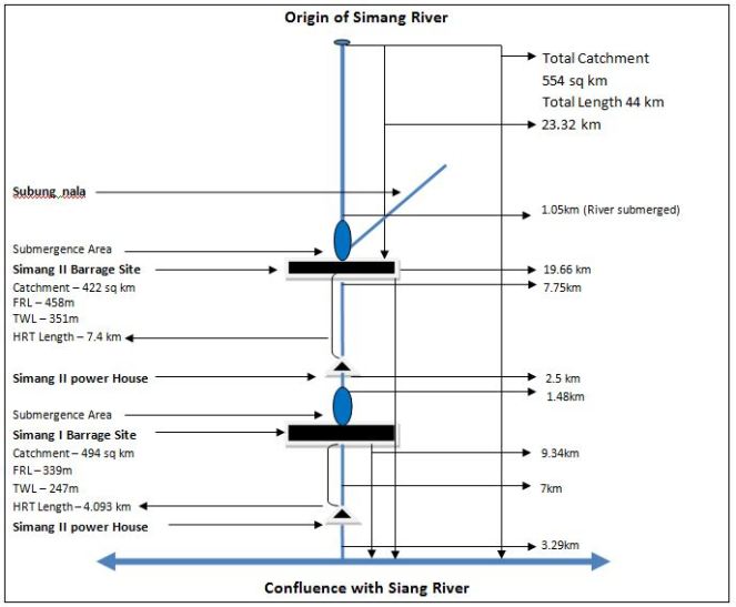
 The Simang River is a tributary of the Siang River which originates at an elevation of 2950 m. The river is 44 km long (as mentioned in the EIA/EMP reports done by consultant R S Environ Link). Total catchment area of Simang River is 554 sq km. There are two projects proposed on the Simang River. The first one is Simang I with an installed capacity of 67 MW (3 x 22.33 MW) and catchment area of 494 sq km. The second one is the upstream project Simang II with an installed capacity of 66 MW (3 x 22 MW) and catchment area of 422 sq km. These two projects were jointly discussed in the 19th meeting of EAC in October 2008 for the first time. Then these projects were subsequently discussed in the 21st, 36th, 66th and 67th meeting of EAC. A diagram of the two projects on the Simang River is given below.
Troubled Figures of EIA/EMP
In order to prepare the above diagram EIA/EMP reports of both Simang I and Simang II has been consulted. A detailed analysis of the numbers and figures mentioned in the EIA/EMPs for the river shows serious inadequacies in both the EIAs and raises questions on the authenticity of the EIA studies being done on the river.
1. EIA Wrong about Length of Simang River: It is surprising to find that the EIA studies for the two projects cannot give the correct the length of Simang River and contradicts each other (e.g. paragrapgh 4 page 1.14 of EIA of Simang I). Even though the total length of the river has been mentioned as 44 km in EIA studies of both the projects, lengths of the river over different parts do not add upto that.
The EIA report of Simang I in map of ‘Figure 1.3: Project in Simang Basin’ of page 1.16 shows that the distance between the origin of the river and reservoir of Simang II HEP is 22.27 km. The EIA report of Simang II states that the distance between barrage axis of Simang II and Simang-Siang confluence is 19.66 km (paragraph 1 page 5.2). The stretch of the Simang River used by Simang II barrage is 1.05km (from page 4.6 paragraph 1 & 2 of Simang II EIA report). If we take the total of these three parts of the Simang River, the total length of the river will be 42.98km and not 44 km.
On the other hand if we take some other figures given for different parts of the river, then we get another length for the Simang River. The Simang I EIA shows that the distance between the barrage axis of Simang II and TWL of Simang I is 15.75 km (Figure 1.3). The distance between the TWL of Simang I and it’s confluence with Siang river is given as 3.29 km. From this the total length of the river comes out as 41.31 km excluding the Simang II reservoir area. The stretch of the Simang River used by Simang II reservoir is 1.05 km. So including this total length of the Simang River is 42.36 km, not 44 km.
This is a serious inadequacy on the part of the EIA studies since the studies are not clear even about the river length across different parts of the projects. Either the EIA consultants do not know the rivers or they are fudging figures. In either case, these EIA reports should not be accepted.
2. Incorrect Assessment of River Use for the Projects The EIA reports of both Simang I and II projects gives incorrect figures for stretch of river used for the projects. The stretch of the Simang River submerged by Simang II barrage is 1.05 km (from page 4.6 paragraph 1 & 2 of Simang II EIA report), stretch of river bypassed between Simang II barrage and TWL is 7.75 km. The EIA report of Simang I states that the stretch of river submerged by Simang I barrage is 1.48 km and stretch of river bypassed between Simang I barrage and TWL is 7 km. This concludes that the total length of the river used by the two projects is 17.28 km and not 15.75 km as claimed in the EIA reports. Not giving the correct information about the stretch of the river used for projects is a major lacunae on the part of the EIAs and hence these EIA should be rejected.
3. Incorrect Assessment Distance between Simang-Siang Confluence and Power House of Simang I: It seems the EIA/EMP consultant has no knowledge of the area since the distance stated between the Simang-Siang confluence and Power House also seems to be incorrect. The Simang I EIA in states that distance between barrage axis of dam and Simang-Siang confluence is 9.34 km. It also stated that the distance between barrage axis and power house is 7 km. This leaves the distance between the Simang-Siang confluence and Simang I power house as 2.34 and not 3.29 as shown in Figure 1.3 in page 1.16 of the EIA. This again proves that the EIA report prepared by the consultant is inadequate and it should not be accepted.
4. Assessment of river length for diversion is doubtful The diverted river length for Simang II HEP given as 7.75 km in the EIA seems to be doubtful. But tunnel lengths mentioned in the same document for Simang II are as follows:
|
Tunnel |
Length (km) |
|
HRT |
7.4 |
|
Surge Shaft |
0.017 |
|
Pressure Shaft |
0.225 |
|
Penstock |
0.056 |
|
TRC |
0.202 |
|
Total |
7.9 |
In fact the bypassed length of the river is likely to be longer than this length of the various tunnel components since rivers do not flow in straight lines, unlike the tunnels.
Critical Issues Not Addressed by EIA/EMP The projects on the Simang River were first considered for TOR in 2008 in the 19th EAC meeting. The proposal that time was to construct three hydro electric projects (HEPs) on the river. In reply to this the EAC had asked, “Secretary (Power) and Secretary (Environment) of Government of Arunachal Pradesh should attend the next meeting to clarify the reason for allotting a series of hydroelectric projects on a river which subsequently flows only through tunnels and damage the aquatic ecology.” The Power secretary and Environment secretary attended the 21st meeting of EAC. Going through the minutes of that meeting, it becomes very obvious that Arunachal with its aim to generate more revenue was ready to dam every river or stream in the state. This strengthens the impression that the Simang I or Simang II HEPs are not going to be much beneficial for the local people, environment or the state.
After going through the EIA/EMP of both the projects we have found that there are several critical issues with these studies. There are several issues which are common in both the studies and several others which are particular to each project. Reading these documents thoroughly gives a feeling that the documents don’t have much of a difference from each other and lot of ‘copy-pasting’ has been done. Some of them are also mere replications (e.g. section 4.2 page 4.7 of Simang I EIA and section 4.1.8 in page 4.6 Simang II EIA). There are also many instances where names and words have been confused, e.g. in page 1.15 of Simang II EIA, in the title of the Table 1.1 “Simang I” has been mentioned instead of “Simang II’. This kind of issues raises question on the validity and authenticity of the EIA/EMP studies done. Some of the critical issues are listed below as an example, this is not exhaustive list.
1. EAC Recommendations not Followed: The EIA/EMP studies of these projects have not followed several of the EAC recommendations. EAC in its meetings had recommended the project proponent to address several important concerns but those were no followed.
“To maintain the aquatic life, a study to be conducted by National Institute of Hydrology, Roorkee. Methodology followed for measurement of water flow to be given.” (19th EAC Meeting) – There is no mention of any study done on environment flows. The EIA/EMP report of both the projects does not give any details of how the environment flow was measured except mentioning what will be the environmental flow.
Between dam and power house how many streams/ tributaries join and what is their contribution in turn of water in the lean season and monsoon? (19th EAC meeting) – The EIA/EMP of none of the two projects responded to this. There are no accurate details about number the flow contribution of different streams or river joining Simang.
Seismic Studies, Slope Stabilization measures, Reservoir Rim Treatment should be included in the EIA/EMP studies. (36th EAC meeting) – The EIA/EMP studies of the two projects do not have any details of seismic studies done in the project area.
Disaster Management Plan should be included in the EIA/EMP studies. (36th EAC meeting) – This is very surprising because none of the two projects in Simang River has any disaster management plan in their respective EIA/EMP documents.

2. Impact of Migration of Outside Workers on Local Communities not Assessed The EIA/EMP reports estimates that there will be migration of nearly 1000 persons for each project during the peak construction period to this very sparsely populated area. People who live in this area belong to several ethnic tribal groups with unique social, economic, political and cultural values. The EIA/EMP reports do not discuss what will be the impact of such migration on the social, political, economic and cultural lives of the people. Influx of such migration will also have impacts on their human rights as well on women. The EIA/EMPs make no mention of these impacts of migration and that is why the EIA/EMP report is incomplete. Besides, even though the projects had been considered together by EAC, no cumulative impact assessment of migration was done.
3. Shoddy Socio-economic Impact Study: The property surveys which the consultant claim to have done for both these projects are inadequate and shoddy socio-economic impact assessment studies. For Simang I a property survey of project affected families in 5 villages was done but it was found incomplete since it does not take into account two of the project affected villages. On page 6A-10 of the EIA report, these 5 villages are stated as Dosing, Lileng, Pareng, Rengo and Boleng. But out of these villages, there are only three villages mentioned in the property survey – Pareng, Rengo and Boleng. The two villages Dosing and Lileng were not found in the list and instead there were two different villages mentioned in the list – Yingku and Sine.
But after reading through the EIA study of Simang II, it becomes clear that project consultant had done only one survey for both the projects. The two villages Yingku and Sine are also found in the property survey list for Simang II EIA with the same number of affected families (page 6A-16).
It is also surprising to see how the opinions can be exactly similar for both the projects when the affected families are different for each project (See page 16A-15 of Simang I HEP EIA and page 16A-17 of Simang II HEP EIA). Besides, in the list mentioned in page 6A-17 of Simang II EIA, village named Yingku is mentioned twice but there is no justification provided for that.
This brings to light how recklessly these EIAs had been prepared. In fact, the whole concept of property survey is questionable. It takes into account very limited concerns related with the projects ignoring many serious issues. One important aspect of what is the value of the river and other common property resources for the people of the area finds no mention in the property survey. Such property survey cannot be taken as a full proof socio-economic impact assessment and hence EIA/EMP is incomplete and cannot be accepted.
4. Options Assessment not Done The EIA/EMPs of the proposed projects have not done any options assessment study. For example, the option of sub megawatt micro hydro project for a sparsely populated and pristine area like this has not been assessed. For ethnic tribal communities with small population micro hydro project is a better option. The option of solar power generation has also not been assessed by the EIA/EMPs of the projects. Options assessment is an important part of the EIA/EMP document and since this is not done the EIA/EMP reports are incomplete and cannot be accepted.
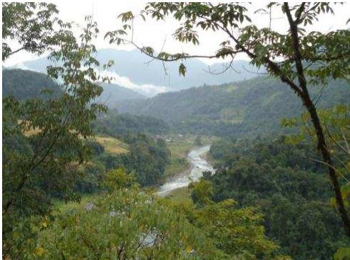
Source: EIA report Simang II
5. Environmental Flows Assessment not Done: The EIA/EMP reports of the two projects do not give any detail of how environment flow was calculated and how environment flow will be released. We have already mentioned that in the 19th EAC meeting, EAC had suggested that in order to maintain the aquatic life, a study should be conducted by National Institute of Hydrology, Roorkee and the methodology followed for measurement of water flow should be made available in the EIA. But there is no mention about any such study in any of the documents.
EIA reports of both projects mentioned about the environment flow release exercise but that should have been done already and should have been a part of the EIA. Since the EIA reports do not mention about any study done on environment flow as asked by the EAC this EIAs cannot be taken as a complete impact assessment.
6. Socio-Economic Impacts of Reduced Flow Ignored: None of EIA/EMP reports mention about the socio economic impacts of reduced flow in the intermediate stretch between the barrage axis and power house. Besides, in questionnaire of the primary survey/property survey which the EIA consultants claim to have done, there is no question on impacts of the reduce flow of water in the river. Besides, the EIA/EMP studies do not discuss the importance of the river for the local people. This proves that EIA report is inadequate and cannot be accepted.

Source: EIA report of Simang II
7. Impacts of Non-monsoon Peaking Power Generation not Assessed: EIA/EMP reports of the two projects do not assess how peaking power generation during non-monsoon period will impact the flow in the river downstream from power house. Peaking power generation will have significant impact in the downstream since there will be sudden flow of water in the river for a short period of the day and rest of times it will remain almost dry. This sudden release of water holds threat for the people living downstream as well as their livestock. There are many instances where large number of people and livestock dying due to sudden release of water from upstream dam. Most recently, on Oct 7, 2013, one person was washed away in Arunachal Pradesh due to sudden release of water from the Ranganadi HEP.[1] Besides, this fluctuation in river water on everyday basis will have severe impacts on aquatic bio diversity of the river and use of the river by the people. EIA study ignores all these issues and that is why this study cannot be accepted as a complete study.
8. Impact Assessment of changing sediment releases not Done The EIA/EMP reports do not talk about how sedimentation will impact the reservoir. The EIAs should have included detail analysis of two main impacts – 1.Impact of changing silt flows downstream from desilting chamber and 2. Impacts of silt flushing in monsoon season on the downstream areas. The EIA/EMP report should also do a cumulative study of reservoir sedimentation because the sediment released from the upstream reservoir will affect the reservoir downstream.
9. Socio-economic Impact Assessment of Quarrying not Done: EIA/EMP of any of the two projects on Simang does not talk about the socio economic impact of quarrying on the local people and environment. EIA/EMP reports also have not assessed how the quarrying in a fragile hill range like Eastern Himalayas will increase the risk of landslide and disaster. Ignoring the disaster risk of quarrying in the hills can have disastrous impacts and the recent Uttarakhand disaster is a proof of that. Since EIA/EMP studies ignore all these issues, they cannot be accepted as complete and that is why EIA/EMPs of Simang I and II should be rejected.
10. False Claim about Height of the Dam: The claim made by the EIA/EMP of both the projects that 18 m high dam reservoir is “very low height” is misleading and false. In the 2nd paragraph of page 10.2, the EMP report of Simang I states “Because it is a run of the river hydro project with a small barrage with very low height (18 m), the inundation will be minimized during reservoir filling.” The same claim has been made in the same page of Simang II EMP. This claim is baseless because according to international standards any dam with a wall height of 15 m or above is a big dam.
11. Climate Change Assessment Not Done EIA/EMP studies of both the projects have not done any climate change impact assessment for the proposed projects. Today when climate change impact risks are increasing day by day, it is very essential for studies like these to do an assessment of possible climate change impacts on the project as well as impacts of the projects on local climate. In fact the word “climate change” is nowhere to be found in the EIA or EMP of the two projects. Without climate change risk assessment, an environment impact assessment cannot complete and that is why this report is unacceptable.
The EIA/EMP studies should also have done an assessment of methane release from the reservoir of the project. Since these important issues are not addressed by the impact assessment study, it cannot be accepted as a complete study.
12. False Claims about Flora and Fauna The EIA/EMP of the two projects makes a completely baseless claim that “There will be no negative impact on flora of region during the operation phase.” This cannot be accepted as truth since during the construction phase of Simang I and II, the forest area diverted will be 29.86 ha and 22.02 ha respectively. After such a diversion forest, the impact on flora and fauna is inevitable because the area is covered by dense forest. The EIA report of Simang I states that forests constitute the predominant land use in the 10 km area which was studied for this project and 67.66% of this area is covered by dense forests. Besides, none of the two EIA studies provide any data on how many trees will be cut down for the project. These are serious lacunas on the part of EIA/EMP of these two projects and that is why this report cannot be accepted as a comprehensive study.
14. Barrage Location not Clearly Stated for Simang I The EIA report of Simang I is not clear about where the barrage of proposed Simang I HEP will be located. In page 1.5 the EIA report states “The reservoir created by the barrage located near Boleng town will operate between FRL 339 m and MDDL 334 m.” But the same report in page 5.2 says “The proposed Barrage axis is situated about 9.34 Km upstream of confluence of Simang river with Siang river. The river Simang joins the SiangRiver near Boleng township.” Besides, the maps show that Boleng area is located near the confluence of two rivers not near the barrage site. This is a significant error of the EIA study and hence this study is inadequate and cannot be accepted.

Source: EIA report of the Project
15. Simang II does not assess the project impact on Protected Area EIA states that the distance between Mouling National Park and the reservoir tail at Subbung Nala and Simang River are 5.6 and 5.7 km respectively (page 1.2, paragraph 2). Being in so close proximity of a protected area there should have been impact assessment of the project on the protected area but the EIA/EMP does not mention any such assessment.
16. Threat to Nearly Threatened Mammals The Simang II HEP is a threat to some of the endangered mammal species listed in IUCN Red List. Common leopard (Panthera pardus) and Assamese macaque (Macaca assamensis) which falls in the “Near Threatened” and Gaur (Bos frontalis) falling in “Vulnerable” category of IUCN Red List are found in the project area of Simang II. There are 13 more species of mammals falling under the “Least concern” category of IUCN which are also found in the area. This has been stated in the EIA study of Simang II.
On the other hand, the EIA study of Simang I ignores some the species falling under IUCN Red List. Rhesus macaque, Indian Porcupine and Asiatic Brush Tailed Porcupine which are found in the area fall under the “Least concern” category of IUCN Red List but the EIA report completely ignores this.
The EIA/EMP reports of the two proposed HEP projects on Simang River have significant lacunas and those cannot be ignored. The EIA consultant also had not consulted the local people in preparing the EIA report. This is another significant lacuna on the part of the EIA because it is the local people who are more aware of the local environment and river as they have lived in that place for generations. It is shameful that on the basis of such studies and reports, public hearing for the two HEPs was held without even announcing the Public hearing dates on the AP Pollution Control Board website. If these dams are constructed on the basis of such shoddy reports and flawed public hearings then it will invite an uncertain future for the people of the area and people have to live at the risk of disaster. The EAC should consider these issues seriously and must not accept these reports. The EAC should also consider recommending the black list of the consultants for the serious lacunae in the reports.
Parag Jyoti Saikia
(with inputs from Himanshu Thakkar)
email: meandering1800@gmail.com
[1] Man drowns in Ranganadi, body recovered – http://www.arunachaltimes.in/oct13%2007.html
Who cares for Riverine Fisheries in Maharashtra?
Introduction
Fresh water inland fisheries in Maharashtra contribute to over 1 lakh MT fish catch each financial year and generate around ₹ 600-800 Crores for dependent fisher folks[i]. As per the economic surveys (2011-12) for Pune region i.e. Pune, Satara, Sangli, Solapur and Kolhapur districts, there are over 20 thousand fisher folks supported by inland fisheries generating ₹ 8,722 Lakh for the fishing community in the entire Pune region.
Table 1. Status of Inland fisheries in Pune region (Source: Extracted from District economic surveys of respective districts produced at the financial year end of 2011-12, available at: http://mahades.maharashtra.gov.in/publication.do?pubCatId=DSA)
| District | length of the river stretches (km) | Total area under inland fisheries (including river, lakes, and dams)- ha | Inland fisheries production (MT) |
Economic wealth (Lakh Rs.) |
Number of cooperative societies | Fisher folk supported |
| Pune | 1252 | 24721 | 22000 | 6600 | 87 | 3762 |
| Solapur | 772 | 27200 | 3000 | 750 | 133 | 4341 |
| Satara | 676 | 14504 | 1950 | 683 | 60 | 2470 |
| Sangli | 392 | 4678 | 1547 | 232 | 83 | 4701 |
| Kolhapur | 955 | 4266 | 2285 | 457 | 47 | 4747 |
| Total= | 4047 | 75369 | 30782 | 8722 | 410 | 20021 |
Though these are in the Bhima-Krishna Basin, the above records are only for reservoir fisheries! The fisheries department does not collect or maintain any data on riverine fish or fisheries in this region. In fact, the Fisheries Department clearly mentions that it concerns itself only with reservoir fisheries and not riverine fisheries.

Figure 1. Fishing in Khodshi Dam region
Why is this a problem?
Across India, the potential of riverine fisheries is decreasing rapidly. At the same time, it is the rivers which form the backbone of the nutritional and economic security of over 10 million marginal fisher folk in India. But, neither are the riverine fisher folk counted by Fisheries Department, nor is their fish catch is monitored.
This has resulted in chronic downplaying of riverine fisheries sector and concentration of attention on aquaculture and marine fisheries.
No regulation or appreciation of riverine fisheries also means that no attention is being paid to the crisis of riverine fisheries, fisher folk and fish diversity. Across the nation[ii] dams and barrages and related changes in hydrology: Dry rivers, stagnant reservoirs, increasing sedimentation in rivers, rising salinity of estuaries, have adversely impacted the fisheries and dependent people. But this is not very well documented and no attention is being paid to address these issues.
Fisheries Department and Riverine Fisheries in Maharashtra
Highlights of The Maharashtra Fisheries Act (1961)[iii]: The Act applies to inland, riverine as well as marine fisheries. However, the act does not have anything specific to offer to riverine fisheries. It does not talk about traditional fisher folk, their rights, water levels that need to maintained downstream dams, fish biodiversity etc. at all. It is only an Act about edible fisheries, mostly applicable for marine and reservoir fisheries.
- The act is said to provide for protection, conservation and development of fisheries in Maharashtra
- The word “fish” includes fishes, crustaceans, oysters and shell fish
- The act provides for the appointment of “fisheries officers”, person not below the rank of sub-inspector to look after the welfare of the fisheries in the jurisdiction
- It prohibits use of nets, gears or anything that is fixed in the soil for catching the fish, use of explosives, toxic chemicals, obnoxious material and arrows for catching the fish
- The State Government is empowered to make rules to regulate or prohibit any discharge of solid or liquid material deleterious to fishes as long as it does not affect the powers of local bodies to discharge sewage water
- Interestingly, the Act also empowers the State Government to enact rules for protection of fish in selected waters to “prohibit or regulate the construction temporary or permanent or weirs, dams and bunds.”
Unfortunately, the Act does not offer any specific protection to riverine fisheries or conservation of fish.
How does the fisheries department work?
SANDRP discussed issues surrounding riverine fisheries and fisher folk with Fisheries Development Officer of Pune Region. The Fisheries Development Officer said that fisheries department transfers fishing rights for a period of 5 years at a stretch, either to a fisheries cooperative society or contractors. Fishing rights[iv] on dam reservoirs with area more than 200 ha and less than 200 ha are leased out for the period of 5 years to fishing cooperative societies or to contractors if no cooperative society approaches to the department. The fishing rights on the tanks with less than 200 ha area are preferably leased out to local fishing cooperative societies.
According to the Fisheries Development Officer, Pune District alone has 87 water bodies, on which fishing rights are controlled by fisheries department. Out of them, 17 water bodies are more than 200 ha in area. On 7 of those 17 water bodies, there are local cooperative fishing communities while 10 are leased out. On the other hand, there are 70 water bodies which are less than 200 ha. Out of those, 38 are controlled by local fishing cooperative societies, while 32 are leased out to contractors.
He said that in case of marine fisheries in Maharashtra, annual reports[v] are available giving details of about species, fish catch, fish landing stations, number of mechanized boats and so on. However, the picture about fresh-water fisheries is very dismal with complete lack of basic data about number of fishermen, species, yearly fish catch, distribution and abundance of fish species etc. In the section of fresh water fisheries, the department only controls leasing out fishing rights in lakes and dams. Therefore, the aspects related to conservation and protection of riverine diversity remains untouched.
In fact, the fisheries development officer went to the extent of saying that we should not ask more questions about riverine fisheries as the mandate of the Fisheries Department is only to look at fisheries in reservoirs and not rivers!
There has been some research on fish diversity in various parts of the Pune region. For Warna basin, an exhaustive fish species abundance and cause-effect analysis is done by Dr. Mohite and Dr. J. Samant[vi]. For the Pune district, an organization named RANWA attempted to study riverine fish diversity. Interestingly, their initial records indicate that rivers flowing through Pune, once had over 110 fish species![vii]
The department breeds the healthy fishes (called as brood stock) in the controlled conditions and sells the young fires or fingerlings to the contractors or local fishing cooperative societies operational in the jurisdiction. The ponds are seeded with the cultures and the fishing continues to the next season.
The rare riverine fisheries cooperatives
Though the fisheries department of the state concerns itself with fishing in the dams and tanks, there are some rare exceptions, which provide a brief glimpse of the potential and richness of riverine fisheries.
In case of Sangli, Kolhapur and Nanded, the fishing rights on Krishna, Warna, Panchaganga, Dudhaganga, Bhogawati (Sangli and Kolhapur) Godavari (Nanded) are leased to the local fishermen. The reason is that, such leasing was being carried from the times of Patwardhan sansthaniks of Sangli and Shahu Maharaj of Kolhapur. Even after the princely states were annexed by the British, such leasing of fishing rights in the open river continued and is going on till today.
However, in these cases too, the department has no clue about the distribution of fish species or the status of fisher folk.
Example of Kolhapur We interacted with 3 cooperative societies in Kolhapur which operate in the rivers to understand the situation and problems the fishermen face. We interacted with 1. Daulat Sahakari Macchimar Sanstha, Shirol, 2. Hatkanangale jalakshetra macchimar sahakari sanstha, Hatkanangale, and 3. Shirol Taluka Sahakari Macchimar Sanstha, Kurundwad

Figure 2. Fish catch in the Sangli Market. Credit:Mandar Paingangkar
Atmaram Apate, Chariman of Hatkanangale jalakshetra macchimar sahakari sanstha elaborated that “In the Kolhapur district alone, there are 52 different fishing cooperative societies fishing in the open river and there are around 4-5 thousand fishermen from the region. All the fishermen are traditional fisher folks who are genuinely familiar with the waters. Each fishing cooperative society has fishing rights decided traditionally on the rivers of Krishna and Panchaganga”.
Figure 3. Fishermen casting his net in Krishna River. Credit: Mr. Nerlikar
On a different note, Shirol taluka macchimar sahakari sanstha wrote a letter to Assistant Commissioner, Fisheries (Technical) of the Kolhapur district seeking “process of collecting revenue from the fishermen of the open river is unjustifiable and should be stopped. Fishermen are aggravated by the fact that such practice is followed in no other district of Maharashtra except these three, so they want such measure to be discontinued.”
However, there are some contrary opinions to this demand too. Atmaram Apte of Hatkanangale fisheries cooperative society feels that “it is by the very process of leasing, rights of fisher folks on the river are recognized and protected. If the process of such leasing is stopped, anyone could come in our area and do fishing while the local fishermen will not be able to make their ends meet”.
In fact, simply recognizing fisherfolk and leasing fishing rights is still an important function, as per Mansih Rajankar, who has worked extensively on fisheries in Vidarbha. According to Rajankar, “At least some user right of these fisherfolk on the rivers is thus recognized. In Vidarbha, dams like Gosi Khurd will destroy downstream fisheries and fisherfolk do not even have nominal user rights on the river and hence, are not even counted as being affected by the dam!”
Pollution It is important to understand that the significant problem fishermen face is about water pollution. The Shirol, Hatkanangale and Jaisingpur MIDCs release highly untreated and toxic effluents which results in fish kills and thereby hampers the fish catch. The fish death have been alarmingly high in the district and the causative agents are sugar mills as well which release their stored wastes in the water on the onset of monsoon[viii].
In Dec 2012 and January 2013, Kolhapur taluka fisheries cooperative society, Bhoiraj fisheries cooperative society, and those from Shirol, Shridhon, Awali had written to fisheries development officer of the Kolhapur district, seeking compensation against the reduced fish catch. The same request was forwarded to Kolhapur district collector by the fisheries department. The district collector dodged the ball in the respective Tehsildar’s court. Tehsildars said that they don’t have enough money to grant for compensation. However, no concrete action was taken against the polluters. Maharashtra Pollution Control Board did not intervene in the matter either.
Unfortunately, no government department is ready to act for betterment of riverine fisher folks in the district.
The fishermen from Shirol Taluka (which has Dutta Cooperative sugar mill, and Shriol MIDC) say that about a decade ago, they used to receive around 10-12 kg of fish catch a day, now they only get 4-6 kg of fish catch per day. They attribute this reduction to the polluted discharges.
Most of the seeding done in reservoirs is exotic fish. Although Tilapia is an exotic pest species which competes with native fish, Fisheries Department is using Tilapia seeds in many reservoirs, from where they enter into river systems, contaminating the rich gene pool. For information on exotic fish invasion in our rivers: http://www.downtoearth.org.in/content/silent-invasion
In fact, Mr. Suneel Koli from Daulat Macchimar Sangathana, Shirol, Kolhapur told us that they get around 60-65 fish varieties in their catch, indicating the richness of riverine fisheries. Dr. Nilesh Dahanukar of Indian Institute of Science, Education and Research (IISER), Pune has recently[ix] discovered a new fish species in the Krishna river basin of Maharashtra section of Western Ghats. Experts believe that fish diversity in the rivers of Western Ghats is highly understudied and more focus needs to be given to the same.
In conclusion
Maharashtra state government and the Maharashtra state Fisheries Department needs to pay urgent attention to welfare of riverine fish diversity, fisheries and fisher folk. When the Fisheries Act 1961 clearly states that it provides for conservation and improvement of fisheries in the state, why is state government turning a blind eye to riverine fisher folks? It is important that the state fisheries department starts identifying the fishing communities (at least-if not the individual fishermen) of the open river. This will also help in understanding the plight of fisher folk in Maharashtra. Inland fisheries should not just be confined to the seeded fishing in dams and reservoirs.
Riverine fisher folk also need to get user rights on the rivers in which they fish. They should also be part of social impact assessment when dams and other structure are built on rivers and also part of Rehabilitation plans.
Rules under the Fisheries Act 1961 about “prohibit or regulate the construction temporary or permanent or weirs, dams and bunds” need to be formulated and enacted.
The polluters (including municipal corporations) and sugar mills need to be penalized as per the Fisheries Act 1961 to safeguard the livelihoods of riverine fisher folk.
The fisheries department needs to acknowledge local biodiversity of fish fauna and take efforts to conserve and promote them instead of only focusing on common carps and major carp varieties of the fishes. The department is not entrusted to protect only these varieties.
It is crucial that the fisheries department and State Department shows some will and initiative to protect riverine fish diversity against the onslaught of more, taller and bigger dams, polluting industries, law defying barons so that riverine fishery would survive for generations to come. With Climate Change becoming a reality, biodiversity and resilience of small scale, riverine fisheries can provide an important adaptation measure, which needs to be promoted urgently.
Damodar Pujari
(damodar.sandrp@gmail.com)
[i] Maharashtra District Economic Survey 2011-12, page number 100
[ii] [ii] https://sandrp.in/dams/Impacts_of_Dams_on_Riverine_Fisheries_in_India_ParineetaDandekar_Sept2012.pdf
[iv] http://www.fisheries.maharashtra.gov.in/pdf/gr_and_circulars/inland/tanklease/gr/gr_dated_15.10.2001.pdf


