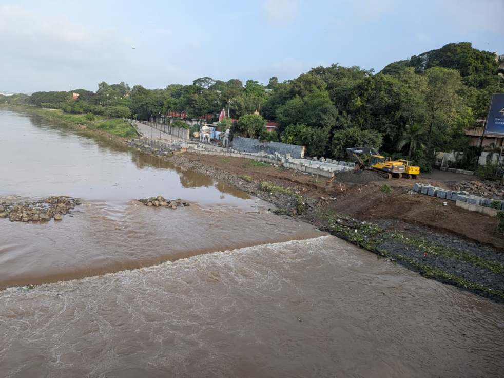
The Pune Riverfront Development – designed by HCP Design, Planning and Management Pvt. Ltd. is the same company behind projects like Central Vista and Sabarmati River Front. The riverfront development in Pune is claimed to be a “copy paste” of that from Sabarmati River – a river basin with completely different landscape and conditions than the Mula -Mutha Basin. Experts and researchers flag various faults with this riverfront development. Here’s what architect and river front researcher Sarang Yadwadkar has to say about this particular project from an urban planning lens through his presentation. In this presentation he connects the project DPR, correspondence with and amongst departments, government reports, and government circulars. He connects these to flag the discrepancies in the project which highlights the violation of guidelines and how the rights of citizens to be free from adverse impacts of climate change are violated.
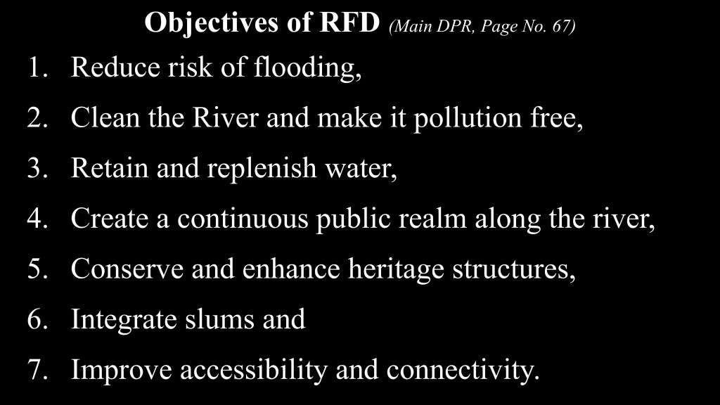
He starts with the objectives for the project as mentioned in the Development Plan Report. There are 7 objectives for the project. In this note, we focus on the objective no. 1 – Reduce risk of flooding. (To get more insight on the entire project click: https://sandrp.in/2021/08/05/pune-river-front-development-project/)
The 7 dams and 3 confluences
To understand the flooding aspect, first let’s understand the Mula Mutha basin along with the flood discharge values of the 7 dams on the upstream and the 3 major confluences (1. Ram- Mula Confluence 2. Pawana-Mula Confluence and the Mula-Mutha Confluence) within the city’s limits.
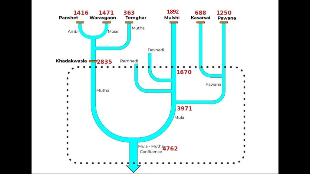
The Total 7 dams (Khadakwasla, Panshet, Warasgav, Temghar, Pavana, Mulshi and Kasar Sai) are constructed on these rivers on the upstream on the West of Pune. These dams are not only close to Pune, but they are close to each other as well.
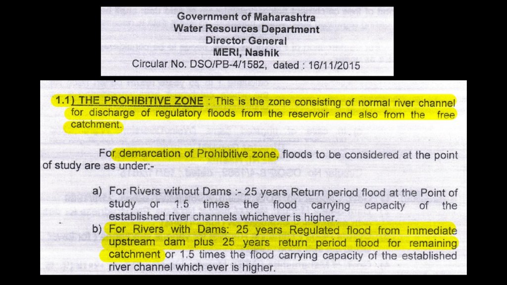
For the confluences, the confluence effect or the backwater effect is another important phenomena one needs to grasp while understanding the Mula-Mutha basin. The backwater effect is the rise in water level and slowing of flow in a river or stream. It happens when a blockage (either a structure like dam/ bund/ culvert or raised water levels) slows down the normal movement of water. This causes the water to back up and flood areas further upstream. This is necessary to consider in urban planning. This is also directed by the Maharashtra Water Resources Department in their circular Dt. 16 November 2015.
Now in case of a heavy rainfall event or a cloudburst, which Punekars have been witnessing over past few years, the catchments of all these seven dams could see huge runoffs simultaneously and enormous quantities of water will have to be released from all these dams which will hit Pune city within short time. In fact, with the encroachments popping up along the river banks, especially near the confluence/s, the back water effect can inundate a large portion of the city near confluences leading to high risk of flood.
Based on this context, study, and analysis, Sarang Yadwadkar puts forth following questions:
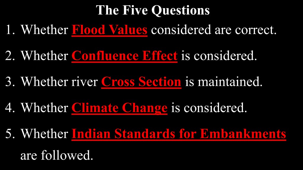
And find answers to these questions based on the RFD DPR, Water Resources Department Circulars and the official correspondence.
Question 1: Whether Flood Values considered are correct?
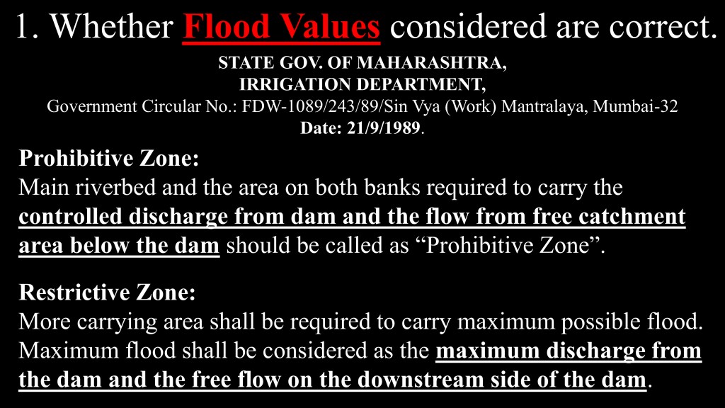
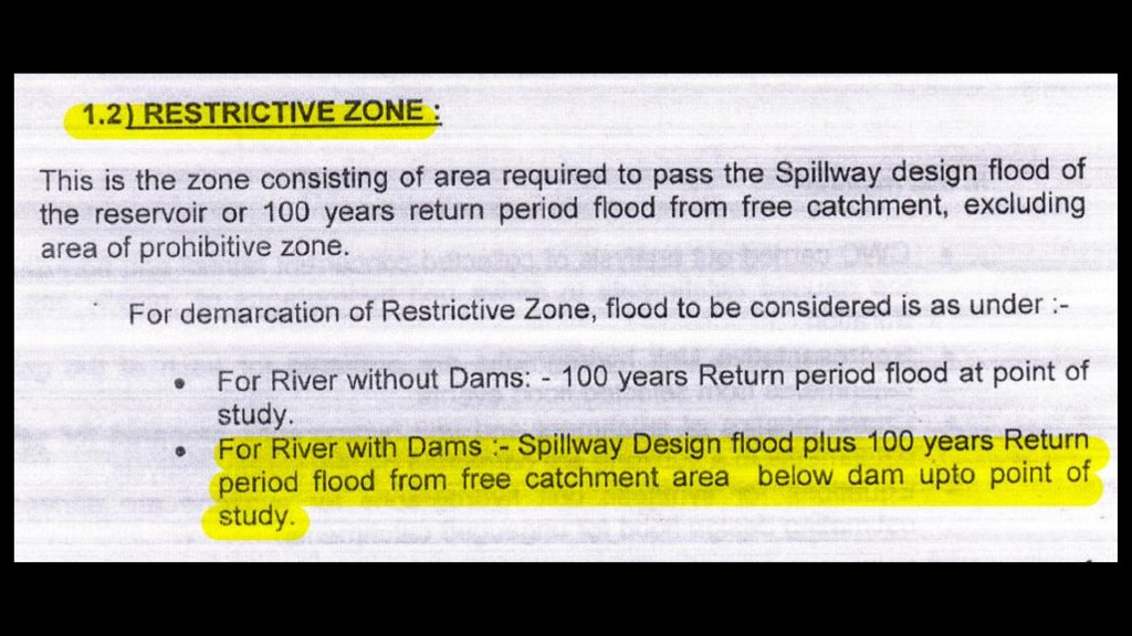
Water Resources Department has certain guidelines for demarcation of flood lines. They are declared in circulars Dt. 21 September 1989 (the picture above) and 16th November 2015 (the images below).
In another series of event, it was discovered that the floodlines of Pune City were illegal and erroneous, marked by then Executive Engineer of Khadakwasla Irrigation Department. A PIL was filed in Hon’ble Bombay High Court regarding these floodlines in which the HC eventually constituted a committee. The committee via Maharashtra Engineering Research Institute (MERI) of WRD shared revised flood values. The new flood values are as follows:
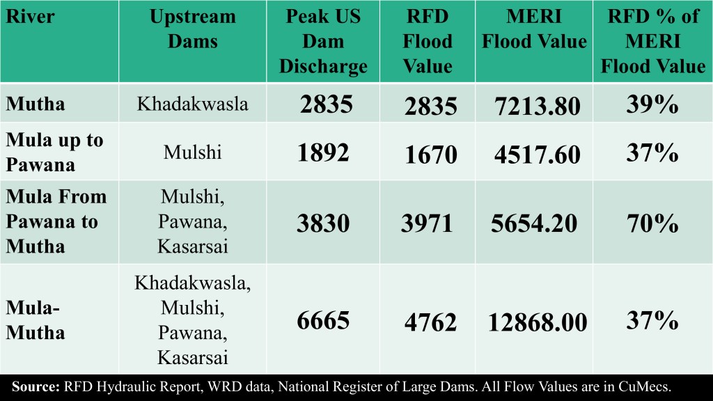
As per the flood values considered in the Hydrology Hydraulics Report, only spillway discharge is taken into account ignoring the flow from free catchment area as required by the WRD Circular Dt. 16th November 2015. To summarize, the flood values are highly underestimated.
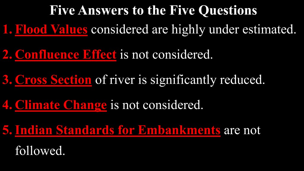
So, to answer if the flood values considered are correct, the answer would be no.
Moving on to the second question – Whether River cross section will be maintained?
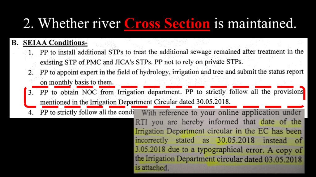
The Environment Clearance is granted to the project subject to the conditions put forth by State Environment Impact Assessment Authority (SEIAA) and SEAC (State Expert Appraisal Committee) are to be followed during project implementation.
One such condition is to follow Water Resources Department Aka Irrigation Department Circular Dt. 03.05.2018. What does this circular say?
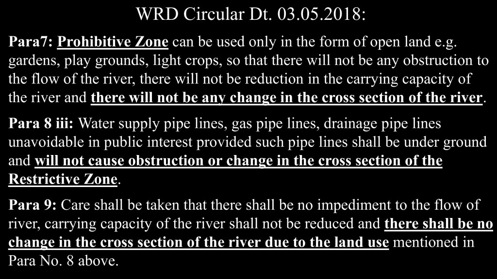
The circular clarifies and strengthens the guidelines for flood plains and their use.
Now referring back to the what the RFD DPR, it presents following drawing:
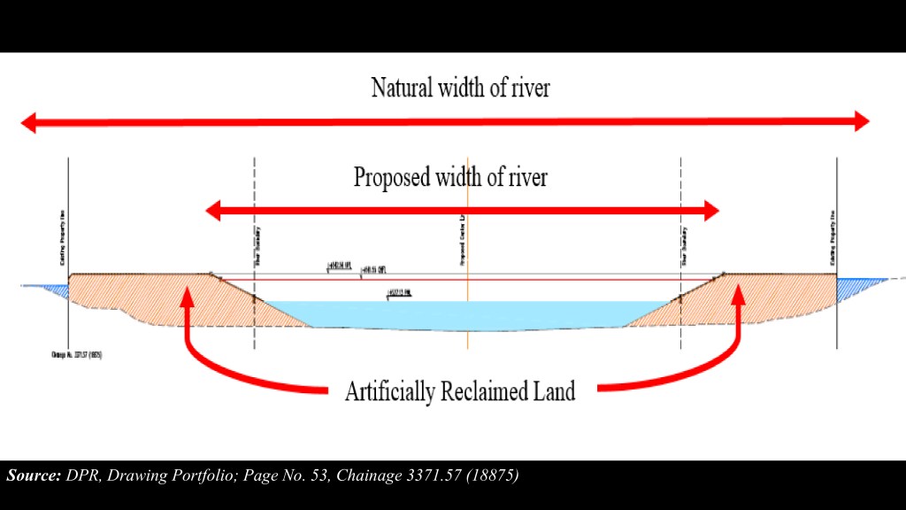
The image clearly shows reduced cross section post RFD. As per the report, the cross section of the river is to be reduced by 40% which is blatant violation of the condition of SEIAA and hence violation of the EC.
Moreover, another interesting image from the DPR is:
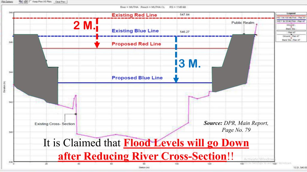
The image shows longitudinal cross section of the river bed, where the drawing shows post dumping of the debris, the flood levels will reduce.
Same is reflected in the letter Dt. 07th July 2022, written by Municipal Commissioner to Chief Engineer, Water Resources Department. Meaning PMC itself agrees to reduction of cross section post river front development project.
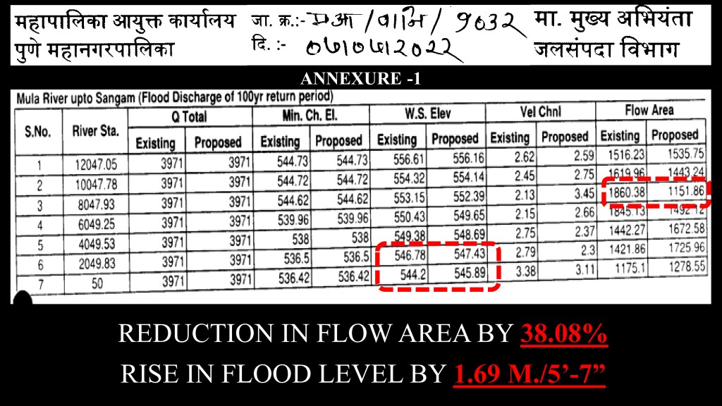
In fact Maharashtra WRD has written to Pune Municipal Corporation about the reduction in cross section area.
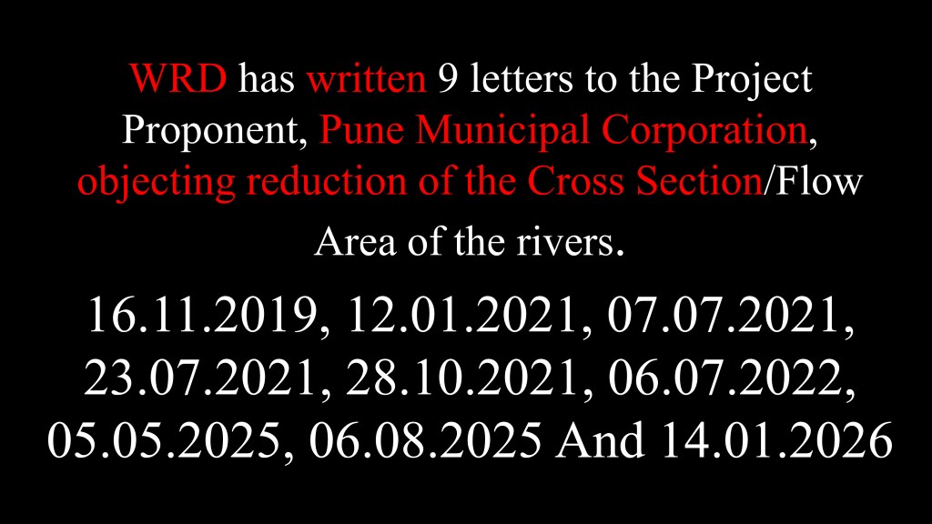
In letter Dt. 07 July 2022, the PMC itself agrees that there will be reduction of cross section post river front development project ignoring all the correspondence by Water Resources Department.
Hence to answer the second question, will the river cross section be maintained? The answer is no.
Moving on to the third question, whether the confluence effect is considered?
Let’s dive in. The WRD Circular Dt. 16th November 2015 states the confluence effect is to be measured and “exercised” while demarcation of the floodlines
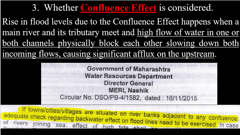
Taking flood values as mentioned in the Hydrology and the Hydraulics Report, it is quite evident that the back water effect aka confluence effect is not at all considered. Let’s take a look at the confluence on a map and flood values mentioned in the RFD DPR.
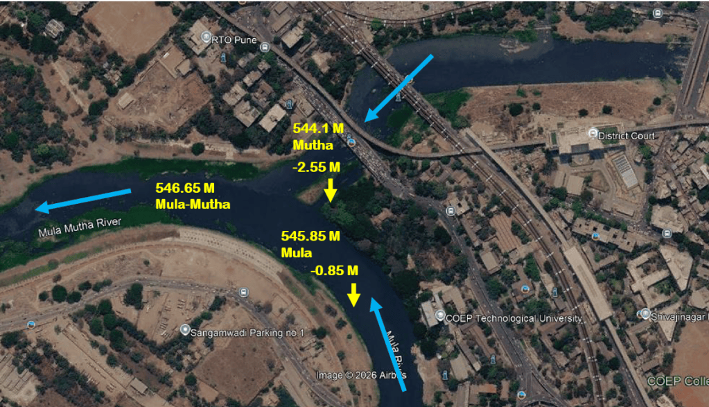
The given flood values if looked at carefully, are non-scientific and go against laws of nature. One need not imagine it as the consultants themselves have visualized it in the DPR. It raises questions about the credibility and intentions of the governing body which has accepted these drawings.
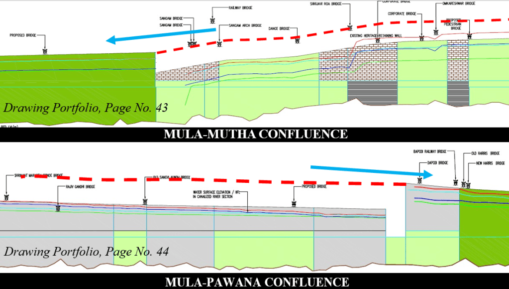
The river normally flows towards the lowest point. How is it possible that the flood levels before the confluence are low and suddenly increase post confluence?
In case the longitudinal sections are not clear, the drawing (on the top) shows Mutha river flowing towards the confluence (of Mula-Mutha) and then the flood levels rise and continue flowing. If the actual flood values are to be considered, it leaves all the existing bridges in the city submerged. Similar observations can be made for Mula-Pawana Confluence.
To answer the third question – whether the confluence effect is considered, simple answer would be no.
Moving on to next question, Q4. Is climate change considered?
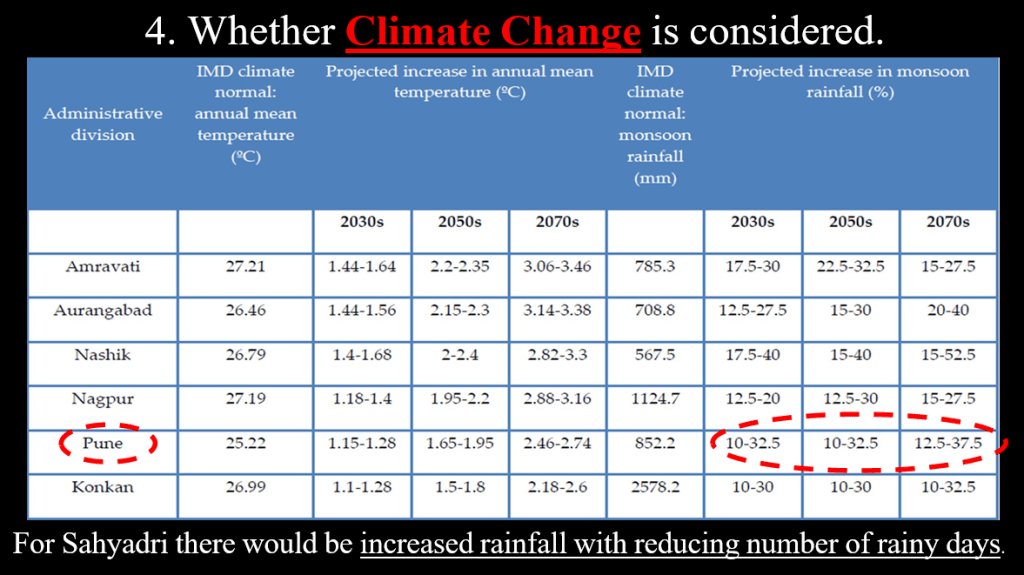
In 2008, the Government of India released the National Action Plan on Climate Change (NAPCC), and in August 2009, directed the States to develop State Action Plans on Climate Change guided by and consistent with the structure and strategies of the NAPCC. To comply to this a report was prepared by The Energy Resources Institute (TERI) for Government of Maharashtra in 2014.
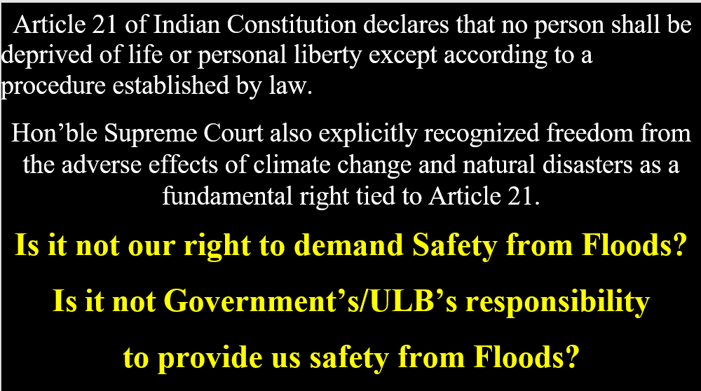
The report projects increase in rainfall and also mention reduction in number of rainy days. No where in the DPR are these figures considered. In fact no other reports/ data on climate change are considered. Today while globally climate mitigation, climate resilient infrastructure are more than buzz words, non-consideration of climate change for a project of INR 4700 crores speaks so much about the planning of Pune city and citizen’s safety.
Hence it can be said climate change is not duly considered in the project.
Moving on to the final question, Q5 Whether Indian Standards for Embankments are followed?
Indian Standard Guidelines for planning and design of river embankments are created by the Bureau of Indian Standards. These guidelines state specifications for the alignment and spacing of embankments.
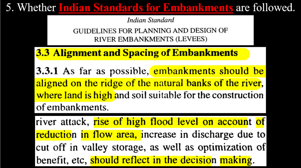
While the guidelines state the embankments are to be aligned on ridge of natural banks of the river, the Pune riverfront developments turn a blind eye to this and constructs the embankments way into the river bed violating these standards as well as conditions of the EC as clearly evident via following images:
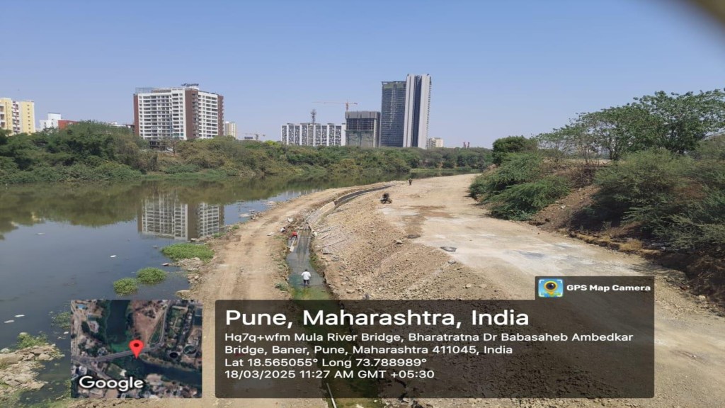
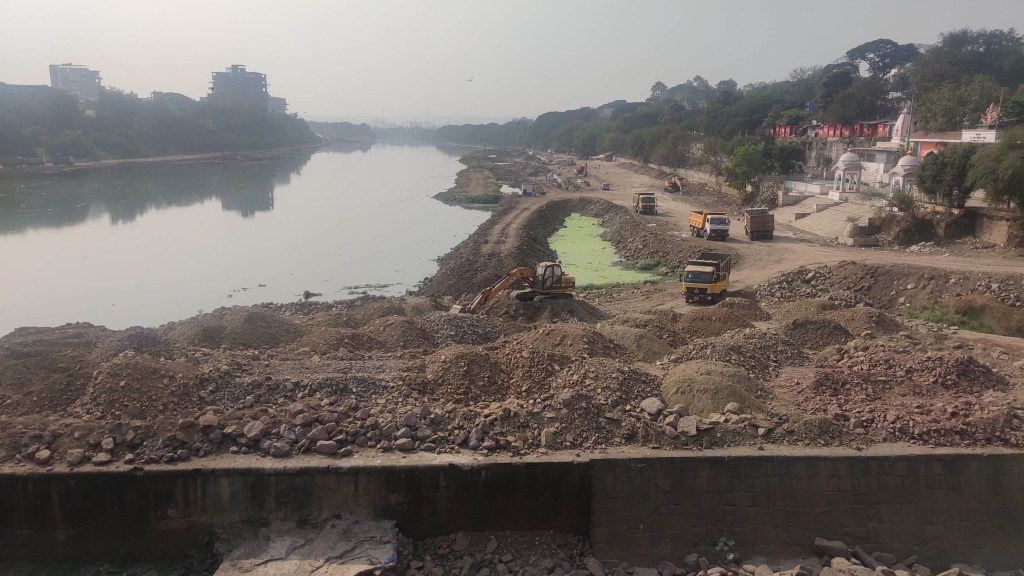
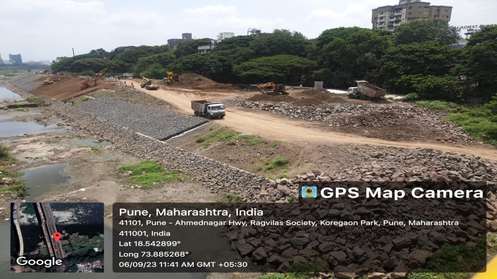
The tree line in the images mark the natural edge of the river bed. The riverfront is being constructed by burying some of the trees.
Hence the answer to the fifth question – are the Indian Standards followed, would be no.
Present Situation
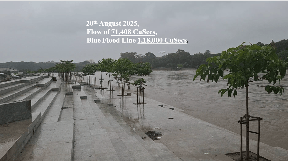
At this point here is another concerning issue. On 20th August 2025, a video was shot from Sangamwadi River front on banks of Mula-Mutha River. The flood level which was supposed to be breached at 1,18,000 CuSecs was breached at 71,408 CuSecs. More encroachments like the riverbed road within the floodlines will lead to rising of the flood levels eventually leading to increase in horizontal spread of the water. For example as visible in the image, the water which was supposed to pass by the riverfront, submerged some parts of the river front. The existing norms and guidelines already warn of this.
Let’s assess the present situation. The following table shows discharge breaching the riverfront at lower flood discharge from the dams.
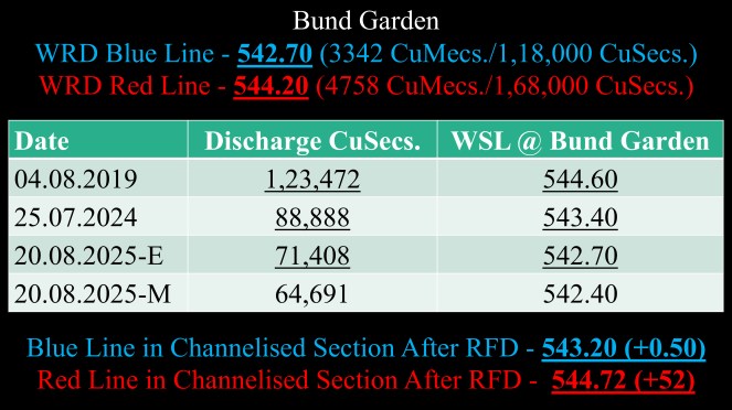
The submergence of riverfront embankments wouldn’t be very surprising since the rise in flood levels post RFD was predicted in the Hydrology and Hydraulics Report by the consultant.
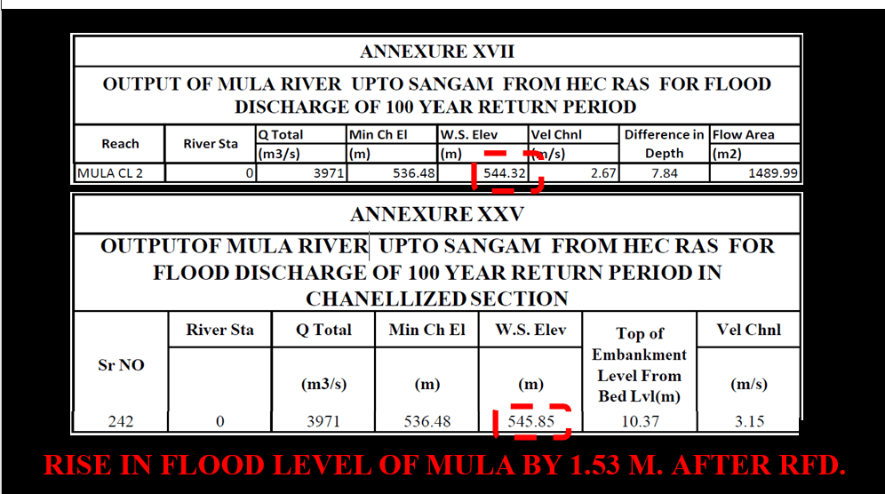
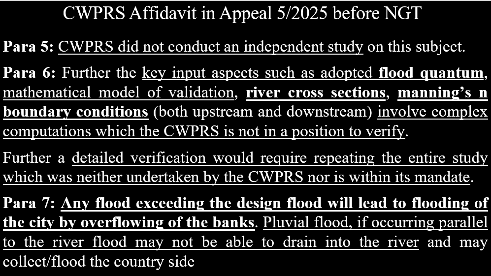
This report so far shows numerous discrepancies. In fact, the project proponent claims that this report is vetted by CWPRS. However, there are gaps between what the project proponent claims and what CWPRS states based on their affidavit filed in Appeal 5/2025 in NGT (WZ).
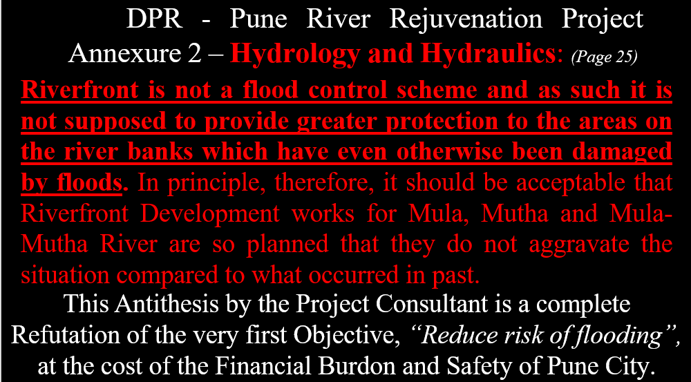
Further the DPR also states following statement:
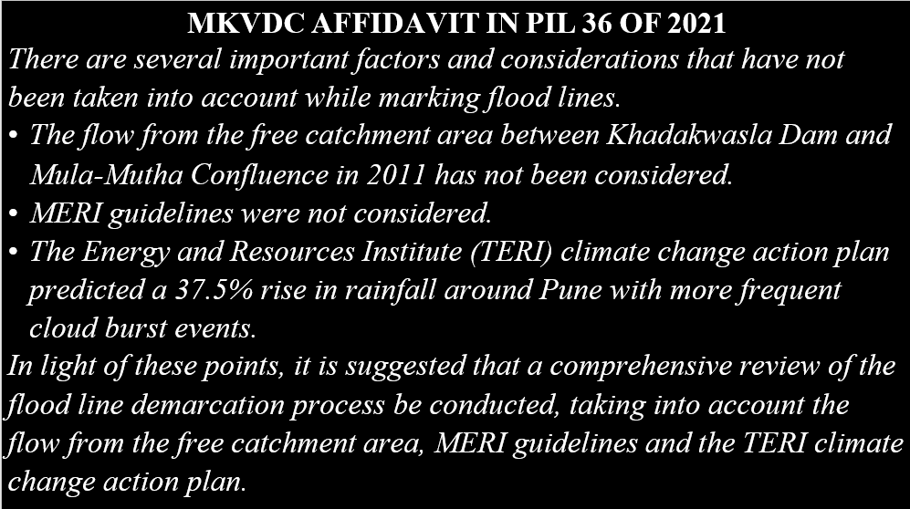
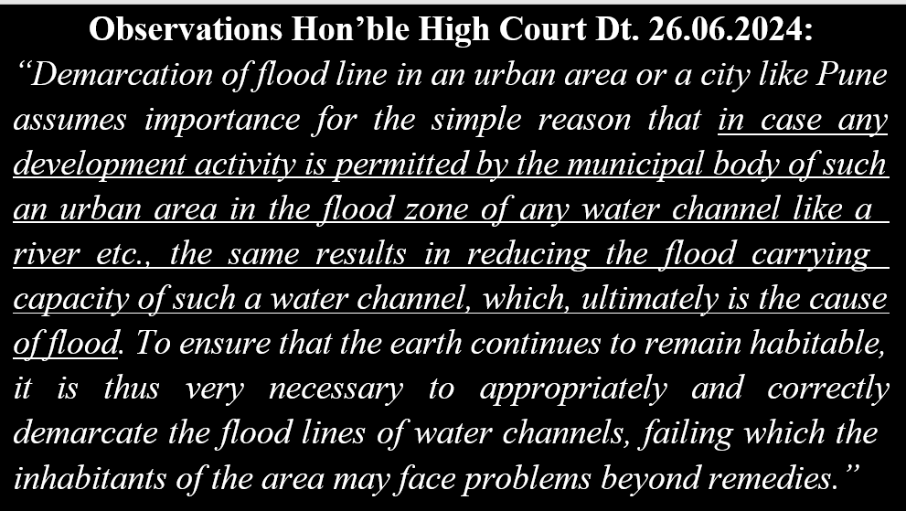
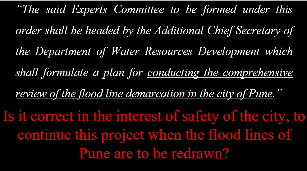
The only priority level flood control measures the city needs is demarcation of the floodlines as per the guidelines as agreed to by Maharashtra Krishna Valley Development Corporation Aka Water Resources Department and observations by Hon. Bombay High Court in PIL 36 of 2021. (The same case where the new flood levels were presented by MERI)
This presentation was created by Mr. Sarang Yadwadkar | Architect, Member of the Planning Committee of the Development Plan of Pune City. He has filed many cases in the National Green Tribunal & High Court against RFD, river pollution and encroachments on riverbeds.
The context was added by Ms. Tara Tanmayi S, SANDRP.


