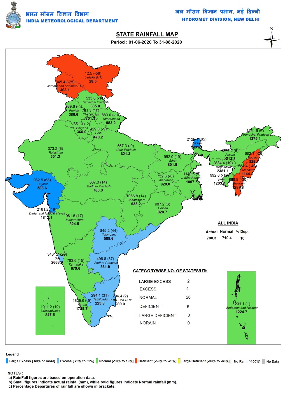
In the ongoing South West Monsoon, India received 44 year old high surplus rainfall of 327 mm in just concluded Aug 2020, 26.6% above normal rainfall of 258.2 mm. This helped the total June-Aug 2020 rainfall to achieve 10% surplus, with actual rainfall 780.3 mm, 69.9 mm higher than normal rainfall of 710.4 mm. In June the country received 18% above normal rainfall and in July it received 9.9% below normal rainfall, the rainfall at the end of June was just 1.1 mm above normal. Thus almost the entire surplus rainfall is thanks to the rainfall during Aug 2020. The rainfall distribution has however, been far from normal that these figures suggest, as we can see from the state wise and district wise figures below.
State Wise Rainfall As we can see from the IMD (India Meteorological Department) map above, of the 37 states and Union Territories (UTs) in India, two had large excess rainfall (Gujarat and Sikkim), 4 had excess rainfall (Tamil Nadu, Andhra Pradesh, Telangana and Goa), 26 had normal rainfall and five had below normal rainfall (Nagaland, Manipur, Mizoram, Jammu & Kashmir and Ladakh). Gujarat had the highest surplus (68%) and Ladakh had the highest deficit (-56%) in June-Aug 2020.
Sub Division Wise Rainfall The IMD map here shows that two of the most drought prone regions of India had received large Excess Rainfall: Saurashtra & Kutch (144%) and Rayalseema (77%). Nine subdivisions had Excess rainfall: Sikkim & Sub Himalayan West Bengal, Konkan & Goa, Madhya Maharashtra, Marathwada, North Interior Karnataka, West Madhya Pradesh, Telangana, Costal AP and Yanam, Tamil Nadu-Puducherry-&-Karaikel. Three sub divisions had Deficit Rainfall: Nagaland-Manipur-Mizoram-Tripura, West Uttar Pradesh, Jammu-Kashmir-&-Ladakh. The rest of the 22 sub divisions had normal rainfall in the three months of June to Aug 2020.

River Basin Wise Rainfall In this map of IMD we can see that among the river basins that received Large Excess Rainfall included: Luni-Saraswati-Bhadar, Pennar, Lower Tungabhadra, Upper Godavari. One more sub basin next to Pennar-Lower Tungabhadra sub basin is marked in dark blue (Large Excess), but the name is missing in the map, IMD needs to provide sub basin wise rainfall in tabular form too as a number of sub basin names and details are missing in map due to lack of space. Among the basins with Deficit Rainfall include: Upper Yamuna, Upper Chenab, Imphal-&-Others. Ravi Basin seems to be in the same category, but the map has no information about this basin. IMD has reported “NO DATA” for rainfall information in Jhelum, Upper Indus and Ladakh area basins.

STATE WISE DISTRICT WISE RAINFALL: NORTH EAST INDIA
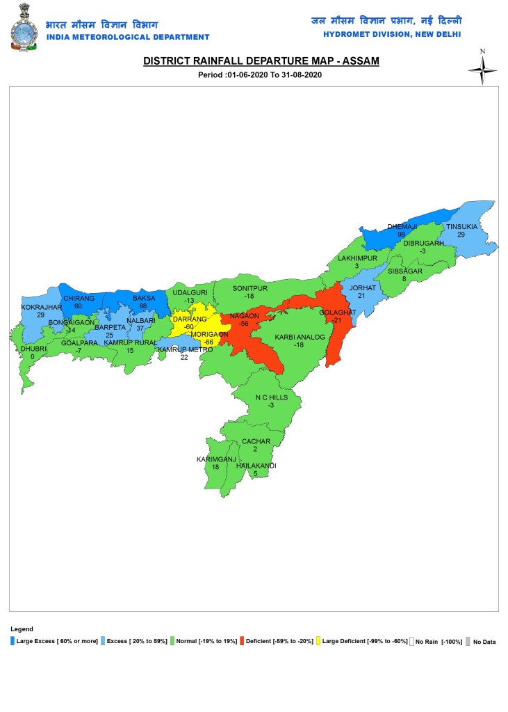
Assam
Arunachal Pradesh

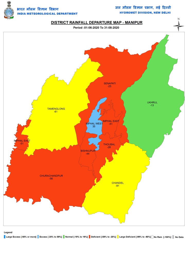
Manipur
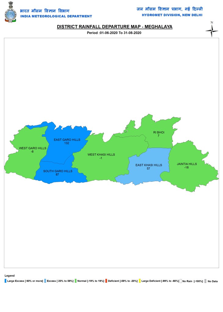
Meghalaya
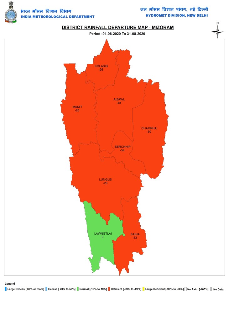
Mizoram
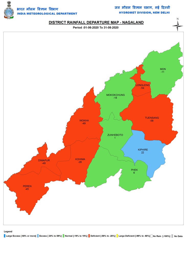
Nagaland
Tripura

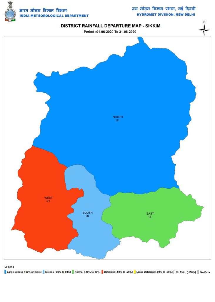
Sikkim
EAST INDIA
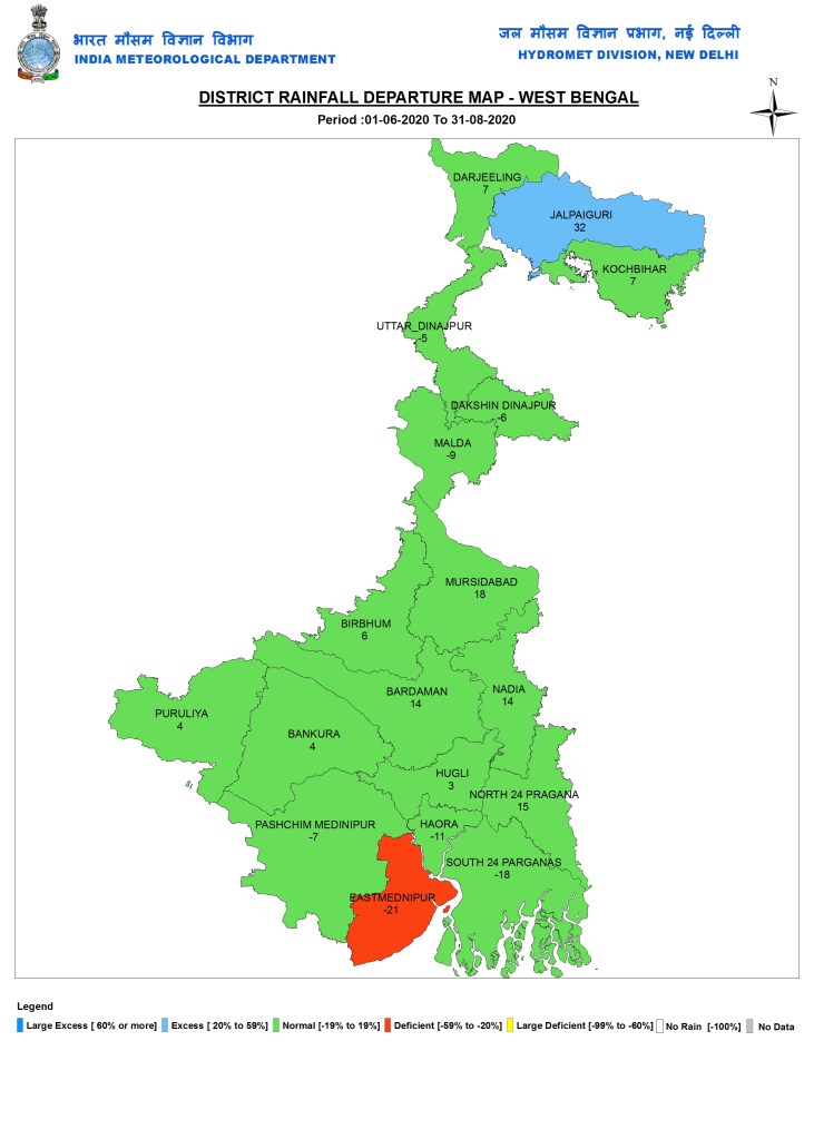
West Bengal
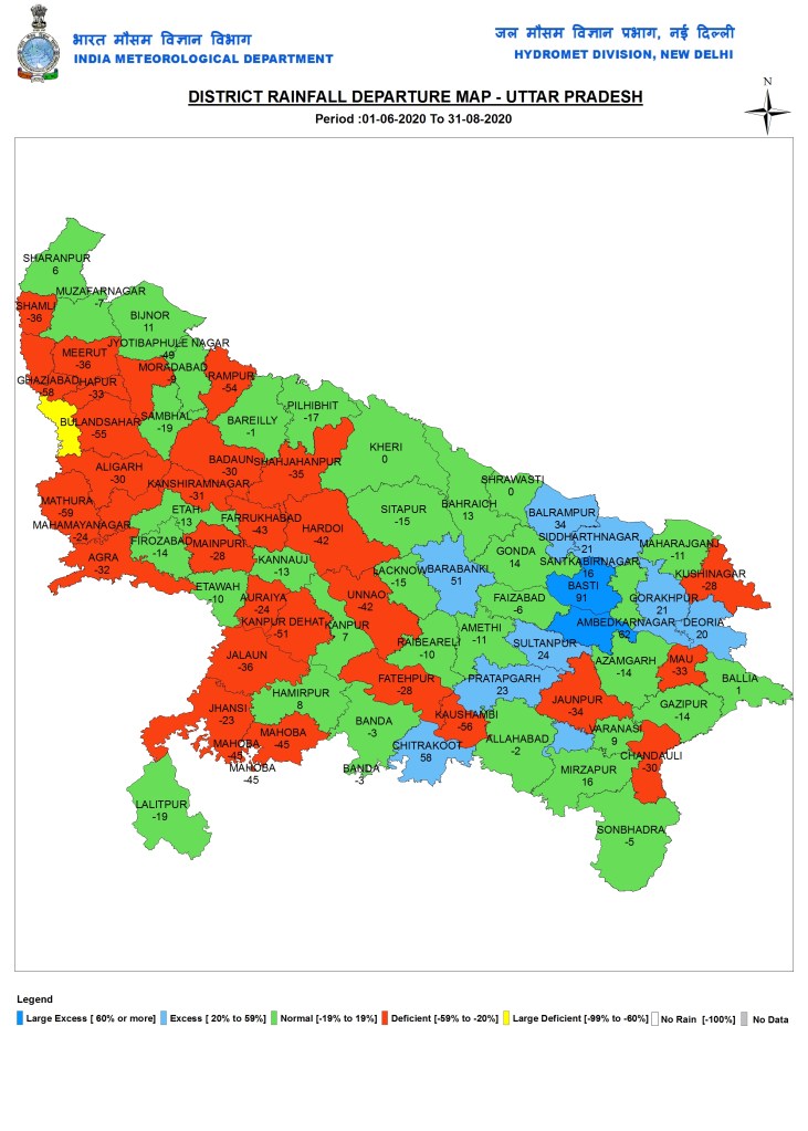
Uttar Pradesh
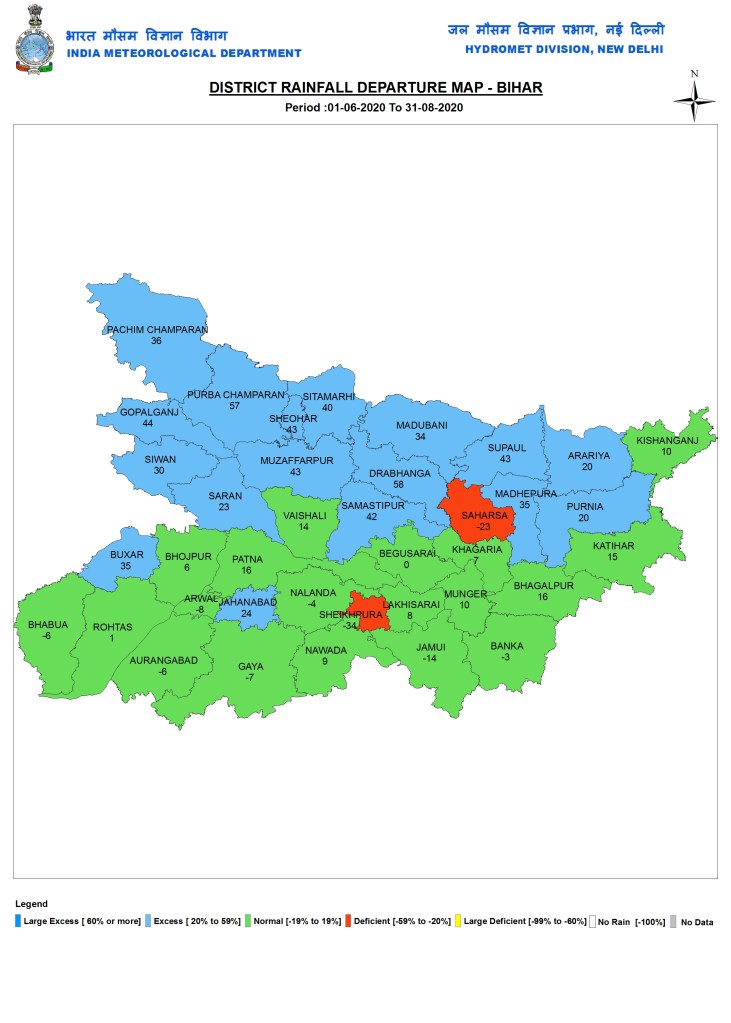
Bihar
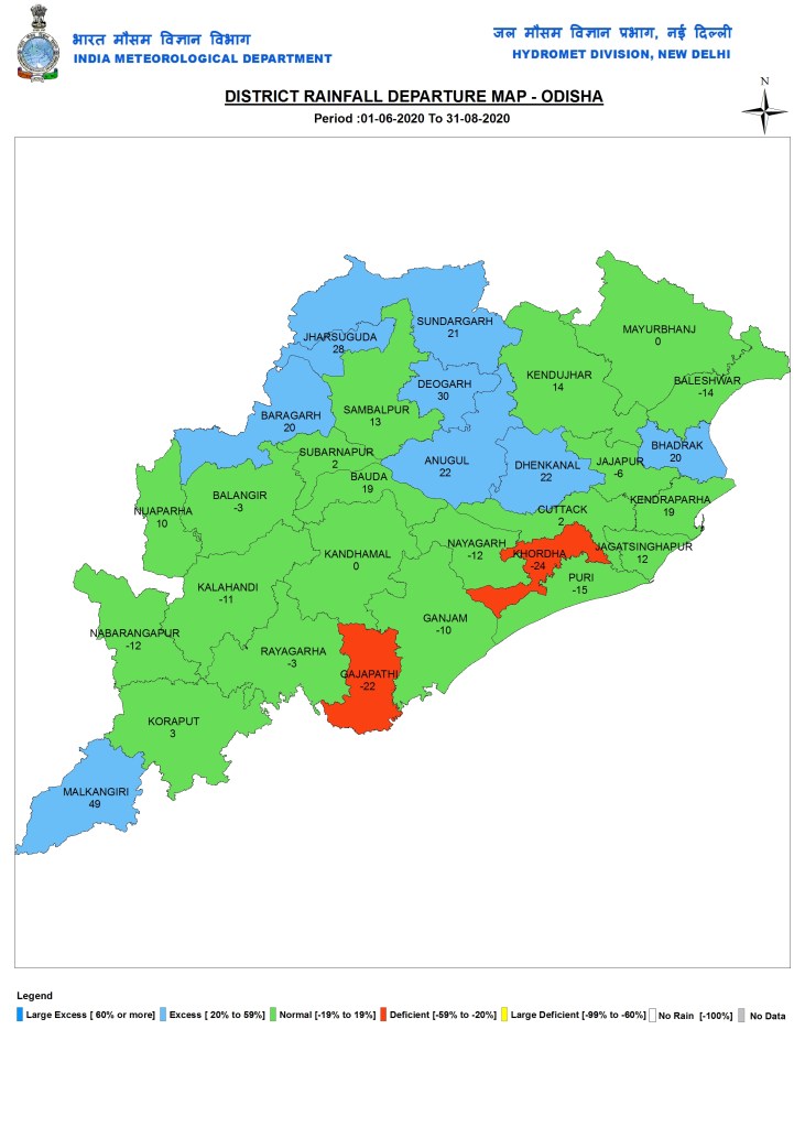
Odisha
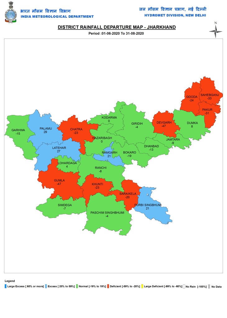
Jharkhand
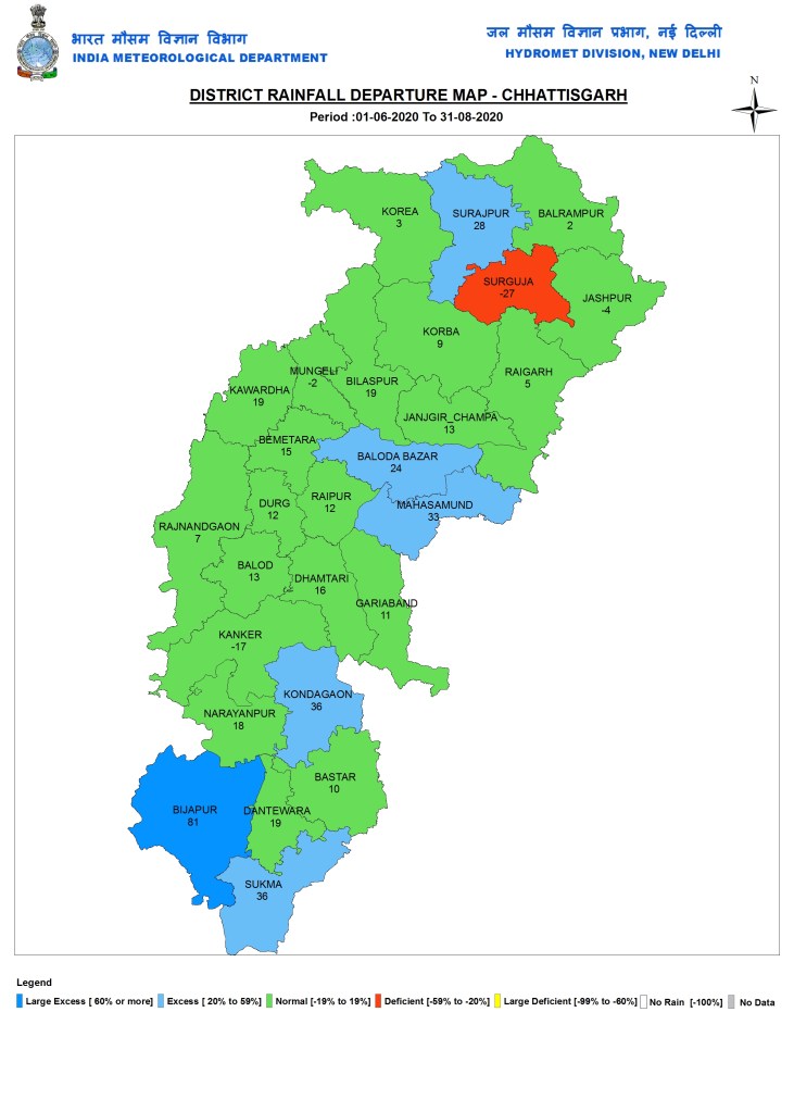
Chhattisgarh
SOUTH INDIA
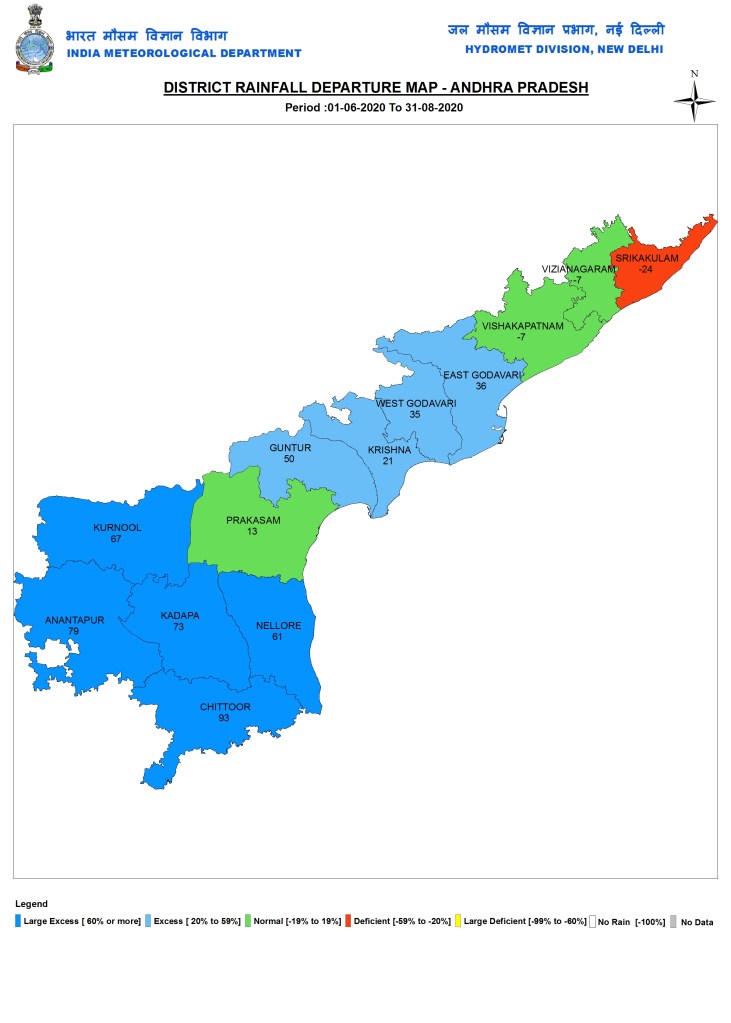
Andhra Pradesh
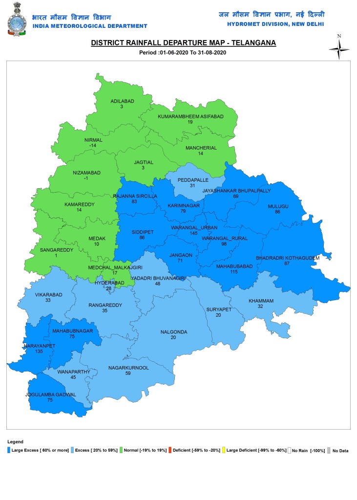
Telangana
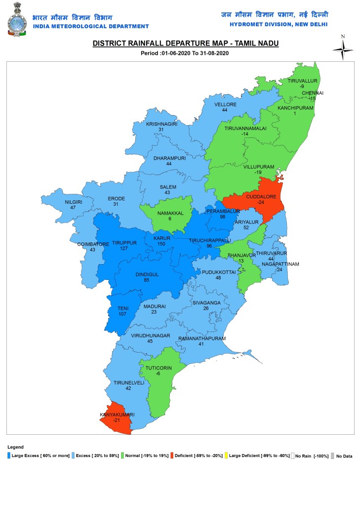
Tamil Nadu
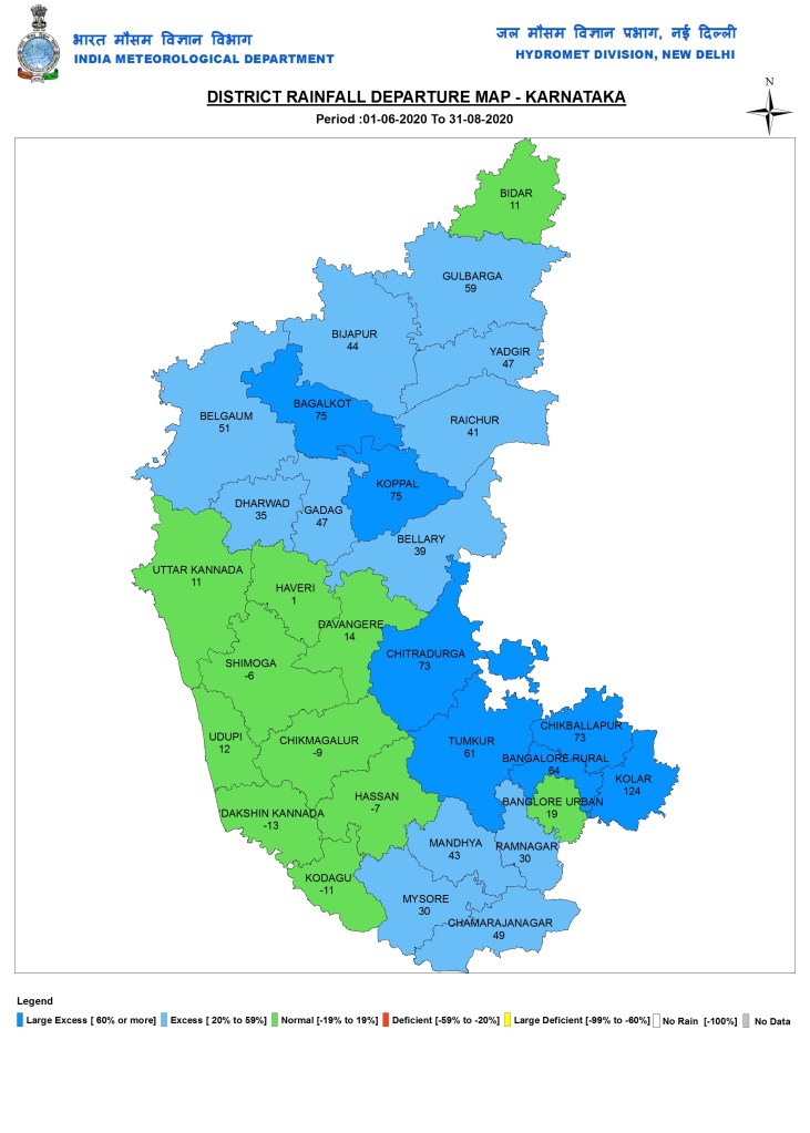
Karnataka
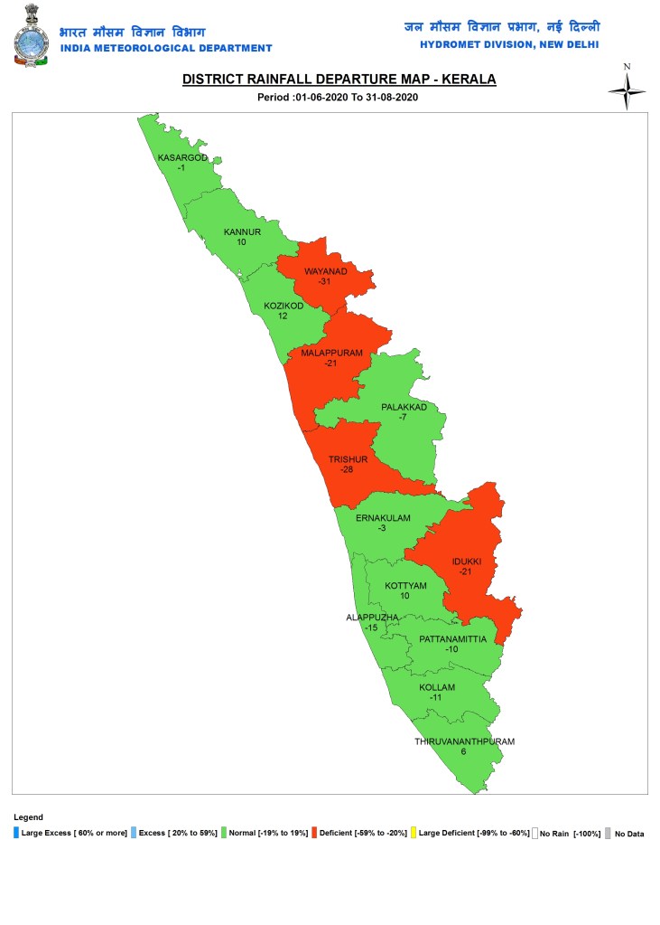
Kerala
WEST INDIA
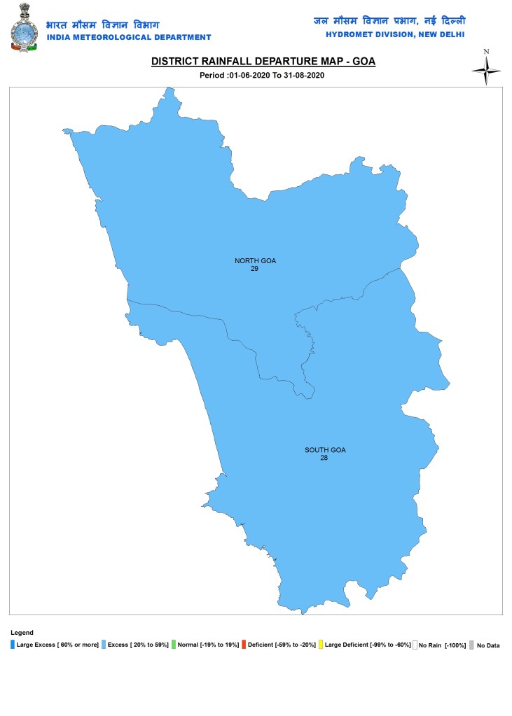
Goa
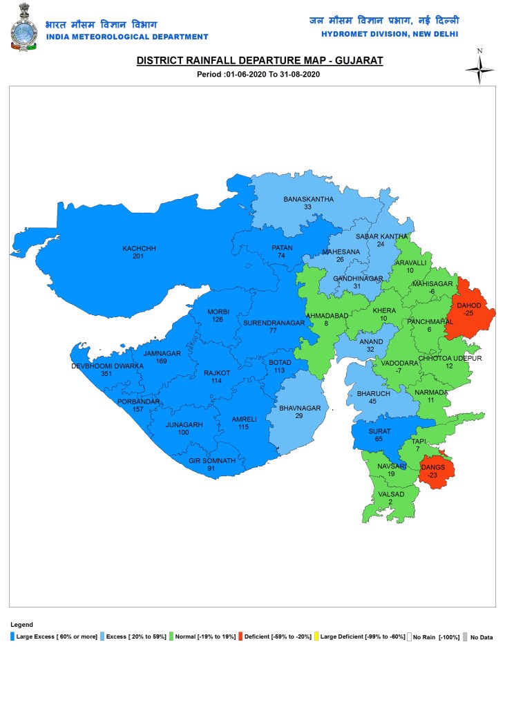
Gujarat
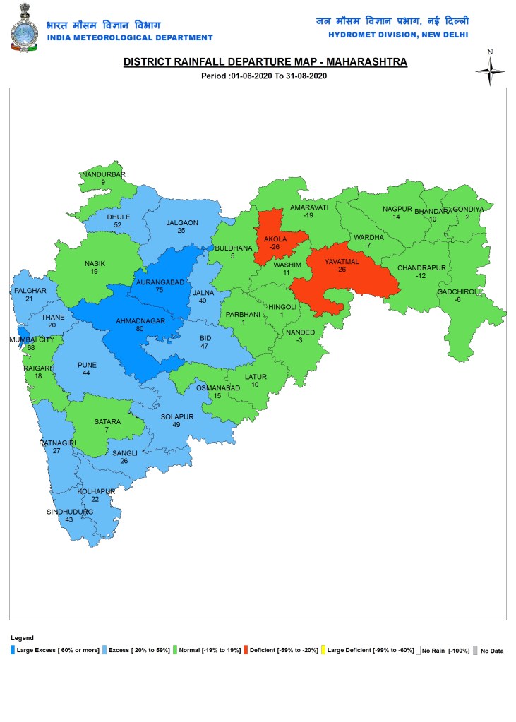
Maharashtra
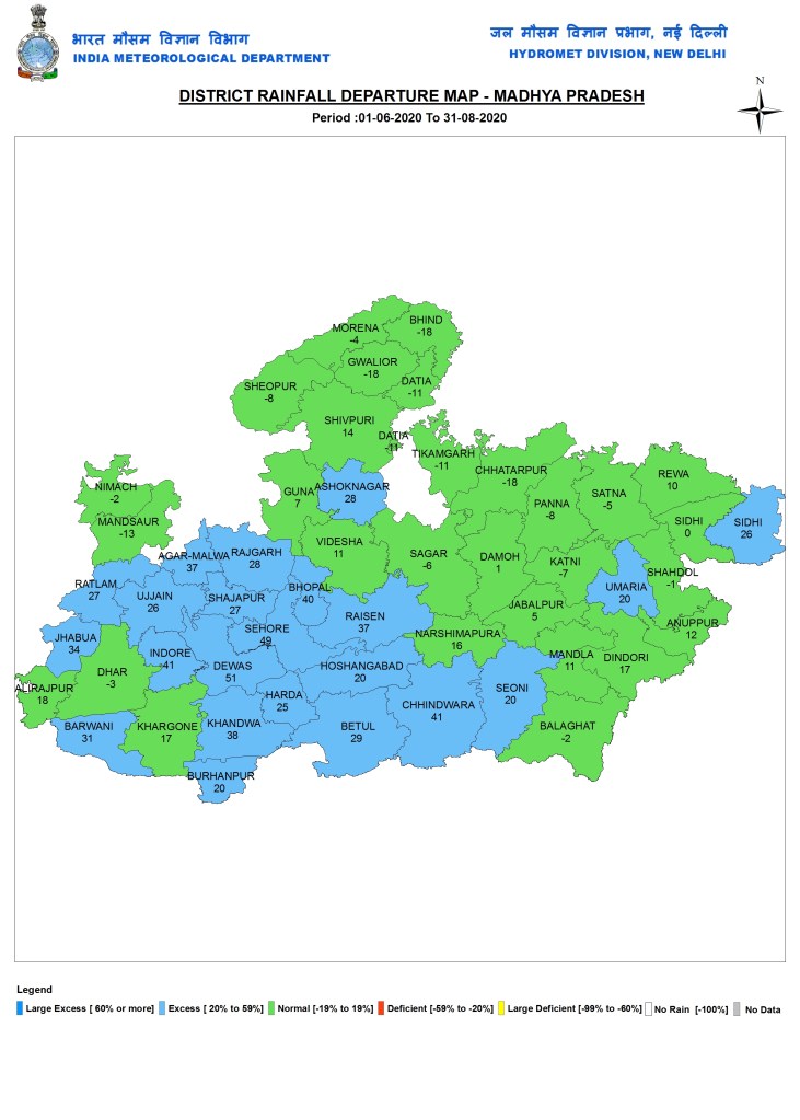
Madhya Pradesh
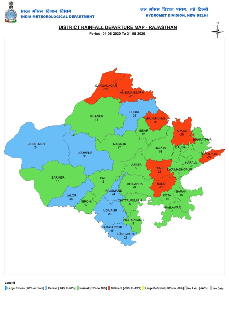
Rajasthan
NORTH INDIA
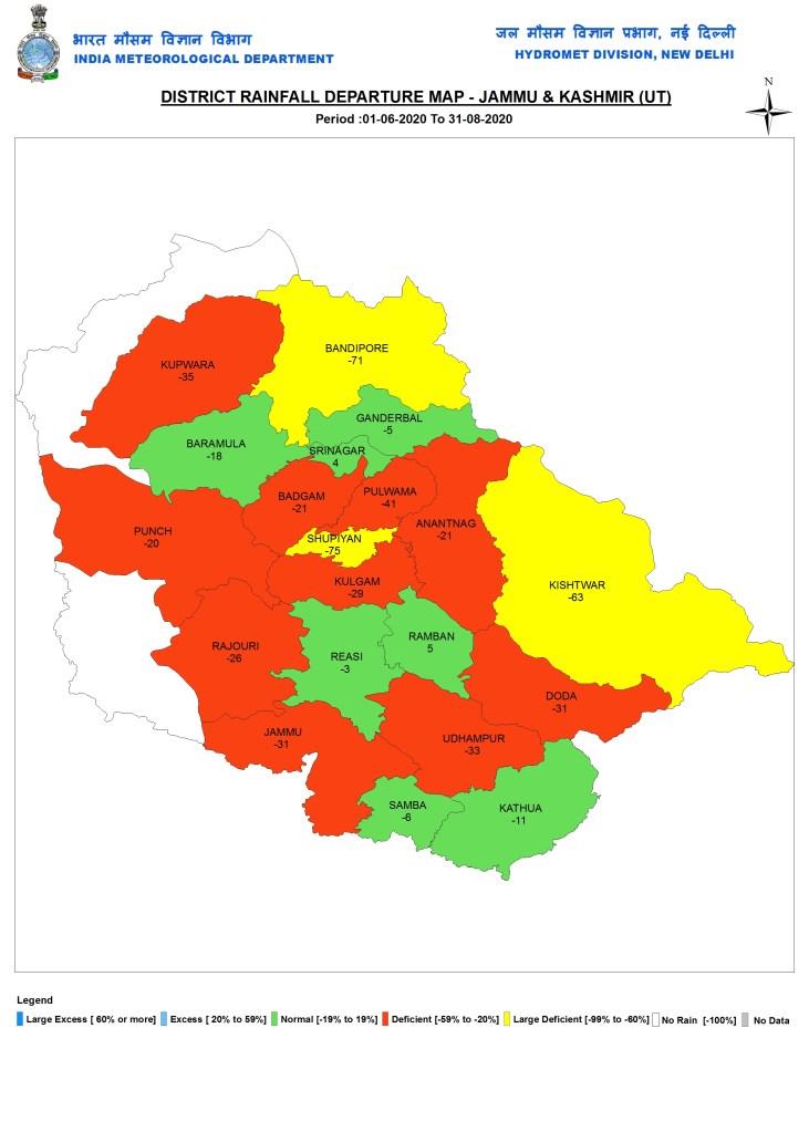
Jammu & Kashmir
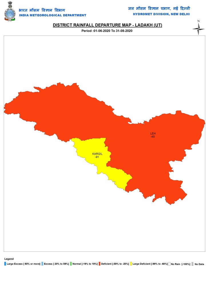
Ladakh
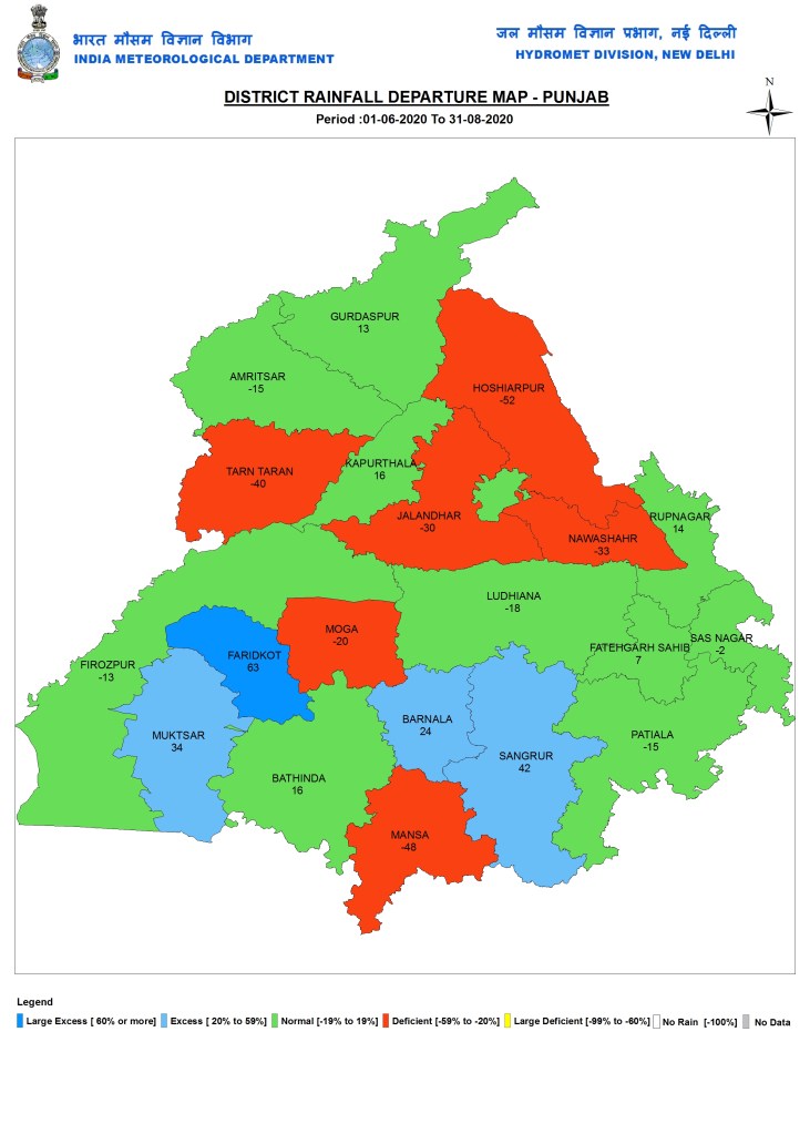
Punjab
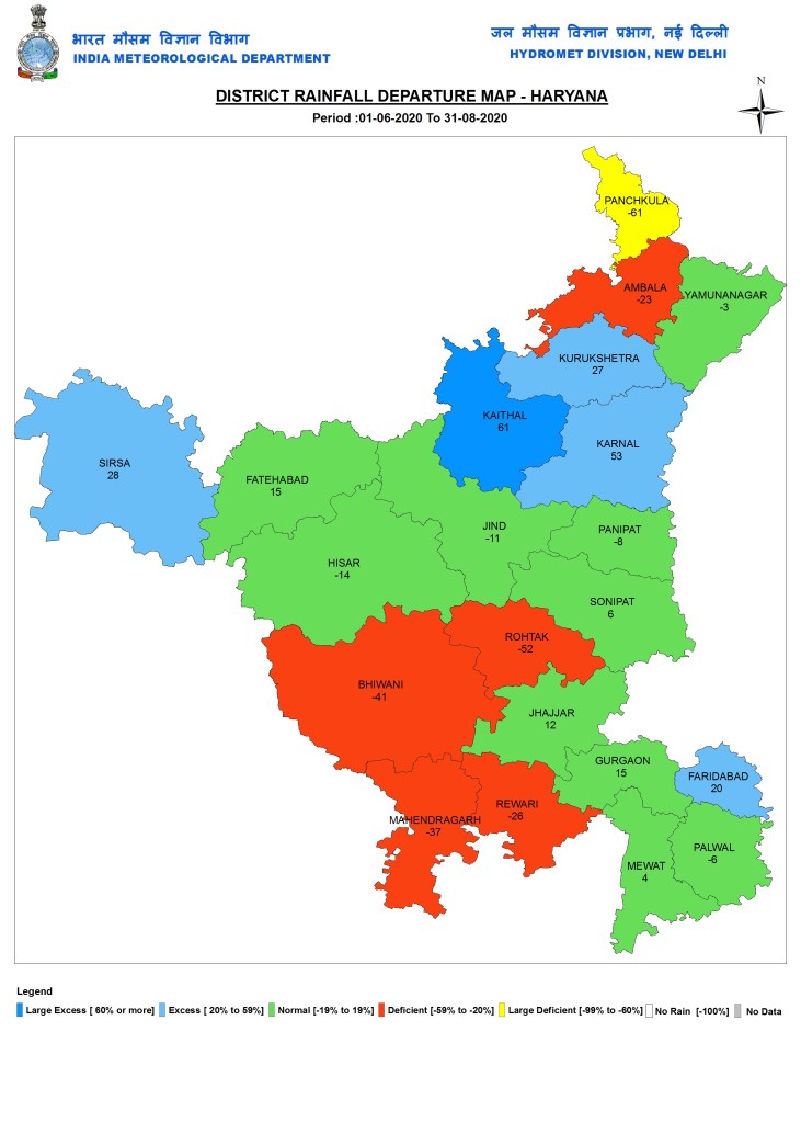
Haryana
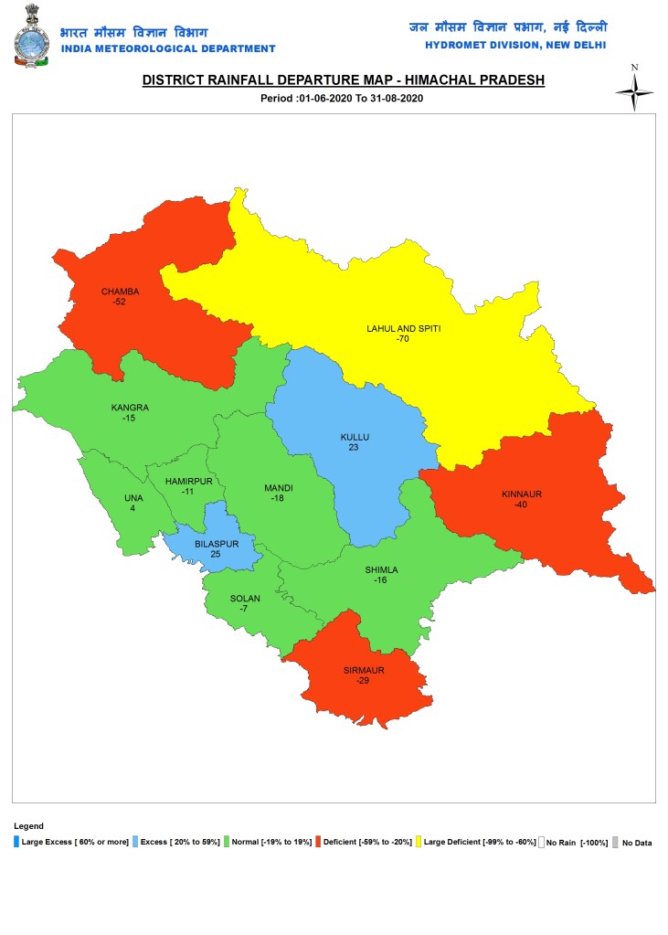
Himachal Pradesh
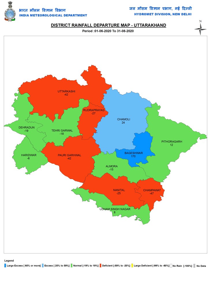
Uttarakhand
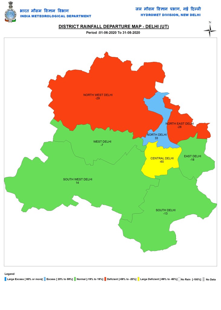
Delhi As can be seen from the map, North West Delhi where SANDRP office is located, has reduced the deficit, but continues to remain 29% below normal in rainfall so far.
SANDRP (ht.sandrp@gmail.com)
