More than 50 people including tribal groups, social activists, water experts, ecologists and wildlife experts, academics came together for a brainstorming workshop about Dams coming up for Mumbai Region. The meeting was organized by South Asia Network on Dams, Rivers and People, Shramik Mukti Sangathana, and Jalbiradari.
Seetaram Shelar of YUVA at Meeting on Dams round Mumbai Photo: SANDRP
About 12 dams are planned or are under construction to satisfy the increasing thirst of the Mumbai Metropolitan Region (MMR). All of these dams fall in eco-sensitive region of the Western Ghats. They will together submerge more than 22,000 hectares of land, including nearly 7000 hectares of forests, lakhs of trees and more than 750 hectares of Tansa Sanctuary. They will affect a minimum of 100,000 tribals who depend on the forests and their ancestral lands for livelihoods. These dams include Kalu, Shai, Balganga, Susari, Khargihill, Bhugad, Pinjal, Gargai, Middle Vaitarna, Barvi and Poshir, among others. These are in addition to the dams already constructed for MMR water supply.
Tribals and other affected groups of Thane and Raigad region have been strongly opposing these projects. Most people in Mumbai seem unaware of their struggles or impacts of these projects.
Most of these dams are escaping the social and environmental impact assessments and management plans, environment clearance requirements, environmental monitoring or public consultations due to blunders in environmental impact assessment notification of Sept 2006, which excludes domestic and industrial water supply projects from environmental clearance process. It signifies the environmental illiteracy of the officials and ministers at the Union Ministry of Environment and Forests. In spite of repeated letters, and acknowledging that this makes no sense, they have refused to change it.
Local protest against Pinjal Dam near Jawhar which can submereg 11 villages and 2000 hectares of forests Photo: SANDRP
MMR has not done any sort of options assessment before pushing these projects and cursory review show that many options exist. At the city or Region level, there is no shortfall in water supply currently and the existing problems are due to inequitable, non-transparent, non-participatory and wasteful water governance in MMR. Municipal corporations under the MMR which are pushing new dams do not treat even 15% of their sewage. Bhiwandi Nizampur & Vasai Virar Corp do not treat ANY of their sewage. The Mumbai Region has no estimate of its rainwater harvesting potential, and there is little effective action in this direction despite high rainfall. Water supply and distribution losses are over 30%. Local water sources like rivers, lakes and wells are being destroyed by pollution and encroachments. There is no interest in democratizing governance of MMR water sector.
The meeting resolution urged the MMR region to address these issues first, which would lead to sustainable water supply to the city and suburbs. Konkan Irrigation Department which is constructing most of these projects has violated several laws related to tribal and forest rights, environment, forests and resettlement and has been mostly favoring a single contractor, illegally.
The meeting also strongly urged the MMRDA, MCGM, Municipal Corporations of MMR, Maharashtra government, Union Ministry of environment and forests, Maharashtra Forest Department, National Board of Wildlife and all others concerned to ensure that following steps are taken up urgently and in a credible way:
Þ Undertake thorough options assessment for Mumbai’s (and also for other cities of MMR) water needs which includes groundwater recharge and sustainable use, protect and use local water sources, rainwater harvesting, sewage treatment and reuse, plug leakages, improve water supply efficiency, take up systematic demand side management measures etc.;
Þ Undertake Environmental and Social impact assessments for all the dams coming up for Mumbai Region;
Þ Take immediate action against KIDC for violating multiple laws while bulldozing ahead with projects and MMRDA for funding projects in the absence of clearances;
Þ Respect people’s protests and Gram Sabha resolutions against displacement, deforestation and their refusal to give permission for these projects;
Þ Take strong penal action against the officers and the contractors who have displaced Adivasis illegally;
Þ Not resume any work or planning for any project before the above is done, stop work on projects in the meantime;
Þ Change the EIA notification to ensure that all large dams are included for environment clearance, public hearings and EIA requirements;
Þ Immediately institute a credible Cumulative Impact Assessment of the projects already constructed and advanced in implementation;
Þ Institutionalize decentralized, democratic governance of water sector in MMR from bottom to top.
Forests in the Western Ghats are Mumbai’s and MMR’s lungs. They are the watersheds of rivers and water sources like Tansa and Bhatsa and naturally purify Mumbai’s & MMR’s drinking water. Rich tribal culture of Thane and Raigad is a shared heritage of Mumbai and we have no right to displace the tribals or destroy their livelihoods. This destruction in Mumbai’s backyard must be stopped.
Submergence of Gargai Dam Photo: SANDRP
However, Mumbai and MMR are not the only urban areas guilty of destroying the environment, forests, biodiversity and livelihoods of lakhs of poor people. Delhi, already having more per capita water than European cities like Paris, Amsterdam or Bonn, is asking for Renuka, Lakhwar and Kishau dams in upstream Yamuna basin, while destroying the YamunaRiver for all downstream areas. Ahmedabad is using water from the Sardar Sarovar Narmada dam that was meant for the people of Kutch and Saurashtra and which has led to displacement of over two lakh people. Jaipur is taking water from Bisalpur dam. Farmers for whom it was made are not getting the water and some lost their lives in police firing, while demanding that water. Massive diversion of Nethrawathi water is proposed for Bangalore and other areas, destroying the pristine Western Ghats forests. 3 farmers died in police firing near Pune when a huge farmers rally was protesting against diversion of water from Pawna Dam to the Corporation of Pimpri-Chinchwad.
Headwaters of Netravathi and Gundia threatened by Yettinahole Diversion Photo: Parineeta Dandekar, SANDRP
As Planning Commission member Dr Mihir Shah recently wrote, the 12th Five Year Plan proposes paradigm shift in Urban sector sector: “Each city must consider, as the first source of supply, its local waterbodies. Therefore, cities must only get funds for water projects, when they have accounted for the water supply from local waterbodies and have protected these waterbodies and their catchments. This precondition will force protection and build the infrastructure, which will supply locally and then take back sewage also locally.”
The trouble with this urban water sector reform agenda is that close to two years into the 12th Plan, we still do not see it being implemented anywhere. We do not see any roadmap for its implementation. And yet the UPA government continues to fund solutions catering to only long distance supply-side measures like big dam projects for urban areas under the Jawaharlal Nehru National Urban Renewal Mission. In fact, of the first Rs 60 000 crores sanctioned for JNNURM, about 70% was for urban water sector, but do we see any progress in democratisation or even improvement of Urban Water Governance?
The hope lies with clean, transparent and participatory governance. Let us hope we see some change in this direction.
In a clever move initiated by the MOEF and assisted by Arunachal Pradesh Government, aimed at bypassing the need of the compulsory clearance from the National Board of Wildlife (NBWL), the Environment Ministry has slashed the protective zone around the hill State’s national parks and sanctuaries from the existing 10 km radius to an insignificant 25-meters in most cases (200 mts is for a very small stretch of Khanchengdzonga National Park).
This shocking move underlines Union Minister Veerappa Moily’s penchant for hydropower projects as he has chosen to override the report of the National Board of Wildlife, a constituent of the MOEF, in a bid to let at least six hydropower projects operating in Sikkim in gross violation of the NBWL clearance and orders of the Hon’ble Supreme Court of India. In October 2013, SANDRP’s published a blog titled “Hydro Power Projects Violating SC order in the Greenest State of India” on the report by NBWL members and its significance.
The notification has drawn tremendous ire of environmentalists and social activists from Sikkim, opposing major dams. “We have been demanding earmarking of the ‘eco-sensitive zone’ up to 10 kilometers radius from the protected areas under Supreme Court order, if the government itself ridicules NBWL’s warning report, manipulates its own laws, what can a citizen of democratic India say?”, said Tseten Tashi Bhutia, convener Sikkim Bhutia Lepcha Apex Committee (SIBLAC), which is fighting a legal battle against the Tashiding project in Sikkim High Court.“We strongly protest this notification of the MOEF and would respond officially as per the protocol, they can’t bulldoze their vested interest, damaging our fragile environment. Already a lot of damage has been done, we might take appropriate legal recourse after consultations, if the notification is not altered or withdrawn”, added Bhutia, speaking exclusively to this correspondent.
Projects within 10 kms boundary of Protected Areas in Sikkim From NBWL SC Members Report
SIBLAC along with another apolitical group Save Sikkim on September 28th, 2013 filed FIRs against Shiga Energy Private Ltd, developer of the 97 MW Tashiding hydro power project for alleged cheating, distortion of facts and violation of environmental norms and the SC order. This is in addition to an ongoing PIL at the Sikkim High Court. The proposed site is about 5 Km away from the buffer zone of the Khangchendzonga Biosphere Reserve, the project also falls within 10 Kms from the Fambongla Wildlife Sanctuary, as such; NBWL clearance needs to be obtained.
Several attempts by this correspondent, to contact the PCCF –cum-Secretary of the Forest and Wildlife Department of Sikkim Mr. Arvind Kumar to get the Sikkim government‘s official version on the controversy, remained unanswered. Under the orders of the Supreme Court(in the Goa foundation case of 2006), any project falling within 10 km radius of a national park or a wildlife sanctuary has to be endorsed by the standing committee of the NBWL unless a different site-specific protection ring is declared for each of these national parks and sanctuaries.
The members of the standing committee of the board had earlier submitted a report in August 2013, to the Ministry warning that at least six dams in the State were coming up without the mandatory clearance and Sikkim faced a Goa-like situation with rampant and illegal development of these dams likely to cause devastation just as unlawful mining had done in the coastal State.
Construction of the Teesta III project at Chungthang on the edge of Khangchendzonga National Park proceeding without SC-NBWL clearances. Note the extensive forest cover and large landslides at the construction site. From: SC NBWL Members Report
The report had said that the proposed Teesta V, and the ongoing Teesta III, DikChu, Panan, and the Tashiding hydroelectric projects were coming up without the statutory NBWL clearance.
Other hydropower projects of Sikkim that are being considered by the MoEF for clearances, and are operating in abeyance of the NBWL clearance, and are also close to the protected areas include: 63 MW Rolep HEP on Rangpo river in East Sikkim (5-6 km from Pangolakha and Kyongnosla WLS), 126 MW Ralong HEP (4.05 km from Kangchendzonga Biosphere Reserve and 1.8 km from Maenam Wildlife Sanctuary), 96 MW Chakung Chu HEP in North Sikkim (1.8 km from Kangchendzonga Biosphere Reserve), 71 MW Sada Mangder, 40 MW Suntaley Tar HEP, within 10 kms from Pangolakha Sanctuary) and 60 MW Rangit III.
Shockingly, the Ministry has now come up with a way to bypass the wildlife board by sticking to the apex court orders merely technically but not in real terms. The court order has said the 10 km protective zone (technically called the Ecosensitive Zone) would be enforced unless the Centre and the State government notified a different perimeter based on scientific assessment. The MOEF has discreetly put out draft notification to reduce these protective zones around four sanctuaries and Sikkim’s lone national park from the existing 10 km to a negligible 25-200 metres, to be effective from April 2014.
The ministry of environment and forest sought public opinion on this move within 60 days so that the ministry can look into suggestions and complaints, if any, relating to extent of the eco-sensitive zone during the period. The proposed ban under the order will come into force after expiry of the 60-day deadline.
“Moves like this makes one wonder as to what would become the fate of the law abiding citizens of this country; when the government elected by the people are resorting to such blatant violations of the existing laws of the land, and are circumventing them to serve vested interests, it is a shame at the least”, reacted Affected Citizens of Teesta(ACT) president Tseten Lepcha, while speaking to this correspondent exclusively. The ACT had created a stir by sitting on a relay-hunger strike during 2005-6, for over a year protesting against the onslaught of numerous hydropower projects operating in Sikkim in blatant violation of all laws. We will take up the issue officially, reiterated Lepcha.
“In a letter dated April 13th 2011, the then Sikkim additional principal chief conservator of forests- cum the chief wild life warden, Mr. N T Bhutia had written to the DG Forests MOEF, reiterating the states’s commitment to announce the 6 ESZ around sanctuaries and the lone NP in Sikkim. That it would comply with the MOEF dictated revision of the perimeter of the ESZ, as is now evident was not mentioned. An RTI query to this effect is pending with the forest department.”
Soumik Dutta (duttauni@gmail.com)
Inputs from SANDRP:
This shameful attempt at regularisation is a complete mockery of Wildlife Clearance as well as ESA zonation process. The Draft notifications do not elucidate upon any justifications behind the extent of ESA or the process through which this was arrived at. This is clearly unacceptable and will not stand legal scrutiny
This shameful regularisation indicates that the MoEF is shielding the guilty projects which have violated EPA (1986) and WPA (1972), colluding with these projects, furthering environmental and cultural destruction in Sikkim.
This is entirely shocking and unacceptable. We urge the MoEF to: • Take back these draft notifications and take strict action against Government of Sikkim and projects which have violated SC orders • Disclose the process through which ESA for Sikkim was arrived at. • Disclose the justification used behind specific buffer zones around specific protected areas • Ensure that violators of the past will in any case be penalised.
Following the SC Orders and considering that: • Sikkim is the most species-rich state in India. • Sikkim falls in geologically fragile and seismically active zone • Communities of Sikkim have strong cultural and religious bonds with forests and region like Dzongu which is surrounding Khangchengdzonga BR,
MoEF should recommend that Sikkim undertakes a participatory process to identify ESA regions around PAs. Not only should the local population have a say in area of the ESA, but also activities allowed in the PA. Unless such a participatory process is devised, Sikkim should respect SC Orders of 10 kms buffer zone of ESA around PAs.
Excerpts from NBWL member Report, August 2013:
“…based on an examination of available information on legal compliances required for the above projects in the Teesta basin, we conclude that, with the notable exception of the Teesta IV project (which has currently approached the Standing Committee of the NBWL for clearance), none of the other projects listed above appear to have sought/obtained this compulsory SC-NBWL clearance, as mandated by the Honourable Supreme Court in the Goa Foundation vs. Union of India case of December 2006.
While we are fully aware that there are many more proposed/ongoing hydroelectric projects situated within the Supreme Court mandated 10-km eco-sensitive zone of wildlife sanctuaries and national parks in Sikkim, we have not been able to ascertain whether Supreme Court stipulations in their regard are being followed, or being violated, and if latter be the case, the MoEF should take due cognizance of the same urgently.
We further recommend that the Standing Committee direct the MoEF to write to the Government of Sikkim asking them to immediately investigate and submit a detailed report listing hydroelectric projects in Sikkim that are being constructed prima facie in violation of Honourable Supreme Court’s order of 12/2006. Based on the list provided by the Government of Sikkim, if it is indeed ascertained that the projects are proceeding in violation of the said Supreme Court ruling, we further recommend that the MoEF initiate action by asking the State Government to suspend ongoing work on those projects immediately and to direct user agencies to formally seek clearance for these projects from the Standing Committee of the National Board for Wildlife.” (Emphasis added)
“Independently, we recommend that the MoEF and the Government of Sikkim thoroughly investigate the circumstances under which the seemingly widespread bypassing of Supreme Court orders in the construction of dams within the 10-km eco-sensitive zone of Sikkim has taken place, fix responsibility for the transgressions and violations, and punish the guilty.” (Emphasis added)
“Finally, we base our recommendations by drawing a parallel between hydroelectric dams in the eco-sensitive zones of Sikkim and iron ore mines in the eco-sensitive zones of Goa. The coastal state, which is just half the size of Sikkim, had heavily pivoted its economy on iron ore mines, just as Sikkim has done with hydroelectric power. The landmark Justice Shah Commission Report observed in the case of iron ore mining in Goa that, “approvals have been granted in many cases… in the eco-sensitive zones without placing the project proposals before the Standing Committee of the National Board for Wildlife (p 190)”. The report went on to say that, “all mining activities should be stopped with immediate effect including transportation of ore for all mining leases where there is no approval or clearance of the Standing Committee of the NBWL and are falling with 10 km of eco-sensitive buffer zone (p 191)” We believe that much of the Summary and Recommendations section of Justice Shah’s report (pp. 189-200) is extremely relevant to the case of the hydroelectric dams in Sikkim, and request that any committee constituted to examine hydroelectric dams in the eco-sensitive areas of Sikkim, pay close attention to this report.” (Emphasis added)
Bahut kathin hai dagar chunav ki; kyo bhar lau pipe-link se ye mataki….
Hype vs Reality of Narmada Kshipra Pipeline Project
The Narmada Kshipra Simhastha Project is to be dedicated to the people of Malwa by former deputy Prime Minister L K Advani on Feb 25, 2014. Significantly, it is happening in absence of BJP’s Prime Ministerial candidate Narendra Modi.
The full page advertisement (going on daily during Feb 23-25, 2014 at huge public expense) and the hype that is being created by the Madhya Pradesh’s BJP government around pumping of around 5000 litres of Narmada water per second from a small Sisalia tank through 47 km long pipeline involving four stage pumping and releasing in the bed of dry KshipraRiver needs to be put in correct perspective. Madhya Pradesh government calls it river linking that too “the first-ever river linking project of the country” (see Madhya Pradesh Govt press release dated: Jan 9, 2013[1]). Such claims are not only a fraudulent presentation, possibly aimed to create a hype in view of the upcoming elections, but are factually wrong in many ways. In MP itself, Indore and Bhopal [both outside Narmada basin] have been getting water from Narmada river through such pipeline schemes for many years, Indore is now getting water through third phase of the scheme). More importantly, the project will not be able to deliver most of the benefits it claims.
Dewas district collector Umakant Umarao explaining in Jal Khet film how RWH is the best option for the region and showed this on ground
The hype The Madhya Pradesh government claims this is “Making possible what seemed impossible”. It is not clear since when has pumping 5 cumecs water through piple-line become impossible in India. It is claimed to be “Realizing the dream of former Prime Minister Shri Atal Bihari Bajpeyi” (wrong spellings in the official MP govt advertisements). It is not clear when did Mr Vajpayee say that it was his dream to achieve pumping of some water through 47 km long pipeline. The project achievement, the advertisement claims: “First phase of restoring Malwa’s legendary prosperity successful”. This claim actually takes the cake and much more! What happened to Malwa’s legendary prosperity? Did they need piped water from another basin for that? How can such a limited quantity of water from another basin at huge cost achieve that?
Some over-enthusiastic MP government officials are claiming (see press statement dated Nov 27, 2012) that this project will also link Narmada with Ganga and some water from the project will go right upto Allahabad! It is just god’s grace that they did not claim it will also help Bangladesh in achieving greater food production!
A farmer of Malwa describing the problem and solution, the result can be seen in the background, from film Jal Khet
The reality But first let us understand what this project is about. The water that will be pumped from Sisalia tank will reach there from NarmadaRiver: through one of the right bank canals of Omkareshwar dam. So the path of the water will be: Narmada river – Omkareshwar dam – common water carrier canal – right bank canal – Rising main of Omkareshwar project Phase IV – Sisalia tank – pump station (PS)-1 – Rising Main (RS pipe) 1 – BP Tank 1 – Gravity Main (GM) 1 – PS-2 – RM-2 – PS 3 – RM 3 – BPT 2 – GM 2 – PS 4 – RM 4 – tank – (Ujjaini village) Kshipra river. Secondly, how much of the water that is released from the dam will reach the consumers? There are no assessment of this in public domain, but considering the long path of the water even after reaching the Kshipra riverbed and considering huge evaporation losses and seepages into the dry riverbed and aquifers below, only a small fraction, less than a quarter of the water pumped, would reach the consumers.
The project claims it will provide drinking water to Dewas and Ujjain cities, over 250 villages along Kshipra river, supply water to Ujjain, Dewas and Pithampur and also recharge groundwater! Showing true intentions, agreements have already been signed with Delhi Mumbai Industrial Corridor for providing 90 MLD (or 25% of the 362 MLD water to be pumped in this scheme) water from this project to Pitampur industrial area in Malwa at the rate of Rs 26 per KL. That will leave very little water for other claimed objectives. Who will get how much water is a matter of assessments which are not in public domain. Moreover, in absence of credible wastewater treatment system and governance in place, more water for industry would mean more untreated industrial effluents into the Kshipra river, worsening the problems for the river and the people. (See: http://www.patrika.com/news/narmada-shipra-river-link-to-pithampur-sanctioned-by-dmic/958548, http://daily.bhaskar.com/article/MP-IND-special-purpose-vehicle-proposed-for-rs-200-cr-pithampur-water-supply-plan-4236793-NOR.html
)
An engineer explains that ponds in Malwa would certainly fill up even at 400 mm rainfall, from film Jal Khet
Unaffordable cost of water Thirdly, this pipeline project involves pumping through 47 km long pipes that would raise the elevation of water by about 348 m from Sisliya (228 m) to Ujjaini (576 m) through pipelines of 1.8 m diameter. This involves use of at least 27.5 MW of power. The power bill of this project would be Rs 118.92 crores per year as per the MP Govt Public Relations Officer (PRO), power cost would be Rs 9 per KL for the pumping of 362 MLD (Million Liters per day). Even if 35% (very optimistic assessment) of the water were to reach the consumers, just the power cost of the raw water reaching the consumer would come to Rs 24 per KL (kiloliter). If we add the cost of maintenance, replacement cost, staff costs for the Narmada Kshipra Pipe Project (NKPP) and also the cost of treatment, distribution of the water to the consumers, the cost of the water that would reach consumer will multiply, would surely go much above Rs 50 per KL. Compare this to the water rate of Rs 5-10 per KL that average urban consumer in India is paying. Which of the rural or even urban consumer is going pay this kind of water bill? Here it may be added that the Rs 432 crores of the project cost is not even included in this water rate. More importantly, do we need this project for drinking water needs of Malwa? Such high head pumping schemes have proved unviable elsewhere too.
It maybe added here that Kshipra river is today in highly polluted state[2]. About 4 lakh liters of polluted water is entering the Kshipra river from Dewas city and industries, affecting villages of Ujjain, Dewas and Indore, and also Hirli dam and even groundwater. The Madhya Pradesh government has completely failed to ensure that such illegal dumping of polluted water is stopped. Now pouring this pipeline water to the polluted Kshipra water would only mean more quantity of polluted water.
4500 ponds constructed in just four years, storing 100 MCM water, more water than what Narmada Kshipra pipeline will bring here at much higher expenses: Jal Khet film
Inappropriate use of Omkareshwar Project’s water and funds The administrative approval for the project dated Oct 19, 2012 says the cost of the project will be taken from Omkareshwar Project Unit II (Canals). Now this raises many questions. Firstly, it is clearly wrong to include the cost of the NKPP in the Omkareshwar canal cost. Secondly, this component was not included in the Omkareshwar project as approved by the Union Ministry of Environment and Forests, Central Water Commission or the Planning Commission. Adding this component to the Omkareshwar project would change the scope of the project and which should entail a fresh clearance from all these authorities. Thirdly, the Omkareshwar project canals get significant funding from Union of India under AIBP (Accelerated Irrigation Benefits Programme) and using that project money for such completely new component is clearly wrong, also from audit and accounts point of view. We are sure CAG will take due note of this and disallow such practices.
Similarly, diversion of water from Omkareshwar canal has angered the farmers and they have filed an Interlocutory Application in Indore bench of Madhya Pradesh High Court, asking for stay on inauguration of the project. While the HC has not provided a stay, it has remarked that command area of the project cannot be changed. As Rehmat of Manthan Adhyayan Kendra said, these projects are also creating new conflicts, which also happened in case of Veda dam in NarmadaValley. More conflicts are likely to come up in future.
A farmer in film Jal Khet explains how Malwa villages could prosper without the Narmada waters
No Impact Assessments, no participatory process There has been no social or environmental impact assessment for this project at any stage. The project also escaped need for environmental clearance using the loophole (which has been questioned for years now) that drinking water projects do not need environmental clearances and hence environmental or social impact assessment or management plans or monitoring or public consultations. In fact, since the project was funded from Omkareshwar project fund, use of that loophole itself is fraudulent. From the statements of the Madhya Pradesh Chief Minister Shri Shivraj Singh Chouhan, and former deputy Prime Minister L K Advani and others, they seemed quite sure about the project being beneficial. Why then they did not have any participatory processes and impact assessments? Incidentally, Mr Advani laid the foundation stone for the project on Nov 29, 2012, strangely at Ujjaini, where no significant work of the project was to happen, leave aside starting of the work where normally, foundation is laid! Did the project have inappropriate foundation?
A screenshot from film Jal Khet showing a rainwater harvesting structure in a village in Dewas district in Malwa
That the project had adverse impacts was apparent even from Govt of MP Press statement of March 21, 2013, which said: “Families who are growing water melons for generations at Kshipra river’s originating point[3] Sisliya reservoir urged Shri Agrawal to give them assistance since they will no more be able to grow water melons due to all-weather filling of Sisliya reservoir due to the project and their livelihood will be affected. Shri Agrawal assured to consider these families’ demands sympathetically.” It is not clear, what decision, Mr K L Agrawal, then chairman of NVDA, took about these and other affected people, it has not been brought out in public domain. There was also forest land affected in construction of the pipeline. There will also be issue of huge energy footprint and hence carbon foot-print of this water. These are only a few of the environmental issues related to the project.
The farm pond movement also led to reduction in electricity consumption, reducing carbon footprint, but the govt scheme is actually going to increase it manifold!
The project was in fact approval through a hurried process without any involvement of either the people of the NarmadaValley or the people of the Malwa. The introductory note[4] of Govt of Madhya Pradesh’s Narmada Valley Development Authority claims: “The Malwa region of M.P. had been reeling under acute water scarcity since about 3 decades. The ground water was plummeting at fast pace and experts had opined that if such conditions prevails, the whole Malwa region shall transform into a desert. The life line of M.P.-Narmada was the only option to feed the water to Malwa…” Similarly, MP Information Department Press Release[5] says: “…the Chief Minister concluded that the crisis can be solved only through Narmada water.” Amazing claims, since there are areas within Malwa that are even today have no water shortage, as can be seen from the screenshots from the film on water harvesting work done in Malwa. However, more importantly, is there anything to substantiate this standard “only option” theory? Why did the government not have a participatory process for arriving at such a conclusion? Also, if Malwa was once prosperous, without needing water from outside, why has it come to this stage now? Why not tackle those reasons? Why did Kshipra, a perennial, sada nira River became, seasonal, polluted River?
As Planning Commission member Dr Mihir Shah recently wrote, the 12th Five Year Plan proposes paradigm shift in Urban sector sector: “Each city must consider, as the first source of supply, its local waterbodies. Therefore, cities must only get funds for water projects, when they have accounted for the water supply from local waterbodies and have protected these waterbodies and their catchments. This precondition will force protection and build the infrastructure, which will supply locally and then take back sewage also locally.” The NKPP clearly violates this norm.
The chief minister, through full page advts is now projecting himself as Bhagirath, but the Malwa communities already got it from UN in 2012, from film Jal Khet
Story of proven alternative: Jal Khet However, this conclusion of There Is No Alternative (TINA for short) is typical phrase used by authorities to shut down any questions or debate. There are many Options for the Malwa region, but to see something that has been proven by the people of Malwa on ground, see a 25 minute film Jal Khet by Anjali Nayar[6], done for the International Water Management Institute, the film synopsis says: “In this awe-inspiring tale of innovation and courage, watch how the district administration joined forces with the villagers to bring water to this arid land. Soon the entire district would come under the throes of change in a massive effort to resolve its own problems, and many other fascinating and unforeseen changes would be discovered to have accrued. The perseverance of these people is a testimony to the enormous human capacity for resourcefulness and resilience.” Note that the district administration and the state were involved in this effort! Even the United Nations recognised this Bhagirath Krishak Abhiyan as best practice of water conservation for food security, as recently as in 2012. There should be no doubt that there are better alternatives than the Narmada Kshipra pipeline project.
The Bhagirath Krishak Abhiyan work was simple: create farm ponds in Dewas district villages in Malwa that will harvest rainwater and provide source for groundwater recharge, irrigation and drinking water. The scheme started on a slow note, but has picked up over the years and has led to construction of over 4500 ponds, recharging groundwater, increasing water and food security and making the people so confident that they say they will never have water shortage. The biodiversity in the area has increased, with lots of birds and some wild animals too coming to the area. While there could be some questions about the claims of the district collector and other government officials, there is little doubt that if such works are implemented with honesty and participation, they can bring significant change.
People started celebrating birthdays of talab and death ceremony of the tubewells in Malwa, from film Jal khet, but MP govt seems hell bent on imposing the pumps on the people
Is this Interlinking of Rivers? Is this part of ILR? The whole hype bringing in Vajpayee dreams etc seems designed to imply that the NKPP is part of the controversial and discredited interlinking of Rivers proposal. This is clearly far fetched and a major stretch on the credulity of all concerned, considering the scale, manner and cost of the ILR compared to a water pipeline project like NKPP. While it does involve transfer of some water from one basin to another for drinking water and the NKPP, like the ILR itself is of seriously doubtful justification, optimality, desirability and sustainability, there can be no comparison of NKPP with the ILR. Moreover, in ILR scheme of things, Kshipra, being part of Ganga basin, is surplus basin, and Narmada, claimed to be a deficit basin, is supposed to get water from Par and Tapi rivers! It seems we are seeing a case of Ulti Ganga here too, compared to ILR!
Watch the confidence of the people: No drinking water shortage EVER! (Jal Khet film)
But than MP is not new to working at cross purposes with the ILR project. It already did that in case of Mohanpura[7] and Kundalia major irrigation projects in Chambal basin in recent months. Both projects are part of PKC (Parbati-Kalisindh-Chambal, one of the five prioritized links of ILR) link of the ILR project, but MP is going ahead with the projects independently, jeopardizing the ILR link. And the Central Water Commission is in fact supporting MP in these machinations.
Model of sangam tirth from NVDA website
Next phase of Narmada Malwa link? The Madhya Pradesh government is saying that the NKPP is only phase 1 of a larger programme. In next phases, they hope to transfer water from NarmadaRiver to other tributaries of ChambalRiver like the Kali Sindh, Parbati and Gambhir. Those phases will involve much bigger transfer, much bigger impacts, costs and implications. However, the MP govt on Sept 27, 2013, gave in principle approval to full Narmada Malwa link at the cost of Rs 2375 crores and asked the NVDA to prepare Detailed Project Reports for these phases. The next phase is making impossible sounding claims of achieving irrigation to 17 lakh ha, drinking water to 3000 villages and 75 towns, in addition to water for industries!
The whole farm pond movement has led to change in heart of some govt officials, from Jal Khet filmThe whole farm pond movement has led to change in heart of some govt officials, from Jal Khet film
No information is available as to how much water is to be transferred (earlier estimates said 3 Million Acre Feet of water is to be transferred, requiring over 550 MW of power), in what manner and with what impacts. MP govt is clearly most undemocratic, non transparent and non participatory. There is an interesting clause in the administrative in principle approval, however. It says the project operation and maintenance expenses must be recovered from the farmers! Rehmat of Manthan Adhyayan Kendra based in Badwani suspects this is because the project is part of the application to the World Bank. Going by the first phase costs, the O&M (Operation and Maintenance) costs of next phase are going to be only higher! But farmers have no clue what they are going to be asked to pay! In no state of India are the farmers charged to completely recover the O and M expenses. In this project, it would clearly be impossible, considering the much larger O&M costs of this project compared to standard gravity fed canals. Is this than a ploy to create a water source of urban and industrial areas?
Photo from NVDA, showing part of the pipeline
However, besides requiring the statutory impact assessments and clearances, the next phase will also have serious inter state implications for the downstream Gujarat state (even NKPP will transfer 158 MCM of water). Gujarat sees NarmadaRiver and the Sardar Sarovar Project on it as its lifeline. The large no of projects that MP is building and planning to build on Narmada[8] is going to have serious implications for Gujarat. With hydrological basis of the Narmada Water Disputes Tribunal, on basis of which Sardar Sarovar has been designed, already in doubt, Gujarat would be wary of this. Now with these Madhya Pradesh plans of transferring water outside the basin, Gujarat would be very worried! And so would Modi! But as recent Madhya Pradesh decisions have shown[9], Madhya Pradesh is least bothered about downstream states.
Another screenshot from Jal Khet showing why the govt official changed his views
In fact, while the discredited ILR is included in Modi’s Lok Sabha elections agenda, he seems to be missing from the scene at this major ILR moment (Modi also completely forgot about it during his trip to North East, it seems, but that is another story!). May be, Gujarat’s worries at Madhya Pradesh schemes are somewhere a reason for this? It is clear, to paraphrase the words of famous qawalli of yester-years (with apologies to poet Sahir Ludhianwi), Bahut kathin hai dagar panghat ki… Full page advertisements at public expenses, making unfounded claims about river linking are much easier!
Himanshu Thakkar, SANDRP [We would like to acknowledge the useful comments provided by Shripad Dharmadhikary and Rehmat from Manthan Adhyayan Kendra and Parineeta Dandekar from SANDRP on an earlier draft of this note.]
Annexure 1:
Time line of Kshipra Narmada Pipeline Project
April 8, 2007 A global call floated by NVDA to invite EoI for selecting a consultant for DPR
Aug 8 2012 The approval of project was given by the CM, to be completed in one year
Aug 27, 2012 Tenders invited
Oct 12 2012 Official sanction for Rs. 432 Crore was accorded
Oct 19 2012 Approval letter issued
Nov 5, 2012 Contracts signed (not clear who are the contractors)
Nov 29 2012 Mr. L K Advani laid the foundation stone
Feb 25 2014 Project to be dedicated to the nation after time over run of 25%
In recent years Madhya Pradesh has been on a Major Irrigation project spree. Some such projects at various stages of Environmental and forest clearance from MP recently include the Kundaliya Major Irrigation Project which will submerge nearly 8000 hectares of land and displace more than 8000 people, Kalisindh Major Irrigation project which will submerge nearly 5000 hectares of land and displace more than 2000 people, Mohanpura Major Irrigation project which will submerge more than 7000 hectares of land and displace more than 10,000 people and Bansujara Multipurpose project on Dhasan river (Betwa/Yamuna basin) which will submerge more than 5200 hectares (though the EMP of the project also done by WAPCOS (Water and Power Consultancy Services) then says that submergence will be 7476 hectares!) and displace at least 25,000 people .[i],[ii]
Projects in Narmada Basin Photo: NVDA
It is significant to note that Madhya Pradesh has one of the worst records of dealing with rehabilitation and resettlement of affected population. The state is struggling with several serious issues including mining (including illegal mining), sand mining, deforestation, alienation of tribals from their lands and rights, etc.
Affected tribal population of the Kharak Dam in Khargone District who were brutalised by police force for peacefully protesting against the dam Photo: The Hindu
It is also significant that it was at the behest of Madhya Pradesh Chief Minister Shivraj Chouhan that the clause of Social impact Assessment for Irrigation Projects and land for land compensation for affected population was deliberately removed from the new Land Acquisition Act 2013 (The Right to Fair Compensation and Transparency in Land Acquisition, Rehabilitation and Resettlement Act, 2013).[iii] How the Union government agreed to this blackmail is another question.
Chinki Project Latest addition to the long list of irrigation projects in MP is the Chinki Major irrigation Project in Narsinghpur District, proposed by the Narmada Valley Development Authority (NVDA). The project envisages irrigation for 89,029 ha of gross command area in Narsinghpur and Raisen Districts and 15 MW of hydro power generation. This project will affect more than 8000 hectares of land and affect a whopping 49 villages in Narsinghpur and Jabalpur according to its preliminary estimate. The project was awarded Terms of Reference Clearance by the EAC of the MoEF in its 58th meeting in June 2012. Recommending TORs (Terms of Reference, which is the first stage clearance) implies that the pre-feasibility study has been done thoroughly and the same is appraised in detail by the MoEF’s (Ministry of Environment and Forests) EAC (Expert Appraisal Committee) for River Valley Projects.
Narsinghpur in Madhya PradeshChinki Irrigation Project Plan
Shattering all these assumptions, we see that Chinki Multipurpose project has applied for TORs again and is on agenda for the 72nd EAC meeting being held on Feb 20-21, 2014 for strange reasons. A perusal of the new PFR (Pre Feasibility Report) exposes that the initial PFR and assumptions were flawed beyond imagination! The initial PFR was done by WAPCOS, which is under the Ministry of Water Resources of India. WAPCOS has been routinely churning out studies of substandard quality and seems to have a strong bias AGAINST environment and people. At the same time, this incidence raises a question mark over the so called “detailed scrutiny” that is done by the EAC of the MoEF while appraising a project. SANDRP studied the new proposal in detail and sent comments to the EAC, MoEF. Excerpts from the submission are given here.
Vast difference between two PFRs! The EAC had issued TORs to Chinki Project in its 58th meeting in June 2012 9PFR by WAPCOS). It is shocking to see the drastic changes between the two PFRs, considering that the dam site and command is staying exactly the same.Comparison of original project features with revised features reveals that the changes in project features include-
Catchment area decreased by more than half the original from 8,802 sq. km to 4,377 Sq. km
Dam height decreased from 35.5 m to 30 m.
Submergence increased more than twice from 3,250 Ha to 6,995 Ha
Land to be acquired nearly doubled from 4,150 Ha to 7,895 Ha
FRL decreased from 348 m to 340 m.
So with lesser catchment area, same dam location, lower dam height, the submergence area has more than doubled!!
These facts highlights how shoddy and unreliable the initial PFR done by WAPCOS and put forward to the EAC was, which was cleared by the EAC. This is a clear case of providing factually wrong reports to the EAC and MOEF and EAC and MoEF should take a clear stand on this instance and suggest necessary punitive steps against the Project Proponent and WAPCOS. This is yet another instance of shoddy work of WAPCOS.
It is high time that the EAC and MoEF blacklist WAPCOS for its conflict of interest and poor quality work. The EAC should not award a new TOR for this scheme, but should ask the MP government to change its EIA consultant, enquire into the reasons and persons responsible for this fraud and undertake necessary steps, including points raised below.
Cumulative Impact Assessment of Projects on Narmada should be mandatory before considering any more projects: The 58th Meeting itself noted the severe over-development of NarmadaBasin in Madhya Pradesh and beyond. The Chinki Multipurpose Project on the Narmada is sixth project after the Upper Narmada, Raghavpur, Rosara, Basania and Bargi Projects, amongst the schemes proposed in the upstream of this site on river Narmada. There are 7 existing projects in the Narmada Basin namely, Karjan (Karjan River), Sukta (Sukta River), Tawa (Tawa River), Barna (Barna River), Bargi (Narmada River) and Matiyari Major (Matiyari River). There are 7 on- going projects namely; Sardar Sarover on Narmada River, Jobat (Hathni River), Man (Man River), Upper Beda (Beda River), Maheshwar, Omkareshwar and Narmada Sagar on Narmada River. Besides these projects, there are 17 projects proposed in the basin!
Jal Satyagraha at Omkareshwar Dam Photo: The Hindu
Most of these projects are fraught with serious issues related to massive displacement, forest submergence, poor rehabilitation and resettlement, tribal issues and forest rights, reservoir fishing leases, legal and procedural issues, questionable benefits, lack of assessments or appraisals, etc. Considering these issues and also MoEF’s Office Memorandum of May 28, 2013, a cumulative impact assessment of all projects in Narmada, including the carrying capacity study should be carried out. This was recommended by the EAC also in its 58th meeting. However, this study should not be conducted by MP Govt or NVDA or WAPCOS, as this is a clear conflict of interest. The study should be carried out involving a multidisciplinary team of experts & local participation after TORs of the study are discussed in public domain. Only after such a study has been approved through a participatory process should other projects be considered. Looking at the severe impact of ongoing projects on Narmada and its people, this is needed to uphold the principle of sustainable development.
Madhya Pradesh’s extremely poor track record of rehabilitation & resettlement For almost three decades now agitations have been going on against MP Govt’s poor R&R. In one of the latest episodes, in Aug 2012, several affected people from Omakareshwar and Indira Sagar Dam undertook a Jal Satyagrah for 17 days together against absence of rehabilitation by MP Govt. The Supreme Court issued a show cause notice to MP Govt and again in 2013, the SC passed strictures against MP Govt when the latter tried to demand an undertaking from farmers affected by the Omkareshwar dam to the effect that they will not demand compensatory land under the rehabilitation policy[iv]. The MP Government has indulged in a number of unfair and unjust practices about rehabilitation and resettlement. It is to be noted here that at least 5 villages submerged by the Omkareshwar dam were not even envisaged to be submerged, indicating the blunders in planning, as well as insensitivity to the displaced population. Affected population of Omkareshwar had to risk their lives while protesting against the unjust ways of MP Government. MP govt’s injustice to SSP affected people is well known, the govt just refused to provide land to the displaced people. MP govt has also shown least concern of the impacts of such projects on the downstream states[v].
Again last year, oustees from Omkareshwar, Indira Sagar, Maheshwar, Maan and Upper Beda all protested together[vi] in Bhopal. The EAC should be aware of the past performance of MP govt in this regard, it should not give TOR clearance for Chinki project which will submerge nearly 8000 ha of land.
WAPCOS’s poor track record: Time and again WAPCOS reports have proved to be of poor quality, aimed only at pushing projects and not concerned at all with any objective or rigorous analysis of the impacts. We have pointed this out to the EAC several times, latest related to Kundaliya, Bansujara[vii] and Mohanpura[viii] Irrigation Projects in MP, and Kangtangshiri HEP in Arunachal Pradesh, but the EAC and MoEF do not seem to be bothered by these serious problems. NGT has indicated that problematic EIA agents need to be blacklisted, but MoEF is not ready to blacklist WAPCOS. Even the Forest Advisory Committee, a statutory body, has passed strictures against WAPCOS.
Plagiarisation: In Chinki Project too, section on wildlife and forests is in fact a description of Kanha National Park, which is far away from the project site. The section says: “At times one is surprised that wild life has survived so well despite the decades of senseless slaughter indulged in by the so called big-game hunters.” This seems unrelated to the project site and is plagiarized from a MP tourist website![ix]
No mention of cumulative impacts: The PFR makes no mention of evident cumulative impacts. The entire section on environmental impacts is superficial.
Discrepancies: The EAC had specifically noted the impact of 2 kms tunnel on forest land. At page 6 and 24, PFR mentions length of tunnel to be 66 meters. At page VII-4, the length of the same tunnel becomes 2.025 kms and at VII- 49, it becomes 2.5 kms!
Form I: In the section 9 on Cumulative impacts, the Form I says there are no cumulative impacts! This is absolutely incorrect when the hydrology, sociology and ecology of the Narmada basin is being changed by several existing, planned and u/construction dams in the basin.
Rainfall in command is nearly 1200 mm! Options Assessment needed: The PFR states: “The purpose is to develop irrigation to about 74273 ha culturable command area spread over the Narsinghpur and Raisen Districts to improve the irrigation system by supplementing limited and erratic rainfall.” (Emphasis added.) Now the average rainfall of Raisen and Narsinghpur Districts is 1200 and 1192 mm each! This is by no means limited. The taluks to be services by the project: Kareli, Tendukheda, Barely and Udaipura have good groundwater irrigation. Barely is the biggest Gud Mandi in India and also has a good network of canal irrigation. In such a situation, rainwater harvesting, groundwater recharge & watershed management should be the first options rather than large dams.
In fact, looking at the dependence on groundwater and the groundwater potential of the region, the Central Groundwater Board recommends creation of several percolation tanks.[xi]
Considering all these issues, we have requested the EAC not to award TORs to Chinki Irrigation Project unless Cumulative Impact Assessment is completed, thorough options assessment is done and a holistic view of human and ecological development in NarmadaBasin in Madhya Pradesh is adopted. We also expect the EAC to recommend action against the Project Proponent and WAPCOS for submitted factually wrong reports to EAC and MoEF.
[ii] Other recent projects include Pancham Nagar Multipurpose project in Ken River Basin requiring 2260 ha of land, Pawai irrigation project on Ken River in Panna district, Runjh irrigation project in Panna district, Datuni irrigation project in Dewas district, Sip Kolar River link project, Upper Ghogra irrigation project in Sehore district in Narmada basin and Tori Tank project in Badwani district.
Most of the major rivers in the North East India are largely free-flowing till date, which is a rarity in India and the world. Their basins are home to unbelievable ecological and cultural diversity. Main rivers in Arunachal Pradesh which form the mighty Brahmaputra are the Siang (the Yarlung Tsang Po), Dibang and Lohit, which meet at the trijunction to form Brahmaputra.
Massive hydropower projects are planned on these rivers in cascade. They will have irreversible destructive impacts on the society, forests, rivers, biodiversity, ecosystems, cultural identity and downstream Assam.
Hydropower Flood in Arunachal Pradesh Map: Neeraj Vagholikar, Sanctuary Asia
Siang River alone has 44 dams planned along its entire length.
Yes, 44 dams. You have read it correctly. At least 44 dams in one sub basin of Brahmaputra River Basin. This is what was meant by MOU virus as Jairam Ramesh described it.
Siang River Basin The Siang river originates in the Chemayungdung mountain ranges which nearly sixty miles south-east of Mansarovar lake in the Mount Kailash range in Southern Tibet at an elevation of 5300 m. A spring called Tamchok Khambab spills from the glaciers which later gather breath and volume to become the Tsangpo, the highest river in world. Tsangpo river flows 1625 km in Tibet parallel to the main range of Himalayas before entering India through Arunachal Pradesh.
Before entering India, the river passes Pi (Pe) in Tibet and suddenly turns to the north and northeast and cuts a course through a succession of great narrow gorges between the mountain Gyala Peri and Namjabarwa (Namcha Barwa) in a series of rapids and cascades. The river then turns south and southwest and flows through a deep gorge across the eastern extremity of the Himalayas with canyon walls that extends upward for 16,500 feet (5,000 meters) and more on each side.
The river enters Arunachal Pradesh near Gelling from where it is known as Siang. The total length of Siang River is 294 km till its point of confluence with Dibang and Lohit River. After entering India the river traverses approximately 197.0 km to join the Siyom river. From there the length of the river till Assam border is 86.3 km. Flowing further 10.6 km in Assam the river joins the confluence of Lohit and Dibang. From this point forward it flows as Brahmaputra river in Assam and traverses a distance of about 195 km up to the confluence of Subansiri river on its right bank. Further downstream it is joined by Kameng at Jamugurihat near Tezpur, after another 123 km. From here it travels for another 134 km up to Guwahati.
River Siang Photo from: Global Descents
The elevation of Siang river catchment area ranges from 90 m to around 5800 m. The total catchment area of Siang river from its origin to its confluence with Lohit and Dibang rivers is 251,521 sq km. Out of this 236555.7 sq km area lies in Tibet. The total catchment area of Siang river in India upto its confluence with Lohit and Dibang rivers is 14965.30 sq km.
A question arises here, what will be the condition of the 294 km long Siang river if the proposed 44 dams are being built on the river. The Siang river basin study has the answer for this which is actually alarming “Only 85.5 km (29%) of free flowing water regime of Siang river will be left out of its total course in India i.e. 294 km of lotic ecosystem will be converted into 208.5 km of lentic ecosystem altering the entire Siang river aquatic system which will adversely impact the aquatic biodiversity and seriously affecting fish populations and their migration behaviour.”(page 11.23)
Three dams on the main Siang will convert the free flowing river into a three-stepped reservoir, without ANY flowing length of the river! These dams alone will affect more than 18,000 hectares of forests! If all the dams are built, water level fluctuations in the downstream D’Ering Sanctuary will be more than 23 feet every single day in the winter and other non monsoon seasons!
82.26% of the Siang basin is under forest cover (more than 15,000 sq kms), it is rich in orchids (more than 100 species!), holds 16 species of rhododendrons, 14 species of Bamboos and 14 species of canes and overall 27 RET species and 46 endemic plant species. 25 (18%) mammalian species found are Schedule I of WPA (Wildlife Protection Act), while 26 are under Schedule II! There are 447 species of birds, of which 31 are Schedule I species. The single basin consists of 5 Important Bird Areas !!(IBAs)
Formation of River Siyom, which will have multiple dams in a cascade Photo from: Team BHP
This information has been collated by the CIA (Cumulative Impact Assessment)/ CCS (Carrying Capacity Study) of the Siang Basin, which was an attempt to look at the scale and cumulative impacts of projects in Siang holistically.
Has the CIA commissioned by Central water Commission and done by RS Envirolink Technologies done an objective, scientific, independent assessment?
SANDRP sent comments about this 2-volume study with over 1500 pages to the Expert Appraisal Committee, Ministry of Environment and Forests which will be considering this basin study in its upcoming meeting on Feb 20-21, 2014. Submission below highlights that the study has very serious short comings and bias. The recommendation of dropping 15 (mostly small ones, all below 90 MW installed capacity) HEPs and re-configuring some others is welcome, but far from sufficient. The study itself is disappointing:
Projects planned in the Siang Basin Phot from CIA/ CCS of Siang Basin
Time Line of Siang Basin Study
Feb 2010
Ministry of Water Resources constituted an Inter-Ministerial Group on the directions of Prime Minister’s Office with a view to evolve a suitable framework to guide and accelerate the development of hydropower in the North East and also to assess the impact of the massive hydropower development in Arunachal Pradesh on downstream areas in Assam
Nov 2010
EAC discussed TOR for the Siang Basin CIA
Dec 23, 2010
MoEF issues TORs for the Siang Basin CIA
April 2011
EAC discusses sampling locations for the CIA on request of CWC
Dec 2011
Work of CIA for Siang awarded to RSET Pvt Ltd
May 2012
RSET says draft interim report discussed by TAC, but there is no meeting of TAC in May 2012, minutes of March and July TAC meetings (the ones before and after May 2012) on CWC website also do not mention any such discussion.
Nov 2012
EAC discusses Draft Interim report
Aug 2013
Draft Final report submitted to CWC
Sept 2013
RSET says Draft final report discussed by TAC, but the minutes of the Sept 2013 meeting of the TAC obtained under RTI donot contain any reference to the Siang basin study
DEC 2013
Draft Final Report submitted to MoEF
Feb 17, 2014
Critique of the Draft Final report submitted by SANDRP to EAC
Feb 20, 2014
MoEF’s EAC to discuss the Draft Final report
To,
Chairperson and Members,
Expert appraisal Committee
Ministry of Environment and Forests
Delhi
Subject: Serious inadequacies of Cumulative Impact Assessment (CIA) and Carrying Capacity Study (CCS) of Siang Sub-basin including Downstream Impacts
Respected Chairperson and Members,
We see from the agenda uploaded on the MoEF Website that Final Report of the Siang CIA/CCS Study commissioned by CWC and conducted by RS Envirolink Technologies Pvt Ltd will be discussed in the 72nd EAC Meeting to be held on 20-21 February 2014.
SANDRP has been analysing basin studies in the Western Himalayas and Brahmaputra Basin for some time now. Looking at the aggressive cascade hydropower development and its far reaching cumulative impacts, CIA/ CCS and Basin Studies should form the backbone of informed decision making by MoEF. Unfortunately, most studies being considered by the EAC are of a sub-standard quality and are shying away from addressing the cumulative impacts [1]. EAC itself is delinking appraisal of individual projects from basin studies, rendering the crucial process meaningless which is in violation of EIA notification of Sept 2006, wherein Form 1 Section 9 actually asks for cumulative impact assessment. Some of the recent orders of National Green Tribunal also make it CIA mandatory, thus making such delinking legally untenable.
Looking at the scale of ecological and social impacts of these projects and the significance of MoEF’s and EAC’s role, we urge the EAC to consider CIA/ CCS/ Basin Studies more seriously.
Main issues with Siang Basin Study include: (These are elaborated with reasons below)
1.No mention of social and cultural impacts!
2.Downstream impacts on Assam not studied in detail
3.Cumulative Disaster vulnerability, impact of projects on such vulnerabilities, Dam Safety Assessment, risk assessment not done
4.“Cumulative” Impacts not assessed on several aspects
5.Non-compliance with critical recommendations by the EAC:
a.Study is not compatible with similar studies done worldwide
b.No suggestions about ramping to reduce downstream impacts
c.No recommendation on free flowing length between two projects
d.No mention of cumulative impact on sediment regime
e.No mention of impact of road construction
f.BBM for eflows not used, despite agreeing to use it before EAC
g.Impact of Sand mining, boulder mining not conducted
h.Impact of specific projects not clearly studied
6.Eflows, one of the most significant issues, handled erroneously: NO ACTUAL ASSESSMENT OF E-FLOWS REQUIREMENTS AS REQUIRED BY TORs
7.No mention of Climate Change, reservoir emissions vis-à-vis cumulative impacts of such massive scale, how the projects would affect the adaptation capacity of the communities and region in the context of climate change
8.No stand taken on three mega projects on Siang Main Stem and other big hydro projects
9. No conclusion about how much length of the river is to be compromised
10. Number of sampling locations: TOR not followed
11. Source of information not given
12. Inconsistency, contradictions in listing of flora-fauna
13.Unsubstantiated advocacy: going beyond the TOR & mandate
14. Other inadequacies of CIA
15.Study should not be finalised without credible Public consultation across the basin.
Division of the Siang Basin into sub basins Phot from : CIA/ CCS Report of the Siang Basin
DETAILED CRITIQUE
1. No mention of social and cultural impacts! In the entire basin study, there is no mention of social and cultural impacts by these 44 projects which will together submerge more than 21,000 hectares of forests and affect the entire Siang Basin adversely. Needless to say, local communities depend heavily on the basin resources like fish, medicinal and food plants, timber varieties for their livelihoods. For example, more than 2000 hectares of multi-cropped, irrigated rice fields will be submerged by Lower Siang Project alone.
Adi Community that will be affected by the dams on Siang Photo with thanks from : Kaushik Shil
The CIA/CCS study needs to be re-conducted, in which social and cultural cumulative impacts are assessed with participation of local communities and downstream communities from Arunachal Pradesh and Assam. It may be remembered that Public Hearing of Lower Siang (in the latest instance, slated to be held on 31st January 2014) had to be cancelled due to a number of procedural issues, and also opposition from local residents [2]. It is incomprehensible how the CIA Study has no assessment of impacts on communities!
2. Downstream impacts on Assam not studied in detail The study assesses impacts specifically on Dibrugarh, Bokaghat (Kaziranga) and Guwahati. However, there are several villages, settlements, tea estates, agriculture, forests etc., on the Right Bank of Siang in Assam after Pasighat. This includes a major part of Dhemaji District of Assam. Impact on this region needs to be assessed. There has been opposition to Siang Dams from places like Jonai from Dhemaji, which have been ignored.[3]
Meeting protesting against Public Hearing of 2700 MW Lower Siang HEP Photo: Echo of Arunachal
According to the model used, the chainage for assessing impacts at D’Ering Sanctuary is between 20-33 kms from Lower Siang Dam. The next chainage is at 102 kms at Dibrugarh. Impacts on the stretch between D’Ering and Dibrugarh, for nearly 70 kilometres are simply not assessed! What can be reason behind this?
Level fluctuations at D’Ering Sanctuary, with Lower Siang, Middle Siyom and Upper Siang Projects is to the tune of 7.2 meters (23.66 feet!!) in lean season. This highlights the need to study impacts on the intermediate zone in Assam between Dering Sanctuary and Dibrugarh. The Study should not be accepted without these assessments.
3.Cumulative Disaster vulnerability, impact of projects on such vulnerabilities, Dam Safety Assessment, risk assessment not done
Upper Siang Stage I, Stage II and Lower Siang are huge projects with direct impact on downstream state. Even as issues of dam safety and risk assessment have gained high significance in Assam as can be seen in Lower Subansiri protests, the basin study/CIA does not include a word on dam safety, cumulative risk assessment, risk of landslips and landslides, seismic zones of projects, past earthquakes in the region, possible mitigation measures, disaster management, etc. There is no assessment of baseline situation about disaster vulnerability of the region and how the projects will change that. By its nature, a CIA/CCS/ basin study is best placed to assess these impacts.
Lanslides are a common feature of this region. Pic shows Yinkiong in Siang II Sub basin where several projects are planned. Photo: Team BHP
These points have been raised by KMSS, Assam and others. The Uttarakhand disaster of June 2013 underlines this and even the Supreme Court of India has asked for an assessment of how hydropower projects contributed to disaster in Uttarakhand. Looking at Uttarakhand Disaster as well as protests from downstream Assam where dam safety is a major issue, dam safety needs to be addressed in the CIA/ CCS. In the absence of all this, projects will not be allowed by communities, as can be seen with Lower Subansiri and Lower Siang.
4.Cumulative impacts not assessed on several aspects The study has a sketchy section (Chapter 11) on Cumulative impact assessment.
The minutes of 62nd EAC meeting noted, “The main objective of the study is to bring out the impact of dams being planned on the main Siang River and its seven tributaries on terrestrial and aquatic ecology, plant and animal biodiversity, including wild life, hydrology of the basin, etc.” (Emphasis is as in original.) However, the study has not placed emphasis on assessing these impacts.
Yar Gyap Chu: a River and basin which holds high religious significance for the Buddhists Photo: Kaushik Shil
Moreover, the study does not attempt to assess cumulative impacts of all the projects due to:
Blasting and Tunnelling: This is not mentioned even once in the entire study! When the disastrous impacts of blasting, tunnelling and related activities are fresh in our minds w.r.t Uttrakhand and Himachal Disasters, it is incomprehensible to see that this section is not mentioned at all in the basin study!
Community resources: No mention on loss of agricultural lands, homesteads, displacement, loss of forest rights, etc.
Infrastructure development: No mention of the impact of workers colonies, buildings on the society, landscape and cultural aspects, etc.
Greenhouse gas Emissions: Considering submergence of more than 20,000 hectares of dense to very dense forests and building of a large number of reservoirs in tropical climate, cumulative impacts on green house gas emissions should have been assessed.
Biodiversity, RET Species, Deforestation: While the report deals with these issues very sketchily, there is no statement as to what will be the cumulative impact of 44 projects on the above issues.
5.Non-compliance with critical recommendations by the EAC Interim basin study was discussed in the 62nd EAC meeting in November 2012. The EAC had given some important recommendations at that stage to be included in the study. However, most of the recommendations have not been complied with, these include:
Study is not compatible with similar studies done worldwide: EAC had specifically recommended compatibility with global studies. However, Siang CIA is not compatible with any global Basin and Cumulative impact Assessment Study. A Cumulative Impact Assessment is a multi-stake – holder process that assesses the cumulative and indirect impacts as well as impact interactions of the proposed dam or set of dams, as well as existing and planned projects from other sectors, on ecosystems, communities, and identified Valuable Ecosystem Components (VECs) within a specific spatial and temporal boundary. [4]
No suggestions about ramping to reduce downstream impact: EAC had specifically asked for ramping study with reference to downstream impacts. However, ramping studies are not done at all, although downstream impacts of the projects in isolation as well as together are huge.
No recommendation on free flowing length between two projects Although Upper Siang I, Upper Siang II and Lower Siang have no free flowing stretch between each other, the study refrains doing any assessments or from making any recommendations in this regard, contrary to EAC’s recommendation.
No mention of cumulative impact on sediment regime 44 projects with several mega reservoirs will have a profound impact on the sediment regime of the rivers as well as downstream impacts thereof. EAC had specifically asked to include sediment balance and impact, which is not discussed in the report.
The minutes of 62nd meeting of EAC says: “The Consultants were also asked to study and recommend on silt management considering “no dam” and “with dam” scenario as silt substantially impact the ecology and cause sedimentation particularly when its velocity is affected d/s due to construction of dam.” No such study has been conducted. In fact globally, sediment balance on cascade projects is a crucial element of study, which is completely left out in the present study.
No mention of impact of road construction Roads and related activities like deforestation, slope destabilisation, blasting, mining, muck dumping, all the cumulative impacts of peaking operation (needs to be done comprehensively, including the limitations that such operation of upstream projects will impose on downstream projects), etc have a critical impact on fragile geology. Role of roads for hydel projects was significant in Uttarakhand Tragedy in June 2013. EAC had specifically asked for “Impacts due to construction of approach roads”. This point is not touched upon in the report.
BBM for eflows not used, despite agreeing to use it in front of EAC Although the consultant agreed in the 62nd meeting that BBM will be used to assess eflows regime,[5] at the insistence of the EAC, in reality BBM has not been used in the study. The reasons given [6] that BBM is a “prescriptive approach”, “it takes too much time” and “only stakeholder in the basin is river and fish” is wrong, shocking and unacceptable.
The study forgets about the people, biodiversity and other stakeholders. Requirements of BBM were known at the time consultant agreed to use this methodology before the EAC. Is fluvial geomorphology, cultural practices, hydrological requirements and sediment balance not important blocks of BBM study?
Impact of Sand mining, boulder mining not conducted EAC had specifically asked for this study. This is critical as mining of sand and boulders from river bed has severe impact on riverine ecology, bed stability, erosion, flow velocity, etc. However, the study has not even mentioned this issue.
Yargyap Chu or the Medicinal RIver Photo: Team BHP
Cumulative Impacts of projects on biodiversity in sub-basins not clearly studied While the study has done impressive job in inventorysing ecological attributes of 11 sub basins, it has fallen woefully short in clearly communicating the individual and cumulative impacts of projects on Valued Ecosystem Components (VECs). This reduces practical application of the report. EAC had brought this up during the 62nd meeting.
Length of rivers to be assessed for downstream studies As per the minutes of the 43rd meeting of EAC held in Nov 2010 the report was to recommend: “What may be criteria for downstream impact study in terms of length of the river downstream to the tail water discharge point and what may be the parameters of such a study”.
The same EAC meeting recommended: “If the states do not change their policy of allotting elevation-wise river reaches for hydropower development, what criteria the EAC may adopt in restricting the river reach for hydropower development. Alternatively, what should be the clear river length of uninterrupted flow between the reservoir tip at FRL of a downstream project and the tail water discharge point of the immediate upstream project.”
“For peaking stations, what extent of diurnal flow variation may be considered safe for the aquatic life. There are examples where the release is drastically reduced during the long time for reservoir filling and huge discharge flows through the river during the few hours of peak power generation. This is detrimental to the aquatic environment of the downstream stretch of the river.”
“For muck disposal, what may be minimum distance that must be maintained between the outer boundary of the muck disposal sites and the river bank.”
6. Eflows, one of the most significant issues handlederroneously: NO ASSESSMENT OF E-FLOWS REQUIREMENTS The CIA has not done assessment of e-flows requirements at various locations keeping in mind the upstream projects. The very crude assumption it has made is by dividing the entire basin in Mahseer and Trout Zone and assuming certain water depths for these fish in lean, monsoon and non-lean, non-monsoon months. Several fisheries scientists do not support this classification or accept these two species alone as representing the ecosystem. The study assumes 50 cms water depth for Mahseer and 40 cms depth for Trout in lean season.[7] Then flows for maintaining that particular depth are calculated and recommended. Added criteria is that depth should not be less that 50% pre-project river depth.
Luxuriant Biodiversity of the Siang basin Photo: Team BHP
Here it is worth quoting the minutes of 62nd meeting of EAC:
“The EAC asked the Consultants to take comprehensive view of the environmental flow assessment and make final recommendations for each stretch. Committee asked to study international literature available on the subject and use the best suitable methodology for this exercise suiting to Indian conditions. The Consultants said that most appropriate method such as Building Block Methodology would be used by them. Detailed habitat simulation modelling for the entire year needs to be considered so that flow release requirement can be established not only for lean season but also for monsoon season and other months… The Consultants while submitted that public hearing as such is not a part of the study as per ToR, informed that BBM entails expert and stakeholder‟s consultations and would be followed.”
This has clearly not been done.
This approach is incorrect on various counts:
The habitat requirements of Mahseer and Snow Trout are higher than the assumed 0.5 m and 0.4 m. This has been confirmed by several fisheries scientists. The WII study on Upper Ganga Projects recommends a minimum of water depth of 1 meter for adult Mahseer (Tor species) (Table 7.6, Page 148) and at least more than 50 cms for Trouts (Schizothorax sps) (Table 7.8, Page 150). Incidentally these tables from WII Cumulative Impact Assessment have been used in the report without stating the source or credit. SANDRP has interacted with several fisheries experts who claim that 0.5 meters is a completely inadequate depth for adult Mahseer.
This faulty assumption has led to low eflows recommendations of 15% of average flows in non-lean non-monsoon months for Heo and Tato I Projects, this is lower even that EACs norms. This assessment and recommendations are clearly unacceptable.
The criteria of 50% water depth wrt pre-project depth is arbitrary and without any scientific justification. For Himalayan rivers with a stable hydrograph like Siang, 50% depth reduction is very high. As can be seen from Eflows chapter, after 50% depth reduction, most river stretches have less than 100 cms depth, which is just about the minimum depth required for an adult Mahseer or a spawning snow trout. However, Mahseer and trouts are abundant in these rivers. This just indicates the problems behind 50% water depth criteria. This should not be accepted.
The entire eflows discourse is not based on assessment of environment flows for various objectives and ignores most critical requirements.
Division of the Basin into Trout and Mahseer Zones Photo: From CIA/ CCS Report of Siang Basin
7. No mention of Climate change In the entire study, there is no mention of climate change, how changing climate would affect the rivers and projects and how project construction would add to climate change impacts and how they will reduce the adaptation capacity of the people and environment to cope with the changing climate. Deforestation to the scale of 21000 hectares of thick forests and complete loss of a biodiversity rich free flowing river has strong impacts in the context of climate change and these need to be assessed.
8. No stand taken on three mega projects on Siang Main Stem and other big hydro projects Three mega projects on Siang Main stem, namely the 6000 MW Upper Siang I, 3750 MW Upper Siang Stage II and 2700 MW Lower Siang will have a huge destructive impact on the entire ecology and society of the region. These three projects together will submerge 18,100 hectares of dense forest area and will convert entire river length between these projects: 208.5 kilometers, into unbroken sequence of reservoir-dam-reservoir-dam-reservoir-dam, with no flowing river between two consecutive projects. The study has not even attempted assessment of length of flowing river required between the projects and eflows allocation for this stretch.
L Section of the Siang River with 3 mega projects which do not leave any flowing river between them. Photo from: CIA/ CCS Report of the Siang Basin
Oppsition to Public Hearing of 2700 MW Lower Siang Project Photo: Echo of Arunachal
These projects in a cascade, destroying a complete flowing river are against the principle of sustainable development and even EAC’s minimalist norm of 1 km of flowing river between projects. A CIA/ CCS study should have raised this issue strongly as these projects are undoing most of the other recommendations. However, the study refuses to take an independent stand against these projects and fails its mandate of being an independent study.
Yamne Basin, claimed to host highest biodiversity in Siang is planned to have 4 projects back to back! Photo: Abor Country Travels
Similarly the study does not take stand on other big hydropower projects proposed in the basin. Most of the projects it has recommended to be dropped are relatively smaller projects, none are big ones. This shows bias of the consultants. The report is also not in consistent in its recommendations.
Positive suggestions: The study recommends dropping 15 projects and keeping some tributaries free from any hydel development. It also calls for including small hydel projects under the ambit of EIA. These suggestions are important and should be accepted. EAC should immediately ask MoEF to recommend changes in the EIA notifications to include all hydro projects above 1 MW.
The study has also asked for change in parameters of Tato II, Hirong, Naying and Siang Middle HEPs so that at least 1 km of river is left flowing between them. This is welcome and EAC should accordingly ask for changes in these projects. But the report has not done any study in this regard.
9. No conclusion about how much length of the river is to be compromised One of the TORs of the study include, as per the minutes of the 43rd meeting of EAC held in Nov 2010: “Considering the total length of the main river in the basin and the HEPs already existing and planned for future development, how many more HEPs may be allowed to come up. In other words, how much of the total length of the river that may be tunneled inclusive of the tunnelling requirement of all the projects that have been planned for development so that the integrity of the river is not grossly undermined.” (Emphasis added.) The report does not do an assessment on this. The B K Chaturvedi committee had recommended that not more than 50% of the river can be compromised. However, this report was to study this aspect, but has neither studied this, nor done analysis or reached any conclusion.
10. Number of sampling locations The minutes of 49th meeting of EAC held in April 2011 concluded that the number of sampling locations will be decided based on this criteria: 3 sites for project with over 1000 MW installed capacity, 2 sites for projects with 500-1000 MW installed capacity and one site for projects below 500 MW installed capacity. In addition 2-3 locations will be selected in the downstream areas.
If we go by this criteria, and considering 44 planned projects listed in the CIA, there should have been 15 locations for 5 projects with capacity 1000 MW or above, 4 for two projects with 500-1000 MW capacity and 37 for projects below 500 MW capacity, in addition to the locations in downstream areas. The CIA has not followed these directions from EAC, else sampling locations would have been about 60 and not 49 as included in the report.
11. Source of information not given Several annexures in Vol II (this too should have been put up on EAC website, but has not been, we got it from other sources), including Annex I says that it is prepared from “PREPARED FROM SECONDARY DATA & FIELD SURVEYS”, but which information has been obtained from field surveys and which information is obtained from which secondary source is not given. In absence of this it is difficult to verify the claims.
12. Inconsistency, contradictions in listing of flora-fauna
– In volume II, Annex I titled “LIST OF PLANT SPECIES REPORTED FROM SIANG BASIN”, which is supposed to include data from secondary sources and field surveys lists 1249 angiosperms and 11 gymnosperms. However, the pteridophytes listed in Annex II titled “LIST OF PLANT SPECIES RECORDED FROM DIFFERENT SUB BASINS OF SIANG DURING FIELD SAMPLING” do not find mention in Annex I or Annex III a/b/c.
– Out of 11 Gymnosperms listed in Annex I, only two figure in Annex II, rest do not get listed in any of the sub basins.
– The species Dicliptera bupleuroides and Phlogacanthus thyrsiflorus listed in Annex 1 Angiosperms do not get listed in any of the sub basins.
– Section 4.1.4 says Paphiopedilum fairrieanum is an endangered and Cymbidium eburneum is an endemic and vulnerable orchid species in Siang basin, however, these species do not get listed in any sub-basins in Annexure II or in any season in Annexure III. Same is the case with endemic orchid species of Siang basin, namely Calanthe densiflora, Dendrobium cathcartii, D hookerianum, Galeola falconeri, Liparis plantaginea and Paphiopedilum fairrieanum.
– Similarly among the Rhododendron species, threatened species like Rhododendron boothii, threatened species like Rhododendron falconeri, newly discovered and critically endangered species like Rhododendron mechukae (even though it was found in Yargyap Chhu sub basin), Rare species like Rhododendron arizelum, Rhododendron dalhousieaevar. rhabdotum,Rhododendron kenderickii, and R edgeworthii are not found in Annex II or III.
Rhododendron Species of Siang Basin Photo: Abor Country Travels
– Endemic cane species Calamus leptospadix also do not figure in Annex II or III.
– The CIA says, “The Siang basin as discussed above is also very rich in floristic resources and there are still number of areas in the basin which are either under-explored or yet to be explored”, however, a CIA is supposed to make recommendation how to ensure that such areas are explored before any more projects are taken up, but this report makes no recommendation in this regard.
– The CIA says that 17 Near Threatened (regional level) medicinal plants, 46 endemic species and additional 55 endemic species are reported in Siang basin, but CIA neither gives list of them, nor locations, how these will be affected by hydropower projects or recommendations to conserve them.
– The scope of study given in Annex 1, Vol. I says: “Preparation of comprehensive checklist of flora (Angiosperms, Gymnosperms, Lichens, Pteridophytes, Bryophytes, Fungi, Algae etc.) with Botanical and local name.” However, we do not find the local names listed.
The situation with respect to fauna species is no different, with similar inconsistencies, lack of specific sub-basin wise situations and recommendations to conserve them. This is true in case of mammals, birds, butterflies, amphibians, reptiles, inspects as also aquatic biodiversity. While the report makes some impressive general statements, but is found to be lacking in specifics mentioned above.
This sample list of inconsistencies and gaps shows that there are serious problems in these lists and the consultant should be asked to remove all these inadequacies. There is also need to get these lists peer reviewed by credible independent experts like those from WII.
13. Unsubstantiated advocacy: going beyond the TOR & mandate The CIA says in last para in section 12.3 titled “Downstream Impacts”, “Keeping the substantial storage requirement in Siang, storage projects in Siang needs to be re-configured, which may lead to merging of Siang Upper Stage I and II into single project to create storage.” There are several other such sentences in this section and elsewhere. This is uncritical acceptance of CWC assertions and is an advocacy for more storage projects in the name of flood moderation. This is clearly uncalled for in a CIA report and such uncritical acceptance of CWC assertions is also not what is expected from a CIA. In any case, this is also beyond the mandate of the CIA.
14. Other inadequacies of CIA
– The CIA does not contain the TOR, the scope of the study given Annex 1 of Vol I is not the TOR.
– 49th EAC meeting had asked for inclusion of Assam Experts in the study, but the study does not mention this.
– The 43rd EAC meeting held in Nov 2010 had asked for inclusion of assessment of the impacts of the projects on wetlands, floodplains, river morphology, sediment transport/ erosion/ deposits, impact on human activities and livelihoods and recommend necessary measures in these regard. The report mentions all these aspects, but fails to assess these impacts and make necessary recommendations.
– The Preface of the CIA claims that the TAC reviewed the draft interim report in May 2012 and draft final report in Sept 2013. We have checked the minutes of the TAC meetings and find that in May 2012 there was no TAC meeting. The 114th TAC meeting happened in March 2012 and 115th TAC meeting happened in July 2012, neither of the minutes include any mention of Siang basin study.
– The Sept 2013 meeting also did not include this report in its agenda. The report seems to be making false claims in this regard, they should be asked to provide minutes of the TAC meeting where this was discussed and what were the outcomes.
15. Study should not be finalised without credible Public consultation across the basin A comprehensive Siang Basin Study will give a cumulative picture of impacts on basin and on basin residents, including downstream population in Assam. The study is supposed to include important findings, which are separate from individual EIA reports. Even MoEF’s Strategic 12th Five Year Plan notes:
Paddy feilds in Siang Basin. Agriculture finds no place in the CIA Photo: Kaushik Shil
“Of late, the limitations of project-level EIA are being realized internationally. Project EIAs react to development proposals rather than anticipate them, so they cannot steer development towards environmentally “robust” areas or away from environmentally sensitive sites. Project EIAs do not adequately consider the cumulative impacts caused by several projects or even by one project’s subcomponents or ancillary developments. The new trend is to address environmental issues earlier in planning and policy making processes. This could be done through cumulative impact assessment.”
However, such a study cannot be complete without consultations held across the basin in a credible way with full information to the communities in the language and manner they can understand. The study should not be accepted without a credible process of Public hearing [8].
CONCLUSION We would like to urge the EAC NOT TO CONSIDER INDIVIDUAL PROJECTS UNLESS THE CIA/CCS Study is APPROVED through a participatory process. In Siang basin, the EAC has already granted EC to 2 projects, Scoping clearance to 16 projects (of which PH has been held for 8 projects) and nine projects will not need EC as they are below 25 MW. This renders the whole exercise of CIA/CCS meaningless!
We urge the EAC to consider all projects from Siang Basin only after CIA-CCS is finalised and keep the scoping and environmental clearances of projects in abeyance till then.
A good report on the Siang Basin CIA: Damn that river Author: Karthik TeegalapalliPosted on: 13 Oct, 2014: http://www.downtoearth.org.in/content/damn-river
Middle Vaitarna Dam across the west flowing Vaitarna River near Mumbai is supposed to be a state-of-the-art technological feat. It’s a 102 meters tall concrete dam, the second tallest in Maharashtra. It was built with an what is claimed to be innovative mix of cement and fly ash from Eklahere Thermal Power Plant. The dam is also claimed to be completed in a record time. Additional Commissioner, Municipal Corporation of Greater Mumbai (MCGM), Mr. Jalota claims that Middle Vaitarna was completed in 15.5 months out of the total project duration of 42 months. This speed is supposed to be ninth fastest globally for RCC Dams[i].
Middle Vaitarna Project Photo with thanks from mmmhydropower.blogspot.com
The project was partly funded by the Jawarharlal Nehru National Urban Renewal Mission (JNNURM). When fully functional, the dam will be supplying 455 MLD (Million Liters per Day) water to MCGM (Municipal Corporation of Greater Mumbai), one of the biggest Municipal Corporations of the world.
So many exceptional performances claimed for one dam!
One would expect the similar concern for efficiency and speed while dealing with rehabilitation and resettlement of project affected population.
The project submerged over 3473 hectares of land (8581 acres land) including over 634 hectares forests (1566 acres forest). It also affected about 8 villages and several adivasi padas in the region. Of these, only 35 families who lost their homes were rehabilitated in a colony near the project site of Kochale village.
A visit to the rehabilitation colony in 2012 and in January 2014 where the project affected families moved in last year reveals:
Extremely poor construction quality. Just one year after families moved in, roofs of one of the houses collapsed. Human injury was narrowly avoided.
Resettlement Colony of the Middle Vaitarna Dam. Photo: Amit Tillu
Almost all of the homes are chronically leaking.
There is no drinking water supply to this colony. The main supply tank does not get water. So no taps are working.
Middle Vaitarna Colony Photo: Amit Tillu
There is no water in the toilets. Site-in-charge and contractor orders a tanker when they feel like.
Common electric connections are defunct: Contractor took away the meters. No electricity at Hospital, Temple and Community Hall.
No Doctor has been appointed at the hospital. It’s an empty building.
Middle Vaitarna resettlement colony Photo: Amit Tillu
Completely disillusioned by these houses, many affected people have built separate mud and thatch houses next to the ‘Sarkari’ homes.
Middle Vaitarna Resettlement Colony Photo: Amit Tillu
What is the state of other Project affected people?
The affected people from Kochale, Karegaon, Vihigaon have received paltry compensation sums at Rs. 28000 per hectare for cultivated land. This is much lower than per hectare compensation given to the Forest Department for trees lost.
Smt. Sangeeta Vare from Kochale village, struggling to get a project affected certificate Photo: Parineeta Dandekar
Project affected were told that one member from each affected family will get a government job. Land acquisition for Middle Vaitarna has been done under the article 52 A of the Maharashtra Land Acquisition Act, which includes provisions for ‘Urgent’ land acquisition. Special Land Acquisition officer promised that action will be taken about securing some jobs. After a long follow up, none of the project affected have received jobs. Requests for recommendations for temporary jobs at the dam site have also been denied.
Regarding “Project Affected” Certificate (Government Resolution 21 Jan 1980): According to the Maharashtra Project Affected Persons Rehabilitation Act 1999, it is the duty of the Collector “to issue a certificate to a person who is nominated by the project affected person for being employed against the quota reserved for the nominees of the affected persons”.
None of the PAs from Middle Vaitarna have received these Certificates, even after repeated and expensive follow up with a number of agencies.
When they contacted the Tahasildar, they were given a list of 12 documents that they have to compile in order to get this Certificate.
These documents include certificates from 4 other officials.
Considering the fact that all the Project affected persons of Middle Vaitarna Project are financially vulnerable tribals, with minimum education and considering that this small number of population is bearing the brunt of displacement and loss of livelihood for a mega city, they could have been helped with in this task.
In the case of Bhatsa Dam near Middle Vaitarna, the same conditions prevails for over 35 years. Project affected have not received full compensation, have not been given project affected certificates or any jobs.
The state of rehabilitation and resettlement for the claimed state of art dam seems dismal to say the least. More than 12 dams are coming up around Mumbai Metropolitan Region for drinking water supply. These will together affect more than one lakh tribals and over 7000 hectares of forest.
At a time when the creation of separate Telengana state from Andhra Pradesh is making headlines in the national media, the issue Polavaram dam seems to have been sidelined in media. But Polavaram dam holds huge significance in this situation since construction of this dam is one of the condition laid down by the center in order to create state of Telengana bifurcating the state of Andhra Pradesh. The dam though has no legally tenable clearance, Odisha and Chhattisgarh continue to oppose it and there are cases pending against the project in the Supreme Court.
Location map of Polavaram with the Submergence area
Now a 2013 film by social activist and filmmaker Saraswati Kavula “Dam’ned” documents plight of the people being affected by the Polavaram dam. The film also brings out the critical issues associated with the construction of this mega dam which were rarely covered by any media. The film is available in four parts on youtube, see: http://www.youtube.com/channel/UCb4JjIYab5w_dFkHwkmkrHQ?feature=g-user-u.
The 71 minutes film is a brilliant documentation of peoples sentiments associated with the river, land and a project which will submerge all of these. Within these 71 minutes the film brings to light the multitude and complexity of issues associated with this mega project. But before getting into that, a brief about this gigantic project has been provided, as given in the film.
The Polavaram Project Polavaram is one of the most controversial dam projects in India. It is also the largest dam in India in terms of the number of people it would displace. The dam will be located near Polavaram village in West Godavari district of Andhra Pradesh, an area bordering Chhattisgarh and Odisha. The dam aims to irrigate 7,21,000 acres of land in four districts of Andhra Pradesh i.e. West Godavari, East Godavari, Vishakhapatnam and Krishna districts. The project proponent claims that this project will also provide drinking water to 540 villages of Vishakhapatnam district along with the city of Vizag and to provide water to industries located in Vishakhapatnam district. The project also aims to transfer 80 TMC (Thousand Million Cubic Feet) water from Godavari to Krishna river basin.
The cost of mega plan will be majorly born by the ethnic tribal people of Andhra as well Chhattisgarh and Odisha. The dam will submerge 300 villages displacing 2,00,000 people. The submergence area will be so huge that the back waters of the dam go all upto Sabari river in Chattisgarh and Sileru river in Odisha. This submergence area will cover 10,000 acres of biodiversity rich forest and also partially submerge the Papikundulum wildlife sanctuary. The people living in these areas are predominantly ‘adivasis’ belonging to Koya and Konda Reddy tribes. There is a substantial number of no-tribal people, majority of the belonging to Dalits and backward classes. In numbers nearly 200 out of the 300 submerged villages are adivasi villages.
Why this Film is Important The film is threaded around people’s strong links with the land, forest, biodiversity and river. Throughout the film how people have associated themselves with the natural resources and how breaking this association is inviting havoc for the economic conditions and social relations have been depicted brilliantly.
“This is a land where our ancestors have been living for ages and we won’t leave it at any cost” such sentiments have been echoed throughout the history in most cases of displacement caused due to dams or any other project displacing people. This film on Polavaram documents with videos why and how this is such a crucial case against such projects. The film shows how displacing people from one place and giving them compensation either in terms of money or in rare cases some land has done little to improve the conditions of the people and has in fact impoverished and disempowered the people. This, as the film very clearly shows, has thrown them in to a life of poverty and uncertainty.
The film is packed with interviews of the people affected by the dam either due to submergence or due to other project components like canal construction. The filmmaker also interviewed experts from the field to show how the construction of Polavaram dam violates legal norms, is technically not feasible and takes no lesson from the experiences of construction of similar project in other parts of the country and how better options exist.
The personal interviews done brings to light how the people have little information about the project in Andhra Pradesh and have literally no information in Chhattisgarh and Odisha. In Andhra Pradesh, the government is also building infrastructure such as roads and buildings in areas which have been identified as submergence areas. This rather than helping people is creating confusions. There has been no environment or social impact assessment or public consultations in Chhattisgarh or Odisha, nor any plans for rehabilitation or environmental management. The Polavaram project got environment clearance in Oct 2005 but till 2013, in Andhra Pradesh out of the 276 submergence villages only 30 to 40 villages have been receiving compensation and that too only partly for their land only.
Complexities with Compensation: Monetary The film also brings out what is actually happening with the money given as compensation. The compensation that was given to one affected family, loosing 1.5 acres of land, was Rs. 1,68,000. When asked what did they do with the money, the head of the family said that they distributed the money among the family members where each person got around Rs. 10,000. People from Khammam district narrated the story of how they have been looted in the process of getting the compensation cheques from the government officials and lawyers. People were also cheated by insurance companies which came to these areas in large numbers posing as banks after people received their cheques. People also believed that after the project compensation was given the social relations in villages have deteriorated. One of the ladies from an affected family said “Many people died since the money came… drinking heavily and died… People are fighting among themselves since the money came.”
The Bone of Contention: Land The film shows that even in case of the compensation received in the form of land, why the result is equally distressful. In a rehabilitation colony in East Godavari district few males are to be found since they have migrated to the cities to find work. People said that there is no farmland for them to work nor there is any work under MGNREGA. In Kuruturu in West Godavari district, the conflict over land between tribal and non-tribal people have intensified since displaced people were given disputed land as part of their rehabilitation plan. Many people who were given such land returned to their original villages due to these conflicts. They now conclude: “we have decided that its better we die in the Godavari, rather then go over there.” Some of the affected people (e.g. in Kunta block in Dantewada district of Chhattisgarh) face double displacement. The people of this area were forced to shift to Salwa Judum camps due to the conflict between Maoist and Salwa Judum since 2005. But at a time when they were returning to their villages to resume their lives, they were told that they will again had to leave their villages as they will be submerged by the Polavaram dam.
Canals Completed without any work on the Dam The film also throws light on drawback of the construction plan of the Polavaram dam. The films shows that the construction work of the irrigation canals of the project is almost complete at a time when no progress has been made in the construction of the main dam. This project, as Himanshu Thakkar of SANDRP points out in the film, resembles the Rs 75,000 crore Maharastra irrigation scam where canals were constructed to fulfill the interests of the construction lobby without doing any work on the main dam. The massive Andhra Irrigation Scam is only beginning to surface, as pointed out in a recent CAG report[i].
Embankments as Huge as ‘China Walls’ The film shows that the proposal to construct embankments as huge as the ‘China wall’ on Sabari and Sileru rivers of Chhattisgarh and Odisha to prevent submergence of the areas in these states can only be possible on paper. The plan to construct embankment came as response to Orissa High Court order which said that Polavram project cannot submerge the areas of Odisha and Chhattisgarh. However, embankments were not a part of the original construction plan which received clearance from Environment Ministry. Nor has there been any environment or social impact assessment or feasibility study based on ground realities of the embankment proposal. There has also been no public consultations in these affected areas.
Experts say construction of such embankments would be a huge blunder of the Polavaram project. In the film Prof. T. Shivaji Rao of Center of Environment Studies in GITAM Univeristy, Vizag opined that with embankments there will be greater damage for Odisha and Chhattisgarh. Andhra Pradesh has also made a plan to put 16 lifts at different points on the embankments on Sabari and Sileru rivers to lift the water from the tributaries to the main river during flooding season. During rains these lifts are to lift and pump the water over the embankment walls and pour it in the river. This is doomed right from the beginning. The film shows this by bringing a detailed account of the experience of similar sluice gate scheme on the Godavari embankment in Bhadrachalam where it failed miserably. The sluices got closed up leading to waterlogging and inundation of houses.
There is no doubt that this film is a very detailed documentation of the issues related with Polavaram dam. The filmmaker could have added some voices from the government or project authorities to give a complete picture. In the film serious concerns were raised against how the government has handled the whole issue of Polavaram. I would recommend all concerned must watch this film. For a copy, either see the youtube link given above or write to the film maker: skavula09@gmail.com, the price of a copy of the film is Rs 350/- including postage charges of Rs 50/-. Do watch and spread the word!
The December 2013 – January 2014 edition of SANDRP’s magazine ‘Dams, River and People’ is now available online. This is the 11-12th issue of magazine in its 11th volume. The contents magazine are mentioned in the list below. Packed with information on water, rivers, dams and environment, this issue covers matters at home in India as well in Bhutan, Nepal, Spain, Vietnam, United States of America and water dispute between India and Pakistan. The magazine in pdf format is available here — https://sandrp.in/DRP_Dec_2013_Jan_2014.pdf. Several of the articles are also available in SANDRP’s blog and they can be viewed just by clicking on the name in the list. Enjoy reading.
By Malika Virdi and Emmanuel Theophilus, Himal Prakriti
While hydro-power is projected as clean energy, there is sufficient evidence to the contrary, on various counts. One of the major concerns about hydropower projects, is that the dams, whether they be impoundment dams or diversion dams (the latter going under the misleading euphemism nowadays of run-of-the-river structures), critically fragment a river. Regulation and release of water at extreme lows (often nil) and sudden releases apart, dams are an impassable barrier for migratory fish, progressively depleting populations past critical thresholds, eventually leaving rivers bereft of life. Dead rivers affect not only the freshwater aquatic realm, but also all terrestrial life dependent on rivers, including large human populations. The impacts are known to cascade down the entire river continuum down to the oceans. Not only does such river regulation have serious political implications in terms of equity and justice between proximate and faraway users, but far-reaching cultural repercussions as well.
Kurichhu HEP Photo: Druk Green
In the on-going discourse on the large-scale build-up of hydro-power projects in the Himalaya, which will soon be the most densely dammed region on earth, one encounters proposed part-solutions, often billed as mitigation measures. Ofcourse, every attempt at addressing the serious problems created by hydropower projects is desirable and welcome. However, which of these actually mitigate or provide solutions to the problems created by hydro-power projects, and which of them only serve to provide camouflage from public gaze, or a cover of legitimacy for mandatory approvals, does require to be looked at more closely.
We have been hearing for long about fish passes of various designs constructed on hydro-power dams in the US and in Europe, to allow the passage of many species of migratory fish, to travel to their breeding grounds in distant mountain rivers. None of the numerous hydro-power projects under construction in Uttarakhand have incorporated any provision for the passage of seasonal migratory fish, and this is puzzling. How are hydro-power projects cleared on environmental grounds and approved despite their disastrous impact on fish movement and subsequently on fish populations?
One instance of a proposed mitigation measure is what was proposed by WAPCOS for NTPC’s Rupsiabagar-Khasiabara HEP in the Gori river basin where we live. While the project has recently been denied Forest Clearance for diversion of forest land for the specific dam-site, it had earlier managed to secure overall Environmental Clearance on the basis of proposed mitigation measures, and is being cited here as a case in point. Addressing the problem of creating a barrier for movement of migratory fish, WAPCOS proposed an entire fish breeding-and-stocking programme. The proposal was for setting up facilities for producing seed of snow trout (Schizothorax richardsonii) at a cost of Rs. 16.05 million, for periodically stocking 3 cm long fingerlings with 100 fingerlings per km of river, for 10 km upstream and downstream of the dam structure, for 5 years. Serious money that could even sound like a serious effort. Only, anyone living close to the river knows that the proposed dam-site itself, let alone 10 km above it, is entirely uninhabited by any fish whatsoever. This was clearly a ‘mitigation measure’ proposed only to obtain environmental clearance. It is another matter that even WAPCOS’s species fish-list for the river was just a wish-list.
In the context of addressing the problem of fish-passage, we were informed of a fish-ladder constructed by the NHPC for the Kurichhu HEP in Mongar in Bhutan, so we undertook to visit and see the fish ladder design, and to speak to the hydro-power company to understand how effective it was. The Kurichhu is a medium sized Himalayan river in Eastern Bhutan, forming the upper main-stem of the Manas river which originates in Tibet. Access to it by road is long and circuitous, and after a year of trying to get away for long enough to visit, we finally reached there on the cloudy afternoon of 11th January 2014. Prior permission had been sought for the visit through contacts in India, and we were received and shown around with rare grace and courtesy by officials of DrukGreen, the company running the hydro-power project after handover to it by the NHPC of India. The sight of the ladder was thrilling, and we were even permitted take photos of the fish ladder.
Fish Ladder at Kurichhu HEP Photo : Authors
January is not the season for either upstream or downstream movement of fish in that zone, so we could not see fish movement in the ladder for ourselves. However, we gathered the following:
The dam is a 55 m high (from the foundation) concrete gravity dam located at an altitude of about 530 meters asl and is 285 meters across the beautiful, dark, blue-green Kurichhu river at Gyalpozhing. At full reservoir level 15.70 million m³ of water is impounded behind the dam. At the time of our visit, one of the four turbines was operational and there was a small release of water downstream of the dam. The fish ladder was in flow, releasing just 0.8 cumecs of water. The project authorities said that during such low-flows, this is the only flow from the dam, since there is no minimum flow required to be maintained by law in Bhutan. The ladder is a pool-and-weir type, with submerged orifices and centrally located notches. A pool and weir design is one of the oldest styles of fish ladders. It uses a series of small dams and pools of regular length to create a long, sloping channel for fish to travel around the obstruction, in this case the dam. The channel acts as a fixed lock to gradually step down the water level; and to head upstream, fish must either negotiate a slot, or jump over from box to box in the ladder.
The Kurichhu fish pass has a total of 98 baffles, each 1.5 m wide and 1.5 m deep, arranged at a distance of about 2.9 m. The total depth of each pool is 2 m. There are two exits (water entrances) to the fish pass, the lower exit placed 5 m lower than the other, to provide for flow at different draw-down levels. The vertical height between the water level of the ‘stilling basin’ (interesting name for a reservoir holding 15.7 million m³ of water) and the water entrance for fish from below the dam is 32 meters. To achieve this height, the fish-pass channel has to traverse a total distance of 320 m, leading to a slope of 1:10, and resulting in a drop in height per pool of 0.3-0.4 m. Quite impressive, except that the slot in the centre of each baffle does not exceed 25 cm in width. Clearly, no way for big fish, and Mahseer (Tor), the fish with the longest migration distance in this river, also happens to be the largest carp in the world.
We asked the project manager whether they know the fish ladder to be effective. He said that on a few occasions during the fish migration season, they had stopped the flow of water in the ladder and found some small fish in some of the drained pools. They did not know which species they were. We enquired whether there had been any systematic study of the efficacy of the fish ladder, in terms of comparing, with a baseline since commissioning the dam in 2002. Whether there was a change in species composition, or a significant change in upstream fish populations during this time? He replied that they had not.
Discussion: It is understandable that project authorities in Bhutan were not familiar with names of fish species or other particularities, because people in Bhutan in general do not catch or eat fish. This could stem from Buddhist tradition, but also from funereal custom, where one of the traditional options is that the body of deceased adults is dismembered and consigned to the river for fish to consume.
On enquiring about any documentation with regard to the fish ladder design, they kindly shared a document titled ‘Feasibility Studies for fisheries development in Kurichhu reservoir, Bhutan’ prepared for NHPC, Faridabad, by CIFRI, Calcutta. While CIFRI has been hired by NHPC ostensibly for extending their expertise on fish, they could have spared us their use of tired narratives of ‘development’. It is clearly beyond their area of expertise. Prefacing their feasibility study on fish passes with statements such as “advancement of human civilization and distortion of natural habitat go hand in hand,” and “requirement of electricity is synonymous with the development of civilization”, and more, just exposes their fait accompli. We photographed relevant pages onsite, and along with discussions, have gathered the following:
Since every fish passage requires to be designed to cater to the specific behavioural propensities and physical capabilities of a particular set of fish species inhabiting the river in question, certain stretches of the river were sampled by CIFRI. The fish they caught can be grouped into three broad groups:
Snow trout, mahseers and minor carps: Schizothorax richardsonii. S. Progastus, Barbodes hexagonolepis, Labeo dolycheilus.
Loaches: Garra lyssorhinchus, G. gotyla,
Catfish: Glyptothorax coheni, G. brevipinnis, Pseudocheneis sulcatus.
CIFRI did not catch Tor during sampling, but during dam building many fish were caught by workers and staff from India, one 15 kg and another 20 kg fish near Kurizhampa bridge. Fish of this size cannot be Barbodes or Chocolate Mahseer, and seem to be Mahseer of the Tor genus (species tor or putitora).
The three functional categories of fish migration in general are: Reproductive (spawning) migration, feeding (trophic) migration and refuge migration. For this, hill-stream fish are known to migrate between three major habitats: A wintering habitat, a feeding habitat and their spawning habitat.
Dams and other diversions for river regulation are seen to impact fish in five major ways:
Obstruction in the ascent of fish in their migration for spawning.
Reservoirs can inundate spawning habitat, silting up gravels,
Changes in river water quality due to inter-basin transfers and stratification of water.
Natural flows downstream are radically altered. This includes abruptness of changes in flow, in volume, velocity and seasonality.
Prevention of young migratory fish and refuge migrants from descending to lower reaches.
In addition, adverse repercussions result from indirect effects such as the disruption of the food-webs downstream, stranding of fish during rapid flow fluctuations, and siltation in the reservoir above the dam. The chemical, trophic and thermal properties of a river are greatly altered. Additionally, changes in slope, riverbed profile, structure of the bottom surface, submergence of gravel zones, and changes in the thermal and trophic regimes, affect the habitability of certain stretches of the river.
Designs of fish passages are many, and can be broadly categorized as follows:
Fish ladders. Pool and weir, baffle fishways, rock-ramp fishways, vertical slot.
Fish lift locks
Fish elevators
Fish trapping and hauling.
Pool and Weir Type Fish Ladder, Bonneville Dam, United States Photo: WikipediaSpecial Fish Ladder for Salmon in Sweden. Photo: Wikipedia
The basic information you need for designing a fish pass, is details about the species particularities such as normal cruising speed and burst speed of target species. Some important criteria are:
Provision of comfortable passage for all migratory species, including the poorer swimmers, over the entire length of the fish pass. To achieve this, provision for refuge against fast currents at regular intervals should be made.
Year-round functionality, under different flow regimes, temperatures and oxygen levels, notably to enable fish displaced by floods to return to their initial habitat.
Sufficient space or carrying capacity allowing massive upstream ascents during reproductive or trophic migration.
Positioning the entry of the fish pass so that it is readily identifiable and accessible to the migrants.
Attraction of fish to the fish pass entrance in the downstream (water exit) in case of upstream migration and deterring them from dead-ends and dangerous places.
Positioning of upstream outlet (fish exit) of fish passes far enough from spillways and turbines to minimize the risk of being swept downstream or being damaged.
Clearly, creating an artificial fish passage is complex and would not work if the multiple aspects are not considered and provided for. Ease of physical passage is just one important aspect. Migration is specifically timed to match various conditions, and even a delay in migration can nullify the purpose. For example, upwelling and excessive turbulence in the areas near the fish entrance are undesirable, as they can confuse migrating fish from finding the entrance. For this, the gates of the dam are required to be manipulated so that the heaviest spill is at the bank opposite the fish-way, with the result that the velocity barrier forms a diagonal lead, a traffic signal of sorts, across the river to the fish entrance. Apart from a sufficient ‘attraction flow’ at the entrance of a fish pass, projects elsewhere have experimented with directing fish traffic with the help of guiding screens, and the use of overblown ‘traffic signals’ such as acoustic arrays, strobe and mercury lights, and even electric fields.
At a fish passage such as the array at Kurichhu, it is critical that at the entrance of the fish-way, the gate is to be manipulated to ensure possible passage of fish. Depth and velocity to suit particular species need to be maintained. CIFRI recommended a ‘compromised’ depth of 25 cm to be sufficient to allow fish passage. In addition the gates should be regulated to ensure that all the baffles are submerged, allowing the fish to swim over them upstream comfortably. This was not the case, when we visited, the flow level did not allow for the baffles to be submerged, as visible in the photograph as well.
Even with a depth of 25 cm in the fish exit, the variable head-height as per the draw-down of the reservoir can create a higher velocity than desired. While CIFRI warns that this poses apprehensions regarding hindrance to fish migration, they dismiss these apprehensions summarily thereafter, stating that this high velocity is observed only for a short distance, which fish would be able to negotiate using burst speed (high speed, short duration). CIFRI mentions that it is only when the speed at the water entrance or any other point exceeds burst speed, (5-6 m per second) that fish would be unable to cross this speed barrier.
While variables such as water temperature and fish length are determinants of swimming speed of fish, CIFRI has assumed that Schizothorax and Barbodes can swim at 3-5 and 2-4 m per second respectively. They have taken the flow speed of water with head height, and fitted it to the equation for determining the velocity through the orifices in or over the baffles, and they are estimated to be ranging from 2.69 to 2.80 m per second, which they say, ‘permits the fish to cruise through the fish-way comfortably.’
There are some doubts here. Even a short distance of one baffle, or at just the entrance is critical, because if that is unpassable, the entire fish-way is unsuccessful. Further, CIFRI has arrived at burst-speed of fish for this river not by actual studies on specific species, but by inference from studies on fish in other countries. What strikes as doubtful about this basis, is their assumption that all other things being equal, a fish of any species is capable of equal burst speed, provided it is of the same length. This does not match anything one sees as evidence in the occupation of different fish species in different river stretches, nor in their striking speed while feeding competitively.
In order to test whether the fish ladder was ‘working’, CIFRI officials operated the fish pass in March (the beginning of the migration season) for 3 days and then closed the sluice gates to check. They found Schizothorax richardsonii, Garra gotyla and G. lissorhinchus in the top-most pool. They did it again in June and found 8 species in the uppermost pool. While it is clear from this that some fish are making it up the channel right upto the top pool, they have no way of knowing for sure whether they were getting through the 25 cm gap at different draw-down levels.
The critical question here is not just whether some fish are making it up the channel, but which species, how many, and are breeding populations making it up on time? A relevant study cited on the April 2013 issue of the Yale Environment 360,titled ‘Fish and hydropower on the U.S. Atlantic coast: failed fisheries policies from half-way technologies’ by J.Jed Brown and 6 other co-authors (Conservation Letters, Vol 6. Issue 4, p 280-286, July/Aug 2013) is instructive. The discussion by co-author John Waldman is titled ‘Blocked Migration: Fish Ladders on US dams are not effective’, citing this study goes on to say that fishways on rivers in the U.S. Northeast are failing, with less than 3 percent of one key species making it upriver to their spawning grounds.
Waldman says that “in most major rivers in the U.S., maintaining some semblance of the integrity of migratory fish runs past hydropower dams is dependent upon the fish using ladders and elevators”. They undertook a study of the success – or, rather, failure – of Atlantic salmon, American shad, river herring, and other species in migrating from the sea to their spawning grounds past a gauntlet of dams on three rivers in the northeastern U.S. – the Susquehanna, Connecticut, and Merrimack. Waldman says “what we found was grimmer than we expected. For one species, American shad, less than 3 percent of the fish made it past all the dams in these rivers to their historical spawning reaches. The sobering aspect of these contemporary studies is that they are based on the insubstantial number of fish today as compared to earlier massive migrations of these species, which numbered in the many millions. For the international community, the record of fish passage on rivers in the northeastern U.S. is a cautionary tale”.
He goes on to say that “hydropower has often been billed as a clean source of renewable energy, and generating electricity without polluting the air or producing greenhouse gases is commendable. But ‘clean’ is in the eye of the beholder, and any claims to being sustainable ignore its multifarious aquatic effects, including blocking fish passage, fragmenting habitat, and undermining a river’s fundamental ecological services.”
What Brown and co-authors found was bleak. One metric used was the percentage of fish passing the first dam that also passed just the second dam. For shad, the numbers were 16 percent on the Merrimack, 4 percent on the Connecticut, and 32 percent on the Susquehanna. But on these rivers, Waldman says, the second dam is only the beginning of the journey, and these rivers have multiple dams blocking access to historical spawning reaches. It’s important to put these results in perspective because they are merely relative to the present paltry numbers of fish that even attempt to migrate up these rivers.
The study says that there are three absolute numbers that matter. One is how many ran annually before the dam was created, the second is the numbers targeted for restoration in fish passage programs, and the third are the numbers that actually show up each year. On all the rivers examined by the study, restoration goals were in the hundreds of thousands of fish – at least one, if not two, orders of magnitude less than historic, pristine runs. Yet run sizes obtained across three decades ranged annually from a high of about 10 percent to, more commonly, 2 percent or less of the stated goals.
There are two significant aspects worth taking note of here. First, the three absolute numbers that matter, as mentioned in the paragraph above. The construction of a fish ladder must come with quantified stated goals, in terms of the number of fish that are required to pass as minimum, to achieve the desired stability of fish populations. This requires an estimate of populations prior to building the dam, and an estimate of the number that migrate unimpeded, as well as specific population dynamics. Fish migrations in large rivers can be in the millions, as already cited here from Brown and Waldman’s study. Here at the Kurichhu, or any other fish-pass in India, population and migration estimates, let alone quantified goals are a far cry.
Secondly, the study clearly illustrates that every subsequent dam upstream has a cumulative impact on the numbers of fish succeeding upstream, diminishing in orders of magnitude. This brings to the fore the critical importance of considering cumulative impact of multiple projects, despite ‘mitigation measures’, along an entire stream-length, before any clearance is given piece-meal.
While on the design for fish-passes on specific hydro-projects, there are many aspects other than physical passability provided by a fish-pass, that determine its success or failure. Changed flow, turbulence, and volumes can be disorienting for fish leading to serial delays, making it unlikely that the many fish make it to the spawning reaches at the optimal time in the river’s seasonal ecological cycle. The numbers of adults successfully returning downstream past the dams also sacrifice their future spawning potential. The flow out of an operating fish-ladder is often very small compared to the water going into the intake to the turbines, and fish will often choose the larger flow during descent, to their peril. At Kurichhu for example, the flow down the fish ladder is just 0.80 m³ a second, which is a fraction of the flows for the 4.75 m diameter intake of any one of the four 15 MW turbines.
There is also the larger question of flows in a river being regulated by series of dams, and sometimes being too low to provide the necessary cues for hormonal change and migration, puts paid to fish even reaching fish-ladders in the first place.
The study by Brown and colleagues in the US says that despite vast spending on modern technologies, contemporary shad migrations on these rivers are at least three to four orders of magnitude below the original unfettered run sizes, with similar results for salmon and river herring. While dams alone don’t explain these results; overfishing, habitat destruction, and alien species contribute – but there is widespread consensus among fish biologists that dams (such fish-passes notwithstanding) are a primary cause. Surely, a cautionary tale for India.
And here is another cautionary tale for India, where unlike Bhutan, fish are eaten, readily. Thirty-three years ago, standing on the Sutlej Barrage at Ropar in Punjab, I witnessed a strange sight. At the base of the barrage, there was some urgent movement in the cold blue waters of the Sutlej in early spring. Mahseer fish were attempting to migrate up and beyond the 10 meter high barrage. There, right along the buttress of the sloping spillway, one could see a living pyramid of thousands of fish upon fish, slithering up the side of the uni-dimensional triangle against the spillway, barely submerged in the leaking flow from one of the gates, and wriggling on top of and past each other, in a futile effort to make it over the barrage. While this may just have been a collective shoal strategy to get past smaller rapids, it was a death-trap for fish there, against a steep and high barrage. Some other men had already seen this, and I could see them wade up to the desperate and tenuous pyramid in knee deep water below the barrage, and carrying away fish in sack-loads.
Hydro-power projects in India may undertake to construct fish-ladders projected as mitigations measures to obtain environmental clearance, but that does not prevent the staff and others from making the best of the concentration of fish at the base of the fish-ladders and even at un-passable barrages and predating on them. The CIFRI study for the Kurichhu mentions that Indian workers hired by NHPC regularly fished at points of concentration during migration season, nullifying the purpose of the fish-pass. Clearly, the dam authorities will also need to be charged with the responsibility for protection of fish-passes, and other points of concentration even on dams without fish passes.
These are some of the aspects that require to be further investigated about fish-passes in our Indian context, and to be put on the table for discussion and closer scrutiny when mitigation measures are proposed by hydro-power projects.
Editor’s Note from SANDRP:
When the rivers in Himalayas are facing huge impacts of cascade hydropower projects, it is important to look at the role played by organisations like CIFRI ( Central Inland Fisheries Research Institute) which is supposed to be Asia’s “premier facility in the feild of inland fisheries research” CIFRI was hired as a consultant for recommending eflows for Teesta IV HEP in Sikkim and 780 MW Nyamjangchu HEP in Tawang, Arunachal Pradesh. In the case of Nyamjangchu, CIFRI recommended a flow of 3.5 cumces from the proposed barrage point, which is 14% lower than the lowest flows recorded (extrapolated) for that site. It is highly improbable that even CIFRI’s target species of snow trout will be able to sustain these drastic flow reductions. CIFRI has not raised a voice when multiple dams are being planned without fish ladders or realistic mitigation measures across the country when protecting riverine fish and fisheries is a part of its mandate.
In a strange contradiction, although India’s NHPC has built Kurichhu HEP and CIFRI has designed the fish ladder for a dam that is 55 mts high, the EAC of the MoEF in India unilaterally thinks that fish ladders do not work for dams, even as high as 42 meters, This EAC also includes representative from CIFRI.
Before concluding that fish ladders will or will not work in India, we need extensive studies on this subject for different rivers and projects. Unfortunately, none are being undertaken, in line with our overall apathy towards riverine fish diversity and fisheries. Good, scientific studies will help in designing ladders which can be useful for species specifically found in Indian rivers, or will conclude that ladders will not work in specific cases, in which case, the irreversible impact of the project will have to be looked at in a perspective beyond ‘mitigation measures’.
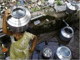
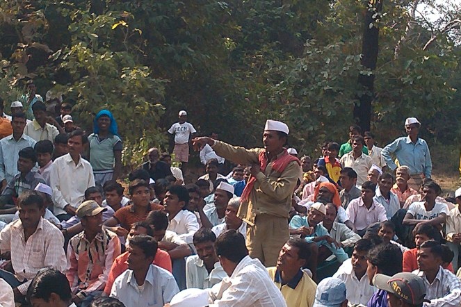


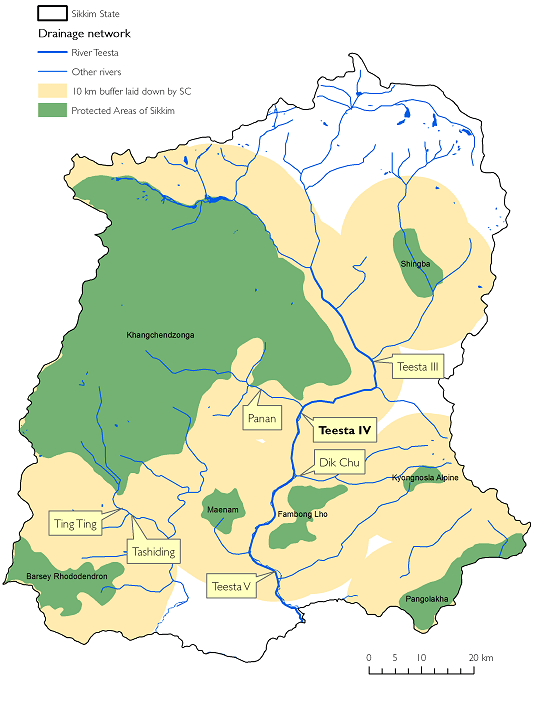


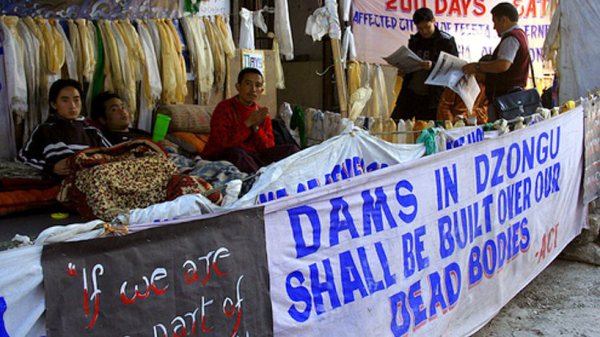
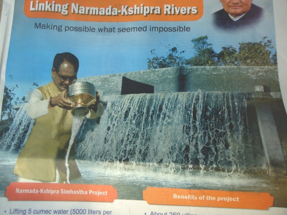


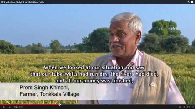
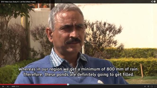
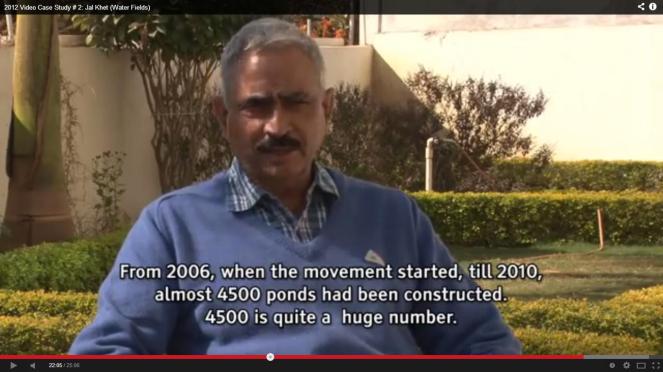
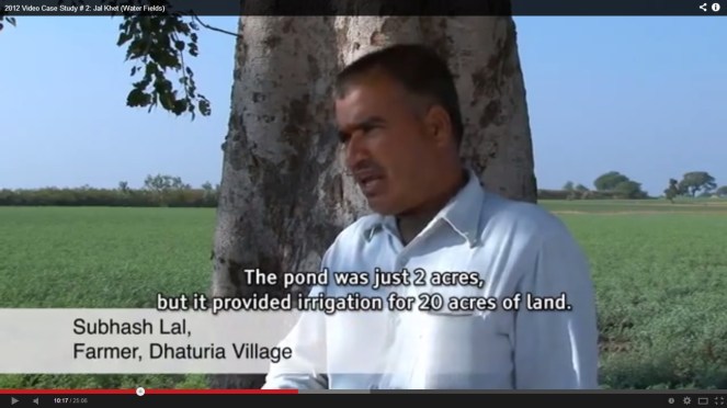
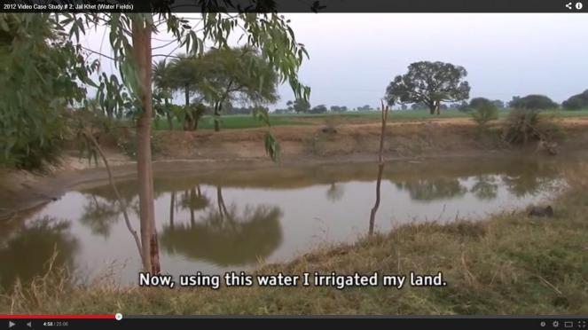

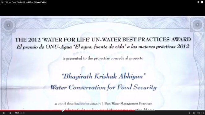


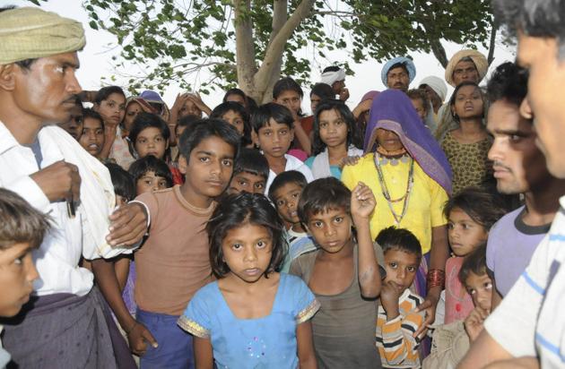

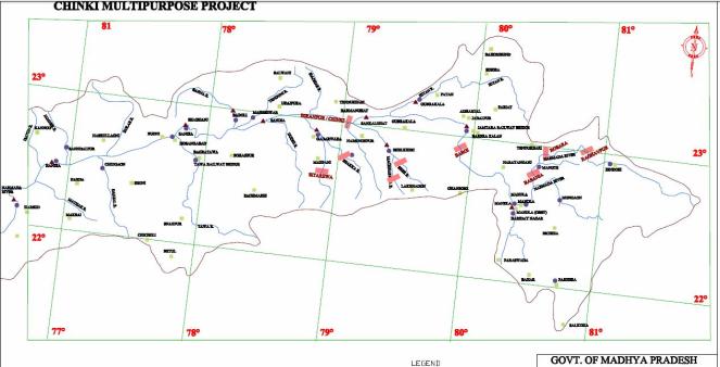

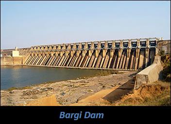


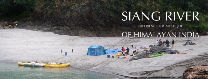


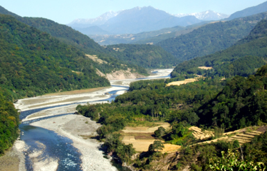


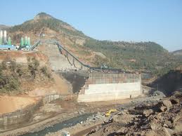


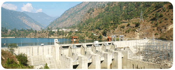


