Dams

World Fisheries Day 2017: Dams, Rivers & Fisheries in India

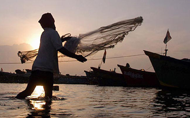
Every year, November 21 is celebrated as World Fisheries day across the world. Fisherfolk communities organize rallies, workshops, public meetings, cultural programs, dramas, exhibition, music show, and demonstrations to highlight the importance of maintaining the world’s fisheries.

As per a recent United Nations study, more than two-thirds of the world’s fisheries have been overfished or are fully harvested and more than one third are in a state of decline because of factors such as the loss of essential fish habitats, pollution, and global warming. The World Fisheries Day helps in highlighting these problems, and moves towards finding solutions to the increasingly inter-connected problems, and in the longer term, to sustainable means of maintaining fish stocks. https://www.gdrc.org/doyourbit/21_11-fisheries-day.html

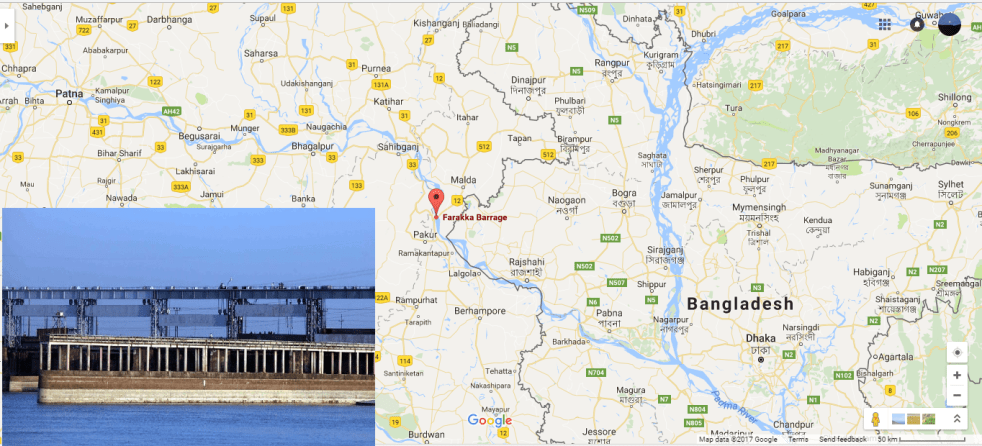
In an attempt to understand the significance of the issue, SANDRP with the help of selective media report, presents an overview of key developments and problems affecting fisheries and fisher folks at India and South Asia level.

Continue reading “World Fisheries Day 2017: Dams, Rivers & Fisheries in India”

Rivers

Will this ‘Rally’ help the rivers?

PRESS RELEASE From India Rivers Week Organising Committee on Sept 13, 2017

We are concerned about the increasing superficial optics around saving rivers, with little or no effort to address fundamental issues which are causing their demise.

The high profile rally initiative to save India’s rivers taken up by well respected religious guru Sadguru and his followers is noteworthy, and the most recent case in point. It is striking that so many film stars, politicians, governments, and public personalities, are joining the call. Lakhs of children are expected to join in the program. While we welcome such an outpouring of good intentions and good will as a demonstration of the positive energy all around, unfortunately, we have seen no evidence either from the rally organisers, on their website[i] or their messaging, that they understand or plan to address the real threats faced by our rivers and their sorry state. Continue reading “Will this ‘Rally’ help the rivers?”

Dams

Jammu and Kashmir Rivers Profile (Jhelum and Chenab Basins)

This report discusses a few of the significant issues in the Jhelum and Chenab basin two of the main tributaries of the Indus and provides the readers a snapshot of the issues confronting the water resources development in the basins. On the basis of these factors, the health and status of the Jhelum and Chenab basins is determined using an assessment matrix providing qualitative weights to each of the indicators and influencing factors to arrive at the overall score of the river categorizing a riverscape as healthy, sick and dying.

Continue reading “Jammu and Kashmir Rivers Profile (Jhelum and Chenab Basins)”

Dams

Uttarakhand Rivers Profile

About Uttarakhand 

Geographical Location- North India largely mountainous with two plains and two partly mountain districts in  the south; Area- 53483 sqkm; Population- 10.12 million; River basins- 4 River basins (R. Ganga‘s basin is subdivided in the map below into R. Bhagirathi, R, Alaknanda and R. Ganga sub-basins); Districts-13; Climate- Sub-tropical to tundra 

About Uttarakhand Rivers

Uttarakhand_Drainage_map

The water quality of Uttarakhand‘s rivers is basically good, especially in the upper reaches. Downstream of some large settlements and in the lower reaches in the Himalayan foot hills the water quality suffers due to the release of untreated sewage and industrial effluents. But the state‘s ambitious program to build 450 hydro power projects threatens the survival of the river ecosystems and the lives and livelihoods of people who live  in these river valleys.

Continue reading “Uttarakhand Rivers Profile”

Dams

Haryana Rivers Profile

Summary of Rivers in Haryana                                                                              

About Haryana

Location: Northwest India, Carved out of Punjab in 1st November 1966; Area: 44212 sq km. Mostly Gangetic/ Trans-Gangetic Plains; Population: 253.53 lakhs (2011); 4 River Basins, 21 Districts; Climate- Arid to semi-arid with average rainfall

Rivers in Haryana fall mainly within Indus and Ganga basins. River Ghaggar sub basin and its tributaries in the west of the state caters to the Indus basin, while river Yamuna and its tributaries in the east make up the portion of the Ganga basin. 

Continue reading “Haryana Rivers Profile”

Dams

DRP: 27 Feb 2017 (Urgent Need To Review Impacts Of Farakka Dam: Experts)

During a global seminar held on Feb. 25-26, 2017 in Patna experts from across the country have advocated an “urgent review” and comprehensive study of the Farakka dam to revive the Ganga river. The experts were discussing various concerns facing River Ganga and the possible solutions for them. The seminar titled as “Incessant Ganga” was organised by Bihar’s Water Resources Department, almost week after, Bihar CM Nitish Kumar has openly termed the barrage as genesis of floods in the State. Speaking in the program, the CM again expressed deep concerns behind receding water flow in the Ganga and increasing silt deposit due to Farakka dam.

Speaking during the seminar, environment expert Himanshu Thakkar the coordinator of SANDRP advocated urgent need for review of Farakka barrage claiming that it has failed to fulfill any of the purpose – irrigation, hydro electric power, water supply – of the barrage for which it was built. As per, Himanshu Thakkar the dam was built to maintain the navigability of Kolkata port. 

Thakkar also suggested that the gates of Farakka be opened during monsoon to mitigate the intensity of floods in Bihar. As per Thakkar there was an urgent need for a comprehensive study of the Farakka barrage to find out its achievements or whether the barrage fulfilled its objectives. The committee constituted for study must include the Centre, Bihar, West Bengal and all states having Ganga, he said adding that a study should be made on the social and livelihood impact of the barrage, how it affected people’s lives, whether its existence was justified and cost-benefit assessment among other issues.

Continue reading “DRP: 27 Feb 2017 (Urgent Need To Review Impacts Of Farakka Dam: Experts)”

Dams

Yamuna River Developments in 2016-2- Other River Interventions

(During monsoon the polluted river cleanses itself allowing migrant fishermen to move in and seek out their livelihood through fishing ;  Photo by Burhaan Kinu)

The exploitation of Yamuna Rivers that starts in upper basin comprising Uttarakhand (UKH) and Himachal Pradesh (HP) gets worse as the river is dammed at Hathini Kund Barrage (HKB) while passing through Shivalik Hills located at the border of Haryana and Uttar Pradesh (UP), the barrage has severely compromised lean season (8-9 months) water flow in the river downstream.

As a result, the waterless riverbed resembles a desert till Delhi’s potable water is released back into the river at Palla village, the border of Delhi and Haryana. The absence of flow facilitates intensive illegal riverbed mining for sand and boulders for longer periods in a year which further destroys the river’s eco-system. More over industrial and domestic effluents in great volume from nearby towns reach the river via tributaries, storm water drains. Amid all this successive State Governments show no will to achieve even basic flow of freshwater in the river, even as they keep pushing more dams.

Here is an account of the projects planned and launched in 2016 related to the River Yamuna. 

Continue reading “Yamuna River Developments in 2016-2- Other River Interventions”

Dams · DRP News Bulletin

DRP: 26 Dec 2016 (Corruption & Fraud in 600 MW Kameng HEP in NE India)

In addition to allegations of fraud related to inflated bills, the officials report of Satish Verma the former chief vigilance officer (CVO) of North Eastern Electric Power Corporation (NEEPCO) mentioned that there have been numerous instances of top government officials allegedly accepting hospitality and gifts that cost the PSU lakhs of rupees. These include gifts for officials in the Ministry of Power: a teak wood cabinet for the Personal Secretary to the Union Power Minister; an iPad Air 2 for the Secretary; payment of a Vodafone bill for a Special Secretary; and a mobile handset for an Additional Secretary.

Continue reading “DRP: 26 Dec 2016 (Corruption & Fraud in 600 MW Kameng HEP in NE India)”
Dams · Ganga

Haryana Rivers Profile: (Part-II – Ganga Basin)

Yamuna Basin:  River Yamuna[1] accounts for 7.10 % of the total geographical area of the country. The Haryana state forms 6.5%[2] of the river basin. It drains an area of 366,223 square km in the Gangetic plain and constitutes 40.2% of Ganga Basin. The river annually carries 10,000 cubic billon meters (CBM) of water of with 4400 cbm is used for irrigation.  Yamuna river basin forms the upper sub-basin of Ganga river[3] the total area of which is 35798.19 square km comprising of 47 water sheds. 

Yamuna river originates from Bandar Punch glacier in Uttarkashi district of Uttarakand. The river flows through about 200 kilometers before reaching Haryana State at Shivalik Hills in Yamuna Nagar district. In the same district the river is trapped in Hathini Kund Barrage located in Kalesar National Park.

Continue reading “Haryana Rivers Profile: (Part-II – Ganga Basin)”

Dams · Indus

Haryana Rivers Profile: (Part-I – Indus Basin)

India is a land of several great rivers[1]. Haryana[2] the 20th Indian state has also been enriched by numbers of rivers, streams and rivulets.  These rivers only strike public discourses during monsoon when they flood human habitations although pollution and sand mining incidents are routinely covered. Moreover there is no Government Department in the State which is in control or possession of complete information on the rivers of the State, as the various State Government Agencies in limited manner deal with specific issues affecting the rivers and there are Government Agencies also whose plans or projects impact the rivers in adverse manner. This two part blog report from SANDRP strives to present a picture on the rivers of Haryana. The State is broadly divided by two basins: Indus and Ganga. This first part of the blog mainly focuses on rives which are part of Indus basin. The second part will bring information of other rivers in the State which join the Ganga basin.  Apart from putting together the basic facts, the blog series also highlights the key issues and present day status of these river systems.

Continue reading “Haryana Rivers Profile: (Part-I – Indus Basin)”