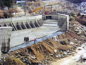
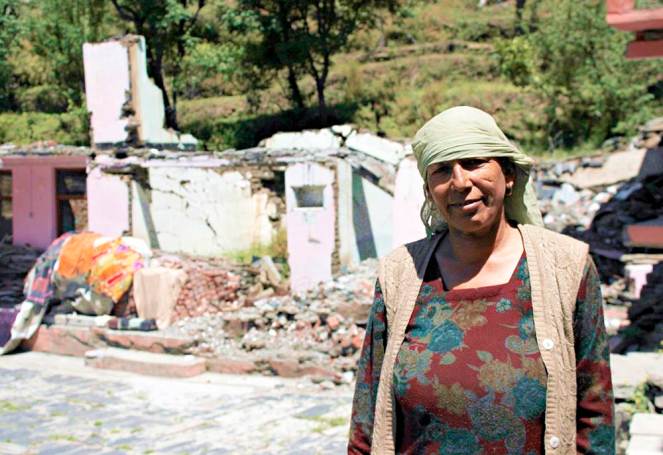
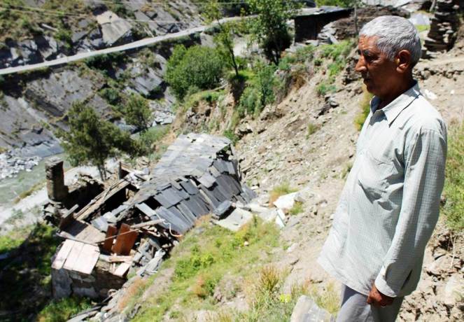
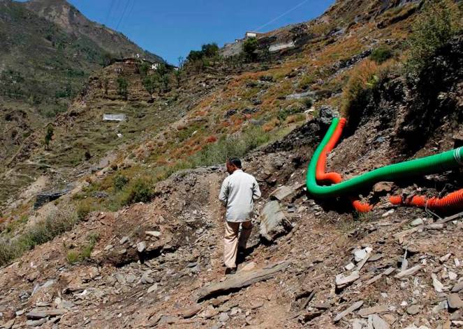
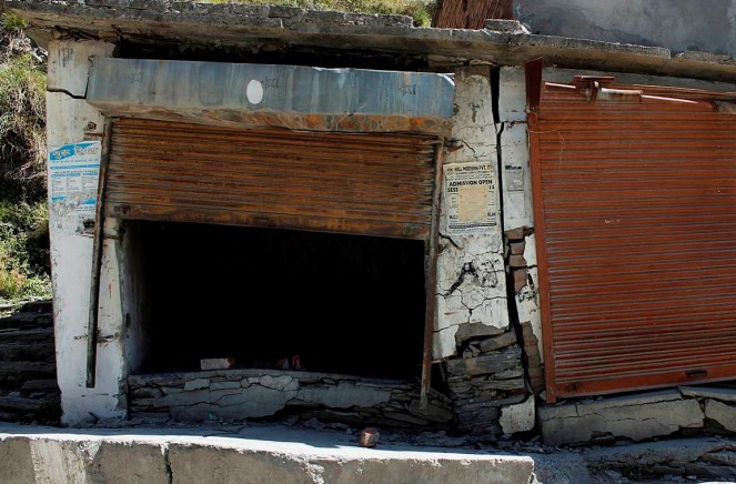
Above: Graph showing how the power generation per MW installed Hydro Capacity has been doing down over the last two decades
As per the latest power generation figures just released by the Central Electricity Authority[1] the hydropower generation during the just concluded Financial Year 2014-15 was 4.25% lower than the previous year’s generation even though the installed capacity has gone up. Average generation per MW of hydro capacity in India in 2014-15 was over 20% less power than what our average generation was in 1993-94. More worryingly, the hydropower generated per MW installed capacity continues its downward slide, the downward slide has been going on for now over two decades. Continue reading “Diminishing Returns from Large Hydropower projects in India”→
DRP from SANDRP January 2015: The following developments are about dams, rivers & people, mostly from India but also some from South Asia and rest of the world. This is for the period Jan 1 to Feb 12, 2015, we hope to publish this more frequently in future. These were put up on daily basis on SANDRP Face book page: https://www.facebook.com/sandrp.in. If you want to get it regularly, you can like the FB page.
I have gone through the report Headwater extinctions: Hydropower projects in the Himalayan reaches of the Ganga and the Beas: A closer look at impacts on fish and river ecosystems by Emmanuel Theophilus[1], published by SANDRP, thanks for sending the report to me in hard and soft copy. It is indeed excellent, many more pages can be written on the beautiful portrayal. I am flagging some concerns, in context of the whole issue. Continue reading “Headwater Extinctions by Emmanuel Theophilus: SOME CONCERNS”→
The 126 MW Larji Hydropower project near Aut on the mainstem of the Beas is run by the Himachal Pradesh State Electricity Board (HPSEB)[2]. The dam is constructed a little downstream of the confluence of the two main tributaries upstream, the Sainj and the Tirthan, at the narrowest part of a spectacular gorge, towering with limestone cliffs. The impounded waters of this dam have, since its construction in 2006, drowned the access road to the entire upper Kullu valley including Manali and the hundreds of villages upstream, including access to the entire Lahul valley and the region of Ladakh over the high passes from this end. The HPSEB then constructed a 3 km long tunnel to enable passage of traffic, and many people have warned of the hazardous nature of the tunnel. The 220 odd gods that descend from different valleys, on the backs of people to the lower Kullu valley every year in autumn however, refuse to use this tunnel. This is what compelled the HPSEB to build and maintain this tunnel, and during autumn to winter, to keep the water-storage in the dam low to enable the passage of gods, who have been traveling this route for over three and a half centuries. It is remark-worthy though, that this dam constructed as recently as 2006, seems to be heavily silted-up already and the dark shadows of sediment-shoals are visible just below the waters of the reservoir[3].
Being among the most recently completed, the Larji dam is the only dam on the Beas that has a fish-ladder, so it was of particular interest to us. Seeing no guard at the security booth, we walk in to the HPSEB dam operating office, and ask to speak to an officer about the fish ladder. To our complete surprise, we are spoken to and even taken on a tour of the ladder by a foreman who has worked on the dam for many years.
Having seen an elaborate fish ladder on the Kuri Chhu river in Bhutan of doubtful effectiveness[4], we could not help but look at this one with hope and excitement. Located at around 1,000 meters altitude, this dam was clearly in the way of a host of migratory species of fish. If this ladder design was effective, then surely the ‘barrier’ problem to seasonal migration for breeding and dispersal would have been addressed. Here though, is what we saw and heard.
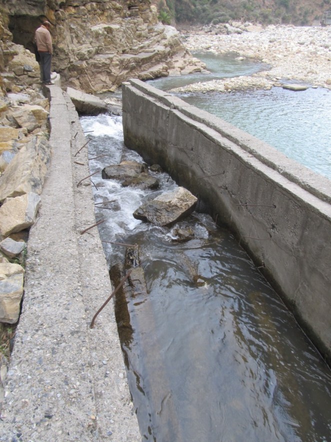
For one, the flow through the fish-pass seems too small to create an ‘attraction flow’ for fish. But even more obviously, the downstream entrance of the fish ladder is a steep cascade over a couple of meters of broken masonry and rock, that would clearly be un-negotiable by any fish that does not jump that high[5].
Downstream entrance of Larji fish ladder: The 2 m high jump that fish require to enter the ladder can be seen here (all photos by the author)
2. The outlet from the dam reservoir into the fish ladder is blocked off by a metal grill-mesh that is narrow enough to trap flotsam like Bisleri water-bottles. The mesh seemed too fine to let Mahseer of breeding-age pass through, either upstream or downstream.
3. The fish ladder was in a serious state of disrepair. To our questions about whether the ladder worked or not, the foreman says honestly that it does not. We see the reasons for this when we walk down the ̴100 meter length of the fish-pass channel.
Fishladder can be seen in serious state of disrepair and blocked by broken concrete parts can be seen here
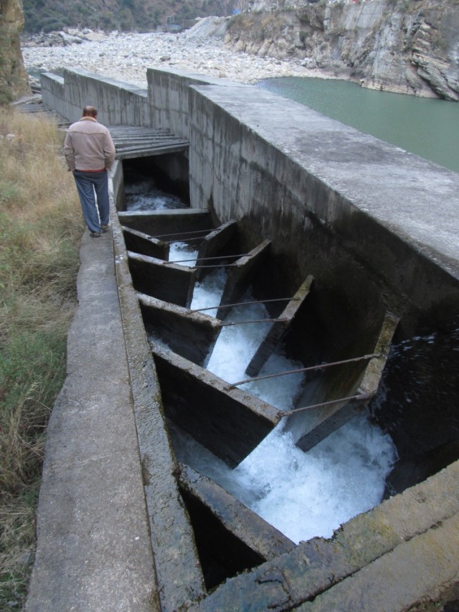
4. The Larji fish ladder seemed to be a hash of different designs of fish passes. There were four different design elements in this one fish-pass. It had a slotted-weir fishway design, a low gradient Denil fishway, a steep-pass Denil fishway and a plain concrete culvert on a grade design. Most of these slotted weirs were clogged with fallen rocks and debris from the slope above, and in places, the pools in them were over-flowing the weir in a vertical fall almost 2 meters high.
Steep-pass Denil fishway part of the fishladder can be seen here, water is flowing too rapidly here for any fish to be able to go upstream. The water picks up momentum down an extremely steep slope with the baffles at 45 degrees to the flow, not offset to slow the water, but concentrating the force of the water in mid-stream flow. The slope seemed to be at almost 40 degrees angle, and the water was turbulent in the extreme in this section. A workable Denilway slope, even for the strongest of swimmers among fish, is not designed to exceed a slope of 20% at most. This was close to a 100% slope
5. The oblique baffles on a Denil fishway are supposed to be placed in a manner that provides staggered partial-obstructions that slow the water down at variable velocities to make it passable for fish. However, here we saw that the water picks up momentum down an extremely steep slope with the baffles at 45 degrees to the flow, not offset to slow the water, but concentrating the force of the water in mid-stream flow. The slope seemed to be at almost 40 degrees angle, and the water was turbulent in the extreme in this section. A workable Denilway slope, even for the strongest of swimmers among fish, is not designed to exceed a slope of 20% at most. This was close to a 100% slope[6].
This part of fish ladder is less steep Denil
The last part of the fishway was a plain concrete culvert on a grade channel, essentially a sloping channel, where even the concrete sides of the channel had toppled over into the river-bed, and the final drop was over a two meter fall into the downstream flow. I asked the foreman whether he knew whether fish managed to make it over this extreme gauntlet. He said that they did not, but that he often saw fish gather and concentrate at the bottom of the dam under the sluice gates, and make futile leaps in an attempt to get over the dam. Clearly, the Larji dam fish ladder is just an unlovely trinket, a deceptive ornament.
Watch a 41 seconds video showing how fast the water is moving through the Larji Dam fishladder at: http://youtu.be/grVaxXPdeyY, Video is by the author.
It seemed to me that the dam builders and operators, the HPSEB in this case, both at the design and the executive levels, were not serious about constructing a fish-pass that would work, and neither were they serious about this at the operation and maintenance aspects. Whether they were serious at all even at the conceptual level, to put in place a mitigation measure that actually helped migratory fish bye-pass the barrier of the dam, or was this part of the design merely to obtain environmental clearance, can only be conjectured about. That hydropower projects can devise deceitful strategies for obtaining environmental clearance is one thing, but what does this tell us about the Union Ministry of Environment and Forests, the Expert Appraisal Committee on River Valley Projects appointed by MoEF, the regional office of the MoEF, the state Fisheries Department and also the state pollution Control Board, who are all variously part of the approval processes for hydropower projects, when they get their environmental clearances based on such ‘mitigation measures’?
Larji Dam – about 100 m long fishladder channel can be seen on the right side
[2] The 126 MW Larji project is also infamous for being the costliest hydro-power project per unit electricity generated so far in India. Finally built at a cost of R.s 10.27 billion, which was twice the estimated cost, the Vigilance department unearthed major financial misappropriation by HPSEB officials.
[5] Other than loaches, those tiny finger sized fish that can even climb (squiggle technique) up high waterfalls, provided there is something like a water-slide at the margins of the fall. They however, are not migratory fish.
[6] CIFRI recommends that the speed of flow of water in a fish-pass should not exceed 2 meters per second. Please see ‘Status of fish migration and fish passes with special reference to India’. MK Das and MA Hassan. CIFRI 2008.
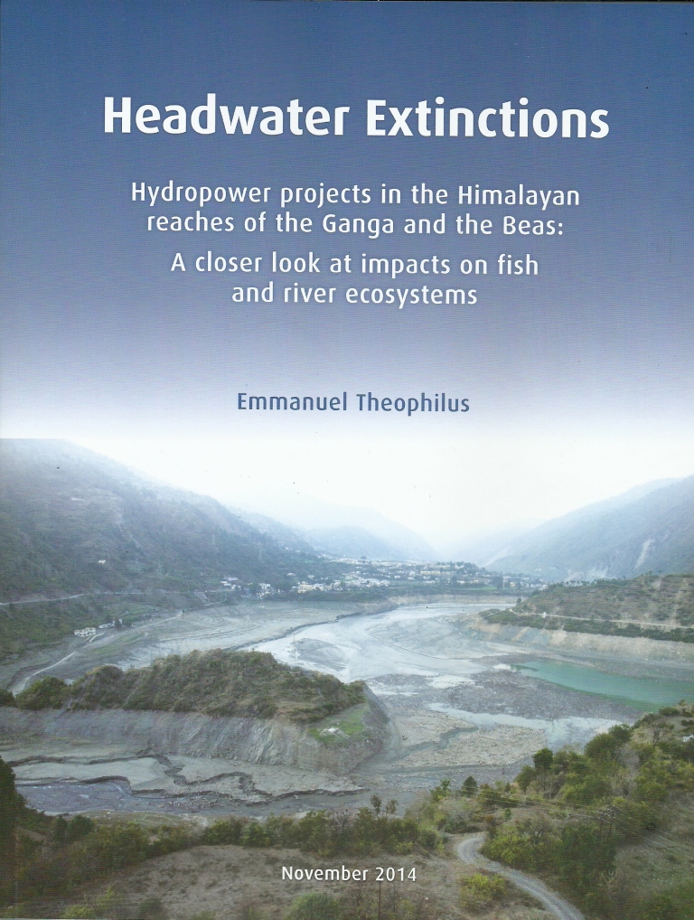
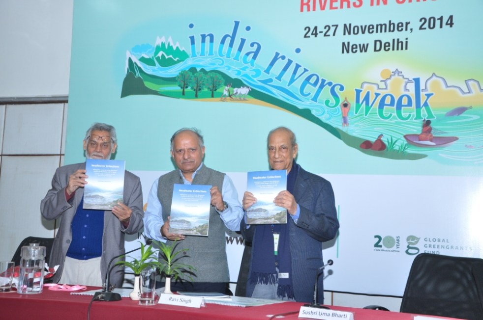
SANDRP has just published a new report: “Headwater Extinctions- Hydropower projects in the Himalayan reaches of the Ganga and the Beas: A closer look at impacts on fish and river ecosystems”, authored by Emmanuel Theophilus. The report[i] was released at the India Rivers Week held during Nov 24-27, 2014.
Front Cover of the report HEADWATER EXTINCTIONS
Headwater Extinctions deals with impacts of hydropower projects in Beas basin in Himachal Pradesh and Alaknanda-Bhagirathi basins in Uttarakhand on river ecosystem and its components, mainly fish. While the harrowing impacts of hydropower projects on local livelihoods and social systems are being realized gradually, we are yet unclear about the extent of impacts of these so-called green projects have on fish and aquatic biodiversity.
Environmental Impact Assessments of large hydropower projects (> 25 MW as per EIA Notification 2006[2]) are supposed to assess ecological impacts of such projects, but we are yet to come across any comprehensive effort in this direction from EIA reports that we have assessed so far.
The Expert Appraisal Committee (EAC) of Union Ministry of Environment, Forests and Climate Change (MoEF & CC) which is entrusted with appraising these projects and their EIAs has paid very little attention to this issue. Since over a decade, the EAC has had expert members from Wildlife Institute of India (WII) and Central Inland Fisheries Research Institute (CIFRI). Both these institutes are supposed to have expertise on fish and aquatic biodiversity. But sadly, their presence has not helped fill the serious lacunae in appraisal and EIAs of the hydropower projects.
SANDRP had been trying to highlight the impact of hydropower on fish and the long standing problems in the so-called mitigation measures being recommended by the EAC. We thought that it may be useful to bring out a first-hand report bring out ground realities of what is happening to our rivers. Emmanuel Theophilus, based in the Dhauliganga Valley and who is an avid mountaineer, storyteller, ecologist and our ally was commissioned by SANDRP to study the impacts of hydropower on fish and ecosystems, review the EIAs as well as mitigation measures recommended by EAC as a part of Environment Management Plans of hydropower projects. We are very glad to publish the report as a first of the hopefully many steps to be taken to understand and address this important issue.
Headwater Extinctions has been written in an eminently readable style that Theo is known for, as could be seen from the earlier blogs[3] he wrote for us! The report has a section on ‘Travelogue’ which records Theo’s travels and thoughts as he visits Bhagirathi and Alaknanda sub basins in Uttarakhand and Beas basin in Himachal Pradesh. The report also brings illuminating photos from these trips. The fact that the travels happened within months of the Uttarakhand disaster of June 2013 could be seen in his photos and travel reports. It further substantives the role hydropower projects played in increasing the proportions of the disaster.
Travelogue is followed by discussions in two parts: Discussions on the impact of hydropower projects on fish and aquatic habitats along the two sub-basins and the role of EIAs, EMPs, Fisheries Plan and the government approval process. The findings of this report are valid for all Himalayan states & rivers.
Back Cover of the report HEADWATER EXTINCTIONS
Headwater Extinctions ends with some striking insights. Sample this: “We are in the midst of river extinctions in the Himalaya, but are surrounded by a tragic drama of double-speak and equivocation. And a horde of jostling brokers. Ranging from reputed universities, government departments, research institutions, everyday bureaucrats, and of course, politicians and contractors from within ‘the community’[4] along the developers and regulators. They not only write the script of this drama, they even play all the part”.
The inside covers of the report have detailed maps of the two basins with locations of hydropower projects, with annexures containing lists of hydropower projects in Upper Ganga and Beas basins and also list of fish found in Upper Ganga basin.
Theo has completed this report on a stringent timeline and budget, which meant that all the proposed and implemented fisheries management plans could not be assessed. We hope Headwater Extinctions provides sufficient material and compelling reasons to overhaul the way impacts of hydropower projects on fisheries and aquatic biodiversity are treated by EIAs, EMPs and government committees. We would also urge agencies like WII and CIFRI to do justice to their work inside EAC and beyond. That they are not doing that is apparent.
For EAC and MoEF&CC, we certainly would like them to ensure proper and full impact assessment of projects on aquatic biodiversity in the EIAs. The EAC also needs to stop approving completely ineffective fish hatcheries. They could initiate a credible independent study of the costs, benefits and performance of the fisheries development plans they have been approving in recent projects. It does not only smell fishy, but more like a scam! Here is a relevant quote from the report: “I can’t help see a few things here, as perhaps you do? Bluntly put, I see slush funds being dangled to a whole range of possible collaborators. The kindest term I can find for them is ‘brokers’.”
We look forward to your comments and suggestions on all aspects of Headwater Extinctions. If you would like a hard copy, please write to us.
[2] We have been saying this for long and this report helps substantiate our contention that the assumption that projects below 25 MW are benign and do not need EIA-EMP or environmental monitoring and public consultations is wrong.
Guest Blog by: : Karthik Teegalapalli(kartix@gmail.com) a researcher with the Nature Conservation Foundation
In April 2014, the Forest Advisory Committee (FAC) decided to deny clearance to the 3000 MW Dibang Multipurpose Hydro-electric Project, the largest capacity hydro project in the country proposed to be developed by the National Hydropower Power Corporation (NHPC) in the biodiversity-rich Arunachal Pradesh State (Saikia 2014). The project was also denied clearance in July 2013. More recently though, the project has been recommended forest clearance by the FAC and Environment Clearance by the Expert Appraisal Committee. Therefore it is pertinent to look at the impacts the project may have in some detail.
Ecological impacts The project, in its earlier version involved diversion of more than 5000 hectares of relatively undisturbed grassland and tropical forest habitat. These and the adjoining forests harbour endangered species such as tiger, leopard, serow as well as the critically endangered takin, all of which are protected under Schedule I of the Wildlife (Protection) Act, 1972 (these species are also listed as present in the area in the Environmental Impact Assessment report of the project, undertaken by National Productivity Council, Guwahati). The grasslands in the area harbour the critically endangered Bengal Florican, a grassland habitat specialist (Sinha et al. 2014). Other species recorded from the area include the critically endangered white-rumped vulture, the slender-billed vulture and the white-winged wood duck. The project site lies in an area identified by the Bombay Natural History Society as a Ramsar site and an Important Bird Area (Islam & Rahmani 2004). The habitat of six endangered plants (Aconitumferox, Coelogynemossiae, Dendrobiumaurantiacum, Paphiopedilumfairieanum, Paphiopedilumvenustum and Vandacoerulea) will be submerged by the reservoir (Chernaik 2007).
The project will also affect aquatic species; the dam will block the breeding migration of four species of fish: the Vulnerable snow trout Schizothoraxrichardsonii, Endangered golden mahseer Torputitora, Near-Threatened mahseer Tortor, and chaguni Chaguniuschagunio. The recommendation of the Environmental Management Plan of the Project to establish fish hatcheries for these species is impractical and can have further damaging effects on the species due to collection of eggs and spawn from the wild population.
The project will have other collateral damages such as through Compensatory Afforestation (CA) that often involves converting an area with diverse native species into monocultures, as has been shown for other dams such as the Sardar Sarovar Dam on the Narmada river (Bhatnagar 2004). The project involves CA of a relatively large area of over 100 sq. km (double the area of forest being affected by the project). The ill-effects of this conversion particularly for the project can be expected to be higher if tree-less natural grassland habitats in Dibang Forest Division, Namsai Forest Division and Anini Social Forestry that harbour grassland habitat specialists are planted with undesired native or non-native tree species. Perhaps the irreversible loss of biodiversity in the forests and grasslands that will be diverted for the project could never be ‘compensated’.
During the construction phase of the project, an estimated 32 lakh truckloads of boulders and 16 lakh truckloads of sand is to be extracted from the Dibang river basin. Unsustainable extraction of sand and boulders has significant negative effects on geomorphology, bank stability, flood character of the river, water quality, river flow, and the biodiversity in the river basin (Padmalal et al. 2008). The project during the construction is to generate 198 lakh cubic meters of muck which will be disposed in the river bank which will cause further loss of 120 ha of river habitat. Construction of new roads (64 km) and widening of existing roads (19.5 km) will also lead to removal of trees and increase the vulnerability of the region to landslides and erosion (Chernaik 2007).
Social impacts The Lower Dibang valley is currently a region of relatively low human population density (~14/km2); the entire population of the Idu-Mishmi tribe is about 12,000. The influx of approximately 6,000 project staff (which is very likely an underestimate) for a period of 8 years or more will affect their way of life, their culture and their tradition as well as open up access to relatively moderately disturbed habitat and biodiversity in the region.
Downstream effects include those on fisheries, agricultural lands and wetlands (beels) and the dam will also increase the vulnerability of the region to flash floods. For instance, in the year 2007, flash floods caused due to sudden release of water from the relatively smaller 405 MW Ranganadi project in the Lower Subansiri district in Arunachal Pradesh swamped 83 villages and caused huge loss of lives and property in the Assam State. The project will have a considerable impact on the Dibru-Saikhowa National Park in Assam which has not been studied in detail in the EIA.
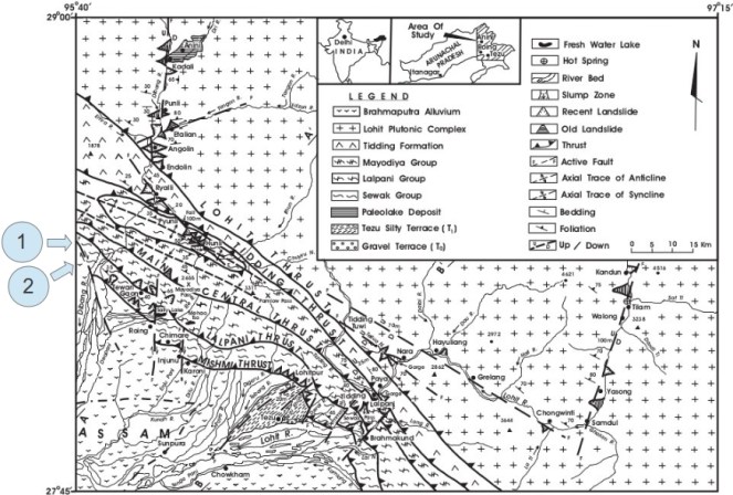
On shaky grounds A critical issue with the project is that the site lies close to an active Fault Line in the Mishmi Thrust of the Mayudia Group in Eastern Arunachal Pradesh with a history of several seismic activities including the Great Assam earthquake of 8.6 magnitude in 1950 (Figure 1, Misra 2009). In the event of an earthquake, the project poses a risk of catastrophic submergence of several villages and vast areas of forests downstream. The recommendations of the Environmental Impact Assessment (EIA) report of the project are cursory and suggest further research on the natural seismicity of the region as well as reservoir-induced seismicity, which should be the basis for the decision about the project.
Figure 1 (Modified from Misra, 2009) showing the location of the fault lines around the proposed project site. 1 is the location of the Fault line and 2 is the location of the proposed site.
Notwithstanding these, in Oct 2014 the project was cleared by the FAC constituted by the new Government, although the committee still had four of the six members who had earlier twice recommended rejection of clearance. Is this decision driven by changes made by NHPC in their project plan? Clearly not. Diversion of forests has now been reduced by a mere 9% to about 4600 hectares; instead of 3.55 lakh trees, the felling has been reduced to 3.24 lakh trees, the power generation capacity has been reduced by 2.3% and the height of the proposed dam reduced by 10 m. In fact, the FAC rejection of April 2014 was for this 10 m rejection proposal!
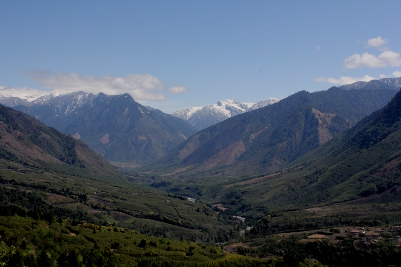
The beautiful Dibang valley, that faces the threat of submergence due to the Dibang Multipurpose Project (Photography by Soumya Dasgupta).
NHPC misleadingly and baselessly claimed that they ‘were not in a position to reduce the height of the dam any further, as it would significantly affect the power generation’. The decision to provide clearance to the project seems like a hasty one driven by the blinders of development and the consequences of such projects is evident from the fate of the Lower Subansiri Hydropower Project in the same State, also by NHPC. After 12 years since the LSHP was initiated and after an expenditure of over Rs. 5000 crores, the work has been on a standstill for the last 35 months as a result of India’s biggest anti-dam people’s movement (Dandekar & Thakkar 2014). Considering the economic, ecological, environmental and social costs of the project as well as the geophysical risk it poses, it would be prudent to withdraw the project till a credible, detailed cumulative study covering these aspects is undertaken in a transparent and participatory way. While the rest of the world is recognising the ill-effects of dams, with the largest dam removal project on the Elwha river in the United States completed just three months back, it is paradoxical that we are heading in the other direction; of building the highest dam in the country and largest capacity reservoir of the North East India without even basic studies, credible impact assessment and democratic decision making process.
References:
Bhatnagar, D. (2004) Uprooting Forests, Planting Trees: Success of Compensatory Afforestation Measures Mitigating the Deforestation for the Sardar Sarovar Dam, India. University of California at Berkeley.
Islam, M. Z. & Rahmani, A. R. (2004) Important bird areas in India: priority sites for conservation. Indian Bird Conservation Network, Bombay Natural History Society and BirdLife International (UK).
Misra, D. K. (2009) Litho-tectonic sequence and their regional correlation along the Lohit and Dibang Valleys, Eastern Arunachal Pradesh. Journal of the Geological Society of India, 73: 213-219.
Padmalal, D., Maya, K., Sreebha, S. & Sreeja, R. (2008) Environmental effects of river sand mining: a case from the river catchments of Vembanad lake, Southwest coast of India. Environmental Geology, 54(4): 879-889.
Saikia, P. J. (2014). Six years after PM laying the foundation ston: No clearance, no work for 3000 MW Dibang Dam.
Sinha, A., Hoque, J., Pradhan, T., Bakshi, M. K., Pulu, J., Singh, A. K. & Ahmed, F. (2012) Sighting record of Bengal Florican Houbaropsisbengalensis (Gmelin, 1789) (Aves: Gruiformes: Otididae) in Lower Dibang Valley District, Arunachal Pradesh, India. Journal of Threatened Taxa, 4(14): 3375-3376.
The state of Himachal Pradesh has a hydropower potential of almost 23,000 MW, which is about one-sixth of the country’s total potential[1]. In a bid to harness it, the state authorities seem to have gone all out without really even assessing the costs and impacts it will have on the local ecology and people. It has already developed about 8432.47 MW till now and is racing towards increasing that and in its way, displacing people, destroying forests and biodiversity, drying the rivers, disrupting lives and cultures in upstream and downstream, and flooding cultivable and forest land. The target of the State government for 2013-14 is to commissioning 2000 MW[2] capacity projects. The state and central governments are pushing for more and more projects, playing havoc with the lives of the locals and thus facing continuous agitations. This update tries to provide some glimpses in hydropower sector in Himachal Pradesh over the last one year.
The Ravi, Sutlej, Chenab, Beas & Yamuna, which form the major river basins of Himachal have been heavily dammed. These projects submerge and bypass the rivers, change the course, the flow and the silt carried by the rivers. The 27 proposed projects in the Chenab basin endanger the fragile ecosystem of the Lahaul-Spiti Valley. In the Sutlej, the nine major hydel projects of 7623 MW which are already running along the 320 km stretch include: 633 MW Khab (proposed), 960 MW Jangi Thopan & Thopan Pawari (re-bidding), 402 MW Shongtong Karcham (under execution), 1,000 MW Karcham Wangtoo (commissioned), 1,500 MW Nathpa Jhakari (commissioned), 412 MW Rampur (under execution), 588 MW Luhri (allotted)[3]. There are about 21 more proposed projects. The same is the case with the Ravi where about 30 projects are proposed to be built or are already functional.
From 1981-2012, more than 10,000 ha of forest land on which people had user rights, have been diverted for hydropower, mining, roads and other projects[4]. This does not include the thousands of hectares of forest land diverted towards projects like the Bhakra Dam before 1980.
On the one hand, the Ministry of Environment and Forests (MoEF) treats the locals like hindrances, saying that they cause damage to the environment by using the forests inefficiently, on the other hand, it approves big projects which cause hundred times more damage to the environment. There is no recognition of the ecological fragility of the landscape, and clearance from the MoEF seems like just a formality. Clearly, the MoEF and the state government are not interested in doing something for the people of the area, but in pushing project constructions to achieve targets at whatever cost it may require. This is also evident in the way the MoEF, without proper consultation, approved the state’s request for making the procurement of no-objection certificates (NOCs) from the Gram Sabhas a non requirement. MoEF itself had passed a circular in 2009, making it mandatory for project proponents to obtain NOCs of the affected Gram Sabhas and compliance to the Forest Rights Act 2006 before the diversion of forest land to non forest purposes. However, in 2012, the MoEF issued a letter which stated that there are no compliance issues with regard to FRA in Himachal Pradesh since the rights of the forest dwellers have already been settled under the Forest Settlement Process in the 1970s[5]. This is clearly wrong and not supported by facts or ground realities.
Taking away the rights of people on land without giving them adequate compensation has been a governmental trend. It is not enough to just grant monetary compensation to them. The land which could be put to various uses by the local is no longer his. The Gaddis, a shepherding community, rely a great deal on their rights over land as they need it for grazing. With the Forest Dept. making some areas inaccessible for them, their land has anyways decreased. In addition to this, projects like the Bajoli-Holi and the proposed dam at Bada Bhangal, which is sanctuary area now, and traditionally a grazing area for the Gaddis, will further take away from the available land.
But it is not only the loss of forest and private land which is the problem here. Another major issue is that of water. With the state giving increased priority to run-of –the –river projects, more and more water from the river is being diverted for longer stretches.
In the controversial Luhri project on the river Sutlej, the diversion of water into a 38 km long tunnel would mean the absence of free flowing river in stretch of almost 50 kms. The agreed amount of water to be left flowing in the river is 25% for the lean season and 30% in monsoon[6]. The project was initially supposed to be of 775 MW installed capacity and was to have two tunnels. This was challenged because higher environmental discharge was to be maintained in the downstream river. The capacity has been reduced to 600 MW and there will be only one tunnel[7].
But even this diversion would mean that villages falling within 50 km downstream of the project will not have access to its water like they used to. It will also lead to the warming up of the valley as the cool waters will be diverted into the tunnel. The environmental impact assessments (EIAs) have failed to address the effects of this. The EIA has also done no assessment of the impact of the tunnels on the land and people over ground. Locals have been agitating under the banner of Sutlej Bachao Jan Sangharsh Samiti, but the project is still on[8].
Another major drawback of the tunneling process is the danger it poses to the residing population and their groundwater sources. The Karcham Wangtoo project (1000 MW) in Kinnaur, which is the country’s largest hydropower project in the private sector (owned by the Jaiprakash Associates) was closed briefly in the December of 2012, due to leakage from the surge shaft and the water-conducting system, raising concerns about the safety of such projects and the absence of a monitoring body[9]. Because of the massive dam, the leakage was between 5-9 cumecs (cubic meters per second) or 5000-9000 liters per second, which is large enough to trigger massive landslides in the area. The company involved in the project will always try to get away saying that such things are unforeseen and it will take time for the project to stabilize. But in the meanwhile, who should be held accountable for the losses to life, livelihoods, habitats and environment due to this?
The same project involves a 17 km long tunnel passing under 6 villages The tunnell has affected water aquifers causing natural springs to dry up. This claim by the villagers was verified by the state’s Irrigation and Public Health department in a response to an RTI application. The official data showed that 110 water sources have been affected by this project. This information has come out only due to the proactive-ness of local people, but these issues are not even part of the impact assessments.
The concerns expressed by locals in the case of the 180 MW Holi-Bajoli project are quire serious. This project on the Ravi River has been given clearances under suspicious circumstances. It is being opposed by the local communities on issues of environment, violation of rights, and impacts on local livelihoods. People have also taken offense at the apathy shown to them by the state government. The tunnel for the project was supposed to be constructed on the right bank of the river, which is relatively devoid of habitation, but the powerhouse and headrace tunnel sites were later shifted to the left bank, on which rest most of the villages of the area. This decision was seen as flawed according to a report by the state-run Himachal Pradesh State Electricity Board Ltd (HPSEBL), which pointed out that it could have negative effects on the environment and the locals. The reason being cited for this is that construction on the right bank would take longer to be completed. GMR’s contention was that the right bank was weak and unsuitable, whereas the opposite has been confirmed by a Geological Survey of India report according to Rahul Saxena of the NGO Himdhara Environment Research Collective[10].
The protests which have been going on for four years now have been due to legitimate concerns raised by the locals of deforestation, loss of land and infrastructure and the loss of peace which would accompany the project. Earlier this year, women of four panchayats set up camp at the proposed site of the power house at Kee Nallah near Holi village to stage their protests. 31 of these women were arrested for protesting against the illegal felling of trees and the road construction of the project. They were taken to Chamba town which is almost 70 kms away from Holi and were detained for more than 24 hours despite appeals for their immediate release. Though they were released on bail the next day, they say that a lot of false charges have been filed against them. The district administration has taken no steps to resolve these issues[11]. In a letter to the Chief Secretary, the people have demanded that all charges be dropped against these women and justice be done about their demands. Despite continuous protests by the people the MoEF has given clearance to this project which requires the diversion of 78 ha of rich forest land and the felling of 4995 treesx.
The locals also say that change in the MoEF policy of NOCs enabled the Deputy Commissioner to issue a false certificate under FRA saying that no rights have to be settled on the land diverted for the project as it has already been done under the settlement process of 1970s.
Management glitches:
In the Chamera II and III projects on Ravi River, there has been much debate about the distance between the two being only 1.5 km without any water source in the middle. The operation of the Chamera II power station is completely dependent on the release by upstream Chamera III project. If the generation schedules of both are very different, there will be danger to the downstream areas. Last year it was observed that the schedules given by the Regional load Dispatch center were not coordinated, resulting in a dis-balance in the generation in both dams. In another instance, leakage was noted in the head race tunnel of Chamera III HEP.[12]
In a letter to the Chief Minister last year, environmental activists sought to know why there has been no committee set up by the State government for the control and monitoring of safety and water flows as is required by the Hydropower Policy 2006 of Himachal.
In another case of delay and mismanagement among many others, the Kol Dam on Sutlej River, the foundation for which was laid by former prime minister Atal Bihari Vajpayee in the year 2000, was due to be completed in 2008 but is not yet functional. The Majathal Wildlife Sanctuary area falls in the submergence area for the project and clearance was required from the National Board for Wildlife as the project would endanger 50,000 trees and the habitat of the ‘cheer pheasant’[13]. The project was finally granted approval by the Supreme Court in December 2013, given permission to drown the proposed parts of the sanctuary. The whole episode smacks of a scam when the project authorities say they forgot to get the clearance for submergence of the sanctuary and the forest & wildlife departments are ready to look away.
But due to continuous delays trigged by shoddy work and project management, the NTPC Dam project has still not been made functional. The delay is expected to be for at least another year, which would mean an additional loss of Rs. 150 crore. For about a year now the NTPC has been claiming that the filling of the reservoir would start, but they had to abandon that twice due to heavy leakages. There are also problems with the gates fitted inside the diversion tunnel and also additional repairs are needed in the tunnel.[14]
The Comptroller and Auditor General of India (CAG) has found that the hydro power projects are not adhering to the compensatory afforestation that was promised. Out of the projects it studied, it found that 58% of them have carried out no afforestation activities at all. According to the results of an audit, it was seen that only 12 companies had deposited compensation money out of which no work was done at all in seven of the projects. Even out of the 12, full afforestation was achieved on paper only in 2 of them[15].
Another major problem is that tunnelling and road construction generate huge amounts of muck and debris. These are not disposed off in the right manner. For example, in the Koldam, the net volume of muck generated is 2.27 crore cubic metres. If this was to be dumped in the Sutlej, it would lead to a raise in the level of the Sutlej by 2.20 metres along a length of 100 kms[16]. The project authorities, including the World Bank funded projects like Rampur and Nathpa Jakhri, find it easier to dump the muck into the river rather than transport and dump it properly. The MoEF, state government and all concerned are happy to not take any action against any of the projects for such blatant violations that everyone knows about and even when evidence of such violations are presented to them.
Small Hydel Projects (SHPs):
The view of the government regarding the non requirement of clearances for small projects is clearly unfounded, unscientific and unacceptable. If the authorities think that these projects cause no or little harm to the environment and the people, they are wrong. The fact is that a lot of the hydro power potential of Himachal Pradesh is envisioned to be realized through these small projects which are being indiscriminately built on even small tributaries of the major rivers, sometimes even the ones listed as negative (from fisheries perspective) for HEPs.
In a recent case, the 4.8 MW Aleo II project located on the Aleo nallah, a tributary of the Beas River, in Kullu district, made news due to the collapse of its reservoir wall in a trial run[17]. The Aleo II project was supposed to become functional in January 2014, but as the management started to fill the 12,000 cubic meter capacity reservoir, its wall collapsed when it was only 75% full. The water from the reservoir went straight into the Beas River, causing sudden rise in its levels till about 50 kms downstream. The management had not informed the panchayat or the public of Prini village which is situated next to the dam site before attempting to fill the reservoir, causing unforeseen danger to them and others downstream.
These small projects[18] also seem to be working without proper lease of land. In a report earlier this year, it was found that out of the 55 projects examined below the 5 MW capacity in Himachal Pradesh, about 47 of them are operating without proper lease of the forest land that they are using. It was found after an RTI was filed regarding this that about 35.973 ha of land in the Chamba district was being used without lease by 13 HEPs. The case was similar in Kangra with about 43.5035 ha being used without lease. This just goes to show that the State regulations regarding hydro projects are not strict and definitely faulty. The land is being ruthlessly exploited by private and public sector companies which have a bullying attitude towards the local population[19].
Excessive electricity? Reports suggest that the state requires about 1200 MW of power, but it is producing so much more that it has no buyers. It is not surprising to see that projects like the 1000 MW Karcham Wangtoo in Kinnaur are facing lack of buyers for electricity. The JPHL has not been able to sign long term Power Purchase Agreements (PPAs) with any power distribution company (discoms). As a result, it is selling electricity through short term agreements or at lower prices. This is the situation with a lot of other plants in the state, both private and public. Even the state is facing difficulties selling its surplus power and as a result has to sell it at lower prices. According to a 2012 report of the CAG, the revenue earned from selling surplus power in Himachal has dropped significantly over the past years. The reason given for this is mostly the increased cost of production which has made power more expensive and the discoms, which are already in debt are thus unable to buy it.[20] Even after facing such losses, why is it that the Himachal government is pushing for more and more projects, destroying the rivers, forests, biodiversity, livelihoods and environment?
To add to the worries of the local people and environmentalists, in a recent announcement, the Chief Minister has announced that there is no NOC required from the fisheries dept, IPH, PWD and the revenue dept for small projects[21] Also, to make things easier for the project developers, it was announced that the small projects below 2 MW installed cpacity, were now liable to give the government only 3% of free power for a period of 12 years, as opposed to the earlier 7%xvi.
In an interesting development of the first ever Cumulative Environmental Impact Assessment (CEIA) in the state, a study of 38 hydro electric power projects in the Sutlej basin, the recommendation has been to designate the “fish-rich khuds, mid-Sutlej, eco-sensitive Spiti, Upper Kinnaur area and 10 other protection areas as a no-go zone for hydro projects”[22]. The CEIA is incomplete, inadequate and makes a lot of unwarranted assumptions and uscientific assertions. Even if this recommendation implemented, several projects in the Sutlej basin are still under way and the government seems to be doing nothing to stop them. There is also an Environmental Master Plan (EMP) prepared by the Department of Environment and Scientific Technology, and approved by the government which claims to have identified the vulnerable areas of the State[23]. This EMP is being adopted by the State for its developmental planning for the next 30 years. But the impact of this is yet to be seen, assuming that it does not turn out to be one of those plans which are never implemented.
Guest Blog by: Sumit Mahar (sumitmahar.12@gmail.com), Him Dhara Environment Research and Action Collective, Himachal Pradesh [1]
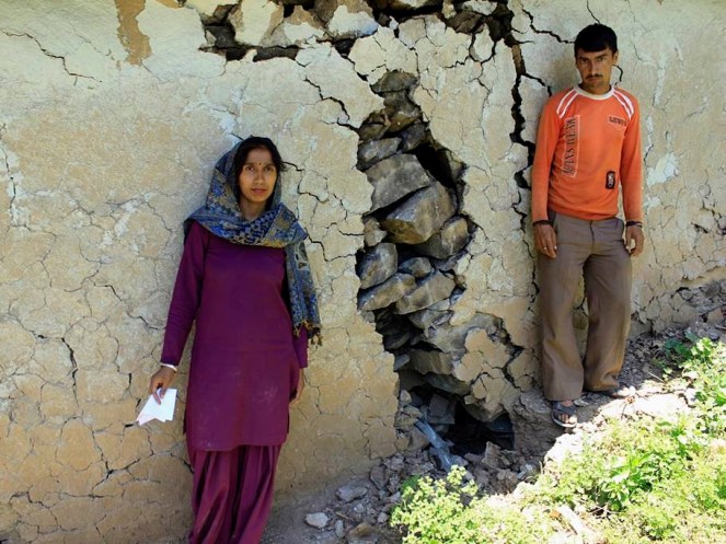
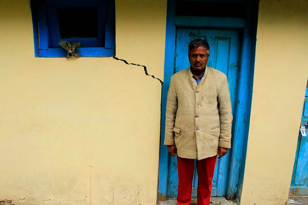
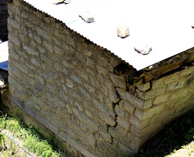
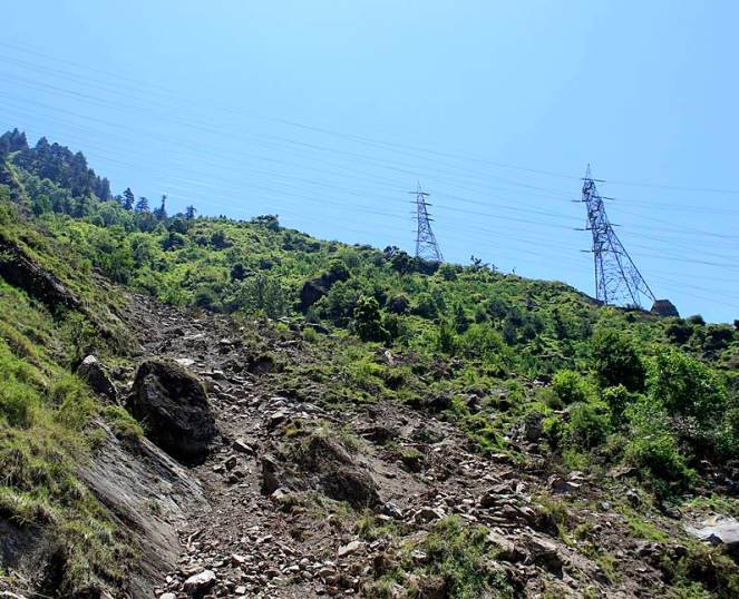
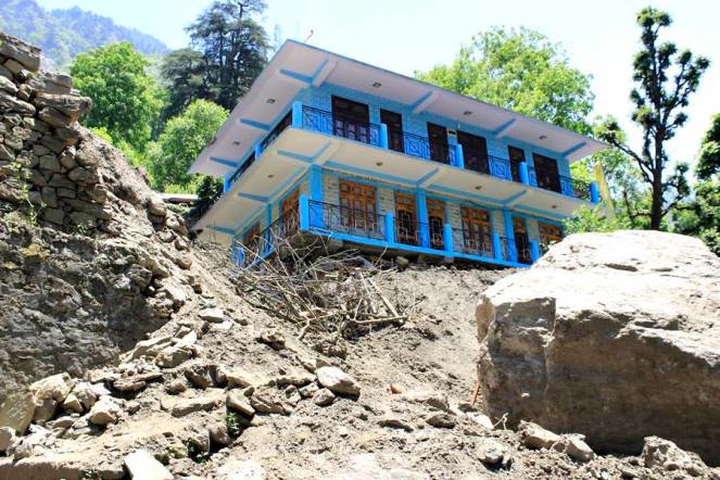
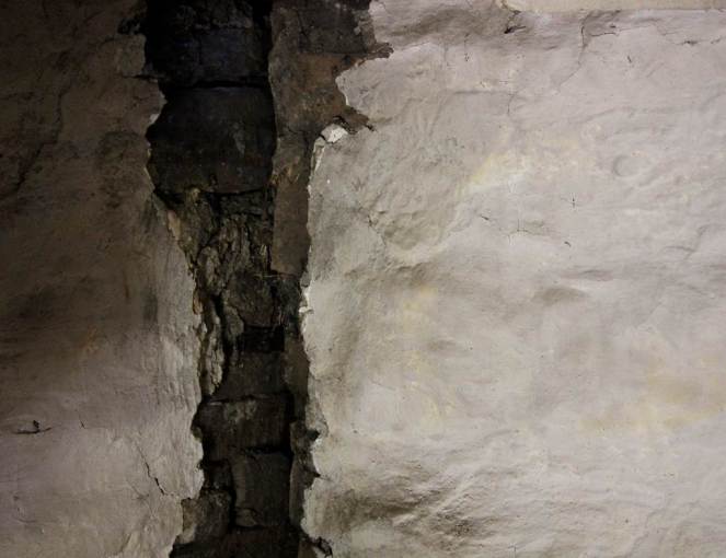
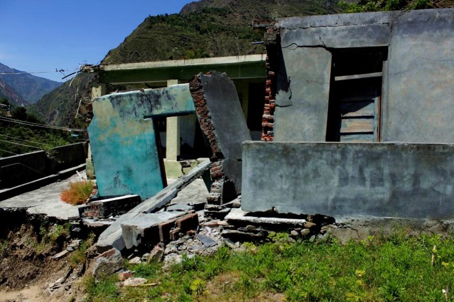
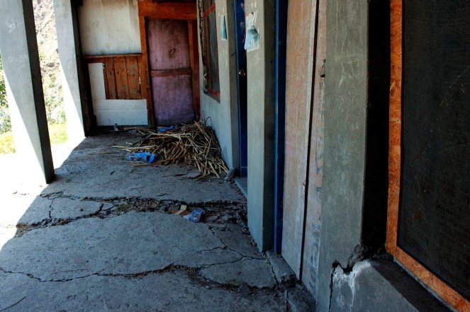
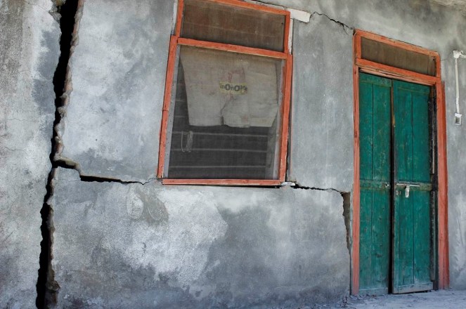
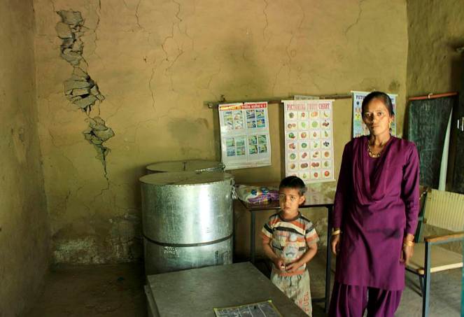
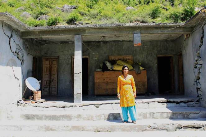
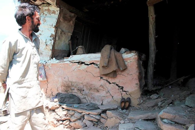
Tunneling for hydropower project using the blasting technique can have massive impacts. It has a series of direct and indirect impacts which have already been documented. Among the most serious impacts is drying up of the natural drinking water springs and the reduction in sub-soil moisture. This directly impacts the drinking water availability for the local villagers as well as agriculture and horticultural productivity, which is critically dependent upon the presence of sub-soil moisture. Blasting for tunnels and other underground components of hydroelectricity projects creates vibrations that have resulted in cracks in houses situated near these components.
Importance of impacts of tunneling and blasting becomes very important since all run of the river (ROR) projects involve tunneling and blasting. Proponents claim that ROR hydropower projects are environment friendly, but most people do not know that the tunneling and blasting adds an additional dimension to the impacts due to ROR hydropower projects and these can be very serious. Most environmental and social impact assessments or cumulative impact assessments do not even assess these impacts. Many times the proponent get away claiming that the impacts are not due to the projects, when in reality all evidence shows that these are very much caused by the tunneling and blasting being done as part of the construction of these projects.
This photo essay documents the impacts of tunneling and blasting for hydropower projects mainly in Kinnaur (part 1 of photo essay does the same for projects in Chamba district) of Himachal Pradesh. In Kinnaur the photo essay includes such impacts of 1000 MW Karcham Wangtoo and 1500 MW Nathpa Jakhri hydropower projects.[2] It is noteworthy that impacts are not only limited to large hydropower projects, but also to what is defined as small hydropower projects (projects below 25 MW installed capacity). This should also help puncture the misconceived notion that small hydropower projects are environmental benign and they do not need environmental and social impact assessment, public consultations, appraisal, monitoring or compliance.
These photo essays are indicative of the kind of impacts tunneling and blasting can have in the process of building hydropower projects in the Himalayas. What they indicate is relevant not only for Himachal Pradesh, but entire Himalayas and all projects that involve such tunneling and blasting. We hope these photo essays open the eyes of state governments, Union Ministry of Environment, Forests & Climate Change, Union Ministry of Power, Union Ministry of Water Resources, Central Electricity Authority, state environment departments, hydropower developers, EIA consultants, chairman and members of Expert Appraisal Committee on River Valley Projects, media, judiciary, civil society and all others concerned.
Karcham Wangtoo Hydro Power Project, Kinnaur
Project
Jaypee Karcham Wangtoo HEP
Capacity (MW)
1000
Basin
Satluj
District
Kinnaur
Villages
Choling, Yulla, Urni, Runnag, Meeru, Chugaun
Pictures taken on
25 May to 2 June 2014
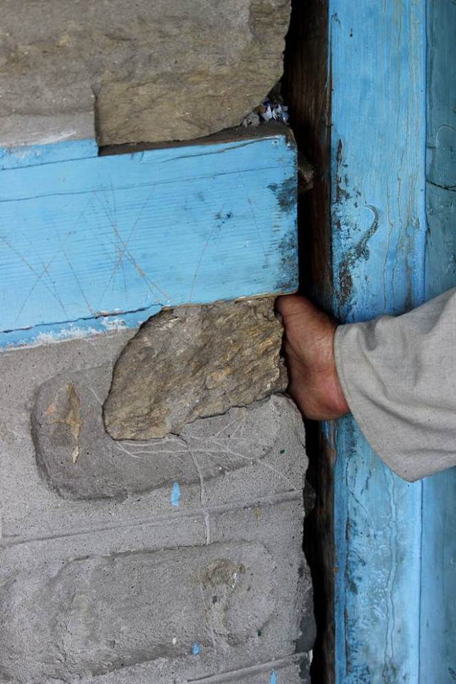
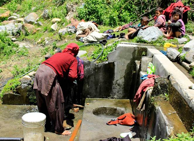
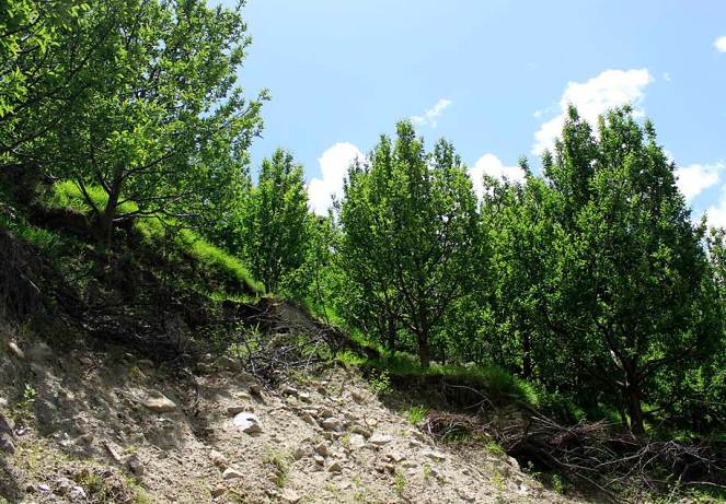
Murim-I, is a local stream that dried up due to the 17 km long 1000MW Karcham Wangtoo project’s tunnel in Kinnaur district. The stream is surrounded by grazing landsMurim-II next to Murim I shared a common source which led to drying up of both streamsNang Choling water source or chashma near the highway. The water was used for drinking not just by the people in Choling but also by passers by. This source has totally dried up now due to the Karcham Wangtoo tunnel constructionPeokeh-I is a water source in the Yulla village. The discharge of this source has reduced by 50% since the construction of the tunnel for Karcham Wangtoo HEPYet another source of water – Peokeh-II, Yulla village whose discharge has reduced by 30 to 40%Jyoti Prakash’s house in Yulla village suffered from cracks because of the tunnel construction of Karcham Wangtoo HEPJagat Singh’s fields had this water source and used this for drinking and irrigation. Due to the reduction in the discharge after tunnel construction there is just enough water to use for drinkingKakhiyo water source was used for drinking by 10 families in Yulla and the source is now totally dryLang Chuldhing water source in Yulla the discharge has reduced due to the tunnel. 4 -5 families in the vicitnity depend on this sourceRam Devi’s gharat in Yulla has been rendered useless along with another 4 above her’s. All due to the drying up of a water source – Yang baroYang Baro water source was feeding the watermills as well as irrigation channels. Now there is hardly any water for theseRamanand Negi showed this water source in Urni village which emerged suddenly in 2005. This has come out in a location where there is a landslide getting activeThis is the Urni steep slope where the landslide is activeRamanand’s House in Urni village which has developed cracks and crevices due to the blasting and construction of tunnel for Karcham Wangtoo ProjectRunnag Chashma is used by the Runnag village for washing and drinking. The water discharge has reduced substantiallyMunni Lal’s apple orchard which was impacted by a landslide last year when the June 2013 monsoon rains occurredLandslide just above the tunnel of Karcham Wangtoo project at Rangle. This was also activated lst year during the monsoonsRyabi Khaldam (Disturbed Source), the water source has relocated naturally after the construction of the tunnel beganLand slide at Meeru village activated last year and the main path of the village disturbedButhkas, IPH Source fully dried now as a result of tunnel. Almost the entire Meeru panchayat was dependent on this water for drinkingJagdish Chand Negi’s house in Chugaun was impacted because of the construction of Karcham Wangtoo TunnelCow shed developed cracks in Chugaun affected by Karcham Wangtoo Project’s tunnel construction
Nathpa Jhakari Hydro Power Project
Project
Nathpa Jhakari HEP
Capacity (MW)
1500
Basin
Satluj
District
Kinnaur
Villages
Nigulseri & Jhakari
Pictures taken on
29/05/2014 & 03/06/2014
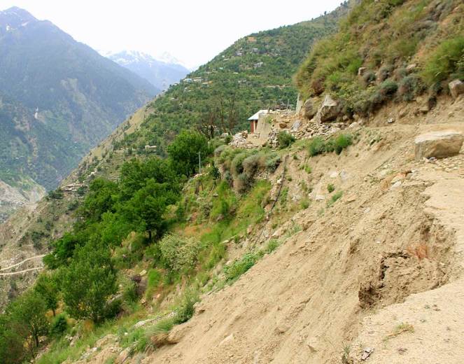
On 25th May 2014 this landslide occurred in Nigulseri village. Locals claim that the tunnel of 1500 MW Nathpa Jhakri Project had already disturbed the area which was further disturbed because of the transmission tower construction for Baspa II and Karchham Wangtoo HEPsGeeta Ram’s house affected by the landslide at NigulseriShamsher Singh’s house cracks at Nigulseri in May 2014. A total of 13 houses have suffered such damagesThis landslide has occurred near powerhouse of the Nathpa Jhakri project in Jhakri
For Part 1 of the photo essay related to tunneling impacts of hydropower projects in Chamba district, see: https://sandrp.wordpress.com/2014/10/01/photo-essay-on-the-impacts-of-blasting-and-tunneling-for-hydropower-projects-in-chamba-district-in-himachal-pradesh-1/
Guest Blog by: Sumit Mahar (sumitmahar.12@gmail.com), Him Dhara Environment Research and Action Collective, Himachal Pradesh [1]
Tunneling for hydropower project using the blasting technique can have massive impacts. It has a series of direct and indirect impacts which have already been documented. Among the most serious impacts is drying up of the natural drinking water springs and the reduction in sub-soil moisture. This directly impacts the drinking water availability for the local villagers as well as agriculture and horticultural productivity, which is critically dependent upon the presence of sub-soil moisture. Blasting for tunnels and other underground components of hydroelectricity projects creates vibrations that have resulted in cracks in houses situated near these components.
Importance of impacts of tunneling and blasting becomes very important since all run of the river (ROR) projects involve tunneling and blasting. Proponents claim that ROR hydropower projects are environment friendly, but most people do not know that the tunneling and blasting adds an additional dimension to the impacts due to ROR hydropower projects and these can be very serious. Most environmental and social impact assessments or cumulative impact assessments do not even assess these impacts. Many times the proponent get away claiming that the impacts are not due to the projects, when in reality all evidence shows that these are very much caused by the tunneling and blasting being done as part of the construction of these projects.
This photo essay documents the impacts of tunneling and blasting for hydropower projects mainly in Chamba (part II of photo essay does the same for projects in Kinnaur district) of Himachal Pradesh. In Chamba, the photo essay includes such impacts of Chamera III, Chanju, Ginni, A.T. hydropower projects.[2] It is noteworthy that impacts are not only limited to large hydropower projects, but also to what is defined as small hydropower projects (projects below 25 MW installed capacity). This should also help puncture the misconceived notion that small hydropower projects are environmental benign and they do not need environmental and social impact assessment, public consultations, appraisal, monitoring or compliance.
These photo essays are indicative of the kind of impacts tunneling and blasting can have in the process of building hydropower projects in the Himalayas. What they indicate is relevant not only for Himachal Pradesh, but entire Himalayas and all projects that involve such tunneling and blasting. We hope these photo essays open the eyes of state governments, Union Ministry of Environment, Forests & Climate Change, Union Ministry of Power, Union Ministry of Water Resources, Central Electricity Authority, state environment departments, hydropower developers, EIA consultants, chairman and members of Expert Appraisal Committee on River Valley Projects, media, judiciary, civil society and all others concerned.
Chamera III Hydro Electric Project, Chamba
Project
Chamera III
Capacity (MW)
231
Basin
Ravi
District
Chamba
Village
Mokhr
Pictures taken on
29/04/2014
In April 2012 there was a massive leakage in the 16km HRT of the 231 MW, Chamera III project just above the Mokhar village in Chamba district leading to severe threat to the village downhill so much so that the 40 families residing there had to be evacuated. This picture is of the Adit 6 of the tunnel. The leakage occurred during testing of the generating units.Leakages in the surge shaft of the 231 MW Chamera III tunnel just above the Mokhar village in ChambaVidya Devi’s house in Mokhar was completely damaged by the landslide caused due to the seepage from the surge shaft in April 2012Shri Jagdish Sharma standing in front of the debris of his leftover house after the leakage tragedyThe pastures of the village buried under the landslide caused by the seepages in Mokhar villageDamages caused by the leakage in the HRT to houses in Mokhar villageDamages caused by the leakage in the HRT to houses in Mokhar villageDamages caused by the leakage in the HRT to houses in Mokhar villageDamages caused by the leakage in the HRT to houses in Mokhar village
Cracks on the walls of Aaganbhadi Kendra of Dhalanjan village due to the tunnel construction of 36 MW, Chanju HEP in Chamba on Ravi basin’s Chanju nallahLilo Devi’s house was located just above the HRT of the Chanju project. 12 houses were completely damaged by the tunnel construction in this village in December 2013Power house site of Chanju HEP, where 1000s of trees were damaged by the blasting for the tunnel construction due to activation of a landslide
People of Dhalanjan village show their destroyed and dilapidated structures
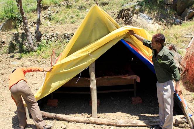
People of Dhalanjan village show their destroyed and dilapidated structuresPeople of Dhalanjan village show their destroyed and dilapidated structuresPeople of Dhalanjan village are now residing in temporary shelters
A.T. Hydro Power Project, Chamba
Project
A.T. Hydro
Capacity (MW)
5
Basin
Ravi (Tarela Nallah)
District
Chamba
Village
Alwas
Pictures taken on
01/05/2014
Landslide at Alwas due to road and channel construction for 5 MW Tarela project in ChambaCracks in the house of Shri Baija Ram due to Tarela Project in Alwas villageLanslide close to Alwas village due to Tarela project
Ginni Hydro Power Project, Chamba
Project
Ginni Hydro
Capacity (MW)
5
Basin
Ravi (Tarela Nallah)
District
Chamba
Villages
Tarela, Junas
Picture was taken on
01/05/2014
Watermill rendered dysfunctional due to landslide cause by construction work for the 5MW Ginni Project in Tarela village in Chamba. The Project also diverted the water that was being used by the village for the watermill. Almost 15-20 watermills in this village have dried up due to the project’s construction activitiesThe location of the landslide which dried up the watermill
Landslide due to the construction activities and then subsequent destruction of the penstock of the Ginni project further led to soil erosion. The village above the slides, Junas has 20 houses and now stand threatened
For Part 2 of the photo essay related to tunneling impacts of hydropower projects in Kinnaur district, see: https://sandrp.wordpress.com/2014/10/02/photo-essay-on-the-impacts-of-blasting-and-tunneling-for-hydropower-projects-in-kinnaur-district-in-himachal-pradesh-2/
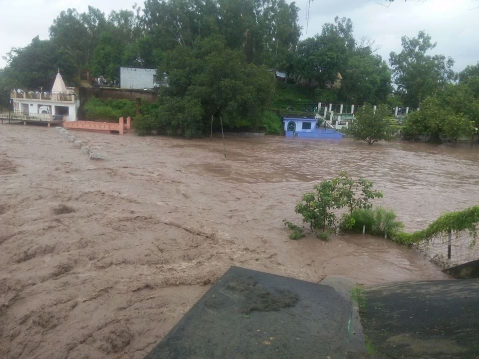
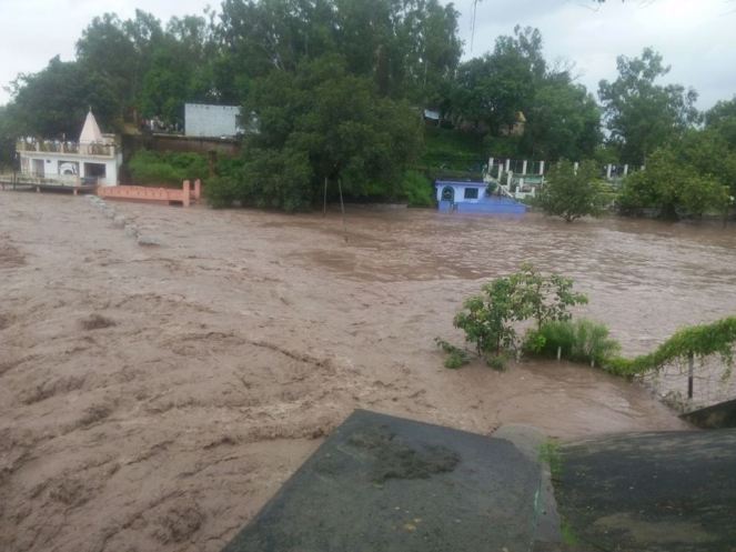
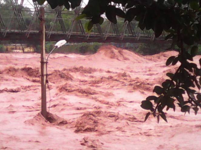
During Sept 4-6, 2014 Jammu and Kashmir in North India is facing one of the worst floods. NDTV[1] has reported that these are the worst floods in 60 years (The Times of India reported that this was worst flood of the state since independence based on number of casualties.). More than 160 people have died and some 2500 villages are affected (1615 in the valley, rest in Jammu), out of which 450 are completely submerged (390 in valley)[2]. Over 10 000 people are stranded across the state. The flood has affected almost all 10 districts in the Jammu region. J&K Chief Minister admitted that the rescuers have yet to reach the worst affected South Kashmir region. Jammu Srinagar Highway has remained blocked for over three days. Several rivers have been flowing above the danger mark and most parts of south Kashmir, including Pulwama, Anantnag and Kulgam districts have been submerged. Jhelum was flowing at 30.7 ft in South Kashmir, 7 ft above the danger mark. Chenab river was also flowing above the danger mark at several places.
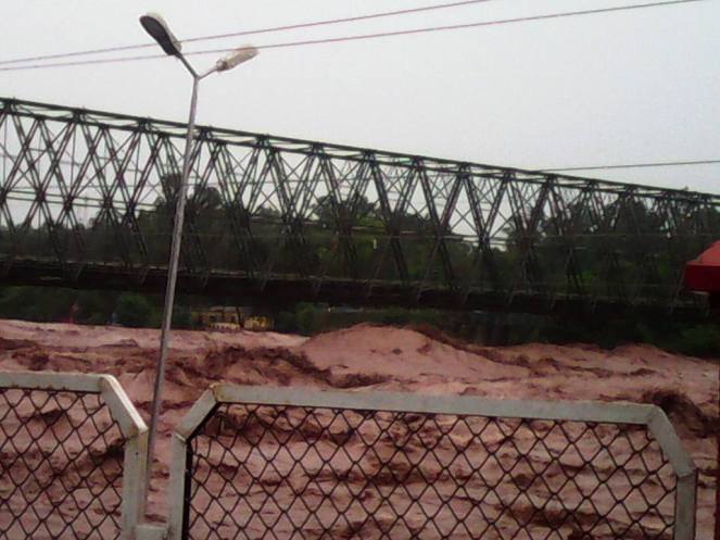
Authorities have declared the bridge over the Chenab in Akhnoor unsafe for traffic. Source: Vinay Saraf’s facebook post
Unprecedented floods Landslides triggered by heavy rainfall have damaged roads, dozens of bridges, buildings and crops. As many as 40 people went missing after a landslide in Thanamandi area of Rajouri district in Jammu region. Heavy rain in the catchment areas of Jhelum river has so far submerged more than 100 villages in the south Kashmir districts of Anantnag, Kulgam, Shopian, Pulwama, where the river was still rising, as well as the north Kashmir districts of Ganderbal, Srinagar and Badgam[3]. The flood has surpassed the 1992 memories and revived the 1959 flood memories[4].
Flood Forecast map of CWC has no sites to forecast floods in J & K
Vehicular traffic has been stopped on the Jammu-Pathankot highway due to incessant rain. Jammu is on red alert and Tawi bridge is also in danger.
Flood image from Vinay Saraf’s Facebook post
State Finance Minister Abdul Rahim Rather said Chenab was flowing at 38 ft at Akhnoor which is four ft above the danger mark cumulatively discharging 2.75 lakh cusecs, a quantum of discharge which equals all other rivers of the state.
The situation is very grim indeed: “According to the Army, the situation in the state is as grim as it was in Uttarakhand last year.” Union Home Minister has visited the state and the prime minister has expressed grief.
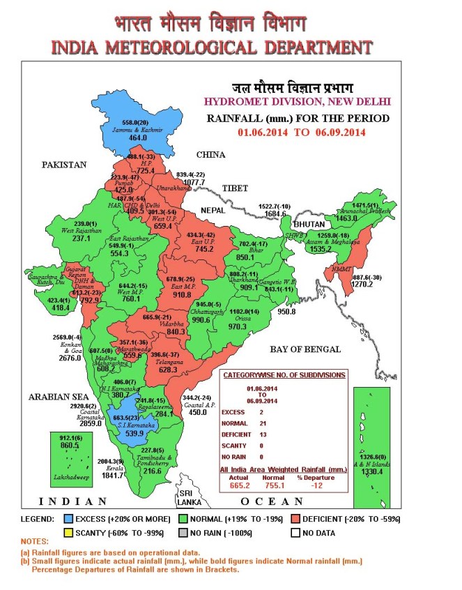
VERY HEAVY Rainfall during Sept 3-6 The state received massive 250 mm of rainfall in just three days between Sept 3-4, out of its seasonal monsoon rainfall of 568 mm till Sept 6, 2014. Rainfall just on Sept 6 was 106 mm, which is unbelievable 3116% of the normal rainfall for that date for J&K.
Rainfall Map from IMD showing that J&K received 558 mm rainfall till Sept 6, progressing to excess rainfall category in three days from deficit category on Sept 3, see the next map below
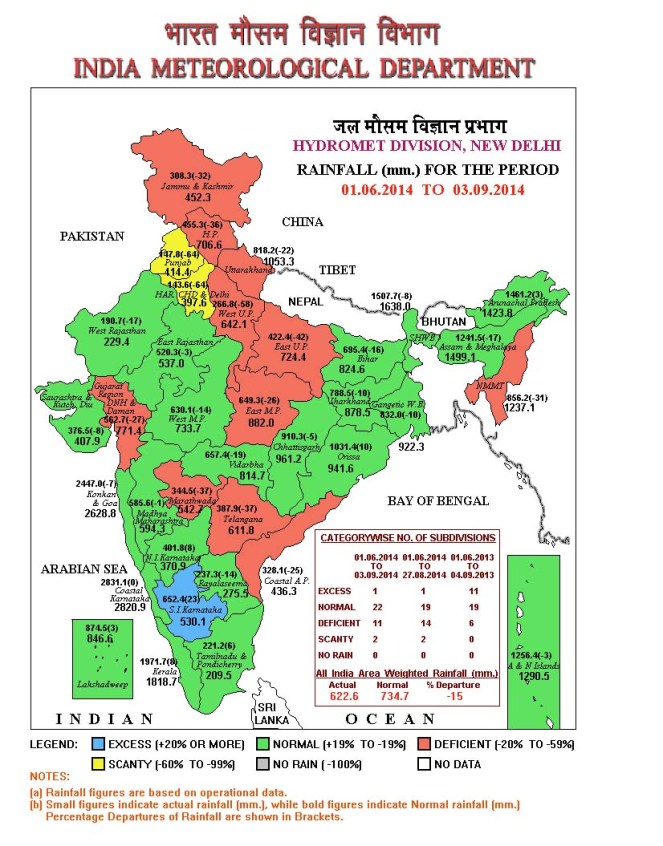
It can be seen from the season rainfall map see above of India Meteorology Department as on Sept 6, 2014 that J&K had received 558 mm rainfall till that date, progressing to Excess Rainfall category (blue colour code) from Deficit season rainfall of 308 mm as on Sept 3, 2014 (see IMD map below), in just three days.
IMD Map of Sept 3, 2014, showing J&K in deficit rainfall category (brown colour) with seasonal rainfall of 308 mm
CWC has no flood forecasts for J&K However, shockingly, India’s premier water resources body, Central Water Commission, responsible for flood forecasting and providing advisory to the states for tackling floods, has no flood forecast for any place in the state. The CWC’s flood forecast list[5] on Sept 6, 2014 has 18 level forecasts and 8 inflow forecasts, but NONE from J&K. CWC’s Flood forecast site has another option[6] that provides hydrographs for various rivers and location. Again for J&K it provides NO hydrographs. The options on CWC’s Flood Forecast site for list based selection[7] and map based selection[8] again has no information about Jammu & Kashmir.
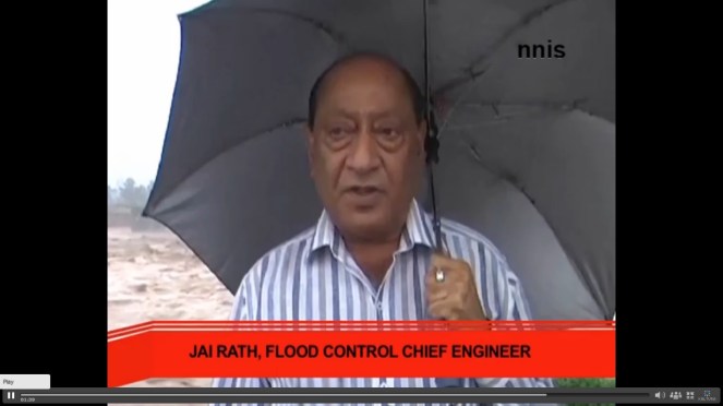
J&K Flood Control Chief Engineer called the situation Alarming. Photo Source – NNIS
This seems like shocking omission on the part of CWC, which functions under Union Ministry of Water Resources and reminds one that CWC completely failed to provide any flood forecast when Uttarakhand faced its worst floods in June 2013[9]. We hope CWC will urgently include the flood vulnerable sites of J&K in its flood forecasting and also explain to the people of J&K and rest of the country why these sites were not included so far.
Akhnoor flood image from Vinay Saraf’s Facebook post
Mismanaged hydro projects increase the damage In this context, media has reported[10] that Dulhasti Hydropower project on Chenab river decided to open its flood gates DURING the worst flood period, which lead to further increase in flood levels in the downstream areas: “Release of water by NHPC dam is expected to increase the levels of the Chenab massively between Kishtwar and Ramban. Surged level can lead to submergence of the highway.” Such additional floods could have been avoided if the gates were kept opened in anticipation of floods. Such opening of gates during the floods can lead to catastrophic consequences for the downstream areas as happened in case of Srinagar Hydropower project in Uttarakhand in June 2013.
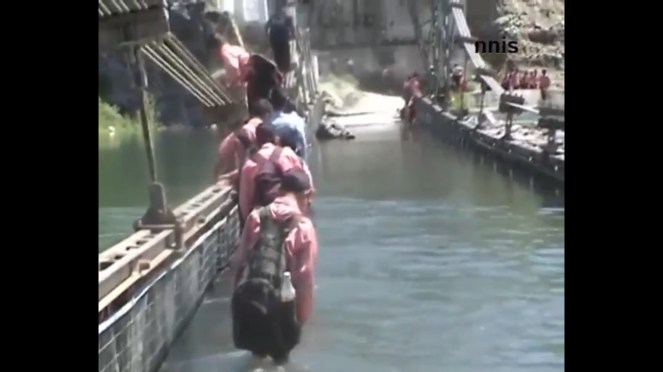
Kids crossing flooded bridge in flood hit J&K Photo Sources – NNIS
MoEF’s wrong decisions The Union Ministry of Environment and Forests have been clearing hydropower projects in the Chenab basin even without proper social and environment impact assessment as was evident in case of Sach Khas project most recently. As SANDRP pointed out in a submission to the Expert Appraisal Committee[11], the EIA and public hearing process of the Sach Khas HEP has been fundamentally inadequate and flawed and yet without even acknowledging the issues raised in this submission the EAC has recommended approval of the project. This is bound to be legally untenable decision. Such decisions by the EAC and MoEF are likely to add to the disaster potential in Chanab and other basins in J&K. There is also no cumulative impact assessment of such massive number of big hydropower projects any basins of J&K.
It is well known, as witnessed in case of Uttarakhand in 2013, that hydropower projects hugely add to the disaster potential of the vulnerable areas. We hope the J&K and central governments make this assessment on urgent basis and we hope the apex court does not have to intervene for such assessment as the Supreme Court had to do through its order of Aug 13, 2013 in case of Uttarakhand.
SANDRP
POST SCRIPT: This is one possible fall out of this, also flashed by several newspaper and following CWC questioned by media: http://www.cwc.nic.in/main/webpages/Flood%20Forecasting%20in%20uncovered%20Himalayan%20and%20interstate%20inflow%20forecasting%2011092014.pdf
Stumbled upon this on January 14, 2015. Hope the government will be now implementing this.