Dams · Floods

Overview of CWC Flood Forecasting Sites 2018: North India

Flood forecasting is an important activity during monsoon, considering the huge and increasing flood prone area, flood frequency, extent and flood damages. Accurate and timely flood forecasting can hugely help reduce the damages due to floods. Central Water Commission (CWC) is the only agency responsible for flood forecasting in India. To understand the CWC’s flood forecasting better, we have compiled the list of the various flood, inflow forecasting sites and flood monitoring sites in India.

In this compilation, we have given state wise list of CWC’s flood forecasting, flood monitoring and inflow forecasting sites, along with available details like rivers, sub basin, river basin, Warning level, Danger Level, High Flood Level, Full Reservoir Level, Maximum Water Level. As we see below, there are many gaps in this basic information for the sites that are part of CWC’s list.

Continue reading “Overview of CWC Flood Forecasting Sites 2018: North India” →

Dams · Yamuna River

Floods & Flood Monitoring in Yamuna: July 2018

The release of around 1.31 lakh cusecs of water in Yamuna from Hathnikund barrage at 09:00 hours on July 26, 2018, was certainly first surge of flood this monsoon in the river. But no one expected, most are still in the dark that the release would multiply by over five times in just two days! It is almost a month after the Southwest monsoon arrived. By this time the river usually floods couples of times.

Looking at the lack of significant rainfall in the catchment area over past weeks, the flood is unexpected and has taken many by surprise. The Irrigation and Flood Control Department, Delhi Government has issued warning for flood plain farmers and human settlements close to river banks, but the warning does not seem to commensurate with the flood peak that is likely to hit the capital in next day or two.

23 Yamuna Flood Chart 1963-2016
Bar chart by Irrigation & Flood Control Dept, Delhi showing history of floods in Yamuna river since 1963.

Yamuna has already crossed warning (204 m) and danger level (204.83) at Old Delhi Railway Bridge (ORB), Delhi. The High Flood Level is 207.49 meters, reached on Sept 6,1978 after around 7 lakh cusecs (cubic feet per second) water was released in Yamuna on 3rd Sept 1978 at 04:00 hrs from Tajewala barrage, that was decommissioned and replaced by Hathnikund barrage in early 1990s. The flood monitoring of River Yamuna began in 1963.

Since then, the river has seen high floods in 1988, 1995, 2010 and 2013. The 2010 and 2013 floods also crossed 207 metres mark but fell short of 1978 level.

Continue reading “Floods & Flood Monitoring in Yamuna: July 2018” →

Assam · Floods

Floods in Tripura, Mizoram, Barak Valley in June 2018

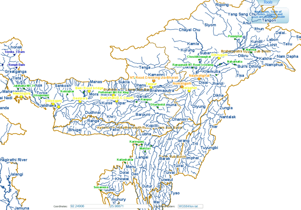
The second wave of floods (first wave came in around May 20-24) this year inA North East India is affecting Tripura, Mizoram and mainly Barak Valley in Assam. Worryingly, while CWC flood forecast site shows water level reaching unprecedented levels in Manu river at Kailashahar in North Tripura District, CWC seems to have NO flood forecasting site in Mizoram. At Matizuri site in Hailakandi district in Barak Valley in Assam, the Katakhal river also approaching its highest ever flood level. In Bangladesh too sites like Amalshid have crossed the HFL.  Continue reading “Floods in Tripura, Mizoram, Barak Valley in June 2018” →