The Maharashtra and Karnataka governments have accepted on affidavit that they have violated the Environment Protection Act 1986 and EIA Notification. The violations have happened in taking up the work even before seeking environmental clearance and both governments have promised on affidavit that this will not be repeated. This has come to light following SANDRP writing to the MoEF’s Expert Appraisal Committee on River Valley Projects about the violations.
SANDRP monitors Environmental clearance (EC) process of hydropower, irrigation and river valley projects, and has come across several proposals from Government of Maharashtra and Government of Karnataka (& others) wherein the Water Resource Departments seek Environmental clearance from the MoEF, even as work on the said projects is well underway on ground, violating the Environment Protection Act (1986) and the EIA Notification.
There may be several such projects from other states too which are violating Environment Laws, but the MoEF does not seem to have the capacity to monitor such violations.
The next meeting[1] of the Expert Appraisal Committee (EAC) on River Valley Projects will consider a proposal from Maharashtra worth nearly Rs. 5000 Crores for Krishna Marathwada Lift Irrigation scheme, which plans to divert 23.66 TMC (Thousand Million Cubic Feet) water from Ujani Dam to irrigate over 100,000 hectares of land in Beed and Osmanabad districts. Ironically, work on Krishna Marathwada scheme is well-advanced, and the State has already spent nearly Rs 500 crores on it, without clearances. SANDRP had put these facts in front of the EAC on Dec 5, 2013, before the 70th meeting of EAC that was held on Dec 10-11, 2013. EAC had then asked the Godavari Marathwada Irrigation Development Corporation (GMIDC) to stop all on going work on the project and demanded an affidavit that no work will start without EC and that the EIA Notification and EPA will not be violated further. It also demanded a Board resolution to this effect.
In response, as per documents with SANDRP, in July 2014, the Governing Council of GMIDC, chaired by the State Water Resource Minister Shri Sunil Tatkare and Chairperson of GMIDC passed a resolution, that “There will not be any recurrence of violation”. The Superintending Engineer, Osmanabad Irrigation Circle has also signed an affidavit with an undertaking that all work on the project is stopped unless EC is secured.
Similarly, Sonthi Lift Irrigation Project from Karnataka was deliberated for clearance in the presence of officials from Karnataka, when the project was almost complete on ground. SANDRP brought this to the notice of the EAC which then issued notice to Krishna Bhagya Jal Nigam Limited. The EAC or MoEF did not take strong action against the proponent and in fact recommended Stage 1 Clearance for the project (April 2014) which is already nearing completion. This decision of EAC was without justification or legal mandate.
Karnataka Neeravari Nigam Limited’s (KKNL) Shiggaon Lift Irrigation Project too will be discussed during the upcoming 76th EAC meeting. The project was discussed in the EAC on September 2013, when as it was formally inaugurated by Karnataka CM in November 2012 itself! In case of Shiggaon too, SANDRP pointed out the violations to the EAC, MoEF, which them issued a notice to the KKNL to file an affidavit about the violation and an undertaking to stop work and not resume it unless EC is granted. The KKNL has filed an affidavit stating “there will be no recurrence of violations”, thus accepting preset violations.
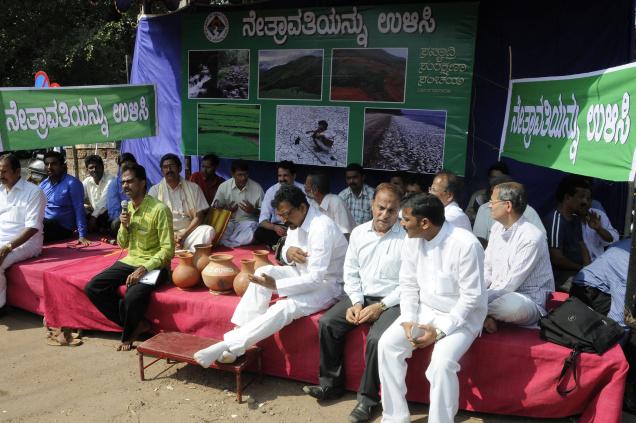
Similar violations of EPA (1986) and EIA Notification (2006) have occurred in case of Singtalur Lift Irrigation scheme in Karnataka. The state has also willfully escaped Environment Appraisal for Yettinahole/ Netravathi diversion project under fraudulent claims.
In case of Maharashtra, the recent CAG report 2014 gave a list of 249 projects that do not have EC and more than 89 do not have Forest Clearance (FC), violating the Forest Conservation Act (1980), causing a loss of thousands of crores to the state. SANDRP has made submissions about many such projects undertaken by WRD, Maharashtra without requisite clearances. Some of these include Shirapur Lift Irrigation Scheme in Solapur, Lower Tapi Irrigation Project in Jalgaon and over 10 Lift Irrigation schemes based on Ujani Dam. MoEF has not taken any action for projects which do not approach the EAC for clearances, even when presented with evidence of violations, thus ignoring blatant violations.
Environmental Clearances are critical from environmental and social point of view and they are also important as a third-party expert appraisal of the project. The Expert Appraisal Committee (EAC) of the MoEF is supposed to look not only at the environmental and social impacts of the project, but also assesses the overall optimality, feasibility and justification, hydrologic soundness of the project, and also the veracity of the supposed benefits of the project. This is also the only platform which includes a Public Hearing through which local communities have a chance to put forth their concerns, BEFORE the project comes up. Escaping Environmental Appraisal thus does not only mean flouting a legal requirement, but an absence of any third party appraisal of the project.
In a state like Maharashtra which has seen huge scams and corruption in irrigation projects, such a third party appraisal is critical from environment as well as larger public welfare point of view.
In this context it is pertinent to note that para 5 of the MOEF’s Office Memorandum dated 12.12.2012 dealing with violations states: “The State Government concerned will need to initiate credible action on the violation by invoking powers under Section 19 of the Environment (Protection) Act, 1986 for taking necessary legal action under Section 15 of the Act for the period for which the violation has taken place and evidence provided to MoEF of the credible action taken.” (Emphasis added)
We are glad that the EAC took cognition of our submissions and refused to clear some projects, asking for affidavits on violations from Maharashtra and Karnataka governments on Krishna Marathawada LIS and Shiggaon LIS respectively. However, in case of Krishna Marathawada LIS in Maharashtra and Shiggaon Lift Irrigation Scheme in Karnataka, no action has been taken under section 19 or section 15, and hence we hope EAC and MoEF will ask for action as legally mandated. In any case, they have no mandate to consider these projects till such action is taken.
We hope rule of law will be followed in letter and spirit.
Prime Minister of India and Chairperson, National Board for Wildlife
Shri. Prakash Javadekar,
Minister of State of Environment, Forests and Climate Change (IC) and
Chairperson, Standing Committee, National Board for Wildlife
Shri. V. Rajagopalan,
Secretary, Ministry of Environment, Forests and Climate Change
Shri. S. S. Garbyal,
Director General of Forests and Special Secretary,
Ministry of Environment, Forests and Climate Change
Subject: Request to urgently amend the flawed constitution of the National Board for Wildlife (NBWL) as indicated in Notification issued by MoEF dated 22 July 2014 & not hold any meetings based on this flawed notification.
Respected Prime Minister, Hon. Minister and Sirs,
It is with great concern that we write to you about the constitution of the new NBWL as indicated in the Government Notification dated 22ndJuly 2014.
The term of the previous NBWL and its standing committee ended in Sept 2013, as was noted by the then chairperson of the standing committee and recorded in the minutes of the latest (Sept 2013) meeting of the standing committee (see: http://www.moef.nic.in/sites/default/files/MOM-30-NBWL-04.09.2013.pdf): “At the outset, Hon’ble Chairperson while welcoming all participants to the 30th Meeting of Standing Committee of NBWL expressed deep appreciation of the contribution of the non-official members in the meetings of the Standing Committee of NBWL and their selfless dedication for the cause of conservation. She added that the present term of NBWL was coming to an end on 5th September 2013 and that the discussions and deliberations made by the present members during the Standing Committee of NBWL meetings had helped the Chair in taking judicious decisions.” (Emphasis added.)
So country was without NBWL and standing committee for more than the ast ten months and the country expected that the government would constitute a proper NBWL honouring the letter and spirit of the Wildlife Protection Act and the need to protect wildlife and biodiversity in protected areas. The concerned people of the country stand disappointed by the July 22, 2014 notification.
At the outset, the Notification dated 22 July 2014 is ambiguous about the constitution of the NBWL and its Standing Committee. It is not even available on MoEF website. The notification seems to be in violation of the Wildlife Protection Act in letter and spirit and is not in the interest of the wildlife, biodiversity or protected areas in the country. A comparative reading of Sept 2003, May 2007 and Sept 2010 notifications of the MoEF about constituting NBWL further strengthen this view.
The notification only mentions a small subset of the NBWL members as listed in the Wildlife (Protection) Amendment Act, 2002. The limited list is in violation of the Wildlife (Protection) Act, 1972 and its subsequent amendment in 2002 by way of the Wildlife (Protection) Amendment Act, 2002. The Director General of Forests is on record having said that this is the entire NBWL. (Please see:http://www.thehindu.com/todays-paper/tp-national/tp-otherstates/new-national-wildlife-board-flouted-wlpa-guidelines/article6261988.ece) This confirms the illegality of the notification.
We would respectfully like to submit that a notification issued by the government cannot override or violate an Act passed by the Parliament, with the ascent of the Hon. President of the Union of India.
Main points of divergence between Wildlife (Protection)Amendment Act, 2002 and the Notification issued on 22nd July, 2014 are as follows:
Clause (e) of the Wildlife Protection Amendment Act, 2002 states:
“(e) five persons to represent non-governmental organisations to be nominated by the Central Government”
However, the Notification dated 22 July 2014 does not nominate any NGO. The only name notification gives for NGO member, namely GEER is not an NGO.
The nominated “Gujarat Ecological Education and Research (GEER) Foundation, Gandhinagar, Gujarat” is a Gujarat Government organisation and not an NGO. Its website is http://www.geerfoundation.gujarat.gov.in, says, it has been “set up in 1982 by the Forests & Environment Department, Government of Gujarat” and the Chairperson of its board is Chief Minister of Gujarat while majority board members too are from Gujarat Government. Thus GEER stands disqualified from being nominated as an NGO.
Clause (f) of the Wildlife (Protection) Amendment Act, 2002 states:
“(f) ten persons to be nominated by the Central Government from amongst eminent conservationists, ecologists and environmentalists”
However, the notification dated 22 July 2014 replaces this by just two people.
“(i) Prof. Raman Sukumar,
(ii) Dr. H.S. Singh.”
Clause (v) of the Wildlife (Protection) Amendment Act, 2002 states:
“v) one representative each from ten States and Union territories by rotation, to be nominated by the Central Government”
However, the notification dated 22 July 2014 replaces this with just five states.
In view of the above, the notification dated 22 July 2014 violates Wildlife (Protection) Amendment Act 2002 and should be urgently taken back. Any meetings or any decisions taken by this board will not stand legal scrutiny.
Apart from the legal issue, it is important for a board like NBWL to have a broader regional representation of independent experts, NGOs and members and this was one of the the objectives behind nominating these members on the NBWL and its standing committee. We hope that the government will appreciate this issue. Indian Wildlife, biodiversity and its habitat like the protected areas, forests, rivers, wetlands, etc., are under tremendous pressure and we hope the new government is committed to conserve our rich wildlife heritage.
We therefore look forward to urgent action on the points mentioned above by immediately taking back the 22nd July 2014 Notification and replacing it with a notification that spells out constitution of NBWL respecting the WLPA in letter and spirit and also respecting India’s wildlife and its dwindling habitat. We hope that no meetings of the NBWL happen before a correct constitution of the board.
Looking forward to your response on the points raised above.
Yours sincerely,
No.
Name/ Organisation
Location
1.
Kalpavriksh Environment Action Group
Pune
2.
Dr. Bhaskar Acharya, Researcher, Bangalore
Bangalore
3.
Dr. Sunil K. Choudhary
University Dept. of BotanyT.M.Bhagalpur UniversityBhagalpur-812007, India
4.
Dr. Rajeev Raghavan South Asia Co-Chair, IUCN SSC/WI Freshwater Fish Specialist GroupMember, IUCN SSC Red List CommitteeMember, IUCN WCPA/SSC Joint Task Force on Biodiversity and Protected Areas
5.
Shripad Dharmadhikary
Pune
6.
Himanshu Thakkar, SANDRP 86-D, AD block, Shalimar Bagh, Delhi, 09968242798
Delhi
7.
Lyla Bavadam
8.
Ranjana Pal
9.
Dr. Latha Anantha, River Research Centre,
Kerala
10.
Cara Tejpal, Conservationist
Delhi
11.
Girish A. Punjabi, Researcher,
Pune
12.
Nachiket Kelkar, Ecologist
Bangalore
13.
Shardul Bajikar, Ecologist, Mumbai
Mumbai
14.
Adv. Indavi Tulpule
Murbad, Thane
15.
Anand Arya
Delhi
16.
Vijay Diwan, Aurangabad Social Forum
Aurangabad
17.
Manshi Asher, Himdhara,
Himachal Pradesh,
18.
Jitn Yumnam, Citizens Concern for Dams and Development, Committee on the Protection of Natural Resources in Manipur, Centre for Research and Advocacy
Imphal, Manipur
19.
Samir Mehta, River Basin Friends
Mumbai
20.
Bharat Seth, International Rivers
Delhi
21.
Joy KJ, SOPPECOM
Pune
22.
Deepali Nandwani
23.
Ravi, Namita and Medha Potluri.
24.
Jagdeep Chhokar
25.
Nitu.S
26.
Munish Kaushik
27.
Ramanathan Sriram
28.
Soma Jha
29.
Dr. V K Gupta
30.
Sabyasachi Patra
31.
Manoj Gupta
32.
Sarita Kumar
33.
Dipu Karuthedathu,Member BNHS, Co-Moderator of keralabirder egroups
301, Jaya Emerald, Maruthinagar, Bangalore
34.
Aditya Panda Naturalist | Wildlife Conservationist | Photographer
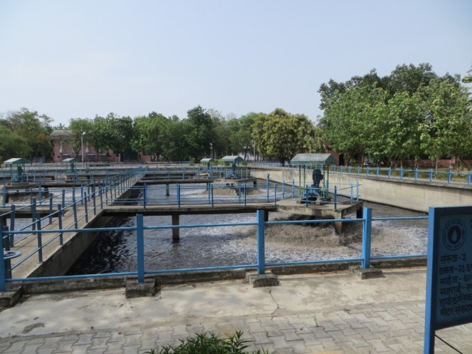
MSPGCL (Maharashtra State Power Generation Corporation Ltd) has signed a Memorandum of Understanding (MoU) with Nagpur Municipal Corporation (NMC) to supply treated water from municipal sewage plant as the water linkage to meet additional demand of MSPGCL’s proposed expansion plan. MSPGCL has agreed to pay NMC Rs 150 million (15 crores) every year for the next 15 years as royalty fee. MSPGCL has two existing thermal power plants (TPP) near Nagpur City. One of the TPP is 840 MW capacity at Khaperkheda, and the other is of 1100 MW is at Koradi. MSPGCL has planned for three new power units – one at Khaperkheda and two at Koradi, each with 660 MW capacity. MSPGCL has also agreed to construct a new sewage treatment plant with tertiary treatment capability with the capacity to pump the treated water to its thermal power stations.
Reusing treated sewage water for thermal power project is a welcome move. However it cannot be seen in isolation. Overall performance of MSPGL and NMC in terms of use of water as a resource and treatment has also to be looked at. Putting together several pieces of information reveals that there is a lot more to this decision. As far as sewage treatment of Nagpur is concerned, NMC is opting for public private participation through sewage treatment. There are layers of irregularities to this decision as well.
Given below is a quick overview of happenings.
MSPGCL opts for treated sewage due to rejection of fresh water allocation for the TPP from Pench River[i]: MSPGCL had the existing allocation from Pench River for 55 Million m3/ year. With the addition of three new power units, MSPGCL was looking for additional water requirement of 58 Mm3/ year starting in 2015, when the new power plants come online.
Following a request from MSPGCL, the Irrigation department of Government of Maharashtra, increased the water allocation from 55 to 67 Mm3/year with a maximum use of 75 Mm3/year within 10 percent variation. However, this was projected to be insufficient for all three units, and there was no additional freshwater allocation available for MSPGCL from any other source.
Idea of using treated sewage water as a water linkage for TPP stemmed from the concept of NEXUS[ii]. NEXUS is a concept and an approach that aims to boost potential to increase overall resource use efficiency and benefits in production and consumption by addressing externalities across sectors.
To resolve the issue of water availability for MSPGCL, USAID, through its project titled Water Energy NEXUS Phase – II (WENEXA – Phase II), initiated a feasibility study that included demand assessment and evaluation of alternate water sources. The study assessed feasibility of use of high quality tertiary treated water from the city of Nagpur’s wastewater plant. WENEXA – Phase II project also implemented a six month long pilot plant to showcase achievable output water quality and get buy-in from both NMC as well as MSPGCL that reuse is effective and feasible.
MoU between MSPGCL and NMC has been signed in year 2009 based on results of this study, pilot plant data and the potential for getting good quality reclaimed water in short period of time. Based on this agreement, NMC being a municipality, approached the central Government and received a grant for a sum of Rs 800 million towards the project under the Jawaharlal Nehru National Urban Renewal Mission (JNNURM), while the remainder of the cost Rs 1200 million to be borne by MSPGCL.
NMC officials said that STP work had started in March 2012 and was expected to be completed by March 2014. The plant is 50% complete. The pipeline from the STP to the two thermal power units is also half complete. Trial run will take place in 2014 or early 2015[iii].
The centre on December 22, 2006 approved the STP project with installed capacity to treat 135 million liters per day (MLD) sewage water at a cost of Rs 130.11 crore.
Due to delay and other reasons the project’s cost increased to Rs 195 crore during work order stage[iv].
NMC’s monthly progress report on JNNURM projects says 56% of the works have been completed. Expenditure on the project comes to Rs 95.76 crore as of January 31 (2014). The centre approved Rs 26.02 crore, and state had released Rs 10.40 crore as on January 31. NMC and MSPGCL had contributed Rs 50.80 crore.
MSPGCL polluting river Kanhan Here is it relevant to note that MSPGCL is discharging untreated effluent from Khaparkheda and Koradi power plants into Kanhan River containing toxic fly-ash. NMC draws this water at its 240 MLD water treatment plant (WTP) and supplies it to the almost 40% of the city, mostly North and East Nagpur.
Print media report of January 2013[v] states that the discharge spot is near Sillewada village that is located near the 500 MW unit of Khaparkheda plant. Sillewada is not located along any major road and only locals know about its existence. Moreover, the discharge spot has to be reached on foot through bushes.
The report also states that water of the river is highly polluted with poisonous substances like lead, arsenic, mercury and heavy metals that cause a host of ailments including cancer. MSPGCL uses coal having 50% fly ash against maximum permissible limit of 34%. The electrostatic precipitator and bag filters of Koradi plant are not functioning. MPCB has not taken any action against MSPGCL for blatant violation of norms.
MSPGCL’s expansion plan for the 36-year-old Koradi plant was given environmental clearance on January 4, 2010[vi] against condition of installing Flue Gas Desulphurisation (FGD). While considering the request of MSPGCL to review the condition regarding installation of FGD system was considered by Expert Appraisal Committee (EAC) in its 54th meeting on August 6-7, 2012, the Committee noted that the data submitted by MSPGCL appeared to be inadequate and inconclusive.
The EAC also noted that there were several complaints of fly ash management for Koradi Plant. That a PIL was pending in the Nagpur Bench of the High Court of Bombay was purportedly with respect to hazards of fly ash from power plants run by MSPGCL including the Koradi plant[vii].
NMC plans a barrage at polluted River Kanhan for drinking water supply NMC plans to construct a barrage at the confluence of Kanhan and Kolara rivers[viii]. The project aims to increase water supply from Kanhan water treatment plant, which would benefit East, North and few parts of South Nagpur. NMC had constructed water treatment plant with installed capacity to treat 240 MLD water. However, the plant cannot function to full capacity due to shortage of raw water from Kanhan River.
A proposal has been tabled before the standing committee seeking approval for Rs 1.82 crore for the construction of barrage[ix]. The standing committee was set to give its nod in the meeting organized on July 14, 2014.
Sewage treatment for Nagpur The city of Nagpur is generating over 450 MLD sewage daily of which NMC is presently treating only 80 MLD[x]. (Details of water supply and sources of water provided in Annexure I)
NMC is operating sewage treatment plant (STP) with an installed capacity of 100 MLD at Bhandewadi and treats 80 MLD water at the STP since 2001. The total cost of treating water comes to around Rs 3 crore per year. In these ten years, NMC has let treated sewage water flow in untreated sewage water of Nag River. Remaining untreated sewage flows into the Nag, Pilli and Pora rivers. The untreated sewage from Nag River flows into Kanhan river, then Wainganga river and finally into Gosikhurd dam.
NMC has plans to earn additional revenue of Rs 25-30 crore per year from treated sewage water. Now NMC has decided to enhance STP capacity to 200 MLD on PPP model. The private operator will enhance the plant capacity followed by operation and maintenance on his own. The operator will sell this water to the interested parties like industries).
PPP project for NMC’s own STP started before JNNURM approval On 27 Sep 2013, the NMC standing committee approved a proposal to construct a sewage treatment plant (STP) on public-private partnership (PPP) basis. It issued a work order to a joint venture of private companies -Vishwaraj Infrastructure Limited (VIL), Drake & Scull Water and Power LLC, and Vasundhara Drills and Drainage Private Limited.
The project is a part of the sewage system plan submitted to the central government under JNNURM scheme. Interestingly the work order has been issued even before the plan has received a nod from the centre. The tendering process for this project started in September 2010. However, the JNNURM plan was submitted to the centre only in February 2013[xi]. Also there is a difference of around Rs 400 crore in the operation and maintenance cost of NMC and the operator awarded tender.
Strong political linkages in PPP projects Media reports that Vishwaraj Infrastructure Ltd. is believed to have strong political linkages with the ruling party[xii]. VIL is also involved in the PPP contract for water supply of Nagpur city. Concession agreement for the water supply PPP has also been signed with a consortium of VIL and Veolia Water India Ltd[xiii].
Selective application of NEXUS and PPP for Sewage Treatment On one hand though MSPGCL is taking waste water for water linkage of TPP, on the other hand it is severely polluting Kanhan River. It only shows that concept of NEXUS has been adopted selectively and not holistically. Moreover the trigger for using waste water is actually the rejection of more fresh water allocation from Pench River by WRD. Releasing polluted water to the river is in clear contradiction with the NEXUS concept which talks about catering to the externalities across the sector. Both NMC and MSPGCL have adopted the concept of NEXUS only to ensure monetary gains. The link goes further and the Kanhan River water made toxic by MSPGCL plants is set to be supplied for the people of Nagpur city.
While reuse of treated sewage by thermal power plant is welcome, in this case, it is being done only after the plant failed to get freshwater supply in the first place. The proposal is still a welcome move. However, when we take the full picture into account we see that the same thermal power project is polluting city’s water supply. PPP for sewage treatment seems to be adopted more to serve political links than the needs of the city. The project is being pushed even before it gets requisite sanctions.
We had earlier written about the reality of the 24X7 water supply claims vs reality in the same city of Nagpur. One thing that clearly comes across the two articles is that in India’s Urban Water Sector, as can be seen from Nagpur example, there is no drive to achieve greater democracy, or greater transparency, accountability and participation. Till such inclusive management is achieved, no amount of new ideas, finances, technologies, infrastructure or partnerships is going to help.
Amruta Pradhan
amrutapradhan@gmail.com
Annexure I
Present water sources for Nagpur Present Annual Raw Water reservation from various sources for city water supply & respective present drawal is as below:
Source: DPR of ‘24×7 Water Supply Project for Nagpur City’
Source
Annual Reservation
Actual Drawal
Mm3/year
MLD
Mm3/year
MLD
Kanhan River
55.00
150.70
43.80
120.00
Pench Project (Pench Right Bank Canal)
112.00
306.88
143.00
400.00
78.00
213.72
Gorewada Lake
5.80
16
6.80
20.00
Total
250.80
687.30
217.60
540.00
As per billing by Irrigation department to NMC. Losses through Canal seepage in the length of 48.50 Km length of travel is @ 20-25% as per the observation of Water audit & Leak detection Study.
Present Treated Water Supply from Various WTPs is as follows-
Source: DPR of ‘24×7 Water Supply Project for Nagpur City’
[ii] It aims to reduce trade-offs and generate additional benefits to outweigh the transaction costs associated with stronger integration across sectors. NEXUS focuses on cross-sectoral management that boosts overall resource use efficiency. Turning waste and by-products into a resource for other products and services like waste energy integration is one of the most important focus areas.
Attempt to blast the dam starts; 8 killed, many more at missing, at risk;
Google map of the location, the landslide location seems just upstream of the dam
A massive landslide at around 2.30 am on Aug 2, 2014 has blocked the flow of the river Sunkoshi in Nepal. Twelve hours later and after first failed attempt by the Nepali army to blast the artificial dam, the reservoir behind the dam continues to swell. Already eight people have been confirmed dead, over 300 are reported missing[1]. Many more are at risk in the downstream Nepal and further downstream India. Sunami Power house has already been inundated. The Landslide seems close to an existing dam on the river. If this is true, when the landslide dam bursts either due to the army efforts or due to the water pressure, it is likely to take the dam with it and this could increase the downstream impacts.
A view of the landslide dam photo courtesy Setopati.com
Prof David Petley wrote to SANDRP about this: “It is very dangerous indeed. I know this site very well as we have been working in that valley for a decade or so. I suspect that the breach will happen quite quickly and will be very damaging.”
“Bishyari much more devastating than GLOFs” Former Water Resources Minister and well known water expert Dipak Gyawali told SANDRP: “Bishyari is the Nepali word for this kind of a “landslide dammed lake outburst flood” much more devastating than the GLOFs . This is a geo-hydrological phenomenon and as the pictures show, brings down entire mountains with thick forests on them. This one was on an old landslide still active but exacerbated by the recent spate of hydropower as well as road blasting.” Jayanta Bandyopadhyay and Dipak Gyawali were the first to put the word ‘bishyari’ in English, in a 1994 much-quoted article in Mountain Research and Development.
Massive scale of the landslide dam, photo thanks to Kathmandu Post
Indian border is about 260 kilometers downstream from the landslide when measured along the river and on the way there is also the Kosi Barrage at Bhaimanagar / Rajbiraj (correction from earlier reported distance).
A view of the massive landslide dam, photo courtesy Nepalhub.com
This morning, an email from our friend Ratan Bhandari from Kathmandu informed of this development, and it seems like a bad news to precede Indian Prime Minister Narendra Modi’s visit to Nepal, but it could also be a timely wake up call not to go for massive interventions in the Himalayan states.
Rising reservoir behind landslide on Sunkoshi river, Nepalhub.com
The massive landslide blocked Sunkoshi River at Mankha VDC in Sindhupalchowk[2] district. Around two dozens houses were buried in the landslide. The landslide has also buried Arniko Highway at Dam Site in Mankha VDC. Locals in Barhabishe, Lamesanghu, Khadichaur, Dolalghat, among other surrounding areas have moved to safety fearing that the blocked river may burst anytime. A Nepal Army chopper has been deployed to intensify the rescue work. The government has mobilized security forces to break a landslide dam that has blocked the flow of water in Sunkoshi River[3] in Jure of Mankha VDC, Sindhupalchowk.
A view of the dam and the river, photo courtesy Setopati.com
The Central Natural Disaster Relief Committee (CNDRC) has asked the Ministry of Home Affairs[4] to declare the areas downstream the blocked Sunkoshi River, from Jure of Sindhupalchok to Nepal-India border, “crisis-hit region” as the threat of outburst floods loomed large. It is hoped that the Indian authorities in downstream Indian areas are alert and doing necessary steps for the protection of life and property in India.
Landslide and the dam photo courtesy onlinekhabar.com
According to the Ministry of Home Affairs, the water level rose to above 130 metres. About 100 houses on the bank of the river have been submerged in Jure of Ramche VDC-5[5], the Araniko highway itself has been blocked.
Houses affected by landslide, photo courtesy onlinekhabar.com
The Sunima hydropower project (constructed in 2004-5) that has already been inundated is a 2.6 MW project built by Himal Hydro[6]. The dam of the 10.5 MW Sunkoshi hydro project (completed in 1972 with Chinese aid) is immediately downstream from the landslide, and is likely to face damage along with its power station further downstream whenever the dam breaches.
A view of Sanima Power House in Sindhupalchok, photo courtsy Himalayan Times, Nepal
Dr David Petley, who has traveled in the area writes in his blog[7]: “However, it is now a crisis. In the peak of monsoon season the river flow is high, and the images show that the lake is filling quickly. The images suggest that there is no reason to be confident that the dam will not breach rapidly when overtopped – indeed, quite the opposite I think as the length of the dam is not large and the materials appear to be fine grained. A breach now could generate a very large flood; when full the effects could be very serious… So what to do? Well of course the first measure is to evacuate people downstream, and this has started. The second is to put a warning system in place, probably at this stage consisting of an observation team with appropriate communications. The third will be to start to excavate a channel, which will require heavy machinery… This is a very difficult problem to manage, so Nepal should seek international help. The best qualified people are the teams that dealt with the valley blocking landslide crisis after the Wenchuan earthquake in China. Given the strategic importance of this road, the Chinese may want to help. However, time is very limited.”
About the possible causes of the massive landslide, this article says it is partly due to the after effects of last year’s landslide at the same site: http://www.myrepublica.com/portal/index.php?action=news_details&news_id=80211.
It also says that the district has seen such landslide blocked rivers causing disasters in the past too including the ones in 1982 (in Balephi village of the district when 97 people had lost their lives) and 1996 (54 people had died due to a landslide caused by dam outburst flood in Larcha, another village of the district).
A view of the blocked Sunkoshi River in Sindhupalchok, Photo courtesy Himalayan Times Nepal
We hope all such necessary steps are urgently taken and Indian government, Bihar state government and Nepal government coordinates in this on urgent basis.
A man taking a photo of the artificial lake formed due to Sunkoshi River Blockade in Sindhupalchok
Himanshu Thakkar, SANDRP
PS: According to http://hydrology.gov.np/new/bull3/index.php/hydrology/station/graph_view?stationId=104&deviceId=91&categoryId=6, the inflow is about 150 cubic meters per second, so in 11 hrs the volume stored would be about 6 million cubic meters. The impact on the downstream would depend on the way this water gets released. (This link thanks to comment on Dave Petley blog.) The lake overflow could have just started at around 1.30 Indian Std Time, but it is not clear what is the outflow rate.
PS 2: Comments from Dr Dinesh Kumar Mishra:
A. Flood warning has already being issued by the district administration in Saharsa about 3 hours ago that there is an imminent danger of floods along the embankment and the most vulnerable point is the site of 1984 breach.
Map with orange line showing the path that the flood pulse from the landslide dam will take to reach Kosi in India, FMIS map
B. There is some activity at the Bhimnagar barrage with officials and engineers keeping an eye over the situation. I am told that the Government has asked its officers of the Kosi Project at Birpur to move to safer places. Otherwise, there is calm at Birpur.
C. I have just received a message from a friend of mine from village Bela in Marauna block of Supaul district (this village is located within the Kosi embankments) and they have not received any warning from the Government and only know that something odd has happened in Nepal.
D. Villages near Madhepur block along the western embankment of the Kosi have not received any warning. They are not aware if anything wrong has happened in Nepal.
E. खबर है की सुन कोसी नदी की धारा पहाड़ धंसने की वजह से बाधित हो गयी है। इस की वजह से नदी के सामने बाँध बन गया है और ये किसी भी समय टूट सकता है जिस से निचले इलाकों को खतरा हो सकता है। मेरी अभी सहरसा शहर, सिमरी बख्तियारपुर के कठघरा गावों, ग्राम बेला (मारौना प्रखंड), जिला सुपौल; बीरपुर (कोसी बराज के निकट), कमलपुर (प्रखंड निर्मली) – जिला सुपौल और मधेपुर के अपने मित्रों से बात हुई है। सहरसा से खबर है कि वहां प्रशासन ने संभावित बाढ़ की चेतावनी दी है मगर सुपौल में अभी तक ऐसा नहीं हुआ है। बेला, कठघरा, भेजा में लोगों को इतनी जानकारी तो है की नेपाल में कुछ गड़बड़ हुआ है और नदी मे ज़्यादा पानी छोड़े जाने की आशंका है पर उस से ज़्यादा जानकारी नहीं है। सहरसा में कोसी तटबंध के किनारे बसे लोगों को संभावित बाढ़ के प्रति आगाह किया गया है।
F. (1700 hrs) ये जगह त्रिबेनी के ऊपर सुन कोसी नदी पर है. त्रिबेनी भारत – नेपाल सीमा से करीब ६० की। मी। पर है और जहां भू स्खलन हुआ है वो करीब ७० की. मी. दूर होगा। अगर ये मिट्टी का बाँध टूट जाता है या तोड़ दिया जाता है जैसा की नेपाली सेना कोशिश कर रही है, ऐसा बताते हैं, तो पानी को भारतीय सीमा तक आने मे समय लगेगा और तय्यारी के लिये कुछ समय मिल जायेगा।मेरी अभी बिहार राज्य आपदा प्रबंधन प्राधिकार से बात हुई है और उन्होने बताया की राज्य का आपदा प्रबंधन विभाग सक्रिय है और एन। डी। आर। एफ। के जवान सीमा पर पहुंच रहे हैं। बेला (मारौना प्रखंड , जी सुपौल) वालों ने स्थानीय प्रशासन से बात की थी। उनका कहना है कि आप लोगों का गाओं ऊँची जगह पर बसा हुआ है इसलिये चिंता की कोई बात नहीं है।
PS 3: Just (1600 hrs) called Control Room of NDMA (ph no: 011 26701728) and Mr Kulwinder informed me that Nepal govt informed NDMA at 1136 hrs about this and NDMA in turn has alerted Bihar Govt, Home Ministry, Cabinet Secretariat and others, he said PMO would also be aware of this when I told him PM is going to Nepal tomorrow. They have kept 9th NDRF battalion at Patna/ Kolkata on alert. He was aware that Koshi would be affected. He is not aware of any cooperation from Indian side on this.
PS 4: 1730 hrs: According to reliable sources, there is debate between Nepalese authorities saying that all the gates of the Koshi barrage should be kept open for the flood wave to safely pass and elements on Indian side that, that should wait for the flood wave to come. A contingent of senior officials are being airdropped to the barrage site with letter from CM. The second blast at the landslide dam in the meantime managed to lower the upstream reservoir water level by 2 m, but it is not clear if the outflow is continuing or has stopped.
1820 hrs: All 56 gates of Kosi Barrage have been opened, good to see that better sense have prevailed.
PS 5: Update from http://www.myrepublica.com/portal/index.php?action=news_details&news_id=80146
(Nepali time 4:00 pm) “The Sunkoshi River has started to flow after Nepal Army (NA) detonated two explosives. The water volume in the river downstream has increased as compared to the regular one. Authorities believe resumption of river flow will put off possible damages.” The landslide dam has created reservoir of 90-100 m height.
From: http://www.myrepublica.com/portal/index.php?action=news_details&news_id=80184
“Three eastern districts, Sunsari, Saptari and Udayapur have maintained high alert to remain safe from the possible Saptakoshi River inundation. The local administration has already begun its task to alert the people of riverside in Sunsari to shift them to safer places while the administration in Udaypur and Saptari districts have made arrangements to inform people about the blockage of river and aware people about the possible flooding, said Sharma. It is possible that as many as 500 VDCs in the districts and Bihar State of India would be inundated if the blocked landslide debris opened at once and the Koshi barrage was damaged.”
“Some 14 VDCs in Khotang district are at high risk of inundation after the landslide in Sindhupalchok district blocked the passage of Bhote Koshi River. Bahunidanda, Dikuwa, Chyasmitar, Durchhim, Dhitung, Rajapani, Batase, Chichkiramche, Barahapokhari, Saunechaur, Suntale and other VDC that are on the side of Sunkoshi river are at high risk of flooding. The District Administration Office and District Police Office have urged the locals to shift in the safe areas to remain away from the possible risks. Assistant Chief District Officer Arjun Rai said that the locals of the low land site have been asked to move to higher ground. ”
“‘Sri Lanka tapu’, which lies in middle of Sapta Koshi River, has been declared flood crisis zone in view of possible flash flood caused by likely bursting of artificial lake formed by landslide in Sunkoshi River. Local administration declared the area flood crisis zone which has settlements of over 12,000 persons on Saturday. Security personnel along with government and non-government organizations have been deployed to aware and shift locals to safer places in east and west of the island which is home to indigenous nationalities of Tarai and Hilly regions. Chief District Officer Sudarshan Prasad Dhakal said that security agencies have been directed to shift children and elders along with valuables to a safer place. Local administration has also urged people in seven other VDCs— Barahachhetra, Mahendra Nagar, Prakashpur, Madhuban, Paschim Kusahawa, Shreepur and Haripur— to move to a safer place. The possible flash flood will reach Sapta Koshi barrage in around 10 hours, and all 56 floodgates have been opened in view of possible danger, informed CDO Dhakal. ”
“…two iron gates, which diverted water to intake of Sunkoshi Hydropower Project (10 megawatts), was swept away by flood in the wee hours on Saturday morning… Similarly, power supply from 45 megawatts Upper Bhotekoshi Hydropower Project has also been disrupted… Likewise, 11 kV transmission line for evacuating power from Chaku Khola (total 6 megawatts) and Bhairab Kunda (3 megawatts) and another 33kV transmission line for evacuating power from Sunkoshi Hydropower Project (10 megawatts) has also been damaged… Officials at Load Dispatch Center of NEA also said Sunkoshi River flooding may breach dams and affect power supply from Khimti Hydropower Project and others hydropower projects on the Tamakoshi River basin.”
“The Central Water Commission has estimated a discharge of 14 lakh cusecs of water but the Indian embassy in Kathmandu has informed the National Disaster Management Authority about the likely discharge of 25 lakh cusecs of water post blast. In either case, 40% of the discharge will gush into Bihar.
The water will take about 12 hours to hit the Kosi barrage which has the capacity of sustaining pressure of only eight lakh cusecs. The flood, if it occurs, would affect a population of 1.5 lakh in Bihar’s eight districts, including 50,000 people in 22 panchayats of Supaul district alone.”
It is well known that Kosi embankment breached in Aug 2008 when flow was below 1.5 lakh cusecs, so even if barrage is able to take 8 lakh cusecs (seems unlikely), embankment is likely breached at much lower flows.
“As the dam resulting from the landslide grew larger by the hour, at least three human settlements became submerged. Damsite bazaar in Mankha-1, Kagune village in Mankha-5 and another settlement in Tekanpur-5 vanished into the water. Security personnel rescued 16 people from Damsite and seven from Tekanpur villages before these became submerged; no one was rescued from Kagune village.
According to Sindhupalchok District Police Office, 26 houses at Damsite, 16 at Kagune and seven houses at Tekanpur disappeared. At Damsite, a school was also buried under the landslide-induced dam.
Local authorities say explosions set off by the NA have slightly reduced the risk of flood outburst. “The risk has been reduced,” said Chief District Officer Gopal Prasad Parajuli. “The water volume in the landslide-induced dam is declining. The blocked water is now flowing through the small channels created by the explosions, albeit only partially.””
A view of water flowing out of landslide dam, photo from myrepublica.com
The last para is good news since it seems to suggest (as can also be seen from above photo) that water has slowly started flowing out and hopefully there is no more accumulation, but slow depletion.
PS 10: Some updates from Bihar (different sources):
At 06:00 AM water level was 1.06 lakh cusec at Kosi Barrage. Water level increasing at the rate of 2-3 thousand cusec per hour. Hish water flow may reach around 1-1:30 PMin Bihar on Aug 3. High alert in 9 districts. (1.Supaul, 2. Saharsa, 3.Madhepura, 4. Khagaria, 5. Bhagalpur, 6.Araria, 7.Purnia, 8.Madhubani 9. Katihar). Threat of danger till Monday morning (4th August 2014)
Three controlled blast by Nepal Army. First at 01:50 PM, Second at 02:50 PM and third at 03:30 PM for water flowing, it is not clear how much water is flowing out.
This is good to know: “‘Outflow of water normal“: Meanwhile, the Sunkoshi River is flowing out of the lake in a controlled rate today, according to the National Emergency Operation Centre (NEOC) of the Ministry of Home Affairs. Water level has not decreased significantly as the volume rate of water flowing in and out of the lake are comparable.”
The same report claims: “According to an official at the NEOC, about half of the chunk of debris that obstructed the River has been destroyed by the controlled blasts to drain out the water.” This is somewhat difficult to understand.
“Parajuli said the amount of water flowing out of the dam and pouring in was almost the same on Sunday morning, keeping the water level stable.” This seems to indicate STATUS QUO at Landslide Dam on Sunday evening?
This paints a bit scary possibility: “Vyasji and minister for water resources, Vijay Kumar Choudhary said, while the barrage is designed to withstand a pressure upto 9lakh cusecs, the highest pressure it has faced is 6 lakh cusecs. Anything above that could be a worry. Around two lakh people living within the embankments on a 256 km stretch from Birpur to Naugacchia and Khagaria near the Ganga would be in the direct path of the feared cascade, once Nepal effects an explosion to release the Sun Kosi waters. To add, the river has a gradient of 47 metres per kilometre in its upper reaches and flattens to only 1 metre per km after Chatra in Nepal. Beyond Chatra, on account of a progressive flattening of the bed gradient, the river first deposits boulders, pebble and shingles for over a distance of 32 km and sediment loads upto Hanumanagar. Officials fear, if the some estimated 27 lakh cusecs is released suddenly, these boulders could hit the Birpur barrage and cause extensive damage forcing it to give way. That would be an unprecedented disaster, the likes of which India has never seen, compromising as it would some 5 lakh people downstream, all the way upto the Ganga, some 80 km south in a straight line.”
(1988) Darbang Bajar, Myagdi: 109 people died, 94 houses damaged
(1989) Tarukhola, Bajhang: 16 people died and four houses destroyed
(1996) Larcha, Sindhupalchowk: 54 persons died and 18 households destroyed
(2010) Madikhola, Kaski: Five people died and 61 families affected
Sunkoshi Progressive Landslide: Photo of June 2013 (left) and July 2014 (right), courtesy ICIMOD
AVOIDABLE TRAGEDY? “Ajay Dixit, a water expert is as baffled as Professor Narendra Khanal at the Central Department of Geography at Tribhuvan University as to what triggered the landslide. The slope is prone to landslide as portion of debris used to fall every year. What they both knew for sure is an oversight of the government. “We totally overlooked the need to monitor such disaster-prone areas, which is not a big deal these days,” said Khanal. He said the disaster is unpredictable but mitigation measures can help avert huge loss.”
This provides some clearer picture: The landslide dam now has about 15 million cubic meters of water (much more than 6 MCM earlier estimated), that the water level is gradually reducing, it has already reduced by 3 mts from peak. “Since the landslide has not stopped completely yet, there is still the risk of Landslide Dam Outburst Flood (LDOF).” That would create BIG disaster in the downstream areas. However, there are serious doubts if the volume is 15 MCM as noted here.
Ranjan Kumar Dahal, a geologist who visited the landslide area along with Home Minister Bam Dev Gautam on Sunday, said, “If another landslide occurs in the same area, the impact could be catastrophic.” Dahal said the upper part of the mountain where the massive landslide occurred is vulnerable to more landslides. “There are cracks,” said he. “So, a little rain could lead to more landslides.”
Very interesting blog from well known Nepal Journalist Kunda Dixit, it says: The landslide zone is about 1000 m high, 500 m wide and has piled up a 100 m high dam on the river bed and the impact was so huge that it has also taken forested area from opposite bank. “In 1981, nearly 20 km of the Arniko Highway and all its bridges were washed away, the Sun Kosi power house was seriously damaged and there was loss of life and property all the way down the valley. Everyone thought it was a monsoon flood, but the event was later traced to a glacial lake high up on the northern side of the Himalaya in Tibet. Like other rivers in Nepal, the Bhote Kosi is prone to glacial lake outburst floods, and geologists have found evidence of previous events in 1935 and 1964… By the time we got to Lamosangu and approached the Sun Kosi intake barrage, the road abruptly vanished at almost the exact spot near Jure where Saturday morning’s deadly landslide occurred.” The 1981 experience is based on Kunda’s reporting experience as a young reporter.
Interestingly, Kunda writes, “As night fell, the water level was down by 2m and falling.” This is good sign.
PS 17: 1830 hours IST on Aug 5, 2014: Some worrying sings:
There is a bit of worrying sign that since last 18 hours, the water flow in Sunkoshi at Pachuwarghat, which is the nearest downstream measuring point, has been almost continuously decreasing from around 401 cumecs to now around 346 cumecs (the peak y’day morning was 569 cumecs, the bottom was 214 cumecs at 17 hrs on Aug 2) when the inflow to the landslide dam as measured at Bahrabise site, the nearest upstream site is same or in fact increased. This seems to suggest that water outflow from the landslide dam has decreased and this in turn could mean more water is getting collected behind the dam. This could possibly due to more landslide fall?
It seems (see: http://www.ekantipur.com/2014/08/05/top-story/army-carries-out-controlled-blast-at-sunkoshi-river/393184.html) Nepal Army carried out another explosion today: “In an attempt to speed up the outflow of water from the dam created after landslide in the Sunkoshi River, security personnel on Tuesday carried out a controlled explosion. A temporary dam was formed in the river in Jure of Sindhupalchok district after a massive landslip early on Saturday morning, stoking fears in the human settlements downstream. Chief District Officer Gopal Prasad Parajuli said the attempt was made to drain out the water, according to the suggestions of geologists, meteorologists and other experts, after the water level in the dam did not decrease even four days after the landslide. “A low intensity blast was carried out because powerful bombs will be risky,” said Parajuli.”
Sunkoshi flowing from Landslide dam Aug 5 2014, Photo Courtesy Circle of Blue
Outflow at Pachuwarghat has increased by 31 cumecs to 377 cumecs from 6 pm to 9 pm. Flow at Bahrabise has also increased in previous six hours by 27 cumecs.
“Arun Shrestha, manager of ICIMOD’s river basin program told Circle of Blue that three main questions must be answered in the next few days: Will the hillside collapse again? What can be done to stabilize the slope? How stable is the landslide dam across the Sun Koshi River?” The nature of the dam, comprised of rock, mud, and sediment, is the greatest concern, Shrestha said. Shrestha mentioned the catastrophic June 2013 floods in Uttarakhand as another example of natural hazards limiting national hydropower plans. But cautious development in Nepal will be easier wished than accomplished, asserted Gyawali, the former water resources minister.
When asked which authorities were responsible for approving hydropower permits, Dipak Gyawali scoffed at the question. “I am afraid these questions arise in your mind conflating Nepal with Norway,” he wrote in an email. “We have a dominating informal sector where policies are made and decisions are taken at the household level. Yes, government has policies. Can they effectively implement it? Well, more easily on the moon than in next-to-inaccessible Nepali hinterlands.” If the authorities want, the Sun Koshi example can serve as a guide for hydropower development, said Gyawali, who is now research director of the Nepal Water Conservation Foundation. “These bishyaris keep happening all the time,” Gyawali said, referring to the floods from landslide dams. “Nepal is better off developing small hydropower plants across the country. If we try to build one single plant, we’re putting a larger risk on the table. Many smaller ones cannot all be knocked out.”
Petley, the Durham University landslide expert, said that more research on natural hazards in the Himalayas is needed. “The Himalayan landscape needs to be managed very carefully,” Petley said. “There is too much indiscriminate development.”
This is clearly WRONG in this report: “The hydropower stations along the river do not use large dams. Rather, they are small facilities, no more than 45 megawatts, that divert a portion of the river’s flow to generate electricity before returning it to the channel downstream.” Most of these projects have large dams and have huge impacts locally.
In the tragedy at a tiny village of Malin in Ambegaon, Maharashtra, as per reports till now, around 40 houses are under huge debris created by a landslide that occurred early in the morning on the 30th July 2014. The death toll till now is reported to be 44 with 150-300 missing as per different estimates. Unfortunately, the chances of survival of the missing are dim as per the Chief of Rescue operations.
Destruction at Malin Photo by Atul Kumar Kale Local activistPhoto by Atul Kumar Kale
Let us look at some key factors at play here:
VERY HEAVY RAINFALL: This region is nestled in the Northern Western Ghats which receives heavy rainfall in the monsoons. The region was receiving particularly very heavy rainfall in the week between 25th to 31st July. SANDRP had posted an alert on this on SANDRP Facebook page (https://www.facebook.com/sandrp.in) on the night of 29th July.
Cumulative rainfall in the week as recorded by NASA’s (The National Aeronautics and Space Administration of US) TRMM (Tropical Rainfall Measuring Mission, see: http://trmm.gsfc.nasa.gov/publications_dir/instant_2.html) was more than 600 mm, most of it between 29th-30th July. In fact on the 29th July, the region including Malin was shown purple in 24 hr rainfall map, which signifies the highest range of rainfall, exceeding 175 mm.
The region is still experiencing heavy to very heavy rainfall as we write this on Aug 1, 2014.
Malin receives very heavy rainfall on the 29th July, 9 pm by NASA TRMMMalin receiving high rainfall on the 30th July 2014, 9 pm IST NASA TRMM
It was surprising to read report from Down to Earth about “mere 4 mm rainfall in 24 hours” before the landslide, which is clearly not the case.
With changing climate, frequency of such high intensity rainfall events is predicted to increase, making these areas even more vulnerable to disasters like landslides.
Landslide Warning
Following the very heavy rainfall in the regions around Northern Western Ghats, extending till Gujarat, NASA’s TRMM had also highlighted this region to be strongly landslide prone on the 30thof July.
See NASA TRMM Landslide Prone Area Map on the 30th July 2014 below which highlights Bhimashankar and Malin region:
NASA Landslide potential Map, 6 pm IST on July 30, 2014
The dam connection:
The Malin village is approximately 1.5 kms from backwaters of the Dimbhe Dam, which is an irrigation project involving a big dam completed in 2000. On the 31st July, the dam held 44% of its live storage, that is about 156 MCM (Million Cubic Meters) of water. The link between water level fluctuations in dams and landslides in the rim of the reservoir and backwaters is well documented. Some geologists have also recorded increased landslides activity in areas surrounding Dimbhe Dam in the past. ( http://timesofindia.indiatimes.com/City/Mumbai/More-landslides-likely-in-5km-radius-of-Dimbhe-dam/articleshow/39314716.cms) Even if the dam was not overflowing when the tragedy occurred, it is well known that the dams can induce such landslides around the rim in view of standing water with fluctuating levels, change in drainage pattern and underground water flow pattern.
Google map showing Dimbhe Dam and location of Malin village close to the backwaters
Key salient features of Dimbhe dam: Ht: 67.21 m; Lengh: 852 m; Live Storage Capacity: 354 MCM (www.mahawrd.org); Reservoir Area: 1754.7 ha.
The role played by the dam and its operations on the geology of the region and its possible connection with the landslide needs to be investigated in depth.
Landslides are not entirely new for the region
The region has seen some landslides in the past (e.g. in 2006-7) according to Saili Palande Datar, an ecologist and historian with Kalpavriksh. According to Anand Kapoor of NGO Shashwat active for decades in the region, a landslide had occurred earlier than that, where some cattle were buried and people had to be rescued. In a massive landslide on July 23, 1989, in village Bhaja in Mawal about 60 km from Pune, 39 people were killed.
In the Western Ghats of Pune as well as Maharashtra, a number of landslide-related tragedies have happened. According to a resident of village Tikona Peth in the catchment of Pavana Dam in Mawal tehsil of Pune, a landslide took place in in her village July, 1994 after heavy rains. There were no casualties, four houses were demolished by huge rocks. In August 2004, one person died due to landslide in Male, near Pune, in 2004 again, a worker died due to landslide in work related to a tunnel for a lift irrigation scheme, in June 2005, 4 workers died due to landslide at a tunnel of Ghatghar hydroelectric project.
Role of large scale land modifications in the region
Indeed according to a landslide map developed by Dr. David Petley, International Expert on Hazards and Risks in the Department of Geography at Durham University, the entire region of Western ghats has experienced landslides.
Dr. Petley has also written about the Malin Landslide here: http://blogs.agu.org/landslideblog/2014/07/31/malin-landslide-1/.
Dr. Petley told SANDRP, “Large scale land use modification and deforestation is the issue here”. He further said: “I would hypothesise here that the very heavy rainfall was the trigger, thick weathered soil, the shape of the slope and poor management of development and of water. A proper investigation should be able to ascertain whether this is right, but such large-scale modification of the landscape should be resisted.”
From Dr. David Petley: Landslide events where fatalities have occurred. We can see that Northern Western Ghats also features regularly in the map.
Landscape modifications around Bhimashankar
Bhimashankar region, the origin of river Bhima which is an important tributary of Krishna, is a high rainfall region with spectacular biodiversity. It is also home to Maharashtra’s state animal Malabar Giant Squirrel. The region is home to a vibrant tribal community which has seen several assaults on its way of life through the formation of the sanctuary, displacement caused by Dimbhe & other Dams, recent windmill projects, etc.,
In the recent years, some of the major landscape changes occurring in this region are through mechanised terracing of slopes for cultivation as well as developments related to windmill projects on mountain tops, which entail deforestation as well as road cutting on steep slopes. Although there are no windmill farms in Malin, such farms exist in the neighbouring Khed tehsil. Plans for such farms in Ambegaon are in the pipeline.
It needs to be understood that terracing for cultivation has been a traditional occupation of the tribals in this region, as in most of the Western Ghats. Not only is it an important livelihood support factor, but it has been limited by its scale, location and implementation due to its inherent manual nature. According to Anand Kapoor of Shashwat, tribals themselves do not prefer terraces made by JCBs and other machines as these are not entirely suitable for cultivation.
However, it is also a fact that now some government departments are using heavy machinery like JCBs in their bid to push terracing program. Unscientific mechanized terracing, which comes together with muck dumping, slope instability, affected drainage etc., can play a huge role in magnifying the impacts on a naturally vulnerable, high rainfall region.
In fact, a preliminary report by the Geological Survey of India (GSI) has singled out land flattening and terracing by heavy machinery as one of the primary causes for the tragedy. As per the preliminary report, a team of GSI experts noticed cracks where heavy soil erosion had occurred. The Deputy Director General of GSI has said that these cracks are a result of improper drainage system of rainwater. The flattening of land would have affected the water drainage resulting in the cracks. He says: “The slope of the hill was flattened almost halfway for agricultural purpose to such an extent that the hilltop had become unstable. The experts have also reported excessive deforestation disrupting the ecology of the hill. Added to this was the damage caused by use of heavy machinery over two years.” The Director General and Deputy Director General will be visiting the site on the 2nd and 3rd August for further analysis.
An independent credible review of the way the land levelling activities are going on under government policies and programs should be immediately instituted and till its report is available, use of heavy machines like JCB may be minimised.
Management of the region according to Western Ghats Expert Ecology Panel (WGEEP) Report and High Level Working Group Report (HLWG)
Both reports place Malin in Ecologically Sensitive Zone I and Ecologically Sensitive Area (ESA) respectively.
An ESZ I tag by the WGEEP report regulates a number of activities in the region, with participation of local communities. The report has specifically mentioned threat of landslides in this region.
While noting the impacts of windmills in the region surrounding Malin, WGEEP notes: “Apart from substantial forest destruction (including Forest Department estimates of about 28,000 trees being cut) via wide roads cutting huge swathes through Reserve Forest, the wind mill project has triggered large scale erosion and landslides through poor construction of roads with steep gradients, and all this rubble is ending up on fertile farmland and in reservoirs of tributaries of the Krishna.
The Forest Department is colluding with wind mill project operators in also illegally denying citizens access to these hills. Boards and check-posts have been put up by the company, falsely claiming to be authorized by the Forest Department. There are many traditional forest dwellers on these hills. Not only are their rights under the Forest Rights Act not being recognized, they are being illegally restrained in their movements on hills they have inhabited for centuries.”
If the WGEEP was accepted by the MoEF and state governments, this would have led to a more people-centred and ecologically-sound management of the Western Ghats region, but Maharashtra has been vehemently opposing WGEEP on the most unjustified grounds and the MoEF too has been busy downplaying the WGEEP.
While HLWG did include Malin village in its list of Ecologically sensitive Areas, however, this ESA tag did not mean much for the region it only regulates mining and red category industries. Most of the development activities that might threaten the region are not regulated by the HLWG. More importantly, HLWG has no role for the local communities in democratic decision making. There is also no mention of this region being landslide-prone in the HLWG, whereas the WGEEP specifically highlights this issue.
It is clear that HLWG is not much help for the region in avoiding tragedies like the Malin tragedy, but WGEEP report certainly would have helped.
Way forward
Northern Western Ghats which are characterized by heavy rainfall, rich biodiversity and predominant tribal population need more sensitive management approach than what it is subjected to right now. Although WGEEP had paved way for a more democratic, equitable and people-centred management of the region, the report was hidden, downplayed and finally rejected by the state as well as the central government. Episodes like Malin highlight the vulnerability and complex inter-linkages that affect the region which require a long term planning vision, integrating a number of components.
Despite this, several ill-conceived projects like townships, windmill farms, large dams and river linking projects like Damanganga-Pinjal and Paar Tapi Narmada are proposed in the region. Close to Bhimashankar region, Mumbai Metropolitan Regional Development Authority (MMRDA) as well as the Greater Mumbai Municipal Corporation are pushing more than 12 large dams. Some of these dams entail huge tunnels under the mountain ranges of Western Ghats. Despite the several risks and impacts, many of these massive dams may also escape scientific Impact Assessments or public hearings. These projects needs to be opposed and urgently dropped as there is little justification of the projects in view of huge number of options available in the cities for which these dams are proposed.
Similarly, Maharashtra Government has plans to build three huge hydropower dams in the Velhe and Mulshi region, which also falls in the Pune District. Velhe region has already seen slope instability and also falls in Seismic zone IV, making any such development highly risky there.
Let us hope that the heart-breaking tragedy at Malin is a wake-up call for all of us, paving way towards more sensitive,responsive, democratic and sustainable management of the Western Ghats. As a first step, the state and central government need to accept and implement the recommendations of the WGEEP immediately in Malin and for the entire Western Ghats.
Much has been talked about PPPs (Public Private Partnerships, a euphemism for privatisation) in urban water supply sector. After National Water Policy 2012 spelled water as an economic good, PPP water projects have spurred further across cities all over India.
Concession agreement between the Municipal Corporation and the private company awarded with the contract is a mode of PPP widely used in this sector. Many municipal corporations sign concession agreements in such a way that the concessionaire gets entirely exclusive rights on using the water infrastructure for purpose of water supply and also of billing & collection. This means that the more water the concessionaire sells, the more profit it earns.
While these agreements are signed assessing the financial feasibility of the projects, realistic studies of their impact on the water use from the dams or source at the back end are missing. So how do PPP projects interact with the water sources like dams which are the source of raw water for these agreements? We conducted a brief case study of 24×7 Water Supply PPP Project of Nagpur in Maharashtra. We see a strong link between demand stress on the dams and 24 x 7 water supply promotions, indicating that the 24×7 water supply projects which are pushed widely across the country may further increase the demand stress on the dams.
The central Indian city of Nagpur has been one of the earliest cities to opt for water supply PPP. The pilot project launched in Dharampeth Zone started in June 2007 and is now in the operational phase. Before the project could be critically assessed for its performance, the NMC (Nagpur Municipal Corporation) in November 2011 extended the PPP to entire City claiming that the demo project has already been successful[i]. Concession agreement was signed with Orange City Water Private Ltd. (OCWL) which is a joint venture of Vishvaraj Environment Pvt Ltd and Veolia Water (India) Private Ltd[ii].
It has to be understood at the outset that Dharampeth ward which was chosen as a demo ward[iii] already had average water supply of 18 to 20 hours a day. This ward also has abundant open wells which are used regularly by the consumers for non-potable uses. In fact the experts say that NMC has chosen the ward with least amount of water problems so that the project can be readily showcased as a success, but with such convenient selection, the NMC did not wait for the critical assessment of the performance of demo.
Water consumption increased after 24×7 Water Supply was launched in demo zone
PPP was launched on a pilot basis in this ward claiming multiple benefits. One of the benefits of 24×7 water supply claimed repeatedly is ‘reduced burden on water resources’. Continuous supply is said to reduce water wastage arising from overflowing storage systems and open taps. It is also said to save on stored household water that is discarded when new supply comes in. Because the distribution pipe network is repaired and renewed where needed before starting 24X7, it also reduces losses arising from leaks in the old pipes.
All this is said to result in reduced water use.
In Nagpur however the case has proved to be the opposite.
Administrative State College of India (ASCI), Hyderabad conducted Impact Assessment of the Pilot Project[iv]. The study found that during the demo project the target set for increase in billed volume was 10%. In reality, there was an actual increase of about 50%. Billed volume for Bajiprabhu Nagar (an area of about 2.5 to 4 SqKM in Dharampeth zone) which was 0.440 MLD, increased to 0.504 MLD. The billed volume[v] for Dharampeth zone increased from around 22 MLD before the project to 33 MLD by March 2010. While 24X7 water is not available to the poor in many slums, meter reading and bills have gone up by two to three times in non-slum area. The NMC officials claim that the increase in total water supplied[vi] to the pilot area from 45 MLD to 52 MLD, is a natural growth.
Findings of another study in which this author was involved are on similar lines. The study shows that the leakages after replacement pipes and leakage at consumer premises due to excess pressure in fact increased the wastage multifold. In addition the taps fitted for slum connections are of poor quality and keep leaking. This adds to the wastage. Non slum connection holders point out that 24 hours availability leads to more wasteful water use. They also mention that 3 to 4 hours of water supply with good force twice a day is much preferred than 24 hours water supply.
Print media reports in September 2011 state that water demand for Demo zone was 41.25 million litres per day (MLD) while the actual supply was 92.98 MLD[vii]. The figures had been quoted from information obtained from RTIs filed by corporator Vedprakash Arya. It was alleged that the additional 51.73 MLD more than the actual requirement has been the wastage from the leaking main pipelines & leakage at consumer premises. It was also alleged that this additional water has been provided to the Demo Zone by diverting water from other zones.
Mr.Arya also shows concern about increase in the water supply quantum when the project is implemented in the entire city. He says that NMC will have to arrange for over 1,000 MLD, which is impossible.
Nagpur receives water from the Pench dam at the cost of irrigation potential
While the demand in the city has been going up with introduction of 24×7 water supply, it will be interesting to take a look at what has been happening at the source of city’s raw water.
The Navegaon Khairi dam in the Parseoni forests from which the Nagpur City receives its raw water is a part of Pench Project, which incidentally straddles the Pench Tiger Reserve. The dam was constructed in 1977. The total water available for utilization at Navegaon Khairi dam is 965 M Cum (75% dependability). PRAYAS Resources & Livelihoods Groups has conducted a detailed case study of water allocation for the Nagpur City. The report presents startling facts. As per the report, the original allocation plan shows that the project was constructed primarily for irrigation purpose, with 79% of the planned water allocated for agriculture development and 21% allocated for non-irrigation purpose. NMC started drawing 112 MCuM water from the Navegaon Khairi dam between 1982 and 84. In 2001 NMC demanded allocation of additional 78 MCuM water to supply for the increased population. Allocating this share of water to NMC would essentially have to be at the cost of loss of irrigation potential. Hence temporary permission was granted to NMC and the city was specifically asked to lower their dependence on the Pench River. The water allocation was made permanent in August 2008 on two conditions –
1) NMC should pay the restoration cost[viii] of 8445 Ha at the rate of Rs 100 000/ha
2) NMC shall undertake treatment of waste water
The current water allocation to NMC from Pench RBC (Right Bank Canal) is 255.71 MCuM.
Kanhan River to be augmented as a future raw water source
After diverting the water from irrigation to urban water supply, NMC is all set to augment a fresh water source for the city’s growing thirst. The DPR (Detailed Project Report) prepared for 24×7 water supply states that NMC has prepared the master Plan for Water Supply to meet the water supply up to 2031 from identified sources. The future source for city would be proposed barrage on Kanhan River which will meet the water demand up to Year 2031. Kochi barrage and Jamghat will be required to be developed to meet water demand beyond 2031.
Accordingly NMC has started the process of to approve the project of constructing a barrage at the confluence of Kanhan and Kolara rivers[ix]. The project aims to increase water supply from Kanhan water treatment plant, which would benefit East, North and few parts of South Nagpur. NMC had constructed water treatment plant with installed capacity to treat 240 MLD water. However, the plant cannot function to full capacity due to shortage of raw water from Kanhan River. The plant can treat water stored in the barrage throughout the year.
A proposal has been tabled before the standing committee seeking approval for Rs 1.82 crore for the work. The standing committee was to give its nod in the meeting organized on July 14 (2014).
Conclusion
Case of Pilot 24×7 water supply project at Dharampeth zone is indicating that 24×7 water supply has increased water use by the consumers. It also indicates that the problem of leakage has actually increased in 24×7 water supply. The PPP agreements are drafted in such a way that the more water the concessionaire sells the more profit it earns. Quick look at the PPP agreements of Bhiwandi, Aurangabad, Latur will confirm this fact. In case of Nagpur the more water the private player bills the more profit he earns. This increases the demand pressure at the raw water source and may result in issues like water supplied at the cost of irrigation potential, and increase in the need of dam projects, with associated social, ecological and economic impacts.
Instead of managing the demand and promoting local options like as Rain Water Harvesting, reuse of treated sewage which will reduce the demand side stress on sources like dams, 24 x 7 water supply projects are widely promoted with the assumption that they will automatically mean less water use. No comprehensive assessment of performance of these projects has been done to actually assess initial claims. As in the case of Nagpur, the model seems to promote more wasteful use of water And is banking on more sources for this.
It is also significant to note here that these efforts are funded by the centre. Out of 17 JNNURM projects sanctioned for Nagpur, (till September 2013) eight projects are water supply sector related projects[x]. All of them are proposed to augment the present water supply source and to develop a raw water source. As the situation stands now, NMC has signed concession agreement with OCWL the entire city and is looking to augment more water sources like Kanhan River. On background of poor performance by OCWL during implementation of the project, this move saw signification local protests and opposition[xi].
There is an urgent need to assess the performance of PPP water supply schemes in terms of water use by the consumers which seems to be missing in the hoopla of promotion of PPPs. The alternative of greater democratization of urban water sector by increasing transparency, participation and accountability seems to be more imperative than PPP experiments.
– Amruta Pradhan, SANDRP. amrutapradhan@gmail.com
References
– National water policy 2012
– Detailed Project Report of 24×7 pilot project
– Unpublished study by PRAYAS Resources & Livelihoods Group: Water Diversion from Irrigation to Non-Irrigation Use in Pench Project
Although infamous for the failure of its large dam approach and the recent dam scam, Maharashtra has also been one of the most progressive states in the country when it comes to watershed development, participatory water management and a pioneering discourse surrounding equitable sharing of available water sources. The state has had a number of remarkable stories like Ralegan Siddhi, Hiware Bazaar, Soppecom’s work on water users associations in Waghad and Palkhed, work of Paani Panchayat, Afarm, etc., in addition to a number of centrally funded and state funded watershed programs like Drought Prone Area Program (DPAP), Integrated Wasteland Development Program (IWDP), Adarsh Gaon Yojana, etc. The state has had its share of stalwarts like Late Dr. Vilasrao Salunkhe, Anna Hazare, Popatrao Pawar, Late Dr. Mukundrao Ghare, Smt. Kalpanatai Salunkhe to name just a few. They talked about not only increasing water availability, but also allocating and managing the available water resources equitably and sustainably and many other facets of participatory watershed management which were strongly rooted in equity, gender sensitivity, social realities and ecological sustainability.
Sarpanch of Hiware Bazar Popatrao Pawar Photo: Business Standard
This overall context had a role to play even as Maharashtra faced one of its worst droughts in 2012-13. The devastating drought pushed some unique watershed initiatives across the state, some of which were directly supported by the state, many without any support.
We looked at a few successful stories of increasing water availability locally, through watershed or other simple measures. The common thread running through these examples is ‘local initiative’. It was experienced again that having local communities at the driving seat, with encouraging guidance from the experts and help from government agencies can lead to positive results.
At the same time, we came across some quick-fix watershed measures which are currently supported by the government and discuss if these can replace the holistic and long-term effort of participatory watershed management and equitable water distribution. The examples below are taken from an agricultural daily “Agrowon” and they are indicative in nature[i]. We have talked with the key people behind the initiatives to understand how the work evolved.
Naigaon village in chronically drought prone Ahmednagar desilts its village tank
Naigaon is a small village of around 5000 people in Jamkhed taluka of Ahmednagar District of Maharashtra. Although Khairi Irrigation Project on Khairi River in Jamkhed is just 3 kms from the village, it does not save Naigaon from water scarcity. Since the past few years, Naigaon has been increasingly facing acute water scarcity in post-February months and its dependence on tankers has increased.
Dry landscape of Jamkhed Photo: jamkhed.wordpress.com
The village has a tank: The Naigaon Tank, constructed by the Water Resources Department after the great drought of 1972. It extends over 42 hectares of land. However due to lack of maintenance, the tank was silted and its water storage had decreased substantially. The 2012-13 drought was the last straw for Naigaon. The tank, silted up and hardly holding any water was an eyesore for the villagers. In the summer of 2013, more than 1500 people of Naigaon came together to desilt the Naigaon tank by hand and by machines. The collective effort resulted in removing over 3 lakh cubic meters of silt from the tank!
Being farmers, they realized the value of this silt and it was spread over more than 250 hectares of agricultural land. The Tahsildar of Jamkhed Taluk, seeing the enthusiasm and initiative of the farmers, waived royalty on the silt. But apart from this, the initiative did not take any help from the government. Why did they do that? We asked Watershed Committee Chair Suresh Ugale. “We decided to get together and do something in late 2012-early 2013. We were afraid that if government schemes like MNREGA take time in sanctioning, then we will lose the monsoon of 2013. We did not want to lose a single monsoon and did all the work entirely on voluntary basis.”
In addition to desilting, the villagers, along with agriculture department carried out watershed works in the surrounding region which included Continuous Contour Trenching, nallah bunding and gulley plugging.
The results are evident. Due to desilting of the village tank, water levels for 30 to 40 surrounding wells have increased. Farmers have been lifting water directly from the tank too. Watershed works have also resulted in increase in water levels of other wells and an increase in soil moisture. This in turn has lead to more crop diversity. In kharif of 2013, 35 ha of additional land was cultivated with multiple crops like cotton, soybean, mung, urad, sugarcane and 18 ha of land was under horticulture. The villagers proudly proclaim that the lands where silt was spread are more productive. In the words of Yogesh Shinde, “My light soil did not allow me much crop choice. But the silt from the tank allowed me to grow jowar and udid ( black gram, a lentil) and fodder crops. We’ve indeed been fortunate this year.”
At the same time, it is worrying that area under sugarcane is also increasing. When asked about this, the watershed Committee chair says, “Yes, we’ve been trying to irrigate all new sugarcane by drip. But that is difficult. The subsidies don’t reach the poorer farmers who need it the most.” But it is clear that without active efforts, more water can mean more water guzzling sugarcane in Naigaon.
No tankers for Pingori village this year
Pingori village in Purandar taluka of Pune district is surrounded by hillocks from three sides. 80% of the land is hills and only 20% is cultivable. Although Pune region has a very high density of large dams, no canal water reaches Pingori. Veer dam lies about 15 to 20 km downstream of the village and plays no role in water supply to the village.
In 2013 the village faced acute drought. People who held lands on the hilly tracts were left with no option but to sell offs their lands. In the words of Babasaheb Shinde, a veteran from the village, ““There was hardly any income source in village without water. People were migrating to cities. We had to do something.”As the situation turned alarming, some villagers came together. It was accepted by all that the key to their challenge lay in water availability. Pingori had a village tank which was badly in need of maintenance and desilting. Despite several follow ups with Water Conservation Department, no desilting was undertaken by the department, siting non-availability of funds as the reason.
Left with no choice, the villagers of Pingori came together. Hundreds of villagers raised funds for desilting the tanks by working on NREGS schemes. Though they raised a considerably sum, it was still not sufficient for the entire desilting operation. Here, they were helped by Dagdusheth Ganapati Temple Trust.
With some help like this, Pingori undertook desilting work for nearly 45 days in summer 2013 by manual labour and machines. Villagers told SANDRP that more than 200,000 cubic meter silt was removed from the single tank and spread on agricultural fields. Desilting not only increased water holding capacity of the tank, but also its recharge. Following the monsoon of 2013, the village tank held more water and water table in the surrounding areas also increased.
Desilted “Ganesh Sagar” of Pingori village Photo:www.dagdushetganapati.org
Several years ago when Pingori tank held more water, it had fish in it and fishery was existing, if not thriving. Silt and droughts killed this initiative. But with desilting, local youth introduced over 2 lakh fish seed in the tank and even formed a Fisheries Society. In addition to desilting, the villagers have also undertaken watershed works in nearby hills, especially continuous contour trenches (CCTs) which has helped significantly in raising water table and augmenting stream flows. Cumulative gain of desilting has been increased cultivation on over 300 acres of land and also increased fodder availability.
Pingori has a remarkable lady Sarpanch Ms. Pallavi Bhosale. Ms. Bhosale tells us “I know what it is not even to have drinking water in your home. As a Sarpanch in 2012-13 I was deeply saddened as I had to call for tankers every other day. I could see women from my village walk for miles for water. So many horticultural plantations had to be hacked. It was very disturbing. The entire village stood together and hence this could happen.”
Today Pingori has not called for a single tanker as yet, although the Purandar block has received less than 25% rainfall in this monsoon till date.
How does Pingori avoid water guzzling crops, now that Pingori tank has water? “As a gramsabha we don’t allow water guzzling crops like sugarcane in Pingori. Our water is very precious and we cannot give more water to a few.”
Medsinga village in Taluka & District of Osmanabad is a village of 2700 population. Drought and water scarcity is a regular feature in Osmanadabad in Marathwada and Medsinga is no exception. As SANDRP indicated during the rought of 2012-13, water from major dams in Osmanbad-Latur regions is almost exclusively diverted to sugarcane and sugar factories, leaving smaller villages high and dry.
The village has a tank built by the villagers themselves, 25-30 years ago. Villagers decided to desilt this tank and increase its water holding capacity.
Here, they built recharge shaft inside the tank bed to increase groundwater recharge. This was a 13m x 7m x 2m pit with 2ft x 2ft pit below that followed by a bore well 70 ft deep. Twine was wound around the borewell casing pipe before inserted into the shaft. The shaft was then filled with pebbles to facilitate water percolation.
The villagers also repaired about 16 cement bunds constructed about 10 years back. These bunds were leaking as parts of cement had washed away. The expenses of about Rs 7 lakhs was covered by Holistic Watershed Development and Mahatma Phule Water Conservation Programme.
The cumulative impact of desilting, recharge and repaired bunds was increased water availability in 27 wells and 32 borewells. There are 2 percolation tanks in the village constructed by Water Conservation Department. They have however lost their capacity due to siltation. Next phase of work plan includes desilting of these tanks.
Is increased water availability an end in itself?
The leaders in Pingori, Naigaon, Sinnar, etc., accept that watershed development is a long and complex process and not simply synonymous with increasing water availability. While it is very positive that water availability is indeed impacted by even short term measures, it seems to be essential that there is long term vision and a watershed approach behind these initiatives. In the absence of a long term vision, water guzzling crops and mismanagement of available resources can lead to a zero sum game. As reviewed by Soppecom in their review on watershed development in Maharashtra,[ii] in itself, watershed development can accentuate inequity by favoring the landed and the lower reaches as well as those who have the capacity to use pumps, siphons, etc.
Unfortunately the May 2013 Government of Maharashtra resolution of supporting nallah widening and deepening known as Shirpur Pattern and raising cement nallah bunds indiscriminately cannot really count as participatory, bottoms up process. Unscientific deepening and widening of streams is not only wasteful, but can also expose the groundwater aquifer, rather than helping recharge. It also raises additional questions of water availability in the downstream, exclusive work by mechanical equipment and not human effort that provides employment to the local needy, Shramadan, etc. While watershed development entails a ridge to valley approach where measures are taken right from the mountain top and logically culminate in the valley in form of bunds or weirs, indiscriminate erection of cement nallah bunds cannot qualify as watershed development. As Seema Kulkarni, Soppecom says, “Watershed program is a culmination of a watershed plan for a village or micro watershed. In the absence of such a plan, it is doubtful whether ad hoc measures can help”.
It is no wonder then that in the contractor-savvy Maharashtra, mega-scale projects like building thousands of cement bunds is looked at as a business venture than a critical intervention. According to reports, Government of Maharashtra through Agriculture and Water Conservation Department built over 3000 bunds spending more than 700 crores just in the last two years. As it is recently reported, many of the cement nallah bunds built hastily in 2013-14 after the Government GR are not holding water, some are built at hydrologically wrong locations, some are already damaged, some are built without sufficient desilting affecting water storage, etc. A Government inquiry has been constituted on the same in many districts.
From the experience of recent examples like Pingori, Naigaon, Devnadi or the older successes like Ralegaon Siddhi or Hiware Bazaar, it seems that Watershed Development is so much more than erecting some structures at the right places with the help of machines. As much as a technical process, it is also a social and ecological process. And it is indeed more effective that way.
– Parineeta Dandekar, Amruta Pradhan, SANDRP
POST SCRIPT:
1. This election time (Oct 10, 2014) report highlights the success story of similar local efforts in Jalna-Aurangabad area: http://indianexpress.com/article/india/india-others/bring-water-gain-goodwill/.
2. Since the implementation of Phad irrigation, a low cost and eco-friendly system that works without electricity, agricultural production has increased improving the situation of farmers in Yavatmal. (Sept 7, 2014) http://www.indiawaterportal.org/articles/oasis-hope-land-suicides
It is officially the monsoon season but there are no dark clouds to be seen on the horizon as yet in majority parts of the country. This year, like some previous drought years, the monsoon has disappointed and the rice crop is in jeopardy. The fields are almost dry and the provision for enough water for irrigation seems to be the only hope the farmers have. Over the past Century, water use around the world has been increasing at a rate more than twice that of population growth1. With the changing climatic conditions, water from rainfall is becoming more unreliable. It is in such a situation that the agricultural sector will have to feed more people and have very little water to spare1 as there is also pressure from increasing water demand from other sectors. In order to then get more crop with less water, our techniques of rice production must be modified. It is in this context that one can look at the System of Rice Intensification (SRI), which, experts argue and studies demonstrate, can be used to preserve this indispensable resource. Studies show that SRI uses upto 52.4% less water per ha of rice farm1.
It has been estimated that irrigated rice uses 34-43% of the world’s total irrigation water.1 Almost all the rice crop grown in India is sustained through irrigation. About 1900-5000 litres of water is used to produce 1 kg of rice2. Thus the water use is immense in rice production. SRI then, is an agro-ecological method[1] for increasing the productivity of rice by changing the way that the plants, soil and water are managed. It is a technique developed in collaboration with the farmers in Madagascar in the 1980s. The purpose of SRI was to enable farmers with limited resources to increase their production and income without relying on external sources7. Most importantly, this practice can be adjusted to suit local climatic and soil conditions. This is because it is based on adjustments in the environment and not a change in the physiological aspect of the seed that is planted. The biggest advantage of SRI is the fact that it uses less seed and less water to give an increased yield as compared to conventionally transplanted (CT) rice. SRI does not require continuous flooding of fields like conventional rice, but requires water only when the crop needs it, i.e., when the field is relatively dry and ready for the next irrigation. Though by its name, SRI only stands for rice cultivation, it is also seen to be used in other crops.
Climate change adaptation: SRI using less water has larger root system in Andhra Pradesh, India.
A number of countries have been practising the SRI technique. In India, this has started becoming popular with farmers. Farmers in states such as Tamil Nadu, Andhra Pradesh, Odisha, Bihar, Tripura have been practising SRI and gaining good results from it for many years now. According to a report in The Hindu, the area under SRI management in Tamil Nadu has now reached about half of the State’s rice area8. It says that in Tripura, almost 3,50,000 farmers are practising SRI in about 1,00,000 hectares, almost half of the State’s rice area8. A recent report on Odisha by the Cornell University in their SRI-Rice Global News Update states that among the families studied by them who actively practise SRI, there was a saving of 19% in the cost of production as the grain yield was higher even though the cost of cultivation was 3.2% higher. The farmers had a positive perception about SRI because it was economically better for them6.
Water saving potential of SRI
Various other studies have been conducted to measure the amount of water saved in the use of SRI in different countries. The results have been positive almost everywhere. Jagannath, Pullabhotla and Uphoff1 in their Meta study comparing SRI and non-SRI method for irrigated rice production using data from 251 trials published in various studies, out of which 139 were from India, observe that there is almost 22% reduction in water use if one uses the SRI technique as compared to the traditional ways of cultivating rice. As compared to the mean Total Water Use (TWU) being about 15.3 million litres per hectare for conventional methods, SRI only demanded 12 million litres per hectare. The saving is even higher for the mean Irrigation Water Use, where non-SRl methods used about 11.1 million litres per hectare; SRI used about 7.2 million litres per hectare1. The study demonstrates that on an average, there is a “37.6% increase in water use efficiency (irrigation + other) with SRI methods compared to non-SRI methods”1. A study by Adusumilli and Bhagya Laxmi in Andhra Pradesh, India, in 2011 shows that there was upto 52.4% total water savings in SRI per ha basis and the SRI crop produced 18.5% higher rice, so water productivity of every kg of SRI rice was over 70% higher than that of non-SRI rice.
Y. V. Singh in his field experiment earlier in 2010-11, observed that less quality of water was utilized in SRI for the production of each unit of grain. Water saving of 34.5-36 % was recorded in SRI as compared to CT rice3. In SRI, cycles of repeated wetting and drying have been found beneficial to rice plant growth as it leads to increased nutrient availability leading ultimately to higher grain yield. There are visible gains in terms of yield upturn and water saving with non-flooding conditions7.
Singh, in his report, also recorded that there was a saving of 7-9 irrigations in SRI rice over CT rice. Besides savings in number of irrigations, there was saving in water in each irrigation since only 3cm water depth was filled in SRI whereas in CT used 5cm of water depth3.
The above statistics show that SRI has definitely been more efficient as a growing technique in conserving the water that is used for irrigation of the fields. It has also been observed that this is true for varying soil textures, differences in seasons, soil pH and also the duration of the variety of rice. Therefore, it is adaptable across diverse agro-ecologies.
An Indian woman shows the difference in the SRI (left) and the non-SRI (right) crop.
SRI is even more relevant in times of water scarcity:
So if we look at the question of water today, it becomes extremely important to then look at the benefits that SRI gives us. This year’s troubled monsoon (while the rainfall deficit at national level is 35% as on July 17, 2014, there are regions where the the rainfall deficit is as high as 64% in Punjab-Haryana, 71% in Western Uttar Pradesh & 82% in Gujarat, in fact these deficits were even higher on July 15, 2014) has been a cause for concern for farmers all over India. It is also the season for the rice crop. Areas of Central India and North-Western India have been receiving very less rainfall leading to reduced water availability. It has been getting more and more difficult for the farmers to maintain their crop and hope for the yield to be good. Since most of the rice crop is grown through irrigation, it then becomes important to maintain the sources of irrigation, mainly groundwater, since most dams do not have water at this stage.
In the Ganga Basin, one of the main kharif (monsoon season) crop is paddy or rice, significant part irrigated with water from the river and groundwater. The Ganga river is in crisis today not only because of pollution, but also because the river has very little freshwater most of the times and most of the places. In such conditions, if river is to have more freshwater all round the year, cutting down on water use for agriculture through SRI like technique for all crops can be hugely useful. SRI thus provides a less water consuming alternative to the people. Despite this potential, the government is not making any efforts to provide policy and economic incentives for farmers to take up SRI. It’s tried and tested benefits are being overlooked. SRI thus can also help the cause of the rivers in the Ganga basin[2].
Importance of Irrigation management:
Though all these studies have demonstrated that there is definite reduction in water use under SRI as compared to conventional methods, Adusumalli and Sen have also observed that even though this decrease is there, there are chances that the potential of water saving may be only marginally utilized4. This large potential in water saving can be realized through various measures like the better control and management of timeliness of water availability. But implementation of such types of irrigation is often difficult by farmers mainly due to lack of reliable water source & little water control7.
SRI practice in Uttarakhand Photo by Padmakshi Badoni
Application of such water saving technique to rice cultivation has the potential to reduce irrigation water requirements by upto 50% with yield advantage of upto 25%. This system requires low investment and is easy to operate. Proper water management is in fact key to higher yields and net income in SRI as this important input influences the effects of other inputs also.7
It is the Union Agriculture ministry, the state governments, agriculture universities and extension system which needs to wake up to this huge water saving potential of SRI, in addition to so many other advantages of SRI, including, most importantly, increasing the incomes of the farmers. This is particularly relevant in North West, West and Peninsular India. Even in climate change context, the SRI plants have shown greater adaptability to both droughts and floods. So why is it that this potential is not being harnessed? Why is it that on the one hand the government is making big budget plans for the apparent rejuvenation of rivers and on the other hand doing nothing about preserving their water? Why is it not pushing SRI in this drought year, particularly the western and North West India where there is maximum monsoon deficit?
To illustrate the neglect of SRI by government, see the PIB Press Release dated July 18, 2014 from Union Ministry of Agriculture with the title: “Measures to Address any Situation Arising due to Deficient Rainfall”. One would have expected that this would at least mention SRI, but there is no mention of SRI there!
Jagannath, P., Pullabhotla H. and Uphoff, N. 2013. Meta-Analysis Evaluating Water Use, Water Savings, and Water Productivity in Irrigated Production of Rice with SRI vs. Standard Management Methods. Taiwan Water Conservancy. Vol. 61. No. 4.
Jagannath, Pratyaya. “More Crop per Drop- System of Rice Intensification”. Cornell International Institute for Food, Agriculture and Development. – published as a poster by the Cornell University.
Singh, Y. V. 2012. Crop and Water Productivity as influenced by Rice Cultivation Methods under Organic and Inorganic sources of Nutrient supply. Paddy and Water Environment. DOI 10.1007/s10333-012-0346-y. Springer-Verlag.
Adusumilli, R. and Schipper, R. Groundwater Irrigated Rice: A Techno-Economic exploration of the possibilities of producing ‘More Rice with Less Water’. Development Economics Group. Wageningen University and Research.
Adusumilli, R and Sen, D. Irrigation System Reforms: New Policy Opportunities with SRI.
Dass A and Dhar S. 2014. Irrigation Management for improving Productivity, Nutrient uptake and Water-use Efficiency in the system of rice intensification: a Review. AnnualAgricultural Research. New Series. Vol. 35 (2): 107-122.
The Cheyyur power project will damage water reserves, harm agriculture and interfere with local drainage routes leading to increased flooding in some areas and reduced rain water flow to vital irrigation tanks, according to a study titled “Hydrological Implications of the 4000 MW coal-fired Ultra Mega Power Project in Cheyyur, Tamil Nadu.” The report finds that the water bodies and water flows in the Cheyyur area render it unsuitable for hosting a large coal-fired power plant.
“Site selection for the power plant has completely ignored the project’s impacts on Cheyyur’s rich surface water resources such as eris (tanks) and ponds and the interconnected network of streams,” said Prof. S. Janakarajan, one of the authors of the study. Janakarajan works extensively on water management, and is currently mapping the water bodies of Thiruvallur and Kancheepuram districts, Tamil Nadu, as a part of the project funded by the Department of Science and Technology, Government of India.
“Thermal power plants are water abusers. Krishnapatnam, in Nellore district, which was as water rich as Cheyyur is now starving for water,” said Shripad Dharmadhikari, an IIT-Bombay graduate who is currently researching the water-related impacts of coastal power plants in Tamil Nadu and Andhra Pradesh. His organisation Manthan Adhyayan Kendra conducts research on water and energy. “Unfortunately, with coal-fired plants, Tamil Nadu will have to make a choice between water and electricity. Particularly in places like Cheyyur, you can’t have both,” he said.
“Not locating the project here keeps open the option of developing this area for its agriculture and hydrological potential. The network of irrigation tanks need to be maintained, not abandoned or diverted for other uses, if Tamil Nadu is interested in some long-term water security for its fast urbanising population,” the report concluded. (both the photos are from internet)
The study, which included computer modelling of rain water flows, found that the site for dumping toxic flyash is located up-gradient of at least seven irrigation tanks with a command area of more than 5000 acres. Noting that the flyash will be mixed with seawater and transported to the ash dump in a slurry form, the report warns of salinisation of groundwater and surface water flows down-gradient of the ash pond.
Relying on RTI records from the Revenue Department, the report pointed out that the plant and ash pond sites enclose more than 150 acres of water bodies, including backwaters, streams and ponds.
The project proponents have failed to study the impacts of key components of the project – such as a proposed 4 km road to East Coast Road, a coal conveyor corridor, a storm water drain and a 25-km railway line – on local drainage and flooding, the study reports.
The study was conducted by Community Environmental Monitoring, a project of The Other Media, Prof. S. Janakarajan, Siddharth Hande and Nityanand Jayaraman.
For more information, contact: Nityanand Jayaraman – 9444082401
Community Environmental Monitoring
92, Thiruvalluvar Nagar 3rd Cross, Besant Nagar, Chennai 600 090
Maharashtra SBWL The State Board for Wildlife has been formed under the Section 6 of the Wildlife Protection Act (1972) (and its subsequent Amendment in 2002) in all states of the country. The main functions of this Board are conservation and protection of wildlife in Protected areas, selection and appraisal of areas to be declared as sanctuaries, etc. It also appraises proposals which affect Protected areas or buffer zones around Protected areas and only after the recommendation of the State Board for Wildlife (SBWL), is the proposal forwarded to the Standing Committee of the National Board for Wildlife.
In Maharashtra, Chief Minister is the Chairperson of the Board, while chief wildlife warden is the member-secretary. Forest minister is the vice-president of the board and minister of state for forest, FDCM (Forest Development Corporation of Maharashtra) managing director, head of forest force (HoFF), field directors of tiger reserves, principal secretary (forest), and principal secretary (tribal development) among others are on the board.
Apart from the government representation, the SBWL also has sizable representation from reputed Wildlife Experts and organizations, some of which have been the members of the SBWL for more than a decade now. Some members include: Sanctuary Asia editor Bittu Sahgal, Bombay Natural History Society’s (BNHS) Dr. Asad Rehmani, Satpuda Foundation’s Kishor Rithe, Bharati Vidyapeeth’s Dr. Erach Bharucha, Executive Director of Wildlife Protection Society of India (WPSI) Belinda Wright, Wildlife expert Anish Andheria, Wildlife Conservation Trust’s (WCT) Hemendra Kothari, Eco-Pro president Bandu Dhotre, MLAs Anandrao Gedam from Armori and Jagdishchandra Valvi, Honorary Wildlife Warden of Pune Anuj Khare etc.
SBWL minutes, Agenda not in public domain Due to some problematic projects considered in the NBWL from Maharashtra, SANDRP tried to access the minutes of the SBWL to understand it’s functioning and decision making. We could not find the minutes in the open domain, the minutes should have been available on the website. Even the agenda and minutes of the National Board for Wildlife which recommends Wildlife Clearance, Expert Appraisal Committee of MoEF which recommends Environmental Clearance or the Forest Advisory Committee which recommends Forest Clearance are available in public domain.
RTI gets no reply We wrote to the Principal Secretary, Revenue and Forests, and PCCF, requesting them to share the minutes but we received no response. We wrote to some members of the SBWL for the minutes, we received no response. ( We could not write to all members as the constitution of the Board and list if members too is not available in the open domain).We contacted the media persons who wrote on SBWL meetings, but they did not have access to minutes. In the meantime, many problematic projects like Gargai Project involving 750 hectares inside the Tansa Sanctuary, Nardawe Irrigation Project, Shirapur Lift Irrigation Scheme, which involved clear violations, were recommended by the SBWL. We wrote about these projects and violations involved to some members, but received no response.
Nardawe Dam is more than 60% complete and has violated EPA (1986), EIA Notification (2006), Forest COnservation Act (1980), FOrest Rights Act (2006) as well as WPA (1972). This project was recommended by the SBWL in its last meeting Photo: SANDRP
Finally we filed an RTI for all past agenda items and minutes of the SBWL. We filed this RTI in April 2014 with the Wildlife Department, Nagpur. Again we received no response. When we called the PIO, Wildlife Division, we were told “There are 32 PIOs in the department, How on earth would they know where our application is?” We talked with the Principal Chief Conservator of Forests, but he asked us to file an RTI again as the original application was untraceable at the office. We filed a new application, even this time we did not get a response in the mandated 30 days. To cut the long story sort, we received half of the information we asked for 3 months after the application. In the meantime we were also told by the office that these proposals are considered by NBWL again, so why are you worried?
Of the 8 Meetings of the SBWL conducted, we received agenda notes and minutes for 4 meetings exactly over 4 years: from 4th meeting in 20.02.2009 to the 8th Meeting in 20.02.2014. The decisions of the SBWL in these meetings on WRD projects are compiled in the table at the end of this report.
As we will see below there are many concerns about the way SBWL is functioning. This is worrisome because the current 33-member committee has ample number of non-government representatives, some noted wild lifers who are passionate about their work. Some of these organisations and individuals have been a part of the SBWL for more than decade now. Although the SBWL is not functioning transparently and accountably, we hear no protest from these members or demands that SBWL needs to function in a transparent way in the open domain. Neither is any dissent minuted in the SBWL meeting minutes.
At the same time, we are aware that some members are trying to fight this situation and have been raising issues, this too gets hidden due to lack of transparency about the functioning of the Board.
Some of the major issues about the functioning of SBWL include:
Many projects are cleared despite clear violations. There is nothing in the minutes to reflect if SBWL members are aware of the ground realities.
Decisions taken in an earlier meeting are changed in the next with no explanations given.
Contradictory decisions being taken, no consistency in decision making.
SBWL Members do not respond to submissions, even if they outline serious issues.
Agenda and Minutes not in open domain. Forest Officials do not share these even when requested
Minutes of the SBWL meetings have no discussions, only decisions.
SANDRP analyzed agenda items of 4 meetings from 2009 to 2014 which were provided to us under RTI. During this period, the SBWL did seem to be taking some good decisions and initiatives about wildlife conservation. This mainly included declaration of new Protected Areas and some conservation reserves. This is commendable, although here too we see only a few members of the SBWL being active on these proposals.
On the other hand, SBWL’s decision making about sanctioning projects is seriously problematic. As SANDRP deals with issues concerning rivers and dams, we are specifically looking at these examples as illustrated below:
Ignoring clear violations: In the 8th meeting the SBWL (on 20.02.14) recommended:
Alewadi Irrigation project in Buldana, 1 km from Melghat Tiger Reserve
Ar Kacheri Irrigation project in Buldana, 1 km from Melghat Tiger Reserve
Shirapur Lift Irrigation Scheme in Solapur parts of it inside Great Indian Bustard Sanctuary, Solapur
Nardawe Irrigation Project, Sindhudurg, 2.5 kms from Radhanagari Sanctuary
It can be seen that part of Shirapur Lift Irrigation Project was completed back in 2009. The project was considered by SBWL in its Feb 2014 meeting . Photo: SANDRPCanals of Shirapur LIS completed and close to Great Indian Bustard Sanctuary Photo: SANDRP
Shockingly, ALL of these projects are already under construction when they came before SBWL, in clear violation of WPA (1972) and Supreme Court Orders. Projects are supposed to obtain the Wildlife clearances before even starting survey works and of course before initiating the work. And the fact that no-one raised the issue of these violations seems to indicate that either the members did not know of this ground reality or they chose to ignore it.
In this case, all of the projects are in violation of the WPA and should undergo necessary punitive action. But what we see in the minutes is that all these projects are recommended for clearance! This indicates the serious issues with the SBWL. When the same projects were considered for Environmental Clearance by the EAC of the MoEF, this committee did not clear these projects and passed strictures against GOM for violations. Note that this was BEFORE these projects were considered by the SBWL.
In April 2014, SANDRP sent an email to some members[1] of the SBWL as well as the Chief Minster, Principal Secretary and PCCF, drawing their attention to the violations, strictures passed on these projects by MoEF’s Expert Appraisal Committee on River Valley Projects[2], requesting the SBWL to take back their recommendation of clearance to these violating projects. But we have received no response till now.
Hugely Contradictory Decisions:
While considering the Tambadi Irrigation Project in Roha, Raigad (Buffer Zone of Phansad Sanctuary) in the 7th SBWL Meeting on 24.1.13, the SBWL passed strict comments on the Water Resources Department , Maharashtra (WRD), stating that:
“All members were of the opinion that no proposal of Irrigation Department should be recommended as the department did not comply with the instructions about mitigation measures which should be taken up like construction of over passes and steps in canals within wildlife corridors. It was reiterated by the Board that unless required action is taken, no proposal would be considered by the board.”
Please note this is the part of the APPROVED minutes circulated to the members on the 7th March 2013. Reading this, anyone would get an impression that all further projects from WRD would not be considered. Shockingly, Action Taken Report for the same project attached to the Agenda of the 8th Meeting (20.02.14) states that: “As decided in the 7th meeting a committee comprising 4 members has been constituted to study this and….it came out with possible mitigation measures.”
Firstly, approved minutes do not reflect this decision and secondly, the approved minutes had taken a completely opposite stand than what is decided. This indicates serious problems in not only minuting the meetings but also inconsistency in decision-making.
Similarly, the committee considered diversion proposal of Savarde Irrigaton project in its 5th Meeting on the 28.06.11.
Dr Asad Rahmani after conducting a Site visit to the project recommended several strong conditions for the project which included:
Cumulative impact assessment of major and medium projects on Radhanagari Wildlife Sanactuary,
Permission from Western Ghats Expert appraisal Panel headed by Prof Gadgil and
WRD to give in writing that no new project impinging directly or indirectly or Radhanagari Sanctuary will be taken up.
WRD provided no responses on this.
When the proposal was discussed for the third time in NBWL on the 24th April 2011, the CCF told the NBWL that Maharashtra Government agreed with ALL conditions raised by Dr. Rahmani, except the one on sharing water[3]. The WRD had still not provided any response.
This indicates that the Maharashtra Government, especially WRD (Water Resources Department) is not bothered about any statutory clearance related processes surrounding its projects and that the GOM (Government of Maharashtra) has agreed that no new WRD projects will be undertake affecting Radhanagari Sanctuary.
Disturbingly, the same SBWL considered Nardawe Irrigation Project in its 8th meeting, which was affecting Radhanagari Sanctuary and also cleared it, without even mentioning its earlier commitment from WRD.
Add to this the fact that Nardawe Irrigation project was an ongoing project which had violated Forest Conservation Act (1980), Environment Protection Act (1986) and EIA notification 2006.
State Level Appraisal Bodies facing problems in Maharashtra Exactly one year back in July 2013, the Chairperson and majority members of the State Expert Appraisal Committee resigned together stating political and industrial pressures as the reasons.[4][5]
When SANDRP talked with some present and past SBWL members, it was clear that there are several serious issues and hindrances in functioning of SBWL. Agenda is not sent even a week before the meeting giving the members no time to understand the projects, in some meetings agenda was put on the table at the time of the meeting. It is significant to note that the Agenda notes received by SANDRP under RTI do not carry dates.
Many of the meetings are “clearance” meetings where projects are set out, expected to be cleared, like the 8th Meeting before the Lok Sabha Election, which had a number of proposals from WRD, when it was stated by the SBWL itself that it will not consider any further proposal from WRD. Not surprisingly, 4 project considered and recommended by the SBWL in its last meetings were in violation of the WPA (1972) as noted above.
At the same time, some active members on the condition of anonymity stated that many members do not raise voice against problematic projects and it is left only to a few members, who raise issues all the time. Some members are happy being a part of a board which is headed by the CM and attend meetings where CM is present and will not raise issues. Some members and organizations have to be in the good books of the Forest and Environment Departments as well as the politicians.
We have stated upfront that the SBWL has also taken some commendable decisions, like the formation of new protected areas. However there is no denying the fact that functioning of SBWL is seriously problematic, opaque, non-transparent and contradictory.
It is high time that the Forest Officials, bureaucracy, politicians as well as the non-officials members take steps to improve the functioning of SBWL. Many of their current decisions will not stand legal scrutiny. The SBWL is a regulatory body and its functioning needs to be governed with some ‘rules of business’, rather than be arbitrary. For starters, the SBWL needs to put their agenda notes and minutes in open domain and invite comments on the same, as is being done by several other decision making bodies.
Dam projects considered in the past 4 Maharashtra SBWL Meetings
No
Name
District
PA Affected
Decision & issues
Meeting
1.
Kukadi Left Bank Caal through GIB Santuary
Ahmedanagar- Solapur
Great Indian Bustard Sanctuary
Recommended
4th20.02.09
2.
Survey & Invstigation for Savarde Irigation Project
Kolhapur
Radhanagari Wildlife Sanctuary
RecommendedMinutes note no new projects of WRD to be considered
5th28.06.11
3.
400 MW Humbarli Pumped Storage HEP
Satara
Koyna Sanctuary
Recommended
5th28.6.11
4.
Baglinga Irrigation Project
Melghat Sanctuary
Recommended
6th7.6.12
5.
Survey and investigation Gargai Dam Project
750 hectares inside Tansa Sanctuary
Recommended.No discussion of site visit, further studies, etc.
6th7.6.12
6.
Dams at Chena and Yeoor for drinking water of Thane
Thane
80 hectares inside Sanjay Gandhi National Park
Not recommended.Thane EE gave letter that after Shai, no new drinking water source will be required till 2031
6th7.6.12
7.
Survey & Investigation for dams at Deokhinpada Vasai. Water supply of Vasai Virar
Tungareshwar Sanctuary
Recommended.CCF refused recommendation, but SBWL recommend clearance for Survey and investigation
6th7.6.12
8.
Tambadi Irrigation Project
Roha, Raigad
Phansad Sanctuary
Initially stated that no project to be considered from WRD, but later suggested mitigation measures for the project
7th24.1.13
9.
Khindsi Feeder Canal Pench Irrigation Project
Nagpur
Pench Tiger Reserve
Recommended after site visit and mitigation measures
7th24.1.13
10.
Raperi Irrigation Project
Washim
Recommended
7th24.1.13
11.
Naradwe Irrigation Project
Sindhudurg
Radhanagari Sanctuary
Recommendeddespite clear violation and ongoing work. Despite SBWLs decision of not considering projects in Radhanagari WLS
7th24.1.13
12.
KholsapadaIrrigation tank
Wasai, Thane
Tungareshwar WLS
Recommended
8th20.02.14
13.
Patiya Irrigation Project
Amravati
Melghat Tiger Reserve
Recommended
8th20.02.14
14.
Shirapur LIS
Solapur
Great Indian Bustard Sanctuary
Recommended(Clear violation, nearly 75% scheme is complete)
8th20.02.14
15.
Alewadi Irrigation Project
Buldana
Ambabarva Sanctuary
Recommended(Violation: Work has started, MoEF has passed strictures)
8th20.02.14
16.
Ar Kacheri Irrigation Project
Buldana
Ambabarva Sanctuary
Recommended(Violation: Work has started, MoEF has passed strictures)
8th20.02.14
Current Constitution of the Maharashtra SBWL as per the RTI Response from Wildlife Department
Chief Minister
Chairperson
Minister, Forests
Vice Chair
State Minister for Forests
Member
Anandrao Gedam, MLA, Gadchiroli
Member
Jagdishchandra Valvi, MLA,
Member
Representative, BNHS (Dr. Asad Rehmani)
Representative from Sahyadri Nisarg Mitra, Chiplun, Ratnagiri
Member
Representative from Satpuda Foundation (Dr. Kishor Rithe)
Member
Dilip Yardi, Aurangabad
Member
Anuj Khare, Pune
Member
Devaji Tofa, Mendha Lekha, Gadchiroli
Member
Dr. Erach Bharucha, Pune
Member
Prakash Amte, Hemlkasa, Gadchiroli
Member
Anish Andheria, Mumbai
Member
Hemendra Kothari, Wildlife Conservation Trust
Member
Ramratan Bhart Bapu Raut
Member
Gopal Bodhe, Mumbai
Member
Papa Patil, Sangli
Member
Bittu Sahgal, Sanctuary Asia
Member
Ms. Belinda Wright, WPSI
Member
Principal Secy, Forests and Revenue
Member
PCCF
Member
Principal Secy, Tribal Development Department
Member
Managing Director, MTDC
Member
Representative Police, not below the rank of Superintendent
Member
Representative from Armed Forces ( not below the rank of Brigadier)
Member
Commissioner, Animal Husbandry, GOM
Member
Commissioner, Fisheries Development
Member
Representative from WII, Dehradun
Member
Representative from Botanical Survey of India
Member
Representative from Zoological Survey of India
Member
Principal Chief Conservator of Forests (Wildlife) Nagpur
Member Secy
Forests inside Tansa Sanctuary which will be submerged if Gargai Dam comes up. The dam has survey and investigation clearance from SBWL Photo: SANDRP
Balganga Dam, nearly complete in the buffer zone of Karnala Bird Sanctuary,without any permission from the SBWL or NBWL Photo: SANDRPCanals of Shirapur Lift Irrigation Scheme, adjacent to Great Indian Bustard WLS. Photo: SANDRP
END NOTES:
[1] We could not send a letter to all the members as even the information about constitution of the Board and its present members is not available in the open domain.