Climate Change · Dams · Drought · Environment · Ganga · Hydropower · Interlinking of RIvers · Irrigation · Rivers

DRP 31 Aug. 2015: Drought hit Latur residents are not guarding gold or money but water

Water has become a closely guarded resource in Latur city which receives municipal supply only once every 15 days. The Dhanegaon dam which supplies water here has been at “dead storage level” for the last four years because of the meagre rains. But this year the water crisis is much worse: the arid Marathwada belt where Latur is located has reported the highest rain deficit in the entire country.

HYDROPOWER

JAMMU & KASHMIR: Eco concerns over Baglihar hydel project worry experts, locals The 900-MW Baglihar hydroelectric project continues to increase the worries of experts and inhabitants in the erstwhile Doda district comprising Kishtwar, Doda and Ramban districts as the region faces a major threat of severe climate change, courtesy successive regimes which have ignored all environmental concerns attached to the project. Torrential rain, cloudbursts and massive landslides are said to be new dangers confronting the people of the erstwhile Doda district which are mostly due to creation of the reservoir of between 30 km and 35 km in length. The region falls in Seismic Zone IV. In another interesting development referring to the All India Power Survey findings, the J&K government’s report—State Action Plan on Climate Change—states that climate change would have drastic impact on hydropower generation capacity in J&K in three possible ways. Firstly, the available discharge of a river may change since hydrology is usually related to local weather conditions, such as temperature and precipitation in the catchment area. Secondly, an unexpected increase in climate variability may trigger extreme climate events, i.e. floods and droughts, and thirdly, changing hydrology and possible extreme events may increase sediment risks. It further reveals that more sediment, along with other factors such as changed composition of water, raises the probability that a hydropower project suffers greater exposure to turbine erosion. Moreover, an unexpected amount of sediment will also lower turbine and generator efficiency, resulting in a decline in energy generated. Since the majority of power is generated from hydropower sources, there are high chances that Jammu and Kashmir may face power crisis if the projected impact of climate change happens. Higher demand of energy due to climatic variability and lower generation due to projected impact of climate change would widen the power supply-demand deficit in Jammu  and Kashmir.

Continue reading “DRP 31 Aug. 2015: Drought hit Latur residents are not guarding gold or money but water”

Hydropower · Uttarakhand

Why Vishnuprayag and other Uttarakhand Hydro Projects continue to affect two years after the June 2013 disaster

In the last week of June 2015, there were widespread rains in Uttarakhand, accompanied by warning by the Dehradun Met Department. The pilgrimage to Kedarnath and Badrinath was affected with massive landslides damaging roads and bridges. But strangely there was little news about the hydropower projects. It was only when Vimalbhai informed me y’day that power generation at Vishnuprayag hydropower project has stopped that I decided to dig deeper into this issue. Continue reading “Why Vishnuprayag and other Uttarakhand Hydro Projects continue to affect two years after the June 2013 disaster”

Dams · Hydropower · Monsoon · Uttarakhand

Dams, Rivers & People: June 22, 2015

HYDROPOWER

HIMACHAL: Himachal Pradesh engineers blames untrained engineers and human errors responsible for growing numbers of hydro power project mishaps (15 June 2015) HP engineers say that the board was suffering these losses as they lacked the trained engineers. The limited staff is under pressure to perform technical duties and pressure mount on them as the government was not serious about filling the posts, said Lokesh Thakur, general secretary, HP Power Engineers’ Association, expressing anguish over the death of three engineers, two of whom worked in the HPSEBL.http://www.tribuneindia.com/news/himachal/lack-of-trained-engineers-to-blame/94204.html Continue reading “Dams, Rivers & People: June 22, 2015”

Alaknanda · Hydropower

श्रीनगर जलविद्युत परियोजना पर 2013 की तबाही के दो सालों बाद की रिपोर्ट मई 2015

Guest Blog by विमलभाई (bhaivimal@gmail.com)

उत्तराखंड में अलकनंदा नदी पर 330 मेगावाट की श्रीनगर जलविद्युत परियोजना बनाने वाली जी0वी0के0 बांध कम्पनी द्वारा लापरवाही से श्रीनगर बांध की मिट्टी डंप नहीं कि गई होती तो जून 2013 में नदी का पानी केवल घरों एंव अन्य जगहों पर आता किन्तु मलबा नहीं आता। लोग अभी तक दो सालों के बाद भी मानसिक, शारीरिक एवं आर्थिक रूप से परेशान एवं अस्त-व्यस्त ना होते।

वैसे श्रीनगर बांध निर्माण में पूर्व से ही काफी कमियां रही हैं तथा इसके पर्यावरणीय पहलुओं पर लोग इलेक्ट्रोनिक व प्रिंट मीडिया के माध्यम से कहते रहे हैं। जी0वी0के0 कम्पनी पर मुकदमें भी हुये, जिनमें से कुछ अभी भी चल रहे हैं। जी0वी0के0 कम्पनी की लापरवाही मीडिया व कई व्यक्तियों द्वारा प्रश्न उठाये गये जो लगातार सच साबित हुये हैं। आज स्थिति यह है कि बांध के खिलाफ केस भी चालू है और बांध कंपनी ने विद्युत उत्पादन भी करना आरंभ कर दिया है।

Continue reading “श्रीनगर जलविद्युत परियोजना पर 2013 की तबाही के दो सालों बाद की रिपोर्ट मई 2015”

Bhutan · Hydropower

Changing profile of India’s Hydro Power Import from Bhutan

Punatsanghchu River in Bhutan, All Photos by SANDRP

Prime Minister Narendra Modi has been saying to Nepal and others that Bhutan is a good example to show how a country can prosper from hydropower generation and export. During his trip to Bhutan in June 2014, soon after taking over as Prime Minister of India, he said, “Our Hydropower cooperation with Bhutan is a classic example of win-win cooperation and a model for the entire region.”

However, this hydropower import by India from Bhutan is not a new development. Central Electricity Authority under Union Ministry of Power provides[1], in its monthly reports, power import from Bhutan, these figures are available since 2005-06. Continue reading “Changing profile of India’s Hydro Power Import from Bhutan”

Arunachal Pradesh · Bhutan · Cumulative Impact Assessment · Dams · Hydropower

Cumulative Impact Assessment of Tawang Basin: Highlights from the NEHU Study

“We want sacred rivers of Tawang to flow freely, not inside Tunnels!” What makes the assertion on this banner more remarkable is the fact that the people holding it up are not fiery activists, but peace-loving Buddhist monks of the Monpa community, from the farthest corner of Arunachal Pradesh: Tawang (photo by Urmi Bhattacharjee).  About 13 hydropower projects are slated to come up on main river stem and tributaries of Tawang Chhu (River) in Tawang in a distance of just  160 kms[1].

Monpa Child from Tawang Photo: tawang.nic.in

Tawang is a tiny district of Arunachal Pradesh nestled between Tibet and Bhutan. The region has had a troubled past and is home to Monpa Buddhists who practice an ancient form of Buddhism. Monpa culture itself is unique and fragile, with less than 50,000 Monpas in Tawang and less than one lakh globally. The region is famed for Tawang Monastery, Galden Namgey Lhatse (which literally means Celestial Paradise on a Clear Night), which is the 2nd largest monastery in the world. Continue reading “Cumulative Impact Assessment of Tawang Basin: Highlights from the NEHU Study”

Ganga · Himachal Pradesh · Himalayas · Hydropower · Uttarakhand

New Publication: Headwater Extinctions – Impacts of hydropower projects on fish and river ecosystems in Upper Ganga and Beas basins

SANDRP has just published a new report: “Headwater Extinctions- Hydropower projects in the Himalayan reaches of the Ganga and the Beas: A closer look at impacts on fish and river ecosystems”, authored by Emmanuel Theophilus. The report[i] was released at the India Rivers Week held during Nov 24-27, 2014.

Front Cover of the report HEADWATER EXTINCTIONS

Headwater Extinctions deals with impacts of hydropower projects in Beas basin in Himachal Pradesh and Alaknanda-Bhagirathi basins in Uttarakhand on river ecosystem and its components, mainly fish. While the harrowing impacts of hydropower projects on local livelihoods and social systems are being realized gradually, we are yet unclear about the extent of impacts of these so-called green projects have on fish and aquatic biodiversity.

Environmental Impact Assessments of large hydropower projects (> 25 MW as per EIA Notification 2006[2]) are supposed to assess ecological impacts of such projects, but we are yet to come across any comprehensive effort in this direction from EIA reports that we have assessed so far.

The Expert Appraisal Committee (EAC) of Union Ministry of Environment, Forests and Climate Change (MoEF & CC) which is entrusted with appraising these projects and their EIAs has paid very little attention to this issue. Since over a decade, the EAC has had expert members from Wildlife Institute of India (WII) and Central Inland Fisheries Research Institute (CIFRI). Both these institutes are supposed to have expertise on fish and aquatic biodiversity. But sadly, their presence has not helped fill the serious lacunae in appraisal and EIAs of the hydropower projects.

SANDRP had been trying to highlight the impact of hydropower on fish and the long standing problems in the so-called mitigation measures being recommended by the EAC. We thought that it may be useful to bring out a first-hand report bring out ground realities of what is happening to our rivers. Emmanuel Theophilus, based in the Dhauliganga Valley and who is an avid mountaineer, storyteller, ecologist and our ally was commissioned by SANDRP to study the impacts of hydropower on fish and ecosystems, review the EIAs as well as mitigation measures recommended by EAC as a part of Environment Management Plans of hydropower projects. We are very glad to publish the report as a first of the hopefully many steps to be taken to understand and address this important issue.

Headwater Extinctions has been written in an eminently readable style that Theo is known for, as could be seen from the earlier blogs[3] he wrote for us! The report has a section on ‘Travelogue’ which records Theo’s travels and thoughts as he visits Bhagirathi and Alaknanda sub basins in Uttarakhand and Beas basin in Himachal Pradesh. The report also brings illuminating photos from these trips. The fact that the travels happened within months of the Uttarakhand disaster of June 2013 could be seen in his photos and travel reports. It further substantives the role hydropower projects played in increasing the proportions of the disaster.

Travelogue is followed by discussions in two parts: Discussions on the impact of hydropower projects on fish and aquatic habitats along the two sub-basins and the role of EIAs, EMPs, Fisheries Plan and the government approval process. The findings of this report are valid for all Himalayan states & rivers.

Back Cover of the report HEADWATER EXTINCTIONS

Headwater Extinctions ends with some striking insights. Sample this: We are in the midst of river extinctions in the Himalaya, but are surrounded by a tragic drama of double-speak and equivocation. And a horde of jostling brokers. Ranging from reputed universities, government departments, research institutions, everyday bureaucrats, and of course, politicians and contractors from within ‘the community’[4] along the developers and regulators. They not only write the script of this drama, they even play all the part”.

The inside covers of the report have detailed maps of the two basins with locations of hydropower projects, with annexures containing lists of hydropower projects in Upper Ganga and Beas basins and also list of fish found in Upper Ganga basin.

Theo has completed this report on a stringent timeline and budget, which meant that all the proposed and implemented fisheries management plans could not be assessed. We hope Headwater Extinctions provides sufficient material and compelling reasons to overhaul the way impacts of hydropower projects on fisheries and aquatic biodiversity are treated by EIAs, EMPs and government committees. We would also urge agencies like WII and CIFRI to do justice to their work inside EAC and beyond. That they are not doing that is apparent.

For EAC and MoEF&CC, we certainly would like them to ensure proper and full impact assessment of projects on aquatic biodiversity in the EIAs. The EAC also needs to stop approving completely ineffective fish hatcheries. They could initiate a credible independent study of the costs, benefits and performance of the fisheries development plans they have been approving in recent projects. It does not only smell fishy, but more like a scam! Here is a relevant quote from the report: “I can’t help see a few things here, as perhaps you do? Bluntly put, I see slush funds being dangled to a whole range of possible collaborators. The kindest term I can find for them is ‘brokers’.”

We look forward to your comments and suggestions on all aspects of Headwater Extinctions. If you would like a hard copy, please write to us.

SANDRP (ht.sandrp@gmail.com)

END NOTES:

[1] The full report is available on our web site, at: https://sandrp.in/Headwater_extinctions221114.pdf

[2] We have been saying this for long and this report helps substantiate our contention that the assumption that projects below 25 MW are benign and do not need EIA-EMP or environmental monitoring and public consultations is wrong.

[3] https://sandrp.wordpress.com/2014/02/02/fish-ladder-at-kurichhu-hydropower-project-bhutan-some-thoughts/ and https://sandrp.wordpress.com/2013/09/27/uttarakhand-floods-of-june-2013-curtain-raiser-on-the-events-at-nhpcs-280-mw-dhauliganga-hep/.

[4] Caveat, there are honest exceptions, but this is a generalization that describes the predominant phenomenon.

brahmaputra · Dams · Hydropower

WRIS River Basin Reports: Hits and Misses

Reliable data and information that is both correct and validated on ground, is a pre requisite to understand any feature or activity. And for a river, a constantly evolving and truly complex entity, it becomes even more crucial. The wellness quotient of rivers, their present health status, all these and more can only be understood, once we have the rudimentary knowledge of the river and the basins that they form.

A step in this direction has been taken up by the India WRIS (Water Resources Information System) project (A joint venture between Central Water Commission and Indian Space Research Organisation), that aims “to provide a ‘Single Window Solution’ for water resources data & information in a standardized national GIS framework”[i]. This project has generated 20 basin level reports that share important information on the salient features of the basin, their division into sub basins, the river systems that flow through it and the water resource structures, such as irrigation & hydro electric projects in the basin. Another crucial inclusion is the length of major rivers in each basin, which have been GIS calculated (Geographic information system)[ii] and in a few reports the place of origin of the rivers too is mentioned. (Ganga Basin Report). This is an improvement over the earlier documented river lengths that included the canal length along with the river lengths, in earlier CWC documents (e.g. water and related statistics)!

The Basin reports include basin level maps which also show the proposed inter basin transfer links and the major water resource structures & projects. Individual maps at the sub basin level mark the rivers & their watersheds. The report gives details on the topography, climate, the land use / land cover area , and also the information on hydro meteorological stations like groundwater observation cells, flood forecasting sites and even water tourism sites.

These reports can be downloaded from the WRIS site.[iii]

The reports are an attempt to document the water resources data & information for a better and more integrated planning, at the basin level. A table below tabulates some important parameters from the 20 basin reports.

Missing Dams! It can be seen from table on next page that total number of dams in all the 20 basins come to 4572. Assuming that this includes all the completed large dams in India by Dec 2013 (WRIS report is dated March 2014), if we look at the number of large dams  in India as in Dec 2013 in the National Register of Large Dams (NRLD), the figure is 4845. This leaves a difference of 273 large dams, which are missing from the WRIS list! This seems like a big descripancy. Unfortunately, since NRLD gives only statewise list and does not provide river basin wise list and since WRIS list provides only river basin wise list and does not provide the names of districts and states, it is not possible to check which are the missing dams, but WRIS need to answer that.

Sub Basins These 20 basins have been further delineated into a number of sub basins. The sub basins details include the geographical extent of the sub basin, the rivers flowing in it, the states that they travel through, number and size range of watersheds and also the details of dams, weirs, barrages, anicuts, lifts & power houses, accompanied by maps at this level. The irrigation and hydro electric projects in the area are detailed and mapped for greater convenience. The sub basin list is given here to get a detailed picure.

Indus Basin Sub-basins:

River Dras in Indus Basin in Jammu and Kashmir (Photo by Sabita Kaushal)
  1. Beas Sub Basin
  2. Chenab Sub Basin
  3. Ghaghar and others Sub Basin
  4. Gilgit Sub Basin
  5. Jhelum Sub Basin
  6. Lower Indus Sub Basin
  7. Ravi Sub Basin
  8. Shyok Sub Basin
  9. Satluj Lower Sub Basin
  10. Satluj Upper Sub Basin
  11. Upper Indus Sub Basin
S. No River Basin Major river No. of sub basins No. of watersheds No. of water resource structures No. of water resource projects
Irrigation Hydro  Electric
Dams Barrages Weirs Anicuts Lifts Power Houses Major Medium ERM*
1 Indus (Upto border) Indus (India) 11 497 39 13 18 0 45 59 30 40 21 55
2a Ganga Ganga 19 980 784 66 92 1 45 56 144 334 63 39
b Brahmaputra Brahmaputra (India) 2 180 16 17 5 0 4 21 9 13 3 17
c Barak & others basin Barak 3 77 4 3 0 0 0 3 0 6 3 3
3 Godavari Godavari 8 466 921 28 18 1 62 16 70 216 6 14
4 Krishna Krishna 7 391 660 12 58 6 119 35 76 135 10 30
5 Cauvery Cauvery 3 132 96 10 16 9 24 16 42 3 15
6 Subernarekha Subernarekha & Burhabalang 1 45 38 4 12 0 0 3 5 34 0 1
7 Brahmani & Baitarni Brahmani & Baitarni 2 79 61 5 4 1 0 1 8 35 4 1
8 Mahanadi Mahanadi 3 227 253 14 13 0 1 6 24 50 16 5
9 Pennar Pennar 2 90 58 0 1 2 0 1 7 14 0 1
10 Mahi Mahi 2 63 134 0 4 0 0 3 10 29 3 2
11 Sabarmati Sabarmati 2 51 50 2 10 0 0 0 9 11 4
12 Narmada Narmada 3 150 277 2 2 0 4 9 21 23 1 6
13 Tapi Tapi 3 100 356 8 11 0 13 2 13 68 2 1
14 WFR Tapi to Tadri Many independent rivers flowing 2 96 219 0 3 0 1 18 13 15 1 12
15 WFR Tadri to Kanyakumari 3 92 69 6 6 4 0 29 19 12 7 21
16 EFR  Mahanadi_ Pennar 4 132 64 5 12 12 0 0 12 46 10 0
17 EFR Pennar _ Kanyakumari 4 165 61 2 2 11 0 6 13 33 4 5
18 WFR Kutch _ Saurashtra Luni 6 268 408 1 10 0 0 0 8 100 4 15
19 Area of inland drainage in Rajasthan Many independent rivers flowing 1 0 0 0 48 0 11 1 1 0
20 Minor rivers draining into Myanmar(Burma) & Bangladesh Many independent rivers flowing 4 54 3 5 0 0 3 3 4 1
  Total 94 4335 4572 203  335

* Extension, Renovation and Modernization                                                                                                                                  ** Data has been accumulated from the individual Basin Reports from India WRIS[iv]

Ganga Basin

  1. Yamuna Lower
  2. Yamuna Middle
  3. Yamuna Upper
  4. Chambal Upper
  5. Chambal Lower
  6. Tons
  7. Kosi
  8. Sone
  9. Ramganga
  10. Gomti
  11. Ghaghara
  12. Ghaghara confluence to Gomti confluence
  13. Gandak & others
  14. Damodar
  15. Above Ramganaga Confluence
  16. Banas
  17. Bhagirathi & others ( Ganga Lower)
  18. Upstream of Gomti confluence to Muzaffarnagar
  19. Kali Sindh and others up to Confluence with Parbati

Brahmaputra Basin It is strange to see that the profile divides this huge basin into just two sub basins, when it could have easily divided into many others like: Lohit, Kameng, Siang, Subansiri, Tawang, Pare, Teesta, Manas, Sankosh, among others.

  1. Brahmaputra Lower
  2. Brahmaputra Upper

Barak & Others Basin

  1. Barak and Others
  2. Kynchiang & Other south flowing rivers
  3. Naochchara & Others

Godavri Basin

  1. Wardha
  2. Weinganga
  3. Godavari Lower
  4. Godavari Middle
  5. Godavari Upper
  6. Indravati
  7. Manjra
  8. Pranhita and others

Krishna Basin

  1. Bhima Lower Sub-basin
  2. Bhima Upper Sub-basin
  3. Krishna Lower Sub-basin
  4. Krishna Middle Sub-basin
  5. Krishna Upper Sub-basin
  6. Tungabhadra Lower Sub-basin
  7. Tungabhadra upper Sub-basin
Srisailam Dam on Krishna River (Source: Wikipedia)

Cauvery Basin

  1. Cauvery upper
  2. Cauvery middle
  3. Cauvery lower

Subernarekha Basin No sub-basins.

Brahmani & Baitarani Basin

  1. Brahmani
  2. Baitarani

Mahanadi Basin

  1. Mahanadi Upper Sub- basin
  2. Mahanadi Middle Sub- basin
  3. Mahanadi Lower Sub- basin

Pennar Basin

  1. Pennar Upper Sub-basin
  2. Pennar Lower Sub-basin

Mahi Basin

  1. Mahi Upper Sub-basin
  2. Mahi Lower Sub-basin

Sabarmati Basin

  1. Sabarmati Upper Sub- basin
  2. Sabarmati Lower Sub-basin

Narmada Basin

  1. Narmada Upper Sub-basin
  2. Narmada Middle Sub-basin
  3. Narmada Lower Sub-basin

Tapi Basin

  1. Upper Tapi Sub- Basin
  2. Middle Tapi Sub- Basin
  3. Lower Tapi Sub- Basin

West flowing rivers from Tapi to Tadri Basin

  1. Bhastol & other Sub- basin
  2. Vasisthi & other Sub- basin

West flowing rivers from Tadri to Kanyakumari Basin

  1. Netravati and others Sub- basin
  2. Varrar and others Sub- basin
  3. Periyar and others Sub- basin

East flowing rivers between Mahanadi & Pennar Basin

  1. Vamsadhara & other Sub- basin
  2. Nagvati & other Sub- basin
  3. East Flowing River between Godavari and Krishna Sub- basin
  4. East flowing River between Krishna and Pennar Sub- basin

 East flowing rivers between Pennar and Kanyakumari Basin

  1. Palar and other Sub-basin
  2. Ponnaiyar and other Sub-basin
  3. Vaippar and other Sub-basin
  4. Pamba and other Sub-basin

West Flowing Rivers of Kutch and Saurashtra including Luni Basin

  1. Luni Upper Sub-basin
  2. Luni Lower Sub-basin
  3. Saraswati Sub-basin
  4. Drainage of Rann Sub-basin
  5. Bhadar and other West Flowing Rivers
  6. Shetrunji and other East Flowing Rivers Sub-basin

Area of inland drainage in Rajasthan Due to very flat terrain and non-existence of permanent drainage network, this basin has not been further sub divided.

Minor rivers draining into Myanmar and Bangladesh

  1. Imphal and Others sub basin
  2. Karnaphuli and Others sub basin
  3. Mangpui Lui and Others sub basin
  4. Muhury and Others sub basin

Narmada Basin: Some details To understand the compiled information at the basin level, we take a look at the one of the basin level reports, the Narmada Basin Report[v] (dated March 2014) as an illustrative example. An overview of the basin area right at the beginning, gives its geographical location, shape, size, topography, climate & population. This basic relevant information is tabulated in a concise table for easy access, as given below:

Salient Features of Narmada Basin from WRIS Basin Report

River information The major river flowing in the basin, the Narmada River (also called Rewa) that flows through the 3 states of Madhya Pradesh, Maharashtra & Gujarat, its length (1333 km) and the length of its 19 major tributaries out of a total of 41 is given, based on GIS calculations. There is also a clear river network map of the Narmada basin that demarcates the 3 sub basins along with the watersheds, and shows the dams / weirs /barrages and the rivers in the basin.

Narmada Basin Report Cover Page (Source: WRIS)
  • Narmada Upper Sub-Basin, with 16 watersheds
  • Narmada Middle Sub-Basin, having 63 watersheds
  • Narmada Lower Sub-Basin, with 71 watersheds

The surface water bodies details include the size (less than 25 ha to more than 2500 ha) and type (Tanks, lakes, reservoirs, abandoned quarries or ponds) of existing bodies. Nearly 91.8% of these are tanks.

Irrigation Projects The water resource projects in the basin are as follows:

  • 21 Major Irrigation Projects
  • 23 Medium Irrigation Projects
  • 1 ERM Project
  • 6 Hydro-Electric Projects

Interestingly description is only of the major and medium irrigation projects, information on minor projects is completely absent. An attempt to include the details of minor irrigation projects would have made the report more useful. The reports seem to not understand the significance of the smaller projects  and their importance for the people and in the conext of the River Basin too.

Water resource structures The number and type of big manmade structures in the basin is given. These are a total of 277 dams, 2 barrages, 2 weirs and 4 lifts, of which again the major structures are marked on a map, and details given as in table below. Dams are classified on the basis of storage and purpose they are used for, and the dam numbers are available at sub basin level.

Narmada Sub Basin details from WRIS Basin Report

The report gives tabulated data for each of the dams, which is supposed to have name of the river, height, length, purpose, year of commissioning, etc. Since GIS is the strength of ISRO, they could have easily given latitude and longitudes of each dam, but they have not. Shockingly, in case of 186 of the dams, name of the river on which it is built is given as ‘Local Nallah’, and in case of 10 they have left the column blank. This means for nearly 71% (196 out of 277) of the dams they do not even know the name of the river they are build on. This is actually an improvement over the performance of CWC. The CWC’s National Register of Large Dams[vi], we just checked, mentions Narmada only 13 times (for 12 dams of Gujarat and 1 dam of Madhya Pradesh).[vii]

It is well known that Narmada Basin is the theatre of India’s longest and most famous anti dam movement, Narmada Bachao Andolan. The movement involves opposition to Sardar Sarovar, Indira Sagar, Omkareshwar, Maheshwar, Jobat dams, among others. Such social aspects should also form part of any river basin report.

 Surface water quality There are 19 surface water quality observation sites in the basin, that collect water data and the report spells out , “As compared to the other rivers, the quality of Narmada water is quite good. Even near the point of origin, the quality of river water was in class ‘C’ in the year 2001 while it was in class ‘B’ in earlier years. As was observed for most other rivers, in case of Narmada also, BOD and Total Coliform are critical parameters.” This shows that even in Narmada Basin, water quality is deteriorating. The statement also remains vague in absence of specifics.

Inter basin transfer links Details of the Par-Tapi-Narmada Link, which is a 401 km long gravity canal and its proposal to transfer 1,350 MCM (Million Cubic metre) of water from ‘surplus rivers’ to ‘water deficit’ areas is given, along with a map. How has the conclusion of surplus or deficit been reached? Does the assessment exhaust all the options including rainwater harvesting, watershed development, groundwater recharge, better cropping patterns and methods, demand side management, optimising use of existing infrastructure, etc? Is this is the least cost option? Does the water balance include groundwater? Who all will be affected by this or even how much land area will be affected by this proposal, there is absolutely no talk of this? No answers in the report.

India River Basins Map (Source - WRIS)
India River Basins Map (Source – WRIS)

There’s more to a river There is no information in basin reports on the regulating or statutory bodies that have a say in the basin in the report. However, some information on the existing organisations and inter-state agreements at the various basin level is given at another WRIS location.[viii]

 The Basin reports for 20 basins are clearly an asset for understanding and analysing water resource situation. However, there is no mention of the numerous ecological, social and environmental services these rivers provide us with. The demographic details of the basin are available, but there is no information on the flora and fauna, who also need and thrive on the river waters. A good navigation tool for water resource information and river management projects at basin level, nevertheless, for a broader and more comprehensive outlook these reports should have included the following essential aspects too:

  • River status: The present water quality & pollution level of the major rivers as well as their tributaries
  • River governance: The local committees, civil bodies and institutions that play a role in river basin development
  • River safety measures: Effect of the existing and planned river management projects on the state of the river, people and society.
  • River ecology: Status of biodiversity, and other ecological aspects of the rivers

Sabita Kausal, SANDRP (sabikaushal06@gmail.com

END NOTES:

[i] India WRIS: http://india-wris.nrsc.gov.in/wrpinfo/index.php?title=Main_Page

[ii] GIS: http://en.wikipedia.org/wiki/Geographic_information_system

[iii] http://india-wris.nrsc.gov.in/

[iv] Basin Reports available for download: http://india-wris.nrsc.gov.in/

[v] http://india-wris.nrsc.gov.in/Publications/BasinReports/Narmada%20Basin.pdf

[vi] http://www.cwc.nic.in/main/downloads/New%20NRLD.pdf

[vii] For more details, see: https://sandrp.wordpress.com/2013/03/14/how-much-do-we-know-about-our-dams-and-rivers/

[viii] http://india-wris.nrsc.gov.in/wrpinfo/index.php?title=Basins

Ganga · Hydropower · Uttarakhand

Why is the IIT Consortium acting like a hydropower lobby?

In a shocking development, Consortium of Indian Institute of Technology (IITC) has submitted a report that is a shot in the arm for the hydropower lobby in Ganga basin in Uttarakhand. This IITC report is being used by the Union Ministry of Environment, Forests and Climate Change (MoEF&CC) to push ahead 24 Hydropower Projects in Uttarakhand which were recommended to be cancelled by two official expert reports, both commissioned on the orders of the Supreme Court of India. It seems the authors of the IITC report are jeopardizing the formidable reputation of the IITs and over a dozen other institutes which are a part of IITC, possibly for some short term gains.

Sounds ridiculous? Read on..

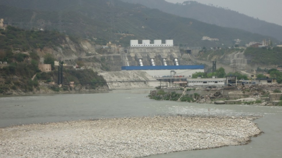
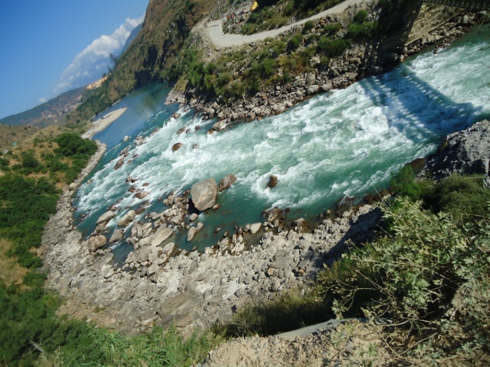
WII report The first expert report mentioned above is the report of the Wildlife Institute of India (WII), commissioned by the MoEF & CC to assess the cumulative impact of some 70 hydropower projects in Alaknanda-Bhagirathi basin in Uttarakhand. WII submitted the report to MoEF&CC in April 2012 and among other recommendations, said that 24 of these projects should be dropped due to their irreversible & long term impact on aquatic and terrestrial biodiversity. At the outset it should be mentioned that the WII (“an internationally acclaimed”, “autonomous institute of MoEF&CC”, see: http://www.wii.gov.in/) recommendation of dropping 24 projects was based on assessment of aquatic and terrestrial biodiversity impacts of the series of hydropower projects in Bhagirathi-Alaknanda basins in Uttarakhand. WII was commissioned to do this study by the MoEF&CC following an earlier SC order based on CEC (Central Empowered Committee) recommendation.

MoEF&CC, did not want to take the recommended action, so it sat on the recommendation of the WII report.

EB report following SC directions to Ministry to take stand on WII report On Aug 13, 2013, following the Uttarakhand disaster of June 2013, the Supreme Court directions, among other things included, “MoEF is directed to examine, as noticed by WII in its report, as to whether the proposed 24 projects are causing significant impact on the biodiversity of Alaknanda and Bhagirath River basins.” Again, MoEF&CC did not want to do any such examination on its own. Since MoEF&CC was setting up an expert body to examine the role of hydropower projects in the Uttarakhand disaster as per other directions of the same SC order of Aug 13, 2013, the ministry included such examination also in the Terms of Reference of the Expert Body (EB) under chairmanship of Dr Ravi Chopra.

The EB terms of reference were even wider than that of WII study and the expertise available with EB was also wider. With such expertise and terms of reference, the EB report (by 11 of the 13 members of EB) submitted to MoEF&CC in April 2014 came to the conclusion that 23 of the 24 projects in WII list should be dropped and even the 24th project, namely the Kotli Bhel 1A should go ahead only after significant modifications. Thus, essentially, EB too endorsed the WII recommendation.

It should be noted here that the WII recommendations were peer reviewed (during the work of Expert Body in 2013-14) by renowned biodiversity expert Dr Brij Gopal. Dr Brij Gopal too endorsed WII recommendation that the 24 projects should be dropped. The peer review was sought by the Central Water Commission representative at the 2nd EB Meeting. Despite objections from some EB members, the Chairman agreed to such a review and proposed the name of Dr. Brij Gopal which was promptly seconded by the Vice-Chairman, Dr. B.P. Das – a former Chief Engineer (Irr), Govt of Odisha and former Vice Chairman of the MOEF&CC’s Expert Appraisal Committee on River Valley Projects. In fact Dr. Brij Gopal suggested that more projects needed to be dropped.

MoEF&CC still did not want to take action on the 24 projects. So using the dissenting report by two government agencies which were largely toeing their official position in EB, the MoEF&CC suggested to the Supreme Court of India on May 7, 2014 that it wants to set up another committee. Seeing no validity in this, the Honorable SC rejected this suggestion and asked MoEF&CC to take a stand. SC has also since then put a stay on any further work on these 24 projects.

Still not ready to take a stand, MoEF&CC, used the reason that since IITC was already working on Ganga River Basin Management Plan (GRBMP) for the ministry since 2010 went ahead and gave the task of reconciling the two EB reports to IITC. In effect this is tantamount to violating the SC directions of not appointing another committee. However, unlike the picture it tried to give to SC, this task was not part of GRBMP work, but given to IITC through a fresh TOR.

Perturbed at not receiving any serious required response from MoEF&CC after repeated orders, the apex court judges of the Supreme Court rightly said the ministry was behaving like Kumbhakarna and Rip Van Winkle.

On Oct 9, 2014, the MoEF&CC submitted an affidavit to the SC, relying entirely on a report from IITC. And lo and behold, IITC had provided a report to the MoEF&CC, certifying that with some vaguely defined criteria, all the 24 projects can go ahead and there is no need to cancel any project! Serendipitously, this is exactly what the MoEF&CC & the hydropower lobby wanted!

It needs to be stated here that IITC had no mandate to submit such a report and the report is unprofessional, inadequate, unwarranted and inconsistent.

Let us see how.

Authors of the IITC report IITC report was authored by eight persons: Dr Vinod Tare (Civil Engineering Dept, IIT Kanpur, see: http://www.iitk.ac.in/ce/CIVIL/faculty.htm), Dr I M Mishra (Department of Chemical Engineering, IIT Roorkee, see: http://www.iitr.ac.in/departments/CH/pages/People+Faculty+imishfch.html#), Dr Purnendu Bose (Civil Engineering Department, IIT Kanpur, see: http://www.iitk.ac.in/ce/CIVIL/faculty.htm), Dr Ligy Philip (Civil Engineering Dept, IIT Madras, see: http://www.civil.iitm.ac.in/people/faculty/ligy/about.html), Dr B S Murty (Civil Engineering Dept, IIT Madras, see: http://www.civil.iitm.ac.in/?q=murty_edu), Dr R P Mathur (formerly Prof of Civil Engineering, University of Roorkee), Dr M Jawed (Dept of Civil Engineering, IIT Guwahati, see: http://www.iitg.ac.in/jawed/homepage/index.html) & Dr Gautam Roy (Consultant GRBMP and former student of Civil Engineering Department at IIT Kanpur). A perusal of the available information on professional background of these persons shows that none of them have expertise on the aquatic and terrestrial biodiversity of the Bhagirathi-Alaknanda basin, to decide on the appropriateness of the WII recommendations. Hence at the outset it seems inappropriate for IITC to sit on judgment over recommendation of an expert body, on subject matter of which IITC has no expertise.

The IITC team of 8 persons listed above, all with essentially engineering background have now also reviewed the EB report and made their own recommendations, again without having the expertise that was available at EB command. It is thus inappropriate for IITC to comment on the recommendations of the EB which had two biodiversity experts from FRI (Forest Research Institute) and WII, besides experts from Uttarakhand in various other disciplines. IITC is thus being unprofessional.

What does IITC report say The IITC report essentially says that ALL the 24 projects can go ahead if they satisfy three criteria: Aviral Dhara, Environmental flows and longitudinal connectivity. The first thing that strikes about these three terms is that they are all vaguely defined and can have flexible interpretations. They are also interconnected and not necessarily independent of each other. Most importantly, they do not take care of the issues based on which the two expert reports said that these 23 projects should be dropped and even the 24th Project, namely the Kotli Bhel 1A may be dropped or modified. But first let us understand these three vaguely defined, flexible and interconnected terms.

Aviral Dhara: According to the IITC report para 2.1 (see also: “Ganga River Basin Management Plan Extended Summary” of June 2014 available at: http://gangapedia.iitk.ac.in/sites/default/files/2014-06-12_GRBMP_Extended%20Summary.pdf): “Aviral Dhara in this context means that the flow of water, sediments and other natural constituents are continuous and adequate over the entire length of the river throughout the year.” There is no definition of what is adequate here, nor it is clarified as to adequacy is from what point of view. Here it should be noted that Aviral literally means uninterrupted, but neither IITC nor MOEF&CC provide this interpretation. According to MOEF&CC affidavit of Oct 9, 2014 (para 8(c)), Aviral means “to flow round the clock” or “continuous flow”.

Environment Flows: For Environmental flows, the “objective” of GRBMP is (see p 9 of the GRMBP Extended Summary) “Environmental Flows shall be maintained in all rivers and tributaries of Ganga River System to fulfill their geological, ecological, socio‐economic and cultural functions.” The E-flows thus would than depend on identifying functions of the river from geology, ecology, socio-economic and cultural perspectives, which can vary. The GRMBP extended summary does not provide clarity on e-flows for any of these aspects and how to go about arriving at required environment flow. It should be mentioned here that to arrive at environment flows, there are about 200 methodologies available globally. The IITC report attached with the MOEF&CC affidavit remains even vaguer as it says maintenance of E-flow should lead “to river stability and ecological balance in the downstream areas.”

Clarity on environmental flows is crucial as the affidavit from MOEF&CC itself agrees that MOEF&CC did not address the issue of eflows adequately while granting environmental clearances in Uttarakhand. One of the basic reasons behind this was lack of clarity on the issue and the same mistake is being repeated in the IITC Report.

Longitudinal Connectivity: In MOEF&CC affidavit of Oct 9, 2014, it is stated (para 6(b)/ 8(b)) that longitudinal connectivity is necessary to ensure “non-disruptive biota movement and silt transportation along the river course that are essential ingredients of a river ecology and its wholesomeness. Otherwise, a fragmented river stands to lose its basic character along with its native aquatic bio-diversity and ecological integrity.”

One of the two places where the term longitudinal connectivity appears in the GRMBP Extended Summary quoted earlier, says: “For dams and barrages, a precondition is essential that they cannot violate the longitudinal connectivity in River Ganga and her major tributaries. Besides they must allow E‐Flows (Environmental Flows) all along the river. A potential method for ensuring river connectivity through dams/ barrages has been suggested.”

The only other place in the GRBMP Extended Summary where the term longitudinal connectivity appears is interesting as it connects all the three terms that IITC has used: “Thus, while longitudinal connectivity in river network is an essential first step to maintain “Aviral Dhara”, having adequate river flows depends much on basin’s overall water status.” This statement is thus also making all three terms even more flexible, subjective and vague since they are dependent on “basin’s overall water status”. This leaves the door open to later reduce the quantum of E-Flows.

It is thus clear that the IITC report annexed by the MOEF&CC with their Oct 9, 2014 affidavit says that if these three vaguely defined terms that are flexible and prone to subjective interpretations are satisfied, then all the 24 projects can go ahead.

While these three, when clearly defined and properly implemented, are necessary conditions for any hydropower project, to say that they are sufficient condition is not only misleading, but also showing lack of understanding of the environmental issues related to hydropower projects. The MOEF&CC affidavit of Oct 9, 2014 relies exclusively on this IITC report and wants to allow all 24 project based on these three vaguely defined, flexible criteria from IITC report.

However, these three criteria are not sufficient to take a decision about these 24 projects as they exclude large number of criteria that the two expert reports considered, including: terrestrial biodiversity (completely absent in IITC report), cumulative impact (completely absent in IITC report it only looks at project specific issues), projects’ location in hazardous zone, projects increasing the disaster potential of the area, among many others.

The SC’s original direction was to examine if the 24 projects would have significant impact on the biodiversity. So the examination for these 24 projects must be done from the total biodiversity aspect and not on the basis of flow alone. The IITC itself has said in the GRBMP Interim Report of Sept 2013 that if biodiversity impact is significant then the project should be disallowed. It is clear IITC has again been inconsistent.

IITC is inconsistent It should be added here that in table 4.2 of their “Interim GRBMP” of Sept 2013 (see: https://nmcg.nic.in/writereaddata/fileupload/25_GRBMPInterim_Rep.pdf), IITC provides larger set of criteria for deciding permissibility of dams and barrages in the Ganga Basin, which include criteria like threat to terrestrial biodiversity, rare, endangered and threatened (RET) species, geological hazards, loss of historical, religious and cultural sites, among others. But these are no longer considered by the IITC in their current report under discussion. The IITC is also being inconsistent, besides being unprofessional and vague.

IITC report shows lack of understanding on basic environmental issues It is also disturbing to read the IITC report saying (section 2.1, last but one para), “However, projects on streams/ rivers with negligible biota may be allowed to proceed as per the environmental and other clearances already given to such projects provided that adequate provision is made to ensure the mandated E-flows. The adverse environmental impacts of such projects on the Ganga river system as a whole are expected to be negligible. Such projects may, therefore, be kept out of Cumulative Environmental Impact Assessment (CEIA) for their approval.”

Firstly, this shows that IITC is out-rightly overruling the recommendation of the WII and EB on criteria of terrestrial biodiversity, geological stability and so on. IITC is doing that too without providing any reasoning or basis. Significant number of the 24 projects have been recommended for rejection by WII and EB based on these criteria. Such baseless rejection of the recommendation by IITC not only shows their poor understanding of environmental and geological issues, but also shows their pro hydro bias.

Secondly, IITC makes the contention that the adverse environment impacts of such projects on Ganga river system is expected to be negligible, without providing any basis or scientific logic or reasoning.

Thirdly, suggesting that all such projects may be kept out of the CEIA seems to show poor understanding of the basics CEIA by the authors of IITC report. Large number of even so called low impact interventions can also cumulatively have big impacts and to exclude them is against the very spirit of CEIA. It also then raises doubts about competence of IITC to prepare GRBMP, since GRBMP is supposed to also look at the cumulative impact assessment and carrying capacity of major interventions in the Ganga Basin. IITC authors do not seem to understand that even aquatic biota gets affected by geological and other factors, that fish is not the only aquatic biota and that there is upstream downstream linkages in lifecycle of the aquatic biota and that there are linkages between aquatic and terrestrial biota life cycles, affected by hydrology.

The above stated issues raise serious doubts about the appropriateness of the IITC report and MOEF&CC’s attempts to push ahead with the 24 hydropower projects in fragile and disaster prone Bhagirathi-Alaknanda basin based on the inappropriate IITC report. Particularly when these projects were to be cancelled as per two expert reports, both commissioned following two separate apex court orders.

Issue of cumulative impacts cannot be taken care of through project specific actions Here it should be noted that the WII report has made its recommendation about dropping 24 HEPs based on cumulative impact assessment of all the operating, under construction and planned projects in the Bhagirathi-Alaknanda River basins. The same is true with respect to EB recommendation. The conclusions arrived at based on cumulative impact assessment by the WII and EB cannot and should not be sought to be addressed by looking at project specific steps or actions as MOEF&CC affidavit and IITC reports are doing.

Did Project Management Board allow IITC to do this report? The IITC task of GRBMP is being overseen by a Project Management Board (PMB) comprising of senior persons of all the seven IITs and some invited members. The IITC report dated July 21, 2014 mentions, “The PMB in its fifth meeting held on Tuesday, June 24, 2014 at IIT Delhi agreed to examine the two reports in the broader framework developed for GRMBP.”

While this is what IITC claims in its July 21, 2014 report, this claim is not supported by the Minutes of the relevant meeting of PMB, as we see below. From the reading of the minutes, it seems that the IITC had no mandate or clearance to do this report.

In the minutes of the fifth meeting of PMB held on June 24, 2014, para 7 seems to be the only relevant para in this context, which reads as follows: “Project Coordinator sought the directions from PMB about the modus operandi for follow-up actions after submission of the final draft of GRBMP – such as responding to queries and comments on GRBMP and dealing with requests for other inputs on Ganga Basin received from government and other agencies. He mentioned that IITC is obliged to respond to such requests based on the work done in preparing GRBMP, and the help of only active contributors of IITC would be needed rather than the existing mechanism of going through PICC and PMB. Professor Manna, Director, IIT Kanpur stated that IIT Kanpur is willing to take the responsibility on behalf of IITC of such matters and Project Coordinator may take the help and advice of concerned IIT Team members as and when needed. It was opined that each IIT may compile the list of new faculty members who may have joined after GRBMP project was started and communicate the same to the Project Coordinator. Professor Khakhar suggested that Directors of the 7 IITs may discuss the matter and communicate the decision to the Project Coordinator on modus operandi for submission of first version of GRBMP, and responding to queries and comments on GRBMP and dealing with requests for other inputs on Ganga Basin received from government and other agencies.”

The first thing that strikes about this para is that the Project Coordinator (Dr Vinod Tare) raised this in the context of “follow-up actions after submission of the final draft of GRBMP”, which is not the case with respect to current issue, since the final draft of the GRBMP is yet to be submitted. There is nothing in this para to support the contention quoted above from the preface of the IITC report that PMB “agreed to examine the two reports in the broader framework developed for GRMBP.”

If this is the only para that is relevant in the context of IITC report to MOEF&CC dated July 21, 2014 and if this para is not applicable at this stage since it is applicable only after submission of final draft of GRBMP, then the question arises, if the IITC had the permission from PMB to submit such a report and if the MOEF&CC should have submitted this report as authorized IITC report? These questions can be answered by only the IITC, its PMB and MOEF&CC, but they are relevant since it is this report purportedly from IITC that is sought to be used by MOEF&CC to ensure that all the 24 projects under discussion go ahead. In fact PMB and all concerned from IITC should quickly clarify that this report cannot be called IITC report, but only from the specific 8 persons listed above. The authors should be asked to remove the claim that this is IITC report.

IITR has poor track record and conflict of interest Here it is pertinent to note that of the four IITs involved in this report of IITC, IIT Roorkee (IITR) has already proven to have a poor and biased track record and should not have been involved in any case. The IITR was in fact commissioned in July 2010 by MOEF&CC to do cumulative impact assessment of the hydropower projects in Bhagirathi-Alaknanda basin. The report submitted by IITR was so pathetic that it was not accepted and it invited adverse comments from official agencies like the Expert Appraisal Committee on River Valley Projects, the Inter Ministerial Group on Ganga Basin Projects and also the Supreme Court of India in Aug 2013 order. (The report was also criticized by other organisations[1].)

Thus, IITR stands discredited on the precise issue of cumulative impacts of hydropower projects in Bhagirathi-Alaknanda basin. To include such an institute for another IITC report now on the same issue not only brings discredit to the whole effort, but raises the issue of conflict of interest.

While some issues are based on procedures and propriety, other issues relate to merit of IITC recommendations as they do not hold the experience or expertise to deal with serious problems related to cumulative impacts, terrestrial biodiversity and RET species, deforestation, and disaster potential of the region.

Thus, on both these counts (technical and merit based), the IITC Report is under cloud and does not hold enough ground to base further informed decisions.

Conclusion In view of the above, it is clear that IITC report is not adequate, reliable, or consistent to take a decision about 23 hydropower projects which have been recommended to be dropped and 24th project, namely the Kotli Bhel 1A project which has been recommended to be dropped/ modified by the WII and EB. IITC had neither the expertise nor the mandate to submit such a report. The MOEF&CC should not be relying on this report and rather coming out with its own position as directed by the Supreme Court of India repeatedly, keeping in mind the issues and merits of the two expert reports, both submitted following two separate apex court orders.

It is unfortunate that IITC has submitted a report that is obviously music to both hydropower developers and government. MoEF&CC has already offered more such work to IITC. We hope IITC will go beyond such short term interests and be more consistent, professional and work towards rejuvenation of the Ganga and other rivers.

This current work is discrediting their future work of GRBMP too.

-Himanshu Thakkar, SANDRP (Being an IIT Mumbai alumni myself, I am writing this with a sense of sadness)

[1] For example, see: http://www.sandrp.in/hydropower/Pathetic_Cumulative_Impact_Assessment_of_Ganga_Hydro_projects.pdf

Environment Impact Assessment · Environmental Laws · Expert Appraisal Committee · Himalayas · Hydropower · Ministry of Environment and Forests

National Green Tribunal’s Fourth Foundation Day: Why such a pro hydro bias?

The National Green Tribunal, NGT marked its 4th Foundation Day on 18 October 2014, with an impressive fanfare. A full day function was organized at the Plenary hall of the capital’s iconic Vigyan Bhawan. NGT in this short span has acquired a formidable reputation as a unique, vibrant, active institute with independent & unbiased mind and forthright, quick redressal of petitions that come to it.

The function in two separate sessions, one in the forenoon and the other in the afternoon (a Seminar) was attended by large number of government officials, judicial officers, advocates, law school students, NGT petitioners and office bearers and members of the NGT Bar association.

NGT  Foundation Function on Oct 18, 2014 (Source: FB page of Information and Broadcasting Ministry)
NGT Foundation Function on Oct 18, 2014 (Source: FB page of Information and Broadcasting Ministry)

Invited dignitaries included Mr Justice Ranjan Gogoi (Judge, Supreme Court), Prakash Javadekar (Union Minister of State for Environment, Forests and Climate Change) and Ashok Lavasa (Secretary, MoEF&CC) in the forenoon session and Mr Justice Sudhanshu Jyoti Mukhopadhaya (Judge, Supreme Court) and Piyush Goyal (Union Minister of state for Power, Coal and new and renewable energy). Mr Justice Swatanter Kumar, the Chairperson of the NGT, Mr Justice Dr. P. Jyothimani, Judicial Member, Principal Bench, NGT, Prof. R. Nagendra, and Dr. D.K. Agarwal, Expert Members at the NGT also spoke and graced the dais.

The function included, in addition to the addresses by the invited dignitaries, the release of 2nd issue of NGT International Journal; the launch of new NGT Website (in the first session) and address by invitee experts (in the second session).

In the first session Mr Javadekar informed the gathering about his political beginnings from a water pollution struggle activist against factory pollution and Mr Lavasa categorically stated that the NGT is playing an extremely crucial role and that there is no move to dilute its powers in any manner. It was in the second session that very controversially one Mr M.K. Pandit was invited to speak as an invited expert.

The Minister of State for Environment, Forests and Climate Change (I/C), Shri Prakash Javadekar lighting the lamp at the 4th Foundation Day function of the National Green Tribunal, in New Delhi on October 18, 2014. The Secretary, Environment, Forests and Climate Change, Shri Ashok Lavasa and the Judge, Supreme Court of India, Mr. Justice Ranjan Gogoi are also seen (Source: FB page of I&B Ministry)

Mr Pandit began with highlighting how recent and how fragile the Himalayas were and that a 8+ richter scale earthquake in central Himalayas was round the corner that could flatten Dehradun. Very soon in his almost 25 minute speech changed track as if on a cue to how great the hydropower dam projects in the Himalayas were for the power security of the country. The Union Power Minister had by then just joined the function to nod in full agreement with all that the Mr Pandit was narrating. The audience on the other hand was left perplexed as to what was happening?

An invited speaker was eulogizing the great merits of high dams receiving approving glances from the power minister on an NGT seminar whose topic was “Natural Disasters, Environment & Role of NGT with special reference to Uttarakhand, J&K, Assam & Himachal Pradesh”. Clearly something was amiss, somewhere?

Secondly, Mr Pandit is not a neutral expert, but an interested party. As leader of scores of pro hydro Environmental Impact Assessments that he has led as part of the CISMHE[1] team (Center for Inter-disciplinary studies of Mountain and Hill Environment) has earned them millions as they also continue to mint more money. Typical of Indian EIAs, no EIA done by CISMHE has ever raised any difficult questions for the developers. It has also never concluded that any of the projects is unviable. CISMHE EIAs are as shoddy, incomplete and inadequate as any other[2]. For example on Luhri HEP, the CISMHE EIA was so problematic that even the Ministry of Environment, Forests and Climate Change’s Expert Appraisal Committee on River Valley Projects and the World Bank found it inadequate and unreliable.

Interestingly, CISMHE website says: “Ministry of Power, Government of India established CISMHE as an R&D Centre in power studies in environment in recognition of its excellent past performance”. This means that there is also conflict of interest here in CISMHE doing EIAs, since it has been set up as an R&D Centre by Ministry of Power, that is itself a promoter and developer of hydropower projects. No wonder, Mr Pandit said what the Power Minister wanted to hear and Power Minister made no efforts to hide his approval of what Mr Pandit was saying.

Very strangely, Mr Piyush Goyal claimed that Tehri dam was an example of good project in the Himalayas that saved Uttarakhand in the floods of June 2013. Mr Goyal should know that this claim had absolutely no basis and even an Expert Body appointed by the Supreme Court of India has shown, after listening to THDC, CWC and others that such a claim has no scientific foundation. Mr Pandit did try to support the unfounded contention of Mr Goyal, but the minister asked him to keep quite.

It became clearer, when a pointed question asked by Shri Manoj Misra of Yamuna Jiye Abhiyaan about what would have been the Tehri dam scenario if the Uttarakhand high rainfall event had occurred in the peak monsoon months of July, August or September and not on 16 June 2013 (as in fact happened in Sept 2010, when Tehri created a havoc in the downstream, damaging its own Koteshwar project[3]), when the dam was almost empty and only beginning to get filled, elicited an evasive response first by the Union Minister (we cannot have structures planned for every 365 days in a year). And later when Pandit ji tried to answer, he was asked to shut without him being able to even respond to the other two questions relating to how does he reconcile to the fact of  a high intensity earthquake visiting a region where he had been advocating the dams; why was USA (as also some other countries), the mecca of large Dams bringing many of its dams down?

In any case, Mr Maharaj Pandit was contradicting himself, because he said something totally different in his article in The Hindu soon after the Uttarakhand disaster of June 2013: “Most downstream damage in otherwise flood-free areas is caused by dams and barrages, which release large volumes of water to safeguard engineering structures. Dam operators often release more water during rains than the carrying capacity of downstream areas, causing floods… Hydropower policy must consider building fewer dams and prioritise those that have the least environmental and social costs. Independent and serious monitoring of the catchment area treatment plans proposed by Forest Departments with funds from hydropower companies needs to be carried out and reported to the Green Tribunal.” In fact then in June 2013, he was on TV channels almost every night, talking about how Himalayas have the highest dam density in the world and that is such a big invitation to disaster! But he seems ready to change his stand to please the minister or the hydro project developers.

It seems as if Mr Pandit had been invited to justify the building of dams in the Himalayas in front of a large gathering of impressionable judicial officials and young student minds. It is possible that it was also intended to influence the minds of NGT members (judicial and experts) and other persons from judiciary in the face of a number of proposed dams being challenged before the various NGT benches and courts.

If a proper seminar was indeed planned on such an important matter, then there should have been several speakers on wide range of perspectives and topics and not just one speaker with conflict of interest and a clear agenda? The only other technical speaker, Dr R. Nagendran, an expert member with NGT southern bench spoke sensibly on how unscientific management of sanitary projects in hilly regions lead to parallel “Faeco-microbial disaster” which is difficult to tackle.

Mr Ritwick Dutta, secretary of NGT bar association said that the information about Mr Pandit speaking from NGT platform was not available in public domain and it is not clear how he was selected as a speaker.

Such blatant pro hydro bias in an NGT foundation day meeting is certainly unwarranted and out of place for an NGT function. An NGT platform should not have been allowed to be used for such biased presentation. We hope the bias apparent in this aberration is just that, an aberration and does not run deeper, considering that some hydropower professionals have been appointed on NGT benches.

We hope that at least in future the NGT, a statutory judicial body, otherwise doing a great job for the protection of environment, would be more careful in not letting its platform get used by the vested interests. The formidable reputation that NGT has acquired with a lot of remarkable orders should not be allowed to be affected by this one incident. NGT indeed needs to be strengthened in every way and not weakened in any manner.

It would also help if the NGT were to distance itself from this biased episode.

Pushp Jain, EIA Research and Response Centre (http://www.ercindia.org/, Pushp Jain pushp@ercindia.org) & SANDRP (based on interviews with those who were present at the NGT foundation day meeting)

END NOTES

[1] http://www.cismhe.org/

[2] For example, see: https://sandrp.wordpress.com/2014/04/11/the-world-bank-drops-funding-usd-650-m-for-the-luhri-hydro-project-victory-for-the-sutlej-bachao-jan-sangharsh-samiti/, https://sandrp.wordpress.com/2014/07/09/pauk-heo-tato-i-hydropower-projects-cismes-shoddy-eias-seven-big-hydro-on-third-order-tributary-of-brahmaputra/, https://sandrp.wordpress.com/2014/10/06/manipulating-environment-forest-clearances-for-dibang-project-deja-vu-lshp-history-repeated-will-it-be-tragedy-or-comedy/

[3] For details, see: https://sandrp.wordpress.com/2013/06/28/uttarakhand-floods-truth-about-thdc-and-central-water-commissions-claims-about-tehri/ and https://sandrp.wordpress.com/2013/08/07/is-thdc-preparing-to-repeat-the-disaster-tehri-created-in-sept-2010/

[4] https://sandrp.wordpress.com/2014/04/29/report-of-expert-committee-on-uttarakhand-flood-disaster-role-of-heps-welcome-recommendations/

[5] http://www.greentribunal.gov.in/

[6] http://www.greentribunal.gov.in/Writereaddata/Downloads/circular7Oct14.pdf

[7] http://www.thehindu.com/opinion/op-ed/nature-avenges-its-exploitation/article4834480.ece