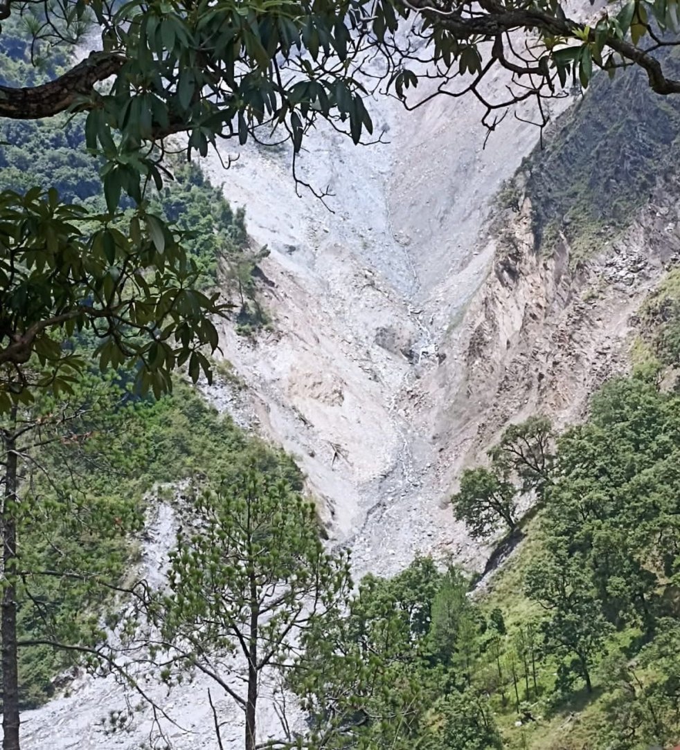
(Feature Image:- बागेश्वर के कुंवारी में इस तरह हो रहे भूस्खलन के कारण पहाड़ी से शंभू नदी में गिर रहा मलबा। Image: Amar Ujala)
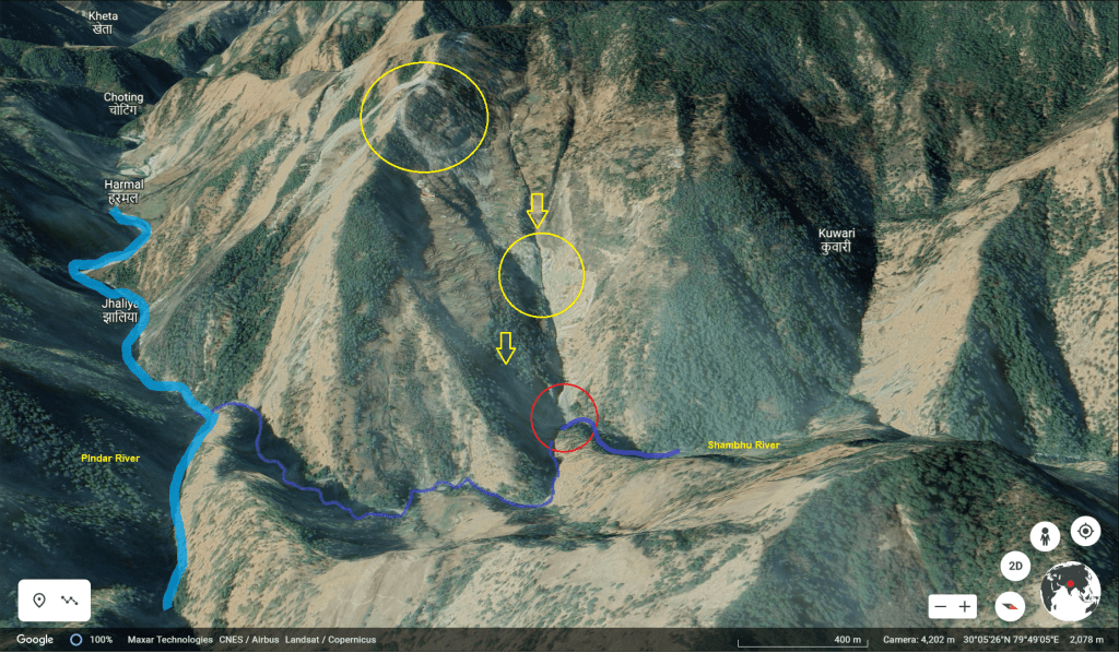
In last week of June 2022, a landslide lake was formed on Shambhu river in Kapkot tehsil of Bageshwar district. Shambhu originates from Shambhu glacier near Borbalda village in the district. It joins the Pindar river another glacier fed river few kilometres upstream Jhaliya village. In turn, passing through Tharali, Narayanbagad the Pindar river merges into Alaknanda river at Karanprayag in Chamoli district.
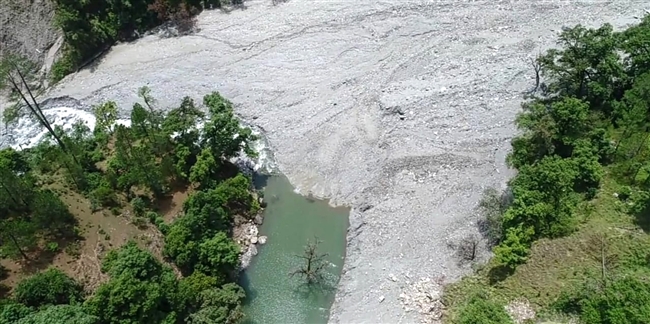
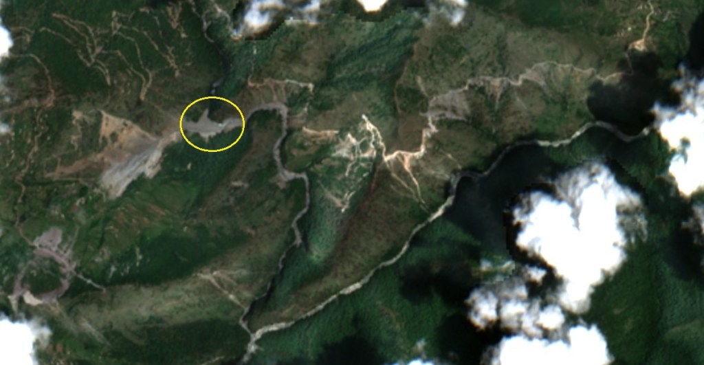
The landslide lake was created at Kalbhyod location some four kilometres downstream Bharakande tok of Borbalda village. Kunwari is the nearest village located at an altitude of 1700 metre on right bank of Shambhu river about two kilometres uphill Kalbhyod. In fact, the landslide had started from Kunwari village area blocking the Shambhu river.
The landslide lake was stated to be V shaped, about 700 metres long, 50 metres wide and 10 metres deep. The lake had some seepage but was increasing in size on account of higher inflows. The locals and experts raised concerns over significant damages in downstream areas in case of sudden burst of the lake. The officials ruled out any immediate risks but admitted possibility of a flash flood disaster in case of a cloud burst or excessive rainfall event in the area.
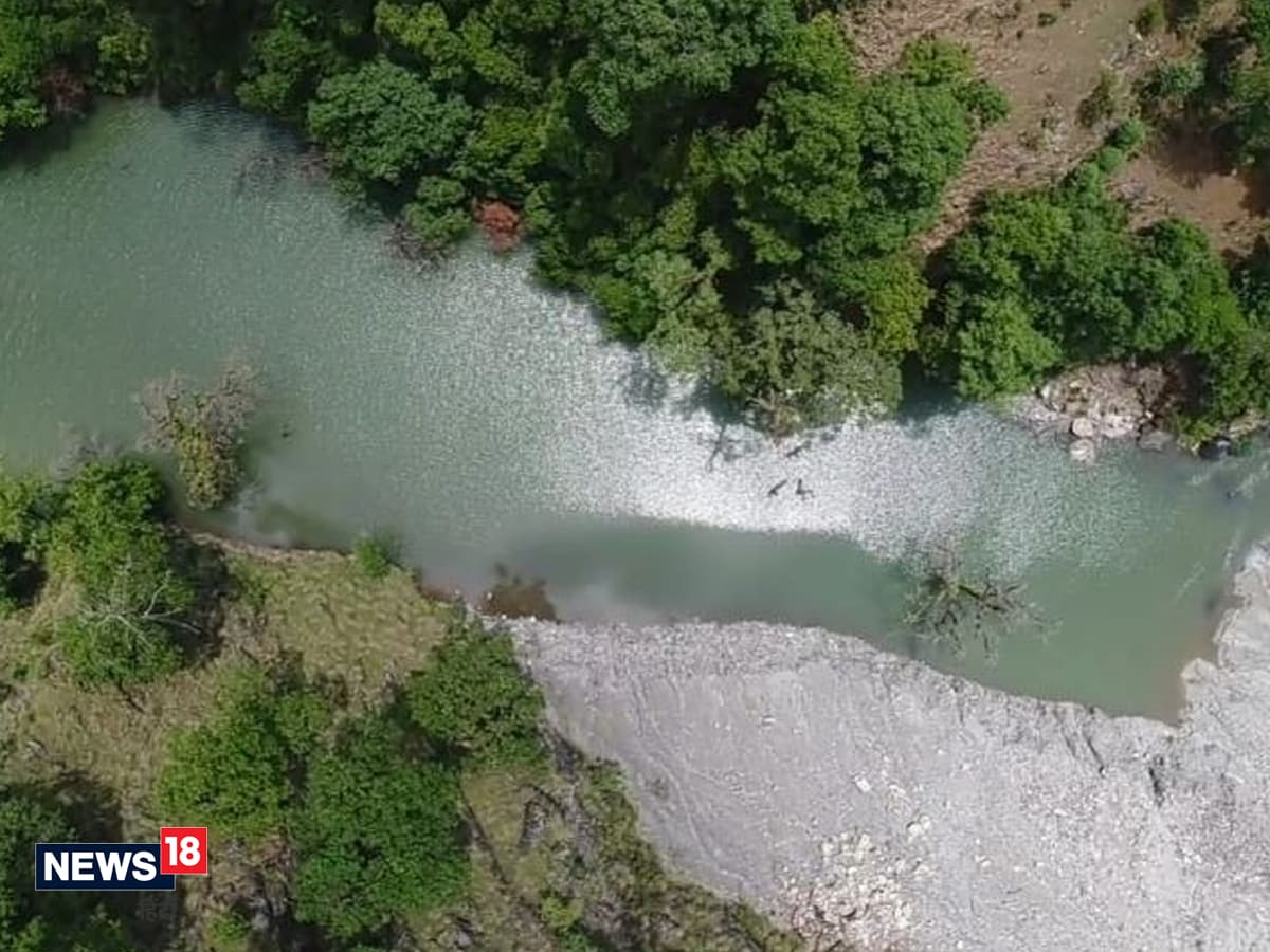
Hence, efforts to remove the blockade were started by the administration. Finally, after five days of action, a team of SDRF succeeded in widening the mouth of the landslide lake by 12 metres increasing the discharge. The exercise has cost about Rs. 10 lakh. Presently, the lake level has been reduced and a flash flood threat has been averted for the time being.

However, the location has seen recurring landslides in recent past blocking the Shambhu river course. Interestingly, the present landslide lake was created in 2018 after continuous landslides gradually raising the river channel with debris. For the past four years, the lake size was slowly expanding. Despite this, no alarm was raised about the looming threat.
It was only during a ground survey between June 8 to12, 2022 by a team of Uttarakhand Space Application Centre (SPAC) and drinking water department, the possible danger from this artificial lake was highlighted. The survey was conducted to explore feasibility of linking glaciers fed river in Pindar basin to rain fed rivers of Bageshwar and Almora districts.
In 2012, the district disaster centre had issued landslide warning for the area. After a huge landslide in 2013, a portion of village had fallen down in the river. The landslide had caused cracks in several homes and blocked the river. The area had witnessed landslides of various intensity in 2014 and 2017 too. However, the debris were getting washed away.
In its 2018 report, Disaster Mitigation and Management Centre (DMMC), had attributed tectonic movement as a reason behind the repeated landslides. As per experts, the area needs constant monitoring and comprehensive study to prepare mitigation plan including relocation of Kunwari village.
While the persistent landslides have been threatening the Kunwari village the resultant blockage of Shambhu river poses flash flood risks for downstream villages. Indeed, the landslide has provided a warning about the twin disaster threat which require due attention and timely action.
Bhim Singh Rawat (bhim.sandrp@gmail.com)
References:-
10. https://www.amarujala.com/uttarakhand/bageshwar/water-released-from-lake-bageshwar-news-hld468013598
