This blog highlights the present day situation of Gaula river in Haldwani (Uttarakhand). The river is water lifeline of Haldwani. However, it lacks adequate flow during lean season, facing excessive riverbed mining for past several years. Large parts of its floodplain & riverbed have been encroached upon and it has become a dumping ground for solid and liquid waste.
The demand for potable water, riverbed material is on steep rise. There is absence of policy or other measures regarding flows, floodplain protection, sustainable mining and proper waste disposal. The ongoing practices of waste disposal and treatment steps are making river degradation and destruction inevitable.
Gaula River
Gaula River is part of the Ramganga/ Ganga basin. It is a forest fed river originating[i] from Bhidapani valley near Paharpani village under Okkhalkanda block of Nainital district. Religious scriptures mention it as Gargi and a sister of Ladhiya river. Baigul, Kichha are other names the river is known by.
The total length of Gaula is about 220 km of which around 100 km stretch lies in Uttarakhand and the rest falls under Uttar Pradesh. Gaula leaves Uttarakhand near Sirauli village (Kichha) of Udham Singh Nagar and merges into Ramganga river near Tulsi Math village under Bareilly district.
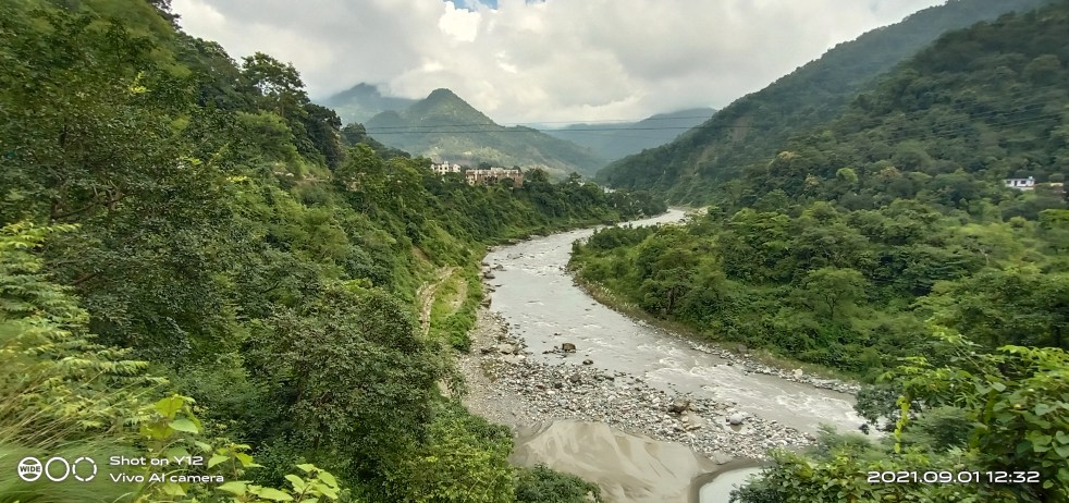
In hills Gaula is fed by Gangoligad, Kalshagad, Kaligad, Balianala and several other seasonal, perennial streams. After flowing for about 60 km through lesser Himalayan hills, Gaula enters in bhabhar (tarai) area near Kathgodam and flows through Haldwani.
Deforestation and degradation of catchment area has gradually led to decline[ii] in overall flows in Gaula. During lean season the river is seen struggling to flow past Gaula barrage where most of its water is extracted for potable, irrigation water supply.
Haldwani City and Water Supply

With over 2.28 lakh population, Haldwani is a sprawling human settlement along and across Gaula river in bhabhar area of Nainital district. The city is named after Haldu, a famous timber tree species once found in abundance in the area but now declining fast around city limits.

Presently, Haldwani is selected under AMURT scheme. The city gets[iii] 17.83 million litre water per day (MLD) from surface water sources including 15.83 MLD from Gaula river, 2 MLD from Sheetlahat gadhera, 17.28 MLD groundwater from 20 tubewells.
After 10 percent intake, backwash and 20 percent distribution losses the net availability is 26.27 MLD while the demand is around 28 MLD. About 80 percent of the city has water supply connections without any metering system. About 40 percent of the supply is non-revenue water.
Haldwani also relies on Bhimtal dam releases between 15 May and 18 June annually. The Jal Nigam has also built several overhand tanks. Still, the city areas reel under severe water crisis particularly during lean season.
Multipurpose Jamrani Dam Project

Since 1975, a 150 metre high concrete dam[iv] is proposed on Gaula river near Jamrani village about 10 km upstream of Gaula barrage in Kathgodam. It is supposed to provide 53 million cubic metre drinking water and irrigation to over 1.50 lakh hectare of land in bhabhar areas of Uttarakhand and Uttar Pradesh apart from installed capacity of 30 MW hydro power.
The project would officially take about 5 years to complete. The dam would affect[v] 462 families from 15 villages and 352 hectare of forest[vi] land in Nainital district. The total cost of the project was roughly estimated around Rs. 428 crore in 2005 which was revised to Rs. 2300 crore in 2015 and has further escalated to Rs. 2800 crore in 2018.
To meet growing potable water demand in and around Haldwani town is among key reasons why the dam is being pushed. Construction of 16 km pipeline and 3 water treatment plants for the purpose would cost[vii] about Rs. 390 crore as per revised DPR by Jal Nigam, Haldwani while government has prepared Rs. 400 crore package[viii] for rehabilitation of affected people.
In October 2019, the project has got environment clearance. The work would not possibly start[ix] before 2023 as the Asian Development Bank (ADB) the main funding agency is reportedly reassessing all the surveys, studies done by the government for the project.
Balianala at Ranibagh
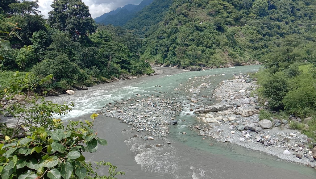
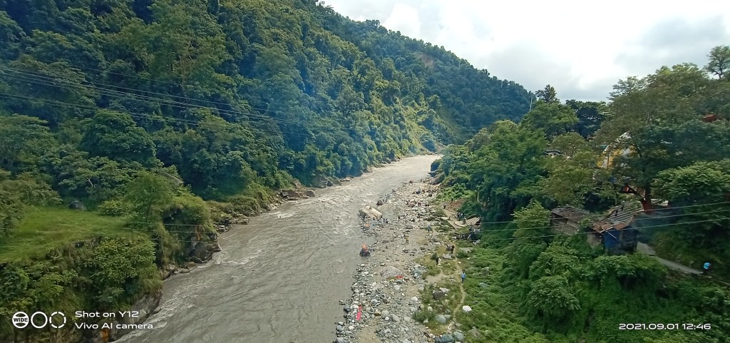
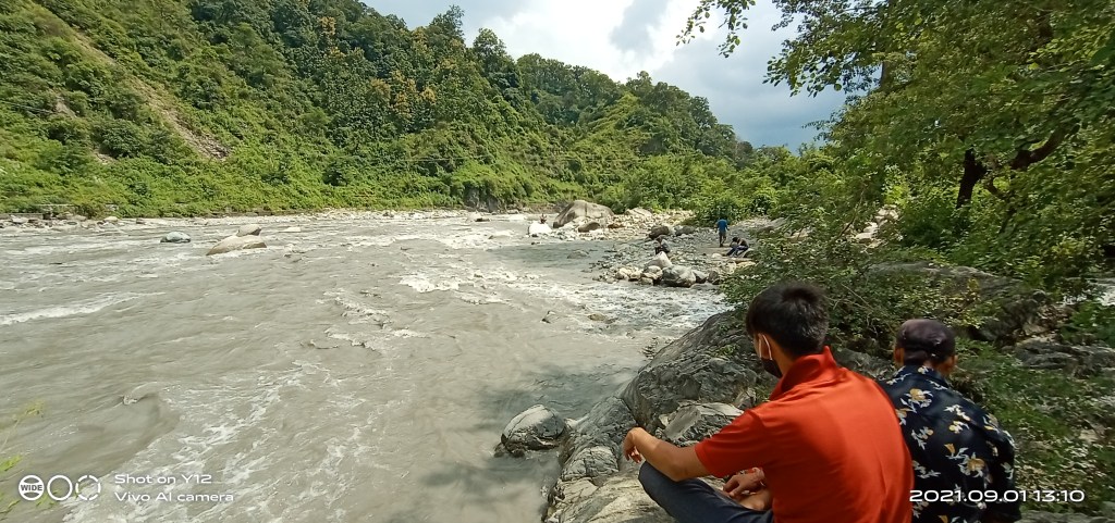
Ranibagh is a small historical town located along highway about 2 km upstream Kathgoadm enroute Bhimtal. At this place, Balianala joins Gaula from right side. Balianala emerges from Nainital and carries water of several other streams along its 15km long journey. The course is is ridden with small, large landslips[x] at multiple sites colouring its flows ashy while at confluence Gaula is seen flowing with pristine blue water.
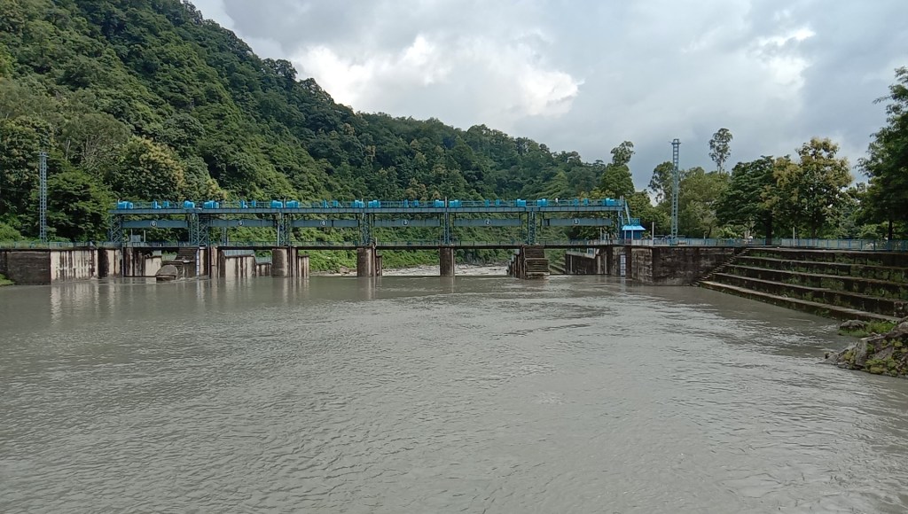
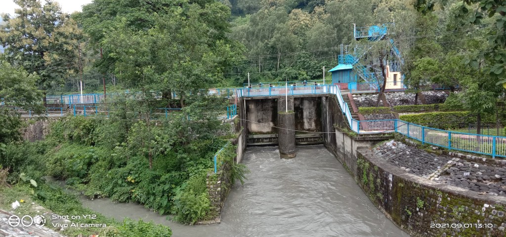
Gaula Barrage
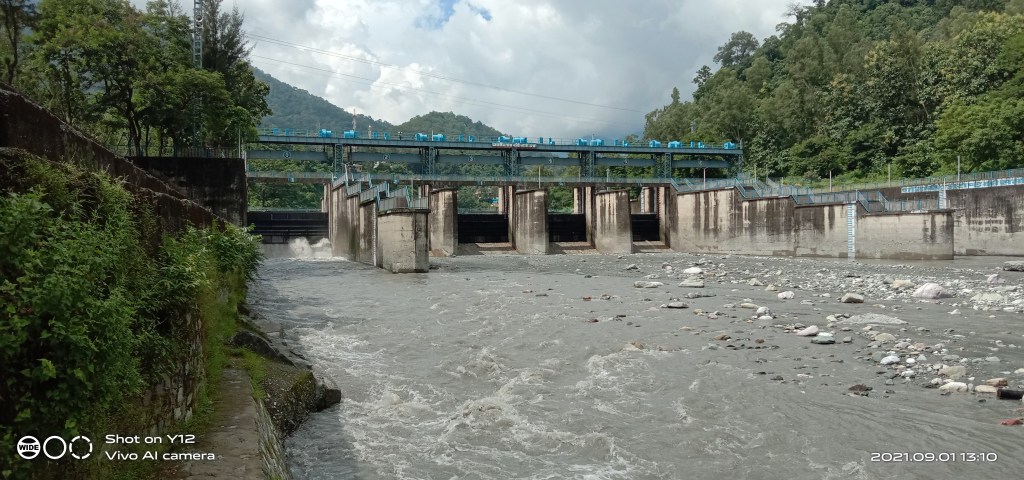
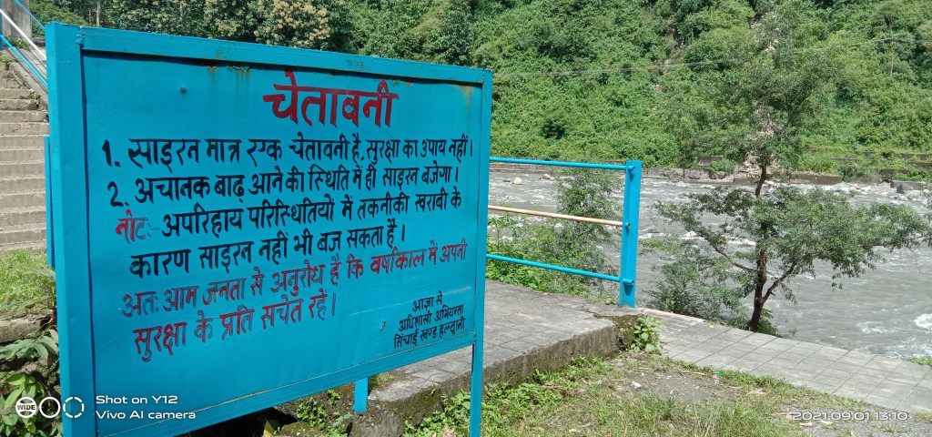
Built in 1984, Gaula barrage[xi] has 1.15 lakh cusec as designed discharge capacity though it has passed the highest discharge of 1.23 lakh cusec in 1993. The barrage has six gates and facilitates diversion of about 300 cusec flows for irrigation and potable water supply into Gaula canal. However the availability in lean months averages about half the requirement leading to water crisis[xii] in dependent areas.
On February 12, 2021, the total water available at the barrage was mere[xiii] 82 cusec which dipped[xiv] further to just 70 cusec on March 15, 2021. Over the years debris and boulders have silted up riverbed upstream of the barrage.
The irrigation department had to create a bund upstream of the barrage to divert available water into canal in the wake of low pondage level. In May 2020, the bund was washed away[xv] affecting supply for days.
The barrage is aging and facing damages[xvi] thus causing losses of 20 MLD. Early in 2019, the irrigation department was given[xvii] Rs. 4.90 crore for repair and maintenance of barrage. The work was going on till May 2021.
Jamrani dam has become perennial demand in political and administration circles despite the fact that the water crisis is mainly due to mismanagement[xviii] of available resources rather than availability. There is no attempt to harvest the rainfall, recharge groundwater, treat and recycle the sewage and such other sustainable measures.
Floodplain Encroachment in Haldwani
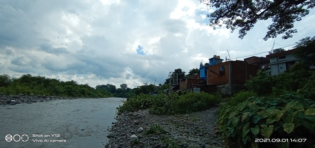
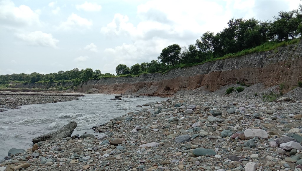
After descending in bhabhar plains, Gaula forms vast floodplain which is at places about 1.5km wide. Also the river course is shifting eastwards as it passes through Haldwani.
With rapid expansion in city limits on either side of river, various public-private facilities have come up in and close to the floodplain. The Kathgodam and Haldwani railway stations, though on higher elevation are located next to the river bank.

Over the years, the huge part of floodplain falling on left side of railway line has been developed by government, private agencies. Right outside the Kathgodam railway station, several hamlets have come up along the river. This followed by a gas depot, forest development corporation office, a big colony behind Jal Sansthan office.
The Military Station at Halwani alone is spread over 160 hectares of land. All these establishments are facing erosion during floods and are being protected by embankments, studs.
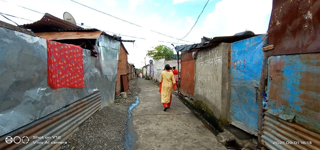
Near Haldwani railway station, Rajpura colony consisting of economically weaker section people has settled over 40 hectares of floodplain. The colony is further spreading on floodplain, is thus quite vulnerable to high floods.
Residents say they have purchased the land from locals. They have electricity connections but buy potable water from private submersible owners. As per them, mining has deepened[xix] Gaula riverbed and it would not flood their homes. The residents have not seen high floods in the river after 2010.
Situated across Rajpura, the Indira Gandhi Stadium has eaten into about 20 hectares of floodplain. There are also several other structures built on floodplain, close to river bank.
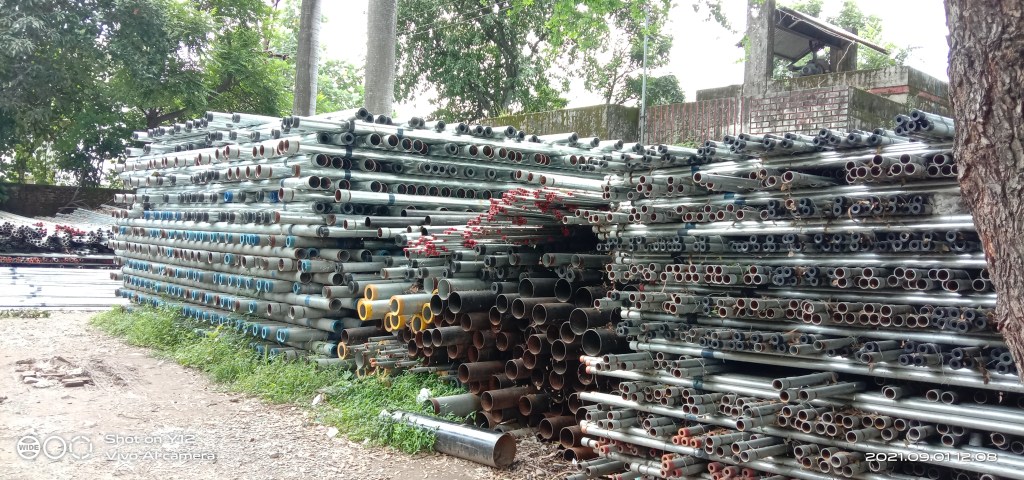
Riverbed Mining
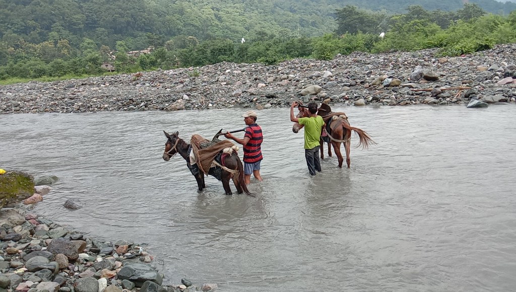
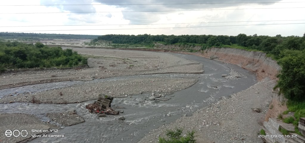
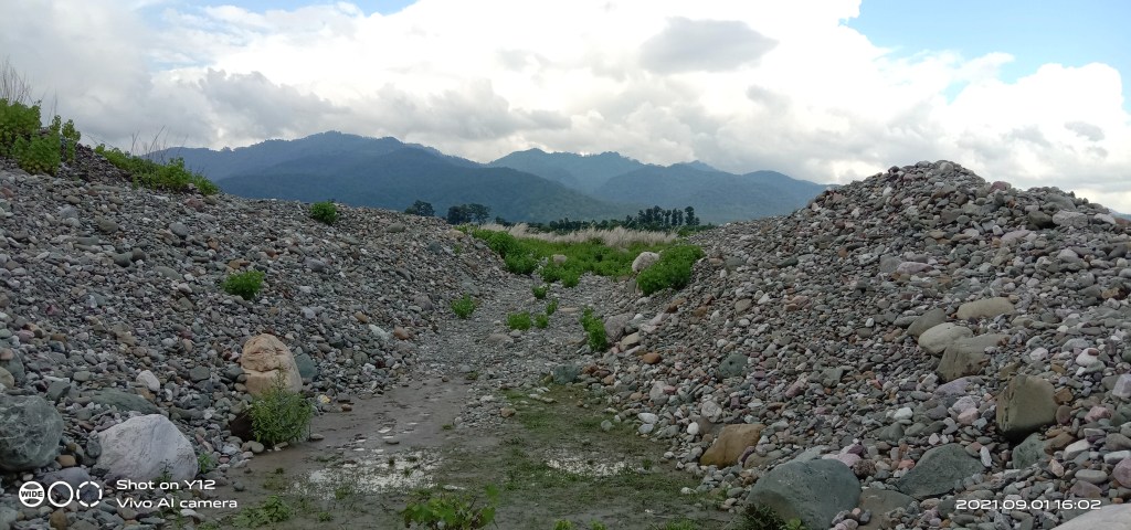
Gaula is among top rivers affected adversely by industrial scale riverbed mineral (RBM) mining in Uttarakhand state. For past couple of decades, about 25 km long river stretch in Kathgodam, Haldwani have been excessively mined of gravels, pebbles and stones. Downstream of Gaula barrage, individuals can be seen scanning through the flowing channel collecting finer RBM which is then transported on mules.
The Uttarakhand Forest Development Corporation (UFDC) manages the entire RBM mining affair from allotment to royalty collection. The excavation season begins from October 1 and goes upto June 15.

There are 11 exit gates established by UFDC between Lalkuan through which around 7000 trucks pass daily, each carrying on an average 90 quintals RBM load which is officially permitted limit. The royalty varies Rs. 25-30 per quintal excluding of transit charges which is about Rs. 5 per quintal. UFDC gets around Rs. 2.40 crore as royalties on daily basis.
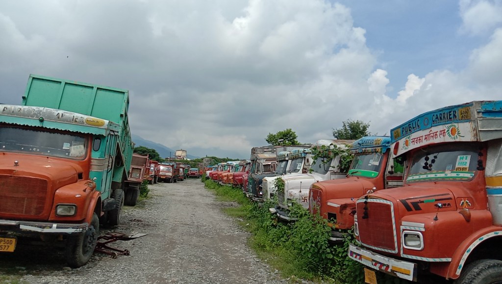
The Gaula Khanan Kamgar Samiti (GKKS) is an association of about 250 truck owners having around 7500 trucks engaged in transportation of RBM. The mines are allotted to them. Mining is done mainly manually by GKKS labours mostly from Bihar and Nepal. The loading, unloading, driver, labour, fuel, maintenance charges are borne by truck owners.
People engaged in mining say, RBM is delivered to stone crusher industry presently at Rs. 30 per quintal. There are about 15 stone crushers located in Haldwani mostly in Lalkuan area. Overall a crusher owner pays about Rs. 65 per quintal for raw material and sells crushed material at over Rs. 120 per quintal.
Most of the crusher owners have links with politicians. There are allegations of nexus between politicians and crusher owners manipulating raw material price causing losses to miners while profiting crusher owners.
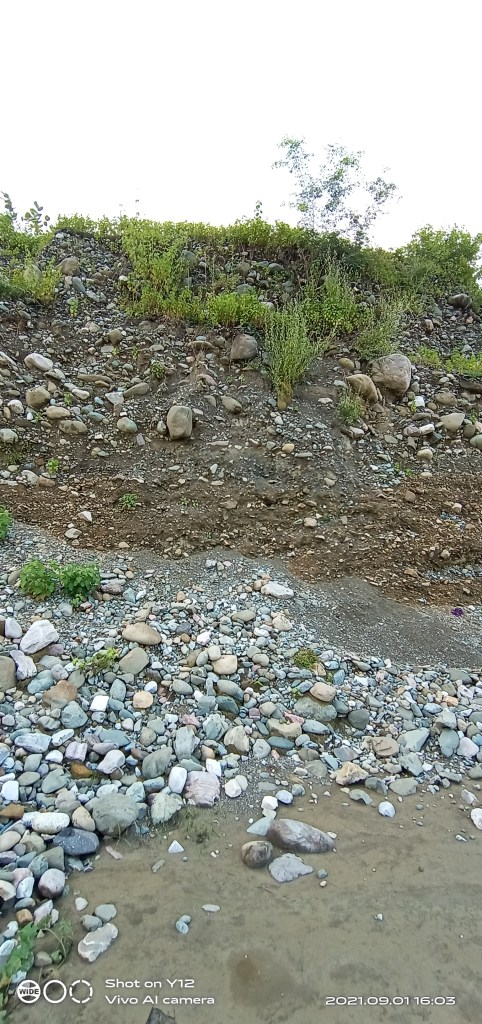
As per miners, less than 10 percent crushed material is consumed locally and the rest is supplied to far away areas of hills and plains. There is hardly any sand left in the river. The unabated RBM mining has deepened the river course upto 40 feet at places. The entire floodplain is dotted with scars of deep mining.
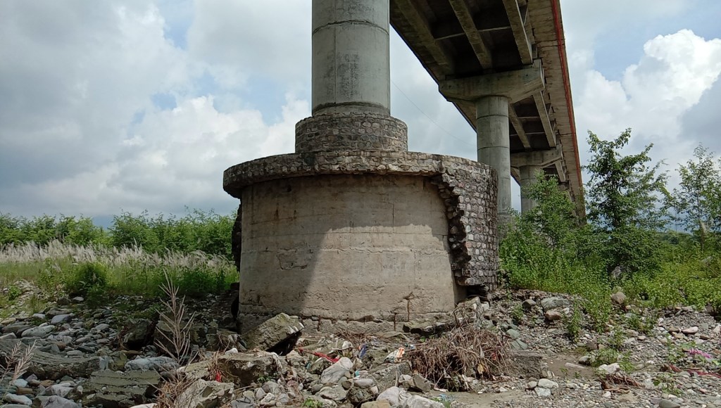
Apart from deforming[xx] the physical course and severely impacting riverine eco-system the unsustainable mining has been damaging the public infrastructures. In 2008, the Bypass bridge built at a cost of Rs. 9 crore collapsed[xxi] on account of excessive mining activities. The bridge was rebuilt in three phases in 2013 costing about Rs. 20 crore and this year, the pillars and protection wall of the bridge has been damaged again due to RBM mining.
In addition to infrastructure damages, the mining activities have also been leading to human deaths. Between March and July month this year, at least five people have lost their lives to mining related accidents. This includes two mine workers who died in two different accidents during excavation and three citizens who were drown to deaths in deep mining pits.
Still, there is no replenishment study and carrying capacity study by UFDC, at least none in public domain. Its website[xxii] has not also been updated post 2016-17 sharing information of overall RBM mined and royalty earned from Gaula river. As per 2007-08 term figure, UFDC received Rs. 17.15 Cr as royalty from RBM mining in Lalkuan and Haldwani alone which was highest in the state.
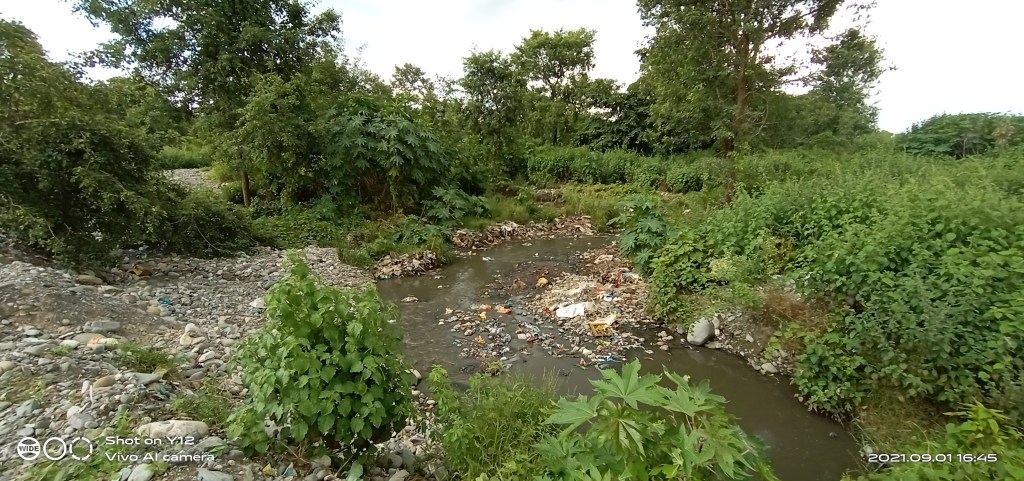
River Pollution
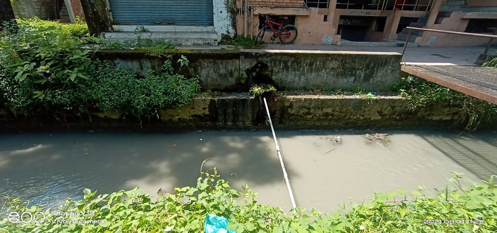
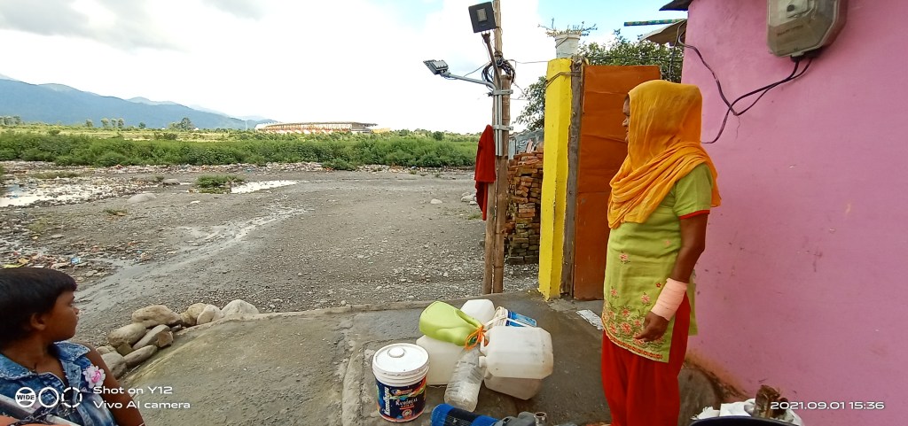
The water quality at Gaula barrage is of B category owing to heavy siltation from Balianala. Siltation has also affected the fish numbers in the river. For past seven years, the residents have been raising[xxiii] voices against dumping of solid and liquid waste in rokhad land (floodplain) along the Gaula river.
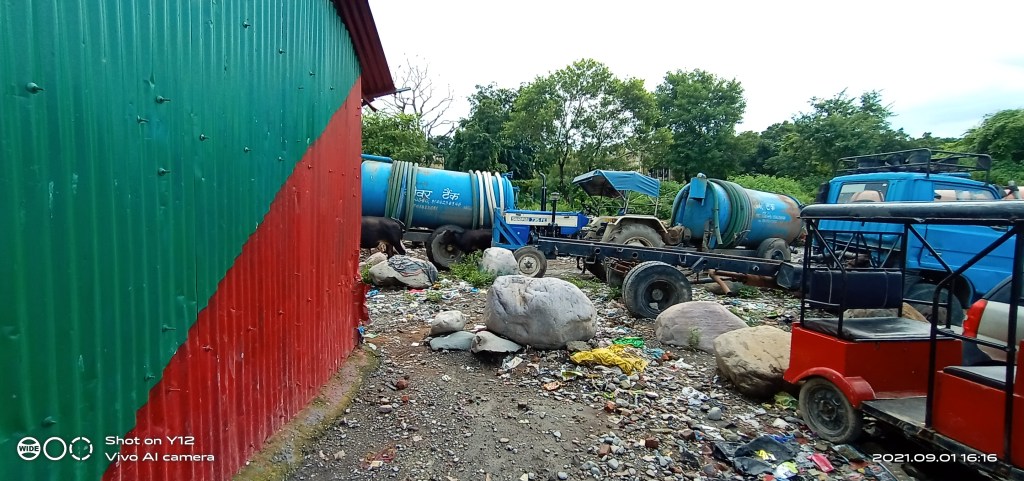
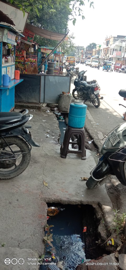
As per Nagar Nigam Haldwani, about 87 percent of city population have toilets but only 10 percent are covered under sewerage network. The city generates around 22.40 MLD sewerage which in absence of any treatment facilities is being dumped in rokhad open areas along Gaula which ultimately falls in the river.
The Nigam had proposed[xxiv] construction of 36 MLD Sewage Treatment Plant (STP) and laying of 120 km long trunk sewer line and branch sewer lines costing about Rs. 140 crore to effectively deal with domestic waste water problem with 2018 and 2020 deadline respectively.

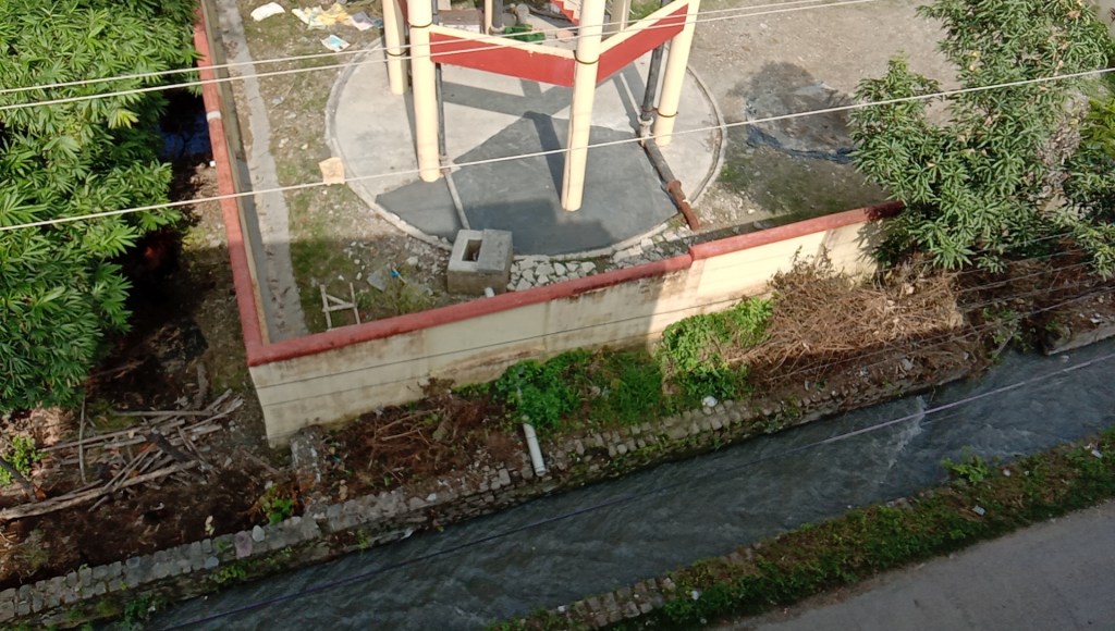
Currently, a 28 MLD STP is under construction[xxv] on 4 hectare of land near Indra Nagar along Haldwani bypass road under AMURT scheme. The construction company is M/s Aquatech Solution Private Ltd..
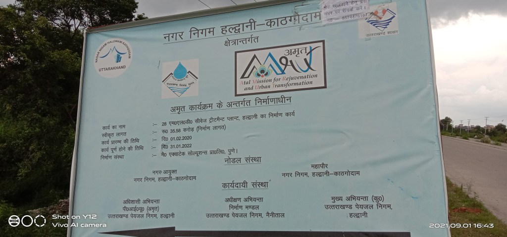
The work would cost Rs. 35.58 crore and started in January 2020 with January 2022 as completion time. Locals feel, the target is difficult to meet given present status and pending work.
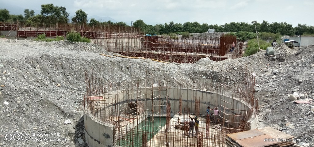
Secondly without laying of sewerage lines throughout city and trunk sewer, the STP would be of no use. Moreover, there is no plan to reuse the treated water and it would be discharge in rokhad land.
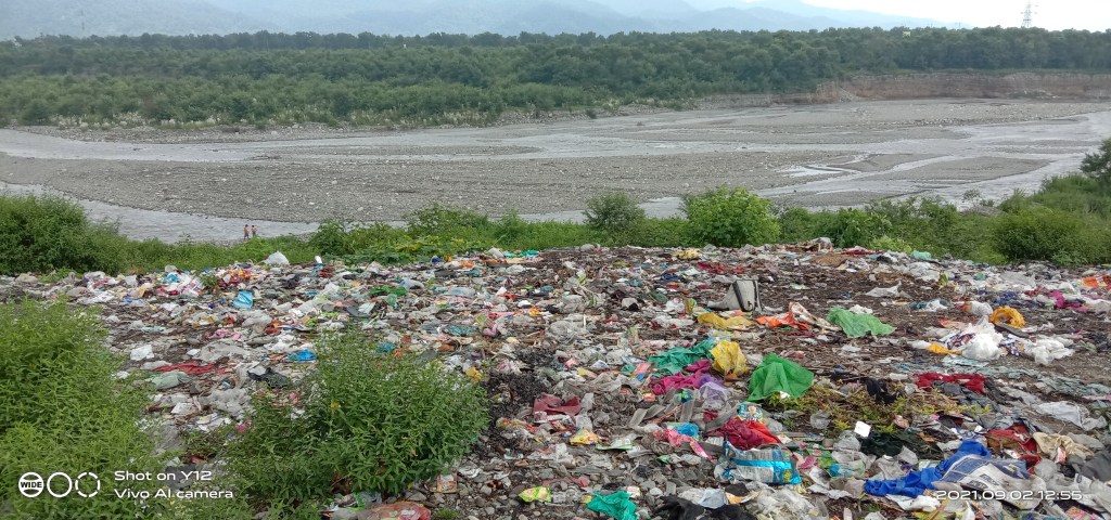
Similarly, after protests against the dumping of solid waste including biomedical waste in rokhad area across Goula river has been stopped. While, the waste is lying there without any remedial measure, the Nagar Nigam has created a waste dump yard on 4 hectare of land close to STP location where about 160 tonnes of solid waste is being dumped from Haldwani, Kathgodam, Lalkuan even from Bhimtal, Bhavali areas. The facility has apparently blocked outlet of storm water drain.
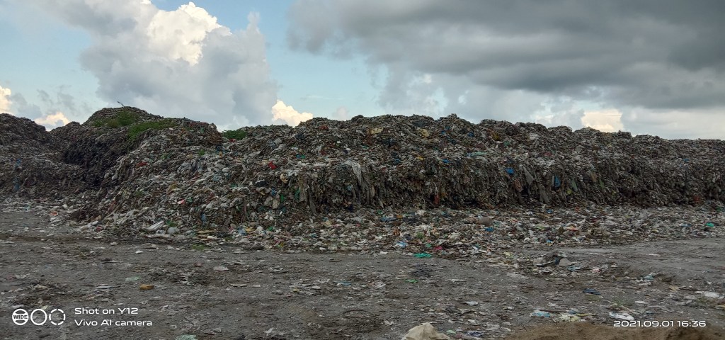
The waste is piling up and lacks composting, recycling measures. Now there are talks of setting up a waste to energy plant to deal with the issue. Both the STP and waste dump yard has been created on rokhand land which has been flooded in 1992.

Close to riverbank there, a non-functioning mandi of Agriculture Produce and Marketing Board is located on about 1.65 hectare land. The facility has been converted into crematoria for Covid 19 victims without any consideration of risks it poses to the health of people and river.
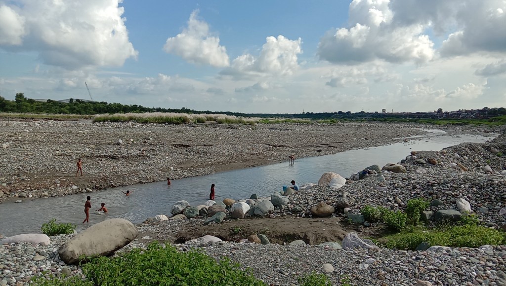
There are many in Haldwani who remember bathing, fishing in Gaula which used to flow round the year with clean water few decades back. But, now the river course runs dry for about four months and the riverbed lies mining ravaged beyond recognition.
Bhim Singh Rawat (bhim.sandrp@gmail.com)
References:-
[i] https://www.kafaltree.com/gaula-river-haldwani/?fbclid=IwAR07eKlJZz-EOgeeXQBVvFs5cnMiR3xWLZW9L9nrvAmMzNBwkR9AaKCxYbc
[ii] https://www.jstor.org/stable/3673618
[iii] http://nagarnigamhaldwani.in/images/Water.pdf
[iv] https://www.uttarakhandirrigation.com/jamrani-dam-project
[v] https://timesofindia.indiatimes.com/city/dehradun/462-families-in-15-villages-to-be-affected-by-jamrani-dam-project/articleshow/71975689.cms
[vi] https://www.tribuneindia.com/news/archive/features/news-detail-593896
[vii] https://www.jagran.com/uttarakhand/nainital-cost-of-supplying-water-to-the-city-from-jamrani-dam-increased-22013469.html
[viii] https://www.livehindustan.com/uttarakhand/story-displaced-villagers-due-to-multipurpose-jamrani-dam-project-hydro-power-electricity-irrigation-power-would-be-rehabilitated-with-400-crore-3896414.html
[ix] https://www.livehindustan.com/uttarakhand/story-jamrani-dam-project-postpone-two-years-water-shortage-uttarakhand-4151275.html
[x] https://www.researchgate.net/publication/310591410_Slope_stability_analysis_of_Balia_Nala_landslide_Kumaun_Lesser_Himalaya_Nainital_Uttarakhand_India
[xi] https://uttarakhandirrigation.com/document/gola-barrage-23_05_2016.pdf
[xii] https://timesofindia.indiatimes.com/city/dehradun/in-haldwani-residents-forced-to-buy-water-from-private-tankers/articleshow/58599840.cms
[xiii] https://www.amarujala.com/uttarakhand/nainital/gaula-s-water-level-is-lowest-in-seven-years-haldwani-news-hld4145881127
[xiv] https://www.etvbharat.com/hindi/uttarakhand/state/nainital/haldwani-may-faces-water-crisis-due-to-gaula-river-water-level-lowest/uttarakhand20210313105427431
[xv] https://www.jagran.com/uttarakhand/nainital-water-supply-in-haldwani-stalled-due-to-breakdown-of-dam-of-gaula-barrage-20248834.html
[xvi] https://www.jagran.com/uttarakhand/nainital-gaula-barrage-will-be-repaired-18641651.html
[xvii] https://www.jagran.com/uttarakhand/nainital-repair-work-of-the-gaula-barrage-stalled-due-to-corona-21654325.html
[xviii] http://www.cedarhimalaya.org/pdf/neha.pdf
[xix] https://www.amarujala.com/uttarakhand/nainital/worrying-the-gaula-river-becomes-30-feet-deep-haldwani-news-hld420905852
[xx] https://www.livehindustan.com/uttarakhand/haldwani/story-gaula-river-changing-due-to-excessive-mining-1208299.html
[xxi] https://www.jagran.com/uttarakhand/nainital-government-sought-report-regarding-gaula-bridge-21980718.html
[xxii] http://www.uafdc.in/achievments.html
[xxiii] https://www.hindustantimes.com/dehradun/complete-tendering-process-for-stp-at-haldwani-in-8-weeks/story-UYOeax9mVK0E7g6EjCODpL.html
[xxiv] http://nagarnigamhaldwani.in/images/Sewer.pdf
[xxv] https://www.livehindustan.com/uttarakhand/haldwani/story-contract-for-stp-construction-in-haldwani-2977279.html

Bhim bhai, dumping of wastes along the river is seen everywhere, even on trekking routes, in remote villages of Uttarakhand. Main reasons being lack of municipal cleaning system and lack of awareness in people about the negative impact on the life of the river and the health of people in the area itself.
During my stay in Uttarakhand, while commuting between Almora and Kathgodam, more than 2 decades ago, I have seen the same thing. Now I guess, the situation has been worse due to population growth. The authorities were inactive then and are now. May be, it’s time to get the locals involved in finding separate places to dump garbage, both for domestic (including kitchen and daily wastes) and recyclable materials (Plastic containers, tins, cans, bottles, single use packaging plastics etc) and make demands to the local administration for cleaning up the trash once (if it is a smaller area) or twice (for larger areas) a week. People have the real power to fight for themselves, whether it is public health or their basic amenities, saving land and water rights or the environment as a whole.
The Koshi river in Almora had the similar situation and I still remember, what difficulty I faced during summer months when our only access to tap water, went dry because the river itself was not able to supply enough. I guess, all the hill stations in Uttarakhand have the same condition regarding availability of potable water, cleanliness, removal of forest areas to avail more lands for domestic use and encroachments of riverbed areas due to lack of proper rehabilitation programs.
Village youths tell their stories on YouTube blogs, about lack of proper roads to their areas. I feel, they are not aware of the pristine wealth they are still having in and around their homes which are getting scarce with time, down the hills, towards towns and cities. AMRUT mahotsab ka Amrit kitna kadwa hai kaun jaane.
LikeLike