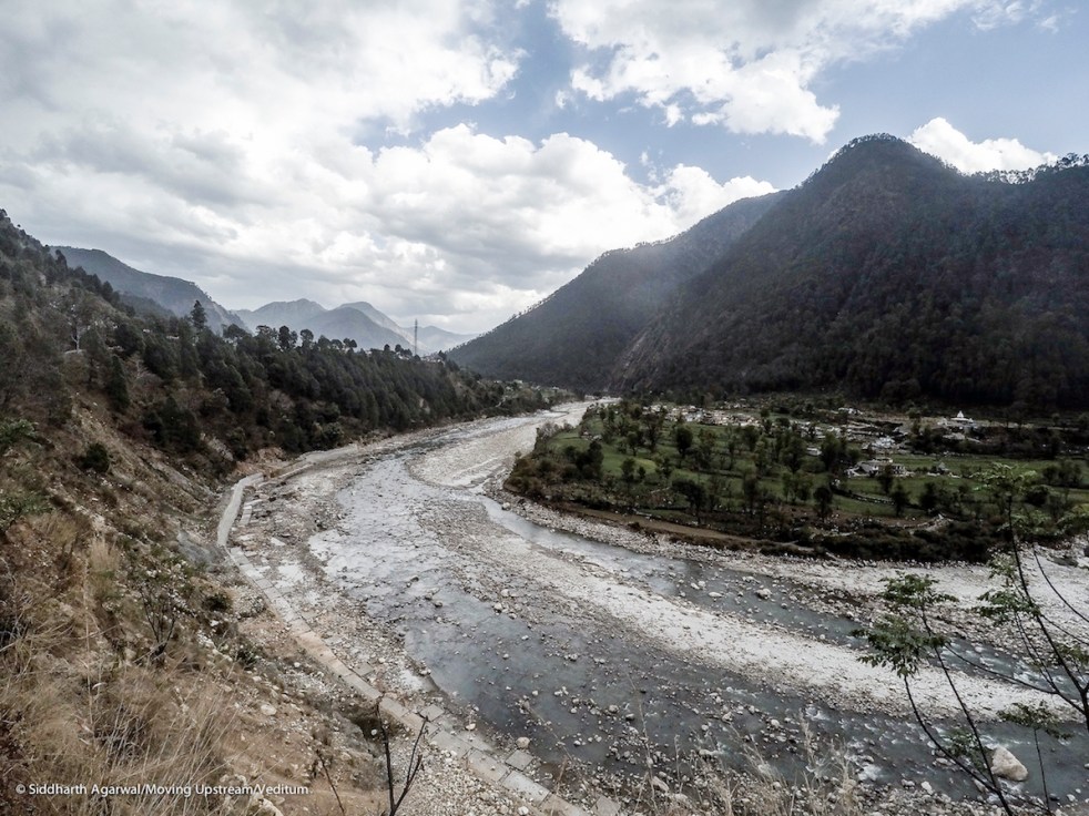
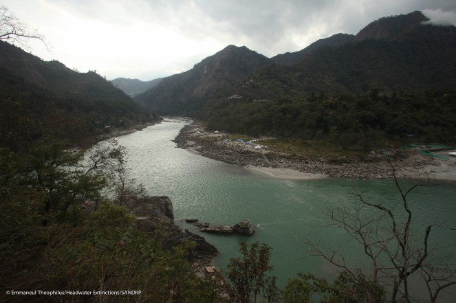
Above: The Bhagirathi valley has a lot of beautiful bends, comparable to the most popular scenic spots across the world. But we’re busy cutting down the mountain to make broader roads in these eco-sensitive areas. Image taken in March 2017. Photo credits: Siddharth Agarwal
Guest Blog by Siddharth Agarwal

In the initial stages of planning the Moving Upstream project on the Ganga for Veditum, where we were going to walk along the whole length of the river, I had approached a lot of individuals to learn from their experiences about the river and the many connected stories around it. These learnings varied from science and activism to adventure and survival. Of all those who were approached, Himanshu Thakkar from SANDRP had been the most generous in extending knowledge resources and sharing contacts from the field. He even entertained a couple of my visits to their office and shared with me a copy of the SANDRP report prepared by Theo, called Headwater Extinctions (February 2014, see: https://sandrp.wordpress.com/2014/12/16/new-publication-headwater-extinctions-impact-of-hydropower-projects-on-fish-and-river-ecosystems-in-upper-ganga-and-beas-basins/, it includes link to full report), along with a few other documents.
Headwater Extinctions looks at the role played by small and large hydropower projects in altering the fish biodiversity and river ecosystems in the Himalayan reaches of the Ganga and Beas basins. It also speaks about the perspective of local people and that of the authorities towards hydropower projects. Theo, who is an adventurer and ecologist, penned down the report with a scientific aptitude, while I will limit myself here in this revisit report to updated observations made on ground while walking along the Ganga in Uttarakhand (March 2017). This comparative observation will hopefully enable a conversation that requires continuity.
Observations – drawing comparisons with statements from the 2014 (in italics):
“In many sections, the once-mighty Bhagirathi, the main-stem of the Ganga, could be hopped over on exposed boulders without even wetting shoes, because of the entire river having been diverted into kilometres of tunnels.” – Feb 2014
In many of our experiences during the walk (2017) along the river in this region, we encountered similar conditions of a dry riverbed. Some people, following our journey through social media, made comments regarding absent surface flows and how it was probably not the right season to assess flow in the river. These people conveniently ignore the fact that while they defend absence of surface flows based on the season, a substantial volume of river water flows through tunnels along these stretches at the same time and also at higher stretches beyond the highest dams. This altered narrative and people’s acceptance, created through large-scale changes of the physical ecosystem and conditioning through media is quite worrisome.


~~
”Even as you drive up from the plains up the first rise of the mountain roads, you are greeted by large signboards put up by Hydro-power Companies. They ‘welcome’ you into the state (only residents or ‘owners’ of a place do that, right?), and they tell you how many hydro-power projects you will encounter, the mileage to each one of them, and all the major towns enroute. Not the Highways Authority, but private hydropower companies, Government hydropower companies, cement companies, and companies that conveniently do both cement and hydropower.”
“There are billboards that tell you that entry is restricted to the entire road even though there are many villages upstream, and this is the only public access to entire valleys. And photography too, so keep that camera down or you will receive the hostility due to a probable subversive.”
Funnily enough, one of the most frequently asked questions to us by those who are officially in-charge of these projects was, “What business do you have in these areas at this time of the year, it isn’t the Yatra season right now. We expect you to not have any ulterior motives.” On being informed that we were undertaking a pad-yatra or journey on foot of the river to learn about it, the responses would range between ‘but is this religious or not?’ and ‘have you taken permission for this’. And, of course, my heavily bearded face and long hair had somehow given them extra reasons to be suspicious of me.
Our presence in a lot of places led to multiple levels of questioning, mostly by dam security folks but sometimes by the over righteous as well. Locals indulged in discussions like people generally do, almost always welcoming, as they went out of their way to accommodate us amongst them even for small durations. It was always a horrid experience passing through areas that had dams, simply because of the harassment it involved.
~~
”Apart from the barrages at Haridwar and Rishikesh which are in the plains of the Terai, there are 70 commissioned, under-construction and proposed hydropower projects in the mountainous reaches.”
“Bhagirathi – There are 9 commissioned projects here, 4 projects are under-construction and 19 are proposed projects.”
“Alaknanda – There are eight commissioned projects, 10 projects under-construction and 20 are proposed projects.”
The situation in 2017 remained almost the same, I understand, except that on Alaknanda, Srinagar Project has been commissioned in the meantime.
~~
”Right here is an instance of a radical break in the connectivity of the Ganga as it comes down from the mountains to the plain. And this hiatus, of headwaters beheaded, is common to every large river in Uttarakhand and Himachal Pradesh. ”
Interesting choice of words by Theo, when he says ‘headwaters beheaded’. Figuratively this definition functions in a fashion similar to how we envision the river as a living entity. I won’t say much about this here, but the disconnect is quite clearly visible in how the river vanishes when stopped behind weirs, diverted and sent to lateral distant lands for power generation or irrigation purposes. It is mind boggling to see, the amount of water that is diverted through these interventions, leaving none or very little for aquatic species or whatever lies downstream. People have become accustomed to these changes now, modifying their lifestyles to adjust to the situation.
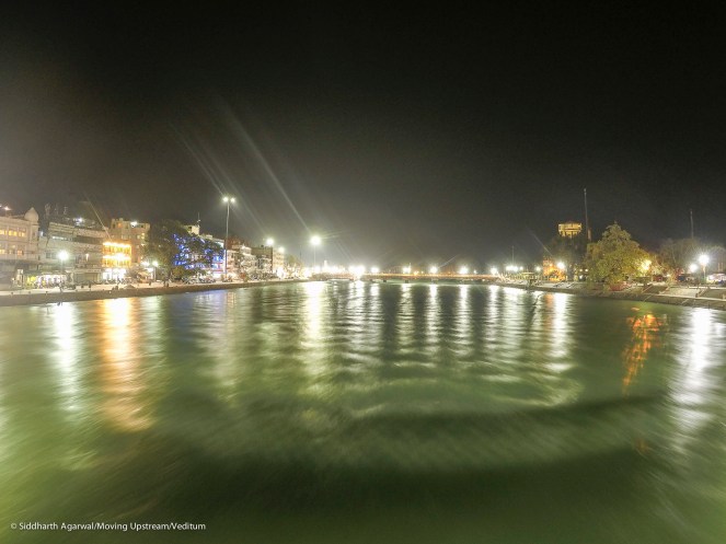
What is also sad is how people do not seem to care about the physical form of the river at all, and this isn’t even about the behind the scenes dumping of untreated sewage and drains into the river. The very fact that in Haridwar, the main bathing ghat (Har Ki Pauri) is actually a canal where water is diverted through a series of barrages, speaks volumes about our disconnect, from both the physical and devotional. The actual riverbed lies dry, with only a small stream flowing. Those that society despises occupy the banks and the river accepts, the poorest of our people living in temporary tarp and bamboo structures.

~~
”Most of the water, along with any fish that survived beyond the diversion, would go down a one-way street to agriculture fields. Those left in the impoundments would be intensively fished through the year by contract fishermen, and those migratory fish stranded downstream of the barrage would congregate and attempt to get over the high barrage during the migration season in futile desperation, making an easy catch for fishermen as well. ”
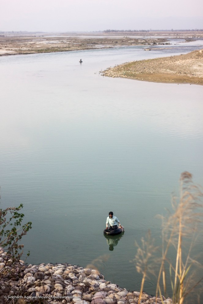
Anyone who has the will to see, will easily notice this in action. Moving Upstream of the River, from the time we entered Uttarakhand from the UP border about 40kms downstream of Haridwar, we spotted very few fishermen. All the fishermen that we did find were behind dam walls in the reservoirs, working for contractors to catch cultivated fish. There were a few fishermen here and there, but didn’t constitute a large enough number to even make it to double digits.
There are enough reports available that clearly lay out the disastrous effect of hydropower projects on fisheries, numbers and trends that are confirmed by the locals. Once locally available protein in the form of fishes are not available anymore. With the contractors coming into the picture, people often mentioned that they neither had the permission to fish anymore, nor the pocket to buy the tasteless fish that was now sold at INR 120-150 per kilogram.
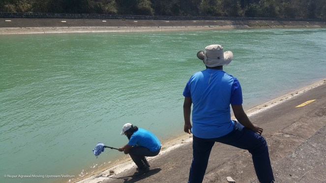
In the stretches covered after entering Uttarakhand, up till Hardiwar, we spotted few places where riverbed mining seemed to have recently taken place, though largely inactive otherwise during our walk. At a couple of spots, it was just a bunch of villagers who were withdrawing material from the riverbed for work in their village, but we did come across some weighbridges too. Most of these structures seemed non-functional, however, the behavior of those still hanging around these weighbridges raised serious doubts in our minds.
~~
”Further upstream at Rishkesh is the Rishikesh-Chilla barrage. Here the 312 meter wide barrage diverts a portion of the flow (565 cumecs) into a wide, lined canal that flows down 14 kilometers to the 144 MW Chilla HEP, and back into the impoundment at Bhimaghoda at Haridwar. Apart from the usual concerns about large-scale diversion and its impact on fish populations, it bears mention also that the canal cuts right through a portion of the Rajaji National Park, and its steep lined sides are clearly impassable or hazardous to elephants, tigers and other terrestrial animals who may attempt to cross it. ”
This did come as a ridiculous surprise to us as well, when we noticed the steep lined canal inside the national park. With a road that goes along the canal, we weren’t too sure if this was by accident or by design to keep the animals out of this section of the park. As part of our documentation process, we tried recording the sound of the river at various different places. But the sides were so steep that we had to make a chain to ensure I didn’t slip into the water. I held on to an extended monopod, which was held at the other end by my friend Shridhar.
~~
”Between Kodiala and Rishkesh, a river length of 35 km, there are presently 140 licensed river-rafting operators. There are 42 rafting camps on lease on these beaches which are on Forest land, and another 30 odd on Civil land. These rafting companies are owned both by local and non-local people, and one interest that they do have in common is that the river continues to run wild and free, and that the aquatic and riparian environment be conserved so as to continue to attract their clientele. In addition to rafting, trekking, village walks and sport-fishing are part of the fare on offer. An informal estimate made of the revenue generated by these companies directly amounts to around Rs. 20 Crore annually. Ancillary business which includes transport, hotels, shops and so on would make this substantially higher.”
The Supreme Court banned a lot of these river camps sometime in 2015-16, since many of them were on forest land, violating the Forest Conservation Act, as the major reason behind it, though it did say that the rafting as such could continue. We saw a lot of abandoned camps, constructed without any care about sanitation and sewage, right on the banks of the river. Some camp owners and rafting guides, personal contacts, mentioned that a lot of these operators were giving the business a bad name, conducting business without quality control in order to make a quick buck.
However, like mentioned in Theo’s writings, the one thing that is most important to any of these camps is the health of the river and they’re important stakeholders in the conversation on the need to have a freely flowing river. It has become a trend these days to measure everything in economic terms, from the smallest fishing pond to dense evergreen forests. But we refuse to do this many times, especially when the state argues for the need to mine or dam a freely flowing stretch of the river in the name of economic development or growth.

~~
”Driving up from there along the Bhagirathi, I come across masked billboards of the THDC, and enquire from local residents about the status of the Kotlibhel 1A project that was also recommended to be ‘reappraised’, cancelled, and work ordered by the Supreme Court to be halted. A gentleman took me to peer over the edge of the road from where a tunnel of the project was visible. There was a hum of heavy machinery coming up from below, and I was told that work on the tunnel was underway anyway. ”
We didn’t notice any work happening between Devprayag and Koteshwar Dam, we were right on the bank of the river all throughout. So, in Feb 2014 there seemed to have been some illegal work going on, but not at the time of our visit in March 2017.
~~
”The huge impoundment of the Koteshwar dam drowns the valley right upto the foot of the giant 260 meter high Tehri dam. ”
This was the most in-animate view of the river we had seen until we reached Tehri. It seemed life-less, with empty and abandoned villages everywhere. We met a few people who were still living in these now abandoned villages, risking it because they had nowhere to go, they hadn’t been compensated or relocated yet.
At the foot of the Koteshwar dam, however, people were cremating a recently deceased soul. They mentioned that all of their older cremation spots had been swallowed up by the huge reservoir created behind the Koteshwar dam walls. We also witnessed more cremations downstream of the Koteshwar dam, at the Koteshwar temple that sits on a horseshoe bend on the Bhagirathi.
~~
“If you drive along this huge reservoir up to a town on the ridge called Chamba, the view of the impoundment still stretches on to the horizon, and on a further 77 km on to Chiliani Saur. The huge terraces of agriculture land are now drowned in meters of sediment-ooze at the drained portion of the reservoir. This is the silt deposited at the bottom and exposed during seasons of low-flow due to the draw-down of waters for generating 1,000 MW of power (2,400 MW for the whole complex which includes pump-storage as well as the Koteshwar dam), for irrigating 870,000 hectares of land, and when industrial areas in Delhi and U.P. take a deep suck of more than 1,215 million litres of drinking water a day. While the length of the Tehri reservoir is said to be 44 km along the main valley, the waters go far past the confluences and into all the side valleys and streams that flow into the Bhagirathi. By road, you must drive for around 90 km to get from one end of the reservoir to the other.” (Pages 12-13)
We were lucky, to be on foot and didn’t have to take the detour along the Syansu, which is a stream that joins the Ganga several kilometres upstream of Tehri. The Syansu is now completely flooded, resembling a lake more than a stream. This meant that our journey to Chiliani Saur was about 50kms of walking, instead of the 77 km drive.
The sediment because of the reservoir’s stagnant water means that the area that lies exposed during draw down cannot be utilised for much agricultural purposes. This pool of water (the reservoir) has also become a source of diseases. Local speak: the temperatures in these areas have gone up substantially due to the presence of stagnated water as compared to the fast flowing rivers they always had. (Similar examples are mentioned in the report in the paragraphs following the one quoted above).

~~
”And what about the fish here? For one, average flows in this section of the Bhagirathi have since reduced from 28 cumecs to just 5.7 cumecs. At the time of my visit, 8th February 2014, there was no flow from the Tehri dam into the Bhagirathi.” (Page 14)
While the report carries a whole section dedicated to understand the condition of fishes, fisheries and fisher-folks, my experience and expertise in this domain is pretty limited. However, even for someone like me, one thing had become amply clear: the people of the valley could no longer afford to consume or catch fish from their own river. All the people we spoke to in the Bhagirathi valley said the same few things:
- There were no more (negligible) wild fish in the river/reservoir.
- Contractors on behest of the government had filled the reservoirs with cultured fish.
- Locals were not allowed any portion of these cultured fish either, and that only the contractors had the permission to fish in reservoir water. Truck-loads of fish would be frequently sent to markets 50-100kms away.
The river has already been stolen along with the culture of these people, now livelihoods and rights are also facing similar extinction.
~~
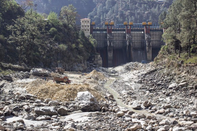
”Upstream of Chiliani Saur and towards Uttarkashi, the Bhagirathi, now a small and greatly reduced stream, flows for 22 km and into a furrow past the massive zone of deep sediment deposits into the reservoir. The recently built Maneri Bhali II dam just before Uttarkashi diverts the entire waters of the Bhagirathi (other than what escapes from under the sluice gates) into a 22 km long tunnel to feed the 304 MW Maneri-Bhali II powerhouse at Dharansu. Upstream of this dam, the Bhagirathi flows for less than a kilometre after being released at Tiloth from an 18 km long tunnel from the Maneri- Bhali I dam upstream. Yes, the diverted 18 km section runs practically dry, except for some basal flows and a small escape from under the sluice gates of the Maneri dam.”
The situation largely remains the same today, with possibly even lesser water flowing through the sluice gates of Maneri dam. During the walk, we had reached Maneri dam couple of days before the Uttarakhand High Court had declared any sort of mining of the Ganga river bed to be illegal.
What we saw was a depressing scene. 50 metres downstream of Maneri dam, the riverbed was completely exposed, dry like a bone and ongoing mining activities for sand and stones. The children of workers ran around the mining site, human rights sent for a toss as exploitation of workers continued in plain sight. We met hundreds of construction and mining workers from Jharkhand, Bihar and Nepal in these stretches of the river, severely underpaid and overworked.

CONCLUSION It is just coincidental that this period of 2014-17 is the period of first three years of the new NDA govt. at centre under Shri Narendra Modi, with Water Resources Ministry charge given to Susri Uma Bharti, known for proclaimed commitment for the cause of Ganga. From the above narration what we see is that the state of river Ganga in Uttarakhand, has only worsened in this period. As I write this, news filters in that Uma Bharti is being replaced as the Water Resources Ministry in the Cabinet Reshuffle slated for Sept 3, 2017. The trouble is there is little guarantee that the new incumbent will deliver better results for the river, in spite of the proclaimed commitment of the NDA government for rivers.
GET INVOLVED As we work on the exercise of continuous observations, we realize the importance of collating as many data points as possible, and we want you to share your individual observations with us in the following form – Image, Observation, Location, Date of Observation. We’re working to build a tool that will make this participatory exercise a convenient process, but till then we request you to make the effort to send the information to us in form of an email. Please send responses to ht.sandrp@gmail.com and contact@veditum.org with subject line – ‘Moving Upstream’.
Siddharth Agarwal (siddharthagarwal.iitkgp@gmail.com)

A very valuable insight and a sad state of affairs.
LikeLike
Picture and Idea seems excellent but I doubt if become polluted
LikeLike
very nice blog! For sharing content and such nice information for me. I hope you will share some more content about. Guide to all the thrilling adventure activities in uttarakhand Please keep sharing!
Destination Weddings in Jim Corbett
LikeLike