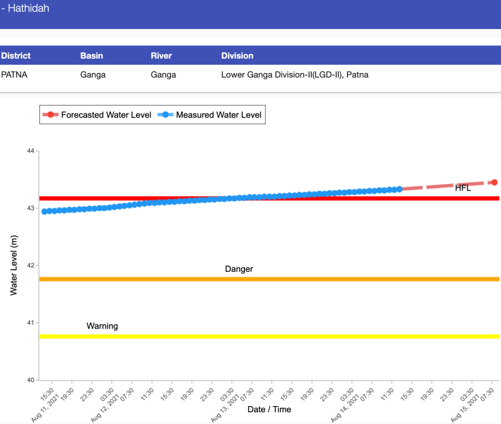
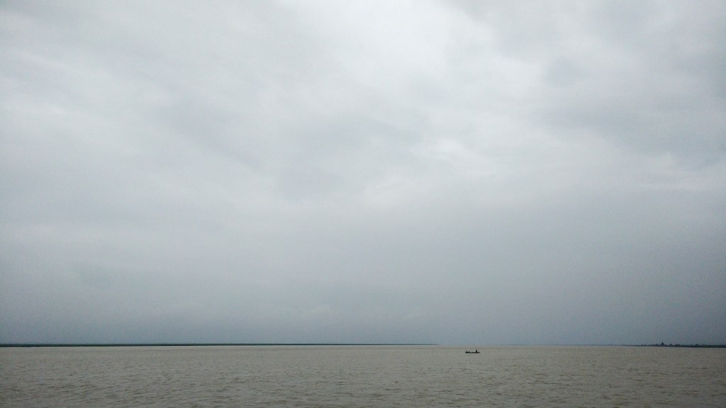
As India prepares to celebrate 75th Independence day on August 15, 2021, large parts of Bihar along the Ganga river, including Patna (flood water entered colonies near Ganga in Patna) and Bhagalpur are preparing to face unprecedented floods. In fact, Central Water Commission’s (CWC) flood monitoring site at Hathidah in Patna district crossed the HIGHEST FLOOD LEVEL (HFL) of 43.17 m at 0300 hours in early morning on Aug 13, 2021. The water level is already at 43.33 m at 1300 hrs on Aug 14. It is forecast to reach 43.45 m by 0800 on independence day still with rising trend. This is apparent from the CWC hydrograph of this site shown above.
Continue reading “Why are Patna & Bhagalpur facing unprecedented floods on India’s 75th independence day?”Tag: Patna
Bihar Sand Mining 2020: Ruining rivers; aggravating floods
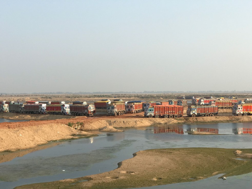
{Feature image: Up to 300 trucks a day take their fill of sand at a mine on the Sone River in Bihar state. India’s construction boom is stripping large volumes of sand, a vital ingredient in concrete, from its rivers. Environmentalists say the extraction is unsustainable, harming local hydrology and wildlife. Paul Salopek}
The 2018 review of sand mining[i] for Bihar highlighted how mismanagement by govt and then National Green Tribunal (NGT) ban on sand mining in Ganga river, Son rivers particularly during monsoon months resulted in sand scarcity and soaring prices affected public and livelihoods of mining laborers.
The video report featuring local people revealed that illegal mining was causing floods in West Champaran by damaging embankments. Similarly, the report on Gaya mentioned sand mining among reasons behind increasing air pollution. The death of four kids by drowning into sand mine pits was shocking. This compilation presents the situation after 2018 so far.
Continue reading “Bihar Sand Mining 2020: Ruining rivers; aggravating floods”
Dams Floods 2018: Filling up Dams well before Monsoon end, Invitation to Disaster
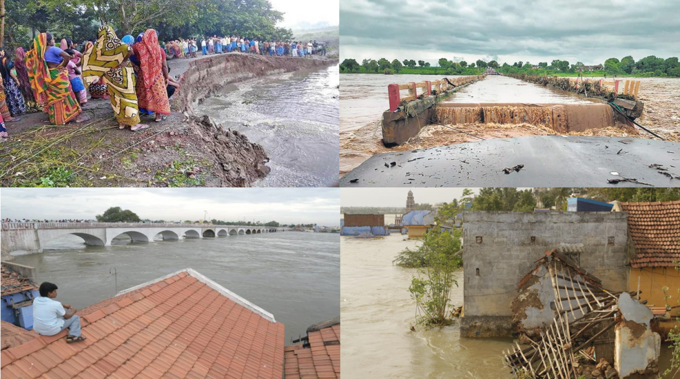
The tendency of filling up reservoirs in the beginning and middle of monsoon season have been leading to avoidable flood disasters in the country. Apart from Kerala flood 2018, which was aggravated by mismanagement of reservoirs, various reports show that reservoirs in river basin of Cauvery, Krishna, Godavari and Ganga were also filled up well before the end of South West monsoon season. Resultantly there were many man made flood spells in downstream areas affecting lives and livelihoods of people.
After highlighting role of dams in floods in Kerala and how improper dam operation affected people in Assam and Himachal Pradesh, this third and concluding part throws light on other dam induced flood (and canal breach) incidents in 2018. Continue reading “Dams Floods 2018: Filling up Dams well before Monsoon end, Invitation to Disaster”
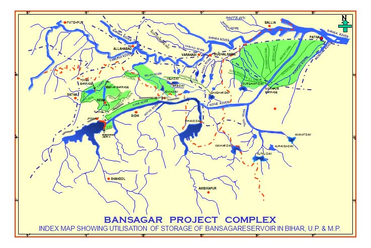
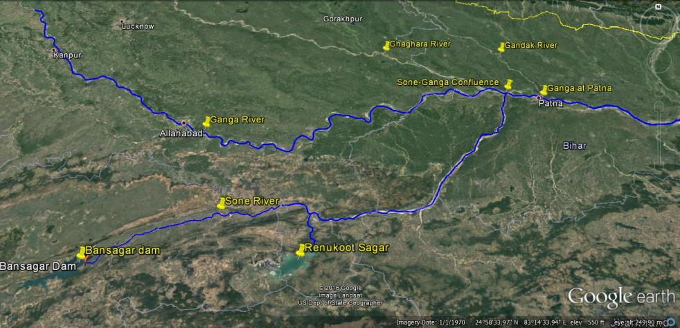
TALE OF A DISASTER FORETOLD: Bansagar Dam ready to create another flood disaster along Sone and Ganga
Bansagar Dam in Sone river basin in Madhya Pradesh already full, violating the rule curve, is ready to create yet another flood disaster along Sone river in Madhya Pradesh and along Sone and Ganga in Bihar.
As per Madhya Pradesh Water Resources Department website’s Flood Report[i] on Sept 10, 2018 afternoon (5pm) (see the screenshots of the website below), ten gates of Bansagar dam were opened by 0.5 m at 11 am on Sept 9, 2018, releasing 35315 cusecs water. The gates were further opened to 0.75 m at 4.40 pm on same date to release 54315 cusecs. A bit curiously, the website is completely silent about any gate opening before that, it implies that no gates were opened this year before 11 am on Sept 9, 2018. The website says the water level at Bansagar Dam reached 341.63 m at 12 noon on Sept 9, 2018, level is given only at intervals of 4 hours during the day. The Dam FRL (Full Reservoir Level) is 341.64 m, so it is likely that when they opened the gates at 11 am on Sept 9, the dam may have already reached FRL. The water level at the dam has remained at 341.58 m till 8 am on Sept 10, 2018, just 4 cm below the FRL, as per the latest available information. Continue reading “TALE OF A DISASTER FORETOLD: Bansagar Dam ready to create another flood disaster along Sone and Ganga”

DRP: 10 Sept 2018: NIDM Lecture on Role of Dams in Kerala Floods
National Institute of Disaster Management, Ministry of Home Affairs, Govt of India invited Himanshu Thakkar, Coordinator of SANDRP, to speak on the topic at IHC on Saturday. At the packed hall with participants that included members from Central Water Commission, National Disaster Management Authority, Embassies, Media and Civil Society, the speaker explained how unwise and unaccountable operation of dams, violating all norms, hugely contributed to the proportions of the Kerala flood disaster. Giving the example of Idukki dam, he showed, how if the dam was operated as per rule curve, its contribution to the floods could have been reduced by over 50%. Similar is the story of other dams in Kerala.
Continue reading “DRP: 10 Sept 2018: NIDM Lecture on Role of Dams in Kerala Floods”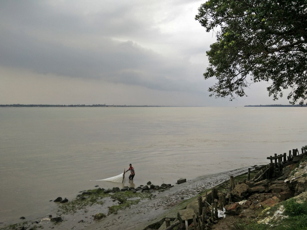
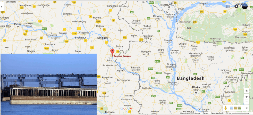
Will sluggish Farakka again create prolonged floods along Ganga in Bihar?
It’s a bit intriguing situation. IMD and Skymet experts are downgrading the monsoon rainfall from earlier forecast 100% to 92%. Both agencies are predicting even lower rainfall in remaining part of current South West Monsoon. Bihar has received 413.2 mm rainfall till Aug 2, 2018, 22% below normal. And yet, starting Aug 1, CWC’s flood forecasting sites along the Ganga were showing ominous portents. For the first time this monsoon, the sites started showing steep upwards trend. Continue reading “Will sluggish Farakka again create prolonged floods along Ganga in Bihar?”

Landmark Ganga Conference in Patna: What Bihar needs to urgently do
DURING FEB 25-26, 2017, A LANDMARK MEETING HAPPENED IN PATNA, ORGANISED BY BIHAR GOVERNMENT, UNDER THE LEADERSHIP OF CHIEF MINISTER SHRI NITISH KUMAR. THE MEETING WAS ON INCESSANT GANGA WITH SUBTITLE “CAN WE ACHIEVE CLEAN GANGA WITHOUT INCESSANT GANGA?”. THIS NATIONAL-INTERNATIONAL CONFERENCE WAS LANDMARK MEETING FOR A NUMBER OF REASONS, BUT MOST IMPORTANTLY, SINCE A STATE GOVERNMENT WAS TAKING THE LEADERSHIP FOR THE CAUSE OF THE RIVER GANGA. WHILE THE CONFERENCE WAS FOCUSSED ON ACHIEVING A REJUVENATED GANGA, I WAS TO SPEAK ON THE WAY FORWARD ABOUT THE FARAKKA BARRAGE, A KEY OBSTACLE IN THE PATH OF REJUVENATED GANGA. FOLLOWING IS MY LETTER TO BIHAR CHIEF MINISTER, FOLLOWING THE CONFERENCE, WHICH CONTAINS MY RECOMMENDATIONS TO THE BIHAR GOVERNMENT. THESE RECOMMENDATIONS WERE APPARENTLY ACCEPTED IN THE FINAL SESSION.
March 2, 21017
To
Shri Nitish Kumar,
Chief Minister of Bihar,
Patna, Bihar
Respected Sir,
Firstly, I would like to thank you and Water Resources Department of Bihar for inviting me to the Patna Conference on Incessant Ganga on Feb 25-26, 2017. This shows great vision and foresight on your behalf, to raise such crucial issues that is not only necessary for the Ganga, people of Bihar, environment of Bihar and future of Bihar, but also for the whole nation. We hope you will continue to lead the nation on this issue, and I am sure you will get huge support, including from me. Continue reading “Landmark Ganga Conference in Patna: What Bihar needs to urgently do”
DRP: 27 Feb 2017 (Urgent Need To Review Impacts Of Farakka Dam: Experts)
During a global seminar held on Feb. 25-26, 2017 in Patna experts from across the country have advocated an “urgent review” and comprehensive study of the Farakka dam to revive the Ganga river. The experts were discussing various concerns facing River Ganga and the possible solutions for them. The seminar titled as “Incessant Ganga” was organised by Bihar’s Water Resources Department, almost week after, Bihar CM Nitish Kumar has openly termed the barrage as genesis of floods in the State. Speaking in the program, the CM again expressed deep concerns behind receding water flow in the Ganga and increasing silt deposit due to Farakka dam.
Speaking during the seminar, environment expert Himanshu Thakkar the coordinator of SANDRP advocated urgent need for review of Farakka barrage claiming that it has failed to fulfill any of the purpose – irrigation, hydro electric power, water supply – of the barrage for which it was built. As per, Himanshu Thakkar the dam was built to maintain the navigability of Kolkata port.
Thakkar also suggested that the gates of Farakka be opened during monsoon to mitigate the intensity of floods in Bihar. As per Thakkar there was an urgent need for a comprehensive study of the Farakka barrage to find out its achievements or whether the barrage fulfilled its objectives. The committee constituted for study must include the Centre, Bihar, West Bengal and all states having Ganga, he said adding that a study should be made on the social and livelihood impact of the barrage, how it affected people’s lives, whether its existence was justified and cost-benefit assessment among other issues.
Continue reading “DRP: 27 Feb 2017 (Urgent Need To Review Impacts Of Farakka Dam: Experts)”
While walking upstream along the Ganga from Ganga Sagar to Gangotri: The Price of Exclusivity
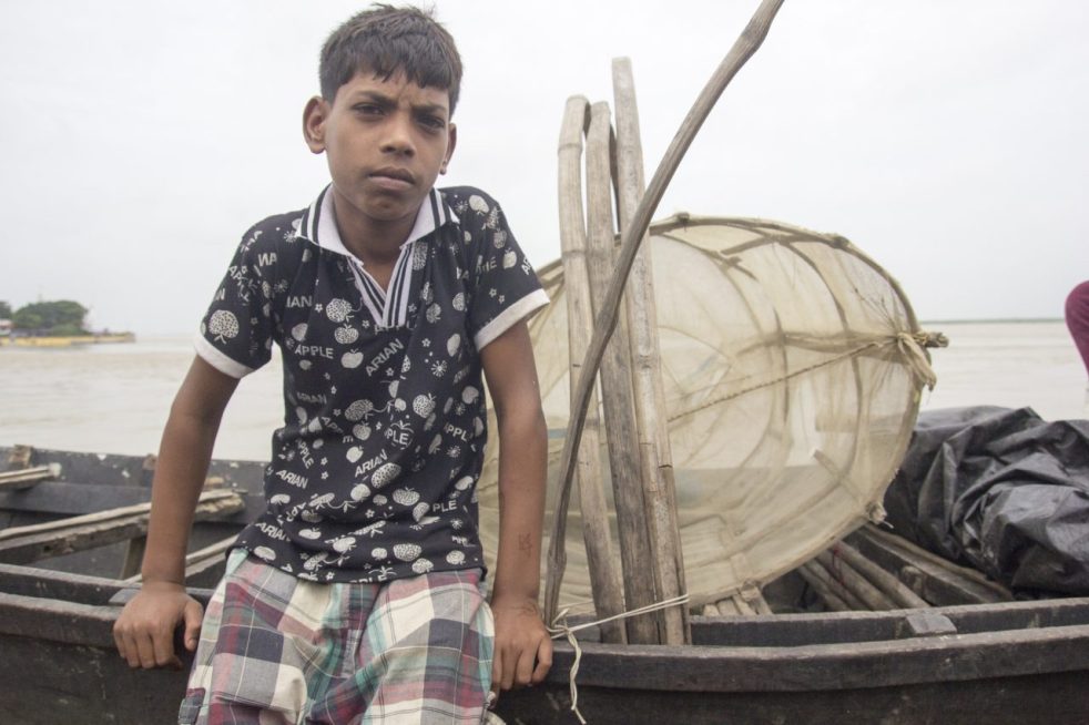
Above: Young kid from a fishing family in Kahalgaon, even the most informed communities (Ganga Mukti Andolan) are clueless about the government’s intentions (Photo by Veditum)
GUEST BLOG BY: Siddharth Agarwal
As the Ganga rises and fills streets and alleys with it’s water all along it’s course, I spend a time out at home, partially because of personal reasons and in some parts due to the rising levels of the river hindering all sorts of movement around it. Currently on a walk along the Ganga for Veditum India Foundation’s ‘Moving Upstream’ project, I’ve been able to walk a distance of about 1000 kms alongside it’s banks from Ganga Sagar till Varanasi in 50 days’ time. Some places saw me walking right next to the river while others had me maintaining my distance since it just wasn’t possible to peruse a course anywhere in the vicinity of the flooded banks.
The rising levels of the river are no surprise, an annual occurrence with variation only in ferocity. We’re surprisingly still caught off guard, every single year, with this news about floods in cities like Patna, Allahabad and Varanasi making it to national television on an almost daily basis. But what of all the places between Patna, Allahabad and Varanasi? What of all the places that are not cities and of all the people who are not urban dwellers? The major focus as I walk along the river are the people of the river and their lives, those who inhabit this space known to all as the vastly fertile Indo-Gangetic plains but unknown as a place extremely vulnerable to the forces of nature and shaky towards those man-made.
I had been informed in advance of the situation of our fishermen by minds already working in the field of environment and rivers in our country, often mentioning that these communities were severely under-represented and very much neglected even when it came to discussions relating to them. Non-inclusiveness of communities while making decisions is not a new theme in India, but given the extent of impact that some upcoming government decisions/policies was going to have on these people, I decided to ask them a few questions as I proceeded upstream from Ganga Sagar, starting early June 2016.
Anywhere downstream of the Farakka barrage, the mention of the word barrage has a stunning effect on the people and 1975 is a year that fisher folks remember as a year of doom. For most readers and even for me before I started upon this trip, this would makes sense if one tries to put in a little effort in imagining how a barrage or dam might affect a river. But unlike how logic would dictate, this effect doesn’t exist just downstream of the barrage and similar reactions continued even further upstream, in Jharkhand and Bihar.

The National Mission for Clean Ganga and The National Waterways programme have been in the limelight for making grand promises of :
1.) Cleaning and maintenance of the river
2.) Economic Development and Cheaper Transportation.
Now, this is not a commentary on the efficiency and feasibility of making such proposals, simply an attempt to understand the impact of such programmes. EIA (Environmental Impact Assessment) and SIA (Social Impact Assessment) are the terms you might be looking for, something that ideally the governing authority should be taking care of. But why is any of this important or relevant to this article? It is because whatever happens in these places between Patna, Allahabad and Varanasi is very much relevant and important to discuss. These are not uninhabited spaces, but pretty well populated areas with a lot of lives at risk.
Coming back to the point of the two government programmes, firstly, the NMCG letting the Waterways programme run through protected areas and non-protected ecologically sensitive areas goes very much against the whole agenda why this mission was set up. Secondly, the waterways programme in a bid to decrease ‘transportation’ costs and utilise our river potential recently ran tests with large vessels on the Ganga.
What is surprising (or rather not) is that these test runs were without any warnings to fishermen and boatmen in said test sections, the few who were on the waters at the time of passing of these vessels had to face high waves, enough to topple a less experienced or unaware boatman. The news of these tests were flashed all over the main stream media, but failed to make it to those for whom it mattered. Not an uncommon occurrence at all, but till when will this go un-noticed? On asking these fishermen if they have any clue why this is happening, most of them responded in the negative while a few said they’ve learnt about the government’s plans to run large vessels on the river.
As this conversation extends and questions follow, it is gradually revealed that the picture is not clear and conversations have somehow trickled down in a very muzzled form. Though most fishermen laugh off the prospect of this being a constant activity because of the extreme reduction in water level that the river has seen these past years, often mentioning how large excavators and multiple tugboats have been needed anytime a large vessel has traversed these stretches in lean seasons. There’s talk of loss of fishing nets and reduced catch, difficulty in controlling small country boats in high waves, chances of accidents when transporting villagers to small ‘diars’ for agricultural work, loss of land where there’s no embankments and so on, but this also brings us to the most important part of this article.
The Water Highway programme on the Ganga has been proposed on a 1500 km stretch from Allahabad to Haldia, with barrages at about every 100 kms. Now, an avid news reader would have knowledge of this as a great policy step but the fisherman who directly depends on the river for his livelihood does not. This holds true for maybe 15-20 different fishing communities that i’ve had the chance to interact with in the first 50 days and even the mention of new barrages was way too shocking for those who have had to bear the burden of Farakka’s impacts. There are even places where locals have signed their wishfulness of a barrage near their villages without understanding consequences and only having been shown the shiny side like we see everyday in the papers, called ‘development’.
The ‘Moving Upstream’ project intends to understand and present a narrative of the river and it’s people, hoping this will lead to more meaningful conversation and inclusive action by the government. In a recent announcement by Sushri Uma Bharti Ji – Union Cabinet Minister of Water Resources, River Development & Ganga Rejuvenation, she said she will march down the length of the river to take stock of the status of various projects commissioned by her. I’m glad that cues are possibly being taken from the Moving Upstream project, but like every other government project, when will our habit of assessment (if at all) after execution stop and preparedness & understanding before implementation materialise? I hope she does her Ganga yatra before approving any projects, I hope for inclusiveness.
Siddharth Agarwal (siddharthagarwal.iitkgp@gmail.com)
दो बाॅधों की कहानीः क्या बिहार की अप्रत्याशित बाढ़ एक टाली जा सकने वाली मानव जनित त्रासदी है?
बाणसागर बाॅध, सोन नदी, गंगा नदी और पटना को दर्शाता मानचित्र
21 अगस्त 2016 की सुबह, गंगा नदी का जलस्तर लगातार बढ़ते हुए, पटना में 50.43 मीटर पर पहुॅच गया। जिससे पटना में गंगा नदी अपने पहले के उच्चतम बाढ़स्तर 50.27 मीटर से 16 सैंटीमीटर ऊपर बह रही थी। 22 अगस्त 2016 तक पानी का जलस्तर गंगा नदी के किनारे तीन अन्य स्थानों पर उच्चतम बाढ़स्तर को पार कर गया। जिसका विवरण निम्न हैः-
स्थान 22.08.2016 को उच्चतम बाढ़स्तर पुराना उच्चतम बाढ़स्तर
बलिया उत्तरप्रदेश 60.30 मीटर 60.25 मीटर (14 सितंबर 2003)
हाथीदाह, बिहार 43.17 मीटर 43.15 मीटर (07 अगस्त 1971)
भागलपुर बिहार 34.55 मीटर 34.50 मीटर (05 सितंबर 2013)
इस तरह से हम देखते हैं कि पटना में उच्चतम बाढ़ का रिकार्ड तोडने के बाद, अब यह बाढ़ गंगा नदी के किनारे बसे बिहार और उत्तरप्रदेश के अन्य इलाकों में पहुॅच रही है। यहाॅ यह बात उल्लेखनीय है कि बिहार में अब तक वर्षा औसत से 14 प्रतिशत कम हुई है। सवाल यह उठता है कि इसके बावजूद गंगा में रिकार्ड तोडने वाली बाढ़ क्यों आयी?
