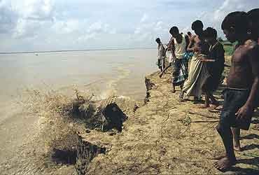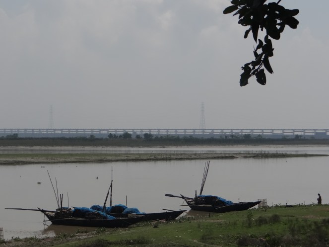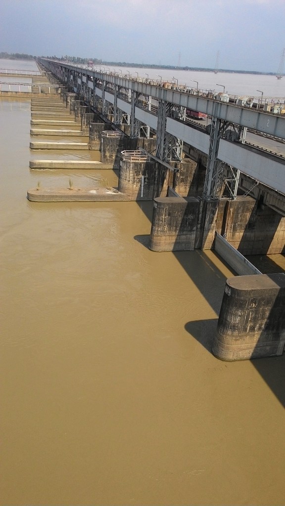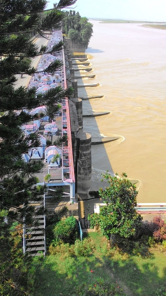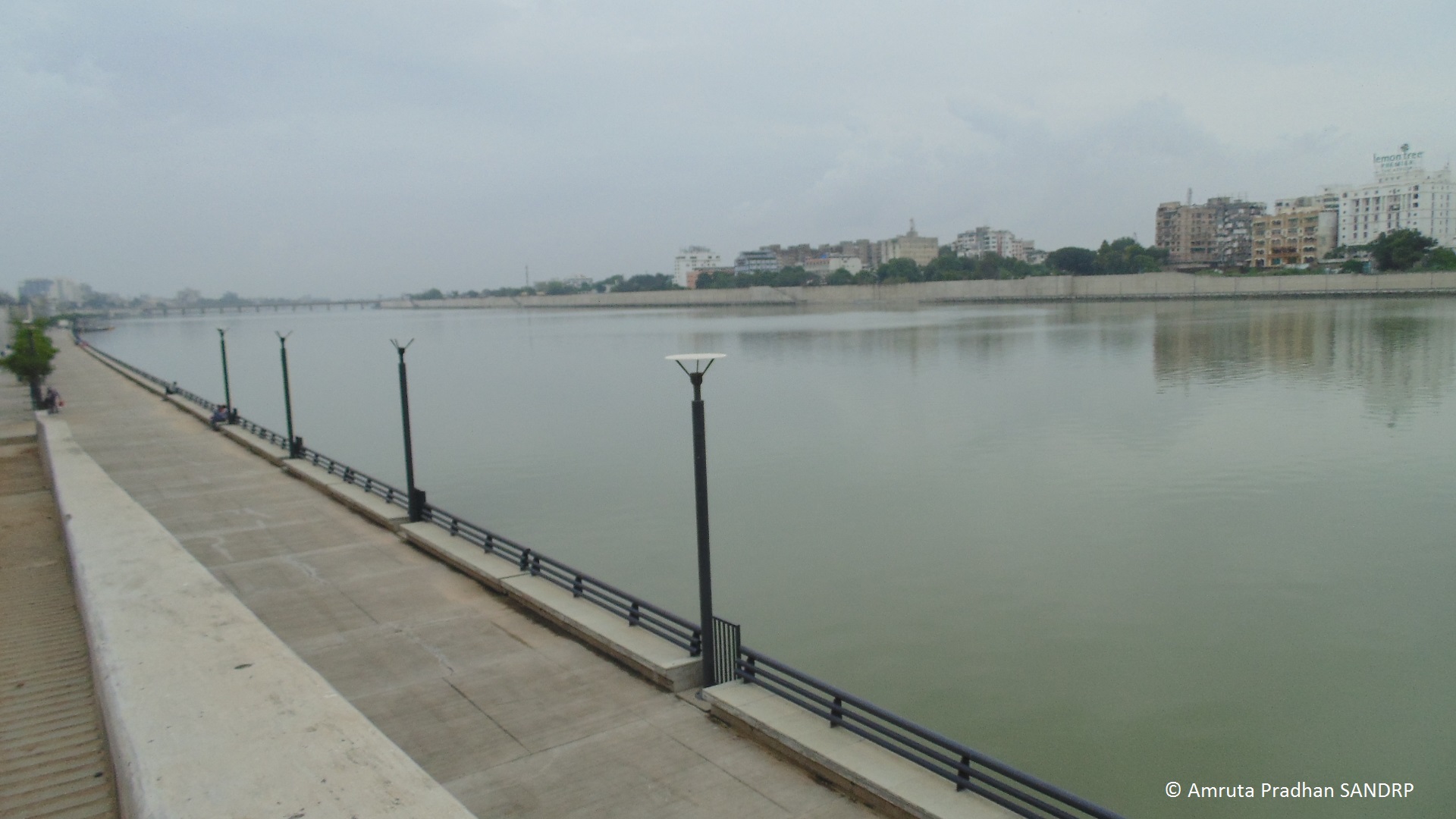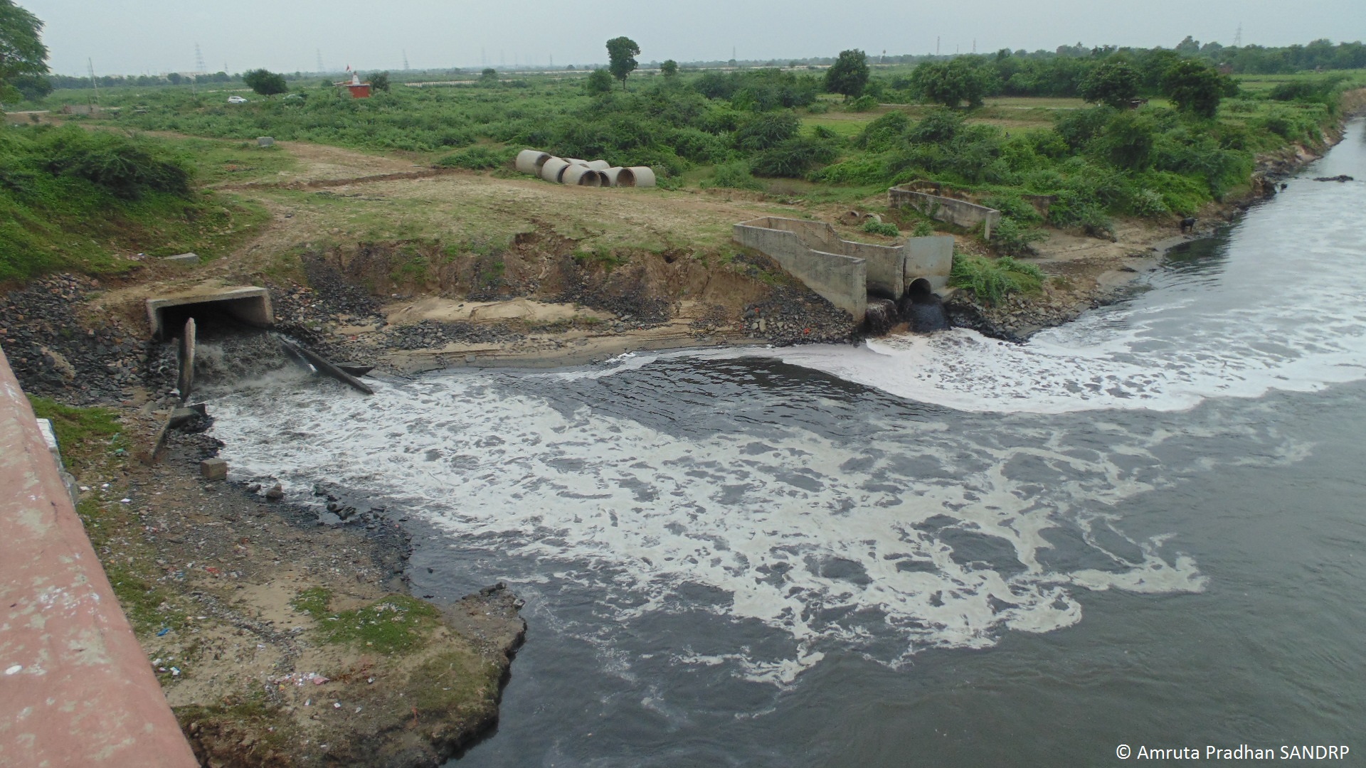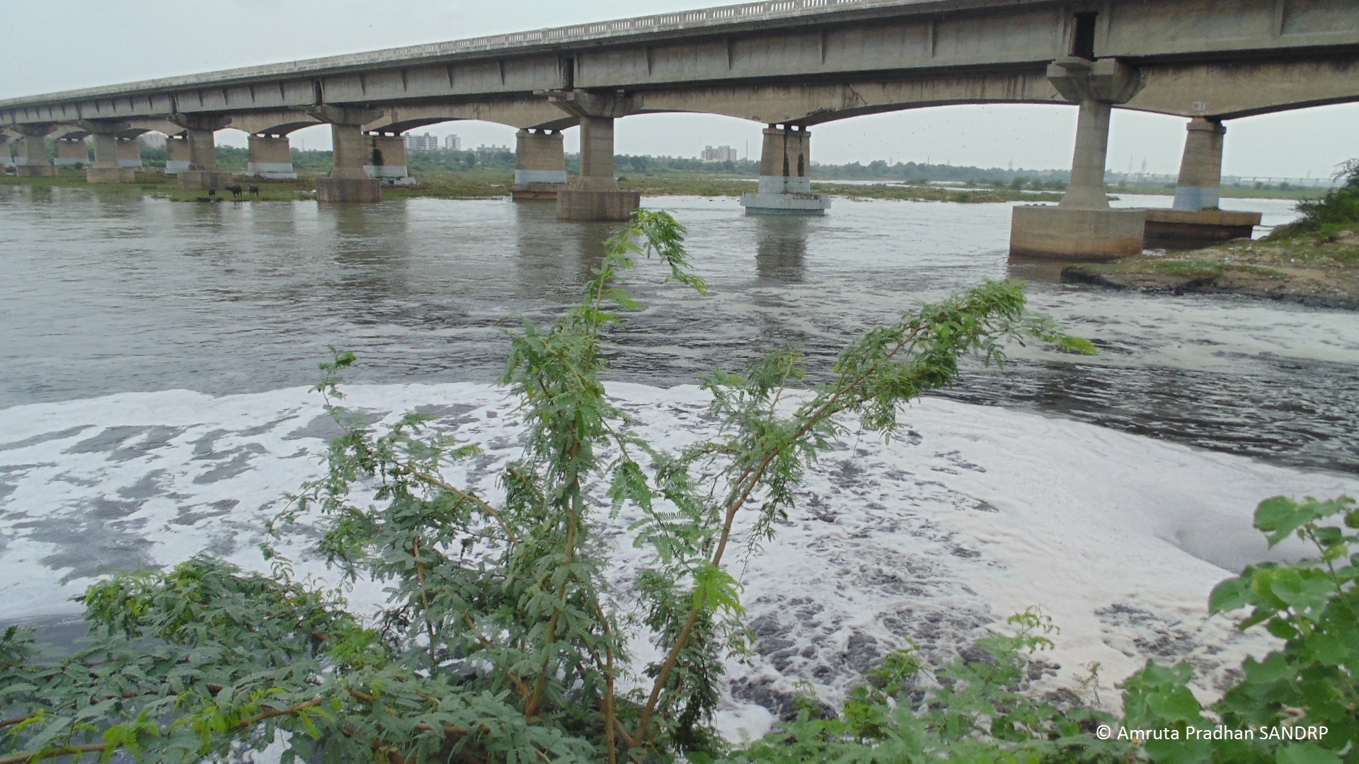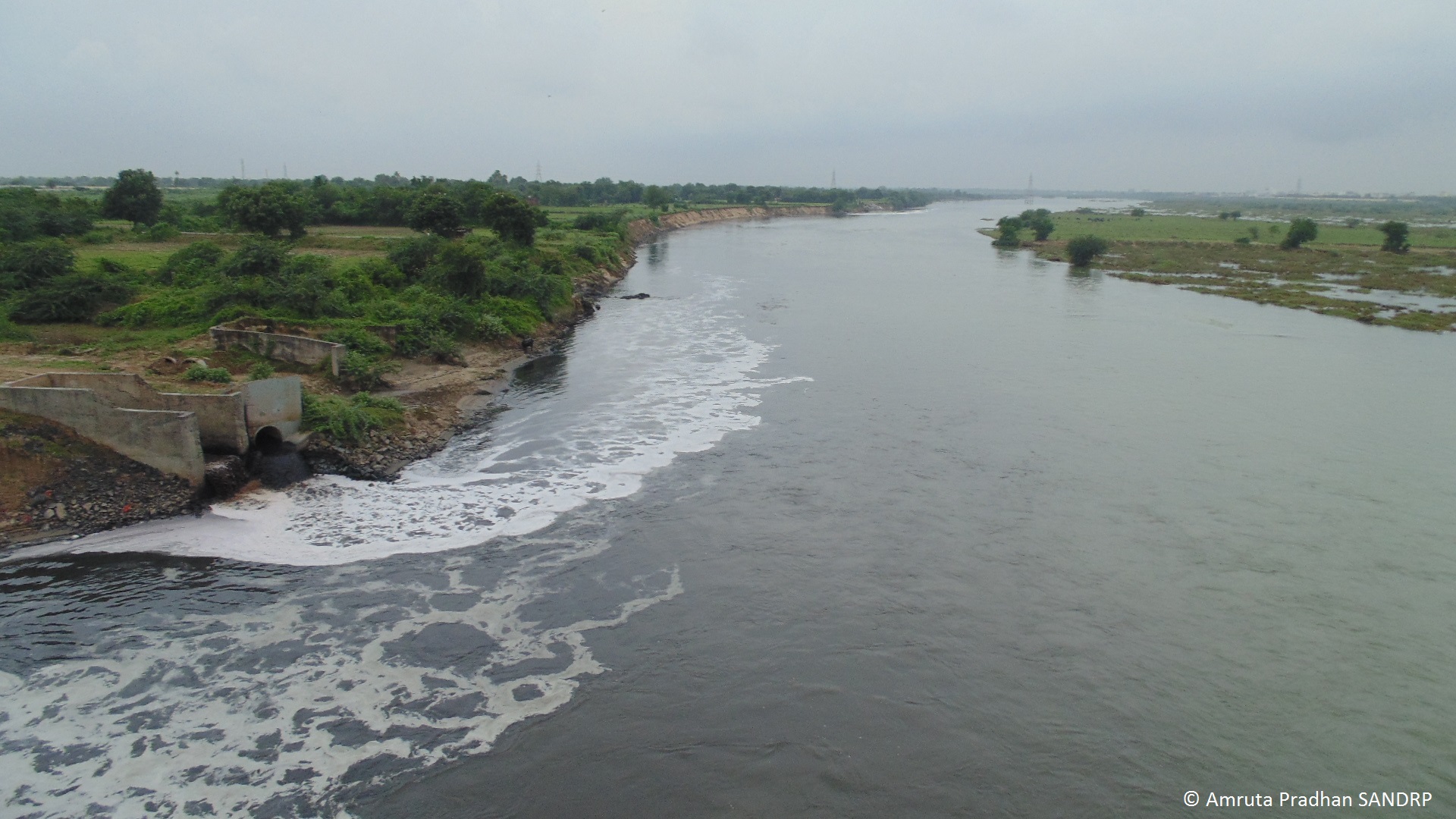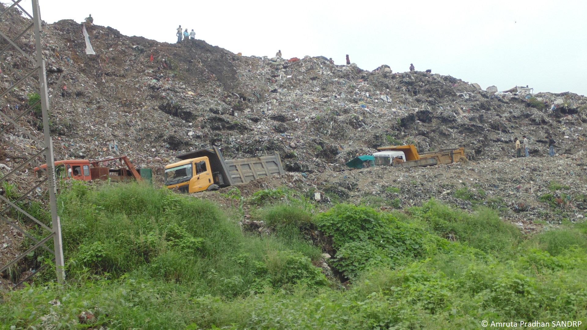
Narmada

Narmada Estuary: Hilsa, other Fish and Fisher people need protection

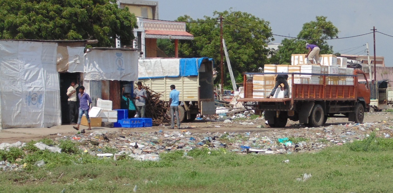
Pungent fishy smell is the first thing that grabs your attention in Bhadbhut village in Bharuch District of Gujarat, which lies on the estuary of the mighty Narmada River, as it meets the Arabian Sea. Every alternate shop in every small lane sells fresh fish and by 11 in the morning, first lot of fresh fish is ice packed in thermocol boxes, all set for far off places like Kolkata and Delhi. Before I was told, I saw for myself that fishing in the Narmada Estuary is the backbone of coastal Bharuch district.
???????????????????????????????
Bhadbhut Village

Just 5.15 kilometers from here is the planned Bhabhut Barrage on the Narmada River. What will happen to Bharuch if barrage is constructed? This is the reason why I am here. To understand the implications of this barrage on lives of thousands of fisherfolk from this estuary and on the famed Hilsa fish, that mysterious silver river migrant, on which the fishing economy depends nearly exclusively.

Hilsa is a marine fish that arrives in the brackish water of estuary for spawning normally inhabiting the lower region of the estuaries and the foreshore areas of the sea. For India the peak upstream migration of hilsa in most of the rivers is generally in the monsoon months of July and August and continues upto October or November.
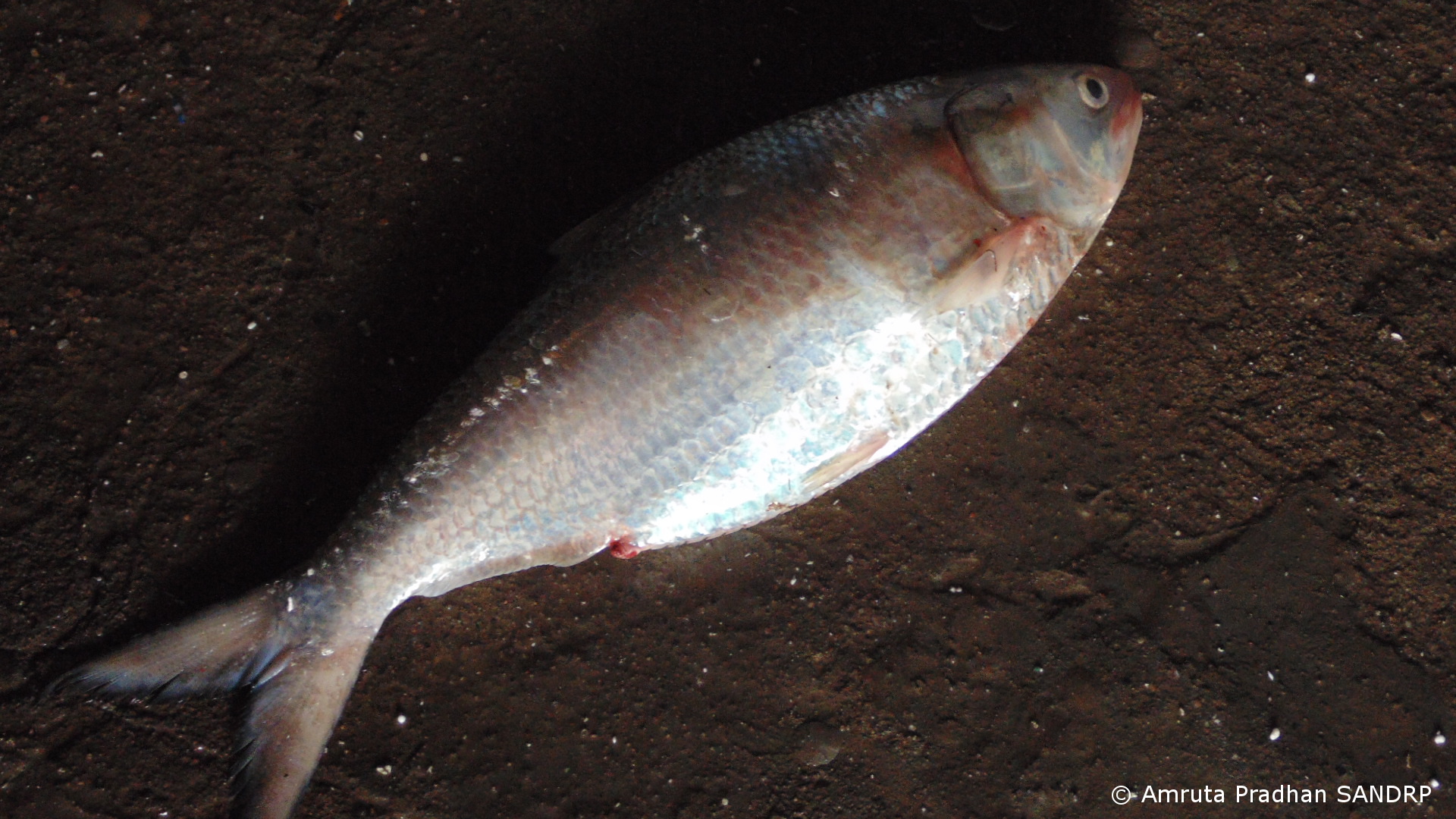
BB 2
Hilsa

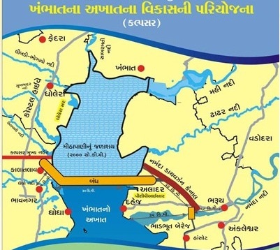
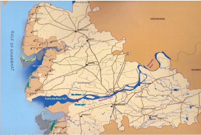
Bhadbhut barrage will be constructed at 5.15 km downstream of village Bhadbhut and 25 km upstream of river mouth. It is part of a gargantuan Kalpasar project pushed by the State Government. Kalpasar (pragmatic critics hold that Kalpasar is in fact an abbreviation of Kalpanic Sarovar, an imaginary reservoir) project which is supposed to be one of the biggest in the world proposes to construct a 30 km long dam (one of the longest in the world) across the Gulf of Khambhat between Bharuch and Bhavnagar districts[i]. The reservoir is supposed to trap the water of twelve rivers that empty their water in the gulf, including Narmada, Mahi, Sabarmati, Dhadar and some Saurashtra rivers. It is expected to create a reservoir of 2000 sq km area, over five times the area of Sardar Sarovar, the reservoir capacity is expected to be over 10 billion cubic meters, that is larger than the SSP reservoir capacity. The project is being pushed ignoring serious issues like hydrological-geological-structural feasibility and needless to say, it’s impacts on environment and fisherfolk. The project will destroy the coastal and deltaic fisheries and wetlands.

As SANDRP has been highlighting for some time now, riverine fisherfolk are one of the most disadvantaged and deprived sections in the dam debate throughout the country. It is no different in Narmada. Livelihood of the fisherfolk from Narmada Estuary has been threatened by several industrial estates established across the district and is now on the verge of being destroyed. Yield of Hilsa has been steadily decreasing (from 15319 tonnes to 4866 tonnes during 1993 to 2004[ii]) since commissioning of Sardar Sarovar Project (SSP) canal and power house in 2006. SSP is built on the Narmada River about 130 km upstream from the estuary. Another dam, Garudeshwar Dam, is under construction downstream from SSP.
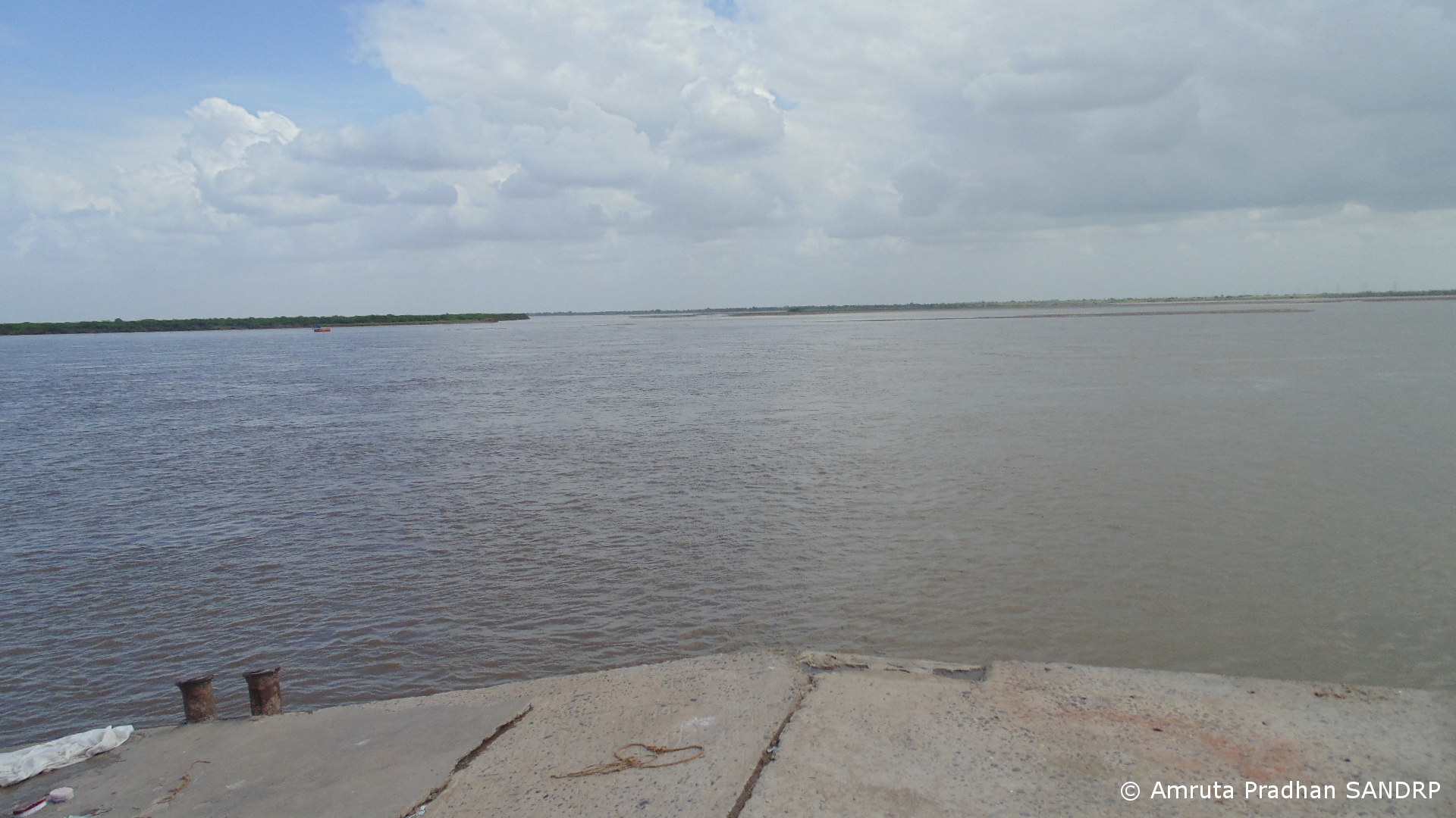
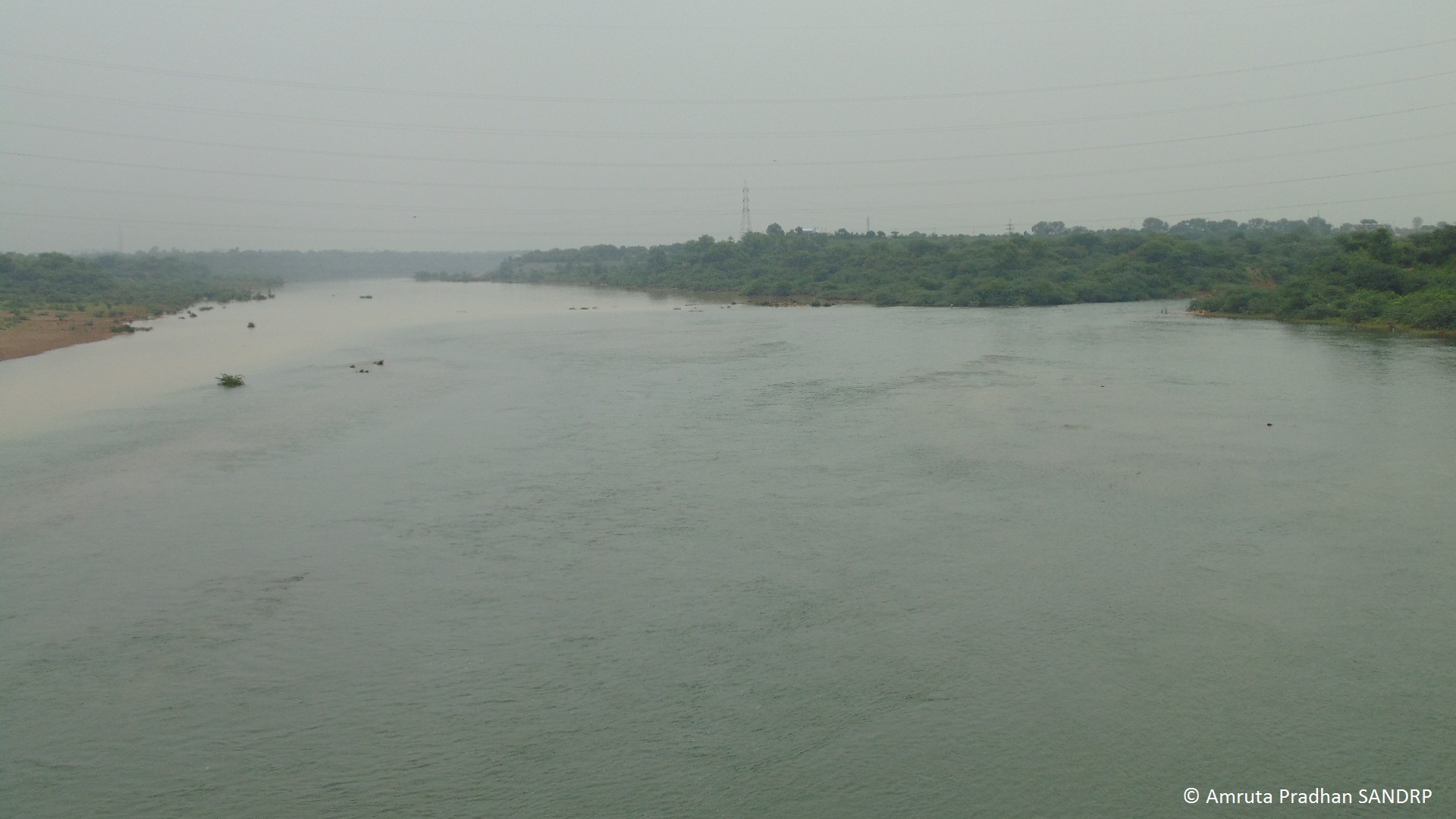
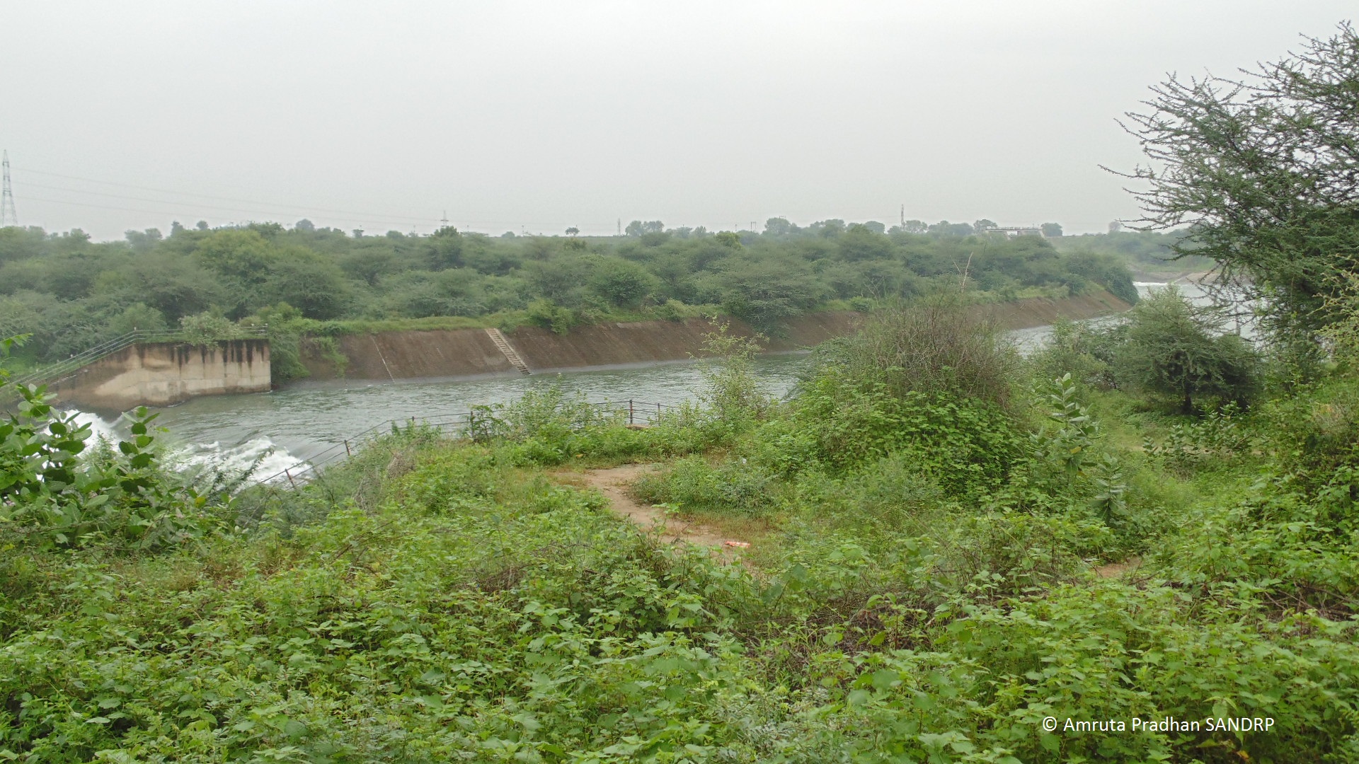
Narmada Estuary
Narmada Estuary

Are people here in the estuary aware of the scale of the Kalpasar project? What do these local fisherfolk have to say about this? How have they been coping with the impacts of SSP?

On the lack of study of the downstream environment, the first paragraph from the chapter on this issue from the report of the Independent Review of the Sardar Sarovar Project instituted by the World Bank is worth quoting in full [iii]:

“From the Sardar Sarovar dam to the ocean, the Narmada River runs for 180 kilometers through a rich lowland region which represents about 10% of its catchment area. In the course of our environmental review we sought information that described the ecology of this lower reach of the river, the estuary, and near shore region in the Gulf of Cambay. We hoped to find a description of the aquatic ecosystem, including parameters indicating the quality and quantity of water and its seasonal changes, biological species, processes, and resource linkages. We looked forward to finding a systematic treatment of flow regimes and geomorphology. We expected to find systematic documentation of resource use, from drinking water to fisheries. We thought there would be documents establishing the kinds of physical, biological and socioeconomic changes to be expected as the Sardar Sarovar Projects are brought on stream and more and more of the natural flow is stored, used or diverted out of the river. We looked for a set of ameliorative measures that would be implemented to mitigate impacts. We thought these measures would be scheduled to begin with phased development of the Sardar Sarovar Projects. We hoped they would also be related to the cumulative effects of other developments on the Narmada further upstream, in particular the Narmada Sagar Projects, and to the expansion of industrial activity in the downstream rive basin in Gujarat itself.

In all our expectations we have been disappointed.” (Emphasis Added.)

The paragraph speaks eloquently and what it says it true even till date.

FIELD VISIT:

Eager to find answers to these questions, I along with Bhupat Solanki a volunteer from Paryavaran Mitra, an Ahmedabad based NGO, first met Praveen Madhiwala, a fish trader and exporter. As I explain the purpose of my visit to him, his first reaction is “if the dam at Bhadbhut comes up, Hilsa will be finished. Not only that, but the dam will prove to be destructive to the entire estuary.” He explains, “Tidal flow of water spreads 60 KM from sea shore to upstream of the estuary. They are planning to build the barrage just 25 KM upstream of the sea shore. What will happen then to the incoming salt water during high tide? It is bound to spread laterally along the barrage spreading in the coastal region and will be destructive to the settlements along the coastline. Calculating all these numbers on paper is very different than experiencing the destructive power of sea. We know what the sea can do.”

Destruction of Hilsa and other fish by Sardar Sarovar

Kamalesh Madhiwala, an advocate from Bhadbhut adds further. “Yield of Hilsa has drastically reduced after Sardar Sarowar Dam has been built. There has been a reduction of 65 to 70%. Overall water level of the estuary has gone down. Post monsoon the river becomes so dry that we can walk across the riverbed. This had never happened in the past before Sardar Sarovar.” When asked about the claim by Narmada Control Authority that it constantly releases 600 cusecs (cubic feet per second) of water from the dam[iii] to maintain the health of the river and the estuary, he says “We don’t think water is released from the SSP. There is no mechanism to monitor this. If you approach government they will show you on paper that they release 600 cusecs of water every day. But no one maintains the on ground data.” According to him the SSP has affected overall fish variety of the estuary as well. “A decade ago there used to be 70 to 80 types of fish varieties available in the estuary. Now we get only about 10 to 12 fish varieties. Earlier along with Hilsa many other riverine species like Prawns, Mahseer etc. have been commercially equally important which Sardar Sarovar has vanquished. Now the fisher people’s income is solely dependent on Hilsa which is very sensitive species. Reduction of water flow in the river immediately affects the yield of Hilsa. Even though Hilsa is available only for about 4 months of the year, 70% of the income of fisherfolk at present is from sale of Hilsa alone.”
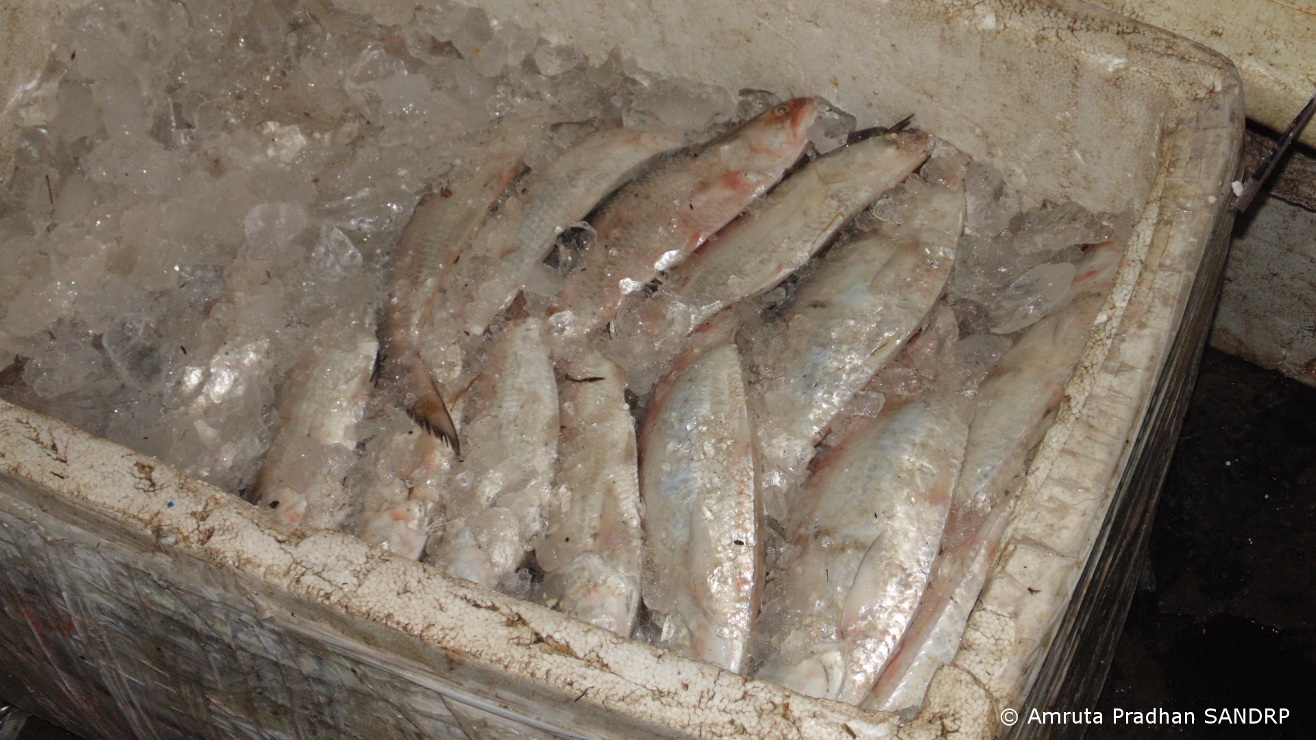
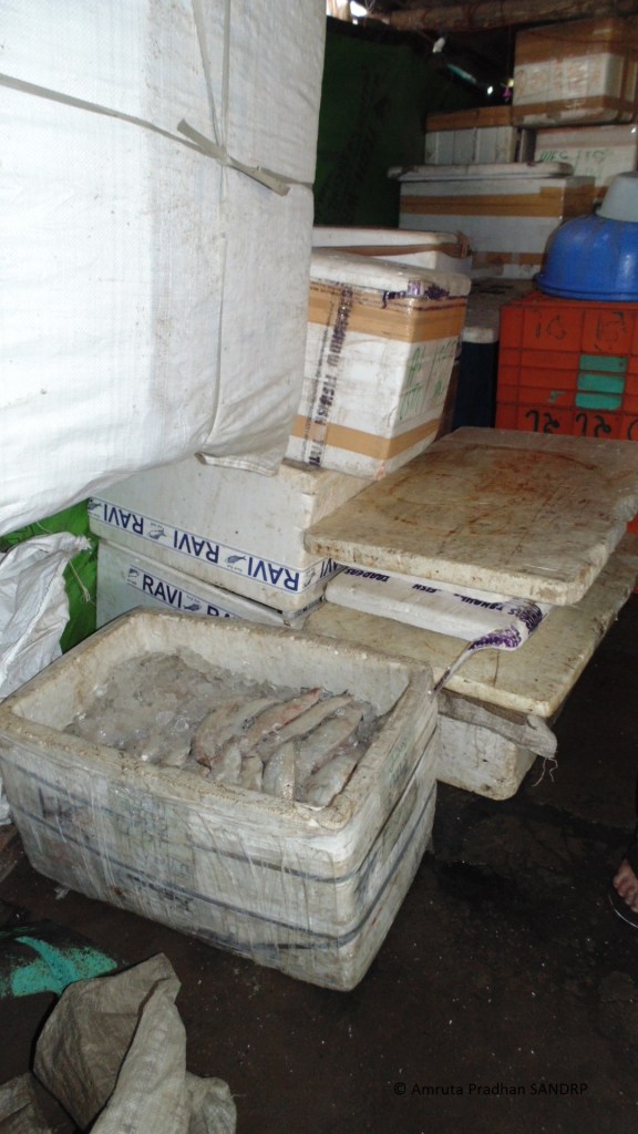
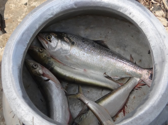
Hilsa ice packed to be transported
70% of the income of fisherfolk is from sale of Hilsa

Farcical EIA of proposed Bhadbhut barrage by NEERI

Kamalesh Bhai also points out several lacunae in the Environmental Impact Assessment (EIA) report that National Environmental Engineering Research Institute (NEERI) has prepared for Bhadbhut Barrage. “The entire study has been an absolute farce. First of all none of the local people were aware of any such study going on. It also grossly underestimates the total population of fisherfolk that will be affected by the Bhadbhut dam.” The report considers the total number of fisherfolk residing in 21 villages to be 12,638 based on more than a decade old data from Census 2001.[iv] According to Kamlesh bhai the actual population residing in the estuary region whose livelihood will be affected by barrage is close to 35 to 40 thousand!

SANDRP had sent detailed critique of the EIA to the Gujarat State Environment Impact Assessment Authority before the public hearing for the project held on July 19, 2013. An excerpt from the critique:

“Unclear objectives of the project The objectives of the project stated in the EIA of the project are:

  • Protection of water quality of Narmada river from salinity due to tidal influence and checking the problems of salinity ingress and deterioration of ground water quality in the upper reaches of Narmada river;
  • Storage of the regulated release of water from SSP and runoff from free catchment for irrigation, domestic and industrial water supply;
  • Flood protection of about 400 sq km low lying area covering 17 villages on the left bank of river Narmada;
  • and Road connectivity between left and right banks, shortening route from Surat/Hajira to Dahej region.

The EIA agency has uncritically accepted these objectives, without assessing if the barrage with low water storage can really fulfill the second the third objective and considering the low salinity level reported by the EIA (mainly based on data provided by the project authorities, again uncritically accepted by NEERI), is the first objective relevant. The fact that the Kalpsar department played such an important role and the fact that it is public knowledge that the barrage is part of the propose Kalpsar project should have been taken note by NEERI. NEERI should have also questioned as to why is this small part of the larger Kalpsar project applying for such piecemeal clearances which is actually in violation of the Supreme Court orders. It should be added here that the Kalpsar project had applied for the TOR clearance from Union Ministry of Env and Forests. The project came up before the MoEF’s Expert Appraisal Committee on River Valley Projects. SANDRP had then sent a letter to the EAC, saying that based on information provided, the project should not be considered for clearance. In its 41st meeting in Sept 2010, the EAC declined to give TOR clearance to the project, saying that the documentation provided are highly inadequate and need to be more holistic and uptodate pre-feasibility report needs to be provided. The project there after has not gone back to EAC.

However, a small part of that same project, the Bhadbhut barrage is now proposed before the Gujarat State Environment Impact Assessment Authority (http://seiaa.gujarat.gov.in/).”

An edited version of letter about the inadequacies of the EIA report sent from Paryavaran Mitra director to Gujarat Pollution Control Board which has been published by Counterview states that the report fails to assess severity of impact on Hilsa and other migratory fishes and instead tries to imply that fishing activity is only a part time employment for fisher community, which is entirely incorrect.[v] The report proposes fish ladder as a mitigation measure with no specific details. Fisherfolk are not impressed. “Tell me madam, have you ever seen a fish climb a ladder?” asks Kamlesh bhai laughing.

While a fish ladder may or may not work (it is not likely to work for Hilsa and other important fish species, it has not worked anywhere in India so far), the fisher folk are not wrong in ridiculing it. Fish ladders have never been taken seriously by the proponents who put them in. Case in point is Farakka Barrage in West Bengal, where too, a fish lock was supposedly made for Hilsa. It has not been operated for over a decade and current officials have no idea that such a thing exists.

Cover Page of the controversial NEERI EIA of  Bhadbhut Barrage Project
Cover Page of the controversial NEERI EIA of Bhadbhut Barrage Project

“The NEERI EIA is a complete copy paste job. It has several incidences of plagiarism. It mentions names of places that are found nowhere in this region. This region also comes under PCPIR[vi] project. The PCPIR EIA report does not talk about impact on Hilsa at all!”- Bhupat Bhai adds. “That’s true” says Kamlesh Bhai. “Even after the NEERI completed the report none of the local people had any idea about the project and its impacts. Now we are raising awareness. On 7th July 2014 local fisherfolk organized a protest rally at the District Magistrate office and more than 4000 fisher people were a part of this. This is our fourth rally opposing the project.” When asked if any compensation is being offered for those getting affected by the barrage, I am told none. According to them in the entire argument about the barrage, its impacts etc. there is absolutely no talk about compensating the fisherfolk. They also raised their voices in the public hearing of the project. 1500 farmers and fisherfolk attended the public hearing on July 19 and walked out soon after sharply registering their protest against the proposed project and naming it as “anti-people”.[vii]
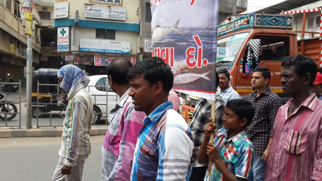
BB 7
Protest March organized on 7th July 2014 (Photo by Kamlesh Madhiwala)

When we arrive at Praveen Macchi’s house, his door is adorned with images of Silvery Hilsa. His family has been involved in fishing from generations. When asked about estuary’s overall condition after SSP he confirms the facts stated earlier by Praveen Bhai and Kamalesh Bhai. “We don’t think water is released from SSP and even if it is, it is so meagre that it is nearly useless. The estuary receives water only when the dam overflows. In 2014 the dam overflowed only once which was as late as September. Other than dam overflow only other source of water is releases from River Bed Power House of SSP, leakage from below the dam wall and some water from downstream streams.” Fish yield of this year is about 30% lower than last year when the estuary received water from dam overflow 4 to 5 times in year. “Now water from SSP has been diverted for hydropower generation. After power generation at Canal Head Power House water is released into Narmada canal instead of river/ estuary.”
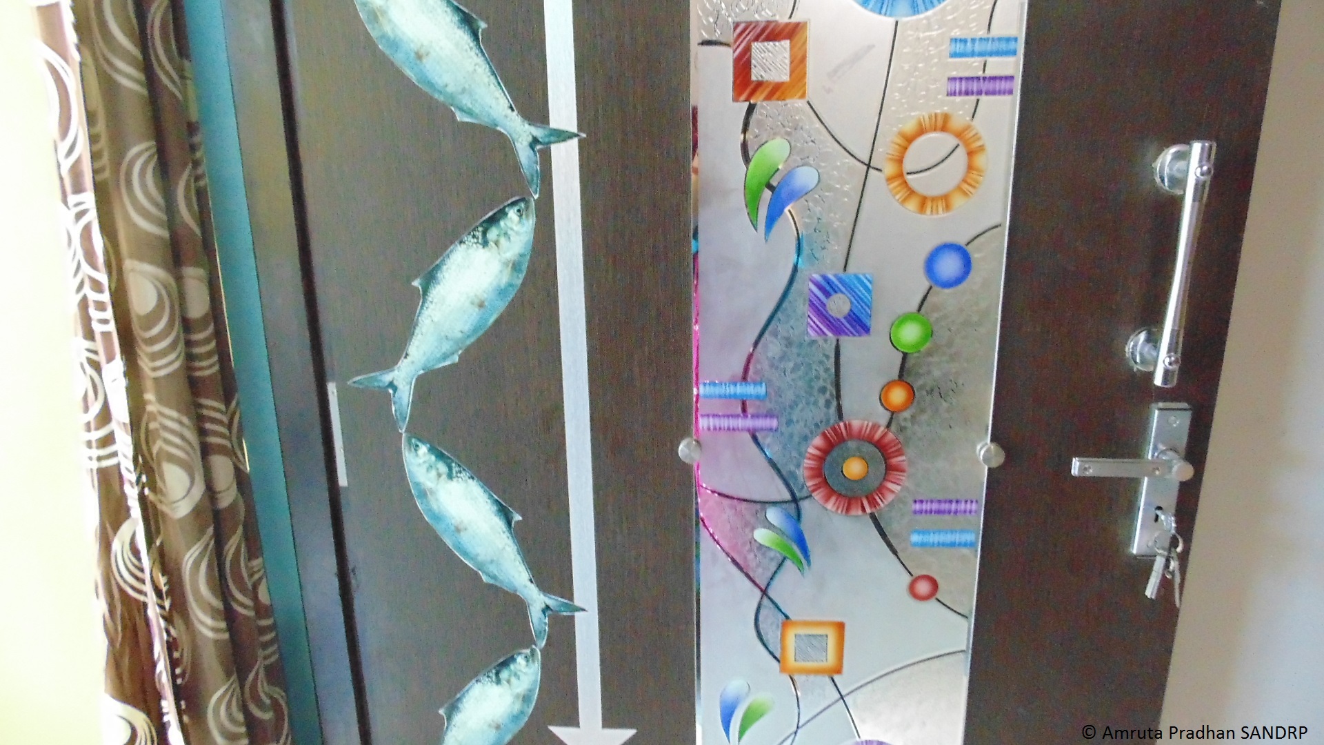
Hilsa used as a decorative element

Pressures on Narmada estuary and livelihoods of thousands

When asked as to how does the Hilsa survive without freshwater water released in the estuary, Praveen Bhai explains “As of now Hilsa arrive at least during monsoon as the river stretch of 130 KM holds rain water. If Bhadbhut barrage is built there will be no free flowing river stretch to support fish breeding. Yield of Hilsa will be hard hit and so will be the fishing industry. Entire population dependent on fishing will lose its livelihood.”
BB 9
If Bhadbhut barrage is built there will be no free flowing river stretch to support fish breeding

Praveen Bhai told me that the fisher people’s cooperative ‘Bhadbhut Matsya Udyog Sahakari Mandali’ is preparing to file a Public Interest Litigation challenging the barrage project. Is livelihood of more than 30000 people getting affected reason enough to argue for stoppage of the project? Will the courts understand this implication? They did not when impact of SSP on fisher people was argued earlier. Let us hope judiciary is more sensitive to the fisher people’s issue this time.
Gujarat Government Map showing Kalpasar and Bhadbhut project locations

Praveen Bhai further informs that the overall salinity of the estuary has gone up due to severely restricted freshwater flow into the estuary. Fish diversity has reduced and riverine fish movement is obstructed due to SSP (Sardar Sarovar Project). Hilsa which would be available till December – January is now seen hardly till September as the salinity levels rise rapidly after monsoon. Says Praveen Bhai: “Narmada has been Hilsa’s favoured habitat. Earlier Hilsa was found in Tapi estuary near Surat as well. But after the Ukai dam was constructed only 2 to 5% of Hilsa arrive at the Tapi estuary. Lives of fisherfolk in the estuary have been devastated. The problem of livelihood of these people became so serious that there are instances where women of the community had to get into prostitution.”

The Narmada estuary is already facing growing pressures from industrial estates. Bharuch District has 13 industrial estates with 137 medium and large scale units of chemicals, textiles, plastics, fertiliser related industries etc. Industrial estate of Dahej which is in close proximity to Bhadbhut releases its untreated effluent in the sea near Bharuch. This is affecting the overall water quality of the estuary. Praveen Bhai points out to a very peculiar phenomenon. A completely different genre of crime has evolved in the industrial estates near Bharuch where youth blackmail the companies when the companies discharge untreated effluent into the sea. The companies, hand in glove with police, bribe the blackmailers for keeping quite. Effluents meanwhile go untreated in the river and sea. This is also true of effluents from Ankaleshwar and other industrial estates. The SSP has worsened this situation due to drastic reduction in freshwater flow that earlier used to dilute the industrial, urban and other effluents.

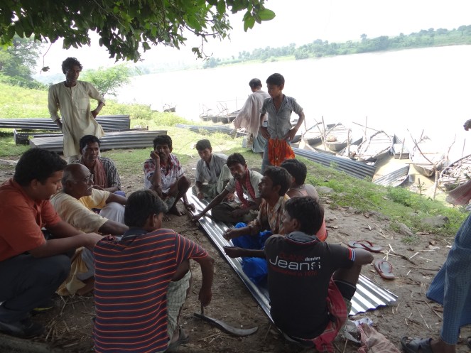
Concerns of fisherfolk We now move towards the banks of Narmada to meet artisanal fisher people there. Boats which can contain upto 5 to 6 people are parked along the banks. Since it is a noon time, hurry burry of fish packing is settling down. One by one tempos from the market are arriving and picking up the packed fish. As we talk with a bunch of fisher people, their worries and concerns tumble out. Several issues emerge while talking to them.

“Government is all set to build a dam destroying our livelihood. As it is government is not extending any kind of support to us river fisherfolk. No bank provides us with loans” one of them speaks.

“Yield of fish has also reduced due to reduced water level of the estuary. Sea water gets contaminated by the untreated effluent that Dahej & other Industrial estates disposes in the sea. This sea water that is highly contaminated with chemicals and heavy metals enters estuary during high tide. This polluted water has also affected the overall fish quality and there is hardly any freshwater from upstream to dilute it because of the dam. Earlier single Hilsa fish used to weigh more than two kilograms. Now it hardly weighs one to 1.25 kgs” says another one.

“With all this polluted water how will the fish grow? It naturally starves” says yet other.

“If Bhadbhut Barrage comes up, Hilsa will no more come here. Our livelihood will be destroyed. Government is not even offering any compensation. No one has been compensated for the impact we have already felt due to the SSP.” They all keep talking anxiously.

They further inform that several farmers in Bharuch who have lost their land in PCPIR project or other industrial estates have shifted to fishing creating more stress in the industry that is already facing a steep decline. Farmers, who are new fisherfolk lack the traditional skills or patience and often fence the estuary and sea with fishing nets in hope of catching Hilsa, which prevents the fishermen’s traditionally used small boats from entering the sea. As they speak, every concern raised is met by a nod by the entire group.
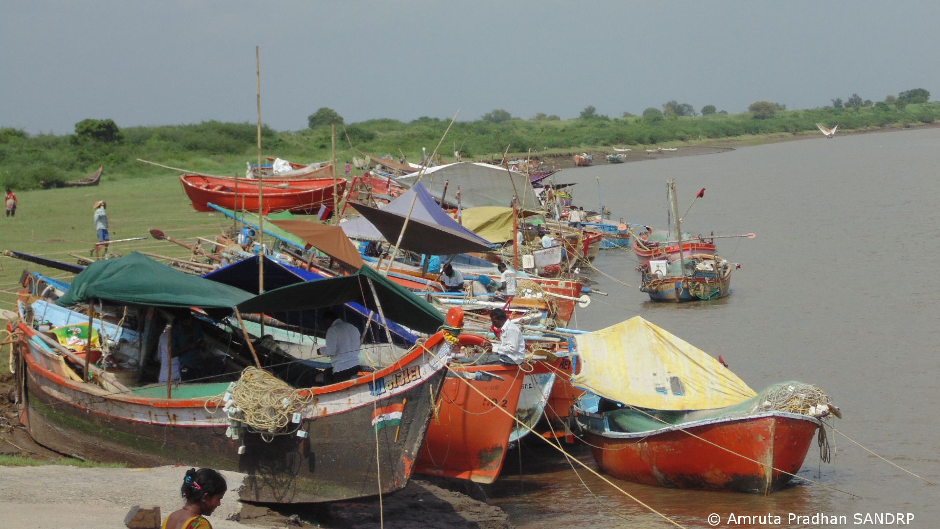
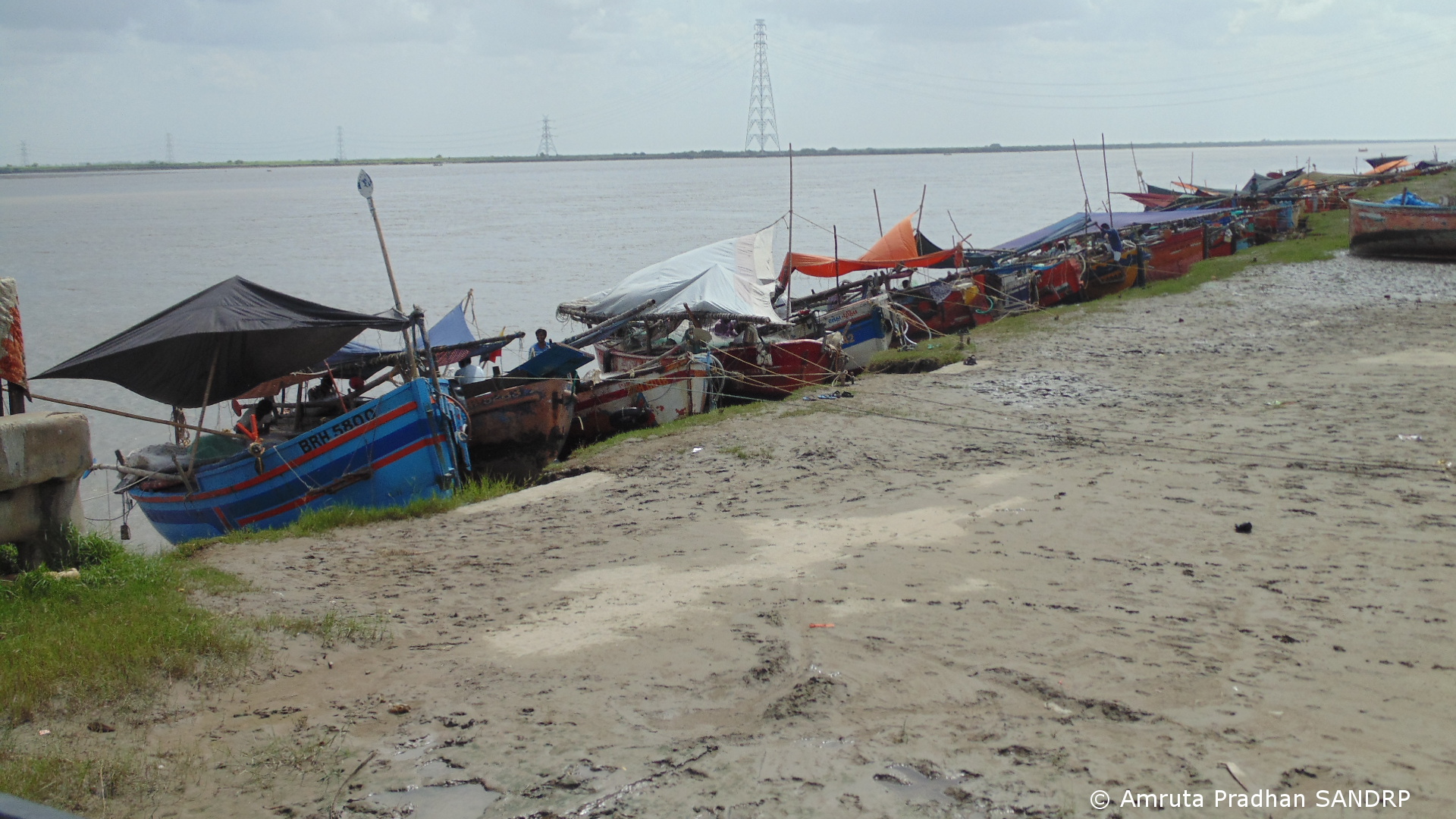
BB 10
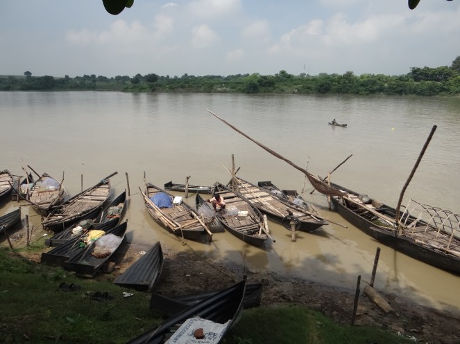
Fishing boats along the banks of river Narmada

BB 11

Contrary to this scenario the EIA report summary by NEERI states “… the fresh water storage in upstream of the barrage will provide a favourable environment for intensive fresh water fishery and provision of fish ladder with shiplocks would enhance the fishery activities and fetch greater economic benefits to the people.”[viii] Fisherfolk when asked about this conclusion show the other side of the argument. Fisheries department floats tender for fishing in the dam reservoir. Only big contractors can afford to obtain the contracts. “It’s not a job for small fishermen like us. If the dam comes up all these small boats you see will vanish” they say.
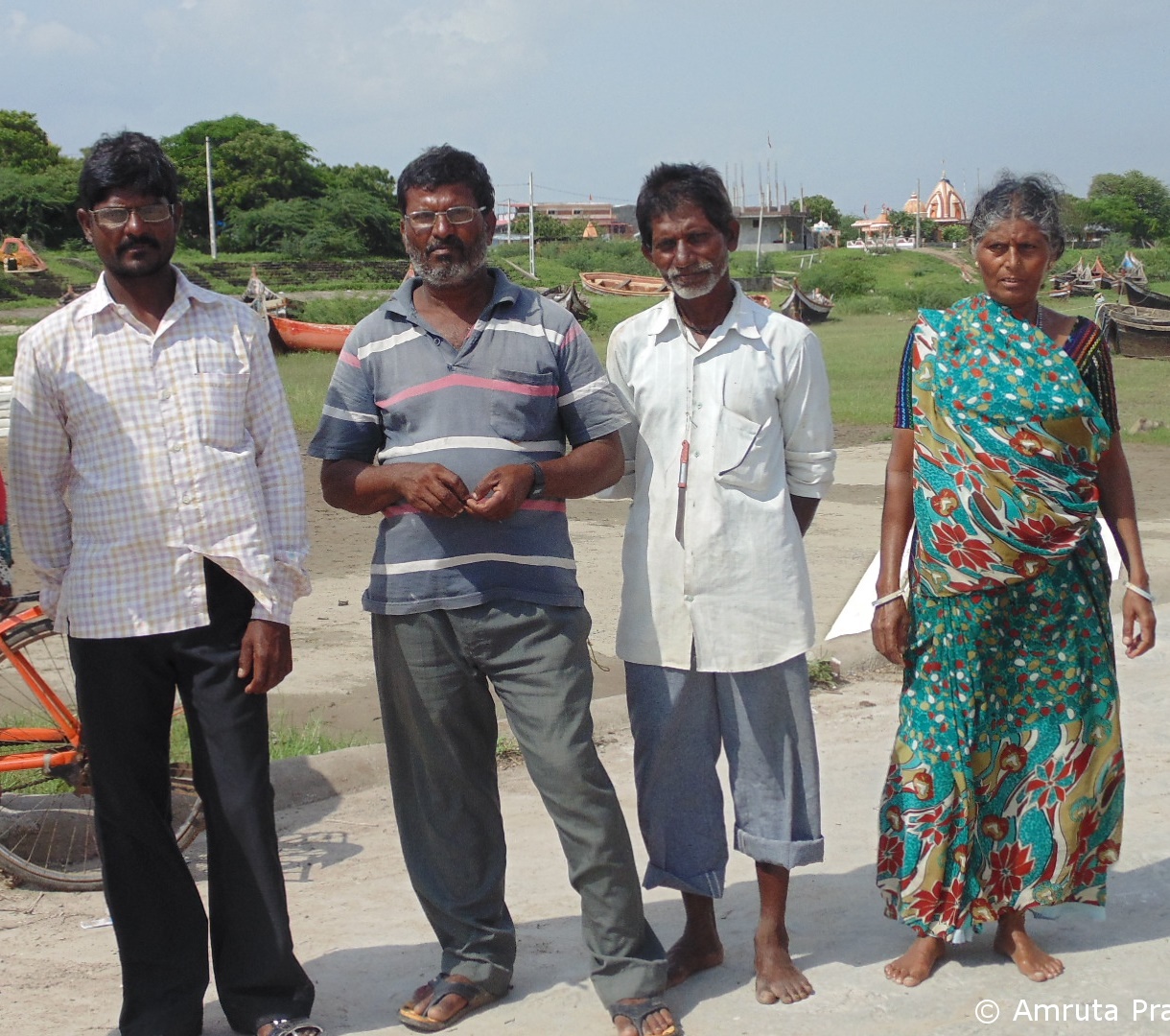
???????????????????????????????
Fisherfolk from Bhadbhut

Other than the threatened livelihood, the fisher families in the estuary are also facing several other issues. Wells of fresh water now contain saline water. Many of them used to rely on Narmada River for drinking water. Since the river has gone dry after SSP, they no more receive drinking water from Narmada River. As the water from the estuary has reduced, the wells which have traditionally been an important source of drinking water are now dry or saline. Villages which are closer to the sea are experiencing saline water and also polluted chemical water ingress. “Many of us are having skin problems because we have to go in the chemical water.” I wonder with fishing industry plagued with so many problems if younger generation is at all willing to continue in the same occupation. When asked about this they tell me that for now the traditional skills is the only real education the younger generation has.

Many of them have protested the project at the public hearing. “We all are opposing the dam. Building dams might to do good for contractors, but what about us? Are we not people?” they ask.

The proposed Garudeshwar Dam on Narmada immediate downstream of SSP will further stop the water flow to estuary as it is designed to pump back to SSP the water released from River Bed Power House. The fisherfolk here do not know about this, nor has the government bothered to tell them or do any impact assessment or prepare any rehabilitation or management plan. The only hope is the petition lying before the National Green Tribunal against the Garudeshwar Dam.

I come back with more questions than answers. Praveen Bhai’s home, with his welcoming door adorned with the silvery Hilsa remains in my thoughts for a long while.

Amruta Pradhan, SANDRP amrutapradhan@gmail.com

(Based on field visit September 2014 by the author.)

END NOTES:

[i] https://sandrp.in/dams/Why_Modis_54000_crore_legacy_project_KALPSAR_is_doomed_Nov_2010.pdf

[ii] https://sandrp.wordpress.com/2014/09/01/collapsing-hilsa-can-the-dams-compensate-for-the-loss/

[iii] Page 277, Sardar Sarovar: The Report of the Independent Review, Resource Futures International Inc, Canada, 1992

[iv] P. 10 of Executive Summary of EIA Report by NEERI

[v] http://counterview.org/2013/07/18/environmental-impact-assessment-report-on-bhadbhut-suggests-project-is-pro-industry-lacks-sensitivity-towards-fisherfolk/

[vi] PCPIR: Petroleum, Chemicals and Petrochemicals Investment Region, see: http://gujaratpcpir.org/

[vii] http://www.counterview.net/2013/07/fisherfolk-walk-of-out-public-hearing.html

[viii] P. 15 of Executive Summary of EIA Report by NEERI
Himachal Pradesh · Himalayas · Hydropower

Photo Essay on the impacts of blasting and tunneling for hydropower projects in Kinnaur district in Himachal Pradesh – 2

Guest Blog by: Sumit Mahar (sumitmahar.12@gmail.com), Him Dhara Environment Research and Action Collective, Himachal Pradesh [1]

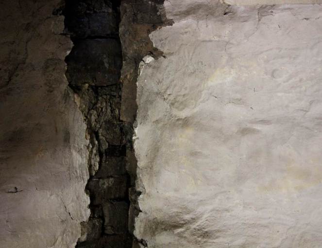
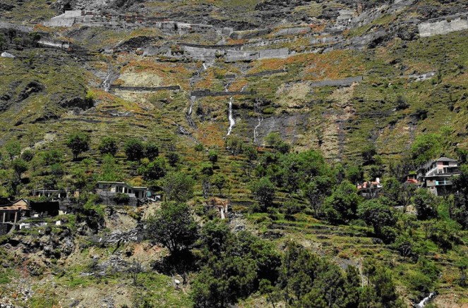
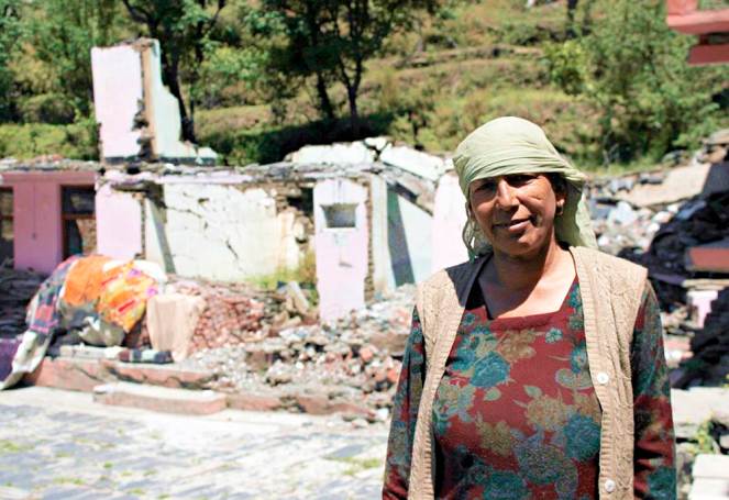
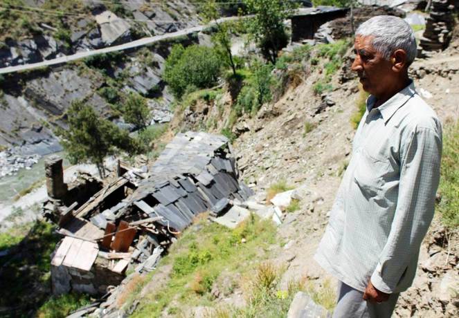
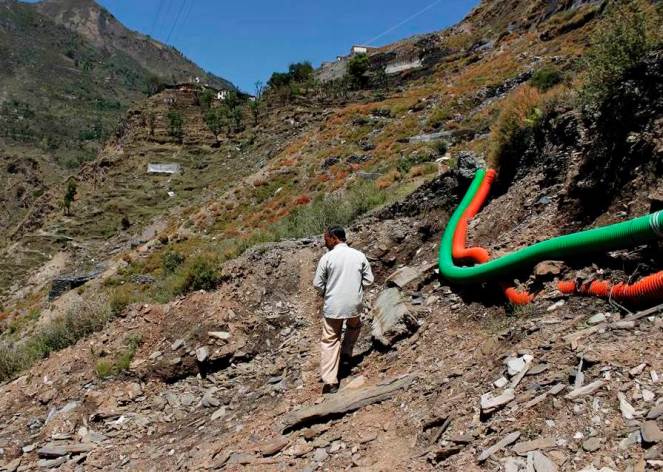
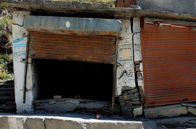
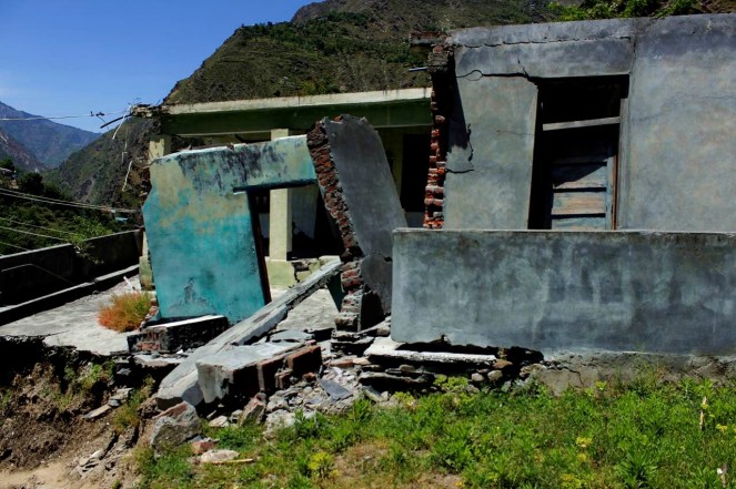
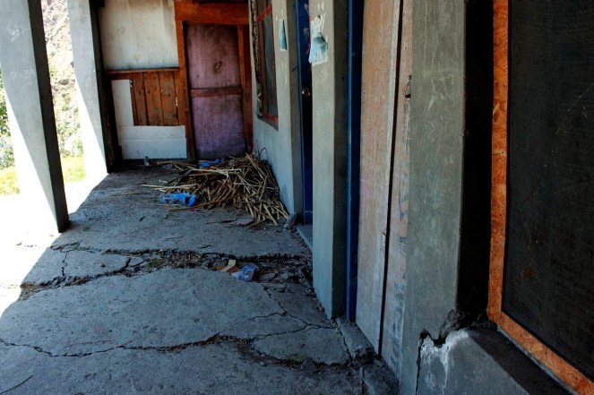
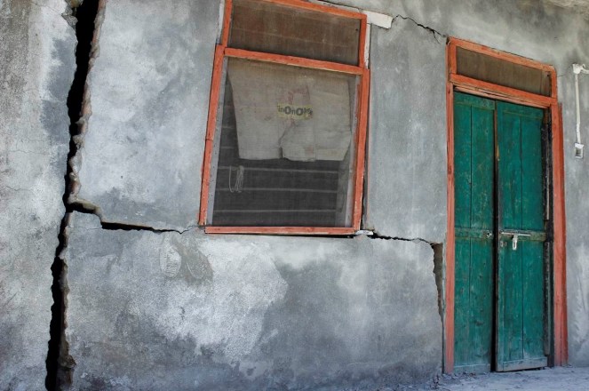
Tunneling for hydropower project using the blasting technique can have massive impacts. It has a series of direct and indirect impacts which have already been documented. Among the most serious impacts is drying up of the natural drinking water springs and the reduction in sub-soil moisture. This directly impacts the drinking water availability for the local villagers as well as agriculture and horticultural productivity, which is critically dependent upon the presence of sub-soil moisture. Blasting for tunnels and other underground components of hydroelectricity projects creates vibrations that have resulted in cracks in houses situated near these components.

Importance of impacts of tunneling and blasting becomes very important since all run of the river (ROR) projects involve tunneling and blasting. Proponents claim that ROR hydropower projects are environment friendly, but most people do not know that the tunneling and blasting adds an additional dimension to the impacts due to ROR hydropower projects and these can be very serious. Most environmental and social impact assessments or cumulative impact assessments do not even assess these impacts. Many times the proponent get away claiming that the impacts are not due to the projects, when in reality all evidence shows that these are very much caused by the tunneling and blasting being done as part of the construction of these projects.

This photo essay documents the impacts of tunneling and blasting for hydropower projects mainly in Kinnaur (part 1 of photo essay does the same for projects in Chamba district) of Himachal Pradesh. In Kinnaur the photo essay includes such impacts of 1000 MW Karcham Wangtoo and 1500 MW Nathpa Jakhri hydropower projects.[2] It is noteworthy that impacts are not only limited to large hydropower projects, but also to what is defined as small hydropower projects (projects below 25 MW installed capacity). This should also help puncture the misconceived notion that small hydropower projects are environmental benign and they do not need environmental and social impact assessment, public consultations, appraisal, monitoring or compliance.

These photo essays are indicative of the kind of impacts tunneling and blasting can have in the process of building hydropower projects in the Himalayas. What they indicate is relevant not only for Himachal Pradesh, but entire Himalayas and all projects that involve such tunneling and blasting. We hope these photo essays open the eyes of state governments, Union Ministry of Environment, Forests & Climate Change, Union Ministry of Power, Union Ministry of Water Resources, Central Electricity Authority, state environment departments, hydropower developers, EIA consultants, chairman and members of Expert  Appraisal Committee on River Valley Projects, media, judiciary, civil society and all others concerned.

 Karcham Wangtoo Hydro Power Project, Kinnaur

Project Jaypee Karcham Wangtoo HEP
Capacity (MW) 1000
Basin Satluj
District Kinnaur
Villages Choling, Yulla, Urni, Runnag, Meeru, Chugaun
Pictures taken on 25 May to 2 June 2014
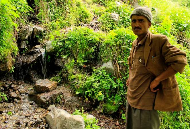
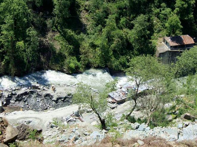
Murim-I, is a local stream that dried up due to the 17 km long 1000MW Karcham Wangtoo project’s tunnel in Kinnaur district. The stream is surrounded by grazing lands
Murim-II next to Murim I shared a common source which led to drying up of both streams
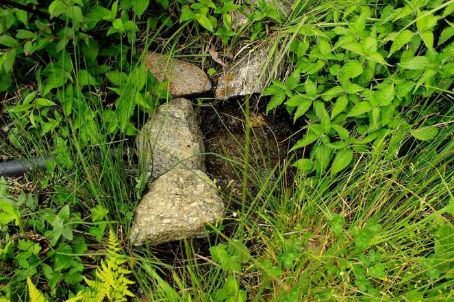
Nang Choling water source or chashma near the highway. The water was used for drinking not just by the people in Choling but also by passers by. This source has totally dried up now due to the Karcham Wangtoo tunnel construction
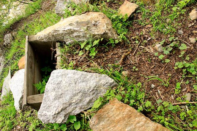
Peokeh-I is a water source in the Yulla village. The discharge of this source has reduced by 50% since the construction of the tunnel for Karcham Wangtoo HEP
Yet another source of water - Peokeh-II, Yulla village whose discharge has reduced by 30 to 40%
Yet another source of water – Peokeh-II, Yulla village whose discharge has reduced by 30 to 40%
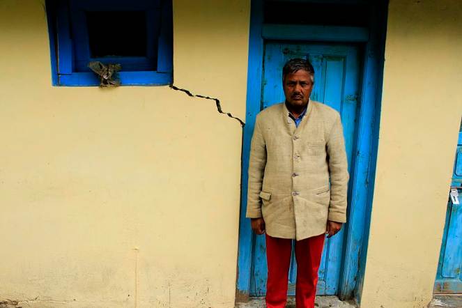
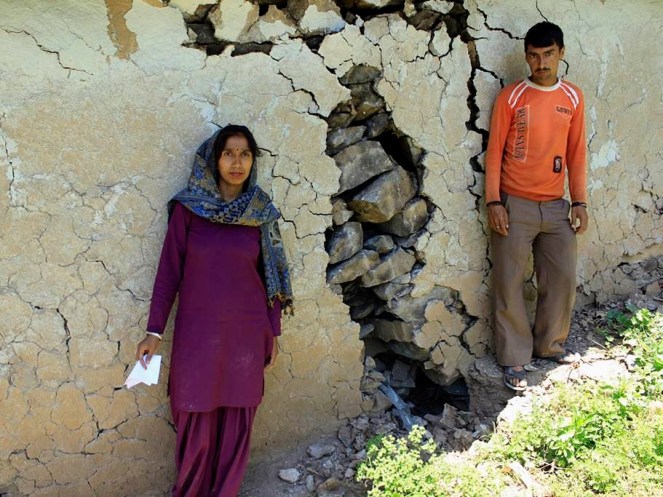
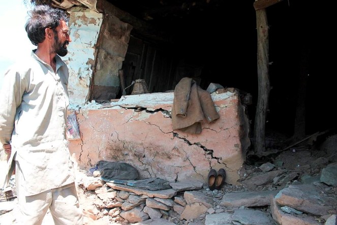
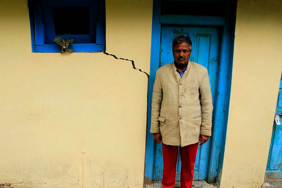
Jyoti Prakash’s house in Yulla village suffered from cracks because of the tunnel construction of Karcham Wangtoo HEP
Jagat Singh’s fields had this water source and used this for drinking and irrigation. Due to the reduction in the discharge after tunnel construction there is just enough water to use for drinking
Kakhiyo water source was used for drinking by 10 families in Yulla and the source is now totally dry
Lang Chuldhing water source in Yulla the discharge has reduced due to the tunnel. 4 -5 families in the vicitnity depend on this source
Ram Devi’s gharat in Yulla has been rendered useless along with another 4 above her’s. All due to the drying up of a water source – Yang baro
Yang Baro water source was feeding the watermills as well as irrigation channels. Now there is hardly any water for these
Ramanand Negi showed this water source in Urni village which emerged suddenly in 2005. This has come out in a location where there is a landslide getting active
This is the Urni steep slope where the landslide is active
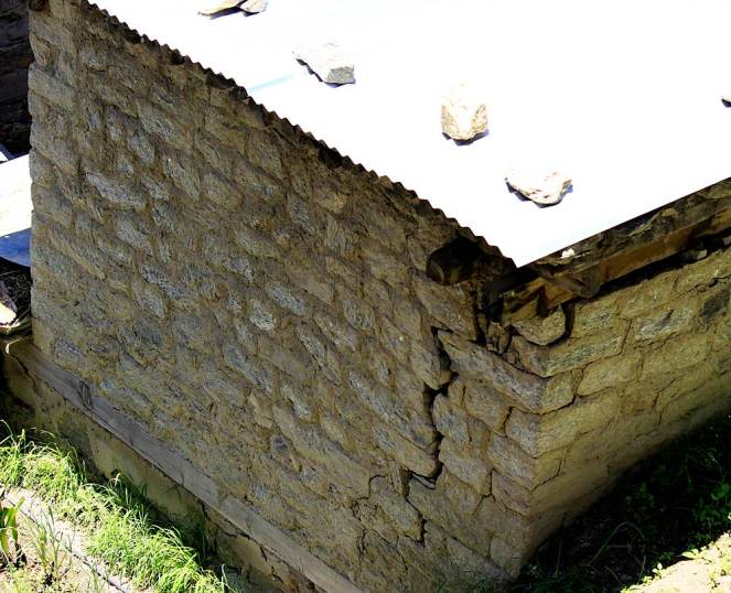
Ramanand’s House in Urni village which has developed cracks and crevices due to the blasting and construction of tunnel for Karcham Wangtoo Project
Runnag Chashma is used by the Runnag village for washing and drinking. The water discharge has reduced substantially
Munni Lal’s apple orchard which was impacted by a landslide last year when the June 2013 monsoon rains occurred
Landslide just above the tunnel of Karcham Wangtoo project at Rangle. This was also activated lst year during the monsoons
Ryabi Khaldam (Disturbed Source), the water source has relocated naturally after the construction of the tunnel began
Land slide at Meeru village activated last year and the main path of the village disturbed
Buthkas, IPH Source fully dried now as a result of tunnel. Almost the entire Meeru panchayat was dependent on this water for drinking
Jagdish Chand Negi’s house in Chugaun was impacted because of the construction of Karcham Wangtoo Tunnel
Cow shed developed cracks in Chugaun affected by Karcham Wangtoo Project’s tunnel construction

Nathpa Jhakari Hydro Power Project

Project Nathpa Jhakari HEP
Capacity (MW) 1500
Basin Satluj
District Kinnaur
Villages Nigulseri & Jhakari
Pictures taken on 29/05/2014 & 03/06/2014
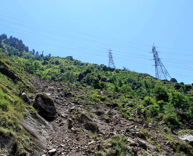
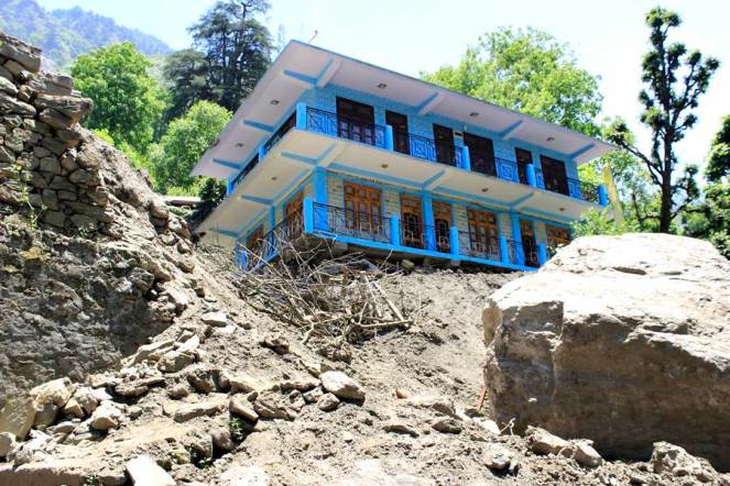
On 25th May 2014 this landslide occurred in Nigulseri village. Locals claim that the tunnel of 1500 MW Nathpa Jhakri Project had already disturbed the area which was further disturbed because of the transmission tower construction for Baspa II and Karchham Wangtoo HEPs
Geeta Ram’s house affected by the landslide at Nigulseri
Shamsher Singh’s house cracks at Nigulseri in May 2014. A total of 13 houses have suffered such damages
This landslide has occurred near powerhouse of the Nathpa Jhakri project in Jhakri

For Part 1 of the photo essay related to tunneling impacts of hydropower projects in Chamba district, see: https://sandrp.wordpress.com/2014/10/01/photo-essay-on-the-impacts-of-blasting-and-tunneling-for-hydropower-projects-in-chamba-district-in-himachal-pradesh-1/

END NOTES:

[1] The photo blog also appears here: http://www.himdhara.org/2014/08/06/photo-essay-when-mountains-are-hollowed/

[2] For a detailed article on this issue, Seeping through the cracks, see: http://www.epw.in/web-exclusives/seeping-through-cracks.html

Environment Impact Assessment · Expert Appraisal Committee · Himachal Pradesh · Hydropower

Photo Essay on the impacts of blasting and tunneling for hydropower projects in Chamba district in Himachal Pradesh – 1

Guest Blog by: Sumit Mahar (sumitmahar.12@gmail.com), Him Dhara Environment Research and Action Collective, Himachal Pradesh [1]

Tunneling for hydropower project using the blasting technique can have massive impacts. It has a series of direct and indirect impacts which have already been documented. Among the most serious impacts is drying up of the natural drinking water springs and the reduction in sub-soil moisture. This directly impacts the drinking water availability for the local villagers as well as agriculture and horticultural productivity, which is critically dependent upon the presence of sub-soil moisture. Blasting for tunnels and other underground components of hydroelectricity projects creates vibrations that have resulted in cracks in houses situated near these components.

Importance of impacts of tunneling and blasting becomes very important since all run of the river (ROR) projects involve tunneling and blasting. Proponents claim that ROR hydropower projects are environment friendly, but most people do not know that the tunneling and blasting adds an additional dimension to the impacts due to ROR hydropower projects and these can be very serious. Most environmental and social impact assessments or cumulative impact assessments do not even assess these impacts. Many times the proponent get away claiming that the impacts are not due to the projects, when in reality all evidence shows that these are very much caused by the tunneling and blasting being done as part of the construction of these projects.

This photo essay documents the impacts of tunneling and blasting for hydropower projects mainly in Chamba (part II of photo essay does the same for projects in Kinnaur district) of Himachal Pradesh. In Chamba, the photo essay includes such impacts of Chamera III, Chanju, Ginni, A.T. hydropower projects.[2] It is noteworthy that impacts are not only limited to large hydropower projects, but also to what is defined as small hydropower projects (projects below 25 MW installed capacity). This should also help puncture the misconceived notion that small hydropower projects are environmental benign and they do not need environmental and social impact assessment, public consultations, appraisal, monitoring or compliance.

These photo essays are indicative of the kind of impacts tunneling and blasting can have in the process of building hydropower projects in the Himalayas. What they indicate is relevant not only for Himachal Pradesh, but entire Himalayas and all projects that involve such tunneling and blasting. We hope these photo essays open the eyes of state governments, Union Ministry of Environment, Forests & Climate Change, Union Ministry of Power, Union Ministry of Water Resources, Central Electricity Authority, state environment departments, hydropower developers, EIA consultants, chairman and members of Expert  Appraisal Committee on River Valley Projects, media, judiciary, civil society and all others concerned.

Chamera III Hydro Electric Project, Chamba

Project Chamera III
Capacity (MW) 231
Basin Ravi
District Chamba
Village Mokhr
Pictures taken on 29/04/2014
In April 2012 there was a massive leakage in the 16km HRT of the 231 MW, Chamera III project just above the Mokhar village in Chamba district leading to severe threat to the village downhill so much so that the 40 families residing there had to be evacuated. This picture is of the Adit 6 of the tunnel. The leakage occurred during testing of the generating units.
2.Leakages in the surge shaft of the 231 MW Chamera III tunnel just above the Mokhar village in Chamba
Leakages in the surge shaft of the 231 MW Chamera III tunnel just above the Mokhar village in Chamba
Vidya Devi’s house in Mokhar  was completely damaged by the landslide caused due to the seepage from the surge shaft in April 2012
Vidya Devi’s house in Mokhar was completely damaged by the landslide caused due to the seepage from the surge shaft in April 2012
Shri Jagdish Sharma standing in front of the debris of his leftover house after the leakage tragedy
The pastures of the village buried under the landslide caused by the seepages in Mokhar village
Damages caused by the leakage in the HRT to houses in Mokhar village

New Links :  http://www.jagran.com/news/state-10802084.html

http://www.jagran.com/news/state-10802084.html

http://www.tribuneindia.com/2012/20120418/himplus.htm#2

 Chanju Hydro Electric Project, Chamba

Project Chanju HEP
Capacity (MW) 36
Basin Ravi (Chanju Nallah)
District Chamba
Village Dhalanjan
Pictures was taken on 30/04/2014
Cracks on the walls of Aaganbhadi Kendra of Dhalanjan village due to the tunnel construction of 36 MW, Chanju HEP in Chamba on Ravi basin’s Chanju nallah
Lilo Devi’s house was located just above the HRT of the Chanju project. 12 houses were completely damaged by the tunnel construction in this village in December 2013
Power house site of Chanju HEP, where 1000s of trees were damaged by the blasting for the tunnel construction due to activation of a landslide

People of Dhalanjan village show their destroyed and dilapidated structures

People of Dhalanjan village show their destroyed and dilapidated structures

People of Dhalanjan village show their destroyed and dilapidated structures
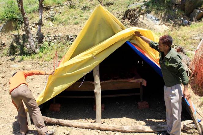
People of Dhalanjan village are now residing in temporary shelters

A.T. Hydro Power Project, Chamba

Project A.T. Hydro
Capacity (MW) 5
Basin Ravi (Tarela Nallah)
District Chamba
Village Alwas
Pictures taken on 01/05/2014
Landslide at Alwas due to road and channel construction for 5 MW Tarela project in Chamba
Cracks in the house of Shri Baija Ram due to Tarela Project in Alwas village
Lanslide close to Alwas village due to Tarela project

Ginni Hydro Power Project, Chamba

Project Ginni Hydro
Capacity (MW) 5
Basin Ravi (Tarela Nallah)
District Chamba
Villages Tarela, Junas
Picture was taken on 01/05/2014
Watermill rendered dysfunctional due to landslide cause by construction work for the 5MW Ginni Project in Tarela village in Chamba. The Project also diverted the water that was being used by the village for the watermill. Almost 15-20 watermills in this village have dried up due to the project’s construction activities
The location of the landslide which dried up the watermill

Landslide due to the construction activities and then subsequent destruction of the penstock of the Ginni project further led to soil erosion. The village above the slides, Junas has 20 houses and now stand threatened

Landslide due to the construction activities and then subsequent destruction of the penstock of the Ginni project further led to soil erosion. The village above the slides, Junas has 20 houses and now stand threatened

For Part 2 of the photo essay related to tunneling impacts of hydropower projects in Kinnaur district, see: https://sandrp.wordpress.com/2014/10/02/photo-essay-on-the-impacts-of-blasting-and-tunneling-for-hydropower-projects-in-kinnaur-district-in-himachal-pradesh-2/

END NOTES:

[1] The photo blog also appears here: http://www.himdhara.org/2014/08/06/photo-essay-when-mountains-are-hollowed/

[2] For a detailed article on this issue, Seeping through the cracks, see: http://www.epw.in/web-exclusives/seeping-through-cracks.html

Ganga

World Rivers Day and Ganga: A look at Farakka Barrage and other such calamities

Last Sunday of every September is celebrated as ‘World Rivers Day’. It is a recent phenomenon, but in many senses more significant than World Water Day. While ‘Water’ is seen more as a resource than the life-blood of the global ecosystem, ‘River’ provides water with its ecological, social, cultural and spiritual context. One this day, SANDRP looks at India’s ‘National River’ Ganga. The river seems to be a symbol of all that is right and wrong with water governance in India. It depicts crystallisation of challenges faced by rivers across the country, albeit at a much larger scale. The rich canvass and the deep spiritual value of Ganga for many cultures make it more riveting. The new government at the centre has declared that rejuvenation of the Ganga River is one of its priorities. However, in addition to several infrastructure projects planned and ongoing on the river and its tributaries (Ganga is not just 2525 kms long river, its is more than 25,000 kms long, with all its tributaries), the new Government is planing to build a series of barrages on the River to make it navigable, from Haldia, at the mouth of Hooghly, a major distributary of the Ganga to Allahabad which is some 1620 kms upstream from Haldia. Before we go further into the advantages or the disadvantages of more barrages on Ganga, let us take a look at what one only existing Barrage on this 1620 km stretch of the river, The Farakka Barrage, has done to the river in the past 39 years since the Barrage was commissioned. Let us see how we have managed the issues which have arisen, how human lives have been impacted, what has been our response, how the main objective of building the barrage has been frustrated, how we have dealt with this realization, how the Barrage has furthered more conflicts and how a thriving fishing activity has been nearly killed by Farakka in the upstream as well as in the downstream. SANDRP visited the region of Farakka Barrage, Malda, Murshidabad, talked with the affected people, fisherfolk, authorities at the Barrage as well as the Director and other officials at the Central Inland Fisheries Research Institute (CIFRI) to understand the complex issues. Prior to detailed analysis, here’s looking at Ganga, Hooghly and Farakka in photos.

The Hooghly-Ganga in Kolkata carries 40,000 cusecs water which has been divereted into Hooghly from Ganga at the Farakka Barrage Photo: Parineeta Dandekar, SANDRP
The Hooghly-Ganga in Kolkata carries 40,000 cusecs water which has been diverted into Hooghly from Ganga at the Farakka Barrage Photo: Parineeta Dandekar, SANDRP

Farakka Barrage was commissioned in 1975 to transfer 40,000 cusecs ( Cubic Feet per second) of water from Ganga into its distributary Hooghly to save the Kolkata Port on the Hooghly from silting up. The barrage is just 16 kms upstream from Bangladesh border.

Cargo at Kolkata Port is dropping streadily. The Port is silted up, dredging is ncresing down the years. Farakka Barrage has NOT controlled the silting problem of the Port Photo: The Hindu
Cargo at Kolkata Port is dropping streadily. The Port is silted up, dredging is increasing down the years. Farakka Barrage has NOT controlled the silting problem of the Port Photo: The Hindu
HooghluKol2
Hooghly at Kolkata Photo: Author

As a part of Farakka Barrage Project,  an afflux bund was constructed over several rivers upstream of Farakka, like Choto Bhagirathi, Pagla, etc., to divert water into the Barrage. The complete diversion of water killed these rivers in the downstream, severely affecting people. Here we see Choto Bhagirathi flowing after many years, thanks to a pipeline and sluice sanctioned this year to supply meager water to the river. This does not help the fish though, there are hardly any left.

Meager fishing at Choto Bhagirathi Photo: Author
Choto Bhagirathi, completely diverted for the Farakka Barrage, only flowing this year. Photo: Author
Fishing nets at Choto Bhagirathi. Fisherfolk told   us this was more out of habit, there re hardly any fish left in the river. Photo: Author
Fishing nets at Choto Bhagirathi. Fisherfolk told us this was more out of habit, there are hardly any fish left in the river. Photo: Author
Kedarnath Mondal, a noted activist working on issues related to Farakka Barrge, discussing with fisherfolk
Kedarnath Mondal, a noted activist working on issues related to Farakka Barrge, discussing with fisherfolk. Photo: Author

Not withstanding the anti-erosion works completed upstream the Farakka Barrage in Malda, the Ganga has deposited huge sediment load in the upstream of the barrage and this has accelerated the swing in its channel. The channel is swinging rapidly to the left bank, eroding and eating away thousands of hectares of villages, farms, mango plantations and chars (islands) in the way, endangering the Barrage itself. Although sediment-laden Ganga has a history of changing courses, this has been aggravated to a great extent by the sedimentation and obsrtuction caused by Farakka.

Anti erosion works upstream of Farakka Barrage Photo: Author
Anti Erosion work destroyed
Anti Erosion work destroyed by the river on its left bank, upstream of Barrage Photo: Author
Erosion at Malda upstream Farakka Photo: Soumya Desarkar
Erosion and its impacts Photo: Jaideep Mazoomdar, Outlook

Even before you arrive at the heavily guarded Barrage, you can see the heavily silted river, with cattle grazing peacefully on islands (chars) just 500 meters-1 km upstream of the barrage. According to River Expert Kalyan Rudra, Farakka hordes nearly 350 million tonnes of sediment flow of Ganga every year in the upstream!!

Cattle grazing just upstream of the Barrage, indicating the enormous sediment deposition
Cattle grazing inside the riverbed just upstream of the Barrage, indicating the enormous sediment deposition Photo: Author
Sedimentation upstream the barrage can be clearly seen Photo: Author
Sedimentation inside the riverbed just upstream of  the barrage can be clearly seen Photo: Author
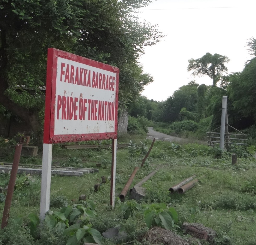
Board proclaiming that Farakka is the Pride of the Nation! Photo: Author
Farakka Barrage
Farakka Barrage Photo: Author
Jpeg
Diversion of water to Farakka Feeder Canal from right bank Photo: Author

The Barrage also severely affected navigation through the river. A separate ship lock was made on the Feeder Canal and it is managed by Inland Waterways Authority of India (IWAI). Hardly any ships pass through due to high sedimentation.

Condition of the Farakka Ship Lock. Secirity Personnel there told us hardly any ships pass this route, less than one ship in three months Photo: Author
Condition of the Farakka Ship Lock. Security personnel posted here told us that hardly any ships pass this route, less than one ship in three months Photo: Author
Hilsa FIshing upstream Farakka is nearly finished as the fish cannot overcome the huge obstacle. Fisherfolk have taken to fishing in the feeder canals where too the catch is meager Photo: Author
Hilsa Fishing upstream Farakka is nearly finished as the fish cannot overcome the huge obstacle. Fisherfolk have taken to fishing in the feeder canals where too the catch is meager Photo: Author
DSC00191
Any meager Hilsa catch is immediately seized by the middleman. In this case middleman gave forty rupees to the fisherman. The Middleman will get more than 300 Rs. for this same catch of Hilsa. Photo Author
Fishermen upstream Farakka are a worried lot

Downstream the barrage, due to trapping of silt in the upstream, silt free water erodes banks with vengeance, especially the left bank. We saw several anti-erosion measures failing miserably in front of the river’s fury.

Anti erosion works get routinely swept away

bankerosion4 Farakka has profoundly changed the character, sediment regime and flow of Ganga. It is affecting lives of lakhs of people in India and Bangladesh through cycles of erosion, sedimentation, floods and affected fishing. Our response to the issue has been dismal. We have not conducted a single review of costs, benefits and impacts of Farakka Project so far. In addition to Farakka , Lower Ganga (Narora), Middle Ganga, Upper Ganga Barrages (Bhimgoda), Kanpur Barrage, Hydropower projects in Uttarakhand and other upstream states have affected the river in most profound ways. If we want to rejuvenate the Ganga, we need to institute a credible independent review the existing Barrages, not plan new ones. May be we can begin with a demand for such a review for Farakka on urgent basis. One World Rivers Day, let us wish for a long and healthy flow for the Ganga River, a symbol of all flowing rivers in India!

-Parineeta Dandekar (parineeta.dandekar@gmail.com)

POST SCRIPT on April 28, 2015:

An edited version of this article and photoessay on The Nowhere People — Environmental Refugees around Farakka, was published in the Mint on March 28th, 2015. Here it is in full: http://www.ficusmedia.com/traildiaries/2015/03/28/the-nowhere-people/
This article was made possible with a grant from The Third Pole and Asia Foundation.
Arati Kumar Rao

Dry Ganga downstream Upper Ganga, Bhimgouda Barrage in Haridwar Photo: Author
Environment Impact Assessment · Expert Appraisal Committee · Ministry of Environment and Forests

Review of environment laws is necessary – But the TSR Subramanian HLC lacks credibility

The Union Ministry of Environment, Forests and Climate Change (MEFCC) in the BJP led new government at the centre has, through Office Memorandum (OM no 22-15/2014-IA.III) dated Aug 29, 2014 constituted High Level Committee (HLC) under the chairpersonship of former cabinet secretary TSR Subramanian, “to review various acts administered by Ministry of Environment, Forests and Climate Change”. Let us try and look at this proposal on its merits.

Firstly, it should be noted that the HLC has a far-reaching mandate to review the core legislations that are supposed to protect India’s environment, including the Environment Protection Act (1986), the Forest Conservation Act (1980), the Wildlife Protection Act (1972), the Water (Prevention and Control of Pollution) Act (1974) and the Air (Prevention and Control of Pollution) Act (1981). Considering that these acts are the back bone of MEFCC’s environmental governance, the recommendations of this committee can have far reaching impact on India’s environmental governance.

Secondly, there are no doubts that India’s environmental laws and governance needs to be reviewed and strengthened. While the industry and vested interest lobbies have been claiming that MEFCC’s work is a hindrance to India’s development and growth, the reality is quite the opposite. MEFCC provides environment clearance (for projects covered under EIA notification of Sept 2006, which is the current notification and which excludes large number of projects from requirement of environment clearance), forest clearance, wildlife clearance, coastal zone clearance and also certifies if the projects applying for CDM (Clean Development Mechanism under the United National Frame Convention on Climate Change) are sustainable development projects.

The committee has been explicitly constituted for reviewing the five environmental laws. These laws need to be strengthened so that there is inclusive, democratic, bottom up process in which people have a decisive role. The governance related to the laws thus needs to be changed in this context so that there is greater transparency, accountability and participation and better compliance is achieved. This is what we mean when we say we need to improve the environmental governance.

MEFCC’s zero rejection rate With respect to giving any of these clearances, the MEFCC has almost zero rejection rate in most crucial sectors. For example a review[1] of the functioning of the Expert Appraisal Committee on River Valley and Hydropower project shows that the committee has not rejected almost any of the proposals that came its way in last seven years. The MEFCC has not rejected any of the proposals that applied for CDM status. Even in other sectors, the MEFCC has rejection rate below 3%, if at all and projects for which clearances have already been given like coal mining, are far from being implemented.

States already have enormous powers Some people have been claiming that states do not have sufficient powers in environmental decision making and hence the powers need to be delegated to the states. The fact is that the states already have enormous powers in environmental governance, including in all clearances. The pollution control regime is completely under the states. The states are empowered to clear several categories of projects in the context of all the clearances. The state pollution boards are supposed to give consent to establish and operate, before which no project can operate, they are also supposed to conduct public consultations even for projects requiring central clearances. Before National Wildlife Board clears a project, State Wildlife Boards need to clear the projects. Consent of Forest Officials from the states is mandatory before Forest Clearance application is processed to higher levels. Which state in India has shown exemplary conduct to inspire confidence that they are in a position to achieve necessary environmental governance? We do not know of any. Unless the capacity of states in this regard is increased, we cannot improve environmental governance in India only in the name of entrusting it in the hands of the states.

Is MEFCC responsible for delays? This is another bogey raised against the MEFCC. The fact is that the EIA notification has clearly defined timelines that says that if MEFCC fails to respond within the timeline, the project can be deemed to have secured the clearance. The fact of the matter is that no project has claimed or gotten such deemed clearance, since most project developers are uninterested in fulfilling even the minimalist demands of MEFCC. On the other hand, most dams and hydropower projects get delayed beyond the promised time frame even after getting the clearances! For any objective person, the claim that MEFCC is responsible for delays and lengthy procedures is clearly a bogey.

Do projects need too many clearances? Another argument made by some is that MEFCC needs too many separate clearances for the same project, which leads to delays. This is again not borne out by facts and clearances that are required now are bare minimum. Except environmental clearance, rest of the clearances do not need public consultation process. Even in case of environment clearance, except the projects covered under EIA notification, rest of them do not need public consultations. The five clearances that MEF gives as listed above are required under each specific law and it is completely justified that separate appraisal process is required for each of them as the issues considered and sectors affected are specific in each case, which cannot be clubbed. We need to strengthen each one of these appraisals, rather than weakening them or clubbing them together.

EAC lacks credible independent members or chairpersons It is public knowledge that most of the people who are appointed on the various committees that appraise the projects for clearances are those who are ready to toe the official line without raising too many uncomfortable questions. There are known cases when the chairman of the EAC or  member of FAC were found to have direct conflict of interest with their involvement in companies whose projects they were to consider for clearance. Recently, NGT has ordered that the chairs of the EAC cannot be generalist administrators but must have domain knowledge and experience. The lack of credible independent members in these committees is a major reason why the Ministry manages to clear almost anything that comes its way.

Poor quality impact assessments It is also well documented how most of the environment & social impact assessments, environment management plans or the cumulative impact assessments are shoddy, inadequate, incomplete, cut paste or dishonest efforts. Even media has reported several cases, environment groups have  repeatedly sent detailed analysis and critiques of these assessments, but the ministry and its committees have the distinction of not rejecting any of such assessments or recommending punitive action against the agencies that are submitting such dishonest or problematic reports.

Public consultations in name sake Under the EIA notification of Sept 2006, the projects are supposed to have public consultations which include public hearing at each of the affected project districts. Here again there have been several documented cases how the public hearings are hijacked by the project developers, they are conducted by partisan government officers and there is no application of mind from the MEFCC to ensure that the issues raised at the consultations are addressed. Several observers, including a former environment minister has accepted that these consultations are largely for namesake only, a box to be ticked. Even when all the people present at the public hearings have said that they do not want the project, it has no impact on the decision of giving clearance to the project.

Non-existent compliance All the clearances given are conditional, and the project developer is supposed to follow these conditions and implement environment management plan. However, how is compliance to these conditions and management plans, a very crucial aspect, to be achieved? The project developer is supposed to submit six monthly compliance reports, but there are no consequences if they do not do that for years! The officials at MEFCC or their regional offices do not have the time to go through these reports and check if these indicate adherence to the required measures and norms prescribed. Neither do these agencies take steps when the compliance reports do not follow the norms. They are never known to have taken any steps in this regard. The monitoring visits from regional offices of the MEFCC are always preplanned and the project developers get away with window dressing at best. There are no surprise visits. Even after monitoring visits, the MEFCC has never taken any steps when MEFCC finds lack of compliance.

We have narrated this list of known problems to show how lax is our environmental governance and how necessary it is to strengthen it rather weakening it. If the review is being done with a view to strengthen the environment governance, it would be welcome.

Review of functioning of institutional set up in environmental governance The review of functioning of institutional set up responsible for environmental governance also becomes imperative after such a long period since these institutions were set up. For example, state and central pollution control boards were set up under the Water Act of 1974, but we do not have experience of a single river or even a tributary of a river having been cleaned up because of the efforts of the pollution control institutions. This failure is a major reason for the state of our rivers today, including the Ganga.

New Issues In addition to the need for strengthening the environmental governance, the review of environmental laws and institutional architecture connecting with their implementation is also necessary in view of the emerging new issues. For example issues like climate change, need for cumulative impact assessments, need for environmental flows in the river, need to protect, preserve and rejuvenate rivers (a proclaimed priority of the current government) or assessment of impact of projects on disaster potential of the area were not as important and urgent as they were when these laws were formulated.

CURRENT REVIEW What I have written above provides sufficient ground for need for review of laws and institutional set up for environmental governance in India. For this we need a credible independent team with clearly defined terms of reference and transparent, participatory and confidence inspiring process. Let us see if the review set up under the HLC qualifies to achieve such a review.

Sinisterly ambiguous TOR Firstly, if we read the four Terms of Reference (TOR) given to this committee under the above mentioned OM, the first TOR says the review will assess status of implementation of the act vis a vis “the objectives”. But the TOR does not define what is meant by “the objectives”. The second TOR is not problematic as it says the review will “examine and take into account the various court orders and judicial pronouncements relating to these acts”. The Third TOR is the most sinister. It says the HLC will recommend specific amendments in the acts, “so as to bring them in line with current requirements and to meet objectives”. The trouble is, neither “current requirements” nor “objectives” have been defined. Without defining them, these are open to any interpretation that is suitable to the committee! Such ambiguous TORs which are open to manipulation are completely unacceptable and do not inspire any confidence in this exercise.

Constitution of HLC The committee chaired by former cabinet secretary T.S.R. Subramanian has four members (including the chair) and two secretaries (both government officials). The constitution of the committee and criteria for selection of the members has remained completely non transparent, which itself raises many questions.

Among the four members, two are former bureaucrats and two are with legal backgrounds. None of the members are either expert in environmental issues or environmental governance. None of the members (including the chair and the secretaries) are known to have fought for or campaigned for or worked for improving environmental governance in India. There are no credible, independent non-governmental members or independent experts here.

Viswanath Anand, one of the two former bureaucrat members of the HLC and former environment secretary, does not inspire confidence due to his track record either as environment secretary (1997-2000) or as Vice Chair of National Environment Appellate Authority (2002-2005). His tenure at NEAA was described by the Delhi High Court as “a one-man show” in the absence of a chairman and three technical members of the authority.[2] Media further reports: “Very few appeals were admitted by Anand during his three-and-a-half-year stint at NEAA. In the Loharinag Pala case, he drew sharp criticism from the Delhi High Court for “adopting a very hyper-technical approach in rejecting the petitions” and overlooking “that these petitioners deserve to be heard on merits”. The court quashed Anand’s order and reinstated the appeal.” That says a lot. There are several other narrations about the role played by Mr Anand at NEAA[3]. Mr Anand is also on Coca Cola India’s Advisory Council on Environment and Sustainability[4], which seems to be in conflict with his role in HLC.

Appointment of Mr Hardik Shah (one of the two secretaries) as the Member Secretary of Gujarat Pollution Control Board was challenged in Gujarat High Court by RTI activist Amit Jethwa before he was killed, as per Indian Express report, see link in End Note 2 bleow.

Considering the non-transparency in its appointment and known background of some of the members, the constitution of the committee too does not inspire any confidence that it will help improve environmental governance in India.

Process of participation The MEFCC has said that within a month, that is by Sept 27, 2014, people can send submission to the committee in less than 1000 characters (or an email)! This is completely ridiculous and shows how non-serious the government and the HLC is about the submissions. This article, with already more than 13000 characters would clearly disqualify for submission to the HLC! Besides the issue of length, there is not even a clearly defined process that tells the people what will happen to their submissions and how are they sure to know that their submissions will be even acknowledged and responded to or even read. The process of participation is completely unacceptable. The whole process limits the participation to only English speaking and writing people who have access to internet, leaving out vast majority of the people out of the review process.

Conclusion It is clear from all accounts that the HLC does not carry any credibility or inspire in any confidence for any objective person. The best course for the MEFCC is to dissolve the HLC and restart the process keeping in mind the comments from groups and individuals without vested interests. The government should in the first place institute a credible independent review of the experience with environment laws, institutions and governance in India. This has also been highlighted by organisations like ESG. The report of this exercise should then be made available to all the gram sabhas in local languages. It is only based on such a report that a review of the environmental laws, institutions and governance be taken up, in which then the people and groups on ground can participate. At least 50% members of the review process should be women, when today there are none.

We have looked at this process purely on its merit, without looking at what the new BJP led government at the centre has done over the last four months. The government has been very busy diluting and dismantling whatever little exists in terms of environmental governance in India. If we add that track record to this analysis, then the conclusion is loud and clear: The formulation of HLC is aimed at completely dismantling the laws and institutions related to environmental governance in India. This is not a good sign for the future of this country and her people.

Himanshu Thakkar, SANDRP

ht.sandrp@gmail.com

Another blog on this issue: https://sandrp.wordpress.com/2014/10/10/strengthen-and-not-dilute-environment-laws-submission-to-the-mefs-hlc-to-review-environment-laws/

END NOTES:

[1] For details, see: https://sandrp.in/env_governance/TOR_and_EC_Clearance_status_all_India_Overview_Feb2013.pdf

[2] http://indianexpress.com/article/india/india-others/the-six-minds-that-will-look-afresh-at-environment-laws/#sthash.RMohoCW9.dpuf

[3] See for example: http://infochangeindia.org/environment/analysis/national-environment-appellate-authority-puppet-of-the-moef.html and http://www.deccanherald.com/content/22796/tribunal-coming-justice-can-wait.html and http://indiatogether.org/neaa-environment

[4] http://www.coca-colaindia.com/sustainability/final-bios.html and http://www.coca-colaindia.com/sustainability/viswanath.html, accessed at 3.37 pm (IST) on Sept 26, 2014

POST SCRIPT 1:
Those who agree may send this to hlc.moef2014@gmail.com, Sept 27,  2014 is the last date for sending submissions, but we need to keep sending submissions on these lines even after that deadline.

Post Script 2: Press Release from Environment Support Group, Bangalore after the meeting with HLC in Bangalore on Sept 27, 2014:

Press Release : Bangalore : 27th September 2014
(Attached PDF with pictures)

High Level Committee of Ministry of Environment and Forests and Climate Change walks out of Public Consultation in Bangalore

The High Level Committee headed by Mr. T. S. R. Subramanian, former Union Cabinet Secretary, constituted by the Union Ministry of Environment and Forests and Climate Change to review environment, pollution control and forest conservation laws, invited the public at large for a consultation between 12 and 1.30 pm today (27th September) at Vikas Soudha, the high security office complex of the Government of Karnataka. Advertisements to this effect had been issued by the Karnataka Department of Forest, Ecology and Environment in various newspapers on 21st September 2014, followed up by various press releases inviting the public to interact with the Committee.

When various individuals and representatives of public interest environmental and social action groups turned up for the meeting, the police prevented their entry at the gates. It was only following a spot protest that the police consented to allow them to participate in the consultation. Despite this indignifying experience, all who gathered proceeded to the meeting hall with the intent of engaging with the High Level Committee.

The meeting commenced with introductory remarks by the Chairperson Mr. Subramanian. Broadly, he shared that the intent of the Committee was to hear views from across India on the type and nature of changes that were required in the environmental and forest protection laws. He stated that the Committee had the mandate of the Government to propose necessary changes that would help improve the quality of life and environment. But he said the need to ensure develop was primary, as the country was very poor (over 80% were poor he claimed) and thereby it is found essential to streamline environmental clearance processes that thwarted growth. Mr. Subramanian also shared that it was a matter of concern to the Government that several development projects were getting mired in litigation on environmental grounds, leading to needless delays. Concluding his introductory remarks he shared that the Committee is not in any manner guided by the Ministry and their recommendatory report would be submitted to the Union Government. The Committee’s proceeding, he clarified, were not open to the public, unless the committee decided to engage with the public. Responding to a question, Mr. Subramanian said that nothing that was submitted to the Committee would be shared with anybody, and that only the report would be submitted to the Government. Mr. Subramanian also said that the Ministry never proposed a public consultation exercise, but he had suggested this should take place.

Mr. K. N. Bhat, Senior Advocate and a member of the Committee, shared that there were a variety of submissions the Committee had received and each of this would be considered. He aired that environment and development should go side by side and the objectives of the laws if not found sufficient to address current needs, need for their review exists. The industry in particular, he said, had raised concerns over delays in environmental and forest clearances when the Committee met with them.

On these introductory notes Mr. Subramanian asked the members of the public to suggest changes to the existing environmental law framework. Officials assisting the Committee did not provide any rationale for the Ministry proposing changes to existing laws. The Committee also did not have any procedure, excepting online submissions of opinions on the Ministry’s website (limited to 1000 words).

When the turn of the public came, a submission was made by the Karnataka Planters Association about procedural difficulties in securing forest clearance and conforming with pollution control norms, and sought amendments for the benefit of plantations. Thereafter, Mr. A. C. F. Anand, an RTI Activist, suggested that all environmental laws must be translated so that it would be understood by all and thus the compliance rates improved.

Speaking next, Mr. Leo F. Saldanha of Environment Support Group requested the Committee to address the basis for its functioning, and whethere the TOR constituting the Committee was sufficient for such a massive and onerous task that involved fundamentally reviewing all environmental laws that were intricately linked to Right to Life, Clean Environment and Livelihoods. He sought to know what it meant, as is main TOR, ““(t)o recomment specific amendments needed in each of these Acts so as to bring them in line with current requirements to meet objectives”.

Mr. Subramanian responded that neither he nor any other members of the Committee were influenced by the TOR in any manner and that they worked per their own understanding of the mandate given to them by the Government. But when Saldanha pressed to know how a Committee consisting of high ranking former civil servants, a former Judge and a Senior Advocate could at all have agreed to such vague terms, Mr. Subramanian reacted dismissively. He claimed that this was a non-substantive issue and sought to move on to hear others. Saldanha argued that it is disturbing that Mr. Subramanian unilaterally rules a legitimate concern over vague and weak TORs as being of trivial concern, when, in fact, it would have been fit and proper for the Committee to have first explained in the interest of public accountability and transparency how they found the terms rationale and acceptable to them. And in case the terms were acceptable, then the High Level Committee, unshackled as it were by the bureaucratic norms of the Ministry, could have provided a clear note on the nature of the reforms being considered and also explicated on the procedure of consulting and receiving criticisms from various sectors, peoples, regions, geographies, etc.

Mr. Vinay Sreenivasa of Alternative Law Forum submitted that the process by which the Committee was conducting the consultation was rather opaque. The vague TOR and the fact that the Committee was constituted by a Government that sought to belittle the importance of the National Wildlife Board and rush pet projects through the clearance mechanism, seemed to suggest the entire exercise appeared to be merely ritualistic. Ms. Aruna Chandrasekhar of Amnesty International – India sought to know what specific amendments were being proposed or demanded by industry/corporate sectors, and requested the Committee put it all out. But Mr. Subramanian waved away this request too.

Prof. Puttuswamy wanted to know how a High Level Committee sought to improve environmental laws when notifications of Ministry were being issued to dilute the laws. To which Mr. Subramanian responded saying he is not a “Postman” for the Ministry. Ms. Priti Rao, meanwhile, asked for decentralised solid waste management. Mr. Vijayan Menon shared that even though he was not an official, he had walked into the Committee’s immediately preceding engagement with Government officials where a clear set of amendments were being proposed. He expressed surprise that this presentation was not being made for the benefit of the general public.

Ms. Bhargavi Rao of Environment Support Group wanted to know how law could be reformed when forest officials are unaware of biodiversity protection laws that had been passed over two decades ago and asserted that this rushed exercise in reviewing environmental laws had all the trappings of making light of people’s fundamental rights and concerns. Justice A. K. Srivatsav (Retd. Judge of the Delhi High Court) and a Member of the High Level Committee stated at this juncture that the public must have confidence in a Committee in which a senior retired Judge is a member. By which time Mr. Subramanian had remarked several times that the public was wasting the Committee’s time and there was no point continuing with this procedure. Several who had gathered protested such an assessment by the Chairman of the High Level Committee. Mr. Srinivas of Mavallipura sought to speak, saying he represents a community impacted by mal-development and waste dumping in his village, and he too was brushed aside.

At this point, Mr. Subramanian got up and said “We will end the joke here!” and walked out. He was followed by the rest of the Committee.

When Mr. Subramanian walked out, it was 1 pm. Members of the common public who had travelled great distances to engage with the Committee protested Mr. Subramanian taking them for granted and dismissing their views as of trivial concern. They demanded that the Committee return to hear the public and as advertised remained in the Hall till 1.30 pm. Neither did the High Level Committee return, nor did any official of the Ministry of Environment and Forests or Karnataka Environment Department come back to explain to the public why the High Level Committee had behaved in this manner. In fact, throughout the engagement with the public, not one Karnataka Government official was present in the Hall.

The undersigned are deeply disturbed by the manner in which the T. S. R. Subramanian headed High Level Committee has treated this public consultation process. The undersigned demand that the Ministry of Environment and Forests and Climate Change call off this exercise as it has all the markings of being a ritual exercise. In its place the undersigned demand that the Ministry must constitute a Committee that has a clear rationale for reform and Terms of Reference that are democratic, consultative and transparent. In particular, the following demands are made:

  1. Environment Ministry must first come out with a White Paper discussing the nature of the reforms that it proposes in environmental, forest conservation and pollution control laws.
  2. On the basis of such a Paper, an accessible Committee must be constituted that would hear peoples responses across the biologically, culturally and linguistically diverse country and also from various sectors equally.
  3. The membership of the Committee should be so constituted that it would reflect diverse concerns and sectos, and in particular ensure that members conversant with tribal and human rights, environmental management, conservation biologists, biodiversity, risk assessment, planning, etc., and not merely ex-bureaucrats or members of the legal fraternity were included Particularly important is the need to ensure there is adequate representation of women on the High Level Committee, which presently is constituted only of men.
  4. The process of the consultation to be followed has to be meaningful and conform with Principle of Prior and Informed Consent, even if this is not a consenting process.
  5. The timeline for the Consultation mechanism for such a critical review has to be reasonable as laws sought to amended, or tweaked, fundamentally affect theRight to Life and Livelihoods, and Right to Clean Environment.
  6. The entire process has to be transparent, all meetings must be recorded publicly, none of the deliberations must be in camera (as it appears to be the case now), and all proceedings, submissions, minutes and reports must be in the public domain.
  7. Adequate facilities must be made to ensure that anyone interested can participated with dignity and without being inhibited by language or geographical location. To ensure this, the process must be devolved by enlisting the support of State and Local Governments.

Signatories:

Mr. Leo Saldanha; Environment Support Group, leo@esgindia.org. Cell: 9448377403

Mr. Vinay Sreenivasa; Alternative Law Forum. Cell: 9880595032

Ms. Bhargavi Rao; Environment Support Group; bhargavi@esgindia.org Cell: 9448377401

Ms. Aarthi Sridhar; Dakshin Foundation, aarthi77@gmail.com. Cell: 9900113216

Mr. Vijayan Menon; menonvij@gmail.com

Mr. Davis Thomas; Environment Support Group; davis@esgindia.org. Cell: 9036180914

Ms. Swapna; sapna.sb@gmail.com

Ms. Priti Rao; priti007@yahoo.com

Ms. Padma Ashok; Save Tiger, padmaashok@gmail.com

Mr. Ashok Hallur; ashokhallur@gmail.com

dinnil@gmail.com

Mr. Rajeev Mankotia; rmanikoth@gmail.com

Mr. Sandesh Udyawar; sandeshudyawar@gmail.com

Ms. Marianne Manuel; Dakshin Foundation, marianne.manuel88@gmail.com

Ms. Shivani Shah; Greenpeace; shivani.shah@greenpeace.org

Mr. Sohan Pavulari; sohan_pavuluri@yahoo.com

Ms. Sangeetha Kadur; sangeetha.kadur@gmail.com

Mr. Bhaskar Bhatt; muggymach3@basejumper.com

Mr. Rohan Kini; rohan.kini@gmail.com

Mr. K.N. Somashekar; cmd_vilinfra@rediffmail.com

Mr. A.C.F. Anand; acfanand@gmail.com

Ms. Shashikala Iyer; Environment Support Group; shashi@esgindia.org

Mr. Leon Louis; Environment Support Group; leon@esgindia.org

Mr. Mallesh K.R; Environment Support Group; mallesh@esgindia.org

Mr. Prashanth; Environment Support Group; prashanth@esgindia.org

Post Script 3

Ramaswmay Iyer, Former Secretary, Union Ministry of Water Resources wrote this email letter to Chairman of HLC Shri T S R Subramanian, we are publishing this here with his permission:

On Sun, Sep 28, 2014 at 8:23 PM, Ramaswamy R. Iyer <ramaswamy.iyer@gmail.com> wrote:

Dear TSR,
I hold you in high regard and was pleased when you were appointed Chairman of the High Level Committee to review the enviromental laws. I hoped that you would save the environmental laws from decimation. I am beginning to lose that hope.
It is amply clear why the HLC has been set up.  This government and in particular Minister Javadekar (who is Minister not for environment butagainst environment) are firmly convinced that environmental laws are playing havoc with ‘development’. What is needed in their view is quick clearance. Both those words are important. The clearance must be quick in all cases, and it must be a clearance in all cases, not a rejection in any instance. In other words, the whole exercise should be reduced to a formality or a ritual. Of course a simpler way of achieveing the objective would be to scrap the clearance procedure altogether, and repeal all the environmental laws. However, that is not easy, and such a move may have a political cost. The next best thing to do is to extract all the teeth from the laws and weaken and dilute them to the point of virtual repeal. It is for such an exercise in emasculation that the MoEF has set up the HLC. I thought that you would not be a party to such an exercise in disingenuousness. I believed that you shared the environmental and ecological concerns of many of us to some extent, if not wholly, and that the environmental laws of the country were safe in your hands. I am not so sure now, after reading reports of what happened at the ‘Public Hearing’ at Bengaluru. It appears that your views on ‘Environment vs Development’  are the same as those of Minister Javadekar. I deeply fear that the report of your HLC will do immense harm to the country. Are you prepared to live with that possibility?
I can only hope that I am wrong. If I have misjudged your position, I am ready to aplogise without reservation.
I am copying this to a few friends.
Best Wishes.
Ramaswamy R Iyer
A-10 Sarita Vihar
New Delhi 110076
Tel: 91 11 26940708
41402709
E-Mail: ramaswamy.iyer@gmail.com
POST SCRIPT 4:
Source: The Times of India, Sept 29, 2014
Forum demands reconstitution MoEF’s committee
Correspondent : Vinobha KT
MANGALORE: Activists in Dakshina Kannada urged that the review of environmental laws must never be done in haste.

Activists expressed their views before the High Level Committee of Union ministry of environment and forests (MoEF) headed by former Union Cabinet Secretary TSR Subramanian during its meet to receive suggestions and objections at deputy commissioner’s office here on Sunday.

The Acts to be reviewed by the centre include Environment Protection Act, 1986, Forest Conservation Act, 1980, Wildlife (Protection) Act, 1972, Water (Prevention and Control of Pollution) Act, 1974 and Air (Prevention and Control of Pollution) Act, 1981.

Karavali Karnataka Janabhivriddi Vedike members said that they are deeply concerned about the haste with which the TSR Subramanian Committee has been set up by the Union Ministry to review five of India’s most important environmental laws.

In a memorandum, Vedike members urged the committee to undertake a study of the effectiveness of the existing laws and their proper implementation, not just from the perspective of obtaining speedy clearances for industrial projects, but from that of protecting the environment and the rights of the poor.

“As concerned citizens, we would like to assert that review of environmental laws must never be done in haste. Protection of the environment concerns is our very survival and must not be seen as an impediment in the drive for industrialisation. Any review must be done in a transparent manner, involving all the stakeholders. The MoEF has a duty to uphold the constitutional right of every individual to livelihood and a clean environment. Economic growth benefiting the rich at the cost of life-sustaining ecosystems must not be seen as development. In view of such concerns, we urge the Government to revamp the review process,” members stated in the memorandum.

Vedike coordinator Shreekumar said seeking to make changes in environmental laws, which are meant to protect important rights enshrined in the Constitution such as Right to Life, Clean Environment and Livelihoods in such haste under vague terms of reference is indeed disturbing. “Recent statements emanating from the Union Government as well as the MoEF have been displaying a dangerous haste with respect to granting environmental clearances for industrial projects with scant respect for environmental protection. Expediting clearances is serving only the interests of corporate powers. The haste and thoughtlessness with which the current review is being undertaken raises the apprehension that it is meant to facilitate such policies,” Shreekumar said urging reconstitution of the committee by including experts in the fields of environmental science, social sciences, natural sciences and environmental law, also giving adequate representation to various stakeholders such as farmers, fishers and tribals.

SOURCE : http://timesofindia.indiatimes.com/city/mangalore/Forum-demands-reconstitution-MoEFs-committee/articleshow/43747853.cms
Ganga

Ganga and Varanasi’s Waste-water Management: Why has it remained such an Intractable Problem?

Guest blog by: Dr Kelly D. Alley (ALLEYKD@auburn.edu), Auburn University, USA

Varanasi is newsworthy these days, situated symbolically and politically in the new Prime Minister’s agenda. In his victory speech, the PM-elect Narendra Modi vowed to clean the sacred river Ganga. After assuming the office of Prime Minister, he reiterated the vow and pledged renewed efforts for Ganga cleanup.

Three months later, a skeptical Supreme Court reviewed the new government’s Ganga Plan and remarked that with this approach the river will not be cleaned in 200 years. The Supreme Court asked for the full details of the cleanup plan, and inserted its role as a monitor over central government plans. The government has reportedly submitted a new plan to the court, but no details are available yet in the public domain. However, from media reports, it seems the plan is not very different from what has been done in the name of the Ganga Action Plan so far.

As residents and sympathetic outsiders know, the wastewater problem in this sacred, ancient city is seemingly intractable. In order to implement lasting solutions to the recurring river pollution scenario, we need to investigate the current situation. I just completed a field trip to this special city that many call Banaras. I visited all the existing and planned components of the wastewater collection, treatment, and disposal system. In this article I will try to create a visual map of the wastewater infrastructure and management problems and define the current lines of command and control within the vast and overlapping water, environment, and public health bureaucracies. This should help to identify systemic problems in each that need to be addressed when charting a new direction.

The seemingly intractable problems of Ganga clean up (rejuvenation will need so much more than just a clean up) in Banaras can be divided into three categories. First, there are governance problems that are related to how decisions on technologies, scale, operators and siting are made. These include problems with the solicitation, selection, and implementation of projects, especially the design and construction and operation and maintenance of sewers, sewage pumping stations and sewage treatment plants. Second, there are serious infrastructure problems that are part of the complexity of this ancient city.

Third, there is a real electrical power supply problem. Securing continuous electrical power for sewage pumping stations and wastewater treatment facilities is a low priority, and emergency standby generators are not used when the grid-provided power is unavailable.  As a result, the intermittent operation of sewage pumping stations and sewage treatment plants is ineffective in protecting water quality in Ganga and in provisioning safe drinking water and sanitation in Varanasi.

When the sewerage infrastructure is operated intermittently, the treatment technology cannot treat the wastewater adequately, and the concentration of contaminants and water quality indicators such as total suspended sewage solids (TSS) and biological oxygen demand (BOD), heavy metals, toxic organic compounds, and the Most Probable Number (MPN/100ml) of fecal coliform bacteria–indicating the presence of enteric waterborne disease pathogens in the treated effluent–remain high. So in a way providing partial power to a sewage treatment plant does not do the work and is therefore a largely inoperable, non-functional, sunk cost.

Governance

The Government of India established the Ganga Action Plan in 1986 to lead the way in river pollution control programs. In 2009, the Government declared the Ganga a national river and established the National Ganga River Basin Authority. The National Mission Clean Ganga (NMCG)–the implementing agency under this Authority–is now housed in the Ministry of Water Resources, River Development and Ganga Rejuvenation under the Government of India. The Mission Director is the chief executive of the NMCG.

At the state level in Uttar Pradesh, there is a state Project Management Group (PMG) chaired by the Chief Minister. It includes members from the State Ministries of Environment and Irrigation, the Uttar Pradesh Pollution Control Board and the state water commissions. The State PMG decides whom to select for work, and in most cases uses the Uttar Pradesh Jal Nigam (the state level sewage engineers) to execute wastewater project work.

The State PMG can outsource consultancy work and allocate projects to NGOs as well; although in all cases, it has allocated the wastewater engineering work to the Uttar Pradesh Jal Nigam. These layers of committee membership create a vast water bureaucracy at the state level in addition to the committee memberships and officers at the Central level. They are not independent regulators, monitors and compliance officers (which are needed) but contributors and benefactors of political and profitable decisions in the ongoing issuing of contracts, clearances and other approvals.

This is a big problem because any contract for sewerage work must pass through all these departments and boards, with money wasted on bids and approvals for specific projects. In addition there is no other implementing agency in Varanasi so if the UP Jal Nigam’s work is shoddy or even fraudulent, then the Ganga River and the whole city suffers without an alternative. This situation is well known to Banaras residents who will complain daily that funds meant to improve the sewerage system are simply eaten up by various agencies while wastewater is diverted into the sacred river without treatment.

In addition, the foreign donor agency, the Japan International Cooperation Agency or JICA, has been present in Varanasi for many years to advise and assist with capacity building and technological cooperation for the Ganga Action Plan. Apart from controlling the flow of funds, however, it appears that JICA has worked within the current lines of command and control, thereby helping to perpetuate rather than reform the system.

Infrastructure

So what is the current situation with the main wastewater drains? The main drains for the city are the Nagwa drain, located in the south and upstream of the main city, and Khirki nallah, located in the north downstream of the main bathing ghats. The Ganga flows northward at Banaras (see map). The Varuna River enters from the west and circles the outer part of the older sacred city complex before draining into the Ganga at the downstream or northern end. In the last year the Varuna River has turned into a wastewater pond upstream of the barrage recently built under the Puranapul Bridge that crosses the Varuna River. The Varuna river banks downstream of that barrage have also become the dumping grounds for all forms of solid waste and the entire landscape is hellish. One wonders how the communities in the vicinity can survive.

The existing wastewater management facilities include three sewage treatment plants, five sewage pumping stations along the ghats, and one main sewage pumping station at Konia. The Konia pumps are supposed to pump up to 80 million liters of sewage per day to the Dinapur treatment plant located in the trans-Varuna neighborhood of Dinapur village, if they work at full capacity. However they rarely do.

For instance, only one screw pump was working on the day of my visit, so that means it was running at 1/3 its capacity. This would also mean that the Dinapur treatment plant was receiving only 1/3 of the wastewater it is capable of treating, according to its nominal treatment capacity, and therefore it was running at 1/3 capacity. However to be exact one would have to know how many hours the one pump operates each day of the week and then the capacity factor can be calculated. For instance, if the pumping station runs at 1/3 capacity for only 6 of the 24 hours each day then the capacity factor would be 1/12 or about 8%.

If capacity factors of the pumping stations and treatment plants are taken into account in a Life Cycle Cost assessment then the cost per unit volume (ML) of treated sewage would sky rocket.  The UP Jal Nigam does not keep a daily operational log with data like energy usage data, and thus there are no metrics, no measures, and no good management practices. This adds up to a lack of proper governance. Many monitoring committees have made visits to site facilities but have failed to correct the daily malfunctioning of the entire system. On my trip to videotape the Khirki wastewater drain in late June, I said to the boatman taking me, “So they release this water into Ganga ji at night and in early morning, right? Like chup ke?” He replied, “No Madam not chup ke. It is right there running wastewater all the time. Everyone can see it, and they are not even bothering to hide it!”

Below are current pictures of parts of the system that have been damaged, destroyed or poorly maintained. The map can be used to place these pictures in the city space.

Map of main infrastructure facilities in Varanasi


Rajendra Prasad ghat sewage pumping station (one of five ghat pumping stations that send sewage running underground toward the river back to the main trunk line and on to Konia pumping station)
A drain in the western side of Banaras in the unsewered area near the Varuna river. This drain runs to Chauka ghat where the Chauka ghat pumping station is proposed.


The Puranapul bridge with the barrage hidden behind the pillars.
Solid waste dumpsites just downstream of the Puranapul bridge.
A drain in the trans Varuna region.


Khirki Nallah, just upstream from the confluence of the Varuna & Ganga rivers and downstream from the sacred city.


Bhagwanpur sewage treatment plant
Konia sewage pumping station. Only one screw pump is working
Another shot of Konia sewage pumping station with only one screw pump working
Aeration basins at the Dinapur sewage treatment plant
Low efficiency splasher aerators in the aeration basin
Secondary clarifier at the 80 MLD Dinapur sewage treatment plant


Canal taking treated effluent back to the river
Treated wastewater--it looks "clean" but the fecal coliform content is usually in the range of 100,000 MPN/100ml to 1,000,000 MPN/100ml. This is well above safe levels for bathing and human consumption
Treated wastewater–it looks “clean” but the fecal coliform content is usually in the range of 100,000 MPN/100ml to 1,000,000 MPN/100ml. This is well above safe levels for bathing and human consumption
Nagwa wastewater drain, near the confluence of the Assi and Ganga and upstream of Assi ghat and the raw (drinking) water intake point for the city. The non-functioning Nagwa pumping station is in the background
Sewage pipeline damaged by the flood of June 2013 but not repaired. When it was built, it was the pipeline to nowhere. There was no treatment plant constructed at its terminus in Ramana Village along the river bank and upstream of the Nagwa drain

Power

We have to think about wastewater problems in the context of public health, environmental health, electrical power supply and national and state priorities for power distribution. In the current scenario using existing technologies and scales (there are better options for technology and scale), a significant amount of energy is required to pump and treat wastewater using sewage pumping stations and the activated sludge treatment process. In India energy supplies are allocated to industrial and urban needs long before they are distributed to sewage treatment plants. Looking at the current energy scenario in India it is not hard to see that wastewater pumping and treatment require continuous power and are not sustainable in the context of the current power deficit. Biological secondary treatment using the Activated Sludge Process (ASP) uses a significant amount of electricity to operate aeration equipment and mixers. Another technology used in Kanpur, the Upflow Anaerobic Sludge Blanket (UASB), is also a capital and energy intensive process. With other demands high on the agenda, it is unlikely that precious power will be available to run all the existing and proposed sewage pumping stations and sewage treatment plants on a daily basis now and into the future if the existing technologies and scales continue to be used.

Take Away Points

If wastewater infrastructure is built, it is done with large government investments of public funds, sometimes with capital from international banks; there is little private equity to drive the process. Instead the costs of building (and also poorly building) these facilities are absorbed across a range of human services including public health, education, housing and infrastructure. The costs of operating and maintaining sewage pumping stations and treatment plants are also high and operation and maintenance of the facilities become a low priority after construction.

For instance, the sewage treatment plant laboratories are ill-equipped and this means that the UP Jal Nigam operators are unable to monitor, measure, and report operational and water quality data. Due to the absence of laboratory equipment, instruments and analytical capacity, they are not able to optimize the treatment process. Generally the functional components of the sewerage infrastructure – the sewage pumping stations and treatment plants – are overwhelmed by the dysfunctional components and by the enormous pollution load. In this way the functioning units in the system become important, not for effectively treating the waste but for projecting a façade of functional infrastructure, especially when site visits by monitoring agencies are underway. Yet the norm is that facilities are operated only periodically and usually below capacity, and the result is that untreated wastewater is passed through open drains to agricultural fields or rivers. During rains and the monsoon, wastewater combined with storm water flows directly into the Assi, Varuna, and Ganga Rivers.

This sacred city requires a competent participatory authority to master plan, design, select the right scales and technology, construct, operate and effectively maintain a comprehensive wastewater collection, treatment and reuse system. Its governance requires clearly defined norms of transparency, accountability and participation.

A competent authority should connect central, state and municipal levels and be accountable to the residents of the city not just through the municipal corporation and its elected officials, but also directly through norms of participatory governance. These governance reforms should include clearly defined norms of transparency, accountability and participation that pertain to the entire system and to each component part–the pumping stations, sewage and water treatment plants, sewers and associated facilities. A piecemeal approach with the Jal Nigam exclusively at the helm has not worked thus far and it has sunk crores of rupees into poorly operated and maintained infrastructure, even in the face of national and global attention and numerous judicial interventions to the cause of Ganga cleanup. A careful constitution of accountable engineering agencies, a welcoming approach in planning and implementation to citizen contributions, and a vigilant monitoring of operations and maintenance practices by concerned citizen groups can go a long way to reforming the system. There is no doubt that this cause runs deep in the hearts of every Banaras resident.

[For PDF file containing this blog, see: https://sandrp.in/otherissues/Varanasi_Ganga_Wastewater_Management.pdf.]

Additional Information:

1) Video of the run off coming through the Rajendra Prasad ghat pumping station after a heavy rain in June 2014: https://www.youtube.com/watch?v=ujBB2FLYkZM

2) Video of Khirki Nallah in June 2014: https://www.youtube.com/watch?v=S0KUXEw7DRg

3) Video of Nagwa Nallah in June 2014:

https://www.youtube.com/watch?v=7xraLNjdPg4&feature=youtu.be

4) POST SCRIPT For further reading: http://www.thethirdpole.net/2015/11/06/tibet-dams-hold-back-silt-not-water

Sabarmati

Whither Riverfront Development? A photo tour of Sabarmati River

Sabarmati Riverfront 1

Sabarmati Riverfront Development Project has converted the Sabarmati River into an urban space by reclaiming nearly 200 ha of land and displacing nearly 10000 people.

Sabarmati Riverfront 5

Concrete embankment walls of height 4 to 6 meters have been created for a stretch of 10.4 KM on both banks with walkways.

Sabarmati Riverfront 2

Width of Sabarmati channel is uniformly narrowed to 275 metres during the riverfront development project, when naturally average width of the channel was 382 metres and the narrowest cross-section was 330 metres.

The original character of the river is changed completely from a river to a canal.

Narmada Canal meets Sabarmati 1
Water from Narmada Canal entering Sabarmati

The water that is impounded in Sabarmati Riverfront stretch is not Sabarmati river water, but Narmada River Water.

Water from Narmada canal is released in Sabarmati upstream of the Riverfront Project.

Narmada Canal 13

City of Ahmedabad or Sabarmati River has no right on Narmada River Water, it’s the water meant for drought prone areas of Kutch, Saurashtra and North Gujarat. Thus the water we see in Sabarmati in Ahmedabad is water deprived from the drought prone areas.

Untitled 1
Site at which water from the Narmada Canal is released into Sabarmati River
Sabarmati Effluent & Sewage Discharge 6
Untreated sewage and industrial effluent are discharged into Sabarmati River near Vasna Barrage downstream of Riverfront project

Sabarmati Riverfront Project has not resulted in cleaning of Sabarmati River. Instead the pollution from untreated sewage and industrial effluent has been diverted near the Vasna Barrage downstream of Riverfront project stretch.

Untitled 2
Untreated sewage and industrial effluent are discharged into Sabarmati near Vasna Barrage downstream of Riverfront project
Sabarmati Effluent & Sewage Discharge 4
Site bellow Narol Vishala Bridge where the untreated sewage & effluent is disposed

Sabarmati Effluent & Sewage Discharge 5

Even after the Riverfront Development Project, Water Quality of Sabarmati River downstream of the Vasna Barrage is extremely poor.

Solid waste dumping site near Vasna Barrage 3
Solid waste dumping site for Ahmedabad located 4 to 5 KM from the Sabarmati River
Solid waste dumping site near Vasna Barrage 4
Solid waste dumping site located 4 to 5 KM from the Sabarmati RIver

So can we see Sabarmati River rijuvenated or even cleaned anywhere? The 10.4 KM long stretch is like a canal, upstream of it is a dry river in most days and downstream is one of the most polluted stretch.

(Photos taken in September 2014 by author)

Amruta Pradhan, SANDRP amrutapradhan@gmail.com

Post Script: January 21, 2015: Another report on reality of Sabaramati success story: http://week.manoramaonline.com/cgi-bin/MMOnline.dll/portal/ep/theWeekContent.do?programId=10350679&contentId=1826603

Agriculture · Irrigation

Climate Change and Agriculture: Where is the National Mission on Sustainable Agriculture?

Adaptive Agriculture: A mix of Millets, Corn, Legumes and Vegetables grown by tribals in the same plot. Photo: Aparna Pallavi, Down to Earth

When the farmers were losing their crop due to less or no rain, the government was still speculating about 2014 being a drought year. Now that the damage is done, we have seen some acknowledgement from authorities of the actual situation. One wonders then why is it that the government has to wait for calamity to strike when it already knows the dangers that lie ahead. In a burst of enthusiasm, it set up the eight missions under the National Action Plan for Climate Change (NAPCC) in 2008, one of which is the National Mission for Sustainable Agriculture. But the ground situation seems to be the same with or without it.

Destruction ofcrops due to untimely hailstorms in Marathwada Photo: Sakaaltimes

The Indian network for climate change assessment (INCCA) report suggests that there is a probability of 10-40% loss in crop production in India by 2080-2100 unless we take mitigation measures and adapt to the global warming[i]. The 5th assessment report of the Intergovernmental Panel on Climate Change (IPCC), estimates that 60% more food will be needed by 2050 given the current trends in food consumption[ii]. It is also estimated that for tropical places especially like India and China, the length of the growing season and suitability for crops will decrease as it is determined by moisture availability and extreme heat, where both are being affected as a result of climate change. This means that there will be considerable losses in agricultural productivity in India, leading to negative impacts on food security in the country. In such a situation, it is important for the government to work towards safeguarding the livelihoods of its farmers, who contribute highly to the GDP (13.7%) and form a big part of the overall labour force in the country. In its National Mission for Sustainable Agriculture, the government stated that there will be an estimated reduction in agricultural yield by up to 4.5-9% in the medium term (2010-2039), whereas a reduction of about >25% in the long term (2040 and beyond) if no measures are taken[iii].

Keeping in line with this, the IPCC report estimates that almost half of the wheat-growing area of the Indo-Gangetic Plains could experience significant amounts of stress due to heat by 2050s, along with the expansion of temperate wheat environments northwards as climate changes. ii The INCCA report said that projections indicated the possibility of loss of 4-5 million tonnes in wheat production with every rise of 1 degree Celsius temperature. i In an instance concerning wheat production in the Indo-Gangetic plains in 2004, the report sites that temperatures were higher by 3-6 degree Celsius, which is almost 1 degree C per day over the whole crop season. As a result, wheat crop matured earlier by 10-20 days and wheat production dropped by more than 4 million tonnes in the countryi.

SA1

Similar is the case with rice. In another report on Punjab, it was seen that with all other climatic variables remaining constant, temperature increases of 1⁰C, 2⁰C, 3⁰C would reduce the grain yield of rice by 5.4, 7.4 and 25.1 % respectively[iv]. The report by INCCA, in its projections for 2030, said that the yields of irrigated rice will be affected by about 10% in the coastal areas. Rain-fed rice yields are projected to increase upto 15% in many districts in the east coast, whereas they may fall by about 20% in the West Coasti. In India, rice is a widely grown crop. Its production determines livelihoods of majority of the farmers for one season. It is also the most water intensive crop. As temperatures rise, there is also increased stress on water required through the growing season. In India, 70% of our arable land is prone to drought, 12% to floods and 8% to cyclones[v]. In such cases, farmers who live with uncertainty have less money for food, farm investments and a reduced capacity and willingness to try out new technologies and practices.

FAO

To add to the rise in temperatures, in its Summary for Policymakers, the IPCC clearly stated that it is very likely that hot extremes, heat waves and heavy precipitation events will continue to become more frequent. Thus the uncertainty is bound to increase. These climate extreme events are being witnessed in India even this year. There has been high rainfall deficit at many places through most of the monsoon season, thus leading to crop losses. There is extreme rain in the hills, which lead to the floods in Uttarakhand, Bihar, Orissa and now in Jammu and Kashmir. But the government still does not acknowledge the role of climate change in these anomalies.

Rice Farming in Punjab Photo: The Tribune

Adapting farmers: Even though the climate is changing, the farming practices have not changed at most places. But there has been evidence that at some places farmers have adopted different techniques in the face of climate change even if they do not address it directly, but only make decisions based on impacts. The small and marginal farmers, it has been noticed, do not have the capacity to go for fresh sowing in case the crop goes bad when rains fail.

The Baiga tribe of Mandia and Dindori districts in particular have reverted back to this technique of planting multiple crops, which are resilient to environmental stress and give assured yield. The Madia tribe in Maharashtra have reverted to a similar practice of penda. This is happening because the people have suffered huge losses due to unsuccessful paddy crop because of erratic rain. These practices are being implemented with the help of an NGO, Nirman. The problem facing the people today is that the land used for this is forest land and not agricultural land, thus causing land insecurity. However, these people are making the effort to save their livelihoods with no help from the government.

A Baiga home with harvested corn Photo: Aparna Pallavi, Down to Earth

In the case of Bundelkhand region in Central India, over 70% of the population relies on rainfall for agriculture[vi]. The farmers here have started replacing wheat with barley as it is a less water intensive crop and this is a semi-arid region. It is also preferred because the input cost of barley is almost 50% less than wheat and its market price is 20% more. In this region, there have been efforts from organizations such as Development Alternatives which has formed farmers’ clubs to help the community adopt climate resilient techniques for agriculture, like drip and sprinkler irrigation, adoption of drought resistant seed varieties and integrated pest management.

Intergrating agroforestry with Wheat in Bundelkhand Photo: ANI News

In another report of a similar instance, basmati farmers in Karnal district are reverting back to an old practice of growing maize, which is a less water intensive crop[vii]. This is being undertaken even in large landholdings, as there is less water availability, with groundwater[viii] levels showing a decline in recent years. According to the National Mission for Sustainable Agriculture document, irrigation requirements in arid and semi-arid regions are estimated to increase by 10% for every 1⁰C rise in temperature[ix]. Therefore, it is very important for farmers to adopt techniques which help in its conservation.

The Consultative Group on International Agriculture Research (CGIAR) research Programme on Climate Change, Agriculture and Food Security (CCAFS), in collaboration with IFFCO India, has started the pilot for implementing climate smart agricultural technologies in three villages in Bihar. In an attempt to alter the cropping pattern, they re-introduced the sowing of mungbean, which is a short duration crop of the summer season. It is planted during the fallow season and increases soil fertility. For increasing yield, the ‘Pusa Visal’ variety of mungbean is used, which is a better variety compared to the previously used one[x]. The yield from the initial trials ranged from about 0.80-1.70 t/ha as against 0.30-0.80 t/ha under farmers’ practice. The yield for the pusa visal variety was also significantly higher than that of the farmers’ variety. Seeing such results, other farmers have also expressed the desire to follow suit.

The CCAFS is also taking initiative in Haryana, where about 26 villages are targeted. Various climate smart techniques like the laser-levelling technique are being implemented here. This technique, it is claimed, helps conserve about 25-30% of the water used otherwise in rice-crop plantation[xi]. Even the way of planting rice is different in that it is directly sown in the field where it then sprouts. This is known as “direct-seeded rice”. Apart from this, there is also the practice of using crop-residue to nourish fields, which saves the cost of extra fertilizer. To optimize the use of fertilizer, farmers are being taught to use a tool called “nutrient-expert”, which judges the amount of fertilizer application required in a field. These techniques help reduce uncertainty in the crop output. The earlier maize growing practice mentioned in the case of Karnal, is also one of the climate smart techniques.

SA2

Agriculture also contributes to the emission of greenhouse gases. In fact, in 2004, agriculture directly contributed to 14% of the global anthropogenic greenhouse gas (GHG) emissions according to the IPCC[xii]. There has been an increase in CO2 emissions by about 100 ppm since pre-industrial times. Emissions of CO2 are often accompanied by ozone (O3) precursors that have driven a rise in troposphere O3 that harms crop yields. Elevated O3 since pre industrial times has very likely suppressed global production of major crops compared to what they would have been without O3 increases, with estimated losses of roughly 10% for wheat and soybean and 3-5% for maize and rice. Thus it is necessary that the government builds its capacity to better understand and measure the impact this has on agriculture and take the required steps to control it.

National Mission for Sustainable Agriculture (NMSA): The focus of this mission under National Action Plan on Climate Change (NAPCC) is supposed to be to mainly improve the productivity of rain-fed agriculture. One might ask then, why it did not promote techniques like the System of Rice Intensification (SRI)[xiii] which requires much less water than conventionally grown rice. The mission recognizes that in the event of climate change, the vulnerability of India is more pronounced because it is dependent on agriculture, places excessive pressure on natural resources and has poor coping mechanisms.

Boost of SRI Photo: India Water Portal
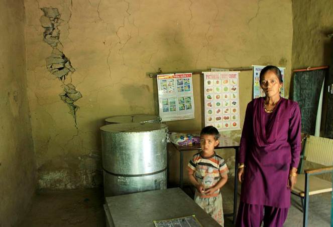
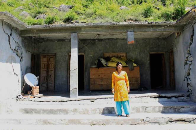
It estimates that most of the crops are likely to witness a decline after 2020 which is when the temperature threshold of many crops might get breached. Studies suggest a significant decrease in cereal production by the end of this century. The situation will be most critical in areas which are rain-fed and have complex cropping systems. These constitute about 60% of the net cultivated area. But acknowledging it is one thing and doing something about it is quite another. The climate smart techniques are showing results at some places, but are still not being actively adopted by the government. In a recent press release, the ministry of agriculture announced that the sowing of kharif crop has crossed the 986.59 lakh ha mark, but this is still much less than the 1020.78 lakh ha which was sown last year around the same time[xiv]. Despite this, the government has expressed hope for a positive response in crop output next season, envisaging a growth of four percent[xv], while not acknowledging the impact of huge rainfall deficit in June July this year.

Drought in Marathwada, Maharashtra Photo: India Today

The mission acknowledges that since most of the agricultural production takes place in rural areas and engages people from the marginalized sections of the society, their coping capacity during climatic extremities are limited. But what has the government done since the inception of this plan? It has been almost 6 years since NAPCC was launched and the farmers still suffer the same fate without any compensation from the government. Even today, they are at the mercy of the weather. It will not work anymore to ignore the fact that this is now being aggravated by climate change. There is a need for more climate smart agricultural techniques in the country. The least the government can do is to acknowledge that the unpredictable weather patterns, especially the irregular monsoon is in fact a result of climate change. It will do good to also recognize that out of the 300 million undernourished in South Asia, about 250 million are in India[xvi] and any threat to agriculture is an added threat to their existence.

Padmakshi Badoni, SANDRP, padmakshi.b@gmail.com

END NOTES:

[i] http://www.moef.nic.in/downloads/public-information/fin-rpt-incca.pdf

[ii] http://www.ipcc.ch/ipccreports/far/wg_II/ipcc_far_wg_II_full_report.pdf

[iii] http://www.agricoop.nic.in/Climatechange/ccr/National%20Mission%20For%20Sustainable%20Agriculture-DRAFT-Sept-2010.pdf

[iv] http://www.thehindubusinessline.com/opinion/can-our-agriculture-tackle-climate-change/article5883523.ece

[v] http://www.thehindubusinessline.com/opinion/can-our-agriculture-tackle-climate-change/article5883523.ece

[vi] http://zeenews.india.com/news/eco-news/organic-farming-helps-farmers-increase-their-resilience-to-climate-change_865934.html.

[vii] http://www.thehindu.com/news/national/other-states/karnal-farmers-get-climatesmart/article6377570.ece

[viii] For more information on groundwater situation in the country, visit SANDRP’s blog https://sandrp.wordpress.com/2014/08/11/groundwater-falling-levels-and-contamination-threaten-indias-water-lifeline-urgent-need-for-community-driven-bottoms-up-management/

[ix] http://www.agricoop.nic.in/Climatechange/ccr/National%20Mission%20For%20Sustainable%20Agriculture-DRAFT-Sept-2010.pdf

[x] http://ccafs.cgiar.org/blog/changing-farming-practices-south-asia-food-secure-future#.VA1RssKSxoE

[xi] http://www.voanews.com/content/india-climate-smart-villages-agriculture-technology-farming/2439713.html

[xii] http://www.oecd.org/tad/sustainable-agriculture/agricultureandclimatechangeimpactsmitigationandadaptation.htm

[xiii] To read more about SRI, see https://sandrp.wordpress.com/2014/07/19/huge-potential-of-system-of-rice-intensification-sri-needs-more-attention/

[xiv] http://pib.nic.in/newsite/AdvSearch.aspx (5th September 2014)

[xv] http://pib.nic.in/newsite/erelease.aspx (8th September 2014)

[xvi] http://www.thehindubusinessline.com/opinion/can-our-agriculture-tackle-climate-change/article5883523.ece

Forest Advisory Committee

Yettinahole Diversion DPR: New Avataar, old problems

River Netravathi in the upper reaches Photo: Parineeta Dandekar, SANDRP

Like a many-headed serpent, Yettinahole (Netravathi) Diversion Project refuses to die. Every time one of its head is cut, it grows a new head.

Following criticism of the Project Report [i](based on which Karnataka Government had already made budget provisions in 2013), a new DPR of the project has been prepared in December 2013 by EIT RIP JV [ii] which tries to amend blatantly illegal stands taken earlier. However, after scratching the surface, it is clear that the DPR is just as illegal and dangerous as the interim Project Report was.

Yettinahole, or rightly the Netravathi Diversion Project has always been a political project, visualized to earn political mileage and brownie points. Veerappa Moily originally from Dakshin Kannada, moved to Chikkaballpur constituency in 2009, from when he started pushing the project strongly. As the Environment Minister, Moily also laid the foundation stone of the project in Chikkaballapur, just before the Loksabaha Elections in March 2014 [iii]. Strategically, the stone was laid in Chikkaballapur and not in Hassan, from where the water actually be diverted. No political party has opposed the project consistently.

Even before a complete DPR, Karnataka 12-14 Budget of the Congress Government allocated nearly 2800 crores for this scheme. The current govt lost no time and directly awarded contracts worth nearly 1000 Crores to Hindustan Construction Company, in a joint venture with GVPRL, without any clearances or any public consultations[iv].

Before the laying of the foundation stone of the project, SANDRP had presented a detailed analyses if the Project Report proving how the project is violating Environmental Protection Act by evading Environmental Clearance.[v] A number of eminent personalities from Karnataka had jointly written to the MoEF to appraise the Project for EC. In response to this, the MoEF had written to the Karnataka Govt and Karnataka Neeravari Nigam Limited (KNNL), seeking clarifications on the nature of the project. Although this move was triggered due to the submission made by SANDRP and other groups, we never saw KNNL’s response despite specifically asking for it. We only saw MoEF’s lame justification, bailing out KNNL and Karnataka Government and turning a blind eye to the huge impacts of the project.

Students protesting against Yettinahole Project Photo: DaijiWolrd

When Karnataka CM Siddramaiah was about to lay the foundation stone along with Mr. Moily, SANDRP wrote an open letter to him[vi], as the Environment Minister, asking a direct question as to how can he himself formally initiate a scheme which is blatantly violating laws governed by his own Ministry. Following this, the ceremony was cancelled[vii], only to be held surreptitiously later.

During all this, there was huge and unprecedented opposition to the project from Dakshin Kannada and Mangalore. Farmers, students, workers, women groups all came together, united in their opposition against a project that would divert their Netravathi.  People stopped trains, organized hundreds of dharnas, boycotted voting, organised signature drives, etc. Leaders in all hues came together in a rare show of discontent. On the day of foundation stone laying, people in Dakshin Kannada voluntarily observed a strict Bandh. Funnily enough, even the beneficiary district of Chikkaballpur opposed the project as the 2.82 TMC water that it would be getting after so much of fanfare was too meager, in the face of the grand promises of lush fields and no worries.

More Protests against the Project Photo: The Hindu
Protest in Hassan against Yettinahole Photo: The Hindu
Protesters stopping  a train Photo: News Karnataka
Protesters stopping a train Photo: News Karnataka

Despite these unprecedented protests and in the face of 2014 Loksabha Elections, foundation stone was laid on a dais in Chikkaballapur. The dais was burgeoning under the weight of several political strongmen.

This event stands out as an example of undemocratic behavior for an elected government.

Foundation Stone laying Ceremony Photo: The Hindu

The Government of Karnataka did not hold a single public meeting in Dakshin Kannada, trying to understand and address people’s apprehensions. When eminent personalities from Dakshin Kannada planned to hold a National Consultation on Yettinahole Diversion in NIT Suratkhal in August 2013, the meeting was cancelled at the last minute due to political pressure on the organizers.

As things stand now, the project does not have Environmental Clearance, Forest Clearance, Wildlife Clearance, has not started rehabilitation and resettlement of over 10 villages that it will submerge, but its work can start at any moment.

SANDRP accessed the Detailed Project Report (DPR) of the Project from local activists, who obtained it under RTI. Analysis of the DPR reveals a number of issues. KNNL has drastically changed the initial Project Report, avoiding mention of contentious issues we had raised like hydropower generation, irrigation component, etc., thus strongly vindicating the objections raised. However, going further, it is clear that these changes are cosmetic. Deeper problems and severe unstudied impacts of the scheme remain.

SANDRP analyzed 4 volumes of the DPR and Annexures of the Project. What follows is some myth busting about the Yettinahole Detailed Project Report.

1. What is the Current Project? Is it different from the last Project Report?

While the Project Report of June 2012 was titled: ‘Scheme for diversion of flood water from Sakleshpura (West) to Kolar/ Chikkaballapura Districts (East)’, the DPR dated December 2013 has taken out all the random stuff on Kolar and Chikkaballapura and simple calls it as “Yettinahole Project”.

Current Project as per the DPR, is divided in Two Phases.

Phase I: 8 weirs will be built in the Western Ghats, on the streams Yettinahole, Kerihole, Kadumanehole and Hongadahalla. It also includes several pump houses next to weirs, raising mains that run for several kilometers are nearly 5 kms wide, 3 Delivery Chambers (DC) and a gravity canal taking waters from Weirs 3, 4 and 5  to Doddanagara (DC 3) in the Western Ghats forests.

From the weirs, 85 cumecs (Cubic Meters per second) water will be drawn 24*7 in the six months of June-November.

This will be delivered through 4 Delivery Chambers with the last DC: DC 4 at Haravanahalli.

Phase II: From DC 4, water will be diverted to a canal running 274 kilometers, cutting across the ridge line dividing Cauvery and Krishna Basins and culminating at a Balancing Reservoir at Byragondlu and Thumbadi, in Koratgere Taluk. Thumbadi Reservoir will store about 3 TMC water and will submerge nearly 700 hectares of land and three villages[viii] while Balancing Reservoir at Byragondlu will store 5.7 TMC water and will submerge 7 villages [ix]and an area of about 2000 hectares. The Reservoir at Devaranyadurga, which was proposed in the Project Report has been replaced by these two.

It includes construction of several storage tanks and reservoirs for en route water supply. It will also delivery water to T.G. Halli and Hesarghatta Reservoirs, which supply water to Bangalore. It also plans to supply water to Devanhalli Industrial Area.

The project envisages constructing 7 additional storage reservoirs and 10 major canals. Water will also be used to fill more than 500 Minor Irrigation (MI) Tanks in many districts and taluks.

It is amazing how the project envisages filling MI Tanks to 50% capacity: The DPR says that water will be pumped and released to the highest point and an additional sluice gate will be made to all MI tanks to let water flow into the cascading MI tank. This sounds highly impractical.

The project also includes constructing over 100 bridges in villages and nearly 100 road brides on major roads.

So although details have changed, the basic of the project remain the same. There is no change in Western Ghats, except for the fact that not 24 TMC, but 47 TMC water will be pumped now!
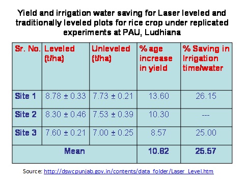
Survey markings in Sakaleshpur. People had no idea why the survey was carried out and no information was given. Photo: Parineeta Dandekar
Survey markings in Sakaleshpur on peoples homes. People had no idea why the survey was carried out and no information was given. Photo: Parineeta Dandekar

2. What is the cost of this current Project? Can the cost be borne easily by KNNL or Karnataka Government?

The cost of the Project as per DPR stands at nearly 13000 Crores as per 12-13 price line. This exceeds the entire 13-14 years’ budget of the Karnataka Water Resources Department, which stands at 8007 Crores and is nearly five times the annual budget of KNNL, the implementing agency.[x] This is a colossal amount of money to spend to convey approximately 7 TMC water to Kolar and Chikkaballapur and other nonspecific projects.

3. Who are the Main Beneficiaries? Will Kolar and Chikkaballpur really get 24 TMC water as promised?

The supposed beneficiaries of the project are several towns, villages, cities and industrial areas[xi] and No, Kolar and Chikkaballapur again lose out and get only about 7 TMC water.

4. Then who will be getting this water?

The DPR puts out a diffuse list of beneficiaries ( see Annex below) including Bangalore urban area through TG Halli and Hesarghatta Reservoir and the Devanhalli Industrial Hub. There are no population projections or future need calculations for this region like all other regions and at no place does the DPR say that water will go to Bangalore. However, TG Halli and Hesaraghtaa reservoirs are both used by the Bangalore Water Supply and Sanitation Board [xii]for Bangalore City and in the last Budget, the government had itself stated that water will be used for Bangalore Urban Area’s needs.

How Bangalore treats its local water bodies Photo: The Alternative

A review of beneficiaries:

  • Bangalore gets 3 TMC water: The DPR says that about 3 TMC water will be released to TG Halli and Hesargahtta Reservoirs and for the Devanhalli Area.
  • Minor Irrigation Tanks and hence irrigation gets maximum water at 9 TMC: Nearly 9 TMC water will be used for filling more than 500 MI tanks upto 50% of their live storage capacity. This water will be supposedly used for “groundwater recharge”. There are several participatory, cheap and sustainable ways for recharging groundwater, which seem to have been rejected in favor of long distance transfer. In any case, this groundwater recharge will be used for agriculture, as most of the agriculture there depends on groundwater and hence, the project qualifies for Environmental Clearance.
  • The project is being pushed for the drought affected taluks in Kolar Chikkaballapur and Tumkur and even a brief glance at the calculation shows that even in 2023-24, the drinking water demand of these places cumulatively will be just 12 TMC! Then why are we diverting 24 TMC water, double of the ten years’ estimate?

5. What is the basis for diverting 24.01 TMC?

The report provides no justification about why 24 TMC is supposed to be diverted. In fact, after population calculations and making provisions for drinking water supply for the beneficiary districts and villages, the DPR simply states : “This has resulted in a balance availability of 8.9 TMC” . This is a strange statement to make. What is meant by “balance availability”? Is there compulsion for diverting 24 TMC by hook or by crook from the Western Ghats?

6. 24 TMC Diversion? No 47 TMC Diversion!

The project envisages diverting 85 cumecs (Cubic Metres per second) water[xiii], purportedly for six months of June-November. The DPR states that pumps will function 24*7 during this period. Even a simple, back-of-the-envelope calculation indicates that 85 cumecs diversion leads to nearly 47 TMC diverted over six months and not 24 TMC, as is claimed.

7. Was there a detailed hydrological study to arrive at 24 TMC diversion?

The proponents have no flow data from individual streams. The 13,000 Crores project is to be based on shoddy hydrology data.

They have used gauge data from Bantwal across Netrvathi, which is approximately 60-70 kilometers downstream and in a completely different eco-region from the hills. This gauge data is simply extrapolated based on catchment area of each stream. This is highly unscientific.

The earlier Project Report used an entirely different method for calculating this yield, based in rainfall in individual catchments. Interesting to see that although to different methods were used by two different reports, divertible yield is exactly the same to the last decimal point of 24.01 TMC!

The fact of the matter is that there have been no scientific studies to find out the level of safe diversion. The DPR makes a fantastic statement in conclusion to the effect that:

“According to the revised computations, the divertible yield has been assessed as 22.14.TMCHowever, Prof.Rama Prasad , who has conducted the Hydrology studies has opined that the yield of 22.14 TMC at 50% dependability is very much on a conservative side and 24.01 TMC of divertible yield is available across the streams. This has been taken note off and for the present proposal, 24.01 TMC of water has been considered as the divertible yield from the selected streams to proceed further regarding finalization of the scheme in total.”

This just shows the random way in which divertible yield has been fixed!

8. How about the downstream Impacts of this diversion, which was the main reason for protests in Dakshin Kannada and Mangalore? Were the impacts studied?

There has been NO assessment of downstream water needs or impacts of this diversion on the downstream people or ecosystems. The DPR just ‘assumes’ that there will not be any impact on downstream users of ecology!

This is evidently misleading. One example of the problem in such assumption is that the flow data of Hongadahalla maintained by KPCL (given in Annex) indicates that flow in streams like Hongadhalla in August near the gauging point, has not exceeded even 20 cumecs. However, the according to the DPR[xiv], arrangement has been made to divert a whopping 30 cumecs from Hongadhalla from Weir 7 during June-November. This means that in the downstream, the rivulet will be rendered dry.

9. Was Impact Assessment for Western Ghats conducted?

The project proponent has not even clarified as to what will be forest land required for diversion. The section on Impact Assessment in the EMP deals largely with the beneficiary region without dealing with impacts on Wesetrn Ghats at all. There has been no study on eflows as per the HLWG (High Level Working Group on Western Ghats/ Kasturirangan Committee Report)report, no study of estuarine fisheries, no study of drinking water needs.

Cornered Wildlife in Sakaleshpur, leading to crisis Photo: News 24 7

10. Will there be profound impacts in the downstream region?

Yes. Yettinahole Project will “divert” water out of the basin and unlike most other irrigation or hydropower projects, the water will be permanently lost from the basin. The ecosystem and livelihoods in the downstream are closely linked to the hydrology of the Netravathi. In fact even in June, which is supposed to be a “peak season” for diversion, Mangalore and other parts of Dakshin Kannada have been facing water shortages[xv]. In addition, there are several estuarine and riverine fishermen dependent on the Netravathi for their livelihoods. There are many industrial areas, SEZs coming up in Mangalore which will be needing more water. While there has been a prospective study of the population and water demand growth of the beneficiary region in the DPR, there has been not even a mention of Mangalore and its increasing needs in the future in the DPR, highlighting the bias of the proponents.

There are several functioning mini hydel projects on the individual streams as well as tributaries which depend on the assured flow from upstream. They have not even been consulted before this decision was taken.

Drying Thumbe Dam which supplies water from Netravthi to Mangalore town Photo: The Hindu

11. Will there be a severe impact on Ecology and Wildlife?

The project falls within 10 kms boundary of the Pushpagiri Sanctuary, one of the specific World Heritage Sites in the Western Ghats[xvi]. The entire region has exceptional biodiversity.  The project also affects the Mysore Elephant Reserve.

The region has exceptional fish biodiversity, with several new species [xvii]being discovered from the region. There have been efforts to declare this area as a specific fish sanctuary.[xviii]Despite this, the Environmental Management Plan of the DPR states that the fish diversity in most streams is “Poor”. This is a very irresponsible and misleading statement.

Man Animal Conflicts in Sakaleshpura are on a rise. Mega infrastructural activities envisaged in Yettinahole Project will worsen the situation further. There has been no mention of this.

Canara Pearlspot, an endangered fish of many such species found in Netravathi Photo: Arkive.org

12. Considering the impacts and the strong opposition from Dakshin Kannada, were any public consultations held?

No. there has not been a single open public consultation held by the proponents or the Karnataka Government in the affected region. This indicates lack of respect for democratic values and transparency. Shockingly to the question: “ Have-public  debates  about  utility  of  projects  been  held  and  the  response  thereof  outlined  in the Report?” has been answered as “Yes” in the DPR.

In fact there has been no such report in the DPR.

The DPR also states: 1.14: “Many public meetings have been held by the Govt. to make the people aware of the importance of the scheme both in the initial reaches and the end reaches of the project.”

More protest Marches in Mangalore Photo: Daiji World

This is entirely false as no such meeting has been held on Dakshin Kannada where informed discussions can be held.

To conclude:

Yettinahole diversion or Netravathi Diversion Project is an extremely costly ( 13000 Crores +) project of the Karnataka Government. It has been based on weak hydrology, nonexistent impact assessment of the downstream region, no Forest Clearance, no Wildlife Clearance and no public consultations. It is violating Environment (Protection) Act 1986, Forest (Conservation) Act 1980 and Wildlife (Protection)Act 1972. As has been proved by SANDRP, Karnataka has violated Environmental Laws in the recent past[xix].

The project provides no justification for diverting 24 TMC, plans to divert more volume than that, most of which is meant for urban areas and irrigation, without options assessment of cheaper and more sustainable options.

The project has illegally awarded tenders worth Rs 1000 crores without clearances.

In the interest of ecology, downstream population of Dakshin Kannada, public resources, wildlife, World Heritage sites and even future generations, at least until we have basis for informed decisions including a credible EIA, SIA, Options assessment and participatory decision making process, Projects like Yettinahole need to be shelved. Already multiple PILs against the project have been filed in the High Court and routed to the NGT. We hope NGT will also take a strong view on the serious issues involved here.

Severe downstream impacts and drying up of streams due to Yettinahole project reminds one of the tale of Sage Durvasa, meditating on the banks of the Tunga, not very far from Dakshin Kannada. Durvasa loved the river and was known for his short temper. As Bheema dammed the flowing River, Durvasa was agitated to see dried up river bed in the downstream. Yudhishthira saw this and advised Bheema to break the dam himself, to avoid the wrath of Sage Durvasa. Bheema relented and broke the dam, to allow the free flow of the river once more. (One of India’s first decommissioned dams?)

Let us hope that Netravathi flows unhindered and continues to support human and non-humans alike like she has been doing for centuries. Even for the areas claimed to be benefiting from the project, there are cheaper, sustainable and credible options available than this mega project.

– Parineeta Dandekar (parineeta.dandekar@gmail.com)

(We are specifically thankful to Kishore Kumar Hongadhalla, from Hassan for all his help.)

Netravathi in the Upper reaches Photo: Parineeta Dandekar

END NOTES:

[i] https://sandrp.wordpress.com/2013/09/18/yettinahole-diversion-an-imprudent-rs-100-billion-proposition/

[ii] This name/acronym of this consultant does not bring any results on the internet

[iii] http://www.coastaldigest.com/index.php/news/62505-amidst-protests-siddaramaiah-moily-lay-foundation-stone-for-yethinahole-project

[iv] http://www.hccindia.com/news.php?news_id=35

[v] https://sandrp.wordpress.com/2013/09/18/yettinahole-diversion-an-imprudent-rs-100-billion-proposition/

https://sandrp.wordpress.com/2013/09/10/complete-appraisal-needed-for-yettinahole-diversion-project-letter-to-moef/

[vi] https://sandrp.wordpress.com/2014/01/30/open-letter-to-dr-veerappa-moily-as-he-supports-foundation-stone-laying-of-yettinahole-diversion-project/

[vii] http://www.daijiworld.com/news/news_disp.asp?n_id=216104

[viii] Mallekavu, Dogganahalli & Gaurikallu

[ix] Veerasagar, Lakkamuttanahalli, Belladahalli, Gajamenahalli, Sugadahalli, Lakkenhalli, Garadagallu

[x] http://waterresources.kar.nic.in/documents/Budget%20allocation%202013-14x.pdf

[xi]Main beneficiaries of the Project:

  • Kolar district comprising of all Taluks
  • Chickaballapura distrct comprisnig of all Taluks
  • Tumkur district  comprising  of  areas  in  Palar  and  Pennar  basins  including  Chiknayakanahalli and Sira Taluks along with selected villages in Tiptur and Gubbi Taluks.
  • Hassan district comprising of villages in Arasikere taluk
  • Karnataka Neeravari Nigam Limited Yettinahole Project
  • Chikamagalore district comprising of selected villages in Kadur taluk
  • Ramanagara district
  • Bangalore Rural district comprising of Nelamangala, Doddaballapura, Devanahalli and Hoskote Taluks
  • Augmenting the water to T.G.Halli reservoir
  • Augmenting water to Hesaraghatta reservoir
  • Drinking water supply to Devanahalli Industrial area and surrounding areas
  • Providing water for tank filling purposes to fill selected M I Tanks to their 50 % capacity (average) in the M I tanks falling under Palar and Pennar basins and Arasikere taluk

[xii] http://bwssb.org/water_source_schemes.html

[xiii] Page 218, Volume I, Detailed Project Report

[xiv] Detailed Project Report, Volume I, Page 197

[xv] http://mangaloretoday.com/main/Precarious-water-situation-in-DK-MP-instructs-supply-in-tankers.html

http://www.samachar.com/MRPL-shuts-down-all-units-due-to-water-scarcity-meujNDiibca.html

http://www.thehindu.com/2005/04/08/stories/2005040815460300.htm

[xvi] http://whc.unesco.org/en/list/1342/multiple=1&unique_number=1921

[xvii] http://wgbis.ces.iisc.ernet.in/biodiversity/pubs/ces_tr/TR122/introduction.htm

[xviii] http://www.iucnredlist.org/details/summary/169618/0

[xix] http://www.thestatesman.net/news/70189-Maharashtra–Karnataka-govts-accept-violating-green-act.html

Ganga · Mithi · Mumbai · Narmada · Sabarmati

Riverfront Development in India: Cosmetic make up on deep wounds


There is a rush of riverfront development schemes in India. We have heard of Sabarmati Riverfront development being drummed many times, followed by the proposed rejuvenation of Ganga, supposedly on the lines of Sabarmati.

What does Riverfront Development entail? Is it River Restoration? Are the millions of rupees spent on Riverfront Development schemes justified? Will it help in saving our damaged rivers?

A cursory glance at the existing river restoration/ improvement/beautification schemes indicates that the discourse revolves mainly around recreational and commercial activities. It is more about real estate than river. Activities that are promoted on the riverfronts typically include promenades, boat trips, shopping, petty shops, restaurants, theme parks, walk ways and even parking lots in the encroached river bed.

Riverfont 1

Pioneering project in Riverfront Development was claimed to be the Sabarmati Riverfront Development project of Ahmedabad city which was supposed to be designed based on riverfronts of Thames in London and Seine in Paris. The project which began as an urban development project is lately being pushed as a role model for many urban rivers in India. This kind of riverfront development essentially changes the ecological and social scape of the river transforming it into an urban commercial space rather than a natural, social, cultural, ecological landscape. Is it wise to go for this kind of development on riverfronts? What does it do to the river ecosystem, its hydrological cycle? What does it do to the downstream of river? These questions need to be explored before accepting the current model of riverfront development as replicable or laudable.

Reclaim and beautify!

Most of the currently ongoing projects lay a heavy emphasis on beautification of rivers. Riverfronts are treated as extension of urban spaces and are often conceived as ‘vibrant’, ‘throbbing’ or ‘breathing’ spaces by the designers. Concrete Wall Embankments, reclamation of the riverine floodplains and commercialization of the reclaimed land are the innate components of these projects. Quick glimpse at various Riverfront Development Projects confirms this.

Sabarmati Riverfront Development Project

Sabarmati Riverfront Development Project of Ahmedabad city which is presented as a pioneer in urban transformation[1] has been proposed by Environmental Planning Collaborative (EPC), an Ahmedabad-based urban planning consultancy firm, in 1997 and envisaged to develop a stretch of 10.4 km of the banks on both sides of the river by creating concrete embankment walls on both banks with walkways. A Special Purpose Vehicle called the Sabarmati Riverfront Development Corporation Ltd. (SRFDCL) was formed in the same year for implementation of the project. The financial cost of the initiative was estimated to be in the range of around INR 11520 million[2]. Around two thirds of this amount has already been spent.

Construction of the project started in 2005. The project sought to develop the riverfront on either side of the Sabarmati for 10.4 kms by constructing embankments and roads, laying water supply lines and trunk sewers, building pumping stations, and developing gardens and promenades[3]. Mainstay of the project was the sale of riverfront property. Land along the 10.4 km stretch on both the banks was reclaimed by constructing retaining walls of height ranging from 4 to 6m[4]. 21% of the 185 ha of reclaimed land which was developed by concretizing the river bank[5] was sold to private developers for commercial purpose.[6] Activities hosted on this reclaimed land were recreational and commercial activities like restaurants, shops, waterfront settlements, gardens, walkways, amusement parks, golf course, water sports and some for public purpose like roads etc. The sale of reclaimed land created by the project is expected to cover the full cost of the project. Ahmedabad Municipal Corporation (AMC) claims that the after the project “river has added vibrancy to the urban landscape of Ahmadabad with its open spaces, walkways, well-designed gardens along with activities which contribute to economic growth.”[7]

Even though the project has been modeled as “best practice” by several financing institutions[8], it has also drawn severe criticism for poor rehabilitation of the displaced (rehabilitation happened only after High Court orders following a public interest petition) disrupting the nexus of shelter, livelihood and services of urban poor, lack of transparency in the execution and for tampering with the carrying capacity of the river. No Environment Impact Assessment of the project has been conducted nor any credible public consultation process held.

Sabarmati channel has been uniformly narrowed to 275 metres during the riverfront development project, when naturally average width of the channel was 382 metres and the narrowest cross-section was 330 metres[9]. In this attempt of “pinching the river”[10], the original character of the river is changed completely from seasonally flowing river to an impounded tank illegally taking water from Narmada Canal[11]. River banks have been treated as land that is wasted on which value could be created by reclaiming and not as seasonal ecological systems with floodplains as an integral part of its flows (Baviskar 2011). Seasonality of the river is destroyed and fauna and avi fauna on edges have been damaged. No thought has been given for protection, sustenance or enhancement of the riverine ecosystem. The water that is now impounded in this stretch is not even Sabarmati river water, but Narmada River Water, on which the city of Ahmedabad or Sabarmati has no right, it’s the water meant for drought prone areas of Kutch, Saurashtra and North Gujarat.

The River Sabarmati itself was a perennial river till the Dharoi Dam in the upstream stopped all water at least in non Monsoon months, making the river dry. The stretch flowing through Ahmedabad was carrying the mostly untreated sewage of Ahmedabad city and toxic effluents from the City and district industries.

In the name of Sabarmati River front development, no cleaning of the river has happened, the project has only transferred the water from both banks to the river downstream from Vasna barrage, which is situated downstream from the city. The Vasna barrage stops and stores the water released from Narmada Main Canal that crosses the river about 10.4 km upstream from the barrage. Thus this 10.4 km stretch of the river now holds the Narmada water and huge losses from the stretch are losses for the drought prone areas.

Riverfont 3

The reclaimed land and the narrowing of the channel have been tampering with the carrying capacity of the river. The project was stalled during August 2006 to March 2007 due to heavy floods[12]. Prior to the floods, the river’s maximum carrying capacity was calculated at 4.75 lakh cusecs on basis of the rainfall over last 100 years[13]. The floods however proved the calculation wrong. National Institute of Hydrology (NIH) and Indian Institute of Technology Roorkee (IITR) were asked to re-evaluate the project design, in the light of the river’s carrying capacity, and see whether the execution of the project would damage the river’s ecology[14]. Report by the NIH, Roorkee in 2007 said “the calculations did not take into account any simultaneous rainfall over the entire catchment area”[15]. This means that the carrying capacity was based only on the water flow from the Dharoi Dam (which is upstream of Ahmedabad City) and not from other places in the river’s catchment until Ahmedabad that also contribute to the volume of water in the Sabarmati. This report states that the riverfront development is “not a flood control scheme”, and that the municipal corporation will have to work out other measures to meet the impending challenge of floods.

The project is also heavily criticized for the poor rehabilitation of the evicted slum population. Large scale eviction was being carried out in an utmost non-transparent manner. A public interest litigation (PIL) was filed in the Gujarat High Court by Sabarmati Nagarik Adhikar Manch (SNAM) or Sabarmati Citizens Rights Forum, supported by several other non-governmental organisations (NGOs) to ensure that the rehabilitation plan was shared with them and to bring transparency to the process. According to the high court orders, at least 11,000 affected families were to be rehabilitated and resettled by AMC. Demolition drive went on without ensuring rehabilitation. Over 3,000 people have moved to a marshland in the outskirts of city with negligible compensation, little & infrequent access to drinking water and minimal sanitation facilities[16].

“The ecology of the river is being transformed to satisfy the commercial greed of a select few,” said Darshni Mahadevia of CEPT, expressing concerns about riverfront ‘beautification’[17].

The project that has converted the Sabarmati River into an urban space by reclaiming nearly 200 ha of land and has sustained by borrowing water from Narmada Canal today is claimed to be a role model for many riverfront development projects in the country. Should this model really be replicated? Many of the rivers like Yamuna, Ganga, Mithi, Brahmaputra etc. that are being ‘developed’, have had a flood history which is being ignored in the process. With having no regards to the hazards of floods, several riverfront projects are being pushed across the country by different government agencies.

The fact that even after a Riverfront Development Project, Water Quality of Sabarmati downstream the Vasna Barrage is extremely poor and the cosmetic treatment of flowing water stretch at Ahmedabad is actually water from Narmada, which was promised for the drought hit regions of Kutch and Saurashtra, highlights the contradictory and superficial nature of such Riverfront development schemes.

Yamuna Riverfront Development inspired from Sabarmati Model

Recently the newly elected BJP led Central Government sent a team of bureaucrats to Gujarat to study the feasibility of replicating the successful model of the Sabarmati Riverfront Development Project for cleaning the Yamuna[18]. Despite the concerns about flooding of Yamuna, the team is exploring ways of replicating Sabarmati Model. In 2009, the Sheila Dikshit administration was also planning channelizing the Yamuna and putting up a waterfront like Paris and London with recreational facilities, parking lots and promenades etc[19].

Reclamation of the floodplains to create a concrete riverfront, like in Ahmedabad, could be ecologically unsound and even dangerous for Delhi that is already extremely vulnerable to floods[20]. The sediment load in Yamuna is very high. The non-channelized river rises by over four metres during peak monsoon flooding[21]. Risk of flooding will increase multifold for a channelized river. The Inter-governmental Panel on Climate Change last year put Delhi among three world cities at high risk of floods. Tokyo and Shanghai are the two other cities.

An expert committee appointed by the Ministry of Environment & Forests (MoEF) to examine the Yamuna River Front Development Scheme of the Delhi Development Authority (DDA) recommended that DDA should scrap its ambitious plan for developing recreational facilities, parking lots and promenades. [22] The committee was formed following order from National Green Tribunal which was drawn in response to a petition filed by activists and Yamuna Jiye Abhiyaan convener Manoj Misra.[23] The committee pointed out that recreational spots located in active floodplain areas would kill the river and cause floods in the city. About the Sabarmati Model Being followed, CR Babu, Chair of the committee said: “There is no Sabarmati river. It’s stagnant water with concrete walls on two sides. The floodplains have been concretized to make pathways and real estate projects. It cannot be replicated for our Yamuna”.

The committee report says the Yamuna Riverfront Development scheme will reduce the river’s flood-carrying capacity and increase flooding and pollution and it recommended a ban on developmental activity in the river’s Zone ‘O’ and its active floodplains on the Uttar Pradesh side. It also said that a 52-km stretch of the Yamuna in Delhi and Uttar Pradesh be declared a ‘conservation zone’ as restoring the river’s ecological functions is heavily dependent on the environmental flow through this stretch, particularly in the lean season.

Manoj Misra of Yamuna Jiye Abhiyan, dismisses the Sabarmati solution saying “We cannot call it a Sabarmati model… It’s like a mirage created for a brief stretch. Let’s be clear about it. If the Delhi bureaucrats have gone there to learn from the Gujarat model, it’s up to them to figure out if it can be implemented. I cannot call the Sabarmati project a river rejuvenation project – it’s more of a real estate project… That is not advisable for Delhi.” [24]

Another important aspect which does not feature at all during the talks of Yamuna Riverfront Development is the massive displacement that will take place. Over a dozen unauthorised colonies are located on the riverbed. These colonies which have been in existence for over 40 years will have to be uprooted which again may lead to Sabarmati like situation where urban poor are brushed aside to serve interests of real estate developers and urban middle class.[25]

Riverfont 4

City of Noida on the other hand has decided to go ahead with the Rs 200 crore Yamuna Riverfront Development Project that Greater Noida Authority (GNA) has been planning[26]. The project involves developing recreational facilities like parks, Yoga centres, picnic spots and sports centres, polo grounds, golf course etc. on Hindon and Yamuna floodplains. Officials from GNA claim that these facilities will be for recreational purpose and will be developed without disrupting the natural flow of Yamuna. Here again the project has nothing to do with sustaining, cleaning, rejuvenation of the river.

Ganga cannot be ‘developed’ as Sabarmati

Prime Minister Narendra Modi made a promise during his election campaign in Varanasi to clean up Ganga.[27] The National Ganga River Basin Authority (NGRBA) was shifted from the environment ministry to the water resources ministry.[28] New name for the Ministry of Water Resources is Ministry of Water Resources, River Development and Ganga Rejuvenation. Uma Bharati was assigned with this specially created ministry for cleaning Ganga by the PM. “If Sabarmati can be cleaned, all other rivers can also be made better.” print media has quoted Uma Bharati.[29] Ms Uma Bharati seems to have no idea that Sabarmati has NOT been cleaned, the Sabarmati project just transferred the polluted water downstream of the 10.4 km stretch. Can Sabarmati Model be replicated at Ganga? Even if it is replicated, will it help the cause or river or river rejuvenation? The answer is clearly a BIG NO. A number of apprehensions have been raised in this regard. “The so-called Sabarmati model won’t work for the Ganga. The Sabarmati has neither been cleaned nor rejuvenated,” Openindia News quotes Himanshu Thakkar, environmentalist and coordinator of SANDRP[30]. He further points out that
Sabarmati Model survives on water from Narmada canal in the stretch of 10.4 km which flows through the Ahmedabad city. This is not possible in case of Ganga.

Priority for the river rejuvenation is restoring its water quality, freshwater flow and not riverbank beautification. More than Rs. 5,000 crore (some estimates this figure to be over Rs 20 000 crores) has been spent on cleaning the Ganga in the past 28 years. The Ganga Action Plan was launched in 1986 and was in 1994 extended to the Yamuna, Gomti and other tributaries of the Ganga. The second phase of the Ganga Action Plan was launched in 2000 and NGRBA was created in 2009.[31] The plan however has not achieved what it set out to achieve. Water quality for Ganga River has been declining and is unfit even for irrigation or bathing. Potable use is out of question. The count of harmful organisms, including hazardous faecal bacteria, at many locations is more than 100 times the limit set by the government. The water’s biochemical oxygen content, which is vital for the survival of aquatic wildlife, has dipped drastically.[32] Any “cosmetic treatments”[33] will not work for Ganga, like they have not worked for Sabarmati.

Several Riverfront Development Projects springing up across nation

While there are experts opposing replication of Sabarmati Riverfront Project on Ganga and Yamuna River, there are several other riverfront projects which are inspired by the Sabarmati Project and which are being pushed without any kind of studies or impact assessment. Their possible impacts on the riverine ecology, flood patterns, downstream areas etc. are going unchecked.

Brahmaputra Riverfront Development Project: Another “multi-dimensional environment improvement and urban rejuvenation project” that is set to come up with plans for reclaimed river banks is on Brahmaputra River in Guwahati[34]. While on one hand the city is struggling to cope up with the flood prone nature of the Brahmaputra River, State Government of Assam plans to take up an ambitious project to develop the city riverfront named ‘Brahmaputra Riverfront Development Project’ under the Assam Infrastructure Financing Authority. The riverfront project will be implemented by the Guwahati Metropolitan Development Authority (GMDA) in phases[35]. Foundation of the beautification project was laid by the Chief Minister Tarun Gogoi in February 2013. The project plans to achieve maximum possible reclamation[36].While the plan talks of revitalization of the river ecology and Strengthening of riverbanks through soil bio engineering it has several urban features on its agenda like promenade, Ghats, Plazas and Parks; buildings, conference facilities, Parking lots, ferry terminals, Bus and para transport stops, Urban utilities and drainage, Improved infrastructure for floating restaurants, Public amenities; Dhobi Ghats, etc.[37]

Will such a huge real estate development leave any room for river or its revitalization?

Tendency to flood is an important feature of River Brahmaputra. The river also has one of the highest sediment loads in the world. Every year during the successive floods, most of the areas in the valley of Assam remain submerged for a considerable numbers of days causing wide spread damages. In a phenomenon as recent as June 27, 2014 Guwahati experienced heavy downpour for 15 hours, setting off flash floods[38]. Half of the city was submerged under flood water. The authorities blamed illegal encroachments on watersheds across the state capital for the flash floods, which had choked the natural outlets for the gushing water. National Institute of Hydrology (NIH), Roorkee; upon being requested by the GMDA; is carrying out a study which includes river shifting analysis for studying stability of the river banks, flow variations to determine the perennial water depth, estimate of floods of various return periods for design of river embankments, estimate of water surface profiles employing hydro-dynamic river flow model and design parameters for river embankments[39]. The Bramhaputra Riverfront Development Project however has been inaugurated even before the requisite studies have been completed.

Riverfont 5

Gomti Riverfront Development Project in Lucknow: The project by the Lucknow Development Authority is based on the Sabarmati Riverfront Model. It plans to “beautify” Gomti River between Gomti Barrage and Bridge on Bye-pass road connecting Lucknow-Hardoi road and Lucknow-Sitapur road, a length of about 15 Km. According to the Technical Bid Document released by the Lucknow Development Authority, the Riverfront Project has no component of water treatment or river restoration, but is a landscape-based development project, which will also look at “reclaiming” the river banks for activities like shops, entertainment area, promenades, etc. The inspiration for the project swings from Thames Rivefront in London, to Sabarmati in Gujarat, depending on the political party in power.[40]

In all this discussion, there is no mention of maintaining adequate flow in Gomti, treating sewage, conserving its floodplains, or any other ecological angles.

River Improvement and Restoration are also about real estate!

For many government agencies, ironically, not just river beautification, but the idea of river improvement and restoration is also about channelizing rivers and providing recreational facilities.

Pune Rivefront Project: Pune Municipal Corporation, the Pune city also known for chronically polluting Mula and Mutha rivers that flow through the heart of the city, has sanctioned a River Improvement Project, under the aegis of JNNURM (Jawaharlal Nehru National Urban Renewal Mission). The Project envisages channelizing the river, introducing barrages to maintain water levels, development of riparian zone as entertainment and shopping groups, even Parking lots, introducing navigation in the river etc. There are several issues with this “improvement” project. Firstly, it is not planned according to the once in a hundred years flood in Pune, it plans to constrict the river further, thus encroaching the riverbed. Creation of stagnant pools through barrages will result in backwater effect on the many nallahs that join the river. These Nallahs routinely flood in rainy season and additional backwater in these nallahs will worsen the situation further. The project does not say a word about treating water quality, but envisages to build drainage lines inside the riverbed and carry the sewage out of Pune city limits. This hardly qualifies as river rejuvenation or restoration. A case has been filed against this project in National Green Tribunal.

Goda Park (Godavari Riverfront Project) in Nashik, Maharashtra: Godavari emerging from the Brahmagiri Hills in Nashik is famed not only for being one of the longest rivers in India, but also because Kumbh Mela is held on its banks every 12 years in Nashik. Nashik and Trimbakeshwar have had no dearth of funding for cleaning Godavari. They have received funds from the National River Conservation Directorate as well as JNNURM. Despite this, Godavari is extremely filthy in Nashik. Ignoring the pressing issues of water quality, Nashik Municipal Corporation and a specific political party have been hankering after beatification of Godavari’s banks. In fact, the project has been handed over to Reliance Foundation by the Nashik Municipal Corporation[41] without any public consultations or discussions. As per reports, the components of this 13.5 kms long project will be laser shows, musical fountains, rope-way, multi-purpose meeting hall, garden, water sports, canteen, etc.[42]

In the meantime, there are several court orders against Nashik Municipal Corporation pending about severe water pollution in the River including Ram Kund where holy dip on Kumbh Mela is supposed to be taken.

Mithi Riverfront Development: Stretch of 18 km of Mithi River flows through city of Mumbai. Course of Mithi has been modified throughout the city to host range of activities.[43] On 26 July 2005, the river flooded some of the most densely populated areas claiming nearly 1000 lives[44].

After these catastrophic floods, the Municipal Corporation of Greater Mumbai (MCGM) and Mumbai Metropolitan Region Development Authority (MMRDA) made a plan to “restore” the river. BMC and MMRDA’s definition of restoration involves desilting, beautification and building of a retaining wall. Stretch of 4.5 km of the total six km stretch of the river that falls within MMRDA’s jurisdiction is covered with mangroves. MMRDA has planned to beautify the stretch of remaining 1.5 km (10 Ha) which lies right amidst mangroves by developing a promenade. MMRDA plans developing this project on a PPP (Public Private Partnership) basis. Interestingly, the Mukesh Ambani-led Reliance Foundation and Standard Chartered bank have been selected for this project.[45]

As per the Coastal Zone Management Plan (CZMP) of the area, the proposed Mithi Riverfront Development Project falls in Coastal Regulation Zone (CRZ) II and III. The proposal was presented to CRZ authority in its 82nd meeting on 10th June, 2013[46]. CRZ authority has not allowed any reclamation or construction activities in this stretch. For Widening, lengthening & reconstruction of the existing bridge CRZ has referred the proposal to MoEF and asked MMRDA to take prior permission of High Court if the proposal involves destruction of mangroves[47].

Observer Research Foundation, a private, not for profit organization (funded by Reliance India[48]) from Mumbai has come up with a study that recommends a 21-point programme for reclaiming the Mithi, envisaging a single and unbroken river-park corridor spanning across the entire 18-km length of the Mithi with dedicated bicycle tracks, gardens, amphitheatres, sports and recreation.[49]

Riverfont 6

Riverfront Development is NOT River Restoration

As is evident, the riverfront projects discussed above are essentially river bank beautification & Real Estate Development projects and not helping restoration of the river. The projects aim at comodifying rivers to develop urban scapes. Such riverfront development changes the essential character of the river. Stream channelization and alteration of shoreline disconnects the river stretch from adjacent ecosystems and leads to risks of habitat degradation, changes in the flow regime and siltation[50].

While the water of the rivers flows in the natural landscapes, there are many processes that are happening. Sediments are carried, fertile land is created along the banks, river channel is widened, flooding, deposition of sediments during flooding, cleansing of river etc.[51] However the urban rivers are alienated from this natural landscape to such an extent that the rivers are reduced to merely nallas carrying city’s sewage and filth.

Flow, connectivity and flood are fundamental characteristics of rivers and rivers need space for that. If these are violated the river water spreads uncontrolled through the habitation causing catastrophic events like Mithi Flooding.

Creating more room for rivers

While Indian cities are busy replicating Riverfronts of Thames and Seine, there are some remarkable projects going on in some other countries which actually talk of giving more room to the rivers during floods. They are trying to restore the river and not beautify, concretize, channelise or encroach on it.

In the Netherlands, such an integrated approach has been adopted for ‘Room for the River Program’[52]. The program is currently being implemented in the Dutch Rhine River Basin of the country.

The programme started in 2006 is scheduled to be completed by 2015. The objectives of the programme are improving safety against flooding of riverine areas of Rivers Rhine and Meuse by increasing the discharge capacity and improving of spatial quality of the riverine area.

At 39 locations, measures will be taken to give the river space to flood safely through flood bypasses, excavation of flood plains, dike relocation and lowering of groynes etc. Moreover, the measures will be designed in such a way that they improve the quality of the immediate surroundings.

While Room for the River programme focuses on flood management in sustainable way, Yolo Bypass is another unique initiative aimed at keeping intact the benefits to the ecosystem without causing a negative impact on water supply[53]. The Yolo Bypass is a flood bypass in the Sacramento Valley located in Yolo and Solano Counties of California State in USA. The primary function of the bypass is flood damage reduction. It is a designated floodway that encompasses 60,000 acres in eastern Yolo County between the cities of Davis and Sacramento. All the properties within the bypass are subject to a flood easement that allows the state to flood the land for public safety and ecological benefit.

Conclusion

Riverfront of Thames in London and Seine in Paris are often cited as successful models of riverfront development in India. However, the ecological as well as social setting of Indian rivers and the challenges that we face are significantly different from these foreign models. A Blind replication will only be wastage of public funds and degradation of the rivers further. Riverfront development projects across the country seem to be alienated from the river, and talk only about its urban banks, trying to achieve cosmetic changes on deeper wounds by encroachment and real estate development on the belly of the rivers. The need of the hour is river rejuvenation and not river FRONT development. Let us hope that we see central place for rivers in all these projects. Moreover, there is neither any social or environmental impact assessment, nor any regulation or democratic participatory decision making process. Such projects will only be at the cost of the poor, the environment, future generation and to short term benefits of real estate developers and a section of urban middle class.

Amruta Pradhan, SANDRP (With Inputs from Himanshu Thakkar & Parineeta Dandekar)

amrutapradhan@gmail.com

An edited version of this article has been published at: http://indiatogether.org/gujarat-sabarmati-riverfront-development-model-for-ganga-yamuna-environment

END NOTES:

[1] http://www.egovamc.com/SRFDCL/SRFDCL.pdf

[2] http://www.egovamc.com/SRFDCL/SRFDCL.pdf

[3] http://www.frontline.in/static/html/fl2802/stories/20110128280208500.htm

[4] http://www.frontline.in/static/html/fl2802/stories/20110128280208500.htm

[5]http://www.business-standard.com/article/current-affairs/amc-bets-on-huge-returns-from-riverfront-property-sale-114032000894_1.html

[6] http://indiaenvironmentportal.org.in/files/file/Sabarmati%20Riverfront.pdf

[7] http://www.egovamc.com/SRFDCL/SRFDCL.pdf

[8] http://indiaenvironmentportal.org.in/files/file/Sabarmati%20Riverfront.pdf

[9] http://www.downtoearth.org.in/node/5786

[10] http://www.frontline.in/static/html/fl2802/stories/20110128280208500.htm

[11] http://landscapeindiapbb.wordpress.com/2013/10/30/riverfront-development-ahmedabad/

[12] http://www.downtoearth.org.in/node/5786

[13] http://archive.indianexpress.com/news/flood-control-in-sabarmati-a-challenge-for-amc/654704/

[14] http://www.downtoearth.org.in/node/5786

[15] http://archive.indianexpress.com/news/flood-control-in-sabarmati-a-challenge-for-amc/654704/

[16] http://indiaenvironmentportal.org.in/files/file/Sabarmati%20Riverfront.pdf

[17] http://www.downtoearth.org.in/node/5786

[18] http://timesofindia.indiatimes.com/city/delhi/Delhi-babu-all-praise-for-Sabarmati-plan/articleshow/36363896.cms

[19] http://timesofindia.indiatimes.com/city/delhi/Scientist-cautions-against-riverfront-plan/articleshow/38500711.cms

[20]http://timesofindia.indiatimes.com/city/delhi/River-experts-say-Sabarmati-no-model-for-Yamuna/articleshow/36222968.cms

[21] http://timesofindia.indiatimes.com/city/delhi/Scientist-cautions-against-riverfront-plan/articleshow/38500711.cms

[22]http://timesofindia.indiatimes.com/city/delhi/Scientist-opposes-Sabarmati-model-says-reclaiming-floodplain-not-a-good-idea-for-Yamuna/articleshow/36679502.cms

[23] http://www.newindianexpress.com/nation/Yamuna-Action-Plan-Soon-Promises-MoEF/2013/12/19/article1953318.ece,

http://www.indiaenvironmentportal.org.in/files/Yamuna%20River%20Front%20NGT%2018Dec2013.pdf

[24]http://timesofindia.indiatimes.com/city/delhi/River-experts-say-Sabarmati-no-model-for-Yamuna/articleshow/36222968.cms

[25] http://www.asianage.com/delhi/illegal-colonies-near-river-may-be-shifted-946

[26] http://timesofindia.indiatimes.com/city/noida/Twin-cities-to-go-ahead-with-riverfront-project/articleshow/34845006.cms

[27] http://indianexpress.com/article/india/politics/modi-assigns-task-of-cleaning-ganga-to-uma-bharti/,

http://www.firstpost.com/politics/cleaning-up-the-ganga-yamuna-why-modi-must-forget-sabarmati-model-1560939.html

[28]http://www.hindustantimes.com/india-news/clean-up-act-superbody-headed-by-pm-modi-to-drive-mission-ganga/article1-1253158.aspx

[29] http://www.firstpost.com/politics/cleaning-up-the-ganga-yamuna-why-modi-must-forget-sabarmati-model-1560939.html

[30] http://news.oneindia.in/india/sabarmati-model-not-enough-for-ganga-1478033.html

[31] http://news.oneindia.in/india/sabarmati-model-not-enough-for-ganga-1478033.html

[32] http://www.business-standard.com/article/opinion/rejuvenating-a-river-114052801804_1.html

[33] http://www.business-standard.com/article/opinion/rejuvenating-a-river-114052801804_1.html

[34] http://www.assamtribune.com/scripts/detailsnew.asp?id=aug3113/city05

[35] http://guwahatilife.blogspot.in/2011/02/cm-lays-foundation-of-beautification-of.html

[36] http://www.assamtribune.com/scripts/detailsnew.asp?id=aug3113/city05

[37] http://www.psda.in/guwahati.asp

[38] http://www.ndtv.com/article/india/flash-floods-in-guwahati-seven-dead-in-last-15-hours-548974

[39] http://www.assamtribune.com/scripts/detailsnew.asp?id=aug3113/city05

[40]http://timesofindia.indiatimes.com/city/lucknow/Lucknow-Development-Authority-to-get-new-blueprint-of-Gomti-riverfront-development-project/articleshow/19687344.cms

http://m.financialexpress.com/news/akhilesh-wants-london-eye-in-lucknow/975999/

[41] http://www.reliancefoundation.org/urban_renewal.html

[42]http://articles.economictimes.indiatimes.com/2013-09-20/news/42252355_1_goda-park-project-reliance-foundation-mns-chief-raj-thackeray

[43] The Mumbai airport has its domestic and international terminals, and its cargo complex along the Mithi River. There are five major railway stations along the Mithi River including Mahim and Bandra on the western line andSion, Chunnabhatti and Kurla on the central line. The upcoming V ersova-Andheri-Ghatkopar corridor of the Mumbai Metro project that also crosses over the Mithi River has two stations planned along the Mithi River at Marol and Saki Naka. There are also several bus stops located close to the river all along its banks.

(Source: http://orfonline.org/cms/sites/orfonline/modules/report/ReportDetail.html?cmaid=23400&mmacmaid=23401)

[44] http://orfonline.org/cms/sites/orfonline/modules/report/ReportDetail.html?cmaid=23400&mmacmaid=23401

[45] http://indianexpress.com/article/cities/mumbai/beautification-plans-of-mithi-river-promenade-stuck-over-crz-norms/

[46] https://mczma.maharashtra.gov.in/pdf/MCZMA_MoM82.pdf

[47] The proposal was cleared subject to compliance of following conditions

(i) The proposed construction should be carried out strictly as per the provisions of CRZ Notification, 2011 (as amended from time to time) and guidelines/ clarifications given by MoEF time to time.

(ii) Disposal of debris during construction phase should be as per MSW (M&H) rules. 2000.

(iii) Tidal flow of river should not be obstructed.

(iv) The project proponent should obtain prior High Court permission, if the proposal involves destruction of mangroves or construction falls with 50 nil buffer zone.

(v) All other required permissions from different statutory authorities should be obtained prior to commencement of work

[48] http://www.rediff.com/news/report/najeeb-jung-the-man-who-may-run-delhi/20131213.htm

[49]http://www.indiawaterportal.org/sites/indiawaterportal.org/files/why_mumbai_must_reclaim_its_mithi_gautam_kirtane_orf_2011.pdf

[50] http://water.epa.gov/type/wetlands/restore/principles.cfm

[51] Nature Conservation by Ketki Ghate, Manasi Karandikar

[52] http://www.downtoearth.org.in/node/5786

[53] http://www.americanrivers.org/initiative/floods/projects/yolo-bypass-and-the-fremont-weir/