Above: Cover photo and map from NIDM report of Bihar floods 2007
Guest blog by: Dr. Dinesh Kumar Mishra
West Champaran district of Bihar is located in the Northwestern corner of the state and is surrounded by the Gandak and the Burhi Gandak along with their tributaries. Two of its blocks, Madhubani and Thakaraha, are located on the western bank of the Gandak and are adjacent to the Deoria district of Uttar Pradesh. There used to be a rail line connection between Chhitauni Ghat of Uttar Pradesh and Bagaha in Bihar. A bridge connecting these two towns was washed away during the floods in 1924 and the British Government did not restore this bridge as the train service was coming handy for the freedom fighters to travel to UP and vice versa. This bridge and the rail service were restored a few years ago. The administration of these two blocks (these are split into four now) is run from Padarauna in UP during the flood season as the blocks get thoroughly disconnected from Bihar. To prevent the westward movement of the Gandak and embankment named Pipra-Piparasi Ghat embankment (PP Embankment) was constructed in 1960s as the river has a tendency to shift towards the west and there is a constant pressure of the river on this embankment during the rainy season. At times, the safety of this embankment is threatened and there is long history of its breaches and the engineers of the Irrigation Department face a tough time maintaining the embankment. When the rail bridge was not there on the Gandak one had to go to Madhubani and Thakaraha by crossing the Ganga via Chhapra, Siwan and Gopalganj. Continue reading “Bihar Floods in 1987 – III – West Champaran”→
Above: Cover photo and map from NIDM report of Bihar floods 2007
Guest blog by Dr. Dinesh Kumar Mishra
Floods in East Champaran started following the heavy rainfall in the last week of July 1987. There was a sudden rise in the flood levels of the tributaries of the Burhi Gandak (Sikrahana) like the Sarisawa, the Tilawe, the Gaadh, and the Bangari leading to submergence of lower areas of Raxaul town where flood water of depth up to two to two and half feet was spread all over. This initial flood had also affected 25 Panchayats and 125 villages in the blocks of Raxaul and Ramgarhawa. The rains that set in on the 26th July, 1987 continued unabated and by the time of the beginning of August all the major rivers –the Gandak, the Burhi Gandak and the Bagmati were in spate. Road communication of Motihari, the district HQ of East Champaran, was disrupted fully in this very first spell of floods. There was three feet deep water passing over NH-28 near Chhapwa. The road to Bettiah and Areraj was too badly damaged to afford vehicular traffic to pass through. Road from Pipra Kothi to Siwan was already damaged much before the rains and its condition deteriorated further after rains. All the three rivers were flowing above danger mark on the 2nd August, 1987 and a vast cultivated area along with hundreds of villages came under a sheet of flood water of these rivers. The train service between Sugauli and Darbhanga was suspended because of flood water on the railway track. Continue reading “Bihar Floods in 1987 – II – East Champaran”→
Background Bihar faced the worst floods if its history in 1987[1], the records of which are yet to be bettered. In the preceding year of 1986 the flood was severe in many parts of Bihar but as the rainy season drew to close, the last October rains failed and a vast area of the State came under the grip of drought. Surprisingly, the districts cited for perennial floods like Saharsa, Purnea and Khagaria in the State were also hit by the drought. The year 1987, however, was worst for floods in Bihar (in addition to UP and W Bengal) while the rest of the country was facing one of the most severe droughts in the century. Many parts of the country were facing famine like situation while all the rain bearing clouds had moved toward Bihar. Traditionally, two days of continuous rains or a clear sky of the same duration during the rainy season signals floods or drought in the State and makes farmers apprehensive of the days to come. Continue reading “Bihar Floods of 1987-I”→
Chennai is going through the same hell today that Mumbai did in July 2005, Surat in August 2006, Ambala and Moradabad in 2010 and Srinagar and Guwahati in September 2014. High rainfall event and the waters’ inability to leave the city harmlessly, flooding houses (many built by the state housing boards), offices, commercial establishments, roads, railway lines and even the airport and the resulting misery for residents, travelers, industry, commerce and the tourists alike. Continue reading “CHENNAI FLOODS: Cities today, countryside tomorrow?”→
Its two years since Uttarakhand faced its worst ever flood disaster during June 15-17, 2013. We remember such tragedies to ensure that we learn the necessary lessons. So that in future such tragedies are not repeated or their dimensions are reduced. One of the enduring debates since that the Uttarakhand tragedy has been about the role of existing and under construction hydropower projects in increasing the proportions of the disaster.
Background There was an unexpectedly heavy flood during 1953 in Bihar that led the State leaders to think about the flood control measures to be taken seriously. The losses incurred in the State in floods prompted the Government of India to formulate its first Flood Policy and take preventive and corrective steps so that the flood victims are helped in whatever way possible. While the Flood Policy was given the final shape and announced in September, 1954 Bihar was already under a severe spell of floods in 1954. The 1954 flood is still counted as one of the worst floods in the history of Bihar and remembered well by the elderly generation. Following the floods of 1954 and promulgation of the National Flood Policy many embankments were constructed along the Bihar rivers and the Burhi Gandak that passes through the present districts of W & E Champaran, Muzaffarpur, Samastipur, Begusarai and Khagaria and joins the Ganga about 25 km below Khagaria town was one to be embanked in its stretch below Champaran. Continue reading “Breach in Chamarbandha Embankment in Samastipur-1958”→
“We went to meet the collector to ask him whether we were the citizens of this country or not? If, because of the Bagmati Project, our citizenship is terminated, he should issue orders to us to leave the country and get settled in Nepal and we will go there” says the Mukhia of Masaha Alam of a village that was in the Bairgania block of Sitamarhi district of Bihar prior to the construction of the embankments on the Bagmati in 1971-72. The village had an area of 150 acres and 420 families according to 1971 census. Only 104 families have been settled till date[2] and the remaining 316 families in the village are still awaiting rehabilitation as they were trapped within the river and its right embankment then forty years ago and are literally on roads since the river was jacketed to prevent flooding of the plains in the river basin. Continue reading “Thanks to Bagmati Project, They Are on Roads for Forty Years”→
This years’ flood[1] was discussed in the Bihar Legislative Assembly on the 18th September, 1948 from a different angle than what is common to political forums. Dip Narayan Singh initiated the debate saying, “…I have a feeling that the floods cannot be stopped altogether and therefore I will request the Government to find ways to reduce the losses caused by floods, provide succor to the people at the time of their emergencies and this process should continue to find innovative means to deal with floods. At the moment this job is assigned to the Sub-divisional Officer or the District Magistrate. When the floods arrive then the victims neither get boats nor the relief reaches them in time. I will request the Government, therefore, to initiate a permanent procedure to deal with floods.” He continued, “Let the Government of India constitute a Commission to go into the details of the floods in the Ganga basin and devise strategies for facing the floods so that the miseries caused by it can be reduced.”
Then and Now. 2008 Kosi Floods, in perspective if the 1948 Floods. Photo: Times of India
Prabhunath Singhsuggested that, “…all the embankments running along the Ghaghara from Darauli in the west to Kasmar in the east via Agampur, Tajpur, Naini Bundh, Sonepur Seva Samiti should be raised and strengthened. Along with this sluice gates should be installed on all the small rivers like Tel and others coming from Naini and Brahmapur to facilitate drainage of the stagnating water.”
He charged the Railway Company of obstructing the process for it felt that if all the other embankments are raised and strengthened, the railway embankments will be adversely impacted. That is the reason this district has to face floods year after year. He suggested to the Government that if it really wanted to help the people in their moment of crisis, it should help the flood victims in rebuilding their houses and arrange seeds for them to put agriculture back on rails. If the Government decides to advance loans for the purpose, it will require nearly Rs 30 million for Saran district alone. With that money it would be better for the Government to device means to make Saran a flood free district for all times to come. He further suggested that the Government must realize the money from the people that it gives to them as help and take advice about the costs involved from the engineers[2]. Saran was a rural district with high population density which was unmatched elsewhere. The villages there were beautiful with rich cultural background. The people there have a high degree of self respect. Gratutious relief should be given only to them who really need it. There are people in our villages who would prefer to die than to queue up for relief.
Timeless flood suffering in Kosi. 2008. Photo: Reuters
Girish Tiwari, also from Saran, said, “…Yesterday someone was asking what is the amount of money orders received in Saran from different places? I want to tell him that the people in Saran will have to starve if their loved ones didn’t send money orders here. The people need relief but there are various ways of providing relief. The places where there is a need of employment, open work there.”
He continued, “There is a stretch of Diyara land starting from Darauli till Sonepur. Let me tell you about Sitab Diyara, the village of Jay Prakash Narayan, which is now located west of the Ghaghara in Balia district of Uttar Pradesh. Many people from this village have shifted to Balia in Uttar Pradesh and some have moved to Rivelganj. People from Nagar Diyara have no place to go and they need land from the Government to settle down somewhere and the Government should acquire land for them. That will be a help.”
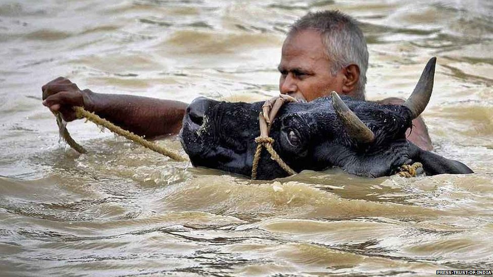
Ram Bonod Singh from Chhapra claimed that, “Not an inch of dry land is available from Manjhi to Sonepur. The current of water was so strong that all the mud houses collapsed. Cattle were in deep trouble. Most of them died or swept away and those survived fell sick. There was no fodder as all the land was under water. Fodder needs to be arranged for them and the Government must open cheap husk and straw shops to save the cattle.
Not much has changed..cattle battling the Bihar Floods now. Photo: BBC News
Dip Narayan Singhlamented that boats were not available normally when the floods struck and the officers had no clue how to face the emergency. Many boats of the traders were parked at Mahnar and Hajipur and had the officers known about their availability they could have helped in rescuing a good number of people from the flooded areas and thus saved their lives. Insisting on the opening of cheap grain shops in the flood ravaged areas he told that a huge amount of food grain was buried under the debris of the collapsed houses and the seeds for the next crop also got trapped there. Such people needed to be helped by ready to eat food and also with seedlings of paddy for immediate transplantation from the areas that were not flooded this year. This should be done without any further loss of time. Some people might need loans for house building and that should be made available to them on deferred payment. Cooperatives could also advance loans to such people wherever they existed. Crop loan might be needed for some and that should be arranged for those who asked for it.
Murli Manohar Prasad talked about floods as a long term problem and said that some years ago there was a meeting with the Government of Uttar Pradesh when it was decided that the Railway Bridge at Majhi on the Ghaghara will have to be extended and embankments should be built on the river from Dhanawari till Chinwari like that built on the Gandak. Uttar Pradesh had opposed this embankment on the ground that the proposed embankment will have adverse impact on the Balia district. He wanted to know from the minister about the fate of those discussions. He also wanted that the issue of deforestation should also be discussed with Uttar Pradesh as massive felling of trees had aggravated the flood situation in Bihar while maintaining that not much benefit is expected from the restoration of forests as, “Unfortunately, the topography of Saran is quite unique. The level of the Gandak river is above the level of its surrounding, the river flows in many streams that take off at various points from the main stream. The level of these streams is also higher than the adjoining land and embankments are built on them also (He was referring to Zamindari embankments.). The local people had developed a very efficient system of irrigation and drainage that worked well till the Moghul Rule. Sluice gates were built on the embankments at various places on the Gandak which helped in controlling various smaller rivers taking off from the Gandak. Whenever people apprehended floods, they used to drop the shutters of the sluice gates. Besides, they have connected the chaurs (depressed lands) with these rivers and could take water from the rivers or discharge water into it with the help of sluice gates. Their drainage channels used to run parallel to the embankment of the river and were connected to the chaurs and the people could manipulate the direction of flow water as they desired. Almost whole of the Saran district was somehow connected to many of its major rivers namely the Ghaghara, the Gandak and the Ganga. Unfortunately, this amazing set up of irrigation and drainage got ruined with time and the sluice gates that were functional till 1878 ceased to function because the indigo planters who were paying the water rates based on the expenses incurred on running the set up to the Government refused to pay it anymore which they were paying so far. That led to the death of a good irrigation and drainage system. When water ceased to flow through these channels then not only the zamindars but rayyats also started encroaching the river bed and the local officers of the Government helplessly watched the proceedings of dismantling law and order situation of the district. His appeal to the Government was that, “it should not end up only distributing relief to the flood victims but should think seriously over the flood problem of the district.”
2013 Kosi Floods Photo: India Today
Prabhunath Singhintervened once again to say that, “The land between Darauli to Sonepur is quite fertile. The district of Saran is rated as a deficit district not because its land is inferior but because its population is very large and per capita availability of land is too small. I want to reiterate, therefore, that the damage inflicted by floods on the district is the only reason of the misery here and the Survey and Settlement Reports confirm it.” The embankment built in Kasmar Pargana from Sonepur to Darauli was earlier looked after by the Zamindars but their attitude changed and they had virtually abandoned the maintenance of those structures which were in ruinous state. He wanted the Government to take over the up-keep and maintenance of these structures. He added that an embankment existed earlier on the left bank of the Ghaghara from Sonepur to Kasmar and all that was needed to be done was repairing this structure. If the Government of Uttar Pradesh objected to it then Bihar Government could always tell them that the embankment already existed and the State was only repairing it. The Survey and Settlement Report records stand a testimony to that effect.
Most of the members of the Assembly were of the view that the policy hitherto adopted of ‘no embankments’ along the rivers should be revisited, should now be changed and embankments must be built wherever needed or demanded by the people. The Government, however, was still not decided and used to pass the buck on the experts’ advice as it very well knew the consequences of embanking of heavily silt laden rivers.
Two ministers in the Government replied to this entire debate in the Assembly and their statements are worth studying minutely. First to reply was Ram Charitra Singh who said, “… It is quite likely that the reason for the floods in North Bihar are the people themselves living in the State. Almost all the rivers of North Bihar have their origin in the Himalayas that are covered with ice. All the rivers that discharge their water into the sea bring a lot of sediments in their flow and deposited it on their path to the sea. That is how the land was formed in this region. Then came the human race which started tampering with the rivers for its own benefits and its lack of foresight resulted in the situation that we are faced with now. The debate that has taken place in the House establishes that we are still trapped in the same mindset. The result is that many embankments have been built and many others are in the process of being built. The debate today in this House has revealed that many of our friends desire that we should continue building the embankments and they believe firmly that this will benefit them and improve the flood situation. I must say that, scientifically, had these embankments not existed the problem of this magnitude were not going to be there but what has happened has happened. We now better concentrate on the future course of action. Our policy is to control the construction of embankments. Wherever these embankments are built, their construction is illegitimate and a vigil has got to be kept on them. At some places there were constraint and embankment had to be built there although it creates problems.”
He continued, “…I went to the Saran district recently and stayed there for three days (watching the flood situation) and immediately after my return here I got 14 embankments built along the Ganga for flood protection including Dighwara, Shitalpur and Kaudimal. I am not upset that so many embankments have been destroyed this year and a sum of Rs. Two lakhs twenty thousand has been wasted but I don’t regret it and should our engineers suggest that an embankment is essential, I will not hesitate helping them build it.” He admitted that the kind of damages due to floods that were seen in Saran this year were not seen elsewhere and assured all his help to the district. Emphasizing the need for drainage of the Chhapra town he had already instructed the Chief Engineer, Special Officer and the District Magistrate to repair the roads, railway line in collaboration with the District Board even if it amounted to cutting the railway line immediately. The Kharif crop was already lost and if the water is not drained out, the chances of Rabi would also recede.
Another minister, KB Sahay had this to say. “…The problem of floods is very critical. If we construct embankments in Saran, what impact will it have on the other districts? If we control the Ganga in Saran, how will that effect the other districts in UP? I want to put all these facts before the House and want to assure you that the Government will appoint a Commission whose job will be to tell that if an embankment is to be built in Muzaffarpur, it should tell us where and how?…If in Patna then where and how and so on.”
[1] This is Third part of a series of articles Dr Dinesh Kumar Mishra has written for SANDRP based on his month long research at the National Library, Kolkata recently.
For Part 1 see: https://sandrp.wordpress.com/2015/03/09/1948-floods-in-bihar-1-inaugural-flood-after-independence-view-from-press-gallery/
Part 2: https://sandrp.wordpress.com/2015/03/10/1948-floods-in-bihar-2-inaugural-flood-after-independence-official-version-of-floods-and-its-aftermath/
[2] He meant that the Government should not give money to the flood victims just as a dole. It was to be a soft loan and the estimates etc should be suggested by engineers.
Government of Bihar, Revenue Department, Report on the Flood and Relief Operations in Bihar for 1948-49. Superintendent, Government Printing, Bihar, Patna, 1951.
Muzaffarpur [2]“During the August floods water from the River Narayani flooded the village Fatehabad. About 100 houses are reported to have collapsed as a result of the breach in the bundh due to change in course of the River Gandak. There were heavy showers and considerable damage was caused to the paddy crops and certain parts of the Sadar and major parts of Katra, Minapur and Sakra thanas experienced floods… During floods in the Ganges, Hajipur sub-division was badly affected and steps had to be taken to arrange relief.” P-15 Continue reading “1948 Floods in Bihar-2 Inaugural flood after Independence – Official Version of Floods and its Aftermath”→