
Above: The beautiful Lohit River, Arunachal Pradesh Photo: Arati Kumar Rao (http://riverdiaries.tumblr.com/)
Author: SANDRP

Vidarbha: “The worst place in the nation to be a farmer?”
Every day, Maharashtra is shaken by the news of farmer suicides in Vidarbha or Marathwada. On Dec 28, 2014 it was reported that 12 farmers in Vidarbha committed suicide in 72 hours[i].
Continue reading “Vidarbha: “The worst place in the nation to be a farmer?””
Kanhar Project in UP: Another unwanted dam
Guest Blog by: Debadityo Sinha (debadityo@gmail.com)
- “We do not want dams; in fact we don’t need it. It is the industries for which they need water, and for which they want us to give up our fertile ancestral land and destroy the forests which we have protected since centuries and put our children in danger.”
An affected villager
Kanhar Dam is one of those projects which is an example of how so called developments worsen the situation for the people and environment. The project conceived 37 years ago has been in abeyance since last 25 years. With the latest inauguration of construction of the dam on 5th December, 2014 after a span of 25 years without a fresh proper cost benefit analysis (CBA), any environment impact assessment (EIA) or Social Impact Assessment (SIA) ever, the commencement of project activities is making way for a large social uprising in the heavily industrialized zone of Uttar Pradesh.
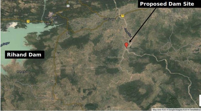
Kanhar Irrigation Project is located downstream of the confluence of River Pagan with Kanhar near village Sugawan in Tehsil Dudhi of District Sonebhadra, Uttar Pradesh. It was originally approved by the Central Water Commission in September, 1976 at an initial budget of Rs. 27.75 Crores. Initially, there was some foundation work undertaken but the project was soon stalled due to inter-state issues, lack of funds and volcanic protests from tribal communities of the region. As per a progress report of the project for 1998-99, the construction work is completely abandoned since 1989-90. Since then, there are numerous occasions when the project was inaugurated, notable among them is one on 15th January, 2011 when the then Chief Minister Mayawati laid foundation stone again. Another inauguration took place when on 12th November, 2012 when Mr. Shiv Pal Singh Yadav (uncle of present CM Akhilesh Yadav), the Irrigation Minister of Uttar Pradesh laid another foundation stone to start the work of spillway. However no work could be taken up.
The project proposes a 3.003 km long earthen dam having a maximum height of 39.90 m from deepest bed level which may be increased to 52.90 m if linked to Rihand reservoir. The project envisages submergence of 4131.5 Ha of land which includes parts of Uttar Pradesh, Chhattisgarh and Jharkhand mostly dominated by tribal communities. The project is expected to provide irrigation to Dudhi and Robertsganj Tehsils via left and right canals emerging from both sides of the dam with capacity of 192 and 479 cusec respectively. The culturable command area of the project is 47,302 ha. The project imposes enormous threat not only on the environment and ecology but also to thousands of tribal families of Vindhyas living there since hundreds of years and has demanded for protection of their forests and proper implementation of R & R (Rehabilitation and Resettlements).

The controversy actually began when the Central Water Commission in its 106th meeting of Advisory Committee for the ‘techno-viability of irrigation, flood control and multipurpose project proposals’ approved the project at an estimated cost of Rs. 652.59 crores at 2008-09 price level. A bare perusal of the minutes shows that there is no consideration of the environment and social impacts of the project. The minutes also show that the approval was granted in the presence of representatives of Ministry of Environment and Forests and Ministry of Tribal Affairs.
Local Voices Suppressed
The inauguration of the project held on 5th December 2014 was marked by the presence of heavy police force and paramilitary forces which were deployed to guard the construction site on the river bed. Few roads have been blocked by Police and it is reported that the entry to the project site is stopped 1.5 km ahead of the construction site. To speed up the work, regular increase of heavy equipments and machinery is in progress. CCTV cameras are also reported to be installed at the site to keep a regular check on the activities.

There is a constant effort by the administrative authorities to suppress the voices of aggrieved and affected raised against the project and those who have attempted to do so are being arrested under the Uttar Pradesh Gunda Niyantran Adhiniyam, 1970 or ‘Gunda Act’. There are repeated incidences of arrests and FIRs against the local people. Incidences of people-police clashes are now becoming a daily routine affairs. Recently the SDM, Dudhi along with the other policemen was also injured in a similar clash. In retaliation to it, there were series of arrests being made by the police and FIRs were filed against 500 unnamed locals. There is an atmosphere of fear already created among the villagers in the region.
The question arises is, whether due procedure has been adopted by the state government as prescribed under law? And if yes then what is the reason for suppressing the voices and why is so such chaos being generated by the government? The project is in controversy due to several questions which are still left unanswered and requires a detailed clarification from the State Government.
The rise of Kanhar Bachao Andolan
The Kanhar Bachao Andolan (KBA) is the first of its kind integrated protest which emerged in the form of an organization in the year 2002 under leadership of a Gandhian activist Bhai Maheshanandji of Gram Sawaraj Samiti based in Dudhi tehsil of Sonebhadra and Gram Pradhans of villages which would be submerged if the project is implemented. The KBA has been raising the issue of tribal rights and discrepancies in the R & R before the state govt. through representations, protests and petitions in High Court. There is a continuous peaceful campaign against the project by KBA since a decade including the unceasing protest which started from 5th December, 2014 on the other side of the River Kanhar opposite to the construction site. Fanishwar Jaiswal, who is a former-Gram Pradhan of Bhisur village and an active member of KBA said, “There was a public meeting organized by the MLA of Dudhi in June, 2014 to address the R & R issues. The Gram Pradhans of several villages presented their views against this project and also submitted written representations; however those views and protests were never registered by the government in any of their reports.”

Rich Forests and Tribal Culture at Stake
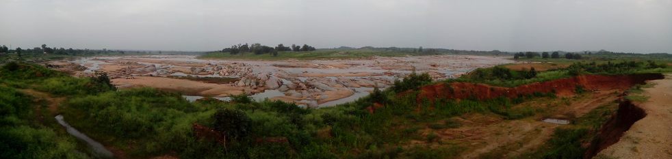
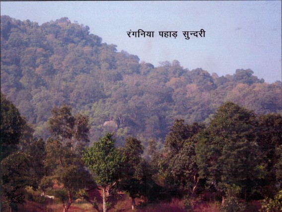
I got a chance to visit Sonebhadra district in July, 2014 where I came to know about this project and the ongoing protests. I visited the project area and interacted with the people of Sundari and Bhisur villages of Dudhi tehsil which are the affected villages among several others. Dense forests and agricultural fields were the most common landscape feature. One could have seen the abandoned machines, several of which were half-sunk to the soil, broken houses with ghostly appearances which were informed as the once constructed officer’s colonies of the project and old rusted sign boards stating ‘Kanhar Sinchai Pariyojna’. Those structure and abandoned equipments were clear evidences of the Kanhar project which was abandoned long back by the government.
Till 1984, a large number of trees were felled by the government in the midst of protests by the tribal communities. But, since then the work did not take place and there was no displacement of tribals. They have now planted more forests in their villages and have their own regulation bodies for protection of these Forests. “Cutting trees is seen as sin in our culture and we have strict fines and punishments if someone does that. Trees are our life and we are protecting them for our children”, said Pradhan of village Sundari which will be the first village to be submerged by the project.
We discussed about the status of biodiversity and came to know about their dependence on traditional medicines which they obtain directly from the forests. All the villagers I met were satisfied with their rural lifestyle and have developed their own way of sustaining agricultural production by choice of specific vegetable, pulses and crops depending on climate.
It was informed that every year elephants visit the Kanhar River from the Chhattisgarh side. Animals like Sloth Bear, Leopard, Blackbuck, Chinkara and several reptiles are abundantly noticed by people due to presence of hills and forests in the region.
‘We do not want dams; in fact we don’t need it. It is for the industries which need water, and for which they want us to give up our fertile ancestral land and destroy the forests which we have protected since centuries’, said a villager.
It is suspected that the Kanhar dam is being constructed to supplement the Rihand dam to provide water for the industries in Sonebhadra and adjoining region. It seems that the government has not learnt from the experience of Rihand dam which was constructed in 1960s in the same district in the name of irrigation, but gradually diverted the water for thermal power plants and industries. The water in Rihand dam is now severely contaminated with heavy metals which has entered the food chain through agriculture and fish. Like the Rihand dam, the new project will cause more destruction than good to the people of the region.
Vindhya Bachao’s Intervention
It is very clear that the project is going to destroy a huge area of dense forests and going to displace not only the tribal communities from their roots but also affect the rich flora and fauna of the Sonebhadra. To know about the actual status of the environment and forests clearance of the project, RTI (Right to Information) applications were filed with the Ministry of Environment, Forests and Climate Change in July, 2014. The belated reply was received only in Dec, 2014 on initiating a first appeal. The responses states that the ‘Environment Clearance’ was granted on 14.04.1980 which is more than 30 years old and therefore any further information with respect to the same cannot be granted since the same is exempted under the RTI Act 2005. Hence, two things are clear that the project requires a fresh ‘Environment Clearance’ under the EIA Notification, 2006 & a forests clearance prior to start of any construction activity.

In view of this fact, On 22nd December, 2014 an application was filed by Advocate Parul Gupta on behalf of applicants Debadityo Sinha (Vindhya Bachao) and O.D. Singh (People’s Union for Civil Liberties) before the National Green Tribunal praying for taking action against the UP Government for carrying out construction activity of the project without statutory clearances under EIA Notification, 2006 and Forest (Conservation) Act, 1980. The application came up before the bench of Justice Swatanter Kumar on 24th December 2014 wherein stay orders were issued against the Government with clear indication that no construction activity shall be allowed to be undertaken if they do not have ‘Environment’ ‘ and ‘Forest’ Clearance’ as prescribed under law.
The major Environmental and Social issues which require to be carefully considered before the project is allowed to move ahead are as follows:
- Large Social Implications: Nearly 10,000 tribal families are going to be affected directly who will lose their ancestral land permanently. Gram Sabhas of the project affected villages has already passed a consensus against the project and submitted the same to the State Govt.
- Dense Forests will be lost: The Renukoot Forest Division is one of the dense forests of Sonebhadra with tree density of 652 per hectare as per data obtained from a forest clearance application involving the same forest division. The Kanhar project document shows 4439.294 Ha of land categorized as ‘Forest and others’. In such case, lakhs of trees will be affected by this project which would cause significant impact on environment, wildlife and livelihood of tribals.
- Loss of Rich Biodiversity: Vindhyan mountain range is known for the wildlife and rich diversity of medicinal plants which are inherently linked with tribal culture. Scientific Publications shows there are at least 105 species of medicinal plants in the region which are extensively used as traditional treatment by tribal people. The project will endanger the remaining few patches of forests which are not only the last few remaining patches of rich biodiversity but refuge to several wild animals in this heavily disturbed landscape. Conversations with the villagers will reveal presence of mammals like Sloth Bear, Leopard, Blackbuck, Chinkara, Jackal etc and several reptiles including Bengal monitor and snake species in these forests. The submergence area falling in Chhattisgarh is reported to be an elephant corridor.
- Immense loss to ecology of river Sone and Ganga: Kanhar is a major tributary of River Sone which forms an important catchment of Ganga River Basin. After construction of Rihand Dam and Bansagar dam and various other water abstraction structures owing to number of industries in the region because of availability of coal mines-River Sone is one of the most exploited system which has lost its riverine characteristics. Central Inland Fisheries Research Institute reported disappearance of 20 fish species from Sone in the time span between 1976 and 2011 which is attributed to increased abstraction of water from the Sone river system. The report clearly states that ‘damming of rivers or tributaries is the root cause of river obstructions causing severe modifications and perturbations to the river flow, velocity, depth, substratum, pools, ecology and fish habitat’. There is reporting of 14 exotic alien species in the river. The report claims that the river Sone is in critically modified (class F) condition with discharge of mere 5.16% of Mean Annual Runoff (MAR) and it will require at least 34.2% of MAR to bring it to slightly modified class (class B). In such a scenario, damming of 5200 km2 of the total catchment of 5,654 km2 of river Kanhar will be disastrous for the river Sone depriving it of the major share of the present water availability. As Sone river system forms an important catchment of River Ganga, the impact on ecology of River Ganga is undeniable.
- Contribution to Climate Change: We will lose lakhs of trees which would act as carbon-absorption system. To double the problem, the carbon which is locked in the forests will be released to atmosphere when these trees will be felled. While Carbon Dioxide is released from aerobic decomposition of plants, the anaerobic decomposition of organic matters will release methane which is 24 times more potential GHG than Carbon Dioxide. There is global evidence which support production of GHGs in dams, the quantity of which varies on several parameters like climatic conditions, water depth, water fluctuation, area of submergence, dissolved oxygen etc. Emission of GHGs like Methane is known for a positive feedback trigger which would lead to more absorption of heat causing further rise in temperature, thus increasing the rate of anaerobic decay in the reservoirs and release of more Methane.
- Lack of Proper Cost-Benefit Analysis: The cost benefit ratio of such projects are calculated on investment and direct benefits from the projects with consideration of impact of project on people & ecosystem, which are often underestimated and excluding socio-cultural costs and cost of a healthy environment and cost of services provided by the river, forest and other ecosystems. The monetary value of the impacts such as on forests, biodiversity, fishing, non-use values, public money spent on infrastructures, cultural loss and other negative impacts are not considered at all.
- Lack of Options assessment There has been no options assessment as to establish that this proposed dam is the best option for water resources development in the Kanhar/ Sone basin.
Conclusion
There is no justification for the project. There has not even been an application of mind if the project is beneficial to the people and society. There is not even any impact assessment, nor any democratic decision making process. A huge amount of public money is already spent on development of schools, roads, hospitals, houses etc in the area, which will be lost permanently by this project. At the time, when this project was incepted in 1976 the environment and social scenario of the country and this region was very different from what it is today. River Sone was not in critically modified state, Forests of Sonebhadra and adjoining regions were still intact, human population was lesser, technology was not so advanced, science of climate change was not fully understood and the need of protection of environment was not felt or required as it is today. In 1976, protection of rivers was not a primary concern as the problems were not evident as it is today. In such scenario furthering such abandoned projects shows poor understanding of environment and insensitive attitude by the policy makers. It is thus important to undertake a proper cost-benefit analysis, a fresh Environment Impact Assessment and Social Impact Assessment, conduct proper options assessment to understand the implications of this project on the ecological balance and people keeping into account the present scenario. Such studies should undergo a detailed scrutiny and public consultation process.

- About the Author: Debadityo Sinha is coordinator of Vindhya Bachao, an environment protection group based in Mirzapur. He can be contacted at debadityo@vindhyabachao.org. More details on the project can be accessed at www.vindhyabachao.org/kanhar.
POST SCRIPT UPDATE on March 16 2015 from the author:
Update from NGT hearing dated 12th March, 2015
The Ministry of Environment, Forests and Climate Change has filed its reply before the National Green Tribunal confirming that there exists a confusion with respect to grant of forest clearance diverting 2500 acres of forest land for construction of the Kanhar dam. The Ministry has defended itself claiming that the Forest Clearance dates back to the time when the Ministry was not in existence and therefore the files pertaining to the same cannot be traced. However, it has shifted the burden of proof on the State of U.P. indicating that a letter dated 28.8.1980 by the then ministry of agriculture implies the grant of fc and must be produced by the state.
The state in defence has filed a bunch of letters which according to them refers to the grant of forest clearance. However, the state has failed to produce thee letter dated 28.8.1980 which is claimed to be the FC granted to the project.
The court observed that :
Learned counsel appearing for MoEF submits that the original letter of 1980 granting Forest Clearance to the Project Proponent is not available in the records of the MoEF. Similar stand is taken by the Project Proponent. However, both of them submit that the preceding and subsequent transactions establish that clearance was granted.
…..
Since it is a matter of fact and has to be determined on the basis of record and evidence produced by the parties, we grant liberty to the Applicant to file Replies to this Affidavit, if any, within three days from today.
We also make it clear that one of the contentions raised before the Tribunal is whether it is an ongoing project for number of years or it’s a project which still has to take off and which law will be subsequently applicable today. Let the Learned counsel appearing for the parties also address to the Tribunal on this issue on the next date of hearing.
Ms. Parul Gupta appeared for the applicants while Mr. Pinaki Mishra and Mr. Vivek Chhib appeared as counsel for State of U.P. and MOEFCC respectively. The matter is now listed for two days- 24th March, 2015 and 25th March, 2015 for arguments. For the order click here , for Press Release click here
POST SCRIPT ON April 14, 2015:
Urgent Alert
Firing in Sonbhadra, UP
Police firing in Kanhar anti dam proterstors early morning today
against illegal land acquisition by UP Govt
Firing done on the day of Ambedkar Jyanti
Police firing on anti land acquisition protesters at Kanhar dam early morning today. One tribal leader Akku kharwar from Sundari village have been hit by bullet in chest, Around 8 people have been grievously injured in the firing and lathi charge by the police. Thousands of men and women are assembled at the site to intensify the protest against on Ambedkar jyanti. The protesters were carrying the photo of Baba Saheb to mark the day as ” Save the Constitution Day”. Akhilesh Govt fired arbitrarily on the protesters among whom women are in the forefront. Most of the women have injured. The firing is being done by the Inspector of Amwar police station Duddhi Tehsil, Sonbhdara, UP.
Condemn this criminal Act and join in the struggle of the people who are fighting against the illegal land acquistion and constructing illegal Dam on kanhar river.
Roma
Dy Gen Sec
All India Union of Forest Working People
POST SCRIPT on April 20, 2015: Update from Roma:
Kanhar Dam – Legitimate demands of dalit farmers in UP being crushed ruthlessly, Chhattisgarh adivasi peasants being kept in the dark – says a fact finding team of
Chhattisgarh Bachao Andolan
Chhattisgarh Bachao Andolan
A fact finding team of the Chhattisgarh Bachao Andolan consisting of Alok Shukla, Sudha Bharadwaj, Jangsay Poya, Degree Prasad Chouhan and Bijay Gupta visited the dam affected villages of the Kanhar Dam in UP and Chhattisgarh on 19th April 2015.
The team first visited Village Bheesur which is closest to the dam site and interacted with the affected families who are mostly of the Dalit community who were still deeply affected by the repression of the 14th April and 18th April.
The affected men and women were very articulate about their grievances and extremely legitimate demands. They explained that they were first told about the Kanhar Dam in the year 1976 when the then Chief Minister ND Tiwari promised 5 acres of land, one job in each family and a house measuring 40’x60’, apart from full facilities of education, health, electricity and water to the 11 affected villages of Uttar Pradesh namely Sundari, Korchi, Nachantad, Bheesur, Sugwaman, Kasivakhar, Khudri, Bairkhad, Lambi, Kohda and Amwaar. In 1983 it is correct that compensation payments were made at the rate of Rs. 1800 per bigha (approximately Rs. 2700 per acre) to the then heads of households. After this the villagers have got no notice whatsoever.
On 07-11-2012 the Irrigation Minister laid the foundation stone of the dam. It was claimed that now a consolidated sum of Rs7,11,000 would be given to the heads of households as identified in 1983 and houses of 45’x10’ dimensions would be constructed for them. The farmers are rightly arguing that they have been in physical possession of the lands all these years and therefore they should be compensated as per the 2013 Act. The government must be sensitive to the fact that the earlier households have multiplied and the compensation must be provided to all adult families who will lose their livelihood. It is also very pertinent that in the meanwhile the Forest Rights Act, 2006 has come into existence and we found that many of the farmers have been granted Pattas under the Act; however the government is refusing to compensate them for the loss of such lands, which is absolutely against the spirit of the Act.
The work of the dam was started on 04.12.2014 and from 23.12.2014 the villagers were sitting in continuous dharna. On that very day, efforts were made to intimidate them. While the SDM and District Magistrate did not intervene till about 6pm, at about 7pm the Provincial Armed Constabulary (PAC) of which about 150 jawans were deployed at the dam site interfered. After the Tehsildar assaulted a young man Atiq Ahmed, people rushed in from the weekly market and a fracas ensued. Right from that day cases were foisted on 16 named and 500 unnamed persons.
Despite this, the villagers continued with their peaceful protest, however since the government was not carrying on any negotiations and at the same time the dam work was progressing, on 14th April they decided to shift the venue of the dharna closer to the site. The PAC opened fire and a bullet passed through Akklu Chero (Cherwa) – an adivasi of Sundari village. 39 persons were injured, 12 of them seriously. The deployment of the PAC was increased to about 500-1000 jawans.
On 18th April early in the morning the administration was determined to remove the protestors. The district force and PAC surrounded the dharna site, uprooted the pandal and mercilessly beat and chased the villagers right up to their villagers. They entered Village Bheesur and not only beat up men and women, but vandalized a motor and motorcycle of Ram Lochan. Colesia showed us her injured arm and fingers and was in tears because she did not know where her husband Mata Prasad was.
People were not certain where missing family members were since the injured have been taken to the Dudhi Health Centre and if any person tries to contact them they face the threat of arrest since between the cases made out against them for the events of 23rd December, 14th April and 18th April cover about 956 persons. But the team found out that the following had been injured mostly with fractures and were possibly hospitalized. The number of women injured is significant:-
Village Bheesur – Rajkalia, Kismatiya Mata Prasad, Uday Kumar and Phoujdar (all ST)
Village Korchi – Phoolmatiya, Butan.
Village Sundari – Ram Bichar, Shanichar, Zahoor, Azimuddin, Jogi.
Village Pathori Chattan – Bhagmani, Ram Prasad, Dharmjeet.
Similarly the PAC people chased the protestors of Village Sundari too right up to the houses on the outskirts of the village. They damaged motorbikes and cycles even setting fire to them.
We observed that the work at the dam site seemed to be progressing fairly fast. The height of the dam which was earlier stated to be about 39.90 m appears to have been increased subsequently to 52.90 m increasing the apprehensions of the people. The Police had cordoned off the area and there were still a large number of PAC trucks and personnel in their makeshift camp of sheets.
When the team reached Village Sundari, there was an extremely tense atmosphere. Some dominant caste-class persons were holding a meeting in which others seemed to be quite subdued. Some very vocal local leaders told us that they do not want any interference from any outside NGO or organization. Most of them were quoting the DM Sanjay Kumar belligerently saying that he had said that all protest and movements should stop. Otherwise he would foist so many cases that they would rot in jail for the rest of their lives and use up all the compensation in paying lawyers. Some persons who seemed to have been sent by the administration were clicking our photos when we introduced ourselves. The leaders told us that they had decided to accept the compensation and would be going to the DM to inform him so as that was the only way the cases would be lifted. While it was clear that not all the persons in the meeting were in agreement with this “decision”, they were clearly cowed down by the cases and the pressure being brought by the administration.
However our most tragic experience was in the affected villages of Chhattisgarh in block Ramchandrapur of district Balrampur. They fall in the “Sanawal” constituency of erstwhile Home Minister Ram Vichar Netam who had assured the villages that there would be no submergence whatsoever in Chhattisgarh. Even when the current MLA Brihaspati Singh of Congress tried to hold a meeting at Sanawal in which he
invited the protestors of UP, lumpen supporters of Ram Vichar Netam made it difficult for him to educate the villagers about this.
We were shocked to find that the Water Resources Department of Chhattisgarh admits that the following 19 villages are to be submerged – Jhara, Kushpher, Semarva, Dhouli, Pachaval, Libra, Kameshwarnagar, Sanawal, Tendua, Dugru, Kundru, Talkeshwarpur, Chuna Pathar, Indravatipur, Barvahi, Sundarpur, Minuvakhar and Trishuli; and 8 to be partially submerged – Chera, Salvahi, Mahadevpur, Kurludih, Tatiather, Peeparpan, Ananpur, and Silaju. Yet the villages are in blissful ignorance.
Only after the incident on the UP side of the dam occurred, on 18th April an Engineer came to Jhara village and stated that 250 acres of land would be submerged out of which 100 acres was private land. But even this is not the truth since it is clear that the entire village is to be submerged. As we were leaving Jhara village we saw a whole convoy of 6 Government Scorpios rushing through the village. Clearly, the state at some point has to begin some legal acquisition proceedings and seem to be at a loss as to how to do so.
Strangely enough, keeping up the pretence of no submergence Shri Netam has had many constructions sanctioned in Sanawal and surrounding villages whereas ordinarily, once there is an intention to acquire, government expenditure is kept to a minimum.
As we returned to Ambikapur, we heard that another fact finding team from Delhi who were to meet with the injured in hospital and the Collector Sonebhadra, had been detained for questioning.
The rapidity and the ruthlessness with which the dam is being built, at any cost, indicates that is unlikely to be for the stated purpose of irrigation. With large industrial projects coming up in Sonebhadra UP and even in neighbouring Chhattisgarh and Jharkhand, on the cusp of which this dam channelizes the waters of Kanhar and Pang rivers, it appears to be that providing water to these projects and also hydel power are likely to be the real causes.
The Chhattisgarh Bachao Andolan comes to the following tentative conclusions on the basis of its fact finding –
1. The demands of the project affected farmers, particularly dalits and adivasis, are eminently reasonable and the administration should enter into sympathetic discussion with them to redress their very legitimate and legal grievances. Work on the dam should be stopped during such negotiations so as to create an atmosphere of good will.
2. The PAC used excessive and unnecessary force on the protestors on both 14th April and 18th April. The complaints of the protestors should be registered as FIRs and action should be taken against the errant police jawans.
3. Using the threat of false cases against the protestors to arm-twist them to accept unjust compensation and rehabilitation is a form of state terror. The cases must be reviewed particularly the practice of filing cases against “unknown” persons, and malicious cases must be withdrawn.
4. In the State of Chhattisgarh, there has been absolutely no transparency, information or following of legal procedure with regard to affected 27 villages. The provisions of the 2013 Act beginning with the pre-acquisition procedure of Social Impact Assessment, Gram Sabha Consultation (all these areas are Scheduled areas), determination of Forest Rights, Public Hearing on Rehabilitation and Resettlement packages etc must be strictly followed.
5. Finally, the attitude of the Uttar Pradesh Government and the district administration of Sonabhadra in restraining activists from entering the area or making an enquiry into the facts on the ground is undemocratic and reprehensible.
—
Delhi Contact : c/o NTUI, B – 137, Dayanand Colony, Lajpat Nr. Ph IV, NewDelhi – 110024, Ph -9868217276, 9868857723,011-26214538
Lucknow contact : 222, Vidhayak Awas, Aish Bagh Road, Rajinder Nagar, Lucknow, UP
Dehradun Contact : c/o Mahila Manch, E block,Saraswati Vihar, Near Homeguard off, Kargi, Dehrdun, Uttarakhand. ph- 09412348071
POST SCRIPT ON APRIL 26, 2015
From: Sandeep Pandey <ashaashram@yahoo.com>
To: “cmup@nic.in” <cmup@nic.in>
Cc: Amod Kumar <amodk2013@gmail.com>; Rigzin Samphel <rigzin123@gmail.com>; Sanjay Kumar <sanjaykumarias02@yahoo.co.in>
Sent: Saturday, April 25, 2015 1:34 AM
Subject: Stop construction of Kanhar Dam
To: “cmup@nic.in” <cmup@nic.in>
Cc: Amod Kumar <amodk2013@gmail.com>; Rigzin Samphel <rigzin123@gmail.com>; Sanjay Kumar <sanjaykumarias02@yahoo.co.in>
Sent: Saturday, April 25, 2015 1:34 AM
Subject: Stop construction of Kanhar Dam
To: Shri Akhilesh Yadav
CM, UP
From: Ajay Shekhar and Sandeep Pandey
Socialist Party (India)
Sub: Work on Kanhar dam should stop untill court decisions are pronounced.
Dear Akhilesh ji,
We want to ask you why your government is trying to forcibly acquire land for Kanhar Dam in Dist. Sonebhadra violating the law of the land whereas your party is opposing the amendments proposed by the Narendra Modi government in the Right to Fair Compensation and Transparency in Land Acquisition, Rehabilitation and Resettlement Act, 2013. In light of the recent incidents of use of force by the District administration on 14th and 18th April, 2015, we wish to say the following.
(1) The SC judgement in the case of Niyamgiri hills, empowering the tribals to take a final decision on whether to allow multinational company to undertake bauxite mining there, should be now a precedent in all projects proposed in tribals areas. In addition the 73rd amendment to Constitution empowering Gram Sabhas to take decisions on economic planning for development should be honoured. Case no. 67043/2011 is pending in Allahabad HC relating to this right of GS and we expect that the district administration of Sonebhadra and Government of UP will wait for a decision on this.
(2) The project is 37 years old and was abandoned in 1984. The forest clearance dates back to 14/4/1980. It is a joke if the administration claims that it has the necessary environment and forest clearances on the basis of a clearance obtained 35 years back. Why is the Sonebhadra administration and UP government not prepared to wait for the National Green Tribunal judgement on this matter?
(3) It is another joke that the district administration wants to proceed on the process of acquisition done around 35 years back whereas the people have not given up their possession till date. The District Magistrate of Sonebhadra claims that he’ll rehabilitate the people displaced due to dam construction in the most ideal manner. But all he has are plans for their housing. What about their livelihood? We believe that land for land is the only proper compensation for a person whose livelihood depends on agriculture.
(4) Force should not be used against people who agitate peacefully. Dr. Ram Manohar Lohia severed relationship with his own government in Kerala because there was police firing over people in an incident in 1954. It is people’s democratic right to protest peacefully and government’s must find peaceful resolution to problems.
We commit to stand by the people in this struggle against the government which is for namesake socialist but is actually serving the interests of capitalists. We condemn all the repressive actions of the government and attempts by the district administration to terrorize people into submission so that they accept the displacement and rehabilitation package.
We hope that the Government of UP would act in a democratic spirit and respect the rights of people. It should immediately halt the construction work at Kanhar dam site and withdraw all the cases foisted on people so that people in jail may be released.
Sincerely,
Ajay Shekhar, Vice President, U.P. and Sandeep Pandey, National Vice President, Socialist Party (India) after a visit to the dam site, Sundari and Bhisur villages on 20 April, 2015.
Further reading:
कनहर कथा http://tehelkahindi.com/story-of-kanhar-barrage-project/
– छत्तीसगढ़ सीमा पर संगीनों के साए में कनहर बांध का निर्माण
http://naidunia.jagran.com/chhattisgarh/raipur-kanhar-dam-making-start-in-chhattisgarh-border-279906
(Nai Duniya)
– Despite NGT stay, UP govt goes ahead with construction of dam
https://www.hindustantimes.com/india-news/despite-ngt-stay-up-govt-goes-ahead-with-construction-of-dam/article1-1304050.aspx
– “Kanhar dam case: Green panel pulls up environment ministry” By IANS | 22 Feb, 2015
END NOTES:
- For NGT order on Kanhar Dam, see: http://vindhyabachao.org/embeds/kanhar/NGT-order-Kanhar.pdf
- For a brief video clip on project location, see: http://youtu.be/ZZD_Jk2hDs0
Why Ken Betwa EIA by AFCL is unacceptable
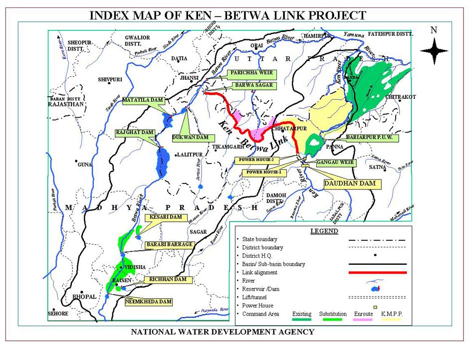
The Environmental Impact Assessment (EIA) of Ken Betwa Riverlink project used for the public hearing to be held on Dec 23 (Silon village in Chhatarpur district) and Dec 27 (Hinouta village in Panna district), 2014 in Madhya Pradesh is, as can be seen from the details below, unscientific, incomplete, inadequate, biased, inconsistent (self contradictory), callous, making unwarranted conclusions/ assumptions, it accepts government claims uncritically and is generally a shoddy piece of work.
For violations involved in public hearing, see our earlier blog[1].
Background Agriculture Finance Corporation of India (now AFC Ltd) was commissioned in 2007 itself to conduct Environmental Impact Assessment (EIA) of Ken Betwa Riverlink proposal. This was even before National Water Development Agency (NWDA, a society of Government of India created in 1981-82 exclusively for studies on River Linking proposals) applied for the Terms of Reference Clearance for the EIA for this project in December 2010.
This review of the EIA of Ken Betwa project is based on the Executive Summary (English) of the EIA made available on the Madhya Pradesh Pollution Control Board (MPPCB) website in Dec 2014 before the statutory public hearing slated for Dec 23, 2014 at Silon village in Chhatarpur district and Dec 27, 2014 at Hinouta village in Panna district, both in Madhya Pradesh.
Since this executive summary is largely the same as the EIA made available to the Expert Committee set up on Inter Linking of Rivers (ILR) by the then Union Ministry of Water Resources (now Union Ministry of River Development, Ganga Rejuvenation and Water Resources – MRDGR&WR) for which I was a member, I have also provided the critique of that earlier EIA (in red font) in Annexure 1 to this Article[2].
The comments given below under each heading are only indicative to establish what is contended about the EIA here and not exhaustive.
Biased EIA In the very second paragraph of the EIA Executive summary[3], it is stated, referring to NWDA studies, “These studies established that Betwa is a water short basin”. But an EIA is not supposed to uncritically accept such assertions or assumption of the developer. In fact the EIA accepts this as gospel truth without critically examining it.
Incomplete EIA The EIA executive summary does not even have a project layout map, sections like biodiversity impact assessment, impact of destruction of substantial part of Panna Tiger Reserve, surrounding forests and livelihoods of the people dependent there on, options assessment, hydrological viability assessment, disaster potential assessment, how the project will be impacted by destruction of forests and climate change, additional green house gas emissions due to the project and downstream impacts, to name just a few issues..
EIA makes wrong claims The EIA claims in very second paragraph: “The scope of EIA studies inter-alia does not include water balance studies.” This is a wrong claim since water balance study of the Ken Betwa links establishes the hydrological viability of the project and by not going into the water balance study, the EIA has failed to establish hydrological viability of the project. SANDRP analysis in 2005[4] of the NWDA feasibility study of Ken Betwa Proposal[5] had established that the hydrological balance study of the Link Project is flawed and an exercise in manipulation to show that Ken has surplus water and Betwa is deficit.
As the collector of Panna district noted in 2005 itself[6], if the 19633 sq km catchment of the Ken river upstream of the proposed Daudhan dam (comprising areas of eight districts: Panna, Chhatarpur, Sagar, Damoh, Satna, Narsinghpur, Katni, and Raisen) were to use the local water options optimally, then there will not be any surplus seen in Ken river at the Daudhan dam site and by going ahead with the Ken Betwa Link without exhausting the water use potential of Ken catchment, which is predominantly a tribal area, the government is planning to keep this area permanently backward. But the EIA of Ken Betwa link does not even go into this issue, making the whole exercise incomplete.
Ken Betwa project destroys Panna Tiger Reserve but EIA claims project may benefit PTR! The Ken Betwa Project, as per the EIA, will submerge 4141 ha of Panna Tiger Park reserve, but the EIA Ex Summary says (para 58), “the reservoir may prevent encroachments of the park and invasion by livestock so that a relatively more secure and compact habitat is formed on Right flank of Daudhan dam which may be beneficial.”
In Para 63, the EIA executive summary goes on to claim that the project will not decrease tourists flow (due to destruction of Panna Tiger Reserve or drying of waterfalls in the downstream), but in fact increase tourist inflow because of the creation of reservoir! No word about the destruction of river!!
Absence of credible submergence figures The EIA has hugely reduced the area to be affected in Panna Tiger Reserve and in the surrounding forests compared to the figures given in the Feasibility report of the project, without any explanation. Well known conservation expert Kishore Rithe, in his article in December 2014 issue of Sanctuary Asia Magazine has raised doubts about these figures and has suggested that much larger area will be destroyed by the project than what is stated in the EIA. He has also said that the EIA does not take into account the biodiversity that will be destroyed in the forest because of the project. Using strong (& justified) words, he has said this is assassination of wildlife, to help the contractors.
EIA LIES on Biodiversity: Endangered and vulnerable species in Ken Basin find no mention in EIA Para 59 of the Ex Summary of EIA is about Aquatic Environment and it says: None of the species of aquatic plants come either under rare or endangered or endemic or threatened categories (REET). This is a shocking lie, since the following paper by Dr.K.D Joshi and B.K. Biswas of CIFRI (Central Inland Fisheries Research Institute) says that the Ken has at least 4 endangered and 9 vulnerable species. The EIA is also keeps mum about the existence of Ken Ghariyal Sanctuary in the downstream area, which will be destroyed due to the project.
CIFRI paper of 2010 said there are 4 endangered and 9 vulnerable fish species in Ken River According to a paper by Dr. K. D. Joshi and B. K. Biswas published in Journal of Inland Fisheries Society of India (42(2): 25-31, 2010) titled Piscine Diversity and Fisheries in the River Ken, proposed for the Inter-River Linking, “53 fish species classified under 40 genera, 19 families and 7 orders. Out of these, 51 species are native and 2 exotic. The river comprises some highly important threatened species including 4 endangered and 9 vulnerable species… The fish species available in the river have immense economic importance”.
Endangered species include: Tor tor (Mahseer), Chitala chitala, Eutropiichthys vacha, Ompok pabda.
Vulnerable (VU) species: 1. Gonialosa manmina 2. Catla catla 3. Puntius sarana sarana 4. Rhinomugil corsula 5. Mystus bleekeri 6. Clarias batrachus 7. Heteropneustes fossilis 8. Clupisoma garua 9. Bagarius bagarius
The paper concludes that the proposed Ken Betwa link project will have “Deleterious impacts on piscine diversity and fishery may occur downstream to the Daudhan dam site in the river Ken, as a result of the depletion in breeding and feeding grounds and hiding sites of the fishes. This could be due to reduction in flow as a result of diversion of the water to the Ken-Betwa link.” The EIA has no word on this.
GEM of the EIA: Project canals help fish migration and will provide a ‘short cut’ for fish! This is indeed a GEM from the EIA executive summary. In para 59 the EIA executive summary says: “Interlinking of these basins through link canal will facilitate rapid migration of the fish easier… The fish has a tendency to migrate upstream. The inter linking of rivers provide another route for fish migration from Yamuna to Betwa and ultimately from Betwa to Ken. Further, the distance from Duadhan dam to the place of confluence of Ken with Yamuna is longer as compared to the distance from the place of confluence of Betwa with Yamuna and Daudhan dam through link canal. Thus, this route will facilitate rapid migration of fish.” This shows shocking ecological illiteracy of the EIA consultants. This para not only shows how poor is their understanding of fish, rivers and ecosystems, it also shows by AFCL should be blacklisted from doing any EIAs.
ANOTHER GEM FROM EIA: RESERVOIRS HELP REDUCE POLLUTION! In para 61 the EIA Ex Summary says: “Stagnated body can get rid of their pollutants by sedimentation while lotic body carries its load of pollutants downwards.” This narration of advantages of stored water as against flowing river clearly seems like a prescription that it is better to dam the river to reduce pollution! Another example ecological illiteracy of the EIA consultants.
Incomplete EMP The Environment Management Plan (EMP) in the EIA ex summary starting from para 66 is incomplete: It does not include environment flow assessment, muck disposal plan, compensatory afforestation plan, Compensatory land allocation for destruction of Panna Tiger Reserve, habitat improvement plan for the balance part of PTR, REET species plan mentioned in para 70(c) at cost of Rs 10 crores, upstream (of Daudhan Dam) water development impacts/ management plan, downstream impacts management, to mention only a few.
Outdated R&R Plan norms As stated in Paras 76 onwards, R&R (Resettlement and Rehabilitation) plan has been prepared based on norms of National R&R Policy of 2007 and MP R&R policy of 2002, but both are outdated in Dec 2014 where the applicable norms are based on The Right to Fair Compensation and Transparency in Land Acquisition, Rehabilitation and Resettlement Act, 2013. Thus the whole R&R plan is completely outdated and will need fresh assessment starting from Social Impact Assessment. The whole EIA has no mention of settlement of rights under Forest Rights Act. Thus the whole social impact and R&R section is outdated, incomplete and under estimated and hence unacceptable.
Fundamental contradictions in R&R figures Para 80 of EIA ex Summary says that 1585 families will be affected by the Daudhan Reservoir. In next para, this becomes population of 1585! Two paras latter, in para 83, the population affected by the reservoir becomes 7224! In para 92 the EIA executive summary says: “Therefore it is only 806 project affected families and there are no other affected families in the project affected villages.” This not only shows contradictions but absolute callousness of the EIA agency.
EIA says minimum agriculture wage is Rs 64/-! In para 94 the EIA executive summary says all the entitlement has been assessed based on agriculture wage rate or Rs 64/- of 2006-07! This is when the minimum agricultural wage rates for unskilled labourers w.e.f. 01.04.2014 is Rs 193[7], more than three times the rate assumed by EIA agency!
Joke of Land for Land by providing 5% of acquired land Para 96 of EIA Ex summary says that total of 6423 ha of revenue land is acquired and it is proposed to provide land for land to ST and SC families. Than it says for this purpose, a total of 358 ha of land will be required! This comes to 5.57% of acquired land and the EIA consultant says this is sufficient for providing land for land! This is clearly a cruel joke on the ST and SC families and shows how great an impoverishment programme this project is.
Social & Environmental impacts of backwater effect not assessed Para 67(c) says that 956 ha of land will be affected due to back water impact, but there is no social and environmental impact assessment of the back water impacts.
Contradictions in EMP
- Para 59 says there are no REET species, and para 70(c) provides Rs 10 crores for REET species plan!
- Para 70(a) says fisheries production from reservoir will be 470 MT / year and para 70(e) says the same will be 60 tons!
- In para 70(a) the EMP says the reservoir fisheries will provide livelihood for 500 families and also that there will be sport licensing.
Questions over choice of AFCL for Ken Betwa EIA The Ken Betwa EIA work has been given to Agriculture Finance Corporation Ltd. (now AFC Ltd – http://afcindia.org.in/). Firstly, the basic mandate of this corporation is Agriculture Finance, and as we all know agriculture finance is in bad shape in India, one of the major reason for the agrarian crisis. In stead of focusing on its core area, this corporation has been majorly working on preparation of Environment Impact Assessment related work. Why should the government encourage such non core work by AFCL, [AFCL is itself is a quasi government body, it being owned by NABARD and EXIM bank]? Secondly, the track record of AFCL in EIA related work is quite bad. Some of the recent EIAs of AFCL that has invited adverse remarks include the EIA of Polavaram Multipurpose project (also one of the ILR links), Tipaimukh project in Manipur, Kameng Hydropower project in Arunachal Pradesh and Thoubal irrigation project in Manipur. In case of Tipaimukh and Polavaram EIAs, even some of the official agencies have found their EIAs to be wanting.
For example, the minutes of the minutes of the meeting of the Expert Appraisal Committee of the MoEF&CC for River Valley Projects, held on Oct 15, 2007 said that the EIA report for the Tipaimukh (even after several revisions spread over several years) “The revised EIA report incorporating the above mentioned information was considered by the committee in its meeting held on 15th October 2007. After careful examination of the report, the committee was of the opinion that the report has been prepared haphazardly… As such the data reported (flora and fauna) is of little value… No fresh study (on water quality) has been undertaken… No mention has been made about as to how many water bodies (ponds, lakes, Jheels, springs, etc.) are going to be submerged by the dam and what type of flora and fauna available there… The Biodiversity Management Plan as well as Fishery Management Plan are not up to the mark. Separate plan for rehabilitating the riverine species should be done. Fishery Management Plan does not say anything as to how measures will be taken for the conservation of the fish fauna occurring in the region. Instead, it talks about cultivation of economically important fish… Plan for the Biodiversity Management also needs significant improvement. IVI should be calculated for dominant species. Nothing has been said about the rehabilitation of mahseer (and similar other species), in spite of its endangered nature. The Financial outlay for both the plans has been prepared just as an eye wash and need thorough revision and enhancement of at least ten to fifteen times. The Biodiversity Management Plan is also having very small financial outlay. This also needs significant enhancement.” (Emphasis added.)

CONCLUSION This analysis clearly shows that the EIA consultant does not have basic understanding of ecological issues related to rivers or river valley projects, ground situation in project area or laws of India. This EIA is clearly unacceptable and should be rejected. The EIA should be re-commissioned to a credible EIA agency. Appropriate steps should be taken against the current EIA consultants. The public hearing planned on Dec 23 and 27, 2014 should be cancelled as there is no basis for conducting an informed public consultation. This EIA and also the public hearing conducted based on this EIA will not stand public, scientific, social or legal scrutiny.
Himanshu Thakkar, SANDRP (ht.sandrp@gmail.com)
—
ANNEXURE 1: EIA CRITIQUE OF APRIL 2010:
Ken Betwa River Link EIA from NWDA received in November 2009
WHY THIS EIA IS NOT ACCEPTABLE
This is in response to NWDA letter No.: NWDA(SCILR)/Tech-1/200/3/2006 (Vol.X)/67-86 Dated 23.3.10, requesting expert committee members to submit comments on the DRAFT Ken Betwa EIA, a soft copy of which was sent to the committee members in Nov 2009.
EIA AGENCY IS BIASED
- In the very second para of the executive summary, EIA says Betwa is “Water short”. EIA agency is supposed to be unbiased and cannot parrot the assumptions of the developing agency, NWDA.
- In para 1.02 (chaper 1, volume 1), it says, “It is noted that dams with reservoirs are among measures mostly resorted to as long term solution to mitigate flood losses as well as to prevent drought situations.” This is completely wrong statement, with no basis in reality, and in any case shows the bias of the agency at the outset.
- In para 1.16 it says, “The anticipated benefits of the project include the following. The transfer of water to deficient areas from surplus areas;…” This clearly shows that the EIA agency has uncritically accepted the conclusion of the project developer, without so much as even an attempt to assess its correctness. How can such an agency be accepted as an objective EIA agency?
- In Para17 it says, “There is no other alternative for irrigating the proposed CCA of about 3.436 lakh hectares, providing drinking water facilities to 16.98 lakh population and generating 78 MW power. This project is inevitable for removal of the backwardness and poverty of this Bundelkhand region of Madhya Pradesh. The no project option will adversely affect the development of this backward region of Bundelkhand and thereby increase the regional disparities. Such disparities contribute for large scale migrations from and unrest in the region. Therefore, no project option is an alternative to be considered.” Here again we can see the clear and repeated bias of the EIA agency. Firstly, the EIA agency does not even say what is the no project alternative. Secondly, it assumes that the project would remove the backwardness and poverty of the Bundelkhand region of MP, without any substantiation. Lastly, it says, no project option is to be considered!!! What does it mean??
EIA AGENCY IS INCOMPETENT
- In para 14 of the Exe Sum, it says, “Out of the above, forest land accounts for to 5258 ha, rest of the area being agricultural lands, settlements, scrubs and water bodies. Ten villages are likely to be submerged. Area of Panna national park or Tiger reserve accounts for about 65.13 percent of total forest area under submergence with 4163 ha.” Simple calculation shows that 4163 is 79.2% of 5258, and not 65.13% as stated by the EIA. The EIA also does not explain why the forest land has reduced from 6400 ha in Feasibility report to 5258 ha and area of Panna tiger resevee has come down from 4586 ha in FR to 4163 ha now.
- In Para 56 the EIA says, “The area (Daudhan project) under irreversible impacts is neither a home nor an important habit for the wildlife including birds”. To say this when the project is going to submerge over 4600 ha of Panna Tiger Reserve is shocking.
- In para 58 EIA says, “Interlinking of these basins through link canal will facilitate rapid migration of the fish easier.” How can this become possible?
- In Para 60 EIA says, “Stagnated body can get rid of their pollutants by sedimentation”. This is clearly wrong.
- In Para 73 EIA says, “The budget for different management activities required to be carried out for mitigation and prevention of dam break is 60 lakh.”, However, none of the measures listed there can prevent dam break.
- In para 1.04 it says, “In the nineteenth century British colonialism introduced technical and hydraulic principle by introducing perennial irrigation in the sub-continent… A third wave in hydraulic manipulation emerged in 1930s with new technologies put into operation to effect the virtual industrialization of river control. Now the entire river basin had become the focus for water planners and engineers. This facilitated to train the river through interconnected dams, reservoirs and diversions all the way to its estuary by harnessing its waters simultaneously for navigation, irrigation, flood control and power generation.” These statements make no sense and in any case are irrelevant and also show the ecological illiteracy of the agency and also its bias for such systems.
- In para 1.10 it says, “The Gangau weir was constructed to augment supplies from Bariapur PUW for transferring the water from Ken basin to Betwa basin, as the construction of a reservoir is proposed at Daudhan village in Chhatarpur district. Before selecting the Daudhan site for construction of a reservoir, an assessment of two other alternative sites were considered.” Makes no sense. There are many other such paras and statements, but these samples should be good enough for any objective reader.
- In Para 1.18 it says, “National Water Development Agency, New Delhi taken up feasibility studies of Ken-Betwa Link Project in Madhya Pradesh to cater to the needs of irrigation besides providing drinking water, power generation and diversion of waters to Betwa basin. Though there are large benefits that may accrue after assuring irrigation they are out weighed by social, environmental and economic costs.” (Emphasis supplied.) If the benefits are out weighed by the costs, than the project is non viable is it not? Why that conclusion is then not reflected in the rest of the report?
EIA INCOMPLETE
- In para 66 (under Reservoir Rim Treatment) the EIA says, “The periphery line beyond the MWL will be in submerged condition for a few days only during flood period and will be vacant during other period.” No details are given as to how much area of which specific villages/ districts will be affected over how much period and what will be the impacts thereof.
EIA DRAWS UNWARRANTED CONCLUSIONS/ ASSUMPTIONS
- Para 26 of Exec Sum says, “Due to drying up of leaves of trees, monkeys were found moving from one tree to another for their shelter in Panna Park near proposed Daudhan dam.”
- In Para 40 it says, “Hence impact due to change in the hydrological cycle are not anticipated.” This is completely wrong, the hydrological cycle will change with the building of the dam and there will be impacts there of.
- In Para 57 it says, “The Daudhan reservoir is capable of effecting the distribution of Tigers since the Tiger reserve of 4163 ha (National Park) will be submerged. But at the same time, the reservoir may prevent encroachments of the park and invasion by livestock so that a relatively more secure and compact habitat is formed on Right flank of Daudhan dam which may be beneficial.” There is no obvious logic to what the EIA says here.
- In Para (on growth of aquatic weeds in reservoir) 59 it says, “The problems are manageable through bio-manipulation of reservoirs.” How can that be achieved and what will be consequences?
- In Para 62 it says, “There are no places of tourist interest going to be affected due to the submergence.” This when the Daudhan dam will submerge over 4500 ha of Panna Tiger reserve, which is obviously a place of tourist interest.
- In Para 66 (under compensatory afforestation) it says, “Assuming that non forest land is not available…” when the EIA is not supposed to make such assumptions.
- In Para 69 the EIA talks about development of fisheries in Daudhan reservoir, without understanding that the most of the reservoir will remain under the forest dept and tiger reserve and such activities are not allowed in reserve area.
EIA MAKES CONTRADICORY STATEMENTS
- In Para 69 the EIA says, “Funds to a tune of 1000 lakh are required for conservation of REET species in the submergence area.” However, earlier in para 57 it says, “…impact of the projects on REET species may not be too severe to prevent any recovery.” And in para 58 it says, “None of the species of aquatic plants comes either under rare or endangered or endemic or threatened categories (REET).”
- In Para 69(a) the EIA says, “There is a proposal to develop carp based fisheries in Daudhan reservoir with an anticipated production of 470 MT/ year” and in para 69(e) it says, “Fish production from the reservoir will be increased steadily on a sustainable basis to attain a yield of 60 tones on full development by adopting the measures suggested.”
EIA AGENCY IS CARELESS
- The EIA in para 34 says, “The Daudhan dam and reservoir area comprises of very hard, compact and dense quartz – arsenate”, but does not give any implications of the presence of dangerous Arsenate compound. According to Wikipedia, “An arsenate(compound) is any compound that contains this (AsO43−) ion.”[1]
- The EIA says (para 4) that the Full reservoir Level is 288 m. When the FRL in FR was 287 m, the EIA should explain this change. It also claims that the MWL will be same as FRL, which is also a change from FR, no explanation is given.
EIA AGENCY USES WRONG TERMS
- In para 39 it says, “No change in the regime of Ken River due to Daudhan dam or Betwa river due to Makodia dam is anticipated.” The line or the para does not explain what is meant by regime of river. If it means flood regime, since the para is talking about floods, its conclusion that there will be no change is completely WRONG. Such big reservoirs would completely change the flood regime downstream from the dams.
EIA Provisions are inadequate
- In Para 91 the EIA provides for “Provision of land to land to the extent of land acquired, to the ST and SC PAFs.”. However this is completely inadequate. If the displaced population of Sardar Sarovar Dam from the same state of MP are entitled for minimum of 5 acres of irrigated land, why should the displaced population of Ken Betwa get anything less? All displaced families must get at least this.
- The EIA does not indicate the R&R plan for the canal and other categories of displaced. This is also not acceptable. All categories of displaced must be treated the same way.
- The R&R plan does not ensure improved and permanent livelihood for the displacement population. It also does not take into account the total resource base of the affected population, without which one cannot even assess if the affected people are better off or not.
THE EIA PROVIDES NO REFERENCES OR NAMES OF THE SOURCES OR EXPERTS IT USES IN THE REPORT. THIS MAKES SUCH FIGURES AND STATEMENTS UNVERIFIABLE AND HENCE UNRELIABLE.
The EIA also does not address many of the issues I raised following the earlier version of the EIA shared with the expert committee, this is pretty shocking too.
This brief note is sufficient to show why the current EIA for the Ken Betwa link proposal is unacceptable and the best course of action would be to go for a fresh EIA with a more credible agency. Pl include this note in the agenda of the 9th meeting of expert committee on ILR. This is not an exhaustive comment, but provides sufficient reason to reject this EIA and commission a fresh EIA from a credible agency, in consultation with the Expert Committee.
March 31, 2010, South Asia Network on Dams, Rivers & People (www.sandrp.in)
END NOTES:
[1] http://en.wikipedia.org/wiki/Arsenate, accessed on March 5, 2010
[1] https://sandrp.wordpress.com/2014/12/20/violations-in-ken-betwa-riverlink-public-hearings-in-last-week-of-2014/
[2] https://sandrp.in/riverlinking/Why_Ken_Betwa%20_EIA_is_unacceptable_April_2010.pdf
[3] http://www.mppcb.nic.in/pdf/594-English.pdf and http://www.mppcb.nic.in/pdf/594-hindi.pdf
[4] https://sandrp.in/riverlinking/knbtwalink.pdf
[5] http://nwda.gov.in/index4.asp?ssslid=35&subsubsublinkid=22&langid=1
[6] http://www.hindustantimes.com/india-news/madhyapradesh/mp-pays-the-price-but-up-to-corner-benefits-of-river-linking-project/article1-1261741.aspx
Violations in Ken Betwa Riverlink Public Hearings in last week of 2014
The public hearings required for the Ken Betwa River linking project (KBRLP) are to be held on Dec 23 and 27, 2014 at Silon in Chhattarpur and Hinouta in Panna districts of Madhya Pradesh. However, these public hearings violate fundamental legal norms in letter and spirit and should be cancelled and not held till these violations are rectified.
Firstly, the EIA (Environment Impact Assessment) notification of September 2006 clearly states that project EIA and EMP (Environment Management Plan) should be put up on the website of the Pollution Control Board a month before the actual public hearing. However, a perusal of the MPPCB website (http://www.mppcb.nic.in/) shows that the full EIA and EMP are still not uploaded on the website. When I talked with the concerned officers of the MPPCB, they confirmed that full EIA-EMP reports have NOT been uploaded on the MPPCB website.
Secondly, even the executive summary of EIA-EMP Report on the website is put up in such an obscure fashion that it is not possible for any common person to locate it. So I called up the phone number given on the MPPCB website: 0755-2464428. I was then told that I should call 0755 2466735 to talk to Mr Kuswaha about this. When I called Mr Kuswaha, he directed me to call Mr Manoj Kumar (09300770803). Mr. Manoj Kumar told me at 5.15 pm on Thursday, Dec 18 that he was already home and that I should call him at 12 noon next day. He however, confessed that even the executive summaries were not there about 15 days ago! When I called Mr Manoj Kumar next day and succeeded in connecting only after a few attempts, he told me that I need to first click on “Public Hearing” tab (Under EIA notification). On clicking this, one goes to a page with a table displaying various lists entitled List 1, List II, List III and List IV etc. Then one needs to click List IV. On clicking that one will see a list of projects from 469 to 601 and in that you go to project no 594 which is the Ken Betwa Project. There is no mention of the date of Public Hearing here.
I also called up Dr R K Jain (09425452150) at MPPCB regional office in Sagar, under whose jurisdiction Chhattarpur and Panna come to ask about the availability of the full EIA and EMP in soft copies. He said they are available at designated places, but about not being available on MPPCB website and available executive summaries not being properly displayed on MPPCB websites, he said that he is unable to do anything as that is happening from Bhopal.
When I told him that it is impossible for anyone visiting the MPPCB site to find this project and that the current public hearings need to be displayed more prominently, he hung up the phone, saying he has no time to answer such questions! In any case non-display of the public hearing date and executive summary in Hindi and English in easily searchable form is another violation of the EIA notification.
Thirdly, when we go through the Executive summaries in English and Hindi, we see that both are incomplete in many fundamental ways. The Hindi executive summary[1] has completely wrong translations. I could find nine gross translation errors in just first 16 paragraphs. The Hindi translation has not bothered to translation words like monsoon, MCM, PH, LBC, CCA, FRL, MWL, K-B, tunnel in first 16 paras, nor given their full forms. This makes the Hindi translation completely incomplete, wrong and unacceptable.
Fourthly, even the English (& Hindi) version of Executive summary on MPPCB website[2] is incomplete. It does not have a project layout map, sections like options assessment and downstream impacts.
Fifthly, the EIA claims in very second paragraph: “The scope of EIA studies inter-alia does not include water balance studies.” This is a wrong claim since water balance study of the Ken Betwa links establishes the hydrological viability of the project and by not going into the water balance study, the EIA has failed to establish hydrological viability of the project. SANDRP analysis in 2005[3] of the NWDA feasibility study of Ken Betwa Proposal[4] had established that the hydrological balance study in the Feasibility of the Ken Betwa Link Project is flawed and an exercise in manipulation to show that Ken has surplus water and Betwa is deficit. As the collector of Panna district noted in 2005 itself, if the 19633 sq km catchment of the Ken river upstream of the proposed Daudhan dam (comprising areas of eight districts: Panna, Chhatarpur, Sagar, Damoh, Satna, Narsinghpur, Katni, and Raisen) were to use the local water options optimally, then there will not be any surplus seen in Ken river at the Daudhan dam site and by going ahead with the Ken Betwa Link without exhausting the water use potential of Ken catchment, which is predominantly a tribal area, the government is planning to keep this area permanently backward. But the EIA of Ken Betwa link does not even go into this issue, making the whole exercise incomplete.
Sixthly, the Ken Betwa Link project is a joint project between Uttar Pradesh (UP) and Madhya Pradesh (MP), about half of the benefits and downstream impacts in Ken and Betwa basins are to be faced by Uttar Pradesh, but the public hearings are not being conducted in UP at all, the proposed public hearing is only in MP! Even within MP, the link canals will pass through and thus affect people in Tikamgarh district, but the public hearing is not being held in Tikamgarh district either.
Seventhly, the project had applied for the legally required Terms of Reference Clearance (TORC) and the same was discussed in the meeting of Expert Appraisal Committee (EAC) on River Valley Projects of Union Ministry of Environment, Forests & Climate Change (MoEF&CC) on Dec 20, 2010. However the public hearing is being held more than four years after EAC recommended the TORC and that is way beyond the normal term of two years for which TORC is valid and even for extended term of TORC of four years. The public hearing being conducted without valid TORC can clearly not be considered valid under EIA notification and hence there is no legal validity of this public hearing.
Eighthly, the EIA done by the Agriculture Finance Corporation of India was already completed when the project applied for TORC! I know this for a fact since copies of their (most shoddy) EIA were made available to the members of the Expert Committee on Inter Linking of Rivers set up by the Union Ministry of Water Resources in Nov 2009 itself. I having been a member of the committee had critiqued the shoddy EIA in April 2010 and this was also discussed in one of the meetings where the AFC EIA consultants were called and had no answer to the questions. The same base line data that is now more than five years old is being used in the EIA being used for this public hearing! This is again in complete violation of the EIA norms.
Ninthly, in a strange development, MoEF&CC issued TORC for the project on Sept 15, 2014, following a letter from National Water Development Agency dated 18.06.2014. This letter is clearly issued in violation of the EIA notification, since as per the EIA notification, the ministry could have either issued the TORC within 60 days of Dec 20, 2010 meeting of the EAC or the TORC would be deemed to have been given on 61st day or Feb 19, 2011. However, issuing the letter almost four years after the EAC meeting and that too without mentioning the deemed clearance is clearly in violation of the EIA notification.
The TORC letter on MoEF&CC website is also incomplete as it does not mention the Terms of Reference at all! They are supposedly in the Annexure 1 mentioned in the TORC, but the letter on MoEF&CC site does not include Annexure 1. When I asked Dr B B Barman, Director of MoEF&CC and who has signed the TORC letter, he said that the project has been given standard TORs for any River Valley Project. But Dr Barman forgot that the MoEF&CC was giving the TORC for the first ever interlinking of rivers project and the TOR for this unprecedented project CANNOT be same as any other River Valley Project. The TORC letter is invalid also from this aspect.
The MoEF&CC letter of Sept 15, 2014 is also without mandate for another reason. The letter says “Based on the recommendations of the EAC, the Ministry of Environment & Forests hereby accords clearance for pre-construction activities at the proposed site as per the provisions of the Environmental Impact Assessment Notification, 2006 and its subsequent amendment, 2009”. However, MoEF&CC seems to have forgotten here that the Daudhan dam site and most of the reservoir is inside the Panna Tiger reserve. Perusal of the 45th EAC meeting held on Dec 20-21, 2010 shows that EAC did not recommend preconstruction activity and the EIA division of the MoEF&CC that issued the Sept 15 2014 has no authority to allow pre construction activities inside the protected areas like Panna Tiger Reserve. Even the NBWL (National Board of Wild Life) Standing Committee meeting of Sept 14, 2006 allowed only survey and investigation and NOT preconstruction activity and in any case such activities inside protected areas cannot be allowed without Supreme Court clearance. It is thus clear that Sept 15, 2014 letter of MoEF&CC for Ken Betwa link is also without authority.
There is a third reason why the MoEF&CC letter of Sept 15, 2014 is legally invalid: the letter giving Terms of Reference clearance did not include the conditions EAC stipulated when it recommended the TORC in the EAC meeting of Dec 20, 2010. One of the conditions was that a downstream study will be done by Central Inland Fisheries Research Institute. This becomes particularly important since there is a Ken Ghariyal Sanctuary[5] which will be affected, as also the Raneh falls, both are also tourist attractions.
However, the EIA of the Ken Betwa links has no downstream impact assessment, no mention of Ken Ghariyal Sanctuary or Raneh falls. The EIA also does not contain the CIFRI study that EAC had asked for. This is yet another reason why this incomplete and inadequate EIA cannot be basis for the public hearing from Ken Betwa Project.
This article is not a critique of the EIA of the Ken Betwa Link, I hope to write a separate article for that. Here we only see how illegal is the Public hearing for Ken Betwa link to be held during Dec 23 and 27, 2014 in Chhatarput and Panna districts. The Ken Betwa link project itself is unviable and unjustified and should not be taken up at all. But that will need another article.
It seems the current Union Government under Mr Narendra Modi and Water Resources Ministry under Sushri Uma Bharti are trying to push ahead with their River Link agenda, putting aside even legal stipulations. They also do not seem to be bothered that the Ken Betwa link will only have adverse impact on Ganga and this will also affect the Ganga Rejuvenation that they say is their priority. The EIA does not say a word on this count.
We hope the proposed public hearing will be cancelled. In any case, any clearance given to the project based on such a public hearing will remain open to challenge.
Himanshu Thakkar, SANDRP (ht.sandrp@gmail.com)
END NOTES:
[1] http://www.mppcb.nic.in/pdf/594-hindi.pdf
[2] http://www.mppcb.nic.in/pdf/594-English.pdf
[3] Ken Betwa Link: Why it won’t click: https://sandrp.in/riverlinking/knbtwalink.pdf, a Hindi translation is also available, write to SANDRP for the same.
[4] http://nwda.gov.in/index4.asp?ssslid=35&subsubsublinkid=22&langid=1
[5] http://en.wikipedia.org/wiki/Ken_River
[7] http://nwda.gov.in/index2.asp?slid=280&sublinkid=91&langid=1
[8] https://sandrp.in/riverlinking/Why_Ken_Betwa%20_EIA_is_unacceptable_April_2010.pdf, also see AFC ltd website mentioning that they got the work for doing EIA for Ken Betwa project in 2009 itself: http://afcindia.org.in/ecology_impact2.html

HLC Report on Review of Environment Laws: Utmost Good Faith towards the Industry, Utmost suspicion towards the affected
In its initial pages, TSR Subramanian Committee Report (High Level Committee Report) comes across as a well-written, even eloquent document. That the environmental laws and governance needed streamlining and a strong, unbiased review was beyond doubt. Such a step was welcome and not an issue for environmentalists or rights groups to take umbrage to,in principle. In reality, overlooking the socio-political realm that infuses political and executive discourse is hardly possible or advisable. As pointed in this critique published in EPW, the report came at a time when environmental issues were abused and made to stand in judgment like no other.
The report has been lauded by the Env Minister who has taken pains to reiterate that his ministry “will not be a roadblock to development anymore”. The report also comes at heels of PM’s affirmation at the overflowing Madison Square Gardens about dismantling old laws. Even the most unbiased observer cannot miss context in which the report is laid out.
Even so, looking at the implications of the report it deserves an unbiased analysis and this is our attempt at it [1]. (We have not dwelt too much on the structure or details of the report as these have been laid out clearly in other critiques.) The High Level Committee constituting of 4 members and 2 Secretaries[2] under the Chairpersonship of Shri T.S.R. Subramanian, Former Cabinet Secretary, was formed on 29th August 2014 vide OM No. 22-15/2014-IA.III. Terms of Reference of this committee were:
(i) To assess the status of implementation of each of the aforesaid Acts* vis-à-vis the objectives;
(ii) To examine and take into account various court orders and judicial pronouncements relating to these Acts;
(iii) To recommend specific amendments needed in each of these Acts so as to bring them in line with current requirements to meet objectives; and
(iv)To draft proposed amendments in each of the aforesaid Acts to give effect to the proposed recommendations.
The third objective of bringing “laws in line with current requirements to meet objectives” is unclear in the absence of stating what the current requirement pertain to: What requirement? Whose requirements? Environmental, Social or Economic requirements? What Objectives? Whose objectives? The committee did not even attempt to clear air about these issues, though questions were raised. The composition of the committee also raised serious issues. (See SANDRP blog and Ritwick Dutta’s guest blog.)
So we had a committee of 4 members and 2 secretaries with questionable credentials, with an unclear TOR and put together by a government which had taken a biased stand on environmental issues sitting in judgment on all 6 environmental laws of the country[3], related orders, institutions and mechanisms which would affect myriad communities, forests and ecosystems, in a period of initially 2 months, extended by a month. Unbelievably, in these three months the committee not only suggested radical changes in all of the above, but also recommended a brand new Law (strangely) called Environmental Laws (Management) Act or ELMA, which, they suggest, would prevail over all contrary judgments issued in past decades or provisions of any environment law promulgated till date!
The committee states in the preamble of the ELMA that conclusions were reached “after interacting with diverse groups of people in different parts of the country”. This may give an impression that the Law or the recommendations are based on wide consensus. This is not the case at all and the output has to be looked clearly as a 6-member committee’s recommendations.
Going through the report As pointed out by Shripad Dharmadhikary in his critique, the report does make a relatively sound diagnosis of the problems of environmental governance of the country. Anyone, either from civil society or industry, who has experienced Forest Clearance or Environmental Clearance procedures, cannot but help be amazed at the entrenched bureaucracy, pathological reluctance to be transparent, colossal lack of accountability while taking decisions affecting ecology-social systems-industries, laziness to change any of the problematic entrenched systems and lack of respect for the people who are affected by decisions. Anyone who has made rounds to Pollution Control Board offices cannot miss the apathetic atmosphere, the couldn’t-care-less attitude of the officials.
So the diagnosis did detect the aching nerve when it states: “The legal instruments have really served only the purpose of a venal administration, to meet rent-seeking propensity at all levels. This impression has been further strengthened by waves of large scale ‘clearances’, coupled with major delays in approvals in individual cases” or “The state – arbitrary, opaque, suspiciously tardy or in-express-mode at different times, along with insensitivity – has failed to perform. The administrative machineries in the Government in the domain of Environment & Forests at all the levels, authorized to administer by Parliament’s statutory mandate, appear to have abdicated their responsibilities.”
“Environmental management is currently seen as an anti-thesis to development; development is seen as inimical to the habitat, natural assets, and in certain circumstances undermining peoples’ livelihood.” “Legislations are weak, monitoring is weaker and implementation is weakest.” And: “Our businessmen and entrepreneurs are not all imbued in the principles of rectitude – most are not reluctant, indeed actively seek short-cuts, and are happy to collaboratively pay a ‘price’ to get their projects going.”
Finally when the report evokes not only current challenges, but even inter-generational equity, it sounds too good to be true! “That environment is sacrosanct; that the purity of air, water and land has been inherited by a generation in mortgage for children of tomorrow; that it is implicitly imperative for each generation to leave the environment to the next generation in a better state than they found it.”
Where are the people? But as you continue reading through the lucid prose, you get that strange feeling of missing the elephant in the room. Where are the people? Where are the millions of people who live in forests or mountains or river valleys and islands or far flung villages, who are most affected by shoddy environmental governance? Why is the report not even mentioning the hardships faced by thousands of such fishermen who lost their livelihoods due to pollution of Vashishthi creek while the MPCB sleeps, or the cracks on the homes of people in Uttarakhand due to hydel projects which received clearances from MoEF CC, or the remote hilly settlements in Himachal who lost their sources of water due to tunneling and blasting for hydropower, or millions of fisherfolk who lost their rights to their rivers, or millions of tribals and others who are still awaiting rehabilitation after being driven out of their homes and their livelihoods?
Why are they not a part of this discourse on environmental management? The report spouts Upanishads and Vedas but does not seem to acknowledge that coexistence with nature has been a part of our eco-region for millennia.

Suddenly, one stumbles on sentences like “India’s growing prosperity is increasing demand for environmental quality”. This reduces environment to a consumable product, aspired by the upper middle class and negates the battles ongoing in the hinterlands of India, where environment equates with livelihood and survival.
As one reads on, the bias against communities and community protests gets clearer, starker and more disturbing. Along with communities, there is hardly any mention of impacts of destructive projects on forests, communities and wildlife. The lines are clearly drawn at compensatory afforestation, raised NPV, monitised afforestation, web-based monitoring, priced data bases, etc. But we are not to question the rationale behind several large scale destructive projects. To illustrate, in the case of Wild Life Protection Act, the report does not talk about habitat destruction due to development projects as one of the major threats to wildlife, but limits itself to hunting, poaching, man-animal conflicts and loss of corridors. Just to put things in perspective, in Arunachal Pradesh, Dibang Basin projects and Siang Basin projects can together submerge more than 23,000 hectares of prime wildlife habitat and affect several Schedule I species.
Some other issues too start getting too big to ignore. In the 113 page report, the word “speed” in context of speedy clearances gets repeated thirteen times. As we move from initial sagacious pages, the emphasis swiftly shifts from concern for environment to “time consuming clearance processes”. After notable recommendations in Forest Conservation Act, (succinctly critiqued here), the report seems to get down the business: Environmental and Forests Clearances. It is here that the superstructures NEMA (National Environment Management Authority) and SEMA (State Environment Management Authority) are introduced. Briefly, NEMA is proposed to be a full time board which will deal with a whole gamut of issues from Project clearances, monitoring, database creation, creation of standards etc,. CPCB will be subsumed under NEMA and it will function under the central government. SEMA at the state level will appraise Category B and C projects, monitoring and compliance, etc,. SPCBs will be subsumed under SEMA which will be under the State Govt.
Public Hearings (PH) According to the report:
- Only environmental, rehabilitation and resettlement issues can be raised at the Public Hearing.
- Only “genuine local participation” is permitted. Mechanism to be put in place to ensure this.
- Public hearing can be entirely dispensed with if local conditions are “not conducive”.
- There is no necessity for holding a PH if project site is away from settlements, if the projects are in industrial zones or complexes, for power, mining and line projects, if the projects are of national or strategic importance.
- Appeal against NEMA SEMA approval has to be filed first with the Board formed under ELMA (which is without any subject experts), which can summarily reject the appeal and levy heavy costs against appellants for pursuing frivolous matters.
- Gram Sabha Consent for Linear Projects not required, Settlement of Forest Rights not a necessity for Stage I Forest Clearance, no site inspection required for stage I forest clearance!
Let us see how these provisions, if accepted, will play out in real life, for example in case of Assam, which faces downstream impacts of Hydropower projects in upstream Arunachal:
- Assam will not be a part of Public Hearing for dams like Lower Siang, despite the fact that impacts of Siang basin projects will deeply impact Assam. This is because PH is restricted to distance from Project Site, and is delinked from the impact of the project! Diurnal fluctuations from the Siang project will result in change in water levels by 22 feet near D’Erring Sanctuary, very close to Dhemaji District of Assam, every day in lean season, but affected people will not be able to participate in public consultations.
- Even population from downstream Arunachal or interested Ecologists, NGOs who have important points to make about the EIA will not be allowed as PH is limited to “Genuine Local Participation” (this violates NGT judgment about who is aggrieved by a project).
- The population of Arunachal, which finally does get to attend, will not be able to talk about social impacts, downstream impacts, impacts of having too many projects in a cascade, safety issues, impacts on their homes and drinking water sources etc., as the scope of their inputs is limited to “environment and rehabilitation and resettlement issues.”
- Requirement of Public hearing itself can be done away with, if the “Local conditions are not conducive”. So in places like Tawang where Monpas are leading nonviolent struggle against destructive dams, the public hearing can simply be cancelled and the project proceed!
- In fact there may be no public hearing for hydropower projects or for any power projects or river link projects!
- In case affected groups want to appeal against NEMA decision, they will have to file a complete case within 15-30 days of MoEFCC’s order, which is extremely difficult for rural communities
- If surmounting all obstacles, a case is filed, the petitioners better be wary as the board has powers to reject their appeal summarily and levy heavy fine on them.

Does this look like a conducive, encouraging environment to bring out accountability, transparency and inclusive environmental governance? On the ground, this may mess up issues further, fuel conflicts and delay projects, rather than fast tracking them!
Process of Project “Approval”: All in Three months: The Report has also recommended how the clearance process should be. This is possibly one of the most problematic areas of the report where all the focus is centered on getting the file move in full throttle. The report recommends Model TORs (Terms of Reference) for sections, which already exist. It also assigns just 10 days for the NEMA to work on a site specific TOR failing which the proponent will use the Model TOR. Laying down TORs for an Environment Impact Assessment Study is one of the crucial parts of the clearance process. Many stalemates we witness today have their roots in inadequate TORs. In fact in some developing countries, there is a Public Hearing at the TOR stage also so that affected communities and interested stakeholders can raise points to be included in the study. NEMA is supposed to recommend approval or rejection (with reasons) within two months of receiving the application. The basis of 2 months is not clear as the EIA study itself has to be at least a single season (one year) study!
Fast track clearances: On this Clearance express, there are some compartments which belong to the bullet train. Because nearly three months is too long a time to wait for projects which have the potential to change an entire eco region evolved over thousands of years, linear projects, projects of strategic importance and power and mining projects which are “engines of the nation’s growth” are put on a separate fast track. It is not clear how soon they will be appraised, or, approved, but imagination runs wild here..

So what constitutes projects of national importance? As pointed by Shripad, much debated Polavaram Dam which can submerge nearly 300 villages in three states or the GosiKhurd dam which can submerge 100 villages, hundreds of hectares of forest land and is mired in deep corruption charges, can be fast tracked for being of National Importance as they already have the tag of being “National Projects”.
As for Monitoring, the committee stresses an ironically-named tool “Mandatory provision of voluntary disclosure”! Monitoring will be web-based, technologically assisted and with minimal need for site visits. This leaves absolutely no chance for any local affected community to be a part of monitoring, or be able to voice its concerns which may not show up on the hightech monitoring devises. The only place where committee mentions accountability is with reference to speed of clearance, failing which the Chairperson of NEMA will be held accountable. There is no accountability demanded either about failing to address impacts on ecology or on people.
Overreach of the Committee: ELMA: Hugely overstepping their mandate, the committee then proposes a new law for streamlining clearance and approval for projects at state and center by proposing Environment Laws (Management) Act, ELMA. As stated at the outset, this is no product of interactive discussions with civil society or general public, but is a part of a report by 4 individuals assisted by 2 secretaries in a period of 3 months.
Uberrima fides? It’s the environment we are talking about! According to the committee, ELMA is based on the principle of Utmost Good Faith or Uberrima Fides, used in Insurance Laws, as against Caveat Emptor, or Buyer Beware principle, where the NEMA, SEMA and the Ministry will put absolute faith in whatever studies, impact assessment reports, compliance reports that the proponent submits. According to the committee, “The law of insurance (Utmost Good Faith) supposes that the insurer knows everything about himself or about his activity to be insured; and the insurance company cannot be expected to know anything about the insured nor will it be able to verify all that is stated, speed being the essence. If the statements made by the insured turn out to be incorrect or if material facts were suppressed or concealed, the insurance company could avoid its liability.” (Emphasis added)
This stress in Insurance Law is entirely misplaced and non-applicable in the realm of environment!
Firstly, the Insurer owns his body, and there is a solid footing to believe him. In case of projects, say for example a dam about to submerge 5000 hectares of prime forest or displace lakhs of people, the proponent is making a claims about something he does not own, but which is public property on which many others depend and which will be irreversibly impacted by the proponent. While in case of Insurance laws the Insurer does not have any concern for the Insured, in case of environment, it is exactly the opposite. The MoEFCC’s prime duty is to safeguard the environment. If the project affects environment in a bid for quick clearances, it is the MoEF which would be (should be) deeply impacted. It cannot just “avoid its liability” like the insurance company as the Report suggests!
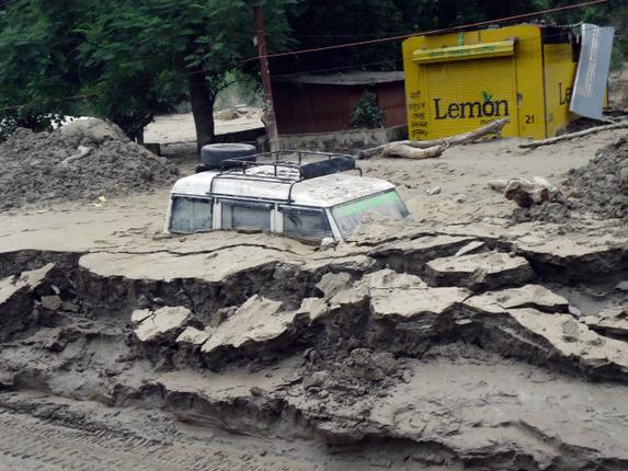
There is absolutely no justification for using principle of Utmost Good Faith in the environmental realm, because most EIAs are fraudulent and compliances do not exist. Even currently, any false information provided at the time of appraisal process is a violation of Environment Protection Act and invites punishment. But there are examples by the dozen about how the MoEFCC refuses to take action even when clear evidence is presented to them about false information presented by proponent. This was violation of EPA 1986, how is this violation different than violation of ELMA?
We know that monitoring is the weakest link in environment governance and there no reason to believe that it will improve in any way by making it web-based. In the absence of this, taking proponent at his word about the information he provides at the time of clearance or monitoring is not workable, justifiable or acceptable.
Appeals against decisions of NEMA or SEMA: The primary space to file an appeal against decision of NEMA or SEMA is now taken by a board Chaired by a retired High Court Judge and two senior officials of the government and the National Green Tribunal is restricted to only judicial review. Merit-Based review and subject experts is one of the strongest assets of NGT, differentiating it from other courts and it is clear that this very role is being clipped by ELMA.
The ELMA will have an overriding effect on any judgments, orders of courts or tribunals under acts dealt with by ELMA.
ELMA also envisages Special Environmental Courts at district level which will take “Cognizance of the serious offences only on a complaint by the officers authorized by the NEMA or SEMA.” As an afterthought, these courts may also hear public only if they are satisfied that responsible authority failed to take action about their complaint in three working days. Taking action is a very vague term.
While the ELMA has provisions for “protecting officials acting in good faith”, it has a penal provision to scare litigation by a provision which says “Punishment for false or frivolous complaints”. So while the proponent will be treated in “Utmost Good Faith” aggrieved citizens will be treated with utmost skepticism and will have to: File appeal within 30 days, prove their bona fides, be wary and careful about filing as it may be deemed “frivolous” and they may be fined!
~~~~
The undercurrent of the HLC report is indeed that the environmental governance will have utmost good faith towards the industry and utmost suspicion towards the affected, the concerned or the civil society. There is no evidence till date to prove that this good faith in the industry is warranted without stringent checks and balances. Even in current compliance system the developers are supposed to voluntarily submit six monthly compliance report, but nothing happens if they do not and no one reads them if they do.This undercurrent overshadows some useful recommendations of the committee.
The HLC report cannot be accepted in this form. Any review of environmental laws needs a consultative and consensus-based process and not a rushed work of two months by a biased panel with unclear and open-ended TORs. The characteristic of ELMA, NEMA and SEMA of excluding participation and not attempting to address issues related to inclusive governance has the potential to polarize environment discourse rather than making it swift and accountable.
The remedy, unfortunately, seems more problematic than the illness. Reminds one of Sahir’s words, जो दवा के नाम पे जहर दे, उसी चारागर की तलाश है…
-Parineeta Dandekar, parineeta.dandekar@gmail.com
END NOTES:
[1] The report has already been critiqued excellently by various authors.
- HLC – TSR Subramanian report: Climate blind or a climate disaster? Himanshu Thakkar, SANDRP https://sandrp.wordpress.com/2014/12/15/hlc-tsr-subramanian-report-climate-blind-or-a-climate-disaster/
- T.S.R. Subramanian Committee’ is interested in “Management of Environment” and not in “Protection of Environment”.-Rohit Prajapati and Krishnakant (http://counterview.org/2014/12/16/tsr-subramanian-committee-is-interested-in-management-of-environment-and-not-in-protection-of-environment/)
- Recipe for Dilution of Environmental Protection Regime: Report of MoEF’s Committee to Review Environmental Laws- Shripad Dharmadhikary (http://shripadmanthan.blogspot.in/2014/11/recipe-for-dilution-of-environmental.html)
- Full Report of MoEF’s Committee to Review Environmental Laws Confirms Initial Apprehensions: Recipe for Dilution of Environmental Protection Regime– Shripad Dharmadhikary: http://shripadmanthan.blogspot.in/2014/12/full-report-of-moefs-committee-to.html
- Executive’s Environmental Dilemmas: Unpacking a Committee’s Report: Manju Menon and Kanchi Kohli: http://www.epw.in/commentary/executives-environmental-dilemmas.html
[2] Members include: Shri Vishwanath Anand, Former Secretary, Justice (Retd.) Shri A.K. Srivastava Former Judge of Delhi High Court, Shri K.N. Bhat, Senior Advocate, Supreme Court of India. Secretaries: Shri Bishwanath Sinha Joint Secretary, MoEF&CC, , Shri Hardik Shah, Member Secretary, Gujarat Pollution Control Board
[3] [1] The Environment (Protection) Act, 1986, [2] The Forest (Conservation) Act, 1980; [3] The Wildlife (Protection) Act, 1972; [4] The Water (Prevention and Control of Pollution) Act, 1974; [5] The Air (Prevention and Control of Pollution) Act, 1981; [6] The Indian Forest Act, 1927.
As pointed out by Rohit Prajapati in his excellent critique, the HLC has also suggested changes to [1] The Forest Right Act, 2006 and [2] The National Green Tribunal Act, 2010, though these were not part of HLC’s TOR.

Larji Dam Fishladder: an unlovely trinket, a deceptive ornament
Emmanuel Theophilus[1] (etheophilus@gmail.com)
The 126 MW Larji Hydropower project near Aut on the mainstem of the Beas is run by the Himachal Pradesh State Electricity Board (HPSEB)[2]. The dam is constructed a little downstream of the confluence of the two main tributaries upstream, the Sainj and the Tirthan, at the narrowest part of a spectacular gorge, towering with limestone cliffs. The impounded waters of this dam have, since its construction in 2006, drowned the access road to the entire upper Kullu valley including Manali and the hundreds of villages upstream, including access to the entire Lahul valley and the region of Ladakh over the high passes from this end. The HPSEB then constructed a 3 km long tunnel to enable passage of traffic, and many people have warned of the hazardous nature of the tunnel. The 220 odd gods that descend from different valleys, on the backs of people to the lower Kullu valley every year in autumn however, refuse to use this tunnel. This is what compelled the HPSEB to build and maintain this tunnel, and during autumn to winter, to keep the water-storage in the dam low to enable the passage of gods, who have been traveling this route for over three and a half centuries. It is remark-worthy though, that this dam constructed as recently as 2006, seems to be heavily silted-up already and the dark shadows of sediment-shoals are visible just below the waters of the reservoir[3].
Being among the most recently completed, the Larji dam is the only dam on the Beas that has a fish-ladder, so it was of particular interest to us. Seeing no guard at the security booth, we walk in to the HPSEB dam operating office, and ask to speak to an officer about the fish ladder. To our complete surprise, we are spoken to and even taken on a tour of the ladder by a foreman who has worked on the dam for many years.
Having seen an elaborate fish ladder on the Kuri Chhu river in Bhutan of doubtful effectiveness[4], we could not help but look at this one with hope and excitement. Located at around 1,000 meters altitude, this dam was clearly in the way of a host of migratory species of fish. If this ladder design was effective, then surely the ‘barrier’ problem to seasonal migration for breeding and dispersal would have been addressed. Here though, is what we saw and heard.
- For one, the flow through the fish-pass seems too small to create an ‘attraction flow’ for fish. But even more obviously, the downstream entrance of the fish ladder is a steep cascade over a couple of meters of broken masonry and rock, that would clearly be un-negotiable by any fish that does not jump that high[5].

2. The outlet from the dam reservoir into the fish ladder is blocked off by a metal grill-mesh that is narrow enough to trap flotsam like Bisleri water-bottles. The mesh seemed too fine to let Mahseer of breeding-age pass through, either upstream or downstream.
3. The fish ladder was in a serious state of disrepair. To our questions about whether the ladder worked or not, the foreman says honestly that it does not. We see the reasons for this when we walk down the ̴100 meter length of the fish-pass channel.
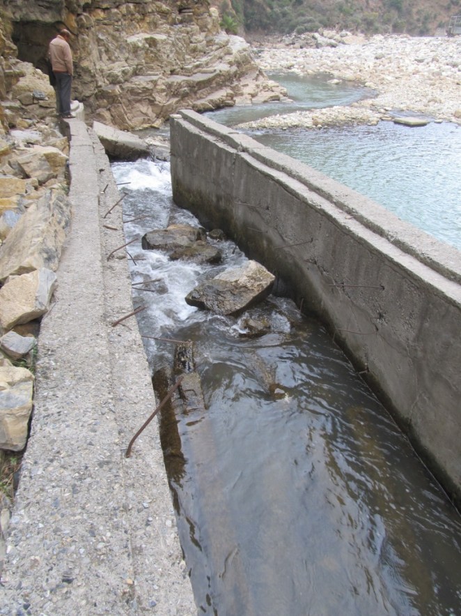
4. The Larji fish ladder seemed to be a hash of different designs of fish passes. There were four different design elements in this one fish-pass. It had a slotted-weir fishway design, a low gradient Denil fishway, a steep-pass Denil fishway and a plain concrete culvert on a grade design. Most of these slotted weirs were clogged with fallen rocks and debris from the slope above, and in places, the pools in them were over-flowing the weir in a vertical fall almost 2 meters high.
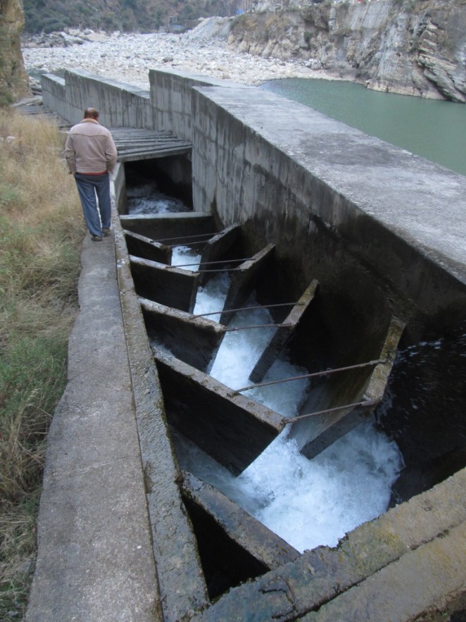
5. The oblique baffles on a Denil fishway are supposed to be placed in a manner that provides staggered partial-obstructions that slow the water down at variable velocities to make it passable for fish. However, here we saw that the water picks up momentum down an extremely steep slope with the baffles at 45 degrees to the flow, not offset to slow the water, but concentrating the force of the water in mid-stream flow. The slope seemed to be at almost 40 degrees angle, and the water was turbulent in the extreme in this section. A workable Denilway slope, even for the strongest of swimmers among fish, is not designed to exceed a slope of 20% at most. This was close to a 100% slope[6].

The last part of the fishway was a plain concrete culvert on a grade channel, essentially a sloping channel, where even the concrete sides of the channel had toppled over into the river-bed, and the final drop was over a two meter fall into the downstream flow. I asked the foreman whether he knew whether fish managed to make it over this extreme gauntlet. He said that they did not, but that he often saw fish gather and concentrate at the bottom of the dam under the sluice gates, and make futile leaps in an attempt to get over the dam. Clearly, the Larji dam fish ladder is just an unlovely trinket, a deceptive ornament.
Watch a 41 seconds video showing how fast the water is moving through the Larji Dam fishladder at: http://youtu.be/grVaxXPdeyY, Video is by the author.
It seemed to me that the dam builders and operators, the HPSEB in this case, both at the design and the executive levels, were not serious about constructing a fish-pass that would work, and neither were they serious about this at the operation and maintenance aspects. Whether they were serious at all even at the conceptual level, to put in place a mitigation measure that actually helped migratory fish bye-pass the barrier of the dam, or was this part of the design merely to obtain environmental clearance, can only be conjectured about. That hydropower projects can devise deceitful strategies for obtaining environmental clearance is one thing, but what does this tell us about the Union Ministry of Environment and Forests, the Expert Appraisal Committee on River Valley Projects appointed by MoEF, the regional office of the MoEF, the state Fisheries Department and also the state pollution Control Board, who are all variously part of the approval processes for hydropower projects, when they get their environmental clearances based on such ‘mitigation measures’?

END NOTES:
[1] This article has been extracted from SANDRP’s publication: Headwater Extinctions: Hydropower projects in the Himalayan reaches of the Ganga and the Beas: A closer look at impacts on fish and river ecosystems, authored by Emmanuel Theophilus, for details, see: https://sandrp.wordpress.com/2014/12/16/new-publication-headwater-extinctions-impact-of-hydropower-projects-on-fish-and-river-ecosystems-in-upper-ganga-and-beas-basins/
[2] The 126 MW Larji project is also infamous for being the costliest hydro-power project per unit electricity generated so far in India. Finally built at a cost of R.s 10.27 billion, which was twice the estimated cost, the Vigilance department unearthed major financial misappropriation by HPSEB officials.
[3] The Larji Dam became infamous in June 2014 when 25 students were washed away downstream from the dam due to sudden and unannounced release of water from the dam, see: https://sandrp.wordpress.com/2014/06/12/nadiya-bairi-bhayi/
[4] https://sandrp.wordpress.com/2014/02/02/fish-ladder-at-kurichhu-hydropower-project-bhutan-some-thoughts/
[5] Other than loaches, those tiny finger sized fish that can even climb (squiggle technique) up high waterfalls, provided there is something like a water-slide at the margins of the fall. They however, are not migratory fish.
[6] CIFRI recommends that the speed of flow of water in a fish-pass should not exceed 2 meters per second. Please see ‘Status of fish migration and fish passes with special reference to India’. MK Das and MA Hassan. CIFRI 2008.
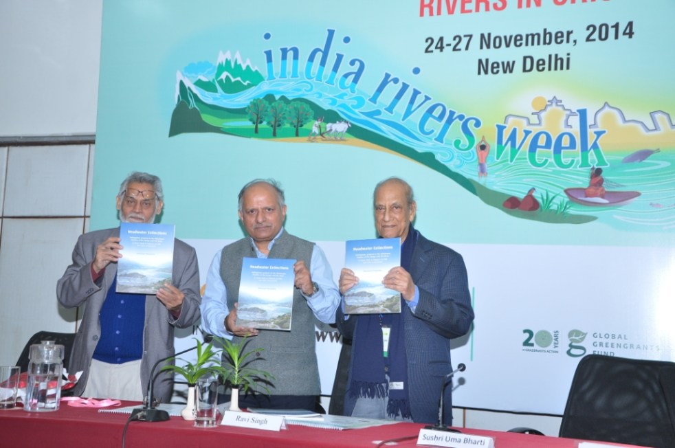
New Publication: Headwater Extinctions – Impacts of hydropower projects on fish and river ecosystems in Upper Ganga and Beas basins
SANDRP has just published a new report: “Headwater Extinctions- Hydropower projects in the Himalayan reaches of the Ganga and the Beas: A closer look at impacts on fish and river ecosystems”, authored by Emmanuel Theophilus. The report[i] was released at the India Rivers Week held during Nov 24-27, 2014.

Headwater Extinctions deals with impacts of hydropower projects in Beas basin in Himachal Pradesh and Alaknanda-Bhagirathi basins in Uttarakhand on river ecosystem and its components, mainly fish. While the harrowing impacts of hydropower projects on local livelihoods and social systems are being realized gradually, we are yet unclear about the extent of impacts of these so-called green projects have on fish and aquatic biodiversity.
Environmental Impact Assessments of large hydropower projects (> 25 MW as per EIA Notification 2006[2]) are supposed to assess ecological impacts of such projects, but we are yet to come across any comprehensive effort in this direction from EIA reports that we have assessed so far.
The Expert Appraisal Committee (EAC) of Union Ministry of Environment, Forests and Climate Change (MoEF & CC) which is entrusted with appraising these projects and their EIAs has paid very little attention to this issue. Since over a decade, the EAC has had expert members from Wildlife Institute of India (WII) and Central Inland Fisheries Research Institute (CIFRI). Both these institutes are supposed to have expertise on fish and aquatic biodiversity. But sadly, their presence has not helped fill the serious lacunae in appraisal and EIAs of the hydropower projects.
SANDRP had been trying to highlight the impact of hydropower on fish and the long standing problems in the so-called mitigation measures being recommended by the EAC. We thought that it may be useful to bring out a first-hand report bring out ground realities of what is happening to our rivers. Emmanuel Theophilus, based in the Dhauliganga Valley and who is an avid mountaineer, storyteller, ecologist and our ally was commissioned by SANDRP to study the impacts of hydropower on fish and ecosystems, review the EIAs as well as mitigation measures recommended by EAC as a part of Environment Management Plans of hydropower projects. We are very glad to publish the report as a first of the hopefully many steps to be taken to understand and address this important issue.
Headwater Extinctions has been written in an eminently readable style that Theo is known for, as could be seen from the earlier blogs[3] he wrote for us! The report has a section on ‘Travelogue’ which records Theo’s travels and thoughts as he visits Bhagirathi and Alaknanda sub basins in Uttarakhand and Beas basin in Himachal Pradesh. The report also brings illuminating photos from these trips. The fact that the travels happened within months of the Uttarakhand disaster of June 2013 could be seen in his photos and travel reports. It further substantives the role hydropower projects played in increasing the proportions of the disaster.
Travelogue is followed by discussions in two parts: Discussions on the impact of hydropower projects on fish and aquatic habitats along the two sub-basins and the role of EIAs, EMPs, Fisheries Plan and the government approval process. The findings of this report are valid for all Himalayan states & rivers.

Headwater Extinctions ends with some striking insights. Sample this: “We are in the midst of river extinctions in the Himalaya, but are surrounded by a tragic drama of double-speak and equivocation. And a horde of jostling brokers. Ranging from reputed universities, government departments, research institutions, everyday bureaucrats, and of course, politicians and contractors from within ‘the community’[4] along the developers and regulators. They not only write the script of this drama, they even play all the part”.
The inside covers of the report have detailed maps of the two basins with locations of hydropower projects, with annexures containing lists of hydropower projects in Upper Ganga and Beas basins and also list of fish found in Upper Ganga basin.
Theo has completed this report on a stringent timeline and budget, which meant that all the proposed and implemented fisheries management plans could not be assessed. We hope Headwater Extinctions provides sufficient material and compelling reasons to overhaul the way impacts of hydropower projects on fisheries and aquatic biodiversity are treated by EIAs, EMPs and government committees. We would also urge agencies like WII and CIFRI to do justice to their work inside EAC and beyond. That they are not doing that is apparent.
For EAC and MoEF&CC, we certainly would like them to ensure proper and full impact assessment of projects on aquatic biodiversity in the EIAs. The EAC also needs to stop approving completely ineffective fish hatcheries. They could initiate a credible independent study of the costs, benefits and performance of the fisheries development plans they have been approving in recent projects. It does not only smell fishy, but more like a scam! Here is a relevant quote from the report: “I can’t help see a few things here, as perhaps you do? Bluntly put, I see slush funds being dangled to a whole range of possible collaborators. The kindest term I can find for them is ‘brokers’.”
We look forward to your comments and suggestions on all aspects of Headwater Extinctions. If you would like a hard copy, please write to us.
SANDRP (ht.sandrp@gmail.com)
END NOTES:
[1] The full report is available on our web site, at: https://sandrp.in/Headwater_extinctions221114.pdf
[2] We have been saying this for long and this report helps substantiate our contention that the assumption that projects below 25 MW are benign and do not need EIA-EMP or environmental monitoring and public consultations is wrong.
[3] https://sandrp.wordpress.com/2014/02/02/fish-ladder-at-kurichhu-hydropower-project-bhutan-some-thoughts/ and https://sandrp.wordpress.com/2013/09/27/uttarakhand-floods-of-june-2013-curtain-raiser-on-the-events-at-nhpcs-280-mw-dhauliganga-hep/.
[4] Caveat, there are honest exceptions, but this is a generalization that describes the predominant phenomenon.
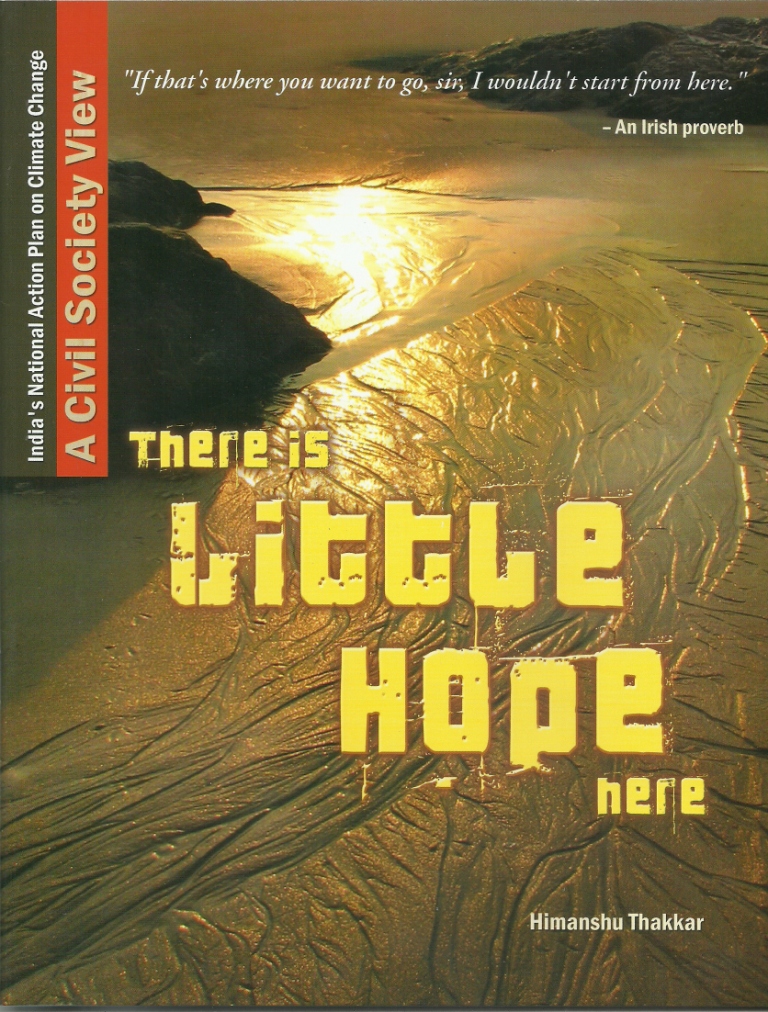
HLC – TSR Subramanian report: Climate blind or a climate disaster?
The Report of the High Level Committee to review various Acts administered by MoEF & CC (the report hereafter) has been submitted[1] on Nov 18, 2014[2], though it has been made public only in early Dec 2014. The High Level Committee (HLC) headed by former cabinet secretary T. S. R. Subramanian faced a lot of well deserved criticism from its inception[3]. While a comprehensive critique of the 106 page HLC report will take time, some critiques have already been published[4].
At the outset it should be mentioned that the HLC report is replete with recommendations for expediting environmental clearance, fast tracking projects and they show anti environment bias, as reflected in its use of “Single Window clearance”, “Fast track clearances”, “making business easier”, “utmost good faith” to name only a few phrases frequently used by HLC. However, this article is limited to commenting on the direct and indirect implications of the HLC report on climate change concerns.
While the mandate of the HLC report was “to review various Acts administered by MoEF & CC”, as the title page of the report says, the report rightly acknowledges that such a review would entail analysis of functioning of the environmental governance in India. And any review of environmental governance would be considered grossly inadequate in 21st century, when climate change is the biggest over arching environmental concern of our times that is also dictating the developmental priorities and options. As the world moves from deeply disappointing negotiations at Lima (Peru), symbolizing the continued let down of recent COPs (Conference of Parties) under United Nations Framework Convention on Climate Change, to the next (21st) COP at Paris in 2015, it would be useful to see the HLC report through the climate change lenses.
HLC is climate blind Scanning through the report for the phrase “climate change”, one finds that it appears just once in the report outside the name of the commissioning ministry (Ministry of Environment, Forests & Climate Change), in para 1.3 in preamble chapter, where it says: “We need to take heed of the very recent Intergovernmental Panel on Climate Change (IPCC) call from Copenhagen that the earth is flirting with danger – the alarm flag has been hoisted.” That reference, one would have thought would lead HLC to give more importance to Climate Change, but that hope is belied when we read through the report. Even the word climate appears just one other time in the report (para 7.10.4 (e)) but that has nothing to do with climate change.
The other phrase generally used synonymously with climate change is global warming. This phrase appears in the report just once in preamble chapter, in para 1.7, which generates some hope: “Global warming, environmental degradation, loss of biodiversity and potential for conflict growing out of competition over dwindling natural resources are the current focus of humanity and should occupy the centre stage in policy formulation.” Indeed, Climate Change is “current focus of humanity and should occupy the centre stage in policy formulation”. But the HLC has nothing to do with that concern as the report does even care to mention that in any of its analysis or recommendations!
That shows that as far as direct reference to climate change is concerned, HLC has shown not referred to it in its analysis or recommendations. It would seem from this that may be HLC report is blind to climate change concerns.
But how can it be blamed for inviting a climate disaster? Let us see how.
Indian government is proud of its National Action Plan on Climate Change which is supposed to drive our developmental plans and priorities during the ongoing 12th Five year plan and beyond. There are several national missions, including National Mission for a Green India, National Mission for Sustaining the Himalayan Ecosystem, National Solar Mission, National Water Mission, National Sustainable Agriculture, National Mission for Enhanced Energy Efficiency and National Mission for Sustainable Habitat, all of which have far reaching implications for environment governance and climate change. The prime minister himself chairs the PM Council on Climate Change, which is a policy making and national monitoring body.
The 12th Five Year Plan specifically gives importance to climate change when it says (para 1.42): “It is known that India will be one of the countries most severely affected if global warming proceeds unchecked and as such appropriate domestic action is necessary. A National Action Plan for climate change has been evolved with eight component Missions. Implementation of these missions must be an integral part of the Twelfth Plan.”
But HLC takes no cognizance of any of these. Nor does it see the ecology, forests, rivers, biodiversity from climate change perspective and how vulnerable groups from climate change point of view would be affected by projects that would adversely impact the ecology, forests, rivers, biodiversity & other natural resources. In fact HLC completely ignores the fact that millions of Indians directly depend on these natural resources. HLC seems to have no clue about this.
Here it will be illuminating to quote what the HLC chairman said recently[5]: “Villages in Gujarat could have got the water five years earlier had there been no andolan. Though some people lost their land in Madhya Pradesh (MP), the result is that half of MP and three-quarters of Gujarat today has access to water. So, there is some cost attached to everything. Some larger force will have to look at it. Ultimately, it is all about striking a balance. We are suggesting that the government should not go after development blindly but also not let people of one village blackmail it by shouting “my right, my right”. Mr Subramanian here is clearly referring to Narmada Bachao Andolan agitation against the Sardar Sarovar Dam on Narmada River. This is not only grossly ill informed opinion, it shows his shocking anti people and anti people’s movement bias.
The HLC was expected to consider populations that are vulnerable due to climate change and also affected by destruction of environment. In fact the entire HLC report has nothing to do with people or populations, leave aside identifying the vulnerable populations and giving affected people any effective say in environmental decision making process. Absence of such role for people is one of the key reasons for current environmental problems in India, as is apparent in any of the environmental and natural resources conflict. But HLC analysis not only ignores this lacuna, HLC recommendations are for further reducing say for the people by suggesting that public consultations can be done away with in most projects.
Let us see some further direct implications of HLC recommendations with respect to climate change. HLC is essentially dealing with forests (chapter 5), wildlife (chapter 6), biodiversity (chapters 5, 6 & 7), environmental governance (chapter 7). It makes a large number of recommendations on these issues and all of these have implications for climate change and how the populations vulnerable to climate change would become further vulnerable when these resources are taken away from them. But here again HLC sees no need to mention climate change. For example, forests are a major storehouse of carbon and HLC recommendations are going to lead to massive deforestations, thus increasing the release of stored carbon and reducing the carbon absorption, besides taking away the adaptation capacity of the forest dependent communities, but HLC finds no merit or reason to mention that. Even in section 7.9.2 where HLC mentions the kind of expertise NEMA (National Environmental Management Authority), there is no mention of climate change.
It is in this context that we need to view the HLC recommendations for faster and single window clearances with advocacy for utmost faith in the project developers, for relaxing the environmental governance on several counts, for fast track clearances for mining, power, line projects and large number of other projects, for recommending relaxation of public consultation process in most of the projects, for insulating the officials and the ministers (the executive) from environmental governance, for delaying the legal challenge process to clearances and also for debarring the legal challenge on merit. These HLC recommendations are all going to help relax the environmental governance and hence invite greater environmental disaster and by implication, climate disaster for India.
The claim of HLC chairman that HLC had tried “to optimize the efforts to balance developmental imperatives causing least possible damage to environment” is clearly unfounded. The remarks of the Union Environment Minister Prakash Javdekar, while accepting the report from HLC, that “the Report was a historic achievement that would strengthen processes to balance developmental commitments and environment protection. The recommendations of the Report would enhance Ministry’s efforts to avoid undue delays and ensure transparency in clearances and implementation of projects” is deeply disappointing and seems to begin an era where environmental conflicts will only increase and deepen.
It is thus clear that HLC report will invite greater climate disaster for India, particularly for those who are poor and already vulnerable to climate change implications. The HLC report should be rejected for this reason alone, besides its other acts of omissions and commissions.
Himanshu Thakkar (ht.sandrp@gmail.com), SANDRP

END NOTES:
[1] See full report: http://envfor.nic.in/node/4610
[2] See: http://pib.nic.in/newsite/PrintRelease.aspx?relid=111520
[3] For example, see: https://sandrp.wordpress.com/2014/09/26/review-of-environment-laws-is-necessary-but-the-tsr-subramanian-hlc-lacks-credibility/;
http://www.assamtribune.com/scripts/detailsnew.asp?id=nov2614/state050
[4] For example, see: http://shripadmanthan.blogspot.in/2014/12/full-report-of-moefs-committee-to.html and Executive’s Environmental Dilemmas: Unpacking a Committee’s Report by Manju Menon and Kanchi Kohli in Economic & Political Weekly, Dec 13, 2014, among others
[5] For full interview, see: http://www.downtoearth.org.in/content/my-report-not-industry-report-t-s-r-subramanian
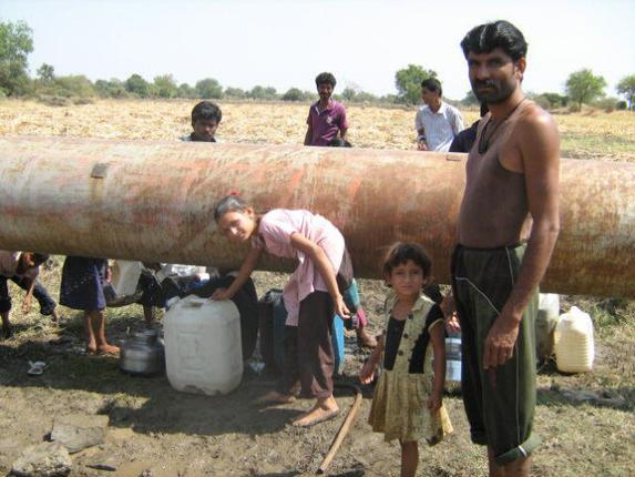
Can Marathwada afford to undertake Sugarcane Crushing in this terrible drought?
Since 2012, farmers in Maharashtra, especially in Marathwada and Vidarbha region of central and eastern Maharashtra are faced with unending mountains of crisis. What started as drought of 2012 went on in form of violent rains at places in 2013, hailstorms of February-March 2014, scanty monsoon in 2014 and unseasonal rains at places in November 2014, affecting lakhs of farmers. Agricultural production has suffered losses as impact of scanty rainfall has been compounded by absence of rains in critical time windows when soybean was filling and cotton bolls were forming. More than 8000 villages in Marathwada region which comprises of Aurangabad, Nanded, Parbhani, Latur, Beed, Hingoli, Jalna and Osmanabad have recorded crop losses of more than 50%.

The entire Winter Assembly of the newly formed Government seems to be clouded by discussions of drought package and increasing farmer suicides in Marathwada and Vidarbha. Since January 2014, more than 400 farmers have committed suicide in Marathwada region, and the pace is picking up worryingly since the past month. Hydrological, meteorological and agricultural droughts are becoming more pronounced in Marathwada.
But can this be attributed to vagaries of nature alone?
A brief analysis of the underlying reasons for the crisis in Marathwada and its future implications:
Truant Monsoon of 2014
As per SANDRP’s analysis of district-wise rainfall figures of Marathwada in monsoon 2014, the picture which arises is dismal:
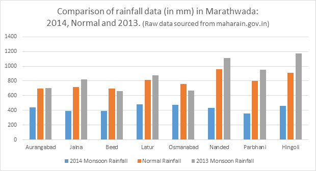
For 2014, departure from normal rainfall for 6 out of 8 districts in Marathwada was more than 40% and rest two districts it was more than 50%, indicating a huge reduction in rainfall. However, contrary to what is being stated in the media, the region received satisfactory rainfall in 2013 monsoon. In fact, 6 districts of the 8 received more than 100% of normal rains and remaining two districts received 88% and 95% of normal rains last year. This is one of the reasons that the reservoir storage in 2014 did not fall as sharply as they did in 2012-13 drought. On 15th October 2014, Jayakwadi dam in Aurangabad had 42% Live storage, which was more than October 2013 storage of 33% and 2012, when it had reached dead storage already (http://www.mahawrd.org/). The entire Marathwada region too showed large reservoir storage of 47%, which is not extremely alarming.
Significantly, 2012-13 drought also unfolded in a similar manner, with highly satisfactory monsoons of 2011.
At the same time, the region is facing one of the worst droughts in recent history today.
This seemingly contradictory situation underlines a number of things, most important being: large dams do not automatically equate with water in farmers’ fields. Work on many projects (most projects in Marathwada) is incomplete ( for example: canals of projects like Lower Dudhana, Jayakwadi Phase II, etc), while contractors and politicians have made a pretty packet from the contracts, many projects are ‘evaporation machines’ than a water supply systems, without canals and distributaries or systems to govern water management. The available impounded water is a valuable political tool, and is used as such. Water allocation and management is far from being sustainable, transparent and accountable.

According to news reports, in the past 11 months, 454 farmers only in Marathwada[1] have committed suicide due to number of reasons, most linked to crop failure and debt. Strikingly, after late November 2014, 52 farmers committed suicides mainly from Beed, Nanded and Osmanabad regions.
| District | Number of farmer suicides since January 2014 | |
| 1. | Beed | 122 |
| 2. | Nanded | 104 |
| 3. | Osmanabad | 54 |
| 4. | Parbhani | 49 |
| 5. | Aurangabad | 40 |
| 6. | Jalna | 22 |
| 7. | Hingoli | 29 |
| 8. | Latur | 34 |
The issue has been raised in the Winter Assembly by the enthusiastic opposition and the CM is yet to announce a drought relief package. It is expected to be close to 8000-9000 Crores or more.
At the same time, there is a huge tussle going on between Nashik and Nagar on one hand and Marathwada on the other, for waters Godavari which originates in Western Ghats flows through Northern Maharahstra and then becomes the lifeline of Marathwada region. Nashik and Ahmednagar have constructed slew of large dams on Godavari and have always been reluctant to release water for Jayakwadi dam in Aurangabad in the downstream. We saw this episode flaring up last year and we are seeing an action replay this year as the HC has ordered immediate release of water from upstream dams for Jayakwadi. (See:http://indiatogether.org/share-environment). (Notably, this is the first time I have witnessed that the Dam Storages data of www.mahawrd.org, the official website of the Water Resources Department is not updated with weekly Dam Storage Levels. This had not happened even at the peak of 2013-12 Drought. Our queries to WRD on this front have been unanswered till date.)
WRD officials and administration have taken cautious stand and water in reservoirs is now reserved mainly for drinking water purposes, any release in downstream for irrigation is being delayed and is being made only after strong negotiations, badly hitting rabi cultivation, which is already less than last year.
Even as conflicts flare up, protests rage and assembly is disrupted, sugarcane crushing goes on unhindered in Marathwada, in whopping 61 Sugar factories!
On the unfortunate and expected lines, the government has not said a word about restricting cane crushing in Marathwada this year, which itself guzzles massive amounts of water, apart from cane cultivation. On the other hand, the party president, Amit Shah himself attended first crushing day of some factories (one of which was reportedly captured by relatives of a BJP MLA by fraud![2])
A look at sugarcane cultivation and crushing season so far in Marathwada:
(All data obtained by SANDRP from Sugar Commissionarate, Maharashtra Government, December 2014)
Area under sugarcane in Marathwada in 2013-14 and Sugar factories
| District | Area under sugarcane (in hectares) | Number of Sugar factories | |
| 1. | Aurangabad | 15,373 | 9 |
| 2. | Jalna | 11,083 | 5 |
| 3. | Beed | 27,299 | 10 |
| 4. | Parbhani | 25,567 | 6 |
| 5. | Hingoli | 18,037 | 3 |
| 6. | Nanded | 28,057 | 9 |
| 7. | Osmanbad | 43,635 | 16 |
| 8. | Latur | 61,479 | 12 |
| TOTAL | 2,30,530 Hectares | 61 Factories | |
| TOTAL SUGARCANE CULTIVATED IN MARATHWADA FOR CRUSHING | 154.28 Lakh Tonnes |
So around 61 sugar factories will crush 154.28 Lakh Tonnes Cane in a period when drought is so bad that water will not be released from reservoirs for irrigation!
In doing so, the factories will use a minimum of 1500 litres of water to crush one tonne of cane. To crush 154.28 lakh tonnes, minimum amount of water used will be: 23,142,000,000 Litres or 23.1 Million Cubic Meters. This is the lowest estimate.
This amount would be sufficient to irrigate nearly 8,000 acres of high yielding groundnut, more of Jowar or can be sufficient for drinking water needs of nearly 15 lakh 85 thousand people[3] till the onset of 2015 monsoon!
This water will be used till the end of crushing season when the drought will be extremely severe if we look at current indices.
Is there a justification of doing so? Will a 10,000 Crore drought package come close to ameliorating the impact of water loss at the peak of drought?
In addition, the pollution control mechanism of most sugar factories is pathetic. Pollution Control Board has raised this number of times. Uncontrolled water and soil pollution by sugar factories will additionally pollute groundwater and water bodies, further affecting water security of the region.
This water may be sourced from dams and groundwater. SANDRP has witnessed in 2012-13drought, sugar factories in Marathwada, mainly Osmanabad region lifted water from dams even when water levels had dipped below dead storage. What will be the impact of this siphoning on local drinking water security?
We should not forget that one of the costliest political lesson for NCP came when Ajit Pawar uttered extremely insulting remarks on dry reservoirs, mocking people’s plight. This was in context of a protest by a lone farmer from Mohol, urging water for drinking, even as sugar factories on Mohol used lakhs of litres of water when the farmer, Prabhakar Deshmukh, was fasting in Mumbai! Needless to say, the ruling party’s defeat was sealed through such acts. (More about Sugarcane in Solapur here: https://sandrp.wordpress.com/2013/04/22/why-solapur-sugarcane-and-sustainability-do-not-rhyme/)
Even in terms of groundwater, Marathwada region has literally touched rock bottom. In a report by GSDA (Groundwater Survey and Development Agency) submitted to Government of Maharashtra,[4] it has been reported that in 249 villages of Marathwada, abstraction has been 100% and there is no more water to draw. Not surprisingly, the regions suffering largest groundwater problems are surrounded by sugarcane and sugarcane factories.
In the past too, SANDRP has underlined how sugarcane in drought affected areas contributed to worsening drought of 2012-13. Then Solapur was in crisis. This year, the district which has 28 sugar factories two years back has 34 sugar factories!
All government announcements about bringing sugarcane under drip have remained on paper and sugarcane continues to rule the drought politics of the region, regardless of the political party. In fact, the Cooperation Minister BJP Government Chadrakant Patil has announced that the only clause which has been limiting further sugar factory rush (of having a minimum aerial distance of 15-25 kms between two factories[5]), can be diluted “ to promote healthy competition”. 200 factories are lined up for licenses with the Sugar Commissionarate! There is no thought about the impact of this decision on water profile of Maharashtra.
This defies logic. The work of Winter Assembly was disrupted several times yesterday (10th December 2014) by aggressive opposition asking for an immediate drought package for Marathwada and Vidarbha. How can a 4,000 or 10,000 Crore Drought Package address these systemic issues? How can this package address siphoning off water from a drought hit region in peak drought? The opponents are happy discussing help to sugar factories for drought relief, not raising any points about impending impacts of crushing cane in drought.
In the long term, there is a need to reduce area under sugarcane and provide proper incentives, fair support price, forward and backward market linkages and support for initiatives like horticulture under drip (and there are several success stories from Marathwada on this), dairying, oil seed and pulses cultivation and processing, dryland farming and importantly, equitable and transparent water management involving all farmers in the region, not restricted to a few.
It is high time that long term decisions are taken in order to make Marathwada truly drought proof and free from clutches of ‘drought packages’ and opportunistic politics, year after year. A start can be made by restricting cane crushing in the region immediately.
-Parineeta Dandekar, SANDRP, parineeta.dandekar@gmail.com
End Notes:
Marathwada Farmers need Water: http://72.78.249.126/Agrowon/20141013/5520233630699177815.htm
SANDRP Analysis on water issues in Maharashtra:
Open Letter to Devendra Fadnavis: https://sandrp.wordpress.com/2014/11/14/open-letter-to-devendra-fadnavis/
Why Solapur, Sugar and Sustainability do not rhyme: https://sandrp.wordpress.com/2013/04/22/why-solapur-sugarcane-and-sustainability-do-not-rhyme
[1] http://www.esakal.com/NewsDetails.aspx?NewsId=5611377824684291267
[2] http://www.loksatta.com/mumbai-news/bjp-leaders-closed-try-to-take-over-controle-on-sugar-factory-in-paithan-1049861/
[3] @ 80 litres per capita per day
[4] http://www.loksatta.com/maharashtra-news/no-rain-in-marathwada-1047256/
[5] http://www.business-standard.com/article/economy-policy/maharashtra-likely-to-abolish-25-km-limit-between-two-sugar-units-114112300348_1.html
Further work on SANDRP on Drought, Maharashtra and Sugarcane can be found in Category: Maharashtra

