The Report of the High Level Committee to review various Acts administered by MoEF & CC (the report hereafter) has been submitted[1] on Nov 18, 2014[2], though it has been made public only in early Dec 2014. The High Level Committee (HLC) headed by former cabinet secretary T. S. R. Subramanian faced a lot of well deserved criticism from its inception[3]. While a comprehensive critique of the 106 page HLC report will take time, some critiques have already been published[4].
At the outset it should be mentioned that the HLC report is replete with recommendations for expediting environmental clearance, fast tracking projects and they show anti environment bias, as reflected in its use of “Single Window clearance”, “Fast track clearances”, “making business easier”, “utmost good faith” to name only a few phrases frequently used by HLC. However, this article is limited to commenting on the direct and indirect implications of the HLC report on climate change concerns.
While the mandate of the HLC report was “to review various Acts administered by MoEF & CC”, as the title page of the report says, the report rightly acknowledges that such a review would entail analysis of functioning of the environmental governance in India. And any review of environmental governance would be considered grossly inadequate in 21st century, when climate change is the biggest over arching environmental concern of our times that is also dictating the developmental priorities and options. As the world moves from deeply disappointing negotiations at Lima (Peru), symbolizing the continued let down of recent COPs (Conference of Parties) under United Nations Framework Convention on Climate Change, to the next (21st) COP at Paris in 2015, it would be useful to see the HLC report through the climate change lenses.
HLC is climate blind Scanning through the report for the phrase “climate change”, one finds that it appears just once in the report outside the name of the commissioning ministry (Ministry of Environment, Forests & Climate Change), in para 1.3 in preamble chapter, where it says: “We need to take heed of the very recent Intergovernmental Panel on Climate Change (IPCC) call from Copenhagen that the earth is flirting with danger – the alarm flag has been hoisted.” That reference, one would have thought would lead HLC to give more importance to Climate Change, but that hope is belied when we read through the report. Even the word climate appears just one other time in the report (para 7.10.4 (e)) but that has nothing to do with climate change.
The other phrase generally used synonymously with climate change is global warming. This phrase appears in the report just once in preamble chapter, in para 1.7, which generates some hope: “Global warming, environmental degradation, loss of biodiversity and potential for conflict growing out of competition over dwindling natural resources are the current focus of humanity and should occupy the centre stage in policy formulation.” Indeed, Climate Change is “current focus of humanity and should occupy the centre stage in policy formulation”. But the HLC has nothing to do with that concern as the report does even care to mention that in any of its analysis or recommendations!
That shows that as far as direct reference to climate change is concerned, HLC has shown not referred to it in its analysis or recommendations. It would seem from this that may be HLC report is blind to climate change concerns.
But how can it be blamed for inviting a climate disaster? Let us see how.
Indian government is proud of its National Action Plan on Climate Change which is supposed to drive our developmental plans and priorities during the ongoing 12th Five year plan and beyond. There are several national missions, including National Mission for a Green India, National Mission for Sustaining the Himalayan Ecosystem, National Solar Mission, National Water Mission, National Sustainable Agriculture, National Mission for Enhanced Energy Efficiency and National Mission for Sustainable Habitat, all of which have far reaching implications for environment governance and climate change. The prime minister himself chairs the PM Council on Climate Change, which is a policy making and national monitoring body.
The 12th Five Year Plan specifically gives importance to climate change when it says (para 1.42): “It is known that India will be one of the countries most severely affected if global warming proceeds unchecked and as such appropriate domestic action is necessary. A National Action Plan for climate change has been evolved with eight component Missions. Implementation of these missions must be an integral part of the Twelfth Plan.”
But HLC takes no cognizance of any of these. Nor does it see the ecology, forests, rivers, biodiversity from climate change perspective and how vulnerable groups from climate change point of view would be affected by projects that would adversely impact the ecology, forests, rivers, biodiversity & other natural resources. In fact HLC completely ignores the fact that millions of Indians directly depend on these natural resources. HLC seems to have no clue about this.
Here it will be illuminating to quote what the HLC chairman said recently[5]: “Villages in Gujarat could have got the water five years earlier had there been no andolan. Though some people lost their land in Madhya Pradesh (MP), the result is that half of MP and three-quarters of Gujarat today has access to water. So, there is some cost attached to everything. Some larger force will have to look at it. Ultimately, it is all about striking a balance. We are suggesting that the government should not go after development blindly but also not let people of one village blackmail it by shouting “my right, my right”. Mr Subramanian here is clearly referring to Narmada Bachao Andolan agitation against the Sardar Sarovar Dam on Narmada River. This is not only grossly ill informed opinion, it shows his shocking anti people and anti people’s movement bias.
The HLC was expected to consider populations that are vulnerable due to climate change and also affected by destruction of environment. In fact the entire HLC report has nothing to do with people or populations, leave aside identifying the vulnerable populations and giving affected people any effective say in environmental decision making process. Absence of such role for people is one of the key reasons for current environmental problems in India, as is apparent in any of the environmental and natural resources conflict. But HLC analysis not only ignores this lacuna, HLC recommendations are for further reducing say for the people by suggesting that public consultations can be done away with in most projects.
Let us see some further direct implications of HLC recommendations with respect to climate change. HLC is essentially dealing with forests (chapter 5), wildlife (chapter 6), biodiversity (chapters 5, 6 & 7), environmental governance (chapter 7). It makes a large number of recommendations on these issues and all of these have implications for climate change and how the populations vulnerable to climate change would become further vulnerable when these resources are taken away from them. But here again HLC sees no need to mention climate change. For example, forests are a major storehouse of carbon and HLC recommendations are going to lead to massive deforestations, thus increasing the release of stored carbon and reducing the carbon absorption, besides taking away the adaptation capacity of the forest dependent communities, but HLC finds no merit or reason to mention that. Even in section 7.9.2 where HLC mentions the kind of expertise NEMA (National Environmental Management Authority), there is no mention of climate change.
It is in this context that we need to view the HLC recommendations for faster and single window clearances with advocacy for utmost faith in the project developers, for relaxing the environmental governance on several counts, for fast track clearances for mining, power, line projects and large number of other projects, for recommending relaxation of public consultation process in most of the projects, for insulating the officials and the ministers (the executive) from environmental governance, for delaying the legal challenge process to clearances and also for debarring the legal challenge on merit. These HLC recommendations are all going to help relax the environmental governance and hence invite greater environmental disaster and by implication, climate disaster for India.
The claim of HLC chairman that HLC had tried “to optimize the efforts to balance developmental imperatives causing least possible damage to environment” is clearly unfounded. The remarks of the Union Environment Minister Prakash Javdekar, while accepting the report from HLC, that “the Report was a historic achievement that would strengthen processes to balance developmental commitments and environment protection. The recommendations of the Report would enhance Ministry’s efforts to avoid undue delays and ensure transparency in clearances and implementation of projects” is deeply disappointing and seems to begin an era where environmental conflicts will only increase and deepen.
It is thus clear that HLC report will invite greater climate disaster for India, particularly for those who are poor and already vulnerable to climate change implications. The HLC report should be rejected for this reason alone, besides its other acts of omissions and commissions.
Since 2012, farmers in Maharashtra, especially in Marathwada and Vidarbha region of central and eastern Maharashtra are faced with unending mountains of crisis. What started as drought of 2012 went on in form of violent rains at places in 2013, hailstorms of February-March 2014, scanty monsoon in 2014 and unseasonal rains at places in November 2014, affecting lakhs of farmers. Agricultural production has suffered losses as impact of scanty rainfall has been compounded by absence of rains in critical time windows when soybean was filling and cotton bolls were forming. More than 8000 villages in Marathwada region which comprises of Aurangabad, Nanded, Parbhani, Latur, Beed, Hingoli, Jalna and Osmanabad have recorded crop losses of more than 50%.
Marathwada region in Maharashtra Map from: Marathi Wikipedia
The entire Winter Assembly of the newly formed Government seems to be clouded by discussions of drought package and increasing farmer suicides in Marathwada and Vidarbha. Since January 2014, more than 400 farmers have committed suicide in Marathwada region, and the pace is picking up worryingly since the past month. Hydrological, meteorological and agricultural droughts are becoming more pronounced in Marathwada.
But can this be attributed to vagaries of nature alone?
A brief analysis of the underlying reasons for the crisis in Marathwada and its future implications:
Truant Monsoon of 2014
As per SANDRP’s analysis of district-wise rainfall figures of Marathwada in monsoon 2014, the picture which arises is dismal:
For 2014, departure from normal rainfall for 6 out of 8 districts in Marathwada was more than 40% and rest two districts it was more than 50%, indicating a huge reduction in rainfall. However, contrary to what is being stated in the media, the region received satisfactory rainfall in 2013 monsoon. In fact, 6 districts of the 8 received more than 100% of normal rains and remaining two districts received 88% and 95% of normal rains last year. This is one of the reasons that the reservoir storage in 2014 did not fall as sharply as they did in 2012-13 drought. On 15th October 2014, Jayakwadi dam in Aurangabad had 42% Live storage, which was more than October 2013 storage of 33% and 2012, when it had reached dead storage already (http://www.mahawrd.org/). The entire Marathwada region too showed large reservoir storage of 47%, which is not extremely alarming.
Significantly, 2012-13 drought also unfolded in a similar manner, with highly satisfactory monsoons of 2011.
At the same time, the region is facing one of the worst droughts in recent history today.
This seemingly contradictory situation underlines a number of things, most important being: large dams do not automatically equate with water in farmers’ fields. Work on many projects (most projects in Marathwada) is incomplete ( for example: canals of projects like Lower Dudhana, Jayakwadi Phase II, etc), while contractors and politicians have made a pretty packet from the contracts, many projects are ‘evaporation machines’ than a water supply systems, without canals and distributaries or systems to govern water management. The available impounded water is a valuable political tool, and is used as such. Water allocation and management is far from being sustainable, transparent and accountable.
Projects under the jurisdiction of Godavari Marathwada Irrigation Development Corporation
According to news reports, in the past 11 months, 454 farmers only in Marathwada[1] have committed suicide due to number of reasons, most linked to crop failure and debt. Strikingly, after late November 2014, 52 farmers committed suicides mainly from Beed, Nanded and Osmanabad regions.
District
Number of farmer suicides since January 2014
1.
Beed
122
2.
Nanded
104
3.
Osmanabad
54
4.
Parbhani
49
5.
Aurangabad
40
6.
Jalna
22
7.
Hingoli
29
8.
Latur
34
The issue has been raised in the Winter Assembly by the enthusiastic opposition and the CM is yet to announce a drought relief package. It is expected to be close to 8000-9000 Crores or more.
At the same time, there is a huge tussle going on between Nashik and Nagar on one hand and Marathwada on the other, for waters Godavari which originates in Western Ghats flows through Northern Maharahstra and then becomes the lifeline of Marathwada region. Nashik and Ahmednagar have constructed slew of large dams on Godavari and have always been reluctant to release water for Jayakwadi dam in Aurangabad in the downstream. We saw this episode flaring up last year and we are seeing an action replay this year as the HC has ordered immediate release of water from upstream dams for Jayakwadi. (See:http://indiatogether.org/share-environment). (Notably, this is the first time I have witnessed that the Dam Storages data of www.mahawrd.org, the official website of the Water Resources Department is not updated with weekly Dam Storage Levels. This had not happened even at the peak of 2013-12 Drought. Our queries to WRD on this front have been unanswered till date.)
WRD officials and administration have taken cautious stand and water in reservoirs is now reserved mainly for drinking water purposes, any release in downstream for irrigation is being delayed and is being made only after strong negotiations, badly hitting rabi cultivation, which is already less than last year.
Even as conflicts flare up, protests rage and assembly is disrupted, sugarcane crushing goes on unhindered in Marathwada, in whopping 61 Sugar factories!
On the unfortunate and expected lines, the government has not said a word about restricting cane crushing in Marathwada this year, which itself guzzles massive amounts of water, apart from cane cultivation. On the other hand, the party president, Amit Shah himself attended first crushing day of some factories (one of which was reportedly captured by relatives of a BJP MLA by fraud![2])
A look at sugarcane cultivation and crushing season so far in Marathwada:
(All data obtained by SANDRP from Sugar Commissionarate, Maharashtra Government, December 2014)
Area under sugarcane in Marathwada in 2013-14 and Sugar factories
District
Area under sugarcane (in hectares)
Number of Sugar factories
1.
Aurangabad
15,373
9
2.
Jalna
11,083
5
3.
Beed
27,299
10
4.
Parbhani
25,567
6
5.
Hingoli
18,037
3
6.
Nanded
28,057
9
7.
Osmanbad
43,635
16
8.
Latur
61,479
12
TOTAL
2,30,530 Hectares
61 Factories
TOTAL SUGARCANE CULTIVATED IN MARATHWADA FOR CRUSHING
154.28 Lakh Tonnes
So around 61 sugar factories will crush 154.28 Lakh Tonnes Cane in a period when drought is so bad that water will not be released from reservoirs for irrigation!
In doing so, the factories will use a minimum of 1500 litres of water to crush one tonne of cane. To crush 154.28 lakh tonnes, minimum amount of water used will be: 23,142,000,000 Litres or 23.1 Million Cubic Meters. This is the lowest estimate.
This amount would be sufficient to irrigate nearly 8,000 acres of high yielding groundnut, more of Jowar or can be sufficient for drinking water needs of nearly 15 lakh 85 thousand people[3] till the onset of 2015 monsoon!
This water will be used till the end of crushing season when the drought will be extremely severe if we look at current indices.
Is there a justification of doing so? Will a 10,000 Crore drought package come close to ameliorating the impact of water loss at the peak of drought?
In addition, the pollution control mechanism of most sugar factories is pathetic. Pollution Control Board has raised this number of times. Uncontrolled water and soil pollution by sugar factories will additionally pollute groundwater and water bodies, further affecting water security of the region.
This water may be sourced from dams and groundwater. SANDRP has witnessed in 2012-13drought, sugar factories in Marathwada, mainly Osmanabad region lifted water from dams even when water levels had dipped below dead storage. What will be the impact of this siphoning on local drinking water security?
We should not forget that one of the costliest political lesson for NCP came when Ajit Pawar uttered extremely insulting remarks on dry reservoirs, mocking people’s plight. This was in context of a protest by a lone farmer from Mohol, urging water for drinking, even as sugar factories on Mohol used lakhs of litres of water when the farmer, Prabhakar Deshmukh, was fasting in Mumbai! Needless to say, the ruling party’s defeat was sealed through such acts. (More about Sugarcane in Solapur here: https://sandrp.wordpress.com/2013/04/22/why-solapur-sugarcane-and-sustainability-do-not-rhyme/)
Even in terms of groundwater, Marathwada region has literally touched rock bottom. In a report by GSDA (Groundwater Survey and Development Agency) submitted to Government of Maharashtra,[4] it has been reported that in 249 villages of Marathwada, abstraction has been 100% and there is no more water to draw. Not surprisingly, the regions suffering largest groundwater problems are surrounded by sugarcane and sugarcane factories.
In the past too, SANDRP has underlined how sugarcane in drought affected areas contributed to worsening drought of 2012-13. Then Solapur was in crisis. This year, the district which has 28 sugar factories two years back has 34 sugar factories!
All government announcements about bringing sugarcane under drip have remained on paper and sugarcane continues to rule the drought politics of the region, regardless of the political party. In fact, the Cooperation Minister BJP Government Chadrakant Patil has announced that the only clause which has been limiting further sugar factory rush (of having a minimum aerial distance of 15-25 kms between two factories[5]), can be diluted “ to promote healthy competition”. 200 factories are lined up for licenses with the Sugar Commissionarate! There is no thought about the impact of this decision on water profile of Maharashtra.
This defies logic. The work of Winter Assembly was disrupted several times yesterday (10th December 2014) by aggressive opposition asking for an immediate drought package for Marathwada and Vidarbha. How can a 4,000 or 10,000 Crore Drought Package address these systemic issues? How can this package address siphoning off water from a drought hit region in peak drought? The opponents are happy discussing help to sugar factories for drought relief, not raising any points about impending impacts of crushing cane in drought.
In the long term, there is a need to reduce area under sugarcane and provide proper incentives, fair support price, forward and backward market linkages and support for initiatives like horticulture under drip (and there are several success stories from Marathwada on this), dairying, oil seed and pulses cultivation and processing, dryland farming and importantly, equitable and transparent water management involving all farmers in the region, not restricted to a few.
It is high time that long term decisions are taken in order to make Marathwada truly drought proof and free from clutches of ‘drought packages’ and opportunistic politics, year after year. A start can be made by restricting cane crushing in the region immediately.
Above: Latha with her friends at Athirappilly Falls. Photo: Parineeta Dandekar
It is difficult for me to write impersonally about the work of Bhagirath Prayas Samman recipient Dr. Latha Anantha. She is Latha Chechi to me, a close friend and more of a sister. The bond is based on water and rivers, possibly stronger than blood. This is only an attempt to introduce the readers to the exemplary work of Latha Chechi (and that of the River Research Centre and Chalakudy Puza Samarakshan Samithi team) as the recipient of the first Bhagirath Prayas Samman for “exemplary capacity for combining sound research with the mobilization of community, political and state agencies, and for ushering in a unique methodology of consensus- based conservation of rivers in the country’”.
Ravi from CPSS receiving Bhagirath Prayas Samman Award on behalf of Dr. Latha, from Justice Madan Lokur
Latha is an agricultural scientist by education and holds a doctorate in the subject. But how did she start working with rivers? In 1989, Latha was a part of a nature camp which took her and many like her into the Silent Valley National Forest. Then, Silent Valley National Forest was declared as a protected area only 4 years back after protracted, and possibly one of India’s foremost anti-destructive dam struggle, led by people. (A fascinating account here )
It was here that, under the guidance of Dr. Sathish Chandran Nair, Latha saw that while forests of Silent Valley are the birth place of beautiful river Kunti, Attapadi region was devoid of forests and most streams were dried up. The Bhavani river was hardly flowing there. The contrast was self revealing. It was here that the connections between forests and water and rivers and tribals and wildlife were forged. She says she was a changed person after witnessing all this.
In 1995, Latha married Unnikrishnan, also an ardent river lover and activist (and a poet!) and together they conducted several nature camps for children and young adults all over Kerala, always coming back to the Chalakudy River and her thick forests near Vazachal and around. By then, she had made friends not only with the river, but with the Kadar tribes who lived with the Chalakudy, on her banks, one amongst them was young Geeta. The learning and exploring continued for a few years, until in 1998 they heard that a dam project on Chalakudy, the Athirappilly dam, had received sanctions from Delhi. They were shell shocked. Back in 1998, this couple and their friends like Ravi, in a remote part of Kerala knew nothing of EIA Notification, sad monotony of sham EIAs, compromised EIA agents, project-friendly meetings at MoEF, nothing. But they persevered.
Helped by stalwarts like Dr. V.S Vijayan, Dr. Sathish Chandran Nair, this tenacious group slowly put the jigsaw puzzle together, piece by piece. They understood the EIA Notification of 1994, got hold of the EIA and saw how the Kadar tribe, living just by the river was not even mentioned. They say how the fact that Chalakudy was already dammed six times before it comes to Athirappilly and how 35% of its flows are already diverted was hidden from the EIA. .Kadar tribal settlement was mentioned incorrectly outside the project impact area. Latha by then also realized that the mandatory public hearing was also not conducted for this project.
Now there was no stopping this group, which also included hydrologist Madhusoodan and botanist K Amitha Bachan. Ravi and Unni filed a case in Kerala High Court in 2001, challenging the EC granted to Athirappilly and Latha & team did all the research, putting together a water-tight case. The court ruled in favor and asked for a fresh public hearing.
Latha and friends already had strong ties in the Chalakudy region. This was not a single day affair, but a trusted relation built over years. The tribals knew this team’s love for them and their river. They listened and they discussed. They were aghast at the dam building plans. The public hearing saw overwhelming participation not only from the tribal communities, but from scientists, shop keepers, hotel owners, farmers, gram panchayat members, etc. The District Collector witnessed this and would not push the project until a river basin study was done, possibly the first such in India.
Public Hearing of Athirappilly Project
There was a lull in the meantime, giving a false sense of security for these Chalakudy lovers. But it also gave them time to get introduced and work with friends like Himanshu Thakkar from South Asia Network on Dams, Rivers & People (SANDRP), Shripad Dharmadhikary from Manthan with whom they had been in touch for long, supporters like Dr. Ramaswmay Iyer, etc. Through SANDRP, in 1998 itself, the group had made submission to the World Commission on Dams opposing the Athirapally project. The CPSS, in collaboration with SANDRP, organized a meeting on the report of the World Commission on Dams at Thrissur on June 22-23, 2002. A meeting against Interlinking of Rivers in Kerala was organized by CPSS and SANDRP on July 12-13, 2003. A book “Tragedy of Commons: The Kerala Experience in River Linking” was published in 2004 by River Research Centre & SANDRP.
Shripad Dharmadhikary at Charpa Falls, also threatened by the Athirappilly project
But Athirappilly dam plan put up its head again in February 2005 when the project gained Environmental Clearance through back door from the MoEF. This time the EC was challenged by none other than the young Geeta, the Kadar woman, living on the banks of the Chalakudy who filed a PIL in the High Court of Kerala in April 2005 challenging the new Clearance granted to the project. The Athirappilly Gram Panchayat President also filed a PIL on EIA violations. The High court again upheld the plea and ordered for a public hearing afresh! This public hearing in 2006 witnessed massive turnout of the tribal community members.
Geeta ji, the petitioner for Athirappilly Project in the backdrop of the falls. Photo: Parineeta Dandekar
In the meantime, Latha also wrote to Jairam Ramesh to intervene in the issue and Unni and Lathachechi met him personally when he was in Kochi. He issued stop Memo to KSEB on January 4th 2010. After this KSEB again approached MoEF. Once again PIL was filed in HC challenging the EIA in 2007 and is still pending in the HC.
This proposal was again recommended environmental clearance by the Ministry of Environment, Forests & Climate Change’s Expert Appraisal Committee (EAC) on River Valley Committee in their meeting in May 2007. However, following directions by Kerala High Court to KSEB, the project came back before EAC in March 2010 and was again discussed in April 2010 and July 2010, till when no conclusion could be reached by EAC and EAC had asked for more information and clarifications. There is no mention of the project in any of the minutes of the subsequent EAC meetings[1].
Since then there has been a lull on the plans though it has not died out completely. River Research Centre, though existing since many years back informally, was formally registered as a Trust. RRC, Chalakudy Puzha Samrakshan Samiti and Latha’s dedication is one of the strengths of Athirappilly waterfalls, which would have been dammed and dried long before if it was not for this people-led, nonviolent struggle.
The Athirappilly Falls
Latha was simultaneously working on campaign against the proposed Pathrakkadave HEP across Kunti River near Silent Valley National Park on several angles such as community mobilisation, EIA, Public hearing, etc. The very destructive dam project has been stalled and the public sentiment and pressure is very big on this project as not to build the dam.
Since early 2000, she has also been involved in education program for children along the banks of the Chalakudy River. RRC and the Schools for Rivers program were instrumental in forming a ‘Kuttikoottam’ (meaning a group of children) of more than 50 children aged between 10-20 years who would set out to know more about their panchayath, its natural resources, human resource potential, culture, folklore, institutions, governance, destruction of environment, problems faced by the river and related livelihoods etc. ( More on it here)
While working on environmental governance and advocacy, CPSS has also worked on novel and promising initiatives like Reservoir Reoperation Model. The project is steered by CPSS and Forum for Policy Dialogue on Water Conflicts in India of which Latha is a Steering Committee member.This model is specifically aimed at dammed rivers, where impacts are supposed to be a way of life. In the much-dammed Chalakudy, RRC, with its dedicated members like Ravi and others demonstrated how operations of a hydropower scheme can be and should be changed to maintain summer irrigation in the downstream and also rudimentary flows for the river. This is far from perfect, but a great step in the direction. At the heart of these processes is joining the dots and bringing people together: from power company, irrigation department, farmers, local self-governments, etc. In April 2013, the CM of Kerala agreed to increase the off peak generation of Poringalkuthu Left Bank Hydro Electric Project. More on this here.
Latha also played an active role in the Save Western Ghats Movement group. In a meeting of this group Kothagiri in Keystone Campus, Environment Minister Jairam Ramesh made the announcement of Western Ghats Expert Ecology Panel, after relentless advocacy by the group, including Latha. The subsequent Panel under the leadership of Dr. Madav Gadgil and what followed had deeply affected the environmental discourse in India. The way MoEF and government of India hid Gadgil report was a shameful, underlining the unwillingness of the administration to take any visionary or long term actions towards people-led environmental governance. Along with organization like Goa Foundation, RRC was a part of the petition filed in the NGT against this opacity and for implementation of the Gadgil Report. The court ordered the MoeF to bring out the Gadgil report. The din that followed, especially in Kerala, was massive and bewildering. Gadgil Report was then subsumed to the problematic Kasturirangan Committee, which decision itself was flawed. Powerful interest lobbies, including religious groups, did not miss a single opportunity at misleading locals about eco sensitive areas. If Western Ghats was tense, Kerala was in the eye of the storm. At this juncture, Latha chechi came out and wrote about Kasturirangan Committee report as one of the reason for political polarization for Kerala, and asked for a sane and democratic approach through the Gadgil Report. Latha organised meetings as well as participated in many meetings and debates organised on the subject all over Kerala.
She has also been working endlessly on the issue of eflows, from upcoming as well as existing dams and has engaged consistently with the MoEF on this. Way back in 2009 RRC, along with SANDRP and Svaraj organized the first consultative National Workshop on Eflows. She has also co-authored the first Primer on Environmental flows, aimed not at scientists, but at community groups and activists who are more likely to urge for the implementation of the concept of eflows. (http://www.internationalrivers.org/files/attached-files/eflows_primer_062012.pdf)
While keeping a balanced, soft spoken and people friendly stand she has not shied from criticizing consultants like NIH and CIFRI for their shoddy eflows assessments. She has served on several government appointed committees in Kerala and has been a resource person for countless programs on rivers and forests. She also serves as the South Asia Advisor, International Rivers and is the Ashoka Fellow, 2012.
Latha’s story, intrinsically linked with River Research Centre, CPSS, Chalakudy River and beyond is a story of soft spoken courage. It is a story of bringing people together and looking at a river as a shared heritage, not only as a part of a conflict.
Today, Latha is undergoing a challenging time physically, undergoing several rounds of treatments. But mentally, she is the same strong and sensitive river woman of the Western Ghats.
She is a natural recipient of the Bhagirath Prayas Samman and we look forward to having her back with us soon in her full form: singing, laughing and loving rivers as she does..
Parineeta Dandekar (parineeta.dandekar@gmail.com)
Near Jog Falls on Sharavati, made dry by the Linganmakki Hydropower Project Photo: Parineeta Dandekar
“Government will not proceed with interlinking of rivers if environmental consequences are adverse”, says Uma Bharti, Union Minister of Water Resources, River Development and Ganga Rejuvenation at the India Rivers Week 2014
Sushri Uma Bharti, Union Minister of Water Resources, River Development and Ganga Rejuvenation speaking in the valedictory function of the first ever India Rivers Week hailed the first ever event on the vital issue. She emphasized “if we want to save our rivers, the first step is to ensure that no untreated effluent or sewage is mixed with treated water and finds its way into our rivers.” She assured that minimum environmental flows will be maintained in the river itself . Manoj Misra, member of the organizing committee of India Rivers Week cautioned her not to proceed hurriedly on the project given its adverse social and ecological consequences.
The Indian Rivers Week-2014 conference awarded individuals and organizations the “Bhagirath Prayas Samman” for their dedicated work on river integrity and safety. Mr Justice Madan Lokur, Hon’ble Judge, Supreme Court of India was the Chief Guest at the Awards Ceremony, held on 26 November, 2014. Speaking on the occasion he stressed on the need to put in place alternative dispute resolution mechanisms to resolve water conflicts. Courts are not the best option for this, he said. Sri Anupam Mishra, Gandhi Peace Foundation, who was the Guest of Honour in this ceremony spoke on the value of time-tested systems of water harvesting and the need to promote the use of indigenous knowledge to solve water problem instead of gigantic and destructive schemes like interlinking of rivers.
Akhil Gogoi receiving Bhagirath Prayas Samman award from Just Madan Lokur of SC 261114
The awards were given to the following extraordinary individual/ organisations:
Dr Latha Anantha, Chalakudy Puzha Samrakshana Samiti who has worked on safeguard the integrity of the river Chalakudy (Kerala) was awarded for her exemplary capacity for combining sound research with the mobilization of community, political and state agencies, and for ushering in a unique methodology of consensus- based conservation of rivers in the country. Their group has been able to stop clearance to the Athirapally project on the Chalakudy for close to two decades now.
Akhil Gogoi, Krishak Mukti Sangram Samiti who has successfully utilised the Right to Information Act in conjunction with mass mobilization of communities with respect to ill conceived projects in river Subansiri (Assam) that could threaten their life, property and livelihoods. Due to the efforts of KMSS led by Akhil Gogoi, in association with a number of other organisations, the government had to make large number of changes in the construction and operation of the Lower Subansiri project and work on the project has remained stalled for close to three years now.
Koel Karo Jan Sangathan, an organization born in 1976 for untiring efforts to safeguard the integrity of the rivers Koel and Karo (Jharkhand). Koel Karo Jan Sangathan has through community mobilisation effort to conserve their sacred sites and to look at alternative development paths in place of the proposed Koel Karo hydroelectric dam. The Sangathan has carried on a long and heroic struggle in the face of enormous pressures from the vested interests, battling tremendous odds to forge one of India’s foremost resistance movements to save rivers, riverine communities and their culture. The Sangathan has demonstrated the use of many innovative methods of struggle including people’s curfew and people’s check points.
Koel Karo activists singing song at IRW 261114
K J Joy, SOPPECOM, Pune speaking on the issue of community initiatives for conflict resolution on rivers said that “there is a need to recognize the complexity, diversity and heterogeneity of conflicts around rivers. These conflicts often end up in courts for redressal. The experiences and struggles reveal limitations in the processes being handled in the court, thus raising the question of whether courts/tribunals are adequately equipped to redress these conflicts. At the same time there are several community evolved and driven resolution mechanisms, sometimes in the form of customary practices. These are often co-opted and/or sabotaged by vested interests and inappropriately mandated state agencies/ laws. There is a need to search for policy, legal and institutional avenues for legitimizing these resolution practices, and also frame alternative mechanisms within a normative framework of social justice, sustainability, and equity and democracy.”
Bhai KK Chatradhara on behalf of the group on “Campaigns for protection or rejuvenation of rivers” said that “river rejuvenation should be looked at from a holistic perspective – from source to sea. Cumulative Impact Assessment including downstream impact assessment should be done before taking up of any new project. That should require consultations with and consent of Gram Sabha and local panchayat raj institutions. Local community people should be involved in discussions and decision making processes at all levels. Effective cost benefit analysis including options analysis and direct and indirect costs incurred such as cost of decommissioning, aesthetic and landscape loss, disaster potential of an area should be assessed. Sand auditing should be carried out.”
Deliberations at India Rivers Week-2014, New Delhi
Preeta Dhar representing the group on “Good legal interventions and secured rivers” pointed that “there is a need for addressing outdated laws and standards, gaps and for accounting for changes in technology.” The greater role of panchayati raj institutions and local communities in governance was stressed. The group also recommended the need for use of legal spaces to develop best practices and do go for strategic litigation.
Sudhirendar Sharma, speaking on behalf of the group on “Dams decommissioning and restored rivers” said that “decommissioning of dams is new in the Indian context and in the light of the Mullaperiyar Dam, highly contentious and political. The arguments favoring decommissioning, if at all, are in a nascent stage both in terms of arguments, language and its presentation. The idiom of decommissioning has yet to be located. Locating decommissioning in the context of potential politics is weak in argument and smells of what critics might argue as a case of kinetic politics.”
The India Rivers Week event is being organized between 24-27 November, 2014 by a consortium of NGOs including WWF India, INTACH, SANDRP, Toxics Link and PEACE Institute Charitable Trust, with additional support from Arghyam (Bengaluru), International Rivers (Mumbai), and Peoples Science Institute (Dehradun) to discuss, deliberate and exchange their experiences and ideas aimed at the conserving, rejuvenation, restoration of rivers in the country. With ‘Rivers in crisis’ as the theme, the Conference endeavors to devise a National Charter for Rivers and promote a National Forum for Restoration of Rivers.
“A river is an ecological system that flows and performs many functions” says Ramaswamy R Iyer, former Secretary to the Government of India, at the India Rivers Week 2014
Over 125 river experts, planners, researchers, artists, enthusiasts and activists from different parts of the country that have congregated at first ever India Rivers Week being held in Delhi, discussed and debated on how to define a river. Ramaswamy R Iyer, former Secretary to the Government of India, defined the river as “A natural organic hydrological ecological system that flows & performs many functions.” The attempt was to pen an aspirational, visionary and implementable definition of rivers to underpin an India Rivers Charter”, to be prepared at the end of these deliberations.
Manoj Misra of PEACE Institute, New Delhi, speaking at the India Rivers Week-2014, said the working group he convened defined river as a, “Hydrological, ecological, geomorphic living entity containing other life forms, landscape level ecosystem in dynamic equilibrium between rainwater, snow, glaciers surface water, groundwater, sea, estuary and providing a large number of social, cultural, ecological and economic services to people and ecosystems all along its basins.”
The event is being organized between 24-27 November, 2014 by a consortium of NGOs including WWF India, INTACH, SANDRP, Toxics Link and PEACE Institute Charitable Trust, with additional support from Arghyam (Bengaluru), International Rivers (Mumbai), and Peoples Science Institute (Dehradun) to discuss, deliberate and exchange their experiences and ideas aimed at the conserving, rejuvenation, restoration of rivers in the country.
Can we think in terms of ‘rights of the river’ and then make it part of some legal system, questioned different groups. The groups were discussing the rivers right to unfettered flow, space for flood plains, flood, breathe, perform ecosystem functions, lateral connectivity and natural water.
Manu Bhatnagar, INTACH, representing the deliberations of another group said, “River is a living commons that drains a catchment along a natural course with natural and dynamic flow and providing ecological goods and services necessary for the development and sustenance of human civilizations under challenging social, economic, political and climatic drivers.” Speaking on the issue Professor Brij Gopal noted that, “River regulation is the root of all problems. We need to regulate human activities”.
“We are not obliging the rivers by editing her flow, we in fact are obliged by the rivers due to their life-giving flows”, said Mallika Bhanot, representing another group.
The conference also deliberated on what a river is not. Manshi Aasher said that a river is not static, an artificial drain, lifeless, embanked/ obstructed, without sand and sediments, carrier of wastewater or just a channel of water.
A living, wide, water course which has natural fresh, flow of water above and under the surface, in its course, nurturing life forms, ecosystems, culture, conserving biodiversity in it and is inclusive of small and big tributaries in its catchment area.
Shashank Shekhar explaining about river flows, clarified, “The flow with its natural variability includes natural water, nutrients, sediments and biota and is the defining characteristic of river systems.” Dinesh Mishra, Barh Mukti Abhiyan, said, “Rivers are self cleansing, flooding is purifying and rivers become pure after floods.” Pranab Choudhary discussed the issue of conservation of biodiversity as against utility and noted the importance of defining and protecting rights of riparian communities especially the poor, including from downstream areas, today these are neither assessed, nor compensated.
Paritosh Tyagi summed up the discussion by saying that the older concept of River Action Plan that focused on river flow should be replaced with focus on the complete basin.
2015 Rivers Calendar The organizers have brought out the 2015 desk calendar featuring the photos of 12 different rivers and highlighting the sacrifice tribals have made during the famous struggle against the Koel Karo project in Jharkhand.
“When Farakka barrage was built, the engineers did not plan for such massive silt. But it has become one of the biggest problems of the barrage now” said Dr. P.K. Parua[1]. And he should know as he has been associated with the barrage for nearly 38 years and retired as the General Manager of Farakka Barrage Project (FBP). I remembered the vast island of silt in the middle of the river barely a kilometer upstream of the Barrage and the people who told us their homes were devastated by the swinging river.
Silt Islands just upstream the Barrage. Photo: Parineeta Dandekar, SANDRP
Though called a barrage, Farakka Barrage is a large dam as per ICOLD, WCD and CWC definitions, with associated large dimensions and impacts. To call it a Barrage is misleading.
Commissioned in 1975[i] across Ganga in Murshidabad District of West Bengal and just 16 kms upstream of the Bangladesh Border, Farakka Barrage has been mired in controversies from the very beginning. Its role is singular: to transfer 40,000 cusecs water from Ganga to its distributary Bhagirathi-Hooghly (hence forth referred as Hooghly). And to make Hoogly river navigable from Kolkata port upstream till Farakka barrage. It was thought that this water will push the silt that is eating up the Kolkata Port and will protect the Port for navigation and economy. In reality, Kolkata Port continues to decay and the barrage has had such severe and unforeseen impacts on the people of India and Bangladesh that the call to review Farakka Barrage entirely is getting louder by the day.
A lot has been written about Farakka Barrage by Indian (and many times by Bangladeshi) authors, so why are we discussing Farakka again? Because Political leaders like Shri. Nitin Gadkari have stated that there are plans of building a barrage after every 100 kms in Ganga from Haldia to Allahabad, a 1600 kms stretch. So we are looking at possibly 15 more barrages on Ganga. But before taking decision about building any other such structure, we need to understand the range of impacts a single barrage has had on the lives of millions of people and how inadequate has been our response in addressing these impacts. Farakka holds critical lessons for Indian politicians, policy-makers, international groups and financial institutions like World Bank dreaming of making a string of barrages across a river which has one of the highest silt loads, densest population and the largest deltas in the world.
Ganga as a “Waterway” Government of India is planning to aggressively develop 1620 kilometers of National River Ganga as “National Waterway 1” (NW1). There is a profound difference between a Highway and Waterway. A highway is simply a road while NW1 is actually River Ganga, performing several other functions, it is important to recognise how the NW1 would affect these functions and the river itself. NW 1 spans from Haldia, near the mouth of Ganga Estuary in West Bengal, to Allahabad in Uttar Pradesh, passing through four states and cities of Haldia, Howrah, Kolkata, Bhagalpur, Buxar, Patna, Ghazipur, Varanasi and Allahabad.
The Inland Waterways Authority of India (IWAI)[ii] plans to use this waterway for the transport of “coal, fly-ash, food grains, cement, stone chips, oil and over dimensional cargo.” Not surprisingly, companies keenly interested in using this waterway include “thermal power plants, cement companies, fertilizer companies, oil companies” etc. In order to make this stretch navigable, IWAI plans initiatives like “river training and conservancy, structural improvement, dredging, and Construction of terminals at Allahabad, Varansai, Gazipur in Uttar Pradesh, Sahibganj in Bihar and Katwa in West Bengal.”
Although this plan was on paper for some years, the new government has approached the World Bank for support of nearly Rs 4200 Crores (700 million dollar) for its implementation. In July 2014, the World Bank agreed to fund initial 50 million dollars including technical support (thus creating work for its own experts!). World Bank Team has already visited Patna for this project and joint meeting of IWAI and World Bank has taken place at Varanasi[iii]. No public consultation has been held thus far.
Although River Navigation has nothing to do with River Rejuvenation, Shri. Nitin Gadkari, Union Surface Transport & Shipping Minister with additional portfolio of Rural Development, who played an active role in the Ganga Manthan, announced this navigation plan as a part of ‘Ganga Rejuvenation’.[iv]
He also announced that the plan entails erecting barrages (dams) on the Ganga at every 100 kilometer interval from Haldia to Allahabad. This would mean damming the Ganga rough about 15-16 times, to maintain water levels and navigability.[v]
If the plan moves ahead, it may escape environmental clearance as the very limited EIA Notification 2006, being actively amended for dilution by the Modi government, includes only irrigation and hydropower dams in its ambit. This does not mean that these barrages will not have severe impacts on the river, its people and its ecosystems. Far from it. SANDRP has written about the impacts of Upper Ganga Barrage at Bhimgouda, the Lower Ganga Barrage at Narora and the Farakka Barrage in Murshidabad, West Bengal (SANDRP’s Report on Farakka, 1999: https://sandrp.in/dams/impct_frka_wcd.pdf).
The analysis at hand is based on official documents and research, site visit, interviews and discussions with experts and local people.
Farakka Barrage, in the backdrop of proposed Barrages
Farakka Barrage, 2.62 kms long, commissioned in 1975 has a unique purpose. The barrage was built for diverting waters of Ganga into its distributary The Hooghly/ Bhagirtahi, for flushing sediments and maintaining the navigability of Kolkata Port (& Hooghly River) which lies at the mouth of Hooghly. Records about high sedimentation in Hooghly can be traced back to 17th Century, but is known to increase following building of Damodar Dams in post independent India. Construction of a barrage on Ganga and diverting its waters into Hooghly was suggested in the 19th Century by Sir Arthur Cotton. After independence, the historic Kolkata port was becoming hugely silted due to sluggish freshwater from upstream on the one hand and and strong saline intrusion from the sea on the other. At that time, Farakka Barrage was thought to be an answer to these problems.
The Farakka Barrage. Photo: Author
Even then, some lone voices highlighted the possible impacts of Farakka Barrage. Notably Mr. Kapil Bhattacharya, Engineer-in-Chief of West Bengal had warned about absence of sufficient water, catastrophic floods and sedimentation in the upstream back in 70s. When Pakistan (current Bangladesh was part of Pakistan during 1947-1971) upheld his views, he was branded as a traitor and lost his job. He had highlighted that one of the main reasons why Hooghly was desiccating was Damodar Valley Corporation (DVC) dams on Damodar and Roopnarayan Rivers.
The Farakka Barrage completed in 1975 has 109 gates, and a feeder canal of 38.1 kms emanating from the right bank, carrying water from Ganga to Hooghly. There is one more barrage at Jangipur in the downstream and afflux bunds in the upstream of Farakka, diverting waters of all smaller rivers like Pagla and Choto Bhagirathi into Farakka, effectively drying them in the downstream.
The Feeder canal is supposed to divert 40,000 cusecs water continuously from Ganga into Bhagirathi/ Hooghly. Hooghly-Bhagirathi itself is not a small river. It is a system drained by 7 tributaries like Pagla, Bansloi, Mayurakshi, Ajoy, Damodar, Rupnarayan, Haldi and the two offshoots of Ganga – Jalangi and Churni.
Location of Farakka Barrage Depiction From : Rudra, Encroaching Ganga and Social Conflicts
Impacts and performance of Farakka Barrage
Several grave questions are being posed on the utility of the barrage itself and its impacts. Some of the main points are illustrated below:
Hooghly estuary cannot be made silt-free by 40,000 cusecs from Farakka only
River Expert Dr. Kalyan Rudra, an authority on rivers in Bengal, especially their interactions with sediment, says that the initial objective of Farakka of flushing silt from the mouth of Hooghly has been “frustrated”[vi]. This assessment has been supported by many, including the past Superintending Engineer of Farakka Dr. P.K. Parua (Pers. Comm.) According to Kolkata Port Trust, the dredging of silt at Kolkata Port has been rising from 6.40 million cubic meters (MCM) annually from Pre-Farakka days to four time increase at 21.88 MCM annually during 1999-2003.
The answer, according to Dr. Rudra, lies in the fact that freshwater flow brought by the Hooghly Estuary, even with 40,000 cusecs from Farakka is just too meagre to flush sediments deep down the estuary. The difference between volumes of freshwater brought by Hooghly, as against the tide bringing saline water from south to north is as much as 1:78, making any deep flushing due to freshwater nearly impossible. Dams in the Hooghly Bhagirathi Basin by Damodar Valley Corporation have further arrested freshwater which could have naturally replenished Hooghly estuary. At the same time the stated aims of Damodar Valley Corporation, fashioned on the lines of Tennessee Valley Authority have not been fulfilled.
Currently, the functioning of Kolkata Port and Haldia port is entirely at the mercy of Dredging Corporation of India (DCI) to desilt the river to maintain sufficient draft (allowable depth of a ship’s keel under water). DCI gets about Rs 300-350 Crores per year for dredging the channel, although several problems have been unearthed like dumping the excavated silt back in the estuary from where it is washed back in the channel. In 2009, the Government of India had actually written to the Kolkata Port Trust, saying that it has become a “liability” and it should explain why it should continue to receive dredging subsidies. A PIL has been filed[vii] in 2013 in Kolkata High Court to save Kolkata and Haldia ports by intensive dredging.
Dredging the National Waterway I Photo: WRIS
It is clear that 40,000 cusecs water from Farakka is not able to help the Kolkata Port much as was envisaged earlier. SANDRP tried to talk with officials at the Kolkata Port Trust, but they declined answering any questions saying that Farakka is a bilateral issue.
This has led to a situation where we have the barrage and the impacts of two countries and millions of people, without even achieving objective for which the project was developed.
2. Sedimentation in the upstream of Farakka Barrage and its massive implications for India and Bangladesh
It is estimated that Ganga carries a silt load of 736 Million Tonnes (MT) annually, out of which about 328 MT of sediment gets deposited in the upstream of Farakka Barrage ANNUALLY[viii]. This annual addition of enormous sediment in the upstream of the barrage has made the river extremely shallow and any ship transport past Farakka has become nearly impossible. As we saw during our visit, islands/chars have formed barely a kilometer upstream the barrage, where animals graze, making any transport nearly impossible.
This massive retention of sediments has resulted in a two-pronged problem:
3. Contribution to delta subsidence and rising sea level in Bangladesh and India
Water released below Farakka barrage has significantly less silt load as about 328 MT silt gets deposited at Farakka. This water has a higher eroding capacity and erodes downstream riverbed. But there is an additional problem: World Heritage site of Sunderbans at the mouth of the Ganga-Brahmaputra-Meghna delta, shared between India and Bangladesh is witnessing possibly the first and highest numbers of Climate Change refugees in the world due to Ingressing Sea which is eating away at smaller islands and the delta. Part reason for this delta subsidence is sea level rise due to global warming and related changes, but the driving reason for encroaching seas is not only sea level rise, but the sinking river delta due to trapping sediment in the upstream dams and barrages like Farakka. The role of river sediments in building deltas is crucial. Ganga-Brahmaputra-Meghana Delta is subsiding rapidly and is categorized as a ‘Delta in Peril’ by experts like Syvitski et al, due to reduction in sediments reaching the delta and compaction of delta, furthering sea level rise. According to recent studies, the rate of relative sea level rise per year in the Ganga Brahmaputra delta is in the range of 8-18 mm per year, one the highest in the world. The related sediment reduction has been a whopping 30% in the twentieth century. (SANDRPs report on Delta Subsidence and Effective Sea Level Rise due to sediment trapping by dams: https://sandrp.wordpress.com/2014/05/07/sinking-and-shrinking-deltas-major-role-of-dams-in-abetting-delta-subsidence-and-effective-sea-level-rise/)
Farakka Barrage has been highlighted as one of the causes for this blocking of sediments at an important juncture. Any role played by Farakka in delta subsidence of GBM Delta has a massive impact on millions of people residing in this delta. According to Prof. Md. Khallequzamman (Pers Comm.), the amount of sediment influx flowing into Bangladesh from upper reaches in India has dropped from 2 billion tons per year in the 1960s to less than 1 billion tons per year in recent years, which is not enough to keep pace with rising sea.[ix]
4. Erosion in the Upstream of the barrage due to Sedimentation
Farakka Barrage is getting silted up due to millions of tonnes of sediment being deposited in the upstream annually. Ganga has been a meandering river, changing courses over centuries, forming paleo channel and ox bows. This deposition of sediment in the upstream is accelerating swinging of Ganga alarmingly to the left bank of the river. This is leading to tremendous erosion in Malda and surrounding regions. More than 4000 hectares of land in Malda has been eroded by the Ganga since 1970s. The river has also breached 8 embankments. Although a number of authors have conclusively written about this and even Legislative Assembly of West Bengal has been unequivocal in saying that “It is accepted all levels that the construction of Farakka Barrage is solely responsible behind the erosion of river Ganges in Malda district”, Central Water Commission trivializes this fact and does not accept any responsibility of Farakka.The only issue CWC seems to be bothered about is the health of the barrage itself which is compromised by erosion on the left bank. In official correspondences of CWC and MoWR scrutinized by SANDRP, the agencies do not mention anything about plight of thousands of people, who are refugees of a swinging river, but are only concerned about the strength of the barrage.[x]
According to Audit Report on Farakka Barrage by Indian Audit and Accounts Departments, between 2006-2012, the “Unintended Consequences” of Farakka include:
Induced water through feeder canal raised water level of Bhagirathi by about 5 meters near Jangipur and does not allow Bansloi and Pagla to join Bhagirtahi freely. A new wetland due to congestion formed Ahiron Beel which has submerged fertile land.
The barrage has trapped substantial sediment and hence river in changing course. In homogenous situation the oscillation of river is secular but it gets aggravated due to Farakka Barrage. On account of Rajmahal hills on right bank and Farakka barrage on the channel, the river erodes the left bank.
The 10 day cycle of increased and decreased release of water from the Barrage has resulted in a complex phenomenon of recharging ground water by river and then receiving base flow from groundwater ( when river is low). The frequent change in water level on account of 10 day altered flow adversely affects the rivers hydro geomorphology leading to escalating bank erosion.
River bed height in Farakka pondage has increased and the river is compensating this reduction by expanding its cross section sideways
Bank Erosion and Embakment breach at Hiranandpur Phot with thanks: Soumya Desarkar
5. Erosion Downstream of the barrage, leading to loss of life and property:
Sedimentation upstream the barrage, coupled with natural swing of Ganga has meant that the river is swinging to the left, encroaching the left bank, leading to erosion in thousands of villages, roads, fields in the downstream of the Barrage in India as well as Bangladesh, causing annual floods. The Irrigation Department West Bengal (Report of the Irrigation Dept for 1997-2001) itself has agreed not only about this erosion due to Farakka Barrage, but has also cautioned about the possibility of outflanking of the Farakka Barrage itself. Many experts maintain the eminent possibility of Ganga outflanking the barrage to flow through its old course of the 15th century, which will reduce the barrage to just a bridge.
On our visit to Farakka, Kedarnath Mandal, a veteran activist working on issued of Ganga and Farakka accompanied us to see extensive erosion in the left bank of the river in the upstream at Simultola as well as downstream in ChaukBahadurpur. In both these regions, the eroding river has paid little heed to the erosion control measures on the banks. Huge boulders have been swept with the current, destabilizing land in their wake.
Washing away erosion control measures at Chow Bahadurpur downstream FBP Photo: Author
We saw extensive bank erosion in the left bank on the downstream where all measures like bull headed spurs, dip trees, porcupines, gunny bags, geo-synthetic covers, boulders bars, boulder crates with nets, etc. have been eroded.
In all this din, the people residing in the chars, their leaders like Kedarnath Mandal, River experts and even the Legislative Council of West Bengal maintain that though erosion and changing courses is a character of Ganga, it has worsened and accelerated hugely since Farakka Barrage. In fact the 13th Legislative Assembly Committee (2004) in its 7th Report notes “It is accepted at all levels that the construction of Farakka Barrage is solely responsible behind the erosion of river Ganges in Malda district”.
6. Near Impossibility of desilting Farakka Barrage
To say that the challenge of desilting Farakka Barrage is Herculean, will be an understatement. The irreversible circle of events is highlighted by the fact that in order to have any appreciable impact, the amount of sediment lifted from the barrage should be at least twice the amount deposited per year, if the project is to be completed even in thirty years. But that seems impossible. According to Dr. Rudra, “Doing so will require a fourteen lane dedicated highway from Malda to Gangasagar” and the transport cost alone “would be nearly twice the revenue earned by Government of India in a year.” Dr. P.K. Parua also accepts that desilting the barrage will be next to impossible.
Such is the scale of sedimentation at Farakka.
7. Source of conflict with Bangladesh
Experts and authorities from Bangladesh have been raising the issue of impact of Farakka for several years now. Farakka Barrage not only obstructs the flow of sediments in Bangladesh, but also diverts waters of Ganga away from Bangladesh delta, depriving millions of fisherfolk and farmers from their livelihood. Water sharing from Farakka, particularly in lean season is now governed by Ganges Water Treaty of 1996. The Treaty holds force between 1 January to 31st May each year and water sharing calculations are based on 10 day flows. Some experts from Bangladesh have maintained that Ganges Water Treaty is not being implemented properly and Bangladesh is receiving less water than its due.[xi] There are issues raised by the Indian side as well of dwindling water availability. All in all, the barrage and the resultant Treaty continues to be a source of impacts for the river and people of the two nations.
Meeting officials at Farakka Barrage
SANDRP met with the Authorities at the Farakka Barrage Project office, which is under the Ministry of Water Resources (MoWR), at New Farakka. After meeting the officials, it was clear that they have no program for silt management at all. They do not even see this as an area of concern and are only concerned with anti-erosion works, which are failing miserably, and releasing water to Kolkata Port, which is not improving its navigability.
While some may argue, rather irrelevantly (considering the warnings of Kapil Bhattacharyya), that Engineers in 1950s, 60s and 70s were not equipped or aware of the issues related to sediment and its far-reaching impacts like erosion, deposition, floods, even sea level rise, the same in any case cannot be said about the current water management. They have the privilege of better knowledge, better resources and also lessons from past experiences. But despite having clear evidence that silt of Ganga is playing havoc with millions in India as well as Bangladesh, the Farakka Barrage Authorities tell us that they have no plan for silt management the barrage except annual erosion control measures.
The mandate of the barrage authorities is also 120 kms of bank erosion works, 40kms in the upstream and 80kms in the downstream. We were told on the condition of anonymity that this extensive work leaves little time even for maintaining the barrage. The bank protection work is also not permanent and is eroded with flood waves. The bureaucratic set up at Farakka makes it impossible to take proactive decisions about Barrage maintenance. The gates of the barrage need replacement, but there is hardly any agency interested in working for Farakka Barrage due to bureaucratic delays.
The officials told SANDRP that the only desilting measure that can be adopted is opening all gates of the Barrage, but that will not be possible unless all gates are replaced as many gates are faulty. Replacing all gates of Farakka will take at least two more years and we do not know even after that whether silt can be flushed. Such a flushing will need a major flood event and the impact of such sudden flushing of billions of tonnes of silt in the downstream will be unprecedented & huge.
Meeting with Farakka Barrage Authorities leaves one with more questions than answers.
Interview with past official of Farakka
SANDRP discussed the multiple issues of Farakka with one of the senior retired official from the Farakka Barrage Authority who has seen the work of the FBPA closely over several years. Some excerpts from these discussions.
SANDRP: Sir, do you think Farakka is fulfilling its functions?
Answer: Farakka was not only designed for diverting water for Hooghly, it was foreseen that there may be an Irrigation component and even a hydropower component. But the inflow at the barrage was over calculated. We never had that sort of inflow in the project. Add to this Treaty with Bangladesh in 1996 and India was left with little water. I would say objectives of Farakka were only partially fulfilled. The barrage has a designed discharge of 27,00,000 cusecs and we have been able to achieve that discharge only twice since commissioning the barrage. In the recent years, water flow has been declining sharply at the barrage. This further handicaps all its functions.
SANDRP: There are several problems associated with silt deposited in the upstream of the barrage like floods, change in course of the river, erosion, etc. Is there any way to tackle this deposited silt?
Answer: Yes, that is a serious problem. This is being faced by ports and barrages the world over and also across India. There are so many players responsible for the increasing silt load and reduced water in the river, right from Nepal.
We can say that the scale of the sediment issue was not understood when the barrage was designed, the engineers then did not have the knowledge or tools for this. Even now, there is no easy way this issue can be tackled. Desilting the barrage would be very costly, and what would be do with the collected silt? Malda and Murshidabad region is densely populated, we cannot dump it anywhere. If we dump it in the river, there will be other problems. It is possibly an evil we have to live with now.
SANDRP: There are plans to erect about 16 more such barrages on the Ganga main stem. What would be the lessons from Farakka for these barrages?
Answer:I think this is a horrible plan. In addition to the challenge of silt, I wonder where will the water come from? Supplies from Upper Ganga Canals are increasing, reducing water flow in the river. Uttar Pradesh is increasing the capacity of Lower Ganga Canals. More and more abstraction will happen. Such a plan does not seem feasible and will be harmful for the river as well.
Ecological Impacts
There’s no Hilsa here
Farakka Barrage has stopped migration of economically important species like the Hilsa (Tenualosa ilsha) and Macrobrachium prawns, both Ilish (Hilsa) and Chingri (Macrobrachium) hold a special significance to people in West Bengal and Bangladesh. A lot has been written about the Barrage’s disastrous impact on Hilsa production and impoverishment of fisherfolk in India and Bangladesh[xii]. About 2 lakh fisherfolk in Malda district alone depend on riverine fisheries and Hilsa here was the backbone of the fishing economy.
Although Central Inland Fisheries Research Institute (CIFRI) has a lab to work on Hilsa, the institute is not working on Fish passes or Hilsa Hatcheries at the Barrage itself!
Fishermen upstream Farakka are a worried lot Photo: Author
Prior to commissioning Farakka Barrage in 1975, there are records of the Hilsa migrating from Bay of Bengal right upto Agra, Kanpur and even Delhi covering a distance of more than 1600 kms. Maximum abundance was observed at Buxar (Bihar), at a distance of about 650 kms from river mouth. Post Farraka, Hilsa is unheard of in Yamuna in Delhi and its yield has dropped to zero in Allahabad, from 91 kg/km in 1960s. Studies as old as those conducted in mid-seventies single out Farakka’s disastrous impacts on Hilsa, illustrating a near 100% decline of Hilsa above the barrage post construction.[xiii]
We met fishermen who have not caught a single Hilsa in the upstream of the barrage despite fishing for three days. In the downstream too, size and recruitment (population) of Hilsa is affected due to arrested migration at Farakka. Some 2 million fisherfolk in Bangladesh depend on Hilsa fishing. Hilsa in Padma river (Ganga in India) downstream Farakka has also declined sharply due to decreasing water and blockage of migration routes.[xiv]
Lone Hilsa caught by a fishermen after three days of effort, sold for a pittance to local fish dealer. Photo: Author
These fisherfolk have never been compensated for the losses they suffered. They were not even counted as affected people when the barrage was designed and they are not counted even now.
Fable of Farakka Fish Lock
The tale of Farakka Barrage Fish Lock is another tragic story. Fish Lock is a gated structure in a Barrage that needs to be operated specifically to facilitate migration of fish from the downstream to the upstream or vice versa to breed, feed or complete their lifecycles.
According to Central Inland Fisheries Research Institute (CIFRI), Farakka Barrage has two Fish Locks between gates 24 and 25. The locks need to be operated to aid fish migration and transport fish. We talked with the Engineers at Farakka Barrage Authority, local villagers, fishermen and even the Barrage Control Room officials who operate the gates of the barrage about the functioning of the Fish Lock. No one had heard about a Fish Lock. There is some information that there is one more lock further upstream in the river, but the FBP Authorities did not seem aware of this.
The control room officials kept showing us the ship lock at the Barrage (which is also rarely used due to turbulence and sedimentation) and told us categorically that “There is nothing called as fish lock here”. The locks have not been operated for a minimum of a decade, possibly much longer.
Who is responsible for the loss of fisherfolk income in the meantime? Will the Farakka Barrage Authority or the MoWR or the CWC or the Kolkata Port Trust or Inland Waterways Authority of India compensate them?
Fisherman upstream Farakka Barrage. He says Hilsa is nearly wiped out from here and there is intense conflict for a meager catch. Photo: Author
According to Dr. Parua, fish locks were operated for some time when he was posted at Farakka, but they never worked as planned. He believes that a bare 60 feet fish lock for a barrage that is more than 2.6 kms long is of little use. There should have been more fish locks planned. He also lamented about the non-functionality of Hilsa Fish Hatchery set up at the banks of the barrage. (We were not even told about the presence of this structure by any of the officials or other concerned persons we met and possibly it has now fallen to complete disrepair now.) He said despite Central Inland Fisheries Research Institute (CIFRI) is based in West Bengal and has a special cell to study Hilsa, they or the Fisheries Department have taken no interest in the functioning of the hatchery or the Fish Locks.
2. Vikramshila Dolhin Sanctuary, Bhagalpur
Bhagalpur is barely 150 kms upriver from Farakka and Dr. Sunil Chaudhary, a past Member of the Sate Wildlife Board of Bihar has been working relentlessly on conservation of Gangetic Dolphins, as well as rights of traditional fisherfolk in Bihar and around Vikramshila region.[xv] SANDRP discussed the issue of Farakka and additional barrages with him. Dr. Chaudhary states that not only barrages, but the dredging itself will have serious impacts on Dolphins. Impacts of Farakka Barrage on fish and fisherfolk in Bihar is still being felt. No Hilsa reach here from Farakka and a generation of fisherfolk has suffered due to this. Forget more barrages on the Ganga, we need a review of Farakka Barrage itself as Ganga Mukti Andolan has been asking for years now.
Any work affecting Vikramshila Dolphin Sanctuary will require clearance from State Wildlife Board, State Wildlife Warden and National Board for Wildlife. We hope that such permissions are not given without due diligence and independent application of mind and at least whatever remains of Ganga is maintained.
In conclusion
The issues arising out of Farakka are extremely serious. Our planners and decision makers may claim that many of the impacts were not foreseen (Not entirely true). But the issue cannot be ignored any longer. We need a credible independent review of the development effectiveness of Farakka Barrage, including costs, benefits and impacts.
What we seem to be doing now is to repeat the mistakes of the past with new barrages planned on the Ganga.
The existing Upper Ganga Barrage (Bhimgouda Barrage) has dried up the river in the downstream. The river is diverted in a canal, where people take ritual baths, while the original riverbed is used as a parking lot.
Dry Ganga downstream Upper Ganga, Bhimgouda Barrage in Haridwar Photo: Author
The Lower Ganga (Narora Barrage) has severely affected fish migration & dried up the river in the downstream at least in lean season. The Barrage has a fish ladder, but there is no monitoring or concern as to whether it is working or not. In its report to the World Bank, Uttar Pradesh Government has said that the “condition of the barrage is poor” and has lamented about increased siltation in the upstream of the barrage and the inability to flush the sediments due to poor condition of its gates.[xvi].
Beyond doubt, the existing barrages, especially the Farakka Barrage have had massive impacts on the river, its ecosystems and its people. We have many critical lessons to learn from these experiences. In stead, we are pushing for more barrages on a river which will only compound existing problems.
Ganga is much more than a waterway or a powerhouse. It is a river, supporting not only urban areas and industries, but rural communities, the basin, the ecosystem and myriad organisms in its wake and it needs to be respected as an ecosystem first, rather than for sentimental reasons like mother or goddess.
The Ganga is being fettered at its origin in the Uttarakhand by over 300 hydropower dams. In addition, if it is again dammed many times over times in its main channel, then the government will not have to worry about River Rejuvenation Plan. There will be no river left for rejuvenation.
A Photo Feature on Farakka Barrage: https://sandrp.wordpress.com/2014/09/29/world-rivers-day-and-ganga-a-look-at-farakka-barrage-and-other-such-calamities/
“We deal with rivers with utmost unconcern and disrespect… India Rivers Week and India Rivers Forum is most welcome, will look forward to participate in it” says Jairam Ramesh at the India Rivers Week 2014 inauguration
Former Union Minister Jairam Ramesh, giving the inaugural address at the first ever India Rivers week emphasized “Ours is a paradoxical society. While we show a lot of respect for rivers socially, we deal with rivers with utmost unconcern and disrespect… India Rivers Week and India Rivers Forum is most welcome, will look forward to participate in it… If we want to save our rivers, the first step is to ensure that no untreated industrial effluent or sewage finds its way into our rivers.” Speaking on development objectives and the growing energy needs of India, he clarified, “Hydro projects may be a painful choice, but we cannot close our doors to it. What we can do is ensure stricter environmental regulations & their enforcement, a cumulative assessment at ‘basin’ and not ‘project’ level and the minimum environmental flow in the river itself.” He was critical of the current dispensation to dismantle all environmental regulations.
Former Union Minister Jairam Ramesh speaking at the India Rivers Week-2014
Ramaswamy R Iyer, former Secretary to the Government of India stressed in his keynote said that rivers are, ”more than just water, and an integral part of our social, historical and cultural fabric.” He spoke on how we obstruct river flow, encroach flood plains, inflict pollution, and hold a economical, cavalier attitude towards it. In other words, “As an American engineer rightly said, we enjoy pushing rivers around,” he added.
Over 125 River experts, planners, researchers, artists, enthusiasts and activists from different parts of the country have congregated at first ever India Rivers Week being held in Delhi during 24-27 November to discuss, deliberate and exchange their experiences and ideas aimed at the conserving, rejuvenation, restoration of rivers in the country. The event is being organized by a consortium of NGOs including WWF India, INTACH, SANDRP, Toxics Link and PEACE Institute Charitable Trust, with additional support from Arghyam (Bengaluru), International Rivers (Mumbai office), and Peoples Science Institute, Dehradun.
Recently the Union Finance Minister Arun Jaitley during his budget presentation pitched for inter-linking of rivers saying the move can yield “rich dividend”. Jairam Ramesh, former Minister, MOEF however stated “We seem to be indulging in the romance of ILR. We need to be more cautious in hurrying up the proposed Inter Linking Rivers projects,” he said, “and understand their ecological and environmental consequences better.” He urged for more debates on water agreement treatise and better co operation within states and also between the neighboring countries.
“Not only are our rivers misunderstood but mistreated and thoroughly abused”, said Manoj Misra, Yamuna Jiye Abhiyaan. “We need to move beyond the understanding a river simply in terms of water.” What makes this event significant is that the practitioners gathered here, through their experience sharing session and discussions, “will generate, adopt and present a Nation River Charter at the end of the meeting.”
Manoj Mishra, PEACE Institute, at the India Rivers Week-2014
This is the first of conclave to enable learning and promote river restoration skills and actions from sharing and exchange of ideas, experiences and practices. “There has been 76% reduction in aquatic biodiversity over the years. That figure is higher than the loss of terrestrial or marine biodiversity, showing the crisis rivers are facing and we need to act fast to address this crisis”, added Ravi Singh CEO, WWF in his welcoming opening remarks.
Lack of true understanding and appreciation – amongst planners, decision makers, various government departments as well as the common man – of rivers as ecological systems that provide a number of ecological and economic services is a major reason for the sorry state of our rivers. No wonder, there exists no national policy or law that could provide our rivers security from death, degradation and unsustainable and unfair exploitation.
Ravi Agarwal, Toxics link, reiterated, “Rivers are diverse eco systems, where water is just a common defining system”, and hoped this ‘unique meeting’ would debate thoroughly on this complex issue.
A recent appraisal has found that there is no river in any of the top 50 cities in the country that is not sick or dying with river Yamuna in Delhi-Mathura-Agra and Ganga in Kanpur-Varanasi-Patna leading the list. Widespread devastations in Uttarakhand (June 2013) and J&K (Sept 2014) and Assam-Meghalaya in North East (September 2014) bring home the fact that disturbed rivers can become dangerous and highly devastating.
Dams, diversions, bumper-to-bumper hydro projects, diverted natural flows, encroached flood plains, embanked river channels, degraded catchments, destruction of local water systems and pollution of various kinds are causing this. Climate change uncertainties are expected to further compromise the integrity of our rivers.
Ramaswamy Iyer observed, “Disputes rarely come in question when a river is free flowing. Only when water distribution come into play, as in the case of large projects, and issues of power crop in, do conflicts increase.” Speaking strongly against the ‘run of the river hydro projects’, and their ‘green’ tag , he wondered “Can we survive the death of our rivers?”
Rivers have been dammed, diverted, channelized, encroached and polluted no end. Rivers, as ecosystems, have been poorly appreciated. With ‘Rivers in crisis’ as the theme, the Conference endeavors to devise an India Charter for Rivers and initiate an India Rivers Forum for Restoration of Rivers.
The compilation ‘My River Journey’, containing river journey accounts of 47 of the participants has been prepared, published and distributed at the IRW-2014, conclave on 24 Nov, 2014.
Above: KKJS Activists receiving Bhagirath Prayas Samman Award from Justice Madan Lokur Photo: IRW
We are happy to share the story of Koel Karo Resistance even as the Koel Karo Jan Sangathan gets the Bhagirath Prayas Samman at First India Rivers Week (IRW) meeting at Delhi on Nov 26, 2014. The Award is being given by Justice Madan Lokur of Supreme Court of India. The Award includes a citation, a scroll and cash prize. KKJS is one of he three awardees, the only organisation to get this award this year. IRW is being organised by Peace Institute, WWF-India, INTACH, Toxics Link and SANDRP. It is honour for the exemplary work done to protect a river. The citation says:
The Organisers of India Rivers Week 2014 have great pleasure in awarding the
BHAGIRATH PRAYAS SAMMAN
To Koel Karo Jan Sangathan
in appreciation of its dedicated, valiant, untiring efforts to safeguard the integrity of the rivers Koel and Karo
(Jharkhand).
Koel and Karo are tributaries of river Brahmani in the state of Jharkhand
threatened by the Koel Karo hydroelectric projects.
Koel Karo Jan Sangathan was born in 1976 as a community mobilisation
effort to conserve their sacred sites and
to look at alternative development paths in place of the proposed Koel Karo dam.
The Sangathan has carried on a long and heroic struggle in the face of
enormous pressures from the
vested interests, battling tremendous odds to forge one of India’s foremost
resistance movements
to save rivers, riverine communities and their culture. In Feb 2001,
8 people died in police firing
during the struggle. The project remains cancelled due to the struggle.
The Sangathan has demonstrated the use of many innovative methods of struggle
including people’s curfew and people’s check points. The Sangathan has successfully
mobilised support from villagers, academicians and political parties to ensure that t
heir rivers are still flowing free and pristine. Women of the river basin have played a
key role in the Sangathan’s work.
It is an honour to recognize and celebrate the
extraordinary and truly Bhagirathan efforts of the
Koel Karo Sangathan in ensuring the
integrity of the rivers Koel and Karo.
Dignitaries on the dias to give away the first Bhagirath Prayas Samman Photo: India Rivers WeekSoma Munda ji of the KKJS, an intergal part of the struggle for decades Photo: IRW
A brief story on the long and arduous struggle
According to the people of Munda tribe in Jharkhand, the whole planet was once under water. It is Sing-Bonga, the god of the Mundaris, who fashioned the earth with some clay from the bottom of the ocean. This he then populated with plants, trees, birds, animals, and finally, with human beings.
Munda Tribes celebrate Mehla Festival in Tapkara. Photo with thanks from: Felix Featurs/ Panos Features
Thus is it that the Mundaris live on the land gifted to them by the Father of all human beings. Over the centuries, the already-sacred landscape became dotted with clusters of sasandiri- the stones marking the resting places of ancestors located at places specified by Sing-Bonga.
Sasandiris in Jharkhand Photo: The Heritage Trust
For much of the latter half of the 20th century, the Mundaris had to wage a long and hard struggle against the State to protect this sacred trust. Unlike how many other similar stories go, this ends in victory. That too, is a testament to the strength of the Mundaris and their deep connection with their lands.
The project: The story begins in the 1950s, when a hydro-electricity project was first conceptualised by the Bihar State Electricity Board[1]. This project aimed to generate 710 MW of electricity by the construction of two earthen dams at a then-estimated cost of 157 crores[2]. Of these, one was a 55-meter high dam on north Karo and the second was a 44-meter high dam on south Koel River.
The Koel RIver Photo from : Wikipedia
The real cost of the project was far more than what any project report could budget for, and this was to be paid by the soon-to-be displaced Munda tribals. The 1973 project report estimated that 125 villages would be affected. This was contested by the locals who stated that 256 villages would be affected[3]. Also at stake were approximately 152 sarnas (sites for ritual festivities) and 300 sasandhris (Mathews, 2011).
The people: The Mundari were largely ignored when the project was being finalised. Roads were built and offices established without consulting the villagers. It is only when land began to be bought up that the people of the affected villages came to know of the plans for their ancestral lands. At that time, probably because they were unaware of the full implications of the project, the Mundari were not opposed to the dam in principle. What disturbed them was the opacity and corruption in the land acquisition.
The struggle: This corruption caused the residents of the Koel and Karo rivers to form a group each to safeguard their interests. The dissatisfaction increased when the survey work led to damage of crops in the area. The two groups came together in 1976 as the Koel Karo Jan Sangathan (Koel Karo People’s Organization) KKJS to offer united resistance to the construction work and demand that work be entrusted to local people. It is also around this time that incidents such as deaths due to drowning near Kutku dam and lack of proper rehabilitation for the displaced of Subarnarekha dam opened the Mundaris eyes to the danger that this construction posed to their way of life. Extensive agitation in the following years led to work being stopped in 1979 till the issues could be resolved. The following year responsibility for the project passed from the Bihar State Electricity Board to the National Hydroelectric Power Corporation, causing a setback to the negotiations.
Till 1984, the villagers successfully prevented any work on the site using a variety of non-violent means despite the presence of troops sent in by the State officials to enable the land acquisition officials. The Mundharis worked to prevent the troops and officials from having access to water, firewood and even preventing them from going out into the forest to defecate. “We told them they can’t defecate on our sacred groves..”, said Soma Munda of the KKJS in an interview[4].
In August 1984, the Supreme Court ruled against the use of force to acquire land. The Government of Bihar then offered to build two ‘model villages’ for the Mundharis to decide whether they would agree to relocate. The KKJS retorted that it would first be essential to relocate the sasandiri. The two ‘model villages’ were never built, and things were at a standstill for the next decade.
Matters picked up again in 1995 when the then Prime Minister, PV Narsimha Rao declared his intention to lay the foundation stone of the Koel Karo project. The Mundaris resisted this by astonishingly simple and effective means- nearly 25,000 people lay down on the roads effectively blocking access.
Road Blockade in protest of Koel Karo Project Photo from: India Environment Portal
In December 2000, the state of Jharkhand was carved out of Bihar. Just two months later, in February 2001, the police fired 75 rounds (unofficial estimates say 150) on a peaceful crowd at Tapkara killing eight people and injuring more than 30 (PUCL,2002). The Tapkara shooting understandably sparked censure from the country and may have forced the government’s decision regarding the dam.
Meeting organised by Koel Karo Jan Sangathan after the day of firing. Photo: Frontline
The result: In August 2003, the Koel Karo project was scrapped, ostensibly for financial reasons; The price had escalated from Rs.157 crores in 1976 to Rs.3,000 crores in 2003[5]. However, the KKJS as well as several others who have been linked with the struggle consider the sustained resistance to be the primary reason for the project being scrapped. It took another seven years for the government to shut down all offices and reassign staff. But on 21st July 2010 the Koel Karo project became history.
The reason why: Koel Karo is today one of the very rare instances in India where tribal peoples have successfully persuaded the government to shelve a sanctioned project. This is not due to any dearth of such similar struggles by equally determined people throughout the country. What is the difference?
One reason put forth by anthropologists is the strong sense of tribal identity. The Mundari have a strong and democratic tribal leadership system which continues today. They have a history of asserting their rights since the 19th century. The Chhota Nagpur Tenancy Act (1903) which safeguard the rights of tribals to their land is just one of the instances where they have brought pressure to bear on the government to maintain their tribal identity. In that respect, they see very little difference in colonial rule and the current government, both being secondary to tribal government. This is the reason that the Koel Karo struggle was able to mobilise people in their thousands and present such an united front. While the tribal governance may account for the united resistance put up by the Mundharis, their motivation however came from a far older source.
Fights of Birsa Munda with the British Photo from: Sivatravelogue
It came from Sing-Bonga Himself. The Mundharis quite simply had no option but to hold on to their land. It is here that their ancestors were, and all through the resistance, not once did Sing-Bonga appear in a dream and give them permission to relocate the sasandiri. This deep and inviolable connection with the land was key to the struggle and manifested itself in the resistance slogans. Initially, the slogan was “Jaan denge par jamin nahin denge (we will give our lives, but not our lands)”. After Tapkara, they changed it to “Jaan bhi nahin denge, jamin bhi nahin denge, dam ko rok lenge” (we will give neither our lives nor our lands but we will stop the dam)”.
Dayamani Barla Photo: Tehelka
The struggle was lead by a number of tribal and non tribal leaders, notable amongst them is Ms. Dayamani Barla, who was involved with Koel Karo since 1990s. She says, “The natural resources to us are not merely means of livelihood, but our identity, dignity, autonomy and culture have been built on them for generations. These communities will not survive if they are alienated from the natural resources. How is it possible to rehabilitate or compensate us?’[6]
Later when Ms. Barla was imprisoned while upholding tribal rights, she wrote from the prison, ” I never overlooked the questions raised by the Jharkand people. The flowing water of the Koyal, Karo and Chata rivers is a witness to this. I learnt to write with my fingers in the mud and sand of this land. On the banks of the river Karo, while grazing my sheep, I learnt to bathe and swim. The shade of grass and trees covered with dew filled in the sky, gave me love.”
Shripad Dharmadhikary of Manthan puts the success of this movement down to persistence. The Mundharis successfully kept up an unrelenting and non-violent resistance for nearly three decades. To put this into perspective, it is in December 1929- only 18 years before achieving freedom- that the Indian National Congress passed a resolution calling for complete independence. Even dominion status was only demanded since 1916, when the All India Home Rule League was established. By that count, the Koel Karo struggle has lasted as long as India’s struggle for self-rule in one way or another.
And finally, Dharmadhikary points out one overwhelming lesson that present and future struggles can learn from Koel Karo. ‘Such struggles,’ he says ‘can be won.’
– Chicu Lokgariwar, chicu.l@gmail.com
Author is with India Water Portal and is based in Uttarakhand
Godavari, the Dakshin Vahini Ganga, originates at an elevation of 1067 meters in the Brahmagiri Hills of the Western Ghats in Nashik District of Maharashtra and continues its journey over 1465 kms in the south east to meet the Bay of Bengal at Narasapuram in West Godavari district of Andhra Pradesh. Like many Indian rivers, Godavari’s origin is consecrated with a Shiva Temple, the Trimbakeshwar, which is also one of the 12 Jyotirlingas (most of them near a river). And like many other rivers, it has an elaborate myth and a hymn in its honour. The river has a sister, Gautami, right at its origin in Maharashtra and again a distributary called Gautami right where the river falls into the sea in Andhra Pradesh!
Bramhagiri range of Western Ghats where Godavari originates Photo from: shritribakeshwar.blogspot.com
The river mainstem, longest in Peninsular India, travels through three states, Maharashtra, Telangana and Andhra Pradesh, while its basin includes Madhya Pradesh, Karnataka, parts of Chattisgarh and Odisha. It traverse through 3 agroclimatic zones, 6 agro ecological zones and supports an astounding array of biodiversity and communities. More than 60 million people call Godavari Basin their home. The basin includes important towns like Nashik, Nagpur, Wardha, Nanded and Chandrapur from Maharashtra and Bhadrachalam, Nizamabad, Mancherial & Ramagundam in Telangana, Rajahmundry & Narsapur in Andhra Pradesh and Seoni & Balaghat in Madhya Pradesh.
The river is considered no less than a sister to Ganga and I remember as a child, elders always referring to Godavari as Ganga. Nashik is important religiously not only as the birth place of this Dakshin Vahini Ganga, where she refused to fall into the Arabian Sea, but also because of the deep association of the city with Ramayana. Nashik was believed to be a part of Dandakaranya where Lord Ram resided for nearly 14 years in Vanavasa. All along the river in places like Tapovan, one can find glimpses of this ancient myth worshipped today. On the banks of Godavari in Nashik also stands the KalaRam Mandir where, in 1930, Babasaheb Ambedkar launched the KalaRam Mandir Entry Satyagraha, storming the temple which was thus far restricted for the depressed classes. Indeed, Godavari has borne witness to several remarkable happenings at her origin itself.
In her middle reaches in Nanded, Takth Sri Hazur Sahib graces the banks of the river where Guru Gobind Singh breathed his last. The place is one of the five holy places in Sikkhism. In Telangana and Andhra too the banks have numerous mosques, temples and ghats of historical significance like Kotilingala in Karimnagar, Telangana, at the confluence of Peddavagu and Godavari. This was the first capital of the Satavahanas circa 230 BC. Most of the important towns in Satavahana era are along the Godavari. Sadly today the Koti Lingala is facing threat of submergence from Sripada Yellampalli Irrigation project. At Dhawaleswaram the river divides into two branches, the Gautami and Vasishta. Between the two lies the Godavari Central Delta. The two arms split into branches as they approach the sea dividing the Central Delta into a number of islands.
Anne Feldhaus sums up the historical legacy of many cultures and religions of this upper Godavari Valley and Marathwada eloquently. She says: “This is the area that Cakradhar, the founder of the Mahanubhav sect (circa 12-13th Century), referred to as the “Ganga valley” that is, the (upper) valley of the Godavari, the northernmost of the great rivers that flow from northwest to southeast across the Deccan Plateau. In Cakradhar’s time, what is now Marathwada was the core of the Yadava kingdom, with its capital at Devgiri (subsequently called Daulatabad). Paithan, the capital of the much earlier kingdom of the Satavahanas (first century B.C.E. to third century C.E.) is also found in Marathwada, on the Godavari river, as is Nanded, the site of the grave of the seventeenth-century Sikh leader Govind Singh. The Mughal emperor Aurangzeb’s city, Aurangabad, is now the principal city of Marathwada in Godavari basin, which is also home to the Buddhist (and Jain and Hindu) caves at Ajanta and Ellora (called Verul in Marathi) and to the major Sufi shrines at Khuldabad.” (From: Feldhaus, Anne, in History of Sacred places in India as reflected in traditional literature, Edited by Hans Bakker, 1990)
Godavari Basin accounts for nearly 9.5% of the total geographical area of the country and extends over states of Maharashtra (48.7%), Andhra Pradesh & Telangana (23.7%), Chhattisgarh (12.4%) and Odisha (5.7%) in addition to smaller parts in Madhya Pradesh (7.8%) and Karnataka (1.4%)
Godavari Basin Map by WRIS
Table-I: Important Tributaries of Godavari
Sr. No.
Name of Tributary
Length
1
Godavari
1419
2
Purna
382.16
3
Penganga
634.36
4
Wardha
538
5
Wainganga
635.40
6
Pranhita
111.0
7
Indravati
558.96
8
Sabari
179.99
9
Kolab
240.05
10
Pravara
198.79
11
Manjara
198.79
Around 32% of Godavari basin area lies in the elevation zone of 500-750 m. Average annual rainfall (1971-2005) is 1096.92 mm. While the high rainfall zone of Western Ghats the annual rainfall varies from 1000 to 3000 mm region on the east of Western Ghats falls in the rain shadow area which experiences less than 600 mm rainfall. About 60% of the basin is covered with agricultural land. Forest area is about 29.78% and water bodies occupy 2.06% of the total basin area.
Sub Basins: The Godavari basin is divided into 8 sub-basins. Principal tributaries are listed in Table-I above.
Geography of the basin: The basin is bounded by the Mahadeo Hills of the Satpura Range in the north, the Western Ghats in the west, Eastern Ghats of the Dandakaranya region of Odisha, Chattisgarh and Andhra in the east. The onterior part of the basin lies in Maharashtra and in a snese the Godavari basin bisects the plateau of Maharasthra.The basin also covers the Vidarbha Plain and the forest covered Wainganga valley. The area is rich in natural vegetation that covers the rugged hilly land.
Wildlife sanctuaries/ Protected areas/ National Parks in the basin: Godavari basin supports significant forest are in the Central India much of this is in the belt of eastern Maharashtra, Chhattisgarh and Telangana states. Wainganga, one of the most important tributary of the Godavari is the stage of Kipling’s Jungle Book. Wainganga basin is home to three tiger reserves viz. Tadoba and Pench National Park in Maharashtra and Indravati National Park in Chhattisgarh. Table-II lists these areas.
Pench National Park in Godavari- Wainganga Basin Photo: Parineeta Dandekar, SANDRP
Table-II: Wildlife sanctuaries/ Protected areas/ National Parks in the basin:
Sr. No.
State
Wildlife sanctuaries/ Protected areas/ National Parks
District
1.
Maharashtra
Tadoba National Park (Tiger Reserve)
Chandrapur
Bor Wildlife Sactuary
Wardha
Navegaon Wildlife Sanctuary
Gondiya
Nagzira Wildlife Sanctuary
Gondiya
Pench National Park (Tiger Reserve)
Seoni
2
Chhattisgarh
Bhairamgarh Wildlife Sanctuary
Dantewada
Kanger Ghati National Park
Bastar
Indravati National Park (Tiger Reserve)
Dantewada
Pamed Wildlife Sanctuary
Dantewada
3
Andhra Pradesh
Coringa Wildlife Sanctuary
East Godavari
Papikonda Wildlife Sanctuary
West Godavari
4
Telangana
Kinnerasani Wildlife Sanctuary
Khammam
Pocharam Wildlife Santuary
Medak
Manjira Bird Sanctuary
Nizamabad
Eturnagaram Wildlife Sanctuary
Warangal
Kawal Wildlife Sanctuary
Adilabad
Siwaram Wildlife Sanctuary
Karimnagar
Pranhita Wildlife Sanctuary
Adilabad
Siwaram Wildlife Sanctuary
Karimnagar
Hilsa from Yanam, Godavari Delta Photo: Indian Express
Fish and Fisheries in the Basin: Godavari Basin is rich in fish species. The estuarine zone itself is habitat for nearly 228 species, some of which are marine. While the upper stretch of the river is nearly completely dependent on reservoir water releases for fisheries the middle zone has species like Carps, Mahseer, and prawns. Delta, in times of floods and monsoon has rich fisheries of prawns, large sized carps, catfishes, Puntius species, etc. According to CIFRI reports (Selvaraj, 2000, River Godavari: Environment and Fishery, CIFRI), dams like Polavaram will affect a number of species like prawns, which would get severely restricted, Hilsa and carps. The impacts of Polavaram on the lives of thousands of migrating fisherfolk has been documented. Hilsa, or the Pulasa, as it is called in the local language is famed in the estuary.
Major Challenges faced by the Godavari and it inhabitants
1. Dams, Barrages and Anicuts
Dams are a primary challenge faced by a river due to the profound ways in which they affect the hydrology, ecology, sociology, continuum of the river.
According to MoWR (Ministry of Water Resources), so far nearly 921 Dams, 28 Barrages, 18 Weirs, 1 Anicut, 62 Lifts and 16 Powerhouses have been constructed in the basin for irrigation, diversion or, storage purpose. The basin has 70 Major Irrigation Projects and 216 Minor Irrigation Projects.
One of the oldest barrage in the basin as well as the country is the Dowleshwaram Barrage also known as Arthur Cotton Barrage, situated on the Godavari Delta near Rajamundry, Andhra Pradesh. Godavari barrage has come up by remodeling the Dowleshwarmam barrage and irrigates the Godavari Delta. The barrage does not have a fish lift or a pass and does not releases eflows in the downstream, starving the delta of sediment and water and blocking migration of the fames Pulasa, Hilsa fish.
Dowleswaram barrage just upstream bifurcation of Godavari into Gautami and Vashitha Photo: The Hindu
Other important projects include Sri Ram Sagar Project or the Pochampadu project in Nizamabad, Telnagana and the Jayakwadi Project in Paithan, Maharahstra. Jayakwadi project boasts of the one of the longest dam walls in the country, running more than 10 kms, which has resulted in massive evaporation losses from the reservoir. The project was built displacing 70 villages and is now in the eye of the storm as intra state water disputes heat up in Maharashtra. In the upstream of Jayakawadi are more than 11 large dams in the districts of Nashik and Ahmednagar, which is a cane and grape growing region. Downstream Jayakawadi too are several projects on the Godavari and tributaries in Maharashtra like 11 barrages on Godavari, Vishnupuri, Upper Penganga, etc. The massive GosiKhurd Dam coming up on Wainganga River, one of the biggest tributary of Godavari, is mired is corruption charges. The project will submerge more than 100 villages and is witnessing stiff resistance from the region.
Waterbirds on mudflats of Jayakwadi Dam Photo: Wikimedia Commons
The Nizamsagar multipurpose project is constructed in Nizamabad district in Telengana on Manjira River in 1931. Kaddam Reservoir is constructed on the Kaddam River in Adilabad district of Andhra Pradesh. The dam broke in a year after construction in 1958, by 4.6 cms water flowing over the crest.[1] Upper Indravati multipurpose project on the Indravati in Odisha diverts waters of the Indravati into the Mahanadi for power generation. Upper Kolab dam was completed in 1990 on Kolab River, Orissa, it has a live storage capacity of 935 MCM. At FRL, the reservoir water spread covers 114 sq. km. The dam displaced more than 50,000 people in the Koraput district of Odisha, who were already distressed by a number projects in Odisha. Hydro projects in the Sileru river, a tributary of Godavari in Odishna has displaced thousands of tribals till date. Thee projects include Machkund (120 MW), Balimela (510 MW), Upper Sileru (240 MW), Donkarayi (25 MW) and Lower Sileru hydro (460 MW) power project.
According to this disturbing report, about 20,000 people from 6 grampanchayats, predominantly tribal are cut off from the main land for several years, first by the Machkund Hydro electric project and then by Balimela Project. They hire a ferry to get to mainland and in 2010, this ferry was targeted and attacked by the maoists.
Surplus basin or Deficit Basin? Surprisingly. although there is a severe water scarcity in many parts of the basin, leading to increasing conflicts, the National Water Development Agency, responsible for works related to Interlinking of Rivers, classifies Godavari as a Surplus Basin and plans diversions from Godavari into other basins like Krishna and Pennar. Ironically, in Maharashtra, there are projects underway to transfer water from Krishna to Godavari!( Krishna Marathwada Lift Irrigation Project).
Sedimentation of the river upstream Sri Ram Sagar Project. Dams trap sediments, decreasing their live storage capacities, while starving the river downstream and killing the delta Photo from: The Hindu
2. Upcoming projects and Major Struggles:
The basins is also witnessing massive conflicts over water. Perhaps Godavari is the first basin in the country to witness a long drawn and oft repeated intrastate water conflict between stakeholders upstream of Jayakwadi and those downstream. The conflict does not seem to subside with entrenched positions, proliferation of water intensive crops like sugarcane and lack of open communication and transparency from the administration. Lower Penganga project, which is set to displace more than 20 villages in the fertile belt of Yavatmal is also witnessing a huge protest against the dam project. Gosikhurd project on Wainganga too is witnessing massive struggle not only from the farmers upstream, but also fisherfolk who fish in the rich Wainganga at present. The upcoming Pranahita-Chevella link, a part of the Jalyagnam project in the present Telanagana is likely to see conflicts as Maharashtra appears to be the loser, losing forest lands, protected area and tribals villages for no tangible gains. Already, water sharing conflicts between newly formed Telangana and Andhra Pradesh are on the anvil.
Protest against Gosikhurd dam Photo from sruti.org.inTribals from Odishna, Andhra and Chattisgarh oppose Polavaram Photo: The Hindu
Jalyagnam project, an intricate plan of over 78 dam projects and lift irrigation schemes mostly on Godavari has also been in the eye of the storm for huge corruption charges, massive displacement and contractor-friendly nature, ignoring the deep impacts on the river and its people.
Other planned projects include: Polavaram, a project which can submerge 276 villages in Telangana, Odisha and Madhya Pradesh, displacing nearly 1,50,000 people! The EIA of the project was majorly flawed, the Public Hearing was rigged and there is huge local opposition to the project. Hydel projects like Bhopalpatanam and Ichampalli projects on Indravati River can submerge near nearly 2 lakh acres of land, mostly forest land[2].
3. Godavari Water Disputes Tribunal: In April 1969, the Central Government constituted the Godavari Water Disputes Tribunal (GWDT) to address water sharing disputes between Maharashtra and Andhra Pradesh. While the disputes were before the Tribunal, the party States themselves, after negotiations entered into agreements from time to time on the utilisation of the waters of the Godavari and its tributaries. Incorporating these agreements in the final adjudication GWDT gave the final verdict in the year 1980 and ordered that the agreements should be observed and carried out by all concerned. Different sub-basins from the catchments intercepted by major/medium projects proposed on various tributaries by the States have been generally allocated among the respective States. However GWDT verdict lacks actual water use monitoring mechanism to implement the agreements in true spirit[i]
4. Water Quality and Pollution:
Like all rivers across India, Godavari too faces severe pollution from urban and rural sewage, agricultural runoff, and industrial effluents. In Maharashtra upper stretch of Godavari from Nashik District to Paithan has been declared as priority I critically polluted stretch by CPCB with BOD ranging from 6 mg/l to 36 mg/l[ii]. A petition has been filed in the high court by few activists from the city against Nashik Municipal Corporation (NMC), Municipal Commissioner, Government of India (GoI), Government of Maharashtra (GoM), and Maharashtra Industrial Development Corporation (MIDC) for failure on their part to clean the pollution of the river[iii].
Godavari polluted at the source in Nashik Photo: Tripadvisor
In Andhra Pradesh stretch flowing from District of Rajamundry has been declared as priority-IV critically polluted stretch with BOD 6 mg/l.
Water quality of Manjara from Latur city in Maharashtra to Karnataka border and also at Sangareddy, at Wardha’s confluence with river Pangangato downstream of Sirpur in Maharashtra and of Indravati at Bodhghat in Madhya Pradesh has been deteriorated.In Vidarbha, the several thermal power plant, including the ones run by the state discharge fly ash and highly contaminated wastes right into the tributaries of the basin.
5. Subsiding Delta due to upstream dams:
The Godavari and Krishna rivers, which are the second and third largest river systems in India after the Ganga, have built their deltas adjacent to each other almost merging into one large delta complex in the central part of the east coast of India.This delta is one of the most fertile and is a densely populated zone of intense economic activity. Delta plain of the river Godavari occupies an area of 1700 sq.km. River Godavari gets divided into two main distributaries, viz. Gautami and Vasishta.
Coringa Wildlife Sanctuary is situated on the deltaic branches of Gouthami and Godavari rivers at Kakinada Bay. It has extensive marshes and mangroves extending in an area of about 235.Sq.Kms
There has been almost a three-fold reduction in suspended sediment loads entering the delta due to trapping from upstream dams. This is leading into coatsla erosion, Effective Sea Level Rise, more flood risks, fisheries reduction, etc. Sediment load at the delat has reduced from 150·2 million tons during 1970–1979 to 57·2 million tons by 2000–2006. Experts like Syvistki et al classify Godavari delta as “Deltas in greater risk: reduction in aggradation where rates no longer exceed relative sea-level rise”. Decline in historic sediments of Godavari post damming has been as high as 74%!
From the origin in Western Ghats to its mouth at the Eastern coast, Godavari traverses a major part of Peninsular India and nourishes several rich cultures and social milieus: from Marathi in Deccan plateau to ancient tribal culture in central India to a vibrant delta system near Rajamundhry. The River is fettered in many dams all along its length and across its basin which have been responsible for human sufferings, ecological impacts, livelihood struggles and conflicts.
The basin is facing several major issues, but the river is also resilient. Let us hope that inhabitants of the Godavari basin are empowered to solve the problems of their river.
Reliable data and information that is both correct and validated on ground, is a pre requisite to understand any feature or activity. And for a river, a constantly evolving and truly complex entity, it becomes even more crucial. The wellness quotient of rivers, their present health status, all these and more can only be understood, once we have the rudimentary knowledge of the river and the basins that they form.
A step in this direction has been taken up by the India WRIS (Water Resources Information System) project (A joint venture between Central Water Commission and Indian Space Research Organisation), that aims “to provide a ‘Single Window Solution’ for water resources data & information in a standardized national GIS framework”[i]. This project has generated 20 basin level reports that share important information on the salient features of the basin, their division into sub basins, the river systems that flow through it and the water resource structures, such as irrigation & hydro electric projects in the basin. Another crucial inclusion is the length of major rivers in each basin, which have been GIS calculated (Geographic information system)[ii] and in a few reports the place of origin of the rivers too is mentioned. (Ganga Basin Report). This is an improvement over the earlier documented river lengths that included the canal length along with the river lengths, in earlier CWC documents (e.g. water and related statistics)!
The Basin reports include basin level maps which also show the proposed inter basin transfer links and the major water resource structures & projects. Individual maps at the sub basin level mark the rivers & their watersheds. The report gives details on the topography, climate, the land use / land cover area , and also the information on hydro meteorological stations like groundwater observation cells, flood forecasting sites and even water tourism sites.
These reports can be downloaded from the WRIS site.[iii]
The reports are an attempt to document the water resources data & information for a better and more integrated planning, at the basin level. A table below tabulates some important parameters from the 20 basin reports.
Missing Dams! It can be seen from table on next page that total number of dams in all the 20 basins come to 4572. Assuming that this includes all the completed large dams in India by Dec 2013 (WRIS report is dated March 2014), if we look at the number of large dams in India as in Dec 2013 in the National Register of Large Dams (NRLD), the figure is 4845. This leaves a difference of 273 large dams, which are missing from the WRIS list! This seems like a big descripancy. Unfortunately, since NRLD gives only statewise list and does not provide river basin wise list and since WRIS list provides only river basin wise list and does not provide the names of districts and states, it is not possible to check which are the missing dams, but WRIS need to answer that.
Sub Basins These 20 basins have been further delineated into a number of sub basins. The sub basins details include the geographical extent of the sub basin, the rivers flowing in it, the states that they travel through, number and size range of watersheds and also the details of dams, weirs, barrages, anicuts, lifts & power houses, accompanied by maps at this level. The irrigation and hydro electric projects in the area are detailed and mapped for greater convenience. The sub basin list is given here to get a detailed picure.
Indus Basin Sub-basins:
River Dras in Indus Basin in Jammu and Kashmir (Photo by Sabita Kaushal)
Beas Sub Basin
Chenab Sub Basin
Ghaghar and others Sub Basin
Gilgit Sub Basin
Jhelum Sub Basin
Lower Indus Sub Basin
Ravi Sub Basin
Shyok Sub Basin
Satluj Lower Sub Basin
Satluj Upper Sub Basin
Upper Indus Sub Basin
S. No
River Basin
Major river
No. of sub basins
No. of watersheds
No. of water resource structures
No. of water resource projects
Irrigation
Hydro Electric
Dams
Barrages
Weirs
Anicuts
Lifts
Power Houses
Major
Medium
ERM*
1
Indus (Upto border)
Indus (India)
11
497
39
13
18
0
45
59
30
40
21
55
2a
Ganga
Ganga
19
980
784
66
92
1
45
56
144
334
63
39
b
Brahmaputra
Brahmaputra (India)
2
180
16
17
5
0
4
21
9
13
3
17
c
Barak & others basin
Barak
3
77
4
3
0
0
0
3
0
6
3
3
3
Godavari
Godavari
8
466
921
28
18
1
62
16
70
216
6
14
4
Krishna
Krishna
7
391
660
12
58
6
119
35
76
135
10
30
5
Cauvery
Cauvery
3
132
96
10
16
9
24
16
42
3
15
6
Subernarekha
Subernarekha & Burhabalang
1
45
38
4
12
0
0
3
5
34
0
1
7
Brahmani & Baitarni
Brahmani & Baitarni
2
79
61
5
4
1
0
1
8
35
4
1
8
Mahanadi
Mahanadi
3
227
253
14
13
0
1
6
24
50
16
5
9
Pennar
Pennar
2
90
58
0
1
2
0
1
7
14
0
1
10
Mahi
Mahi
2
63
134
0
4
0
0
3
10
29
3
2
11
Sabarmati
Sabarmati
2
51
50
2
10
0
0
0
9
11
4
–
12
Narmada
Narmada
3
150
277
2
2
0
4
9
21
23
1
6
13
Tapi
Tapi
3
100
356
8
11
0
13
2
13
68
2
1
14
WFR Tapi to Tadri
Many independent rivers flowing
2
96
219
0
3
0
1
18
13
15
1
12
15
WFR Tadri to Kanyakumari
3
92
69
6
6
4
0
29
19
12
7
21
16
EFR Mahanadi_ Pennar
4
132
64
5
12
12
0
0
12
46
10
0
17
EFR Pennar _ Kanyakumari
4
165
61
2
2
11
0
6
13
33
4
5
18
WFR Kutch _ Saurashtra
Luni
6
268
408
1
10
0
0
0
8
100
4
15
19
Area of inland drainage in Rajasthan
Many independent rivers flowing
–
–
1
0
0
0
48
0
11
1
1
0
20
Minor rivers draining into Myanmar(Burma) & Bangladesh
Many independent rivers flowing
4
54
3
5
0
0
3
–
3
4
1
–
Total
94
4335
4572
203
335
* Extension, Renovation and Modernization ** Data has been accumulated from the individual Basin Reports from India WRIS[iv]
Ganga Basin
Yamuna Lower
Yamuna Middle
Yamuna Upper
Chambal Upper
Chambal Lower
Tons
Kosi
Sone
Ramganga
Gomti
Ghaghara
Ghaghara confluence to Gomti confluence
Gandak & others
Damodar
Above Ramganaga Confluence
Banas
Bhagirathi & others ( Ganga Lower)
Upstream of Gomti confluence to Muzaffarnagar
Kali Sindh and others up to Confluence with Parbati
Brahmaputra Basin It is strange to see that the profile divides this huge basin into just two sub basins, when it could have easily divided into many others like: Lohit, Kameng, Siang, Subansiri, Tawang, Pare, Teesta, Manas, Sankosh, among others.
Brahmaputra Lower
Brahmaputra Upper
Barak & Others Basin
Barak and Others
Kynchiang & Other south flowing rivers
Naochchara & Others
Godavri Basin
Wardha
Weinganga
Godavari Lower
Godavari Middle
Godavari Upper
Indravati
Manjra
Pranhita and others
Krishna Basin
Bhima Lower Sub-basin
Bhima Upper Sub-basin
Krishna Lower Sub-basin
Krishna Middle Sub-basin
Krishna Upper Sub-basin
Tungabhadra Lower Sub-basin
Tungabhadra upper Sub-basin
Srisailam Dam on Krishna River (Source: Wikipedia)
Cauvery Basin
Cauvery upper
Cauvery middle
Cauvery lower
Subernarekha Basin No sub-basins.
Brahmani & Baitarani Basin
Brahmani
Baitarani
Mahanadi Basin
Mahanadi Upper Sub- basin
Mahanadi Middle Sub- basin
Mahanadi Lower Sub- basin
Pennar Basin
Pennar Upper Sub-basin
Pennar Lower Sub-basin
Mahi Basin
Mahi Upper Sub-basin
Mahi Lower Sub-basin
Sabarmati Basin
Sabarmati Upper Sub- basin
Sabarmati Lower Sub-basin
Narmada Basin
Narmada Upper Sub-basin
Narmada Middle Sub-basin
Narmada Lower Sub-basin
Tapi Basin
Upper Tapi Sub- Basin
Middle Tapi Sub- Basin
Lower Tapi Sub- Basin
West flowing rivers from Tapi to Tadri Basin
Bhastol & other Sub- basin
Vasisthi & other Sub- basin
West flowing rivers from Tadri to Kanyakumari Basin
Netravati and others Sub- basin
Varrar and others Sub- basin
Periyar and others Sub- basin
East flowing rivers between Mahanadi & Pennar Basin
Vamsadhara & other Sub- basin
Nagvati & other Sub- basin
East Flowing River between Godavari and Krishna Sub- basin
East flowing River between Krishna and Pennar Sub- basin
East flowing rivers between Pennar and Kanyakumari Basin
Palar and other Sub-basin
Ponnaiyar and other Sub-basin
Vaippar and other Sub-basin
Pamba and other Sub-basin
West Flowing Rivers of Kutch and Saurashtra including Luni Basin
Luni Upper Sub-basin
Luni Lower Sub-basin
Saraswati Sub-basin
Drainage of Rann Sub-basin
Bhadar and other West Flowing Rivers
Shetrunji and other East Flowing Rivers Sub-basin
Area of inland drainage in Rajasthan Due to very flat terrain and non-existence of permanent drainage network, this basin has not been further sub divided.
Minor rivers draining into Myanmar and Bangladesh
Imphal and Others sub basin
Karnaphuli and Others sub basin
Mangpui Lui and Others sub basin
Muhury and Others sub basin
Narmada Basin: Some details To understand the compiled information at the basin level, we take a look at the one of the basin level reports, the Narmada Basin Report[v] (dated March 2014) as an illustrative example. An overview of the basin area right at the beginning, gives its geographical location, shape, size, topography, climate & population. This basic relevant information is tabulated in a concise table for easy access, as given below:
Salient Features of Narmada Basin from WRIS Basin Report
River information The major river flowing in the basin, the Narmada River (also called Rewa) that flows through the 3 states of Madhya Pradesh, Maharashtra & Gujarat, its length (1333 km) and the length of its 19 major tributaries out of a total of 41 is given, based on GIS calculations. There is also a clear river network map of the Narmada basin that demarcates the 3 sub basins along with the watersheds, and shows the dams / weirs /barrages and the rivers in the basin.
Narmada Basin Report Cover Page (Source: WRIS)
Narmada Upper Sub-Basin, with 16 watersheds
Narmada Middle Sub-Basin, having 63 watersheds
Narmada Lower Sub-Basin, with 71 watersheds
The surface water bodies details include the size (less than 25 ha to more than 2500 ha) and type (Tanks, lakes, reservoirs, abandoned quarries or ponds) of existing bodies. Nearly 91.8% of these are tanks.
Irrigation Projects The water resource projects in the basin are as follows:
21 Major Irrigation Projects
23 Medium Irrigation Projects
1 ERM Project
6 Hydro-Electric Projects
Interestingly description is only of the major and medium irrigation projects, information on minor projects is completely absent. An attempt to include the details of minor irrigation projects would have made the report more useful. The reports seem to not understand the significance of the smaller projects and their importance for the people and in the conext of the River Basin too.
Water resource structures The number and type of big manmade structures in the basin is given. These are a total of 277 dams, 2 barrages, 2 weirs and 4 lifts, of which again the major structures are marked on a map, and details given as in table below. Dams are classified on the basis of storage and purpose they are used for, and the dam numbers are available at sub basin level.
Narmada Sub Basin details from WRIS Basin Report
The report gives tabulated data for each of the dams, which is supposed to have name of the river, height, length, purpose, year of commissioning, etc. Since GIS is the strength of ISRO, they could have easily given latitude and longitudes of each dam, but they have not. Shockingly, in case of 186 of the dams, name of the river on which it is built is given as ‘Local Nallah’, and in case of 10 they have left the column blank. This means for nearly 71% (196 out of 277) of the dams they do not even know the name of the river they are build on. This is actually an improvement over the performance of CWC. The CWC’s National Register of Large Dams[vi], we just checked, mentions Narmada only 13 times (for 12 dams of Gujarat and 1 dam of Madhya Pradesh).[vii]
It is well known that Narmada Basin is the theatre of India’s longest and most famous anti dam movement, Narmada Bachao Andolan. The movement involves opposition to Sardar Sarovar, Indira Sagar, Omkareshwar, Maheshwar, Jobat dams, among others. Such social aspects should also form part of any river basin report.
Surface water quality There are 19 surface water quality observation sites in the basin, that collect water data and the report spells out , “As compared to the other rivers, the quality of Narmada water is quite good. Even near the point of origin, the quality of river water was in class ‘C’ in the year 2001 while it was in class ‘B’ in earlier years. As was observed for most other rivers, in case of Narmada also, BOD and Total Coliform are critical parameters.” This shows that even in Narmada Basin, water quality is deteriorating. The statement also remains vague in absence of specifics.
Inter basin transfer links Details of the Par-Tapi-Narmada Link, which is a 401 km long gravity canal and its proposal to transfer 1,350 MCM (Million Cubic metre) of water from ‘surplus rivers’ to ‘water deficit’ areas is given, along with a map. How has the conclusion of surplus or deficit been reached? Does the assessment exhaust all the options including rainwater harvesting, watershed development, groundwater recharge, better cropping patterns and methods, demand side management, optimising use of existing infrastructure, etc? Is this is the least cost option? Does the water balance include groundwater? Who all will be affected by this or even how much land area will be affected by this proposal, there is absolutely no talk of this? No answers in the report.
India River Basins Map (Source – WRIS)
There’s more to a river There is no information in basin reports on the regulating or statutory bodies that have a say in the basin in the report. However, some information on the existing organisations and inter-state agreements at the various basin level is given at another WRIS location.[viii]
The Basin reports for 20 basins are clearly an asset for understanding and analysing water resource situation. However, there is no mention of the numerous ecological, social and environmental services these rivers provide us with. The demographic details of the basin are available, but there is no information on the flora and fauna, who also need and thrive on the river waters. A good navigation tool for water resource information and river management projects at basin level, nevertheless, for a broader and more comprehensive outlook these reports should have included the following essential aspects too:
River status: The present water quality & pollution level of the major rivers as well as their tributaries
River governance: The local committees, civil bodies and institutions that play a role in river basin development
River safety measures: Effect of the existing and planned river management projects on the state of the river, people and society.
River ecology: Status of biodiversity, and other ecological aspects of the rivers

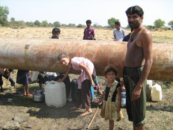

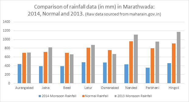


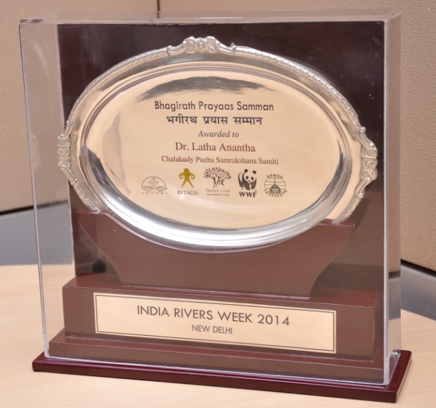


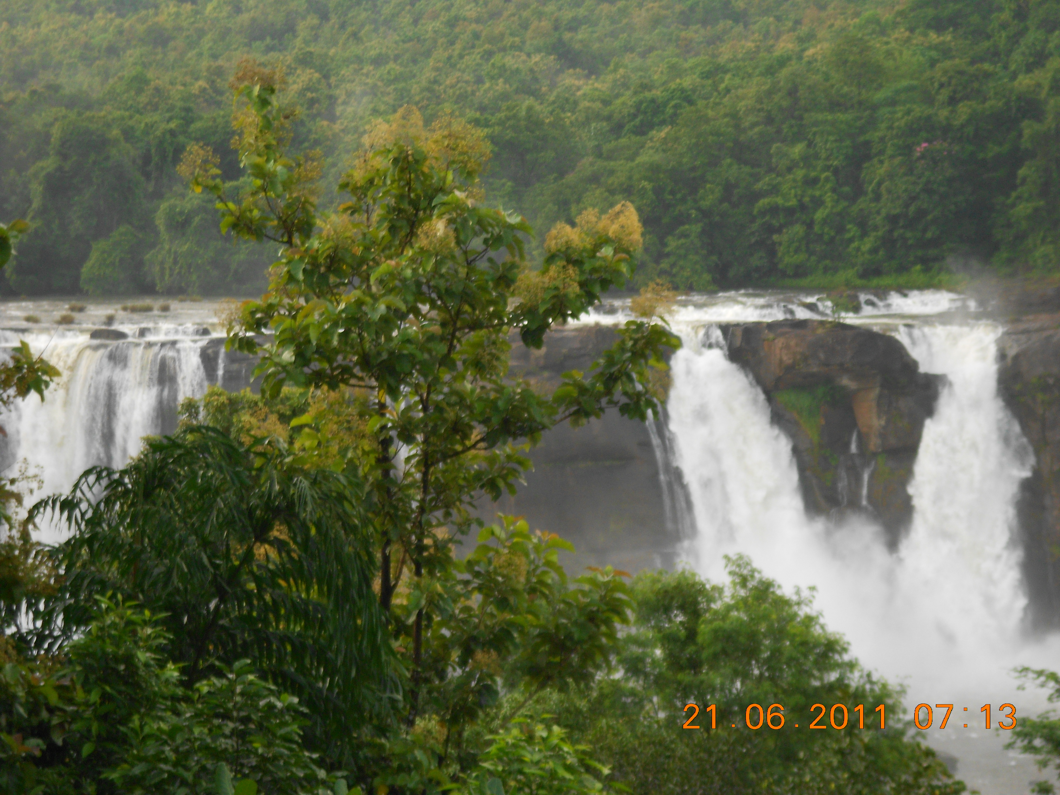

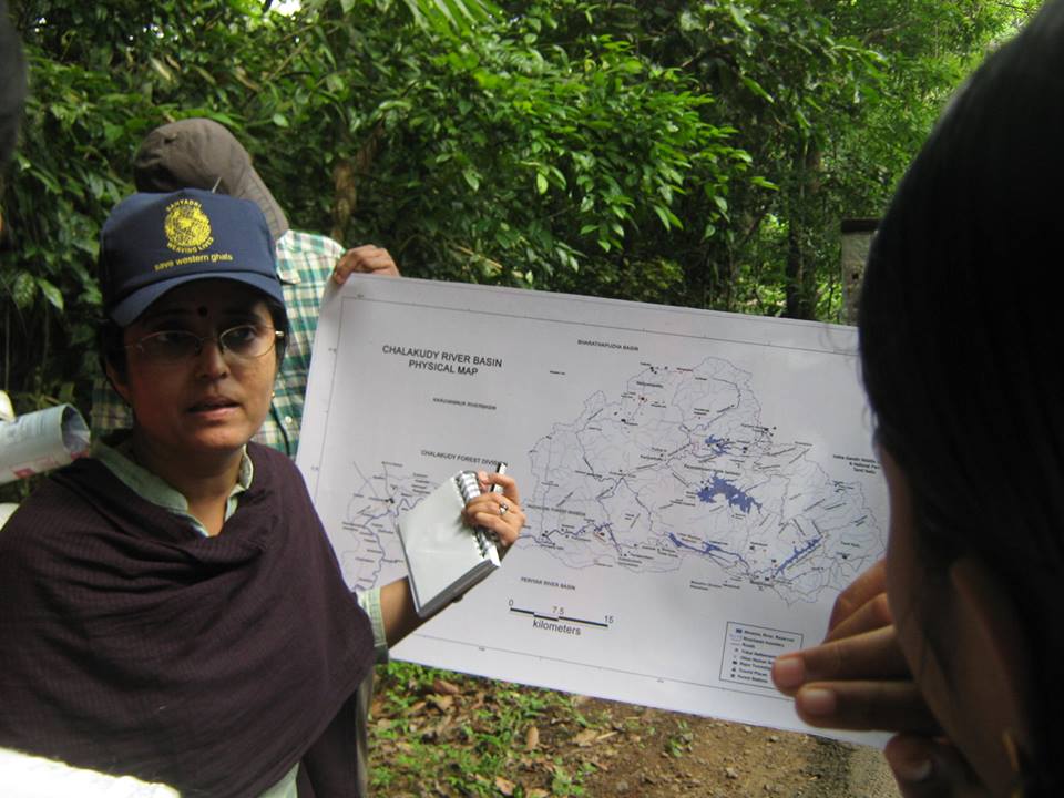


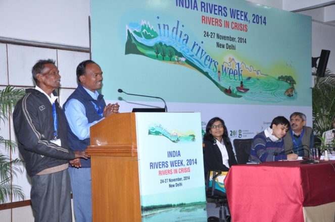
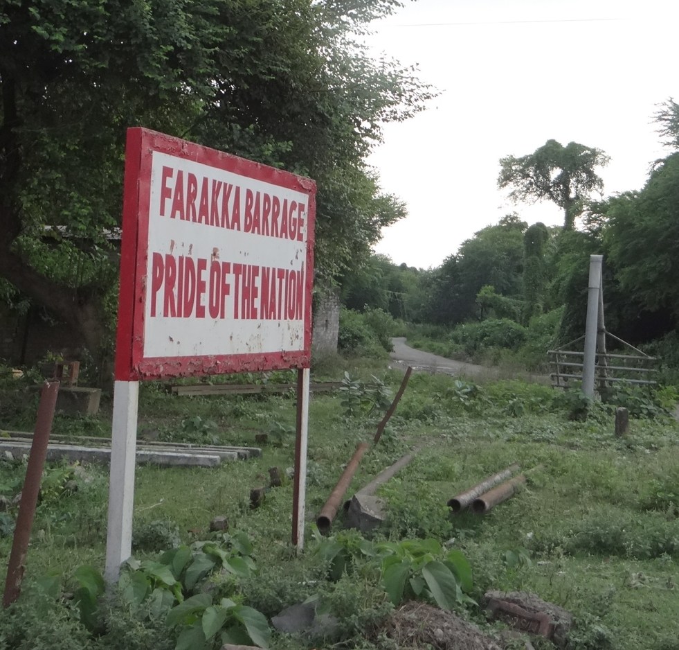
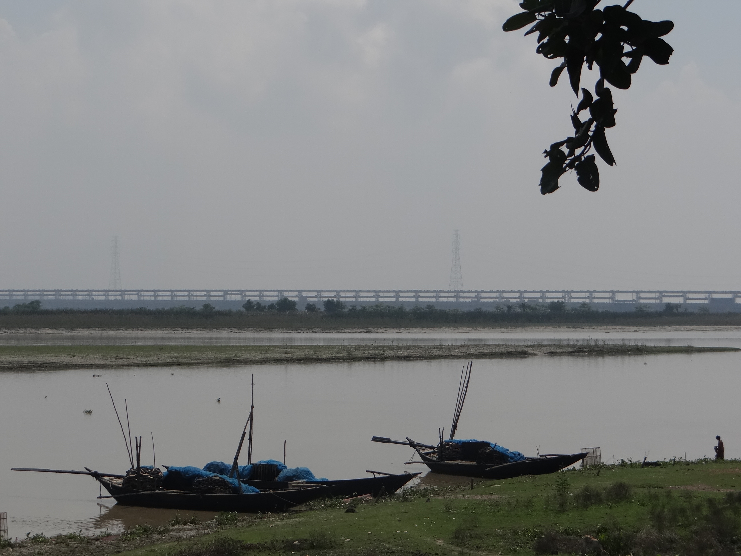

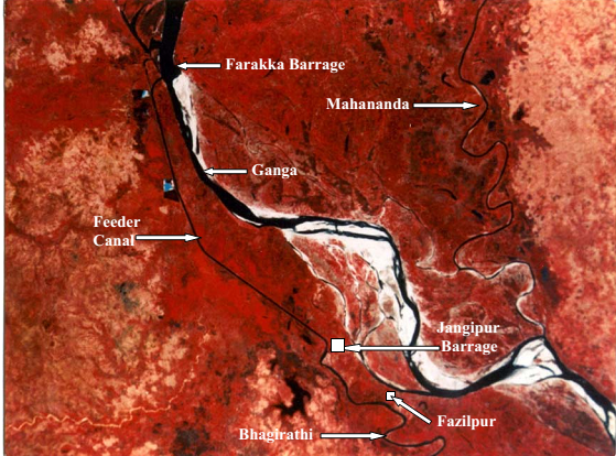
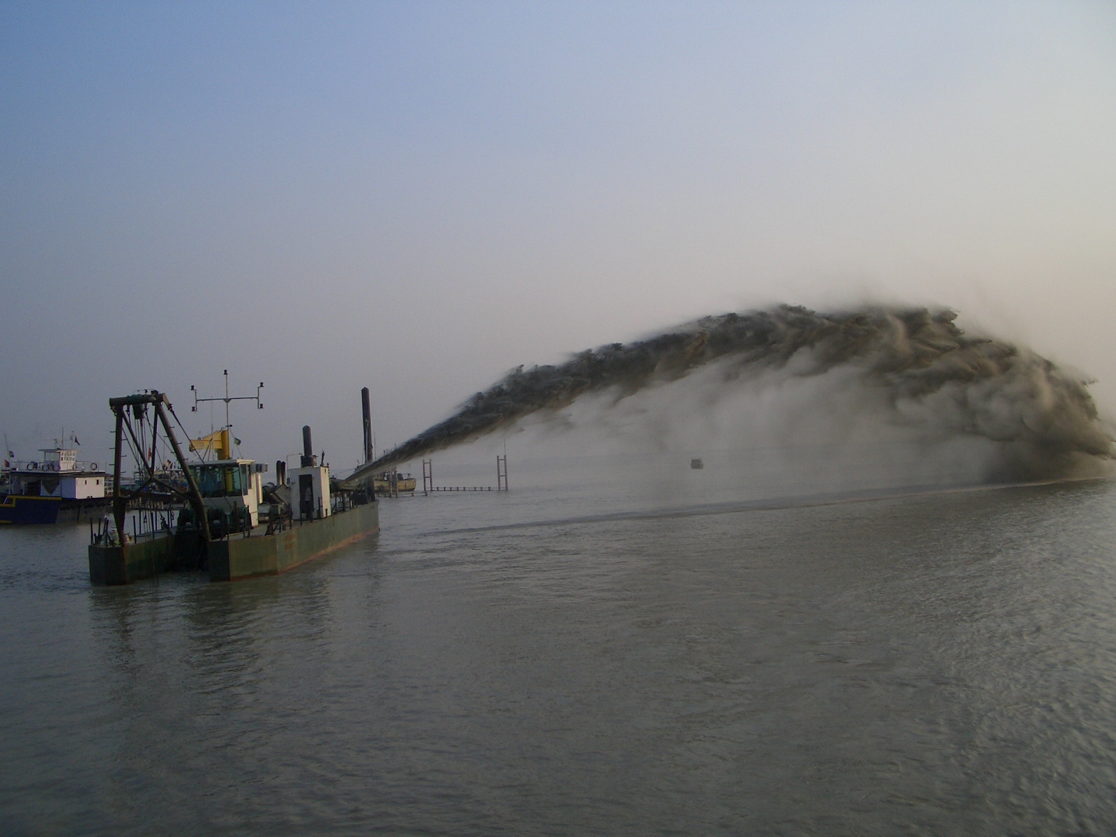
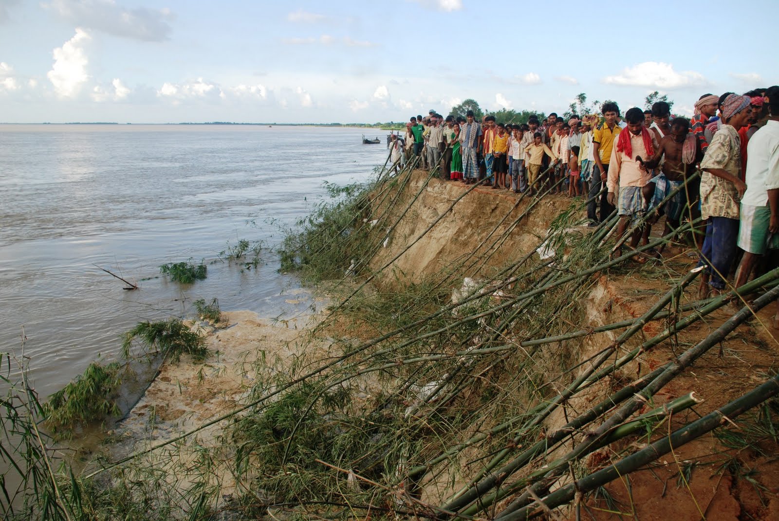

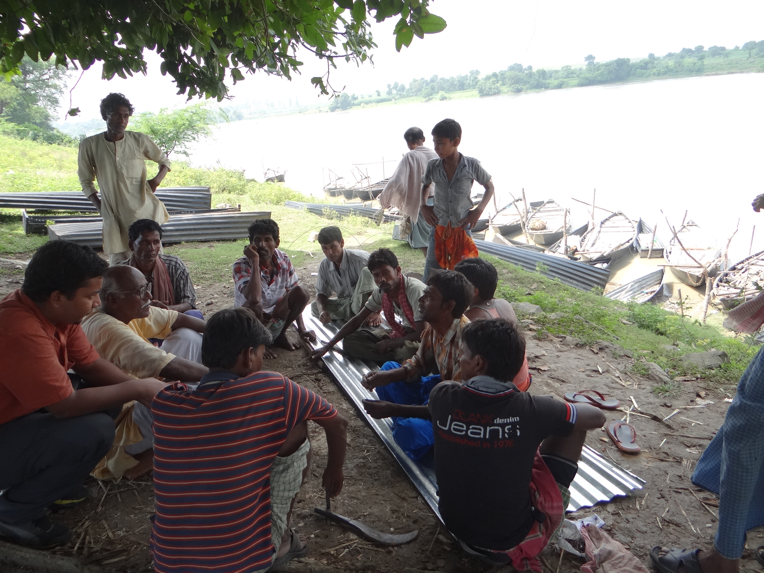
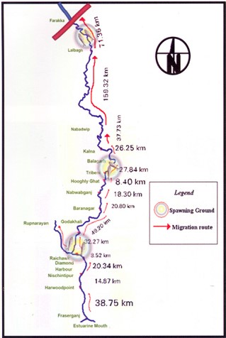 missioning Farakka Barrage in 1975, there are records of the Hilsa migrating from Bay of Bengal right upto Agra, Kanpur and even Delhi covering a distance of more than 1600 kms. Maximum abundance was observed at Buxar (Bihar), at a distance of about 650 kms from river mouth. Post Farraka, Hilsa is unheard of in Yamuna in Delhi and its yield has dropped to zero in Allahabad, from 91 kg/km in 1960s. Studies as old as those conducted in mid-seventies single out Farakka’s disastrous impacts on Hilsa, illustrating a near 100% decline of Hilsa above the barrage post construction.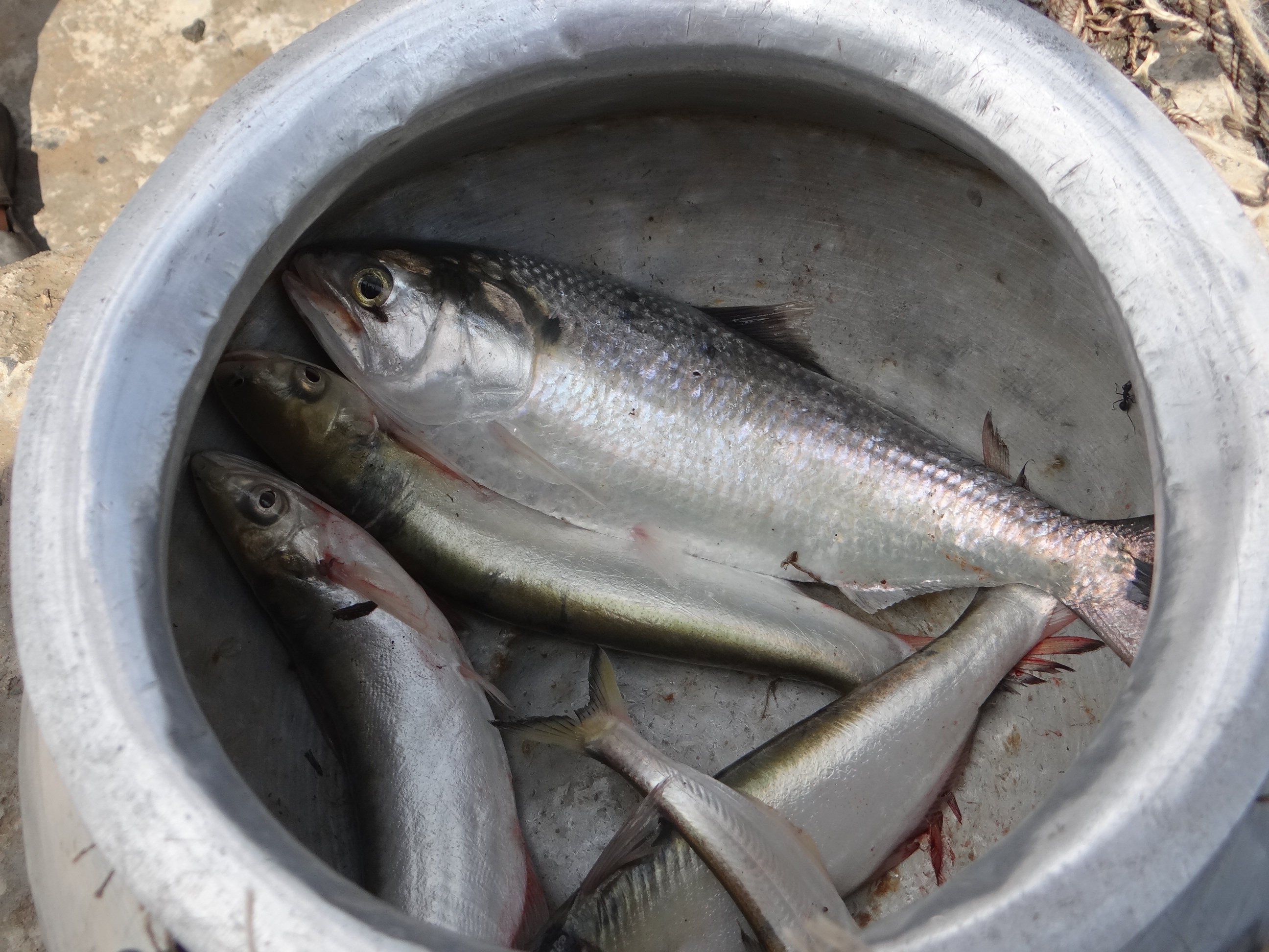


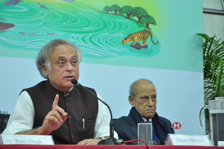
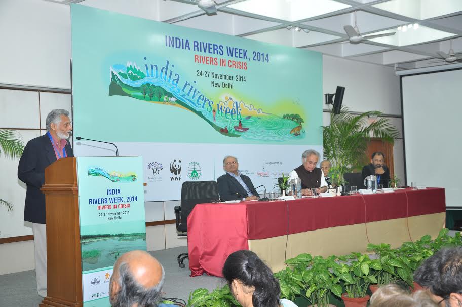
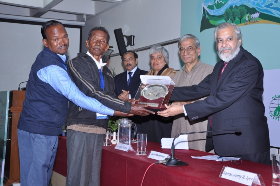
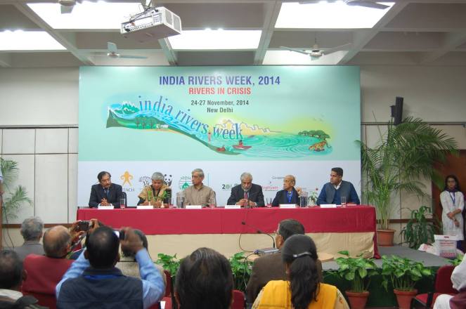
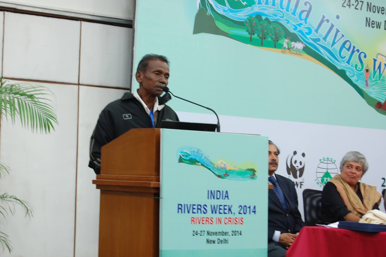
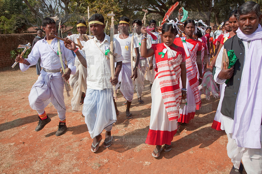
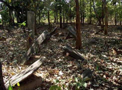
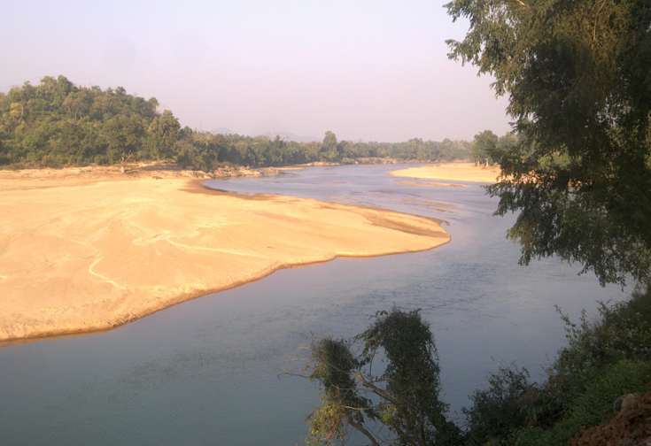
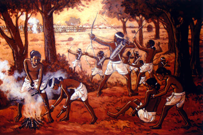
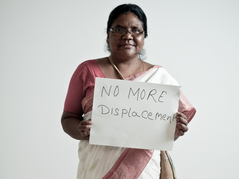
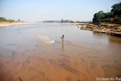
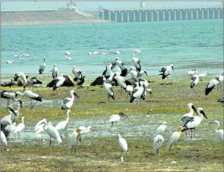

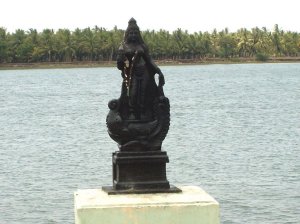
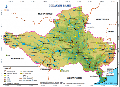
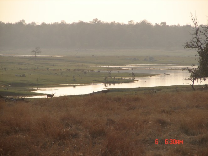
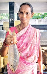
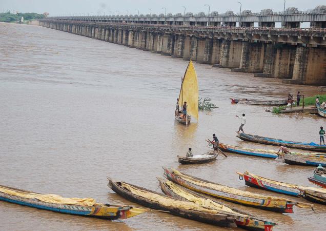
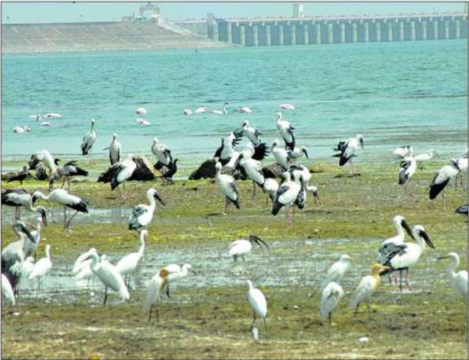
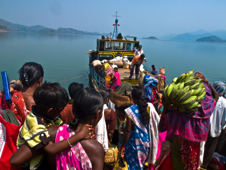
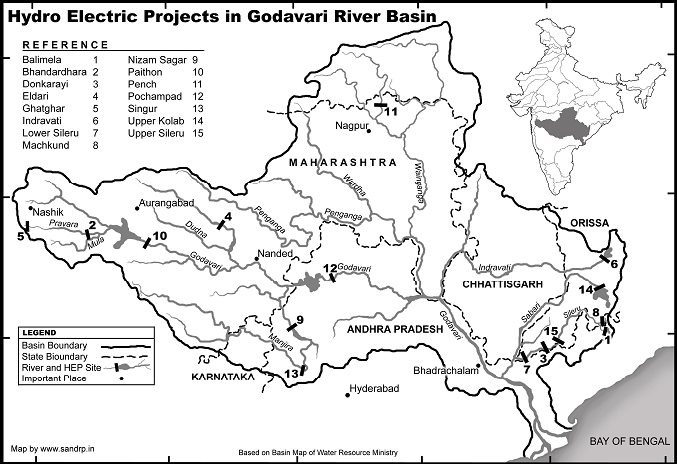
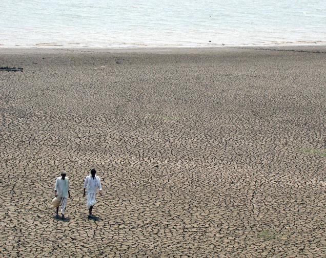
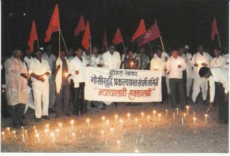
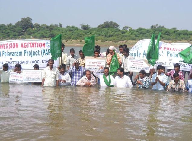
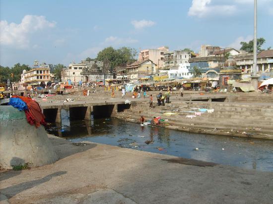
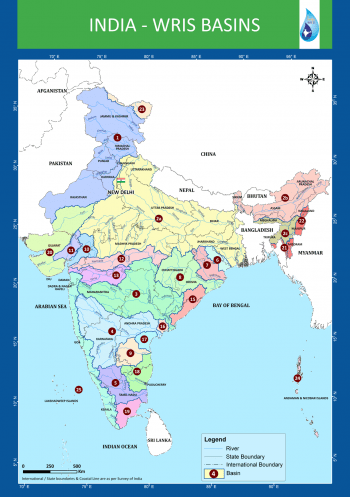
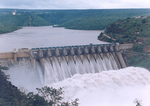
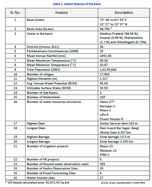
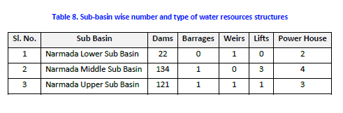
 SANDRP