Cumulative Impact Assessment · Dams · Environment Impact Assessment · Hydropower · Ministry of Environment and Forests · Western Ghats

Comments on HLWG Report submitted to Ministry of Environment and Forests

This post is based on a submission made by SANDRP and our colleagues on the HLWG Report on Western Ghats. 20th May 2013 is the last date to submit comments on this. Comments need to be sent to: amit.love@nic.in. We request groups and individuals to make as many submissions as possible.

Comments on HLWG Report with a focus on Water issues

Date: May 20, 2013

To,


Mrs. Jayanthi Natarajan

Union Minister of State (IC)

Ministry of Environment and Forests

Government of India

Email: mosefgoi@nic.in, jayanthi.n@sansad.nic.in


Dr. V Rajagopalan

Secretary

Ministry of Environment and Forests

Government of India

Email: envisect@nic.in


Dr. Amit Love,

Deputy Director,

Ministry of Environment and Forests

Email: amit.love@nic.in


Dear Mrs. Jayanthi Natarajan and Dr. Rajagopalan,


SUB: Comments on the High Level Working Group Report with respect to water sector

This is in response to announcement posted on MoEF website about submitting comments on the HLWG report under the Chairpersonship of Dr. Kasturirangan. These comments mainly deal with water in Western Ghats: One of the most critical issues for Western Ghats States.

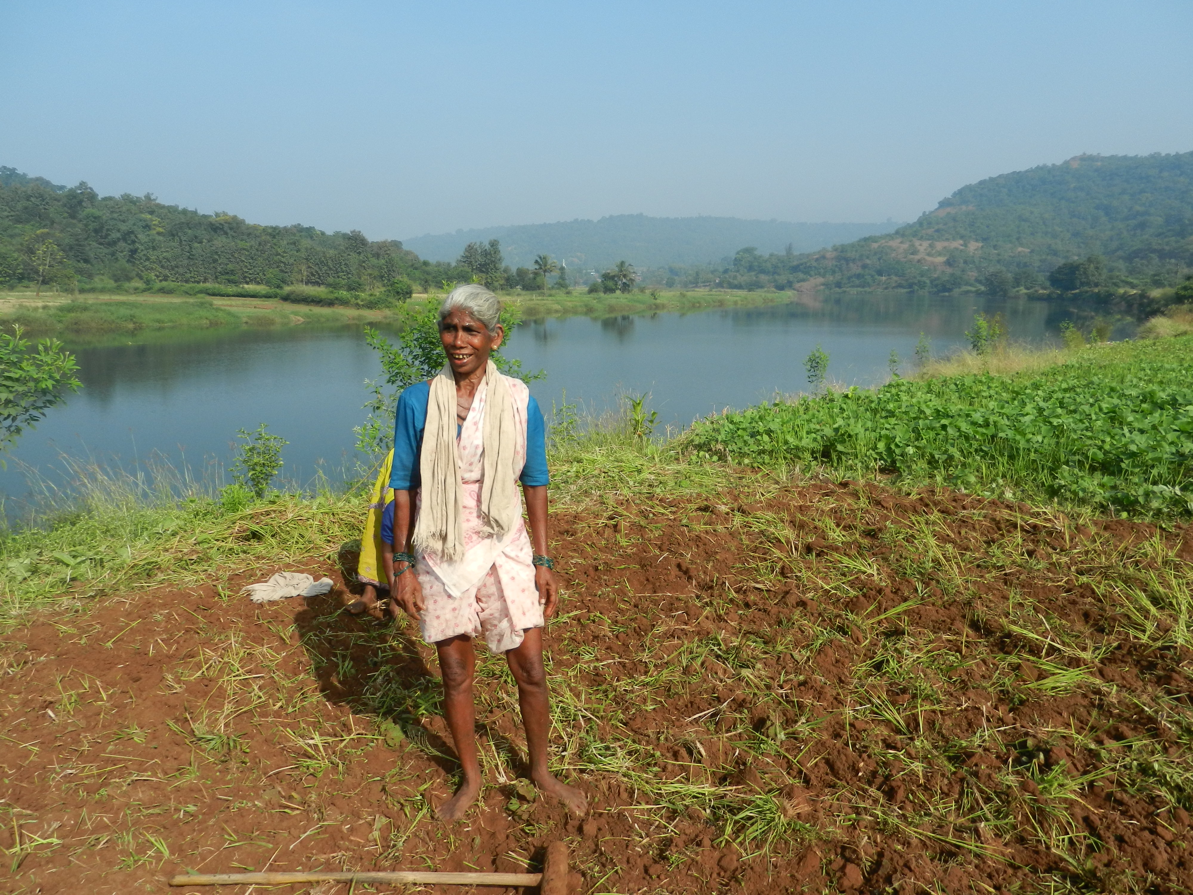
A lady collecting drinking water from a sacred grove in Western Ghats Photo: SANDRP

Unfortunately, we have to note that recommendations of the HLWG Committee in response to WGEEP Report as well as some of HLWGs omissions and commissions are detrimental to the well-being of rivers, wetlands and dependent communities in the Western Ghats and hence, for related sectors like ecology, water supply, irrigation, hydropower, etc. This is elucidated in the following points:

  1. HLWG does not comment on any other issue related to water except hydropower:

While the Gujarat, Maharashtra, Goa, Karnataka, Kerala and Tamilnadu are facing multiple issues with respect to rivers, drinking water, irrigation, loss of biodiversity and livelihoods, dam-induced displacement, etc., the only issue HLWG report has commented upon is Hydropower. The WGEEP report has dealt with a number of issues related to the water sector from democratic community driven bottom up governance, watershed development, opposition to large dams in ESZ I and II, drinking water, fisheries, etc. However, the HLWG does not comment on any of these recommendations of the WGEEP, nor does it offer its own position on these. This is a serious lacuna in the HLWG Report.

In the absence of such recommendations, we request that MoEF adheres to WGEEP recommendations.
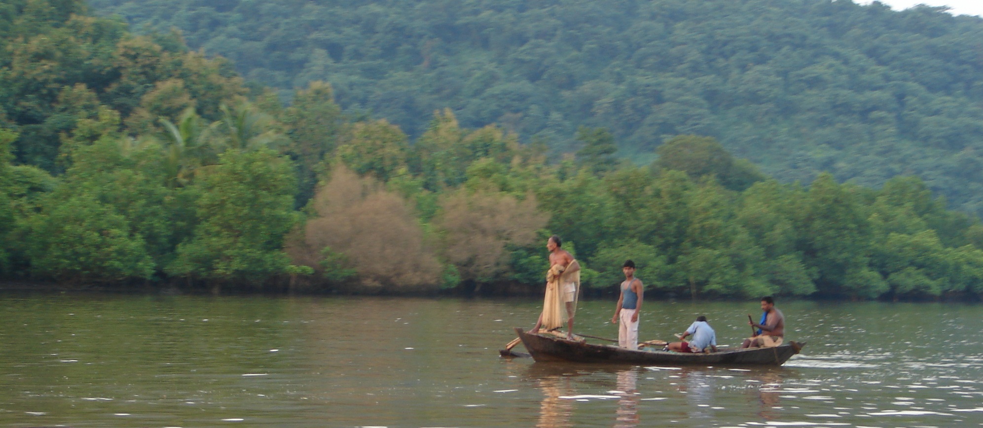
Fishing in Vashishthi Estuary, Western Ghats. Photo: SANDRP
  1. HLWGs recommendations about Hydropower are ad hoc, unscientific and misleading
  1. HLWG claims that all Hydropower is “renewable and clean.”

This is a completely incorrect statement and it’s surprising to see that it comes from HLWG. The world over, the myth of Hydropower as clean source of energy has been busted.[1],[2] Hydropower projects have huge impacts on environment, ecology, forests, rivers, biodiversity and livelihood security of the people. Studies have proved that methane emissions from reservoirs formed by hydropower dams in tropical countries can have significant global warming potential, methane being about 21 times more potent global warming gas than CO2. Dams emit methane at every draw down.[3] With tropical forests in the Western Ghats (WG) under submergence and otherwise destruction by such projects, this threat is even more serious. Already WG has some of the biggest hydropower plants in the country including the Koyna, Bhandardara, Ghatghat HEPs and three Tata HEPs in Maharashtra, Linganmakki, Gerisouppa, Bhadra, Tungabhadra, Upper Tunga, Talakalale, Kabini, Harangi, Chakra, Supa, Varahi, HEPs in Karnataka, Idukki, ldamalayar, Lower Periyar, Poringalkuttu, Sholayar HEPs in Kerala and Bhavani HEPs in Tamil Nadu. All these projects have not only contributed to greenhouse gas emissions, but have also adversely affected communities, forests, rivers and ecosystems in Western Ghats. There are numerous pending cases of rehabilitation from these dams (for example Koyna in Maharashtra) till date involving tens of thousands of people and communities in many areas are still suffering from erratic water releases from these projects (downstream communities near Jog Falls d/s Linganmakki).

Hydropower dams in WG are in many cases transferring water across the basin for power generation, making it unavailable of the original basin and its inhabitants (For example:  Interbasin transfers from Koyna and Tata Hydropower dams in Maharashtra). Every hydropower project has finite life. Thus, for the basin dwellers and everyone else, Hydropower not much renewable either.

 HLWG is not justified in giving a ‘clean and renewable’ certificate to hydropower.
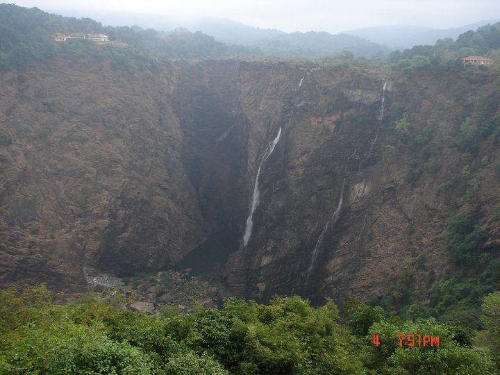
Jog Falls on Sharavathy: Dried and diverted by the Linganmakki HEP in Karnataka Western Ghats. Photo: SANDRP


  1. HLWG allows Hydropower projects in ESAs while not looking at performance of existing projects

While the WGEEP did not allow large dams and hydropower projects in ESZ I and II, HLWG has allowed hydropower projects in its demarcated ESAs. This is unacceptable. Western Ghats are already ravaged by dams and at least the areas of high biodiversity value should now be protected from the same onslaught. But the HLWG has rejected WGEEP recommendations about this. While doing so, they have not looked at the performance of the existing HEPs in WG. SANDRP has been studying performance of HEPS in India for some time now based on generation data from Central Electricity Authority. The performance of existing hydropower plants in WG is dismal as can be seen below:

  • In Koyna Basin, the per MW generation in 2010-11 has dropped by a huge 56.79% from the highest per MW generation achieved in the year 1994-95.[4]
  • In Kali Nadi projects, the per MW generation has dropped by 46.65% from the highest per MW generation achieved in 1994-95[5]
  • In Sharavathi Basin projects, per MW generation in 2010-11 has dropped by 37.60% from the highest per MW generation achieved in the year 1994-95[6]
  • Same situation is true for most other hydropower projects.
  • Most of these projects are performing far below the level at which the projects were given techno-economic clearances.
  • There is no assessment as to how much of the generation from such hydropower projects is during peaking hours. Nor is there any attempt at optimising the peaking power from these projects.

It is clear that there is huge scope to make the existing projects more efficient, rather than destroying ESAs in WG with more projects.

We request that in line with WGEEP report, large dams should not be permitted in ESAs of Western Ghats.

  1. Recommendation about mitigating impacts of Hydropower are extremely weak
  • The HLWG has recommended 30 % of lean season flow as the minimum flow throughout the year as a conditionality for allowing hydro power projects in the ESA. This is contradictory to the recommendation for ecological flows by the HLWG.  Ecological flows means trying to mimic the natural flow regime in the river as far as possible and that would include arriving at different seasonal flows based on studies and consultation with the river communities and other stakeholders, using the Building Block Methodology which even the Inter Ministerial Group on Ganga Basin has said is the most appropriate for India. Moreover, the IMG has recommended 50% releases in lean season flows, applicable for all existing projects. MoEF should accept these norms immediately for all existing projects.

The MoEF should be recommending ecological flows / environmental flows as in the WGEEP report and not minimum environmental flows and this should be determined through holistic methodologies like Building Block Methodology and local participation.

  • The HLWG recommendation of 3 km minimum distance between dams is totally ad hoc, arbitrary and hence unacceptable. Firstly, the HLWG should have mentioned min 3 km of flowing river between projects. The minimum distance is river specific and would depend upon a basin level study of the river including the altitudinal profile of the river, the riparian forest status, the aquatic habitats and biodiversity, the present dependability and many such criteria. More significantly, the cascade hydropower dam menace which is destroying rives in Himalayas need not be replicated in western ghats. We would like to reiterate that no large dams should be allowed in the ESA of WG.

The MoEF should recommend for arriving at river specific studies while accepting 5 km of free flowing river between projects as minimum distance of free flowing river between projects. The best case is not to allow any further large dams in Western Ghats.


No flows in Sharavathy downstream Linganmakki  Dam and Jog Falls. Photo: SANDRP
No flows in Sharavathy downstream Linganmakki Dam and Jog Falls. Photo: SANDRP


  1. The HLWG does not stress the need for Environmental Clearance for Mini hydel Projects

Hydro projects less than 25 MW are currently exempt from Environmental Clearance due to a dangerous omission in the EIA Notification 2006. WG is currently facing a severe threat due to a flood of these unplanned cascades of Mini Hydel Projects. Ecosystems and communities in rivers like Netravathi, Kumaradhara, Krishna and Cauvery are facing impacts of these projects, many of which are fraudulent.[7] Netravathi has more than 44 mini hydel projects planned and under operation. Kerala has plans to set up  around 100 mini Hydel projects on its rivers. The threat of these projects on river systems in Western Ghats is so high that in March 2013, the Karnataka High Court, has banned any new mini hydel projects in Karnataka Western Ghats[8].

WGEEP had recommended no mini hydel projects in ESZ I and II. HLWG has not done this. While the HLWG makes a rather vague statementThere is a need to redesign and reevaluate small hydropower projects – below 25 mw as these often have limited impact on energy generation and can lead to huge impacts on ecology’, it has not recommended that these projects should need an EIA and EC process, like it has said for Wind Energy. This is a very serious omission. SANDRP and many organizations have written about this to the MoEF several times.

The MoEF should amend the EIA Notification 2006 and include all hydel projects above 1 MW in its purview.


Pristine Forests set for submergence under the 24 MW Kukke Mini hydel Plant in Dakshin Kannada, Karnataka. Photo: SANDRP
  1. The HLWG does not stress the need of Environmental Clearance (EC) for Drinking Water and Industrial supply dams

HLWG has not looked at water as a sector, but has only confined itself to hydropower. This has resulted in several loopholes. Many dams are being constructed in Western Ghats for Drinking Water and Industrial water supply. These are also exempt from EC process as per the EIA Notification 2006. Dams like Kalu, Shai, Balganga, Khargihill, Pinjal, Gargai are set to submerge more than 6000 hectares of forest in ESAs and Protected Areas in Northern Western Ghats in Maharashtra.

WGEEP Report had recommended no large dams in ESZ I and II, but the HLWG does not talk about these dams at all. Their impacts on WG forests and communities are entirely ignored. This is another serious lapse of the HLWG report.

The MOEF should amend the EIA Notification 2006 to include all large dams, irrespective of the purpose, including drinking and industrial water supply dams in its purview. No large dams should be planned in ESA of Western Ghats.
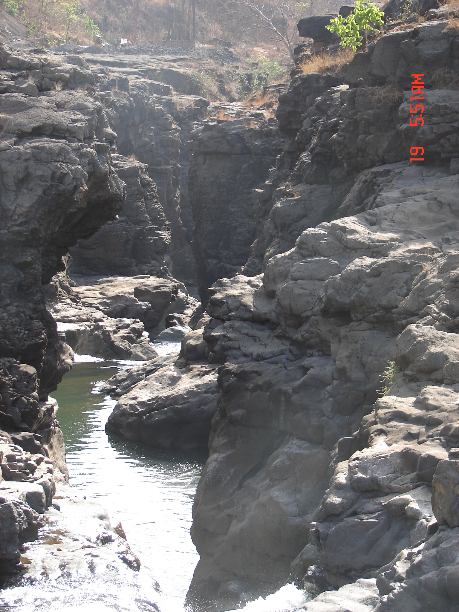
 

Ravines of Vaitarna already submerged by the Middle Vaitarna Dam near Mumbai Photo: SANDRP
  1. HLWG does not recommend eflows from existing projects

Several hundreds of Irrigation, water supply, hydropower dams have transformed the nature of rivers and dependent communities in Western Ghats. While the WGEEP Report mentioned maintaining eflows from existing projects, the HLWG does not make any recommendation for eflows from existing projects.

Hydropower projects in Karnataka like Kali, Linganmakki have affected communities and ecosystems in the region, have driven some species to extinction. There is an urgent need to restore eflows in all WG rivers.

The MoEF should recommend that eflows should be assessed with holistic and participatory methodology like BBM and recommend e-flows for all dammed rivers in Western Ghats with time limit of one year.

  1. HLWG does not apply its mind to dam decommissioning

The HLWG has chosen to ignore the recommendations on dam decommissioning. While the states have rejected the recommendation the MoP (Ministry of Power) and Central Electricity Authority has noted that dam decommissioning in a phased manner is worth considering.

There are several irrigation and hydropower dams in the Western Ghats which are severely underperforming or incomplete after two decades, or more than 100 years old, and/or unsafe. For example, several experts have opined than large irrigation projects in Konkan region of Maharashtra are severely underutilized. Tillari Interstate Project between Maharshatra and Goa which has come up affecting a wildlife corridor and which has still not rehabilitated its affected population, has a created irrigation potential of 7,295 hectares in Maharashtra of which farmers are utilizing just 162 hectares, according to the Govt Of Maharashtra’s 2012 White Paper on Irrigation Projects in Maharashtra. This underlines the redundancy of large irrigation projects in the WG.

The HLWG had an opportunity to relook at such projects, which it has not done. The HLWG could have noted that the state governments and the MoEF and MoP should start the process of evolving parameters / criteria towards the process of dam decommissioning.

The MoEF may please recommend the same.
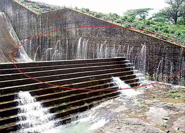
Leaking Khadkhad dam Mahrashtra Western Ghats Photo: Pune Mirror


  1. HLWG does not recommend free flowing rivers for WG

Rivers in Western Ghats are repositories of biological, ecological and cultural diversity. Rivers in WG harbor high endemism and diversity in freshwater fish. They also house several Sacred groves at river origins, river fish sanctuaries, etc., protecting rivers and fish. The freshwater biodiversity remains the most fragmented among all biodiversity and HLWG has taken no note of this state and further risks that freshwater biodiversity faces. The WGEEP had wisely followed a graded approach in tune with the ecological connectivity of river ecosystems. ln the HLWG approach, stretches of rivers would flow out of the natural landscape into the cultural landscape which is open to indiscriminate development and the chance for their restoration or protection would be completely lost out. A river cannot be protected in pieces like this.

Looking at the pressures from dams and water abstractions, there in an urgent need to conserve ecologically, culturally and socially important rivers in their free-flowing condition. This approach is well accepted globally and several countries have created specific legislations for protecting free flowing rivers[9]. It seems that the IMG Committee on Upper Ganga, in which Ms. Sunita Narain (Member of Kasturirangan Committee), was also a member has recommended that some six tributaries of Upper Ganga basin should be kept in pristine state. While rejecting WGEEPs recommendation about dam decommissioning or dam free rivers in the ESZs, HLWG has not recommended keeping even a single river in Western Ghats in its free flowing condition.

MoEF should identify ecologically, culturally and socially important rivers, based on community and ecological knowledge and conserve Heritage Rivers of Western Ghats in their free flowing condition for the current and future generations.
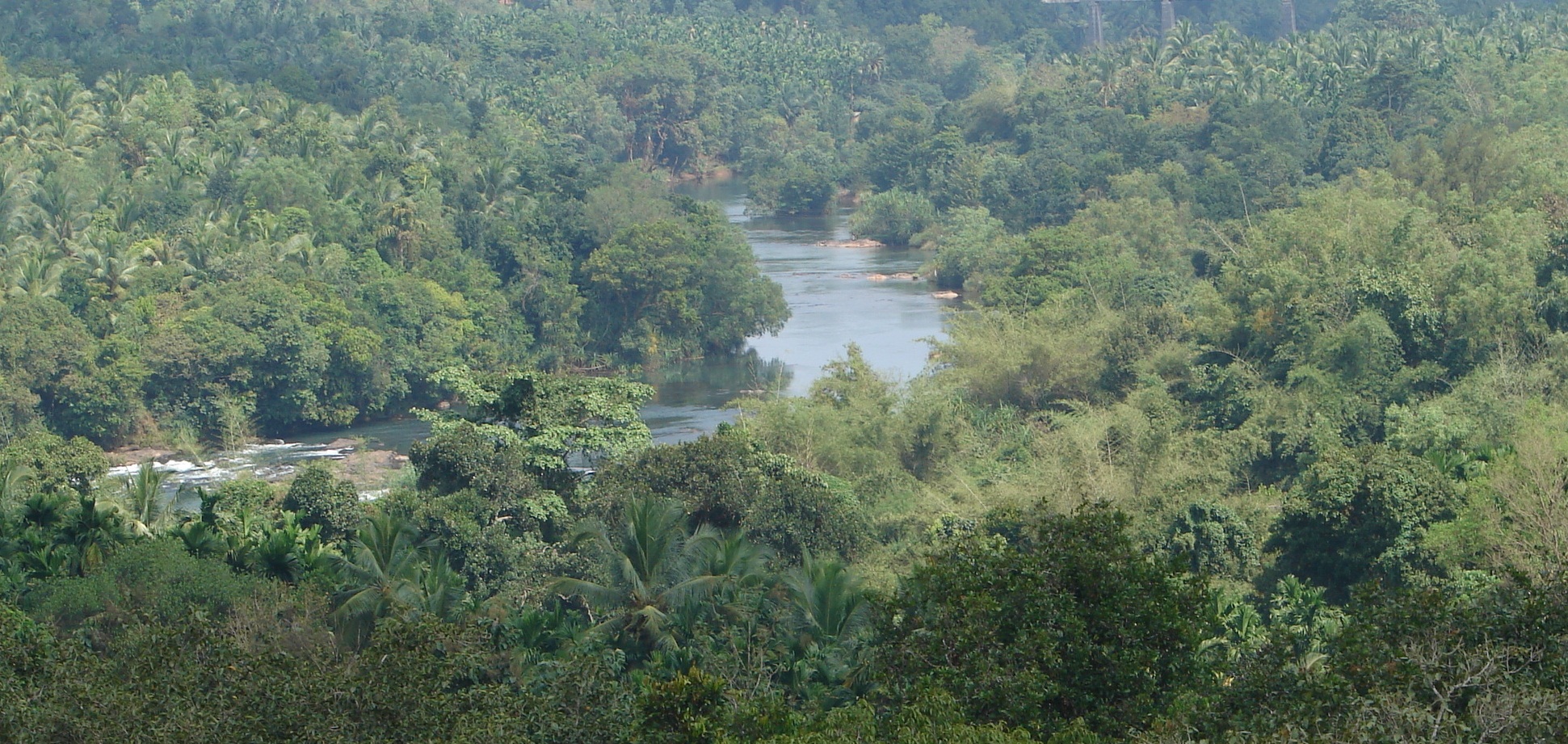
 

Seetha Nadi, free flowing river in Karnataka Western Ghats. Photo: SANDRP
  1. HLWG allows Inter basin transfers in Western Ghats, without any justification or studies

The HLWG has agreed to inter basin transfers toeing the claims of some of the states. There are ample instances of failed interstate – inter basin transfers in the Western Ghats rivers which have turned into permanent scenes of conflicts like the famous Mullaperiyar,  Parambikulam Aliyar, Siruvani interstate inter basin transfers between Kerala and Tamil Nadu. The HLWG while acknowledging the need for ‘ecological flows assessment’ in rivers has failed to note that in all these inter basin transfers, the river / tributary has been completely diverted and has lost its ‘ecological flows’. The HLWG could have recommended a cumulative impact assessment of the existing inter basin transfers which would reveal the ground reality.

HLWG seems to have accepted the contention of states like Maharashtra: “This (stopping IBT) would be a problem, they explained, as many regions of the Western Ghats lie in the rain shadow area and need water to be diverted for irrigation and drinking.”

Reality is that, ALL the interbasin transfers happening in Maharashtra currently (through Koyna and Tata Hydro power projects, an amount more than 4 Billion Cubic Meters Annually) are transferring water FROM the rain shadow area of Krishna and Bhima basins TO water surplus regions in Konkan. If HLWG was concerned about water supply for rain shadow regions, it would have at least recommended that this transfer from deficit area to high rainfall area be immediately reviewed and reversed in a time bound manner. It has chosen not to, showing its complete ignorance of ground reality or its completely pro government and pro vested interests bias.

The MoEF should retain the recommendation for no more inter basin transfers as in the WGEEP report and ask for immediate review of transfer of water from deficit basins to high rainfall areas. 


  1. HLWG allows hydro projects in first and second order streams

The HLWG has not said no to hydro power projects in first and second order streams in ESA. Meanwhile the MoP, CEA and WAPCOS all agree that hydro power projects should not be permitted in these highly ecologically sensitive areas which are the ‘origin’ of Western Ghats Rivers.

The MoEF should retain the recommendation for no run of the river schemes in first and second order streams as in the WGEEP report.

  1. HLWG offers no comments of on several water sector recommendations of WGEEP which have been supported by State Governments

Kerala and Maharashtra have accepted many of the recommendations of the WGEEP in water sector (page 14 section 2.3 – point 9) like catchment area treatment plan, protection of high altitude valley swamps, water conservation measures, rehabilitation of mined areas, improved river flows etc. It is surprising to note that the HLWG is silent on these very important measures and has not even endorsed these acceptable recommendations which can significantly contribute towards improving water availability in the Western Ghats.

The MoEF should follow these recommendations of the WGEEP.

  1. HLWG takes an extremely biased stand about Athirappilly and Gundia Hydropower projects, rejected by the WGEEP

The WGEEP had categorically stated that the Athirappilly and Gundia Hydropower project should not come up in Western Ghats, looking at their huge impacts on biodiversity, several studies by local organisations and local opposition. However, ignoring all these, the HLWG has taken a very pro project stand on these projects, stating that they can be considered with some vaguely due process, which the state government would be happy to show they have followed it on paper. This is entirely unacceptable.

The MoEF should not allow Athirappilly and Gundia HEPs looking their impact on ecology and communities and in face of the strong local opposition that they are facing.
DSC02831
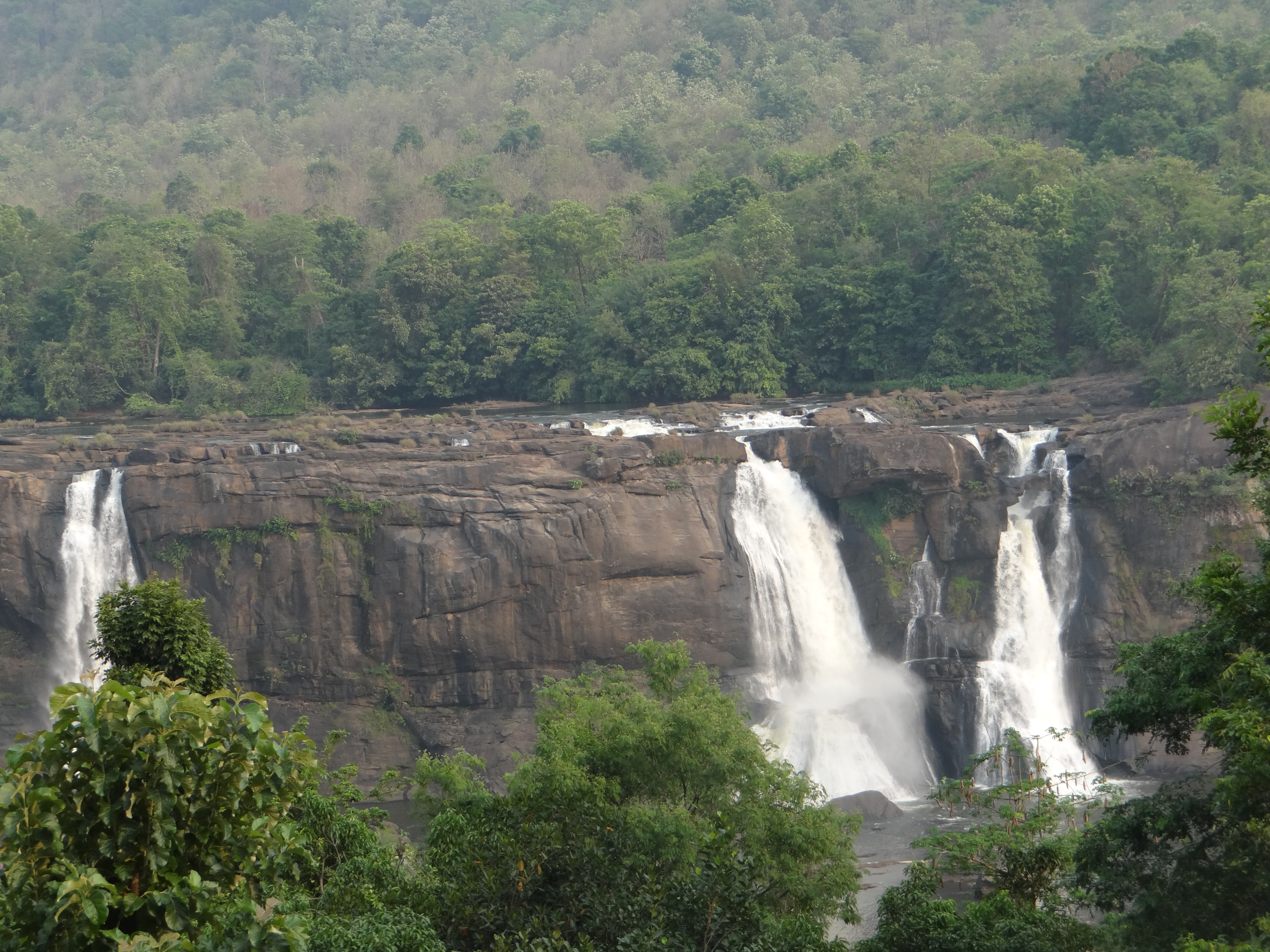
Athirappilly Waterfalls on the Chalakudy River Photo; SANDRP

The WGEEP process and report initiated a robust discussion about the paradigm of development and conservation in Western Ghats. Water and Rivers is a cross cutting issue connecting ecosystems and communities, rural areas and urban centers, providing goods and services and supporting freshwater biodiversity, which is most threatened currently.

A proactive position on conserving rivers in Western Ghats will go a long way in protecting and conserving myriad livelihoods and ecosystems that thus depend of them.

We hope the MoEF considers the recommendations made above about the WGEEP and HLWG Reports and helps conserving rivers of the Western Ghats for people and ecosystems urgently. The HLWG Report cannot be accepted the way it stands presently. As a step in this direction, we also suggest that WGEEP should get a formal chance to respond to the points raised about it in the HLWG.

Thanking You,


Yours Sincerely,

Himanshu Thakkar, Parineeta Dandekar, South Asia Network on Dams, Rivers and People, New Delhi and Pune (ht.sandrp@gmail.com , parineeta.dandekar@gmail.com)

Dr. Latha Anantha, River Research Centre, Thrissur, Kerala (rrckerala@gmail.com)

Shripad Dharmadhikary, Manthan Adhyayan Kendra, Pune, Maharashtra (manthan.shripad@gmail.com)

Dr. T.V. Ramchandra, Energy & Wetlands Research Group, Centre for Ecological Sciences, IISc, Bangalore (cestvr@ces.iisc.ernet.in)

Janak Daftari, jalbirdari, Mumbai, Maharashtra (daffy@jalsangrah.org)

Sujit Patwardhan, Parisar, Pune, Maharashtra (patwardhan.sujit@gmail.com)

Dr. Nilesh Heda, Samvardhan, Vidarbha, Maharashtra (nilheda@gmail.com)

Nisarg Prakash, Nature Conservation Foundation and Nityata Foundation, Bangalore, Karnataka (nisargprakash@gmail.com)

Mrinalinee Vanarase, Iora Consultants, Pune, Maharashtra (ioraespune@gmail.com)

Shankar Pujari, President, Nivara Bandhkam Kamgar Sangh, Sangli, Maharashtra (shankarpujari16@gmail.com)

Damodar Pujari, SANDRP, Pune, Maharashtra (damodar.sandrp@gmail.com)

Saili Palande-Datar, Kalpavriksha, Pune, Maharashtra

Following Members from Energy and Wetlands Research Group, Centre for ecological Science, Indian Institute of Sciences: 

  • Dr. M.D. Subash Chandran
  • Dr. Prakash Mesta
  • Dr. Uttam Kumar
  • G R Rao
  • Mahima Bhat
  • Vishnu Mukri
  • Sreekanth Naik
  • Balachandran C
  • Boominathan M
  • Bharath H Aithal
  • Bharath Settur
  • Vinay S
  • Ganesh Hegde
  • Anindita Dasgupta
  • Arun D T
  • Vishnu Bajpai
  • Gouri Kulkarni
  • Sudarshan Bhat
  • Durga Madhab Mahapatra
  • Ashwath Naik
  • Sowmya Rao
  • Shwetmala


Hydropower · Ministry of Environment and Forests

Central Water Commission’s Dam Register: How much do we know about our dams and rivers?


Image

Central Water Commission is India’s technical organisation under the Union Ministry of Water Resources. It publishes National Register of Large Dams (NRLD), the latest version can be seen at: http://www.cwc.nic.in/main/downloads/New%20NRLD.pdf. This is a key document that provides information about large dams in India.

The latest NRLD seems to have been uploaded only this month, since for a number of states, it claims to have been updated till January 2013. The NRLD is certainly a useful document, the only list of large dams in India and it also gives a number of salient features of the large dams in India. SANDRP has been using this document and also been doing some analysis of the information available in the NRLD.

As per the latest edition, India has 5187 large dams (height above 15 m in most cases, height of 10-15 m case of some with additional criteria). 371 of these dams are under construction and rest have been completed. In case of 194 large dams in NRLD, we do not know the year of construction, which means most of such dams must have been built before independence.

NRLD is not an exhaustive list

NRLD follows the definition of large dams given by the International Commission on Large Dams for inclusion of dams in the NRLD. However, the NRLD is far from exhaustive list of large dams in India. Very significant number of large dams built for hydropower projects in Himachal Pradesh, Uttarakhand, North East India, among other states, do not figure in the list, even though all of these would come under the definition of large dams as given in the NRLD. To illustrate from Himachal Pradesh, following dams are all under construction as per Central Electricity Authority, many of them in advance stages, but they do not figure in NRLD: Allain Duhangan, Kashang, Sainj, Swara Kuddu, Shongtong Karcham, Sorang, Tangnu Romai, Tidong. It’s a dangerous situation for safety issues, since many of them are under construction by private companies. For example, in December 2012 heavy leakage was detected in the surge shaft of the 1000 MW Karcham Wangtoo Project on Sutlej River in Kinnaur district in Himachal Pradesh. The project had to be shut down and the repairs are still going on. Had there been a serious mishap at the project the impact would be also felt by the cascade of projects downstream, including the 1500 MW Nathpa Jakhri HEP (India’s largest operating hydropower project), 412 MW Rampur HEP, 800 MW Kol Dam HEP and the Bhakra complex further downstream.

The case of missing dams

Earlier in 2010 and 2011 we filed a number of applications with the CWC under the Right to Information Act to ask them how a very large number of dams that were listed in earlier NRLD of 1990, 2002 (both printed versions) did not figure in the NRLD 2009 and many of the large dams listed in 1990 also did not figure in NRLD 2002. The CWC response in most cases was to transfer our RTI application to the relevant states, stating that CWC is not responsible for the information in the NRLD, it only compiles the information given by the respective states.

This was far from satisfactory response from India’s premier technical water resources organisation. Was CWC acting only as a post box on even such a serious issue of listing of large dams? It was not applying its mind to the information supplied by the states, not raising any questions, nor clarifying the contradictions and gaps with respect to the earlier editions of NRLD? Needless to add, this reflects very poorly on the CWC. Here it should be added that CWC is also responsible for the monitoring policies and practices related to the safety of dams in India as also a number of other aspects. What kind of diligence can we expect from CWC under these circumstances? Our analysis then also showed that many dams that should have figured in the earlier versions (considering the date of completion stated in the subsequent editions of NRLD) were not there. Again our RTI applications in such cases were transferred to respective states. We did get some response from Central Water Commission and Maharashtra, which was far from satisfactory. In case of over a hundred dams, the CWC Director, Design and Research Coordination Directorate accepted the errors in NRLD and promised that “Data entry errors/ omissions as indicated above will be rectified”.

Where are our dams located?

A quick review of the latest NRLD raises some fresh questions of the NRLD. In this exercise we just wanted to check how many dams are there in different river basins/ sub basins. This is an important question from a number of perspectives including cumulative impacts, optimisation of dam operations, hydrological carrying capacity and cumulative dam safety issues, to name a few. We through this would be simple enough exercise. But when we started looking at the 5187 large dams of India listed in NRLD, we found that in most cases, there is no name for the river on which the dam is constructed. When counted, we were shocked that in case of 2687 or 51.8% of large dams of India, the NRLD does not mention the name of the river. In most cases they just write “local river” or “local Nallah” or the box under river is left blank. Under the circumstances, it is not possible to get a clear picture of any river basin, nor about the cumulative impacts or safety aspects or possibility of optimisation of the dams in any one river basin. The absence of such basic information reflects very poorly on the quality of NRLD, and on the CWC and respective states.

Worst states

India’s largest dam builder state, namely Maharashtra, has the largest number of dams for which it does not know the name or location of the rivers or tributaries. Out of 1845 large dams in Maharashtra, in case of 1243 dams, Maharashtra does not know the name of the rivers! That means in case of 67.37% of its dams, Maharashtra does not even know the names of the rivers. It is not just for the old dams, but even for 81 of the dams completed after 2000, Maharashtra does not know the names of the rivers. Even for relatively larger 61.19 m high Berdewadi dam (completed in 2001) and 48 m high Tarandale dam (completed in 2007), the names of the rivers are now known.

Madhya Pradesh is worse than Maharashtra, it does not know the names of the rivers for 90.17% of its dams (817 dams out of total of 906). In percentage terms, Chhattisgarh is worst as it does not know names of the rivers for 227 of its 259 large dams. These three states of Maharashtra, Madhya Pradesh and Chhattisgarh collectively do not know the names of the rivers for 2287 of dams in NRLD. Some of the other states that should also share the “honours” here are Gujarat (138 dams out of 666 for which names of rivers are not known), Andhra Pradesh (124 out of total of 337) and Rajasthan (71 out of 211 large dams).

It is a disturbing situation that the agencies that are responsible for our large dams do not even know the names of the rivers (every river in India has a name, so if someone were to argue that the rivers do not have names, it won’t be acceptable excuse) on which they are located. Without the names of the rivers and locations of the various dams on specific rivers, we cannot even start looking at the crucial issues like dam safety, cumulative social and environmental impacts, hydrological carrying capacity and optimum utilisation of the storages created behind the dams. We clearly have far to go to even start knowing our dams and rivers.

Himanshu Thakkar (ht.sandrp@gmail.com)

South Asia Network on Dams, Rivers & People (www.sandrp.in, an edited version of this published at: http://indiatogether.org/2013/mar/env-dams.htm

Dams

Comments on MWR’s DRAFT HYDRO-METEOROLOGICAL DATA DISSEMINATION POLICY (2013)

 The Union Ministry of Water Resources has invited comments by March 31, 2013 (comments to be sent to: nwp2012-mowr@nic.in) on its Draft Hydro-Meteorological Data Dissemination Policy 2013 based on the document available at: http://mowr.gov.in/DraftHydrometlDataDisseminationPolicy_2013.pdf. This is indeed a welcome move. Since there has been no publicity of this notice, we assume that the policy has just been put up on the MWR website on March 7, 2013.

PREAMBLE The preamble to the policy should also mention that the National Water Mission of 2008 and the Draft National Water Policy 2012 (final version still not available on MWR website, typical of the MWR functioning) also require transparent data sharing policy.

LANGUAGE OF DRAFT POLICY AND PERIOD OF COMMENTS The three week period provided for comments is too brief and the policy is also not available in languages that majority of people of this country speak and understand. This is an issue that is of interest to majority of people of the country. Hence the draft policy should be translated into local languages and disseminated widely before setting a reasonable deadline for inviting comments.

UNCLASSIFIED RIVER BASIN INFORMATION The policy should mandate the MWR, CWC, CGWB, India Meteorological Department and all other organisations that are involved in such data collection to put all unclassified hydro-meteorological information promptly in public domain. This is also the requirement implied by the section 4(2) of the RTI act, which the draft policy quotes. United States Geological Society, the agency of USA that is in charge of gathering such data in the US is making this available to the mobile phone users through a publicly available application, see: http://www.enn.com/ecosystems/article/45658. The qualification now put in section 6.1 of the draft policy that the information even in unclassified basins only after “after validation and to the extent published in Water Year Book, Water Quality Year Book, Water Sediment Year Book, Ground Water Year Book” is clearly unacceptable. CWC takes years to publish its year books and the information cannot be held secret till CWC and CGWB find time to make their year books public. About the validation issue, the information promptly put up can say that this is unvalidated information and validated information an be put up after validation. This is even now standard practice adopted by number of agencies like Central Electricity Authority who put up the “tentative” monthly generation reports first and actual reports later on (see: http://www.cea.nic.in/monthly_gen.html).

CLASSIFIED BASINS INFORMATION It is good to see that there is no blanket ban on making public hydro-met information for the classified river basins and there is some application of mind to make some of it public. However, this is still far from sufficient. In the classified basins section, you can say that following categories of data should be made public:

(1) Data pertaining to any “public interest” project in the basin, public interest being defined as per say the Land Acquisition Act, any project where land is compulsorily acquired;
(2) Data related to any project that is defined as a public project under the RTI Act;

(3) Data related to any project being defined as Category A or B1 projects for EIA under the 2006 EIA Notification;

(4) Data related to any project that requires forest land;

(5) Data related to any irrigation, drinking water, flood control project and data related to any hydropower project as all of them are supposed to be public purpose projects. All information that is necessary for assessing and understanding cost benefit, social and environment impact assessment of hydropower projects, dams, diversions, information necessary for assessing and understanding disaster management plans including dam break analysis and such kind of information should be in public domain.;

(6) Data related to any project or intervention that can cause significant impact on the local populations or ecology, and

(7) Any data or information that is made available to any private developer or commercial interests.

(8) All information about the water flow at smaller sub basins of the classified basin should be in public domain, as this is very useful for all water related planning, decision making and analysis.

(9) All information shared with the neighbouring countries should be in public domain.

(10) Information about functioning of all transboundary cooperation projects, plans and committees should be in public domain.

INFORMATION SHARED BY NEIGHBORING COUNTRIES The policy should also make it clear that information shared by the neighbours with India, particularly relevant for people in terms of information related to floods, water flow and water quality etc should also be promptly available in public domain. What is the use of flood forecasting information if it is not available to those who are in the areas that are vulnerable to flood risks that this information is pertaining to?

ORGANISATIONS OTHER THAN CWC AND CGWB There are a large number of organisations besides CWC and CGWB that are also involved in collecting hydro-met information, including IMD, state government, BBMB, NHPC, NEEPCO, SJVN, THDC and private sector hydropower developers. The policy should be pertaining to all such organisations. All information gathered by IMD should be in public domain, in all basins.

METHODS OF DATA COLLECTION In addition to actual data, the methods of data collection should also be available in public domain, so that the information users can also understand the implications of such methods for the accuracy or otherwise of such data. The methods deployed related reports by CWC, CGWB, MWR and others in ensuring the accuracy of the data, including third party evaluation should also be in public domain.

GOOD OPPORTUNITY This is a good opportunity to make the functioning of the ministry of water resources also transparent, it would hugely help improve the image of the ministry. The National Water Mission and new Draft National Water Policy also talk about making available all relevant policy and document in public domain promptly. However, this is yet to happen. We hope you will give due consideration to these comments and accordingly change the policy.

Himanshu Thakkar, South Asia Network on Dams, Rivers & People (www.sandrp.in), ht.sandrp@gmail.com

Dams

Letter to MoEF: Report on ‘Inviolate’ Forest Areas

The MoEF is seeking comments on  “Report of the Committee to formulate objective parameters for identification of inviolate forest areas”. 23rd Feb is the last day! The comments are  to be sent to secy-moef@nic.inwith subject line “Comments on “Report o the Committee to formulate objective parameters for identification of inviolate forest areas”” as per announcement on MoEF website.The report of the committee can be found at: http://moef.nic.in/assets/Report_on_Inviolate_Forest_area.pdf

Looking at the highly unacceptable nature of the report as it now stands, SANDRP (and its partners) have sent the following letter to the MoEF. We urge as many people to send in comments on this report.

Ms. Jayanthi Natarajan

Minister of Environment and Forests

Email: jayanthi.n@sansad.nic.in


 2. Dr. V RAJAGOPALAN: Secretary(E&F)

Email: secy-moef@nic.in

 Subject: “Comments on “Report o the Committee to formulate objective parameters for identification of inviolate forest areas”: Faulty and exclusionary process to determine criteria for the declaration of inviolate forest areas with respect to coal mining


Dear Ms. Natarajan and Dr Rajagopalan,


We the undersigned would like to put forward our strong objection to the process followed by the MoEF in the drafting of the above mentioned criteria (Report of the Committee to Formulate Objective Parameters for Identification of Inviolate Forest Areas, July 2012) and the short-sighted nature of the approach to identify which forests of India are to be exposed to exploitation by coal mining. Here we would like to point out that the GOM that asked for the expert committee report on this issue was the GOM for environment and development issues in general and if the specific areas need protected since they are inviolate, they should also be inviolate for all purposes and projects?

 This process should be open to public input and engagement, and highlighting that any criteria must take into account the multifaceted nature of human-forest interactions in the country and the millions of livelihoods that depend on the country’s forests, aside from issues of forest cover, forest types, biodiversity, wildlife and endangered species and areas, intact landscapes and hydrological value. Some key missing issues include livelihood issues, cultural issues and interlinking issues with other areas. Another set of parameters missing are: seismically active, flood prone, erosion prone, coastal and such other vulnerable areas. Areas where tribals are in majority should also be excluded without free, prior and informed consent of all the gram sabhas in the region. It is amazing that the social and democratic governance issues get no place in the parameters.

 The grids are not being assigned values of eco sensitivity as per the Pronab Sen Committee report or as per the methodology followed by the WGEEP for the Western Ghats.

 Issue of carrying capacity and cumulative impact assessments and linkages across the areas are key issues.

 The MoEF has kept this process secretive and opaque. By keeping this process behind closed doors and only at internet level in English language, the MoEF has made this process to determine “forest trade-offs” extremely exclusive, expert-driven and narrow in scope. This is contrary our constitution’s stated objectives of upholding democracy and promoting inclusive growth. The fact that this report was finalised in July 2012 and yet only uploaded in the public domain on January 24, 2013, with a period of less than one month for comments, is unacceptable and indicative of the opaque manner in which this critical issue has been approached.

 Our overarching and firm objection is that the MoEF has adopted a non-participatory and undemocratic approach of arriving at these parameters, preferring to work behind closed doors. Our first demand therefore is that these parameters be opened up for extensive public debate, scrutiny and contribution, in such a manner as to hear from those people and organisations that stand to be most affected. This process, of course, cannot be accomplished in less than a month, so we are asking that a new process to achieve the same be announced. Some essential parameters of the process include: translation of the report in local languages, facilitation to ensure that it reaches the communities concerned and affected and a credible independent and transparent process for getting inputs, the process should also be transparent to show how the inputs were used.

 Without prejudice to the above, we would also like to raise strong substantive concerns related to the parameters that have been suggested, which go beyond the issues of process stated above. While the suggested criteria appear to recognise the importance of forests for their biological, landscape, hydrological, wildlife and forest cover and forest type values, they are completely silent on the issue of the livelihoods of forest-dependent communities, their cultural issues and also the inter-linkage issues. As you are no doubt aware, India’s forests are a critical survival resource of millions of Indians. These livelihoods are invariably severely compromised, if not destroyed entirely, by mining, dams and other activities that destroy the forests.

 Such a contradictory approach to India’s forests devoid of their socio-economic context is disconcerting and is also illegal in the context of forest rights act, PESA, Scheduled areas act and Panchayat Raj act. For a country which has a large part of its population dependent directly or indirectly on forests, the future of these same forests cannot be determined solely through the parameters listed in the report.

 The proposed system of weights/scoring is also faulty and arbitrary. The system of averaging the score rigs the process such that a high score on any one parameter (for example, areas notified as Conservation Reserves) is not sufficient to protect the area. By stating that only areas with an average score above 70 will be considered inviolate, the system is in effect discounting the need to protect any area that scores less than 70. This includes, by the committee’s proposal, areas outside the PA network with more than 5 Schedule I species, or areas with occasional wildlife presence, or most Dry Deciduous Forests. The vast majority of wildlife corridors in Western, Central, Eastern, Southern and North Eastern India will fall in these categories.

 Identification of Biodiverse areas through IIRS Data While IIRS data can be one of the useful tools, it cannot be the only one for selection of biodiverse areas. Information and knowledge about the local biodiversity through the involvement of the local communities, academics and civil society should also be used in this process. Under the National Biodiversity Authority Act, Peoples Biodiversity Registers were mandated. Hundreds of villages across India have worked on these registers and documented their biodiversity. The current report cannot just chose to neglect all these institutional and legal mechanisms in place

 A relevant question in this regard is: Do we have sufficient information about for example biodiversity in various Himalayan and Western Ghat forests? New species are being discovered every month even without a concerted effort from the government. Hence, total dependence on IIRS data will be a blunder.

 Wildlife value There is no mention of the aquatic biodiversity in this subject head or anywhere else in the document. Aquatic biodiversity also needs to be taken note of and needs protection. Particularly in the context of protected areas, it needs to be recognised that the aquatic biodiversity within the protected areas would be affected by interventions in the aquatic sources, upstream and downstream of the protected areas and thus would need protection in that respect. Secondly, we have very few protected areas for aquatic biodiversity and we need many more of them.

 Hydrological Value In the committee report there is mention of maintenance of forest cover in the catchment of only first order perennial streams. This, though a step in right direction, is only limited step. It needs to be recognised and understood that the natural forest cover in the catchment of all streams would be of equal importance since destruction of such forest cover has implications for hydrological flow pattern in the downstream areas, aquatic biodiversity in the downstream streams, silt flow patterns in the downstream flows and all the connected water-fish-food-energy securities for the downstream areas.

 This complexity is missed when the suggestion is to declare only the following areas as inviolate areas:

1. The directly draining catchment of the first order streams that are used as drinking water streams for towns and villages,

2. Areas located in direct draining catchments of the first order perennial streams feeding the irrigation and hydropower projects,

3. Areas located within 250 m of the banks of the perennial streams/ rivers, boundary of important wetlands (not clear what is the definition of important wetlands, are all wetlands with area more than 10 ha to be considered as important wetland, is river and its floodplain included in the definition of the wetland?) and storage reservoirs of water supply/ irrigation/ hydropower/ multipurpose projects (does it mean this applies to all natural and man made reservoirs of India, since all such reservoirs are used for one or the other purpose listed here?).

 There is also contradiction when, while on the hand areas within 250 m of the banks of perennial streams and rivers is supposed to be inviolate (and thus get a score of 100), in section 3.6.1 it is suggested that areas within 100 m of the major seasonal streams or rivers should get a score of 70. The trouble is, we do not have ready made baseline data or clear definition as to what areas are supposed to be included when it is mentioned “banks of perennial rivers and streams”. Secondly, there is no clarity as to what would be called a seasonal or perennial river. For example, there are rivers that were perennial but has become seasonal because of human interventions. Then there are some rivers that were seasonal, but have become perennial due to the community conservation actions.

 Moreover as far as hydrological value is concerned, the sustainable existence of value for any sq km grid area would actually depend on what is going on in a much wider area, almost whole of the catchment and also what is happening in the downstream. This reality does not seem to be captured by the suggested methodology. It would not make sense to give value in this sense to only the specific grid, but to protect that much larger area would need to be given implied value and any decisions would need to be keep in mind such inter-linkages.

 The inter-linkages are also important for the implied change in pressures on specific grid element when decisions lead to violation of value of linked grid elements.

 Community conserved areas: Across India, traditional communities have protected stretches of forest, grasslands, wetlands and river through community conservation. As India hosts the CBD this year, we cannot simply neglect Indigenous Community Conserved Areas (ICCAs) even as a signatory to the CBD. All community conserved areas should be declared as inviolate zones.

Fragmentation Similarly, the parameters do not deal effectively with the critical issue of fragmentation of forests as a result coal-mining related infrastructure and ancillary activities – roads, railways, power lines etc. If some areas are recognised as inviolate and the adjoining areas are opened up for mining, there will be demands on the adjoining forests for ancillary infrastructure. Fait accompli arguments will be advanced, as is currently the practice among industry proponents.  Any discussion on excluding mining from critical forest areas needs to take on board cumulative impacts of the land use change which is likely to take place. The MoEF needs to engage with this critical question through widespread debate and consultation as a first step.

Faulty Decision Rules: Decision Rule 1: They have not included already identified ecologically sensitive areas.

Decision Rule 2: A score of 70 is way too high for determining that the grid is inviolate. The rule should be that any area that gets over 70% score with respect to any one of the parameter should be inviolate area.

Decision Rule 3: Only if 90% or more grid from any coal blocks are outside inviolate zone, should there be consideration for such block for mining.

 Compliance A key question in this regard is, who will monitor and ensure that the inviolate forests will remain inviolate? Considering the past track record of the bureaucracy in MoEF, there is little credibility of their ability or interest in keeping such areas inviolate. The example of areas declared earlier as no go areas for mining and how almost of them are now gone is fresh in the minds of the people. We need a credible mechanism involving the local people in ensuring compliance of the decisions. 

Keeping in mind all of the above, we demand that:

 a) The above mentioned criteria be opened up for more detailed scrutiny and debate with an acceptance of the multiple roles played by our forest areas. This process (some essential elements of the process are mentioned above) must be inclusive and broad-based, in contrast to the exclusionary process followed thus far.

 b) That the ministry uphold the spirit of environment justice and the need to safeguard the livelihoods of forest dependent communities as also their cultural issues when making decisions on forest diversion.

 c) That no further forest diversion for mining should be allowed until the conclusion of a transparent and open process as specified in point a) above. This is especially important given the growing conflict in forest areas.

 d) Any further criteria setting process be inclusive and broadbased rather than the exclusive and expert dominated processes like is in the present case. This goes completely against the government’s constitutional commitment to being a sovereign, socialist republic.

 We look forward to your response and the announcement of an open consultation process on the need to protect our remnant forests from coal mining and other activities in forest areas.

 Sincerely

Himanshu Thakkar (ht.sandrp@gmail.com)

South Asia Network on Dams, Rivers & People, 86-D, AD block, Shalimar Bagh, Delhi 110088 (www.sandrp.in)

Parineeta Dandekar (parineeta.dandekar@gmail.com)

SANDRP, Pune.

Dams

Hilsa is India’s Salmon

Just like Salmon is special to the United States, Hilsa fish is special to Indians. Its declining rapidly. Causes of this decline are well know. Hilsa is anadromous fish and needs to complete its lifecycle from sea to river, which is now impossibles through the hurdle of dams. This article highlights the facts well, however, its sad to see that institutions like CIFRI and ICAR are still not ready or brave enough to tackle the main issue of dams. They are busy funding more research projects about Hilsa. The gap between research and burning reality is widening..

http://www.business-standard.com/article/opinion/surinder-sud-the-right-bait-to-catch-hilsa-113021101361_1.html

SANDRP worked on a report which uniequivocally proved that large dams and infrastaturye projects have been behind fishery collpases in many Indian Rivers: https://sandrp.in/dams/Impacts_of_Dams_on_Riverine_Fisheries_in_India_ParineetaDandekar_Sept2012.pdf

Dams

Freshwater Biodiversity Conservation finds place in Indian Biodiversity Congress!

IBC Recommendation to MoEF: Safeguarding Riverine Biodiversity and ecosystem goods and services of rivers and inland water bodies

http://www.ibconline.co.in/files/IBC_REPORT_AND_RECOMMENDATIONS_2012.doc

Dams, hydropower projects, diversions and hydrological modifications to rivers and inland water bodies are having a huge negative impact on biodiversity and dependent livelihoods across India. Biodiversity Assessments for such projects is nonexistent or fundamentally inadequate or flawed including in in ecological hotspots like Himalayas and Western Ghats. Environmental Impact Assessments are severely flawed. Credible mitigation measures for endangered, threatened, endemic or rare fish and other biodiversity are not in place, even Endangered and iconic species like Ganges River Dolphins are under threat from absence of flows in the downstream and hydrological obstructions. Downstream impacts are neither part of social impact assessment nor part of resettlement and rehabilitation measures. All these  gaps are leading to incremental, cumulative negative impacts on biodiversity and local communities which depend on riverine biodiversity for their livelihoods.

IBC recommends that:

  • EIA notification 2006 should be amended urgently to include all hydel project above 1 MW capacity, all large dams including those for drinking water, industrial use, irrigation above 1000 hectares and flood control structures under its purview
  • Cascade of Hydropower dams in any river basin, including in the Indian Himalayas and Western Ghats should be reviewed, cumulative impact assessment including carrying capacity and river basin studies should be mandatory. No further projects should be considered before such studies in any basin having two or more projects. The studies should be done by credible independent agencies having no conflict of interest.
  • Recommendations of studies like Wildlife Institute of India’s report on Cumulative Impacts of Hydel Development on terrestrial and aquatic ecology of Alaknanda and Bhagirathi Basins should be accepted and 24 hydel projects should be immediately scrapped for their irreversible negative impacts on biodiversity, as recommended by the WII study.
  • Process of Environment Impact Assessments should be made stringent, consultants with conflict of interest should be blacklisted. More scientific inputs and peer reviews should be brought in these studies.
  • Participatory Studies about environmental flow requirements of rivers, free flowing distance of rivers between two dams (should be more than 5 km as suggested by additional chief secretary of Himachal Pradesh in a report to high court) and downstream impacts of dams should be undertaken by the MoEF with participation from scientists and communities across the country. In the absence of these studies, more projects should not be sanctioned.
  • Fish Diversity and dependent livelihoods of inland fisherfolk are being greatly jeopardized by current dam development, in the absence of any mitigation measures. We urge the MoEF to undertake studies about efficacy of current fish farms and hatcheries, studies on fish ladders and passes and impacts of dams on fish diversity in India and not sanction new dams in areas of great fisheries diversity like Western Ghats and Indian Himalayas in the absence of mitigation measures and studies
  • Dams affecting community conserved areas and conservation reserves should be scrapped like 780 MW Nyamjangchhu Project in Arunchal Pradesh affecting last wintering sites of Black-necked Cranes, a community reserve.
  • Free-flowing rivers of India need legal protection as reservoirs of rare biodiversity.
  • Ramsar and other wetlands should get legal protection from impacts due to upstream abstractions.
  • In every state and ecological zone, certain rivers should be left as no go zones for dams and hydropower projects.
  • Community conserved riverine stretches and community fish sanctuaries should get legal protection.
Dams

National Plan for Conservation of Aquatic Ecosystems omits Rivers?

Image While the National Wetland Conservation Program and National Lake Conservation Program did not include rivers in their purview, even the newly announced 900 crores National Plan for Conservation of Aquatic Ecosystems seems to have ignored Rivers. The National River Conservation Program,under the MoEF includes hardly 35 polluted riverine stretches. That is the only specific protection rivers get apart from some failed plans like GAP and YAP.

While Rivers in India provide habitats to endangered biodiveristy, and provide numerous goods and services, they continue being overlooked and abused ..http://www.dnaindia.com/india/report_cabinet-nod-to-rs900-crore-wetlands-development-plan_1797394