
In the morning of Aug 11, 2017, while checking my daily morning routine sites, I saw the sudden appearance of purple patch (signifying rainfall in access of 175 mm rainfall in previous 24 hours) on NASA daily rainfall accumulation map for Indian subcontinent.[i] The purpose patch covered parts of the West Bengal, North East Indian and Bangladesh. I was taken aback, but it was not very unusual to see in the peak of monsoon. So as we usually do, I took a screenshot and put up on SANDRP FB page with a warning that this could lead to floods. I did not realize that this was the beginning of an unprecedented wave of floods for these regions that may extend to Ganga basin as I write this. Such purple patches generally disappear in 24 hours, since the rains do not last to long. However, in the case of current phase, not only the purple patch has last now for 42 hours, it has extended to the west, all along India Nepal region along the southern boundary of Nepal. Continue reading “Brahmaputra basin faces unprecedented flood wave in Aug 2017”
Category: Rivers
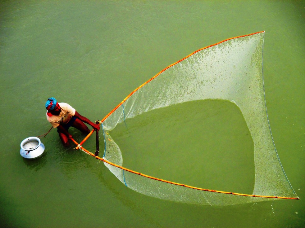
Retracing Her Path 1: A Journey along the Teesta River in Bangladesh
Above: A local fisherman fishing upstream of the barrage (Photo: Gauri Noolkar-Oak)
Guest Blog by Gauri Noolkar-Oak
Few journeys take us through a string of experiences that nourish the senses and the soul. A thoroughbred urban, city-lover, I nevertheless knew deep down that my journey of such nourishment would be with a river. I began researching rivers by chance, but with time, I grew to first like and then worship the entity. In early 2017, I acquired a grant from the Joke Waller-Hunter Initiative to study water conflicts in the Teesta basin, and I knew: this was going to be it.
My journey was inspired by the book “Empires of the Indus” written by Alice Albania, a brave woman who travelled the Indus river from mouth to source, and explored her history and cultures. But beyond that, I hardly had a plan; I did not know how long the journey would take, whether I would be able to see the whole river, and when I would return home. When I landed in Dhaka at the end of April this year, all I knew was that I wanted to see the Teesta right from her confluence with the Brahmaputra River in Bangladesh all the way up to her source at Tso Lamo in Sikkim, on the Indo-China border. Continue reading “Retracing Her Path 1: A Journey along the Teesta River in Bangladesh”
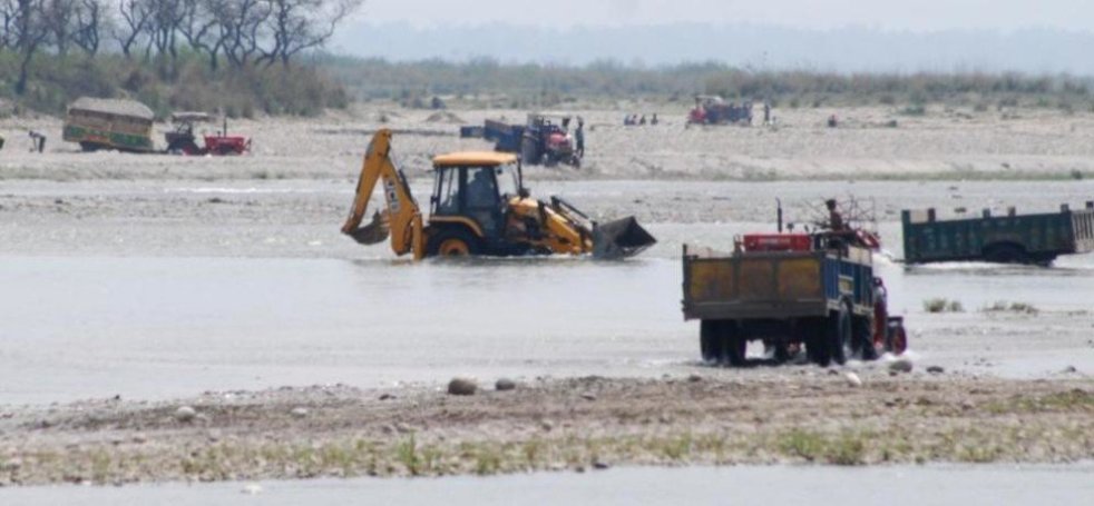
About Matri Sadan Fight Against Illegal Mining In River Ganga
Finally on World Environment Day, Swami Shivanand has withdrawn[I] his fast unto death agitation. It was thirteenth day of his indefinite hunger strike including six days of water fast (from May 25 – 30, 2017) against illegal mining in Ganga.
The saint ended his protest around 6pm on June 05, 2017, only after receiving written assurance from the Central Government. As per information, referring to Matri Sandan repeated pleas, UP Singh Director General of National Mission for Clean Ganga has accepted that there were violations[II] of rules specially Rule No. V of Environment Protection Act during mining in Ganga. Subsequently he has asked Chairman, Central Pollution Control Board initiate criminal proceedings against the officials[III] concerned for non-compliance of the rules.
Continue reading “About Matri Sadan Fight Against Illegal Mining In River Ganga “
NHPC negligence leads to man-made disaster in Parbati Valley in Himachal Pradesh
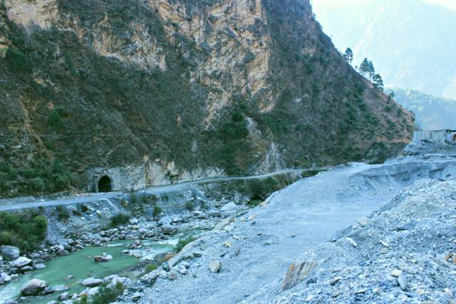
(Above: illegal muck dumping by Parbati HEP along the Sainj River in Himachal Pradesh)
The people of Sainj-Parbati valley in Beas basin in Himachal Pradesh’s Kullu disrict’s Banjar Tehsil are living in constant fear of a disaster. Since six days now, the power tunnel of the NHPC’s under construction 800 MW Parbati II hydropower project is heavily leaking, but NHPC refused to stop water release into the tunnel till the leakage led to landslides and displacement of people. Ultimately on the night of April 17, 2017, huge cracks spread over 200 m appeared in the hills, leading to landslide & fall of soil and rocks, immediately threatening eight families of Rahan (Reina) village, though over 400 families of some 12 villages of Rella Panchayat (including Rella, Sharan, Jiva, Sulga, Khadoa, Rahan, Shalah, Bhebal, Bahara, Bagidhar, Khaul, etc) are facing the prospects of disaster as cracks in the hill have appeared just above the villages. People here are spending sleepless nights since several days now. They are afraid that if the leakage continues, these villages will have to be evacuated any moment, else a major catastrophe may result.[i] Continue reading “NHPC negligence leads to man-made disaster in Parbati Valley in Himachal Pradesh”

The Sad State Of These Persons Called Ganga & Yamuna – Can State Protect Them?
Guest Blog by: Chicu Lokgariwar
It’s a girl! And another girl!
On March 20 2017, the High Court of Uttarakhand in an unforeseen move, bestowed ‘legal personhood’ on the Ganga and the Yamuna. Ten days later, as people were still trying to understand the implications of this order, the Court declared the glaciers, lakes, and wetlands of these basins as legal persons. What does this mean exactly?
The decree: As per an order passed on 20th March 2017, while ruling on a public interest litigation filed by Mohammed Salim against the State of Uttarakhand, the High Court has declared the entire length of the Ganga and the Yamuna, including their tributaries to be juristic persons.
The order states, ‘..the Rivers Ganga and Yamuna, all their tributaries, streams, every natural water flowing with flow continuously or intermittently of these rivers, are declared as juristic/legal persons/living entities having the status of a legal person with all corresponding rights, duties and liabilities of a living person in order to preserve and conserve river Ganga and Yamuna.’
Continue reading “The Sad State Of These Persons Called Ganga & Yamuna – Can State Protect Them?”

Varanasi, God’s Own Land
Guest Blog by Nandini Oza
My recent visit to Varanasi in March 2017 was with a lot of expectations for more than one reason. Varanasi is situated on the majestic Ganga and located between the two rivers Varuna and Asi with Gomti – Ganga sangam (confluence) not far away. Naturally Varanasi would be of interest to any person interested in rivers and water. The Government has also announced the ambitious Namami Gange program which is essentially a national mission for cleaning of the river Ganga. The Government has also declared building of waterways through more than hundred rivers across the country and all the three rivers of Varanasi, the Ganga, Varuna and Asi are a part of this project. Besides, Varanasi being Prime Minister Mr. Narendra Modi’s constituency for three years now, he takes personal interest in its development through several programmes like Swatch Bharat Abhiyan, Namami Gange and so on. This visit was therefore to familiarise myself with the ground situation, issues and recent developments and I share my impressions here. I also share some of the discussions I had with local groups and individuals of the holy city of Banaras.

Rivers of Stories
Above: Sohni in Chenab, painitng by Manjit Bawa
To say that rivers hold great cultural significance for South Asia is stating the obvious. Also obvious is that the cultural legacy of rivers overpowers the religious narrative… which too, is not tied only to Vedic Hinduism. All faiths in the subcontinent have a deep connection with rivers which manifests in stories, lore, songs and poetry. While Suktas in Rigveda eulogizing rivers are known, actually breathtaking is the lyrical beauty of the verses which describe Sindhu or Indus as a “wild, magnificent white stallion, roaring and galloping through the Himalayas into the plains” or sometimes as a “loving mother cow, its calves following her from the steep mountain paths”. Continue reading “Rivers of Stories”
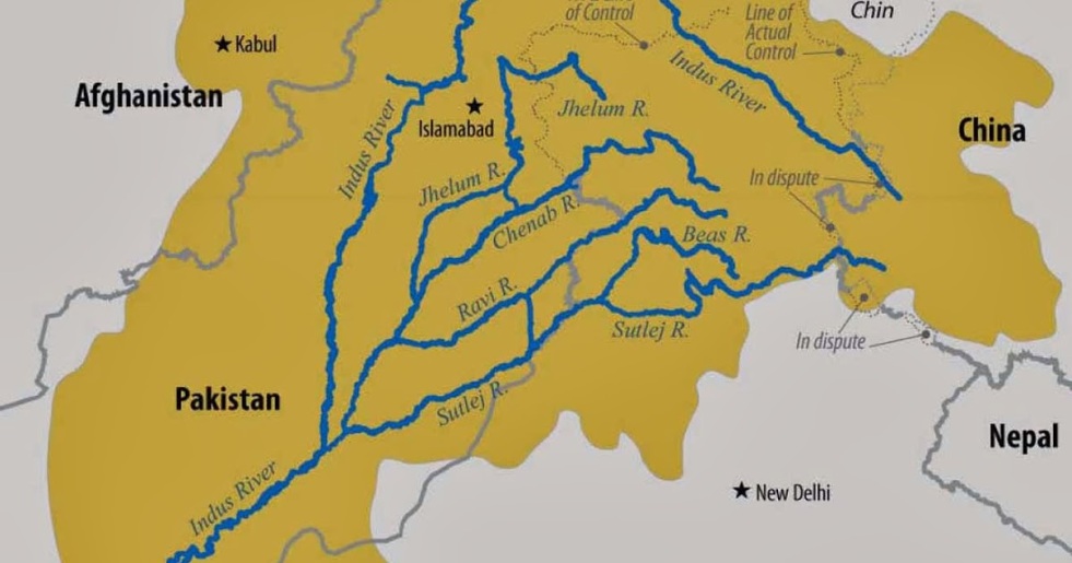
India Pakistan resume talks on Indus Treaty: Stakes are high
When on March 20-21, 2017, on the eve of World Water Day, India and Pakistan’s Permanent Indus Commission met in Islamabad for its 113rd meeting, there was a lot at stake besides the immediate issue or even the Indus Treaty.
In many ways, the Indus Treaty remains a bright spot in relations between these two neighbors and the treaty keeps bringing them back to the talking table…This is the magic of a shared river! Continue reading “India Pakistan resume talks on Indus Treaty: Stakes are high”
River bank failure due to sudden water flow changes
Can land, trees, structures, farms, pipes, poles, pumps etc, along a river bank several kilometers downstream collapse if water flow in the river is suddenly reduced or stopped? Yes, reduced/ stopped, not increased? This kind of river bank slump or collapse or failure is not easily understood, but it does happen. Let us see how. Continue reading “River bank failure due to sudden water flow changes”

Godavari Basin in Maharashtra: A Profile
The river Godavari is the largest of the peninsular rivers of India. Maharashtra is home for its early flows and Godavari for Maharashtra is no less than Ganga. Referred to as Dakshin Ganga the river holds immense spiritual and cultural significance. Several places at its origin are said to be abode of Rama during the exile. These places are worshipped even today.
One of the unique aspects of this river is that it drains nearly entire East to West length of Maharashtra. And while running ceaselessly towards the Bay of Bengal the river encompasses nearly all the geographically diverse regions of the state. Originating in Western Ghats this river later traverses through the arid and dry region of Marathwada and then emerges in high rainfall region of Vidarbha. While the Upper Godavari sub basin is a part of prosperous sugar cane growing belt of Western Maharashtra; its tributaries like Manjara and Wardha-Wainganga flow through the region where there is still significant potential of local water systems.

