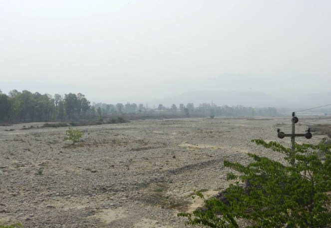
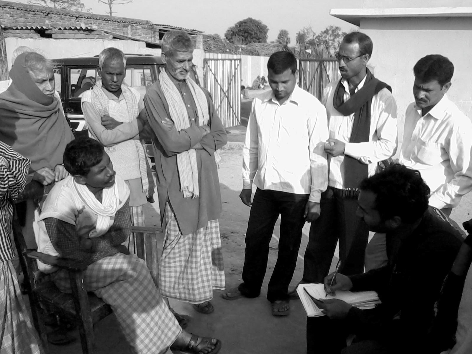
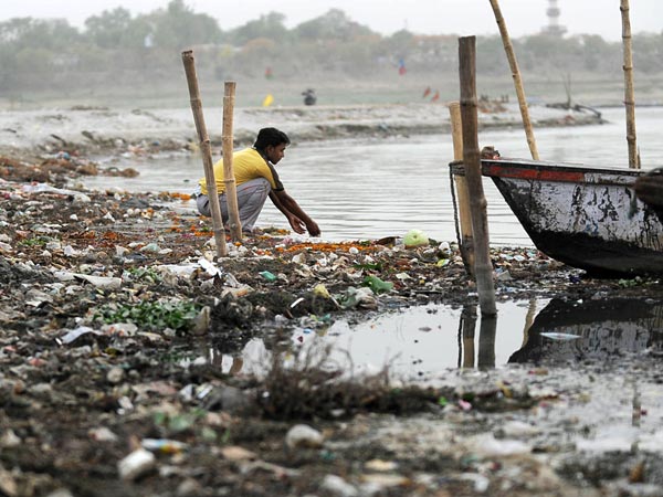
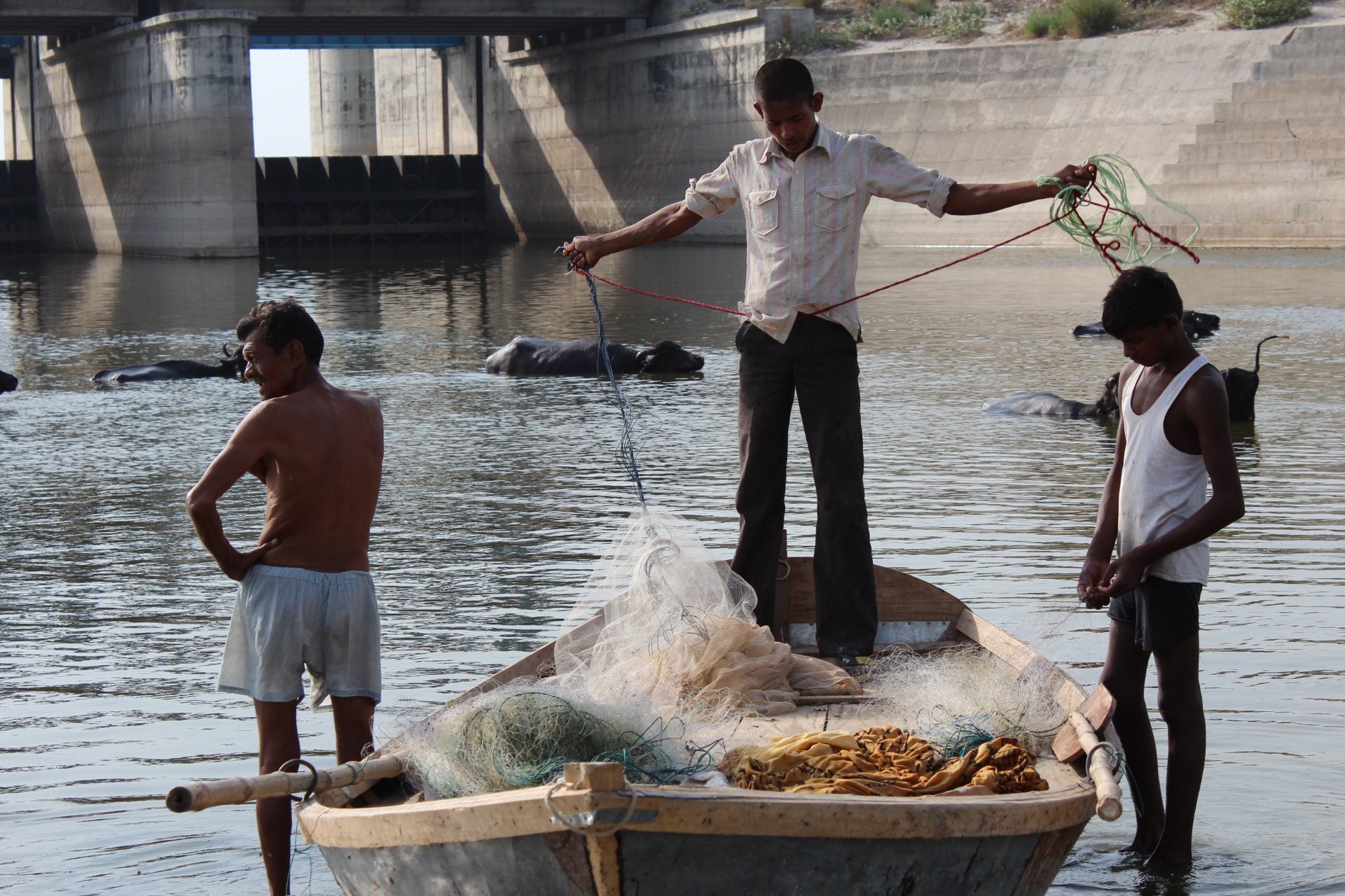
Who has not seen a river? And who has then, not been moved by a fierce emotion? The common man sees its life granting blessed form, the government or CWC engineer sees in it as a potential dam project, the hydropower developers a site for hydro project, a farmer his crop vitality, fisher folk, boatspeople and river bed cultivators a source of livelihood, the industry & urban water utilities view it as their personal waste basket, the real estate developer as a potential land grab site, a sand miner as a source of sand and the distraught villager his lifeline. In earlier days, film makers used to see it as site for filming some memorable songs, but these days even that has become a rarity.[1]
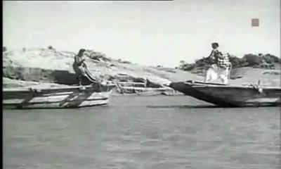
Song “Nadi Naare na jaao” from Film Mujhe Jeene do
Rivers truly are a complex entity that invoke varied emotions and responses!
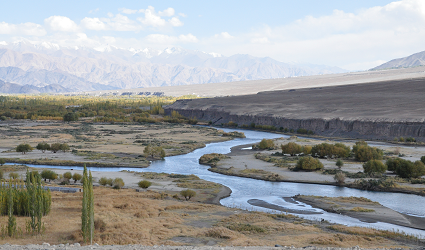
A river shifts in colour, shape, size, flow pattern of water, silt, nutrients and biota, in fact all its variables seem to change with time and space. The perceptions differ as one moves from mountains to plains to the deltas. The same stream displays a wide variance of characteristics that depend upon the land it flows through and the micro climate along its banks. Rivers many a times seem to mirror the local flavour of the land they flow through. Or is it the local flavour that changes with river flow? Clearly both are interdependent.
Today, as we talk of rivers, their rejuvenation and try to figure out their ecological flow and their health quotient , a good beginning to understand the existing rivers would be their classification modules. What defines a river? Which factors are used for their classification? How do we actually classify our rivers?
As far as the first of these questions is concerned, none of the official agencies have tried to define a river!
Possiby, the first post independence classification of river basins was attempted in 1949 by precuser institute of current Central Water Commission (CWC). Since then various organisations have followed their own methodology and criteria for basin classification and arrived at different numbers.
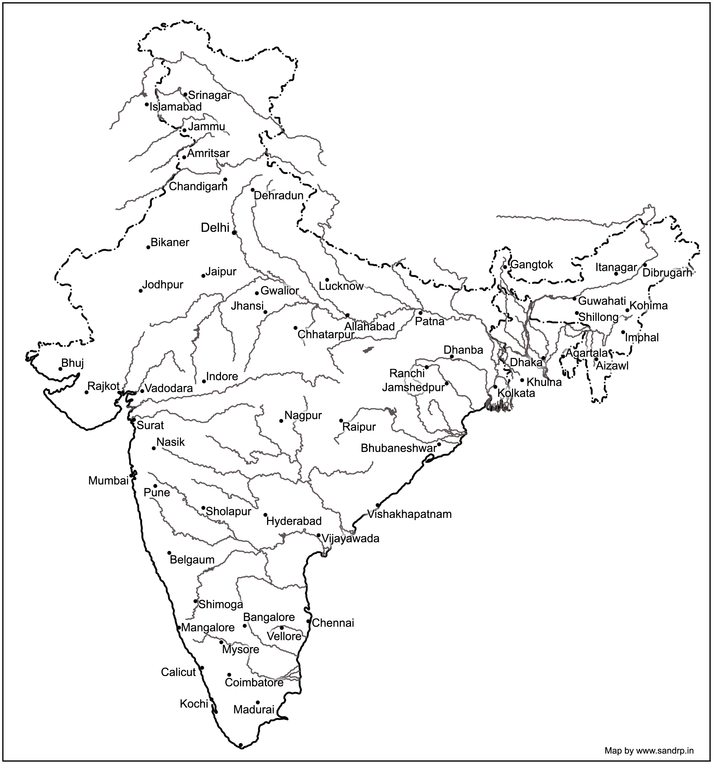
Basin Map of Rivers by Central Water Commission
NIH (National Institute of Hydrology), Roorkee organises our 7 major rivers, that is the Brahmaputra (apparently this includes the Ganga and the Meghna), Godavri, Krishna & Mahanadi (that flow into the Bay of Bengal), and the Indus, Narmada & Tapi (which drain into the Arabian Sea) , along with their tributaries to make up the entire river system in our country.[2] This is clearly problematic and chaotic, since it leaves out vast areas of the country and the rivers that flow through them.
A quick look at the classification based on these 3 aspects –origin, topography and the basin they form.
Based on Origin or Source
Depending on the origin or where they begin their journey from, there are the Himalayan (perennial) rivers that rise from the Himalayas and the Peninsular rivers that originate from the Indian plateau. The Himalayan rivers include the Ganga, the Indus and the Brahmaputra river systems along with their tributaries, which are fed throughout the year by melting ice and rainfall. They are swift, have great erosion capacity and carry huge amounts of silt & sand. They meander along the flat land, create large fertile flood plains in their wake and their banks are dotted by major towns and cities.
The peninsular rivers, on the other hand are more or less dependent on rain. These are gentler in their flow, follow a relatively straighter path, have comparatively less gradient and include Narmada, Tapi, Godavari, Krishna, Cauveri and Mahanadi rivers, among many others.
Based on topography
The Himalayan Rivers flow throughout the year, are prone to flooding and include Indus and the Ganga-Brahmaputra-Meghna.
The Deccan Rivers include the Narmada and Tapi rivers that flow westwards into the Arabian Sea, and the Brahmani, Mahanadi, Godavari, Krishna, Pennar & Cauvery that fall into the Bay of Bengal.
The Coastal Rivers are comparatively small in size and numerous in number, with nearly 600 flowing on the west coast itself.
Rivers of the Inland Drainage Basin are centered in western Rajasthan, parts of Kutch in Gujarat and mostly disappear before they reach the sea as the rainfall here is scarce. Some of them drain into salt lakes or simply get lost in the vast desert sands.
Island Rivers Rivers of our islands: A&N islands & Lakshadip group of islands
Based on basin formed
On the basis of the basin formed, our rivers are distributed into 7 river systems. The Indus River System originates in Kailash range in Tibet, and includes Zanskar, Shyok, Nubra ,Hunza (in Kashmir) along with Jhelum, Chenab, Ravi, Beas and Sutlej as its principal tributaries. In the Brahmaputra River System, it was earlier assumed that the Mansarovar lake is the source of the Brahmaputra river, however, now it is confirmed that Angsi Glacier is the main source (see: See: http://www.thehindu.com/news/international/china-maps-brahmaputra-indus/article2384885.ece). Most of the course of the river lies outside the country. In India it flows through Arunachal Pradesh and Assam, where it is joined by several tributaries. For more information on this river, see: https://sandrp.wordpress.com/2013/07/17/brahmaputra-the-beautiful-river-or-the-battleground/.
Mighty Brahmaputra in Assam
The Narmada River System comprises of the Narmada River that represents the traditional boundary between North & South India and which empties into the Arabian Sea in Bharuch district of Gujarat. Tapi river of the Tapi River System rises in the eastern Satpura Range of Madhya Pradesh and then empties into the Gulf of Cambay of the Arabian Sea, Gujarat. Its major tributaries are Purna, Girna , Panzara , Waghur , Bori and Aner rivers.
Also called the Vriddh (Old) Ganga or the Dakshin (South) Ganga, Godavari of the Godavari River System, originates at Trambakeshwar, Maharashtra and empties into the Bay of Bengal. Summers find the river dry, while monsoons widen the river course. Its major tributaries include Indravati, Pranahita, Manjira, Bindusara and Sabari rivers.
The Krishna River System includes Krishna river, one of the longest rivers of the country,that originates at Mahabaleswar, Maharashtra, and meets the sea in the Bay of Bengal at Hamasaladeevi, Andhra Pradesh. Tungabhadra River, formed by Tunga and Bhadra rivers, is one of its principal tributary. Others are Koyna, Bhima, Mallaprabha, Ghataprabha, Yerla, Warna, Dindi, Musi and Dudhganga rivers.
The Kaveri River System has the Kaveri (or Cauvery) river whose source is Talakaveri in the Western Ghats and it flows into the Bay of Bengal. It has many tributaries including Shimsha, Hemavati, Arkavathy, Kapila, Honnuhole, Lakshmana Tirtha, Kabini, Lokapavani, Bhavani, Noyyal and Amaravati. The Mahanadi of the Mahanadi River System, a river of eastern India rises in the Satpura Range and flows east into the Bay of Bengal.
Broader definition: Catchment area size
River basins are widely recognized as a practical hydrological unit. And these can also be grouped, based on the size of their catchment areas (CA). This easy to understand river system classification divides them into the following categories as tabulated below:
River basin
CA in sq km
No. of river basins
CA in million sq. Km
% area
% Run off
% population
Major river basin
CA > 20,000
14
2.58
83
85
80
Medium
20,000<CA<2,000
44
0.24
8
7
20
Minor (Coastal areas)
CA< 2,000
Many
0.20
9
8
Desert rivers
Flow is uncertain & most lost in desert
–
0.1
–
Drainage System of Indian Rivers
Major river basins include the perennial Himalayan rivers- Indus, Ganga & Brahmaputra, the 7 river systems of central India, the Sabarmati, the Mahi, Narmada & Tapi on the west coast and the Subarnekha, Brahmani & the Mahanadi on the east coast and the 4 river basins of Godavri, Krishna, Pennar and Cauvery, which takes the total to 14. The medium river basins include 23 east flowing rivers such as Baitarni, Matai & Palar. A few important west flowing rivers are Shetrunji, Bhadra, Vaitarna & Kalinadi. The minor river basins include the numerous, but essentially small streams that flow in the coastal areas. In the East coast, the land width between the sea and the mountains is about 100 km, while in the West coast, it ranges between 10 to 40 km. The desert rivers flow for a distance and then disappear in the desert of Rajasthan or Rann of Kutch, generally without meeting the sea.[3]
A need for details
Under India-WRIS (Water Resources Information System) project too, the river basin has been taken as the basic hydrological unit, but the country has been divided into 6 water resource regions, 25 basins and 101 sub basins, which are an extension of the earlier 20 basins delineated by CWC, as detailed in the ‘River basin Atlas of India’. [4] The details of the individual catchment area of these 20 river basins is tabulated here:
S No
River Basin
CA (Sq. Km)
Major river
River Length, km
1
Indus (Upto border)
321289
Indus(India)
1114
2
Ganga- Brahmaputra-Meghna
a
Ganga
861452
Ganga
2525
b
Brahmaputra
194413
Brahmaputra (India)
916
c
Barak & others
41723
Barak
564
3
Godavari
312812
Godavari
1465
4
Krishna
258948
Krishna
1400
5
Cauvery
81155
Cauvery
800
6
Subernarekha
29169
Subernarekha
395
Burhabalang
164
7
Brahmani & Baitarni
51822
Brahmani
799
Baitarni
355
8
Mahanadi
141589
Mahanadi
851
9
Pennar
55213
Pennar
597
10
Mahi
34842
Mahi
583
11
Sabarmati
21674
Sabarmati
371
12
Narmada
98796
Narmada
1312
13
Tapi
65145
Tapi
724
14
West flowing rivers from Tapi to Tadri
55940
Many independent rivers
15
West flowing rivers from Tadri to Kanyakumari
56177
16
East flowing rivers Between Mahanadi & pennar
86643
17
East flowing rivers Between Pennar & Kanyakumari
100139
18
W flowing rivers of Kutch & Saurashtra includes Luni
321851
Luni
511
19
Area of inland drainage in Rajasthan
60269
Many independent rivers
20
Minor rivers draining into Myanmar & Bangladesh
36202
Many independent rivers
Note: 1. River Length is only for the main stem of the river, does not include tributaries, etc.
Area of inland drainage in Rajasthan is not given in this reference, it has been arrived at by inference.
Indus basin is constibuted by six main rivers: Sutlej, Beas, Ravi, Chenab, Jhelum and Indus itself. Some tributaries of this system form independent catchment in India (e.g. Tawi river in Chenab basin) as these confluence with the main river only in downstream of the border.
Of course these methods only classify rivers based on their physical & geographical attributes, their drainage area, river length, volume of water carried and tributary details. For a detailed study of a river, what is also needed is its ecological assessment. The methods for river classification may be varied and still evolving, but this information is fundamental to better understand and map the rivers that criss cross across the country.
And definitely a first step to try and understand our rivers!
Godavari is the second longest river in India after the river Ganges. It is popularly known as “Dakshin Ganga”. It originates at Bramhagiri hills in Tryambakeshwar of Nashik District in Maharashtra. 13 KM stretch of the river flows through Nashik City. About 1.25 KM of this stretch is of religious significance. Kumbh Mela is a mass Hindu pilgrimage in which millions of pilgrims gather on banks of Godawari in Nashik city to bathe in a sacred river. It is one of the world’s largest religious gatherings which happens every 12 years. Next Kumbh Mela is scheduled in JulySeptember 2015. About 1 crore pilgrims are expected to arrive[i].
The river that has a high cultural and religious significance has been routinely used as a dumping ground for city’s sewage and industrial effluent. There are around 20 locations where sewage and industrial effluent from 2 industrial estates is directly discharged into the river which have rendered the river water unfit for drinking and domestic use[ii].
A petition has been filed in the high court by few activists from the city against Nashik Municipal Corporation (NMC), Municipal Commissioner, Government of India (GoI), Government of Maharashtra (GoM), and Maharashtra Industrial Development Corporation (MIDC) for failure on their part to clean the pollution of the river[iii]. The court has acknowledged that the major factor contributing to the pollution is the human factor and that various religious and other activities are contributing to the pollution of the river for years. Court has appointed the National Environmental Engineering Research Institute (NEERI) for formulating a comprehensive action plan for the purposes of cleaning of the River Godavari and proper maintenance of the river. Considering the forthcoming Kumbh Mela in July-September 2015, the Court has directed NEERI to submit an action plan to tackle with Kumbh Mela. The court has also appointed a committee to examine the action taken by all the concerned Authorities as regards the implementation of the recommendations in the first two reports submitted by NEERI and the directions contained in the court order.
While NEERI has submitted the two reports about cleaning of Godavari and plans for Green Kumbh are being heavily discussed, NMC has undertaken projects which are in stark contradiction with the court order.
Concretization of river bank in the name of ‘Goda Park’
As SANDRP had highlighted in its article on Riverfront Development projects in India (https://sandrp.wordpress.com/2014/09/17/riverfront-development-in-india-cosmetic-make-up-on-deep-wounds/), NMC has taken up ‘Goda Park’ a riverfront project on Godavari flowing through municipal limits[iv]. Earliest version of Goda Park was implemented some 4 to 5 years back and consisted of a 2.5 KM walkway along the river. This project has been a failure on multiple grounds. The stretch of the walkway lined up with paved concrete blocks is severely underutilized as a result of less dense population. The walkway has also become a platform for host of illegal activities. “Citizens are facing safety issues as a result of these activities” says Mrs. Prajakta Baste, principal of College of Architecture Nashik. The walkway falls within the flood line. During monsoon it is completely under water. As a result it has been damaged at several places. Pipelines that discharge untreated sewage in Godavari run from bellow the walkway resulting in stench and filth.
While the earlier version of Goda Park has failed, the project has been revived this year with a fresh blue print. As experts and activists say it has been a dream project of Maharashtra Navnirman Sena (MNS) chief Raj Thackeray and MNS ruled NMC has resolved to materialize it. The 13.5 km long project (on both the banks making it 26KM in total) will be developed from Ahilyadevi bridge to Gangapurgaon, having facility of laser shows, musical fountains, rope-way, multi-purpose meeting hall, garden, place for exercise including yoga, water sports and plantation of herbal plants and a canteen. Due to lack of adequate funds with NMC the project has been handed over to Reliance India Foundation (RIF) for execution[v]. Apart from small coverage in print media, no information about the project is available in the public domain.
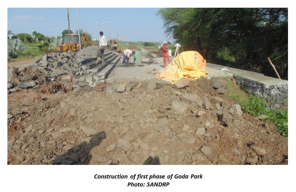
Not many people are aware that work for first 500 m stretch of Goda Park on left bank at Anandwalli has already been taken up by RIF and is in progress. This stretch includes Gym (Phase I: 60m x 18m, Phase II: 45m x 18m) and garden. The project is problematic on many fronts.
Constructions proposed within the blue line: Flood lines along Godavari in Nashik city have been re-demarcated after the city faced heavy downpour on 28th August 2008 and houses & buildings constructed within 125 to 200m from the river channel were under water for upto 10 to 15 hours[vi]. These newly defined lines which according to local people have been already tampered with and brought closer to the river channel so as to facilitate the real estate development are completely violated by the project.
The circular dated 21st September, 1989 issued by the Assistant Secretary, Irrigation Department; Government of Maharashtra prohibits any construction within blue line due to possibility of floods any time[vii]. The project readily violates this norm proposing structures for gym phase I & II within the blue line. The project thus is an illegal encroachment on the river bank. The project talks about several such features including multi-purpose meeting hall, restaurants, yoga centre, recreational centres etc.
Goda Park set to destroy the riparian zone: Riparian areas which are naturally vegetated lands along rivers and streams act as natural filters of nonpoint source pollutants, including sediment, nutrients, pathogens, and metals. It is important to preserve the riparian areas because these areas can play a significant role in managing adverse water quality impacts. These areas also act as buffers during floods and play an important role in flood absorption.
Riparian vegetation of full 18 M width of river bank has been cleared for length of 500 M for construction of gym and landscaped garden. Concretization of the cleared patch is in progress. Deputy Engineer from Construction Department of NMC Mr. Rajput said that stretch of 18 to 30M width will be ‘developed’ for entire 13 KM on both the banks. Goda Park is thus set to destroy the riparian area along the entire river. River has been fighting poor water quality and destruction of the riparian vegetation will only worsen the case.
Addressing water quality issues is not a part of the project: The city has around 20 locations where untreated sewage is discharged directly into the river. And shockingly one such discharge point is located barely 200 m from raw water sourcing location. NMC has not taken any action against this and has continued lifting this contaminated water.
At certain locations along the river water quality is in poorest condition. Godavari River has been designated as an A2 class river which means that the river is a source of drinking water. Water quality standards prescribed by CPCB for the A2 class river state that the permissible limit for Biological Oxygen Demand (BOD) is 2mg/l or less. In reality at certain locations along the river BOD is as high as 51mg/l. Similarly Dissolved Oxygen (DO) at certain locations is as low as zero to 3.5mg/l when the water quality standards demand it to be 6 mg/l or more[viii]. The high value of COD is indicator of pollution due to discharge of domestic and industrial effluent in the river water.
Cleaning up the river and restoring its water quality which is the prime need has gone unaddressed in Goda Park. While the project plan talks about several urban features; it does not talk of treatment of sewage. Petitioners of the ongoing PIL regarding the degraded water quality of the river are disappointed with the Goda Park. Activist Rajesh Pandit, one of the petitioners expresses his concern over the project saying “Godavari River is like our mother who is in ill health and is in intensive care unit (ICU). Instead of treating her and getting her out of ICU, NMC is trying to put some make up and beautify her. That is definitely not what she needs right now!” The group of petitioners has also corresponded with NEERI to obtain their views about the project. The reply is awaited.
Goda Park is in violation of the court order: The order issued by the High Court essentially directs the NMC to restore the health of the river back to the water quality standards prescribed for A2 Class River. The project will only cause further damage to the river and is far from compliance with the orders issued by High Court for rejuvenation of Godavari River. The petitioners in fact highlight the fact that implementing any project which causes damage to river is a punishable offence as per Indian Penal Code Section 431.
NMC ignorant of the impacts: Mr. Vanjari of Environment Department of NMC when contacted to discuss the environmental impacts of Goda Park project told SANDRP that he does not have any information about the project. It is shocking that the environment department does not have any information of a project that is set to alter character of 26KM bank of the river. Dy Engineer of Construction Department Mr. Rajput when contacted for discussing the environmental impact of the project was of opinion that the project causes no damage to the river and is very much in line with the court order. When asked if there has been any study to assess the impact of the project on ecology of the river the answer was negative and Dy Engineer was also of opinion that there was no need for such a study. He also said that the stretch which is being developed is under flood water only once or twice a year and thus it is not much of a problem.
This only shows that NMC is completely ignorant about the impact of the project and does not realize the seriousness of the issue.
While recommendations by NEERI are being discussed and debated with no concrete action taken as of now, Goda Park has been expedited both by NMC and RIF. There are several other grounds on which the project is unjust. The fertile and ecologically important land on the river banks has been handed over to a corporate without public consent. Both NMC and RIF have taken the public for granted. The citizens are being misled with promise of riverfront development on lines of Sabarmati. Public at large is unaware of these issues. Profit making by a corporation at the cost of natural resource stands clearly unjustified.
[vi] “Analysis and Mapping of Flood Line in Godavari River Basin within the Nasik Municipal Corporation Area” published in International Journal of Research in Social Sciences Volume 2- Issue 2 (ISSN: 2249-2496)
[vii] Bombay High Court order issues on 07/03/2014 for PIl-176.12
[viii] “Water Quality Assessment of Godavari River at Nashik, India: Impact of Sewage and Industrial Wastewater” Published in Universal Journal of Environmental Research and Technology 2013 Volume 3, Issue 4: 452- 457
Ganga is hotter but Yamuna is hot too, with a number of suitors now trying to chase it, thanks to Prime Minister Modi’s often expressed desire for a rejuvenated Ganga.
But Sinya Ejima, the JICA (Japan International Cooperation Agency) chief in India takes the cake, when he expects to swim and drink the Yamuna waters in Delhi in 2017 (thanks to JICA’s assistance to the Yamuna Action Plan, YAP) [1].
But is there more to this public declaration of bravado by Mr Ejima than that meets the eye? Let us try and decipher..
It was way back in 1993-94 when Government of India launched Yamuna Action Plan with an objective to “bring the water quality of the river back to bathing level” with JICA’s (then called the JBIC) assistance. In popular scientific ‘pollution’ parlance, it meant achieving a BOD level of 3 mg per liter all through the length of the 1376 km river from Yamunotri till Allahabad.
Yamuna Action Plan was implemented like its predecessor Ganga Action Plan (GAP) as primarily a pollution abatement effort in 21 cities in Haryana and UP and the National Capital territory of Delhi and claimed to have created a total sewage treatment capacity of 753 MLD at a total cost of Rs 682 crores (1 Crore = 10 million).
Listless and dying river in Delhi Photo: Yamuna Jiye Abhiyan
YAP II began, again with JICA assistance, in 2003 at a total cost of Rs 624 crore for abatement of pollution of river Yamuna in Delhi, UP (98 towns) and Haryana (6 towns). It claims to have created additional sewage treatment capacity of 189 MLD.
Yamuna Action Plan III, again with JICA assistance with a projected life span of 7 years is currently underway since 2012 and is aimed again at the pollution abatement in the city of Delhi. The cost estimate of YAP III is Rs 1656 crores and its components include rehabilitation of damaged trunk sewers in the Kondli and Rithala catchments; rehabilitation and modernization of STPs at Okhla, Rithala and Kondli in tune with the under preparation sewerage master plan for the city.
Against all the above mentioned efforts, tall claims and money spent (largely national debt), the Central Pollution Control Board, in response to the Supreme Court of India, reported in March 2012:
“River Yamuna is not conforming to the desired levels from Panipat downstream to Agra downstream due to higher concentration of one or the other criteria pollutants.” The report added that “efforts of state governments of Haryana, Uttar Pradesh and the National Capital Territory of Delhi for collection and treatment of waste water are not showing improvement in the water quality of river Yamuna.”
Clearly, all the past efforts at the ‘cleaning’ of river Yamuna mostly with JICA assistance (read loan) have failed.
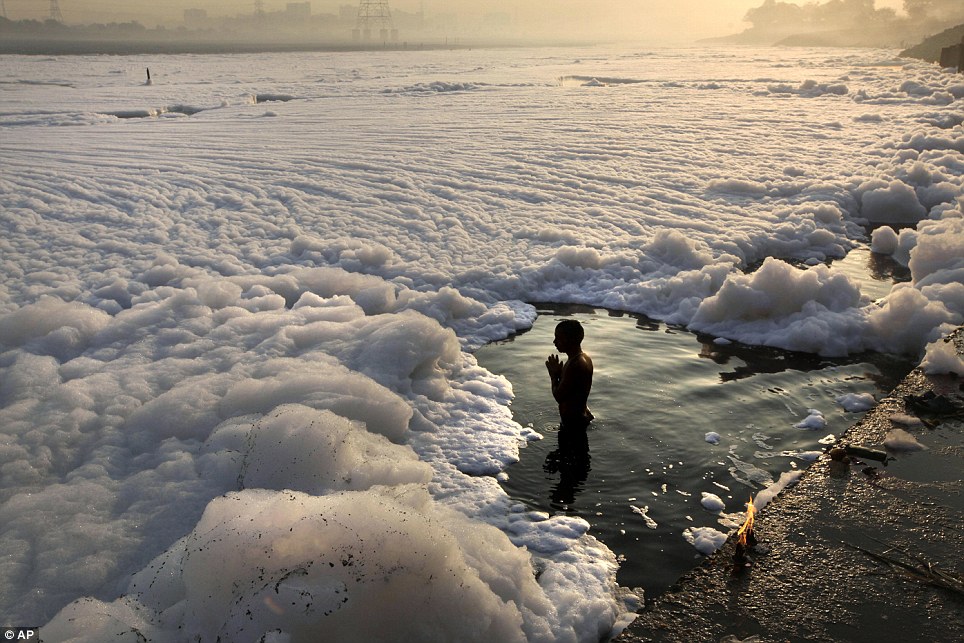
Wroshipping the polluted Yamuna. Photo from Daily Mail. co.uk
So, what could have prompted this new found source of energy and bravado as shown by Mr Ejima, the JICA chief in India at a presentation the other day at the India-Japan joint working group meet on Urban Development on ‘JICA’s Operations In Urban Sector in India’ in Delhi?
It is no longer a secret that following Prime Minister Modi’s clarion call from the ghats in Varanasi for the rejuvenation of river Ganga (and by implication its other tributaries like Yamuna), there has been a sudden and newly-found interest in rivers of India by countries like Holland, Germany, France and Australia (to name but a few) and a regular stream of experts/visitors (read consultants) there from can be found making the rounds of the corridors of power in New Delhi.
All this could be unnerving and a turf threat to any ‘established’ provider of goods and services in the name of river cleaning in India, say the likes of JICA, and possibly thus the said show of bravado by its chief in India.
However, the so-called river ‘cleaning’ route focused on pollution abatement as the primary means of river ‘rejuvenation’ is in our understanding fundamentally flawed and hence destined to fail. Results of all past similar efforts validate our stand.
If only we could begin practicing the basic principle of a ‘River’ and ‘Sewer’ not meant to mix, and that all sewerage improvement works (main component of JICA assistance) in cities of India be treated and planned as a strategy of ushering in a sound urban management, rather than river rejuvenation?
Sine qua non for any river rejuvenation is the restoration of its flow in its most natural state.
However, if true to his words, Mr Sinya with his tested and failed (unfortunately) primarily pollution abatement efforts can still manage to restore the Yamuna enough to swim and drink its waters in the year 2017, we would love to toast him as a national river restoration icon. AMEN.
A recent appraisal has found that there is no river in any of the top 50 cities in the country which is not sick or dying with river Yamuna in Delhi-Mathura-Agra and Ganga in Kanpur-Varanasi-Patna leading the list.
Widespread devastations in Uttarakhand (June 2013) and J&K (Sept 2014) and Assam-Meghalaya in North East (September 2014) bring home the fact that disturbed rivers can become dangerous and highly devastating.
Dams, diversions, bumper-to-bumper hydro projects, diverted natural flows, encroached flood plains, embanked river channels, degraded catchments, destruction of local water systems and pollution of various kinds are some of the reasons for the above.
The uncertainties associated with the phenomenon of climate change are predicted to further compromise the integrity of our rivers.
Lack of true understanding and appreciation – amongst planners, decision makers, various government departments as well as the common man – of rivers as ecological systems providing a number of ecological and economic services is a major reason for the sorry state of our rivers.
No wonder, there exists no national policy or law that could provide our rivers security from degradation and exploitation.
With an aim to remedy the above situation, a consortium of NGOs including WWF India, INTACH, SANDRP, Toxics Link and PEACE Institute Charitable Trust, are organizing with additional support from Arghyam (Bengaluru), International Rivers (Mumbai office), and Peoples Science Institute, Dehradun, the first ever India Rivers Week, 2014 as a national event in New Delhi from 24-27 of November 2014.
The venue for the Conference is the WWF India secretariat in Delhi. Sri Ramaswamy R. Iyer, former Secretary, Ministry of Water Resources and a leading expert on rivers in the country is chairing the consortium partners.
Over 100 River experts, planners, researchers, artists, enthusiasts and activists from different parts of the country shall congregate in Delhi for 4 days to discuss, deliberate and exchange their experiences and ideas aimed at the restoration of rivers in the country.
With ‘Rivers in Crisis’ as the theme, the Conference shall endeavor amongst other things to devise a National Charter for Rivers, promote a National forum for restoration of rivers and reward an individual and an organization with remarkable track record of work on rivers with the “Bhagirath PrayasSamman”.
Advice and expertise from river experts and activists from different parts of the country has been solicited in form of a National Advisory Committee to make the event productive and successful.
Above:Respecting public opinion and expectations about their city center and their river. This includes people from all economic and social strata Photo: http://www.asla.org
As India attempts to tackle the huge and growing problem of Urban water pollution and Urban rivers, there are repeated attempts to look outwards and try to learn from experience of successful cases from other countries. While replication of such cases is never easy and most of the times not possible, one can learn lessons from such examples. Here is one such case from North African Country of Morocco.
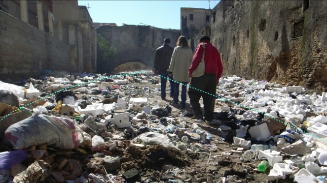
Fez River – A River of Trash as Aziza says Source – TED
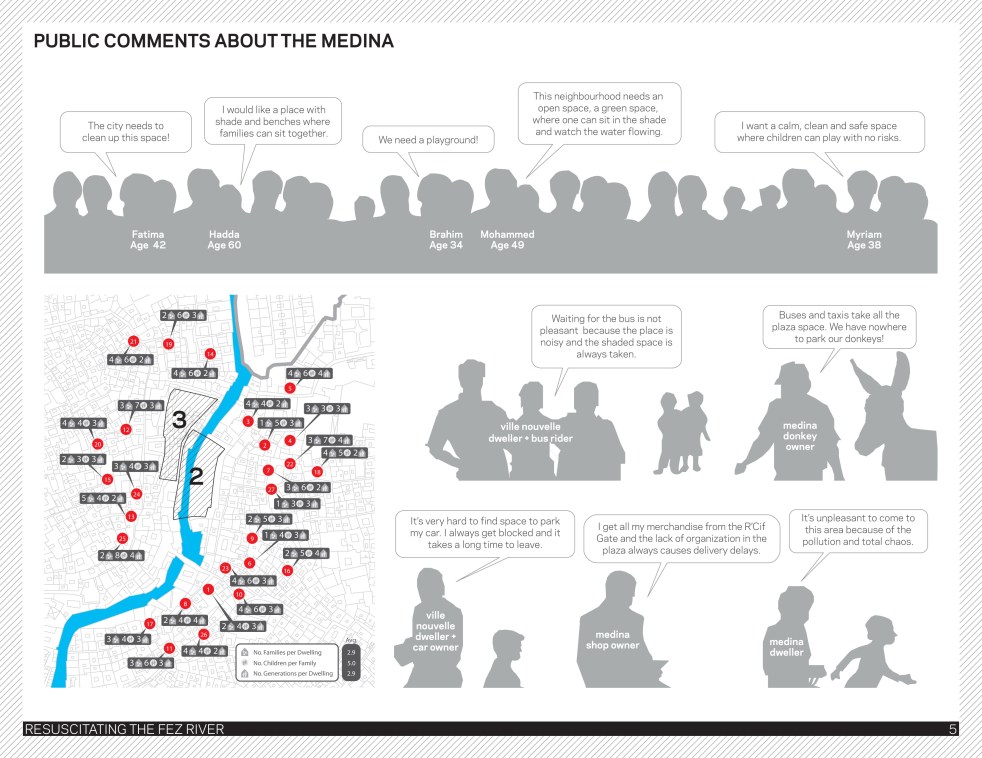
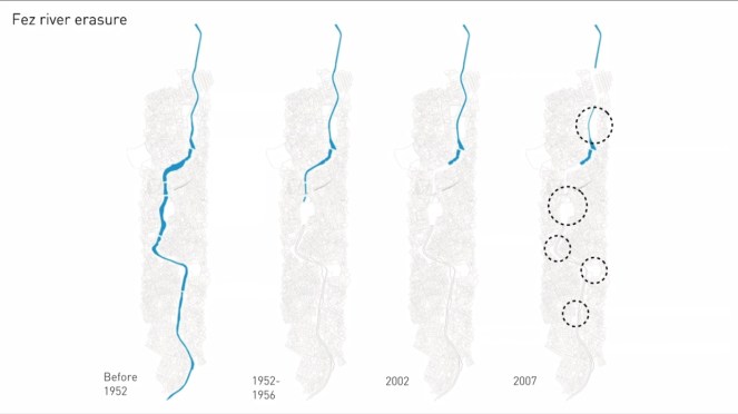
Architect and Professor at Toronto University, Aziza Chaouni narrates in her TED talk how the Fez River flowing through the City of Fez in Morocco (Northern Africa) is being cleaned up and uncovered and the role she played: “The Fez River winds through the medina (city) of Fez, Morocco—a mazelike medieval city that’s a World Heritage site. Once considered the “soul” of this celebrated city, the river succumbed to sewage and pollution, and in the 1950s was covered over bit by bit until nothing remained. TED Fellow Aziza Chaouni recounts her 20 year effort to restore this river to its former glory, and to transform her city in the process.”[1]
Fez River Crusader Aziza Chaouni Source – TED talks
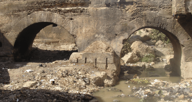
Her narration of the city and the river has striking similarities with Indian rivers and cities: “The Fez medina has about 250,000 inhabitants, and all their untreated sewage went straight into the narrow river that runs through it. The river was also heavily contaminated by nearby crafts workshops and tanneries — with chemicals such as chromium 3, which is lethal. People working in the tanneries were getting skin cancer, and some of them were dying. It was terrible. Obviously the river started to stink, so people started building walls to block the view. Then, because it became a health hazard, they covered it with concrete starting in 2002. And because it was covered, people began using that open space as trash yard.”[2]
Her description of how government functions is also applicable here: “Environmental protection is almost seen as a luxury in developing countries… you have high levels of environmental pollution, but you just don’t know about it as there is not much control or accountability”.
Fez River: How it was erased over the years Source – TED talk
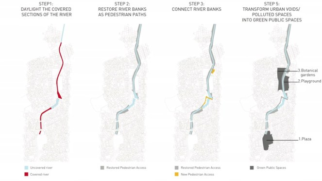
The interventions she proposed were relevant for the specific location and situation and the strategies are more generally applicable: “So we proposed three main interventions: a pedestrian plaza, a playground and a botanical garden. We used four main strategies: precisely placed interventions strategically phased to enhance water quality, remediate contaminated sites, create open spaces, and build on existing resources for economic development. These interventions had to benefit the population on several levels — social, environmental, economic, urban — and be resilient, so that it would still function regardless of changes in budget, political climate, and so on. At the wider city scale, we needed to prevent the newly cleaned river water inside the medina from getting polluted upstream, so we recommended measures for improving regional water quality, too. Depending on soil geomorphology, levels of water pollution, adjacent urban fabric and ecological systems, we purposefully located various rehabilitation tactics like canal restorers, constructed wetlands, bank restoration and storm-water retention ponds.”
Fez River: Rejuvenating step by step. Source – TED talksState of Fez River Source – Tedconfblog
This is something which is entirely missing in our ‘Riverfront Develoment Projects” which lately are only about real estate and propose to do nothing for the river itself.
Her observation about difficulties of a municipal project are relevant for us too: “As some of my colleagues have observed, any municipal project around the world is the most complex project you can possibly work on, especially on a large scale. Because there are just so many variables, there are so many changes in the sociopolitical landscape, and so many commercial and economic interests colliding.”
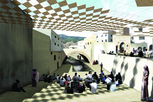
About Chaouni’s background: “Born and raised in Fez, Morocco, Chaouni has long found herself fascinated with the Fez River, which winds through the city’s ancient Medina. Once considered the city’s soul, sending water to both public and private fountains, in the 1950s, the stream started to become a toxic sewer because of overcrowding, over-development and pollution. The city responded by covering the river over with concrete slabs, bit by bit, in the process destroying houses and creating dumping grounds. When Fez received a grant to divert and clean the river’s water, Chaouni proposed the Fez River Project to uncover the river, restore its riverbanks and create pedestrian pathways. Her vision: to reclaim these areas as public spaces and reconnect them to the rest of the city.”
“A project that Chaouni has been working on for two decades, her mission to transform the Fez River began with her thesis in graduate school and has continued throughout her career. Over the course of years, the river is gradually being uncovered—illegal parking lots are being transformed into playgrounds, trees and vegetation are being planted to create public spaces. Overall, the project is revitalizing Fez as a living city.”[3]
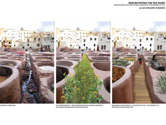
Community-centric plans for resuscitating the famed pits of the Fez Photo: holcimfoundation.org
This example of Fez city and River is still work in progress, but what has been achieved there is certainly impressive. It can provide some lessons for us, provided we are ready to listen: It is possible to truly rejuvenate an urban river: and Sabarmati is not even the right example. In her TED talk, Aziza at one stage says that they could achieve some things only when they put on the ‘Activist’ hat, shedding the ego of the Architect.
Indian Government has no role for activists, unfortunately.
SANDRP
Impression of the resuscitated Fez River in the heart of the city Photo: Aziza Chaouni Projects
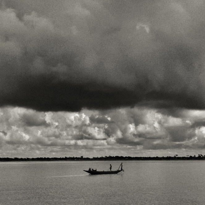
Above: Hilsa fishers in Bangladesh setting out for their journey Photo: with thanks from Arati Kumar-Rao
In addition to the Gangetic Fisheries Primer, SANDRP will shortly publish a Primer documenting the Impacts of dams on Riverine Fish and Fisher Communities. One of the most profound impacts of dams on fish is blocking migration routes and perhaps no other fish symbolizes this impact as dramatically as the Hilsa: the Silver Queen of the River.
Glimpses of the impacts of dams on Hilsa in South Asia.
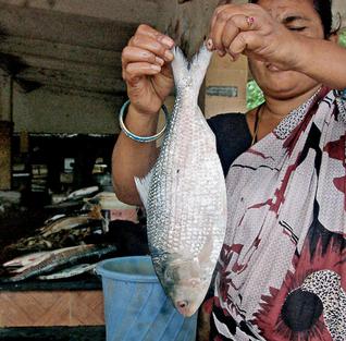
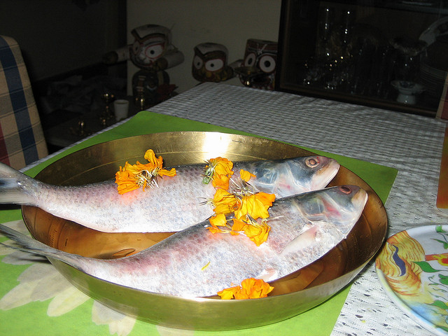
Arguably, Hilsa is not just a tasty and healthy fish species that migrates from the sea up the river to spawn. It is a cultural icon that binds Bengalis, whether from West Bengal or Bangladesh, together in their shared love for Ilish Machch. Pohela Baishakh or the new year day’s meal is not complete without Ilish. Though Hilsa is celebrated fervently by the Bengalis, it is prized in all estuaries of South Asia, from Narmada, Mahanadi, Godavari, Cauvery to Indus and Irrawaddy and takes the name of Chaski, Palva, Ilishii, Palla, Pulasa, etc. It is also found at confluence of Tigris and Euprates in Iran, where it is as prized and known as Sbour. The fish flavours several poems, folklore, songs and phraseologies of the entire South Asia. In cultural terms, the significance of Hilsa is comparable only to Salmon and Mahseer.
Ilish fish and rice, a religious offering and cultural fare on Pohela Baishakh Photo: Flickr
Tenualosa ilisha, Hilsa or Indian Shad belongs to the sub family Alosinae of Family Clupeidae. Commercially, it is the most important fisheries in the estuaries, especially in the Ganga-Hooghly region.It occurs in marine, estuarine and riverine environments and is found in Indus of Pakistan, Irrawaddy of Myanmar and Indian rivers like Ganga, Bhagirathi, Hooghly, Rupanarayan, Brahmaputra, Godavari, Narmada, Cauvery, Tapti, coastal rivers like Padma, Jamuna, Meghana, Karnafuly and others in Bangladesh. It is seen to migrate up smaller estuaries like Pennar too.
Hilsa, by habitat, is a marine fish but migrates in estuaries and rivers for spawning, normally inhabiting the lower region of the estuaries and the foreshore areas of the sea. Hilsa ascends the rivers for spawning and the spent fish and their progeny migrate down the river towards lower estuaries and coastal areas, moving in shoals. The peak upstream migration of Hilsa in most of the rivers of the country is generally in the monsoons months of July and August and continues upto October or November. The spring spawners that enter the river for spawning in January-March return to the sea during July-August when these are caught in good numbers. The monsoon spawners that enter the river during September- October return to the sea after spawning and these spent fishes are caught in good numbers during January- March. Similarly, the off springs of spring-spawners make journey for the sea from the river during November- January, whereas the off springs of monsoon spawners return to the sea from the river during July- September. (Bhaumik et al, CIFRI, 2012)
Obstruction to undertaking this spawning migration by dams and barrages has been singled out as the primary reasons for the fall of Hilsa fisheries in India as well as Bangladesh. The trade of this commercially important fish species constitutes upto 1.5% of Bangaldesh’s National Gross Domestic Product and about 2 million fishers are estimated to depend on Hilsa fisheries in Gangetic estuaries. Till August 2014, Bangladesh has stopped Hilsa exports to India to contain astronomic price rises in Bangladesh as the costs of the fish are becoming uncontainable due to its cultural importance on one hand and dwindling supply on the other. India has requested Bangladesh to lift the ban of Hilsa export, but it is yet to relent, due to a number of socio-political reasons. [2]
Fishers setting off for Hilsa from the Bangladesh Sunderbans Photo: With thanks from Arati Kumar-Rao
One of the main reasons for the phenomenal fall of Hilsa in Gangetic delta has been the Farakka Barrage built by India in the 1970’s, just a few kilometers upstream the India –Bangladesh border, to divert water from Ganga into the Hooghly river, to keep the Kolkata Port at the mouth of Hooghly, free of sediments.
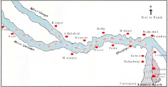
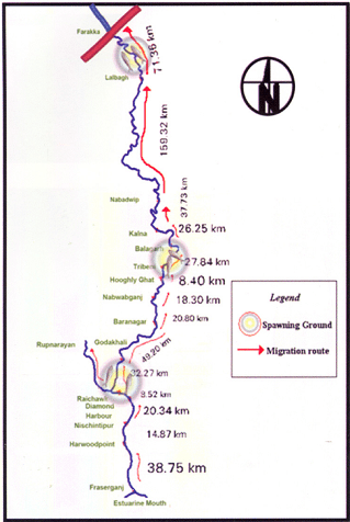
Prior to commissioning Farakka Barrage in 1975, there are records of the Hilsa migrating from Bay of Bengal right upto Agra, Kanpur and Delhi covering a distance of about 1400 kms. Maximum abundance was observed at Buxar, near Allahabad, at a distance of about 650 kms from river mouth. Post Farraka, Hilsa is unheard of in Yamuna in Delhi and its yield has dropped to zero in Allahabad, from 91 kg/km in 1960s. Studies as old as those conducted in mid-seventies[3] single out Farakka’s disastrous impacts on Hilsa, illustrating a near 100% decline of Hilsa above the barrage post construction.
Migration route of Hilsa, Pre Farakka Barrage spanning about 1400 kms Source: CIFRI 2012Highly restricted range of Hilsa post Farakka Source: CIFRI
An obligatory Fish lock provided in Farakka Barrage is non-functional and tagging experiments reveal that Hilsa cannot move across the barrage due to obstruction of three-tire sluice gates.[4] For more on how Farakka has failed its objective and continues to impact livelihoods: https://sandrp.wordpress.com/2014/11/25/lessons-from-farakka-as-we-plan-more-barrages-on-ganga/
Fishers who live off the Ganges strongly feel the pressure of dams, personified by Farakka. In north India, ‘Farakka’ –the word doesn’t mean a village on the Bangladesh border anymore, but means destruction by dams. The local Hindi dialects have borrowed new phraseology: “Farakka hua, tabse hilsa toh bas bhabis” (Farakka happened, and then Hilsa exist only in imagined future)”. The same phrase repeats up to the Yamuna River! In a recent status survey of Gangetic fisheries almost 75-80% of fishers singled out ‘Farakka’ as the root cause of all their miseries. They actually referred to multiple barrages built on the respective rivers. But destruction had a common name: Farakka.[5]
Bangladesh has been making several serious attempts to revive Hilsa fisheries and implements a strict fishing ban in certain months to avoid fishing “jatkas” or small Hilsa. It has also declared several Hilsa Sanctuaries to protect the fish and is witnessing small and steady improvements in the population. India has hardly taken any steps to protect this specie. IUCN has led a program called Ecosystems for Life: A Bangladesh-India Initiative and Hilsa fisheries is a part of this project. There is also a Norwegian project on Hilsa Aquaculture [7] ( All prior efforts of Hilsa Aquaculture have failed). However, the primary need to address the giant problem of the Farakka Barrage is being unaddressed. The barrage and reduced freshwater in the downstream is also exacerbating other stressors like sedimentation of the river mouth, high fishing pressure on limited stocks, concentrated pollution, etc.
Hilsa in other Rivers (would taste as sweet!) Hilsa is found not only in Ganges delta but most of the estuaries in India. In all of these places, Hilsa fishery is primarily affected by dams and barrages near the estuaries, blocking spawning migration and reducing freshwater from upstream.
Hilsa in Cauvery: A century of impacts In Tamizh, Hilsa caught at Sea is Kadal Ullam and the one in the River is the Aattu Ullam. Here, the impact of Mettur dam on valuable Hilsa fisheries in the Cauvery has been recorded as early as 1939 in an issue of Current Science, where it is stated: “Unfortunately the effect of the dam (Mettur on Cauvery) on the fisheries below was disastrous. The number of valuable Indian Shad or Hilsa, the most important sea fish ascending the Cauvery for breeding purposes, declined as the high floods which enabled them to ascend the rive no longer occur. The serious decline of fisheries in Cauvery would be evident from the fact that the fishery rental of the river below the dam which used to amount to 80000 Rs. annually has steadily declined since the formation of the dam to about 42,900 rupees.”[8]Puntius species also disappeared in Cauvery post dam, which formed 28% of the landings prior to dam construction.[9]
As per the Report “Fishing the Cauvery: How Mettur Changed it all,” by Ramya Swayamprakash published by SANDRP[10], It was Sir Aruthur Cotton himself, way back in 1867 who alerted the erstwhile government about the damages wrought by weirs on river fisheries. Immediately, Dr. Francis Day was commissioned to investigate the impact on fisheries and subsequently appointed Inspector-General of Fisheries in India. In his report on the fisheries of India and Burma, Day condemned dams as insurmountable barriers to fish passage; he designed a fish passage which was on the Lower Anicut on the Kollidam. The pass was primarily designed for the Hilsa who could not ascend it, as it was too wide. According to the Madras Fisheries department in 1909, the fish pass did not ensure Hilsa migration because of various practical and technical difficulties; in the first place, the expenses for the construction of a fish pass were not commensurate with the expected results and secondly, sufficient water could not be provided for the efficient working of the pass. Interestingly, Hilsa was sought to be cultivated and exported along the lines of the Salmon in north-western United States. So important was the Hilsa that a stuffed specimen made its way into the exhibits sent to the Great Exhibition from the Bombay Presidency, in 1851!
Fishing at the Lower Anicut on Cauvery Photo: Wikimedia Commons
Today, the Hilsa is unknown on the Cauvery. According to fish biologists, the Hilsa ascended the anicuts on the Cauvery up to Mettur to spawn overcoming the low anicuts. But the coming of the Mettur Dam formed an impassable barrier.
Hilsa in Godavari is known as Pulasa when caught i the river and Vilasa when caught n the sea! Here too, the fish is declining and main reasons are said to be declining water levels and the Dowleswaram Barrage [11] (Arthur Cotton Barrage). In Andhra villages too Pulasa has a huge cultural significance.
This author made a presentation to the Standing Committee of the Lok Sabha, the lower house of Indian Parliament in June 2012 about the impacts of dam on riverine fish and discussed Hilsa, when an MP from Coastal Godavari district in Andhra Pradesh said, “I know Pulasa! My constituency depends on riverine fisheries like Pulasa, and not marine fisheries, but we end up talking only about marine fish and not river fish and Pulasa and the impacts of upstream projects on livelihoods of river fishers”
Pulasa/ Hilsa of the Godavari Photo: The Hindu
In Mahanadi, Orissa, Hilsa has been hit by dams and is recording a declining trend[12]. Paradip recorded about 500 tonnes Hilsa, but prices have increased astronomically.[13]
Hilsa in Narmada, Sardar Sarovar and the proposed Bhadbhut Barrage The narrative of damming the Narmada by the Narmada Valley Projects is one of the most significant stories of an on-going struggle against modifying a river and way of life of her people. Although there are many facets to the story ranging from displacement, false benefits and true costs, forest loss, non-existent rehabilitation and an all-pervasive insensitivity of the government towards weaker communities, the impacts of this project on riverine fisheries have been equally profound. Narmada River system experienced a nearly 70% decline in Hilsa catches in just a decade between 1993 to 2004 ( From 15319 t to 4866 t ) and this decline was prominently recorded from 1998-99 onwards.[14] As per CIFRI, the most stressed species after Sardar Sarovar Project (SSP) construction is the Hilsa and Macrobrachium prawn (Jumbo River Prawn). CIFRI made some prediction about impacts of the dam after 35 years, calling it a ‘critical period’ when fisheries will be nearly lost. Shockingly, these conditions are already being witnessed in Narmada Estuary in Bharuch which records nearly 30% Inland Fish production. More than 12,000 people from 21 villages in Bharuch alone depend on Narmada Estuary for fisheries.
Assessment of impact of commissioning of Sardar Sarovar dam and other projects in 2009 by CIFRI revealed that SSP will retain 96% of the sediment, adversely affecting biological productivity of the downstream including Narmada estuary.[17] However, already the Sardar Sarovar and upstream dams in Narmada Basin have already resulted in retention of about 95% sediment, cutting off the delta from nutrient rich silt. Historical sediment discharge of Narmada was 61 million tonnes and the current sediment discharge (average of last ten years of the study) was found to be 3.23 million tonnes.[18]
According to CIFRI, “While the annual inflow is 23.68 MAF (1981-1990), it will be reduced to 15.9 MAF after 10th year of SSP, to 4.34 MAF at the 30th year and will cease at the 45th year. This freshwater decline will severely affect Hilsa fishery and prestigious fishery contributed by M rosenbergii (Jumbo River Prawn)”. As freshwater declines, there will be “Steep hike in salinity regime with tidal ingress. Fishery not tuned to such enhanced salinity will succumb to such pressure. Mangroves will also be affected and this will impact marine fish production as Mangroves are nurseries of many marine fish.”
Gujarat Government has agreed to release 600 cusecs water from Sardar Sarovar and Bhadbhut Barrage as environmental flows. There is no study as to whether this amount is sufficient for estuarine balance, for ecological needs of Hilsa or other species, for spawning migration, etc. Also, there is no guarantee that Gujarat will release this meagre quantity. Ironically, the minimum flows of 600 cusecs agreed to be released by Gujarat through SSP come to 532. 9 Million Cubic Metre (MCM) water annually and CIFRI’s warning of a sharp fisheries decline at 30th year was for 4.34 MAF or 5353.4 MCM! So, 532.9 MCM released now as minimum flows is barely 10% of a dire scenario predicted at 30th year of commissioning SSP[i]!
It is hardly a wonder that Hilsa is falling sharply in Narmada Estuary and fishers are directly blaming the Sardar Sarovar for this decline.[19]
Last Straw for Narmada Hilsa: Bhadbhut Barrage: Gujarat Government is planning to build Bhadbhut Barrage about 17 kms from Bharuch, directly affecting the Narmada estuary and the Hilsa and Prawn fishery. The Barrage is planned for SEZ and also water sports and is a part of an infeasible scheme known as the Kalpasar project which plans to dam almost all rivers as they meet the Gulf of Khambat.
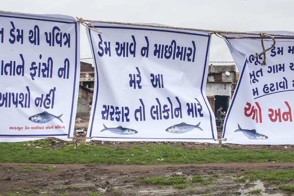
Slogans against Bhadbhut Barrage say: “The Dam will kill the fishers: This government is killing people”
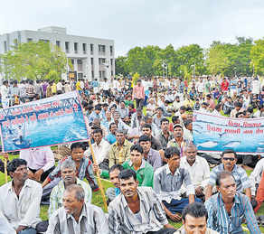
The Bhadbhut Barrage is being fiercely opposed by fishers in Bharuch because of its serious impacts on their livelihoods and Hilsa fisheries. Public Hearing of Bhadbhut Barrage was held in July 2013, wherein the fisher community staged a walk out, stressing that the EIA had under-reported Hilsa fisheries in the region, number of fishers and their dependence on the Estuary for fish. The walkout took place immediately after Pravin Tandel, the fisherfolks’ local leader, spoke saying the project would “adversely affect the fish catch, especially Hilsa, once it is implemented. Currently, Hisla fetches Rs 1,200 per kg, and is our main source of livelihood.”[20]
Fisherfolk protesting against Bhadbhut Barrage Photo: Counterview.org
Hilsa in the Indus: In the Indus too, Hilsa fisheries, known as Palla are the main stay of local fisher communities. Hilsa fish is a highly contested territory due to declining catches.
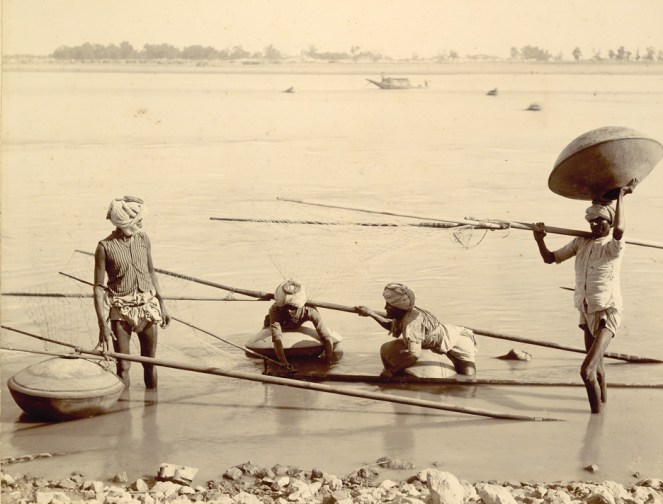
Before the construction of the Sukkur Barrage, the Palla used to reach to Multan as per records of 1907. The Sukkur Barrage and then later the Kotri Barrage severely restricted Palla’s range, affecting the fish and its fishers. According to M. R. Quereshi, ex-Director of Marine Fisheries Department of Pakistan, the Palla used to ascend the river (Indus) to spawn in the middle of June but its ascent is now delayed by at least one month owing to late freshets. Kotri Barrage near Hyderabad has severely restricted its breeding range. Like the Cauvery, in Kotri too the fish ladders do not work due to faulty designs and Hilsa is unable to ascend them, consequently prevented from going up to the upper reaches of the river. As a result the Hilsa fishery is being depleted and immediate action is imperative to increase its production. “Failing this, the fish will eventually disappear from the river.”
Palla/Hilsa fishers at Kotri, on the banks of Indus circa 1890. Photo from British Library, UK
To conclude, the fate of this silvery fish hangs in a fine balance. Not only does the Hilsa enjoy huge cultural significance, it also supports millions of livelihoods. In the United States, several dams, like the recent Glines Canyon Dam on the Elwha, have been decommissioned for their impacts on migrating fish and dependent communities. Elwha river dams came down in a biggest decommissioning effort because the indigenous Klallam tribe asserted its rights on traditional Salmon fisheries which were blocked by these dams. In Japan too, Arase Dam was decommissioned because of its impact on Ayu fish and fishers.
What has happened in India to the Hilsa fish and fishers is far more serious.
Hilsa has a striking ecological, economic and cultural significance. Till date, ranching or farming of Hilsa has not worked. Till date, fisher communities continue to face conflicts, hardships and risks, go deeper and deeper in the sea to gather a few Hilsa. Till date, dam operations have not changed, nor have the fish passes been designed, built, operated or monitored to help the fish. Till date, none of the fisher communities who suffered colossal losses when a dam affected Hilsa, have been compensated for their loss.
Is it not time to rethink these dams, to help the fish and our fishers?
Hilsa as a sacred offering Photo from Flickr, with thanks to Arup Kanjilal
[1] Dugan, 2008, Quoted in FAO Report No. 7, Sustainable Fisheries and Aquaculture for food security and nutrition, 2014
[2] Chief Minister Mamata Banerjee refused to share the Teesta waters with Bangladesh, the neighbouring country has imposed a ban on export of the silver-scaled fish.
[3] Ghosh, 1976 quoted in Review of the biology and fisheries of Hilsa, Upper Bengal Estuary, FAO, 1985
[4] Bhaumik and Sharma, Present status of Hilsa in the Hooghly Bhagirathi River, CIFRI, 2012
[14] Milton, STATUS OF HILSA (Tenualosa ilisha) MANAGEMENT IN THE BAY OF BENGAL: AN ASSESSMENT OF POPULATION RISK AND DATA GAPS FOR MORE EFFECTIVE REGIONAL MANAGEMENT, Report to FAO Bay of Bengal Large Marine Ecosystem Project , 15 February 2010
[15] CIFRI, River Narmada, Its Environment and Fisheries, 2009
[i] While we do not know the schedule through which Gujarat Government plans to release this water, the fact remains that this figure of 600 cusecs is not supported by any studies.
Some highlights from SANDRP’s latest Publication on Riverine Fisheries of the Ganga
The government is discussing Ganga not only as ‘Ganga Mata’, but also as a ‘navigational corridor’ with plans to build barrages after every 100 kilometers with funding from World Bank. At her origin, hundreds of hydropower dams are changing the ecological character of the Ganga. However, as a rich ecosystem, the Ganga also supports about 10-13 million riverine fisherfolk and about 300 freshwater fish species! Riverine fisheries have been a blind spot in Independent India, despite the fact that they provide nutritional and livelihood security to millions of people.In the post independence water management discourse, river has been equated to water and water to irrigation, water supply, and hydro power. The profound impacts of irrigation, water supply and hydropower dams on sectors like riverine fisheries have been entirely ignored.
Nachiket Kelkar looks at the status of riverine fisheries and fisher communities in the Gangetic Basin of India and highlights the devastating impacts of dams, barrages and water abstractions on this. Nachiket’s study on Gangetic Fisheries is based on long term engagement with fisher communities in the basin as well as robust scientific studies.
SANDRP has published this work in the form of a Primer which will soon be available online. What follows are some glimpses from the Primer. Please write to us if you are interested in receiving a full soft copy of the Primer.
Riverine fisheries of the Gangetic basin support one of the largest fishing populations of the world. However, its fish resources are rapidly declining due to large dams, barrages and hydropower projects, severely altered river flows, fragmentation of hydrological connectivity between rivers and wetlands, alarming levels of pollution, riverfront encroachment, rampant sand mining and unregulated overexploitation of fish resources.
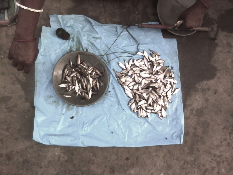
Across its range, the fisheries show indications of economic unviability and ecological collapse, with violent social conflicts as an outcome of the contest over scarce and declining resources as well as politics and access. A major factor behind the serious fisheries-related problems is severe alteration of river flow volume and seasonal dynamics by large dams, barrages and hydropower projects. The state of river fisheries directly indicates the declining biophysical, ecological and social integrity of the river basin. The existing in-river fisheries contribute merely about 10% of the overall inland fish production. Even this production is highly unsustainable today and has all the indicators of serious levels of overfishing. For instance, river fisheries in Bihar now even glean small-sized fish fry for markets in northern West Bengal (Siliguri) and Assam, where eating small fish is a delicacy (F.pers.comm).
To understand the situation in Gangetic Basin clearly, a detailed, large-scale interview survey was conducted by the author in 2012 across 372 fishers in 59 fisher groups spread over 17 rivers in 5 north Indian states. The survey objective was to document perceptions of traditional fishing communities about issues and problems in fishing in the Gangetic basin. Of the respondents, c. 90% singled out “large dams and poor river flows” as the main causes for a near-total decline in fisheries and fish resources over the past 4 decades. About 90% people mentioned low water availability and stoppage of fish migratory routes by large dams as the main cause for fish declines. Almost 45% (from eastern and northern UP, and Bihar) singled out the Farakka barrage as the main problem.
The Canvas of Gangetic River Fisheries
The Ganga River, from her headwaters to the delta, along with hundreds of her tributaries drains an area of approx. 0.9_1 million km2 across northern and eastern India, flowing through 10 states in India and also in Nepal and Bangladesh. These rivers form one of the largest alluvial mega-fan regions of the world, and deliver huge quantities of sediment from the Himalayas to the northern Indian plains and to the Bay of Bengal in the Indian Ocean. The Gangetic floodplains shape not only landforms but also complex human cultures that attempt to stabilize themselves and adapt to the constantly changing riverine forces. Biodiversity, hydrology, geomorphology and social dynamics influence each other through constant interaction and multiple feedback mechanisms.
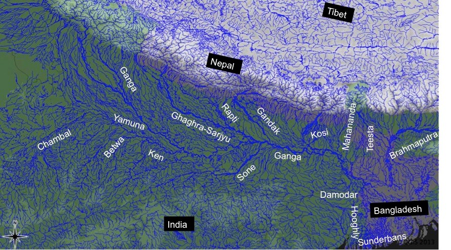
The major rivers of the Gangetic Basin (Based on ‘hydro1k-rivers-Asia.dbf’).
The dynamic balance of these factors triggers opportunities for spawning, reproduction, population dynamics and viability, migration and movement of freshwater species, including fishes, river dolphins, otters, crocodilians, turtles, invertebrates as well as terrestrial biodiversity.
In floodplain rivers, as floodwaters recede post-monsoon, fishers record the highest catches in October and November, as large post-breeding and migrating adult fishes (e.g. major carps, clupeids, mullet) become catchable. Winters, from December to early February, generally record low catches because many fish show slowed behavior and limited movement. But in spring fisheries of minor carps and catfishes record high production. With water levels reducing, fishes become more concentrated in specific river habitats like deep pools, where they are easy to fish. Summer fish catch biomass is also reasonably good due to the overall low water availability.
In the Gangetic basin, fisheries are practiced in a range of diverse freshwater habitats including natural and man-made, lentic (stagnant water) and lotic (flowing water) ecosystems. Natural freshwater areas include large floodplain rivers, non-perennial rivers, perennial and seasonal streams, cold-water rivers and streams, glacial lakes, estuaries, tidal rivers, floodplain wetlands, oxbow lakes, grassland swamps and marshes. Manmade habitats include dug or built-up wetlands, ponds, man-made reservoirs, dam reservoirs and canals. To the fisher, flow velocity, depth profile, substrate type, vegetation structure, current patterns and habitat stability are key indicators for fishing effort allocation and logistical decisions.
Fish Diversity in the Gangetic Basin
The overall species pool of the Gangetic fish assemblage is estimated at around 300 species (53+ families, 150+ genera; 250 species). The floodplain fisheries are dominated by major and minor carps (Cyprinidae), catfishes (Siluriformes: 6-7 families), Clupeidae, Notopteridae and a mix of many other families. Major carps and the Clupeid fish, Hilsa (Tenualosa ilisha) and some large catfishes form the most valued catches across most parts of the Gangetic floodplains.
Major carps, the most preferred freshwater food fishes, include species like Catla, Rohu, Mrigal, Mahseer etc. exhibit potamodromous (along freshwater upstream-downstream gradients) migration. Though these fishes have suffered serious declines due to overfishing, pollution and dams, they have been mass-produced through artificial rearing in pond aquaculture. Farmed large carps form the major proportion of fish eaten anywhere in India today. In wild fisheries, catfishes come lower in the preference order, but with the decline of carps, medium and small catfishes have become the main fishing targets. Further, as most catfishes are sedentary and do not show long-distance movements, the fisheries have completely switched from carp- to catfish-targeting fisheries. Other deep-bodied, highly sought after fishes include the Chitala and Notopterus, or the featherfishes, and mullet.
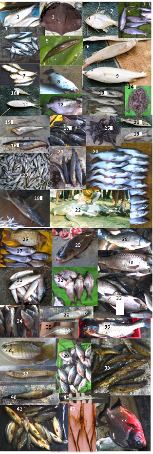
Various fish species in Ganga Basin. Refer to the Primer for more information.
The estuarine fishery in the Hooghly and Sunderbans tidal rivers in West Bengal is dominated by shellfish (prawns, mud crabs and shrimp), Clupeidae and Engraulidae, Sciaenidae, catfishes of the Ariidae and a far more diverse set of families compared to truly inland fisheries. Other important components of the commercial fisheries include 5-6 species of shellfishes (mainly prawn and shrimp).
Coldwater fisheries specialize on large-bodied, rapids-loving potamodromous migrant fishes such as Mahseer and Snow Trout. These fishes are of high commercial importance and are in high demand by professional sport fishers and anglers, apart from being highly prized as food locally. Mahseer in particular, have recently led to the opening of new markets of luxury wildlife tourism that is based on angling and recreation in the Western Himalaya.
Dam reservoir fisheries are almost entirely based on managed stocking and breeding of commercial fishes in hatcheries, of major carps Catla, Rohu and Mrigal, catfishes like Pangasiodon, and minor catfishes. The state of river fisheries in the Gangetic basin has been affected over the last few decades by several threats described in the next section.
Dams and Riverine Fisheries in India Fisheries across India have been severely affected by dams, flow regulation and associated human impacts, which have substantially altered ecological requirements of fisheries and biodiversity together. If one clinically investigated the fisheries’ decline, they would find it to coincide with the period of maximum dam building (1970s-80s) in India. Most commercially valuable fish species, especially major carps and Hilsa, have shown population-level collapse and even commercial extinction over large inland waters. Reduction in harvested fish size-class distributions, a classical indicator of overexploitation by fisheries, points to poor fish recruitment and adult survival, which may be further brought down by flow regulation by dams. Dams have acted as the major factor of disruption by blocking migratory routes of upriver or estuarine spawning fishes such as Hilsa and Anguilla eels. Dams have also caused loss of genetic connectivity between fish populations, most notably seen in major carp stocks. Erratic water releases, nutrient and sediment trapping behind dams and barrages, failure of breeding in carp and catfish species due to siltation, erosion, poor water availability, modified thermal regimes required for breeding (increase in temperatures due to low river depth/flow), and exceptional levels of hazardous pollution (again, magnified due to the poor flows reducing dilution capacity of river water), are other fallouts that adversely affect fisheries. The fact that there is just not enough water in the river must form the bottom line of any causal investigation of riverine fisheries. Lack of appropriate policy measures and pollution receive dominant mention as threats to fisheries by government research agencies, but they are mere outcomes of much larger shifted baselines because of dams. Dams, barrages and hydropower projects through flow regulation have increased uncertainty about fishing and driven fishing to desperate levels: fishers often resort to destructive practices, or even worse, exit the fishery altogether. Such exit does not solve the problem of existing fisher folk: water is critical to sustaining not just fisheries but the river and the people dependent on it. Detailed understanding of the lives of fishing communities of the Ganges is therefore critical.
Ganga made completely dry at Haridwar by the Bhimgouda barrage Photo: SANDRP.
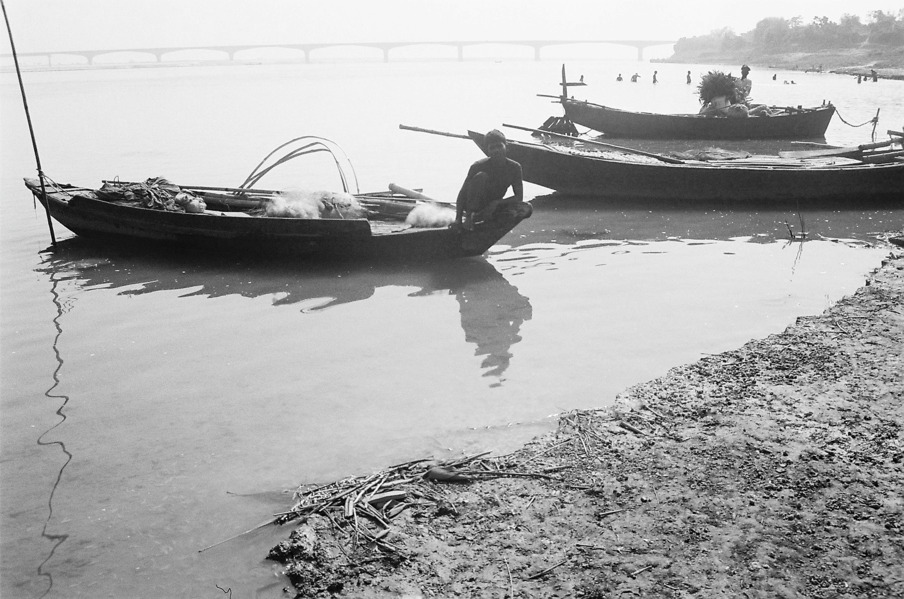
Fisher communities in Ganga: Around 10-13 million people in the Gangetic floodplains are estimated to be dependent on fish resources for their livelihoods, directly or indirectly. However, accurate estimates of active traditional and non-traditional fisher populations are still wanting. It is important for any discussion on fishing communities to clearly separate traditional fishing communities from ‘non-traditional fishers’, who may be practically from any other local community and with the possession of other livelihood options, but also opportunistic fishing, due to unrestricted access to imported nets and gear available in markets to anyone. Traditional fishing communities were always the craftsmen of their own nets and gear, and also possess remarkable ecological knowledge about rivers, fish and biodiversity, their breeding biology, ecology, seasonality, and distribution. Of course, with the degradation of fisheries throughout the Gangetic plains, the traditional knowledge and practices of fishing are eroding fast. Hence such knowledge needs to be documented well, especially from old fishers with whom it still persists, to identify historical baselines of river fisheries with a different, past ecological reference (pers.obs.; F.pers.comm).
Traditional fishing communities today form a highly marginalized, politically unorganized and socio-economically impoverished people. Caste discriminations and political history form the chief reasons for their poverty and subjugation over centuries of fishworking. But the present condition of rivers does not seem to offer hope to any improvement in their economic position unless and until there is collective voicing of their concerns, especially against large-scale water engineering projects that threaten their livelihoods.
Author in discussions with fishers
Their livelihoods, one may argue, confined them to the river’s water,albeit the fact that they never owned the waters legally. However, they always have stated cultural claims of temporally confined territory, following their foraging preferences and site usage. But depending on the nature of the river’s hydrological dynamics, there may be variable maintenance of fixed ‘territories’ by fishers adopting a roving mode of fishing, and neither legal nor cultural claims can be reconciled to a level that the conflicting parties can reach mutually. With regards to their economic viability and status, a large proportion of the traditional fishworkers fall Below the Poverty Line (BPL), and are recorded as Economically Backward Castes, and also have been assigned the status of Scheduled Castes. Annual incomes from fishing alone, according to the few estimates available, range from INR 25,000/- to INR 50,000/- (pers.obs., F.pers.comm.).
Large dams, flow regulation and Gangetic basin fisheries : The singular key problem of fisheries today is that it lacks water in the dry-season, because of flow regulation by dams, barrages and hydropower projects. More water flow releases are needed for the protection of riverine fisheries in the Gangetic basin. Widespread river habitat degradation, industrial, agricultural and domestic pollution, altered flows and modification of sediment and nutrient fluxes by dam projects, and resource overexploitation (by fisheries, agriculture or industry) have had major consequences for the unique biodiversity and fisheries of floodplain rivers across Asia. Obstruction and fragmentation of river flow, habitat destruction, accelerated erosion and siltation, long-distance water diversions (involving huge amount of transmission losses and waste) and poor flow releases are the major direct threats of dam-canal systems in the Gangetic plains.
Flow volume problems: Lower-than-minimum flows have been consistently recorded across the Ganga, Yamuna, Chambal, Kosi, Sone, Ken, Betwa, Ghaghra and Gandak rivers. Along with these large rivers, almost all others (Rapti, Baghmati, Mahananda, Teesta, Kamla, Burhi Gandak, Punpun, Gomti and others) have been highly regulated64,69. The reduction of freshwater discharge reaching the Sunderbans because of the Farakka barrage has led to high degree saline ingress throughout the estuary, causing die-offs of considerably large tracts of mangroves and aquatic vegetation, as well as severe losses to the upstream fishery. Downstream, fishing practices suited to brackish and fresh waters now have to adapt to saline intrusion into the estuary’s waters. Globally, fragmentation and flow regulation have caused the most severe impacts through drastic alterations to riverine biota and ecology. Low flows and fragmented connectivity of river channels lead inevitably to fish population declines and breeding failure. Over time, dams have probably led to genetic isolation of fish populations as well as river dolphin / crocodile populations, destruction of fish breeding habitats and spawning triggers and loss of valuable wild fish germplasm. These losses are so large in their ecological value and opportunity costs that they cannot be recovered with artificial fish culture techniques or hatcheries.
Aggravation of pollution effects: The Ganges basin is one of the most polluted large river basins in Asia, especially with regards to domestic sewage and agricultural runoff. Poor flows reduce the dilution and self-purification capacity of river water to reduce concentration of pollutants and local impacts on fishes. . Agricultural fertilizers (organophosphates, organochlorines, nitrates etc.), heavy metal pollution from industrial effluents, thermal power plants, oil refineries, distilleries and tanneries, and nitrogen-rich sewage, waste-water and non-biodegradable substances such as plastics, mercury, radioactive compounds and hospital wastes can cause fish kills or even worse, lead to high levels of toxicity in tissues. Pollution problems are especially acute in highly regulated river reaches, especially around Delhi (Yamuna River), and the Gomti at Lucknow, Yamuna until Panchnada in UP and Ganga River at Kanpur, Allahabad, Varanasi, Patna, Barauni, Bhagalpur and Farakka.
Polluted Ganga at Allahabad Photo: National Geographic
Siltation in dam reservoirs and barrage gates: Excessive siltation in the Ghaghra barrage has led to, as per local fishers, breeding failure in Labeo angra (Ghewri), a preferred spring-fisheries target in the region. The fishers claimed that over the past 5 years they have not captured a single fish with eggs inside it, and also added that catches have plummeted heavily (F.pers.comm). Siltation of gravel/sediment in reservoir or storage zones is a problem of huge magnitude for fisheries, especially through breeding failure. Accumulated silt in reservoirs is estimated to be so high (in tens of meters height) that it cannot even be easily flushed out, and leads to nearly 60-90% reductions in sediment fluxes of rivers in monsoon and non-monsooon seasons. Siltation adds to obstruction of flow release through barrage gates. In the Farakka barrage, sediment load accumulation is leading to breakage of gates every year, adding to maintenance costs.
Habitat destruction and alteration of erosion-deposition dynamics: Soil erosion by erratic and sudden releases before floods can potentially lead to alteration and destruction of fish breeding habitats and stock depression. Changes in depth and flow velocity lead to fish not being able to receive natural physiological cues for movement and spawning that are otherwise provided by variability in discharge. Flow alteration also alters hydrological connectivity and sediment transport with wetlands and confluence channels during flooding. As a result these productive breeding habitats often become unavailable for catfishes and carps. These factors together become a problem for pre-settlement fish juveniles and recruits, which move into the main channels.
Threats to cold-water and foothills fisheries from Hydropower Dams: Overall, despite their projected low impact situation, hydropower projects can have serious large-scale effects on mountain streams as well as rivers downstream. Globally, despite mitigation measures in hydropower constructions, fish migration and development have largely been deemed as failures. In India, hydropower projects, especially run-of-river projects in higher altitudes, often have disastrous effects on natural thermal regimes, cause sediment blockages and perturb natural flow variability at diurnal timescales through releases varying across several orders of magnitude. These changes severely affect not just breeding and migration in higher-altitude cold-water fisheries of snow trout and Mahseer in Himachal, Sikkim and Uttarakhand, but also downstream fisheries of catfish and carps in the foothills and plains due to altered flows. Their cumulative downstream impact can also potentially risk fisheries-based uses of river water without being exposed to the risk of sudden flow releases every day.
Globally, through extreme perturbation of natural flow dynamics, dams have homogenized and altered many crucial river-floodplain processes, and have had disastrous impacts on biodiversity and fisheries. There is an urgent need to ensure ecologically necessary, adequate and natural flow regimes in all rivers of the Gangetic basin. The current water scarcity is so severe that projects such as river interlinking, apart from their ridiculous proposed costs, are simply impossible to conceive of, water itself being the limitation. There is no doubt that further water developments will prove disastrous for a whole section of people and their livelihoods, and must be scrapped. Rivers that need urgent attention in this respect are the Chambal, Yamuna, Ken, Betwa, Alaknanda, Bhagirathi, Mandakini, Sone, Damodar, the Ganges at Farakka and Allahabad, Sharada, Ghaghra and all other rivers especially in Uttar Pradesh, Uttarakhand, Madhya Pradesh and Bihar0. Run-of-river hydropower projects, flow diversions and links, pumped irrigation, embankments, agricultural intensification, groundwater depletion and sand mining are highly destructive threats that will affect not just fisheries but the whole social fabric of river users in the near future.
Despite the demonstrated folly of not allowing rivers to flow from headwaters to estuaries and deltas, engineers, technocrats and politicians talk of “rivers flowing wastefully into the sea”. This statement would imply that the thousands of species and millions of fisher livelihoods that need flowing water in rivers are of no value to the state policy on water resource development. Such statements are ignoring important societal needs and hence are evidently irresponsible.
No post dam-construction compensation schemes exist for fishers, who may lose their entire livelihood because of flow-regulation and loss of hydrological connectivity due to dams. Downstream fisher populations must be ideally compensated for the lost fishing catch and livelihood opportunity, but in general there has been scant attention towards the communities’ livelihoods (F.pers.comm). Downstream water allocations through on-ground consultations with fisher communities are urgently needed (F.pers.comm). In India, water resources development is so strongly irrigation-focused (and now strongly focused on industry and hydropower), that, in comparison, riverine fisheries are not even acknowledged as legitimate and in need of conservation and livelihood protection. These biases mean that only pond aquaculture receives any attention. If river conservation and development groups can actively work with fishing communities in order to develop an informed and aware constituency or interest group, fishers will gain political voice in making negotiations about water availability in river basins.
Fisherfolk of Ganga Photo: Gangapedia
Fisheries incur ‘colossal losses’ every season due to irregularities in dam operations, and always fall severely short of demand. But now, through the boom of artificially managed pond aquaculture and wetland fishing especially in Andhra Pradesh and West Bengal, the nature of supply itself has radically changedThis boom has contributed to India becoming one of the largest producers of inland freshwater fish in the world. But such ranking hides a lot of miserable facts about river degradation. Although net production shows increases, the collapse of river fisheries that still support millions of poor people who don’t get access to aquaculture, get totally ignored under such swamping. This is why farmed fish in fish hatcheries can barely replace riverine fisheries despite the fact that they have cornered the attention of fisheries development.
The failure of river fisheries has led to large-scale outmigration for labour from the Indo-Gangetic plains (F.pers.comm.). This might be a significant contributor to the magnitude of labour-related migrations from the Gangetic plains, which has been a rising exodus. Today, fisher folk from Uttar Pradesh, Bihar and Bengal provide a large proportion (20-40%) of construction and manual labor force across India (F.pers.comm). Others who stay behind have to take to menial jobs such as rickshaw-pullers or servants (F.pers.comm; pers.obs). Some are forced to take to crime to be able to feed themselves and their families. These factors can weaken the social resilience of production systems and create poverty, disparity and community breakdown. It has been argued that ethnic conflicts between local Indian populations and illegally immigrated Bangladeshi refugees are linked to poor water releases from the Farakka barrage in West Bengal, to downstream floodplain reaches in Bangladesh.
Mitigation measures like Fish ladders and hatcheries
There is little existing research on the construction design, functioning and efficiency of fish ladders in tropical and subtropical large floodplain rivers. Across the tropics, monitoring studies on fish ladders do not show positive results. A handful of barrages in India have constructed fish ladders, but owing to numerous problems they have been largely a failure. These problems are all related to the extremely low discharge rates from the dams – as there is simply not enough water volume allocated for migrating fishes, which therefore cannot access the ladders and fish lifts. Other problems are linked to siltation in reservoirs and turbulence of flows near the fish passages. For instance, the Farakka fish lifts do not seem to have been of any help due to the extremely low outflow of the Ganga River from it, and the commercial extinction of the Hilsa fisheries both upstream and downstream is clear with an estimated 99.9% decline. Fish passes constructed at barrages on the Yamuna River (Hathnikund barrage) and the Ganga barrage at Haridwar have been monitored by CIFRI and the results suggest that they have had very low success for migration of cold-water species like the Golden Mahseer Tor putitora. Similar structures on the Beas River and Mahanadi River (Salandi dam, Orissa) have found to be ineffective in buffering the adverse impacts on fisheries production in these rivers. India has dominantly followed reservoir hatcheries development, and therefore consideration for effective fish ladders has always been low priority. However, as we have seen, hatcheries themselves bring about several problems for native fish populations – and are not an ecologically viable solution, despite being economically profitable to certain interests. Given the poor success of existing fish passages, it is important to consider modern designs in existing and proposed dams that are suited to the ecology of our own fishes. A whole body of interdisciplinary research – spanning engineering and ecology, is needed to address the significant gaps in our understanding of making fish passages work. We need to monitor existing examples well to assess reasons for their failure. Again, just the act of allowing higher dry-season flows and timely adequate releases in the river could be a far more effective strategy for fisheries improvement than other intensive technology-driven practices to enhance fisheries production (F.pers.comm)
River restoration and alternative livelihoods: Given the current state of riverine fisheries, there is an urgent need to consider possibilities for large-scale ecological restoration of rivers by modifying dam operations and improving ecological flows. Alongside restoration, it is crucial to consider alternative livelihoods to fishers, which regard their traditional knowledge and provide them with clearly defined user rights and responsibilities over management of wild-caught or cultured fish resources. Ecological restoration of all major and minor rivers in India needs to be undertaken urgently, to ensure ecologically adequate, naturally timed flow releases, consistent dry-season flow regimes, hydro-geomorphological habitat maintenance, flood maintenance and reduction in pollution. Dam re-operations to ensure adequate flows and variability in river discharge remain a neglected aspect of river management in most regions today. Flow restoration can lead to improved health, numbers and availability of native commercial carps and preponderance of larger fish sizes through improved juvenile recruitment, along with other advantages to surface hydrology and local groundwater availability. Large-scale scientific research and monitoring programs must be instituted to study the response of inland wild-capture fisheries and take further steps to mitigate local threats. Restoration also needs to involve stringent restrictions on release of untreated domestic and industrial effluent, especially in urban belts such as Kanpur, the National Capital Region of Delhi, Allahabad-Varanasi, Mathura-Agra, Lucknow in Uttar Pradesh; Patna, Barauni in Bihar and the Durgapur and Kolkata regions in West Bengal. Strict restrictions are needed on sand-mining, riverfront encroachment and embankment construction, especially in the Chambal, Ghaghra, Gandak, Baghmati, Rapti and Kosi Rivers. In this regard, more judicial interventions, such as seen recently in the case of sand-mining closures from river beds based on a review by the National Green Tribunal, are critical in reducing wanton and unregulated destruction of riverfronts, when implemented effectively. In terms of reducing the most direct impacts, there is a need to regulate fishing pressure and completely curb destructive fishing practices like dynamiting, use of mosquito-nets, beach seines, and gillnets below allowable mesh-sizes, poisoning, use of long-lines etc. Traditional fishers must be involved directly in monitoring and banning the use of destructive practices by the government monitoring agencies.
Finally, the quest for sustaining fisheries in the Ganga River basin in the long-term will require rethinking of current dominant paradigms to move towards ecological restoration of rivers, their biodiversity, as well as socially just, rights-based and equitable socio-political restoration of traditional fisher communities and fisheries management systems.
-Nachiket Kelkar
Ashoka Trust for Research in Ecology and the Environment, Srirampura Royal Enclave, Jakkur, Bangalore 560064, India. (The views expressed are of the author and do not belong to the institution where the author currently works)
Twelve-point recommendation from traditional fisher communities for sustaining riverine fisheries and livelihoods in the Gangetic basin.
Rank
Need
Recommendations
1
Water
Provide enough water, adequate natural flows in all rivers. Allow fish movements upriver, currently blocked by large dams and barrages. STOP new dams and mindless, high-cost, destructive and unsustainable engineering projects such as river interlinking.
2
Ban on destructive fishing practices
Curb destructive practices of fishing, especially mosquito-netting, poisoning, dynamite-fishing, trawling and beach-seine netting everywhere.
3
Poverty alleviation and social security
Fishers are in need of government dole or loans, technical know-how, permits and I-cards, housing, education and displacement packages. It is alleged that these benefits are hardly reaching them, although the allocations of funds reach farmers easily. Fishers need government security from criminals / mafia / anti-social elements / pirates that harass them and grab fish catch.
5
Define fisher rights and responsibilities
Clearly define fishing use and access rights across all riverscapes, provide clear guidelines on multi-objective management of fisheries amidst other economic activities
6
Reduce pollution and mass fish-kills
Urgent need to reduce the presently excessive river pollution, especially industrial but also domestic wastes.
7
Alternative livelihoods
River fisheries are currently in a state of ecosystem-level decline or collapse. Trash fishes have become the most common catch, replacing many commercially viable carps and catfishes. People require alternative livelihoods in situ, to check problems related to migration and exodus to work as construction laborers or rickshaw-pullers. Community-based, cooperative pond carp-culture fisheries seem highly promising. Other alternative livelihoods include working with river management authorities, conservation agencies, ecotourism, agriculture etc.
8
Fishery co-operatives
Focus on community-based management of river fisheries and help it develop in an ecologically friendly and sustainable manner. Replace the systems of private contracts and free-for-all fishing by power-equitable, social dignified resource-sharing arrangements
9
Ensure compliance of fishers towards biodiversity conservation and monitoring
Needs to be ensured through continued monitoring of fishing activity and behavior, including by-catch or hunting of species. This will help safeguard endangered wild species such as gharial, turtles, river dolphins, birds etc. This can also help the spread of exotic food fishes that are rapidly invading our rivers (the worst examples are Tilapia species, Chinese and Common Carps, and more recently, Red-bellied Piranha.
10
Use of Food Security Act, Rural Labor Programs
Can facilitate daily incomes by which fisheries losses could be offset; while also providing a solid community-level incentive to regulate and monitor fishing.
11
Restoration of native riverine fish communities
Very important given the huge decline in native carp species of high commercial value. Fisheries need to protected not only by revival of stocks, facilitating better fish recruitment, but also by protecting fish breeding habitats from
12
Adaptive management of water tenure in fishing areas
Owing to natural uncertainty linked to flow regimes and channel course changes, new flexible systems of tenure in fisheries are required. Such systems would fit in well with providing a clear definition to fishing rights in any riverine stretch.
Environment Groups oppose amendments in Hydropower Policy: Raise concerns over dilution of clearance procedures
Local, state level and national Environmental groups today sent a submission to the Chief Secretary, Himachal Pradesh raising strong objections to the ammendments in the Hydropower Policy made by the State Government in March 2014. The key objections of groups are to do with the gross dilution in clearance procedures by the State Government vide a notification issued on 4th March 2014. The notification was issued post the setting up of a Committtee on Speedy Development of Small Hydro Projects in 2013, which made a series of recommendations in order to deal with the delays in the execution of Hydropower Projects. The Committtee formed was headed by the Chairman, HP Electricity Regulatory Commission (HPERC) and has mostly recommended doing away with several departmental clearances, in order to expedite the implementation of Small Hydropower Projects (below 25 MW). The most shocking and objectionable part of the March 2014 notification is that though the mandate of the committee was to look into the problems private power developers of Small Hydropower Projects face; the amendments seem to have been made applicable to all kinds of hydro power projects in the state.
The amendments introduced are intended to fast track the clearance procedure with respect to small hydels, by doing away with separate NOCs from Public Works Department (PWD), Irrigation & Public Health Department (IPH), Revenue, Fisheries and Wildlife. “These NOCs are critical because they recognise the fact that these Hydropower Projects, both small and large, have serious ecological and social impacts. For instance, the fact is that water sources do get impacted and affect the irrigation and drinking water needs of the villages in the project area. “A thorough investigation and NOC by the IPH is critical in determining whether the design of the project is feasible from the point of view of the impact on water sources”, said members of Himdhara, Environment Research and Action Collective, one of the signatories of the memorandum.
The memoradum also states that the committee constituted has been biased. “Out of the 15 members of the committee, about 6 are power producers, which include Himurja and representatives of private power producers association. There is a clear conflict of interest and we are appalled that the State government created such a committee in the first place. Further, the committee has no representation of the Department of Science, Technology and Environment or any non governmental, independent persons that would look into social and environmental issues. The committee does not even have a member of the Forest department. Considering the impacts of these projects on local livelihoods, there should have been at least one independent member with an expertise on social issues. While we feel that the very objective of the committee is aligned with the interests of the power producers, the least the government could have done was ensure that the social and environmental interests are not sidelined or ignored”, is one such issue the submission raised.The groups have alleged that no public consultation was held before finalising the recommendations or issuing the notification.
Another major objection raised is that of diluting the consultation process with the local affected villages by relying on a one time consultation with the Gram Panchayats to be headed by a Single Joint Inspection Committee. “The earlier guidelines required an NOC from the Gram Panchayat and followed two consultations, one at the initial stage and one after signing of the Implementation Agreement,” says R.S Negi of Him Lok Jagriti Manch. “This notification is unconstitutional because it undermines the the role of the Panchayats, but for tribal areas like Kinnaur, Lahaul-Spiti and Chamba, this is a clear violation of the 2006 Forest Rights Act and 1998 PESA Act, which protects the democratic rights of Gram Sabhas by making their NOC mandatory for any such development activity.”
Himanshu Thakkar of SANDRP added, “It is unclear on what basis the committee came to the conclusion that the major reason for delays in case of small hydroprojects are the NOCs. There is no analysis or illustration or case study in the report to suggest this. Then how does the committee justify its recomendations?” The memorandum states that ‘the committee came to these recommendations without conducting any kind of impact assessment study or case study of any of the existing projects, their local impacts as well as their background and feasibility’.
The groups have demanded that the March 2014 notification be withdrawn and that the government should carry out a series of public consultations before ammending the Hydropower Policy 2006. Some of the key demands made in the memorandum are that NOCs from Gram Panchayats, PWD, Revenue, Fisheries, Widlife be made mandatory.“Infact, we have been demanding that small hydels be brought under the purview of EIA notification 2006 and all SHPs above 1 MW should require an environment clearance with environment impact studies and public hearing.” added members of Himdhara.
The Maharashtra and Karnataka governments have accepted on affidavit that they have violated the Environment Protection Act 1986 and EIA Notification. The violations have happened in taking up the work even before seeking environmental clearance and both governments have promised on affidavit that this will not be repeated. This has come to light following SANDRP writing to the MoEF’s Expert Appraisal Committee on River Valley Projects about the violations.
SANDRP monitors Environmental clearance (EC) process of hydropower, irrigation and river valley projects, and has come across several proposals from Government of Maharashtra and Government of Karnataka (& others) wherein the Water Resource Departments seek Environmental clearance from the MoEF, even as work on the said projects is well underway on ground, violating the Environment Protection Act (1986) and the EIA Notification.
There may be several such projects from other states too which are violating Environment Laws, but the MoEF does not seem to have the capacity to monitor such violations.
The next meeting[1] of the Expert Appraisal Committee (EAC) on River Valley Projects will consider a proposal from Maharashtra worth nearly Rs. 5000 Crores for Krishna Marathwada Lift Irrigation scheme, which plans to divert 23.66 TMC (Thousand Million Cubic Feet) water from Ujani Dam to irrigate over 100,000 hectares of land in Beed and Osmanabad districts. Ironically, work on Krishna Marathwada scheme is well-advanced, and the State has already spent nearly Rs 500 crores on it, without clearances. SANDRP had put these facts in front of the EAC on Dec 5, 2013, before the 70th meeting of EAC that was held on Dec 10-11, 2013. EAC had then asked the Godavari Marathwada Irrigation Development Corporation (GMIDC) to stop all on going work on the project and demanded an affidavit that no work will start without EC and that the EIA Notification and EPA will not be violated further. It also demanded a Board resolution to this effect.
In response, as per documents with SANDRP, in July 2014, the Governing Council of GMIDC, chaired by the State Water Resource Minister Shri Sunil Tatkare and Chairperson of GMIDC passed a resolution, that “There will not be any recurrence of violation”. The Superintending Engineer, Osmanabad Irrigation Circle has also signed an affidavit with an undertaking that all work on the project is stopped unless EC is secured.
Similarly, Sonthi Lift Irrigation Project from Karnataka was deliberated for clearance in the presence of officials from Karnataka, when the project was almost complete on ground. SANDRP brought this to the notice of the EAC which then issued notice to Krishna Bhagya Jal Nigam Limited. The EAC or MoEF did not take strong action against the proponent and in fact recommended Stage 1 Clearance for the project (April 2014) which is already nearing completion. This decision of EAC was without justification or legal mandate.
Karnataka Neeravari Nigam Limited’s (KKNL) Shiggaon Lift Irrigation Project too will be discussed during the upcoming 76th EAC meeting. The project was discussed in the EAC on September 2013, when as it was formally inaugurated by Karnataka CM in November 2012 itself! In case of Shiggaon too, SANDRP pointed out the violations to the EAC, MoEF, which them issued a notice to the KKNL to file an affidavit about the violation and an undertaking to stop work and not resume it unless EC is granted. The KKNL has filed an affidavit stating “there will be no recurrence of violations”, thus accepting preset violations.
Similar violations of EPA (1986) and EIA Notification (2006) have occurred in case of Singtalur Lift Irrigation scheme in Karnataka. The state has also willfully escaped Environment Appraisal for Yettinahole/ Netravathi diversion project under fraudulent claims.
In case of Maharashtra, the recent CAG report 2014 gave a list of 249 projects that do not have EC and more than 89 do not have Forest Clearance (FC), violating the Forest Conservation Act (1980), causing a loss of thousands of crores to the state. SANDRP has made submissions about many such projects undertaken by WRD, Maharashtra without requisite clearances. Some of these include Shirapur Lift Irrigation Scheme in Solapur, Lower Tapi Irrigation Project in Jalgaon and over 10 Lift Irrigation schemes based on Ujani Dam. MoEF has not taken any action for projects which do not approach the EAC for clearances, even when presented with evidence of violations, thus ignoring blatant violations.
Environmental Clearances are critical from environmental and social point of view and they are also important as a third-party expert appraisal of the project. The Expert Appraisal Committee (EAC) of the MoEF is supposed to look not only at the environmental and social impacts of the project, but also assesses the overall optimality, feasibility and justification, hydrologic soundness of the project, and also the veracity of the supposed benefits of the project. This is also the only platform which includes a Public Hearing through which local communities have a chance to put forth their concerns, BEFORE the project comes up. Escaping Environmental Appraisal thus does not only mean flouting a legal requirement, but an absence of any third party appraisal of the project.
In a state like Maharashtra which has seen huge scams and corruption in irrigation projects, such a third party appraisal is critical from environment as well as larger public welfare point of view.
In this context it is pertinent to note that para 5 of the MOEF’s Office Memorandum dated 12.12.2012 dealing with violations states: “The State Government concerned will need to initiate credible action on the violation by invoking powers under Section 19 of the Environment (Protection) Act, 1986 for taking necessary legal action under Section 15 of the Act for the period for which the violation has taken place and evidence provided to MoEF of the credible action taken.” (Emphasis added)
We are glad that the EAC took cognition of our submissions and refused to clear some projects, asking for affidavits on violations from Maharashtra and Karnataka governments on Krishna Marathawada LIS and Shiggaon LIS respectively. However, in case of Krishna Marathawada LIS in Maharashtra and Shiggaon Lift Irrigation Scheme in Karnataka, no action has been taken under section 19 or section 15, and hence we hope EAC and MoEF will ask for action as legally mandated. In any case, they have no mandate to consider these projects till such action is taken.
We hope rule of law will be followed in letter and spirit.
MSPGCL (Maharashtra State Power Generation Corporation Ltd) has signed a Memorandum of Understanding (MoU) with Nagpur Municipal Corporation (NMC) to supply treated water from municipal sewage plant as the water linkage to meet additional demand of MSPGCL’s proposed expansion plan. MSPGCL has agreed to pay NMC Rs 150 million (15 crores) every year for the next 15 years as royalty fee. MSPGCL has two existing thermal power plants (TPP) near Nagpur City. One of the TPP is 840 MW capacity at Khaperkheda, and the other is of 1100 MW is at Koradi. MSPGCL has planned for three new power units – one at Khaperkheda and two at Koradi, each with 660 MW capacity. MSPGCL has also agreed to construct a new sewage treatment plant with tertiary treatment capability with the capacity to pump the treated water to its thermal power stations.
Reusing treated sewage water for thermal power project is a welcome move. However it cannot be seen in isolation. Overall performance of MSPGL and NMC in terms of use of water as a resource and treatment has also to be looked at. Putting together several pieces of information reveals that there is a lot more to this decision. As far as sewage treatment of Nagpur is concerned, NMC is opting for public private participation through sewage treatment. There are layers of irregularities to this decision as well.
Given below is a quick overview of happenings.
MSPGCL opts for treated sewage due to rejection of fresh water allocation for the TPP from Pench River[i]: MSPGCL had the existing allocation from Pench River for 55 Million m3/ year. With the addition of three new power units, MSPGCL was looking for additional water requirement of 58 Mm3/ year starting in 2015, when the new power plants come online.
Following a request from MSPGCL, the Irrigation department of Government of Maharashtra, increased the water allocation from 55 to 67 Mm3/year with a maximum use of 75 Mm3/year within 10 percent variation. However, this was projected to be insufficient for all three units, and there was no additional freshwater allocation available for MSPGCL from any other source.
Idea of using treated sewage water as a water linkage for TPP stemmed from the concept of NEXUS[ii]. NEXUS is a concept and an approach that aims to boost potential to increase overall resource use efficiency and benefits in production and consumption by addressing externalities across sectors.
To resolve the issue of water availability for MSPGCL, USAID, through its project titled Water Energy NEXUS Phase – II (WENEXA – Phase II), initiated a feasibility study that included demand assessment and evaluation of alternate water sources. The study assessed feasibility of use of high quality tertiary treated water from the city of Nagpur’s wastewater plant. WENEXA – Phase II project also implemented a six month long pilot plant to showcase achievable output water quality and get buy-in from both NMC as well as MSPGCL that reuse is effective and feasible.
MoU between MSPGCL and NMC has been signed in year 2009 based on results of this study, pilot plant data and the potential for getting good quality reclaimed water in short period of time. Based on this agreement, NMC being a municipality, approached the central Government and received a grant for a sum of Rs 800 million towards the project under the Jawaharlal Nehru National Urban Renewal Mission (JNNURM), while the remainder of the cost Rs 1200 million to be borne by MSPGCL.
NMC officials said that STP work had started in March 2012 and was expected to be completed by March 2014. The plant is 50% complete. The pipeline from the STP to the two thermal power units is also half complete. Trial run will take place in 2014 or early 2015[iii].
The centre on December 22, 2006 approved the STP project with installed capacity to treat 135 million liters per day (MLD) sewage water at a cost of Rs 130.11 crore.
Due to delay and other reasons the project’s cost increased to Rs 195 crore during work order stage[iv].
NMC’s monthly progress report on JNNURM projects says 56% of the works have been completed. Expenditure on the project comes to Rs 95.76 crore as of January 31 (2014). The centre approved Rs 26.02 crore, and state had released Rs 10.40 crore as on January 31. NMC and MSPGCL had contributed Rs 50.80 crore.
MSPGCL polluting river Kanhan Here is it relevant to note that MSPGCL is discharging untreated effluent from Khaparkheda and Koradi power plants into Kanhan River containing toxic fly-ash. NMC draws this water at its 240 MLD water treatment plant (WTP) and supplies it to the almost 40% of the city, mostly North and East Nagpur.
Print media report of January 2013[v] states that the discharge spot is near Sillewada village that is located near the 500 MW unit of Khaparkheda plant. Sillewada is not located along any major road and only locals know about its existence. Moreover, the discharge spot has to be reached on foot through bushes.
The report also states that water of the river is highly polluted with poisonous substances like lead, arsenic, mercury and heavy metals that cause a host of ailments including cancer. MSPGCL uses coal having 50% fly ash against maximum permissible limit of 34%. The electrostatic precipitator and bag filters of Koradi plant are not functioning. MPCB has not taken any action against MSPGCL for blatant violation of norms.
MSPGCL’s expansion plan for the 36-year-old Koradi plant was given environmental clearance on January 4, 2010[vi] against condition of installing Flue Gas Desulphurisation (FGD). While considering the request of MSPGCL to review the condition regarding installation of FGD system was considered by Expert Appraisal Committee (EAC) in its 54th meeting on August 6-7, 2012, the Committee noted that the data submitted by MSPGCL appeared to be inadequate and inconclusive.
The EAC also noted that there were several complaints of fly ash management for Koradi Plant. That a PIL was pending in the Nagpur Bench of the High Court of Bombay was purportedly with respect to hazards of fly ash from power plants run by MSPGCL including the Koradi plant[vii].
NMC plans a barrage at polluted River Kanhan for drinking water supply NMC plans to construct a barrage at the confluence of Kanhan and Kolara rivers[viii]. The project aims to increase water supply from Kanhan water treatment plant, which would benefit East, North and few parts of South Nagpur. NMC had constructed water treatment plant with installed capacity to treat 240 MLD water. However, the plant cannot function to full capacity due to shortage of raw water from Kanhan River.
A proposal has been tabled before the standing committee seeking approval for Rs 1.82 crore for the construction of barrage[ix]. The standing committee was set to give its nod in the meeting organized on July 14, 2014.
Sewage treatment for Nagpur The city of Nagpur is generating over 450 MLD sewage daily of which NMC is presently treating only 80 MLD[x]. (Details of water supply and sources of water provided in Annexure I)
NMC is operating sewage treatment plant (STP) with an installed capacity of 100 MLD at Bhandewadi and treats 80 MLD water at the STP since 2001. The total cost of treating water comes to around Rs 3 crore per year. In these ten years, NMC has let treated sewage water flow in untreated sewage water of Nag River. Remaining untreated sewage flows into the Nag, Pilli and Pora rivers. The untreated sewage from Nag River flows into Kanhan river, then Wainganga river and finally into Gosikhurd dam.
NMC has plans to earn additional revenue of Rs 25-30 crore per year from treated sewage water. Now NMC has decided to enhance STP capacity to 200 MLD on PPP model. The private operator will enhance the plant capacity followed by operation and maintenance on his own. The operator will sell this water to the interested parties like industries).
PPP project for NMC’s own STP started before JNNURM approval On 27 Sep 2013, the NMC standing committee approved a proposal to construct a sewage treatment plant (STP) on public-private partnership (PPP) basis. It issued a work order to a joint venture of private companies -Vishwaraj Infrastructure Limited (VIL), Drake & Scull Water and Power LLC, and Vasundhara Drills and Drainage Private Limited.
The project is a part of the sewage system plan submitted to the central government under JNNURM scheme. Interestingly the work order has been issued even before the plan has received a nod from the centre. The tendering process for this project started in September 2010. However, the JNNURM plan was submitted to the centre only in February 2013[xi]. Also there is a difference of around Rs 400 crore in the operation and maintenance cost of NMC and the operator awarded tender.
Strong political linkages in PPP projects Media reports that Vishwaraj Infrastructure Ltd. is believed to have strong political linkages with the ruling party[xii]. VIL is also involved in the PPP contract for water supply of Nagpur city. Concession agreement for the water supply PPP has also been signed with a consortium of VIL and Veolia Water India Ltd[xiii].
Selective application of NEXUS and PPP for Sewage Treatment On one hand though MSPGCL is taking waste water for water linkage of TPP, on the other hand it is severely polluting Kanhan River. It only shows that concept of NEXUS has been adopted selectively and not holistically. Moreover the trigger for using waste water is actually the rejection of more fresh water allocation from Pench River by WRD. Releasing polluted water to the river is in clear contradiction with the NEXUS concept which talks about catering to the externalities across the sector. Both NMC and MSPGCL have adopted the concept of NEXUS only to ensure monetary gains. The link goes further and the Kanhan River water made toxic by MSPGCL plants is set to be supplied for the people of Nagpur city.
While reuse of treated sewage by thermal power plant is welcome, in this case, it is being done only after the plant failed to get freshwater supply in the first place. The proposal is still a welcome move. However, when we take the full picture into account we see that the same thermal power project is polluting city’s water supply. PPP for sewage treatment seems to be adopted more to serve political links than the needs of the city. The project is being pushed even before it gets requisite sanctions.
We had earlier written about the reality of the 24X7 water supply claims vs reality in the same city of Nagpur. One thing that clearly comes across the two articles is that in India’s Urban Water Sector, as can be seen from Nagpur example, there is no drive to achieve greater democracy, or greater transparency, accountability and participation. Till such inclusive management is achieved, no amount of new ideas, finances, technologies, infrastructure or partnerships is going to help.
Amruta Pradhan
amrutapradhan@gmail.com
Annexure I
Present water sources for Nagpur Present Annual Raw Water reservation from various sources for city water supply & respective present drawal is as below:
Source: DPR of ‘24×7 Water Supply Project for Nagpur City’
Source
Annual Reservation
Actual Drawal
Mm3/year
MLD
Mm3/year
MLD
Kanhan River
55.00
150.70
43.80
120.00
Pench Project (Pench Right Bank Canal)
112.00
306.88
143.00
400.00
78.00
213.72
Gorewada Lake
5.80
16
6.80
20.00
Total
250.80
687.30
217.60
540.00
As per billing by Irrigation department to NMC. Losses through Canal seepage in the length of 48.50 Km length of travel is @ 20-25% as per the observation of Water audit & Leak detection Study.
Present Treated Water Supply from Various WTPs is as follows-
Source: DPR of ‘24×7 Water Supply Project for Nagpur City’
[ii] It aims to reduce trade-offs and generate additional benefits to outweigh the transaction costs associated with stronger integration across sectors. NEXUS focuses on cross-sectoral management that boosts overall resource use efficiency. Turning waste and by-products into a resource for other products and services like waste energy integration is one of the most important focus areas.