
Who has not seen a river? And who has then, not been moved by a fierce emotion? The common man sees its life granting blessed form, the government or CWC engineer sees in it as a potential dam project, the hydropower developers a site for hydro project, a farmer his crop vitality, fisher folk, boatspeople and river bed cultivators a source of livelihood, the industry & urban water utilities view it as their personal waste basket, the real estate developer as a potential land grab site, a sand miner as a source of sand and the distraught villager his lifeline. In earlier days, film makers used to see it as site for filming some memorable songs, but these days even that has become a rarity.[1]
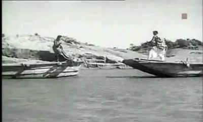
Rivers truly are a complex entity that invoke varied emotions and responses!
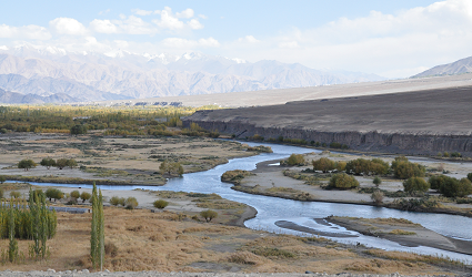
A river shifts in colour, shape, size, flow pattern of water, silt, nutrients and biota, in fact all its variables seem to change with time and space. The perceptions differ as one moves from mountains to plains to the deltas. The same stream displays a wide variance of characteristics that depend upon the land it flows through and the micro climate along its banks. Rivers many a times seem to mirror the local flavour of the land they flow through. Or is it the local flavour that changes with river flow? Clearly both are interdependent.
Today, as we talk of rivers, their rejuvenation and try to figure out their ecological flow and their health quotient , a good beginning to understand the existing rivers would be their classification modules. What defines a river? Which factors are used for their classification? How do we actually classify our rivers?
As far as the first of these questions is concerned, none of the official agencies have tried to define a river!
Possiby, the first post independence classification of river basins was attempted in 1949 by precuser institute of current Central Water Commission (CWC). Since then various organisations have followed their own methodology and criteria for basin classification and arrived at different numbers.

NIH (National Institute of Hydrology), Roorkee organises our 7 major rivers, that is the Brahmaputra (apparently this includes the Ganga and the Meghna), Godavri, Krishna & Mahanadi (that flow into the Bay of Bengal), and the Indus, Narmada & Tapi (which drain into the Arabian Sea) , along with their tributaries to make up the entire river system in our country.[2] This is clearly problematic and chaotic, since it leaves out vast areas of the country and the rivers that flow through them.
A quick look at the classification based on these 3 aspects –origin, topography and the basin they form.
- Based on Origin or Source
Depending on the origin or where they begin their journey from, there are the Himalayan (perennial) rivers that rise from the Himalayas and the Peninsular rivers that originate from the Indian plateau. The Himalayan rivers include the Ganga, the Indus and the Brahmaputra river systems along with their tributaries, which are fed throughout the year by melting ice and rainfall. They are swift, have great erosion capacity and carry huge amounts of silt & sand. They meander along the flat land, create large fertile flood plains in their wake and their banks are dotted by major towns and cities.
The peninsular rivers, on the other hand are more or less dependent on rain. These are gentler in their flow, follow a relatively straighter path, have comparatively less gradient and include Narmada, Tapi, Godavari, Krishna, Cauveri and Mahanadi rivers, among many others.
- Based on topography
The Himalayan Rivers flow throughout the year, are prone to flooding and include Indus and the Ganga-Brahmaputra-Meghna.
The Deccan Rivers include the Narmada and Tapi rivers that flow westwards into the Arabian Sea, and the Brahmani, Mahanadi, Godavari, Krishna, Pennar & Cauvery that fall into the Bay of Bengal.
The Coastal Rivers are comparatively small in size and numerous in number, with nearly 600 flowing on the west coast itself.
Rivers of the Inland Drainage Basin are centered in western Rajasthan, parts of Kutch in Gujarat and mostly disappear before they reach the sea as the rainfall here is scarce. Some of them drain into salt lakes or simply get lost in the vast desert sands.
Island Rivers Rivers of our islands: A&N islands & Lakshadip group of islands
- Based on basin formed
On the basis of the basin formed, our rivers are distributed into 7 river systems. The Indus River System originates in Kailash range in Tibet, and includes Zanskar, Shyok, Nubra ,Hunza (in Kashmir) along with Jhelum, Chenab, Ravi, Beas and Sutlej as its principal tributaries. In the Brahmaputra River System, it was earlier assumed that the Mansarovar lake is the source of the Brahmaputra river, however, now it is confirmed that Angsi Glacier is the main source (see: See: http://www.thehindu.com/news/international/china-maps-brahmaputra-indus/article2384885.ece). Most of the course of the river lies outside the country. In India it flows through Arunachal Pradesh and Assam, where it is joined by several tributaries. For more information on this river, see: https://sandrp.wordpress.com/2013/07/17/brahmaputra-the-beautiful-river-or-the-battleground/.

The Narmada River System comprises of the Narmada River that represents the traditional boundary between North & South India and which empties into the Arabian Sea in Bharuch district of Gujarat. Tapi river of the Tapi River System rises in the eastern Satpura Range of Madhya Pradesh and then empties into the Gulf of Cambay of the Arabian Sea, Gujarat. Its major tributaries are Purna, Girna , Panzara , Waghur , Bori and Aner rivers.
Also called the Vriddh (Old) Ganga or the Dakshin (South) Ganga, Godavari of the Godavari River System, originates at Trambakeshwar, Maharashtra and empties into the Bay of Bengal. Summers find the river dry, while monsoons widen the river course. Its major tributaries include Indravati, Pranahita, Manjira, Bindusara and Sabari rivers.
The Krishna River System includes Krishna river, one of the longest rivers of the country,that originates at Mahabaleswar, Maharashtra, and meets the sea in the Bay of Bengal at Hamasaladeevi, Andhra Pradesh. Tungabhadra River, formed by Tunga and Bhadra rivers, is one of its principal tributary. Others are Koyna, Bhima, Mallaprabha, Ghataprabha, Yerla, Warna, Dindi, Musi and Dudhganga rivers.
The Kaveri River System has the Kaveri (or Cauvery) river whose source is Talakaveri in the Western Ghats and it flows into the Bay of Bengal. It has many tributaries including Shimsha, Hemavati, Arkavathy, Kapila, Honnuhole, Lakshmana Tirtha, Kabini, Lokapavani, Bhavani, Noyyal and Amaravati. The Mahanadi of the Mahanadi River System, a river of eastern India rises in the Satpura Range and flows east into the Bay of Bengal.
Broader definition: Catchment area size
River basins are widely recognized as a practical hydrological unit. And these can also be grouped, based on the size of their catchment areas (CA). This easy to understand river system classification divides them into the following categories as tabulated below:
| River basin | CA in sq km | No. of river basins | CA in million sq. Km | % area | % Run off | % population |
| Major river basin | CA > 20,000 | 14 | 2.58 | 83 | 85 | 80 |
| Medium | 20,000<CA<2,000 | 44 | 0.24 | 8 | 7 | 20 |
| Minor (Coastal areas) | CA< 2,000 | Many | 0.20 | 9 | 8 | |
| Desert rivers | Flow is uncertain & most lost in desert | – | 0.1 | – |
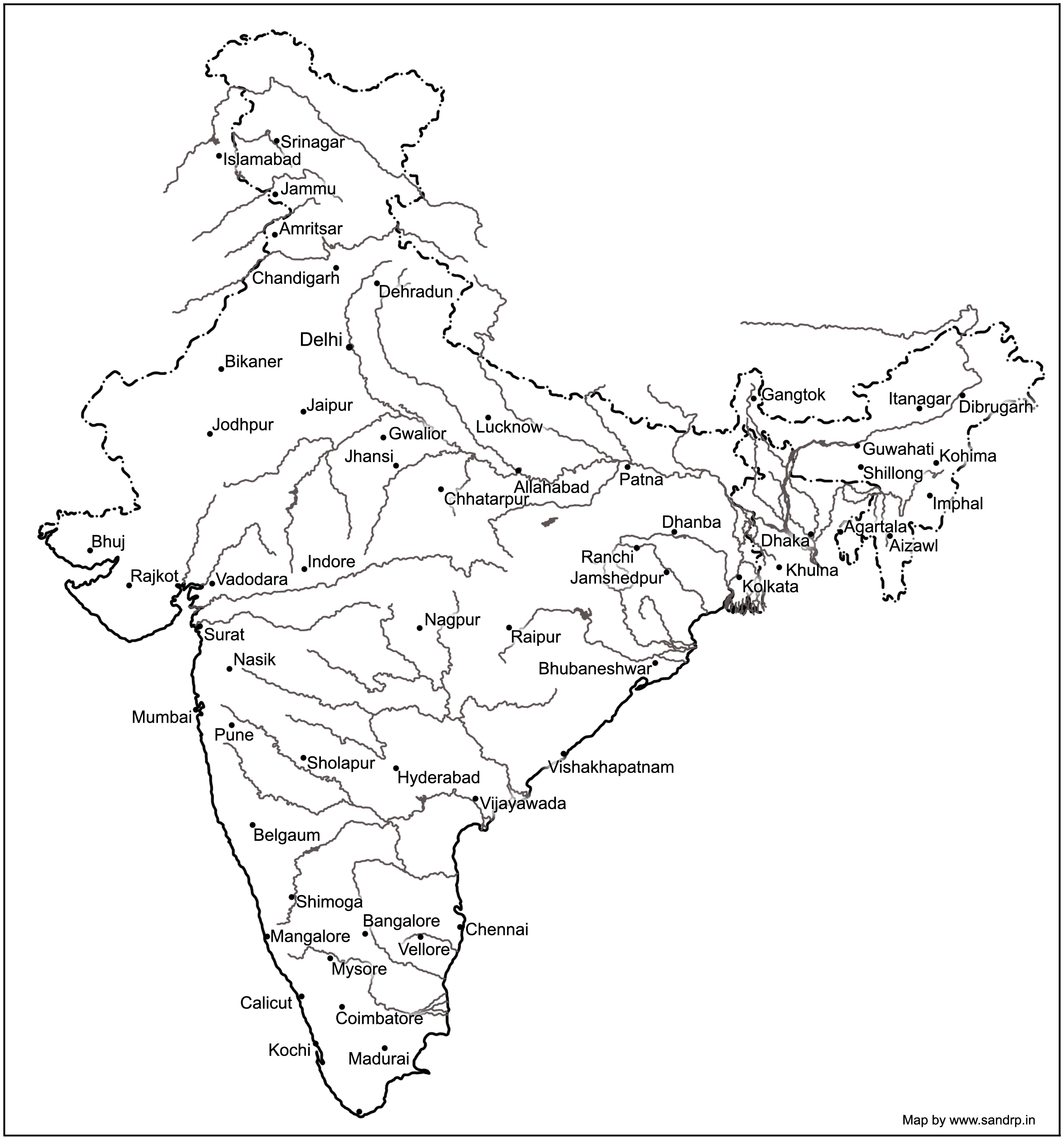
Major river basins include the perennial Himalayan rivers- Indus, Ganga & Brahmaputra, the 7 river systems of central India, the Sabarmati, the Mahi, Narmada & Tapi on the west coast and the Subarnekha, Brahmani & the Mahanadi on the east coast and the 4 river basins of Godavri, Krishna, Pennar and Cauvery, which takes the total to 14. The medium river basins include 23 east flowing rivers such as Baitarni, Matai & Palar. A few important west flowing rivers are Shetrunji, Bhadra, Vaitarna & Kalinadi. The minor river basins include the numerous, but essentially small streams that flow in the coastal areas. In the East coast, the land width between the sea and the mountains is about 100 km, while in the West coast, it ranges between 10 to 40 km. The desert rivers flow for a distance and then disappear in the desert of Rajasthan or Rann of Kutch, generally without meeting the sea.[3]
A need for details
Under India-WRIS (Water Resources Information System) project too, the river basin has been taken as the basic hydrological unit, but the country has been divided into 6 water resource regions, 25 basins and 101 sub basins, which are an extension of the earlier 20 basins delineated by CWC, as detailed in the ‘River basin Atlas of India’. [4] The details of the individual catchment area of these 20 river basins is tabulated here:
| S No | River Basin | CA (Sq. Km) | Major river | River Length, km |
| 1 | Indus (Upto border) | 321289 | Indus(India) | 1114 |
| 2 | Ganga- Brahmaputra-Meghna | |||
| a | Ganga | 861452 | Ganga | 2525 |
| b | Brahmaputra | 194413 | Brahmaputra (India) | 916 |
| c | Barak & others | 41723 | Barak | 564 |
| 3 | Godavari | 312812 | Godavari | 1465 |
| 4 | Krishna | 258948 | Krishna | 1400 |
| 5 | Cauvery | 81155 | Cauvery | 800 |
| 6 | Subernarekha | 29169 | Subernarekha | 395 |
| Burhabalang | 164 | |||
| 7 | Brahmani & Baitarni | 51822 | Brahmani | 799 |
| Baitarni | 355 | |||
| 8 | Mahanadi | 141589 | Mahanadi | 851 |
| 9 | Pennar | 55213 | Pennar | 597 |
| 10 | Mahi | 34842 | Mahi | 583 |
| 11 | Sabarmati | 21674 | Sabarmati | 371 |
| 12 | Narmada | 98796 | Narmada | 1312 |
| 13 | Tapi | 65145 | Tapi | 724 |
| 14 | West flowing rivers from Tapi to Tadri | 55940 | Many independent rivers | |
| 15 | West flowing rivers from Tadri to Kanyakumari | 56177 | ||
| 16 | East flowing rivers Between Mahanadi & pennar | 86643 | ||
| 17 | East flowing rivers Between Pennar & Kanyakumari | 100139 | ||
| 18 | W flowing rivers of Kutch & Saurashtra includes Luni | 321851 | Luni | 511 |
| 19 | Area of inland drainage in Rajasthan | 60269 | Many independent rivers | |
| 20 | Minor rivers draining into Myanmar & Bangladesh | 36202 | Many independent rivers | |
Note: 1. River Length is only for the main stem of the river, does not include tributaries, etc.
- Area of inland drainage in Rajasthan is not given in this reference, it has been arrived at by inference.
- Indus basin is constibuted by six main rivers: Sutlej, Beas, Ravi, Chenab, Jhelum and Indus itself. Some tributaries of this system form independent catchment in India (e.g. Tawi river in Chenab basin) as these confluence with the main river only in downstream of the border.
Of course these methods only classify rivers based on their physical & geographical attributes, their drainage area, river length, volume of water carried and tributary details. For a detailed study of a river, what is also needed is its ecological assessment. The methods for river classification may be varied and still evolving, but this information is fundamental to better understand and map the rivers that criss cross across the country.
And definitely a first step to try and understand our rivers!
Sabita Kaushal, SANDRP (sabikaushal06@gmail.com)
END NOTES:
[1] This blog is part of a series of blogs we plan to put up in view of the India Rivers Week being held during Nov 24-27, 2014, see for details: https://sandrp.wordpress.com/2014/10/15/press-release-india-rivers-week-from-24-27-nov-2014-first-irw-event-to-be-held-in-delhi/
[2] Rivers of India: National Institute of Hydrology, Roorkee
http://www.nih.ernet.in/rbis/india_information/rivers.htm#Peninsular
[3] India’s Water Wealth: KL Rao, Orient Longman, 1975
[4] River basin atlas of India, 2012: A report by Central Water Commission and Indian Space Research Organisation: http://www.indiawaterportal.org/articles/river-basin-atlas-india-report-central-water-commission-and-indian-space-research

It was traditional belief that claimed the Brahmaputra originated in the Manasarovar Lake. Explorers and geographers, rather than “assuming” this to be so, set out to verify it one way or another. They soon realised this was not the case and it has been known for over a century that geographically its origins lie elsewhere. Yet strangely even many official sites still maintain this misinformation.
LikeLike
This is a great initiative. Rivers do require a week, if not a month of our annual concerted attention. This effort will push our focus on this aspect which we seem to take it for granted..
LikeLike