Introduction
Protests are erupting in Arunachal Pradesh against India’s proposed 11,000 MW Siang Upper Multipurpose Project SUMP[1], a project pushed as if fait accompli to withstand the possible impacts of China’s 60,000 MW Medog Hydropower Dam System, World’s largest hydropower project.
China, aside from the curated media briefs and speeches from the July 2025 groundbreaking ceremony on the Tibetan Plateau, has shared no details of the project: no official information on location of the dams, their storage or discharge capacities, operational aims, etc.[2] Chinese media and even its scientists go on to laud the project in bombastic terms[3] while hinting perhaps they do not have the details either[4]. China hails this as advancing its “national security, ecological, energy, livelihood and international cooperation”[5] ambitions. In its media, the storage capacity of the largest dam is sometimes quoted 16 BCM, while India seems to have estimated it at 5.5 Billion Cubic Meters (BCM).
For the largest hydropower project in the world, described by Premier Li as the “project of the century”[6] whose exit is planned just a few kilometers upstream India’s boundary, China’s opacity is unacceptable. Its track record surrounding transboundary water projects is problematic as can be seen with Mekong projects or, more importantly, lack of warning even during extreme events like the 2000 Yigong landslide. Tibetans, who are first to bear the brunt of displacement are not in the picture and their voices, stifled.[7]
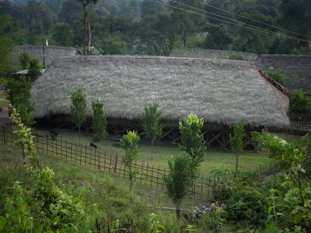
Arunachal’s Chief Minister Pema Khandu is consistently positioning India’s largest proposed hydropower project, the 280-300 mts high, 9-10 BCM storage, approximately 11,000 MW Siang Upper Multipurpose Project as a “water defense project”[8] against Medog Project. However, brave indigenous opposition to the SUMP highlights its generational impacts: potential to submerge 27 Adi tribal village villages fully and 40-45 partly, affect thousands of orange and pineapple farms, wet rice terraces, displacing or dispossessing over a hundred thousand indigenous people. On the one hand are secretive, diplomatic corridors of power and on the other are the dispossessed Tibetans, the Tani ethic groups in Tibet (such as Bokar, Damu, Khamba etc.) and proud indigenous Adis. This is a David and Goliath struggle in every sense.
While China’s secrecy about a mega project affecting two downstream countries is unacceptable, does that make Upper Siang Project, SUMP, acceptable? Or necessary? Is it in the interest of the people of Arunachal and India? Is it even sufficient to counter the impact of China’s Project?
Beyond Geopolitics
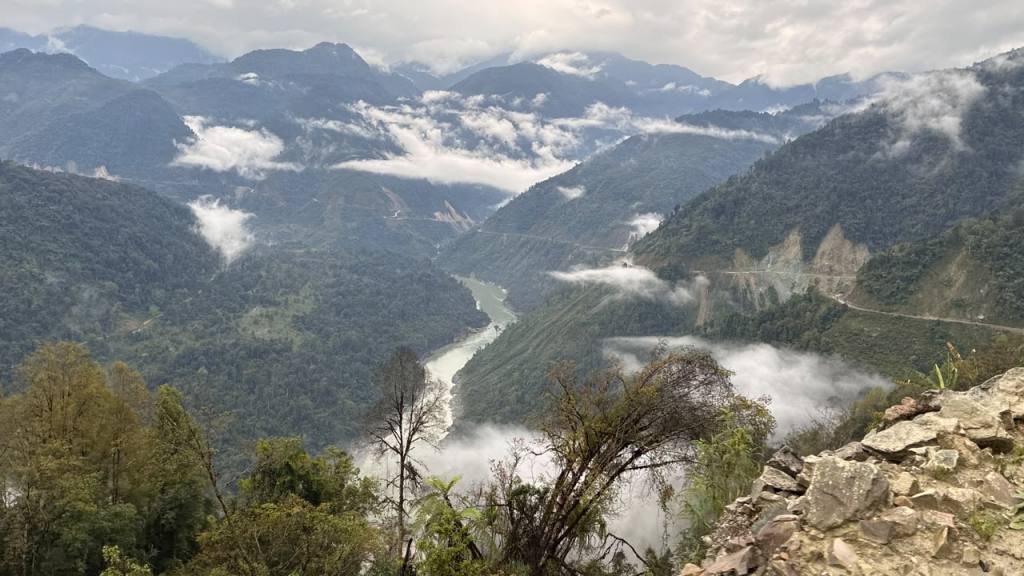
Beyond the geopolitical challenge lies the sheer geographical, geological and geomorphic challenge of the Yarlung Tsangpo Gorge along the Namcha Barwa or Eastern Himalayan Syntaxis within which, both projects are planned. This is not just a dangerous place to build such projects. It might be one of the most dangerous places in the world to build mega projects. This is one of the most seismically active, geologically complex and landslide prone regions in the world,mwith unprecedented rates of pushing up and cutting down through tectonic uplift (mountain building), rock exhumation (deep earth buried rocks come to the surface) and erosion (removal of rock by wind, water and ice), simultaneously. The river in this “deepest gorge in the world” has one of the greatest stream power and erosion rates making the gorge an “extraordinary sediment factory,” mobilizing more sediment per unit area than any other place. An unbelievable 45% sediment in Bangladesh comes from this tiny area, less than 3% of the Brahmaputra basin. Rapid warming of the Tibetan plateau now adds more landslides, glacial lake outburst floods, avalanches and flash floods to the mix.
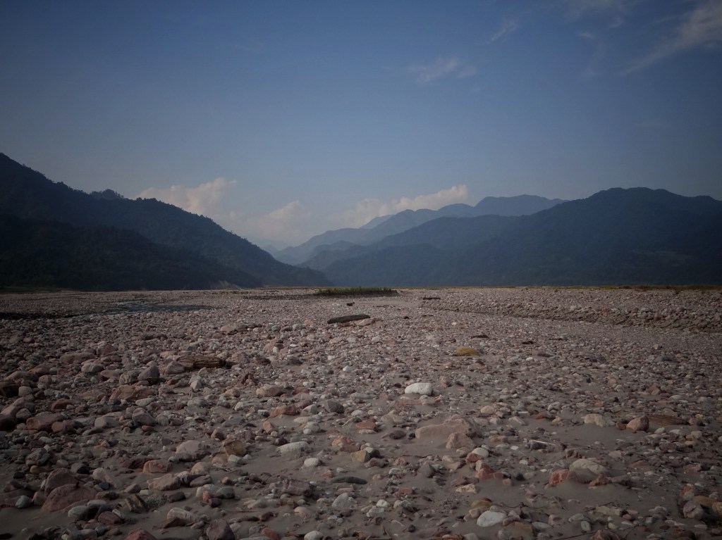
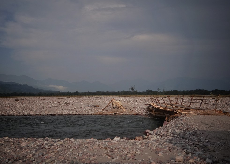
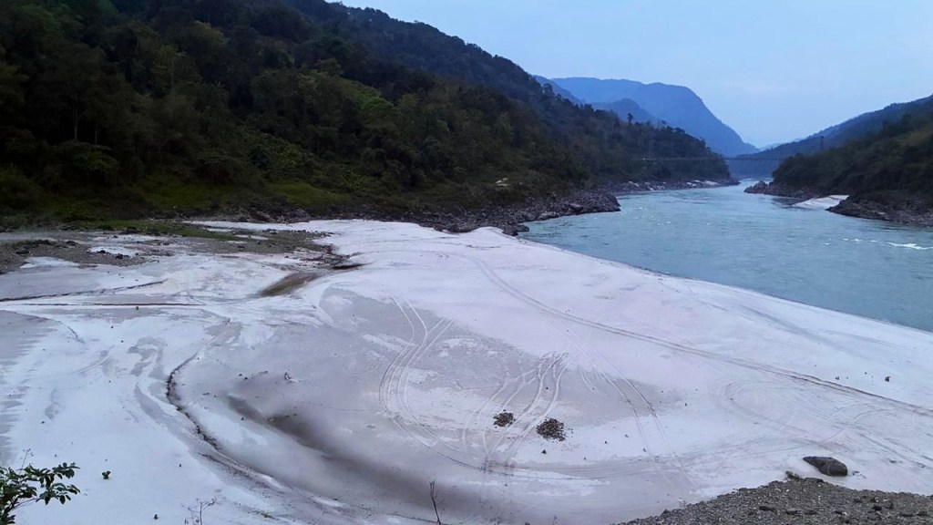
Sediment in Siang at Pasighat Photo: Parineeta Dandekar
Megaprojects have been built facing one of the above challenges before, but no place where astounding culmination of processes exist like the Yarlung Tsangpo Gorge. And there are planning of not one but two mega projects here: the world’s largest hydropower project and India’s largest proposed hydropower project by far. Add to this China’s secrecy about the project and the past disasters and India’s mis-guided push for the project, coupled with lack of coordination around flood management, natural hazard monitoring and susceptibility mapping and the situation becomes alarming.
Together, Medog and SUMP have put the communities downstream at tremendous risk from complex technological lock-ins and compounding risk to grave natural hazards without any reliability on warning, susceptibiity, or mitigation. Distrust, secrecy and haste compound this risk even further. The race to dam the Yarlung Tsangpo-Siang is a race no one can safely win.
Medog Hydroelectric Project: “Cut the bend, divert through tunnels”[9] Yarlung Tsangpo Downstream Project[10]
In the absence of any reliable official data, this section is built on Chinese, international and Indian media reports, Chinese academic papers and some rare tender and company information sheets. There is a glaring lack of Indian scientific papers that could harness the use of remotely sensed data to understand hazard risk and susceptibility.
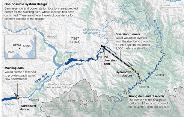
It looks like the project is divided into Upstream annual storage-cum-regulating dam at Mainling/Menling/Milin/米林 (29.2037, 94.0787), a smaller intake dam at Pé/Pai Town 派镇 (29.5699, 94.8982), tunnels with hydropower stations and downstream regulating weir/ dam at Xirang 西让 Dam (29.2551, 95.1902; ~50km upstream of Tuting) . Water from the Tibetan plateau will be brought down through the tunnels, bypassing the gorge. There is possibility of building small reservoirs between different stages of the hydropower configuration.
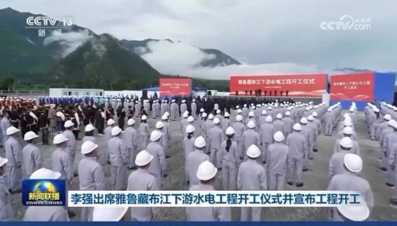
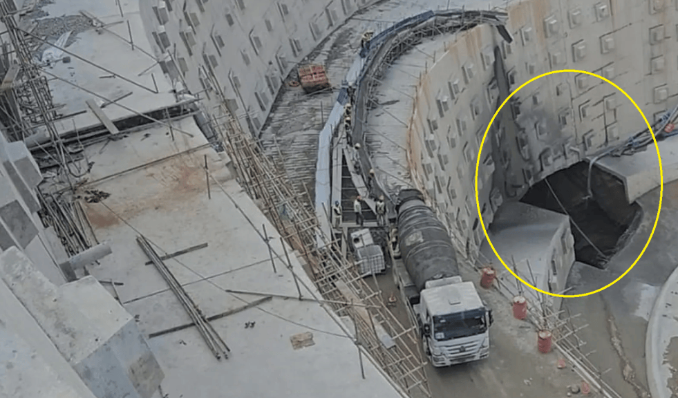
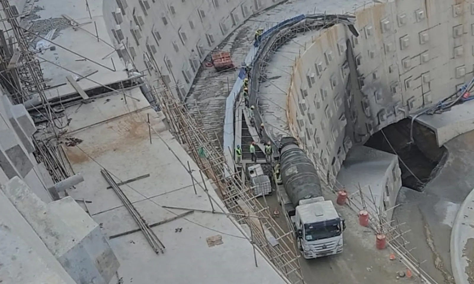
Groundbreaking/commencement ceremony of the Yarlung Tsangpo Downstream Hydroelectric project July 2025, TibetExpress
- Upper Mainling/ Milin dam with “annual regulating”[11] storage capacity which can be between 5.5 BCM-7 BCM (not clear if this is live storage or total storage). Some media reports suggest it close to 16 BCM[12], but this might mean the dam crest [13] will impact the Lhasa-Nyingchi railway line, cause more displacement of Tibetans and submergence of some of the most fertile lands in Mainling and protected areas on the Mainling plateau. We assume a 5.5 BCM- 7BCM storage here.
- Intake dam at Pai town/Gyala acting as a diversion weir transferring about 2000-3000 cumecs (cubic meters per second) into the tunnel. This figure does need vetting.
- Subsequent hydraulic head is split into tunnels bored through Namcha Barwa. Likely between 3-5 parallel tunnels
- The power production will be through 5 cascade powerhouses[14],[15]possibly the Jiala/ Pai Station, Medog Station (flagship underground powerhouse), Beibeng Station and Xirang/Shirang Station: southernmost cascade end station either on Yarlung Tsangpo or the tributary.
- Downstream Reservoir? Water from the tunnels possibly drops into Xirang Chu, a right bank tributary of Yarlung Tsangpo close to border before entering the mainstem. According to Fan Xiao[16], a Chinese geologist, environmentalist and former chief engineer with the Regional Geological Survey Team, the water will meet Yarlung Tsangpo through a series of dams on Xirang Chu, a right bank tributary.[17] However, according to a paper by scientists from China Institute of Water Resources and Hydropower Research[18], “Third reservoir functions as the ultimate counter-regulation reservoir, ensuring runoff process stability during reservoir storage periods.” (Location unclear, Xirang or Yarlung Mainstem)
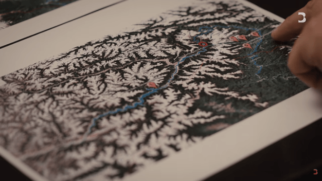
This last counter regulating reservoir is the contentious part of the current discussions because of its potential direct impact across the border. No information about its final place in design, its location (whether on tributary or mainstem), and its storage capacity exists in open domain. Experts in CNN-Stimson Centre piece opine that[19] final dam on the river would pose engineering challenges and would be unnecessary. Fan Xiao’s paper states that water will be released in Xirang chu. There might be a possible dam on Xirang chu rather than mainstem Yarlung Tsangpo, though it is doubtful because of the small and steep valley of Xirang chu or Duoxiong Chu.
The storage capacity and operation of the upstream dam and the downstream dam will have direct impact on Arunachal Pradesh.
Arunachal and Assam will be impacted by natural disasters like landslides, GLOFs, avalanches, dam breaks, earthquakes and flash floods occurring in the Yarlung Tsangpo Gorge or the Great Bend, deepest river gorge in the world. As of 2023 the Randolf Glacier Inventory (https://rgidata.org/) suggests roughly 2000+ glaciers feed this watershed in the immediate vicinity of the dams perhaps with tens of thousands of glacial lakes. For a warming Tibetan plateau, this is a recipe for disasters made worse by dams and technological lock-ins.[CS1] This region exerts disproportionate impact on the downstream. Xirang, the last point of the Medog Hydropower Project is located at the end of this gorge while the backwaters of the SUMP may reach around 30-40 kms upstream from the gorge, depending on the location and height. [CS2]
WHY IS THE YARLUNG TSANGPO GORGE SUCH A DANGEROUS LOCATION?
Namcha Barwa Syntaxis and Yarlung Tsangpo Gorge: Culmination of highest risks
“Syntaxis” means a sharp, hairpin structural bend where geological strata, major fault lines, and river courses are abruptly squeezed and rotated around a tight corner. This is what happens at the Eastern Himalayan or the Namcha Barwa Syntaxis where the easternmost corner of the Indian plate is still negotiating with the Eurasian plate. Rather than continuing eastward, the tectonic boundary is forced into a clockwise loop. At the core of this loop stand the twin peaks of Namcha Barwa (7,782 m) and Gyala Peri (7,294 m), on opposite banks of the river. The Yarlung Tsangpo wraps around Namcha Barwa in an abrupt horseshoe bend, descending roughly 2,000 vertical metres in a short distance before crossing into India as the Siang. This gorge is the deepest in the world, three times the average depth of Grand Canyon!
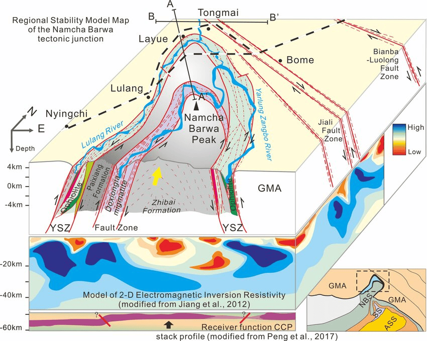
- Extremely frequent and complex seismic activity: This might be one of the most seismically active regions in the world, an example of “Tectonic Aneurysm”. Aneurysm is a term restricted to the bulging of a weakened artery. But here it is the earth’s surface that is bulging under combined impact of some of the highest uplift rates and rock exhumation rates in the world, combined with possibly the highest stream power per unit area in the world. The gorge shows extreme fluvial incisions (cutting down) as well as one of the highest rates of uplift and exhumation of rocks (pushing up)[20]
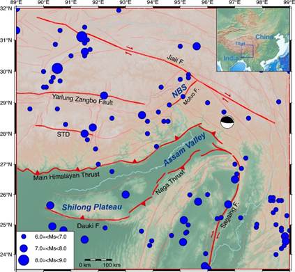
It was also the region that recorded the largest earthquake on land so far[21], Assam earthquake of 1950, 8.6 Richter scale that occurred in what we know today as Anjaw district of Arunachal Pradesh (28.3514947,96.4462057; 15km west of Chaglagam). Here in the Eastern Himalayan Syntaxis, brittle rock formations are subjected to shear, rotational compression, and deep structural faulting along the Jiali, Motuo, Paizhen and Xixingla fault zones. Dong et al (2023) report more than 200 earthquakes >4 Mw between 1950 and 2018 in the gorge region. [22] This region is also prone to earthquake swarms (wherein aftershocks and pre-shocks are not registered, and earthquakes go on over several weeks if not months). In 2015 scientists from Geological Survey of India proposed that hydro-fracturing is responsible for such swarms, wherein the extremely high precipitation leads to large pressures and stresses that are relieved by earthquake swarms, And a particular monsoonal bias for swarm activity (Mukhopadhyay and Dasgupta 2015. Earthquake swarms near eastern Himalayan Syntaxis along Jiali Fault in Tibet: A seismotectonic appraisal). The frequent seismic activity and exceptionally complex geophysical and geological setting of this region directly affects and creates a cascading set of natural hazards that are highlighted further below.
- The Extraordinary Namcha Barwa Sediment Factory[23]
Coming together of singular factors results in Yarlung Tsangpo Gorge being one of the most productive debris factories on Earth. This holds profound implications for the dams in the downstream. Scientists call this region an “erosional hotspot” and a “natural laboratory to test feedback among tectonic, climate and erosion.”[24]
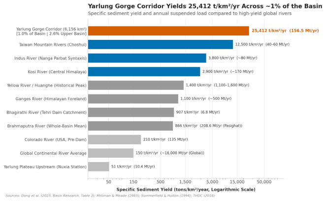
Hydrological stations show that upstream on the dry Tibetan Plateau (at Nuxia/Pai), the Yarlung Tsangpo carries only ~15 to 30 million metric tonnes (Mt) of sediment per year. But by the time the river reaches Pasighat at the foot of Arunachal Pradesh, the total sediment load surges to ~210 to 250 Mt per year.[25] Specific sediment yield across the gorge reaches more than 25,412 tonnes/km²/year.[26],[27] By comparison, the global continental average is ~150 t/km²/yr.
Studies estimates that 61-74% of the sediment load at Pasighat comes from this tiny region.[28] In fact, this tiny part of Brahmaputra basin, just 3% of its area, contributes to about 45% sediment of Brahmaputra in Bangladesh![29] More than a quarter of the sediment at Sundarbans comes from this region and its acute activity.
Video: February 2018 at Ane Siang floodplain, Pasighat. After the November 2017 landslides in the Tsangpo gorge an extraordinary amount of sediment from those landslides were deposited in the floodplains Video by Chintan Sheth
How will the downstream regulating dam of the Medog Hydropower Project manage this immense silt? If it is a small weir or a smaller dam, as is more probable, it will not be able to hold much silt and it will either pass it all in the downstream or will be overwhelmed by it. In any case, that sediment will end up in SUMP and as a large storage dam, it will hold back most of it. Storage dams hold back about 90% of the sediment they receive. Tehri dam holds back about 95% of the sediment it receives, passing only about 5% of the sediment downstream.[30]
What will be the impact of the sediment stored in SUMP on the downstream when the productivity and millions of livelihoods in the downstream depend on this silt? What will it mean to its own storage capacity and flood cushion?
Furthermore the entrapment of such large quantities of sediment in the upper reaches of the river will only make the river sediment deficit or hungry likely leading to enhanced catastrophic erosion of the downstream stretches that are already suffering an acute crises of bank erosion.
Bangladesh is facing seas level rise and increased delta erosion. How will trapping more than a quarter of Brahmaputra sediment impact Bangladesh?[31] Mass loss from Brahmaputra catchment is twice as much that of the Ganges catchment, making dams in Brahmaputra basin much more vulnerable to sediment and debris.[32] This is not without precedent, China’s dams on Mekong and dams built in response to China’s dams are expected to affect nearly 50% suspended sediment in the river.[33]
- Yarlung Tsangpo Gorge has highest stream power in the World
Erosive strength of a river is measured in unit stream power[34]. Yarlung Tsangpo when it enters the gorge is not a small river or a headwater. It is a 1300 kms long continental river before it enters the steep gorge. The gorge itself has an extremely acute gradient of over 2000 mts in about 200-250 kms with its narrow regions just about 100 mts in width. Coming together of these factors leads to unit stream power of Yarlung Tsangpo being one of the highest in the world for a large river.[35] Yarlung Tsangpo’s 2,000-metre descent negotiated around this bend exceeds the total elevation drop of the Mississippi River across its entire 3,700-kilometre course by more than fourfold.
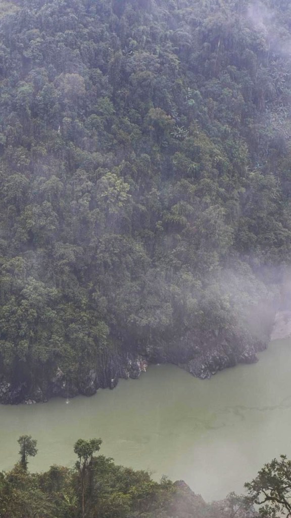
- Major recent landslides and collapses in the Yarlung Tsangpo Gorge
In the recent decades, four major mass-wasting events have demonstrated how fragile the syntaxis is: the 2000 Yigong disaster and the recurring 2017, 2018, and 2021 Sedongpu collapses. It is important to note China’s opacity about these disasters even when they were immensely dangerous to India and caused loss of lives and livelihoods in the downstream. China has also designed and deployed early warning systems in this region that monitor seismic activity, landslides and glacial mass wasting. None of that data is shared with India as no standing water treaty exists or under the current conditions of the MoU between the states.
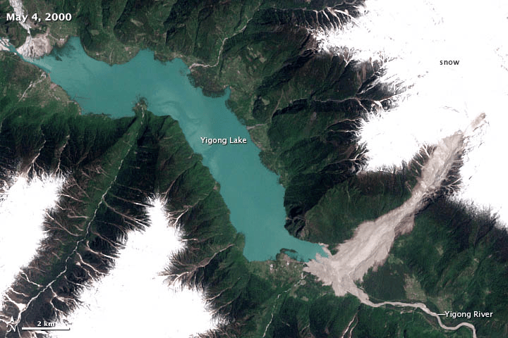
- 2000 Yigong Disaster: The Monster Slide[36]
In 2000, Yarlung Tsangpo Gorge witnessed “One of the world’s largest recorded landslides”[37] in the Yigong-Parlung Tsangpo valley, a left bank tributary of the Yarlung Tsangpo. Two earthquakes in April 2000 and the resultant landslide blocked the tributary creating a dam area of 2.5 square kilometers and 90 meters deep. The natural dam gave way (following Chinese army’s weeks long efforts) in June 2000, flooding areas for days all the way to Assam. The surge swept away large forest areas and several bridges along the Siang. “Several elders still remember the intense wave of water that rushed within minutes reportedly causing 30 deaths and destruction of more than 50 villages in Arunachal Pradesh and Assam. Many fields remain damaged after 17 years.” wrote Chintan Sheth in 2017.[38] This was the largest outburst flood from a landslide dam ever recorded in modern history.
It is long-held by Indian administration and media that China, which had been working on diffusing the landslide dam for two months, did not give India advance warning of the threat.[39],[40]
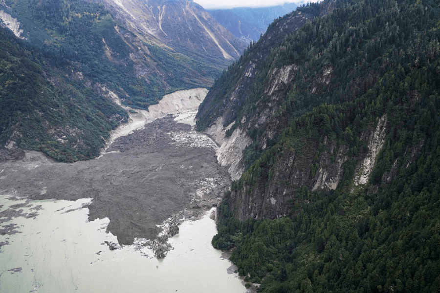
- The Sedongpu Valley Hotspot
The Sedongpu (Sendongpu) Basin is a steep, glaciated tributary gully joining Yarlung Tsangpo roughly 15 to 20 km downstream of the Pai (Pe) gorge entrance. Its headwaters sit on the sheer face of Gyala Peri (7,294 m). Over a horizontal distance of 10 to 12 km, the valley drops from over 7,200 m down to the Tsangpo riverbed at ~2,750 m.
Driven by climate warming and permafrost degradation, Sedongpu has transformed into an active debris corridor.[41] Leading geologist Dave Petley who runs the extremely informative Landslide Blog calls it “One of the most landslide-prone locations on the planet.” “Since 2017, over 700 millon cubic metres of debris has been mobilised in this 11 km long catchment.”[42] Studies as recent as 2025 have warned that “increase in the frequency of mass wasting events in the Sedongpu gully in recent years indicates that the gully has entered an intense mass wasting period.[43] Ice rock collapses and resultant river blockages are becoming common at this hotspot.[44]
- The 2017 Collapse[45]: In late October and November 2017, millions of cubic meters of rock and ice collapsed from Sedongpu, partially blocking the Yarlung Tsangpo. In India, the Siang suddenly turned into a dark, cement-like slurry, choking fish, destroying local drinking-water intakes, and sparking political panic in Arunachal Pradesh.
But China did not issue an advance early warning.
It was only after an Indian scientist Chintan Sheth geolocated the debris to landslides and seismic tremors in the Great Bend[46] that China officially commented saying that it was because of “natural cause” and that Indian media and politicians should avoid “Unnecessary speculation.” SANDRP reported this immediately in 2017[47]. All news articles blamed China of dam construction on the Tsangpo, without supporting evidence, as the cause of the Siang’s muddiness, this misformation continues to be peddled. Three small landslide dams were also detected in the gorge but were cleared the August 2018 after above normal rainfall occurred across the Tibetan plateau leading to a a 50 year record flow rate of the Tsangpo.
- The October 2018 Twin Damming Events: On October 17 and October 29, 2018, two consecutive rock-and-ice avalanches or a glacier collapse completely blocked the mainstem Yarlung Tsangpo. The debris formed a 20 to 30 metre barrier dam, impounding a temporary reservoir of several hundred million cubic meters. About 6000 Tibetans were relocated. Upstream backwater rose rapidly, while downstream flows at Tuting and Yingkiong in Arunachal Pradesh plummeted to near zero before overtopping breached the landslide dam, sending rapid surges and muddy debris down into Assam. The glacier collapse due to excess warming, created a chain of disasters glacier collapse → glacial debris flow → river blockage → dammed lake → outburst flood. It is the combined effect of glacier dynamics, climate warming, heavy precipitation, seismic activity and high topographic relief that caused this disaster. It is predicted that such disasters will continue and likely intensify as the climate warming continues.
China provided information about this to Indian Consulate in Beijing and people were evacuated in time along the river in Arunachal and Assam. SANDRP had written about this[48] and a further 2020 event[49].
- The March 2021 Collapse: Another multi-million cubic meter rock-ice avalanche down Sedongpu blocked the river in 2021, confirming that the mainstem Tsangpo self-dams repeatedly under current warming trends.
SANDRP wrote about this on 30th March itself[50], trying to draw attention of the policymakers when there was no information about this from China or even the Indian side.
China provided no advance warning about this.
Climate change and warming in Tibet
The impacts of all the singular natural processes of this location are exacerbated when a warming Tibet Plateau comes in the picture. Tibet is warming at twice the rate of global averages[51], resulting in accelerated glacier retreat, permafrost degradation, and increased natural disasters (Chen et al., 2022; Nie et al., 2021, 2023). These changes profoundly alter the hydrological regime and sediment transport of these river systems[52] (Huss et al., 2017; Lutz et al., 2014; Yaoet al., 2022), Studies have demonstrated that under future climate scenarios, temperatures will rise, precipitation will increase, snowmelt and ice melt will intensify, flood flows will increase, and flooding will become more frequent.11,12,13,14,[53] Research on High Mountains Asia hydropower systems [54]suggests that large amounts of sediment from glacier and landslide debris can fill up reservoirs, cause dam failure and degrade power turbines. ()
Existing data sharing between India and China[55] Hydrological data sharing MoU, the only diplomatic instrument on Yarlung Tsangpo flows between India and China, expired in June, 2023. Following Chinese Foreign Minister Wang Yi’s visit to India in 2025, Beijing agreed in principle to share data on a limited, emergency and humanitarian basis but the formal MoU has not been renewed. None of the four Brahmaputra riparians, China, India, Bangladesh, and Bhutan, are signatories or parties to the UN Watercourses Convention (1997), and no enforceable water-sharing rights exist. During 2017 Doklam standoff with India, China withheld hydrological data on both the Brahmaputra and Sutlej rivers simultaneously for the entire flood season. Beijing’s official explanation was problems with data-gathering even as it continued to provide data to Bangladesh during the same period.
What does all this, taken together mean for the river, the downstream and for the SUMP Project?
Apart from being a risky security target close to the border, proposed SUMP project lies directly in the way of hazards travelling down the Yarlung Tsangpo Gorge. These hazards have been many in the past and are projected to rise in the future.
Massive Sediment Retention and loss of flood cushion: The project will face extreme flows when upstream dams open their spillways intentionally or during extreme precipitation or naturaldisasters. If the SUMP traps even a part of the approximately 140-160 million cubic meters sediment generated in the gorge every year, its flood cushion will deplete rapidly, jeopardizing its primary flood control function. In high-relief, narrow Himalayan gorges, coarse bedload and debris do not settle uniformly into the deep dead storage pool near the dam wall. Instead, they deposit at the head of the reservoir, forming a delta that raises upstream bed levels and backwater elevations, encroaching on active storage capacity much before the dead storage pool is filled. Sluice gates or silt flushing from the dam cannot address this effectively. (Annandale, 2013)
Dam-induced flood situations: If SUMP is to use its installed capacity, the reservoir needs to store water for electricity generation and cannot remain empty, waiting for an upstream event. The situation when SUMP does not have enough flood cushion and an upstream disaster hits SUMP will have catastrophic downstream impacts. This has happened several times within India, as seen during the disaster releases at Sardar Sarovar (2020, 2023), Koyna/Almatti (2019), and Pong/Bhakra (2023), Ranjit Sagar/ Madhopur Barrage (2025), these are just some recent instances.
Massive Medog Hydropower Project, combined with China’s secrecy and possible strategic control is a geopolitical threat with localized, albeit serious impacts, even without SUMP. But a huge storage dam like SUMP in the way of a disaster-prone gorge with some of the highest sediment loads, seismicity, landslide hazards, GLOFs and debris flows in the world is a definite geomorphological risk for India that cannot be mitigated in any reasonable way.
In conclusion The region where Medog Project and SUMP is planned shows a remarkable confluence of some of the most volatile geologic and geomorphic processes in the world, exacerbated by a rapidly warming Tibetan plateau. When we add the absence of diplomacy, credible channels of data sharing, early warning or disaster response, the Yarlung Tsangpo-Siang region becomes one of the most dangerous locations in the world to build mega projects. India is responding to an external upstream hazard by building a permanent domestic structural vulnerability.
China too, is not entirely insulated from risks, as Climate Historian of Tibet, Ruth Gamble says, “For the last forty years, China has developed the best hydroelectric engineers in the world by far, but they are not magicians, they cannot stop the tectonic plates or earthquakes.”
International fora are observing China’s lack of transparency and its impact on India and Bangladesh. International Court of Justice has taken a position about the need for EIA for transboundary projects in the past and China’s international reputation suffers if it does not share information about its prestigious project with its downstream riparian neighbors. A Trilateral Basin Consultation and a joint Transboundary Environmental Impact Assessment (TEIA)[56] will only help China and its downstream neighbors.
India and Bangladesh can also raise China’s not sharing and non-compliance internationally, publicly and persistently, along with the ICJ’s customary transboundary EIA duties at the UN, UNEP, and international environmental conventions to generate international reputational pressure.
In any case, India urgently needs to establish Independent Earth Observation and Early Warning system for the Yarlung Tsangpo using its considerable satellite capabilities, and expertise that actively monitor mountain systems for hazards, which it does not seem to be using so far.
Maintaining sovereign radar flow-profiling arrays at the border (Gelling, Bishing, Tuting) and automated satellite SAR surveillance of any projects and barrier lakes across Tibet is an urgent need. So is basic state deployed warning systems and academically peer-reviewed risk assessments, simulations and models using remotely sensed data. Independent academics in India like Chintan Sheth have expressed their frustration that India seem to have a huge blind spot wrt Yarlung Tsangpo and there is no excuse for that. Without,
China urgently needs to share basic project details with India and Bangladesh. But India, for its part, must treat the concerns of the Adi communities in Arunachal Pradesh with the seriousness they deserve. On the evidence so far, SUMP’s risks hugely outweigh its promised benefits.
India seem to have cast itself as King Lear, “I am more sinned against than sinning”. China’s secrecy is inexcusable. But as King Lear’s suffering was also partly of his own making, a storage dam in the path of this gorge’s hazards would be too.
Parineeta Dandekar with Chintan Sheth
parineeta.dandekar@gmail.com
Additional References
- Annandale, G. W. (2013). Quenching the Thirst: Sustainable Water Supply and Climate Change. CreateSpace Publishing.
- Boes, R. M., et al. (2019). “Sediment-induced hydro-abrasive wear on hydraulic machinery and structures.” IOP Conference Series: Earth and Environmental Science, 240, 022026.
- Brune, G. M. (1953). “Trap efficiency of reservoirs.” Transactions of the American Geophysical Union, 34(3), 407–418.
- Burg, J.-P., et al. (1998). “Syn-to post-collisional crustal exhumation in the Namche Barwa Syntaxis (eastern Himalaya).” Geology, 26(3), 239–242
- Finnegan, N. J., et al. (2008). “Coupling of rock uplift and river incision in the Namche Barwa–Gyala Peri massif, Tibet.” Geological Society of America Bulletin, 120(1–2), 142–155
- Lang, K. A., et al. (2016). “Early onset and late acceleration of rapid exhumation in the Namche Barwa syntaxis, eastern Himalaya.” Science Advances, 2(4), e1500825
- Larsen, I. J., & Montgomery, D. R. (2012). “Landslide erosion coupled to tectonics and river incision in the Namche Barwa syntaxis, Tibet.” Nature Geoscience, 5(8), 558–562
- Padhy, G. K., & Saini, R. P. (2012). “A review on silt erosion in hydro turbines.” Renewable and Sustainable Energy Reviews, 16(5), 2887–2894.
- Singh, S. K., & France-Lanord, C. (2002). “Tracing the distribution of erosion in the Brahmaputra watershed from isotopic compositions of stream sediments.” Earth and Planetary Science Letters, 202(3), 645–662.
- Stewart, R. J., et al. (2008). “The sedimentology and provenance of the Indus and Brahmaputra river systems.” Large Rivers: Geomorphology and Management, 403–424
- Walling, D. E. (2006). “Human impact on land–ocean sediment transfer by the world’s rivers.” Geomorphology, 79(3–4), 192–216.
- Zeitler, P. K., et al. (2001). “Erosion, Himalayan geodynamics, and the geomorphology of metamorphism.” GSA Today, 11(1), 4–9.
- Zeitler, P. K., et al. (2014). “Crustal reworking at southeast Tibet for the last 10 m.y.: Geodynamic implications of tectonic aneurysm.” Tectonics, 33(11), 2187–2212.
- Report on 2017 Landslide flood event: https://archive.arunachaltimes.in/index.php/2017/12/21/earthquakes-in-tibet-have-triggered-massive-landslides-darkening-the-siang-river/
[1] https://frontline.thehindu.com/environment/siang-dam-project-arunachal-tribal-protests/article71640500.ece
[2] https://www.cnn.com/2025/12/17/china/china-largest-hydropower-dam-intl-hnk-dst
[3] https://www.news.cn/20241225/5cc61d9f02ea453b8b8e553aa0663c07/c.html
[4] https://www.nature.com/articles/s43247-025-02247-8
[5] https://jamestown.org/yarlung-tsangpo-hydropower-fuels-prcs-energy-computing-strategy/
[6] https://www.isdp.eu/wp-content/uploads/2026/09/Focus-Asia-Genevieve-Sep-14-2026.pdf
[7] https://www.cnn.com/2025/12/17/china/china-largest-hydropower-dam-intl-hnk-dst, https://tibet.net/medog-dam-threats-on-tibets-yarlung-tsangpo-river-raised-at-un-human-rights-council/
[8] https://www.facebook.com/reel/2374305800072031
[9] https://www.news.cn/politics/leaders/20250719/ead658b6a9664769af9d5e33aedff281/c.html
[10] https://cn.chinadaily.com.cn/a/202507/23/WS688057fda310028a84abf3ee.html, https://cn.chinadaily.com.cn/a/202507/19/WS687b669ea310028a84abeb08.html
“over 100 kilometers of tunnels, is expected to consume over 30 million tons of high-standard cement, and the annual demand for civil explosives will reach 100,000 tons.” (https://ex.chinadaily.com.cn/exchange/partners/82/rss/channel/cn/columns/sz8srm/stories/WS68831954a310028a84abfb09.html). More propaganda about the project https://user.guancha.cn/main/content?id=1486459
According to the plan, the first unit is expected to be put into operation around 2030 and completed in 2045. (https://kuku.baidu.com/app#/workbench/new-task?md5=516e9bb905b0d5a114c488d23f260804)
[11] https://www.nature.com/articles/s43247-025-02247-8
[12] https://user.guancha.cn/main/content?id=1486529
[13] at 3090 mts
[14] https://cn.chinadaily.com.cn/a/202507/23/WS688057fda310028a84abf3ee.html
[15] https://cn.chinadaily.com.cn/a/202507/23/WS688057fda310028a84abf3ee.html
[16] Dr. Xiao has extensively written about the dams and their consequences in China, including the fact that dams cause earthquakes, which cause more earthquakes (https://journal.probeinternational.org/2022/11/29/dams-cause-earthquakes-earthquakes-cause-other-earthquakes/) and the astonishing changes to communities and their environment 20 years after the Three Gorges Dam (the largest engineering project ever undertaken (https://journal.probeinternational.org/2014/11/24/astonishing-changes-in-the-life-and-environment-of-chongqing-20-years-after-the-construction-of-the-three-gorges-dam-fan-xiao/).
[17] https://journal.probeinternational.org/2024/01/10/chinas-yarlung-tsangpo-great-bend-mega-dam-not-feasible-due-to-risks/
[18] https://www.nature.com/articles/s43247-025-02247-8#author-information
[19] https://edition.cnn.com/2025/12/17/china/china-largest-hydropower-dam-intl-hnk-dst
[20] Extreme Fluvial Incision (Cutting Down): As the Yarlung Tsangpo enters the Namcha Barwa syntaxis, it drops 2,000 metres across a short horizontal distance. Over millennia, aided by high kinetic energy and recurring mega floods, the river has carved downward into solid bedrock at rates of 5 to 10+ mm per year (5 to 10 meters every thousand years) (Finnegan et al., 2008; Larsen & Montgomery, 2012).
Ultrafast Uplift & Exhumation (Pushing Up): When a river cuts away millions of tonnes of overlying rock so rapidly, it relieves the pressure on the upper crust. Hot, lighter lower crustal rock rises to fill the gap, like an aneurysm bulging through a weakened artery wall (Zeitler et al., 2001). Studies demonstrate that Namcha Barwa is being forced upward and exhumed at 5 to 10+ mm per year, with peak local pulses reaching 10–13 mm per year (Burg et al., 1998; Lang et al., 2016). Compare this with global uplift averages of about 0.1 to 1 mm per year in places like Alps and Rockies. The sustained movement at Namcha Barwa is 10 to 20 times faster than the continental average, rivalled globally only by the Nanga Parbat Syntaxis in Pakistan and the Saint Elias Range in Alaska.
[21] https://ui.adsabs.harvard.edu/abs/2020E&PSL.53115928C/abstract
[22] https://www.researchgate.net/publication/373162472_The_extraordinary_Namche_Barwa_sediment_factory_in_the_Eastern_Himalayan_Syntaxis
[23] https://onlinelibrary.wiley.com/doi/10.1111/bre.12795
[24] https://www.researchgate.net/publication/373162472_The_extraordinary_Namche_Barwa_sediment_factory_in_the_Eastern_Himalayan_Syntaxis
[25] From specific studies: Our analysis indicates that the Yarlung River sediment load increases by a factor of 20 between Nuxia upstream of the gorge (10.4 Mt/a; Shi et al., 2018) and Medog downstream of the gorges (208.6 Mt/a)
[26] https://eesarchive.lehigh.edu/EESpeople/peopledocs/zeitler-pubs/finnegan_etal_2008.pdf
[27] https://www.researchgate.net/publication/373162472_The_extraordinary_Namche_Barwa_sediment_factory_in_the_Eastern_Himalayan_Syntaxis
[28] Enkleman Denudation of the Namche Barwa antiform, eastern Himalaya, Earh and planetary Science Letters, 2011, Elsevier, https://www.researchgate.net/publication/373162472_The_extraordinary_Namche_Barwa_sediment_factory_in_the_Eastern_Himalayan_Syntaxis
[29] Enkleman Denudation of the Namche Barwa antiform, eastern Himalaya, Earh and planetary Science Letters, 2011, Elsevier
[30] https://www.hydropower.org/sediment-management-case-studies/india-tehri
[31] For Bangladesh, reduced or redistributed sediment could influence riverbank erosion, agricultural land formation, fisheries and the evolving morphology of the Bengal Delta. Ecological consequences also deserve greater attention. The endangered Ganges River dolphin, including populations inhabiting the Brahmaputra system, depends on suitable river depth, prey availability and functioning aquatic habitats. https://www.ispionline.it/en/publication/himalayas-at-breaking-point-chinas-medog-dam-and-the-coming-water-security-crisis-250081
[32] https://d-nb.info/1361458631/34
[33] https://www.sciencedirect.com/science/article/abs/pii/S00489697203599700
[35] unit stream power in the Tsangpo gorge exceeds 300 to >1,000 W/m², reaching peaks above 2,000 W/m² during high monsoon flows (Finnegan et al., 2008). This represents the highest sustained unit stream power documented for any large river on Earth.
[36] https://science.nasa.gov/earth/earth-observatory/a-monster-slide-78293/
[37] https://science.nasa.gov/earth/earth-observatory/a-monster-slide-78293/
[38] https://archive.arunachaltimes.in/index.php/2017/12/21/earthquakes-in-tibet-have-triggered-massive-landslides-darkening-the-siang-river/
[39] https://www.mea.gov.in/rajya-sabha?dtl/8587
https://www.usmcu.edu/Portals/218/RagingWatersWeb.pdf
[40] https://blogs.agu.org/landslideblog/2008/09/26/the-yigong-rock-avalanche-tibet/
[41] https://www.thehindu.com/sci-tech/energy-and-environment/frequent-mass-wasting-in-tibet-a-cause-for-worry-in-india/article68564709.ece
[42] https://eos.org/thelandslideblog/sedongpu-gully-1
[43] Li et al, Journal of Rock Mechanics and Geotechnical Engineering, 2025
[44] https://nhess.copernicus.org/articles/23/3015/2023/
[45]https://www.researchgate.net/publication/363488136_Earthquakes_in_Tibet_have_triggered_massive_landslides_darkening_the_Siang_River
[46] the 
[47] https://sandrp.in/2017/12/24/muddy-siang-is-sign-of-danger-ahead-wake-up-call-for-indian-authorities/#_edn1
[48] https://sandrp.in/2018/11/01/another-landslide-dam-on-yarlung-tsangpo-raises-more-questions/
[49] https://sandrp.in/2020/08/03/drp-nb-03-aug-2020-india-needs-to-demand-info-from-china-on-brahmaputra-issues/
[50] https://sandrp.in/2021/03/30/massive-landslide-on-yarlung-tsangpo-on-march-22-2021/
[51] https://nhess.copernicus.org/articles/23/3015/2023/
[52] https://agupubs.onlinelibrary.wiley.com/doi/full/10.1029/2024WR039016)
[53] https://www.nature.com/articles/s43247-025-02247-8
[54] https://www.nature.com/articles/s41561-022-00953-y
[55] https://www.isdp.eu/wp-content/uploads/2026/09/Focus-Asia-Genevieve-Sep-14-2026.pdf
[56] https://sandrp.in/2020/12/23/why-is-india-not-demanding-teia-for-the-great-bend-hydro-proposal-of-china/