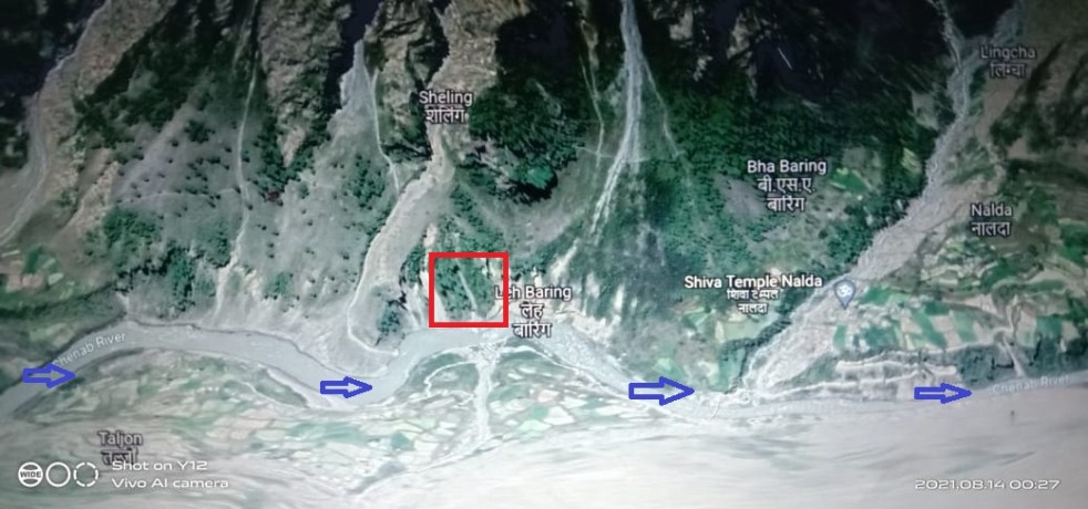
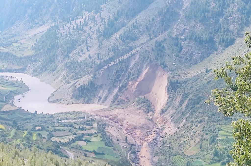
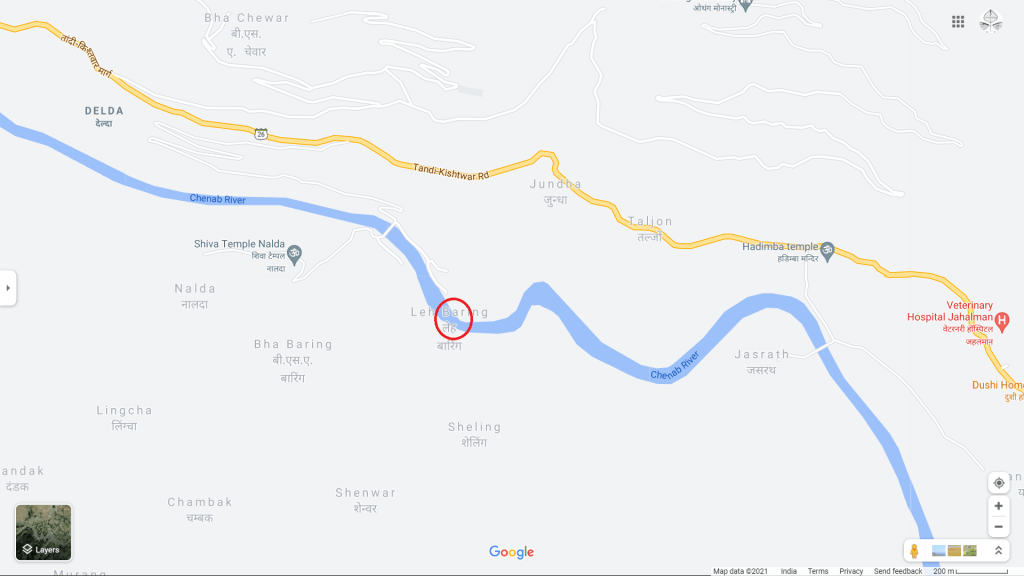
A huge landslide[i] took place near Nalda village under Udaipur tehsil in Lauhl Spiti blocking the Chenab river flows in early hours of August 13, 2021. The exact location seems to be the left bank of Chanab River at Leh Baring site just upstream of Nalda Village Bridge and opposite Jundha village. The Tanda-Kishtwar NH 26 runs along right bank of the river.
The incident occurred when huge portion of hill slipped into Chenab blocking the entire channel completely. Within hour, the formation of Landslide Lake started submerging huge part of areas upstream.


Google map, Google earth/3D images of the landslide location.
As the water level increased, low lying agricultural fields and some homes in Jundha, Taljun, Jahalman, Halling villages on right bank and Jasrath, Lomach villages on left bank were flooded.
The damming of river also created a threat[ii] to about 11 villages along the river. Seeing their homes, farms drowning in lake waters, the Jasrath, Jundha villagers moved to safer locations.
The district administration sought help[iii] from Army experts to conduct an aerial survey to channelise the flow of water in time before it could lead to a major disaster in the region.
A local is briefly describing the incident, its impact and threats in this video[iv] by The Tribune newspaper. Another The Tribune video[v] shows the terrain, glimpse of aerial survey and flooded houses. A video[vi] by Punjab Kesri newspaper shows the water channel flowing over blockage from right side which had lower height as debris mass fell on the left bank.
As on August 14, 10:00 am, it seems major part of debris mass has been washed away restoring Chenab to its usual course.
Latest update by The Tribune reads: State Disaster Management Director Sudesh Kumar Mokhta said Tarang and Jasrat villages were hit due to the floodwater. 4 houses in Tarang village were submerged, 5 cowsheds, a sheep and a calf were also washed away, and 30 bigha of agricultural land was inundated.
After a couple of hours, the river started to flow over the landslide. Over time the temporary lake size reduced and ultimately the river started flowing normally. Lahaul-Spiti Deputy Commissioner Neeraj Kumar said the situation was under control now. Evacuated people had been accommodated at a safe place and a team of experts would visit the area to assess the cause of the landslide and recommend necessary precautions.
This is 8th big landslide incident reported this month in the state.
According to Dave Petley: The failure is clearly defined[vii] by two existing joints or faults meeting at a c.90 degree angle.
Google Earth imagery shows scars of several landslips, landslide along the river in the past. The incident reveals how vulnerable is Chenab valley to such disasters where series of hydro power projects are planned on Chenab and key tributaries like Meyar, Chandra, Bhaga rivers.
The site of the proposed 102 MW Rashil hydro project lies about 6 km upstream to the landslide lake site. Currently there is 4.5 MW Thirot hydro project in operation on a right bank tributary of Chenab about 7 km downstream. The other proposed hydro projects can be seen in the map below.

Bhim Singh Rawat (bhim.sandrp@gmail.com)
END NOTES:
[i] https://twitter.com/EndangeredHimal/status/1426054537517821963?s=20
[ii] https://twitter.com/HimachalW/status/1426075989436555268?s=20
[iii] https://www.tribuneindia.com/news/himachal/video-landslide-blocks-flow-of-chenab-in-himachals-lahaul-spiti-11-villages-run-risk-of-being-submerged-297095
[iv] https://www.youtube.com/watch?v=odJejuIVkc4
[v] https://www.youtube.com/watch?v=GkRrGVR7oW0
[vi] https://www.youtube.com/watch?v=DzbdFVz3Lgs&t=14s
[vii] https://blogs.agu.org/landslideblog/2021/08/13/nalda-1/
