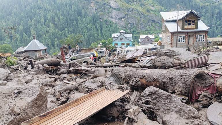
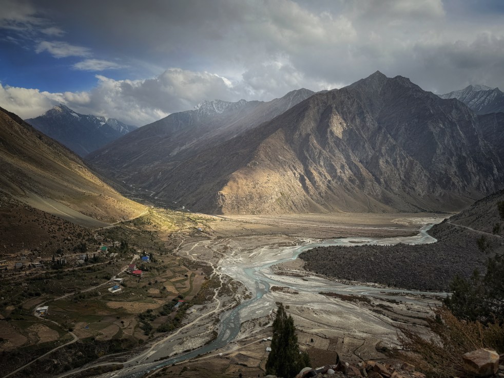
Collapsed Bridge: Bride and Groom wait on the banks of flooded Jahlma even as farmers carry their harvests on their backs Photo: Govind Phurpa
“The sun was so hot, we knew the floods would be coming.” Says Jagdish ji, resident of Lindur village in the Lahaul Himalayas.
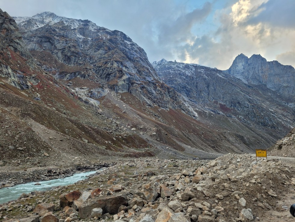
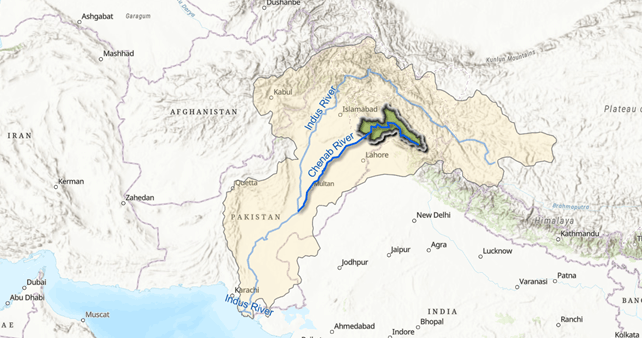
His home and fields are adjacent to a glacial stream called Jahlma Nallah which shoots from the Pir Panjal range to meet the Chenab River below. And just as he predicted, on the afternoon of 29th June 2026, like the past five years[1], Jahlma Nallah flooded and roared. In a matter of minutes, the thin flow transformed into a terrifying, brown debris-laden force. The sludge raced towards Chenab and nearly blocked the river by the brute force of water and debris it collected on its way. It cut off the connectivity of hundreds of villages.[2]
The flood surges kept repeating over the days and have not stopped entirely as I write this. They quieten in the late night and cool early mornings and gather force around noon, showing a distinct diurnal fluctuation. “Every year, one month of connectivity is being lost to the floods of Jahlma Nallah and its only increasing.” Says Govind Phurpa whose village is on the banks of Nallah. The flood surge happens as the sun is shining high and bright, in the absence of rain, snowfall or even cloud cover. There are no substantial glacial lakes upstream to cause Glacial Lake Outburst Floods (GLOF), unfortunately common in the Himalayas, nor is it a one-time happening. Thousands of farmers in a remote part of the Himalayas are suffering due to the roaring Jahlma Nallah as it blocks their only way to Manali and the markets for their vegetables.
And we honestly have no clue what is happening. Or why it is happening.
The repeated diurnal floods of Jahlma Nallah under the scorching sun have turned into a cyclic phenomenon that is dramatic, nearly unrecorded and needing rigorous studies. There are no global parallels to be found. Nor is it limited only to Jahlma. More and more nallahs in the Himalayas are flooding under the sun or very little rain.
This should be ringing alarm bells for government agencies and scientific bodies, but that is not so.
The Jahlma Phenomenon
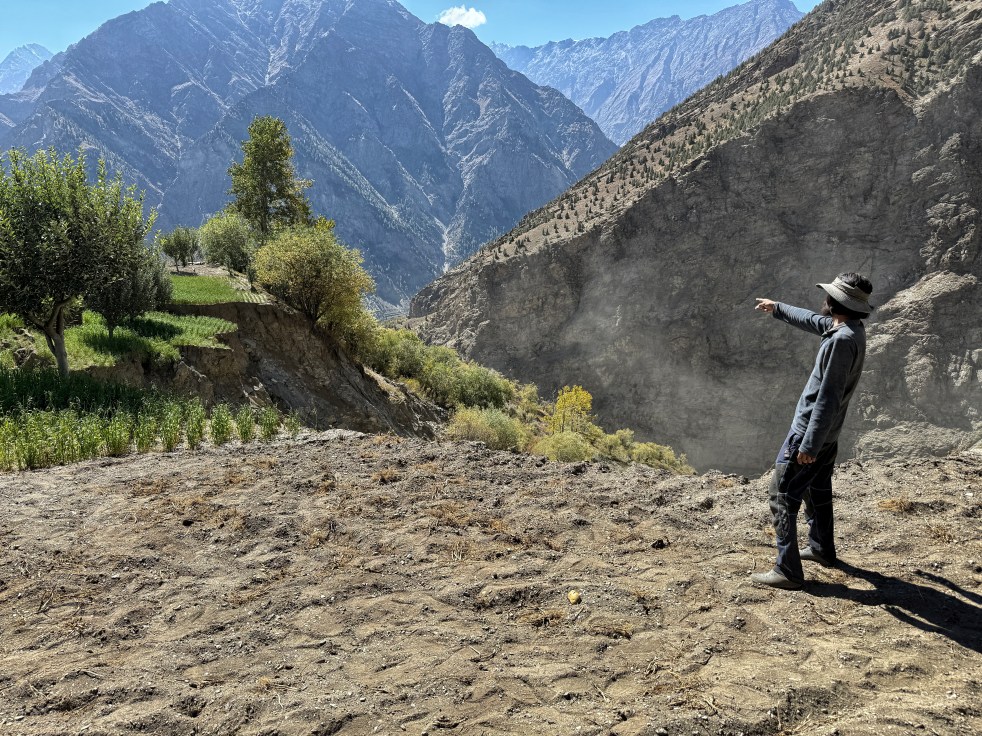
We were in Lindur village (3,328 metres elevation), on the banks of Jahlma Nallah in October 2024 and have been in touch with the local groups who have been sharing disturbing stories from around the Nallah. “Every year the Nallah bed gets about 5 metres deeper after the floods.” Says Jagdish ji, a resident of Lindur.
In July 2023, the Nallah flooded catastrophically and ended up blocking the flow of Chenab by forming a landslide dam where it meets the river. Lindur village also suffered land subsidence and cracks on houses. This was just after the Joshi Math land subsidence crisis, and the villagers were justifiably terrified. After prolonged protests, the administration appointed IIT Mandi and the Geological Survey of India (GSI) to understand the situation.

The Dec 2023 GSI Report, ‘A Note On Preliminary Post Disaster Study of Ground Cracks and Subsidence in Lindoor Village, Lahaul and Spiti District,’[3] linked the subsidence with repeated seismic activity in the region, infiltration of water in the cracks, and steep slopes “made up of loose, unsorted debris materials.” It recommended sealing the cracks and relocating Lindur village.

The Dec 2023 IIT Mandi Report, ‘A Preliminary Investigation Report on the Subsidence Happening in the Lindur Village, Lahaul, Lahaul & Spiti, Himachal Pradesh,’[4] studied the subsidence in detail and it offers some shocking insights. By extrapolating the changes in temperature, precipitation and soil temperatures in Lindur, it paints a clear picture of a rapidly warming region with erratically changing precipitation, and melting permafrost which held the loose debris together, as the main reason behind subsidence. Permafrost is any ground that remains frozen for more than two consecutive years.

Above: Graph showing rapid rise in June and July air and soil temperatures from 1950–2023, based on data drawn from the IIT Mandi Report.
It said, “(land)displacement rapidly increases from the summer season until the beginning of winter, indicating that it is attributed to the thawing of permafrost during the summer.” “We observed the orientation of the cracks is towards the riverbed and sub-surface ice melting water flowing to the Jahlma nala river.” The authors later published their work in Nature in 2025 under the title “Investigating the First Case of Permafrost Degraded Subsidence in Lahaul & Spiti Region of Tethyan Himalayas,”[5] reporting a high rate of subsidence to the tune of 7.914 cm/year and pinpointing the source as melting permafrost “permafrost melt induced subsidence.”
See our detailed report here: Climate Change, Jahlma Nallah and Lindur.

It established that the region is surrounded by rock glaciers: a mass of rocks and boulders holding on to an ice core, and in turn held together by networks of ice. Rock glaciers, an important storehouse of water, are supposed to be more climate-resilient than clean ice glaciers because the ice is insulated better.[6]
An active rock glacier can be visualized as a river of rocks moving gradually through its melting ice. While receiving less attention than clear-ice glaciers, rock glaciers are being discussed more now. Some seasonal discharge, especially during afternoons, is observed in them due to thawing of permafrost. But all this is a gentle picture.
What is happening in Jahlma Nallah is much more intense than a slow-creeping rock glacier or a gentle thawing of permafrost. It is a violently roaring sludge of water, sediment and rocks which routinely destroys the downstream. Neither the IIT Mandi Report nor the GSI report concludes that the unique floods of Jahlma are permafrost induced. In fact, three independent scientific outputs: the two 2023 field reports plus the 2025 paper have now studied this mountainside, and none of them address the Jahlma phenomenon that is cutting off villages and destroying harvests. But it is high time that the issue is studied and steps are taken for the safety of the mountain and the thousands of affected residents.
Discussion with the author of the IIT Mandi Report
Dr. Dericks P. Shukla from IIT Mandi[7], and the lead author of the IIT Mandi report, discussed the Jahlma Phenomenon with me. He and his team have mapped more than 2,000 glacial lakes in the Himachal Himalayas.
He says, “The exact causes behind the scale of flooding in Jahlma Nallah are not clear. In the absence of a glacial lake, the massive discharge of the flood is significant. One of the reasons could be thin debris covering the ice, which is not insulating enough, causing enhanced melting.”
He further says, “One side of Jahlma Nallah has rock glaciers, the other has debris-covered glaciers. The villagers often climb up to monitor the cracks, and there are cracks as wide as 2 feet, with a depth of 20 feet near the glacier, they say.”
“Does climate change have anything to do with this?” I ask. “Most certainly. We have analyzed consistently increasing air and soil temperatures. Precipitation is changing entirely, with less snowfall in the early winters and more precipitation falling as rain and not snow. The slopes here are steep and made of meta-sedimentary rocks which are amenable to erosion. When water in the rock glaciers melts, it becomes a lubricant for this eroded debris and increases its speed over the steep slopes. But we need gauging stations for water and silt on the Nallah to know what’s happening. I have seen such happenings in the Bhaga Basin also.”
“Which agency do you think is equipped enough to understand and respond to this situation?”
“Any agency which has hydrological knowhow and equipment for one. Like the Central Water Commission.” He says.
What does the science say
Globally, some papers out of the Alps recently have started describing permafrost warming toward its melting point, carving channels through itself as it goes, and letting water out not steadily but in turbulent, unscheduled pulses or surges: an active rock glacier discharging through its own internal channel network. According to Marcer et al. (2019),[8] “destabilized” rock glaciers are characterized by a significant acceleration that can bring the landform to abnormally high velocities; a warmer climate may trigger destabilization as increasing temperatures cause permafrost degradation of the rock glacier. Although the study talks of landform destabilization by permafrost melting, it does not report any floods caused by the same as in the case of Jahlma.

A 2018 study, Jones et al.,[9] talks about the global hydrological importance of rock glaciers as water stores, in fact highlighting their resilience in the face of a warming climate.
In more recent hydraulic research in 2026 Seelig[10] describes channels forming within rock glaciers that can enhance water transport, accelerate permafrost thaw, and trigger debris flows and thermokarst-related outburst hazards (thermokarst being the depression caused by the thawing of ice-rich permafrost.) It also describes temporary lakes forming on the surface of rock glaciers which can burst and cause floods downstream: an interesting lead to follow for Jahlma, though the diurnal flow fluctuations this research documents are not linked in it to sudden, destructive floods of Jahlma’s scale.
The closest comparable case in the Himalayas we found is Nepal’s Lhotse Glacier, where Rounce, Byers, Byers and McKinney (2017)[11] recorded outburst floods, without a lake, from the same debris-covered ice body in consecutive years. However, the distinct diurnal nature of flooding is absent in both examples above. The glacial floods in rivers of the Alps and North America in summers are documented, but they do not roar and bring an immense amount of debris with them.
Jahlma’s consecutive flooding for the past five years is running longer and more frequently than anything published on this mechanism. In the absence of a gauge station, we cannot talk in discharge numbers, but the visuals show the massive scale of the flood. And the only response so far has been reactive, with none of the instrumented monitoring. There is no automated weather station in Jahlma Nallah, no discharge gauge. Almost all the weather data used by the studies has been extrapolated from distant stations. The Scientific Reports (Nature) paper underlines the “importance of more detailed studies into the interaction of climatic, geological and hydrological factors that drive permafrost thaw and land subsidence in the Indian Himalayas.”
Affecting the one precious growing season
The issue here is not of one subsiding village alone. It is of several villages downstream from Lindur like Jahlma, Jasrath, Jobrang which get flooded during their peak harvesting time when Jahlma Nallah roars. The bridge across Jahlma Nallah, part of the SKTT road, connects hundreds of villages [12]with Manali through the Atal Tunnel. When Jahlma Nallah causes the bridge to collapse, like it has now, it means losses of immense proportions to these remote communities. The cold region has only one growing season, and the precious cauliflowers, lettuce and peas harvested now will wilt in a matter of days if they do not reach the market. The villagers from Pangi Valley, over one hundred kilometres away from Jahlma Nallah, have written to the BRO to repair the Jahlma bridge and save their harvests.
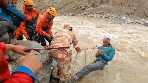
“You can see a line of trucks and tempos laden with vegetables, stranded on the banks of Jahlma Nallah.” Says Jagdish. “In the absence of a bridge, we were using a zipline installed by the administration to cross the nallah. It was very scary.”
Rahul Rajput from Lindur says, “The administration says that it will be 20 July at the minimum for the bridge to open. This will mean immense losses to the farmers.”
Administrators and politicians of Lahaul, like MLA Anuradha Rana, try to address these symptoms by repeatedly repairing roads, rebuilding bridges, and desolately talking about compensation and relocation of the residents of Lindur. The Border Roads Organisation has been called every year for the past five years to repair the bridge or road washed away in the flood. The problem with Jahlma Nallah is systemic, and it needs focused studies, conclusions, and long-term solutions.
Govind Phurpa, tells me of a marriage party which had to get down from their cars when confronted by the broken bridge. The bride and groom walked across sludge and waited on the other side for any transport available to get home. So did the guests. A severely ill old woman was placed inside the arm of a JCB excavator to be lifted across the Nallah.

“We built a Kuhl (irrigation channel) from the Jahlma Nallah just last year to irrigate our fields. I can only see rubble in its place now.”
The bridge across the Nallah collapsed in the last week of May. “It has been hammered by floods the last five years. This year there were landslides from Jahlma repeatedly. The foundations just gave way,” says Rahul. Now the villagers upstream are concerned that the backwater and debris of Jahlma is threatening the Jobrang bridge on the Chandrabhaga (Chenab).
Deputy Commissioner and Chairperson of the State Disaster Management Authority, Kiran Bhadana, IAS, told reporters that floods in the rivers and streams of the valley have intensified because of glacial melt.
Jahlma Nallah is not alone
In 2025, we put together a list of nallahs that were in the eye of the storm when it comes to floods and losses of life and property, and which need long-term approaches.[13] Jahlma Nallah was on that list. A similar situation is seen in nallahs like Shansa, Karpat and Jispa in Lahaul. Dhondhal Nallah in Miyar Valley faced exactly similar flash floods in June in the absence of rain. The bridge in this remote region too was washed away.

Trilok Thakur, Chairperson of the Pangwal Ekta Manch, Pangi tells a similar story. Pangi is a remote valley in Himachal between the Pir Panjal and Zanskar ranges with Chenab flowing through it. Its connectivity to the outer world is through 2 vulnerable roads, one of which is supposedly the ‘most dangerous roads in the world’.[14] Mr. Thakur says, “In forty years of my experience, I have not seen nallahs in Pangi flood like this without rain. Till about 10 years back, we walked from Kilar to Sach Pass over the mountains from April to October every year. We used to see massive glaciers on the way. The clear glaciers are all but gone now. The road has become difficult because of the flooding rivulets in June- July itself without rain. Our bujurg (elders) are aghast. Nallahs don’t flood without rain.”
Jahlma is not the only Nallah flooding in the sun. We may have several such across the Himalayas.

Governance Response?
How is the administration responding to increasing challenges posed by climate change? A source who has seen and experienced the workings says, “Departments just work in silos. Under the National Disaster Management Authority, the Himachal State Disaster Management Authority (SDMA) was supposed to finalize two important projects: the National Glacial Lake Outburst Floods Risk Mitigation Programme (NGRMP) and the National Landslide Risk Mitigation Project (NLRMP). This was supposed to be a multi-agency coordinated exercise. The project discussions have been going on for three years and the agencies involved have sent all the necessary paperwork over and over again. But no project has been finalized for more than three years. Now the meetings have also stopped.”
But there is a very urgent need to understand the Jahlma phenomenon. Once the monsoons set in, the Himalayan region experiences further challenges in the form of landslides and cloudbursts, and it will be more difficult to understand this.
Band-aid measures are inadequate when the permafrost itself is thawing at great speed. The bridge across Jahlma lies in rubble, Pangi and Miyar valley experience repeated floods, sick patients cross Jahlma nallah in JCB excavators, and even the mighty Chenab creeps submissively around the massive silt brought down by the nallahs.
“My old house is so cracked that I am building a new house in Lindur now. I know it might not be a long-term choice. But what option do I have? Banaye to bhi mushkil, na banaye to bhi mushkil,” says Jagdish.
In the meanwhile, trucks and tempos laden with precious farm produce lay waiting on the banks of a Himalayan Nallah which floods when the sun shines.
Parineeta Dandekar, SANDRP
parineeta.dandekar@gmail.com
The report is a part of the River Ethnographies Project. Read the other reports here: https://mershoncenter.osu.edu/research/river-ethnographies
[1] 2021: https://sandrp.in/2021/08/14/landslide-dam-on-chenab-river-in-himachal-pradesh/
2024: https://www.youtube.com/watch?v=BPdH1YTwrC8
[2] https://www.ndtv.com/india-news/glacier-melt-triggers-flash-flood-in-himachals-lahaul-spiti-over-50-vehicles-stranded-11705121,
[3]Geological Survey of India (GSI), A Note on Preliminary Post Disaster Study of Ground Cracks and Subsidence in Lindoor Village, Lahaul and Spiti District, Dec 2023.
[4]IIT Mandi, A Preliminary Investigation Report on the Subsidence Happening in the Lindur Village, Lahaul, Lahaul & Spiti, Himachal Pradesh, Dec 2023.
[5]Shukla, D.P. et al. (2025). “Investigating the First Case of Permafrost Degraded Subsidence in Lahaul & Spiti Region of Tethyan Himalayas.” Nature.
[6] https://www.nature.com/articles/s41598-018-21244-w
[7] Founding Chairperson & Associate Professor, School of Civil and Environmental Engineering, IIT Mandi
[8]Marcer, M. et al. (2019). “Evaluating the Destabilization Susceptibility of Active Rock Glaciers in the French Alps.” The Cryosphere, 13, 141–155.
[9]Jones, D.B., Harrison, S., Anderson, K., Betts, R.A. (2018). “Mountain Rock Glaciers Contain Globally Significant Water Stores.” Scientific Reports, 8, 2834.
[10] Seelig et al (2026) “Preferential flow paths in active rock glaciers” Earth-Science Reviews
Sailer et al. (2023), “The Role of Thermokarst Evolution in Debris Flow Initiation,” Natural Hazards and Earth System Sciences, 23, 2547 — documents a thermokarst lake outburst triggering a debris flow on an Austrian rock glacier.
[11]Rounce, D.R., Byers, A.C., Byers, E.A., McKinney, D.C. (2017). “Brief Communication: Observations of a Glacier Outburst Flood from Lhotse Glacier, Everest Area, Nepal.” The Cryosphere, 11, 443–449.
[12] Junda, Nalda, Mooring, Thirot, Kishori, Triloknath, Shakoli, Udaipur, Chimret, Tingret, Mangran, Salgran and Tindi
[13] https://sandrp.in/2025/09/01/vulnerable-nallahs-in-the-himalayas-need-urgent-attention/
[14] https://www.bbc.com/travel/article/20160401-a-perilous-ride-to-a-remote-valley