
What lessons emerge if we analyze the audit reports on irrigation sector for 2018? In this blogpost, we take an overview of the audit findings of CAG reports of Irrigation Sector that entered public domain in the year 2018. Continue reading “Will CAG Reports of Irrigation Sector in 2018 help improve performance?”
Tag: Ministry of Water Resources
Groundwater Governance: Why Dec 12, 2018 CGWA notification would be disastrous
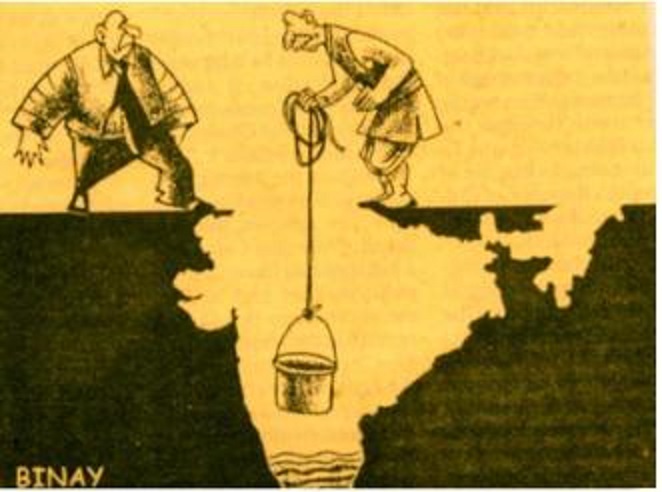
On December 18, 2018, the principle of Bench of the National Green Tribunal, called the CGWA (Central Groundwater Authority) notification gazetted[i] on Dec 12, 2018 as against “national interest”.[ii] The trouble is can we even expect CGWA and their parent, Union Ministry of Water Resources, River Development and Ganga Rejuvenation (MoWR for short) to get us out of the deep murky groundwater pit that we are in today?
NGT rightly asked, can just charging fees regulate groundwater? But it seems the MoWR cannot think in terms of a policy for groundwater, which is what the NGT had asked, not price tag list.
Continue reading “Groundwater Governance: Why Dec 12, 2018 CGWA notification would be disastrous”

AIBP: just a pack of unverifiable claims or worse?
Union Ministry of Water Resources (MoWR) has been claiming that Accelerated Irrigation Benefits Program (AIBP) is a success story of Modi government and some media stories[i] are happy to uncritically report those claims. If we take a close, objective look at the MoWR website[ii], we gather that the claims of success is just that: claim of the ministry. There is no evidence available on the ministry’s website or in the media report that support such claims to show that additional irrigation has actually been achieved. Continue reading “AIBP: just a pack of unverifiable claims or worse?”

MoWR report on “Assessment of E-Flows” is welcome, needs urgent implementation
A three member committee set up by the Union Ministry of Water Resources, River Development and Ganga Rejuvenation (MoWR for short) has submitted a report in March 2015, which makes welcome recommendation on “Assessment of Environment Flows”. These recommendations on Environmental Flows (E-Flows) need to be implemented immediately for better health of our rivers. The committee members include Dr Vinod Tare of Indian Institute of Technology Consortium (IITC), senior officials of Union Ministry of Environment, Forests and Climate Change (MoEF for short, it was represented by Dr Shashi Shekhar, Special Secretary in MoEF) and MoWR (represented by Dr Amarjeet Singh, Additional Secretary, MoWR). Sushri Uma Bharti, Union Water Resources Minister[1] and even the recent meeting of National Ganga River Basin Authority (NGBRA) on March 26, 2015[2], headed by the Prime Minister referred to this committee. Continue reading “MoWR report on “Assessment of E-Flows” is welcome, needs urgent implementation”

NGT Orders MAILY SE NIRMAL YAMUNA – WILL THIS LEAD TO A REJUVENATED YAMUNA?
Guest Blog by Manoj Misra (yamunajiye@gmail.com), Yamuna Jiye Abhiyan, Delhi
The National Green Tribunal (NGT) in a landmark judgment pronounced on 13 January 2015[1], has set an ambitious road map for a rejuvenated river Yamuna by 2017. Naming it as “Maily se Nirmal Yamuna rejuvenation project, 2017” the green court in the judgment spread over almost 100 pages has detailed steps necessary to achieve what all previous efforts have miserably failed. Continue reading “NGT Orders MAILY SE NIRMAL YAMUNA – WILL THIS LEAD TO A REJUVENATED YAMUNA?”

Know our rivers: A beginners guide to river classification
Who has not seen a river? And who has then, not been moved by a fierce emotion? The common man sees its life granting blessed form, the government or CWC engineer sees in it as a potential dam project, the hydropower developers a site for hydro project, a farmer his crop vitality, fisher folk, boatspeople and river bed cultivators a source of livelihood, the industry & urban water utilities view it as their personal waste basket, the real estate developer as a potential land grab site, a sand miner as a source of sand and the distraught villager his lifeline. In earlier days, film makers used to see it as site for filming some memorable songs, but these days even that has become a rarity.[1]
Rivers truly are a complex entity that invoke varied emotions and responses!
A river shifts in colour, shape, size, flow pattern of water, silt, nutrients and biota, in fact all its variables seem to change with time and space. The perceptions differ as one moves from mountains to plains to the deltas. The same stream displays a wide variance of characteristics that depend upon the land it flows through and the micro climate along its banks. Rivers many a times seem to mirror the local flavour of the land they flow through. Or is it the local flavour that changes with river flow? Clearly both are interdependent.
Today, as we talk of rivers, their rejuvenation and try to figure out their ecological flow and their health quotient , a good beginning to understand the existing rivers would be their classification modules. What defines a river? Which factors are used for their classification? How do we actually classify our rivers?
As far as the first of these questions is concerned, none of the official agencies have tried to define a river!
Possiby, the first post independence classification of river basins was attempted in 1949 by precuser institute of current Central Water Commission (CWC). Since then various organisations have followed their own methodology and criteria for basin classification and arrived at different numbers.

NIH (National Institute of Hydrology), Roorkee organises our 7 major rivers, that is the Brahmaputra (apparently this includes the Ganga and the Meghna), Godavri, Krishna & Mahanadi (that flow into the Bay of Bengal), and the Indus, Narmada & Tapi (which drain into the Arabian Sea) , along with their tributaries to make up the entire river system in our country.[2] This is clearly problematic and chaotic, since it leaves out vast areas of the country and the rivers that flow through them.
A quick look at the classification based on these 3 aspects –origin, topography and the basin they form.
- Based on Origin or Source
Depending on the origin or where they begin their journey from, there are the Himalayan (perennial) rivers that rise from the Himalayas and the Peninsular rivers that originate from the Indian plateau. The Himalayan rivers include the Ganga, the Indus and the Brahmaputra river systems along with their tributaries, which are fed throughout the year by melting ice and rainfall. They are swift, have great erosion capacity and carry huge amounts of silt & sand. They meander along the flat land, create large fertile flood plains in their wake and their banks are dotted by major towns and cities.
The peninsular rivers, on the other hand are more or less dependent on rain. These are gentler in their flow, follow a relatively straighter path, have comparatively less gradient and include Narmada, Tapi, Godavari, Krishna, Cauveri and Mahanadi rivers, among many others.
- Based on topography
The Himalayan Rivers flow throughout the year, are prone to flooding and include Indus and the Ganga-Brahmaputra-Meghna.
The Deccan Rivers include the Narmada and Tapi rivers that flow westwards into the Arabian Sea, and the Brahmani, Mahanadi, Godavari, Krishna, Pennar & Cauvery that fall into the Bay of Bengal.
The Coastal Rivers are comparatively small in size and numerous in number, with nearly 600 flowing on the west coast itself.
Rivers of the Inland Drainage Basin are centered in western Rajasthan, parts of Kutch in Gujarat and mostly disappear before they reach the sea as the rainfall here is scarce. Some of them drain into salt lakes or simply get lost in the vast desert sands.
Island Rivers Rivers of our islands: A&N islands & Lakshadip group of islands
- Based on basin formed
On the basis of the basin formed, our rivers are distributed into 7 river systems. The Indus River System originates in Kailash range in Tibet, and includes Zanskar, Shyok, Nubra ,Hunza (in Kashmir) along with Jhelum, Chenab, Ravi, Beas and Sutlej as its principal tributaries. In the Brahmaputra River System, it was earlier assumed that the Mansarovar lake is the source of the Brahmaputra river, however, now it is confirmed that Angsi Glacier is the main source (see: See: http://www.thehindu.com/news/international/china-maps-brahmaputra-indus/article2384885.ece). Most of the course of the river lies outside the country. In India it flows through Arunachal Pradesh and Assam, where it is joined by several tributaries. For more information on this river, see: https://sandrp.wordpress.com/2013/07/17/brahmaputra-the-beautiful-river-or-the-battleground/.

The Narmada River System comprises of the Narmada River that represents the traditional boundary between North & South India and which empties into the Arabian Sea in Bharuch district of Gujarat. Tapi river of the Tapi River System rises in the eastern Satpura Range of Madhya Pradesh and then empties into the Gulf of Cambay of the Arabian Sea, Gujarat. Its major tributaries are Purna, Girna , Panzara , Waghur , Bori and Aner rivers.
Also called the Vriddh (Old) Ganga or the Dakshin (South) Ganga, Godavari of the Godavari River System, originates at Trambakeshwar, Maharashtra and empties into the Bay of Bengal. Summers find the river dry, while monsoons widen the river course. Its major tributaries include Indravati, Pranahita, Manjira, Bindusara and Sabari rivers.
The Krishna River System includes Krishna river, one of the longest rivers of the country,that originates at Mahabaleswar, Maharashtra, and meets the sea in the Bay of Bengal at Hamasaladeevi, Andhra Pradesh. Tungabhadra River, formed by Tunga and Bhadra rivers, is one of its principal tributary. Others are Koyna, Bhima, Mallaprabha, Ghataprabha, Yerla, Warna, Dindi, Musi and Dudhganga rivers.
The Kaveri River System has the Kaveri (or Cauvery) river whose source is Talakaveri in the Western Ghats and it flows into the Bay of Bengal. It has many tributaries including Shimsha, Hemavati, Arkavathy, Kapila, Honnuhole, Lakshmana Tirtha, Kabini, Lokapavani, Bhavani, Noyyal and Amaravati. The Mahanadi of the Mahanadi River System, a river of eastern India rises in the Satpura Range and flows east into the Bay of Bengal.
Broader definition: Catchment area size
River basins are widely recognized as a practical hydrological unit. And these can also be grouped, based on the size of their catchment areas (CA). This easy to understand river system classification divides them into the following categories as tabulated below:
| River basin | CA in sq km | No. of river basins | CA in million sq. Km | % area | % Run off | % population |
| Major river basin | CA > 20,000 | 14 | 2.58 | 83 | 85 | 80 |
| Medium | 20,000<CA<2,000 | 44 | 0.24 | 8 | 7 | 20 |
| Minor (Coastal areas) | CA< 2,000 | Many | 0.20 | 9 | 8 | |
| Desert rivers | Flow is uncertain & most lost in desert | – | 0.1 | – |
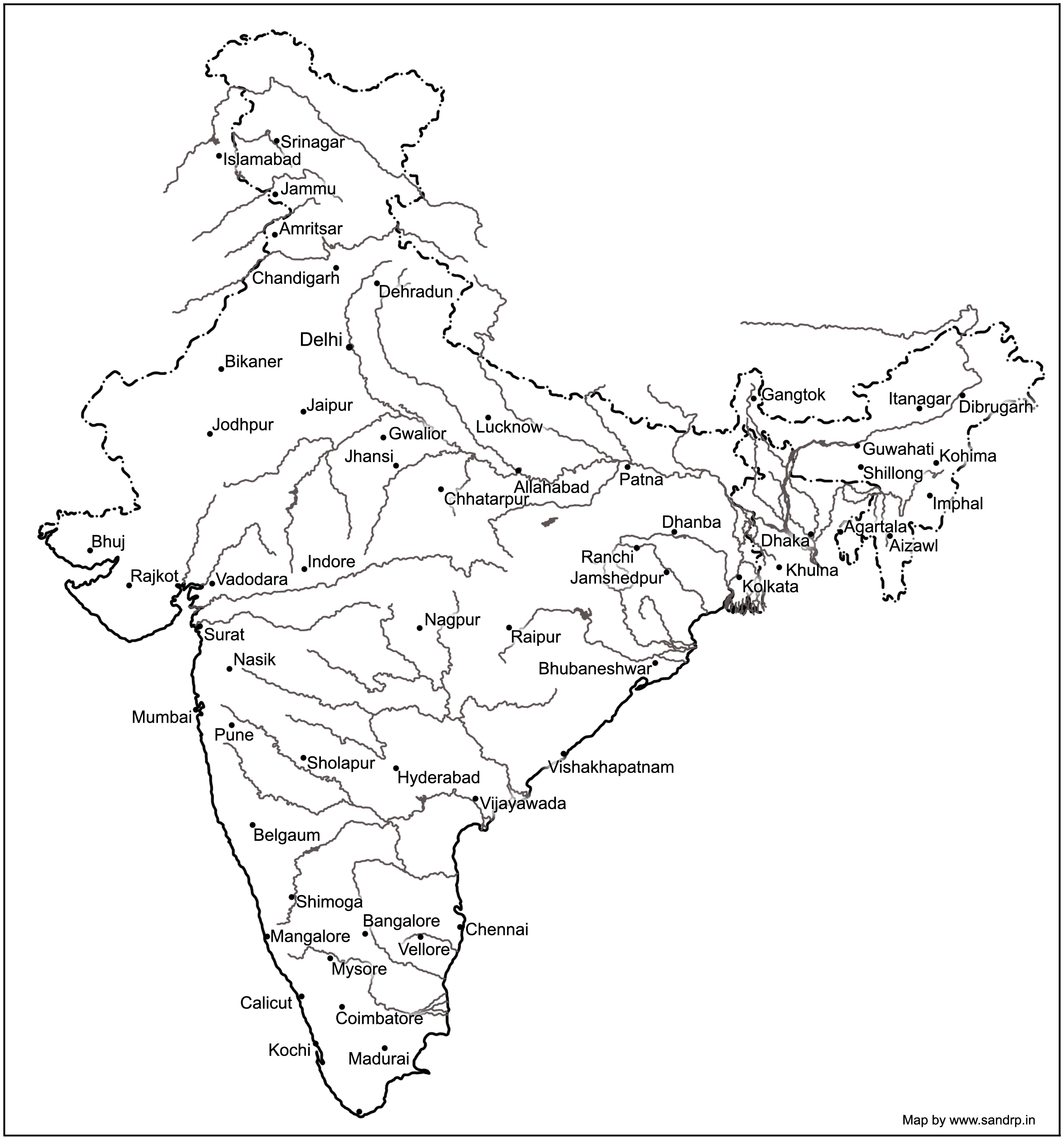
Major river basins include the perennial Himalayan rivers- Indus, Ganga & Brahmaputra, the 7 river systems of central India, the Sabarmati, the Mahi, Narmada & Tapi on the west coast and the Subarnekha, Brahmani & the Mahanadi on the east coast and the 4 river basins of Godavri, Krishna, Pennar and Cauvery, which takes the total to 14. The medium river basins include 23 east flowing rivers such as Baitarni, Matai & Palar. A few important west flowing rivers are Shetrunji, Bhadra, Vaitarna & Kalinadi. The minor river basins include the numerous, but essentially small streams that flow in the coastal areas. In the East coast, the land width between the sea and the mountains is about 100 km, while in the West coast, it ranges between 10 to 40 km. The desert rivers flow for a distance and then disappear in the desert of Rajasthan or Rann of Kutch, generally without meeting the sea.[3]
A need for details
Under India-WRIS (Water Resources Information System) project too, the river basin has been taken as the basic hydrological unit, but the country has been divided into 6 water resource regions, 25 basins and 101 sub basins, which are an extension of the earlier 20 basins delineated by CWC, as detailed in the ‘River basin Atlas of India’. [4] The details of the individual catchment area of these 20 river basins is tabulated here:
| S No | River Basin | CA (Sq. Km) | Major river | River Length, km |
| 1 | Indus (Upto border) | 321289 | Indus(India) | 1114 |
| 2 | Ganga- Brahmaputra-Meghna | |||
| a | Ganga | 861452 | Ganga | 2525 |
| b | Brahmaputra | 194413 | Brahmaputra (India) | 916 |
| c | Barak & others | 41723 | Barak | 564 |
| 3 | Godavari | 312812 | Godavari | 1465 |
| 4 | Krishna | 258948 | Krishna | 1400 |
| 5 | Cauvery | 81155 | Cauvery | 800 |
| 6 | Subernarekha | 29169 | Subernarekha | 395 |
| Burhabalang | 164 | |||
| 7 | Brahmani & Baitarni | 51822 | Brahmani | 799 |
| Baitarni | 355 | |||
| 8 | Mahanadi | 141589 | Mahanadi | 851 |
| 9 | Pennar | 55213 | Pennar | 597 |
| 10 | Mahi | 34842 | Mahi | 583 |
| 11 | Sabarmati | 21674 | Sabarmati | 371 |
| 12 | Narmada | 98796 | Narmada | 1312 |
| 13 | Tapi | 65145 | Tapi | 724 |
| 14 | West flowing rivers from Tapi to Tadri | 55940 | Many independent rivers | |
| 15 | West flowing rivers from Tadri to Kanyakumari | 56177 | ||
| 16 | East flowing rivers Between Mahanadi & pennar | 86643 | ||
| 17 | East flowing rivers Between Pennar & Kanyakumari | 100139 | ||
| 18 | W flowing rivers of Kutch & Saurashtra includes Luni | 321851 | Luni | 511 |
| 19 | Area of inland drainage in Rajasthan | 60269 | Many independent rivers | |
| 20 | Minor rivers draining into Myanmar & Bangladesh | 36202 | Many independent rivers | |
Note: 1. River Length is only for the main stem of the river, does not include tributaries, etc.
- Area of inland drainage in Rajasthan is not given in this reference, it has been arrived at by inference.
- Indus basin is constibuted by six main rivers: Sutlej, Beas, Ravi, Chenab, Jhelum and Indus itself. Some tributaries of this system form independent catchment in India (e.g. Tawi river in Chenab basin) as these confluence with the main river only in downstream of the border.
Of course these methods only classify rivers based on their physical & geographical attributes, their drainage area, river length, volume of water carried and tributary details. For a detailed study of a river, what is also needed is its ecological assessment. The methods for river classification may be varied and still evolving, but this information is fundamental to better understand and map the rivers that criss cross across the country.
And definitely a first step to try and understand our rivers!
Sabita Kaushal, SANDRP (sabikaushal06@gmail.com)
END NOTES:
[1] This blog is part of a series of blogs we plan to put up in view of the India Rivers Week being held during Nov 24-27, 2014, see for details: https://sandrp.wordpress.com/2014/10/15/press-release-india-rivers-week-from-24-27-nov-2014-first-irw-event-to-be-held-in-delhi/
[2] Rivers of India: National Institute of Hydrology, Roorkee
http://www.nih.ernet.in/rbis/india_information/rivers.htm#Peninsular
[3] India’s Water Wealth: KL Rao, Orient Longman, 1975
[4] River basin atlas of India, 2012: A report by Central Water Commission and Indian Space Research Organisation: http://www.indiawaterportal.org/articles/river-basin-atlas-india-report-central-water-commission-and-indian-space-research
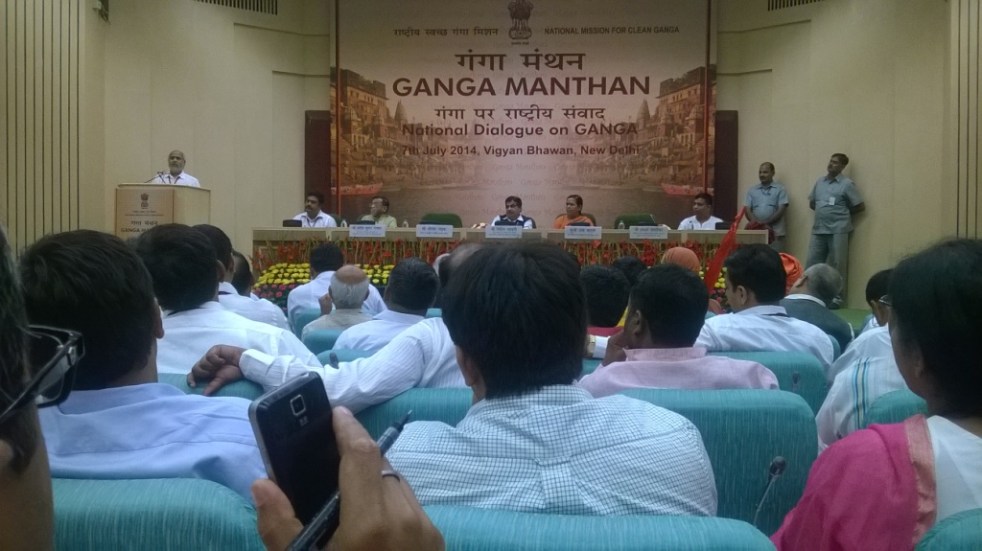
Will this Ganga manthan help the River?

The one day Ganga Manthan[1] organized by the National Mission for Clean Ganga on July 7, 2014 was described by Union Minister[2] Sushri Uma Bharti & Union Minister[3] Shri Nitin Gadkari as “Historical”. The Union Environment Minister, who has one of the most crucial role in achieving a rejuvenated Ganga, was supposed to be there, but could not come at any stage.
I attended the full day meeting with a lingering question: Will this help the river? Even some of the ardent skeptics said that Uma ji has emotional, spiritual and religious attachment with the cause of Ganga.
At the conclave attended by close to a thousand people, the story of how Ms. Bharti came back to the BJP party about a year back to work for the cause of Ganga, and how she was promised a year back that if their party came to power, Ganga will get a separate ministry and she its charge was narrated repeatedly by both Ms Bharti and Mr Gadkari at least twice. It was also stated that the government has the commitment, the will & all the money to make the Ganga clean (Nirmal) and perennial (aviral). There were also repeated statements by both ministers about the officials being so committed to the cause of Ganga. These, in essence, were the basic positive assets of this government to achieve Ganga Rejuvenation.
While it was good to see large gathering involving various sections of the society, including many independent non government voices, missing were some key stakeholders: Ganga basin state governments, farmers groups, Ministry of Urban Development, fisher-folk groups, boats-people representatives. Another key constituency missing was Ministry of Agriculture, since agriculture is major user of water & irrigation and responsible for water diversion and at the same time major non point source polluter through use of chemicals and fertilizers.
Rejuvenation does not mean just nirmal and aviral But if the task is Rejuvenation of River Ganga, are these assets sufficient? What exactly does Rejuvenation of River Ganga mean? There were no answers to this question at the meeting. The government did not even seem bothered about these questions. Are Nirmal and Aviral Ganga sufficient objectives to achieve Rejuvenation of Ganga? The answer is clearly no, for, even a pipleline or canal carrying perennial flow of water can claim that distinction. A rejuvenated river will need much more than that, but the government has nothing else to offer for a rejuvenated river.
Even for Aviral Ganga, the government had absolutely nothing to offer. In the information package shared with the participants, the only thing relevant to Aviral Ganga was the extended summary of draft “Ganga River Basin Management Plan” being prepared by consortium of seven IITs in collaboration with some 11 other organisations. This is led by Dr Vinod Tare of IIT Kanpur. While standing with Dr Tare and Rajendra Singh of Tarun Bharat Sangh at the lunch, I said, the problem with Ganga is not of technology[4], but of governance. Despite being a proud IITian myself, I have no hesitation in saying that IITs do not have expertise in governance issues, so how can the IIT Consortium help in fix a governance problem? Having read the full Draft Plan of the IIT consortium, it only further strengthens the view that it was wrong decision of Jairam Ramesh to give this task to IIT Consortium.
Agenda for further destruction As a matter of fact, while this government has yet to take a step that will truly help rejuvenation of Ganga, they have declared their agenda that will possibly further destroy the river. This was clear on June 6, 2014, within ten days of new government taking over when a PIB press release[5] announced, “Shri Gadkari said it is proposed to conduct dredging to provide a width of 45 meters and for a three (3) meters draft (depth) to enable transport of passengers and goods between Varanasi and Hoogly on river Ganga in the first stage of its development and eleven terminals are proposed to be constructed along the banks. He said barrages are proposed to be constructed at every 100 Kms.” This was a shocking and arrogant announcement. There is nothing in public domain about this Rs 6000 crores plan, no details as to what exactly is planned, where the barrages are planned, why are they needed, what are their environmental impacts, what are the social impacts, what are the riverine impacts, what is the cost and benefits, who will pay the costs and who will reap the benefits, where is public consultation….there is absolutely nothing in public domain and here is a nine day old government declaring such massive plan! By July 7, 2014, the PIB Press Release declared that the depth will now by 5 meters and not three announced earlier. The PIB PR now said, “He (Mr Gadkari) said barrages are proposed to be constructed at every 100 Kms on the river. Shri Gadkari said his Ministry has sent a proposal in this regard to World Bank for the development of Allahabad- Haldia corridor.”
The minister possibly does not know that there is just one barrage on the Allahabad-Haldia 1500 km long stretch, namely the Farakka barrage and Bangladesh had threatened India to take the matter about building this barrage to the UN! Moreover, that barrage, everyone accepts, has not even achieved the basic objective it was supposed to achieve, namely navigability of Kolkata port, but has had many other severe impacts.

At Ganga Manthan, Mr Gadkari dropped a bombshell[6] when he said this plan is already in advanced stage of appraisal with the World Bank! He said the government hopes to get Rs 4000 crores from the World Bank!! The World Bank has zero track record in achieving any clean river anywhere in the world, after spending billions of dollars every year. In India itself it stands guilty of destroying many rivers. A more inauspicious start to the Ganga Manthan possibly could not have been possible. At the Ganga Manthan itself, there was opposition to this plan, as The Hindu[7] has reported.But Ms Uma Bharti finds nothing amiss about this as was clear by her answers at the press conference. But what about at least some semblance of participatory democracy?
Business as usual at NMCG and NGBRA will not help In reality, this is not all. While this Manthan for Ganga Rejuvenation is happening, the NMCG and NGBRA[8] (National Ganga River Basin Authority) go on with their work in business as usual fashion. So in Varanasi, the Uttar Pradesh Jal Nigam is going about its task of floating and examining the bids for five-part sewer laying and Sewage Treatment Plants with the help of JICA money. In Kanpur, the effort to divert several streams to Pandu is going on. In Allahabad, “the draft final ESAMP sewerage works for sewerage districts” A & C could be found on the NGBRA website. In Patna, the World Bank is funding the sewerage projects of Pahari in Patna & river front development and the draft social and environmental impact assessments could be found on NGBRA website. All of this (except the Varanasi packages, which are funded by Japanese aid agency) is going on under USD 1 Billion World Bank Funded NBGRA project.
So the business as usual that is going on for 40 years is now going to help rejuvenate Ganga!
The NMCG announced that the Manthan, a “National Dialogue on Ganga”, was supposed “to facilitate interaction with various stakeholders”, “to discuss the issues & solutions to the task of Ganga Rejuvenation”, “to prepare road map for preparation of a comprehensive plan”. The website said the Ganga is “holiest of Rivers”, “purifier of mortal beings” & “living godess”, but now “seriously polluted” and in “extreme environmental stress”.
Where is the dialogue? However, the way the meeting was organized, there was essentially no dialogue. After the inaugural plenary session, the participants were divided among four groups: 1. spiritual leaders, 2. environmentalists, NGOs, water conservationists, 3. scientists, academicians and technocrats, and administrators; 4. public representatives.
I went to the second group and there, when someone pointedly asked, if there is any representative of the government present, there was no response! In fact it was positively shocking that the first panel member that spoke in this group was Dr Arun Kumar of AHEC (Alternate Hydro Energy Centre) whose work on Ganga basin cumulative impact assessment is so discredited that even the official agencies like the Expert Appraisal Committee of MoEF, the Inter-ministerial Group on Ganga, the Expert Body appointed by the Supreme Court after the June 2013 flood disaster and the Supreme Court itself has criticized it or found it unreliable. NMCG has discredited itself by appointing such a person to give an overview of achievement of Ganga Action Plans.

Ms Bharti apologized in the beginning for hurriedly-called meeting. But the least she could have ensured was a credible process that will ensure that the officials have to show application of mind to the various suggestions received and conduct of the meeting in credible and confidence inspiring way. But the meeting did not inspire confidence that there will be any credible process that will ensure that there is application of mind to the various inputs given. Many of the participants did not have any opportunity to speak.
Recommendations for the government on Ganga
1. Make an honest effort to learn from the past. Why have the efforts of last 40 years since the passage of Water Pollution Act 1974 not helped Ganga? Similarly why did the GAP I, NRCP, GAP II, NGBRA not helped make the Ganga clean (nirmal) or perennial (aviral)?
2. Understand & recognise that Ganga is a river and what are the essential characteristics of a Ganga that it needs to rejuvenate it as a river. At Ganga Manthan, in post lunch session in the room where the fourth group for public representatives was sitting, I was sitting next to an official of Ministry of Water Resources and I casually asked him does the ministry of water resources understand what is a river? He first said yes, but when I said you are only dealing with water and nowhere in your work have we seen any value for rivers, he said ok, but we can do it in collaboration with MoEF. The trouble is, even MoEF does not understand rivers. [It was also strange to see in this session Mr Madhav Chitale (former Water Resources Secretary) describing Tennessee Valley Authority of 1933 as an effort to clean the river! Such misrepresentation going unchallenged was shocking.] It should be remembered that it is this ministry of water resources through which Sushri Uma Bharti has to achieve a rejuvenated Ganga!
3. Ganga is not 2525 km long river: We kept hearing this sentence that Ganga is 2525 km length of river and Mr Bhurelal in fact said we need to limit ourselves to discussing how to make this stretch clean. The trouble is, if the tributaries are not healthy rivers, how can the main stem of Ganga be rejuvenated? As Manoj Misra of Yamuna Jiye Abhiyaan said, Ganga is not 2525 km, but much more than 25000 km including all the tributaries, as Yamuna is not 1400 km long but 13470 km long including all the tributaries.
4. Ganga in Mountains: Learn the lessons from Uttarakhand disaster, that affected the headwaters of the Ganga river. The Expert body constituted by the MoEF under Dr Ravi Chopra has a lot to say there. Revisit all the existing, under construction and planned projects in the whole basin.
5. Farakka barrage: It is well known that the barrage did not serve the basic purpose it was created for, namely making the Kolkata port navigable. But it has created such havoc in upstream and downstream for millions of people that some of the Bihar MPs of previous Lok Sabhas talked about decommissioning of the barrage in the debate on Ganga. But this government wants to make many more barrages! First do a post facto assessment of the Farakka barrage and its current costs, benefits and risks.
6. Formulate an Urban Water Policy: The footprint of the urban areas on the rivers is increasing in multiple ways, but we have no urban water policy. Some key elements that such a policy will include: Reducing transmission & Distribution losses, water audit from RWA upwards, Rainwater harvesting, decentralised and eco-friendly ways of sewage treatment and recycle, groundwater recharge and bottom up management, demand side management, protection of local water bodies, protection of riverbeds, floodplains and forest areas & democratisation of the Urban water utilities. As the working report for the 12th Five Year Plan on Urban water said, no Urban areas should be allowed to have external water till they exhaust their local potential, including recycling of the treated sewage and other demand side and supply side options. The footprint of the urban areas will increase exponentially if we do not urgently on this front.
7. Agriculture is the biggest user of water and our government encourages use of chemicals and pesticides in agriculture. Most of these chemicals end up in water bodies including rivers. If we do not want our rivers to be dumping grounds for these chemicals, the government should encourage organic farming. Similarly, in stead of encouraging water intensive cropping patterns and methods, government needs to encourage low water use crops and methods like System of Rice Intensification (SRI). SRI is applicable for many crops and can reduce water need by upto 50% and yet increase yields and incomes of farmers. But the government has shown no interest in encouraging SRI. Such methods can free up a lot of water for the river. Similarly, under the influence of powerful sugar lobby, we are producing more sugarcane and sugar than we need and than we are exporting the same at subsidized rates! So essentially we are exporting water at huge subsidized rates, that too from Ganga, but we have no water for the river!
8. Irrigation is the biggest user of water. At Bhimgoda, Bijnor and Narora barrages, we are diverting almost all the water in the river for irrigation. But we have no water for the river. If we change our water resources development and agriculture policies, it is possible to restrict these diversions to 50% and release the rest for the river. We need to review all this.
9. The IIT consortium report is seriously flawed and is not likely to help the river.
10. We need to define the path of the riverbed or right of way for the river, based on its need to carry 100 year flood and silt. In absence of such a defined space for the river, there are a lot of encroachments. There is also no river regulation law to regulate this riverways land. This is urgently required.
11. Our Pollution Control Boards and related mechanism is not known to have achieved a single clean river or nala in 40 years of their existence, anywhere in the country. This is because of the completely non transparent, unaccountable, non participatory and exclusive bodies, where people whose lives are affected by the pollution have no role. A complete revamp of this is required to make its management inclusive from block level upwards, and answerable to the local people through clearly defined management system.
12. One of the major reason for the failure of the GAP, NRCP and NGBRA is that their functioning is top down, with absolutely no clearly defined norms for transparency, accountability, participation and inclusive management. Unless we completely change this, no amount of money, no amount of technology, no amount of infrastructure or institutions is going to help the Ganga. We need management system for every STP, every freshwater plant, every city and town, every 3-5 km of the river, every tributary and so on. At least 50% members of the management committees for each of them should be from outside the government, including community members. The people whose lives and livelihoods depend on river including fisherfolk, boatspeople, river bed cultivators, local sand miners, communities depending on river for different water needs have to be represented in such management system. That will also create an ownership in river rejuvenation effort. This is also applicable to urban areas and all the tributaries.
13. This is also true for our environmental governance of dams, hydropower projects, flood control projects, water supply projects, and so on. Today there is no credible environmental management at planning, appraisal, construction, operation or decommissioning stage.
14. River of course needs water. Urgently. Chart out a road map to achieve 50% of freshwater releases from all dams and barrages in two years. Also no sewage water or effluents entering the river in two years.
In the concluding plenary, after listening to the reports from four groups (there were a lot of positive and useful suggestions there), Ms Uma Bharti and Mr Gadkari said that they won’t make any announcement today but they will ensure that the good suggestions that have come will be given to the decision-makers who will create a road map. This is very vague and unconvincing process with no credible transparency. The least the ministers could have assured is a confidence-inspiring process that would transparently ensure that the decision makers have applied their minds to the suggestions. But even that was not promised.
Despite this seemingly gloomy outcome, considering that the NMCG has invited[9] suggestions even after the meeting, I am going to send this blog link to them and wait for their response! Ganga definitely needs a lot of sewa from all of us if the river is to have any better future.
Himanshu Thakkar (ht.sandrp@gmail.com)
END NOTES:
[1] For details, see: http://www.gangamanthan.in/
[2] Union Minister of Water Resources, River Development and Ganga Rejuvenation
[3] Union Minister of Road Transport & Highways, Shipping, Rural Development, Panchayati Raj, Drinking Water & Sanitation
[4] It’s worth noting here that Mr Gadkari seems to have abiding faith in technology, he said that this is an age of technology and there are technological solutions for all problems! This possibly shows where we are heading!
[5] Title: “Development of River Ganga for Tourism, Transport and to make it Environment Friendly”
[6] PIB PR on July 7, 2014; http://www.business-standard.com/article/current-affairs/ganga-clean-up-may-cost-rs-80-000-crore-114070700889_1.html
[7] http://www.thehindu.com/news/national/plan-for-navigation-in-ganga-basin-questioned/article6187510.ece
[8] http://moef.nic.in/sites/default/files/ngrba/index.html
[9] NMCG would welcome any further suggestions, ideas, write-up etc from all interested person through email: info@gangamanthan.in
[10] Also the views of NGBRA expert member B D Tripathi that also questions Dr Vinod Tare and IIT consortium report on Ganga: http://www.thenewsminute.com/technologies/72
http://www.thenewsminute.com/technologies/71: Ganga clean up more about governance than technology: Himanshu Thakkar
http://www.thenewsminute.com/technologies/70: Experts flay Uma Bharti’s Ganga Manthan clean up plan

India Water Week 2013: Another evidence of MoWR working like a big dam lobby?
India Water Week 2013
Another evidence of MoWR working like a big dam lobby?
It is well known that India’s water resources ministry in India and its offices like the CWC and NWDA work more like a big dam lobbies, now increasingly working for the private sector business organisations, rather than the communities that they are supposed to serve. If an additional proof was needed, it has become available in the form, content, inclusion and exclusion of the concerned groups in its India Water Week being organised at Vigyan Bhawan in Delhi during April 8-12, 2013.
Ministry of Water Resources, Govt of India, along with organisations likes Central Water Commission, Central Ground Water Board, National Water Development Agency, some related ministries of Govt of India are collectively organising India Water Week during April 8-12. Sponsors of the week long show include some state dam and irrigation organisations to private sector business organisations like L&T and Jain Irrigation and also hydro power company from neighbouring country like the Punatsanchu Hydropower Authority of Bhutan. The theme of this year’s event is: “Efficient Water Management: Challenges and Opportunities”.
The official website (http://www.indiawaterweek.in/) says about the event, “Ministry of Water Resources, Government of India have established a key annual policy and technology showcase event… The event is targeted at International and National audience comprising of policy planners and technologists involved with water resources management in all key sectors of economy”.
Further elaborate statement (http://www.indiawaterweek.in/html/aboutus.html) says something different, “the Ministry of Water Resources, Government of India have made a comprehensive plan for creating a unique platform for deliberating the issues involving all stakeholders including decision makers, politicians, researchers and entrepreneurs of water resources not only from Indian arena but also from International avenues”. So all stakeholders involved in India water sector are supposed to be participating in this. However, we see no sign of any scope for the most important stakeholders: farmers, women, tribals, fisherfolk or even critical voices from civil society. The organiser claims to have made efforts “for effective civil society involvement too in the consultative processes of India Water Week 2013”. We have not noticed any, but that must be our fault.
The registration fee: Who can afford? The fee is nominal: only Rs 8000/- per participant. Needless to add, the stakeholders have to make their own travelling and staying arrangements, not included in this registration fees. 99% of Indians cannot afford such fees, but we guess its not for them. The trouble, however, is that this is happening at public expense by the government of India agencies, in the name of people of India, most of whom cannot even participate it it.
The programme page of the official site (http://www.indiawaterweek.in/html/programme.html) opens with a telling statement: “Keeping in view the priorities of the Government of India towards making optimal usage of all the available water resources”. So, very interestingly, whatever the organisers are doing, is not only on behalf of water resources ministry and its subordinate offices, but the entire Government of India.
Commodification of Water That the event organisers equate water resources with water is apparent when they say: “the water resources are a single entity, which are shared by all the above sectors out of a common pool of utilizable water”. They simple do not seem to understand that water is an ecological good, embedded in the ecological entities and when water is taken out, it has consequences.
Enlightening definition of wide consultations What the Ministry understands by wide consultations is abundantly clarified by them. The Programme page says: “The theme for the event has been decided after wide consultations amongst the national and international level stakeholders and workers in the field. You can view the deliberations here.” When you click to view the deliberations, it takes you to: http://www.indiawaterweek.in/pdf/programme1.pdf. This page contains minutes of the meeting held on April 30, 2012, chaired by the Central Water Commission Chairman. It actually includes the list of 15 participants, and no prize of guessing that all, each one of them happen to be government officers! It is thus quite enlightening to know what is the meaning of wide consultations. Obviously those mortals who are not government officials have no place in the consultations.
National Water Policy It is learnt from the statements of the Union Water Resources Minister Harish Rawat that he will launch the new National Water Policy from the inaugural function on April 8, 2013. Here it should be noted that people of India have yet to see the final version of the new NWP, but those who pay the registration fees, will be first to see it! More importantly, it may be recalled that majority of the states that participated in the National Water Resources Council meeting held on Dec 29, 2012 opposed the policy. If one were to go by the latest draft available on MWR website (see: http://mowr.gov.in/writereaddata/linkimages/DraftNWP2012_English9353289094.pdf), the new policy is likely to advocate treated water as an “economic good”, encourage private sector to be service provider in public private participation mode and largely support business as usual practices rather than learn any lessons from past experiences. For more detailed comments on the new NWP draft, see: https://sandrp.in/wtrsect/Letter_to_NWRC_on_New_National_Water_Policy_Dec2012.pdf.
Buyer Seller meet for Dam Rehabilitation and Improvement Project There is an interesting session in the event with above sub title. DRIP is a World Bank funded programme managed by CWC for rehabilitation of some 243 dams that are more than 50 years old. The official programme website says, the objective of the event is to facilitate state dam agencies to get “exposure to state of the art technologies and solutions”. Its bit of a mystery what is going to be bought and sold, since even contours of the DRP programme are not in public domain. We hope, it is not about buying and selling of the old dams, as seems to be the case from the title of the session.
Hydropower A quick look at the detailed programme (see: http://www.indiawaterweek.in/html/event_plan.html) shows that the event will have four sessions on hydropower: 1. Water Availability and issues in development of hydro / thermal power 2. Hydro Power Green Power 3. Hydro Power Generation – Impact on Environment 4. Accelerated Development of Hydropower. The formulation, description and available names of moderators of these sessions clearly show how the MWR is acting like a big dam lobby.
For example, the page on first session (see: http://www.indiawaterweek.in/pdf/IWW-2013-IB2_30.pdf) does not talk about water availability issues at all, but about the huge untapped hydropower potential, like any lobbyist would do. The moderator is Mr A B Pandya, who is known to be proponent of big dams.
For the second session on Hydro Power Green Power (see: http://www.indiawaterweek.in/pdf/IWW-2013-IB2_49.pdf) the very title says that it is going to play the usual pro hydro jingle. Not surprisingly, the moderator is Mr Dasho Chhewang Rinzin from Bhutan’s Druk Green Power Corporation Limited. The session description includes, “Environmental Impacts of Hydro Projects need to assessed in proper keeping in view all aspects”. While former environment minister Jairam Ramesh, Assam Power Minister and many others are on record to have said that almost all EIAs in India are mostly dis-honest, cut and past jobs, to expect Managing Director of Bhutan corporation to moderate such a session is clearly inappropriate decision. It is open secret that Bhutan, in spite of its slogan of Gross Happiness Index, gives scant regard for social or environment issues of hydropower projects. Only where you can do that, can you get away with calling Hydro Power as Green Power.
For the Third Session on Accelerated Development of Hydro Power, (see: http://www.indiawaterweek.in/pdf/IWW-2013-IB2_42.pdf), the session is, to be moderated by the Chairman of Central Electricity Authority, which has been sanctioning every hydropower project that comes its way, without even fulfilling its duty under Section 8(2) of India Electricity Act 2003, which asks CEA to evaluate the impact of the projects on basin wide context.
For the fourth session on Impact of Hydro Power on Environment (see: http://www.indiawaterweek.in/pdf/IWW-2013-IB2_15.pdf), the description actually talks only about positive impacts of hydropower on environment! Even about negative impacts, it says, “These impacts, however, may not necessarily be characterised as negative impacts”. The description actually shows how ostrich like the organisers are: “there is no universally accepted methodology for monitoring the downstream, reservoir or upstream ecological responses of the river systems”. They would not even like to acknowledge the existence of the report of the World Commission on Dams.
Session on Environment Flows It is indeed welcome to see the session titled: “Case for setting aside gains for environment flow”, though the title should be talking about gains from and not for environment flows. More worryingly, the organisers could not find anyone more credible than former Power Sector Shri Anil Razdan to moderate this session. Mr Razdan clearly has no environmental credentials and is rather known for his advocacy for more hydropower projects. This shows how insincere the organisers are on such vital issues.
There is only one more session on “Water Management and Sustainable Ecosystem” where there is likely to be some discussion on Ecosystem (see: http://www.indiawaterweek.in/pdf/IWW-2013-IB2_28.pdf). The session is to be moderated by Ms Sui Coates, Chief, WSH UNICEF. Good to see some representative of fairer gender at last. We hope UNICEF will in future speak up when dams destroy rivers, forests, biodiversity and livelihoods in future, which they have not done in the past, even though they are active in India.
In Conclusion: No-Water-weeks in India’s Drought Prone areas Even as the mandarins of water resource establishment host this multi crore water week, very large parts of India, including parts of Maharashtra, Gujarat, Karnataka, Tamil Nadu and Kerala are facing drought and crores are people are suffering no-water-week, week after week. The organisers of India Water Week have clearly scant regard for these crores of unfortunate people. They may in fact join in chorus with Maharashtra Deputy Chief Minister Ajit Pawar (see: http://www.ndtv.com/article/india/ajit-pawar-apologises-for-shocking-remark-if-no-water-in-dam-do-we-urinate-in-it-351163) in mocking at these people. It would however be useful to remind them that Maharashtra is the state of India that has the highest number of big dams, more than a third of India’s big dams are in that state, and yet that state is claimed to be suffering drought worse than the 1972 drought, when the rainfall is much higher than the 1972 drought in most drought affected districts (for details see: https://sandrp.wordpress.com/2013/03/30/how-is-2012-13-maharashtra-drought-worse-than-the-one-in-1972/) and when the states has built close to thousand big dams in these 40 years. Big dams are not going to be solutions of India’s Water Future, they are actually going to create more problems and we need to find real solutions, beginning with some honest review of past experiences, which is what such event should start from. But the organisers of India Water Week seem in no mood for any such exercise.
Himanshu Thakkar (ht.sandrp@gmail.com)
South Asia Network on Dams, Rivers & People (www.sandrp.in)
Manoj Mishra (yamunajiye@gmail.com)
Yamuna Jiye Abhiyaan, Delhi (http://www.peaceinst.org/)
Dr Latha Anantha (rrckerala@gmail.com)
River Research Centre, Thrissur, Kerala
Parineeta Dandekar (parineeta.dandekar@gmail.com)
SANDRP, Pune
Shripad Dharmadhikary (manthan.shripad@gmail.com)
Manthan Adhyayan Kendra, Pune
Comments on MWR’s DRAFT HYDRO-METEOROLOGICAL DATA DISSEMINATION POLICY (2013)
The Union Ministry of Water Resources has invited comments by March 31, 2013 (comments to be sent to: nwp2012-mowr@nic.in) on its Draft Hydro-Meteorological Data Dissemination Policy 2013 based on the document available at: http://mowr.gov.in/DraftHydrometlDataDisseminationPolicy_2013.pdf. This is indeed a welcome move. Since there has been no publicity of this notice, we assume that the policy has just been put up on the MWR website on March 7, 2013.
PREAMBLE The preamble to the policy should also mention that the National Water Mission of 2008 and the Draft National Water Policy 2012 (final version still not available on MWR website, typical of the MWR functioning) also require transparent data sharing policy.
LANGUAGE OF DRAFT POLICY AND PERIOD OF COMMENTS The three week period provided for comments is too brief and the policy is also not available in languages that majority of people of this country speak and understand. This is an issue that is of interest to majority of people of the country. Hence the draft policy should be translated into local languages and disseminated widely before setting a reasonable deadline for inviting comments.
UNCLASSIFIED RIVER BASIN INFORMATION The policy should mandate the MWR, CWC, CGWB, India Meteorological Department and all other organisations that are involved in such data collection to put all unclassified hydro-meteorological information promptly in public domain. This is also the requirement implied by the section 4(2) of the RTI act, which the draft policy quotes. United States Geological Society, the agency of USA that is in charge of gathering such data in the US is making this available to the mobile phone users through a publicly available application, see: http://www.enn.com/ecosystems/article/45658. The qualification now put in section 6.1 of the draft policy that the information even in unclassified basins only after “after validation and to the extent published in Water Year Book, Water Quality Year Book, Water Sediment Year Book, Ground Water Year Book” is clearly unacceptable. CWC takes years to publish its year books and the information cannot be held secret till CWC and CGWB find time to make their year books public. About the validation issue, the information promptly put up can say that this is unvalidated information and validated information an be put up after validation. This is even now standard practice adopted by number of agencies like Central Electricity Authority who put up the “tentative” monthly generation reports first and actual reports later on (see: http://www.cea.nic.in/monthly_gen.html).
CLASSIFIED BASINS INFORMATION It is good to see that there is no blanket ban on making public hydro-met information for the classified river basins and there is some application of mind to make some of it public. However, this is still far from sufficient. In the classified basins section, you can say that following categories of data should be made public:
(1) Data pertaining to any “public interest” project in the basin, public interest being defined as per say the Land Acquisition Act, any project where land is compulsorily acquired;
(2) Data related to any project that is defined as a public project under the RTI Act;
(3) Data related to any project being defined as Category A or B1 projects for EIA under the 2006 EIA Notification;
(4) Data related to any project that requires forest land;
(5) Data related to any irrigation, drinking water, flood control project and data related to any hydropower project as all of them are supposed to be public purpose projects. All information that is necessary for assessing and understanding cost benefit, social and environment impact assessment of hydropower projects, dams, diversions, information necessary for assessing and understanding disaster management plans including dam break analysis and such kind of information should be in public domain.;
(6) Data related to any project or intervention that can cause significant impact on the local populations or ecology, and
(7) Any data or information that is made available to any private developer or commercial interests.
(8) All information about the water flow at smaller sub basins of the classified basin should be in public domain, as this is very useful for all water related planning, decision making and analysis.
(9) All information shared with the neighbouring countries should be in public domain.
(10) Information about functioning of all transboundary cooperation projects, plans and committees should be in public domain.
INFORMATION SHARED BY NEIGHBORING COUNTRIES The policy should also make it clear that information shared by the neighbours with India, particularly relevant for people in terms of information related to floods, water flow and water quality etc should also be promptly available in public domain. What is the use of flood forecasting information if it is not available to those who are in the areas that are vulnerable to flood risks that this information is pertaining to?
ORGANISATIONS OTHER THAN CWC AND CGWB There are a large number of organisations besides CWC and CGWB that are also involved in collecting hydro-met information, including IMD, state government, BBMB, NHPC, NEEPCO, SJVN, THDC and private sector hydropower developers. The policy should be pertaining to all such organisations. All information gathered by IMD should be in public domain, in all basins.
METHODS OF DATA COLLECTION In addition to actual data, the methods of data collection should also be available in public domain, so that the information users can also understand the implications of such methods for the accuracy or otherwise of such data. The methods deployed related reports by CWC, CGWB, MWR and others in ensuring the accuracy of the data, including third party evaluation should also be in public domain.
GOOD OPPORTUNITY This is a good opportunity to make the functioning of the ministry of water resources also transparent, it would hugely help improve the image of the ministry. The National Water Mission and new Draft National Water Policy also talk about making available all relevant policy and document in public domain promptly. However, this is yet to happen. We hope you will give due consideration to these comments and accordingly change the policy.
Himanshu Thakkar, South Asia Network on Dams, Rivers & People (www.sandrp.in), ht.sandrp@gmail.com
