Betwa River

Uttar Pradesh: Satellite Images Reveal Betwa River Ravaged by Mining

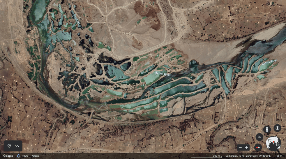
(Feature Image: Screen shot of undated google earth image showing multiple vertical, horizontal bunds created by deep, mechanized riverbed mining across Betwa near Bheri Dariya in Sarila tehsil of Hamirpur district.)

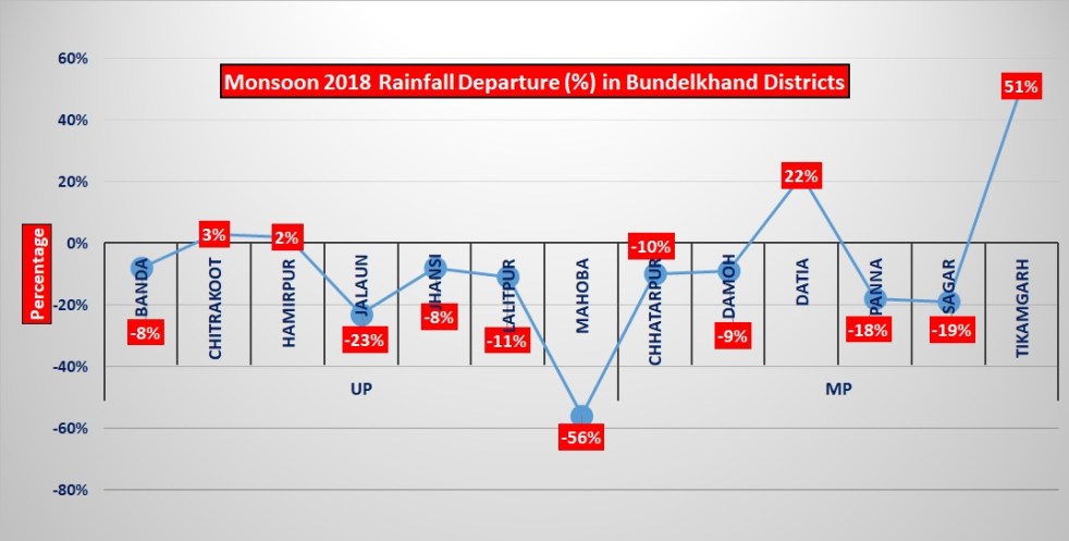
The comparison of Sentinel satellite images dated February 20, 2023 with images of September-October 2022 reveal large scale riverbed mining operations along Betwa river at multiple sites in Jhansi, Jaluan and Hamirpur districts. The details of some of the sites is given in table below followed by the satellite imageries and time lapse animation of few sites.

Continue reading “Uttar Pradesh: Satellite Images Reveal Betwa River Ravaged by Mining”
Dams · Monsoon

Bundelkhand: Overview of 2018 Monsoon

Bundelkhand is known as a drought prone region. It is comprised of 7 districts of Uttar Pradesh and 6 districts of Madhya Pradesh. Monsoon rains are crucial. However for past several years, the region has faced deficit rains leading to water scarcity particularly for agriculture related activities. Let us the situation of of Monsoon rain in Bundelkhand this year.

Bundelkhand is part of Lower Yamuna Basin, for which IMD provides rainfall figures in its river basin wise rainfall maps. This basin received 785.4 mm rainfall in 2018 monsoon, 9% below  normal rainfall of 863 mm for this sub basin. IMD needs to provide rainfall figures for each sub basins, including Ken, Betwa, Dhasan etc.

Continue reading “Bundelkhand: Overview of 2018 Monsoon”