Arunachal Pradesh · Dams · Environment Impact Assessment

When EIAs Don’t Know River Lengths! Review of EIA/EMP of Simang I & II HEP on Simang River in Arunachal Pradesh

for the box 1The Simang River is a tributary of the Siang River which originates at an elevation of 2950 m. The river is 44 km long (as mentioned in the EIA/EMP reports done by consultant R S Environ Link). Total catchment area of Simang River is 554 sq km. There are two projects proposed on the Simang River.  The first one is Simang I with an installed capacity of 67 MW (3 x 22.33 MW) and catchment area of 494 sq km. The second one is the upstream project Simang II with an installed capacity of 66 MW (3 x 22 MW) and catchment area of 422 sq km. These two projects were jointly discussed in the 19th meeting of EAC in October 2008 for the first time. Then these projects were subsequently discussed in the 21st, 36th, 66th and 67th meeting of EAC. A diagram of the two projects on the Simang River is given below.
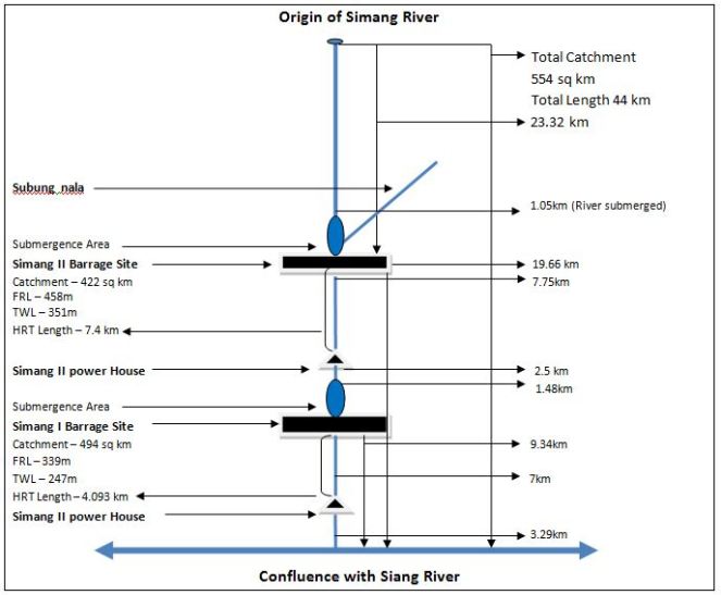
Diagram of Simang I & II projects on Simang River

Troubled Figures of EIA/EMP

In order to prepare the above diagram EIA/EMP reports of both Simang I and Simang II has been consulted. A detailed analysis of the numbers and figures mentioned in the EIA/EMPs for the river shows serious inadequacies in both the EIAs and raises questions on the authenticity of the EIA studies being done on the river.

1. EIA Wrong about Length of Simang River: It is surprising to find that the EIA studies for the two projects cannot give the correct the length of Simang River and contradicts each other (e.g. paragrapgh 4 page 1.14 of EIA of Simang I). Even though the total length of the river has been mentioned as 44 km in EIA studies of both the projects, lengths of the river over different parts do not add upto that.

The EIA report of Simang I in map of ‘Figure 1.3: Project in Simang Basin’ of page 1.16 shows that the distance between the origin of the river and reservoir of Simang II HEP is 22.27 km. The EIA report of Simang II states that the distance between barrage axis of Simang II and Simang-Siang confluence is 19.66 km (paragraph 1 page 5.2). The stretch of the Simang River used by Simang II barrage is 1.05km (from page 4.6 paragraph 1 & 2 of Simang II EIA report). If we take the total of these three parts of the Simang River, the total length of the river will be 42.98km and not 44 km.

On the other hand if we take some other figures given for different parts of the river, then we get another length for the Simang River. The Simang I EIA shows that the distance between the barrage axis of Simang II and TWL of Simang I is 15.75 km (Figure 1.3). The distance between the TWL of Simang I and it’s confluence with Siang river is given as 3.29 km. From this the total length of the river comes out as 41.31 km excluding the Simang II reservoir area. The stretch of the Simang River used by Simang II reservoir is 1.05 km. So including this total length of the Simang River is 42.36 km, not 44 km.

This is a serious inadequacy on the part of the EIA studies since the studies are not clear even about the river length across different parts of the projects. Either the EIA consultants do not know the rivers or they are fudging figures. In either case, these EIA reports should not be accepted.

2. Incorrect Assessment of River Use for the Projects The EIA reports of both Simang I and II projects gives incorrect figures for stretch of river used for the projects. The stretch of the Simang River submerged by Simang II barrage is 1.05 km (from page 4.6 paragraph 1 & 2 of Simang II EIA report), stretch of river bypassed between Simang II barrage and TWL is 7.75 km. The EIA report of Simang I states that the stretch of river submerged by Simang I barrage is 1.48 km and stretch of river bypassed between Simang I barrage and TWL is 7 km. This concludes that the total length of the river used by the two projects is 17.28 km and not 15.75 km as claimed in the EIA reports. Not giving the correct information about the stretch of the river used for projects is a major lacunae on the part of the EIAs and hence these EIA should be rejected.

3. Incorrect Assessment Distance between Simang-Siang Confluence and Power House of Simang I: It seems the EIA/EMP consultant has no knowledge of the area since the distance stated between the Simang-Siang confluence and Power House also seems to be incorrect. The Simang I EIA in states that distance between barrage axis of dam and Simang-Siang confluence is 9.34 km. It also stated that the distance between barrage axis and power house is 7 km. This leaves the distance between the Simang-Siang confluence and Simang I power house as 2.34 and not 3.29 as shown in Figure 1.3 in page 1.16 of the EIA. This again proves that the EIA report prepared by the consultant is inadequate and it should not be accepted.

4. Assessment of river length for diversion is doubtful The diverted river length for Simang II HEP given as 7.75 km in the EIA seems to be doubtful. But tunnel lengths mentioned in the same document for Simang II are as follows:

Tunnel

Length (km)

HRT

7.4

Surge Shaft

0.017

Pressure Shaft

0.225

Penstock

0.056

TRC

0.202

Total

7.9

In fact the bypassed length of the river is likely to be longer than this length of the various tunnel components since rivers do not flow in straight lines, unlike the tunnels.

Critical Issues Not Addressed by EIA/EMP The projects on the Simang River were first considered for TOR in 2008 in the 19th EAC meeting. The proposal that time was to construct three hydro electric projects (HEPs) on the river. In reply to this the EAC had asked, “Secretary  (Power)  and  Secretary  (Environment)  of  Government  of Arunachal Pradesh  should  attend  the  next meeting to clarify the reason for allotting a series of hydroelectric projects on a river which subsequently flows only through tunnels and damage the aquatic ecology.” The Power secretary and Environment secretary attended the 21st meeting of EAC. Going through the minutes of that meeting, it becomes very obvious that Arunachal with its aim to generate more revenue was ready to dam every river or stream in the state. This strengthens the impression that the Simang I or Simang II HEPs are not going to be much beneficial for the local people, environment or the state.

After going through the EIA/EMP of both the projects we have found that there are several critical issues with these studies. There are several issues which are common in both the studies and several others which are particular to each project. Reading these documents thoroughly gives a feeling that the documents don’t have much of a difference from each other and lot of ‘copy-pasting’ has been done. Some of them are also mere replications (e.g. section 4.2 page 4.7 of Simang I EIA and section 4.1.8 in page 4.6 Simang II EIA). There are also many instances where names and words have been confused, e.g. in page 1.15 of Simang II EIA, in the title of the Table 1.1 “Simang I” has been mentioned instead of “Simang II’. This kind of issues raises question on the validity and authenticity of the EIA/EMP studies done. Some of the critical issues are listed below as an example, this is not exhaustive list.

1. EAC Recommendations not Followed: The EIA/EMP studies of these projects have not followed several of the EAC recommendations. EAC in its meetings had recommended the project proponent to address several important concerns but those were no followed.

“To maintain the aquatic life, a study to be conducted by National Institute of Hydrology, Roorkee. Methodology followed for measurement of water flow to be given.” (19th EAC Meeting)  – There is no mention of any study done on environment flows. The EIA/EMP report of both the projects does not give any details of how the environment flow was measured except mentioning what will be the environmental flow.

Between dam and power house how many streams/ tributaries join and what is their contribution in turn of water in the lean season and monsoon? (19th EAC meeting) – The EIA/EMP of none of the two projects responded to this. There are no accurate details about number the flow contribution of different streams or river joining Simang.

Seismic Studies, Slope Stabilization measures, Reservoir Rim Treatment should be included in the EIA/EMP studies.  (36th EAC meeting) – The EIA/EMP studies of the two projects do not have any details of seismic studies done in the project area.

Disaster Management Plan should be included in the EIA/EMP studies. (36th EAC meeting) – This is very surprising because none of the two projects in Simang River has any disaster management plan in their respective EIA/EMP documents.

Pareng Village located in the upstream of Simang I barrage Siteand near the power house of power house site Simang II HEP. Source: EIA/EMP report of Simang I & II

2. Impact of Migration of Outside Workers on Local Communities not Assessed The EIA/EMP reports estimates that there will be migration of nearly 1000 persons for each project during the peak construction period to this very sparsely populated area. People who live in this area belong to several ethnic tribal groups with unique social, economic, political and cultural values. The EIA/EMP reports do not discuss what will be the impact of such migration on the social, political, economic and cultural lives of the people. Influx of such migration will also have impacts on their human rights as well on women. The EIA/EMPs make no mention of these impacts of migration and that is why the EIA/EMP report is incomplete. Besides, even though the projects had been considered together by EAC, no cumulative impact assessment of migration was done.

3. Shoddy Socio-economic Impact Study: The property surveys which the consultant claim to have done for both these projects are inadequate and shoddy socio-economic impact assessment studies. For Simang I a property survey of project affected families in 5 villages was done but it was found incomplete since it does not take into account two of the project affected villages. On page 6A-10 of the EIA report, these 5 villages are stated as Dosing, Lileng, Pareng, Rengo and Boleng.  But out of these villages, there are only three villages mentioned in the property survey – Pareng, Rengo and Boleng. The two villages Dosing and Lileng were not found in the list and instead there were two different villages mentioned in the list – Yingku and Sine.

But after reading through the EIA study of Simang II, it becomes clear that project consultant had done only one survey for both the projects. The two villages Yingku and Sine are also found in the property survey list for Simang II EIA with the same number of affected families (page 6A-16).

It is also surprising to see how the opinions can be exactly similar for both the projects when the affected families are different for each project (See page 16A-15 of Simang I HEP EIA and page 16A-17 of Simang II HEP EIA). Besides, in the list mentioned in page 6A-17 of Simang II EIA, village named Yingku is mentioned twice but there is no justification provided for that.

This brings to light how recklessly these EIAs had been prepared. In fact, the whole concept of property survey is questionable. It takes into account very limited concerns related with the projects ignoring many serious issues. One important aspect of what is the value of the river and other common property resources for the people of the area finds no mention in the property survey. Such property survey cannot be taken as a full proof socio-economic impact assessment and hence EIA/EMP is incomplete and cannot be accepted.

4. Options Assessment not Done The EIA/EMPs of the proposed projects have not done any options assessment study. For example, the option of sub megawatt micro hydro project for a sparsely populated and pristine area like this has not been assessed. For ethnic tribal communities with small population micro hydro project is a better option. The option of solar power generation has also not been assessed by the EIA/EMPs of the projects.  Options assessment is an important part of the EIA/EMP document and since this is not done the EIA/EMP reports are incomplete and cannot be accepted.
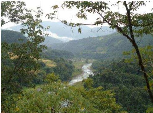
Intermediate zone near Sine Village between barrage and power house of Simang II  Source: EIA report Simang II
Intermediate zone near Sine Village between barrage and power house of Simang II
Source: EIA report Simang II

5. Environmental Flows Assessment not Done: The EIA/EMP reports of the two projects do not give any detail of how environment flow was calculated and how environment flow will be released. We have already mentioned that in the 19th EAC meeting, EAC had suggested that in order to  maintain  the  aquatic  life,  a  study  should be conducted  by  National  Institute  of Hydrology, Roorkee and the methodology followed for measurement of water flow should be made available in the EIA. But there is no mention about any such study in any of the documents.

EIA reports of both projects mentioned about the environment flow release exercise but that should have been done already and should have been a part of the EIA. Since the EIA reports do not mention about any study done on environment flow as asked by the EAC this EIAs cannot be taken as a complete impact assessment.

6. Socio-Economic Impacts of Reduced Flow Ignored:  None of EIA/EMP reports mention about the socio economic impacts of reduced flow in the intermediate stretch between the barrage axis and power house. Besides, in questionnaire of the primary survey/property survey which the EIA consultants claim to have done, there is no question on impacts of the reduce flow of water in the river. Besides, the EIA/EMP studies do not discuss the importance of the river for the local people. This proves that EIA report is inadequate and cannot be accepted.

Power house site of Simang II HEP  Source: EIA report of Simang II
Power house site of Simang II HEP
Source: EIA report of Simang II

7. Impacts of Non-monsoon Peaking Power Generation not Assessed:  EIA/EMP reports of the two projects do not assess how peaking power generation during non-monsoon period will impact the flow in the river downstream from power house. Peaking power generation will have significant impact in the downstream since there will be sudden flow of water in the river for a short period of the day and rest of times it will remain almost dry. This sudden release of water holds threat for the people living downstream as well as their livestock. There are many instances where large number of people and livestock dying due to sudden release of water from upstream dam. Most recently, on Oct 7, 2013, one person was washed away in Arunachal Pradesh due to sudden release of water from the Ranganadi HEP.[1] Besides, this fluctuation in river water on everyday basis will have severe impacts on aquatic bio diversity of the river and use of the river by the people. EIA study ignores all these issues and that is why this study cannot be accepted as a complete study.

8. Impact Assessment of changing sediment releases not Done The EIA/EMP reports do not talk about how sedimentation will impact the reservoir. The EIAs should have included detail analysis of two main impacts – 1.Impact of changing silt flows downstream from desilting chamber and 2. Impacts of silt flushing in monsoon season on the downstream areas. The EIA/EMP report should also do a cumulative study of reservoir sedimentation because the sediment released from the upstream reservoir will affect the reservoir downstream.

9. Socio-economic Impact Assessment of Quarrying not Done:  EIA/EMP of any of the two projects on Simang does not talk about the socio economic impact of quarrying on the local people and environment. EIA/EMP reports also have not assessed how the quarrying in a fragile hill range like Eastern Himalayas will increase the risk of landslide and disaster. Ignoring the disaster risk of quarrying in the hills can have disastrous impacts and the recent Uttarakhand disaster is a proof of that. Since EIA/EMP studies ignore all these issues, they cannot be accepted as complete and that is why EIA/EMPs of Simang I and II should be rejected.

10. False Claim about Height of the Dam: The claim made by the EIA/EMP of both the projects that 18 m high dam reservoir is “very low height” is misleading and false. In the 2nd paragraph of page 10.2, the EMP report of Simang I states “Because it is a run of the river hydro project with a small barrage with very low height (18 m), the inundation will be minimized during reservoir filling.” The same claim has been made in the same page of Simang II EMP. This claim is baseless because according to international standards any dam with a wall height of 15 m or above is a big dam.

11. Climate Change Assessment Not Done EIA/EMP studies of both the projects have not done any climate change impact assessment for the proposed projects. Today when climate change impact risks are increasing day by day, it is very essential for studies like these to do an assessment of possible climate change impacts on the project as well as impacts of the projects on local climate. In fact the word “climate change” is nowhere to be found in the EIA or EMP of the two projects. Without climate change risk assessment, an environment impact assessment cannot complete and that is why this report is unacceptable.

The EIA/EMP studies should also have done an assessment of methane release from the reservoir of the project. Since these important issues are not addressed by the impact assessment study, it cannot be accepted as a complete study.

12. False Claims about Flora and Fauna The EIA/EMP of the two projects makes a completely baseless claim that “There will be no negative impact on flora of region during the operation phase.” This cannot be accepted as truth since during the construction phase of Simang I and II, the forest area diverted will be 29.86 ha and 22.02 ha respectively. After such a diversion forest,   the impact on flora and fauna is inevitable because the area is covered by dense forest. The EIA report of Simang I states that forests constitute the predominant land use in the 10 km area which was studied for this project and 67.66% of this area is covered by dense forests. Besides, none of the two EIA studies provide any data on how many trees will be cut down for the project. These are serious lacunas on the part of EIA/EMP of these two projects and that is why this report cannot be accepted as a comprehensive study.

14. Barrage Location not Clearly Stated for Simang I The EIA report of Simang I is not clear about where the barrage of proposed Simang I HEP will be located. In page 1.5 the EIA report states “The reservoir created by the barrage located near Boleng town will operate between FRL 339 m and MDDL 334 m.” But the same report in page 5.2 says “The proposed Barrage axis is situated about 9.34 Km upstream of confluence of Simang river with Siang river. The river Simang joins the SiangRiver near Boleng township.” Besides, the maps show that Boleng area is located near the confluence of two rivers not near the barrage site. This is a significant error of the EIA study and hence this study is inadequate and cannot be accepted.

Barrage site Simang I HEP Source: EIA report of the Project
Barrage site Simang I HEP
Source: EIA report of the Project

15. Simang II does not assess the project impact on Protected Area EIA states that the distance between Mouling National Park and the reservoir tail at Subbung Nala and Simang River are 5.6 and 5.7 km respectively (page 1.2, paragraph 2). Being in so close proximity of a protected area there should have been impact assessment of the project on the protected area but the EIA/EMP does not mention any such assessment.

16. Threat to Nearly Threatened Mammals The Simang II HEP is a threat to some of the endangered mammal species listed in IUCN Red List. Common leopard (Panthera pardus) and Assamese macaque (Macaca assamensis) which falls in the “Near Threatened” and Gaur (Bos frontalis) falling in “Vulnerable” category of IUCN Red List are found in the project area of Simang II. There are 13 more species of mammals falling under the “Least concern” category of IUCN which are also found in the area. This has been stated in the EIA study of Simang II.

On the other hand, the EIA study of Simang I ignores some the species falling under IUCN Red List. Rhesus macaque, Indian Porcupine and Asiatic Brush Tailed Porcupine which are found in the area fall under the “Least concern” category of IUCN Red List but the EIA report completely ignores this.

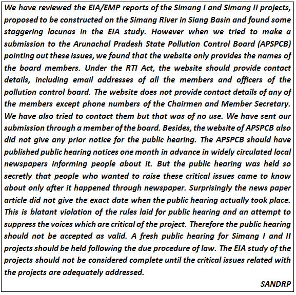
The EIA/EMP reports of the two proposed HEP projects on Simang River have significant lacunas and those cannot be ignored. The EIA consultant also had not consulted the local people in preparing the EIA report. This is another significant lacuna on the part of the EIA because it is the local people who are more aware of the local environment and river as they have lived in that place for generations.  It is shameful that on the basis of such studies and reports, public hearing for the two HEPs was held without even announcing the Public hearing dates on the AP Pollution Control Board website. If these dams are constructed on the basis of such shoddy reports and flawed public hearings then it will invite an uncertain future for the people of the area and people have to live at the risk of disaster. The EAC should consider these issues seriously and must not accept these reports. The EAC should also consider recommending the black list of the consultants for the serious lacunae in the reports.

Parag Jyoti Saikia 

(with inputs from Himanshu Thakkar)

email: meandering1800@gmail.com


[1] Man drowns in Ranganadi, body recovered – http://www.arunachaltimes.in/oct13%2007.html
Dams

Who cares for Riverine Fisheries in Maharashtra?

Introduction

Fresh water inland fisheries in Maharashtra contribute to over 1 lakh MT fish catch each financial year and generate around ₹ 600-800 Crores for dependent fisher folks[i]. As per the economic surveys (2011-12) for Pune region i.e. Pune, Satara, Sangli, Solapur and Kolhapur districts, there are over 20 thousand fisher folks supported by inland fisheries generating ₹ 8,722 Lakh for the fishing community in the entire Pune region.

Table 1. Status of Inland fisheries in Pune region (Source: Extracted from District economic surveys of respective districts produced at the financial year end of 2011-12, available at: http://mahades.maharashtra.gov.in/publication.do?pubCatId=DSA)

District length of the river stretches (km) Total area under inland fisheries (including river, lakes, and dams)- ha Inland fisheries production (MT)

Economic wealth (Lakh Rs.)

Number of cooperative societies Fisher folk supported
Pune 1252 24721 22000 6600 87 3762
Solapur 772 27200 3000 750 133 4341
Satara 676 14504 1950 683 60 2470
Sangli 392 4678 1547 232 83 4701
Kolhapur 955 4266 2285 457 47 4747
Total= 4047 75369 30782 8722 410 20021


Though these are in the Bhima-Krishna Basin, the above records are only for reservoir fisheries! The fisheries department does not collect or maintain any data on riverine fish or fisheries in this region. In fact, the Fisheries Department clearly mentions that it concerns itself only with reservoir fisheries and not riverine fisheries.

kodshi

Figure 1. Fishing in Khodshi Dam region


Why is this a problem?

Across India, the potential of riverine fisheries is decreasing rapidly. At the same time, it is the rivers which form the backbone of the nutritional and economic security of over 10 million marginal fisher folk in India. But, neither are the riverine fisher folk counted by Fisheries Department, nor is their fish catch is monitored.

This has resulted in chronic downplaying of riverine fisheries sector and concentration of attention on aquaculture and marine fisheries. 

No regulation or appreciation of riverine fisheries also means that no attention is being paid to the crisis of riverine fisheries, fisher folk and fish diversity. Across the nation[ii] dams and barrages and related changes in hydrology: Dry rivers, stagnant reservoirs, increasing sedimentation in rivers, rising salinity of estuaries, have adversely impacted the fisheries and dependent people. But this is not very well documented and no attention is being paid to address these issues.

Fisheries Department and Riverine Fisheries in Maharashtra

Highlights of The Maharashtra Fisheries Act (1961)[iii]: The Act applies to inland, riverine as well as marine fisheries. However, the act does not have anything specific to offer to riverine fisheries. It does not talk about traditional fisher folk, their rights, water levels that need to maintained downstream dams, fish biodiversity etc. at all. It is only an Act about edible fisheries, mostly applicable for marine and reservoir fisheries.

  • The act is said to provide for protection, conservation and development of fisheries in Maharashtra
  • The word “fish” includes fishes, crustaceans, oysters and shell fish
  • The act provides for the appointment of “fisheries officers”, person not below the rank of sub-inspector to look after the welfare of the fisheries in the jurisdiction
  • It prohibits use of nets, gears or anything that is fixed in the soil for catching the fish, use of explosives, toxic chemicals, obnoxious material and arrows for catching the fish
  • The State Government is empowered to make rules to regulate or prohibit any discharge of solid or liquid material deleterious to fishes as long as it does not affect the powers of local bodies to discharge sewage water
  • Interestingly, the Act also empowers the State Government to enact rules for protection of fish in selected waters to “prohibit or regulate the construction temporary or permanent or weirs, dams and bunds.”

Unfortunately, the Act does not offer any specific protection to riverine fisheries or conservation of fish.

How does the fisheries department work?
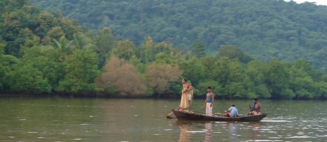
SANDRP discussed issues surrounding riverine fisheries and fisher folk with Fisheries Development Officer of Pune Region. The Fisheries Development Officer said that fisheries department transfers fishing rights for a period of 5 years at a stretch, either to a fisheries cooperative society or contractors.  Fishing rights[iv] on dam reservoirs with area more than 200 ha and less than 200 ha are leased out for the period of 5 years to fishing cooperative societies or to contractors if no cooperative society approaches to the department. The fishing rights on the tanks with less than 200 ha area are preferably leased out to local fishing cooperative societies.

According to the Fisheries Development Officer, Pune District alone has 87 water bodies, on which fishing rights are controlled by fisheries department. Out of them, 17 water bodies are more than 200 ha in area. On 7 of those 17 water bodies, there are local cooperative fishing communities while 10 are leased out. On the other hand, there are 70 water bodies which are less than 200 ha. Out of those, 38 are controlled by local fishing cooperative societies, while 32 are leased out to contractors.

He said that in case of marine fisheries in Maharashtra, annual reports[v] are available giving details of about species, fish catch, fish landing stations, number of mechanized boats and so on. However, the picture about fresh-water fisheries is very dismal with complete lack of basic data about number of fishermen, species, yearly fish catch, distribution and abundance of fish species etc. In the section of fresh water fisheries, the department only controls leasing out fishing rights in lakes and dams. Therefore, the aspects related to conservation and protection of riverine diversity remains untouched.

In fact, the fisheries development officer went to the extent of saying that we should not ask more questions about riverine fisheries as the mandate of the Fisheries Department is only to look at fisheries in reservoirs and not rivers!

There has been some research on fish diversity in various parts of the Pune region. For Warna basin, an exhaustive fish species abundance and cause-effect analysis is done by Dr. Mohite and Dr. J. Samant[vi]. For the Pune district, an organization named RANWA attempted to study riverine fish diversity. Interestingly, their initial records indicate that rivers flowing through Pune, once had over 110 fish species![vii]

The department breeds the healthy fishes (called as brood stock) in the controlled conditions and sells the young fires or fingerlings to the contractors or local fishing cooperative societies operational in the jurisdiction. The ponds are seeded with the cultures and the fishing continues to the next season.

The rare riverine fisheries cooperatives

Though the fisheries department of the state concerns itself with fishing in the dams and tanks, there are some rare exceptions, which provide a brief glimpse of the potential and richness of riverine fisheries.

In case of Sangli, Kolhapur and Nanded, the fishing rights on Krishna, Warna, Panchaganga, Dudhaganga, Bhogawati (Sangli and Kolhapur) Godavari (Nanded) are leased to the local fishermen. The reason is that, such leasing was being carried from the times of Patwardhan sansthaniks of Sangli and Shahu Maharaj of Kolhapur. Even after the princely states were annexed by the British, such leasing of fishing rights in the open river continued and is going on till today.

However, in these cases too, the department has no clue about the distribution of fish species or the status of fisher folk.

Example of Kolhapur We interacted with 3 cooperative societies in Kolhapur which operate in the rivers to understand the situation and problems the fishermen face. We interacted with 1. Daulat Sahakari Macchimar Sanstha, Shirol, 2. Hatkanangale jalakshetra macchimar sahakari sanstha, Hatkanangale, and 3. Shirol Taluka Sahakari Macchimar Sanstha, Kurundwad

sangliFish

Figure 2. Fish catch in the Sangli Market. Credit:Mandar Paingangkar

Atmaram Apate, Chariman of Hatkanangale jalakshetra macchimar sahakari sanstha elaborated that “In the Kolhapur district alone, there are 52 different fishing cooperative societies fishing in the open river and there are around 4-5 thousand fishermen from the region. All the fishermen are traditional fisher folks who are genuinely familiar with the waters. Each fishing cooperative society has fishing rights decided traditionally on the rivers of Krishna and Panchaganga”.

fish_Krisha

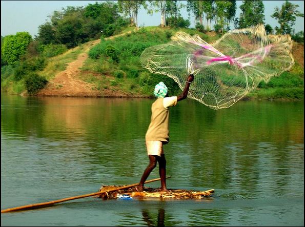
Figure 3. Fishermen casting his net in Krishna River. Credit: Mr. Nerlikar

On a different note, Shirol taluka macchimar sahakari sanstha wrote a letter to Assistant Commissioner, Fisheries (Technical) of the Kolhapur district seeking “process of collecting revenue from the fishermen of the open river is unjustifiable and should be stopped. Fishermen are aggravated by the fact that such practice is followed in no other district of Maharashtra except these three, so they want such measure to be discontinued.”

However, there are some contrary opinions to this demand too. Atmaram Apte of Hatkanangale fisheries cooperative society feels that “it is by the very process of leasing, rights of fisher folks on the river are recognized and protected. If the process of such leasing is stopped, anyone could come in our area and do fishing while the local fishermen will not be able to make their ends meet”.

In fact, simply recognizing fisherfolk and leasing fishing rights is still an important function, as per Mansih Rajankar, who has worked extensively on fisheries in Vidarbha. According to Rajankar, “At least some user right of these fisherfolk on the rivers is thus recognized. In Vidarbha, dams like Gosi Khurd will destroy downstream fisheries and fisherfolk do not even have nominal user rights on the river and hence, are not even counted as being affected by the dam!”

Pollution It is important to understand that the significant problem fishermen face is about water pollution. The Shirol, Hatkanangale and Jaisingpur MIDCs release highly untreated and toxic effluents which results in fish kills and thereby hampers the fish catch. The fish death have been alarmingly high in the district and the causative agents are sugar mills as well which release their stored wastes in the water on the onset of monsoon[viii].

In Dec 2012 and January 2013, Kolhapur taluka fisheries cooperative society, Bhoiraj fisheries cooperative society, and those from Shirol, Shridhon, Awali had written to fisheries development officer of the Kolhapur district, seeking compensation against the reduced fish catch. The same request was forwarded to Kolhapur district collector by the fisheries department. The district collector dodged the ball in the respective Tehsildar’s court. Tehsildars said that they don’t have enough money to grant for compensation. However, no concrete action was taken against the polluters. Maharashtra Pollution Control Board did not intervene in the matter either.

Unfortunately, no government department is ready to act for betterment of riverine fisher folks in the district.

The fishermen from Shirol Taluka (which has Dutta Cooperative sugar mill, and Shriol MIDC) say that about a decade ago, they used to receive around 10-12 kg of fish catch a day, now they only get 4-6 kg of fish catch per day. They attribute this reduction to the polluted discharges.

Most of the seeding done in reservoirs is exotic fish. Although Tilapia is an exotic pest species which competes with native fish, Fisheries Department is using Tilapia seeds in many reservoirs, from where they enter into river systems, contaminating the rich gene pool. For information on exotic fish invasion in our rivers: http://www.downtoearth.org.in/content/silent-invasion

In fact, Mr.  Suneel Koli from Daulat Macchimar Sangathana, Shirol, Kolhapur told us that they get around 60-65 fish varieties in their catch, indicating the richness of riverine fisheries. Dr. Nilesh Dahanukar of Indian Institute of Science, Education and Research (IISER), Pune has recently[ix] discovered a new fish species in the Krishna river basin of Maharashtra section of Western Ghats. Experts believe that fish diversity in the rivers of Western Ghats is highly understudied and more focus needs to be given to the same.

In conclusion

Maharashtra state government and the Maharashtra state Fisheries Department needs to pay urgent attention to welfare of riverine fish diversity, fisheries and fisher folk. When the Fisheries Act 1961 clearly states that it provides for conservation and improvement of fisheries in the state, why is state government turning a blind eye to riverine fisher folks? It is important that the state fisheries department starts identifying the fishing communities (at least-if not the individual fishermen) of the open river. This will also help in understanding the plight of fisher folk in Maharashtra. Inland fisheries should not just be confined to the seeded fishing in dams and reservoirs.

Riverine fisher folk also need to get user rights on the rivers in which they fish. They should also be part of social impact assessment when dams and other structure are built on rivers and also part of Rehabilitation plans.

Rules under the Fisheries Act 1961 about “prohibit or regulate the construction temporary or permanent or weirs, dams and bunds” need to be formulated and enacted.

The polluters (including municipal corporations) and sugar mills need to be penalized as per the Fisheries Act 1961 to safeguard the livelihoods of riverine fisher folk.

The fisheries department needs to acknowledge local biodiversity of fish fauna and take efforts to conserve and promote them instead of only focusing on common carps and major carp varieties of the fishes. The department is not entrusted to protect only these varieties.

It is crucial that the fisheries department and State Department shows some will and initiative to protect riverine fish diversity against the onslaught of more, taller and bigger dams, polluting industries, law defying barons so that riverine fishery would survive for generations to come. With Climate Change becoming a reality, biodiversity and resilience of small scale, riverine fisheries can provide an important adaptation measure, which needs to be promoted urgently.

Damodar Pujari

(damodar.sandrp@gmail.com)


[i] Maharashtra District Economic Survey 2011-12, page number 100

Dams · Hydropower · Ministry of Environment and Forests · Sikkim

Hydro Power Projects Violating SC order in the Greenest State of India

Gangtok, 9 October 2013: Deemed as the greenest state in India, the government of Sikkim has drawn flak of the national board of wildlife (NBWL) for blatant violation of the environmental norms and the standing order of the Supreme Court in implementation of several hydro power projects under different stages of construction.

The background: In its 28th meeting held on 20th March 2013, the proposal for 520 MW Teesta Stage-IV Hydroelectric Power Project, on River Teesta in North Sikkim to be developed by NHPC Ltd, was placed before the SC-NBWL (Standing Committee-National Board of Wild Life) for consideration. The Member Secretary had informed the SC-NBWL that the project location falls 4 km away from the Fambonglho Wildlife Sanctuary and was recommended by the State Board for Wildlife.

photo 1
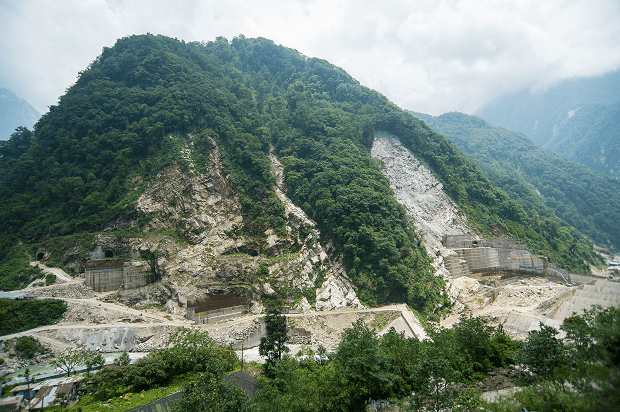
Photo from SC-NBWL committee report has this caption: Construction of the Teesta III project at Chungthang on the edge of Khangchendzonga National Park proceeding without SC-NBWL clearances. Note the extensive forest cover and large landslides at the site

Following discussions, the SC-NBWL decided that a team comprising Dr M.K.Ranjitsinh, Kishor Rithe, Dr A.J.T Johnsingh and Dr M.D. Madhusudan would carry out site inspection and submit a report to the committee for its consideration. Following this decision, the above committee visited the project site and nearby areas from 15th to 21st May 2013. The committee met the representatives from the Sikkim Government’s Forest, Environment and Wildlife Management Department (FEWMD), the user agency, NHPC Ltd, and people from local citizens’ groups. The report of the committee dated Aug 2013 is now available online (http://envfor.nic.in/division/wl-orders).

The report raises serious concerns about a number of hydropower projects in Sikkim under construction without wildlife clearance in contravention to the Supreme Court order[1] (in the Goa foundation case).  The Chamling government in Sikkim has allowed blatant violation of the Supreme Court order, a situation compared by the report with what had happened in Goa with respect to mines which were operating without wildlife clearance in violation of SC orders (the subject of the Shah Commission report). The Union Ministry of Environment and Forests is equally responsible for allowing continuing construction of these projects without legally mandatory clearances. The decision based on this report in the NBWL Standing Committee is still pending.

map 1
Map with locations of projects and protected areas from the SC-NBWL committee report

Both before and during site inspection, multiple stakeholders brought to the notice of the NBWL team that there were other proposed and ongoing hydel projects in the Teesta Basin located within the eco-sensitive zone (as defined by the Supreme Court in the Goa Foundation case), of the Khangchendzonga NP and Fambonglho WLS, which had not obtained the Supreme Court mandated clearance from the Standing Committee of the National Board for Wildlife.

Besides this,  the team in their journeys saw  two projects under active construction—the Dik Chu[2] and the Teesta III[3]—that were clearly within the Supreme Court mandated eco-sensitive area. For Dik Chu HEP, the report says, “However, the accompanying FEWMD officials informed us that these mandatory wildlife clearances from the SC-NBWL had, apparently, not been obtained.” For Teesta III HEP, FEWMD officials were not aware of the SC-NBWL clearance, and the committee noted, we “must therefore conclude, on the basis of information available with us, that such a clearance was not obtained… we are deeply concerned about the advisability of this project.”

Deeply concerned about the likelihood of various hydel projects coming up in violation of the Supreme Court’s order in the Goa Foundation case, the team has  requested the MoEF to write to the government of Sikkim, seeking a comprehensive list of completed, ongoing and proposed hydroelectric projects within the Supreme Court mandated 10-kilometre zone of the Khangchendzonga National Park (KNP) and Fambonglho Wildlife Sanctuary (FWLS). For each project,  details sought included:  (a) location (latitude-longitude) and distance from KNP and FWLS; (b) current status of the project; and (c) if and when they had obtained the required Environment, Forest and Wildlife Clearances. Even after waiting for 10 weeks, the NBWL team did not receive either an acknowledgment, or a response from the Pawan Chamling government to their query.

The committee, left with no option was compelled to use publicly available information on Environmental Clearances (EC) (http://environmentclearance.nic.in), submissions and information provided by other stakeholders, and to examine minutes from the SC-NBWL’s meetings, to ascertain if there was merit to the allegations made about the violations of the Supreme Court’s order of 12/2006.

Key recommendations Based on examination of available information on legal compliances required for the projects in the Teesta basin, the committee concluded that, with the notable exception of the Teesta IV project (which has currently approached the SC-NBWL for clearance), none of the other projects appear to have sought/obtained this compulsory SC-NBWL clearance, as mandated by the Supreme Court. While the SC-NBWL is fully aware that there are many more proposed/ongoing hydroelectric projects situated within the Supreme Court mandated 10-km eco-sensitive zone of wildlife sanctuaries and national parks in Sikkim, it has not been able to ascertain whether Supreme Court stipulations in their regard are being followed, or being violated, and if latter be the case, the MoEF should take due cognizance of the same urgently.

“We are of the unanimous considered opinion that it is absolutely essential to assess the overall impact of these projects, both from the recent past and those in the pipeline, rather than deal with them in a piecemeal fashion. Hence, we urge the Standing Committee not to consider the Teesta IV project’s request for clearance separately, but treat it as part of a larger set of hydroelectric projects in the Teesta Basin, with vast ecological, social and legal portents”, the committee has recommended.

It further recommend that the Standing Committee direct the MoEF to write to the Government of Sikkim asking them to immediately investigate and submit a detailed report listing hydroelectric projects in Sikkim that are being constructed prima facie in violation of Supreme Court’s order. Based on the list provided by the government of Sikkim, if it is indeed ascertained that the projects are proceeding in violation of the said Supreme Court ruling, it further adds that the MoEF initiate action by asking the State Government to suspend ongoing work on those projects immediately and to direct user agencies to formally seek clearance for these projects from the SC-NBWL. It adds that the MoEF and the Government of Sikkim thoroughly investigate the circumstances under which the seemingly widespread bypassing of Supreme Court orders in the construction of dams within the 10-km ecosensitive zone of Sikkim has taken place, fix responsibility for the transgressions and violations, and punish the guilty.

About Teesta IV proposal from NHPC, for which the committee visited Sikkim, the report recommends, “Finally, in the light of the devastating June 2013 Uttarakhand floods, we are deeply concerned about the wisdom of such large-scale manipulations of mountain river systems that are being implemented, against all reasonable scientific advice (and thedisregard of the CISHME’s recommendation against the construction of Teesta III, is a case in point)… Hence, we urge the Standing Committee not to consider the Teesta IV project’s request for clearance separately, but treat it as part of a larger set of hydroelectric projects in the TeestaBasin, with vast ecological, social and legal portents.”

The report also recommends  that projects already in the pipeline and that may be proposed in future in Sikkim, be placed before the Standing Committee, “chaired by a very senior official of the MoEF, Besides senior officials of the MoEF and the Sikkim Government, this committee must include legal experts as well as experts in hydrology/ geology/ seismology/ social science/ botany/ riverine ecology/wildlife ecology, from reputed research institutions and some representatives of local communities” whenever they fall within the purview of the Supreme Court-mandated 10 km eco-sensitive area around PAs. The committee report adds that much of the summary and recommendations section of Justice Shah’s report (pp. 189-200) is extremely relevant to the case of the hydroelectric dams in Sikkim, and that any committee constituted to examine hydroelectric dams in the eco-sensitive areas of Sikkim, pay close attention to this report.

No ecological flows from NHPC’s Teesta V What the report says about this subject makes disturbing reading: ”On 16th May 2013, driving upstream of the Teesta V powerhouse, we noted extremely low flow in the river, which was particularly so in the stretch of the river directly downstream of the Teesta V dam (Figure 1), where the river was diverted through a tunnel. Such low flows, where River Teesta has been diverted through tunnels, are a cause for serious concern in the context of maintaining the ecological function of a river. We enquired from NHPC officials about how details of ecological flows were determined, and learnt that ecological flow was not a parameter that was optimised in the planning process. We were told that downstream flows were effectively a consequence of maximising hydropower potential of various river basins as determined jointly by the Central Electricity Authority and the Central Water Commission. These values, in turn, were used as the basis for soliciting proposals for hydroelectric power projects. In other words, we learnt to our great dismay that absolutely no ecological consideration whatsoever was used in the process of determining the hydropower potential of river basins.”

Violations galore, government unresponsive In a submission made by Tseten Lepcha in his capacity as the then Honorary Wildlife Warden of North Sikkim to Jayanthi Natarajan in 8th October 2011, Lepcha had contended that how the 1750 MW Demwe Lower by the Athena group is being considered by the SC-NBWL for wildlife clearance, when a project by the same promoters (1200 MW Teesta III) is under construction in violation of Supreme Court orders (without wildlife clearance). The current NBWL report confirms that the 1200 MW Teesta III is under construction illegally, violating SC orders. In an earlier submission he had made to the SC-NBWL on April 19, 2011 he mentioned violation of the WLPA (killing of a Serow – Schedule I species) in the 1200 MW Teesta III project being developed by the Athena group. The developer of the project, Teesta Urja Ltd (a special purpose vehicle of M/S Athena Pvt. Ltd.), through its sub-contractor, SEW Infrastructure Ltd, was involved in the death of a Serow (Capricornis sumanntraensis), a Schedule I animal, at the project site on June 4, 2008.

photo 2
Photo from SC-NBWL com report with this caption: The Teesta V dam showing the virtual absence of flow in the river downstream of the dam, which can have devastating consequences for river-dwelling and river-dependent species

Several attempts by this correspondent, to contact the PCCF –cum-Secretary of the FEWM department of Sikkim Mr. Arvind Kumar on his cell phone, and his official e-mail address to get the Sikkim government’s official version on the controversy, remained unanswered.

How IPPs are cheating by flouting norms Sikkim Bhutia Lepcha Apex Committee (SIBLAC) convenor Tseten Tashi Bhutia, while speaking to this correspondent expressed immense joy at the NBWL report. “We have been protesting cultural and religious genocide being committed by the Sikkim government in the name of developing hydro power, apart from severely degrading the environment, this is a moral boost. I hope GOI takes strong action”, he said. Bhutia added that there are violations of the Places of Worship (special provisions) Act 1991, extended to Sikkim, and the gazette notifications of the Chamling government, in allowing the Tashiding project on holy river Rathong Chu.

SIBLAC along with another apolitical group Save Sikkim on September 28th, 2013 filed FIRs against an IPP, Shiga Energy Pvt ltd, developer of the 97 MW Tashiding hydro power project for alleged cheating, distortion of facts and violation of environmental norms and the SC order. This is in addition to an ongoing PIL at the Sikkim High Court.

The facts revealed by Tseten Tashi Bhutia in his FIR are startling and shocking. As per the requirement of the Environment Ministry (MoEF, Government of India), the executing agency i.e. Shiga Energy Private Limited, is required to submit a Six-monthly compliance report[4] on the status of the 97 MW Tashiding HEP to the stipulated environmental conditions in a prescribed format .However, while going through the latest Six monthly report dated 22.11.2012[5] submitted by the executing agency to the concerned authority i.e. North Eastern Region Office, Ministry of Environment & Forest, Government of India , it is found that as against the IX necessary conditions required in the prescribed format, the executing agency have intentionally deleted Stipulation No. VIII, jumping to the next condition.

The Monitoring report of MEF regional office (signed by DR S C KATIYAR, SCIENTIST ‘D’) dated Oct 2012[6] says about Stipulation VIII: “the proposed site is about 5 Km away from the buffer zone of the Khangchendzonga Biosphere Reserve as per Supreme Court order clearance from NBWL may be obtained (if required).”  Status of Compliance: “Not complied with” and further writes; “the project also falls within 10 Kms from the Fambomgla Wildlife Sanctuary, as such; NBWL clearance needs to be obtained.”

Thus the agency has not complied to nor has obtained NBWL clearance yet as evident from the Monitoring Report on the Implementation Status of Conditions of Environmental Clearance dated Oct 4th, 2012. In other words, the executing agency has simply and swiftly been misleading and cheating the authorities till date by submitting wrong report to Ministry of Environment and Forest, Govt. of India. More surprising is to witness the lack of action by the MoEF on these manipulations and lack of action even after the Monitoring Report clearly reports non compliance.

Rathongchu is a sacred river according to the Denjong Neyig and Nesol texts having its source at various secret and sacred lakes at Khangchendzonga, Sikkim’s supreme guardian deity and runs independently till it meets River Rangit at the lower reaches; This sacred Rathongchu is the source to the annual Tashiding Bumchu ceremony which is held in the first lunar month, corresponding to the months of February and March. In fact, this Bumchu (Sacred Water) ceremony has been continuing for centuries and attracts thousands of devotees and pilgrimages from far across including Bhutan, Nepal, and entire Himalayas.

Ironically, a one-man Professor P S Ramakrishnan committee, of the JNU School of Environmental Sciences, submitted a report titled Ecology and Traditional Wisdom,  on October 9th 1995, to the government of Sikkim where he categorically stated, “on social, cultural, and religious considerations, apart from the rich bio-diversity and fragile ecology of the Yuksom valley region, I strongly recommend that no hydro power or other projects should be allowed on River Rathongchu, deemed extremely sacred by Buddhists”. Under the circumstances, how was the Tashiding HEP allotted to the Shiga Energy Ltd by the Sikkim Government and cleared by the MoEF is moot question.

Some of the other proposed projects that are mentioned in the SC-NBWL committee that are also coming up requiring the SC-NBWL clearance include the 300 MW Panan HEP, the Ting Ting HEP, besides the ones mentioned above, see the accompanying map from the SC-NBWL report. Other hydropower projects of Sikkim that are being considered by the MoEF for clearances and that are also close to the protected areas include: 63 MW Rolep HEP on Rangpo river in E Sikkim (5-6 km from Pangolakha and Kyongnosla WLS), 126 MW Ralong HEP (4.05 km from Kangchendzonga Biosphere Reserve and 1.8 km from Maenam Wildlife Sanctuary), 96 MW Chakung Chu HEP inn North Sikkim district (1.8 km from Kangchendzonga Biosphere Reserve). Other such possible projects include: 71 MW Sada Mangder, 60 MW Rangit III, among others.

Let us hope now following the SC-NBWL report, the MoEF will promptly order stoppage of illegally ongoing construction of the guilty HEPs, not waiting for the SC-NBWL committee to meet, since the new Standing Committee of the NBWL remains to be constituted after the term of the earlier committee ended. The evidence provided by the SC-NBWL committee is sufficient to take prompt action. The fact that the MoEF has not take action yet, weeks after submission of the SC-NBWL report speaks volumes about the possible collusion of the MoEF in this murky affair.

Soumik  Dutta (duttauni@gmail.com, with inputs from SANDRP)

END NOTES:


[1] WP 406/2004, Goa Foundation vs. Union of India, Order dated 04/12/2006: “The MoEF would also refer to the Standing Committee of the National Board for Wildlife, under Sections 5 (b) and 5 (c) (ii) of the Wild

Life (Protection) Act, the cases where environment clearance has already been granted where activities are within 10 km. zone”

[2] Strangely, the Environment clearance letter for the project does not even mention the need for SC-NBWL clearance, see: http://environmentclearance.nic.in/Auth/openletter.aspx?EC=5766

[3] The Six monthly compliance report for Teesta III dated June 2013 also is quite on the issue of compliance with SC-NBWL clearance, see: http://environmentclearance.nic.in/writereaddata/Compliance/57_Teesta%20HEP-III%20_june2013.pdf, the condition for this was mentioned in the MoEF letter dated 30-04-2010 with additional condition: “Considering the proximity of Khangchendzonga National Park from the project site, clearance from the Standing Committee of theNational Board for Wildlife (NBWL) should be obtained”.

[4] For latest version of the compliance report, see: http://environmentclearance.nic.in/writereaddata/Compliance/34_Tashiding%20Six%20Monthly%20Compliance%20Report_May%202013.pdf. In this report, the column before the condition VIII says: NA (not available).

Climate Change · South Asia

Climate Change, Migration and Conflicts in Assam-Bangladesh: Why we need better reports than this

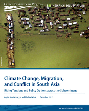
A new report named “Climate Change, Migration andClimateMigrationSubContinent_COVER Conflicts in South Asia: Rising tension and Policy options across the sub-continent” was published in December 2012 by Center for American Progress and Heinrich Böll Foundation. This report, authored by Arpita Bhattacharyya and Michael Werz has analyzed how migration and security concerns are overlapping in the era of climate change in South Asia. Even though the title of the report mentions South Asia, it is mainly focused on India and Bangladesh. The central argument of the report is that an inevitable threat of climate change will intensify migration from Bangladesh to Northeast India, in general and Assam in particular.

In this report the authors have examined the role of climate change, migration, and security broadly at the national level in India and Bangladesh. Discussing the focus and relevance of the report the authors write “In this paper we examine the role of climate change, migration, and security broadly at the national level in India and Bangladesh—and then zero in more closely on northeast India and Bangladesh to demonstrate the interlocking problems faced by the people there and writ larger across all of South Asia.” But the report falls short of indentifying a causal relationship between climate change, migration, and conflict. This report emphasizes on understanding climate change, migration and security as three distinct layers of tension and assesses scenarios in which the three layers will overlap. The report takes Assam, the central state of northeastern border of India as a case study where the three factors converge. But the elements related to this convergence are rather inadequate that required further probing.

The report discusses the Assam movement of 1983 and the    clashes which  occurred in the summers of 2012 between ‘members of the Bodo tribe and  and  Muslim community’. Bringing climate change into the framework the report states “In assessing the security challenges of climate change, Assam provides an example of several factors coming together in a complex way. Climate change will stress existing migration patterns both locally and internationally in Bangladesh. Even more importantly, the perception that there has been an increase in immigrants has the potential to stoke tensions over immigration in Assam.” It seems to be generalization of a very complex process. We have found towering claims like this have very less linkages with the situation on ground(please see our blog – 2012 Floods Displaced 6.9 Million in Northeast-IDMC: Staggering but Highly Exaggerated). The report also mentioned that “Floods in September 2012 displaced 1.5 million people in the northeastern state of Assam” this again is not beyond doubts. The data available from National Disaster Management shows that, highest number of people affected in the floods in September 2012 is 383421.

Climate Change Scenario in India: For India the report draws from the “Climate Change and India: A 4×4 Assesment” (2010) which was prepared by the Indian Ministry of Environment and Forests for examining climate change impacts and projections through 2030 across four regions of India (the Himalayan Region, Western Ghats, Northeastern Region, and the Coastal Region) and four key policy sectors: agriculture, forests, human health, and water.

Bangladesh Discussing the situation in Bangladesh the reports deals with rising temperatures which are likely to have severe effects on agricultural production in Bangladesh due to higher rates of evaporation and changing rainfall patterns. According to the authors “Bangladesh could see up to an 8 percent reduction in rice production and a 32 percent reduction in wheat production by 2050…. With 63 percent of the population dependent on agriculture for basic livelihoods, the rise in temperatures could be crippling.”

The report warns about increases both in extent and frequency of floods in the country. Talking about rise in sea level the report states, “The Bangladeshi government projects that the sea level will rise by 5.5 inches (14 centimeters) by 2030, 12.6 inches (32 centimeters) by 2050, and 34.7 inches (88 centimeters) by 2100. Predictions about the displacement of people resulting from a 1-meter (roughly 40 inches) rise in sea-level range from 13 million to 40 million in Bangladesh alone.” The report also discusses cyclone and storm surges, river and coastal erosion and saltwater intrusion. Bringing migration into the picture, the report first discusses rural urban migration within Bangladesh and describes a situation of migrants in the capital city Dhaka “When describing why they came, migrants tell stories of flood and famine in quiet rural towns where options dwindle by the day … these villagers pour into Dhaka at a rate of about 400,000 to 500,000 each year.”

Talking about international migration from Bangladesh, the report states “More informal—but still substantial—migration takes place from Bangladesh to India, especially to the far eastern Indian states of West Bengal and Assam….. It is estimated that approximately 12 million to 17 million Bangladeshi immigrants have come to India since the 1950s, with most residing in the northeast states of West Bengal, Assam, and Tripura.” In this situation presenting the interplay of migration and climate change the report says, “How climate change will effect migration to Bangladesh’s urban centers is not exactly determined. Even more uncertain is how climate change and Bangladesh’s urban growth will interact to shape international migration, particularly to India. But given the trajectory of available climate change projections and historical precedent, India may continue to be a popular destination for many Bangladeshi migrants.” However this seems to be an opaque statement without any substantiation. Instead of pitching their argument in the ahistorical categorization between an underdeveloped Bangladesh and an emerging India, the author should consider the present human development indicators of Bangladesh vis-à-vis India  (please see “Social indicators of Bangladesh are better than India”).

As a part of the solution, it suggests building of sustainable urban areas where governments manage to guarantee food security, deliver required energy resources, and develop infrastructure to more effectively protect livelihoods in rural areas. However, its suggestion that “economic growth must be maintained to accommodate growing populations and allow society to better prepare itself to deal with the impacts of climate change” seems to suggest that the authors have not understood basics of both economic growth and re-distribution as well as  climate change.

The American Perspective The paper does not provide any adaptation and mitigation measures for climate change. The paper argues for changing the pathways of growth towards greater sustainability. Talking about modern sustainable urban centers the paper focuses on the areas where U.S.-Indian cooperation can happen. The report is written in order to assess how United States can play a pivotal role in the threats and consequences of climate change arena in South Asia and that is why ‘the American perspective’ on the climate change in South Asia can be all pervasively found in the report. The report propose three policy collaborations that the United States can take up with South Asian partners as complex crisis scenarios unfold in the wake of climate change – 1. High-level climate-vulnerable cities workshop, 2. A dialogue on migration and 3. Ecological infrastructure development.

Pressing Critical issues

There are a lot of critical issues with this report which needs to be addressed.

How much migration is actually happening now: The report establishes its firm belief in the fact that large scale migration from Bangladesh to northeastern parts of India is still continuing. The report should have first questioned how much migration is actually happening rather than claiming that there will be increase in migration in the near future. There were several analysis available specially drawn from Government of India’s Census data which shows a complete different picture.  In an article named “Riots & the Bogey of Bangladeshis”, published in Hindu on 8th August 2012,  Delhi base researcher and activist Bonojit Hussain did an analysis of census data and reported that “Even though the religion-wise census figures for 2011 are not yet available, provisional results from the 2011 census show that the decadal growth rate of population between 2001-2011 for Kokrajhar district is 5.19 per cent, interestingly, marking a decline of 9 per cent as compared to the decadal growth rate of 14.49 per cent between 1991 to 2001. (The decadal growth rate for Assam between 1991 to 2001 was 18.92 per cent and 16.93 per cent between 2001-2011)……. The other possibility, which seems more plausible, is that there has been a considerable out-migration from Kokrajhar, especially after the formation of the BTAD in 2003. Since the Bodos (who constitute 20 per cent of the population in the BTAD area) hold a monopoly over political power in the area, it is unlikely that there has been any significant out-migration of the Bodo population from Kokrajhar district. The Koch Rajbangsis, who constitute roughly 17 per cent of the total population of the BTAD, have been campaigning for and demanding a separate homeland — Kamtapur — which territorially overlaps the BTAD, thus making it unlikely that they would out-migrate, abdicating their political claim over the territory. In all probability, the out-migration involves other non-Bodo communities, including Muslims.” The report seems to ignore this reality. It is also important to note that the report has very little to substantiate its assumptions.

Social indicators of Bangladesh are better than India: The report seems to ignore the substantial improvements in social indicators in Bangladesh. A recent review of Jean Drèze and Amartya Sen’s new book ‘An Uncertain Glory,’ states the improved social conditions of Bangladesh in the following way “even Bangladesh has better social indicators than India. It has higher life expectancy (69 vs India’s 65), better sanitation (half of all homes in India have no toilets compared to 10 per cent in Bangladesh), lower infant mortality (37 versus India’s 47) and lower fertility rate (2.2 against 2.6 for India). For those arguing that Bangladesh is a much smaller country, the answer is that its GDP per capita is roughly half that of India’s.”[1]

Is urbanization the only option: The report is biased towards urbanization. The report shows no interest to discuss how rural areas can be prepared to face climate change better. Projecting sustainable urbanization as the solution for migration is presenting only one side of the story. The report also seems like an attempt to push forward American agenda in South Asia. The report laments the facts that the urbanization programmes like JNNURM is facing shortage of funds.  But there are already several examples JNNURM programmes in India which are increasing the debt burden on the people and undermined the traditional sustainable systems.

Are thermal and large hydro-power projects climate friendly: The report on climate change shockingly, reemphasizes on coal based power generation. A study on climate change prescribing for coal based power generation is really very strange.

In another surprise the report, shows bias for (large) hydro power generation, even though hydro-power dams have very severe impacts on river ecology, bio-diversity and climate change. While discussing about water politics between China, India and Bangladesh the report mentioned about the fear of water diversion by China through hydro power dams and its severe impacts on flow of the Brahmaputra. But it makes no mention of more than 150 hydro power projects, which are being planned in Arunachal Pradesh and other north eastern states within the Indian territory and the downstream impacts of these. These projects will dam every major tributary of the Brahmaputra River. These tributaries collectively contribute at least four times more to the flow of the Brahmaputra than Yarlung Tsangpo or Siang, the part of Brahmaputra which flows from China. The report has no reference to any of this.

Internal migration within Assam and India: The report talks about migration from Bangladesh to Assam but it makes no mention of people migrating from rural areas of Assam to other cities due to severe flood and erosion. The report also does not take into account the case of char-dwellers (people living in sand bars) in Bangladesh and Assam. According to the Socio Economic Survey of 2003-04 in 14 districts of Assam, there were 2251 char villages with a population of 24, 90,397.[2] People who live on chars in Assam and in Bangladesh will be directly affected by any change in flow pattern in the rivers.

Spreading propaganda? Though this report is on migration from Bangladesh to Assam, the report presents very little data to back up its claims. Besides, on the issue of increasing Maoist activity in India, the report does a shoddy job. The map showing maoist activities in India is questionable. Since this report accepts the current development path of coal based and large hydro-based power generation unquestionably, the discussion on Maoist activity in India resonate with Assam’s Chief Minister Tarun Goigoi’s unfounded attempts at colouring of anti-dam struggle of the people in Assam as Maoist activity. Such uncritical acceptance of Indian government’s unfounded assertions discredits the report.

Parag Jyoti Saikia


[1] http://www.thehindu.com/books/books-reviews/the-inequalities-of-democracy/article4941693.ece

[2] Chakraborty G.,”Distortion  of Natural Watersheds and Land Erosion: The Char Areas Of Assam”, SIBCOLTEJO, Vol. 05 (2010): 18-30

Dams

River Conversations

Rivers in our times are facing many threats, most rivers are facing existential threats. This blog is a way of starting some conversation on Rivers and the threats that they face.

Since February 2013 (the blog was launched in June 2012, but till Feb 2013 there were just about six blogs, posted in June-July 2012, none after that) we at SANDRP have taken this blog a little more seriously in communicating conversations around rivers.

This is the 100th blog!

During the past about 9 months, we (SANDRP team as well as invited authors) have tried to write about issues surrounding our rivers. We’ve written about Large Dams (and mini hydels), Hydropower Projects, their impacts, their decreasing efficiency, the innumerable issues related to infrastructure projects affecting rivers, dependent communities and ecosystems and the governance process.  

We’ve talked about Climate Change and its impacts on rivers and communities, topical issues like Maharashtra drought in 2012-13, the Uttarakhand disaster in June 2013, India’s flood forecasting and disaster management, Eco sensitive areas like Himalayas and Western Ghats and threats that relatively pristine rivers of North East India are facing. Most institutions and sections of society remain oblivious, unaffected by the fate of our rivers.

Looking at the crisis that our rivers, dependent communities and freshwater ecosystems are in, the need for increased and consistent engagement with the governance processes around rivers is becoming stronger. Most of the rivers in Himalayas are being dammed multiple times, riverine fisheries and fish diversity is severely affected, dam scams are surfacing from across the country: from Maharashtra to Andhra Pradesh to Karnataka to Arunachal Pradesh.

Looking at this, we sincerely hope that more and more people will get involved with issues surrounding our rivers.

We request you to share stories and issues surrounding your rivers.

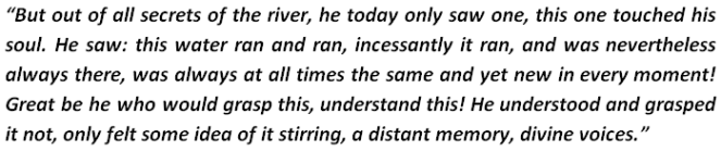
CONVERSATIONS WITH RIVER This is equally important, but more difficult. Hermann Hesse’s Siddhartha provides one of the rare instances of conversations WITH rivers. So we have reproduced some quotations from that most remarkable novel along with some photos that provide, hopefully, instances of conversations AT rivers. 

1

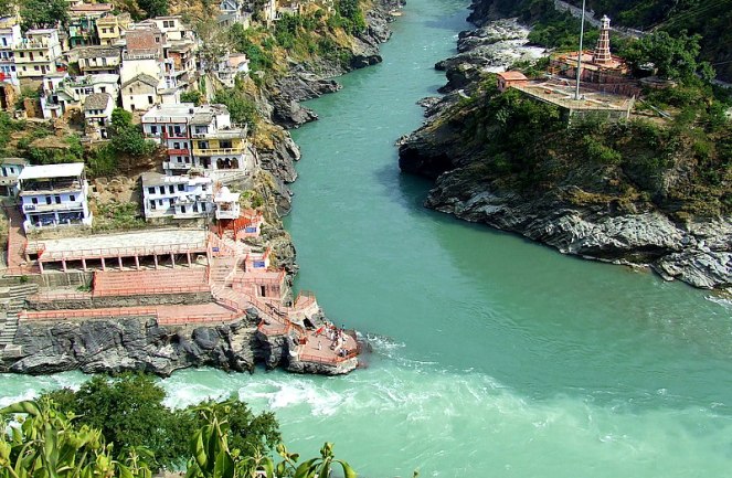
The Mighty Ganga Photo: Ganga Action Parivar
The Mighty Ganga Photo: with thanks from Ganga Action Parivar

2

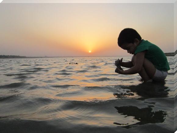
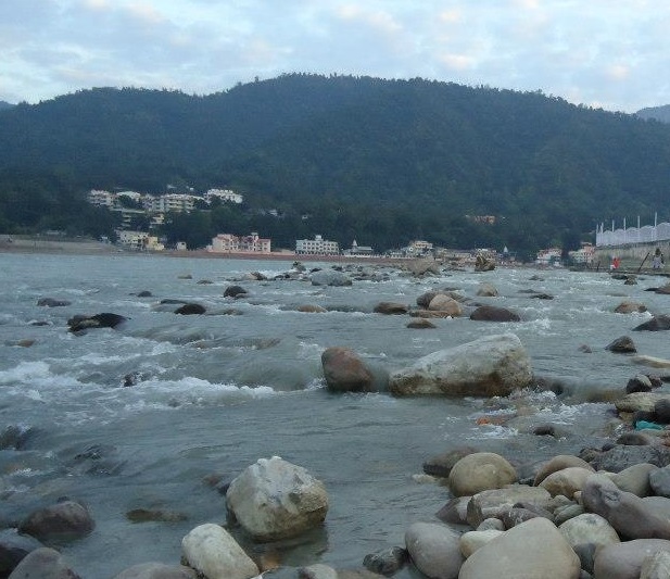
A small boy by the Bhama River when water was released into the river after a long dry spell. Photo: SANDRP

3

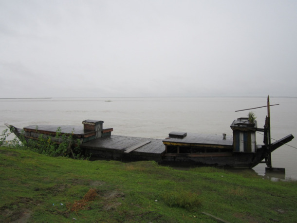
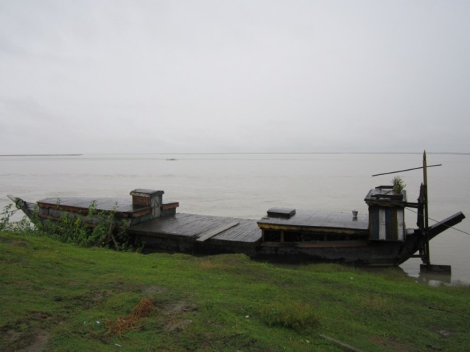
Boat by the Brahmaputra Photo: SANDRP

4

Floods in Uttarakhand Photo with thanks from Times of India

5

The lovely Souparnika River in Karnataka Photo: SANDRP
The lovely Souparnika River in Karnataka Photo: SANDRP 

6

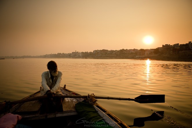
Ferryman at Varanasi Photo: with thanks from Gavin Gough gavingough.photoshelter.com
Ferryman at Varanasi Photo: with thanks from Gavin Gough gavingough.photoshelter

7

Child at Ganga Photo with thanks from:gnarlysunset.com

The river has something special to tell to all of us… only if we pause and listen…

The question is how many rivers we have with us still, to have such converstaions? How many rivers will the next generation have?

Do tell us about your conversations with rivers. In the meantime we will get back to conversations on rivers.

SANDRP

Floods · International Water Issues · Ministry of Water Resources

Bangladesh’s Amazing and New Flood Forecasting: A Tip for India’s CWC to Improve its Flood Forecasting Performance

Bangladesh has come up a new flood forecasting and warning system with several amazingly useful features of forecasting floods available on their website from June 2013. Flood forecasting is a vital non-structural measure to mitigate flood losses which can be very useful for a deltaic nation like Bangladesh which face brunt of floods annually. The Flood Forecasting and Warning Centre (FFWC) is under the aegis Bangladesh Water Development Board and is supported by UNDP through the Comprehensive Disaster Management Programme (Phase II) and Ministry of Disaster Management and Relief. The website can be accessed at http://www.ffwc.gov.bd/index.php.

ps 1

While the features have become available on website since June 2013, many of them have been otherwise available since 2011. In fact, Interactive Voice Response [Calling from mobile (phone no- 10941), flood and weather messages can be heard in Bangla (charge applicable)] facility is available since 2011.

The Deltaic Bangladesh Geographically, Bangladesh is country located in one of the biggest active deltas in the world with an area of about 1,47,570 sq km.  The climate of the country is subtropical-monsoon climate where annual average precipitation is 2300 mm which varies from1200 mm in the north-west to over 5000 mm in the north-east. Bangladesh, as stated in its Annual Flood Report of 2012, has a total of 230 rivers out of which 57 are Transboundary Rivers. 54 of these transboundary river flows from India to Bangladesh which includes the Ganges and the Brahmaputra. Bangladesh consists of flood plains of the Ganges, the Brahmaputra and the Meghna rivers and their numerous tributaries and distributaries. The FFWC carries out monitoring of 86 representative water level stations and 56 rainfall stations across Bangladesh.

The FFWC Website The homepage of the FFWC website presents a map of the whole country and its rivers, marked with flood forecasting sites in Bangladesh which is really useful for a number of reasons:

(i) For a first time visitor it gives a good idea of the rivers in Bangladesh and their flood forecasting sites.

(ii) When the cursor stops at a particular forecasting site, a pop up site appears with location details, water level, highest water level and danger level at that particular site.

(iii) with locations of forecasting sites on the same river clearly marked, one can get an overview of the situation across the river basin.

(iv) colour code of the symbol at each FF location gives an idea if the water level is above/ below warning or danger level or High Flood level.

ps 8

The homepage of FFWC offers an option to view the whole website in Bangla. This is very welcome and useful since this important information can be accessed and used by people in local language.

The home page also provides information on the sites where water level is currently on the rise or above the danger mark. Below the line of tabs of the website, name of the sites where water level is on the rise keeps on scrolling. Clicking in any of the sites in the scroll, leads to a pop-up where the rise in water level is presented in graph for the previous one week. The rise in water level for each day is also showed according to time which appears when the cursor is kept on any of the dots of the graph.  This pop up can also be saved either as a photo, as a pdf or as a SVG vector image.

The FFWC website provides rainfall data and water level data of every designated site in the four river basins of Bangladesh under the ‘data’ tab: Bramaputra (13 sites), Ganga (17 sites), Meghna (15 sites) and South East Hills (10 sites).  The rainfall data table gives rainfall of the day, along with previous two days rainfall, normal monthly rainfall and cumulative rainfall for the month. But here FFWC can add the total rainfall data for the whole season which will make it more useful.

The water level data table provides water level of the day, previous day water level and projection of water level for the next three days along with name of the river and location name for 38 sites in Brhamaputra basin, 27 sites in Ganga basin, 26 sites in Meghna basin and 7 sites in South East Hill Basin. ps 10

The FFWC website under the ‘Forecasting and Warning’ tab provides very substantial information regarding floods under following heads: ‘Flood Summary’, ‘Flood Bulletin’, ‘3-day Deterministic Flood Forecast’, ‘5-day Deterministic (experimental) Flood Forecast’, ‘Medium Range (1-10 Days)Forecast’ ‘Structure Based Forecast’ (available for a few structures like embankments or bridges on experimental basis) and ‘Special Outlook’ (only in Bangla language).

Under the ‘Map’ tab, the website has ‘Rainfall Distribution Map’ and ‘Inundation Map’. The rainfall distribution map[i] provides at a glace picture of rainfall over the last 24 hours. The latter provide the options to view inundation maps[ii] for the given day and forecasts for next two days, both for Dhaka and for Bangladesh as a whole. ps 2

ps 7

The ‘Reports’ tab holds annual reports on floods in Bangladesh for last five years. In the ‘Hydrograph’ tab, the website first provides of forecast of water level for each site through a graph. Under ‘Forecast’ the website provides observed water level at each selected site for the day, previous six days (with all the observations available on the graph) and forecast for the next three days. This is provided for 89 sites which include 8 sites from South East Hills basin, 26 sites in Meghna basin, 21 sites in Ganga basin and 34 sites in Brahmaputra basin. Division wise break up is: Borisal-1; Chittagong-11; Dhaka-30; Khulna-6; Rajshahi-14; Rangpur-12; Sylhet-15. It also provides monsoon hydrograph for 104 sites, where the water level throughout the monsoon is given, some of the graphs seems to show flat levels, though, raising questions if these are providing correct information.

Here for some sites several selected years’ monsoon season data is also represented through graph for some of the sites but it becomes bit confusing since no rational for choosing a particular year is provided. Providing the basis for choosing a particular year monsoon will clarify the picture. In both ‘forecast’ and ‘monsoon’ options the sites are presented not only river basin wise but also on the basis of regions making it more easy to use. Hydrograph also includes ‘Real Time Data’ of three sites. The real time data of these three sites presents the water level from one day to last 60 days through graph.

ps 9

GoI-CWC’s Flood Forecasting website If we compare this with the flood forecasting website of Government of India’s Central Water Commission (http://www.india-water.com/ffs/index.htm), the CWC site home page has two options ‘list based’ and ‘map based’ but the latter surprisingly never worked for this whole monsoons season, it has never worked, it seems. Clicking on the map based option leads to page which asks for plug in download. There is also an option for map browser installation but that never worked.

The ‘list based option’ has the flood forecasting sites under three options – state, basin and region-wise. But there is no page where all the flood forecasting sites can be found at one place. CWC flood forecasting site provides forecasts available at a given point of time, only for one day and which is removed as soon as the time of forecasting gets over. The forecasting in table format is made only for those sites where the water level has crossed the warning level. The CWC flood forecasting website does not provide three day, or five day or ten day forecasts. This is in contrast with the flood forecasting done by Bangladesh because the website provided water level data for each site in the country in one place and it is fast, more responsive and user friendly. Besides, on CWC site there is no option of keeping a record of previous forecasts. All the forecasting data available in the CWC website is available in English and not even in Hindi.

In case of CWC, there were also instances when water level even after crossing the danger level did not appear in the flood forecasting table. This has been observed for example in case of the Sahibganj site on the GangaRiver. Sahibganj did not appear in the flood forecasting table even for once even though the site was witnessing low to moderate floods as shown in the list base option of the same website.

There are also several other issues with the CWC flood forecasting website e.g. wrong flood forecasting, no forecasting of the floods during the Uttarakhand disaster and inadequate flood forecasting sites which had been pointed out to CWC by SANDRP[iii].

CWC need to do serious homework to improve its performance in flood forecasting for and in doing so it can take some good lessons from Bangladesh.

Extending the forecasts to GBM basin There is a huge scope for Transboundary cooperation in extending the flood forecasting across the countries sharing Ganga-Brahmaputra-Meghna basins, including Bangladesh, India, Bhutan, Nepal and China. In fact Md Amirul Hossain, Executive Engineer at FFWC wrote to SANDRP in response to a question, “The FFWC of Bangladesh has been receiving little (rather very little) upstream data/ information on water level or flood situation. This little data helped us very much for generating everyday flood forecasting. If we would be in a position to share hydro-met data of the upstream, most of within India, few in Nepal & Bhutan, then the Flood Forecasting and Warning Lead time could further be increased/ extended. FFWC-Bngladesh likes to share the information, skill and experience and would be happy to participate in an effort to develop “BASIN FLOOD FORECASTING AND WARNING” for Brahmaputra-Ganges and Meghna basin (GBM-Basin).” It is heartening to see this offer from FFWC, Bangladesh. We hope steps will be taken to realize this potential and more and transparent sharing of flood forecasting information across the countries will be a reality soon.

 Himanshu Thakkar and Parag Jyoti Saikia

Dams

NIH Roorkee’s Workshop on Eflows: Where is the credibility?

National Institute of Hydrology (NIH), Roorkee, an organisation under Union Ministry of Water Resources (MoWR) is organising a workshop on Assessment of Environmental flows (E-flows) in Rivers in Roorkee on the 2-3 October 2013.

Any serious engagement with e-flows, from any quarter is a welcome sign. However, NIH’s engagement with eflows is a bit ironic, looking at its past work and support for hydroelectric and large infrastructure projects, without any consideration for environmental flows.

Not surprisingly, NIH has refrained from inviting almost any voices that have been critical about MoWR’s Large Dam agenda. On the other hand, main ‘stakeholders’ invited are representatives from Hydroelectric dam projects! Expectedly, the workshop is looking at environmental flows in a role adversarial to “development”, without understanding the role the rivers play in a society. In fact there is no session on value of rivers, which forms the basis of the concept like eflows.

Let us have a quick look at NIH’s track record and its response to the concept of eflows so far.

Following the Uttarakhand Disaster, Supreme Court on the 13th of August, 2013 said in no uncertain terms that the Cumulative Impact Assessment Study done by AHEC, Roorkee on Upper Ganga Projects “has not made any in-depth study on the cumulative impact of all project components”, practically rejecting AHEC Study. Even the members of the MoEF’s (Ministry of Environment and Forests) EAC (Expert Appraisal Committee) on River Valley Projects have said that e-flows estimated in the AHEC report are unclear. Inter-ministerial Group Report (The BK Chaturvedi Committee) on Upper Ganga Projects has rejected most of the AHEC recommendations for eflows.

National Institute of Hydrology, Roorkee (NIH Roorkee) was a part of the study team of the AHEC Report on Upper Ganga[I] and hence, what this SC order and other agencies have said about AHEC report applies to NIH too.

NIH is supposed to be India’s premier institute on hydrology, but a closer look at the research and projects its done so far makes it clear that NIH is a also an integral part of the lobby that pushes large dams as the only solution to all of India’s water-related problems. The lobby includes the Ministry of Water Resources and the Central Water Commission. These organisations form an integral part of NIH’s organisational structure. Chairman of the governing body of NIH[II] is Secretary, MoWR. Its members include MoWR Joint Secretary and planning commission members. Its Standing Committee is comprised exclusively of MoWR representatives.

NIH introduces Environmental Hydrology as its area of specialisation. One of its tasks is[III] “Estimation of surplus and deficit water availability considering water demand and available water supply”. This concept of surplus and deficit has been used to support Interlinking of Rivers, which is ecologically one of the most destructive water projects in India. This too is explicitly supported by NIH. Note that while doing the studies related to ILR, NIH has assumed NO water for the environment!

It has estimated[IV], “In India, the estimates put a requirement of 10 BCM (billion cubic meters) for the year 2025 and 20 BCM for the year 2050 for EFR purpose.” This estimate, coming from an institute which is supposedly India’s Premier institute on hydrology lacks any ecological, social and scientific justification.

NIH’s thrust on ‘Water Resource Projects’ is so strong that its ‘water resources section’[V] pushes projects like the 2000 MW Lower Subansiri HEP, in Brahmaputra basin, without even mentioning that work on the project has stalled since Dec 2011 and  it is facing the biggest anti dam protest in India, mainly due to downstream impacts and non-transparent decision making processes.

As hydropower projects are being built in cascades in vulnerable regions, NIH has been conspicuously absent from the discourse. It has not taken a stand about e-flows, distance of free flowing rivers between projects and other environmental measures when hydropower projects are being built from Kashmir to Arunachal Pradesh with high disaster potential. On the other hand, through its studies like GLOF Analysis for Jelam Tamak Hydropower project [2] in Alaknanda basin in Uttarakhand, NIH has been largely supporting these projects, underplaying their impacts.

In fact, NIH did a eflows study for Loharinagpala HEP in Bhagirathi, where it assumed that Bhagirathi is a highly degraded river and recommended that 10% MAR will suffice as e-flows[VI], using the Tennant Method. Bhagirathi, which is hailed as the original stream of Ganga is not a ‘highly degraded’ river by stretch of imagination upstream of Maneri Bhali projects, but it will be ‘highly degraded’ if projects pushed by institutes like NIH are implemented. Significantly, Loharinagpala HEP was scrapped because of issues related to e-flows and aviral dhara of Ganga.

Strangely, NIH workshop on Assessing E-flows program starts not by addressing the importance of e-flows, but by stressing the importance of dams! The first session will be on Water Resources Development in India – need for power, irrigation, water supply and dams, to be conducted by NIH itself. It seems that this workshop is an attempt to get more eflows consultancies from private and government hydel projects.

Groups like WAPCOS (also a MoWR institute) and CIFRI have been churning out studies after studies with shoddy analysis and wrong biodiversity assessments, helping the project proponents and destroying the river further. However, communities, groups, and even judiciary are now putting its foot down about these shoddy studies.

NIH should realise that eflows are not one more of their studies which can be carried out excluding wide range of stakeholders: from communities to ecosystems. NIH has poor track record on eflows and it will have to do much more than organising workshops on eflows, if it is looking to establish its credibility on the issue.  

END NOTES:


[1] Environmental flows or E-Flows are defined as: ‘Environmental Flows describe the quantity, quality and timing of water flows required to sustain freshwater and estuarine ecosystems and the human livelihoods and well-being that depend on these ecosystems.” (Brisbane Declaration 2007)

[2] which has been rejected by Wildlife Institute of India and even BK Chaturvedi committee has suggested that the project should be taken up only after Ganga Basin Management Plan from IIT Consortium


[VI] “The E-Flow value computed by the Tenants method, considering it as 10% of the MAR, is 3848 Cumec Days for a calendar year” (NIH: Concluding Remarks No 10): Source: Dr. Bharat Jhunjhunwala’s Letter to IITR xa.yimg.com/kq/groups/8723444/2093659328/name/iitr

Dams

Happy World Rivers Day!!

Indians and South Asians dont need a reason to celebrate our rivers. Rivers, in their myriad avatars, are celebrated and worshipped across the Indian subcontinent, by religions like Islam, Hinduism, Buddhism, Jainism, Sikhism alike.

Most of our rivers are dying and the living, healthy and free flowing rivers are increasingly threatened. Indian Rivers have NO legal protection and there is no law that says that rivers should have freshwater! In the absence of political will and transparent and democratic governance more and more rivers are being damaged, diverted, destroyed and dried.

The species of flowing rivers are dwindling, the communities that depend are them are becoming increasingly vulnerable, governance surrounding rivers is becoming more and more non-transparent, strait jacketed and ecologically destructive. Decision makers are refusing to accept the dynamics, linkages, interdependencies and LIFE of rivers.

Religions too, have FAILED miserably in protecting rivers that they seem to worship so publicly.

We need to understand and appreciate the meaning and value of a healthy, flowing and giving river. Is river only a channel supplying drinking water? Is it only an irrigation canal? Is it only a powerhouse of electricity? Is it only an open drain to transport our sewage and effluents? Is it only an abstract religious idea in which we wash our sins?

What is the worth of a flowing river for us and the decision makers?

We do need every excuse to celebrate, nurture and contemplate our rivers. We need to take time and think more deeply about our connected future.

Last sunday of Sepetmeber has been celebrated as World Rivers Day by a small province in Canada since the past 33 years. Down the years, many countries, organisations and groups have joined in and this year, World Rivrs Day is being celebrated in over 60 countries across the world. (http://worldriversday.com/) Link to SANDRPs Note on World Rivers Day last year: https://sandrp.in/rivers/World_Rivers_Day_PR_Sept_30_2012.pdf

On this occassion, we look at some of our most spectacular, generous and threatened rivers and hope that the coming year will give us more reasons to celebrate our rivers!

Mighty Ganga at Rishikesh Photo: Himanshu Thakkar, SANDRP
Ganga, completely dry downstream Bhimgouda Barrage, Haridwar Photo: Parineeta, SANDRP

DevPrayag, confluence of Alaknanda and Bhagirathi Rivers, forming Ganga, threatened by Kotlibhel dam projects. Photo: trekearth.com

DevPrayag, confluence of Alaknanda and Bhagirathi Rivers, forming Ganga, threatened by Kotlibhel dam projects. Photo: trekearth.com
The beautiful Baspa River, a tributary of Satluj in himachal Pradesh. A river renowned for its scenic beauty and spectacular fish. now thretened by 300 MW Baspa II Hydel Project, without fish ladders or passes. Photo: Debashsih Dey
The beautiful Baspa River, a tributary of Satluj in Himachal Pradesh. A river renowned for its scenic beauty and spectacular fish. Now threatened by 300 MW Baspa II Hydel Project, without fish ladders or passes. Photo: Debashsih Dey
The beautiful Nyamjangchu River, Tawang, Arunachal Pradesh, now threatened by the 780 MW Nyamjangchu Hydel Project. Photo courtesy: Tenzing Rab Monpa
Breathtaking floodplains of the Lohit River, an important tributary of the Brahmaputra, threatened by the 1750 MW Lower Demwe Dam.  Photo: Neeraj Vagholikar
Breathtaking floodplains of the Lohit River, an important tributary of the Brahmaputra, threatened by the 1750 MW Lower Demwe Dam.
Photo: Neeraj Vagholikar

The Brahmaputra during monsoon in Matmora, Dhakukhana Sub-division, Lakhimpur District, Assam.  Photo – Parag Jyoti Saikia, SANDRP

The Brahmaputra during monsoon in Matmora, Dhakukhana Sub-division, Lakhimpur District, Assam.
Photo – Parag Jyoti Saikia, SANDRP

A woman weaving below a ‘Chang ghar’, a house made on an elevated platform. People from Mishing ethnic community live on chang ghars which is traditional way coping with floods. This photo taken in Matmora area of Dhakukhana subdivision also shows the backwaters of the river Brahmaputra. Photo – Parag Jyoti Saikia, SANDRP


Railway track washed away in the flash floods of Gai River I Dhemaji district of Assam of 15th August 2011.  Photo – Parag Jyoti Saikia, SANDRP
Railway track washed away in the flash floods of Gai River in Dhemaji district of Assam of 15th August 2011.
Photo – Parag Jyoti Saikia, SANDRP 


Fish, preserved in nets along Brahmaputra. Photo: Himanshu Thakkar, SANDRP
Fish, preserved in nets along the mighty Brahmaputra. Photo: Himanshu Thakkar, SANDRP

Gundia River and surrounding forests threatened by the 200 MW Gundia Dam and Yettinahole Diversion Photo: SANDRP

Gundia River and surrounding forests threatened by the 200 MW Gundia Dam and Yettinahole Diversion Photo: SANDRP

Estuary of the free flowing Shashtri River in Maharashtra
Estuary of the free flowing Shashtri River in Maharashtra, one of teh last remaining free flowing rivers of the country Photo: SANDRP
Seetha Nadi, free flowing river in Karnataka Western Ghats. Photo: SANDRP
Fishing in Vashishthi Estuary, Western Ghats. Photo: SANDRP
The beautiful Cauvery, shackeled in many small hydel projects at the gaganchukki falls, Karnataka. Photo: SANDRP
The lovely bharachukki falls on Cuavery, also shackeled by many mini hydel projects. Photo: SANDRP
Estuary of the Karli River in Western Ghats. Photo SANDRP
Thinking like a River at Athirappilly Falls on Chalakudy River, threatned by 164 MW Athirappilly Hydel Project Photo: SANDRP
Celebrating RIvers!! The Kumaradhara in Karnataka, near site for Kukke Stage II Mini Hydel Proejct Photo: SANDRP
Dams · Kerala

Public Pressure Leads to Changes in Kerala Dam Operation

Kerala Govt Agrees to Change Operation of Chalakudy River Hydropower Project:

Public Pressure Leads to Changes in Dam Operation

The decision to increase off-peak generation at Poringalkuthu Left Bank Hydro Electric Project (PLB HEP) in Chalakudy River, taken at a meeting convened by the Hon Chief Minister of Kerala in the fourth week of April (PRD – Thrissur, 25-04-13) was a partial success to the sustained campaign for dams re-operation at Chalakudy river. The meeting was attended by the Ministers for water resource and power, River Basin MLAs and officials of state electricity board and irrigation department. The decision however falls short of the demand for reverting the operation of PLB HEP into base load.

Chalakudy River Basin Physical Map

Normaly the summer water availability in the river below Poringalkuthu HEP should be between 1.3 – 1.5 MCM / day. The failure of both monsoons in 2012 and violation of Kerala-Tamil Nadu interstate Parambikulam – Aliyar agreement (1970) condition that the Kerala Sholayar reservoir shall be kept at full reservoir level by Tamil Nadu on the 1st of February every year (Sch. II.3 – PAP Capture 1Agreement), reduced the water availability in 2013 summer to less than 1 MCM per day resulting in severe water stress in the river basin. On top of the water shortage, intra-day as well as inter-day flow fluctuations in tail-race discharge from PLB HEP had worsened the situation. Anticipating water shortage the river basin MLAs as well as Local Self Government (LSG) heads had been demanding action from the State Government since December 2012.

Background: The river – dams and flow regime Chalakudypuzha (ChalakudyRiver), the fifth largest river in Kerala with a length of 144 kms and catchment area of 1704 Sq.kms is one of the heavily utilised rivers in the state. Major tributaries of this west flowing river originate from the Anamalai hills, Parambikulam Plateau and Nelliyampathy hills of Southern Western Ghats. The river/ its tributaries have been dammed at six places. The dams and diversions have completely altered the natural hydrological regime in the river. The river is the life line of about 30 Local Self Governments (LSGs) and about ten lakh people. Apart from the dams and diversion structures, numerous drinking water schemes and lift irrigation schemes are also dependent on the river. The table below provides details of existing major projects on the river.

Existing dams/ diversions in Chalakudypuzha

Sl. No. Project Commissioning Year Purpose Storage MCM Developer
1 Poringalkuthu LB HEP 1957 Hydro Power 32 Kerala SEB
2 Thunakadavu (PAP)* 1965 Diversion 15.77 Tamilnadu
3 Kerala Sholayar (PAP) 1966 Hydro Power 153.49 Kerala SEB
4 Parambikulam (PAP) 1967 Diversion 504.66 Tamilnadu
5 Peruarippallam (PAP) 1971 Diversion 17.56 Tamilnadu
6 TN Sholayar (PAP) 1971 Hydropower + diversion 152.7 Tamilnadu
7 ChalakudyRiver Diversion Scheme 1959 ** Irrigation 0,218 Kerala-Irri Dept
8 Idamalayar Augmentation Scheme 1990s Diversion NA Kerala SEB

*PAP- Parambikulam Aliyar Project    **Partially operational since 1952

Almost 75 percent of the catchments of the ChalakudyRiver were forested at the turn of 20th century. Hence the river had a fairly Capture 2healthy flow even during summer months. However, at present, the natural summer flow in the river has reduced drastically due to forest degradation and dams and diversions. Consequently, the present river flow in non-monsoon months is almost entirely dependent on the storage at Kerala Sholayar and Poringalkuthu reservoirs. The downstream major irrigation project, the Chalakudy River Diversion Scheme (CRDS) does not have storage of its own. It is completely dependent on the tailrace discharge from the PLB – HEP. Over the last two decades, the daily flow fluctuation due to the semi-peaking operation of the PLB-HEP is affecting the functioning of CRDS. Incidentally, the campaign against the proposed Athirappilly hydroelectric project (AHEP) had first brought this issue into focus. One of the major issues with regards to AHEP, a peaking power station, was the downstream impacts of drastic intra-day flow fluctuation (to the tune of 1:17).
Incidentally, Western Ghats Ecology Expert Panel had recommended not to give clearance to the project after conducting field visits and detailed and transparent consultations. However, the High Level Working Group formed to look into the WGEEP report acted in a non-transparent manner. They conducted a field visit with the project proponent (The Kerala State Electricity Board – KSEB), without informing the public, press or the Grama Panchayath and not providing opportunity for the organisations opposing the project to present their case before the committee. The HLWG recommended that the project proponent can approach the Ministry of Environment and Forest (MoEF) for fresh clearance, if it so desired, after some studies despite identifying the project location as ecologically sensitive area.

Analysis of hydrological data for AHEP as well as debates on the issue revealed the existing flow fluctuations due to changed operation pattern of PLB HEP since early 1990s. As the capacity of the PLB HEP was enhanced from 32 MW (8 MW X 4) to 48 MW with the commissioning of a 16 MW generator in 1999, the peak generation and the resultant flow fluctuation increased. The field assessment in the CRDS command area had confirmed the impacts due to the flow fluctuations.

As part of an action research done by the Kerala State Centre of Forum for Policy Dialogue on Water Conflicts in India, an attempt was made to find possible solutions to the conflict of interest between power generation and downstream needs. The conflict between CRDS and other downstream uses due to total diversion of water at its head works at Thumboormuzhi was also taken up. An alternate reservoir operations management (ROM) strategy that aims at sustainable and equitable sharing of available water resources was prepared as part of the study. Capture 3

ROM strategy for Chalakudy River The ROM strategy tried to synchronise the operations of Kerala Sholayar and PLB HEPs with the downstream requirements. Secondary data regarding the river flow, rainfall etc. was collected from concerned agencies like KSEB, Water Resources Department etc. Issues with respect to the present flow regime were assessed through field surveys and stakeholder consultations.  After analysing the available data and assessing downstream irrigation needs through people’s perception and based on the suggestions/ comments by the experts, the draft reservoir operations strategy was prepared. ROM strategy is attempted for water available to the basin after diversions to Tamil Nadu and Idamalayar with focus for non-monsoon months.

In the proposed ROM strategy, the summer water availability for the downstream needs is suggested to be increased through modifications in the operation pattern of Kerala Sholayar and Poringalkuthu HEPs. At Kerala Sholayar, the total utilisable quantity of water is fixed as per the PAP agreement. The monsoon discharge is proposed to be reduced by about 15 % of the average flow (data period – 1979 to 2006) so that the non-monsoon water availability can be enhanced. At Poringalkuthu, the ROM strategy proposes that the water level in the reservoir shall be kept at close to the full reservoir level up to the end of January. The change in the operation of the two HEPs is expected to ensure water availability of not less than 1.5 MCM/ day for the downstream uses. The ROM strategy proposes to operate the Poringalkuthu HEP, the lower dam, that discharges water into the main river as a base load station (as it was operated before 1990s) in non-monsoon months. This can ensure a steady discharge of over 17 m3/sec.

Peringal Dam Photo: CPSS
Peringal Dam
Photo: CPSS

At present the entire flow reaching Thumboormuzhi weir, the head works of CRDS is being diverted to the canals, except for some overflow during peak hours. This is affecting the downstream areas including the ecological functions of the river. The ROM strategy proposes a minimum flow of not less than 2 m3/sec to be released from Thumboormuzhi weir in to the river. This may be increased later after improvement in natural summer river flow through eco-regeneration of the upper catchments and by reducing the irrigation demand through adoption of ‘more crop per drop’ approach in the CRDS command.

The revised operation pattern is not expected to have significant impact on the power front. The non-monsoon power generation from the river basin is expected to slightly increase, whereas, the peak power generation will be reduced by 8 MW to 16 MW, which is about 0.25-0.5 % of the present summer peak demand of Kerala of about 3400 MW.

Building public awareness and public pressure The ROM strategy was widely discussed with the LSGs and other stakeholders. As the LSGs, farmers and Irrigation and Agriculture departments were active partners in the action research (2008 – 2012) they Capture 4readily accepted the proposed ROM strategy. Many LSGs demanded the state government to implement this, through resolutions. With the shortage in rainfall during 2012 monsoons, severe water stress was anticipated and a series of steps were taken to put pressure on the state government for dams re-operation so that the summer water shortage for downstream areas can be reduced.

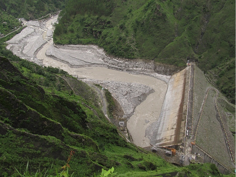
  • A meeting of the LSG representatives organised by Chalakudy Puzha Samrakshana Samithi (CPSS) before the start of irrigation season discussed the anticipated scenario for the 2012-13 season and decided to step up campaign for changing the operation pattern at PLB HEP.
  • The project advisory committee meeting of CRDS, in December 2012 also took a similar decision.
  • In December 2012, five MLAs of the ChalakudyRiver basin, cutting across party lines, jointly demanded the Chief Minister to convene a meeting of the concerned ministers, MLAs, LSG heads and officials to discuss the issues with regards to the summer water availability in the river basin. This was the result of a series of interactions with these MLAs by the CPSS team.
  • In the second week of January 2013, 25 LSG heads gave a submission to the CM demanding action by the government to ensure water availability at Kerala Sholayar as per the PAP agreement and changing the Poringalkuthu HEP to base load station.
  • Even as no action was taken by the state government and the situation was becoming grim, the project advisory committee meeting of CRDS decided that a delegation must go to Thiruvananthapuram and meet the CM and other concerned ministers. A meeting of LSG heads organised jointly by CPSS and Chalakudy basin Block Panchayaths also decided to take necessary actions.
  • On March 19th 2013,   four MLAs and 10 LSG heads from ChalakudyRiver basin met the Chief Minister and Minister for Water Resources. Rajaneesh from CPSS was also part of the team. The people’s representatives wanted the Govt to take necessary steps to ensure better water availability for Chalakudy basin. The main points raised were regarding violation of Parambikulam – Aliyar Agreement condition and ensuring steady flow from Poringalkuthu HEP for the downstream needs. The CM agreed to convene a meeting of all concerned immediately. However, the meeting was delayed by more than one month and when the meeting finally took place, the LSG representatives were not invited for the same.
  • Meanwhile a detailed discussion was held with the KSEB Chairman in the first week of April 2013. The Chairman promised to look into the issue.
  • All along the campaign, the print as well as visual media reported these developments and published / telecast stories on the issue.

Partial re-operation The daily average generation at Poringalkuthu in January 2013 was 0.4481 MU (Million Units, as per Kerala State Load Despatch Centre website) and the corresponding discharge was about 1.2 MCM per day. Due to the non-compliance of PAP agreement condition, the combined storage at Kerala Sholayar and Poringalkuthu reservoirs on the 1st February was only around 115 MCM against an anticipated volume of 160 -170 MCM. Consequently, the generation was less in the following months. The average generation and discharge in February, March and April were 0.3457 MU / 0.93 MCM, 0.3237MU / 0.87 MCM and 0.3343 MU / 0.9 MCM respectively. The semi-peaking operation at PLB HEP continued resulting in intra-day fluctuations. The off-peak generation was mostly limited to 8 MW with a corresponding discharge of around 6.5 m3/sec, which is highly insufficient to meet the irrigation demand of the CRDS command. There were also instances of practically no generation during off-peak hours, especially during night times.

Upper Sholayar Dam Photo: CPSS
Upper Sholayar Dam
Photo: CPSS

Apart from the intra-day fluctuation the inter-day flow fluctuations was also a major cause of worry. The situation was particularly bad in the second half of March and first half of April. On 4 days between March 21st and April 10th, the generation was between 0.158 MU and 0.182 MU. The corresponding discharge was less than 0.5 MCM. On a few other days, the generation was between 0.2 -0.3 MU.

Since the decision of the meeting convened by the CM, the situation has slightly improved. The inter-day fluctuation was less since 25th of April with the discharge of 0.9 -1 MCM on most days. More importantly, the off-peak generation was at least 16 MW (except on a couple of days). The average discharge since the last week of April has also slightly increased in comparison to the previous months.

The change in operation pattern does not seem to have had any negative impact on power front. Initially the KSEB had increased off-peak generation without reducing peak generation. The generation figures as per the SLDC website shows the generation at PLB HEP on 25th, 26th and 27th April (after the decision at Ministry level meeting) as 0.425 MU, 0.402 MU and 0.412 MU respectively, corresponding to discharge of around 1.1 MCM. Later only one machine was available and the peak as well as total generation reduced.  The average generation during this period was around 0.35 MU corresponding to a discharge of about 0.95 MCM. The generation figure shows that the station was running continuously as a base load station (by default?) for two weeks. Even though the rate of discharge was less than the actual requirement, we have requested the irrigation officials to assess the effect of steady inflow at CRDS.

The decision for increasing off-peak generation is significant since it is acknowledgement by the government that the downstream requirement should be given priority over power generation. However, the long delay in taking such a decision even after the river basin MLAs and LSG heads unanimously demanded for the same cannot be justified. Also, the steps taken so far are not sufficient. The storage position as on 27-04-2013 at Kerala Sholayar and Poringalkuthu reservoirs (33.78 MCM and 9.23 MCM respectively) could have supported a daily discharge of upto 1.3 MCM till May 31st, especially since the catchments traditionally get good pre-monsoon rains and an inflow of 100 cusecs from Tamil Nadu Sholayar was anticipated, on the basis of inter-ministerial discussion on PAP agreement.

The campaign / advocacy for further changes in operation will have to be continued as the present decision is of a temporary nature. Until and unless the non-monsoon discharge from Poringalkuthu HEP is enhanced to around 17 m3/ sec, sufficient river discharge from CRDS head works is not likely to materialise. (The suggested discharge rate from Poringalkuthu HEP as per the ROM strategy, based on anticipated water availability, is 17.25 m3/ sec and the corresponding generation will be 24 MW.) The fact that the Chalakudy MLA protested against closing down all generators of old powerhouse together since May 7th shows that the people’s representatives are now more vigilant on the issue and this should help in stepping up the campaign. Moreover, a collective of Local Self Government heads is emerging for the cause of the river and this collective, if it becomes active, can really help take forward the efforts for the revival of ChalakudyRiver.

S P Ravi (cholayar@rediffmail.com)

Dams · Hydropower · Uttarakhand

Uttarakhand Floods of June 2013: Curtain Raiser on the Events at NHPC’s 280 MW Dhauliganga HEP

box 2Days after walking down the Gori, we go to the Sub-Divisional Magistrate of Dharchula sub-division, Pramod Kumar, who is busy coordinating rescue and relief on a war-footing, but still has the courtesy to meet. On being asked by me regarding the sudden release of water by the 280 MW National Hydro-Power Corporation (NHPC) Dhauliganga Hydro-Electric Project (HEP, see below the layout of the project given on NHPC website) at Chirkila and the ensuing damage downstream, he confirms that he received an emergency call on the night of 16th June, 2013 from the NHPC, asking that they be permitted to release the impounded water in their reservoir, because it was in danger of breaching. Under normal circumstances they do not need his permission. He also confirms that he had refused, because the water level in the Mahakali main-stem was already flowing at danger-mark. NHPC went right ahead and opened their gates at full on the night of 16th June, without authorization or any prior warning to anybody[1] but their own office-residence complex 20 km downstream, at Dobat.

Map of Dhauliganga Dam Source: NHPC
Map of Dhauliganga Dam
Source: NHPC

Was this really an emergency, or was this purely opportunistic on the part of NHPC to take this opportunity early in the season to flush their reservoir that had been filled almost to half with bed-load and silt? We went looking for clues and information. I went to the NHPC office complex at Dobat, and met Bhuvan Chand Joshi, their Public Relations Officer. After giving me the spiel on how safe, and how green this so called run-of-the-river (ROR) project was, constructed by no less than the Japanese, the Germans and the Koreans put together[2], he admitted that their underground power-station was entirely flooded. Housed in a gigantic underground cavern about 100 meters long, four-storeys high at 40 meters and about 16 meters wide, river water had filled it right upto the control-room on the fourth floor. I had already been told by Kesar Singh Dhami, taxi owner of Dharchula, that on the 16th June itself, when he was ferrying the first batch of Kailash yatris to the road-head on their way up to Tibet, he had noticed the reservoir was filled high already with flood-waters, with large uprooted trees and other woody debris floating at the damsite. He confirms that water was being released, but only a small release, despite the dam being fuller than he had ever seen it.

I was also told by another employee of NHPC (who did not wish to be named) that what had gone wrong was that despite the high flows on the 15th and 16th June, the power-station continued with production of electricity as usual. In what seems to be an unbelievably short-sighted and poor design, the Tail-race Tunnel, from where water is released back into the river after having turned the turbines, is flushed into a tributary stream, the Ellagad. It was when Ellagad also pulsed, that it sent a train of bed-load debris down its lower reaches, effectively blocking the exit of the Tail-race Tunnel coming out of the powerhouse. The power house continued to take in water from the Head-race Tunnel intake to work their turbines, unaware that the exit for water had been blocked. It is only when the water blocked in the Tail-race Tunnel surged back up, burst through the turbine units and began flooding the powerhouse, that NHPC even know that something was wrong. It was then that the massive curved steel gates of the intake were slid shut, and the powerhouse evacuated. This was further confirmed by Joshi, PRO, who also said that the ‘matter was under investigation’ by their own team for organizational detail. The General Manager and the Chief Engineer of the Dhauliganga HEP had meanwhile been transferred out. It is not clear yet how soon after the powerhouse was flooded, that they opened the sluice gates at the bottom of the reservoir. Draining it was clearly beneficial for NHPC, but catastrophic for roads, bridges and habitations downstream, both in India and Nepal.

Dhauliganga before the disaster, with zero water flow downstream from the dam, killing a perennial river. Source: Author

If you look closely enough, there are two separate events here. The flooding of the powerhouse, and the ’emergency’ release of reservoir water. The powerhouse was not flooded because of too much water in the reservoir, but because it was in operation when its tail-race exit seven km downstream, is blocked-off because of poor short-sighted design[3]. They are then forced to close the gates of the intake, and abandon the powerhouse where water has reached the control-room on the fourth floor. The intake gates are now shut, but the flood waters continue to fill the reservoir further. They have already allowed the dam fill to a very high level, and here is the other curious factor.

The design of the Dhauliganga dam, is such that the dam has no provision for water to ‘overflow’ the dam safely, should undesired (even if foreseeable) levels be reached as they did this year. Or say if giant boulders block the narrow sluice gates at the bottom of the reservoir. Or in the real-time situation of what actually happened this year, the blocking of the tail-race tunnel leading to flooding of the powerhouse, hence requiring the shutting off of the intake, and losing the option of reducing reservoir levels more gradually and safely through two simultaneous releases. They then open the flood-gates. Clearly, one of two things have led to this decision:

One, letting the reservoir fill to a very high level is not out of the ordinary for NHPC; they do it every monsoon, as they had done on 16th June as well. It is not for many months in the year that they have enough water to run all four turbines. Despite the run-of-the-river label, Joshi confirmed that they were unable to let any water to continue to flow un-diverted in the river-channel during the winter-spring months (we have photographic evidence of this as well), or they would not have water to turn even one turbine! The mandatory requirement that every hydro-power dam in Uttarakhand be required to release at least 10% of the river’s minimum flows at all times (as greatly insufficient as such a small flow is for downstream life), it seems neither a consideration while justifying the economics of such projects, and neither is it complied to here. The use of the term run-of-the-river here, is plain deception.

The Dhauliganga Hydro-power dam, after being flushed of bed-load sediment Source: Author
The Dhauliganga Hydro-power dam, after being flushed of bed-load sediment
Source: Author

Their regular annual schedule for flushing the reservoir of bed-load and sediment is normally the 15th of July and the 31st of July every year. Here again, when the reservoir is full, and there is enough water to provide the pressure for increased and accelerated flow to flush the reservoir on a twice-annual basis. Both flushing schedules follow each other closely at peak-flow season, so that the flushing is as complete as possible, and there is enough of a monsoon season ahead to fill the reservoir up again before the winter-lean. The probable reason for preponing the flushing could be the chance of flushing some of the unusually high accumulation of bed-load debris that had come down in this years flood. What this meant to the efficiency of the power-station is one thing, but what it means to all life in and along the river, is quite another.

Two, that the faulty design of the dam, both in location of its tail-race exit as well as no provision for over-topping, in combination with the carelessness of allowing the reservoir to fill to such levels at the start of the monsoon, was responsible for the ’emergency’ catastrophic release.

Stitched photo of the bed of the drained Dhauliganga reservoir  Source: Author
Stitched photo of the bed of the drained Dhauliganga reservoir
Source: Author

The Dhauliganga HEP is located on the Darma–yangti river, re-christened the Dhauliganga  river, just a couple of kilometers upstream of the confluence with the Mahakali at Tawaghat. In these two kilometers, the rivers flows (twice a year when it is allowed to, for a few hours) down steeply to the confluence which it meets at right-angles. With the Mahakali already in spate, coupled with the sudden release of more than 6 million cubic meters of stored water (Gross Storage Capacity), plus the flow of the river in flood (steadily increasing from 398 cubic meters a second on 15th June), as well as millions of tonnes of bed-load boulders and sediment, the damage downstream is clear to see. If you look at the fresh scour-level on the banks downstream of the dam, it is in places more than 15 meters higher than the flood-level flow of the DhauliRiver. The river added thousands of tonnes of even more debris when, because of the flood level it reached, it tore through, plucking high at the talus-cones on either bank, and at every turn. At the confluence at Tawaghat, there must have been something of a back-flood for some time (a common flood phenomenon where the high-flowing main-stem creates a temporary water-dam), because the water-level seems to have risen very high, taking away the bridge that connects the entire Kuti valley and the trade route to Tibet,   tearing away almost the entire village-market complex at Tawaghat, and destroying the road as well. The flood waters had clearly reached the top of the road because of the deposition of river-sand on it. When I walked this section days later, the river was only less than a meter below danger mark. Even so, it was flowing about 12 meters below the road! Further downstream, the destruction was more serious.

In order to understand the magnitude of this flood event, I ask Joshi of NHPC for flow-data of the Dhauli river between the 12th and the 18th of June. He goes off for some time and returns with a sheet of paper that has hand-scrawled 6 hourly flow volumes from 12th June, but stops short at 15th June. All the flow volumes between the 12th and the 15th were below 150 cubic meters a box 1second (cumecs), and at 12 am, on the night of the 15th June it jumps up to 389.92 cumecs. This is just the start of the flood. Joshi seems to balk right here, and says that they have not received data for the 16th June yet (the day I speak to him was the 8th of July), and that he may get it after a week or so. And anyway, he says, the powerhouse was abandoned from the night of the 16thJune, so getting data beyond that would be out of question. It is clear that Joshi was unwilling to give me flow-data for the duration of the flood-pulse. He had only minutes before informed me of how automated the whole operation was, and that it was possible for them to even operate the power-house sitting in their Dobat office-complex itself. The real scenario will be clear when we get flow data for the 16th and 17th of June.

According to NHPC, the Peak Flood Design for the Dhauliganga HEP is 3,210 cumecs, at a return interval of 100 years. That is the flow volumes that the dam is designed to be able to take without damage, at flood levels expected at least every hundred years. It is unlikely that flow volumes had reached almost 10 times the flow volumes of the flood on the 15th June at the damsite (389.92 cumecs). NHPC gets its flow data from an automated level-gauge at the reservoir, so it did not require anyone to take readings manually, even prior to abandoning the station. If unprecedented levels had indeed been reached, then why had they held on to water in the reservoir right till the night of the 16th June?  Please see the accompanying photographs, of the dam reservoir, empty of water. You can see at least two levels of cut-away terraces. The lower ones are alluvial terraces, consisting clearly of coarser gravels and cobbles deposited by the flowing river. The higher terraces, more visible high on the upper true-left bank in the photo, are remnant lacustrine (lake-bed) terraces, consisting of finer silts and sand, deposited by the stilled waters in the reservoir when it was full. This was the highest point of sediment accumulation in the reservoir prior to being flushed out. Clearly, at least 45% the reservoir was full of debris and sediment before NHPC flushed it. And if you look at the brown line on the concrete face of the dam, you see the level that the reservoir was allowed to fill upto, marked by the ‘bath-tub ring’ of floating bark and woody debris stuck there after draining.

Joshi tells me that when a delegation of people from Nepal came to NHPC to talk about the possible role that NHPC’s sudden release of water might have had on the flood that devastated Khalanga bazar at Darchula, he had told them that to the contrary, the dam had saved Nepal from great damage. “See how much debris is still behind our reservoir!” This was bare-faced misinformation. There are two aspects being denied here. One, that great masses of debris were actually flushed out from the lower-end of the reservoir on the night of 16th June, leading to greatly increased flood levels as well as erosive potential downstream, especially on the Nepal bank at Darchula, which bore the brunt of flushed debris centrifuged on the curve. As is evident from the photo of the dam-site above, most of the debris that has been flushed, is from the front-end of the reservoir only. And two, that all dams and reservoirs, despite some being able to flush out debris from a section of the reservoir, do actually hold back a great deal of bed-load as well as suspended sediment in the upper end of the reservoir. They impede the very essential flow of sediment down to the oceans. Look now at the geometry of bed-load debris in the stitched photo. Distortions from the wide-angle lens apart, it clearly shows a gradual slope, and a filling up of the bed-rock channel to form a wide, sloping flood-plain. Had it not been for the dam, the bed-load would have continued to fill up the bed-rock channel downstream at about the same angle, slowing the entire flow of water and entrained debris. It would not have been washed down catastrophically all the way down to Darchula, without the force of an additional 6 million m³ of stored water released suddenly.

Emmanuel Theophilus (etheophilus@gmail.com)


[1]    NHPC never gives warning of sudden releases. There is a notice painted on a board at Tawaghat, the first river-side habitation downstream, that warns people not to go anywhere near the river, because water may be released anytime.

[2]    Kajima Construction Corporation Ltd of Japan, Daewoo Engineering and Construction Company of Korea, and Bauer Maschinen of Germany.

[3]    How a tail-race exit could be planned on the Ellagad stream which is very steep and unstable, full of debris from a service tunnel, and highly ‘flashy’, is indicative of poor design and of lax design approval mechanisms.