Forest Advisory Committee

Yettinahole Diversion DPR: New Avataar, old problems

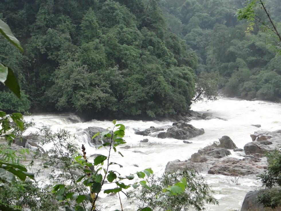
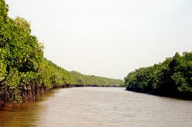
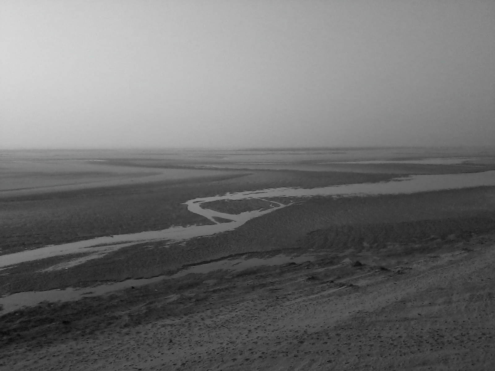
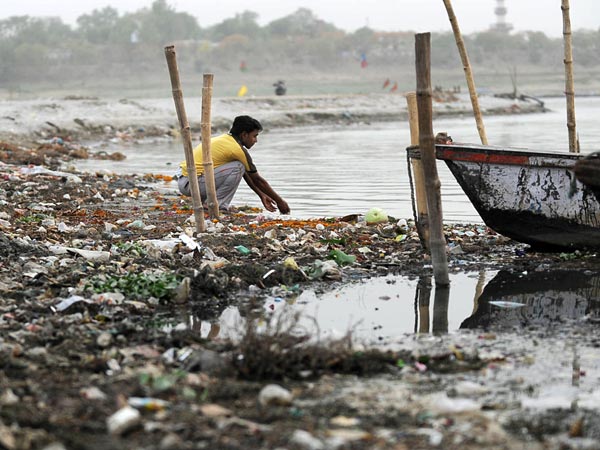
River Netravathi in the upper reaches Photo: Parineeta Dandekar, SANDRP

Like a many-headed serpent, Yettinahole (Netravathi) Diversion Project refuses to die. Every time one of its head is cut, it grows a new head.

Following criticism of the Project Report [i](based on which Karnataka Government had already made budget provisions in 2013), a new DPR of the project has been prepared in December 2013 by EIT RIP JV [ii] which tries to amend blatantly illegal stands taken earlier. However, after scratching the surface, it is clear that the DPR is just as illegal and dangerous as the interim Project Report was.

Yettinahole, or rightly the Netravathi Diversion Project has always been a political project, visualized to earn political mileage and brownie points. Veerappa Moily originally from Dakshin Kannada, moved to Chikkaballpur constituency in 2009, from when he started pushing the project strongly. As the Environment Minister, Moily also laid the foundation stone of the project in Chikkaballapur, just before the Loksabaha Elections in March 2014 [iii]. Strategically, the stone was laid in Chikkaballapur and not in Hassan, from where the water actually be diverted. No political party has opposed the project consistently.

Even before a complete DPR, Karnataka 12-14 Budget of the Congress Government allocated nearly 2800 crores for this scheme. The current govt lost no time and directly awarded contracts worth nearly 1000 Crores to Hindustan Construction Company, in a joint venture with GVPRL, without any clearances or any public consultations[iv].

Before the laying of the foundation stone of the project, SANDRP had presented a detailed analyses if the Project Report proving how the project is violating Environmental Protection Act by evading Environmental Clearance.[v] A number of eminent personalities from Karnataka had jointly written to the MoEF to appraise the Project for EC. In response to this, the MoEF had written to the Karnataka Govt and Karnataka Neeravari Nigam Limited (KNNL), seeking clarifications on the nature of the project. Although this move was triggered due to the submission made by SANDRP and other groups, we never saw KNNL’s response despite specifically asking for it. We only saw MoEF’s lame justification, bailing out KNNL and Karnataka Government and turning a blind eye to the huge impacts of the project.

Students protesting against Yettinahole Project Photo: DaijiWolrd

When Karnataka CM Siddramaiah was about to lay the foundation stone along with Mr. Moily, SANDRP wrote an open letter to him[vi], as the Environment Minister, asking a direct question as to how can he himself formally initiate a scheme which is blatantly violating laws governed by his own Ministry. Following this, the ceremony was cancelled[vii], only to be held surreptitiously later.

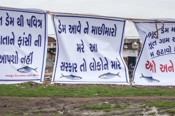
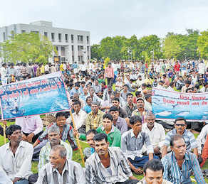
During all this, there was huge and unprecedented opposition to the project from Dakshin Kannada and Mangalore. Farmers, students, workers, women groups all came together, united in their opposition against a project that would divert their Netravathi.  People stopped trains, organized hundreds of dharnas, boycotted voting, organised signature drives, etc. Leaders in all hues came together in a rare show of discontent. On the day of foundation stone laying, people in Dakshin Kannada voluntarily observed a strict Bandh. Funnily enough, even the beneficiary district of Chikkaballpur opposed the project as the 2.82 TMC water that it would be getting after so much of fanfare was too meager, in the face of the grand promises of lush fields and no worries.

More Protests against the Project Photo: The Hindu
Protest in Hassan against Yettinahole Photo: The Hindu
Protesters stopping  a train Photo: News Karnataka
Protesters stopping a train Photo: News Karnataka

Despite these unprecedented protests and in the face of 2014 Loksabha Elections, foundation stone was laid on a dais in Chikkaballapur. The dais was burgeoning under the weight of several political strongmen.

This event stands out as an example of undemocratic behavior for an elected government.

Foundation Stone laying Ceremony Photo: The Hindu

The Government of Karnataka did not hold a single public meeting in Dakshin Kannada, trying to understand and address people’s apprehensions. When eminent personalities from Dakshin Kannada planned to hold a National Consultation on Yettinahole Diversion in NIT Suratkhal in August 2013, the meeting was cancelled at the last minute due to political pressure on the organizers.

As things stand now, the project does not have Environmental Clearance, Forest Clearance, Wildlife Clearance, has not started rehabilitation and resettlement of over 10 villages that it will submerge, but its work can start at any moment.

SANDRP accessed the Detailed Project Report (DPR) of the Project from local activists, who obtained it under RTI. Analysis of the DPR reveals a number of issues. KNNL has drastically changed the initial Project Report, avoiding mention of contentious issues we had raised like hydropower generation, irrigation component, etc., thus strongly vindicating the objections raised. However, going further, it is clear that these changes are cosmetic. Deeper problems and severe unstudied impacts of the scheme remain.

SANDRP analyzed 4 volumes of the DPR and Annexures of the Project. What follows is some myth busting about the Yettinahole Detailed Project Report.

1. What is the Current Project? Is it different from the last Project Report?

While the Project Report of June 2012 was titled: ‘Scheme for diversion of flood water from Sakleshpura (West) to Kolar/ Chikkaballapura Districts (East)’, the DPR dated December 2013 has taken out all the random stuff on Kolar and Chikkaballapura and simple calls it as “Yettinahole Project”.

Current Project as per the DPR, is divided in Two Phases.

Phase I: 8 weirs will be built in the Western Ghats, on the streams Yettinahole, Kerihole, Kadumanehole and Hongadahalla. It also includes several pump houses next to weirs, raising mains that run for several kilometers are nearly 5 kms wide, 3 Delivery Chambers (DC) and a gravity canal taking waters from Weirs 3, 4 and 5  to Doddanagara (DC 3) in the Western Ghats forests.

From the weirs, 85 cumecs (Cubic Meters per second) water will be drawn 24*7 in the six months of June-November.

This will be delivered through 4 Delivery Chambers with the last DC: DC 4 at Haravanahalli.

Phase II: From DC 4, water will be diverted to a canal running 274 kilometers, cutting across the ridge line dividing Cauvery and Krishna Basins and culminating at a Balancing Reservoir at Byragondlu and Thumbadi, in Koratgere Taluk. Thumbadi Reservoir will store about 3 TMC water and will submerge nearly 700 hectares of land and three villages[viii] while Balancing Reservoir at Byragondlu will store 5.7 TMC water and will submerge 7 villages [ix]and an area of about 2000 hectares. The Reservoir at Devaranyadurga, which was proposed in the Project Report has been replaced by these two.

It includes construction of several storage tanks and reservoirs for en route water supply. It will also delivery water to T.G. Halli and Hesarghatta Reservoirs, which supply water to Bangalore. It also plans to supply water to Devanhalli Industrial Area.

The project envisages constructing 7 additional storage reservoirs and 10 major canals. Water will also be used to fill more than 500 Minor Irrigation (MI) Tanks in many districts and taluks.

It is amazing how the project envisages filling MI Tanks to 50% capacity: The DPR says that water will be pumped and released to the highest point and an additional sluice gate will be made to all MI tanks to let water flow into the cascading MI tank. This sounds highly impractical.

The project also includes constructing over 100 bridges in villages and nearly 100 road brides on major roads.

So although details have changed, the basic of the project remain the same. There is no change in Western Ghats, except for the fact that not 24 TMC, but 47 TMC water will be pumped now!

Survey markings in Sakaleshpur. People had no idea why the survey was carried out and no information was given. Photo: Parineeta Dandekar
Survey markings in Sakaleshpur on peoples homes. People had no idea why the survey was carried out and no information was given. Photo: Parineeta Dandekar

2. What is the cost of this current Project? Can the cost be borne easily by KNNL or Karnataka Government?

The cost of the Project as per DPR stands at nearly 13000 Crores as per 12-13 price line. This exceeds the entire 13-14 years’ budget of the Karnataka Water Resources Department, which stands at 8007 Crores and is nearly five times the annual budget of KNNL, the implementing agency.[x] This is a colossal amount of money to spend to convey approximately 7 TMC water to Kolar and Chikkaballapur and other nonspecific projects.

3. Who are the Main Beneficiaries? Will Kolar and Chikkaballpur really get 24 TMC water as promised?

The supposed beneficiaries of the project are several towns, villages, cities and industrial areas[xi] and No, Kolar and Chikkaballapur again lose out and get only about 7 TMC water.

4. Then who will be getting this water?

The DPR puts out a diffuse list of beneficiaries ( see Annex below) including Bangalore urban area through TG Halli and Hesarghatta Reservoir and the Devanhalli Industrial Hub. There are no population projections or future need calculations for this region like all other regions and at no place does the DPR say that water will go to Bangalore. However, TG Halli and Hesaraghtaa reservoirs are both used by the Bangalore Water Supply and Sanitation Board [xii]for Bangalore City and in the last Budget, the government had itself stated that water will be used for Bangalore Urban Area’s needs.

How Bangalore treats its local water bodies Photo: The Alternative

A review of beneficiaries:

  • Bangalore gets 3 TMC water: The DPR says that about 3 TMC water will be released to TG Halli and Hesargahtta Reservoirs and for the Devanhalli Area.
  • Minor Irrigation Tanks and hence irrigation gets maximum water at 9 TMC: Nearly 9 TMC water will be used for filling more than 500 MI tanks upto 50% of their live storage capacity. This water will be supposedly used for “groundwater recharge”. There are several participatory, cheap and sustainable ways for recharging groundwater, which seem to have been rejected in favor of long distance transfer. In any case, this groundwater recharge will be used for agriculture, as most of the agriculture there depends on groundwater and hence, the project qualifies for Environmental Clearance.
  • The project is being pushed for the drought affected taluks in Kolar Chikkaballapur and Tumkur and even a brief glance at the calculation shows that even in 2023-24, the drinking water demand of these places cumulatively will be just 12 TMC! Then why are we diverting 24 TMC water, double of the ten years’ estimate?

5. What is the basis for diverting 24.01 TMC?

The report provides no justification about why 24 TMC is supposed to be diverted. In fact, after population calculations and making provisions for drinking water supply for the beneficiary districts and villages, the DPR simply states : “This has resulted in a balance availability of 8.9 TMC” . This is a strange statement to make. What is meant by “balance availability”? Is there compulsion for diverting 24 TMC by hook or by crook from the Western Ghats?

6. 24 TMC Diversion? No 47 TMC Diversion!

The project envisages diverting 85 cumecs (Cubic Metres per second) water[xiii], purportedly for six months of June-November. The DPR states that pumps will function 24*7 during this period. Even a simple, back-of-the-envelope calculation indicates that 85 cumecs diversion leads to nearly 47 TMC diverted over six months and not 24 TMC, as is claimed.

7. Was there a detailed hydrological study to arrive at 24 TMC diversion?

The proponents have no flow data from individual streams. The 13,000 Crores project is to be based on shoddy hydrology data.

They have used gauge data from Bantwal across Netrvathi, which is approximately 60-70 kilometers downstream and in a completely different eco-region from the hills. This gauge data is simply extrapolated based on catchment area of each stream. This is highly unscientific.

The earlier Project Report used an entirely different method for calculating this yield, based in rainfall in individual catchments. Interesting to see that although to different methods were used by two different reports, divertible yield is exactly the same to the last decimal point of 24.01 TMC!

The fact of the matter is that there have been no scientific studies to find out the level of safe diversion. The DPR makes a fantastic statement in conclusion to the effect that:

“According to the revised computations, the divertible yield has been assessed as 22.14.TMCHowever, Prof.Rama Prasad , who has conducted the Hydrology studies has opined that the yield of 22.14 TMC at 50% dependability is very much on a conservative side and 24.01 TMC of divertible yield is available across the streams. This has been taken note off and for the present proposal, 24.01 TMC of water has been considered as the divertible yield from the selected streams to proceed further regarding finalization of the scheme in total.”

This just shows the random way in which divertible yield has been fixed!

8. How about the downstream Impacts of this diversion, which was the main reason for protests in Dakshin Kannada and Mangalore? Were the impacts studied?

There has been NO assessment of downstream water needs or impacts of this diversion on the downstream people or ecosystems. The DPR just ‘assumes’ that there will not be any impact on downstream users of ecology!

This is evidently misleading. One example of the problem in such assumption is that the flow data of Hongadahalla maintained by KPCL (given in Annex) indicates that flow in streams like Hongadhalla in August near the gauging point, has not exceeded even 20 cumecs. However, the according to the DPR[xiv], arrangement has been made to divert a whopping 30 cumecs from Hongadhalla from Weir 7 during June-November. This means that in the downstream, the rivulet will be rendered dry.

9. Was Impact Assessment for Western Ghats conducted?

The project proponent has not even clarified as to what will be forest land required for diversion. The section on Impact Assessment in the EMP deals largely with the beneficiary region without dealing with impacts on Wesetrn Ghats at all. There has been no study on eflows as per the HLWG (High Level Working Group on Western Ghats/ Kasturirangan Committee Report)report, no study of estuarine fisheries, no study of drinking water needs.

Cornered Wildlife in Sakaleshpur, leading to crisis Photo: News 24 7

10. Will there be profound impacts in the downstream region?

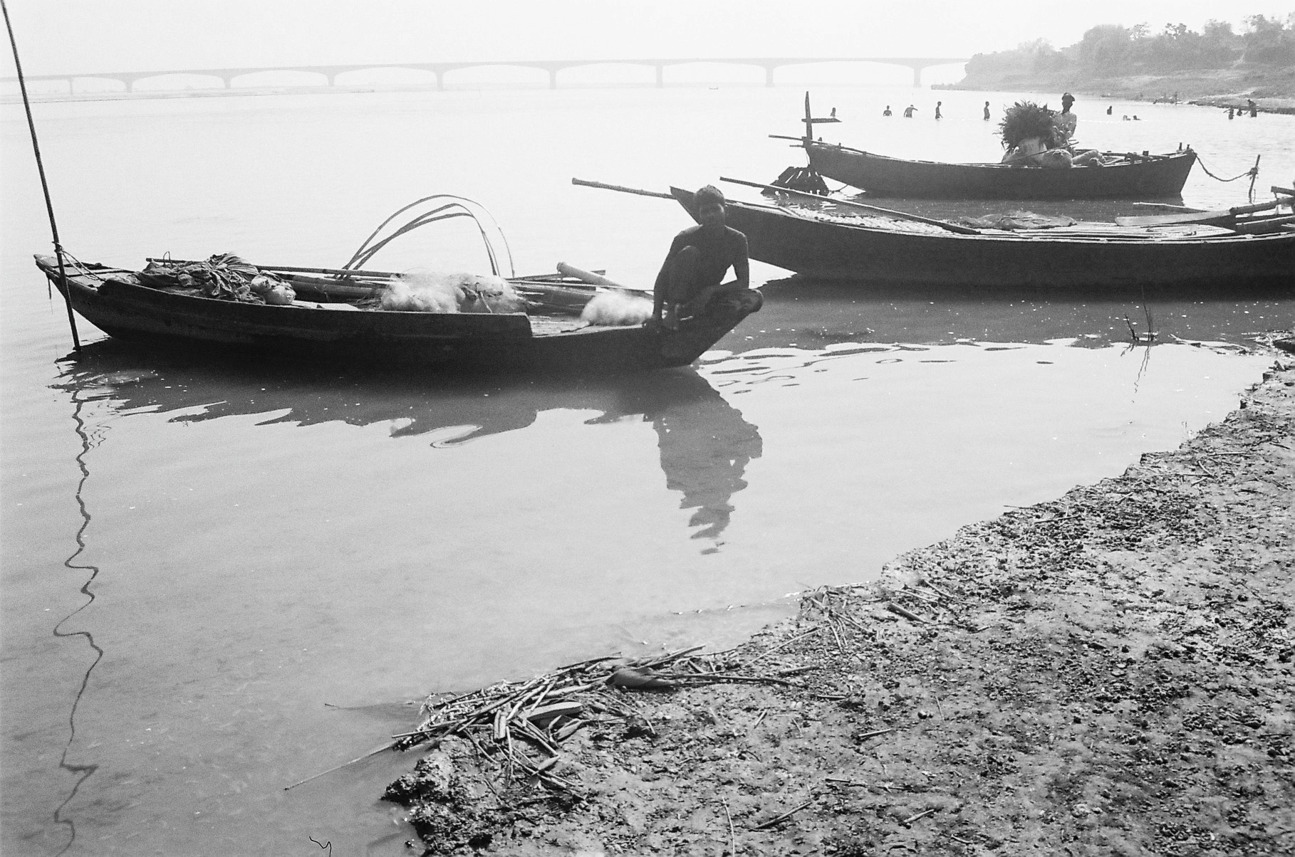
Yes. Yettinahole Project will “divert” water out of the basin and unlike most other irrigation or hydropower projects, the water will be permanently lost from the basin. The ecosystem and livelihoods in the downstream are closely linked to the hydrology of the Netravathi. In fact even in June, which is supposed to be a “peak season” for diversion, Mangalore and other parts of Dakshin Kannada have been facing water shortages[xv]. In addition, there are several estuarine and riverine fishermen dependent on the Netravathi for their livelihoods. There are many industrial areas, SEZs coming up in Mangalore which will be needing more water. While there has been a prospective study of the population and water demand growth of the beneficiary region in the DPR, there has been not even a mention of Mangalore and its increasing needs in the future in the DPR, highlighting the bias of the proponents.

There are several functioning mini hydel projects on the individual streams as well as tributaries which depend on the assured flow from upstream. They have not even been consulted before this decision was taken.

Drying Thumbe Dam which supplies water from Netravthi to Mangalore town Photo: The Hindu

11. Will there be a severe impact on Ecology and Wildlife?

The project falls within 10 kms boundary of the Pushpagiri Sanctuary, one of the specific World Heritage Sites in the Western Ghats[xvi]. The entire region has exceptional biodiversity.  The project also affects the Mysore Elephant Reserve.

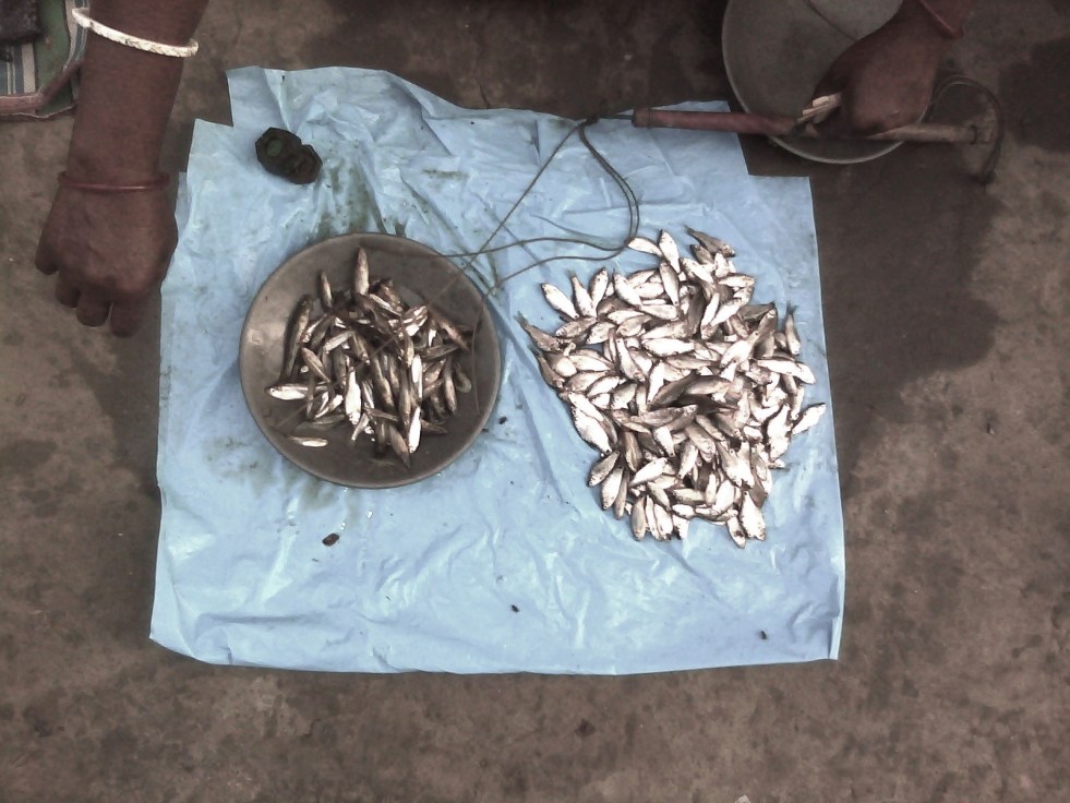
The region has exceptional fish biodiversity, with several new species [xvii]being discovered from the region. There have been efforts to declare this area as a specific fish sanctuary.[xviii]Despite this, the Environmental Management Plan of the DPR states that the fish diversity in most streams is “Poor”. This is a very irresponsible and misleading statement.

Man Animal Conflicts in Sakaleshpura are on a rise. Mega infrastructural activities envisaged in Yettinahole Project will worsen the situation further. There has been no mention of this.

Canara Pearlspot, an endangered fish of many such species found in Netravathi Photo: Arkive.org

12. Considering the impacts and the strong opposition from Dakshin Kannada, were any public consultations held?

No. there has not been a single open public consultation held by the proponents or the Karnataka Government in the affected region. This indicates lack of respect for democratic values and transparency. Shockingly to the question: “ Have-public  debates  about  utility  of  projects  been  held  and  the  response  thereof  outlined  in the Report?” has been answered as “Yes” in the DPR.

In fact there has been no such report in the DPR.

The DPR also states: 1.14: “Many public meetings have been held by the Govt. to make the people aware of the importance of the scheme both in the initial reaches and the end reaches of the project.”

More protest Marches in Mangalore Photo: Daiji World

This is entirely false as no such meeting has been held on Dakshin Kannada where informed discussions can be held.

To conclude:

Yettinahole diversion or Netravathi Diversion Project is an extremely costly ( 13000 Crores +) project of the Karnataka Government. It has been based on weak hydrology, nonexistent impact assessment of the downstream region, no Forest Clearance, no Wildlife Clearance and no public consultations. It is violating Environment (Protection) Act 1986, Forest (Conservation) Act 1980 and Wildlife (Protection)Act 1972. As has been proved by SANDRP, Karnataka has violated Environmental Laws in the recent past[xix].

The project provides no justification for diverting 24 TMC, plans to divert more volume than that, most of which is meant for urban areas and irrigation, without options assessment of cheaper and more sustainable options.

The project has illegally awarded tenders worth Rs 1000 crores without clearances.

In the interest of ecology, downstream population of Dakshin Kannada, public resources, wildlife, World Heritage sites and even future generations, at least until we have basis for informed decisions including a credible EIA, SIA, Options assessment and participatory decision making process, Projects like Yettinahole need to be shelved. Already multiple PILs against the project have been filed in the High Court and routed to the NGT. We hope NGT will also take a strong view on the serious issues involved here.

Severe downstream impacts and drying up of streams due to Yettinahole project reminds one of the tale of Sage Durvasa, meditating on the banks of the Tunga, not very far from Dakshin Kannada. Durvasa loved the river and was known for his short temper. As Bheema dammed the flowing River, Durvasa was agitated to see dried up river bed in the downstream. Yudhishthira saw this and advised Bheema to break the dam himself, to avoid the wrath of Sage Durvasa. Bheema relented and broke the dam, to allow the free flow of the river once more. (One of India’s first decommissioned dams?)

Let us hope that Netravathi flows unhindered and continues to support human and non-humans alike like she has been doing for centuries. Even for the areas claimed to be benefiting from the project, there are cheaper, sustainable and credible options available than this mega project.

– Parineeta Dandekar (parineeta.dandekar@gmail.com)

(We are specifically thankful to Kishore Kumar Hongadhalla, from Hassan for all his help.)

Netravathi in the Upper reaches Photo: Parineeta Dandekar

END NOTES:

[i] https://sandrp.wordpress.com/2013/09/18/yettinahole-diversion-an-imprudent-rs-100-billion-proposition/

[ii] This name/acronym of this consultant does not bring any results on the internet

[iii] http://www.coastaldigest.com/index.php/news/62505-amidst-protests-siddaramaiah-moily-lay-foundation-stone-for-yethinahole-project

[iv] http://www.hccindia.com/news.php?news_id=35

[v] https://sandrp.wordpress.com/2013/09/18/yettinahole-diversion-an-imprudent-rs-100-billion-proposition/

https://sandrp.wordpress.com/2013/09/10/complete-appraisal-needed-for-yettinahole-diversion-project-letter-to-moef/

[vi] https://sandrp.wordpress.com/2014/01/30/open-letter-to-dr-veerappa-moily-as-he-supports-foundation-stone-laying-of-yettinahole-diversion-project/

[vii] http://www.daijiworld.com/news/news_disp.asp?n_id=216104

[viii] Mallekavu, Dogganahalli & Gaurikallu

[ix] Veerasagar, Lakkamuttanahalli, Belladahalli, Gajamenahalli, Sugadahalli, Lakkenhalli, Garadagallu

[x] http://waterresources.kar.nic.in/documents/Budget%20allocation%202013-14x.pdf

[xi]Main beneficiaries of the Project:

  • Kolar district comprising of all Taluks
  • Chickaballapura distrct comprisnig of all Taluks
  • Tumkur district  comprising  of  areas  in  Palar  and  Pennar  basins  including  Chiknayakanahalli and Sira Taluks along with selected villages in Tiptur and Gubbi Taluks.
  • Hassan district comprising of villages in Arasikere taluk
  • Karnataka Neeravari Nigam Limited Yettinahole Project
  • Chikamagalore district comprising of selected villages in Kadur taluk
  • Ramanagara district
  • Bangalore Rural district comprising of Nelamangala, Doddaballapura, Devanahalli and Hoskote Taluks
  • Augmenting the water to T.G.Halli reservoir
  • Augmenting water to Hesaraghatta reservoir
  • Drinking water supply to Devanahalli Industrial area and surrounding areas
  • Providing water for tank filling purposes to fill selected M I Tanks to their 50 % capacity (average) in the M I tanks falling under Palar and Pennar basins and Arasikere taluk

[xii] http://bwssb.org/water_source_schemes.html

[xiii] Page 218, Volume I, Detailed Project Report

[xiv] Detailed Project Report, Volume I, Page 197

[xv] http://mangaloretoday.com/main/Precarious-water-situation-in-DK-MP-instructs-supply-in-tankers.html

http://www.samachar.com/MRPL-shuts-down-all-units-due-to-water-scarcity-meujNDiibca.html

http://www.thehindu.com/2005/04/08/stories/2005040815460300.htm

[xvi] http://whc.unesco.org/en/list/1342/multiple=1&unique_number=1921

[xvii] http://wgbis.ces.iisc.ernet.in/biodiversity/pubs/ces_tr/TR122/introduction.htm

[xviii] http://www.iucnredlist.org/details/summary/169618/0

[xix] http://www.thestatesman.net/news/70189-Maharashtra–Karnataka-govts-accept-violating-green-act.html

Ganga · Mithi · Mumbai · Narmada · Sabarmati

Riverfront Development in India: Cosmetic make up on deep wounds


There is a rush of riverfront development schemes in India. We have heard of Sabarmati Riverfront development being drummed many times, followed by the proposed rejuvenation of Ganga, supposedly on the lines of Sabarmati.

What does Riverfront Development entail? Is it River Restoration? Are the millions of rupees spent on Riverfront Development schemes justified? Will it help in saving our damaged rivers?

A cursory glance at the existing river restoration/ improvement/beautification schemes indicates that the discourse revolves mainly around recreational and commercial activities. It is more about real estate than river. Activities that are promoted on the riverfronts typically include promenades, boat trips, shopping, petty shops, restaurants, theme parks, walk ways and even parking lots in the encroached river bed.

Riverfont 1

Pioneering project in Riverfront Development was claimed to be the Sabarmati Riverfront Development project of Ahmedabad city which was supposed to be designed based on riverfronts of Thames in London and Seine in Paris. The project which began as an urban development project is lately being pushed as a role model for many urban rivers in India. This kind of riverfront development essentially changes the ecological and social scape of the river transforming it into an urban commercial space rather than a natural, social, cultural, ecological landscape. Is it wise to go for this kind of development on riverfronts? What does it do to the river ecosystem, its hydrological cycle? What does it do to the downstream of river? These questions need to be explored before accepting the current model of riverfront development as replicable or laudable.

Reclaim and beautify!

Most of the currently ongoing projects lay a heavy emphasis on beautification of rivers. Riverfronts are treated as extension of urban spaces and are often conceived as ‘vibrant’, ‘throbbing’ or ‘breathing’ spaces by the designers. Concrete Wall Embankments, reclamation of the riverine floodplains and commercialization of the reclaimed land are the innate components of these projects. Quick glimpse at various Riverfront Development Projects confirms this.

Sabarmati Riverfront Development Project

Sabarmati Riverfront Development Project of Ahmedabad city which is presented as a pioneer in urban transformation[1] has been proposed by Environmental Planning Collaborative (EPC), an Ahmedabad-based urban planning consultancy firm, in 1997 and envisaged to develop a stretch of 10.4 km of the banks on both sides of the river by creating concrete embankment walls on both banks with walkways. A Special Purpose Vehicle called the Sabarmati Riverfront Development Corporation Ltd. (SRFDCL) was formed in the same year for implementation of the project. The financial cost of the initiative was estimated to be in the range of around INR 11520 million[2]. Around two thirds of this amount has already been spent.

Construction of the project started in 2005. The project sought to develop the riverfront on either side of the Sabarmati for 10.4 kms by constructing embankments and roads, laying water supply lines and trunk sewers, building pumping stations, and developing gardens and promenades[3]. Mainstay of the project was the sale of riverfront property. Land along the 10.4 km stretch on both the banks was reclaimed by constructing retaining walls of height ranging from 4 to 6m[4]. 21% of the 185 ha of reclaimed land which was developed by concretizing the river bank[5] was sold to private developers for commercial purpose.[6] Activities hosted on this reclaimed land were recreational and commercial activities like restaurants, shops, waterfront settlements, gardens, walkways, amusement parks, golf course, water sports and some for public purpose like roads etc. The sale of reclaimed land created by the project is expected to cover the full cost of the project. Ahmedabad Municipal Corporation (AMC) claims that the after the project “river has added vibrancy to the urban landscape of Ahmadabad with its open spaces, walkways, well-designed gardens along with activities which contribute to economic growth.”[7]

Even though the project has been modeled as “best practice” by several financing institutions[8], it has also drawn severe criticism for poor rehabilitation of the displaced (rehabilitation happened only after High Court orders following a public interest petition) disrupting the nexus of shelter, livelihood and services of urban poor, lack of transparency in the execution and for tampering with the carrying capacity of the river. No Environment Impact Assessment of the project has been conducted nor any credible public consultation process held.

Sabarmati channel has been uniformly narrowed to 275 metres during the riverfront development project, when naturally average width of the channel was 382 metres and the narrowest cross-section was 330 metres[9]. In this attempt of “pinching the river”[10], the original character of the river is changed completely from seasonally flowing river to an impounded tank illegally taking water from Narmada Canal[11]. River banks have been treated as land that is wasted on which value could be created by reclaiming and not as seasonal ecological systems with floodplains as an integral part of its flows (Baviskar 2011). Seasonality of the river is destroyed and fauna and avi fauna on edges have been damaged. No thought has been given for protection, sustenance or enhancement of the riverine ecosystem. The water that is now impounded in this stretch is not even Sabarmati river water, but Narmada River Water, on which the city of Ahmedabad or Sabarmati has no right, it’s the water meant for drought prone areas of Kutch, Saurashtra and North Gujarat.

The River Sabarmati itself was a perennial river till the Dharoi Dam in the upstream stopped all water at least in non Monsoon months, making the river dry. The stretch flowing through Ahmedabad was carrying the mostly untreated sewage of Ahmedabad city and toxic effluents from the City and district industries.

In the name of Sabarmati River front development, no cleaning of the river has happened, the project has only transferred the water from both banks to the river downstream from Vasna barrage, which is situated downstream from the city. The Vasna barrage stops and stores the water released from Narmada Main Canal that crosses the river about 10.4 km upstream from the barrage. Thus this 10.4 km stretch of the river now holds the Narmada water and huge losses from the stretch are losses for the drought prone areas.

Riverfont 3

The reclaimed land and the narrowing of the channel have been tampering with the carrying capacity of the river. The project was stalled during August 2006 to March 2007 due to heavy floods[12]. Prior to the floods, the river’s maximum carrying capacity was calculated at 4.75 lakh cusecs on basis of the rainfall over last 100 years[13]. The floods however proved the calculation wrong. National Institute of Hydrology (NIH) and Indian Institute of Technology Roorkee (IITR) were asked to re-evaluate the project design, in the light of the river’s carrying capacity, and see whether the execution of the project would damage the river’s ecology[14]. Report by the NIH, Roorkee in 2007 said “the calculations did not take into account any simultaneous rainfall over the entire catchment area”[15]. This means that the carrying capacity was based only on the water flow from the Dharoi Dam (which is upstream of Ahmedabad City) and not from other places in the river’s catchment until Ahmedabad that also contribute to the volume of water in the Sabarmati. This report states that the riverfront development is “not a flood control scheme”, and that the municipal corporation will have to work out other measures to meet the impending challenge of floods.

The project is also heavily criticized for the poor rehabilitation of the evicted slum population. Large scale eviction was being carried out in an utmost non-transparent manner. A public interest litigation (PIL) was filed in the Gujarat High Court by Sabarmati Nagarik Adhikar Manch (SNAM) or Sabarmati Citizens Rights Forum, supported by several other non-governmental organisations (NGOs) to ensure that the rehabilitation plan was shared with them and to bring transparency to the process. According to the high court orders, at least 11,000 affected families were to be rehabilitated and resettled by AMC. Demolition drive went on without ensuring rehabilitation. Over 3,000 people have moved to a marshland in the outskirts of city with negligible compensation, little & infrequent access to drinking water and minimal sanitation facilities[16].

“The ecology of the river is being transformed to satisfy the commercial greed of a select few,” said Darshni Mahadevia of CEPT, expressing concerns about riverfront ‘beautification’[17].

The project that has converted the Sabarmati River into an urban space by reclaiming nearly 200 ha of land and has sustained by borrowing water from Narmada Canal today is claimed to be a role model for many riverfront development projects in the country. Should this model really be replicated? Many of the rivers like Yamuna, Ganga, Mithi, Brahmaputra etc. that are being ‘developed’, have had a flood history which is being ignored in the process. With having no regards to the hazards of floods, several riverfront projects are being pushed across the country by different government agencies.

The fact that even after a Riverfront Development Project, Water Quality of Sabarmati downstream the Vasna Barrage is extremely poor and the cosmetic treatment of flowing water stretch at Ahmedabad is actually water from Narmada, which was promised for the drought hit regions of Kutch and Saurashtra, highlights the contradictory and superficial nature of such Riverfront development schemes.

Yamuna Riverfront Development inspired from Sabarmati Model

Recently the newly elected BJP led Central Government sent a team of bureaucrats to Gujarat to study the feasibility of replicating the successful model of the Sabarmati Riverfront Development Project for cleaning the Yamuna[18]. Despite the concerns about flooding of Yamuna, the team is exploring ways of replicating Sabarmati Model. In 2009, the Sheila Dikshit administration was also planning channelizing the Yamuna and putting up a waterfront like Paris and London with recreational facilities, parking lots and promenades etc[19].

Reclamation of the floodplains to create a concrete riverfront, like in Ahmedabad, could be ecologically unsound and even dangerous for Delhi that is already extremely vulnerable to floods[20]. The sediment load in Yamuna is very high. The non-channelized river rises by over four metres during peak monsoon flooding[21]. Risk of flooding will increase multifold for a channelized river. The Inter-governmental Panel on Climate Change last year put Delhi among three world cities at high risk of floods. Tokyo and Shanghai are the two other cities.

An expert committee appointed by the Ministry of Environment & Forests (MoEF) to examine the Yamuna River Front Development Scheme of the Delhi Development Authority (DDA) recommended that DDA should scrap its ambitious plan for developing recreational facilities, parking lots and promenades. [22] The committee was formed following order from National Green Tribunal which was drawn in response to a petition filed by activists and Yamuna Jiye Abhiyaan convener Manoj Misra.[23] The committee pointed out that recreational spots located in active floodplain areas would kill the river and cause floods in the city. About the Sabarmati Model Being followed, CR Babu, Chair of the committee said: “There is no Sabarmati river. It’s stagnant water with concrete walls on two sides. The floodplains have been concretized to make pathways and real estate projects. It cannot be replicated for our Yamuna”.

The committee report says the Yamuna Riverfront Development scheme will reduce the river’s flood-carrying capacity and increase flooding and pollution and it recommended a ban on developmental activity in the river’s Zone ‘O’ and its active floodplains on the Uttar Pradesh side. It also said that a 52-km stretch of the Yamuna in Delhi and Uttar Pradesh be declared a ‘conservation zone’ as restoring the river’s ecological functions is heavily dependent on the environmental flow through this stretch, particularly in the lean season.

Manoj Misra of Yamuna Jiye Abhiyan, dismisses the Sabarmati solution saying “We cannot call it a Sabarmati model… It’s like a mirage created for a brief stretch. Let’s be clear about it. If the Delhi bureaucrats have gone there to learn from the Gujarat model, it’s up to them to figure out if it can be implemented. I cannot call the Sabarmati project a river rejuvenation project – it’s more of a real estate project… That is not advisable for Delhi.” [24]

Another important aspect which does not feature at all during the talks of Yamuna Riverfront Development is the massive displacement that will take place. Over a dozen unauthorised colonies are located on the riverbed. These colonies which have been in existence for over 40 years will have to be uprooted which again may lead to Sabarmati like situation where urban poor are brushed aside to serve interests of real estate developers and urban middle class.[25]

Riverfont 4

City of Noida on the other hand has decided to go ahead with the Rs 200 crore Yamuna Riverfront Development Project that Greater Noida Authority (GNA) has been planning[26]. The project involves developing recreational facilities like parks, Yoga centres, picnic spots and sports centres, polo grounds, golf course etc. on Hindon and Yamuna floodplains. Officials from GNA claim that these facilities will be for recreational purpose and will be developed without disrupting the natural flow of Yamuna. Here again the project has nothing to do with sustaining, cleaning, rejuvenation of the river.

Ganga cannot be ‘developed’ as Sabarmati

Prime Minister Narendra Modi made a promise during his election campaign in Varanasi to clean up Ganga.[27] The National Ganga River Basin Authority (NGRBA) was shifted from the environment ministry to the water resources ministry.[28] New name for the Ministry of Water Resources is Ministry of Water Resources, River Development and Ganga Rejuvenation. Uma Bharati was assigned with this specially created ministry for cleaning Ganga by the PM. “If Sabarmati can be cleaned, all other rivers can also be made better.” print media has quoted Uma Bharati.[29] Ms Uma Bharati seems to have no idea that Sabarmati has NOT been cleaned, the Sabarmati project just transferred the polluted water downstream of the 10.4 km stretch. Can Sabarmati Model be replicated at Ganga? Even if it is replicated, will it help the cause or river or river rejuvenation? The answer is clearly a BIG NO. A number of apprehensions have been raised in this regard. “The so-called Sabarmati model won’t work for the Ganga. The Sabarmati has neither been cleaned nor rejuvenated,” Openindia News quotes Himanshu Thakkar, environmentalist and coordinator of SANDRP[30]. He further points out that
Sabarmati Model survives on water from Narmada canal in the stretch of 10.4 km which flows through the Ahmedabad city. This is not possible in case of Ganga.

Priority for the river rejuvenation is restoring its water quality, freshwater flow and not riverbank beautification. More than Rs. 5,000 crore (some estimates this figure to be over Rs 20 000 crores) has been spent on cleaning the Ganga in the past 28 years. The Ganga Action Plan was launched in 1986 and was in 1994 extended to the Yamuna, Gomti and other tributaries of the Ganga. The second phase of the Ganga Action Plan was launched in 2000 and NGRBA was created in 2009.[31] The plan however has not achieved what it set out to achieve. Water quality for Ganga River has been declining and is unfit even for irrigation or bathing. Potable use is out of question. The count of harmful organisms, including hazardous faecal bacteria, at many locations is more than 100 times the limit set by the government. The water’s biochemical oxygen content, which is vital for the survival of aquatic wildlife, has dipped drastically.[32] Any “cosmetic treatments”[33] will not work for Ganga, like they have not worked for Sabarmati.

Several Riverfront Development Projects springing up across nation

While there are experts opposing replication of Sabarmati Riverfront Project on Ganga and Yamuna River, there are several other riverfront projects which are inspired by the Sabarmati Project and which are being pushed without any kind of studies or impact assessment. Their possible impacts on the riverine ecology, flood patterns, downstream areas etc. are going unchecked.

Brahmaputra Riverfront Development Project: Another “multi-dimensional environment improvement and urban rejuvenation project” that is set to come up with plans for reclaimed river banks is on Brahmaputra River in Guwahati[34]. While on one hand the city is struggling to cope up with the flood prone nature of the Brahmaputra River, State Government of Assam plans to take up an ambitious project to develop the city riverfront named ‘Brahmaputra Riverfront Development Project’ under the Assam Infrastructure Financing Authority. The riverfront project will be implemented by the Guwahati Metropolitan Development Authority (GMDA) in phases[35]. Foundation of the beautification project was laid by the Chief Minister Tarun Gogoi in February 2013. The project plans to achieve maximum possible reclamation[36].While the plan talks of revitalization of the river ecology and Strengthening of riverbanks through soil bio engineering it has several urban features on its agenda like promenade, Ghats, Plazas and Parks; buildings, conference facilities, Parking lots, ferry terminals, Bus and para transport stops, Urban utilities and drainage, Improved infrastructure for floating restaurants, Public amenities; Dhobi Ghats, etc.[37]

Will such a huge real estate development leave any room for river or its revitalization?

Tendency to flood is an important feature of River Brahmaputra. The river also has one of the highest sediment loads in the world. Every year during the successive floods, most of the areas in the valley of Assam remain submerged for a considerable numbers of days causing wide spread damages. In a phenomenon as recent as June 27, 2014 Guwahati experienced heavy downpour for 15 hours, setting off flash floods[38]. Half of the city was submerged under flood water. The authorities blamed illegal encroachments on watersheds across the state capital for the flash floods, which had choked the natural outlets for the gushing water. National Institute of Hydrology (NIH), Roorkee; upon being requested by the GMDA; is carrying out a study which includes river shifting analysis for studying stability of the river banks, flow variations to determine the perennial water depth, estimate of floods of various return periods for design of river embankments, estimate of water surface profiles employing hydro-dynamic river flow model and design parameters for river embankments[39]. The Bramhaputra Riverfront Development Project however has been inaugurated even before the requisite studies have been completed.

Riverfont 5

Gomti Riverfront Development Project in Lucknow: The project by the Lucknow Development Authority is based on the Sabarmati Riverfront Model. It plans to “beautify” Gomti River between Gomti Barrage and Bridge on Bye-pass road connecting Lucknow-Hardoi road and Lucknow-Sitapur road, a length of about 15 Km. According to the Technical Bid Document released by the Lucknow Development Authority, the Riverfront Project has no component of water treatment or river restoration, but is a landscape-based development project, which will also look at “reclaiming” the river banks for activities like shops, entertainment area, promenades, etc. The inspiration for the project swings from Thames Rivefront in London, to Sabarmati in Gujarat, depending on the political party in power.[40]

In all this discussion, there is no mention of maintaining adequate flow in Gomti, treating sewage, conserving its floodplains, or any other ecological angles.

River Improvement and Restoration are also about real estate!

For many government agencies, ironically, not just river beautification, but the idea of river improvement and restoration is also about channelizing rivers and providing recreational facilities.

Pune Rivefront Project: Pune Municipal Corporation, the Pune city also known for chronically polluting Mula and Mutha rivers that flow through the heart of the city, has sanctioned a River Improvement Project, under the aegis of JNNURM (Jawaharlal Nehru National Urban Renewal Mission). The Project envisages channelizing the river, introducing barrages to maintain water levels, development of riparian zone as entertainment and shopping groups, even Parking lots, introducing navigation in the river etc. There are several issues with this “improvement” project. Firstly, it is not planned according to the once in a hundred years flood in Pune, it plans to constrict the river further, thus encroaching the riverbed. Creation of stagnant pools through barrages will result in backwater effect on the many nallahs that join the river. These Nallahs routinely flood in rainy season and additional backwater in these nallahs will worsen the situation further. The project does not say a word about treating water quality, but envisages to build drainage lines inside the riverbed and carry the sewage out of Pune city limits. This hardly qualifies as river rejuvenation or restoration. A case has been filed against this project in National Green Tribunal.

Goda Park (Godavari Riverfront Project) in Nashik, Maharashtra: Godavari emerging from the Brahmagiri Hills in Nashik is famed not only for being one of the longest rivers in India, but also because Kumbh Mela is held on its banks every 12 years in Nashik. Nashik and Trimbakeshwar have had no dearth of funding for cleaning Godavari. They have received funds from the National River Conservation Directorate as well as JNNURM. Despite this, Godavari is extremely filthy in Nashik. Ignoring the pressing issues of water quality, Nashik Municipal Corporation and a specific political party have been hankering after beatification of Godavari’s banks. In fact, the project has been handed over to Reliance Foundation by the Nashik Municipal Corporation[41] without any public consultations or discussions. As per reports, the components of this 13.5 kms long project will be laser shows, musical fountains, rope-way, multi-purpose meeting hall, garden, water sports, canteen, etc.[42]

In the meantime, there are several court orders against Nashik Municipal Corporation pending about severe water pollution in the River including Ram Kund where holy dip on Kumbh Mela is supposed to be taken.

Mithi Riverfront Development: Stretch of 18 km of Mithi River flows through city of Mumbai. Course of Mithi has been modified throughout the city to host range of activities.[43] On 26 July 2005, the river flooded some of the most densely populated areas claiming nearly 1000 lives[44].

After these catastrophic floods, the Municipal Corporation of Greater Mumbai (MCGM) and Mumbai Metropolitan Region Development Authority (MMRDA) made a plan to “restore” the river. BMC and MMRDA’s definition of restoration involves desilting, beautification and building of a retaining wall. Stretch of 4.5 km of the total six km stretch of the river that falls within MMRDA’s jurisdiction is covered with mangroves. MMRDA has planned to beautify the stretch of remaining 1.5 km (10 Ha) which lies right amidst mangroves by developing a promenade. MMRDA plans developing this project on a PPP (Public Private Partnership) basis. Interestingly, the Mukesh Ambani-led Reliance Foundation and Standard Chartered bank have been selected for this project.[45]

As per the Coastal Zone Management Plan (CZMP) of the area, the proposed Mithi Riverfront Development Project falls in Coastal Regulation Zone (CRZ) II and III. The proposal was presented to CRZ authority in its 82nd meeting on 10th June, 2013[46]. CRZ authority has not allowed any reclamation or construction activities in this stretch. For Widening, lengthening & reconstruction of the existing bridge CRZ has referred the proposal to MoEF and asked MMRDA to take prior permission of High Court if the proposal involves destruction of mangroves[47].

Observer Research Foundation, a private, not for profit organization (funded by Reliance India[48]) from Mumbai has come up with a study that recommends a 21-point programme for reclaiming the Mithi, envisaging a single and unbroken river-park corridor spanning across the entire 18-km length of the Mithi with dedicated bicycle tracks, gardens, amphitheatres, sports and recreation.[49]

Riverfont 6

Riverfront Development is NOT River Restoration

As is evident, the riverfront projects discussed above are essentially river bank beautification & Real Estate Development projects and not helping restoration of the river. The projects aim at comodifying rivers to develop urban scapes. Such riverfront development changes the essential character of the river. Stream channelization and alteration of shoreline disconnects the river stretch from adjacent ecosystems and leads to risks of habitat degradation, changes in the flow regime and siltation[50].

While the water of the rivers flows in the natural landscapes, there are many processes that are happening. Sediments are carried, fertile land is created along the banks, river channel is widened, flooding, deposition of sediments during flooding, cleansing of river etc.[51] However the urban rivers are alienated from this natural landscape to such an extent that the rivers are reduced to merely nallas carrying city’s sewage and filth.

Flow, connectivity and flood are fundamental characteristics of rivers and rivers need space for that. If these are violated the river water spreads uncontrolled through the habitation causing catastrophic events like Mithi Flooding.

Creating more room for rivers

While Indian cities are busy replicating Riverfronts of Thames and Seine, there are some remarkable projects going on in some other countries which actually talk of giving more room to the rivers during floods. They are trying to restore the river and not beautify, concretize, channelise or encroach on it.

In the Netherlands, such an integrated approach has been adopted for ‘Room for the River Program’[52]. The program is currently being implemented in the Dutch Rhine River Basin of the country.

The programme started in 2006 is scheduled to be completed by 2015. The objectives of the programme are improving safety against flooding of riverine areas of Rivers Rhine and Meuse by increasing the discharge capacity and improving of spatial quality of the riverine area.

At 39 locations, measures will be taken to give the river space to flood safely through flood bypasses, excavation of flood plains, dike relocation and lowering of groynes etc. Moreover, the measures will be designed in such a way that they improve the quality of the immediate surroundings.

While Room for the River programme focuses on flood management in sustainable way, Yolo Bypass is another unique initiative aimed at keeping intact the benefits to the ecosystem without causing a negative impact on water supply[53]. The Yolo Bypass is a flood bypass in the Sacramento Valley located in Yolo and Solano Counties of California State in USA. The primary function of the bypass is flood damage reduction. It is a designated floodway that encompasses 60,000 acres in eastern Yolo County between the cities of Davis and Sacramento. All the properties within the bypass are subject to a flood easement that allows the state to flood the land for public safety and ecological benefit.

Conclusion

Riverfront of Thames in London and Seine in Paris are often cited as successful models of riverfront development in India. However, the ecological as well as social setting of Indian rivers and the challenges that we face are significantly different from these foreign models. A Blind replication will only be wastage of public funds and degradation of the rivers further. Riverfront development projects across the country seem to be alienated from the river, and talk only about its urban banks, trying to achieve cosmetic changes on deeper wounds by encroachment and real estate development on the belly of the rivers. The need of the hour is river rejuvenation and not river FRONT development. Let us hope that we see central place for rivers in all these projects. Moreover, there is neither any social or environmental impact assessment, nor any regulation or democratic participatory decision making process. Such projects will only be at the cost of the poor, the environment, future generation and to short term benefits of real estate developers and a section of urban middle class.

Amruta Pradhan, SANDRP (With Inputs from Himanshu Thakkar & Parineeta Dandekar)

amrutapradhan@gmail.com

An edited version of this article has been published at: http://indiatogether.org/gujarat-sabarmati-riverfront-development-model-for-ganga-yamuna-environment

END NOTES:

[1] http://www.egovamc.com/SRFDCL/SRFDCL.pdf

[2] http://www.egovamc.com/SRFDCL/SRFDCL.pdf

[3] http://www.frontline.in/static/html/fl2802/stories/20110128280208500.htm

[4] http://www.frontline.in/static/html/fl2802/stories/20110128280208500.htm

[5]http://www.business-standard.com/article/current-affairs/amc-bets-on-huge-returns-from-riverfront-property-sale-114032000894_1.html

[6] http://indiaenvironmentportal.org.in/files/file/Sabarmati%20Riverfront.pdf

[7] http://www.egovamc.com/SRFDCL/SRFDCL.pdf

[8] http://indiaenvironmentportal.org.in/files/file/Sabarmati%20Riverfront.pdf

[9] http://www.downtoearth.org.in/node/5786

[10] http://www.frontline.in/static/html/fl2802/stories/20110128280208500.htm

[11] http://landscapeindiapbb.wordpress.com/2013/10/30/riverfront-development-ahmedabad/

[12] http://www.downtoearth.org.in/node/5786

[13] http://archive.indianexpress.com/news/flood-control-in-sabarmati-a-challenge-for-amc/654704/

[14] http://www.downtoearth.org.in/node/5786

[15] http://archive.indianexpress.com/news/flood-control-in-sabarmati-a-challenge-for-amc/654704/

[16] http://indiaenvironmentportal.org.in/files/file/Sabarmati%20Riverfront.pdf

[17] http://www.downtoearth.org.in/node/5786

[18] http://timesofindia.indiatimes.com/city/delhi/Delhi-babu-all-praise-for-Sabarmati-plan/articleshow/36363896.cms

[19] http://timesofindia.indiatimes.com/city/delhi/Scientist-cautions-against-riverfront-plan/articleshow/38500711.cms

[20]http://timesofindia.indiatimes.com/city/delhi/River-experts-say-Sabarmati-no-model-for-Yamuna/articleshow/36222968.cms

[21] http://timesofindia.indiatimes.com/city/delhi/Scientist-cautions-against-riverfront-plan/articleshow/38500711.cms

[22]http://timesofindia.indiatimes.com/city/delhi/Scientist-opposes-Sabarmati-model-says-reclaiming-floodplain-not-a-good-idea-for-Yamuna/articleshow/36679502.cms

[23] http://www.newindianexpress.com/nation/Yamuna-Action-Plan-Soon-Promises-MoEF/2013/12/19/article1953318.ece,

http://www.indiaenvironmentportal.org.in/files/Yamuna%20River%20Front%20NGT%2018Dec2013.pdf

[24]http://timesofindia.indiatimes.com/city/delhi/River-experts-say-Sabarmati-no-model-for-Yamuna/articleshow/36222968.cms

[25] http://www.asianage.com/delhi/illegal-colonies-near-river-may-be-shifted-946

[26] http://timesofindia.indiatimes.com/city/noida/Twin-cities-to-go-ahead-with-riverfront-project/articleshow/34845006.cms

[27] http://indianexpress.com/article/india/politics/modi-assigns-task-of-cleaning-ganga-to-uma-bharti/,

http://www.firstpost.com/politics/cleaning-up-the-ganga-yamuna-why-modi-must-forget-sabarmati-model-1560939.html

[28]http://www.hindustantimes.com/india-news/clean-up-act-superbody-headed-by-pm-modi-to-drive-mission-ganga/article1-1253158.aspx

[29] http://www.firstpost.com/politics/cleaning-up-the-ganga-yamuna-why-modi-must-forget-sabarmati-model-1560939.html

[30] http://news.oneindia.in/india/sabarmati-model-not-enough-for-ganga-1478033.html

[31] http://news.oneindia.in/india/sabarmati-model-not-enough-for-ganga-1478033.html

[32] http://www.business-standard.com/article/opinion/rejuvenating-a-river-114052801804_1.html

[33] http://www.business-standard.com/article/opinion/rejuvenating-a-river-114052801804_1.html

[34] http://www.assamtribune.com/scripts/detailsnew.asp?id=aug3113/city05

[35] http://guwahatilife.blogspot.in/2011/02/cm-lays-foundation-of-beautification-of.html

[36] http://www.assamtribune.com/scripts/detailsnew.asp?id=aug3113/city05

[37] http://www.psda.in/guwahati.asp

[38] http://www.ndtv.com/article/india/flash-floods-in-guwahati-seven-dead-in-last-15-hours-548974

[39] http://www.assamtribune.com/scripts/detailsnew.asp?id=aug3113/city05

[40]http://timesofindia.indiatimes.com/city/lucknow/Lucknow-Development-Authority-to-get-new-blueprint-of-Gomti-riverfront-development-project/articleshow/19687344.cms

http://m.financialexpress.com/news/akhilesh-wants-london-eye-in-lucknow/975999/

[41] http://www.reliancefoundation.org/urban_renewal.html

[42]http://articles.economictimes.indiatimes.com/2013-09-20/news/42252355_1_goda-park-project-reliance-foundation-mns-chief-raj-thackeray

[43] The Mumbai airport has its domestic and international terminals, and its cargo complex along the Mithi River. There are five major railway stations along the Mithi River including Mahim and Bandra on the western line andSion, Chunnabhatti and Kurla on the central line. The upcoming V ersova-Andheri-Ghatkopar corridor of the Mumbai Metro project that also crosses over the Mithi River has two stations planned along the Mithi River at Marol and Saki Naka. There are also several bus stops located close to the river all along its banks.

(Source: http://orfonline.org/cms/sites/orfonline/modules/report/ReportDetail.html?cmaid=23400&mmacmaid=23401)

[44] http://orfonline.org/cms/sites/orfonline/modules/report/ReportDetail.html?cmaid=23400&mmacmaid=23401

[45] http://indianexpress.com/article/cities/mumbai/beautification-plans-of-mithi-river-promenade-stuck-over-crz-norms/

[46] https://mczma.maharashtra.gov.in/pdf/MCZMA_MoM82.pdf

[47] The proposal was cleared subject to compliance of following conditions

(i) The proposed construction should be carried out strictly as per the provisions of CRZ Notification, 2011 (as amended from time to time) and guidelines/ clarifications given by MoEF time to time.

(ii) Disposal of debris during construction phase should be as per MSW (M&H) rules. 2000.

(iii) Tidal flow of river should not be obstructed.

(iv) The project proponent should obtain prior High Court permission, if the proposal involves destruction of mangroves or construction falls with 50 nil buffer zone.

(v) All other required permissions from different statutory authorities should be obtained prior to commencement of work

[48] http://www.rediff.com/news/report/najeeb-jung-the-man-who-may-run-delhi/20131213.htm

[49]http://www.indiawaterportal.org/sites/indiawaterportal.org/files/why_mumbai_must_reclaim_its_mithi_gautam_kirtane_orf_2011.pdf

[50] http://water.epa.gov/type/wetlands/restore/principles.cfm

[51] Nature Conservation by Ketki Ghate, Manasi Karandikar

[52] http://www.downtoearth.org.in/node/5786

[53] http://www.americanrivers.org/initiative/floods/projects/yolo-bypass-and-the-fremont-weir/

Chenab · Floods · Jammu and Kashmir

Why does Central Water Commission have no flood forecasting for Jammu & Kashmir? Why this neglect by Central Government?

During Sept 4-6, 2014 Jammu and Kashmir in North India is facing one of the worst floods. NDTV[1] has reported that these are the worst floods in 60 years (The Times of India reported that this was worst flood of the state since independence based on number of casualties.). More than 160 people have died and some 2500 villages are affected (1615 in the valley, rest in Jammu), out of which 450 are completely submerged (390 in valley)[2]. Over 10 000 people are stranded across the state. The flood has affected almost all 10 districts in the Jammu region. J&K Chief Minister admitted that the rescuers have yet to reach the worst affected South Kashmir region. Jammu Srinagar Highway has remained blocked for over three days. Several rivers have been flowing above the danger mark and most parts of south Kashmir, including Pulwama, Anantnag and Kulgam districts have been submerged. Jhelum was flowing at 30.7 ft in South Kashmir, 7 ft above the danger mark. Chenab river was also flowing above the danger mark at several places.


Authorities have declared the bridge over the Chenab in Akhnoor unsafe for traffic. Source: Vinay Saraf's facebook post
Authorities have declared the bridge over the Chenab in Akhnoor unsafe for traffic. Source: Vinay Saraf’s facebook post

Unprecedented floods Landslides triggered by heavy rainfall have damaged roads, dozens of bridges, buildings and crops. As many as 40 people went missing after a landslide in Thanamandi area of Rajouri district in Jammu region. Heavy rain in the catchment areas of Jhelum river has so far submerged more than 100 villages in the south Kashmir districts of Anantnag, Kulgam, Shopian, Pulwama, where the river was still rising, as well as the north Kashmir districts of Ganderbal, Srinagar and Badgam[3]. The flood has surpassed the 1992 memories and revived the 1959 flood memories[4].

Flood Forecast map of CWC has no sites to forecast floods in J & K

Vehicular traffic has been stopped on the Jammu-Pathankot highway due to incessant rain. Jammu is on red alert and Tawi bridge is also in danger.

Flood image from Vinay Saraf's Facebook post
Flood image from Vinay Saraf’s Facebook post

State Finance Minister Abdul Rahim Rather said Chenab was flowing at 38 ft at Akhnoor which is four ft above the danger mark cumulatively discharging 2.75 lakh cusecs, a quantum of discharge which equals all other rivers of the state.

The situation is very grim indeed: “According to the Army, the situation in the state is as grim as it was in Uttarakhand last year.” Union Home Minister has visited the state and the prime minister has expressed grief.

VERY HEAVY Rainfall during Sept 3-6 The state received massive 250 mm of rainfall in just three days between Sept 3-4, out of its seasonal monsoon rainfall of 568 mm till Sept 6, 2014. Rainfall just on Sept 6 was 106 mm, which is unbelievable 3116% of the normal rainfall for that date for J&K.

Rainfall Map from IMD showing that J&K received 558 mm rainfall till Sept 6, progressing to excess rainfall category in three days from deficit category on Sept 3, see the next map below

It can be seen from the season rainfall map see above of India Meteorology Department as on Sept 6, 2014 that J&K had received 558 mm rainfall till that date, progressing to Excess Rainfall category (blue colour code) from Deficit season rainfall of 308 mm as on Sept 3, 2014 (see IMD map below), in just three days.

IMD Map of Sept 3, 2014, showing J&K in deficit rainfall category (brown colour) with seasonal rainfall of 308 mm

CWC has no flood forecasts for J&K However, shockingly, India’s premier water resources body, Central Water Commission, responsible for flood forecasting and providing advisory to the states for tackling floods, has no flood forecast for any place in the state. The CWC’s flood forecast list[5] on Sept 6, 2014 has 18 level forecasts and 8 inflow forecasts, but NONE from J&K. CWC’s Flood forecast site has another option[6] that provides hydrographs for various rivers and location. Again for J&K it provides NO hydrographs. The options on CWC’s Flood Forecast site for list based selection[7] and map based selection[8] again has no information about Jammu & Kashmir.

J&K Flood Control Chief Engineer called the situation Alarming. Photo Source - NNIS
J&K Flood Control Chief Engineer called the situation Alarming. Photo Source – NNIS

This seems like shocking omission on the part of CWC, which functions under Union Ministry of Water Resources and reminds one that CWC completely failed to provide any flood forecast when Uttarakhand faced its worst floods in June 2013[9]. We hope CWC will urgently include the flood vulnerable sites of J&K in its flood forecasting and also explain to the people of J&K and rest of the country why these sites were not included so far.

Akhnoor flood image from Vinay Saraf's Facebook post
Akhnoor flood image from Vinay Saraf’s Facebook post

Mismanaged hydro projects increase the damage In this context, media has reported[10] that Dulhasti Hydropower project on Chenab river decided to open its flood gates DURING the worst flood period, which lead to further increase in flood levels in the downstream areas: “Release of water by NHPC dam is expected to increase the levels of the Chenab massively between Kishtwar and Ramban. Surged level can lead to submergence of the highway.” Such additional floods could have been avoided if the gates were kept opened in anticipation of floods. Such opening of gates during the floods can lead to catastrophic consequences for the downstream areas as happened in case of Srinagar Hydropower project in Uttarakhand in June 2013.

Kids crossing flooded bridge in flood hit J&K Photo Sources - NNIS
Kids crossing flooded bridge in flood hit J&K Photo Sources – NNIS

MoEF’s wrong decisions The Union Ministry of Environment and Forests have been clearing hydropower projects in the Chenab basin even without proper social and environment impact assessment as was evident in case of Sach Khas project most recently. As SANDRP pointed out in a submission to the Expert Appraisal Committee[11], the EIA and public hearing process of the Sach Khas HEP has been fundamentally inadequate and flawed and yet without even acknowledging the issues raised in this submission the EAC has recommended approval of the project. This is bound to be legally untenable decision. Such decisions by the EAC and MoEF are likely to add to the disaster potential in Chanab and other basins in J&K. There is also no cumulative impact assessment of such massive number of big hydropower projects any basins of J&K.

It is well known, as witnessed in case of Uttarakhand in 2013, that hydropower projects hugely add to the disaster potential of the vulnerable areas. We hope the J&K and central governments make this assessment on urgent basis and we hope the apex court does not have to intervene for such assessment as the Supreme Court had to do through its order of Aug 13, 2013 in case of Uttarakhand.

SANDRP

POST SCRIPT: This is one possible fall out of this, also flashed by several newspaper and following CWC questioned by media: http://www.cwc.nic.in/main/webpages/Flood%20Forecasting%20in%20uncovered%20Himalayan%20and%20interstate%20inflow%20forecasting%2011092014.pdf

Stumbled upon this on January 14, 2015. Hope the government will be now implementing this.

END NOTES:

[1] http://www.ndtv.com/article/cheat-sheet/over-100-dead-as-jammu-and-kashmir-witnesses-worst-floods-in-50-years-587572?pfrom=home-lateststories

[2] http://www.thekashmirwalla.com/2014/09/death-toll-160-jammu-kashmir-facing-worst-flood-60-years/

[3] http://www.kashmirdispatch.com/headlines/050926328-thousands-flee-homes-in-flood-ravaged-jammu-and-kashmir.htm

[4] For pictures of what people are going through, see: http://www.thekashmirwalla.com/2014/09/pictures-deadly-floods-hit-kashmir/

[5] http://180.92.171.80/ffs/current-flood-forecast/

[6] http://180.92.171.80/ffs/hydrograph/

[7] http://180.92.171.80/ffs/data-flow-list-based/

[8] http://www.india-water.gov.in/eSWIS-MapViewer/

[9] https://sandrp.wordpress.com/2013/06/25/central-water-commissions-flood-forecasting-pathetic-performance-in-uttarkhand-disaster/

[10] http://www.kashmirlife.net/kashmir-flooded-chenab-may-witness-upsurge-as-dulhasti-gates-being-opened-65126/

[11] https://sandrp.wordpress.com/2014/08/19/sach-khas-hydro-project-in-chenab-basin-another-example-of-wapcoss-shoddy-eia/

[12] http://www.hindustantimes.com/india-news/flood-situation-in-jammu-worsens-toll-mounts-to-100/article1-1260718.aspx

Climate Change · Ministry of Environment and Forests

Climate Change and Rising Sea-Levels: Real Threats coupled with Govt’s inaction

Above: Child playing on the Ghormara island in Sunderbans, which is being increasingly affected by rising sea levels    Photo: Phys.org

Global ocean levels have risen by about 19 cms in the past century[i]. Over 1961-1993, the global average sea level rose at a rate of 1.4 mm per year. But in the recent past, the rate of rise has gone up.  Over 1993-2003, it was observed that the average rate of rise more than doubled to about 3.1 mm per year[ii]. As the earth gets warmer, the threat of land inundation due to sea level rise also increases.

So what is the cause of this rise? According to scientists, this is caused due to thermal expansion of the ocean water and due to melting of glaciers and of ice caps. The amount these have contributed to the above is only speculative as the data available for such estimations is spotty and does not date back far enough. But what is somewhat known is the loss this creates and might create in the future in terms of land inundation, though not really accounting for the loss  in the lives of various people, especially the ones living along coasts. The problem today is not that this is happening, the problem is that we do not seem to be doing enough to mitigate the impacts of the sea level rise, nor do we seem to do anything to adapt to it.

In the case of the Indian subcontinent, according to a report published by a group of ecologists led by Dr. M Zafar-ul Islam, there may be a loss of about 14,000 sq. km. of land in case the sea levels rise by one metre[iii]. The report also warns that marine intrusion might affect 18 of the 48 eco-regions in India. This report mainly assesses the losses in the case of sea levels rising by one metre and six metres. In the one metre scenario, which is the estimated rise by 2100, the Sundarbans may lose about half of their area, while the Godavari-Krishna mangrove region is estimated to lose about a quarter of its land. It is also estimated that seven protected areas – Bhitarkanika, Chilka Lake, Point Calimere, Interview Island, Lothian Island, Sajnakhali and Pulicat Lake- would be about 50% flooded in case of a 1 metre riseiii.

The Bhitarkanika Mangrove System is a rich repository of biodiversity, while providing shelter from coastal erosion Photo fro Vagabound images
The Bhitarkanika Mangrove System is a rich repository of biodiversity, while providing shelter from coastal erosion Photo from Vagabound images

In the Sundarbans part of the largest riverine delta of the world, the villagers are struggling to protect their lands as more and more land is being claimed by sea water, sinking villages. The people living on the banks of these islands have observed that the river has widened and is eating into the island on a regular basis, constantly reshaping them. A study by Professor Sugata Hazra, director of the School of Oceanography, Jadavpur University, found that the total land area of 6402.090 sq. Kms of Sunderbans in 2001 was found to be reduced to 6358.048 sq kms in 2009. This would mean an approximate loss of about 44.042 sq kms. This has led to the displacement of approximately 7,000 people in the last 30 years according to this study[iv], but this seems like an under-estimation. The MoEF’s (Union Ministry of Environment and Forests) Climate Change Assessment report, also called 4 X 4 report (since it looks at 4 Sectors in 4 most vulnerable regions), prepared by the Indian Network of Climate Change Assessment, quoted a 2000 study by Goodbread and Kuehl, which said that the rise in sea level can be attributed partially to the subsidence of the Ganga-Brahmaputra delta at the rate of about 4mm/year, as estimated by sedimentological studies[v].


From Peter Caton's remarkable Photo documentation of teh Sea Level rise in Sunderbans Photo: Peter Caton/ Greenpeace
From Peter Caton’s remarkable Photo documentation of the Sea Level rise in Sunderbans Photo: Peter Caton/ Greenpeace

Deltas as sinking as sediments are trapped by dams The sinking of deltas due to upstream interventions are also contributing to impacts felt in the coastal areas, in addition to the impacts due to rising sea levels. In many cases like the above, part of the driving force for effective rise in sea levels is the sinking deltas due to the absence of sediments from the upstream. According to a report by SANDRP earlier this year, the Ganga-Brahmapuptra delta, carrying one of the highest sediment loads of the world, has experienced a 30% reduction in sediment over the past century. Thus the impacts seen in case of the Sundarbans is a mix of two factors: rising sea level and delta sinking. The driving force behind sinking deltas is damming of rivers in the upstream, which blocks sediments from entering the river channel and effectively, the Delta. The reduction in water flow to the deltas due to upstream diversions adds to this.

pic1

Source: http://www.nature.com/news/floods-holding-back-the-tide-1.15013

These dams trap the sediment that should have come downstream with the river and deposited on the delta. Moreover, due to water diversions in the upstream, less and less water is flowing in the deltas, and less flow means less capacity to carry sediment to the deltas. Due to these reasons, the deltas are experiencing reduced silt deposit which then leads to their sinking and the sea eating away the remaining area. According to the report, in the last 50 years, the combined annual sediment flux of the large Chinese rivers has reduced from 1800 million tons (Mt) to about 370 Mt mainly due to the construction of a large number of dams[vi]. The Yellow river delta in China is sinking so fast that the local sea levels are effectively rising by upto 25 cms/year, nearly 80 times the global average.i

Deltas_Coverpage

It is also interesting to note that in places like Jakarta, Indonesia, which is home to almost 10 million people, the heavily populated areas have sunk by as much as six and a half feet as groundwater is pumped from the earth to drink[vii]. This increases their risk of flooding and even more so if the groundwater levels continue to drop. With this drop in groundwater levels, the river flow in downstream areas decrease. This reduces the capacity of the river to carry silt, thus making the condition even worse[viii].

An estimated half a billion people live on or near deltas, constituting the highly vulnerable populations. The government needs to alter its development plans to suit the vulnerabilities and needs of these people. With its constant imposition of building large dams and barrages without taking into account the impacts they are going to have downstream, the government is just adding to the existing impacts and threats faced due to climate change. Moreover the governmnet anyways refuses to acknowledge that large sections of Indian people, particularly the poor and weaker sections are suffering due to the impacts of climate change, it refuses to identify people who are vulnerable to climate change, it refused to compensate them when they suffer for no fault of theirs and it refuses to demand from the climate polluters in the west and within India to pay for the losses.

Pic2

Above: A woman wades across water in the Ganga Brahmaputra Delta. The dams hold back sediments crucial to the delta formation. Source: http://www.thethirdpole.net/dams-responsible-for-south-asias-sinking-deltas/

Reports: IPCC In the recent past, there has been much interest in sea levels rising and some research has gone into this direction. The Intergovernmental Panel on Climate Change has been assessing and publishing about the various impacts of climate change and through their assessment reports, but it is not the only body doing this. In fact, it has come under a lot of criticism lately with people outside the body, especially ones who use semi-empirical models for study, showing that the figures of the IPCC under estimate the risk at hand.

In the 4th Intergovernmental Panel on Climate Change (IPCC) report, 2007, global sea levels were observed to be on the rise with the projected rise being about 18-59 cms by 2100. After facing criticism for this figure seen as an underestimation, IPCC came out with a 5th report on climate change. In this, the predictions of global rise in sea level have gone up by 50% and now stand at 28-98 cms by 2100. This is the wide range. For high emissions, the IPCC predicts that there will be a rise by 52-98 cms, whereas, even with emission reductions, the rise is predicted at 28-61 cms[ix]. These projections are made for the global sea level for 2081-2100 relative to 1986-2005. This then puts a lot of low-lying areas at the risk of flooding. These estimates are speculative to some extent due to the complexities inherent to the models used for study and spotty data. These estimates are also likely to be under estimates.

Other reports predict higher sea level rise The models that the IPCC uses for study are process models. This range given by them is derived from these models in combination with climate projections and literature assessment of glacier and ice sheet models. Some other studies done using ‘semi-empirical’ models, give different results. These studies look at how temperatures have changed over hundreds of years and the way sea levels have corresponded to it. They extrapolate based on this and their figures have come to be almost twice as high as what the IPCC found. They argue that the sea levels will rise by as much as 2 metres, and cause floods affecting roughly 187 million people[x]. The IPCC has dismissed these models as divergent and inaccurate, perhaps themselves adopting a more conservative approach than they should.

Pic3

Maale, capital of the Maldives, an Indian Ocean archipelago that is the lowest, flattest country on Earth is now protected by a seawall. By 2100 rising seas may force Maldivians to abandon their home. Photo: George Steinmetz. Source: http://ngm.nationalgeographic.com/2013/09/rising-seas/steinmetz-photography#/08-maale-maldives-670.jpg

Not being able to put a finger on it: One of the problems pointed out about the IPCC is that it does not provide the upper limit for sea level rise. For instance, if the collapse of marine-based sectors of the Antarctic ice-sheet is initiated, then the sea level could rise by several times more than projected during the 21st century[xi]. Scientists have estimated that the ice caps in the poles and Greenland hold enough water to raise sea level by 65 metresi. In the case of Greenland, scientists have assessed that the entire island is losing weight. The warm shore water is causing glacier calving into the sea. In a recent press release on a study conducted on ice sheets in Antarctica and Greenland, Veit Helm, glaciologist at the Alfred Wegener Institute (AWI) in Bremerhaven said that ice sheets are losing volume at the rate of about 500 cubic km per year[xii]. This study found that the volume loss in Greenland has doubled since the year 2009. At the same time, the loss of the West Antarctic sheet has tripled. This then means that the estimated rise in sea levels needs to be relooked at.

It is the responsibility of the governing authorities to take measures to try and minimize the damage that is occurring and will occur from climate change and its own skewed development projects. The government needs to identify, acknowledge and safeguard the already vulnerable communities and not make them more vulnerable in the face of the dangers they face from climate change. There is a need to integrate these climate change warnings and mitigation measures into planning and development, especially in the coastal areas. This is clearly not happening. There is little effective steps from Indian government to protect mangroves, deltas, or  coastal areas either from dams and diversions in the upstream or from sea-level rise in the downstream. On the contrary, the government plans are for accelerating the dam construction in the upstream and destructino of mangroves due to coastal projects. India’s National Action Plan on Climate Change or the state Action Plans on Climate Change do not have any credible assessments or mitigation or adaptation plans in this context.

There have been increased instances and intensities of tsunamis, floods and cyclones in the recent past. In the case of rising sea levels and deltaic changes, the warnings have been there for a long time. It is not going to be a sudden catastrophe, but is a well established danger which lurks on our coasts. Therefore, there is no excuse to let it go unaddressed. There is no excuse for inaction.

Padmakshi Badoni, SANDRP,  padmakshi.b@gmail.com

The mud men of the Sunderbans, trying to repair their river banks. Photo Peter Caton


END NOTES:

[i] http://e360.yale.edu/feature/rising_waters_how_fast_and_how_far_will_sea_levels_rise/2702/

[ii] http://www.moef.nic.in/sites/default/files/fin-rpt-incca_0.pdf

[iii] http://www.thehindubusinessline.com/news/14000-sqkm-land-at-risk-with-rising-sea-level-report/article4826559.ece

[iv] http://economictimes.indiatimes.com/news/environment/global-warming/villagers-struggle-to-save-land-as-islands-shrink-in-sundarban/articleshow/27238842.cms

[v] http://www.moef.nic.in/sites/default/files/fin-rpt-incca_0.pdf

[vi] https://sandrp.in/Shrinking_and_sinking_delta_major_role_of_Dams_May_2014.pdf

[vii] http://timesofindia.indiatimes.com/home/science/Worlds-coastal-megacities-sinking-10-times-faster-than-rising-water-levels/articleshow/34389492.cms

[viii] For a recent update on the groundwater situation in India, see:  https://sandrp.wordpress.com/2014/08/11/groundwater-falling-levels-and-contamination-threaten-indias-water-lifeline-urgent-need-for-community-driven-bottoms-up-management/

[ix] http://www.realclimate.org/index.php?p=15875

[x] http://e360.yale.edu/feature/rising_waters_how_fast_and_how_far_will_sea_levels_rise/2702/

[xi] http://www.realclimate.org/index.php?p=15875

[xii] http://www.downtoearth.org.in/content/record-decline-ice-sheets-antarctic-and-greenland

Dams

Aziza Chaouni: “How I brought a River and My City back to Life”

Above: Respecting public opinion and expectations about their city center and their river. This includes people from all economic and social strata Photo: http://www.asla.org

As India attempts to tackle the huge and growing problem of Urban water pollution and Urban rivers, there are repeated attempts to look outwards and try to learn from experience of successful cases from other countries. While replication of such cases is never easy and most of the times not possible, one can learn lessons from such examples. Here is one such case from North African Country of Morocco.

Fez River - A River of Trash as Aziza says Source - TED
Fez River – A River of Trash as Aziza says Source – TED

Architect and Professor at Toronto University, Aziza Chaouni narrates in her TED talk how the Fez River flowing through the City of Fez in Morocco (Northern Africa) is being cleaned up and uncovered and the role she played: “The Fez River winds through the medina (city) of Fez, Morocco—a mazelike medieval city that’s a World Heritage site. Once considered the “soul” of this celebrated city, the river succumbed to sewage and pollution, and in the 1950s was covered over bit by bit until nothing remained. TED Fellow Aziza Chaouni recounts her 20 year effort to restore this river to its former glory, and to transform her city in the process.”[1]

Fez River Crusader Aziza Chaouni Source - TED talks
Fez River Crusader Aziza Chaouni Source – TED talks

Her narration of the city and the river has striking similarities with Indian rivers and cities: “The Fez medina has about 250,000 inhabitants, and all their untreated sewage went straight into the narrow river that runs through it. The river was also heavily contaminated by nearby crafts workshops and tanneries — with chemicals such as chromium 3, which is lethal. People working in the tanneries were getting skin cancer, and some of them were dying. It was terrible. Obviously the river started to stink, so people started building walls to block the view. Then, because it became a health hazard, they covered it with concrete starting in 2002. And because it was covered, people began using that open space as trash yard.”[2]

Her description of how government functions is also applicable here: “Environmental protection is almost seen as a luxury in developing countries… you have high levels of environmental pollution, but you just don’t know about it as there is not much control or accountability”.

Fez River: How it was erased over the years Source - TED talk
Fez River: How it was erased over the years Source – TED talk

The interventions she proposed were relevant for the specific location and situation and the strategies are more generally applicable: “So we proposed three main interventions: a pedestrian plaza, a playground and a botanical garden. We used four main strategies: precisely placed interventions strategically phased to enhance water quality, remediate contaminated sites, create open spaces, and build on existing resources for economic development. These interventions had to benefit the population on several levels — social, environmental, economic, urban — and be resilient, so that it would still function regardless of changes in budget, political climate, and so on. At the wider city scale, we needed to prevent the newly cleaned river water inside the medina from getting polluted upstream, so we recommended measures for improving regional water quality, too. Depending on soil geomorphology, levels of water pollution, adjacent urban fabric and ecological systems, we purposefully located various rehabilitation tactics like canal restorers, constructed wetlands, bank restoration and storm-water retention ponds.”

Fez River: Rejuvenating step by step.  Source - TED talks
Fez River: Rejuvenating step by step. Source – TED talks
State of Fez River Source - Tedconfblog
State of Fez River Source – Tedconfblog

This is something which is entirely missing in our ‘Riverfront Develoment Projects” which lately are only about real estate and propose to do nothing for the river itself.

Her observation about difficulties of a municipal project are relevant for us too: “As some of my colleagues have observed, any municipal project around the world is the most complex project you can possibly work on, especially on a large scale. Because there are just so many variables, there are so many changes in the sociopolitical landscape, and so many commercial and economic interests colliding.”

About Chaouni’s background: “Born and raised in Fez, Morocco, Chaouni has long found herself fascinated with the Fez River, which winds through the city’s ancient Medina. Once considered the city’s soul, sending water to both public and private fountains, in the 1950s, the stream started to become a toxic sewer because of overcrowding, over-development and pollution. The city responded by covering the river over with concrete slabs, bit by bit, in the process destroying houses and creating dumping grounds. When Fez received a grant to divert and clean the river’s water, Chaouni proposed the Fez River Project to uncover the river, restore its riverbanks and create pedestrian pathways. Her vision: to reclaim these areas as public spaces and reconnect them to the rest of the city.”

“A project that Chaouni has been working on for two decades, her mission to transform the Fez River began with her thesis in graduate school and has continued throughout her career. Over the course of years, the river is gradually being uncovered—illegal parking lots are being transformed into playgrounds, trees and vegetation are being planted to create public spaces. Overall, the project is revitalizing Fez as a living city.”[3]

Community-centric plans for resuscitating the famed pits of the Fez Photo: holcimfoundation.org

This example of Fez city and River is still work in progress, but what has been achieved there is certainly impressive. It can provide some lessons for us, provided we are ready to listen: It is possible to truly rejuvenate an urban river: and Sabarmati is not even the right example. In her TED talk, Aziza at one stage says that they could achieve some things only when they put on the ‘Activist’ hat, shedding the ego of the Architect.

Indian Government has no role for activists, unfortunately.

SANDRP

Impression of the resuscitated Fez River in the heart of the city Photo: Aziza Chaouni Projects

END NOTES:

[1] http://www.ted.com/talks/aziza_chaouni_how_i_brought_a_river_and_my_city_back_to_life

[2] http://blog.ted.com/2014/04/04/from-an-open-sewer-to-a-jewel-of-the-city-aziza-chaouni-on-uncovering-and-restoring-the-fez-river/

[3] http://www.ted.com/speakers/aziza_chaouni

Gujarat · Madhya Pradesh · Ministry of Water Resources · Narmada

Appeal to Government to revoke unjustified decision of increase in Sardar Sarovar Dam Height to 138.68 and Start Dialogue

1 September 2014

To
Sushri Uma Bharati
The Honourable Minister
Ministry of Water Resources, River Development and Ganga Rejuvenation
Government of India
New Delhi
minister-mowr@nic.in, psmwr-mowr@nic.in, mod-mowr@nic.in, secy-mowr@nic.in, mwp@nic.in

Copy to:
1. Shri Santosh Kumar Gangwar, Minister of State for Water Resources, River Development and Ganga Rejuvenation
2. Shri Alok Rawat, Secretary, Ministry of Water Resources, River Development and Ganga Rejuvenation and ex-officio Chairman of the Narmada Control Authority
3. Shri A. Mahendran, Executive Member (Additional Charge), Narmada Control Authority

Respected Madam,

We the undersigned are deeply concerned about the recent decision of the Narmada Control Authority (NCA) to raise the height of the Sardar Sarovar dam by 16.76 metres taking the height to the designed final height of 138.68 metres.

Sardar Sarovar Dam

We think this decision of the NCA is unjustified and unwise. 1) It will cause huge additional displacement, when rehabilitation of the people affected even at the current height is incomplete. 2) As everybody agrees and experience has shown, even at current height, Gujarat is in a position to take the water stored to virtually any part of the designed command area, and can draw its share of water as per the Narmada Water Disputes Tribunal (NWDT) award. Moreover, it has been able to utilise only a small portion of the water available at current height. So there are no compelling reasons for raising the height on this count.

Under these circumstances, the decision taken by the newly formed government at the centre and the NCA to raise the height of the dam within two weeks of oath by the new government is a hasty, unwise and disastrous decision. We earnestly appeal to you and the government to immediately withdraw the decision to raise the height of the dam.

More importantly, the issues related to the dam have festered over more than 30 years of its troubled history because governments have tended to take a legalistic stand rather than initiate an inclusive dialogue on the substantive issues about the project amongst all concerned, particularly those adversely affected. We appeal to you to start such an inclusive process of reflection and dialogue to arrive at a broad social consensus on four critical issues about the Sardar Sarovar Project (SSP) as outlined below.

1. Height of the dam: What is the height of dam needed for Gujarat to utilise its share of Narmada waters and take water to all its designated command? As already mentioned above, Gujarat is in a position to take water anywhere in the designated command area. There are studies and alternatives which indicate that Gujarat may be able to utilise its share of Narmada waters at current height and no further height increase may be required on this count. Doing away with the installation of the 16.8 meter high gates does not have any structural implications for the dam. So far as power generation is concerned, major power benefit is transitional, falling off as the states utilise their share of water and final residual power benefit is small. Moreover, even today, as per Central Electricity Authority (CEA) figures, at current height SSP generated 5,882 Million Units of Power in 2013-14, which is more than what SSP was envisaged to generate. The biggest beneficiary of power generated at SSP is Madhya Pradesh, but it forms a small percentage of its present power capacity and generation while virtually the entire brunt of massive displacement has to be borne by it. So, it may be optimal for Madhya Pradesh to trade off much of its transitional power benefit with the greatly reduced submergence and displacement with a dam at the current height. Thus there is a distinct possibility that optimal solutions exist at current height and they need to be explored.

2. Equitable distribution, sustainable use and participatory and efficient management of stored water: Given the ability to carry water to all parts of Gujarat at current height, it is more important to concentrate on issues of how water is used now. Criticism on these counts comes from some of the strongest proponents of the project. The project has been criticised, among other things, on account of gross underutilisation of the stored water, irrigation water not reaching the drought prone areas of Kachch, Saurashtra and North Gujarat, diversion of water for unplanned uses (for example, river front development, urban and industrial use south of Sabarmati), non existence of water users’ associations (WUAs) for most part of the command, lack of proper drainage in the command area, and inefficient and inequitable use.

3. Status of displacement and rehabilitation: There is a large gap in the perceptions and articulations of state and various groups and individuals including those from the adversely affected, both about the exact numbers involved as well as about the quality of rehabilitation. While the authorities have generally been claiming satisfactory rehabilitation, there is every indication that the rehabilitation even at current height falls quite short of what is legally required or what basic human justice demands. Since the submergence and displacement that would take place between 121.92 metres and 138.68 metres would be massive, there is every indication that effective rehabilitation would be intractable and virtually impossible. It becomes much more urgent to bridge this gap and come to a consensus on the actual extent and quality of rehabilitation already carried out before causing further massive displacement.

4. Environment and Climate Change: Environment and climate change issues that are important in the long run have not been given due attention. Downstream impacts of SSP on environment and livelihoods have not been properly assessed, environment-flows and requirements have not been studied and management plans have not been formulated or implemented. Climate change experts emphasise the importance to reevaluating the costs, benefits, impacts and optimality of projects and it is high time we initiated studies and discussion on these with respect to the SSP. If rejuvenation of rivers is to receive a central place in water resources development and the Narmada is to remain alive these issues need to be brought into discussion and resolved as soon as possible.

Good governance entails making socially and environmentally just decisions within a deliberative democratic framework and it is the lack of this that has resulted in three decades history of conflict and polarisation around SSP. We sincerely hope you will put us on a path of better governance, the professed aim of the new government, by revoking the decision to increase the height of the SSP from the current 121.92 m to 138.68 m and initiating a comprehensive dialogue on the substantive issues surrounding it.

Yours sincerely,

A. C. Bhagabati,
A. Latha,
A. Vaidyanathan,
Achyut Das,
Amita Baviskar,
Ashish Kothari,
Bharat Patankar,
Brij Gopal,
Devaki Jain,
Dinesh Abrol,
Dunu Roy,
Ghanshyam Shah,
Himanshu Thakkar,
Himanshu Upadhyaya,
K. J. Joy,
Kanchan Chopra,
M K Prasad,
Mamata Dash,
Manoj Mishra,
N. C. Narayanan,
Nafisa Bharot,
Prashant Bhushan,
Rajeswari Sarala Raina,
Ramaswamy R. Iyer,
S. Janakarajan,
Sanjay Kak,
Seema Kulkarni,
Sharachchandra Lele,
Shripad Dharmadhikary,
Sudarshan Iyengar,
Sudhirendar Sharma,
Suhas Paranjape,
Vimalbhai,
Viren Lobo.

Names added subsequently:

Persis Ginwalla,

Rohit Prajapati

V N Sharma

For any further details and follow up please contact:
Ashish Kothari (chikikothari@gmail.com);
Himanshu Thakkar, (ht.sandrp@gmail.com);
Himanshu Upadhyaya (himanshugreen@gmail.com);
K. J. Joy (joykjjoy2@gmail.com);
Shripad Dharmadhkari (manthan.shripad@gmail.com);
Suhas Paranjape (suhas.paranjape@gmail.com)

Dams · Free flowing rivers

Collapsing Hilsa: Economic, ecological and cultural impact of dams

Above: Hilsa fishers in Bangladesh setting out for their journey Photo: with thanks from Arati Kumar-Rao

In addition to the Gangetic Fisheries Primer, SANDRP will shortly publish a Primer documenting the Impacts of dams on Riverine Fish and Fisher Communities. One of the most profound impacts of dams on fish is blocking migration routes and perhaps no other fish symbolizes this impact as dramatically as the Hilsa: the Silver Queen of the River.

Glimpses of the impacts of dams on Hilsa in South Asia.

~~~~~~~~~~~~~~~~~~~~~~~~~~~~~~~~~~~~~~~~~~~~~~~~~~~~~~~~~~~~~~~~

Arguably, Hilsa is not just a tasty and healthy fish species that migrates from the sea up the river to spawn. It is a cultural icon that binds Bengalis, whether from West Bengal or Bangladesh, together in their shared love for Ilish Machch. Pohela Baishakh or the new year day’s meal is not complete without Ilish. Though Hilsa is celebrated fervently by the Bengalis, it is prized in all estuaries of South Asia, from Narmada, Mahanadi, Godavari, Cauvery to Indus and Irrawaddy and takes the name of  Chaski, Palva, Ilishii, Palla, Pulasa, etc. It is also found at confluence of Tigris and Euprates in Iran, where it is as prized and known as Sbour. The fish flavours several poems, folklore, songs and phraseologies of the entire South Asia. In cultural terms, the significance of Hilsa is comparable only to Salmon and Mahseer.

Ilish on Pohela Baishakh Photo: Flickr
Ilish fish and rice, a religious offering and cultural fare on Pohela Baishakh Photo: Flickr

Tenualosa ilisha, Hilsa or Indian Shad belongs to the sub family Alosinae of Family Clupeidae. Commercially, it is the most important fisheries in the estuaries, especially in the Ganga-Hooghly region.It occurs in marine, estuarine and riverine environments and is found in Indus of Pakistan, Irrawaddy of Myanmar and Indian rivers like Ganga, Bhagirathi, Hooghly, Rupanarayan, Brahmaputra, Godavari, Narmada, Cauvery, Tapti, coastal rivers like Padma, Jamuna, Meghana, Karnafuly and others in Bangladesh. It is seen to migrate up smaller estuaries like Pennar too.

Hilsa, by habitat, is a marine fish but migrates in estuaries and rivers for spawning, normally inhabiting the lower region of the estuaries and the foreshore areas of the sea. Hilsa ascends the rivers for spawning and the spent fish and their progeny migrate down the river towards lower estuaries and coastal areas, moving in shoals. The peak upstream migration of Hilsa in most of the rivers of the country is generally in the monsoons months of July and August and continues upto October or November. The spring spawners that enter the river for spawning in January-March return to the sea during July-August when these are caught in good numbers. The monsoon spawners that enter the river during September- October return to the sea after spawning and these spent fishes are caught in good numbers during January- March. Similarly, the off springs of spring-spawners make journey for the sea from the river during November- January, whereas the off springs of monsoon spawners return to the sea from the river during July- September. (Bhaumik et al, CIFRI, 2012)

Obstruction to undertaking this spawning migration by dams and barrages has been singled out as the primary reasons for the fall of Hilsa fisheries in India as well as Bangladesh. The trade of this commercially important fish species constitutes upto 1.5% of Bangaldesh’s National Gross Domestic Product and about 2 million fishers are estimated to depend on Hilsa fisheries in Gangetic estuaries. Till August 2014, Bangladesh has stopped Hilsa exports to India to contain astronomic price rises in Bangladesh as the costs of the fish are becoming uncontainable due to its cultural importance on one hand and dwindling supply on the other. India has requested Bangladesh to lift the ban of Hilsa export, but it is yet to relent, due to a number of socio-political reasons. [2]

Fishers setting off for Hilsa from Bnagladesh Sunderbans Photo: With thanks from Arati Kumar-Rao
Fishers setting off for Hilsa from the Bangladesh Sunderbans Photo: With thanks from Arati Kumar-Rao

One of the main reasons for the phenomenal fall of Hilsa in Gangetic delta has been the Farakka Barrage built by India in the 1970’s, just a few kilometers upstream the India –Bangladesh border, to divert water from Ganga into the Hooghly river, to keep the Kolkata Port at the mouth of Hooghly, free of sediments.

Prior to commissioning Farakka Barrage in 1975, there are records of the Hilsa migrating from Bay of Bengal right upto Agra, Kanpur and Delhi covering a distance of about 1400 kms. Maximum abundance was observed at Buxar, near Allahabad, at a distance of about 650 kms from river mouth. Post Farraka, Hilsa is unheard of in Yamuna in Delhi and its yield has dropped to zero in Allahabad, from 91 kg/km in 1960s. Studies as old as those conducted in mid-seventies[3] single out Farakka’s disastrous impacts on Hilsa, illustrating a near 100% decline of Hilsa above the barrage post construction.

Migration route of Hilsa, Pre Farakka Barrage spanning about 1400 kms Source: CIFRI 2012
Highly restricted range of Hilsa post Farakka Source: CIFRI

An obligatory Fish lock provided in Farakka Barrage is non-functional and tagging experiments reveal that Hilsa cannot move across the barrage due to obstruction of three-tire sluice gates.[4] For more on how Farakka has failed its objective and continues to impact livelihoods: https://sandrp.wordpress.com/2014/11/25/lessons-from-farakka-as-we-plan-more-barrages-on-ganga/

Fishers who live off the Ganges strongly feel the pressure of dams, personified by Farakka. In north India, ‘Farakka’ –the word doesn’t mean a village on the Bangladesh border anymore, but means destruction by dams. The local Hindi dialects have borrowed new phraseology: “Farakka hua, tabse hilsa toh bas bhabis” (Farakka happened, and then Hilsa exist only in imagined future)”. The same phrase repeats up to the Yamuna River! In a recent status survey of Gangetic fisheries almost 75-80% of fishers singled out ‘Farakka’ as the root cause of all their miseries. They actually referred to multiple barrages built on the respective rivers. But destruction had a common name: Farakka.[5]

Bangladesh has been making several serious attempts to revive Hilsa fisheries and implements a strict fishing ban in certain months to avoid fishing “jatkas” or small Hilsa. It has also declared several Hilsa Sanctuaries to protect the fish and is witnessing small and steady improvements in the population. India has hardly taken any steps to protect this specie. IUCN has led a program called Ecosystems for Life: A Bangladesh-India Initiative and Hilsa fisheries is a part of this project. There is also a Norwegian project on Hilsa Aquaculture [7] ( All prior efforts of Hilsa Aquaculture have failed). However, the primary need to address the giant problem of the Farakka Barrage is being unaddressed. The barrage and reduced freshwater in the downstream is also exacerbating other stressors like sedimentation of the river mouth, high fishing pressure on limited stocks, concentrated pollution, etc.

Hilsa in other Rivers (would taste as sweet!) Hilsa is found not only in Ganges delta but most of the estuaries in India. In all of these places, Hilsa fishery is primarily affected by dams and barrages near the estuaries, blocking spawning migration and reducing freshwater from upstream.

Hilsa in Cauvery: A century of impacts In Tamizh, Hilsa caught at Sea is Kadal Ullam and the one in the River is the Aattu Ullam. Here, the impact of Mettur dam on valuable Hilsa fisheries in the Cauvery has been recorded as early as 1939 in an issue of Current Science, where it is stated: “Unfortunately the effect of the dam (Mettur on Cauvery) on the fisheries below was disastrous. The number of valuable Indian Shad or Hilsa, the most important sea fish ascending the Cauvery for breeding purposes, declined as the high floods which enabled them to ascend the rive no longer occur. The serious decline of fisheries in Cauvery would be evident from the fact that the fishery rental of the river below the dam which used to amount to 80000 Rs. annually has steadily declined since the formation of the dam to about 42,900 rupees.”[8] Puntius species also disappeared in Cauvery post dam, which formed 28% of the landings prior to dam construction.[9]

As per the Report “Fishing the Cauvery: How Mettur Changed it all,” by Ramya Swayamprakash published by SANDRP[10], It was Sir Aruthur Cotton himself, way back in 1867 who alerted the erstwhile government about the damages wrought by weirs on river fisheries. Immediately, Dr. Francis Day was commissioned to investigate the impact on fisheries and subsequently appointed Inspector-General of Fisheries in India. In his report on the fisheries of India and Burma, Day condemned dams as insurmountable barriers to fish passage; he designed a fish passage which was on the Lower Anicut on the Kollidam. The pass was primarily designed for the Hilsa who could not ascend it, as it was too wide. According to the Madras Fisheries department in 1909, the fish pass did not ensure Hilsa migration because of various practical and technical difficulties; in the first place, the expenses for the construction of a fish pass were not commensurate with the expected results and secondly, sufficient water could not be provided for the efficient working of the pass. Interestingly, Hilsa was sought to be cultivated and exported along the lines of the Salmon in north-western United States. So important was the Hilsa that a stuffed specimen made its way into the exhibits sent to the Great Exhibition from the Bombay Presidency, in 1851!

Fishing at the Lower Anicut on Cauvery Photo: Wikimedia Commons

Today, the Hilsa is unknown on the Cauvery. According to fish biologists, the Hilsa ascended the anicuts on the Cauvery up to Mettur to spawn overcoming the low anicuts. But the coming of the Mettur Dam formed an impassable barrier.

Hilsa in Godavari is known as Pulasa when caught i the river and Vilasa when caught n the sea!  Here too, the fish is declining and main reasons are said to be declining water levels and the Dowleswaram Barrage [11] (Arthur Cotton Barrage). In Andhra villages too Pulasa has a huge cultural significance.

This author made a presentation to the Standing Committee of the Lok Sabha, the lower house of Indian Parliament in June 2012 about the impacts of dam on riverine fish and discussed Hilsa, when an MP from Coastal Godavari district in  Andhra Pradesh said, “I know Pulasa! My constituency depends on riverine fisheries like Pulasa, and not marine fisheries, but we end up talking only about marine fish and not river fish and Pulasa and the impacts of upstream projects on livelihoods of river fishers”

Pulasa/ Hilsa of teh Godavari Photo: The Hindu
Pulasa/ Hilsa of the Godavari Photo: The Hindu

In Mahanadi, Orissa, Hilsa has been hit by dams and is recording a declining trend[12]. Paradip recorded about 500 tonnes Hilsa, but prices have increased astronomically.[13]

Hilsa in Narmada, Sardar Sarovar and the proposed Bhadbhut Barrage The narrative of damming the Narmada by the Narmada Valley Projects is one of the most significant stories of an on-going struggle against modifying a river and way of life of her people. Although there are many facets to the story ranging from displacement, false benefits and true costs, forest loss, non-existent rehabilitation and an all-pervasive insensitivity of the government towards weaker communities, the impacts of this project on riverine fisheries have been equally profound. Narmada River system experienced a nearly 70% decline in Hilsa catches in just a decade between 1993 to 2004 ( From 15319 t to 4866 t  ) and this decline was prominently recorded from 1998-99 onwards.[14] As per CIFRI, the most stressed species after Sardar Sarovar Project (SSP) construction is the Hilsa and Macrobrachium prawn (Jumbo River Prawn). CIFRI made some prediction about impacts of the dam after 35 years, calling it a ‘critical period’ when fisheries will be nearly lost. Shockingly, these conditions are already being witnessed in Narmada Estuary in Bharuch which records nearly 30%  Inland Fish production. More than 12,000 people from 21 villages in Bharuch alone depend on Narmada Estuary for fisheries.

Assessment of impact of commissioning of Sardar Sarovar dam and other projects in 2009 by CIFRI revealed that SSP will retain 96% of the sediment, adversely affecting biological productivity of the downstream including Narmada estuary.[17] However, already the Sardar Sarovar and upstream dams in Narmada Basin have already resulted in retention of about 95% sediment, cutting off the delta from nutrient rich silt.  Historical  sediment  discharge  of  Narmada  was  61  million  tonnes  and  the  current sediment  discharge  (average  of  last  ten  years  of  the  study)  was  found  to  be  3.23  million  tonnes.[18]

According to CIFRI, “While the annual inflow is 23.68 MAF (1981-1990), it will be reduced to 15.9 MAF after 10th year of SSP, to 4.34 MAF at the 30th year and will cease at the 45th year. This freshwater decline will severely affect Hilsa fishery and prestigious fishery contributed by M rosenbergii (Jumbo River Prawn)”. As freshwater declines, there will be “Steep hike in salinity regime with tidal ingress. Fishery not tuned to such enhanced salinity will succumb to such pressure. Mangroves will also be affected and this will impact marine fish production as Mangroves are nurseries of many marine fish.”

Gujarat Government has agreed to release 600 cusecs water from Sardar Sarovar and Bhadbhut Barrage as environmental flows. There is no study as to whether this amount is sufficient for estuarine balance, for ecological needs of Hilsa or other species, for spawning migration, etc. Also, there is no guarantee that Gujarat will release this meagre quantity. Ironically, the minimum flows of 600 cusecs agreed to be released by Gujarat through SSP come to 532. 9 Million Cubic Metre (MCM) water annually and CIFRI’s warning of a sharp fisheries decline at 30th year was for 4.34 MAF or 5353.4 MCM! So, 532.9 MCM released now as minimum flows is barely 10% of a dire scenario predicted at 30th year of commissioning SSP[i]!

It is hardly a wonder that Hilsa is falling sharply in Narmada Estuary and fishers are directly blaming the Sardar Sarovar for this decline.[19]

Last Straw for Narmada Hilsa: Bhadbhut Barrage: Gujarat Government is planning to build Bhadbhut Barrage about 17 kms from Bharuch, directly affecting the Narmada estuary and the Hilsa and Prawn fishery. The Barrage is planned for SEZ and also water sports and is a part of an infeasible scheme known as the Kalpasar project which plans to dam almost all rivers as they meet the Gulf of Khambat.

Slogans against Bhadbhut Barrage say: "The Dam will kill the fishers: This government is killing people"
Slogans against Bhadbhut Barrage say: “The Dam will kill the fishers: This government is killing people”

The Bhadbhut Barrage is being fiercely opposed by fishers in Bharuch because of its serious impacts on their livelihoods and Hilsa fisheries. Public Hearing of Bhadbhut Barrage was held in July 2013, wherein the fisher community staged a walk out, stressing that the EIA had under-reported Hilsa fisheries in the region, number of fishers and their dependence on the Estuary for fish. The walkout took place immediately after Pravin Tandel, the fisherfolks’ local leader, spoke saying the project would “adversely affect the fish catch, especially Hilsa, once it is implemented. Currently, Hisla fetches Rs 1,200 per kg, and is our main source of livelihood.”[20]

Fisherfolk protesting against Bhadbhut Barrage Photo: Counterview.org

Hilsa in the Indus: In the Indus too, Hilsa fisheries, known as Palla are the main stay of local fisher communities. Hilsa fish is a highly contested territory due to declining catches.

Before the construction of the Sukkur Barrage, the Palla used to reach to Multan as per records of 1907. The Sukkur Barrage and then later the Kotri Barrage severely restricted Palla’s range, affecting the fish and its fishers. According to M. R. Quereshi, ex-Director of Marine Fisheries Department of Pakistan, the Palla used to ascend the river (Indus) to spawn in the middle of June but its ascent is now delayed by at least one month owing to late freshets. Kotri Barrage near Hyderabad has severely restricted its breeding range. Like the Cauvery, in Kotri too the fish ladders do not work due to faulty designs and Hilsa is unable to ascend them, consequently prevented from going up to the upper reaches of the river. As a result the Hilsa fishery is being depleted and immediate action is imperative to increase its production. “Failing this, the fish will eventually disappear from the river.”

Palla fishers at Kotri, on the banks of Indus circa 1890. Photo from British Library, UK
Palla/Hilsa fishers at Kotri, on the banks of Indus circa 1890. Photo from British Library, UK

To conclude, the fate of this silvery fish hangs in a fine balance. Not only does the Hilsa enjoy huge cultural significance, it also supports millions of livelihoods. In the United States, several dams, like the recent Glines Canyon Dam on the Elwha, have been decommissioned for their impacts on migrating fish and dependent communities. Elwha river dams came down in a biggest decommissioning effort because the indigenous Klallam tribe asserted its rights on traditional Salmon fisheries which were blocked by these dams. In Japan too, Arase Dam was decommissioned because of its impact on Ayu fish and fishers.

What has happened in India to the Hilsa fish and fishers is far more serious.

Hilsa has a striking ecological, economic and cultural significance. Till date, ranching or farming of Hilsa has not worked. Till date, fisher communities continue to face conflicts, hardships and risks, go deeper and deeper in the sea to gather a few Hilsa. Till date, dam operations have not changed, nor have the fish passes been designed, built, operated or monitored to help the fish.  Till date, none of the fisher communities who suffered colossal losses when a dam affected Hilsa, have been compensated for their loss.

Is it not time to rethink these dams, to help the fish and our fishers?

-Parineeta Dandekar, SANDRP, parineeta.dandekar@gmail.com

Hilsa as a sacred offereing Photo from Flickr, with thanks to the contributor
Hilsa as a sacred offering Photo from Flickr, with thanks to Arup Kanjilal


[1] Dugan, 2008, Quoted in FAO Report No. 7, Sustainable Fisheries and Aquaculture for food security and nutrition, 2014

[2]  Chief Minister Mamata Banerjee refused to share the Teesta waters with Bangladesh, the neighbouring country has imposed a ban on export of the silver-scaled fish.

[3] Ghosh, 1976 quoted in Review of the biology and fisheries of Hilsa, Upper Bengal Estuary, FAO, 1985

[4] Bhaumik and Sharma, Present status of Hilsa in the Hooghly Bhagirathi River, CIFRI, 2012

[5] Nachiket Kelkar, Thirsty Rivers, Bygone Fishes, Hungry Societies, Dams Rivers and People, December 2012 https://sandrp.in/rivers/Thirsty_Rivers_Bygone_Fishes_Hungry_Societies_Nachiket_Kelkar_Dec2012.pdf

[6] Pathak et al, Riverirne Ecology and Fisheries, vis a vis hydrodynamic alterations: Impacts and Remedial measures, CIFRI, 2010

[7] http://www.nofima.no/filearchive/Rapport%2002-2013.pdf

[8] B. Sundara Raj, The Mettur Dam Fisheries, Current Science, October 1939

[9] Sugunan, Reservoir Fisheries of India, FAO, 1995

[10]  Ramya Swayamprakash, Fishing the Cauvery, How Mettur changed it all, SANDRP, June 2014

[11] http://www.thehindu.com/todays-paper/tp-national/tp-andhrapradesh/pricey-pulasa-is-now-everyones-favourite/article6235820.ece

[12] A Raisd,On Mahseer of Hirakud, Fishing Chime, August 2005 http://www.fishingchimes.com/onmah.htm

[13] http://timesofindia.indiatimes.com/home/environment/flora-fauna/Is-Hilsa-fish-on-its-way-out/articleshow/21932621.cms

[14] Milton, STATUS OF HILSA (Tenualosa ilisha) MANAGEMENT IN THE BAY OF BENGAL: AN ASSESSMENT OF POPULATION RISK AND DATA GAPS FOR MORE EFFECTIVE REGIONAL MANAGEMENT, Report to FAO Bay of Bengal Large Marine Ecosystem Project , 15 February 2010

[15] CIFRI, River Narmada, Its Environment and Fisheries, 2009

[16] EIA of Bhadbhut Barrage by NEERI, 2013

[17] CIFRI, River Narmada, Its Environment and Fisheries, 2009

[18] Gupta et al, quoted in Dandekar, Thakkar, Shrinking and Sinking Deltas: Major role of Dams in delta subsidence and Effective Sea Level Rise, SANDRP, 2014 https://sandrp.in/Shrinking_and_sinking_delta_major_role_of_Dams_May_2014.pdf

[19] http://articles.economictimes.indiatimes.com/2012-08-08/news/33100832_1_hilsa-catch-utpal-bhaumik-hilsa-prices

[20] http://www.counterview.net/2013/07/fisherfolk-walk-of-out-public-hearing.html

[i] While we do not know the schedule through which Gujarat Government plans to release this water, the fact remains that this figure of 600 cusecs is not supported by any studies.

Bihar · Dams · Ganga · Himalayas · Interlinking of RIvers

Dams, Fish and Fishing Communities of the Ganga: Glimpses of the Gangetic Fisheries Primer

Some highlights from SANDRP’s latest Publication on Riverine Fisheries of the Ganga

The government is discussing Ganga not only as ‘Ganga Mata’, but also as a ‘navigational corridor’ with plans to build barrages after every 100 kilometers with funding from World Bank. At her origin, hundreds of hydropower dams are changing the ecological character of the Ganga. However, as a rich ecosystem, the Ganga also supports  about 10-13 million riverine fisherfolk and about 300 freshwater fish species! Riverine fisheries have been a blind spot in Independent India, despite the fact that they provide nutritional and livelihood security to millions of people.In the post independence water management discourse, river has been equated to water and water to irrigation, water supply, and hydro power. The profound impacts of irrigation, water supply and hydropower dams on sectors like riverine fisheries have been entirely ignored.

Nachiket Kelkar looks at the status of riverine fisheries and fisher communities in the Gangetic Basin of India and highlights the devastating impacts of dams, barrages and water abstractions on this. Nachiket’s study on Gangetic Fisheries is based on long term engagement with fisher communities in the basin as well as robust scientific studies.

SANDRP has published this work in the form of a Primer which will soon be available online. What follows are some glimpses from the Primer. Please write to us if you are interested in receiving a full soft copy of the Primer.

~~~~~~~~~~~~~~~~~~~~~~~~~~~~~~~~~~~~~~~~~~~~~~~~~~~~~~~~~~~~

GangeticFisheries1

Riverine fisheries of the Gangetic basin support one of the largest fishing populations of the world. However, its fish resources are rapidly declining due to large dams, barrages and hydropower projects, severely altered river flows, fragmentation of hydrological connectivity between rivers and wetlands, alarming levels of pollution, riverfront encroachment, rampant sand mining and unregulated overexploitation of fish resources.

Across its range, the fisheries show indications of economic unviability and ecological collapse, with violent social conflicts as an outcome of the contest over scarce and declining resources as well as politics and access. A major factor behind the serious fisheries-related problems is severe alteration of river flow volume and seasonal dynamics by large dams, barrages and hydropower projects. The state of river fisheries directly indicates the declining biophysical, ecological and social integrity of the river basin. The existing in-river fisheries contribute merely about 10% of the overall inland fish production. Even this production is highly unsustainable today and has all the indicators of serious levels of overfishing. For instance, river fisheries in Bihar now even glean small-sized fish fry for markets in northern West Bengal (Siliguri) and Assam, where eating small fish is a delicacy (F.pers.comm).

To understand the situation in Gangetic Basin clearly, a detailed, large-scale interview survey was conducted by the author in 2012 across 372 fishers in 59 fisher groups spread over 17 rivers in 5 north Indian states. The survey objective was to document perceptions of traditional fishing communities about issues and problems in fishing in the Gangetic basin. Of the respondents, c. 90% singled out “large dams and poor river flows” as the main causes for a near-total decline in fisheries and fish resources over the past 4 decades. About 90% people mentioned low water availability and stoppage of fish migratory routes by large dams as the main cause for fish declines. Almost 45% (from eastern and northern UP, and Bihar) singled out the Farakka barrage as the main problem.

The Sone River in the dry season. Poor river flows released by dams and barrages have serious implications on fisher livelihoods. Photo: © Subhasis Dey.

The Canvas of Gangetic River Fisheries
The Ganga  River, from her headwaters to the delta, along with hundreds of her tributaries drains an area of approx. 0.9_1 million km2 across northern and eastern India, flowing through 10 states in India and also in Nepal and Bangladesh. These rivers form one of the largest alluvial mega-fan regions of the world, and deliver huge quantities of sediment from the Himalayas to the northern Indian plains and to the Bay of Bengal in the Indian Ocean. The Gangetic floodplains shape not only landforms but also complex human cultures that attempt to stabilize themselves and adapt to the constantly changing riverine forces. Biodiversity, hydrology, geomorphology and social dynamics influence each other through constant interaction and multiple feedback mechanisms.

The major rivers of the Gangetic Basin (Based on ‘hydro1k-rivers-Asia.dbf’).

The dynamic balance of these factors triggers opportunities for spawning, reproduction, population dynamics and viability, migration and movement of freshwater species, including fishes, river dolphins, otters, crocodilians, turtles, invertebrates as well as terrestrial biodiversity.

In floodplain rivers, as floodwaters recede post-monsoon, fishers record the highest catches in October and November, as large post-breeding and migrating adult fishes (e.g. major carps, clupeids, mullet) become catchable. Winters, from December to early February, generally record low catches because many fish show slowed behavior and limited movement. But in spring fisheries of minor carps and catfishes record high production. With water levels reducing, fishes become more concentrated in specific river habitats like deep pools, where they are easy to fish. Summer fish catch biomass is also reasonably good due to the overall low water availability.

In the Gangetic basin, fisheries are practiced in a range of diverse freshwater habitats including natural and man-made, lentic (stagnant water) and lotic (flowing water) ecosystems. Natural freshwater areas include large floodplain rivers, non-perennial rivers, perennial and seasonal streams, cold-water rivers and streams, glacial lakes, estuaries, tidal rivers, floodplain wetlands, oxbow lakes, grassland swamps and marshes. Manmade habitats include dug or built-up wetlands, ponds, man-made reservoirs, dam reservoirs and canals. To the fisher, flow velocity, depth profile, substrate type, vegetation structure, current patterns and habitat stability are key indicators for fishing effort allocation and logistical decisions.

Fish Diversity in the Gangetic Basin
The overall species pool of the Gangetic fish assemblage is estimated at around 300 species (53+ families, 150+ genera; 250 species). The floodplain fisheries are dominated by major and minor carps (Cyprinidae), catfishes (Siluriformes: 6-7 families), Clupeidae, Notopteridae and a mix of many other families. Major carps and the Clupeid fish, Hilsa (Tenualosa ilisha) and some large catfishes form the most valued catches across most parts of the Gangetic floodplains.
Major carps, the most preferred freshwater food fishes, include species like Catla, Rohu, Mrigal, Mahseer etc. exhibit potamodromous (along freshwater upstream-downstream gradients) migration. Though these fishes have suffered serious declines due to overfishing, pollution and dams, they have been mass-produced through artificial rearing in pond aquaculture. Farmed large carps form the major proportion of fish eaten anywhere in India today. In wild fisheries, catfishes come lower in the preference order, but with the decline of carps, medium and small catfishes have become the main fishing targets. Further, as most catfishes are sedentary and do not show long-distance movements, the fisheries have completely switched from carp- to catfish-targeting fisheries. Other deep-bodied, highly sought after fishes include the Chitala and Notopterus, or the featherfishes, and mullet.

Various fish species in Ganga Basin. Refer to the Primer for more information.

The estuarine fishery in the Hooghly and Sunderbans tidal rivers in West Bengal is dominated by shellfish (prawns, mud crabs and shrimp), Clupeidae and Engraulidae, Sciaenidae, catfishes of the Ariidae and a far more diverse set of families compared to truly inland fisheries. Other important components of the commercial fisheries include 5-6 species of shellfishes (mainly prawn and shrimp).

Coldwater fisheries specialize on large-bodied, rapids-loving potamodromous migrant fishes such as Mahseer and Snow Trout. These fishes are of high commercial importance and are in high demand by professional sport fishers and anglers, apart from being highly prized as food locally. Mahseer in particular, have recently led to the opening of new markets of luxury wildlife tourism that is based on angling and recreation in the Western Himalaya.

Dam reservoir fisheries are almost entirely based on managed stocking and breeding of commercial fishes in hatcheries, of major carps Catla, Rohu and Mrigal, catfishes like Pangasiodon, and minor catfishes. The state of river fisheries in the Gangetic basin has been affected over the last few decades by several threats described in the next section.

Dams and Riverine Fisheries in India Fisheries across India have been severely affected by dams, flow regulation and associated human impacts, which have substantially altered ecological requirements of fisheries and biodiversity together. If one clinically investigated the fisheries’ decline, they would find it to coincide with the period of maximum dam building (1970s-80s) in India. Most commercially valuable fish species, especially major carps and Hilsa, have shown population-level collapse and even commercial extinction over large inland waters. Reduction in harvested fish size-class distributions, a classical indicator of overexploitation by fisheries, points to poor fish recruitment and adult survival, which may be further brought down by flow regulation by dams. Dams have acted as the major factor of disruption by blocking migratory routes of upriver or estuarine spawning fishes such as Hilsa and Anguilla eels. Dams have also caused loss of genetic connectivity between fish populations, most notably seen in major carp stocks. Erratic water releases, nutrient and sediment trapping behind dams and barrages, failure of breeding in carp and catfish species due to siltation, erosion, poor water availability, modified thermal regimes required for breeding (increase in temperatures due to low river depth/flow), and exceptional levels of hazardous pollution (again, magnified due to the poor flows reducing dilution capacity of river water), are other fallouts that adversely affect fisheries. The fact that there is just not enough water in the river must form the bottom line of any causal investigation of riverine fisheries. Lack of appropriate policy measures and pollution receive dominant mention as threats to fisheries by government research agencies, but they are mere outcomes of much larger shifted baselines because of dams. Dams, barrages and hydropower projects through flow regulation have increased uncertainty about fishing and driven fishing to desperate levels: fishers often resort to destructive practices, or even worse, exit the fishery altogether. Such exit does not solve the problem of existing fisher folk: water is critical to sustaining not just fisheries but the river and the people dependent on it. Detailed understanding of the lives of fishing communities of the Ganges is therefore critical.

Ganga made completely dry at Haridwar by the Bhimgouda barrage Photo: SANDRP.

Fisher communities in Ganga: Around 10-13 million people in the Gangetic floodplains are estimated to be dependent on fish resources for their livelihoods, directly or indirectly. However, accurate estimates of active traditional and non-traditional fisher populations are still wanting. It is important for any discussion on fishing communities to clearly separate traditional fishing communities from ‘non-traditional fishers’, who may be practically from any other local community and with the possession of other livelihood options, but also opportunistic fishing, due to unrestricted access to imported nets and gear available in markets to anyone. Traditional fishing communities were always the craftsmen of their own nets and gear, and also possess remarkable ecological knowledge about rivers, fish and biodiversity, their breeding biology, ecology, seasonality, and distribution. Of course, with the degradation of fisheries throughout the Gangetic plains, the traditional knowledge and practices of fishing are eroding fast. Hence such knowledge needs to be documented well, especially from old fishers with whom it still persists, to identify historical baselines of river fisheries with a different, past ecological reference (pers.obs.; F.pers.comm).
Traditional fishing communities today form a highly marginalized, politically unorganized and socio-economically impoverished people. Caste discriminations and political history form the chief reasons for their poverty and subjugation over centuries of fishworking. But the present condition of rivers does not seem to offer hope to any improvement in their economic position unless and until there is collective voicing of their concerns, especially against large-scale water engineering projects that threaten their livelihoods.

Author in discussions with fishers

Their livelihoods, one may argue, confined them to the river’s water, albeit the fact that they never owned the waters legally. However, they always have stated cultural claims of temporally confined territory, following their foraging preferences and site usage. But depending on the nature of the river’s hydrological dynamics, there may be variable maintenance of fixed ‘territories’ by fishers adopting a roving mode of fishing, and neither legal nor cultural claims can be reconciled to a level that the conflicting parties can reach mutually. With regards to their economic viability and status, a large proportion of the traditional fishworkers fall Below the Poverty Line (BPL), and are recorded as Economically Backward Castes, and also have been assigned the status of Scheduled Castes. Annual incomes from fishing alone, according to the few estimates available, range from INR 25,000/- to INR 50,000/- (pers.obs., F.pers.comm.).

Large dams, flow regulation and Gangetic basin fisheries : The singular key problem of fisheries today is that it lacks water in the dry-season, because of flow regulation by dams, barrages and hydropower projects. More water flow releases are needed for the protection of riverine fisheries in the Gangetic basin. Widespread river habitat degradation, industrial, agricultural and domestic pollution, altered flows and modification of sediment and nutrient fluxes by dam projects, and resource overexploitation (by fisheries, agriculture or industry) have had major consequences for the unique biodiversity and fisheries of floodplain rivers across Asia. Obstruction and fragmentation of river flow, habitat destruction, accelerated erosion and siltation, long-distance water diversions (involving huge amount of transmission losses and waste) and poor flow releases are the major direct threats of dam-canal systems in the Gangetic plains.

Flow volume problems: Lower-than-minimum flows have been consistently recorded across the Ganga, Yamuna, Chambal, Kosi, Sone, Ken, Betwa, Ghaghra and Gandak rivers. Along with these large rivers, almost all others (Rapti, Baghmati, Mahananda, Teesta, Kamla, Burhi Gandak, Punpun, Gomti and others) have been highly regulated64,69. The reduction of freshwater discharge reaching the Sunderbans because of the Farakka barrage has led to high degree saline ingress throughout the estuary, causing die-offs of considerably large tracts of mangroves and aquatic vegetation, as well as severe losses to the upstream fishery. Downstream, fishing practices suited to brackish and fresh waters now have to adapt to saline intrusion into the estuary’s waters. Globally, fragmentation and flow regulation have caused the most severe impacts through drastic alterations to riverine biota and ecology. Low flows and fragmented connectivity of river channels lead inevitably to fish population declines and breeding failure. Over time, dams have probably led to genetic isolation of fish populations as well as river dolphin / crocodile populations, destruction of fish breeding habitats and spawning triggers and loss of valuable wild fish germplasm. These losses are so large in their ecological value and opportunity costs that they cannot be recovered with artificial fish culture techniques or hatcheries.

Aggravation of pollution effects: The Ganges basin is one of the most polluted large river basins in Asia, especially with regards to domestic sewage and agricultural runoff. Poor flows reduce the dilution and self-purification capacity of river water to reduce concentration of pollutants and local impacts on fishes. . Agricultural fertilizers (organophosphates, organochlorines, nitrates etc.), heavy metal pollution from industrial effluents, thermal power plants, oil refineries, distilleries and tanneries, and nitrogen-rich sewage, waste-water and non-biodegradable substances such as plastics, mercury, radioactive compounds and hospital wastes can cause fish kills or even worse, lead to high levels of toxicity in tissues. Pollution problems are especially acute in highly regulated river reaches, especially around Delhi (Yamuna River), and the Gomti at Lucknow, Yamuna until Panchnada in UP and Ganga River at Kanpur, Allahabad, Varanasi, Patna, Barauni, Bhagalpur and Farakka.

Polluted Ganga at Allahabad Photo: National Geographic

Siltation in dam reservoirs and barrage gates: Excessive siltation in the Ghaghra barrage has led to, as per local fishers, breeding failure in Labeo angra (Ghewri), a preferred spring-fisheries target in the region. The fishers claimed that over the past 5 years they have not captured a single fish with eggs inside it, and also added that catches have plummeted heavily (F.pers.comm). Siltation of gravel/sediment in reservoir or storage zones is a problem of huge magnitude for fisheries, especially through breeding failure. Accumulated silt in reservoirs is estimated to be so high (in tens of meters height) that it cannot even be easily flushed out, and leads to nearly 60-90% reductions in sediment fluxes of rivers in monsoon and non-monsooon seasons. Siltation adds to obstruction of flow release through barrage gates. In the Farakka barrage, sediment load accumulation is leading to breakage of gates every year, adding to maintenance costs.

Habitat destruction and alteration of erosion-deposition dynamics: Soil erosion by erratic and sudden releases before floods can potentially lead to alteration and destruction of fish breeding habitats and stock depression. Changes in depth and flow velocity lead to fish not being able to receive natural physiological cues for movement and spawning that are otherwise provided by variability in discharge. Flow alteration also alters hydrological connectivity and sediment transport with wetlands and confluence channels during flooding. As a result these productive breeding habitats often become unavailable for catfishes and carps. These factors together become a problem for pre-settlement fish juveniles and recruits, which move into the main channels.

Threats to cold-water and foothills fisheries from Hydropower Dams: Overall, despite their projected low impact situation, hydropower projects can have serious large-scale effects on mountain streams as well as rivers downstream. Globally, despite mitigation measures in hydropower constructions, fish migration and development have largely been deemed as failures. In India, hydropower projects, especially run-of-river projects in higher altitudes, often have disastrous effects on natural thermal regimes, cause sediment blockages and perturb natural flow variability at diurnal timescales through releases varying across several orders of magnitude. These changes severely affect not just breeding and migration in higher-altitude cold-water fisheries of snow trout and Mahseer in Himachal, Sikkim and Uttarakhand, but also downstream fisheries of catfish and carps in the foothills and plains due to altered flows. Their cumulative downstream impact can also potentially risk fisheries-based uses of river water without being exposed to the risk of sudden flow releases every day.

Globally, through extreme perturbation of natural flow dynamics, dams have homogenized and altered many crucial river-floodplain processes, and have had disastrous impacts on biodiversity and fisheries. There is an urgent need to ensure ecologically necessary, adequate and natural flow regimes in all rivers of the Gangetic basin. The current water scarcity is so severe that projects such as river interlinking, apart from their ridiculous proposed costs, are simply impossible to conceive of, water itself being the limitation. There is no doubt that further water developments will prove disastrous for a whole section of people and their livelihoods, and must be scrapped. Rivers that need urgent attention in this respect are the Chambal, Yamuna, Ken, Betwa, Alaknanda, Bhagirathi, Mandakini, Sone, Damodar, the Ganges at Farakka and Allahabad, Sharada, Ghaghra and all other rivers especially in Uttar Pradesh, Uttarakhand, Madhya Pradesh and Bihar0. Run-of-river hydropower projects, flow diversions and links, pumped irrigation, embankments, agricultural intensification, groundwater depletion and sand mining are highly destructive threats that will affect not just fisheries but the whole social fabric of river users in the near future.

Despite the demonstrated folly of not allowing rivers to flow from headwaters to estuaries and deltas, engineers, technocrats and politicians talk of “rivers flowing wastefully into the sea”. This statement would imply that the thousands of species and millions of fisher livelihoods that need flowing water in rivers are of no value to the state policy on water resource development. Such statements are ignoring important societal needs and hence are evidently irresponsible.

No post dam-construction compensation schemes exist for fishers, who may lose their entire livelihood because of flow-regulation and loss of hydrological connectivity due to dams. Downstream fisher populations must be ideally compensated for the lost fishing catch and livelihood opportunity, but in general there has been scant attention towards the communities’ livelihoods (F.pers.comm). Downstream water allocations through on-ground consultations with fisher communities are urgently needed (F.pers.comm). In India, water resources development is so strongly irrigation-focused (and now strongly focused on industry and hydropower), that, in comparison, riverine fisheries are not even acknowledged as legitimate and in need of conservation and livelihood protection. These biases mean that only pond aquaculture receives any attention. If river conservation and development groups can actively work with fishing communities in order to develop an informed and aware constituency or interest group, fishers will gain political voice in making negotiations about water availability in river basins.

Fisherfolk of Ganga Photo: Gangapedia

Fisheries incur ‘colossal losses’ every season due to irregularities in dam operations, and always fall severely short of demand. But now, through the boom of artificially managed pond aquaculture and wetland fishing especially in Andhra Pradesh and West Bengal, the nature of supply itself has radically changedThis boom has contributed to India becoming one of the largest producers of inland freshwater fish in the world. But such ranking hides a lot of miserable facts about river degradation. Although net production shows increases, the collapse of river fisheries that still support millions of poor people who don’t get access to aquaculture, get totally ignored under such swamping. This is why farmed fish in fish hatcheries can barely replace riverine fisheries despite the fact that they have cornered the attention of fisheries development.

The failure of river fisheries has led to large-scale outmigration for labour from the Indo-Gangetic plains (F.pers.comm.). This might be a significant contributor to the magnitude of labour-related migrations from the Gangetic plains, which has been a rising exodus. Today, fisher folk from Uttar Pradesh, Bihar and Bengal provide a large proportion (20-40%) of construction and manual labor force across India (F.pers.comm). Others who stay behind have to take to menial jobs such as rickshaw-pullers or servants (F.pers.comm; pers.obs). Some are forced to take to crime to be able to feed themselves and their families. These factors can weaken the social resilience of production systems and create poverty, disparity and community breakdown. It has been argued that ethnic conflicts between local Indian populations and illegally immigrated Bangladeshi refugees are linked to poor water releases from the Farakka barrage in West Bengal, to downstream floodplain reaches in Bangladesh.

Mitigation measures like Fish ladders and hatcheries
There is little existing research on the construction design, functioning and efficiency of fish ladders in tropical and subtropical large floodplain rivers. Across the tropics, monitoring studies on fish ladders do not show positive results. A handful of barrages in India have constructed fish ladders, but owing to numerous problems they have been largely a failure. These problems are all related to the extremely low discharge rates from the dams – as there is simply not enough water volume allocated for migrating fishes, which therefore cannot access the ladders and fish lifts. Other problems are linked to siltation in reservoirs and turbulence of flows near the fish passages. For instance, the Farakka fish lifts do not seem to have been of any help due to the extremely low outflow of the Ganga River from it, and the commercial extinction of the Hilsa fisheries both upstream and downstream is clear with an estimated 99.9% decline. Fish passes constructed at barrages on the Yamuna River (Hathnikund barrage) and the Ganga barrage at Haridwar have been monitored by CIFRI and the results suggest that they have had very low success for migration of cold-water species like the Golden Mahseer Tor putitora. Similar structures on the Beas River and Mahanadi River (Salandi dam, Orissa) have found to be ineffective in buffering the adverse impacts on fisheries production in these rivers. India has dominantly followed reservoir hatcheries development, and therefore consideration for effective fish ladders has always been low priority. However, as we have seen, hatcheries themselves bring about several problems for native fish populations – and are not an ecologically viable solution, despite being economically profitable to certain interests. Given the poor success of existing fish passages, it is important to consider modern designs in existing and proposed dams that are suited to the ecology of our own fishes. A whole body of interdisciplinary research – spanning engineering and ecology, is needed to address the significant gaps in our understanding of making fish passages work. We need to monitor existing examples well to assess reasons for their failure. Again, just the act of allowing higher dry-season flows and timely adequate releases in the river could be a far more effective strategy for fisheries improvement than other intensive technology-driven practices to enhance fisheries production (F.pers.comm)

River restoration and alternative livelihoods: Given the current state of riverine fisheries, there is an urgent need to consider possibilities for large-scale ecological restoration of rivers by modifying dam operations and improving ecological flows. Alongside restoration, it is crucial to consider alternative livelihoods to fishers, which regard their traditional knowledge and provide them with clearly defined user rights and responsibilities over management of wild-caught or cultured fish resources. Ecological restoration of all major and minor rivers in India needs to be undertaken urgently, to ensure ecologically adequate, naturally timed flow releases, consistent dry-season flow regimes, hydro-geomorphological habitat maintenance, flood maintenance and reduction in pollution. Dam re-operations to ensure adequate flows and variability in river discharge remain a neglected aspect of river management in most regions today. Flow restoration can lead to improved health, numbers and availability of native commercial carps and preponderance of larger fish sizes through improved juvenile recruitment, along with other advantages to surface hydrology and local groundwater availability. Large-scale scientific research and monitoring programs must be instituted to study the response of inland wild-capture fisheries and take further steps to mitigate local threats. Restoration also needs to involve stringent restrictions on release of untreated domestic and industrial effluent, especially in urban belts such as Kanpur, the National Capital Region of Delhi, Allahabad-Varanasi, Mathura-Agra, Lucknow in Uttar Pradesh; Patna, Barauni in Bihar and the Durgapur and Kolkata regions in West Bengal. Strict restrictions are needed on sand-mining, riverfront encroachment and embankment construction, especially in the Chambal, Ghaghra, Gandak, Baghmati, Rapti and Kosi Rivers. In this regard, more judicial interventions, such as seen recently in the case of sand-mining closures from river beds based on a review by the National Green Tribunal, are critical in reducing wanton and unregulated destruction of riverfronts, when implemented effectively. In terms of reducing the most direct impacts, there is a need to regulate fishing pressure and completely curb destructive fishing practices like dynamiting, use of mosquito-nets, beach seines, and gillnets below allowable mesh-sizes, poisoning, use of long-lines etc. Traditional fishers must be involved directly in monitoring and banning the use of destructive practices by the government monitoring agencies.

Finally, the quest for sustaining fisheries in the Ganga River basin in the long-term will require rethinking of current dominant paradigms to move towards ecological restoration of rivers, their biodiversity, as well as socially just, rights-based and equitable socio-political restoration of traditional fisher communities and fisheries management systems.

-Nachiket Kelkar

Ashoka Trust for Research in Ecology and the Environment, Srirampura Royal Enclave, Jakkur, Bangalore 560064, India. (The views expressed are of the author and do not belong to the institution where the author currently works)

Member, IUCN Cetacean Specialist Group, IUCN, Gland, Switzerland.

Email: rainmaker.nsk@gmail.com, nachiket.kelkar@atree.org


Twelve-point recommendation from traditional fisher communities for sustaining riverine fisheries and livelihoods in the Gangetic basin.

Rank Need Recommendations
1 Water Provide enough water, adequate natural flows in all rivers. Allow fish movements upriver, currently blocked by large dams and barrages. STOP new dams and mindless, high-cost, destructive and unsustainable engineering projects such as river interlinking.
2 Ban on destructive fishing practices Curb destructive practices of fishing, especially mosquito-netting, poisoning, dynamite-fishing, trawling and beach-seine netting everywhere.
3 Poverty alleviation and social security Fishers are in need of government dole or loans, technical know-how, permits and I-cards, housing, education and displacement packages. It is alleged that these benefits are hardly reaching them, although the allocations of funds reach farmers easily. Fishers need government security from criminals / mafia / anti-social elements / pirates that harass them and grab fish catch.
5 Define fisher rights and responsibilities Clearly define fishing use and access rights across all riverscapes, provide clear guidelines on multi-objective management of fisheries amidst other economic activities
6 Reduce pollution and mass fish-kills Urgent need to reduce the presently excessive river pollution, especially industrial but also domestic wastes.
7 Alternative livelihoods River fisheries are currently in a state of ecosystem-level decline or collapse. Trash fishes have become the most common catch, replacing many commercially viable carps and catfishes. People require alternative livelihoods in situ, to check problems related to migration and exodus to work as construction laborers or rickshaw-pullers. Community-based, cooperative pond carp-culture fisheries seem highly promising. Other alternative livelihoods include working with river management authorities, conservation agencies, ecotourism, agriculture etc.
8 Fishery co-operatives Focus on community-based management of river fisheries and help it develop in an ecologically friendly and sustainable manner. Replace the systems of private contracts and free-for-all fishing by power-equitable, social dignified resource-sharing arrangements
9 Ensure compliance of fishers towards biodiversity conservation and monitoring Needs to be ensured through continued monitoring of fishing activity and behavior, including by-catch or hunting of species. This will help safeguard endangered wild species such as gharial, turtles, river dolphins, birds etc. This can also help the spread of exotic food fishes that are rapidly invading our rivers (the worst examples are Tilapia species, Chinese and Common Carps, and more recently, Red-bellied Piranha.
10 Use of Food Security Act, Rural Labor Programs Can facilitate daily incomes by which fisheries losses could be offset; while also providing a solid community-level incentive to regulate and monitor fishing.
11 Restoration of native riverine fish communities Very important given the huge decline in native carp species of high commercial value. Fisheries need to protected not only by revival of stocks, facilitating better fish recruitment, but also by protecting fish breeding habitats from
12 Adaptive management of water tenure in fishing areas Owing to natural uncertainty linked to flow regimes and channel course changes, new flexible systems of tenure in fisheries are required. Such systems would fit in well with providing a clear definition to fishing rights in any riverine stretch.
Climate Change · Floods · Hydropower

Climate Change & Himalayan Glaciers: A News Round up

This year has witnessed erratic rainfall, increased snowfall, rising sea levels and other extreme weather conditions and the situation is not likely to improve in the coming months. Recent assessments have declared that this is the result of climate change, which we so conveniently blame for every untoward weather condition without properly addressing our own role in bringing it about or perhaps minimizing its effects. The climate is changing and the urgency to address this now is more than ever. Climate change acts as a catalyst and multiplies the threat we already face from certain environmental circumstances. The effects of climate change are being felt worldwide and global urgency is being expressed through various seminars and assessments being carried out by different international bodies like the IPCC (Intergovernmental Panel on Climate Change). Scientists have warned that extreme weather events will increase in intensity if climate change goes unchecked. Unchecked climatic change is also responsible for loss of life and property. According to the World Bank Report ‘Building Resilience: Integrating Climate and Disaster Risk into Development’, “from 1980 to 2012, disaster-related losses amounted to US$3,800 billion worldwide. Some 87% of these reported disasters (18,200 events), 74% of losses (US$2,800 billion) and 61% of lives lost (1.4 million in total) were caused by weather extremes (Munich Re 2013)[i].”

1

Image showing the retreat of the Gangotri glacier (http://glacierchange.files.wordpress.com/2010/01/gangotri-2006.jpg)

These weather extremes can cause and are in turn caused by changes in various water resources such as seas, lakes, rivers and glaciers. The Himalayas, spreading across over 2500 kms are the source of various life giving rivers in India and other parts of South Asia. The Ganga, Brahmaputra and the Indus, among the most important rivers for the South Asian region, originate in the Himalayan glaciers. The Himalayas have the highest concentration of glaciers outside the polar caps. These glaciers are natural stores and regulators of water in these rivers, which in turn support needs and livelihoods of millions of people, provide water for irrigation, domestic consumption and energy generation. Climate change is likely to result in smaller glaciers and less melt water. For rivers like the Indus, which gets almost half of its water from the melting of glaciers, this can lead to the endangering of the livelihood of millions of people living in low lying areas.

Rapid retreat of Himalayan Glaciers as compared to global averages Courtesy ICIMOD

Even though such fears are being expressed by various groups of people, studies done by the ICIMOD in collaboration with Netherlands’ Utrecht University and research organization FutureWater, observe that the water levels in the Indus, Ganga and the Brahmaputra are likely to increase at least until 2050[ii]. This, they say, is due to an increase in melt-water in the Indus and an increase in precipitation in the Ganges and the Brahmaputra. But these projections, as even the scientists acknowledge, do not say anything about the future of these rivers. With retreating glaciers, what will the fate of rivers like the Indus be, which depend largely on melt-water, is still to be ascertained.

Soaring temperatures, melting glaciers A study prepared by the Uttarakhand government has predicted that the mean annual temperature (MAT) in the Himalayan region is likely to rise by up to 2 degree centigrade by 2030. It has also predicted a rise of 5-13% in rainfall in the next 2 decades. This was disclosed in the Rajya Sabha on 5th of August, 2013 by the then Science and Technology minister, S Jaipal Reddy[iii].

According to a report presented in the Second India Water Forum in 2013, melting of glaciers will lead to a reduction in the critical water supplies for the people of the Himalayas. The International Centre for Integrated Mountain Development (ICIMOD) predicted that Himalayan water flow from the glaciers to the basin would reduce by about 25-50% by the end of this century[iv]. The significant effects of this will be seen in the upper reaches. Taking the case of Ganga, it is seen that though its snow and ice melts contributes only about 1-5% of the water in the Ganga and its tributaries, this is only an annual averageiv. The percentage of melt water becomes higher in the months of March, April and May. This then becomes a very crucial amount of water in the rivers in those summer months where it cannot be recharged through rain.

This is also very important for the hydro projects downstream. Seasonal melt-water serves as the main source of power for an increasing number of hydroelectric dams on the rivers served by the glaciers. The amount of electricity generated depends on the amount of water flow in the river. Thus with changing river patterns in South Asia, the hydropower production will be disrupted. A 1% reduction in stream flow can reduce electricity output by roughly 3%[v]. The unreliable and potentially decreasing flow of water implies that whole hydropower development plans need a comprehensive rethink, also considering the increaed threat of flashfloods and related disasters in changing climate.

Another report by the ICIMOD has found that glacier runoff contributes majorly to river flow for about 2-4 months, mainly from early/mid-summer, till late summer/early fall and reaches its maximum in the Northern hemisphere in July-August. The total mass of the glaciers is much more than what is recharged every year, thus leading to smooth inter-annual flow variability and thus reducing risks of the late summer droughts in hot and dry summers. Climate Change, however, may lead to consistent mass loss in glaciers, hence reducing their inter-annual storage capacity[vi].

The report further reads:

The withdrawal of glaciers and seasonal snow covers as the transient storages for precipitation in certain areas implies first and foremost the loss of flow regulation capacity in basin’s headwaters… Combined effect of the reduction of glacier area and seasonal snow extent on the seasonality of flow from the alpine catchments will be characterized by an increase of the magnitude of the short-term flow variability, in particular, an increase of autumn and winter flow, shift of late spring-early summer peak to earlier dates and possible decrease of mid-late summer flow (assuming no changes in precipitation). Hydrological regimes will be gradually changing from glacio-nival to fluvial, i.e., dependent primarily on rainfall… The glacier runoff simulation results suggest that relative shares of renewable and nonrenewable components in total glacier runoff have undergone a remarkable change: the nonrenewable component increased from 16-30% of total glacier runoff in 1961-1990 to 26-46% in 2001-2010 in all the study basins. However, the increase of non-renewable runoff in none of the basins has been large enough to overweigh the decrease of the renewable component of glacier runoff due to overall reduction of the glacier-covered area.[vii]

According to another study co-authored by Anil Kulkarni, visiting scientist at the Divecha Centre for Climatic Change, entitled, The state and fate of Himalayan glaciers, the rate of loss of glacial mass in the Himalayan and Karakoram (H-K) region, has increased after roughly 1995. Rough estimates suggest that glaciers in the Indian Himalaya are losing mass at the rate of 16 Billion T per year[viii]. The loss in mass for many small glaciers located in low altitude range could be larger than the average suggests, being as high as 1 m per year. This is substantial loss considering mean depth of small glaciers could be between 30 and 50 mviii.  These small glaciers and ice fields are important source of water for many mountain communities. This source of water is and could be significantly influenced in near future and could affect sustainability of many mountain communities. There is today neither a mapping of such vulnerable communities, nor any plans to compensate them for the losses they are suffering and will suffer for no fault of theirs.

This loss of mass, especially if it comprises of non-renewable runoff, can also lead to further complications. According to geophysicist and seismologist, Geological Survey of India, Mr. O.P. Mishra, melting of glaciers due to increasing temperatures and high rainfall also add to the already existing complex of factors influencing earthquake activity in the Himalayan region[ix]. According to him, the ice sheet melting leads to the loosening of the litho static pressure (vertical pressure on the underlying crust)ix. As a glacier retreats and its weight eases, the earth could show a tendency to bounce back up in the form of a moderate or even a strong earthquake. According to him, there is a strong correlation between the retreat of ice sheets and increased seismic activityix. This increase in seismic activity can also lead to further melting of glaciers and a change in their behavior as it has the capacity to alter the axis of rotation, which can then lead to changes in surrounding areas.

According to a study conducted by the Chinese Academy of Sciences (CAS), the glaciers in the Tibetan plateau, which form the source of vital rivers such as the Brahmaputra, have shrunk by about 15%, which would mean about 8,000 square kms since 1980[x].

Retreating glaciers in Tibet Photo: ecns.cn

They also found that the perennial frozen earth in the plateau had decreased by 16% over the past 30 yearsviii. This does not present a favourable scenario for water security in the region and downstream areas of the Brahmaputra. According to scientists, this glacial retreat has accelerated since the 1990s and is making the plateau more vulnerable to the effects of climate change. This again means the plans for hydropower projects in North East India will need a review, but unfortunately, the Environmental and Social Impact Assessments of these projects are not even considering these factors and the MoEFCC’s (Ministry of Environment and Forests and Climate Change) Expert Appraisal Committee on River Valley Projects is not even taking these into consideration while appraising these projects in spite of repeated submissions on this by SANDRP.

2

Above: The scale of glacial melting on the west Rongbuk Glacier located in Southern Tibet,between 1921 and 2008. Photo by: RGS and David Breashears. (http://tibet-edd.blogspot.in/2012/03/glacial-meltdown-and-glacial-lake.html)

The situation is similar in the case of the Gangotri glacier. Scientists at the GB Pant University of Himalayan Environment and Development have observed that the gangotri glacier is reducing in volume and size. The glacier is 30.2 km long and is the origin of the Bhagirathi, one of the main tributaries of the Ganga. This has retreated more than 1500 metres in the last 70 years. According to researchers, from the year 2000 onwards, the average rate of retreat of the glacier per year has been about 12-13 metres[xi].

Even while this is happening, there have not been any efforts to sensitize the scores of pilgrims who flock to Gangotri every year towards the condition the glacier is in, and how they can help in not letting it deteriorate further or at least in slowing down the process. They need to be made aware of the danger that the environment is faced with and should be encouraged to take steps towards its conservation. The state and union government also needs to ensure that local projects do not lead to worsening the situation. It is also the responsibility of the local people of the area to conserve what is important for them. They have to come out and take responsible action to ensure that they have a say in the plans made for their area.

Pilgrims at Gomukh, snout of Gangotri Glacier Photo from : http://savegangotri.org/scenes-of-ecological-degradation-and-destruction/

The impact of glacier melting is felt in the upper reaches of the river and also in low-lying areas. For example, the Tawi river in Jammu has become shallow over time so much so that one does not need a boat to cross it anymore at certain locations and certain times. According to the retired director of operations M.M. Munshi, Geological Survey of India, “the glaciers and barrier lakes in the Jujdhar and Seojdhar ranges, which contribute a larger share of water to Tawi, have almost disappeared… water flow in all the rivers is declining… the perpetual snow line in Jammu and Kashmir has gone up to 16,000 feet from 13,000 feet in the last hundred years”[xii]. Such changes affect those who mainly rely on water for their livelihoods, i.e., farmers as also ground water recharge. It is not only the unavailability of water, but also the floods caused due to untimely or heavy rains. In such situations, which are recorded to be increasingly occurring in this region, people have to suffer the loss of land, livestock and thus even livelihood.

Such floods in the upper reaches by the headwaters can also be caused due to the flooding/breaking of glacial lakes. These glacial lakes can either already exist or even get formed in case the precipitation and/or glaciers melt increases. Global warming is seen as one of the key causal factors in their formation. According to recent reports, melting of glaciers is leading to the formation of small lakes in the high reaches of Himachal Pradesh. These lakes pose danger to the villages downstream. Out of the 249 glacial lakes in Himachal, 11 have been identified as having high potential for breach. Glaciers and ice-bodies cover a total of 2472.49 sq km (4.44%) of the total area of 55673 sq km in the state[xiii]. This is made worse by the uncertainty of rainfall and increasing frequency of higher intensity rainfall.

These kind of glacial lakes are forming in many areas in the Himalayas. Such lakes can also have loose moraines with them, which pose a greater threat to downstream areas as there could be a sudden breach of the moraine dams leading to flooding. One of the ways to prevent excessive harm to the people is if the rate of glacier melting can be studied with some degree of attentiveness, then alarm systems can be installed in areas downstream to warn the people in case of a Glacial Lake Outburst Flood (GLOF).

Rapidly increasing frequency of flash floods and GLOFs in Hindukush Himalayas Courtesy: ICIMOD


.3

Above: People in Halji Village, NW Nepal, watch as a GLOF destroys their fields. (http://www.asianart.com/articles/halji2/index.html)

The monsoon is likely to become even more unpredictable in the coming years. Thus the threat to our environment from climate change is on the rise and it increases every day that we choose to ignore it. The government had set up the National Action Plan on Climate Change (NAPCC) in 2008 which was intended to serve as a road map on how India plans to combat climate change. There are various missions under the NAPCC amongst which are the National Water Mission and the National Mission for Sustaining the Himalayan Ecosystem, which has been constituted primarily to understand to what extent the glaciers are retreating and how the problem can be addressed. The government plans to review all the missions in 2017. However, as SANDRP publication “Review of NAPCC: There is little Hope here” showed, both content and process of formulation of the NAPCC had nothing to be hoped for particularly as far as vulnerable communities were concerned. A more detailed review of the National Water Mission in SANDRP’s 2012 publication “Water Sector Options for India in a Changing Climate” showed, the process, content and implementation of the National Water Mission is not going to bring any help to sustainable water resources development or to the vulnerable sections.

We have seen various so-called natural disasters happen since 2008, a very significant one of which was the Uttarakhand flood disaster of June 2013. The Uttarakhand government, at the end of last year, proposed a Rs 9,000 crore action plan to minimize the effects of climate change. Under this plan, it had allocated Rs 108 crore to be spent on water resources, like the treatment of catchment areas and flood control, etc. These measures just show the desperation of the government to show that something is being done in the namesake, even though it is not based on any scientific studies or participatory process. It seems to be the same way in which the Disaster Management cell was set up in Uttarakhand to try and manage any disaster that might strike the region, the campus of which was affected in the 2013 floods. The affected people have still not received sufficient help from the government. Even the basic minimum facility like the road that leads into Uttarkashi has not been constructed. The local people have to cross tracts of dusty and congested roads to reach from one place to the other when it has been over a year since disaster struck the town.

What we need is for the community to be involved at every stage from planning, impact assessments, decision making, implementation, operation and maintenance process and awareness creation in the areas which are most vulnerable. The current top-down approach that pushes business as usual situation will clearly not help.

Padmakshi Badoni, SANDRP, padmakshi.b@gmail.com

Standing Proud: Chewang Norphel from Ladkah who has been constructing small check dams and helping form artificial glaciers. Photo: climateheroes.oeg
Standing Proud: Chewang Norphel from Ladkah who has been constructing small check dams and helping form artificial glaciers. Photo: climateheroes.org


END NOTES:

[i] http://www-wds.worldbank.org/external/default/WDSContentServer/WDSP/IB/2013/11/14/000456286_20131114153130/Rendered/PDF/826480WP0v10Bu0130Box37986200OUO090.pdf

[ii] http://timesofindia.indiatimes.com/Home/Environment/Global-Warming/Water-supply-in-Ganga-Brahmaputra-will-increase-Study/articleshow/35955391.cms

[iii] http://economictimes.indiatimes.com/environment/global-warming/mean-annual-temperature-in-himalayan-region-to-rise-by-2-degrees-by-2030/articleshow/21625356.cms

[iv] http://www.thethirdpole.net/glacier-melt-will-reduce-crucial-water-supplies-for-people-living-in-the-himalayas/?utm_source=third+pole+newsletter&utm_campaign=8590241a4e-thethirdpole+June+newsletter+2013&utm_medium=email&utm_term=0_43686cf8d5-8590241a4e-46415029

[v] http://www.nature.com/news/climate-change-melting-glaciers-bring-energy-uncertainty-1.14031

[vi] http://www.iwmi.cgiar.org/Publications/IWMI_Research_Reports/PDF/PUB150/RR150.pdf)

[vii] http://www.iwmi.cgiar.org/Publications/IWMI_Research_Reports/PDF/PUB150/RR150.pdf

[viii] http://www.iisc.ernet.in/resehig_himalayan_glaciers.html

[ix] http://www.thethirdpole.net/in-the-jigsaw-of-himalayan-risk-climate-change-and-earthquakes-are-linked/?utm_source=third+pole+newsletter&utm_campaign=f192aa85b1-thethirdpole+June+newsletter+2013&utm_medium=email&utm_term=0_43686cf8d5-f192aa85b1-46415029

[x] http://www.thehindu.com/sci-tech/energy-and-environment/tibetan-plateau-glaciers-have-shrunk-by-15-per-cent/article6130865.ece

[xi] http://www.thehindu.com/sci-tech/energy-and-environment/gangotri-glacier-is-retreating-report/article5549905.ece

[xii] http://www.trust.org/item/20140225155301-lt9p4/?source=hpeditorial

[xiii] http://timesofindia.indiatimes.com/home/environment/global-warming/Melting-glaciers-giving-rise-to-new-lakes-in-Himachal-Pradesh/articleshow/38889169.cms

Chenab · Cumulative Impact Assessment · Environment Impact Assessment · Expert Appraisal Committee · Himachal Pradesh · Hydropeaking · Hydropower · Ministry of Environment and Forests

Sach Khas Hydro project in Chenab Basin: Another example of WAPCOS’s shoddy EIA

Even after multiple appeals by various experts, organizations and local people, Expert Appraisal Committee (EAC) set up by Ministry of Environment & Forest (MoEF) has once again chosen to ignore alarms of changing climate such as disaster of Uttarakhand in 2013 and has continued to consider Hydro Power Projects on Chenab Basin for Environmental Clearance (EC) before the Cumulative Impact Assessment of Chenab Basin has been accepted by MoEF. While on one hand the State Government of Himachal Pradesh has promptly appointed a committee headed by Chief Secretary to supervise and monitor all the progress and to “sort out” problems of getting various clearances “without delay in single window system”[i], on the other hand overall transparency of the Environmental Clearance Process has been steadily decreasing.

Sach Khas HEP (260 + 7 MW) (located in Chamba District of Himachal Pradesh) was considered by EAC in its 76th meeting held on August 11, 2014. Even though the project was considered for EC, no documents were uploaded on the website. Website does not even list the project under “Awaiting EC” category. This is in clear violation with MoEF norms, basic norms of transparency and Central Information Commission (CIC) orders. There are no fixed guidelines for documents to the uploaded, the time by when they should be uploaded and rules that project cannot be considered if the documents are not uploaded.

SANDRP recently sent a detailed submission to EAC pointing out several irregularities of the project. The comments were based on reading of the Environmental Impact Assessment (EIA) report available on the HP Pollution Control Board Website (which cannot be substitute for putting up the documents on EAC website). Environmental Management Plan (EMP) of the project is not accessible at all! Non availability of EMP on the HP Pollution Control Board website too is a violation of EIA notification 2006.

The EIA report which is prepared by WAPCOS is another example of a poorly conducted EIA with generic impact prediction and no detailed assessment or quantification of the impacts. Moreover since EMP is not available in the public domain, there is no way to assess how effectively the impacts have been translated into mitigation measures. Violations of Terms of Reference (TOR) issued by EAC at the time of scoping clearance is a serious concern.

Project Profile

Sach Khas HEP is a Dam-toe powerhouse scheme. The project has a Concrete Dam & Spillway with Gross storage of 25.24 MCM, Live Storage of 8.69 MCM and Reservoir Stretch at FRL of 8.2 km (approx.) Three intakes each leading to 5.8m diameter penstocks are planned to be located on three of the right bank non-overflow blocks. Three penstocks offtaking from the intakes are proposed to direct the flows to an underground powerhouse on the right bank of the Chenab river housing 3 units of 86.67 MW turbines with a total installed capacity of 260 MW. The project also proposes to construct 2 units of 7 MW each to be installed to utilize the mandatory environmental releases. The EIA mentions (p 2.19) that the HP government has allocated 3.5 MW Hydropower project on Chhou Nala in the project area to the project authority, so this is integral part of the project.

Sach Khas Dam Site

Sach Khas Hydro Electric Project was considered before completion of Cumulative Impact Assessment of Chenab Basin

Chenab basin may have one of the highest concentrations of hydropower projects among all basins in India[i]. The basin has over 60 HEPs under various stages of planning, construction and commissioning in states of Himachal Pradesh (HP) and Jammu and Kashmir (J&K). 49 of these projects are planned or under construction in Chenab in HP and of which 28 projects of combined generation capacity of 5,800 MW are at an advanced stage of obtaining (Environment Ministry) clearances[ii]. MoEF sanctioned TORs for Cumulative Impact Assessment (CIA) of the HEPs on Chenab in HP in February 2012 however the project specific ECs were delinked from the CIAs[iii].

MoEFs Office Memorandum dated May 28 2013 states, “While, first project in a basin could come up without insisting on cumulative impact study, for all subsequent hydro-power projects in the basin, it should be incumbent on the developer of second/ other project(s) to incorporate all possible and potential impacts of the other project (s) in the basin to get a cumulative impact assessment done.”

We had pointed out in our submission against Kiru & Kwar projects in Jammu & Kashmir that CIA of all the proposed, under construction and operational projects and carrying capacity assessment (CCA) of the Chenab River basin to see if it can support the massive number of HEPs in safe and sustainable way is one of the first steps before considering clearances to HEPs in this region. Looking at the fragility of the Himalayan ecosystem, considering any hydropower project in the basin without these studies will be an invitation to disaster[iv]. This fact has been repeatedly highlighted by multiple organizations and experts including SANDRP.

Sach Khas EIA Study: Gross violation of TOR

The EIA violates several stipulations of TOR issued on Feb 22, 2013, which also included the stipulations of EAC in Sept 2012 and Nov 2012 meetings where the project TOR was considered and also Annexure attached with the TOR. This has severely affected the overall quality of the EIA report.

About assessing the impacts of the project on wild life the TOR said: “Reaching conclusion about the absence of such (Rare, Endangered & Threatened) species in the study area, based on such (conventional sampling) methodology is misleading” as such “species are usually secretive in behavior”, “species specific methodologies should be adopted to ascertain their presence in the study area”, “If the need be, modern methods like camera trapping can be resorted to”. None of this is shown to be done in any credible way in EIA.

TOR also recommends intense study of available fish species in the river particularly during summer (lean) months with help of experimental fishing with the help of different types of cast and grill nets. There is no evidence in EIA of any such intensive efforts detailed here. In fact the field survey in summer moths was done in May June 2010, years before the EAC stipulation.

TOR (EAC minutes of Sept 2012) state “Chenab river in this stretch has good fish species diversity & their sustenance has to be studied by a reputed institute.” This is entirely missing. TOR (EAC minutes of Sept 2012) states “During the day, the adequacy of this discharge (12 cumecs) from aquatic biodiversity consideration needs to be substantiated”. This again is missing. TOR said 10 MW secondary station may be a more desirable option. This is not even assessed. TOR said Impacts of abrupt peaking need to be assessed. This is also not done. Site specific E-Flow studies and peaking studies stipulated by TOR are missing. TOR states that Public Hearing / consultations should be addressed & incorporated in the EIA-EMP. However there is no evidence of this in the report.

TOR also required following to be included in EIA, but many of them found to be missing: L section of ALL upstream, downstream projects; Project layout showing all components with A-3 scale of clarity and 1: 50000 scale; drainage pattern map of river upto project; critically degraded areas delineated; Demarcation of snowfed/ rainfed areas; different riverine habitats like rapids, pools, side pools, variations, etc;

Contradictions in basic project parameters

The EIA report provides contradictions in even in basic parameters of the project components: So section 2.1 on page 2.1 says, “The envisaged tail water level upstream of the Saichu Nala confluence is 2150 m.” This i s when the TWL is supposed to 2149 m as per diagram on next page from the EIA. Section 2.3 says: “River bed elevation at the proposed dam axis is 2145m.” At the same time, the tail water level is 2149 m. How can Tail water level of hydropower project be higher than the river bed level at the dam site? This means that the project is occupying the river elevation beyond what HPPCL has allocated to it. Page 23 of EIA says: “…the centerline of the machines in the powerhouse is proposed at 2138.00m…” So the Centre line o the power house is full 11 m BELOW the tail water level of 2149 m? How will the water from power house CLIMB 11 m to reach TWL level?

EIA report unacceptable on many fronts

Dam ht of 70 m was stated in TOR, however the report states it to be 74 from river bed. The submergence area, consequently has gone up from 70 ha at TOR stage to 82.16 ha, as mentioned in Table 2.2 of EIA. Total land requirement which was 102.48 ha as per TOR ha has now increased to 125.62 ha, with forest land requirement going up to 118.22 ha. This is a significant departure from TOR that should be requiring fresh scoping clearance. Part of the field study has been done for the project more than four years ago and rest too more than three years ago. There are not details as to exactly what was done in field study. EAC had noted in their meeting in Sept 2012, while considering fresh scoping clearance for the project, “EIA and EMP should be carried out afresh keeping in view the drastic changes in the features due to increase in installed capacity of the power house.” (Emphasis added.) The EIA report is thus unacceptable on multiple fronts.

No cognizance of Cumulative Impacts

CIA of the entire Chenab basin including HP and J&K is not being considered, which itself is violating MoEFs Office Memorandum dated May 28 2013. The OM states that all states were to initiate carrying capacity studies within three months from the date of the OM No. J-11013/I/2013-IA-I. Since this has not happened in case of Chanab basin in J&K, considering any more projects in the basin for Environmental clearance will be in violation of the MoEF OM.

On Cumulative Impact Assessment, the OM said, “While, first project in a basin could come up without insisting on cumulative impact study, for all subsequent hydro-power projects in the basin, it should be incumbent on the developer of second/ other project(s) to incorporate all possible and potential impacts of the other project (s) in the basin to get a cumulative impact assessment done.” The EIA of both the projects does not include the cumulative impacts.

The project is located between Purthi HEP upstream and Duggar HEP downstream. Elevation difference between TWL of Purthi (2220m) and FRL of Sach Khas (2219m) is barely 1 m. The horizontal distance between them is as less as 117m. This is clearly unacceptable and in violation of the minimalist EAC-MoEF norms.

Elevation difference between TWL of Sach Khas (2149m) and the FRL of Duggar (2105 m) is 44 m and the horizontal distance is 6 km. This is thus a cascade of three among many other projects in the basin.

Cascade of three projects

Purthi HEP Site

Dugar HEP Site

Even so the report does not even mention the other two projects. EIA study is project specific and no cumulative impacts are assessed along with the other two projects. The EIA does not provide a list of all the HEP projects taken up in the Chenab basin in HP state[i]. The MoEF sanctioned TORs for conducting Cumulative Impact Assessment (CIA) of Chenab In February 2012. EAC considering any further project in Chenab basin before completion of the CIA study of the basin by a credible agency (not WAPCOS) and finalised in a participatory way will be in violation of the MoEF order of May 2013.

EIA report completely misses out on the detailed analysis of cumulative impacts in terms of disaster potential of the area and how the project will increase that; impacts on flora, fauna, carrying capacity, livelihoods; cumulative downstream impact, cumulative impact of hydro peaking. impacts on springs and drainage pattern; impacts of forest diversion on environment, hydrology and society and implementation of the Forest Rights Act; changing silt flow pattern in different phases, impacts of mining, tunneling, blasting etc. Impact of reduction in adaptive capacity of the people and area to disasters in normal circumstance AND with climate change has not been assessed. Project makes no assessment of impact of climate change on the project even when over 60% of the catchment area of the project is snow-fed and glacier fed. Options assessment in terms of non dam options as required under EIA manual and National Water Policy are missing.

Generic impact prediction

Impact prediction is too generic with no detailed assessment, which is what EIA is supposed to do. Impacts have not been quantified at all. The EIA report merely states the likely impacts in 2 or 3 sentences. Several important impacts have gone missing. None of the serious impacts have been quantified. For an informed decision making and effective mitigation and EMP quantification of impacts is essentially a pre requisite. Following are some such incidences:

Impacts of blasting & tunneling: TOR for the impacts on “Socio-economic aspects” says, “Impacts of Blasting activity during project construction which generally destabilize the land mass and leads to landslides, damage to properties and drying up of natural springs and cause noise pollution will be studied.”(p.196 of EIA Report). The total area required for Underground Works is 2.44 Ha. The project proposes underground power house with an installed capacity of (260+7). There are three TRTs proposed of length 99.75m, 113.13m, and 132.35m. Even so the impacts of blasting for such huge construction are simply disregarded in the EIA report by stating that “The overall impact due to blasting operations will be restricted well below the surface and no major impacts are envisaged at the ground level.” (p.165). While assessing the impacts of blasting on wild life the report states that direct sighting of the animals has not been found in the study area and the possible reason could be habitation of few villages. No attempt has been made to assess impacts of blasting like damage to properties, drying up of springs etc. This is a clear violation of TOR.

Impacts of Peaking & diurnal flow fluctuation: In the lean season during peaking power generation the reservoir will be filled up to FRL. As stated in report, this will result in drying of river stretch downstream of dam site of Sach Khas hydroelectric project for a stretch of 6.0 km, i.e. upto tail end of reservoir of Dugar hydroelectric project. The drying of river stretch to fill the reservoir upto FRL for peaking power will last even upto 23.5 hours, after which there will continuous flow equivalent to rated discharge of 428.1 cumec for 0.5 to 2 hours. Such significant diurnal fluctuation with no free flowing river stretch will have serious impacts on river eco system. There is no assessment of these impacts. Instead the report projects this as a positive impact stating “In such a scenario, significant re-aeration from natural atmosphere takes place, which maintains Dissolved Oxygen in the water body.” This is absurd, not substantiated and unscientific.

International experts have clearly concluded that: “If it is peaking it is not ROR”[ii]. In this case the EIA says the project will be peaking and yet ROR project, which is clear contradiction in terms.

Impacts on wild life: EIA report lists 18 faunal species found in the study area. Out of them 8 species are Schedule I species and 8 Schedule II species. Even so while assessing the impacts of increased accessibility, Chapter 9.6.2 b(I) of the report mentions “Since significant wildlife population is not found in the region, adverse impacts of such interferences are likely to be marginal.” If the project has so many schedule I and II species, the impact of the project on them must be assessed in the EIA. Moreover, massive construction activities, the impacts of long reservoir with fluctuating levels on daily basis, high diurnal fluctuation and dry river stretch of 6km on wild life could be serious. But the report fails to attempt any assessment of the same.

Impacts on geophysical environment are missing: The project involves Underground Works of 2.44 Ha. This involves construction of underground powerhouse, three headrace tunnels and several other structures. This will have serious impacts on the geophysical environment of the region and may activate old and new landslides in the vicinity of the project. The report makes no detailed assessment of this. Generic comments like “Removal of trees on slopes and re-working of the slopes in the immediate vicinity of roads can encourage landslides, erosion gullies, etc.” (p.176) have been made throughout the report. Such generic statements can be found in every WAPCOS report. Such statements render the whole EIA exercise as a farce. Project specific, site specific impact assessment has to be done by the EIA. Considering that the project is situated between Purthi HEP upstream and Duggar HEP downstream, a detailed assessment of the geophysical environment and impact of all the project activities is necessary. Further since the EMP is not at all available in public domain, it is difficult to assess what measures are suggested and how effective measures to arrest possible landslides have been suggested.

Downstream view of Sach Khas

Right Bank Drift at Sach Khas

No assessment for Environmental Flow Releases

TOR states that the minimum environmental flow shall be 20% of the flow of four consecutive lean months of 90% dependable year, 30% of the average monsoon flow. The flow for remaining months shall be in between 20-30%, depending on the site specific requirements (p.192). Further the TOR specifically states that a site specific study shall be carried out by an expert organization (p.193).

The TOR also mandated, “A site specific study shall be carried out by an expert organisation.” However completely violating the TOR, the EIA report makes no attempt for the site specific study to establish environmental flows. Instead it proposes to construct 2 units of 7 MW each to be installed to utilize the mandatory environmental releases. This completely defeats the basic purpose of the environmental flow releases. Such flows will help neither the riverine biodiversity, nor fish migration nor provide upstream downstream connectivity.

Socio-economic profile of the study area and Rehabilitation & Resettlement Plan are missing

TOR specifies a detailed assessment of socio-economic profile within 10 km of the study area including demographic profile, economic structure, developmental profile, agricultural practices, ethnographic structure etc. It also specifies documentation sensitive habitats (in terms of historical, cultural, religious and economic importance) of dependence of the local people on minor forest produce and their cattle grazing rights in the forest land. As per the TOR the EIA report is required to list details of all the project affected families.

Report however excludes assessment of socio economic impact of the study area. The total land required for the project is 125.62 ha, of which about 118.22 ha is forest land and the balance land 7.4 ha is private land. There are cursory mentions of habitations in the study area. Chapter 8.7 ‘Economically Important plant species’ states that in study area the local people are dependent on the forest produce such as fruits, timber, fuel wood, dyes and fodder for their livelihood. However the EIA report does not even estimate the population displaced due to land acquisition and impact of the various components of the project on livelihood of the people. Further detailed study is then out of question. This is again gross violation of TOR.

Indus Water Treaty

Chenab basin is international basin as per the Indus Water Treaty. A recent order of the international court has debarred India from operating any projects below MDDL and has disallowed provision for facility to achieve drawdown below MDDL in any future project[i] (for details, see: https://sandrp.wordpress.com/2013/12/23/international-court-asks-india-to-release-more-water-and-rejects-plea-to-re-interpret-february-verdict-on-kishanganga/). The EIA described gate opening in this project for silt removal, which stands debarred by international court. The EIA thus is in violation of the verdict of international Court.

The EIA says (p. 21 bottom), “Five low level sluices with crest at 2167m of size 7.5m width and 12.3m height are proposed for flood passage. Drawdown flushing of the reservoir shall be carried out through these sluices for flushing out of the sediment entrapped in the reservoir. Detailed studies on sedimentation and reservoir flushing can be taken up at detailed planning stage.” The MDDL of the project is 2209.3 m as mentioned in the same para. This means the project envisages sediment flushing by drawdown to 2167 m (sluice crest level, the sluice bottom level wll be 12.3 m below that), about 42.3 m below the MDDL. This is clearly not allowed under PCA order cited above on Indus Treaty.

Impact of 3.5 MW Chhou Nala HEP to be constructed for the project not assessed

The EIA mentions (p 2.19) that the HP government has allocated 3.5 MW Hydropower project on Chhou Nala in the project area to the project authority, so this is integral part of the project. But the EIA does not contain any impacts of the SHP. The stream on which this is planned is extremely important for the people as drinking water schemes, irrigation Kuhls and gharats of Rai, Chhou and Thandal villages are located on this stream in the proposed project area. Thus the project will have huge impacts, but there is no assessment of these impacts. This is another glaring omission of EIA. It was shocking to read that the resident commissioner said at the public hearing that this question is not part of Environmental Public hearing, when it is very much part of it.

Public hearing report

At several places either no information is given or misleading information has been presented. For example the project representatives mis-informed the people at PH that 15-20% water will be released, when minimum water they need to release is above 20%. DFO said that soil will be spread over the muck disposal site for tree planting over it, but there is no provision of this in EIA-EMP. Many questions were provided with vague answers or no answers at all. No clear answer was given when asked if the muck dumping sites have been decided in consultation with the local people, implied answer is clearly that local people have NOT be consulted. When asked about agreements to ensure that the company implements EMP and Social Management Plan as required, there was no promise that such an agreement will be signed with the village gram sabhas. The affected people raised the issue of erosion impact of diversion tunnel, but no specific response was provided in response to this issue. When a resident of Chhou village raised the issue of vulnerability of the village to the landslides, no clear answer was given by the project developer. When the same person asked that our cremation ground is going under submergence, what is the company planning about it, the project developer replied that IF the cremation ground goes under submergence, we will think about this. This only shows that the project developer and EIA consultant have not even done an assessment of such basic aspects. The PH report accepts that close to 100 workers are already working without even basic sanitation facilities, this is clear violation of EIA notification further the EIA Agency fails to mention this.

EIA is full of cut and paste, generic statements, no actual assessments

Out of nine chapters of EIA, only the last chapter is about impacts assessments! So out of 170 pages of nine chapters, only 31 pages of chapter 9 is supposedly about impact assessment and there too mostly there is no real impact assessment, mostly only generic statements that can be included in any EIA. There are several unnecessary sections in the EIA like chapter 3 on “Construction Methodology” which is unnecessary in EIA. In most other sections too, the information is just cut and paste from DPR. By way of impact prediction, the EIA report is only listing them doing absolutely NO ASSESSMENT and no quantification of impacts is attempted. Further since the EMP is not available in the public domain, it is impossible to assess if the measures provided in the EMP are effective. Such EIA is definitely not acceptable.

No proper referencing The EIA does not provide references to the specific information, without this it is difficult to cross check which information is from which secondary sources and how credible it is and which information is from primary survey.

Conclusion

This is another most shoddy piece of EIA by WAPCOS.

Moreover, as we can see the EIA has not done several impact assessments, has violated large no of TORs on several counts, the EIA-EMP are not available on EAC website, the project parameters have undergone changes necessitating fresh scoping clearance as mentioned in TOR but that has not happened, baseline study is 3-4 years old, EAC stipulation of fresh EIA-EMP has been violated, Project is using larger riverine stretch than given by HP govt, there is no proper referencing, hydrology is weak, EMP is not available on HPPCB website in violation of EIA notification, among several other issues listed above. Every conceivable serious problem can be found in this EIA of WAPCOS.

It is full of generic statements that can be pasted in any EIA without any attempt at project specific impact assessment. SANDRP has been pointing to EAC and MoEF about such unacceptable EIA by WAPCOS for several years, but neither EAC, nor MoEF has taken any action in this regard. SANDRP has once again urged to EAC and MoEF to reject this EIA and recommend blacklisting of WAPCOS and to issue fresh scoping clearance for the project as mentioned in the TOR since the project parameters (dam height, submergence area, land requirement, etc) have gone through significant changes.

We sincerely hope the EAC will not only take serious cognition of these and not recommend clearance to the project, but also direct the project proponent and EIA consultant to implement other recommendations made above.

 Amruta Pradhan (amrutapradhan@gmail.com), Himanshu Thakkar (ht.sandrp@gmail.com)

[i] https://sandrp.wordpress.com/2013/12/23/international-court-asks-india-to-release-more-water-and-rejects-plea-to-re-interpret-february-verdict-on-kishanganga/

[ii] See for example https://sandrp.in/basin_maps/Hydro_%20Electric_Projects_in_Chenab_River_Basin.pdf

[iii] https://sandrp.wordpress.com/2014/07/01/if-its-peaking-its-not-an-ror-interview-with-dr-thomas-hardy-iahr-and-texas-state-university/

[iv] https://sandrp.wordpress.com/2013/07/01/pm-kick-starts-850-mw-ratle-project-in-jk-without-full-impact-assessment-invitation-to-another-disaster-in-chenab-basin/

[v] https://sandrp.in/hydropower/Dams_on_Chenab_How_many_are_too_many_Dec2012.pdf

[vii] https://sandrp.wordpress.com/2013/07/01/pm-kick-starts-850-mw-ratle-project-in-jk-without-full-impact-assessment-invitation-to-another-disaster-in-chenab-basin/

[viii] Refer to SANDRP studies on Chenab

– https://sandrp.wordpress.com/2013/07/01/pm-kick-starts-850-mw-ratle-project-in-jk-without-full-impact-assessment-invitation-to-another-disaster-in-chenab-basin/

– https://sandrp.in/hydropower/Dams_on_Chenab_How_many_are_too_many_Dec2012.pdf

– https://sandrp.wordpress.com/2014/05/06/massive-hydropower-capacity-being-developed-by-india-himalayas-cannot-take-this-onslought/

[ix] http://northgazette.com/news/2013/04/25/special-committee-to-monitor-hydro-projects-in-hp-cm/