
In this Photo Blog, we narrate some recent history in flood-lines regulation in Pune that shows how the disasters – including in ongoing 2026 monsoon- are the result of corrupt, non-transparent, unaccountable governance.
The rivers in Maharashtra are seasonal rivers and have their cycles of shrinking and blooming. During dry seasons they shrink and they bloom during monsoon. For instance, the Mutha River in Pune City is one of such river.
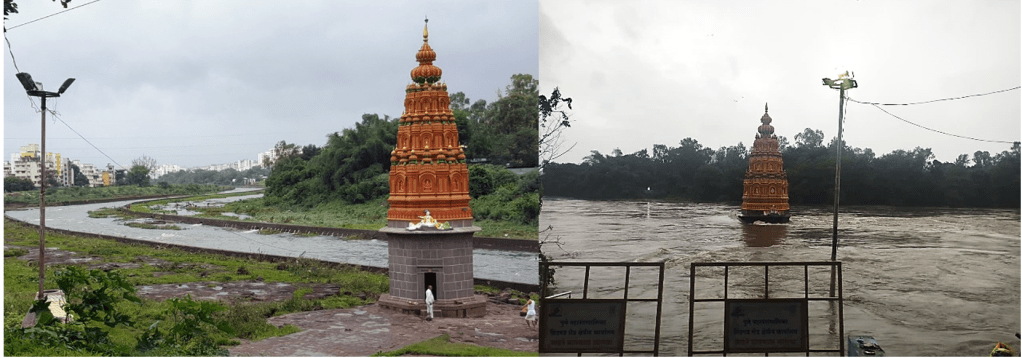
The Mutha river within Pune City limits is streamlined, which allows Punekars to use her flood plains during the dry season whereas, the river reclaims the space during the monsoon. A perfectly beautiful example of co-habiting.
The Water Resources Department (WRD) has issued the guidelines/ directives defining the flood zones and flood lines which I look at as a formal agreement defining these boundaries between the river and the humans.
But what exactly are these flood plains and flood lines?
Floodlines are an engineering concept designed as flood adaptation measure The imaginary lines drawn to distinguish between different flood zones in a river bed. The two zones are restrictive and prohibitive, bounded by the two floodlines – red and blue.
- The blue flood line indicates the possibility of floods occurring every 25 years. I.e. there are 4% chances of this flood happening every year.[i]
- The red flood line indicates the land that will be inundated by a 100-year return period flood, which has a 1% chance of occurring in any given year.
- The area between a red flood line and a blue flood line is known as restrictive zone which allows some constructions with certain restrictions.
- The area between two blue floodlines is known as prohibitive zone where all sorts of constructions are prohibited but can be used for certain activities like a playground, parking lot, or for cultivating during non- monsoon season. [ii]
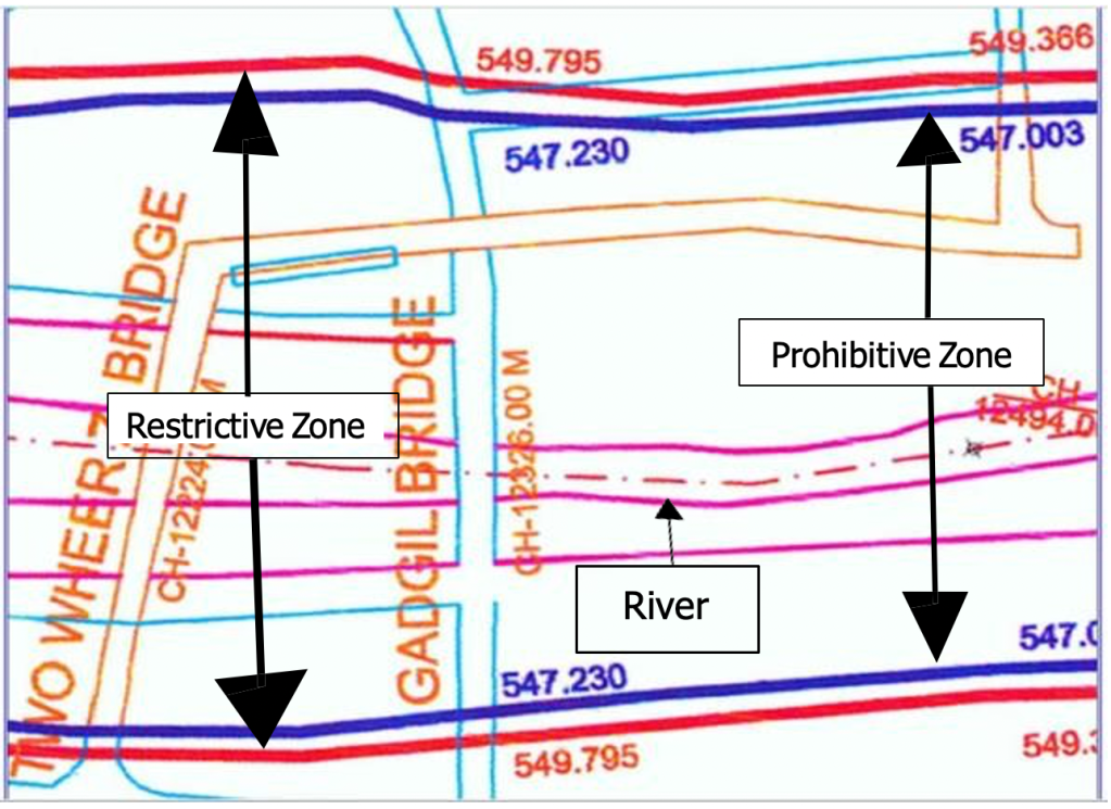
Pune City’ s Floodline History
For Pune City, the history of floodlines is as important of growth of the city – city limits, and of course the spread of Pune Municipal Corporation’s (PMC) governance. To understand this let’s dive into the case of Ekta Nagari – a neighbourhood situated right on banks of Mutha river which year by year faces impact of the floods during monsoon.
In Maharashtra, the floodlines were introduced in 1989 by the Water Resources Department via GR Dt.: 02-09-1989.[iii] In this circular, they issued guidelines and orders for demarcation of the floodlines.
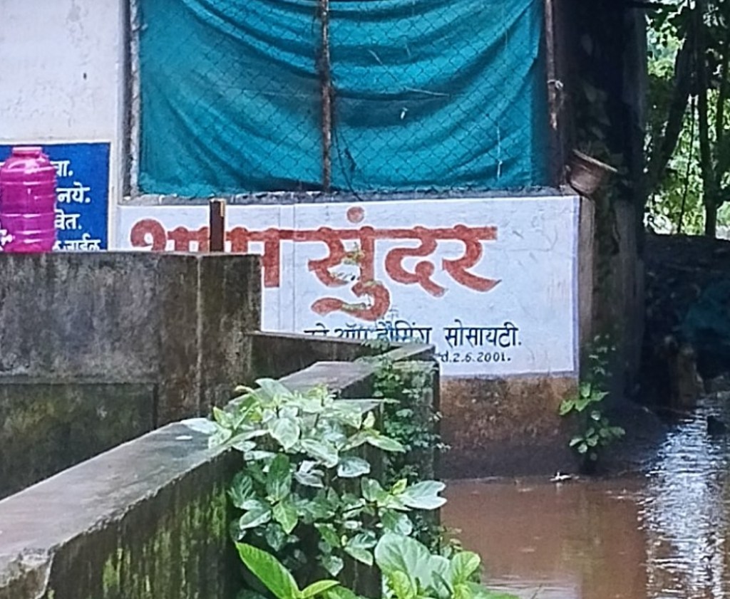
8 years later, i.e. in 1997, PMC expanded and merged 36 villages within PMC limits. Including the villages Vadgaon Budruk and Hingne Khurd (Sinhgad Road) on cusp of which today’s Ekta Nagari is situated.[iv] Merger in PMC was the legal trigger for the chang in the land use pattern. While some areas were categorised as commercial zones, some were converted to residential areas and some stayed farm lands. These areas were quick to develop in the early 2000s. For instance, the Shyamsundar Co-Op Housing society, located right next to Mutha river, was built in 2001.
In 2011, finally the 1989 directive was followed and the floodlines were demarcated in Pune city by the Khadakwasla Irrigation Department, 22 years after the Water Resources Department issued the circular.
Upon expiration of the 1987 – 2007 development plan for the city, Pune Municipal Corporation initiated the Development Plan (DP) for Pune City in 2013.[v] With flood lines in place, it was expected that the DP would include the flood lines but shockingly, Pune DP did not show any flood lines! Municipal Corporation said at the time that WRD did not give them any benchmarks hence they did not demarcate them![vi]
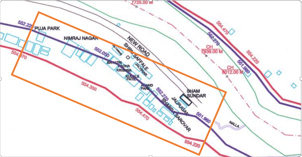
Action regarding this building should have been taken upon demarcation of floodlines, however we see no action.
Eventually the guidelines regarding floodlines also evolved. Few of the notable amendments were in 2015. They are as follows:
WRD GR Dt. 02-03-2015 strengthens the guidelines for:
- Land use within the floodlines and to ensure strict enforcement of the same, solely authorises the regional chief engineer of the WRD to for any approvals regarding floodlines.[vii]
The circular Dt. 16-11-2015 issued by the Maharashtra Engineering Research Institute (MERI) of WRD consists of following updates:
- Flow from free catchment area should be calculated and considered while demarcation of floodlines.
- Backwater effect to be calculated for cities/towns/villages established on confluence of rivers.
- The flood line maps shall be digitised with the help of GIS.
- Flood lines marked on maps are to be verified with on ground markings, post which these maps shall be sanctioned by the Chief Engineer of WRD.[viii]
When the flood line maps for Mutha river were to be digitised for Pune City, in 2016, an executive engineer of Khadakwasla Irrigation Department (KID) sanctioned erroneous flood line maps – which was clearly a violation of 2015 WRD circular.
Based on this information, a PIL was filed in Hon. Bombay High Court by Mr. Sarang Yadwadkar, Mr. Vivek Velankar and Mr. Vijay Kumbhar. After back and forth of correspondence and filing RTI applications for the case, it was brought forth that the 2016 floodlines demarcated for the city were not scientific. The floodlines did not calculate confluence effect or the flow from free catchment area as directed in the MERI Circular2015 and based on reply to RTI filed by Mr. Yadwadkar, the WRD shared that no new hydraulic study had been conducted for demarcating the 2016 floodlines.
The Bombay High Court in its order Dt. 30th June 2025, directed Government of Maharashtra to form an expert committee to study and finalise the floodlines of the city. This report was to be submitted 4 months from the date of directive and 2 months to implementation. It’s been over a year now yet Pune doesn’t have demarcated scientific and legitimate floodlines till date.
However, what so far is shared is a report of flood levels by Maharashtra Engineering Research Institute (MERI) under WRD. They mention that the current flood level of blue floodline of Mutha before confluence with Mula is 1,07,739 (exact fig.1,07,738.08676) cusecs after calculation the backwater effect and flow from free catchment area whereas the current blue floodlines are still marked at 60,000 cusecs. Meaning the floodlines considered for any sort of construction highly underestimates the flood levels.
The illegitimate marking of 2016 floodlines is a corrupt act and has led to numerous illegal constructions in the city, endangering the lives of residents. Let’s not forget the neighborhoods like Ekta Nagari which exist from even before the floodlines were demarcated existed to face consequences of shady, sluggish and corrupted governance. And while I mention example of Mutha, the pattern more or less repeats itself across Mula, Ram, Indrayani, and Pawana rivers.
| Why run and hurry? Here’s dictionary: Flow from Free Catchment Area:Flow of water which doesn’t drain into a dam but rather directly flows into the lowest drainage point is called as flow from free catchment area. For instance, a stream from a Taljai hill might directly flow into Mutha river will be considered as flow from free catchment area. The Backwater EffectThe backwater effect is the rise in water level and slowing of flow in a river or stream. It happens when an obstacle, a narrow structure like a bridge or culvert, a dam, or high ocean tides block or slow down the normal movement of water. This causes the water to back up and flood areas further upstream. |
Pune is highly flood prone due to its saucer shaped topography, 7 major dams on the upstream, and 6 rivers on banks of which the city exists. Rainfall pattern suggest increase in frequency of heavy rainfall.[ix],[x] Additionally, the anthropogenic encroachments in these floodplains lead to horizontal increase in the spread of flood water or to simply put – Archimedes principle comes into play which is quite evident in the Ekta Nagari case.
| Similar pattern can be seen in the case of Metro stretch of 1.45km passing through the riverbed. A report was published by CWPRS in legal matter against this particular stretch. It mentions at Bhide Bridge, the water level rises 1.5m above the blue floodline i.e. the vertical rise in flood. In fact, the report also mentions “In this reach Bhide bridge and Metro piers P162, P163 shows higher inundation area in the range of about 10 m to 12 m”, meaning 10-12 m area around the metro pillars is impacted by the flood |
Solutions..?
There have been incidents of buildings and constructions being demolished in Pune
(Demolition of 36 bungalows in Chikhali, Pune built in blue flood lines.[xi]) as well as other parts of the nation, for instance for violating the CRZ guidelines the Maradu towers in Kochi, Kerala were demolished. But how long should the citizens be punished for systematic failure ?
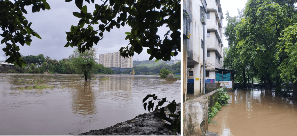
Often residents buy apartments based on approval based on building permissions by the urban governing bodies. Failure of these bodies in working honestly is quite evident via citizens who face the brunt of it. For instance, like every year, the Ekta Nagari was flooded twice, once at discharge of approx. 27000 cusecs and, once from dam discharge of approx. 38,000-43,000 cusecs from Khadakwasla Dam.[xii]
| “At many places development is seen within blue line, some structures are illegal, and some are legally constructed with permission of local authorities. This violation of development plan rules encourages others to follow the same and during flooding such areas are highly at risk and are major obstruction to flood water flow.”Flood Fury of Pune: Understanding the Tributaries |
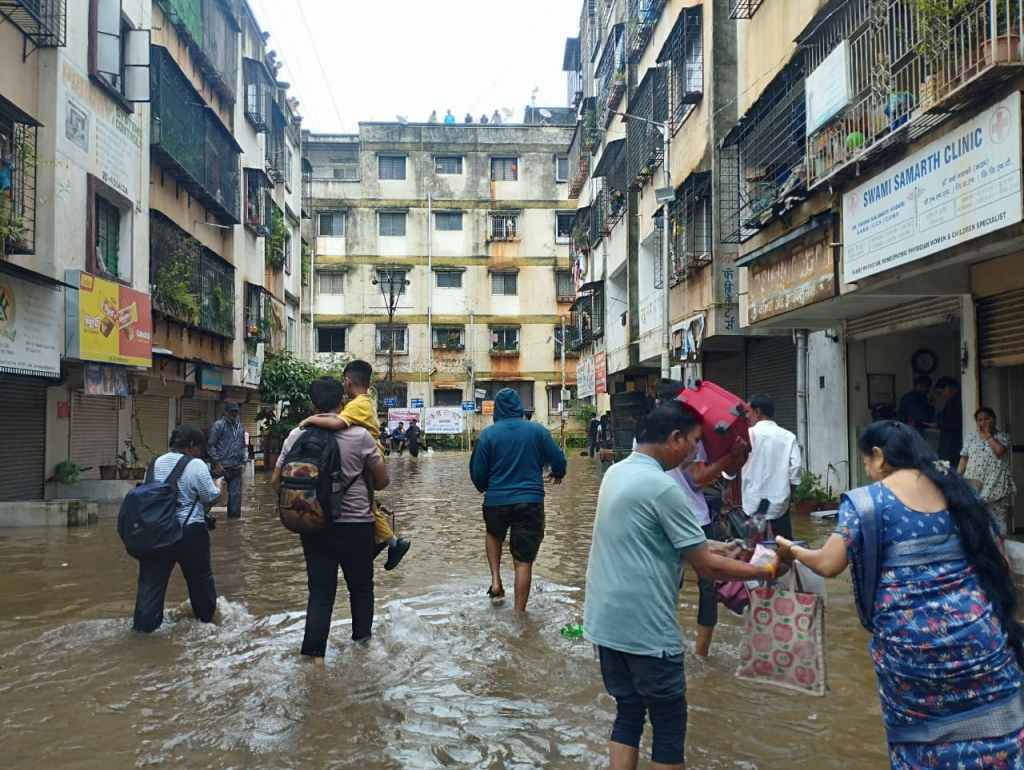
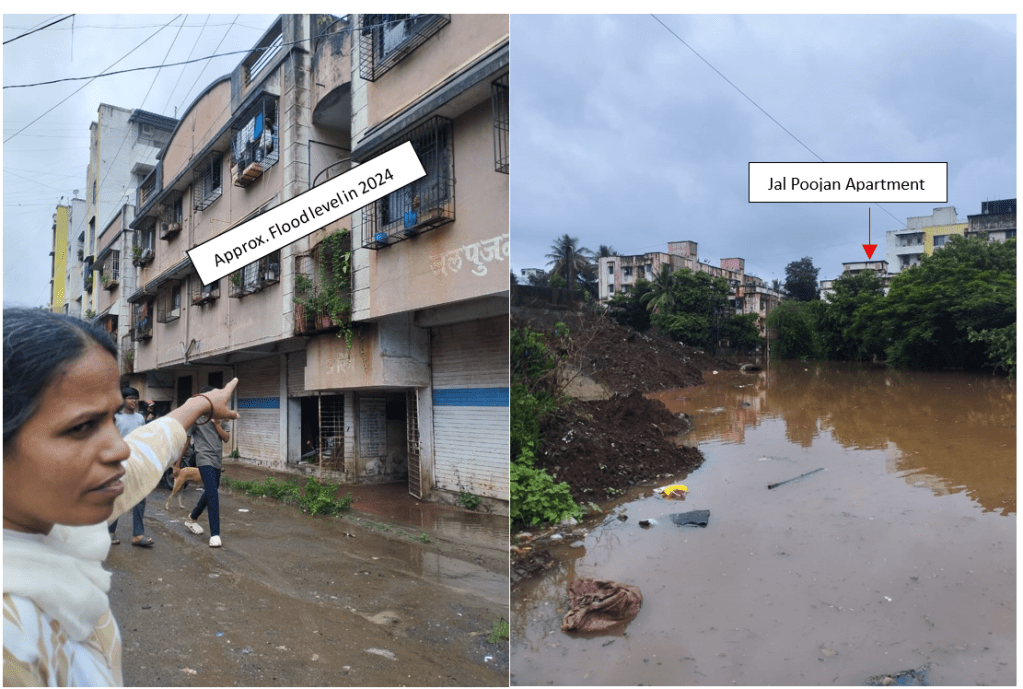
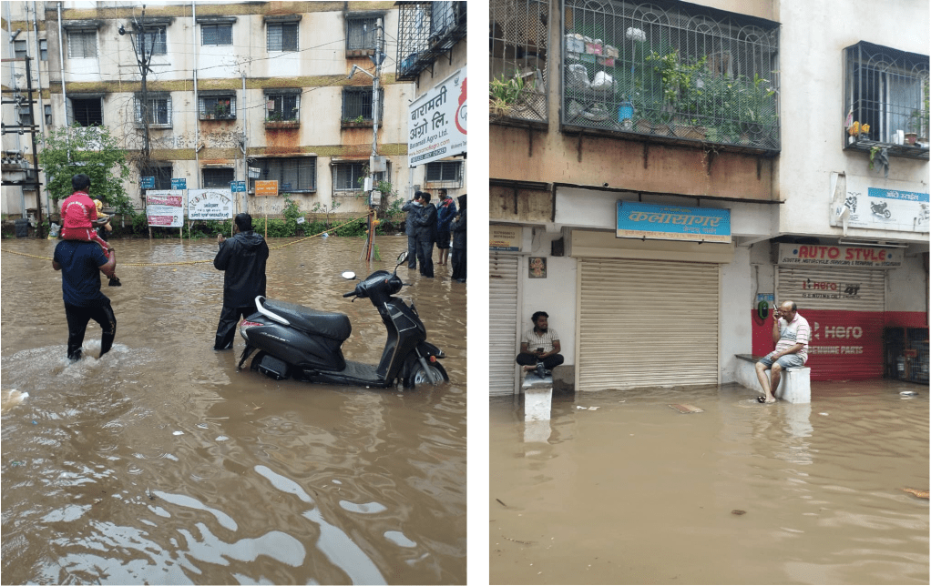
As reported by BBC Marathi, based on 2026 “floods” in Ekta Nagari, the water is known to reach second floor of these buildings. A family moved out, right a month after renting the house to avoid the stress of dam discharge entering into their homes.[xiii] This particular family had the means to do so, but not all the residents might have such capacity. In 2024, a rehabilitation plan was declared by then chief minister Eknath Shinde, however no update on it is available.
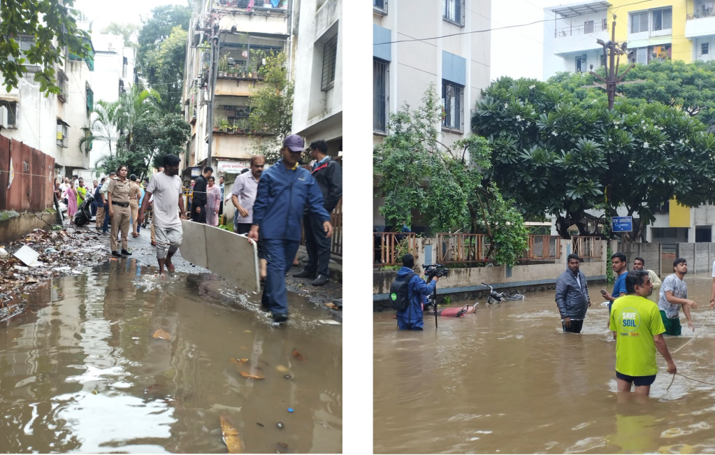
While speaking with Ujwala Bobade, a resident of Jal Pujan Apartment, she shared her agony, “I run a shop here, almost every year now we have been facing this (flooding) issue. They (WRD Authorities) should manage the dam discharge such that the buildings don’t get flooded. During the 8th July dam discharge of approx. 20,000 cusecs, my shop was greatly damaged. Today (on 31st July 2026) morning, the discharge was 4,000 cusecs while suddenly in the afternoon they said it will be increased up to 40,000 cusecs. We haven’t been able to sleep a blink last night. At least this year the PMC officials have been issuing warnings, in 2024, we got to know about the floods when water had reached our apartments. In 2024, CM Eknath Shinde came here for a visit – he promised us rehabilitation but nothing has happened ever since. My family members have to take a day off just to shift our household items to a safe place, and drop kids to our relatives’ place,” Many other residents echoed her sentiments.
| “All states should prioritise demarcation of floodlines, especially tier 1 cities where ‘development’ takes place and settlements established right near dams. Most of the states don’t even identify floodlines. This PIL should set an example to identify and demarcate floodlines all over the country. The 8th July 2026 floods at release of 27,203 cusecs were just a teaser. Many residents staying in Ekta Nagari are from hard working middle class and have settled in area for almost two decades now. Many of them work in nearby areas in fact, when Ekta Nagari faced floods in 2024 a directive was released by CM Eknath Shinde for rehabilitation, apathy of PMC and state government towards Punekars is quite visible through their inaction in this matter. This inaction is unjust, directly impacts the safety of the citizens.”– Sarang Yadwadkar, Petitioner in Bombay HC |
| Timeline So Far… 1989: Water Resources Department via GR Dt.: 02-09-1989 [1] conveyed for floodlines to be demarcated. 1997: 36 villages merged within PMC limits. Including the villages Vadgaon Budruk and Hingne Khurd (Sinhgad Road) on cusp of which today’s Ekta Nagari is situated. Late 1990s- Early 2000s: Societies like Shyam Sundar Co-Op Housing Society and Jal Pujan Apartment etc. are developed along river banks 2011: Water Resources Department follows 1989 circular and demarcates floodlines. 2013: Pune Municipal Corporation initiates work on Pune City Development Plan which was supposed to have floodlines marked but they were not marked. 2015: WRD and MERI (An institute under WRD) updates the exisiting guidelines with regards to floodlines. Updates include – Digistisation of floodlines, signed and approved solely by Chief Engineer, WRD., Inclusion of flow from free catchment area, impact of backwater effect etc. 2016: Demarcation of “updated” and digitised floodlines, approved by Executive Engineer – violating the 2015 WRD circulars. 2021: PIL filed by Arch. Sarang Yadwadkar regarding floodlines being illegal and illegitimate/ fraudulent. 2024: Flood water reaches upto almost 2nd floor of buildings evening onwards due to dam discharge. Then CM Eknath Shinde promised a rehabilitation policy. 2025: In PIL 36/2021, Hon. Bombay High Court directed Government of Maharashtra to form an expert committee to study and finalise the floodlines of the city within 4 months. 2026(Present): Pune exists without well studied and legal floodlines and no update on policy by ex CM Eknath Shinde while Ekta Nagar and many more neighbourhoods like this area continue to face the impact of dam discharge from almost 4 dams on a heavy monsoon day. |
From the Ground
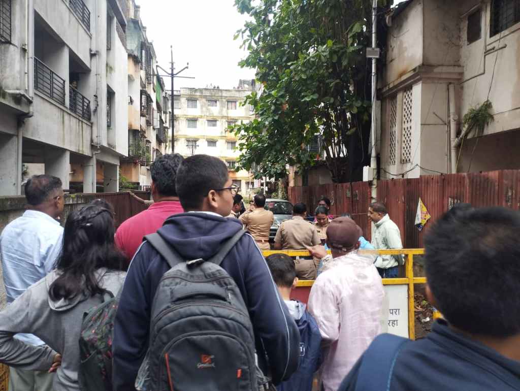
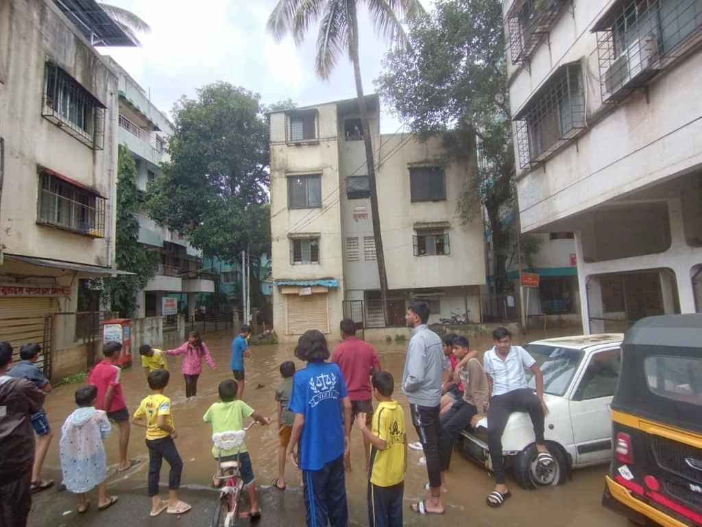
While in conversation with locals, and the rescue team, they mentioned that as per their observation, often the backwater effect due to the surface runoff of the stream which meets the Mutha river is more frequently damaging than the dam discharge. Regardless, of where the water comes from, the concern is flood. This is a pertinent point since in theory the point is already covered in the MERI Circular but ground realities are a silent witness to “on paper policy”.
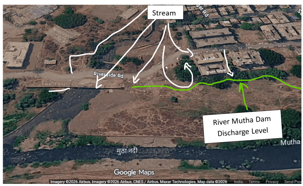
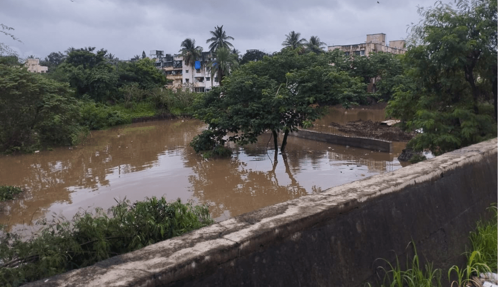
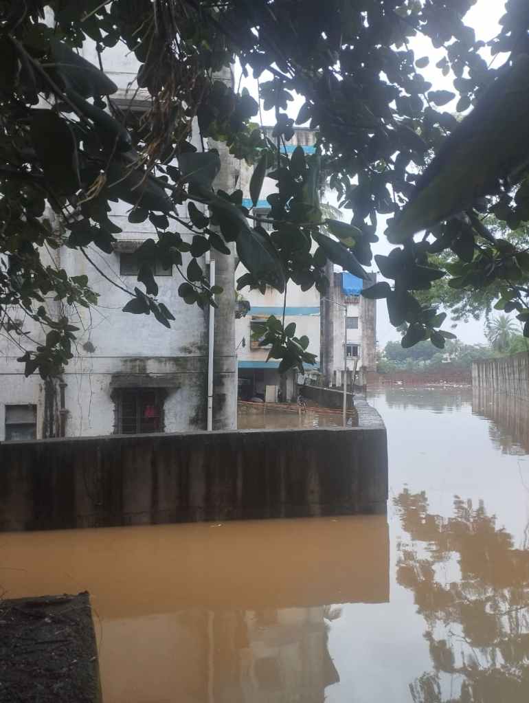
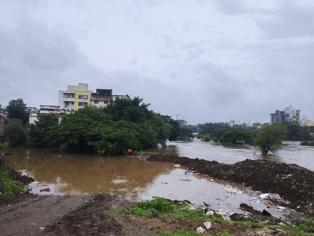
While speaking with locals, it was often mentioned that retention walls should be constructed to keep flood water at bay, however it is quite evident from the picture above that a retention wall can hardly keep water at bay. In fact, there were many incidents of collapsing retention walls in all areas around Pune City could be seen this monsoon.
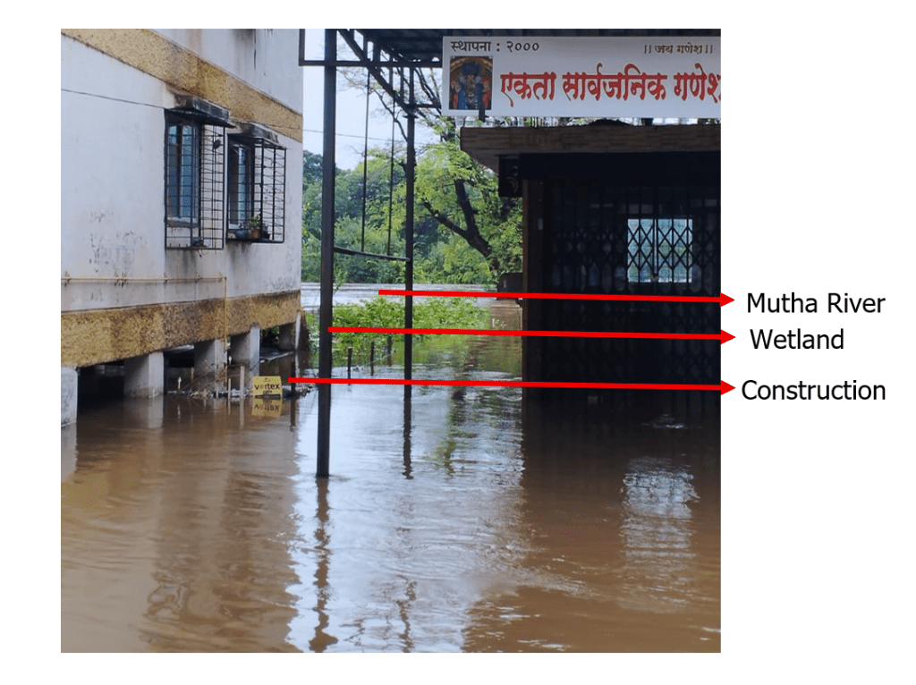
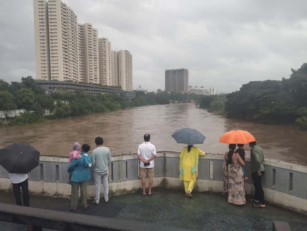
The 2026 rains were an example for the erratic and heavy rainfall Pune can face. If the encroachments are not checked, eventually more neighborhoods might be at impact of fluvial flooding. Considering Pune’s geographical location, contemporary development and increase in the imperviousness of the city, with the apparent changes in monsoon patterns, and frequency of floods, the scientifically demarcated floodlines as one part of the urban planning are more important than ever, if not, the Punekars have incurred heavy losses and will continue to suffer. The system failure is evident leading to suffering of common citizens. Prioritizing people over profit and holding system to account is important. The development should go hand in hand with respecting the nature’s boundaries. After all, it is said that a river reflects the people around. Is that in the case here as well? Increasing burdens and shrinking space. If you relate, you must know how the river might feel.
– Based on interview with Sarang Yadwadkar, and Residents of Ekta Nagar.
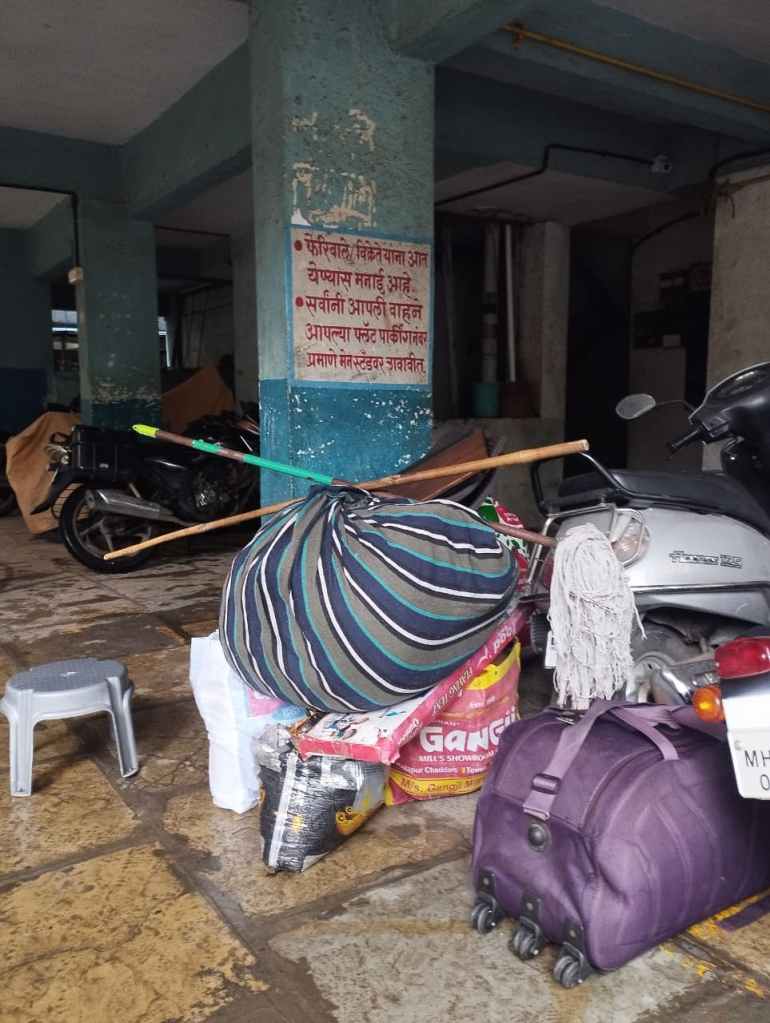
We would be happy to get your feedback.
SANDRP
[i] https://nora.nerc.ac.uk/id/eprint/14153/1/N014153CR.pdf
[ii] https://www.mahawrdgr.in/%e0%a4%aa%e0%a5%81%e0%a4%b0%e0%a4%be%e0%a4%9a%e0%a4%be-%e0%a4%b8%e0%a4%82%e0%a4%ad%e0%a4%be%e0%a4%b5%e0%a5%8d%e0%a4%af-%e0%a4%a7%e0%a5%8b%e0%a4%95%e0%a4%be-%e0%a4%9f%e0%a4%be%e0%a4%b3%e0%a4%a3/
[iii] https://www.mahawrdgr.in/%e0%a4%aa%e0%a5%81%e0%a4%b0%e0%a4%be%e0%a4%9a%e0%a4%be-%e0%a4%b8%e0%a4%82%e0%a4%ad%e0%a4%be%e0%a4%b5%e0%a5%8d%e0%a4%af-%e0%a4%a7%e0%a5%8b%e0%a4%95%e0%a4%be-%e0%a4%9f%e0%a4%be%e0%a4%b3%e0%a4%a3/
[iv] https://timesofindia.indiatimes.com/city/pune/plan-to-merge-villages-runs-into-political-roadblocks/articleshow/14814796.cms
[v] https://www.thehindu.com/news/national/other-states/Pune-development-plan-cleared-with-an-eye-on-civic-polls-activists/article17030369.ece
[vi] https://sandrp.in/2024/08/30/flood-lines-riverfront-development-and-citizen-heroes-story-of-pune-floods/
[vii]https://www.mahawrdgr.in/%e0%a4%aa%e0%a5%82%e0%a4%b0%e0%a4%95%e0%a5%8d%e0%a4%b7%e0%a5%87%e0%a4%a4%e0%a5%8d%e0%a4%b0-%e0%a4%b5-%e0%a4%aa%e0%a5%82%e0%a4%b0%e0%a4%b0%e0%a5%87%e0%a4%b7%e0%a4%be%e0%a4%be%e0%a4%82%e0%a4%9a%e0%a5%8d/
[viii] https://drive.google.com/file/d/1J-Pqwr6sUOzZ7oZiuwFHXq2342MNwlGZ/view?usp=sharing
[ix] https://www.plantarchives.org/article/361-%20Extreme%20Rainfall%20Distribution%20Patterns%20in%20Western%20Maharashtra%20India%20A%20Multi-Station%20Analysis%20for%20Climate%20Resilient%20Agriculture.pdf
[x] https://www.teriin.org/projects/nutrition-security/files/Maharashtra-CC-Report.pdf
[xi] https://timesofindia.indiatimes.com/city/pune/pimpri-chinchwad-civic-body-demolishes-36-illegal-bungalows-built-within-indrayani-river-flood-line-in-chikhali/articleshow/121241358.cms
[xii] https://www.researchgate.net/publication/363043969_Flood_Fury_of_Pune_Understanding_the_Tributaries


very well studied & written article. Great & timely topic to showcase the facts. To add- Mutha Rivers existing channel is also a big obstruction in the river flows. It’s not allowing water to percolate underneath due to it’s construction below ground
LikeLike
Many thanks, Shailajaji, for pointing out this additional factor. True.
LikeLike