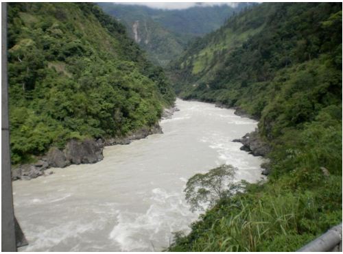
It’s heartening to see the Editorial in Arunachal Times (see below) about the flawed, dishonest, cut and paste Environment Impact Assessment report of the Kalai-II Hydropower project in Arunachal Pradesh. NEHR has written about this to the Anjaw district Deputy Commissioner and one hopes the DC has the courage to take appropriate action: Halt the public hearing and ask the project proponent to get a proper EIA done by a competent and honest consultant. WAPCOS Ltd, which has done the current flawed EIA has been known to do such flawed EIAs on numerous occasions in the past as we have written about it and also informed the MoEF, Expert Appraisal Committee on River Valley Committee, without any impact so far unfortunately.
It is good to see that NEHR has gone a step forward and sent legal notice to WAPCOS and we hope not only NEHR takes WAPCOS to NGT/ Courts, but the judicial agency does take action to reject the EIA and recommend blacklisting of the EIA agency. Unfortunately, the track record of NGT and judicial bodies so far is far from encouraging in this regard, but one hopes there is always possibility of a change.
In fact, we have yet to see what can be called an honest EIA of a river valley project in India and have been asking all concerned for years to show us one. So far there has been only deafening silence by way of response. There is of course the political economics behind this situation. Why should an EIA consultant give a problematic EIA report if the masters, the project proponents only want a positive EIA report? Particularly as the consultant wants to remain in EIA business and get more EIA consultancy jobs?
Do Proper EIA of Kalai HEP: Arunachal Times Editorial The North East Human Rights (NEHR) has stated that the assessment and land acquisition process for the Kalai-II Hydroelectric Project (HEP) should be halted due to multiple flaws in the Environmental Impact Assessment (EIA). According to NEHR, the study conducted by WAPCOS Ltd. contains numerous errors, including clear evidence of copy-paste work, indicating a lack of originality and due diligence. The organization alleged this in a letter addressed to the Deputy Commissioner of Anjaw district.
NEHR further claimed that the EIA is riddled with inconsistencies and lacks thorough research, raising serious concerns about the legitimacy of the process. It has since issued a legal notice to WAPCOS, seeking clarification on grounds of alleged cheating and fraud under the Bharatiya Nyaya Sanhita, as well as the illegal acquisition of Scheduled Tribe land through forged and false reporting. Previously, some villagers had raised concerns about a lack of transparency in conducting the EIA and Social Impact Assessment (SIA). They have submitted a formal complaint to the Arunachal Pradesh State Pollution Control Board.
The project is being executed by THDC India Limited. The government must, at the very least, adhere to established environmental regulations. The safety concerns surrounding such projects are not hypothetical-they have materialized in other parts of the state. A multi-seasonal study must be undertaken with due diligence, and the fears and concerns of the local population must be genuinely addressed. Pushing forward with a project while ignoring valid grievances will only foster distrust, deepen resistance, and lead to irreversible environmental damage.
HYDRO POWER PROJECTS
Arunachal’s tribal lawyer rekindles mega dam debate Tatak belongs to the Adi tribe and is the legal advisor of Siang Indigenous Farmers’ Forum (SIFF), a people’s movement against the Siang Upper Multipurpose project.
HP defends HEPs before SC Faced with the Supreme Court’s warning that the entire state may vanish in thin air, if unregulated development continues unabated, the Himachal Pradesh Government has, in an affidavit filed in the court defended construction of hydropower projects in the state, terming them a cleaner alternative to fossil fuel-based thermal power projects.
LNJ Bhilwara acquires 49% stake of Statkraft in Two HP HEPs LNJ Bhilwara Group announced it has acquired Statkraft’s 49 per cent minority stake in Malana Power Company. With the acquisition, its arm Bhilwara Energy Ltd has become the sole owner of Malana Power. The transaction includes Statkraft’s stake in the 86 MW Malana Hydropower Plant and the 192 MW Allain Duhangan Hydropower Plant, both in Himachal Pradesh. These plants have been operated as 51:49 joint ventures since 2004.
Managing Distressed Hydro Projects The Central Water and Power Research Station and Indian Geotechnical Society are organising a seminar on ‘Managing Ageing and Distressed Hydro Power Projects’ on 11-12 September at the CWPRS. The topic for discussion is – safety and performance of dams and hydropower assets. Director of CWPRS Dr Prabhat Chandra said many structures are operating beyond their original lifetime, so addressing structural, hydroelectric, geotechnical and operational challenges through robust diagnostics, rehabilitation, and modern monitoring has become a national priority. NDSA chairman Anil Jain will be the Chief Guest at the Inaugural session.
DAMS
IISER study: Dams are not permanent assets, siltation makes them unsafe The IISER study delivers a clear warning: India must stop viewing dams as permanent assets. Dams and reservoirs across India have been reduced to 50% of their storage capacity due to heavy sedimentation, which is eroding their capacity to generate power and protect communities from floods and droughts, says a new study by the Indian Institute of Science Education and Research (IISER) Bhopal. The study, published in the international journal Stochastic Environmental Research and Risk Assessment (SERRA), examined government records for more than 300 large reservoirs with storage exceeding 100 million cubic metres.
By 2050, many more, particularly in the Himalayan region, the Narmada-Tapi basin, the Western Ghats, and Indo-Gangetic Plains, are expected to reach this level. “India’s Dam Safety Act, 2021, was enacted to strengthen structural inspections and prevent failures across more than 5,700 large dams. But our study highlights that safety cannot be limited to walls and gates alone. A reservoir that loses half its storage may not collapse but becomes functionally ‘unsafe’,” said Dr Somil Swarnkar, assistant professor at IISER Bhopal, who led the study. Prof. Rajiv Sinha of IIT Kanpur said that the study provides very useful and actionable insights.
हरदा में सैकड़ों आदिवासी अपनी ज़मीन बचाने लिए कर रहे हैं विरोध प्रदर्शन राज्य के हरदा और नर्मदापुरम ( होशंगाबाद) जिले के हज़ारों आदिवासी इन दिनों दो अलग-अलग संकट का सामना कर रहे हैं। एक तरफ मोरंड-गंजाल बांध से डूब का खतरा है तो दूसरी ओर रहटगांव के वन ग्रामों में प्रस्तावित डॉ. राजेंद्र प्रसाद अभयारण्य से आजीविका का खतरा बना हुआ है। इन दोनों परियोजनाओं के विरोध में शुक्रवार (12 सितंबर 2025) को जय आदिवासी युवा शक्ति (जयस) संगठन के बैनर तले ग्रामीण सड़कों पर उतरे।
The long shadow of an unfinished dam in Jharkhand The five-decade-old Mandal dam project has received fresh clearances and is now being revived as protests continue.
Decisions by EAC meeting for River Valley Projects held on Aug 29 2025
1. Kamalapadu Closed Loop Pumped Storage Project (950 MW) in 359.61 ha at Village Attiraladinne, Kamalapadu & Kundanakota etc., Sub-dist Peddapappur & Yadiki, Dist Anantpur, Andhra Pradesh by AP Power Generation Corp Ltd – Env Clearance: Approved
2. Jankhai Closed Loop Pumped Storage Project (1500 MW) in 427 Ha at Village Kathmana, Janakhai etc, Sub-dist Sirmour and Jawa. Dist Rewa, Madhya Pradesh by GSC PSP Madhya Pvt Ltd – Terms of Reference: Approved
3. Koppolu Open loop Pumped Storage Project (2400 MW) in 332.73 Ha at Village Koppolu, Sub-dist Kondapuram, Dist Y.S.R., Andhra Pradesh by Chinta Green Energy Pvt Ltd – Terms of Reference: Approved
4. Rewa Closed Loop Pumped Storage Project (600 MW) in 449.47Ha Village Nevrhiya, Uprohit Pura, Bajara, Chaura & Chhataini etc., Sub-dist Teonthar & Hanumana, Dist Rewa, Madhya Pradesh by Dhakara Energy Psp Pvt Ltd – Terms of Reference: PP Absent
5. Sonpura Major Micro Irrigation Project (CCA: 19410 Ha) in 1042.9Ha Village Akhai Mahadev, Panwari, Parnakheri & Garkatu etc., Sub-dist Badarwas, Kolaras & Guna, Dist Shivpuria and Guna, Madhya Pradesh– Terms of Reference: Approved
6. Integrated Anandapur Barrage Project (CCA: 60,000 Ha) in Keonjhar dist, Odisha by Dept of irrigation, Govt. of Odisha – Amendment in Environmental Clearance: More Info Sought
DAM SAFETY
Bargi Dam safe: MP govt On Sept 7, a video purportedly showing seepage from the Bargi Dam went viral, raising concerns over its safety. “On Sept 8, the dam was jointly inspected by a team from the Central Water Commission from Bhopal and the Bureau of Designs. After the technical examination, the dam was found to be completely safe,” Additional Chief Secretary (ACS) Dr Rajesh Rajora said. “National Dam Safety Authority (NDSA) consultant U S Vidyarthi, Director the Central Water Commission Kayyin Mohammad, other senior officials and experts visited the site and according to all of them, the Bargi Dam is safe,” Rajora said.
“The dam has attained its full capacity level (following heavy rains in the upper catchment areas). There is seepage in a part of the dam”: Jabalpur district collector Deepak Saxena. The breach was found in the Block 3/10 (out of total 30 blocks) of the 5,357-metre-long dam, Jabalpur district collector Deepak Saxena said. The full reservoir level of the dam is 422.76 metres, water level has reached 423.05 m, with inflow of 1775 cumecs. With dam running full, nine gates were opened on Sept 3 and six more later on when the dam was to be literally overflowing, officials said.
Mevasa Dam Breach in Kutch-Gujarat The earthen bund of the irrigation dam in Mevasa village in Rapar Taluka of Kutch district in Gujarat got washed away on Sept 8, 2025 and massive quantity of water started flowing out into the Gagodar River. The administration has alerted the downstream villages on the banks of Gagodar River that could face the impact of this sudden water release. Officials have issued an alert and some of the affected villagers in the downstream area have been asked to shift to safer places.
Nangal: Poor drainage key factor behind landslips near dam, say experts team of civil engineering experts from IIT-Ropar visited landslide-prone areas around Nangal town to assess the growing threat to habitations in Bhabhor village, Laxmi Narayan Temple and several other structures located along the Nangal Dam reservoir. The experts identified poor drainage systems, high water flow in the reservoir during monsoon and faulty building designs as the primary reasons behind recurring landslides in the region.
They also highlighted the collapse of several retaining walls, which they said were poorly designed and had failed to provide stability to the vulnerable slopes. The experts further recommended that the Punjab Government make structural stability certifications mandatory for all buildings constructed near hill slopes and water bodies to ensure safety in such sensitive zones.
DAM FLOODS
Sept. 2025: Six Killed in Luti Dam Flood Disaster in Chhattisgarh A flash flood disaster caused by a significant breach in Luti dam bund has killed six people while one remained missing in Dhaneshpur village near Vishram Nagar under Balrampur district of Chhattisgarh. Six of the flood victims are members of a single family living about 500 meter downstream from the dam area. About 11 villagers were swept away by strong current of waters. Some of them managed to save their lives by holding on to trees and swimming to their safety. Three persons also suffered injuries in this dam induced flood incident.
PAC blames BBMB, Punjab for Man Made Floods, Moves NGT “Calling the recurring floods in Punjab “man-made disasters”, the Public Action Committee (PAC) on Sept 8 moved the National Green Tribunal (NGT), accusing the Bhakra Beas Management Board (BBMB) and the state government of systemic negligence. Addressing a press meet in Ludhiana, PAC members Kuldeep Singh Khaira, Er Kapil Arora, Jaskirat Singh and Dr Amandeep Singh Bains alleged that unscientific dam operations, coupled with the Punjab government’s failure to curb illegal mining and encroachments, aggravated the situation.
PAC members also alleged that BBMB’s premature release of water from the dams this year triggered sudden flooding in Punjab, even before reservoirs reached their maximum safe levels. “This was not a natural disaster but a human error.”
Punjab Govt warns BBMB The Punjab Government has issued a stern directive to the Bhakra Beas Management Board (BBMB), urging it to stop random fluctuations in water outflows from the Bhakra and Pong dams. The move comes amid concerns that erratic releases are exacerbating risks of bund breaches, threatening agriculture lands and crops, and infrastructure in downstream districts.
Sutlej tributaries contributed to Punjab floods The Tributaries of the Sutlej, especially Swan (contributed 90 000 cusecs, of which 75000 cusecs from HP and 15000 cusecs from Punjab area) and Sirsa (brought in about 70000 cusecs during the period), have contributed more to the deluge than the main river in the July-August monsoon period, according to official data provided by the state Drainage Department. The swollen Sutlej has submerged hundreds of villages, including those in border districts of Fazilka and Ferozepur, while posing a risk to areas in Ropar and Ludhiana.
The Swan river, which originates from Himachal Pradesh’s Una, meets the Sutlej near Anandpur Sahib. The Sirsa, which has its origin from near Solan in the neighbouring hill state, merges with the Sutlej at Ghanauli near Ropar town. The situation worsened in the Beas basin as well, where additional inflows from rivulets in Hoshiarpur district compounded the already high discharges from the Pong Dam, according to source.
PUNJAB FLOODS: Lives, Homes and Crops lost “There is a clear mismanagement by dam authorities. Both Bhakra and Pong dams were past prudent storage by August 20, but the outflow of water was kept very low despite heavy rainfall in the catchment areas and forecast of more heavy rainfall days in both Himachal Pradesh and Punjab,” said Himanshu Thakkar, the coordinator of South Asia Network on Dams, Rivers and People (SANDRP).
“They had to eventually release heavy quantities of water from August 26 onwards when Punjab was already facing floods due to local rainfall. Ranjit Sagar dam also released more water than the inflow from August 27 onwards, which technically means it contributed to flooding instead of moderating it,” Thakkar added.
The release of water from Ranji Sagar Dam damaged two gates of Madhopur barrage that led to submergence of large tracts in Gurdaspur and Pathankot districts. “The least the authorities can do is put all the information related to dam operations, including rule curve, daily inflow, outflow, storage, rainfall and downstream carrying capacity balance of the flood flows, in the public domain,” Thakkar stated. “All the members of the technical committee are clearly responsible for the disaster and only an independent judicial inquiry can uncover the truth.” The Himachal Pradesh government has already filed an FIR against BBMB, accusing it of releasing excess water without warning that triggered flood-like situation in two regions of Kangra district.
Public Action Committee (PAC) Mattewara, a group of activists in Punjab, has also filed a petition in the National Green Tribunal (NGT), seeking audit on the working of BBMB and the Punjab government on flood management and prevention, through an independent expert committee. “Instead of reducing risk, our dams have worsened floods. This is not just nature’s fury, it is human negligence. Transparency and accountability are the only way forward,” Jaskirat Singh, a member of PAC Mattewara, told Mongabay India.
In the early part of August, the release of water from these dams was kept low despite heavy rainfall in the catchment areas. This was a huge mistake. hereafter, Himanshu Thakkar, the coordinator of South Asia Network on Dams, Rivers and People (SANDRP), said: “They had to eventually release heavy quantities of water from August 26 onwards when Punjab was already facing floods due to local rainfall.” It ultimately led to the submergence of large parts of Gurdaspur and Pathankot districts.
MAKE DAM OPERATIONS TRANSPARENT, DEMAND EXPERTS SANDRP, which analysed the daily rainfall data, dam levels and outflow for all the three major dams in Punjab, stated the dams played a major role in worsening the floods in Punjab. “We need more transparency in dam operations,” said Himanshu Thakkar, Co-Ordinator of SANDRP. “All information related to dam operations, including the rule curve, should be made available in the public domain, including daily inflow, outflow, storage, upstream conditions and the names of those responsible for operations. SOPs should clearly define monsoon operations, rainfall forecast in upstream and downstream catchment areas, and post monsoon reviews should be mandatorily conducted and put in public domain.”
The SANDRP analysis revealed that the outflow from Ranjit Sagar Dam on the Ravi rose from 9,000 cusecs on August 24 to 1,73,000 cusecs by August 27 as the dam crossed the Full Reservoir Level (FRL) at 527 m. “From August 27, outflow exceeded inflow for five days, which by definition of Central Water Commission (CWC) means the dam had generated floods. Clearly, it ended up contributing to floods rather than moderating it,” it stated. Furthermore, according to it, by August 1, Bhakra Dam was already 53 per cent full, but outflow increased significantly only on August 19-20, when spillway gates were opened for the first time in two years. Early outflows would have aided power generations, which was often suboptimal. Between August 1-20, inflow exceeded outflow by 180 per cent, pushing the dam beyond prudent storage levels, it stated.
Floodwaters can be used to recharge Punjab’s depleting aquifers For southwest Punjab and Fazilka in particular, the floodwaters can be used to recharge depleting groundwater aquifers. Fazilka, Ferozepur, Muktsar and the broader southwest face a stark contradiction: While groundwater aquifers have plummeted 9 to 22 metres due to decades of over-extraction, mismanaged paddy cultivation, and scant rainfall — just 82mm annually in Fazilka — these same lands also drown under the onslaught of rare but intense flooding. The crisis is not a mere function of rainfall. Poorly maintained drainage infrastructure of the Abul Khurana, Langiana, Chanbhan drains and especially the Aspal extension drain and failing water governance have compounded the devastation.
The Aspal Extension and other drains, built to safeguard low-lying fields by channelling excess water, have transformed into a conduit of disaster thanks to flawed design, inadequate capacity, and chronic neglect. Instead of averting flood risk, it has amplified destruction, inundating homes and farmlands. Crucially, this is neither unique to Fazilka nor an isolated lapse — drains across Muktsar, Bathinda, and other districts mirror this inertia. Southwest Punjab’s underground formations can hold up to 50 billion cubic metres. It is a vast, untapped water bank capable of absorbing surplus that would otherwise ravage the land.
Misleading advocacy for flood control dams This article in Down to Earth by two students begins with misleading and unscientific advocacy for flood control dams for Punjab, “constructed solely to prevent the floods in the region”. It is suggested that is necessary since “The sudden release of water from large dams brings devastation to the rivers and communities downstream”. It seems a bit like a dam lobby that sees an opportunity in every flood! The authors may have educated themselves about proper management of the existing dams that could have helped prevent this to a large extent. They could also have underlined widely implemented rainwater harvesting, small local water bodies etc. in the catchments and downstream of these dams.
It’s a pity since it mars and some otherwise good questions the authors are raising including need for updated disaster management plans, greater role for Punjab in BBMB, increased data availability under Section 35(e) of the Dam Safety Act, 2021, BBMB’s complete non-transparency about dam management data, lack of regular bulletins from the Punjab government, shortage of human resources in BBMB, among others.
Govt panel formed to investigate Guj hydro deaths in Mahisagar wont help The Mahisagar district administration has formed a committee to investigate the death of five workers who drowned in a large reservoir at the Ajanta Hydropower Project in Dolatpura village on Sep 4. Mahisagar police registered a case under sections 106 and 125(A) of the Bharatiya Nyay Sanhita for causing death by negligence and committing a negligent act endangering life or personal safety. No arrests have been made so far.
Deputy superintendent of police Kamlesh Vasava said all documents and agreements related to the contract with Ajanta Energy Private Ltd are being collected to determine whether any violations occurred. The committee, headed by the sub-divisional magistrate of Lunawada, includes Vasava, engineers from the Kadana project, officials from the Gujarat Electricity Transmission Company, and other relevant personnel. This will not help. What is required to unearth the truth is an independent committee.
Water released from Panchna Dam destroys farms in Karauli & Bharatpur districts The agrarian community in Bharatpur is reeling under severe losses after excess water released from the Panchna Dam in Karauli district flooded vast stretches of farmland. The sudden release of water into the Gambhiri river has submerged crops of millet, sorghum and chilli, leaving farmers in despair with nothing left to feed their families. This season, three times more water than the dam’s capacity was discharged, the gates of the dam have been opened seven times this season.
Temporal Analysis of Floods in Punjab (1990-2010) was published in the International Journal of Research and Analytical Reviews. The paper studied the floods in the state from 1990 to 2010. It noted that while the floods in Punjab in these two decades were mainly caused by torrential rains between July and September, release of water from the Bhakra dam on the Sutlej, poor management of rivers and canals and weakening of embankments were also to blame. The drainage of water is obstructed due to lack of timely cleaning of rivers and canals. Small streams break their banks and submerge fields and villages. Ignoring the repair of embankments causes weak dams to break in the rain and devastation increases. The Flood Preparedness Guidebook 2024 stated that flood conditions are created due to many types of obstructions in natural drainage routes, especially structures that obstruct the flow of drains.
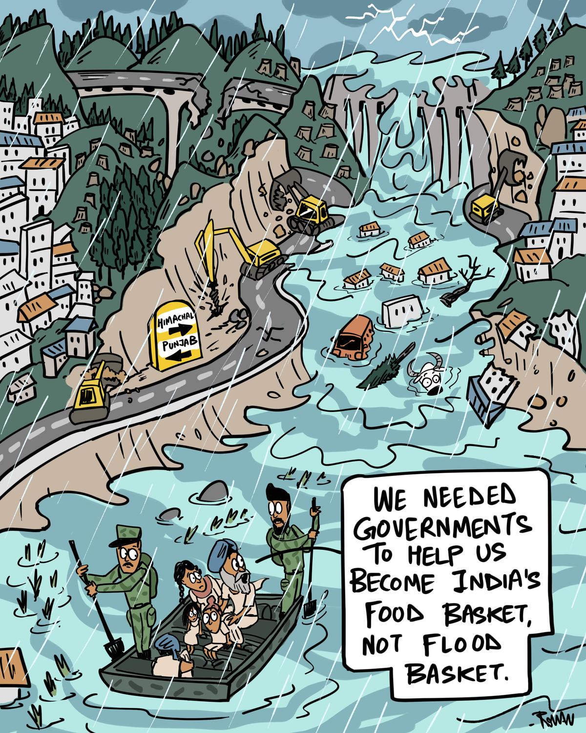
Punjab floods Green Humour by Rohan Chakravarty
FLOODS
Multiday Precipitation Is a Prominent Driver of Floods in Indian River Basins The drivers of floods in the Indian river basins have not been examined for the observed and projected future climate. Here using a novel framework, we examine antecedent moisture conditions and precipitation characteristics before high flow events. We estimate the probability of occurrence of flood drivers and their association with peak flood magnitude under the observed and projected future climate in Indian river basins. Multiday precipitation, a proxy to heavy precipitation on wet soil conditions, was found as the predominant flood driver in the observed and projected future climate. We show that multiday precipitation is more prominent driver than extreme soil moisture conditions in larger rivers basins while extreme precipitation drives floods in smaller river basins. The frequency of major drivers of floods is projected to rise in the future, which may pose a greater risk to agriculture and infrastructure under the warming climate.
Encroachments, Climate Change contributed to Punjab Floods Experts and official assessments stress that human interventions, including blocked drainage systems, encroachments on natural water channels, and unregulated construction activities such as road laying, have aggravated the Punjab flood crisis. Union Agriculture Minister Shivraj Singh Chouhan, during a visit to the State on September 4, blamed illegal mining.
The Water Resources Department’s Flood Preparedness Guidebook 2024 highlights that threats persist due to heavy releases from reservoirs, as well as breaches in embankments.
J&K: Old wounds reopened by new floods Whenever the water level in the Jhelum rises, panic spreads among residents, still haunted by the 2014 floods that killed nearly 300 people. Following the 2014 flood, several measures were recommended to prevent a similar situation; however, the majority of them remain on paper.
Haryana Union minister of state for railways and Jal Shakti, V. Somanna, on Sept. 13 inspected the Hathnikund Barrage in Yamuna Nagar district along with officers from the irrigation department to assess the current water flow of the Yamuna river. The minister said that due to recent heavy rainfall, there was significant land erosion and waterlogging at several locations near the embankments of the Yamuna river. He directed officers to further strengthen the river embankments to prevent any future damage.
Kurukshetra Lok Sabha MP Naveen Jindal on Sept. 14 visited Tapu Kamal Pur village in Yamunanagar district and inspected the land erosion near the banks of Yamuna. He directed officials to strengthen the river embankments, so that land erosion could be stopped. He assured the flood-hit villagers who suffered losses of special help from the government. Karnal Even as the water level in the Yamuna has come down, the threat of erosion along the edges of the river has sparked fresh concerns, forcing the Irrigation Department to take up urgent repair and strengthening work.
Photos of New Delhi residents on the swollen banks of the Yamuna River. Agra: The water level of the Yamuna River in Agra has risen immensely, surpassing the danger mark and reaching the walls of the Taj Mahal, officials reported on Sept. 08.
Prayagraj Ganga flowed close to danger mark for longer this yr After staying above warning level for almost six days, water level of Ganga came below 70.26 meters on Sept 14. This was the third time in 45 days that Ganga crossed the warning level, and in recent years, it was the first time water level of the river remained flowing close to warning level for over a month.
As per CWC records, on Sept 8, 1978, the Ganga in Varanasi reached the mark of 73.9 meters, and it became the HFL mark of the district. Except for Ballia, no other district has witnessed breaking of the 1978 record. Ballia witnessed Ganga reaching the 60.39 meters mark against danger level of 57.61 on Aug 25, 2016.
Ganga, Yamuna recede Offering much-awaited respite to the administration and residents alike, the water level of Ganga and Yamuna is receding at all three points—Phaphamau, Chhatnag, and Naini on Sept. 12. The Ganga, Yamuna, and Sharda rivers have begun to recede but continue to flow above the danger mark at several locations in the state. In July 2025, all major ghats in Varanasi, were submerged as the Ganga’s water level keeps rising due to continuous rainfall in the region.
HIMALAYAN DISASTERS
Are cloudbursts a scapegoat for India’s floods? Currently, the IMD monitors rainfall mainly through automatic weather stations (AWS), rain gauges and satellite data. It has also progressively installed 10 Doppler Weather Radars (DWR), which use high-power microwave radiation to detect precipitation, over the north-western Himalayas beginning in 2021. It has plans to expand the national network to 126 by 2026.
Until then, there remains various challenges in identifying cloudbursts in the Himalayan region, says Himanshu Thakkar, coordinator of the South Asia Network on Dams, Rivers and People. One is that the IMD has insufficient monitoring stations in the Himalayan region. For example, Dharali’s closest AWS station is 7 km away.
Another is that cloudburst-measuring equipment such as rain gauges, which are generally more common as they are cheaper than AWS, have limited ranges. Yet “IMD’s density of rain gauge[s] is very low,” says Thakkar. In the Himalayas, rainfall can differ sharply over short distances due to the steep topography, and peaks and ridges can block DWR signal. These factors make it challenging to accurately determine how much rainfall an area has received.
Unplanned and rampant infrastructure development in the region plays a significant role in these disasters, Thakkar says. When rains flow down from the hills, they bring with them mud and stones, mixed in with construction waste from road-building projects. Such waste is often dumped in rivers and along slopes in the Himalayas. This combination can cause devastating flash floods in areas surrounding the rivers, he notes.
As such, “describing the cause of these disasters as cloudbursts or landslides isn’t good enough”, he says. “What’s needed is an independent, multidisciplinary assessment of Himalayan disasters to understand what exactly happened and to [show] accountability.” The assessment would highlight any “geological, meteorological, systemic, social or environmental factors as well as the role of infrastructure development and different agencies.”
Thakkar says that, “considering the vulnerability of the Himalayan region and its subsequent disaster-proneness”, the IMD and state governments need to build up monitoring equipment infrastructure to not only measure the rainfall post-disaster but also use it to forecast and establish an early warning system.
While India has built capacity in rescue and relief operations, prevention remains weak, says Thakkar. Prevention means clearly identifying vulnerable regions in the Himalayas, including streams, rivers and landslide-prone areas. It includes putting an effective monitoring system in place, studying rivers and their natural flows and curbing infrastructure development nearby. It means permanently resettling people living in identified disaster-prone areas, and carrying out environmental impact and disaster impact assessments of all major interventions in vulnerable regions.
Mohd Farooq Azam, senior intervention manager for the cryosphere at the International Centre for Integrated Mountain Development (ICIMOD) said hazard zonation mapping for potentially dangerous glacier lakes is equally important.
Madhavan Nair Rajeevan, the former secretary of India’s Ministry of Earth Sciences suggests installing very high-resolution automatic rain gauges, and at a much higher density, of one per 2-3 km. “The radar network should be integrated along with other observational platforms like automatic weather stations, rain and snow gauges, river water levels, run-off and groundwater measurements,” says Rajeevan.
Experts also warn that focusing solely on the cloudburst label risks missing the bigger picture of a disaster’s fundamental causes, such as global warming and its impacts.“What is clear is that India’s Himalayan states are facing relentless rains and even more devastation with each passing day,” said Thakkar. “This is becoming even worse in the face of climate change.”
Dharali disaster due to intense Rainfall, not floods: Report The panel constituted by the Uttarakhand govt has said in its preliminary report that the Aug 5 (1.30 pm to 6 pm) Dharali floods happened due to intense localised rainfall on high altitudes o Aug 4 and not GLOF. The panel included scientists from Wadia Institute of Himalayan Geology and Uttarakhand state Council for Science and Technology. There were more than one wave of intense rainfall, leading to more than one wave of flood, the panel have said. The intense rainfall destabilised morain and boulders, creating a shaking feeling at the high altitudes. More than 15-20 lakh cubic meters of muck may have flown down.
Earlier a joint team of State Disaster Response Force and Nehru Institute of Mountaineering had trekked upto the base of Srikantha Mountain and origin of the Kheera Gad stream and found no evidence of GLOF.
Meanwhile an analysis report by Dr Navin Juyal and Hemant Dhyani, titled: “Dharali Disaster: An Echo of Himalayan Vulnerability and Human Failure in Bhagirathi Eco-Sensitive Zone” has accused authorities of repeatedly ignoring scientific warnings, violating Bhagirathi Eco-Sensitive Zone norms and pushing unscientific road expansion in geologically fragile zone. (No soft copy of this Hindustan Times Report available, hard copy shared)
INTERVIEW: ‘Can’t control weather extremes, but can reduce our vulnerability’ Dr Ashwini Ranade, Senior Scientist at the Centre for Cryosphere and Climate Change Studies, National Institute of Hydrology, Roorkee: Since we cannot control the occurrences of extremes, we need policies to reduce our vulnerability. Climate change is intensifying extreme events, but the disastrous situation is worsening due to human errors such as encroachments and unplanned development in floodplain zones. We need to understand that the Himalayas are a very fragile system. Not all slopes in the Himalayas are suitable for infrastructure, and in unstable areas, development should be completely restricted. In Punjab, the flood situation also occurs because of the release of excess water from upstream dams.
700 dead across 3 N Himalayan states in 3 months Since June 1, torrential rains have unleashed flash floods, landslides, cloudbursts and rain-related road accidents across Uttarakhand, Himachal Pradesh and Jammu & Kashmir, leaving more than 725 people dead and scores missing. In Uttarakhand, over 250 people died — 80 in natural calamities and 85 in road accidents — while 95 remain missing and are feared dead. Himachal Pradesh recorded more than 300 fatalities, with 156 deaths from landslides, floods and electrocution, and around 150 more from rain-linked accidents. J&K reported at least 175 deaths, the worst of them in Kishtwar’s Chisoti flash flood that claimed nearly 140 lives. In Aug, a deadly landslide along the Vaishno Devi yatra route killed 35 pilgrims.
Officials say this scale of devastation is no longer an exception. Instead, it is increasingly the norm. Scientists, too, warn that climate change is reshaping the very character of the Indian summer monsoon, making such extreme weather events more frequent and intense.
MANAGEMENT OF WATER SOURCES
Rajasthan 93 dams dry despite heaviest rains; encroachments block water flow The desert state witnessed its heaviest monsoon in more than a century this year, yet, paradoxically, dozens of its reservoirs remain bone dry. According to the water resources department, 93 of Rajasthan’s 693 dams are still empty despite the state receiving 701.6 mm of rainfall between June and Sept—the highest in 108 years. Among these are 27 large dams with a combined storage capacity exceeding 4.25 million cubic metres, along with 66 smaller reservoirs.
URBAN RIVERS
Pune: Increase in Mutha water pollution PMC’s efforts to treat sewage have been falling short, the civic body’s environment status report for 2024-25 has revealed. Environmentalists have claimed that the administration has not been treating sewage properly, leading to deterioration in the river’s water quality. PMC officials said that projects to augment the city’s sewage treatment capacity are in the pipeline.
RIVERS
Odisha govt approves Rs 240 cr Mahanadi RFD Odisha govt on Sept. 11 approved a Rs 240 crore Mahanadi Riverfront Development Project, a flagship initiative aimed at transforming key stretches of the state’s riverbanks into vibrant public spaces and tourism hubs. The project will be implemented over three years – 2025-26 to 2027-28 — and will be fully funded by the state through the water resources development.
Of the total investment, Rss 160 crore has been earmarked for the development of Mahanadi riverfront between Mandalia and Chaunpur in Sambalpur district. Another Rs 80 crore will be spent on revamping the Kuakhai and Kushabhadra riverbanks near Pandara in Bhubaneswar. Kuakhai and Kushabhadra are part of the Mahanadi river system. Kuakhai river is a distributary of Mahanadi. It branches off from the Kathajodi river near Naraj in Cuttack. Kushabhadra river originates from Kuakhai at Gandarpur in Balianta and flows southwest toward Nimapara and Gop before emptying into the Bay of Bengal.
Maharashtra: Tilganga River Pollution The Tilganga River in Satara has been heavily polluted by chemical-laden wastewater from Jarandeshwar Sugar Mills, threatening the health of residents and farmers in Kumthe and nearby villages.
YAMUNA Sept 2025: Why did Yamuna Repeat July 2023 Like Flood Spell in Delhi? In first week of September 2025, Yamuna river in Delhi has again witnessed another unusual flood spell. This is happening two years after the river recorded unprecedent flood event in July 2023. This report compares the July 2023 flood with the one in Sept 2025 underlining the probable factors making these deluges uncommon and man-made flood disaster.
Report warns floodplains in Delhi losing capacity due to projects In alarming reduction in the flood-carrying capacity of the Yamuna floodplains in Delhi has been noted in recent years, a report by the South Asia Network on Dams, Rivers and People (SANDRP) has warned, pointing towards a surge of infrastructure projects, rampant encroachments and ill-conceived beautification works. The shrinking capacity, it said, explains the “unconventional” flood levels witnessed in the Capital in July 2023 and again this September – despite far lower upstream discharge compared to historic floods.
“First in July 2023 and now in September 2025, the river flood levels have gone beyond 207 metre at DRB, with less than half of the earlier peak flood volume recorded at the HKB. This is a very serious matter and suggests a catastrophic flood event to unfold in the national capital whenever HKB records more than 500,000 or 600,000 cusecs, the peak flood volume, or repeats the 1978, 2010, 2013 or 2019-like flood spells,” said Bhim Singh Rawat, associate coordinator of SANDRP.
SANDRP’s July 2025 field report, also incorporated in the current study, highlighted ongoing dumping of construction material, solid waste, illegal construction, and widespread violations along the floodplain downstream of Wazirabad.
As a way forward, the report recommended halting new projects that dissect the floodplain, removing structures deemed dispensable, restoring land occupied by large projects, and prioritising ecological restoration over cosmetic interventions.
Satellite imagery published by HT on September 7 illustrates the extent of the flooding crisis. During this year’s monsoon flooding, water-covered area expanded dramatically, with the river bursting well beyond its usual boundaries across multiple neighbourhoods including Burari, Karawal Nagar, and areas near the Red Fort and Akshardham temple. The satellite images highlight a critical issue: as the river enters the city’s urban core, it becomes increasingly constricted by development along its banks, leaving little room for natural overflow during high-water periods.
DDA shifts focus from building concrete structures to greenscapes Delhi Development Authority (DDA), which started cleaning up the silt deposits at project sites on the Yamuna floodplain to restore public infrastructure after the flooding on Sept. 09, has decided to shift its focus from building concrete structures to green landscapes along the banks.
The reason for the shift is the time-tested resilience of certain indigenous species of plants, which are part of a multi-tier riverine plantation project. “The plantation system was adapted according to the ecological needs of the floodplain, and it survived the water level rise in 2023. This year, too, it is anticipated that the plants have not suffered major damage,” an official said. A budget of Rs 82 crore has been allocated in the current financial year for the floodplain rejuvenation.
The development of the Yamuna riverfront is being done in phases. Out of the 1,700 hectares of land spread over a 22-kilometre urban stretch, approximately 780 hectares have been developed. The Asita park, Vasudev Ghat, Amrit Biodiversity Park, and Bansera are part of this rejuvenation plan. On the remaining 920 hectares, the Yamuna Vatika, Mayur Nature Park, Kalindi Aviral and Hindon Lake are about to come up. Work is in progress at the Millennium depot near Sarai Kale Khan, where a market will be created using tents. There will be parking area too.
A DDA official added that lieutenant governor VK Saxena was personally overseeing the clean-up of the floodplain. DDA officials said that the staff waited for the water to recede before cleaning the sitting areas, lights and pavements. The staff are now cleaning the surface-level silt, removing unwanted plants and repairing public infrastructure, including seating areas, lights and pavements. Restoring the waterbodies comes next.
Govt plans to revive Yamuna by dredging Delhi govt is preparing to move NGT seeking permission to dredge the Yamuna riverbed in the city. The decision has been taken as Delhi has faced urban flooding repeatedly and the Yamuna’s water-carrying capacity has shrunk here.
Minister Parvesh Verma said the proposal was aimed at reviving the river’s natural flow, easing pressure on regulator drains and enhancing flood resilience of low-lying neighbourhoods along its banks. Dredging involves excavation of accumulated silt, sludge and solid waste from a waterbody. This is usually avoided in a river for concerns related to damaging the ecosystem and disturbing its banks.
Will clean river in 3 years: Minister Cabinet Minister Parvesh Singh Sahib said on Sept. 11 at a national conference on ‘Restoring River Health — Yamuna as a Model System’, held in collaboration with Delhi University Botany department’s ‘Nature Care Initiative’. The minister also mentioned a second river, which flows through the Capital — Sahibi, also known as Najafgarh drain — which he said the government plans to clean as well.
Poems on Yamuna: Tonight The poetry series ‘Memories of Yami’ by Rachit Sharma seeks to document the stretch of River Yamuna in Delhi, exploring its diverse strands of memory, culture, climate and collective future. Here’s the fifth poem titled ‘Tonight’.
Ghaziabad Govt is working on a ₹450 cr plan to clean Hindon river.
RIVERS BIODIVERSITY
Study flags chemical contamination risk to Gangetic dolphins A scientific study has revealed alarming levels of toxic chemicals in the Ganga river, threatening the health and survival of the endangered Gangetic dolphins.Published in the journal ‘Heliyon’, the study by the Wildlife Institute of India found that these freshwater mammals are being exposed to a hazardous cocktail of endocrine-disrupting chemicals (EDCs) through their diet.
FISH, FISHERIES, FISHERFOLKS
Against the Tide Can hilsa grown in ponds taste exactly like the actual thing? The author writes about an ongoing experiment.
Kashmir is reviving its brown trout population The brown trout, first introduced by the British in the 1900s, is a dying breed in Kashmir. Now, the fisheries have decided to reintroduce them for game in the Valley’s waters.
SAND MINING
Maharashtra Woman IPS officer ‘threatened’ for defiance The opposition on Sept. 11 targeted deputy chief minister Ajit Pawar claiming that he had tried to stop IPS officer Anjana Krishna from Solapur rural police from taking action against an NCP member in an illegal sand mining case. They based their allegation on a video clip recorded in Kurdu village of Karmala tehsil in Solapur a few days ago. The row intensified after his party MLC shot a letter to the UPSC seeking the verification of documents like those submitted for caste proof but on Sept. 13, the MLC retracted his comments and apologised. Breaking his silence on the issue the CM Devendra Fadnavis said that he has sought a report from the Solapur district collector, however, added that the Deputy CM has already clarified his position. This explains how a set of rules from 1968 enable this VIP culture.
Madhya Pradesh Taking seriously the allegations of large-scale illegal mining in the rivers of, the NGT has directed the formation of a four-member joint committee for investigation. This investigation will be conducted regarding illegal mining done by Dhanlaxmi Merchandise Private Limited (DMPL) in Umrar, Mahanadi, Halali and Belkund rivers. It is alleged that the company has carried out mining in Narsinghpur, Raisen, Hoshangabad and Katni districts without environmental clearance and outside the designated area. Mining was done directly in the Umrar, Mahanadi, Halali and Belkund river streams with heavy machines, which disrupted the water flow, broke the banks and affected aquatic life.
A public spat between a BJP MLA and a collector in Bhind, Madhya Pradesh, highlighted the deep-rooted issue of illegal sand mining. The real crisis—rivers being ravaged by mafias—is overshadowed by political drama. Deshdeep Saxena asks: Will Madhya Pradesh ever put the rivers before egos?
ED raids multiple locations across in W Bengal The Enforcement Directorate (ED) on Sept. 08 carried out searches at multiple locations in Kolkata and several districts of West Bengal as part of its investigation into alleged money laundering through illegal sand mining from rivers. Multiple teams from the central agency, accompanied by police personnel and central security forces have conducted the raids in several areas, including Jhargram, Behala, Regent Park, Bidhannagar, and Kalyani, in connection with the scam, a senior official told PTI.
ED seized almost Rs 90 lakh in cash during raids across 27 spots in the state in connection with illegal sand mining, said sources. During searches at Sheikh Jahirul Ali’s residence in Jhargram, ED seized cash worth Rs 25 lakh, sources said. From the house of Sourav Roy in Midnapore, Rs 64 lakh was seized. While ED did not comment on the seizure, agency sources indicated that the proceeds of crime were converted into investments by the miners.
The ED probing the multi-crore sand smuggling case in West Bengal has unearthed a unique modus operandi in the illegal business, where the kingpins committed sophisticated forgery in e-challans to hoodwink the system. These e-challans were issued at various check-posts to the trucks carrying sand from river beds by different sand-mining and trading entities in the state.
Punjab govt to allow flood-hit farmers to mine sand from their fields: Sisodia AAP leader Manish Sisodia on Sept. 07 said farmers will be allowed to extract sand that has been deposited in their fields following the worst floods that struck Punjab, asserting that the accumulation of silt in agricultural fields was the biggest concern of growers for sowing the next crop. A day after visiting flood-affected areas of Punjab, the Union agriculture minister Shivraj Singh Chouhan on Sept. 06 underlined how illegal mining on riverbeds and floodplains over the years has weakened the embankments (bunds) along the Sutlej, Beas, Ravi, and Ghaggar rivers, causing waters to enter the villages, and said he would submit a “detailed report” on the damage suffered by the state to PM Modi. A day later, Punjab Water Resources Minister Barinder Kumar Goyal hit back on Sept. 07 saying the floods were a natural disaster, and this was not the right time to indulge in politics over it.
Illegal mining magnifies flood damages in J&K Widespread illegal riverbed mining by the sand mafia is being blamed for aggravating the destruction, although the quality of construction of the infrastructure is also being questioned.
Jammu: Illegal mining intensified destruction Former MLC Vikramaditya emphasized that besides natural causes, man-made factors like rampant illegal mining in rivers have dangerously increased the vulnerability of several areas. He urged strict enforcement of environmental safeguards to prevent such practices from compounding the effects of natural disasters in future.
Tamil Nadu VAO alleges assault over illegal sand mining A Village Administrative Officer (VAO) in Tamil Nadu has claimed that she was attacked after intervening in illegal sand mining in Namakkal district. The incident has prompted police to register a case. Sivagami, VAO of Paalamedu in Thiruchengodu Circle, said she received a tip-off about illegal sand mining on Aug. 19 morning and went to the site to stop the activity.
WETLANDS, LAKES, WATER BODIES
States, UTs to adopt guidelines for wetland infra The standing committee of the National Board for Wildlife (SCNBWL) has decided that guidelines for infrastructural development in and around wetlands located within protected areas and their designated eco-sensitive zones will be circulated to all states and UTs and adopted following finalisation –– a move that could protect these vulnerable and critical ecosystems, although some experts question the need for infrastructure projects in wetlands.
Demolition begins at Ajmer’s Seven Wonders Park, 6 months after SC order Acting on Supreme Court’s March directions, the Ajmer Development Authority (ADA) started tearing down the popular spot ahead of the September 17 deadline in the district administration’s affidavit. This comes after the Supreme Court, on March 18, gave six months for its demolition while hearing concerns regarding construction in the wetland and green belt surrounding Anasagar Lake in Ajmer. The court also ordered the administration to take down the food court at Luv-Kush Garden in Vaishali Nagar by April 7, 2025. However, despite the court’s directions, one statue was moved, with officials claiming that only one company had put forth their bid when tenders were floated.
11 years on, no wetland tag for Najafgarh jheel Najafgarh jheel’s wait for a wetland tag gets longer. On Sept 4, NGT gave the environment ministry another eight weeks to finalise a joint report on the wetland. The ministry told the bench that Wetlands International South Asia (WISA) and WWF recently conducted a ground survey after a joint meeting of the two state wetland authorities and their draft report is now being “revalidated.” This latest extension comes months after a May 1 hearing, when the tribunal directed National Wetland Authority to independently ascertain the exact wetland area of Najafgarh on the Haryana side and submit its findings by the end of Aug.
The order followed sharp discrepancies in submissions — while Haryana’s Wetland Authority claimed only 75 acres along the Najafgarh drain on Delhi-Haryana border qualified as wetland, Indian National Trust for Art and Cultural Heritage (INTACH) presented satellite imagery and flood data showing water coverage ranging from 2,000 to 5,300 acres, with an average of 3,800 acres submerged.
The case remains mired in delays 11 years after INTACH first petitioned NGT to secure wetland status for Najafgarh jheel on Delhi-Haryana border. These details were disclosed in an affidavit filed on Sept 2.
Why wetlands need dry days In Uttar Pradesh, wetlands are carrying the conservation burden so much that some solutions are counter-productive. In the long run, this might be problematic
WATER OPTIONS
Book that brought ponds back to life Translated into eight languages and available in Braille, Anupam Mishra’s ‘Aaj Bhi Khare Hain Talab (The Ponds Are Still Relevant)’ wasn’t launched in a farmhouse or nominated for major literary awards. But the book has become a movement. Spread over a frugal 119 pages, it reveals how ponds and lakes were fundamental to life and livelihoods across the country, and how their construction, preservation, and regeneration was embedded in community fabric — guided both by science and deeper philosophical values.
First published by the Gandhi Peace Foundation in Hindi in 1993, the book continues to find fresh readers in new languages and forms. This year, it has been made accessible online in a disabled-friendly e-text, says Kailash Pande of Delhi Blind School.
GROUNDWATER
Rajasthan Govt Makes Meters Mandatory On Tubewells For Industrial & Commercial Use Under the said bill, permission of the government has been made mandatory as well before digging a tubewell or borewell, with a fee for extracting water and meters in tubewells for industrial and commercial use, although about 83 percent of Rajasthan’s groundwater is being used in agriculture, tubewells have been exempted from installing meters.
Rains water hopes for water table, but deeper issues persist in Karnataka While the government claims that this increase in groundwater is the result of filling up lakes, desilting works and other projects taken under MGNREGS, experts say excess rainfall in the last five years has only ensured that the surface-level water has improved and not the deeper aquifer that could improve long-term availability of groundwater.
URBAN WATER
DJB proposes new rules to stop groundwater contamination Delhi Jal Board (DJB) submitted an affidavit to NGT regarding contamination of groundwater through rainwater harvesting pits. The board proposed several suggestions, including not allowing the installation of harvesting systems in stormwater drains. In preparing fresh guidelines for setting up rainwater harvesting structures (RWH) in Delhi, DJB stated that a joint committee expert meeting was held on July 31, 2025, to identify contamination in the groundwater table through RWH structures. It was noted that separators needed to be installed to bypass the first rain from entering them. The tribunal has been hearing a plea since Feb 2023, after a Dwarka resident alleged that rainwater harvesting pits in the sub-city were leading to groundwater contamination.
RFD project along Munak canal At the heart of the government’s plan to develop an elevated corridor and a riverfront project along the Munak Canal, which carries water from Haryana to Haiderpur in Delhi, is a section from Inderlok to Pitampura—lying defunct and it is currently full of debris and waste—that agencies plan to rejuvenate in a ₹35-crore project, officials familiar with the matter said. This section of the canal is defunct and dry and is one of the largest Chhath ghats in the Capital, officials with the irrigation and flood control (I&FC) department said. The government has initiated the consultancy for the development of a 20 km-long elevated corridor from Bawana to Inderlok along the canal. The starting point of the corridor will be Bawana-Narela Road and it will end near the Inderlok Metro Station.
Vasant Kunj residents allege contamination as families fall sick DJB officials, however, dismissed claims of contamination from the Sonia Vihar Water Treatment Plant, which supplies the area.
Noida: Provide Ganga water to Jaypee Wishtown societies: HC The Allahabad High Court has directed the Noida authority to provide Ganga water supply for drinking purposes to thousands of people living in the Jaypee Wishtown housing societies in sectors 128, 129 and 130 areas along the Noida Expressway. The bench of justice Praveen Kumar Giri and justice Shekhar B. Saraf delivered the order on September 11 that was released on its official website on Sept 14. Currently, citizens in these societies in sectors 128, 129 and 130 areas along the Noida Expresswa are dependent on the ground water that is saline.
MONSOON 2025
Aug 2025: High Rainfall days in India’s districts This article analyses state wise number of days in Aug 2025 when rainfall was 50-100 mm, 100-150 mm, 150-200 mm, 200-250 mm & 250+ mm. There were 664 such instances in Aug 2025. 338 of India’s 737 districts had one or more such instances during Aug’25.
June Aug 2025: District wise rainfall in India’s SW Monsoon This Blog Provides District wise rainfall maps for all states of India for June-August 2025 Rainfall figures. In Aug 2025, India received just 268.8 mm or 5.45% above normal rainfall of 254.9 mm as per India Meteorological department (IMD).
Monsoon starts an early withdrawal from Rajasthan The southwest (summer) monsoon started withdrawing from some parts of west Rajasthan on Sept. 14 against the normal date of Sept 17, the IMD said. It marked the beginning of this year’s monsoon retreat from the country. Normally, the withdrawal process ends on Oct 15 – a few days ahead of the onset of winter monsoon in Peninsular India. It’s the earliest withdrawal of monsoon since 2015, when the retreat began on Sept 4, under the old regime where the normal date of beginning of the withdrawal used to be Sept 1 based on records during 1901-1940.
North America’s role in Asia’s monsoons -While researchers have long known the Asian monsoon can influence the climate far beyond Asia, this latest study is the first to reveal the reverse is also true—that the existence of the North American continent has teleconnections across the Pacific Ocean and strengthens the East and South Asian summer monsoon rainfall.
ENVIRONMENT GOVERNANCE
Rs 250 cr not shifted to treasury, PPCB informs NGT The Punjab Pollution Control Board (PPCB) has filed a written submission before the NGT that it has not transferred Rs 250 crore to the state treasury, as directed by the government earlier. However, the status of Rs 84 crore lying with the Forest and Wildlife Conservation Department is not known yet. Acting on a petition filed by civil society group Public Action Committee (PAC), the NGT had stayed the utilisation of funds lying with the PPCB and the Forest and Wildlife Conservation Department.
SOUTH ASIA
W Bengal CM wants Indo Bhutan River Commission with WB as member West Bengal Chief Minister Mamata Banerjee on Sept 10 reiterated her demand of setting up an Indo-Bhutan River Commission and said that West Bengal should be made a member of the Commission. “We have repeatedly demanded that Bengal must be made a member of an Indo-Bhutan River Commission. It is necessary because the waters of Bhutan’s Sankosh river flood Jalpaiguri Alipurduar also goes underwater,” the Chief Minister said.
In response to a question raised by Trinamool Congress Rajya Sabha MP Ritabrata Banerjee on August 11, 2025, the Ministry of Jal Shakti had informed the Parliament that there is no such proposal under consideration to form an Indo-Bhutan River Commission. The Ministry pointed out that the primary concern for India on trans-border rivers flowing from Bhutan and entering the States of Assam and West Bengal are recurring floods and erosion in the border areas and the adjoining plains in India. “Accordingly, both the countries have entered into bilateral cooperation on flood related issues, which consist of a Joint Group of Experts (JGE) & a Joint Technical Team (JTT) on flood management and a Joint Experts Team (JET) on flood forecasting. These expert groups meet at regular intervals to discuss issues related to trans-border rivers,” the response added.
BBC Ground Report by Raghvendra Rao on China’s Medog and India’s Siang Dam: It quotes SANDRP’s Coordinator besides others. https://www.youtube.com/watch?v=kE_nfWouYVs
China’s Medog Dam Engineers propose excavating numerous 20-kilometer passages beneath the Namcha Barwa massif to redirect river flows through a series of five stepped generating facilities. This “straightening” work, as Xinhua describes it, represents one of the most ambitious mountain engineering projects in human history. The technical complexity and estimated cost of 1.2 trillion yuan ($167 billion) underscore Beijing’s commitment to the project despite enormous logistical challenges in transporting materials and workers to such a remote location. Firms like Dongfang Electric, Sieyuan Electric, Pinggao Group, and XJ Electric stand to gain significantly from contracts, while the broader construction industry anticipates massive demand for concrete, industrial explosives, and construction supplies.
REST OF WORLD
NASA Data, Trainings Help Uruguay Navigate Drought NASA satellite data and trainings helped Uruguay create a drought-response tool that its National Water Authority now uses to monitor reservoirs and guide emergency decisions. A similar approach could be applied in the United States and other countries around the world.
SANDRP
